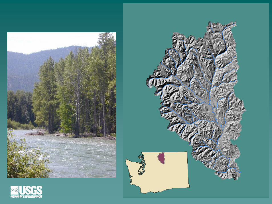
water resource investigations in the methow river · pdf filewater resource investigations in...
TRANSCRIPT
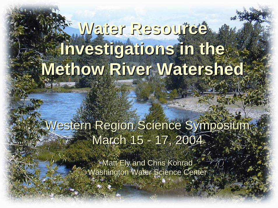
Water Resource Water Resource Investigations in the Investigations in the
Methow River WatershedMethow River Watershed
Western Region Science SymposiumWestern Region Science SymposiumMarch 15 March 15 -- 17, 200417, 2004
Matt Ely and Chris KonradMatt Ely and Chris KonradWashington Water Science CenterWashington Water Science Center

Don’t worry. Don’t worry. I’m with the Government.I’m with the Government.
Washington State Watershed Planning ActWashington State Watershed Planning Act
Listing of three species of fish under the Listing of three species of fish under the Endangered Species ActEndangered Species Act
Contentious situation between farmers, Contentious situation between farmers, environmentalists, and government environmentalists, and government agenciesagencies
Significant funding from Washington’s Significant funding from Washington’s senatorsenator
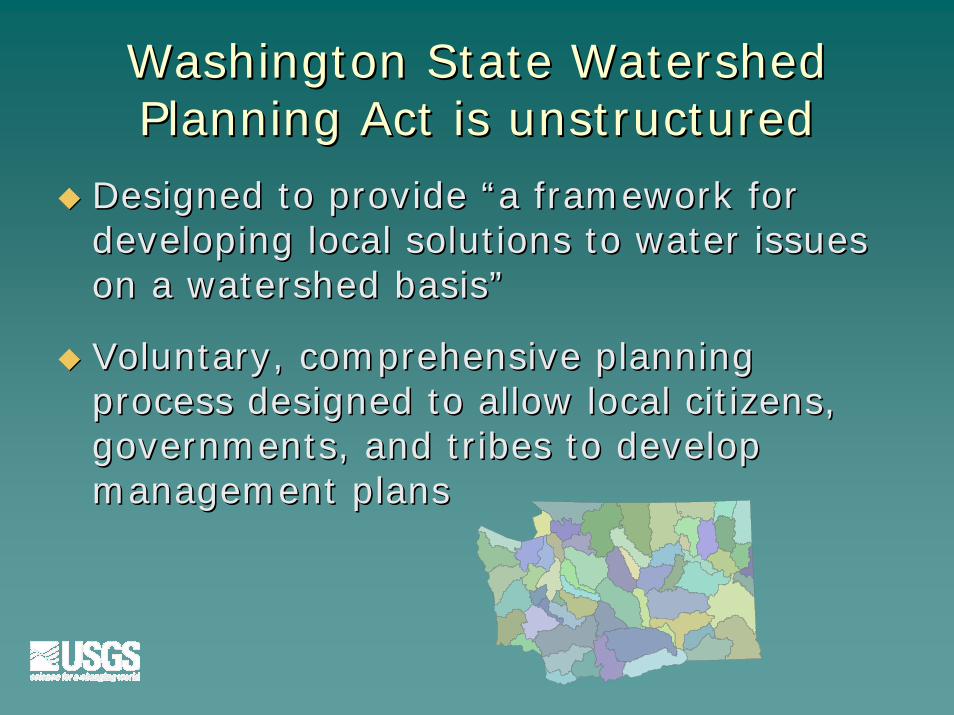
Washington State Watershed Washington State Watershed Planning Act is unstructuredPlanning Act is unstructured
Designed to provide “a framework for Designed to provide “a framework for developing local solutions to water issues developing local solutions to water issues on a watershed basis”on a watershed basis”
Voluntary, comprehensive planning Voluntary, comprehensive planning process designed to allow local citizens, process designed to allow local citizens, governments, and tribes to develop governments, and tribes to develop management plansmanagement plans

Methow Basin Planning Unit

““The enemy of my enemy is my The enemy of my enemy is my friend…unless he’s from Beaver Creek”friend…unless he’s from Beaver Creek”
The Planning Unit The Planning Unit approach creates approach creates odd bedfellows and odd bedfellows and shifting alliancesshifting alliances
Difficult to predict Difficult to predict reactions of reactions of proposed studies proposed studies and the results and the results
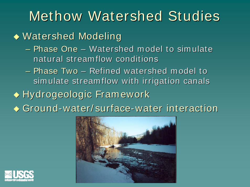
Methow Watershed StudiesMethow Watershed StudiesWatershed ModelingWatershed Modeling–– Phase OnePhase One –– Watershed model to simulate Watershed model to simulate
natural streamflow conditionsnatural streamflow conditions–– Phase TwoPhase Two –– Refined watershed model to Refined watershed model to
simulate streamflow with irrigation canalssimulate streamflow with irrigation canals
Hydrogeologic FrameworkHydrogeologic FrameworkGroundGround--water/surfacewater/surface--water interactionwater interaction

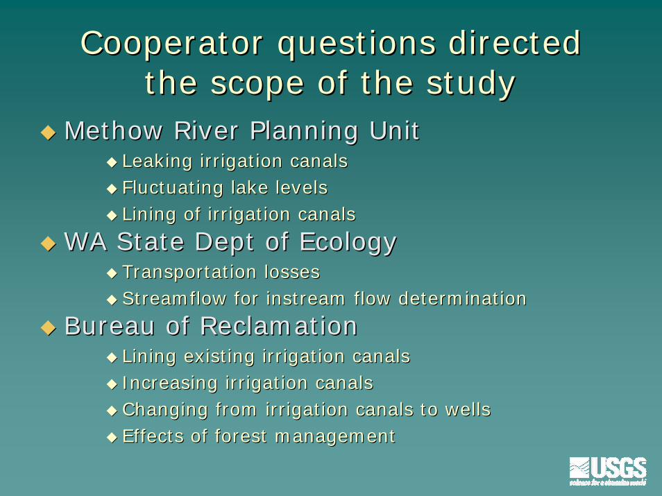
Cooperator questions directed Cooperator questions directed the scope of the studythe scope of the study
Methow River Planning UnitMethow River Planning UnitLeaking irrigation canalsLeaking irrigation canalsFluctuating lake levelsFluctuating lake levelsLining of irrigation canalsLining of irrigation canals
WA State Dept of EcologyWA State Dept of EcologyTransportation lossesTransportation lossesStreamflow for instream flow determinationStreamflow for instream flow determination
Bureau of ReclamationBureau of ReclamationLining existing irrigation canalsLining existing irrigation canalsIncreasing irrigation canalsIncreasing irrigation canalsChanging from irrigation canals to wellsChanging from irrigation canals to wellsEffects of forest managementEffects of forest management
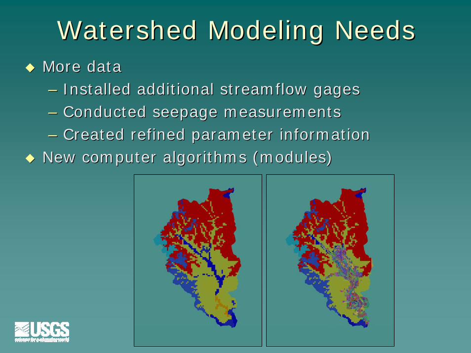
Watershed Modeling Needs Watershed Modeling Needs More dataMore data–– Installed additional streamflow gagesInstalled additional streamflow gages–– Conducted seepage measurementsConducted seepage measurements–– Created refined parameter informationCreated refined parameter information
New computer algorithms (modules)New computer algorithms (modules)
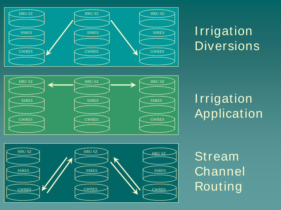
HRU SZ
SSRES
GWRES
HRU SZ
SSRES
GWRES
HRU SZ
SSRES
GWRES
Irrigation Diversions
HRU SZ
SSRES
GWRES
HRU SZ
SSRES
GWRES
HRU SZ
SSRES
GWRES
Irrigation Application
HRU SZ
SSRES
GWRES
HRU SZ
SSRES
GWRES
HRU SZ
SSRES
GWRES
Stream Channel Routing
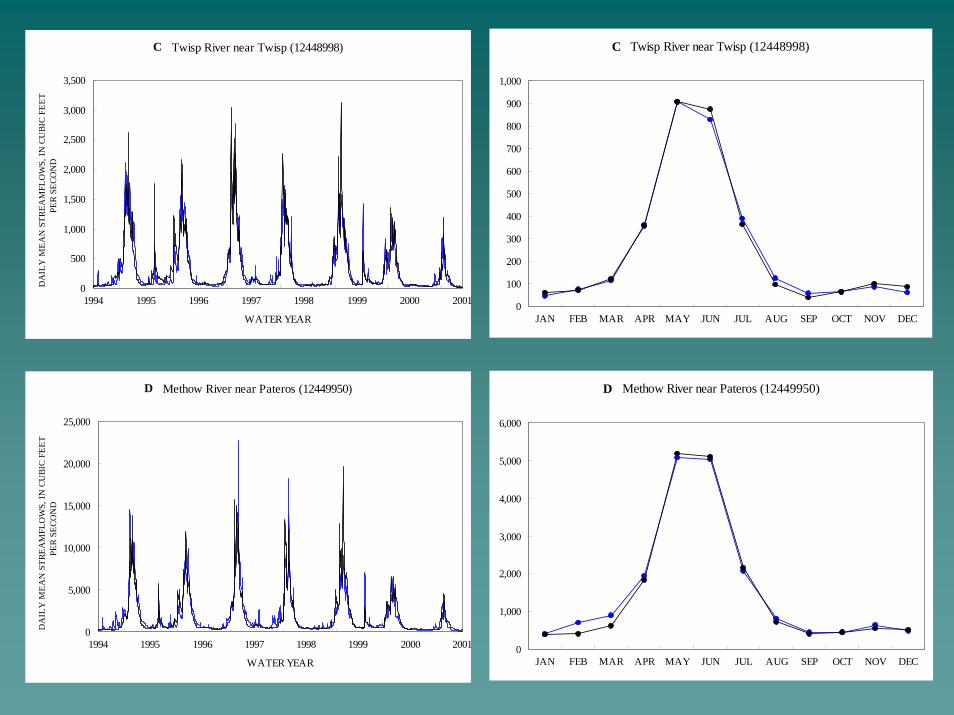
C Twisp River near Twisp (12448998)
0
100
200
300
400
500
600
700
800
900
1,000
JAN FEB MAR APR MAY JUN JUL AUG SEP OCT NOV DEC
D Methow River near Pateros (12449950)
0
1,000
2,000
3,000
4,000
5,000
6,000
JAN FEB MAR APR MAY JUN JUL AUG SEP OCT NOV DEC
D Methow River near Pateros (12449950)
0
5,000
10,000
15,000
20,000
25,000
1994 1995 1996 1997 1998 1999 2000 2001
WATER YEAR
DA
ILY
MEA
N S
TREA
MFL
OW
S, IN
CU
BIC
FEET
PE
R SE
CON
DC Twisp River near Twisp (12448998)
0
500
1,000
1,500
2,000
2,500
3,000
3,500
1994 1995 1996 1997 1998 1999 2000 2001
WATER YEAR
DA
ILY
MEA
N S
TREA
MFL
OW
S, IN
CU
BIC
FEET
PE
R SE
CON
D
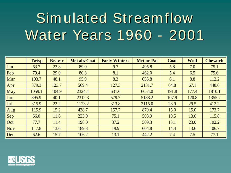
Simulated Streamflow Simulated Streamflow Water Years 1960 Water Years 1960 -- 20012001
Twisp Beaver Met abv Goat Early Winters Met nr Pat Goat Wolf ChewuchJan 63.7 23.8 89.0 9.7 495.8 5.8 7.0 75.1Feb 79.4 29.0 80.3 8.1 462.0 5.4 6.5 75.6Mar 103.7 48.1 95.9 8.3 655.8 6.1 8.8 112.2Apr 379.3 123.7 569.4 127.3 2131.7 64.8 67.1 448.6May 1059.1 104.9 2324.4 631.6 6054.0 191.8 177.4 1810.1Jun 895.9 40.1 2312.3 579.7 5188.2 107.9 120.8 1355.7Jul 315.9 22.2 1123.2 313.8 2115.0 28.9 29.5 412.2Aug 115.9 15.2 438.7 157.7 870.4 15.0 15.0 173.7Sep 66.0 11.6 223.9 75.1 503.9 10.5 13.0 115.8Oct 77.7 11.4 198.0 37.2 509.3 13.1 23.0 102.2Nov 117.8 13.6 189.8 19.9 604.8 14.4 13.6 106.7Dec 62.6 15.7 106.2 13.1 442.2 7.4 7.5 77.1
Station Name Month
Mean simulated
streamflow (cfs)
Mean measured
streamflow (cfs)
Bias, in percent
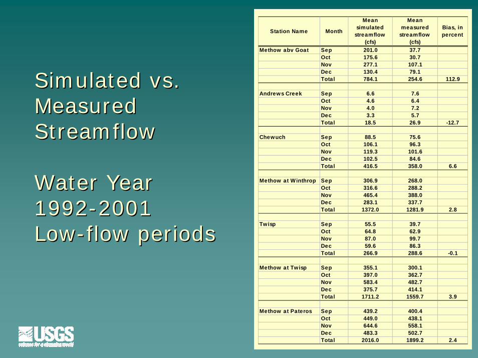
Methow abv Goat Sep 201.0 37.7Oct 175.6 30.7Nov 277.1 107.1Dec 130.4 79.1Total 784.1 254.6 112.9
Andrews Creek Sep 6.6 7.6Oct 4.6 6.4Nov 4.0 7.2Dec 3.3 5.7Total 18.5 26.9 -12.7
Chewuch Sep 88.5 75.6Oct 106.1 96.3Nov 119.3 101.6Dec 102.5 84.6Total 416.5 358.0 6.6
Methow at Winthrop Sep 306.9 268.0Oct 316.6 288.2Nov 465.4 388.0Dec 283.1 337.7Total 1372.0 1281.9 2.8
Twisp Sep 55.5 39.7Oct 64.8 62.9Nov 87.0 99.7Dec 59.6 86.3Total 266.9 288.6 -0.1
Methow at Twisp Sep 355.1 300.1Oct 397.0 362.7Nov 583.4 482.7Dec 375.7 414.1Total 1711.2 1559.7 3.9
Methow at Pateros Sep 439.2 400.4Oct 449.0 438.1Nov 644.6 558.1Dec 483.3 502.7Total 2016.0 1899.2 2.4
Simulated vs. Simulated vs. MeasuredMeasuredStreamflowStreamflow
Water Year Water Year 19921992--20012001LowLow--flow periodsflow periods

GW/SW Interaction QuestionsGW/SW Interaction Questions
To what extent do irrigation diversions To what extent do irrigation diversions reduce lowreduce low--flow discharge in the rivers? flow discharge in the rivers?
What fraction of groundWhat fraction of ground--water recharge water recharge is due to irrigation canal seepage?is due to irrigation canal seepage?
How would increased groundHow would increased ground--water water pumping (rather than surface water pumping (rather than surface water diversions) influence lowdiversions) influence low--flow discharge flow discharge in rivers?in rivers?
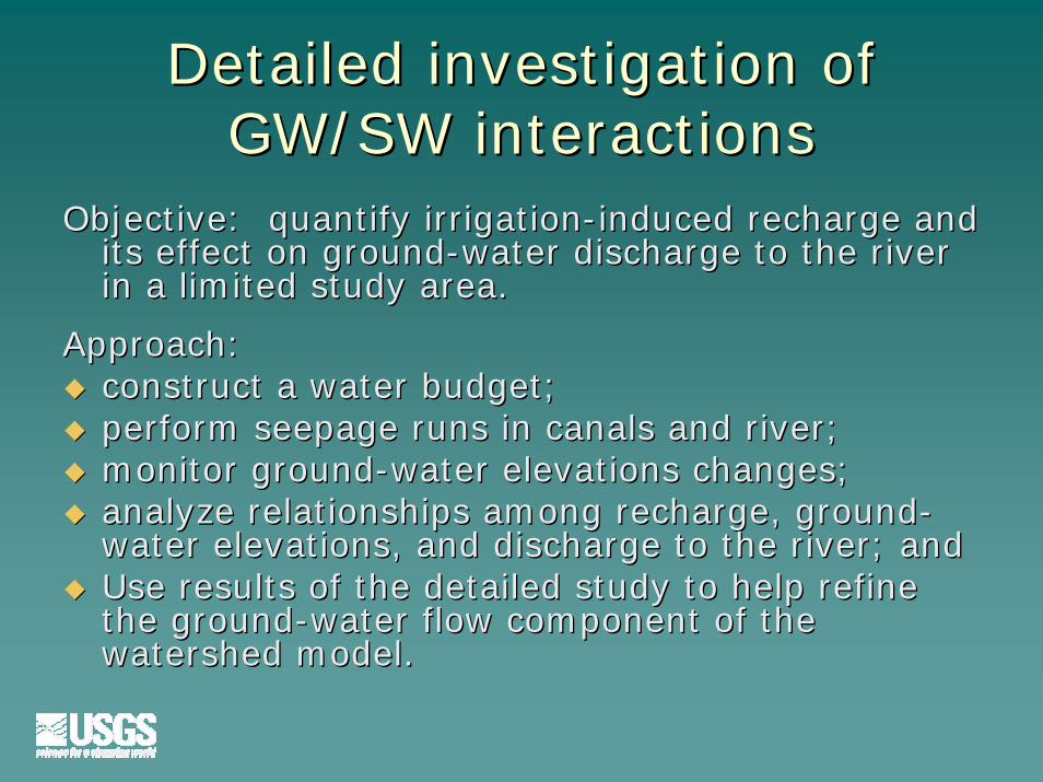
Detailed investigation of Detailed investigation of GW/SW interactionsGW/SW interactions
Objective: quantify irrigationObjective: quantify irrigation--induced recharge and induced recharge and its effect on groundits effect on ground--water discharge to the river water discharge to the river in a limited study area.in a limited study area.
Approach:Approach:construct a water budget; construct a water budget; perform seepage runs in canals and river;perform seepage runs in canals and river;monitor groundmonitor ground--water elevations changes;water elevations changes;analyze relationships among recharge, groundanalyze relationships among recharge, ground--water elevations, and discharge to the river; andwater elevations, and discharge to the river; andUse results of the detailed study to help refine Use results of the detailed study to help refine the groundthe ground--water flow component of the water flow component of the watershed model.watershed model.

Local interest in Local interest in detailed studydetailed study
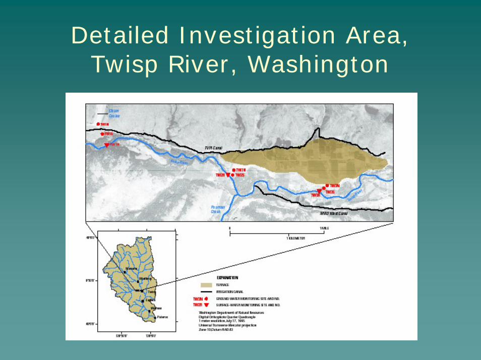
Detailed Investigation Area,Twisp River, Washington
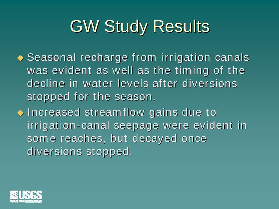
GW Study ResultsGW Study Results
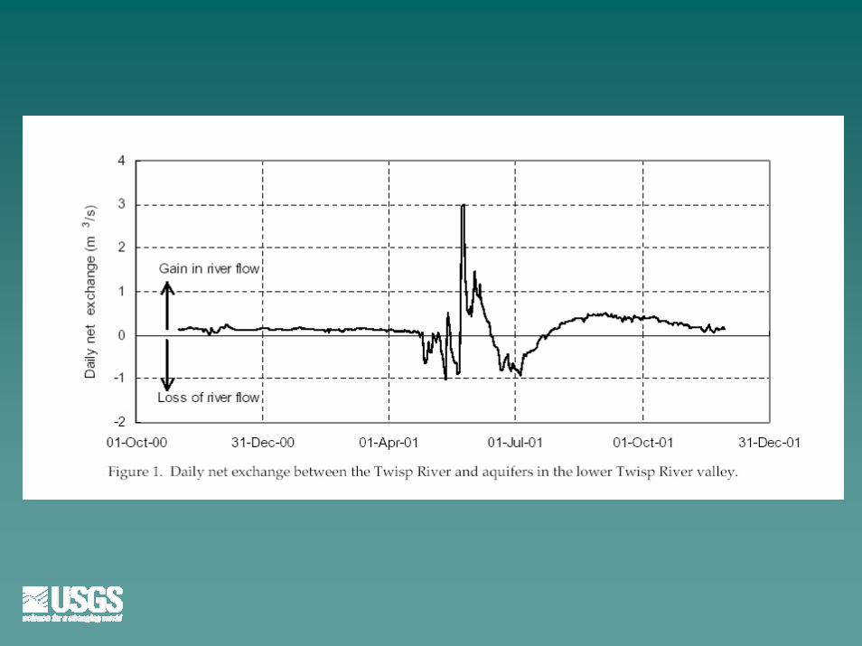
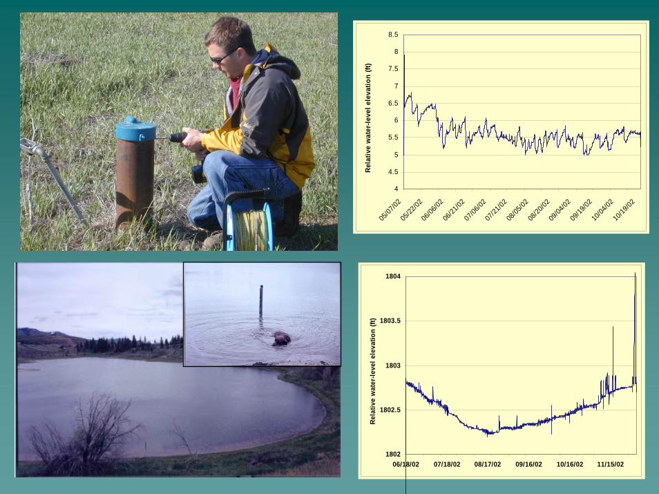
Seasonal recharge from irrigation canals Seasonal recharge from irrigation canals was evident as well as the timing of the was evident as well as the timing of the decline in water levels after diversions decline in water levels after diversions stopped for the season.stopped for the season.Increased streamflow gains due to Increased streamflow gains due to irrigationirrigation--canal seepage were evident in canal seepage were evident in some reaches, but decayed once some reaches, but decayed once diversions stopped.diversions stopped.
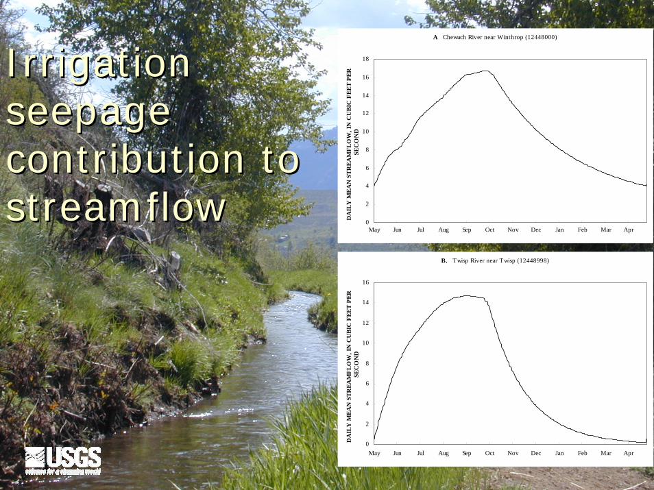
A Chewuch River near Winthrop (12448000)
0
2
4
6
8
10
12
14
16
18
May Jun Jul Aug Sep Oct Nov Dec Jan Feb Mar Apr
DA
ILY
MEA
N S
TREA
MFL
OW
, IN
CU
BIC
FEE
T PE
R
SEC
ON
D
B. Twisp River near Twisp (12448998)
0
2
4
6
8
10
12
14
16
May Jun Jul Aug Sep Oct Nov Dec Jan Feb Mar Apr
DA
ILY
MEA
N S
TREA
MFL
OW
, IN
CU
BIC
FEE
T PE
R
SEC
ON
D
Irrigation Irrigation seepage seepage contribution to contribution to streamflowstreamflow
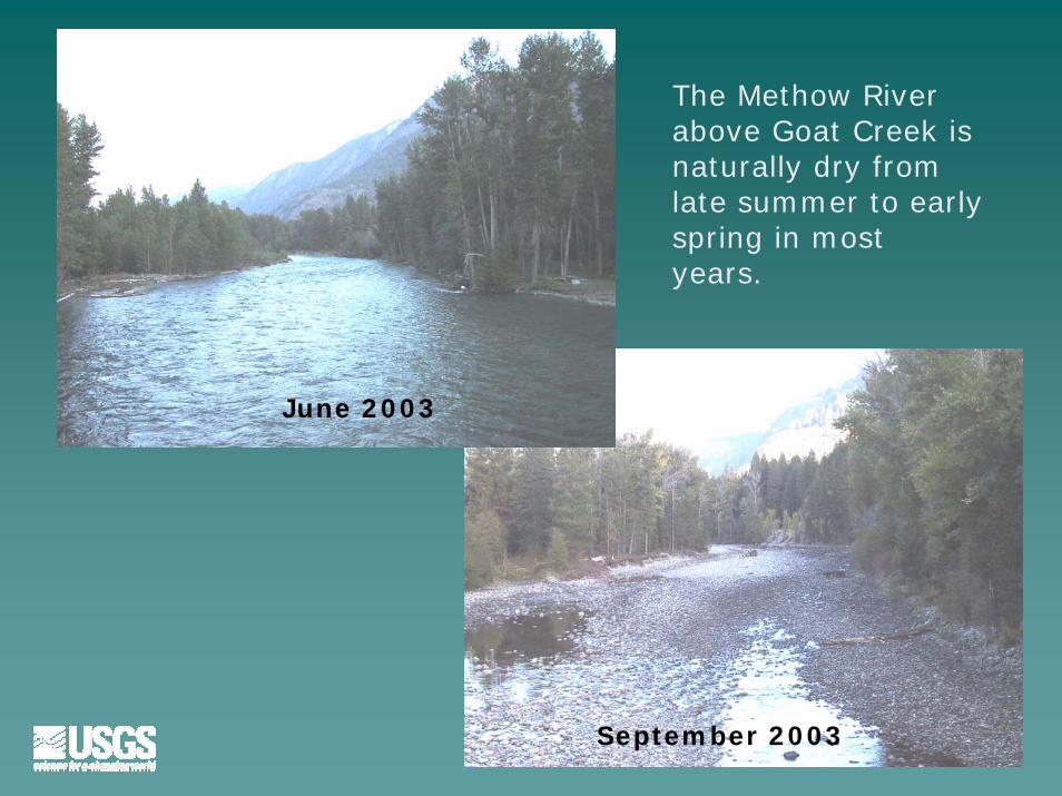
The Methow River above Goat Creek is naturally dry from late summer to early spring in most years.
September 2003
June 2003
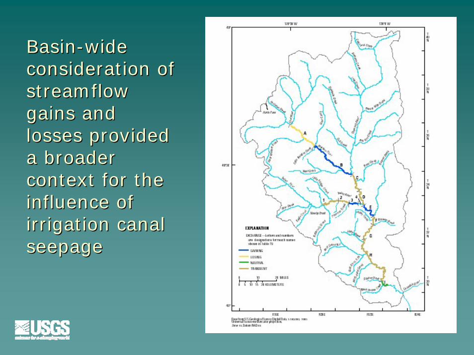
BasinBasin--wide wide consideration of consideration of streamflow streamflow gains and gains and losses provided losses provided a broader a broader context for the context for the influence of influence of irrigation canal irrigation canal seepageseepage
Cooperator questions directed Cooperator questions directed the scope of the studythe scope of the study
Methow River Planning UnitMethow River Planning UnitLeaking irrigation canalsLeaking irrigation canalsFluctuating lake levelsFluctuating lake levelsLining of irrigation canalsLining of irrigation canals
WA State Dept of EcologyWA State Dept of EcologyTransportation lossesTransportation lossesStreamflow for instream flow determinationStreamflow for instream flow determination
Bureau of ReclamationBureau of ReclamationLining existing irrigation canalsLining existing irrigation canalsIncreasing irrigation canalsIncreasing irrigation canalsChanging from irrigation canals to wellsChanging from irrigation canals to wellsEffects of forest managementEffects of forest management
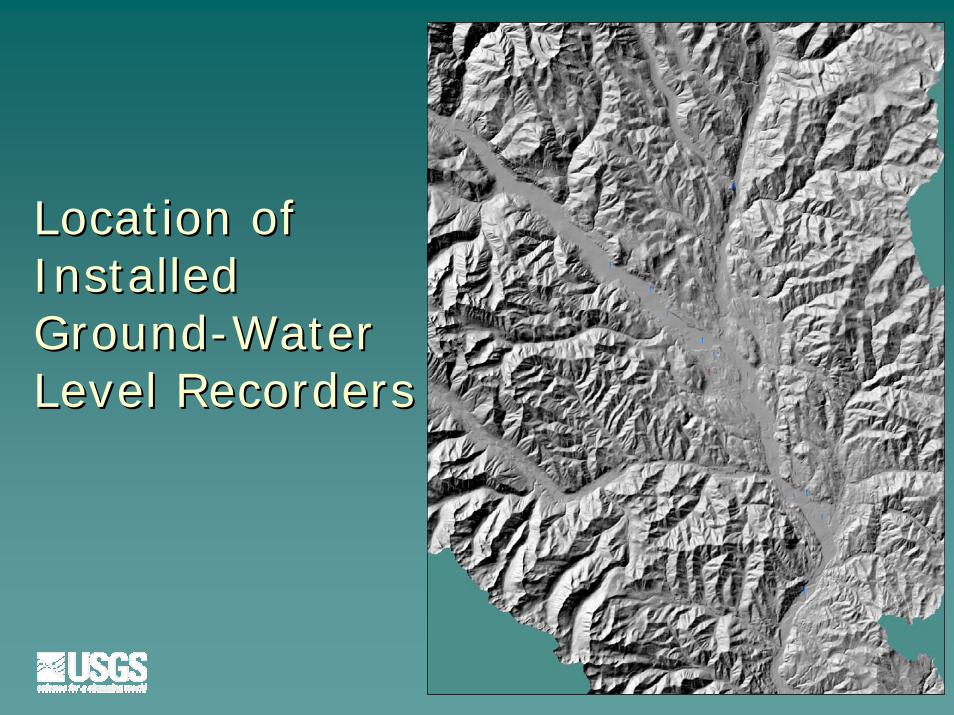
Location of Location of InstalledInstalledGroundGround--Water Water Level RecordersLevel Recorders
Explanation! Installed data loggers - Wells
! Installed data logger - Little Twin Lake
!
!!
!
!
!
!
!
!
!
!
!
!
!
!!
4
4.5
5
5.5
6
6.5
7
7.5
8
8.5
05/07
/02
05/22
/02
06/06
/02
06/21
/02
07/06
/02
07/21
/02
08/05
/02
08/20
/02
09/04
/02
09/19
/02
10/04
/02
10/19
/02
Rel
ativ
e w
ater
-leve
l ele
vatio
n (ft
)
1802
1802.5
1803
1803.5
1804
06/18/02 07/18/02 08/17/02 09/16/02 10/16/02 11/15/02
Rela
tive
wat
er-le
vel e
leva
tion
(ft)
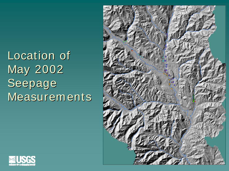
Location of Location of May 2002 May 2002 Seepage Seepage MeasurementsMeasurements
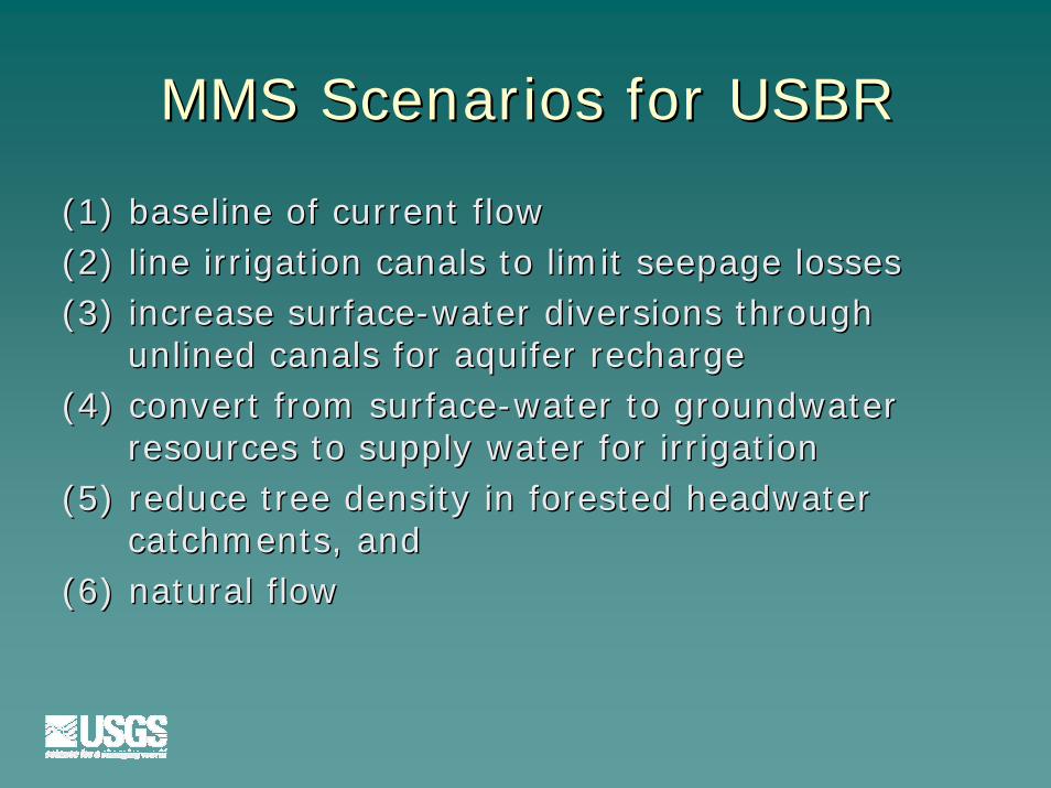
MMS Scenarios for USBRMMS Scenarios for USBR
(1) baseline of current flow(1) baseline of current flow(2) line irrigation canals to limit seepage losses(2) line irrigation canals to limit seepage losses(3) increase surface(3) increase surface--water diversions through water diversions through
unlined canals for aquifer rechargeunlined canals for aquifer recharge(4) convert from surface(4) convert from surface--water to groundwater water to groundwater
resources to supply water for irrigationresources to supply water for irrigation(5) reduce tree density in forested headwater (5) reduce tree density in forested headwater
catchments, andcatchments, and(6) natural flow(6) natural flow
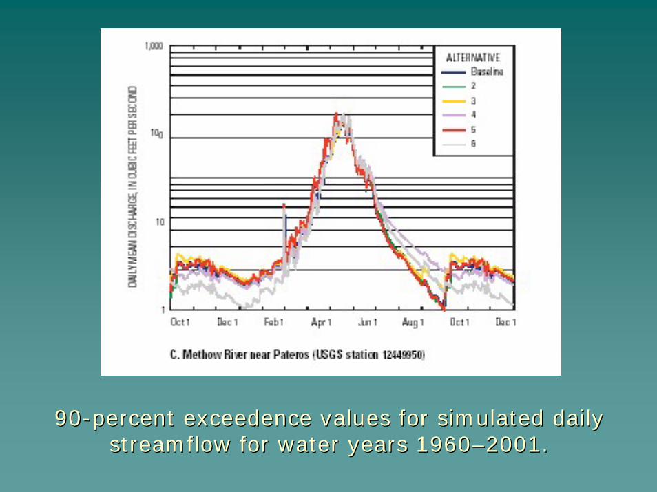
9090--percent percent exceedenceexceedence values for simulated daily values for simulated daily streamflow for water years 1960streamflow for water years 1960––2001.2001.

USGS Reports have been well received but timing of release did not always coincide with cooperator needs
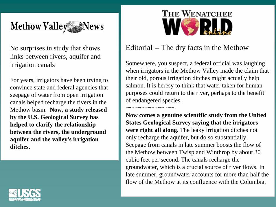
No surprises in study that shows links between rivers, aquifer and irrigation canals
For years, irrigators have been trying to convince state and federal agencies that seepage of water from open irrigation canals helped recharge the rivers in the Methow basin. Now, a study released by the U.S. Geological Survey has helped to clarify the relationship between the rivers, the underground aquifer and the valley's irrigation ditches.
Editorial -- The dry facts in the Methow
Somewhere, you suspect, a federal official was laughing when irrigators in the Methow Valley made the claim that their old, porous irrigation ditches might actually help salmon. It is heresy to think that water taken for human purposes could return to the river, perhaps to the benefit of endangered species.~~~~~~~~~~~~~~~Now comes a genuine scientific study from the United States Geological Survey saying that the irrigators were right all along. The leaky irrigation ditches not only recharge the aquifer, but do so substantially. Seepage from canals in late summer boosts the flow of the Methow between Twisp and Winthrop by about 30 cubic feet per second. The canals recharge the groundwater, which is a crucial source of river flows. In late summer, groundwater accounts for more than half the flow of the Methow at its confluence with the Columbia.
Importance of Importance of strongstrong USGS presenceUSGS presencein study areain study area
–– USGS has been streamgaging in the Methow USGS has been streamgaging in the Methow watershed since 1919watershed since 1919
–– More importantly, the USGS More importantly, the USGS streamgagerstreamgagerworked in the Methow since 1990worked in the Methow since 1990
Importance of Importance of strong liaisonstrong liaison in study in study areaarea
Importance of Importance of strong activestrong active interestinterest in in study areastudy area
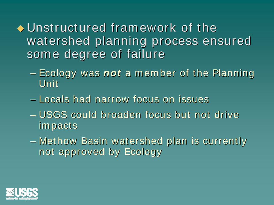
Unstructured framework of the Unstructured framework of the watershed planning process ensured watershed planning process ensured some degree of failuresome degree of failure
–– Ecology was Ecology was notnot a member of the Planning a member of the Planning UnitUnit
–– Locals had narrow focus on issuesLocals had narrow focus on issues
–– USGS could broaden focus but not drive USGS could broaden focus but not drive impactsimpacts
–– Methow Basin watershed plan is currently Methow Basin watershed plan is currently not approved by Ecologynot approved by Ecology