weather tools & measurements weather administration
TRANSCRIPT

Weather Tools&
Measurements
Weather Administration

Essential Questions• What are they?
• What do they measure?
• What are their units
• Who observes the weather for us?
Instruments of Weather
Make a list of five of the most common weather instruments
that you can think of.

The Most Common Weather Tools Are:
• Thermometer• Wind Vane• Anemometer• Barometer• Rain Gauge• Psychrometer• H.V.S.
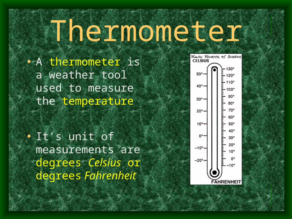
Thermometer• A thermometer is a
weather tool used to measure the temperature
• It’s unit of measurements are degrees Celsius or degrees Fahrenheit

Wind Vane• By observing wind
vanes and compasses, we can know the direction of the wind.
• Compass rose and/or 0 to 360 degrees

Anemometer• An anemometer is a
weather tool that measures wind speed.
• Km/hr and m/hr

Barometer• Barometers are
important to measuring air pressure.
• millibars (mb) or inches of mercury.
High – Fair
Low - Foul

Rain Gauge• A rain gauge is a
weather tool used to collect rain.
• Rulers measure frozen forms of precipitations
• Centimeters or inches

Psychrometer
• A psychrometer is used to measure humidity or moisture in the air.
• Percent (%) moisture held in the air.

High Volume Sampler
• H.V.S. samples air quality.
• Accessories can be added to monitor any type of pollutants

Other tools are…• Weather Maps
• Radar
• Doppler Radar
• Satellites / GPS
• Weather Balloons / Radiosonde
• “Personal observations”
• Almanac
• Lightening Detector
• Weather Rope or Weather Rock

Weather Maps
• A weather map displays various meteorological features across a particular area at a particular point in time. Such maps are used for research and weather forecasting purposes.
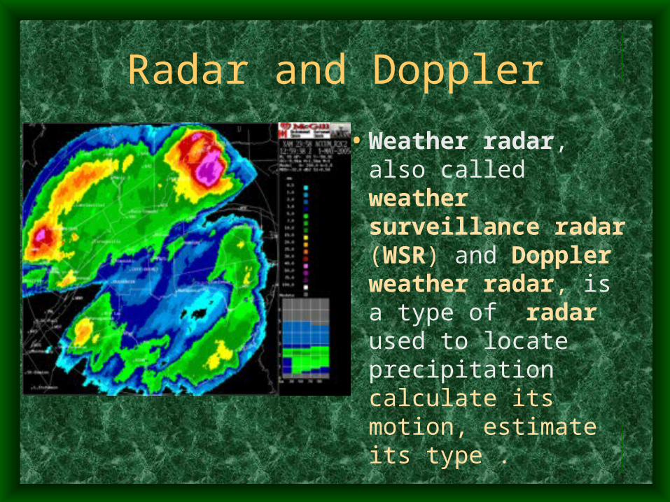
Radar and Doppler
• Weather radar, also called weather surveillance radar (WSR) and Doppler weather radar, is a type of radar used to locate precipitation calculate its motion, estimate its type .
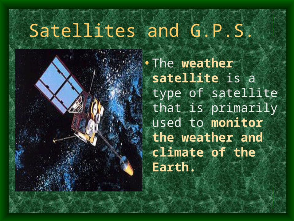
Satellites and G.P.S.
• The weather satellite is a type of satellite that is primarily used to monitor the weather and climate of the Earth.

Weather Balloons and Radiosonde
• A weather or sounding balloon is a balloon which carries weather instruments aloft to send back information by means of a small, expendable measuring device called a radiosonde.
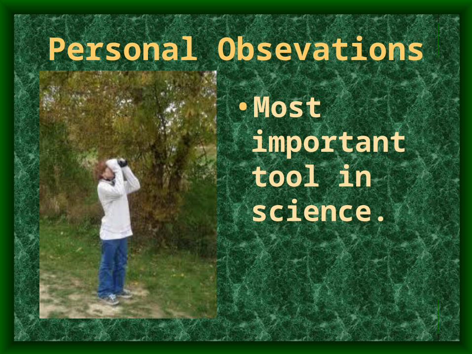
Personal Obsevations
• Most important tool in science.

Almanac• Records and predicts
astronomical events the rising and setting of the Sun, lunar phases, tides, weather, and other phenomena with respect to time, climate and seasons.
• Helps with crop planting and harvest schedules.

Lightening Detector• Detects
lightening strikes within a certain mileage perimeter.

Weather Rope / Weather Rock Personal Observations

NOAA???
National Oceanographic and Atmospheric Administration

Who Administers the Atmospheric Conditions???
• The National Weather Service is a component of the National Oceanic and Atmospheric Administration (NOAA).
• NOAA is an Operating Unit of the U.S. Department of Commerce.

Organizational Structure…Organizational Structure…Organizational Structure…Organizational Structure…
U. S. Department of CommerceU. S. Department of Commerce(International Trade, US Business Growth, Aid in (International Trade, US Business Growth, Aid in
Technological Advancement)Technological Advancement)
National Oceanic and AtmosphericNational Oceanic and AtmosphericAdministration (NOAA)Administration (NOAA)(Climate, Ocean Life, Satellites, Research)(Climate, Ocean Life, Satellites, Research)
National Weather ServiceNational Weather Service(Forecasts, Warnings, River Data, Weather Safety)(Forecasts, Warnings, River Data, Weather Safety)

International Responsibilities
The World Meteorological Organization (WMO)
is a specialized agency of the United Nations. It is the UN system's authoritative voice on the state and behavior of the Earth's atmosphere, its interaction with the oceans, the climate it produces and the resulting distribution of water resources.

Reading a Weather Map and Station Models.
Essential Questions:
•What are the symbols used in reporting the weather?
•What is a station model and how is it read?
SWBAT• Analyze station models and their symbols
• Construct station models
• Complete an online station model activity

Station Model

Weather Condition Symbols

Cloud Coverage Symbols

Precipitation Symbols

Cloud Type Symbols

Barometric Shorthand
• http://regentsearth.com/Illustrated%20ESRT/Page%2013%20%28Weather%20Map%20Symbols%29/Pressure.htm

Wind Conditions - Wind Barb

Station Models Game
• http://itg1.meteor.wisc.edu/wxwise/AckermanKnox/chap1/station-1.html
• http://cimss.ssec.wisc.edu/wxwise/station/page5.html