web mapping at the massachusetts historical commission · web mapping at the massachusetts...
TRANSCRIPT
Web Mapping at the Massachusetts Historical
Commission
NEURISANovember 16th, 2009
Joshua Rosenthal Massachusetts Historical Commission
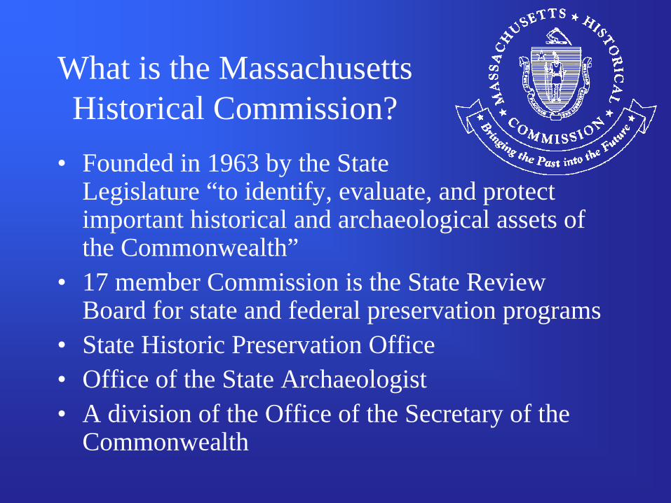
What is the Massachusetts Historical Commission?
• Founded in 1963 by the State Legislature “to identify, evaluate, and protect important historical and archaeological assets of the Commonwealth”
• 17 member Commission is the State Review Board for state and federal preservation programs
• State Historic Preservation Office• Office of the State Archaeologist• A division of the Office of the Secretary of the
Commonwealth
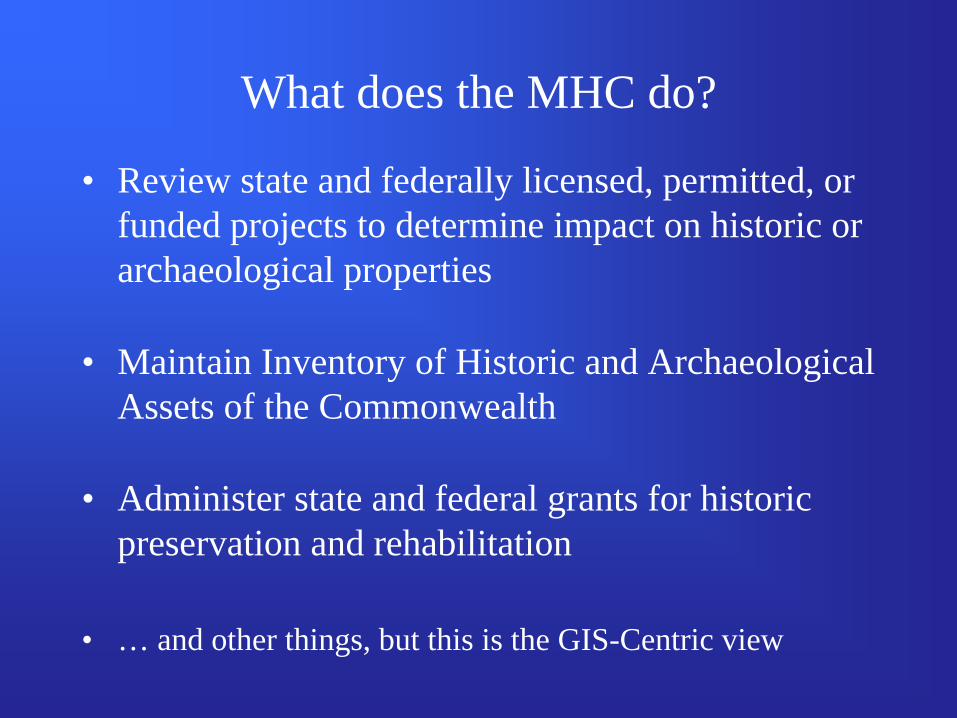
What does the MHC do?
• Review state and federally licensed, permitted, or funded projects to determine impact on historic or archaeological properties
• Maintain Inventory of Historic and Archaeological Assets of the Commonwealth
• Administer state and federal grants for historic preservation and rehabilitation
• … and other things, but this is the GIS-Centric view
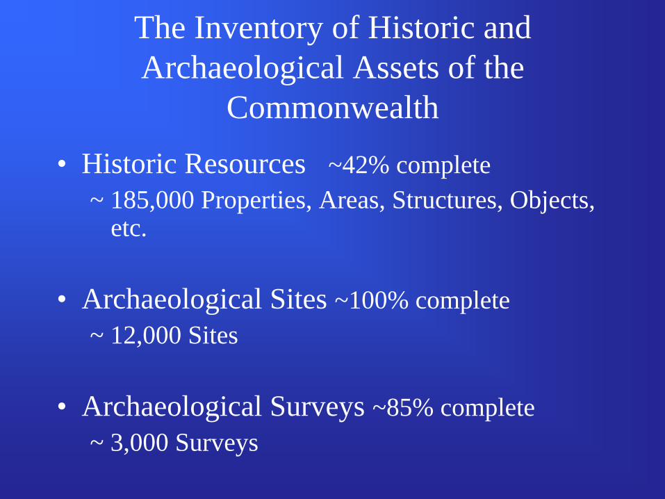
The Inventory of Historic and Archaeological Assets of the
Commonwealth
• Historic Resources ~42% complete~ 185,000 Properties, Areas, Structures, Objects,
etc.
• Archaeological Sites ~100% complete~ 12,000 Sites
• Archaeological Surveys ~85% complete~ 3,000 Surveys
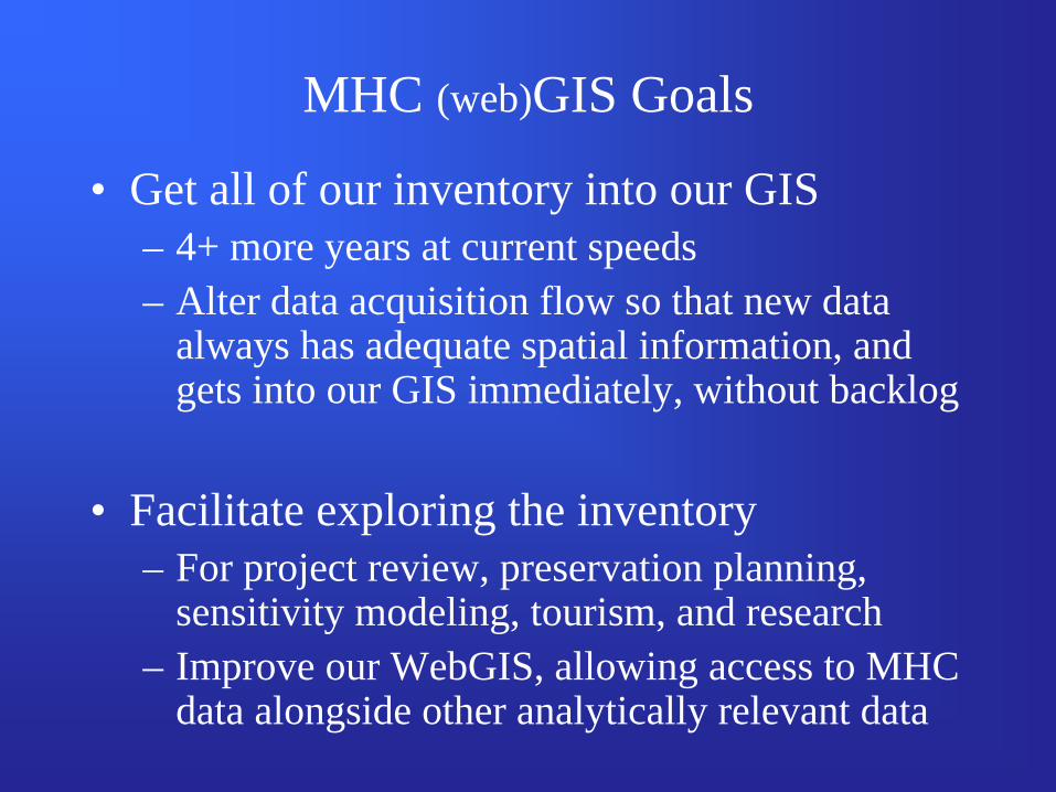
MHC (web)GIS Goals
• Get all of our inventory into our GIS– 4+ more years at current speeds– Alter data acquisition flow so that new data
always has adequate spatial information, and gets into our GIS immediately, without backlog
• Facilitate exploring the inventory– For project review, preservation planning,
sensitivity modeling, tourism, and research– Improve our WebGIS, allowing access to MHC
data alongside other analytically relevant data
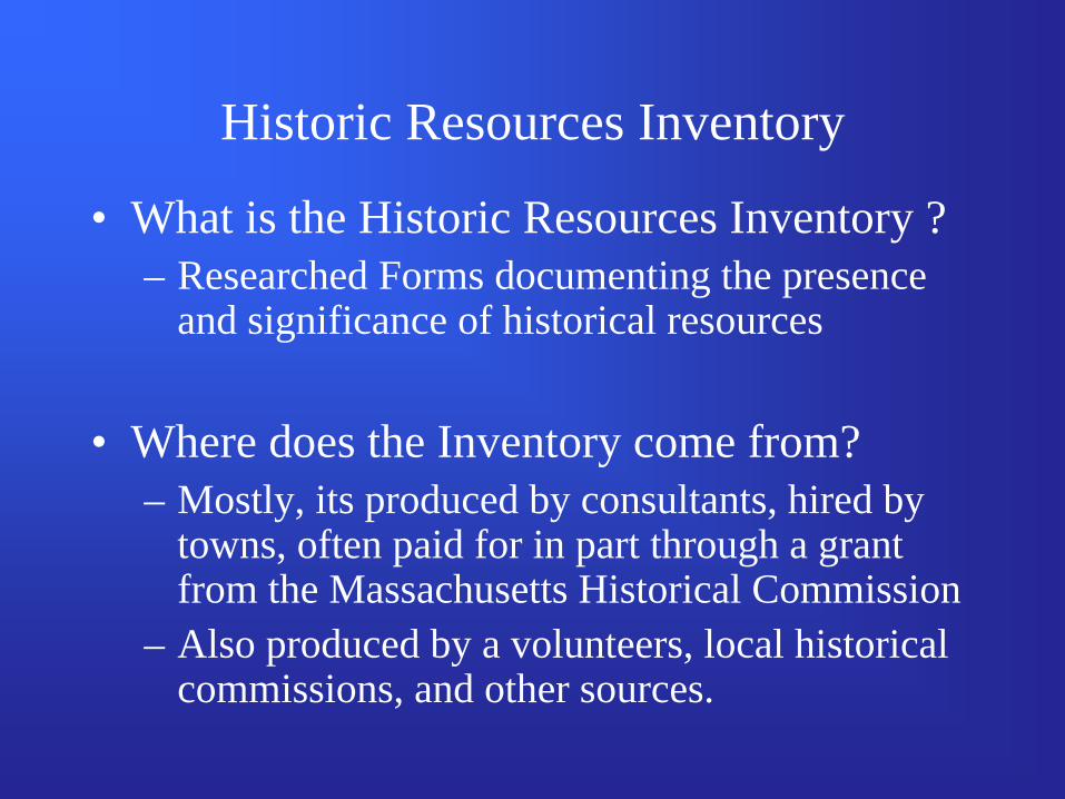
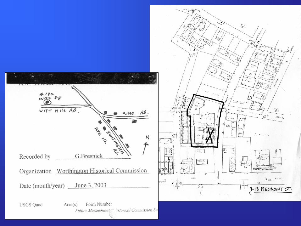
Historic Resources Inventory
• What is the Historic Resources Inventory ?– Researched Forms documenting the presence
and significance of historical resources
• Where does the Inventory come from?– Mostly, its produced by consultants, hired by
towns, often paid for in part through a grant from the Massachusetts Historical Commission
– Also produced by a volunteers, local historical commissions, and other sources.
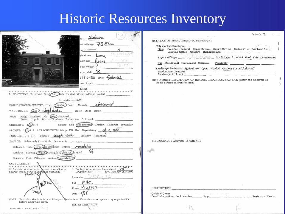
Historic Resources Inventory
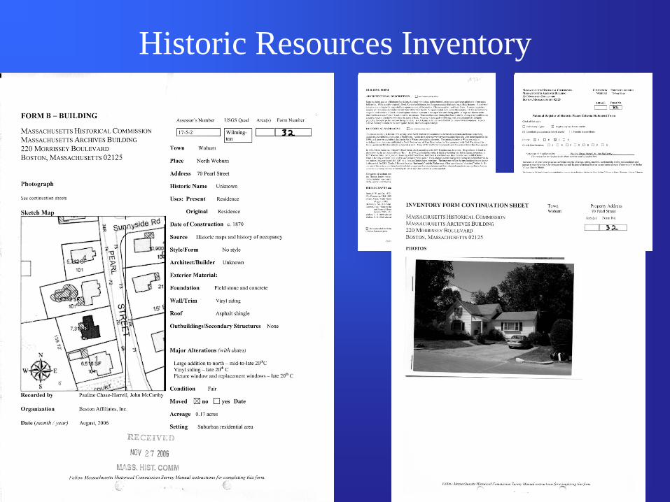
Historic Resources Inventory
• Ideally…– GIS produced maps, including parcels,
footprints, street labels, an intersection, and accompanying shapefiles
• Unfortunately…– Towns don’t always have GIS resources, or
resources aren’t available to consultants– Sometimes forms are produced by volunteers,
not consultants
Map Guidelines
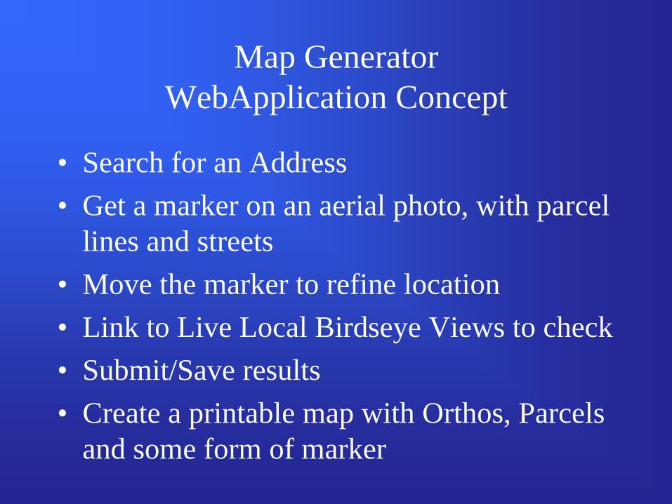
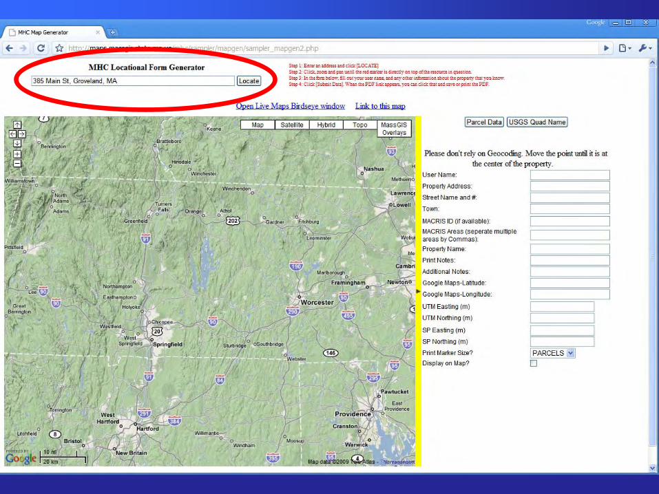
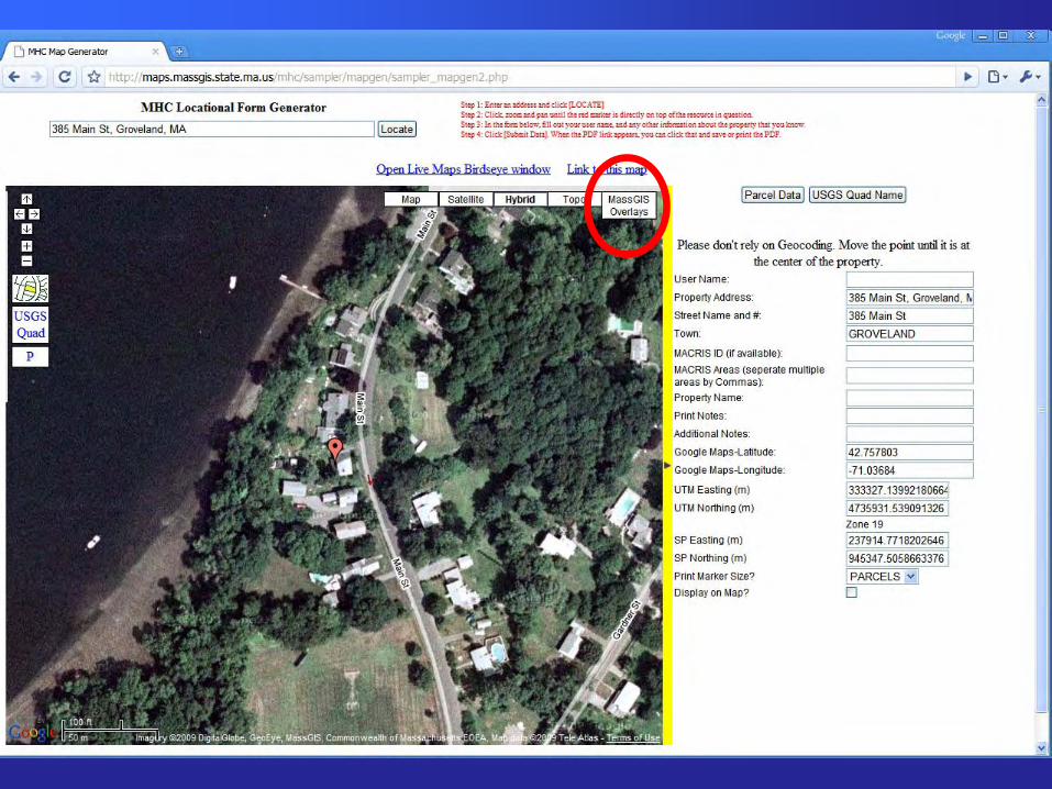
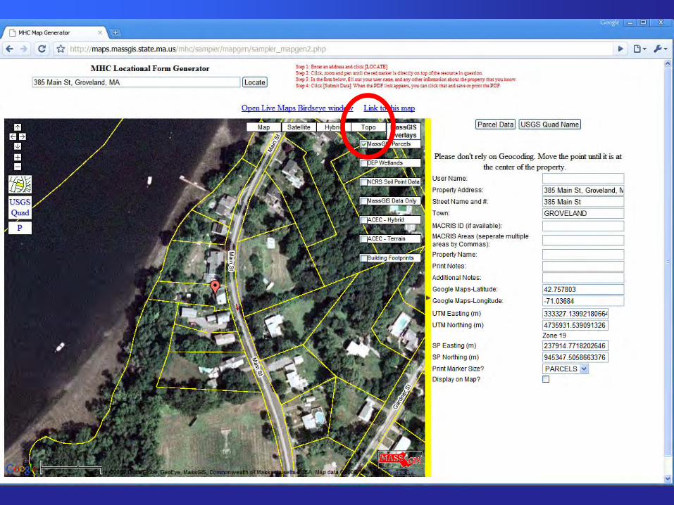
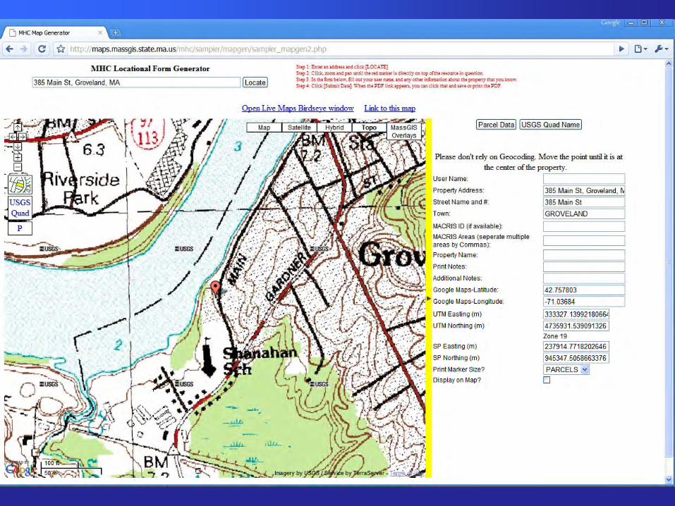
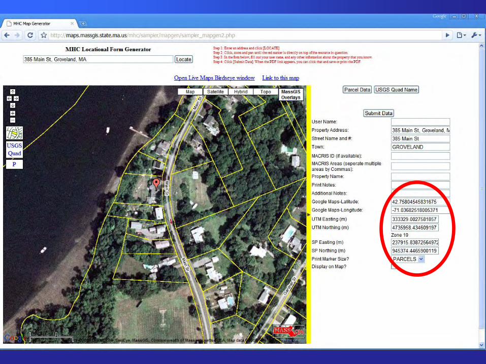
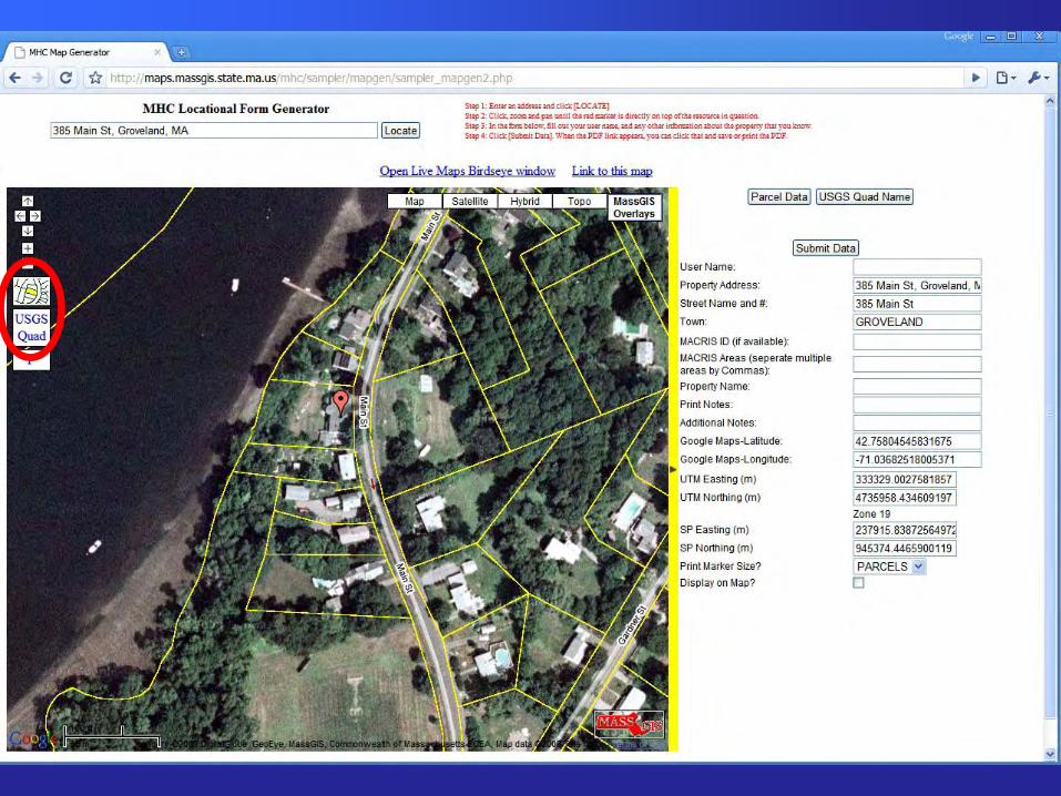
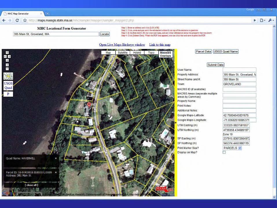
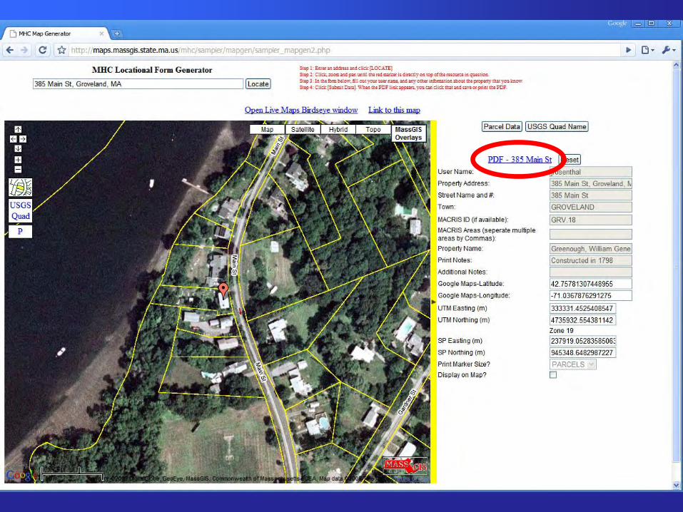
Map GeneratorWebApplication Concept
• Search for an Address• Get a marker on an aerial photo, with parcel
lines and streets• Move the marker to refine location• Link to Live Local Birdseye Views to check• Submit/Save results• Create a printable map with Orthos, Parcels
and some form of marker
Google Maps API & Google Spreadsheets
• Why Google Maps API?– Demo on MassGIS Wiki– Speed– Familiarity of interface to users– Really active and helpful email list
• Why use Google Spreadsheets?– A demo on the Google Maps usergroup
showing how to publish data to a Google Spreadsheet without any server side scripting.
• Answer: Because it was really easy.
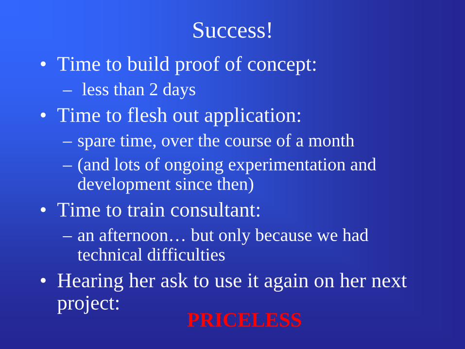
Success!• Time to build proof of concept:
– less than 2 days• Time to flesh out application:
– spare time, over the course of a month– (and lots of ongoing experimentation and
development since then)• Time to train consultant:
– an afternoon… but only because we had technical difficulties
• Hearing her ask to use it again on her next project:
PRICELESS
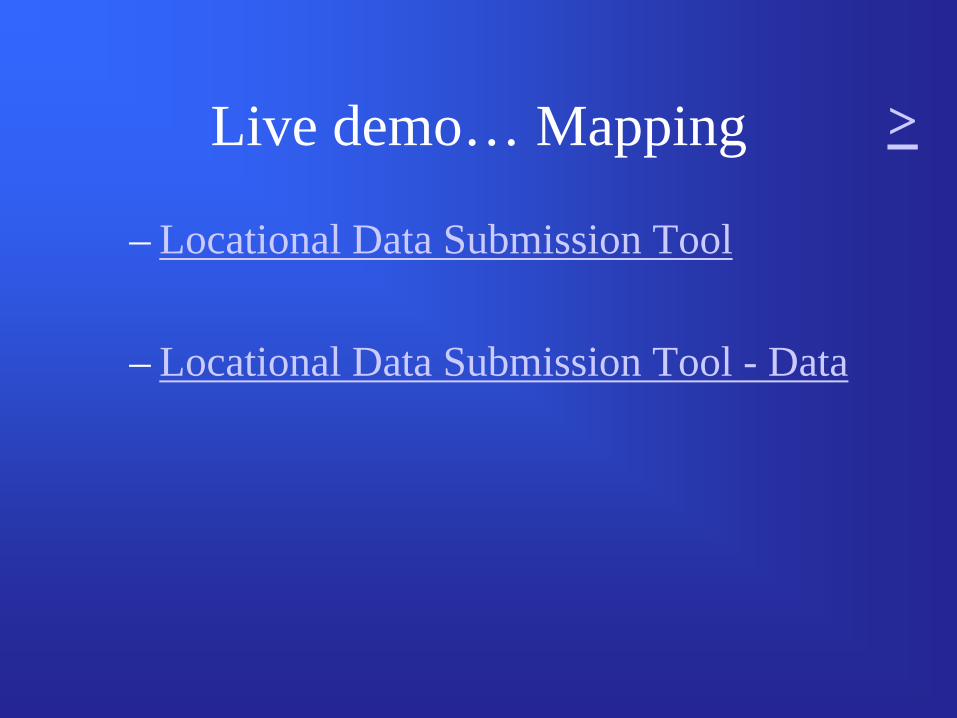
Live demo… Mapping
– Locational Data Submission Tool
– Locational Data Submission Tool - Data
>
Or, an offline tour


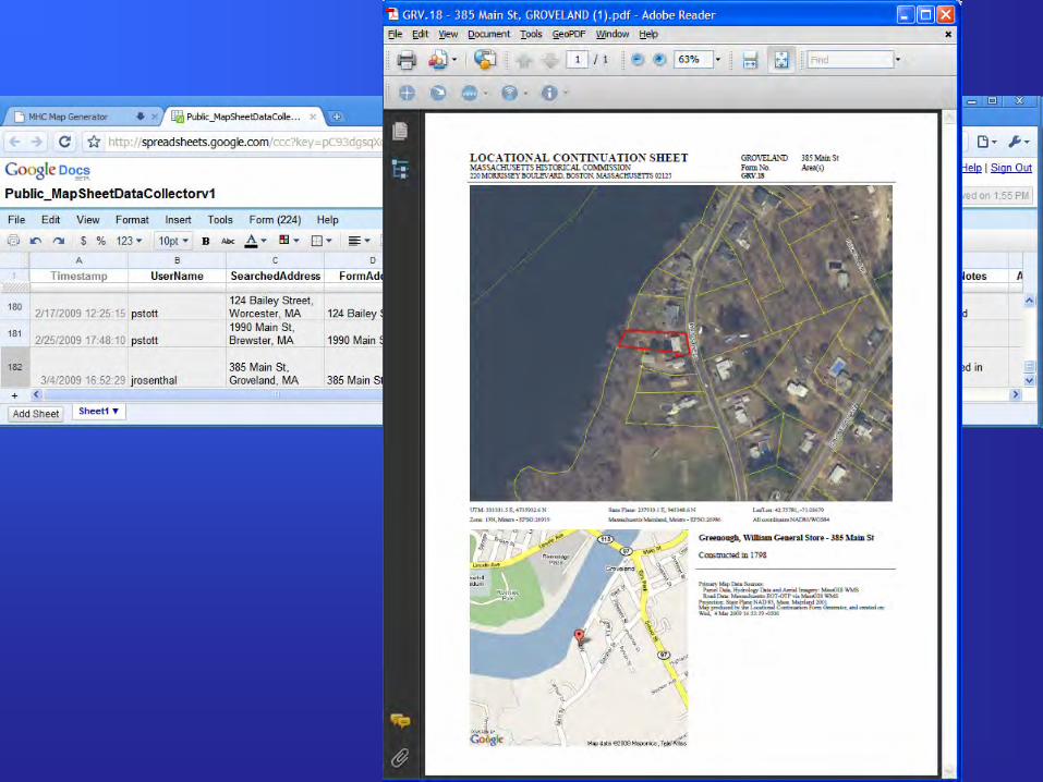
Map Generator - The Good…
• We have a tool that allows quick and easy production of pretty good, standardized maps, while recording data.
• We have a very simple tool that allows the recording of point data for someone without GIS resources/knowledge.
• We have a tool that is easily adapted to querying MassGIS data, tailored to our needs.
Map Generator - The Bad…
• Not our ideal map (parcels + footprints). Aerial photos don’t b/w photocopy well.
• MassGIS doesn’t have parcels for all towns, and thus we don’t have adequate data for many towns.
• We’re stuck with paper, and files that simply produce the paper… currently MS Word templates. These are yet another file.
Map Generator - The Ugly…Thoughts on Using Google Frameworks
• Pros:– Familiar– Fast– Great user base– Very Easy to learn and use
Map Generator - The Ugly…Thoughts on Using Google Frameworks
• Cons– Terms of Use are very confusing
• 9.1 “Free, Public Accessibility to Your Maps API Implementation.”
– Stability? • Will it be there tomorrow? • Will it work the same tomorrow?
– Is it ‘appropriate’ for an agency to use a Google Map, with Logo, for something official?
– Spherical Mercator
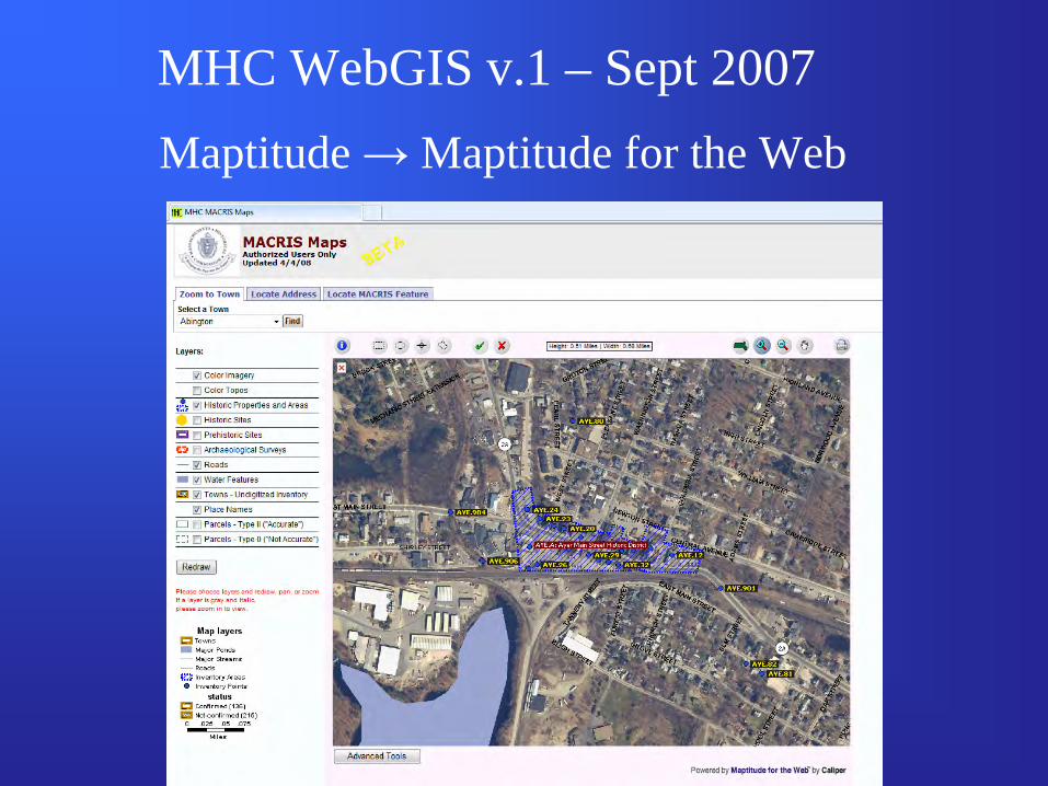
MHC WebGIS v.1 – Sept 2007Maptitude → Maptitude for the Web
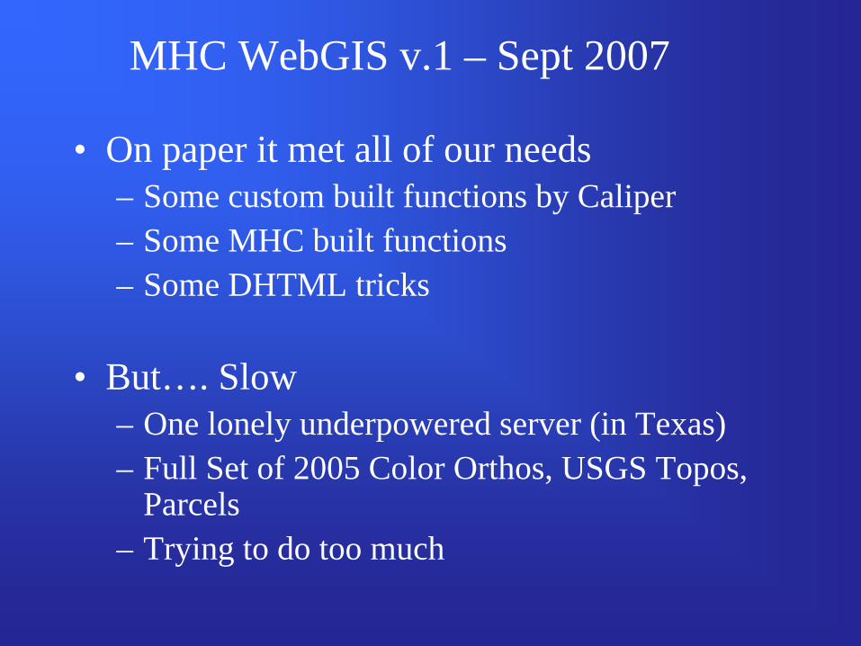
MHC WebGIS v.1 – Sept 2007
• On paper it met all of our needs– Some custom built functions by Caliper– Some MHC built functions– Some DHTML tricks
• But…. Slow– One lonely underpowered server (in Texas)– Full Set of 2005 Color Orthos, USGS Topos,
Parcels– Trying to do too much
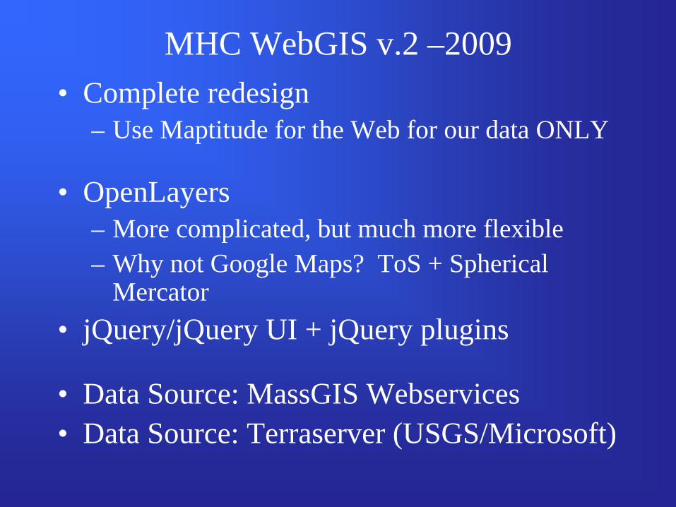
MHC WebGIS v.2 –2009• Complete redesign
– Use Maptitude for the Web for our data ONLY
• OpenLayers– More complicated, but much more flexible– Why not Google Maps? ToS + Spherical
Mercator• jQuery/jQuery UI + jQuery plugins
• Data Source: MassGIS Webservices• Data Source: Terraserver (USGS/Microsoft)
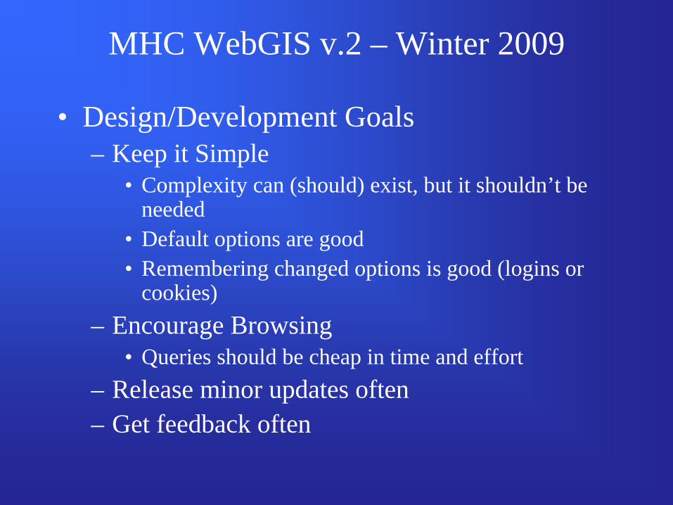
MHC WebGIS v.2 – Winter 2009
• Design/Development Goals– Keep it Simple
• Complexity can (should) exist, but it shouldn’t be needed
• Default options are good• Remembering changed options is good (logins or
cookies)– Encourage Browsing
• Queries should be cheap in time and effort– Release minor updates often– Get feedback often
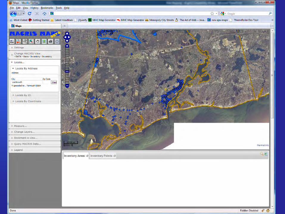
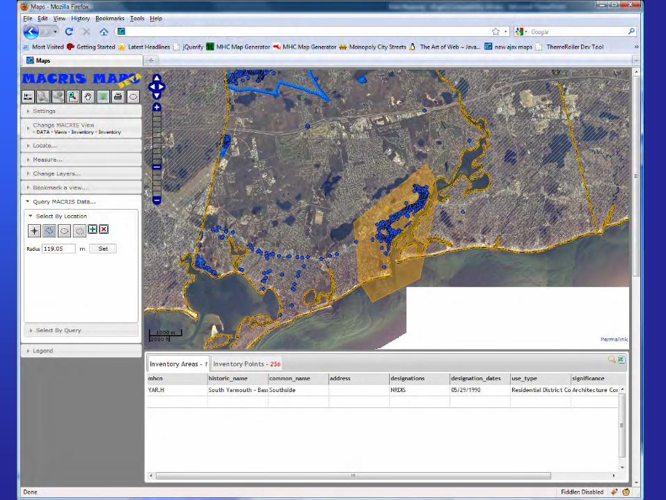
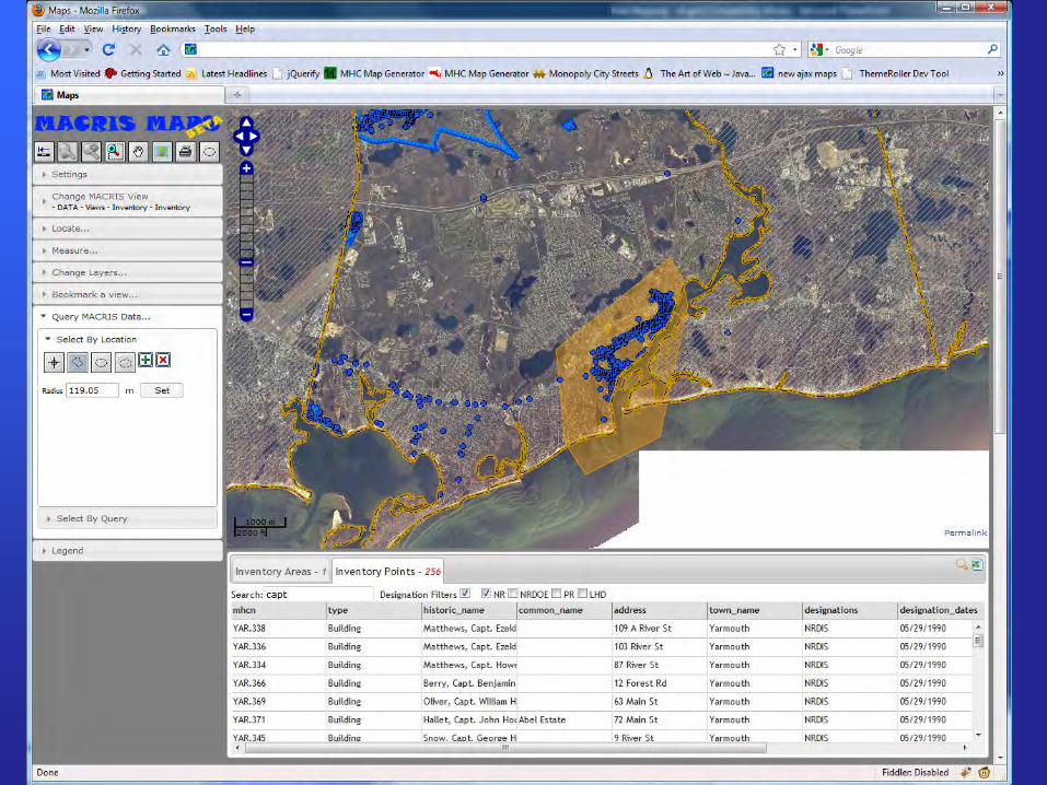
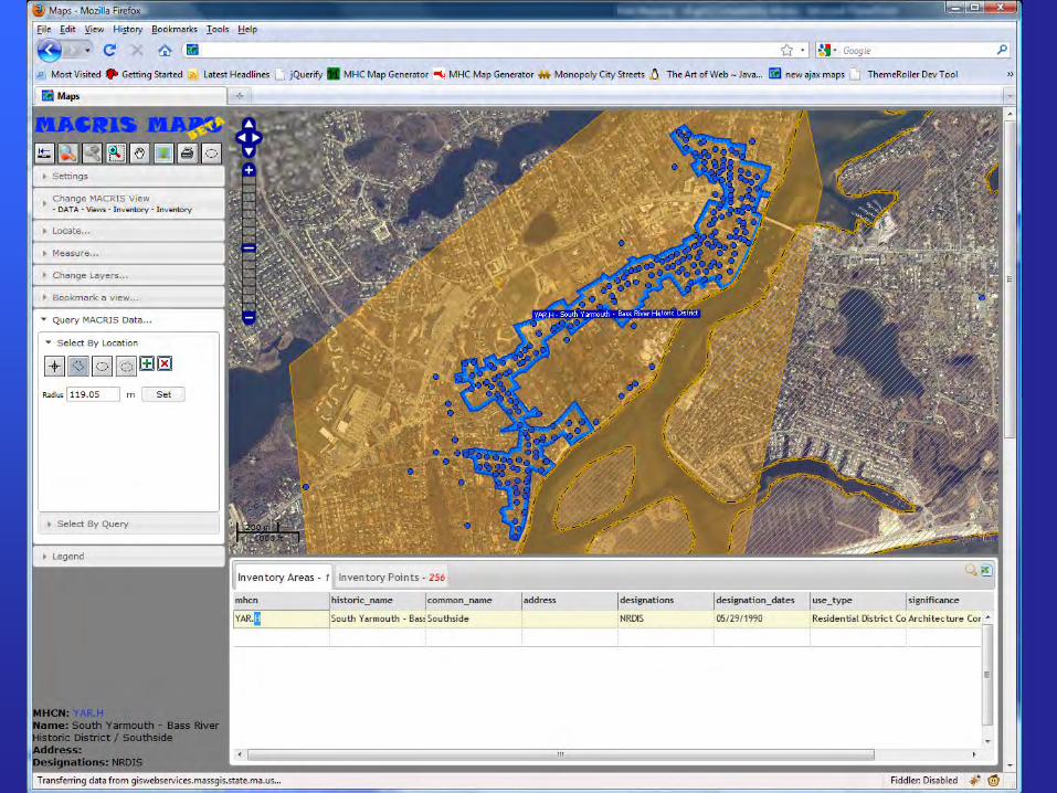
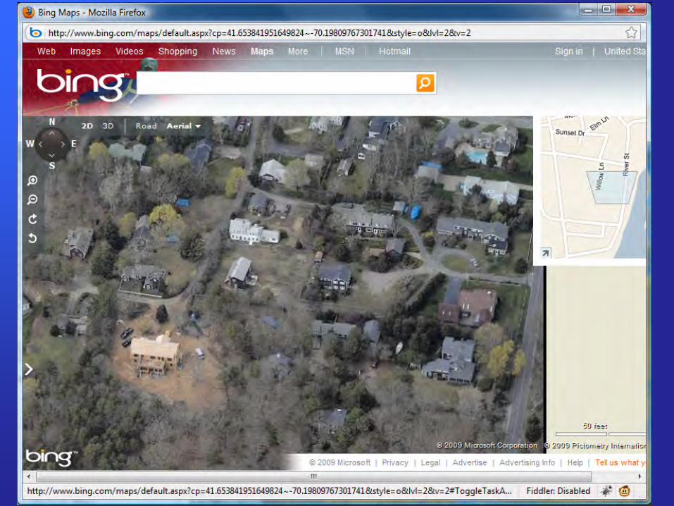
Live demo… WebGIS
– WebGIS
>
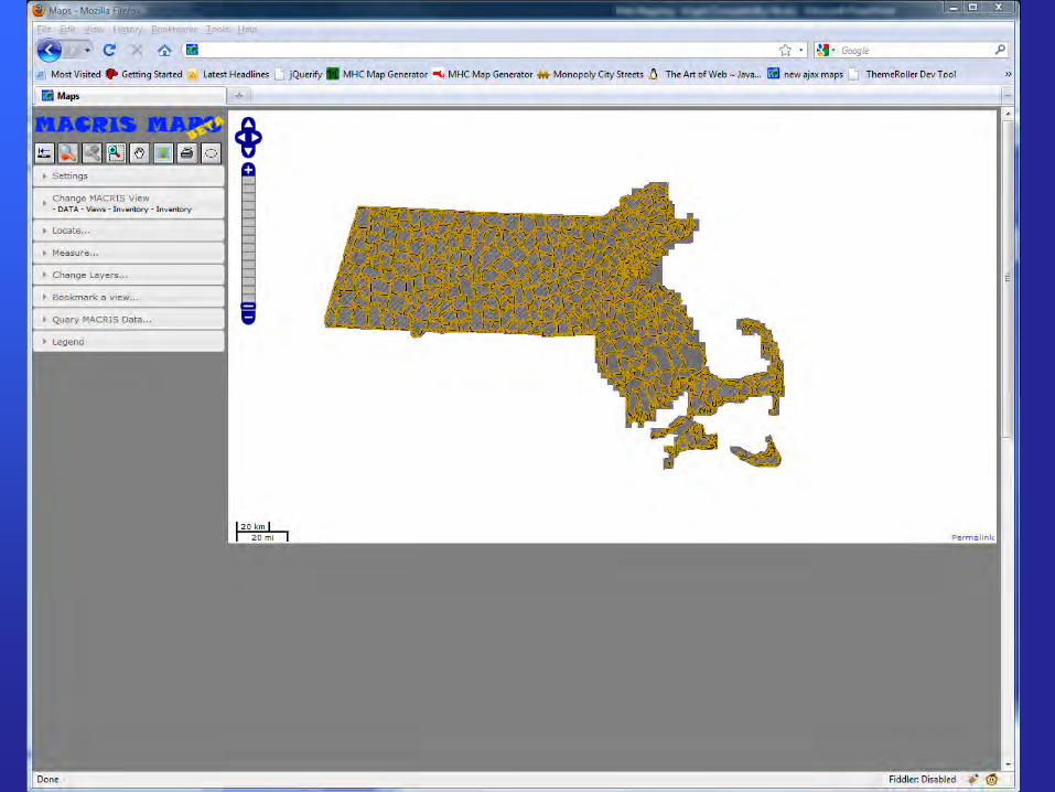
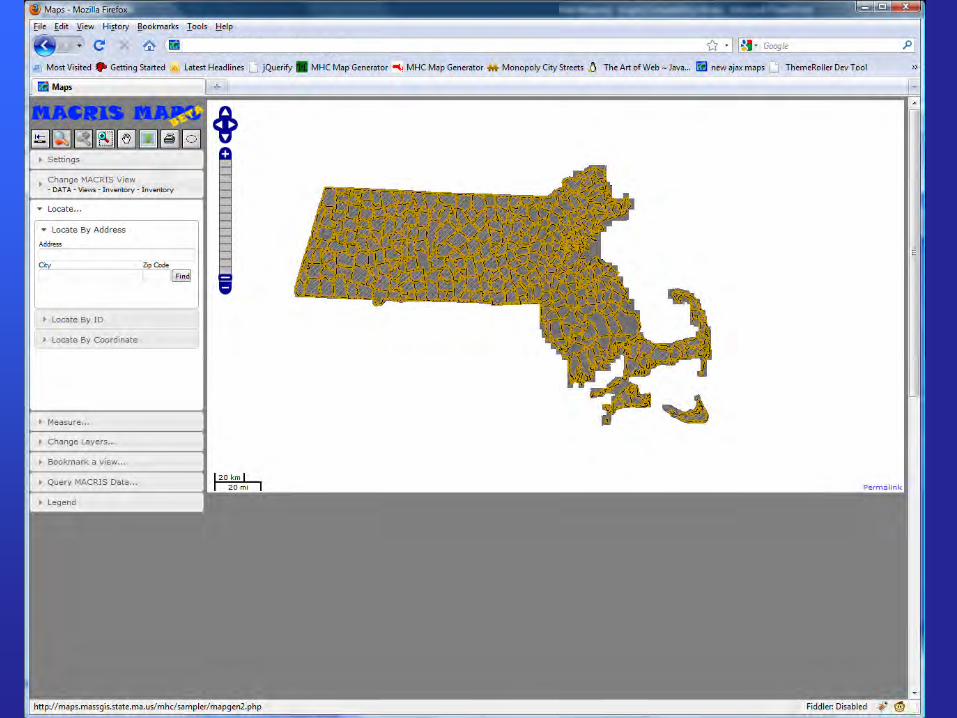
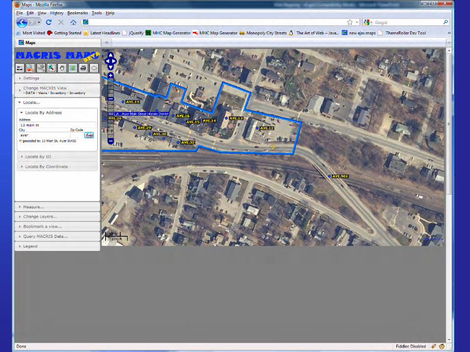
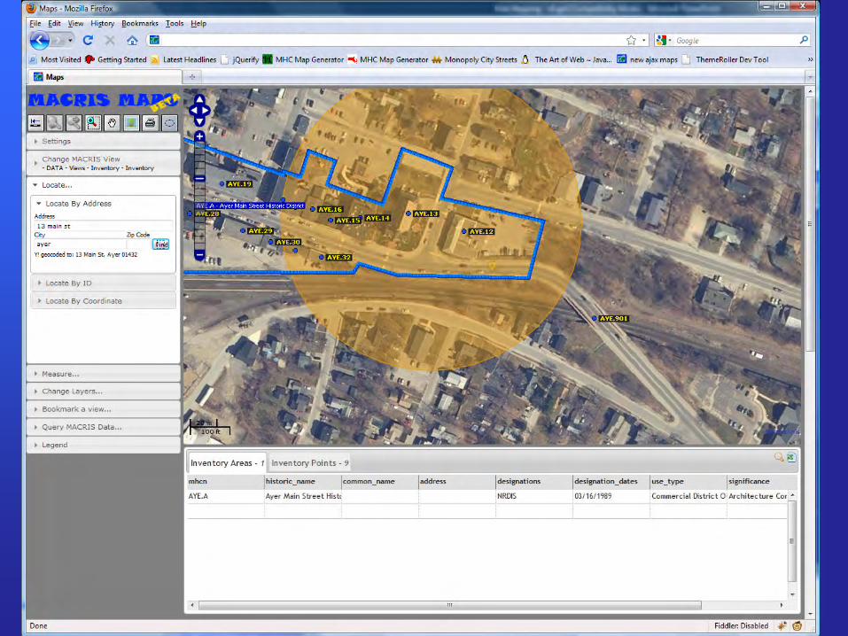
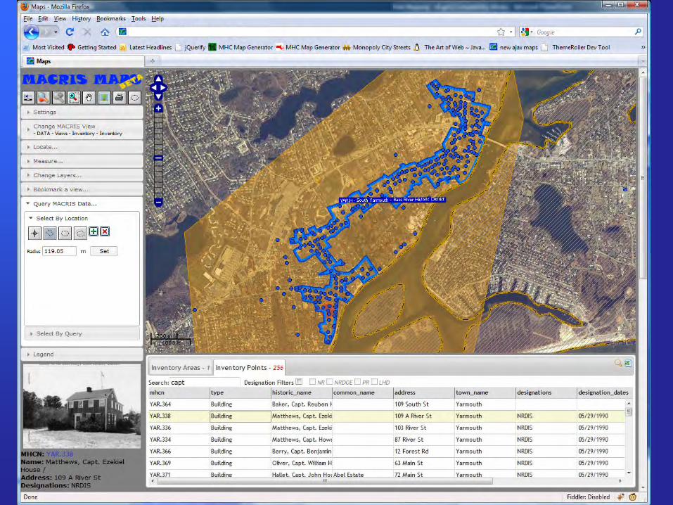
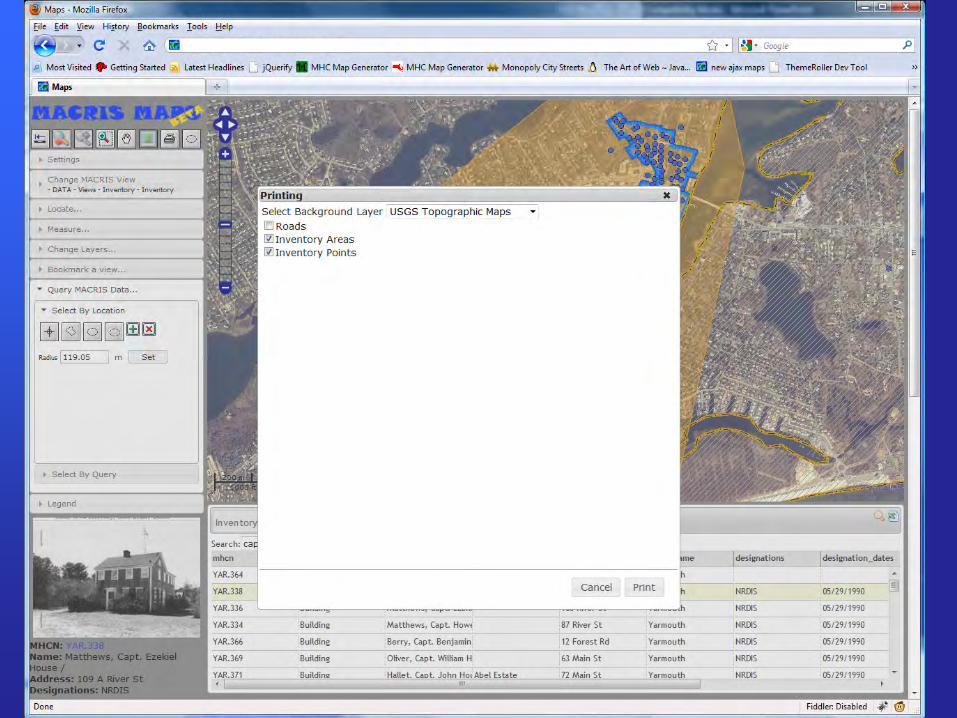
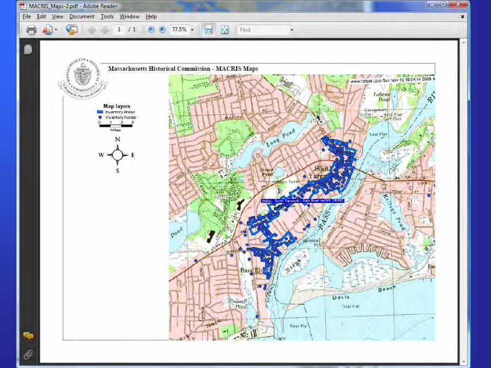
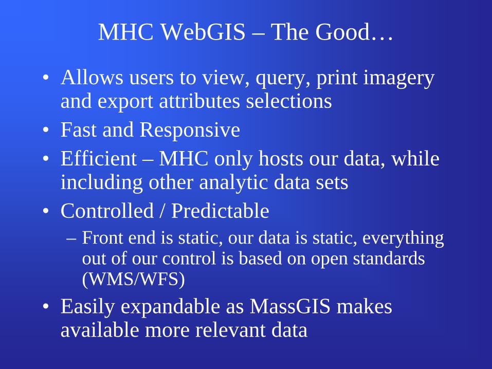
MHC WebGIS – The Good…
• Allows users to view, query, print imagery and export attributes selections
• Fast and Responsive• Efficient – MHC only hosts our data, while
including other analytic data sets• Controlled / Predictable
– Front end is static, our data is static, everything out of our control is based on open standards (WMS/WFS)
• Easily expandable as MassGIS makes available more relevant data
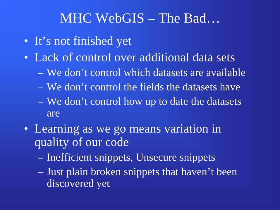
MHC WebGIS – The Bad…• It’s not finished yet• Lack of control over additional data sets
– We don’t control which datasets are available– We don’t control the fields the datasets have– We don’t control how up to date the datasets
are• Learning as we go means variation in
quality of our code– Inefficient snippets, Unsecure snippets– Just plain broken snippets that haven’t been
discovered yet
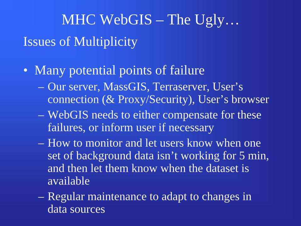
MHC WebGIS – The Ugly…Issues of Multiplicity
• Many potential points of failure– Our server, MassGIS, Terraserver, User’s
connection (& Proxy/Security), User’s browser– WebGIS needs to either compensate for these
failures, or inform user if necessary– How to monitor and let users know when one
set of background data isn’t working for 5 min, and then let them know when the dataset is available
– Regular maintenance to adapt to changes in data sources
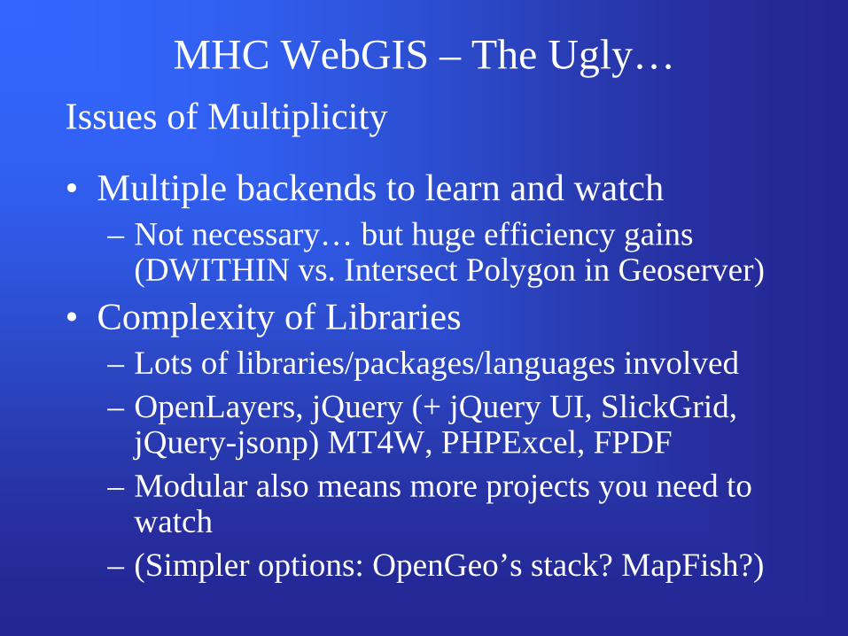
MHC WebGIS – The Ugly…Issues of Multiplicity
• Multiple backends to learn and watch – Not necessary… but huge efficiency gains
(DWITHIN vs. Intersect Polygon in Geoserver)• Complexity of Libraries
– Lots of libraries/packages/languages involved – OpenLayers, jQuery (+ jQuery UI, SlickGrid,
jQuery-jsonp) MT4W, PHPExcel, FPDF– Modular also means more projects you need to
watch– (Simpler options: OpenGeo’s stack? MapFish?)
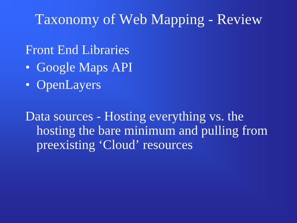
Taxonomy of Web Mapping - Review
Front End Libraries• Google Maps API• OpenLayers
Data sources - Hosting everything vs. the hosting the bare minimum and pulling from preexisting ‘Cloud’ resources
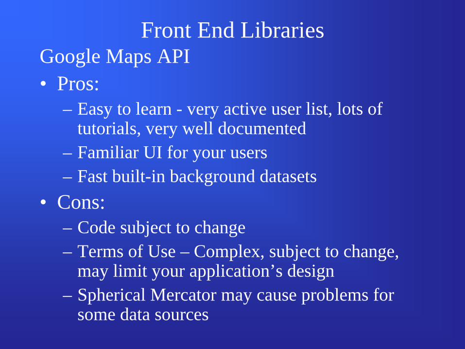
Front End LibrariesGoogle Maps API• Pros:
– Easy to learn - very active user list, lots of tutorials, very well documented
– Familiar UI for your users– Fast built-in background datasets
• Cons:– Code subject to change– Terms of Use – Complex, subject to change,
may limit your application’s design– Spherical Mercator may cause problems for
some data sources
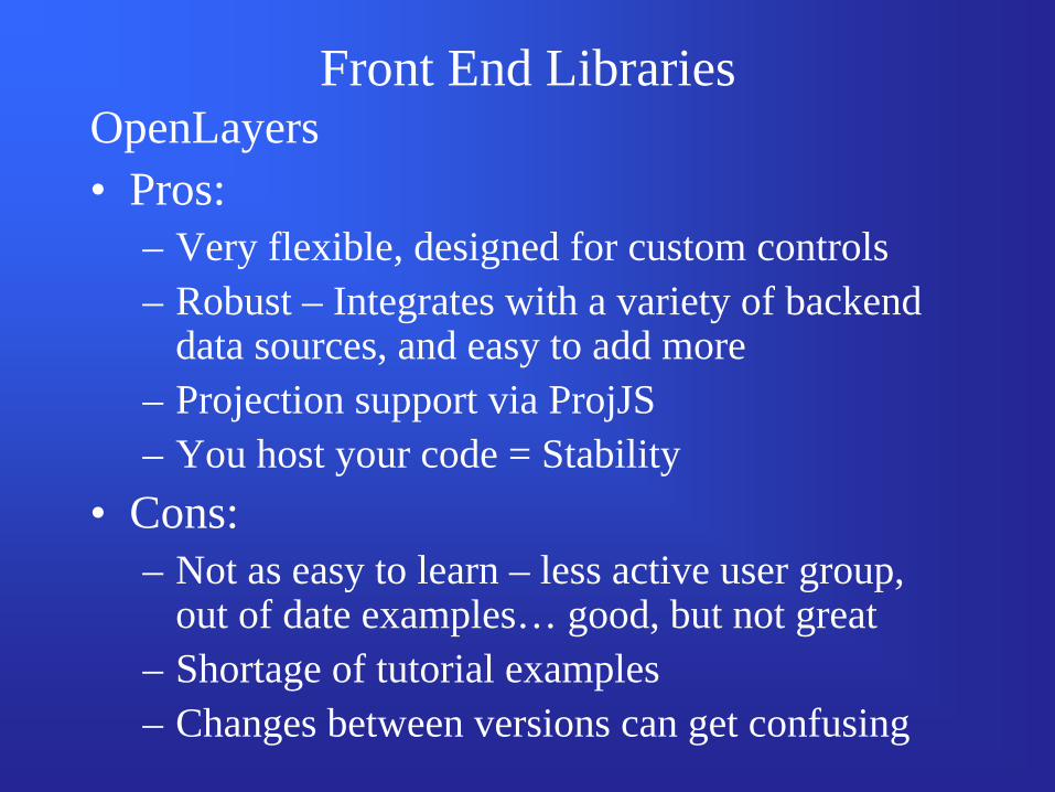
OpenLayers• Pros:
– Very flexible, designed for custom controls– Robust – Integrates with a variety of backend
data sources, and easy to add more– Projection support via ProjJS– You host your code = Stability
• Cons:– Not as easy to learn – less active user group,
out of date examples… good, but not great– Shortage of tutorial examples– Changes between versions can get confusing
Front End Libraries