welcome to the 16th australian space research conference · welcome to the 16th australian space...
TRANSCRIPT

1
Welcome to the 16th Australian Space
Research Conference
and to RMIT University, Melbourne! This will be the Tenth ASRC
jointly sponsored and organised by the National Committee for Space and Radio Science (NCSRS) and the National Space Society of Australia (NSSA). The ASRC is intended to be the primary annual meeting for Australian research relating to space science. It welcomes space scientists, engineers, educators, and workers in Industry and Government.
The 16th ASRC has over 140 accepted abstracts across Australian space research, academia, education, industry, and government.
We would like to thank RMIT University and the International
Space University – Southern Hemisphere Space Studies Program for their sponsorship of the conference. Special thanks also go to the Australian Space Mars Society Australia (MSA) for its support.
We look forward to an excellent meeting!
Iver Cairns Wayne Short
Co Chair ASRC 2016 Co Chair ASRC 2016 University of Sydney President, NSSA
2
Contents
About the NSSA ...................................................................... 3
About the NCSRS .................................................................... 4
Program Committee & Organisers ............................................. 5
Venue Details ......................................................................... 7
Program Overview .................................................................. 9
Detailed Program .................................................................. 10
Invited Speakers .................................................................. 21
Oral Presentations ................................................................ 30
Poster Presentations ............................................................. 37
Collection of Abstracts ........................................................... 39

3
About the NSSA
The National Space Society of
Australia is the coming together of like-minded space enthusiasts who
share a vision for the future in which there is an ambitious and vigorous space program leading to eventual space settlement.
To this end the National Space Society (worldwide) promotes interest in space exploration, research, development and habitation through events such as science and business conferences, speaking to the press, public outreach events,
speaking engagements with community groups and schools, and other pro-active events. We do this to stimulate advancement and development of space and related applications and technologies
and by bringing together people from government, industry and all walks of life for the free exchange of information.
As a non-profit organisation, the National Space Society of Australia draws its strength from an enthusiastic membership who
contributes their time and effort to assist the Society in pursuit of its goals.
For more information, and to become a member:
www.nssa.com.au
Ad Astra! Wayne Short
NSSA President 2016

4
About the NCSRS
The National Committee for Space and Radio Science (NCSRS) is chartered by the Australian Academy of Science to foster space science, to link Australian space scientists together and to their
international colleagues, and to advise the Academy’s Council on policy for science in general and space and radio science in
particular. The NCSRS was formed in 2012 by combining the former National Committee for Space Science (NCSS) and the National Committee for Radio Science (NCRS). The NCSRS web page can be reached at
https://www.science.org.au/committee/space-and-radio-science
NCSRS believes that ASRC meetings provide a natural venue to link Australian space scientists and foster the associated science, two of its core goals. As well as ASRC, NCSRS is also sponsoring
the VSSEC – NASA Australian Space Prize.
This is the sixth ASRC meeting following launch of the first Decadal Plan for Australian Space Science. NCSRS encourages people to work together to accomplish the Plan’s vision: “Build Australia a long term, productive presence in Space via world-leading innovative space science and technology, strong education and
outreach, and international collaborations.”

5
Program Committee & Organisers
2016 ASRC Program Committee
Jeremy Bailey (UNSW Australia)
Annalea Beattie (Mars Society Australia)
Russell Boyce (UNSW Australia, Canberra)
Iver Cairns (University of Sydney), Chair
Graziella Caprarelli (University of South Australia)
Brett Carter (RMIT University)
Jonathan Clarke (Mars Society of Australia)
Andrew Dempster (UNSW Australia)
Brad Evans (University of Sydney)
Alice Gorman (Finders University)
Duane Hamacher (UNSW Australia)
Trevor Harris (Defence Science and Technology Group, Department of Defence)
Jonathan Horner (University of Southern Queensland)
Alexey Kondyurin (University of Sydney)
Roberto Sabatini (RMIT University)
Michael Smart (University of Queensland)
Kefei Zhang (RMIT University)
6
2016 ASRC Organising Committee
Sarah Barter
RMIT University, operations and secretariat
Cheryl Brown
ACSER, UNSW Australia, secretariat
Annalea Beattie
Mars Society Australia
Iver Cairns
Co Chair ASRC 2016
University of Sydney
Brett Carter
RMIT university
Jonathan Horner
University of Southern Queensland
Guy Murphy
Mars Society Australia
Robert Norman
RMIT University
Roberto Sabatini
RMIT University
Wayne Short
Co Chair ASSC 2016
President, NSSA
Kefei Zhang
RMIT University
Chair, local organising committee
7
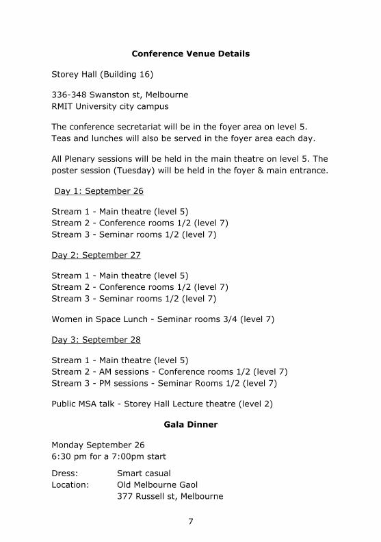
Venue Details
Conference Venue Details
Storey Hall (Building 16)
336-348 Swanston st, Melbourne
RMIT University city campus
The conference secretariat will be in the foyer area on level 5.
Teas and lunches will also be served in the foyer area each day.
All Plenary sessions will be held in the main theatre on level 5. The
poster session (Tuesday) will be held in the foyer & main entrance.
Day 1: September 26
Stream 1 - Main theatre (level 5)
Stream 2 - Conference rooms 1/2 (level 7)
Stream 3 - Seminar rooms 1/2 (level 7)
Day 2: September 27
Stream 1 - Main theatre (level 5)
Stream 2 - Conference rooms 1/2 (level 7)
Stream 3 - Seminar rooms 1/2 (level 7)
Women in Space Lunch - Seminar rooms 3/4 (level 7)
Day 3: September 28
Stream 1 - Main theatre (level 5)
Stream 2 - AM sessions - Conference rooms 1/2 (level 7)
Stream 3 - PM sessions - Seminar Rooms 1/2 (level 7)
Public MSA talk - Storey Hall Lecture theatre (level 2)
Gala Dinner
Monday September 26
6:30 pm for a 7:00pm start
Dress: Smart casual
Location: Old Melbourne Gaol
377 Russell st, Melbourne

8
Location of conference facilities –
RMIT University city campus

9
Program Overview

10
Detailed Program
Monday - Stream 1 (Storey Hall main theatre)
Time Speakers Name Title
7:45-9:00 Registration
9:00-9:10 Iver Cairns, Wayne Short
Welcome to ASRC
9:10-9:20 Acting Vice Chancellor, Professor Paul Gough
Welcome to RMIT University
Plenary Session I
CHAIR: Iver Cairns
9:20-9:50 Prof Frances Bagenal, University of Colorado
Exploration of the Outer Solar System: New Horizons at Pluto and Juno at Jupiter
9:50-10:20 Dr Gordon J. Frazer, DST Group
Wide field-of-view sensing for surveillance-of-space
10:20-10:50 Dr Robert Norman, RMIT University
RMIT SPACE Research Centre – overview of past and present research endeavours
10:50-11:15 Morning Tea
National Context
CHAIR: Russell Boyce
11:15-11:30 John Le Marshall Earth Observation from Space (Bureau of Meteorology)
11:30-11:45 Ben Greene SERC
11:45-12:00 Mark Todd DIIS (Civil Space, Cyber Security and ICT)
12:00-12:15 Kirco Arsov BoM Space Weather Services
12:15-12:30 Nick Stacy DST Group
12:30-12:45 Alice Gorman SIAA / IAC2017
12:45-13:00 Russell Boyce NCSRS
13:00-14:00 Lunch
Space Engineering: Cubesats
CHAIR: David Lingard
14:00-14:15 Andrew Dempster, UNSW Australia
Evaluation of Current and Projected CubeSat Propulsion Technologies for Navigating Cislunar Space
14:15-14:30 Angus Muffatti, RMIT Multi-objective Design Optimisation of a small scale Cusped Field Thruster for micro satellite platforms

11
Time Speakers Name Title
14:30-14:45 Prof Christine Charles, ANU
Plasma experiments in the laboratory and space: the emerging role of ‘CubeSat’ nano-satellites and miniaturised propulsion systems.
14:45-15:00 Roger Dudziak, UNSW Canberra
Passive Thermal Control System for CubeSats
15:00-15:15 Dr Li Qiao, UNSW Canberra
Knowledge exploration for CubeSat design trade space using multi-dimensional scaling and clustering
15:15-15:30 Dr Andrew Wabnitz , DST Group
SpaceLink: A Lightweight, Robust and Secure Communication Link for Small Satellites
15:30-15:45 George Coulloupas, RMIT University
A Systems Engineering Approach to Miniaturised Satellite Constellation Design Optimisation
15:45-16:00 Victor Lim, RMIT University
Optimising the launch, deployment and performance of a smallsat constellation
16:00-16:30 Afternoon Tea
Cubesats
CHAIR: Christine Charles / Jason Held
16:30-16:50 Dr David Lingard , DST Group
Australian Participation in the Biarri CubeSat Missions
16:50-17:10 Dr Douglas Griffin, UNSW Canberra
DST Group and UNSW Canberra Buccaneer Programme Status and Plans
17:10-17:30 Dr Matthew Tetlow, Inovor Technologies
The SUSat QB50 mission
17:30-17:50 Prof Andrew Dempster, ACSER, UNSW Australia
Updates and progress of UNSW-EC0 Cubesat
17:50-18:10 Prof Iver Cairns, University of Sydney
The INSPIRE-2 / AU03 Cubesat for the QB50 Project
18:30-21:30 ASRC Gala Dinner

12
Monday - Stream 2 (Conference Rooms 1/2)
Time Speakers Name Title
Space & Atmospheric Physics
CHAIRS: Fred Menk/Robert Norman
14:00-14:15 Dr Alina Donea, Monash University
Far side imaging of the Sun for space weather prediction: how many active regions do we miss?
14:15-14:30 Ms Samira Tasnim, University of Sydney
A generalized equatorial model for the accelerating solar wind
14:30-14:45 Dr Dave Neudegg, Space Weather Services, BOM
Long term median foF2 variations in the Antarctic polar cap and the competing effects of solar EUV, magnetospheric precipitation and ionisation transport
14:45-15:00 Dr Melrose Brown, UNSW Canberra
Low Earth Orbit interaction with the atmosphere
15:00-15:15 David Netherway, DST Group
Measured and Predicted Power Received via HF Ionospheric Propagation
15:15-15:30 Miss Julie Currie, University of Newcastle
Relationship between HF radar spectral broadening and field aligned currents
15:30-15:45 Mr Kehe Wang , Space Weather Services, BOM
The Metadata Development of Space Weather Services and a Proposal of a United Australian Space Research Metadata Portal
15:45-16:00 Dr Anne Unewisse, DST Group, Edinburgh
Imagers for Ionospheric Airglow Observations
16:00-16:30 Afternoon Tea
Indigenous Sky Knowledge
CHAIR: Alice Gorman /Ann Cairns
16:30-16:45 Edoardo Tescari, University of Melbourne
Exploring Indigenous Astronomical Knowledge in Australia and Central America: A Cross-Cultural Collaboration
16:30-17:00 Dr Duane W. Hamacher, Monash University
How Torres Strait Islanders “Read” the Twinkling of Stars to Predict Weather
17:00-17:15 Karlie Noon, University of Newcastle
Australian Indigenous uses of Moon Haloes to Predict Weather
17:15-17:30 Carla B. Guedes, UNSW Australia
Australian Indigenous Traditions of the Moon and its Relationship to Women
17:30-17:45 Trevor M. Leaman, UNSW Australia
Sacred Celestial Landscapes: Were Wiradjuri Cultural Sites also used as Astronomical “Observatories”?
17:45-18:00 Robert S. Fuller, UNSW Australia
The astronomy of the Aboriginal peoples of the Sydney Basin

13
Monday - Stream 3 (Seminar Rooms 1/2)
Time Speakers Name Title
13:00-14:00 Lunch
Planetary Science
CHAIR: Graziella Caprarelli
14:00-14:15 Dr Kurt Liffman, Swinburne University
A Unified Framework for Producing CAI Melting, Wark-Lovering Rims and Bowl-Shaped CAIs
14:15-14:30 Miss Emily Jessica Bathgate, UTS
Raman, SEM and EPMA analyses of Australian eucrites
14:30-14:45 Jack Soutter, USQ The Long-Term Stability of the Known Neptune Trojans
14:45-15:00 Dr Lucyna Kedziora-Chudczer, UNSW Australia
Auroral emissions of Jupiter
15:00-15:15 Dr Jerome Daquin, RMIT University
Heterogeneous Multiscale Methods for the mean orbital motion: a
discussion
15:15-15:30 Dr Franklin Mills, ANU
Simulations of time-of-day variability of SO2 on Venus
15:30-15:45 A/Prof Jonti Horner, USQ
Towards the Exo-Earth Era - a Dedicated Australian Exoplanet Observatory
15:45-16:00 Prof Jeremy Bailey, UNSW Australia
How did we discover what planetary atmospheres are made of?

14
Tuesday - Stream 1 (Storey Hall main theatre)
Time Speakers Name Title
8:00-9:00 Registration
Plenary Session II
CHAIR: Russell Boyce
9:00-9:30 Prof Kathleen Campbell, University of Auckland
Astrobiology of Hot Springs on Early Earth and Mars
9:30-10:00 Dr Peter May, Bureau of Meteorology
Earth Observations from Space: Critical information used by the Bureau for national benefit
10:00-10:30 Dr Bradley Evans, University of Sydney
Leveraging “Big Environmental Data” for Modelling Ecosystem Production in Space and Time
10:30-11:00 Morning Tea
Remote Sensing and GNSS
CHAIR: Bradley Evans
11:00-11:15 John Le Marshall, Bureau of Meteorology
Recent and Impending Advances in the Use of Earth Observations from Space for Numerical Weather Prediction
11:15-11:30 Dr. Graham Dorrington , School of Engineering
On the Feasibility of Nanosats for Early Bushfire Detection
11:30-11:45 Ruken Alac Barut, UNSW
Analysing Post-Seismic Deformation of Izmit Earthquake with InSAR, GNSS AND Coulomb Stress Change Modelling
11:45-12:00 Prof. Stuart John Anderson, University of Adelaide
Space-borne interception of HF radar echoes for environmental intelligence
12:00-12:15 Dr. German Olivares-Pulido, CRCSI
CRCSI Project 1.21: Ionospheric Modelling
12:15-12:30 Dr. Kirco Arsov, Bureau of MEteorology
High accuracy ionospheric modelling to support GNSS positioning and navigation in Australia
12:30-12:45 Prof Kefei Zhang, RMIT University
An Advanced Near Real-Time Water Vapour Platform for Severe Weather and Climate Studies
13:05-14:00 Lunch
Space & Atmospheric Physics II
CHAIR: Brett Carter
14:00-14:15 Dr Zahra Bouya, Space Weather Services, Bureau of Meteorology
The Australian Region Ionospheric Maps

15
Time Speakers Name Title
14:15-14:30 Mr Andrew Heitmann, DST Group, Edinburgh
Parameterised modelling of travelling ionospheric disturbances using angle-of-arrival observations on oblique HF propagation paths
14:30-14:45 Dr Kenneth J.W. Lynn, Ionospheric Systems Research
Descending Intermediate layers/Descending Sporadic E
14:45-15:00
15:00-15:15 Dr Bo Li, University of Sydney
Mapping Magnetic Field Lines between the Sun and Earth
15:15-15:30 Prof Fred Menk, University of Newcastle
Role of Ultra-low Frequency Plasma Waves in Engergizing Particles in Earth’s Radiation Belts
15:30-15:45 Prof Iver Cairns, University of Sydney
Prediction and testing of Type II radio emission, white light images, and CME properties from the Sun to Earth
15:30-16:00 Ms Belinda Nicholson, USQ
Stars as proxies for studying the Sun’s early history
16:00-16:30 Afternoon Tea
16:30-18:00 Poster session
18:00-19:20 Cocktail Function
Tuesday - Stream 2 (Conference Rooms 1/2)
Time Speakers Name Title
10:30-11:00 Morning Tea
Human factors
CHAIR: Guy Murphy
11:00-11:20 Dr Rowena Christiansen, University of Melbourne
Space Medicine 101 – A Primer on What Happens to the Human Body in Space
11:20-11:40 Dr Rowena
Christiansen, University of Melbourne
NASA’s Human Research Program
– The 33 Key Issues for Human Health and Performance in Space
11:40-12:00 Dr Tracey Sletten , Monash University
Circadian misalignment and sleep disruption during long-term analog space missions.
12:00-12:20 LCDR Luke Dixon, RAN, Future Submarine Program
Human Factors in Hostile Environments: Projecting 102 Years of experience in Australian Submarines to long haul space missions
12:20-12:40 Dr Kimberley Norris, University of Tasmania
Antarctic Behavioural Health as a Space Analogue
13:00-14:00 Lunch

16
Time Speakers Name Title
Space Business & Entrepreneurship
CHAIRS: Alice Gorman / Jason Held
14:00-14:20 Mrs Melanie Revellat, Airbus
Bartolomeo – Your All-In-One Mission Service
14:20-14:40 Dr Jason Held, Saber Astronautics
Planning missions for large constellations
14:40-15:00 Troy McCann, Melbourne University
The Melbourne Space Program: Growing Australia's Space Sector
15:00-15:20 Ian Whitchurch, Neumann Space
The Barsoom Express : Earth orbit to Mars orbit in three months by solar electric propulsion
15:20-15:40 Ivan Voropaev, Wave Power Engineering Pty Ltd
Satellite electric drive
15:40-16:00
Tuesday - Stream 3 (Seminar Rooms 1/2)
Time Speakers Name Title
13:00-14:00 Lunch
Education, Outreach & Ethics
CHAIRS: Lachlan Thompson /
Jeremy Bailey
14:00-14:15 Dr Tanya Hill, Melbourne Planetarium
The planetarium – connecting the public to current space research
14:15-14:30 Lachlan Thompson, Mount Burnett & Emerald Observatory
New Capability for Emerald & Mount Burnett Observatories, Victoria for Earth Situational Awareness, Research, Education and Tourism
14:30-14:45 A/Prof Graziella Caprarelli, UniSA
The International Space University Southern Hemisphere Program
14:45-15:00 Prof Jeremy Bailey, UNSW
A Large Fully-Online Astrobiology Course
15:00-15:15 Mrs Gabriela-Nicoleta Hobbs,UNSW Canberra
The Ethics of Working with Robots
15:15-15:30 Victoria Tasker, Australian National University
Becoming cyborgs to expand humanity: will the integration of technology and humans reinforce humanity, or redefine it?
15:30-15:45 Mrs Gabriela-Nicoleta Hobbs,UNSW Canberra
Educational and Scientific Benefits of Extreme Environments

17
Wednesday – Stream 1 (Storey Hall main theatre)
Time Speakers Name Title
8:00-9:00 Registration
Plenary Session III
CHAIR: Wayne Short
9:00-9:30 Upulie Diveksara, Monash University
A New Era of Space Exploration
9:30-10:00 Dr Eriita Jones, UniSA Identifying Something Which Can’t Be Seen: Holistic Methodologies In The Search For Subsurface Water on Mars and Other Planets.
10:00-10:30 Dr. Douglas Griffin, UNSW Canberra
The Engineering of Space Flight Programmes in the Australian Context: a sustainable model
10:30-11:00 Morning Tea
GNSS
CHAIRS: John LeMarshall / Kefei Zhang
11:00-11:15 Arunkumar Rathinam, ACSER, UNSW
Prospects for Multi-GNSS for Space Service Volume
11:15-11:30 Francesco Cappello, RMIT University
GNSS Attitude Determination and Control for Space Transportation Applications
11:30-11:45 Dr Zishen Li, RMIT University
Towards a Two-Layer Ionospheric Delay Model for Real-time Single-frequency PPP over Australian Region
11:45-12:00 Changyong He, SPACE Research Centre, School of Science, RMIT
Comparison of atmospheric mass density models and their impact on the orbit propagation of low Earth orbit satellites
12:00-12:15 Changjiang Hu, UNSW Canberra
Contemporary Space-based GNSS Remote Sensing
12:15-12:30 Francesco Cappello, RMIT University
Navigation and Guidance Systems for Space Transportation Applications
12:30-12:45 Subramanian Ramasamy, RMIT University
Design and Development of Communication System for Unmanned Reusable Space Vehicles
13:00-14:00 Lunch
Space Engineering
CHAIRS: Andrew Dempster / Lily Qiao
14:00-14:15 Mr Garland Hu , DST Group
Modular and Reusable Flight Software Design for the Buccaneer Risk Mitigation Mission
14:15-14:30 Ms Natalie Olsen , DST Group
Ground Segment Software Design and Development for the Buccaneer Risk Mitigation Mission

18
Time Speakers Name Title
14:30-14:45 Simon Barraclough, UNSW Canberra
Assessment and Verification of the Thermal Performance of the BRMM Spacecraft
14:45-15:00 Dr Giuseppina Dall’Armi-Stoks, DST Group
Computational Electromagnetic Modelling to Support Spacecraft Design
15:00-15:15 Prof Roberto Sabatini, RMIT University
Overview of the ISS Columbus module astrionics
15:15-15:30 Mr Subramanian Ramsamy, RMIT University
Astrionics Systems for Unmanned Reusable Space Vehicles
15:30-15:45 Mr Yi Xiang Lim, RMIT University
Cognitive Human Machine Interface for the Ground Pilot Station of an Unmanned Reusable Space Vehicle
15:30-16:00 Prof. Michael Smart, University of Queensland
Flyback booster for dedicated launch of small satellites
16:00-16:20 Afternoon Tea
Space Situational Awareness
CHAIR: Melrose Brown
16:20-16:35 Brenton Smith, UNSW Canberra
The Impact Of Lift And Drag On 6D of Motion Of Leo Objects : Formation Control And Debris Behaviour
16:35-16:50 Adam Harris, RMIT University
An analysis of short-arc orbit determination for Low Earth Orbit objects comparing batch and Kalman Filter methods
16:50-17:05 Andoh Michael Afful, RMIT University
Space Object Characterisation - A Case for Ballistic Coefficient Estimation
17:05-17:20 Dr Yang Yang, RMIT University
Schmidt-Kalman Filter and its Applications to Orbit Determination of Space Objects
17:20-17:35 Dr Florent Deleflie , IMCCE (Celestial Mechanics Institue) @ Paris Observatory (France)
Atmospheric reentry prediction for artificial satellites from TLE time series and precise orbit determination
17:35-17:50 Dr Jerome Daquin, RMIT University
Stability, chaos and transport in Earth orbits
17:50-18:00
Iver Cairns, Wayne Short
Closing remarks
18:30-20:00 MSA “David Cooper memorial lecture” by Dr James Waldie
Public talk (level 2): From the outback to the space station: developing revolutionary spacesuits with NASA and ESA
19
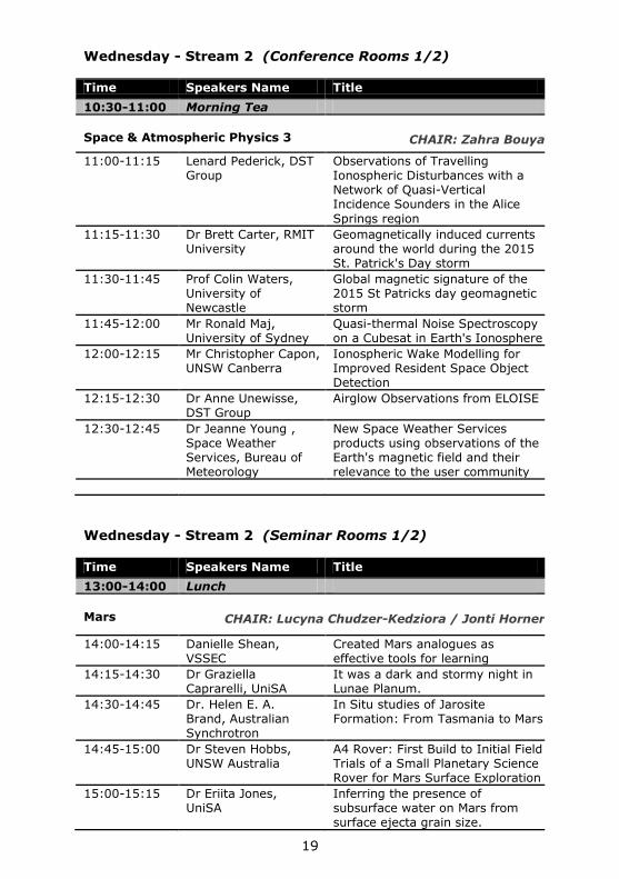
Wednesday - Stream 2 (Conference Rooms 1/2)
Time Speakers Name Title
10:30-11:00 Morning Tea
Space & Atmospheric Physics 3
CHAIR: Zahra Bouya
11:00-11:15 Lenard Pederick, DST Group
Observations of Travelling Ionospheric Disturbances with a Network of Quasi-Vertical Incidence Sounders in the Alice
Springs region
11:15-11:30 Dr Brett Carter, RMIT University
Geomagnetically induced currents around the world during the 2015 St. Patrick's Day storm
11:30-11:45 Prof Colin Waters, University of Newcastle
Global magnetic signature of the 2015 St Patricks day geomagnetic storm
11:45-12:00 Mr Ronald Maj, University of Sydney
Quasi-thermal Noise Spectroscopy on a Cubesat in Earth's Ionosphere
12:00-12:15 Mr Christopher Capon, UNSW Canberra
Ionospheric Wake Modelling for Improved Resident Space Object Detection
12:15-12:30 Dr Anne Unewisse, DST Group
Airglow Observations from ELOISE
12:30-12:45 Dr Jeanne Young , Space Weather Services, Bureau of Meteorology
New Space Weather Services products using observations of the Earth's magnetic field and their relevance to the user community
Wednesday - Stream 2 (Seminar Rooms 1/2)
Time Speakers Name Title
13:00-14:00 Lunch
Mars
CHAIR: Lucyna Chudzer-Kedziora / Jonti Horner
14:00-14:15 Danielle Shean, VSSEC
Created Mars analogues as effective tools for learning
14:15-14:30 Dr Graziella Caprarelli, UniSA
It was a dark and stormy night in Lunae Planum.
14:30-14:45 Dr. Helen E. A. Brand, Australian Synchrotron
In Situ studies of Jarosite Formation: From Tasmania to Mars
14:45-15:00 Dr Steven Hobbs, UNSW Australia
A4 Rover: First Build to Initial Field Trials of a Small Planetary Science Rover for Mars Surface Exploration
15:00-15:15 Dr Eriita Jones, UniSA
Inferring the presence of subsurface water on Mars from surface ejecta grain size.

20
Time Speakers Name Title
15:15-15:30 Dr Graham Dorrington , RMIT University
Rationale and Strategies for Reconnaissance of Lunar and Martian Pit-Voids
15:30-15:45 Dr Steven Hobbs, UNSW Australia
Hands Off Field Work: Comparison of Human and Robotic Methods for Gathering Terrain Data using Structure From Motion
15:30-16:00 Dr Craig Benson, UNSW Canberra
A Southern Hemisphere Planetary Radar Demonstration
16:00-16:20 Afternoon Tea
Space Missions & Projects
CHAIR: Graham Dorrington
16:20-16:35 Igor Dimitrijevic, UNSW Canberra
Buccaneer Risk Mitigation Mission Assembly, Integration and Verification Programme
16:35-16:50 Dr Anthony John Horton, Australian Astronomical Observatory
The Australian Space Eye: a CubeSat to study the history of galaxy formation
16:50-17:05 Igor Rozenberg, Space Association of Australia
Russian New Generation “Federation” Crewed Spacecraft Project Status
17:05-17:20 Mr Sanat Biswas, UNSW Australia
Position and Velocity estimation of Re-entry Vehicles using Fast Unscented Kalman Filters
17:20-17:35 Rohan Kapoor , RMIT University
Modelling a Rendezvous to Comet Hartley 2 around its Perihelion
17:35-17:50 Mr Yang Zhao, RMIT University
New Methods for Improving Two-line Element Outlier Detection Based on a Consistency Check
17:50-18:00
Iver Cairns, Wayne Short
Closing remarks (Level 5)

21
Invited Speakers
16th Australian Space Research Conference:
plenary speakers
Professor Frances Bagenal
Laboratory for Atmospheric and
Space Physics
University of Colorado, Boulder
“Exploration of the Outer Solar
System: New Horizons at Pluto and
Juno at Jupiter”
Dr. Fran Bagenal is a research
scientist at the University of
Colorado, Boulder and is co-
investigator and team leader of the
plasma investigations on NASA’s New
Horizons mission to Pluto and the
Juno mission to Jupiter. Her main
area of expertise is the study of charged particles trapped in
planetary magnetic fields and the interaction of plasmas with the
atmospheres of planetary objects, particularly in the outer solar
system. She edited the monograph Jupiter: Planet, Satellites and
Magnetosphere (Cambridge University Press, 2004).
Born and raised in the UK, Dr. Bagenal received her bachelor
degree in Physics and Geophysics from the University of Lancaster,
England, and her doctorate degree in Earth and Planetary Sciences
from MIT (Cambridge, Mass) in 1981. She spent five years as a
postdoctoral researcher at Imperial College, London, before
returning to the United States for research and faculty positions in
Boulder, Colorado. She has participated in several of NASA's
planetary exploration missions, including Voyager 1 and 2, Galileo,
Deep Space 1, New Horizons and Juno.
22
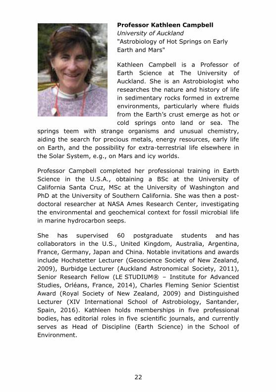
Professor Kathleen Campbell
University of Auckland
"Astrobiology of Hot Springs on Early
Earth and Mars"
Kathleen Campbell is a Professor of
Earth Science at The University of
Auckland. She is an Astrobiologist who
researches the nature and history of life
in sedimentary rocks formed in extreme
environments, particularly where fluids
from the Earth’s crust emerge as hot or
cold springs onto land or sea. The
springs teem with strange organisms and unusual chemistry,
aiding the search for precious metals, energy resources, early life
on Earth, and the possibility for extra-terrestrial life elsewhere in
the Solar System, e.g., on Mars and icy worlds.
Professor Campbell completed her professional training in Earth
Science in the U.S.A., obtaining a BSc at the University of
California Santa Cruz, MSc at the University of Washington and
PhD at the University of Southern California. She was then a post-
doctoral researcher at NASA Ames Research Center, investigating
the environmental and geochemical context for fossil microbial life
in marine hydrocarbon seeps.
She has supervised 60 postgraduate students and has
collaborators in the U.S., United Kingdom, Australia, Argentina,
France, Germany, Japan and China. Notable invitations and awards
include Hochstetter Lecturer (Geoscience Society of New Zealand,
2009), Burbidge Lecturer (Auckland Astronomical Society, 2011),
Senior Research Fellow (LE STUDIUM® – Institute for Advanced
Studies, Orléans, France, 2014), Charles Fleming Senior Scientist
Award (Royal Society of New Zealand, 2009) and Distinguished
Lecturer (XIV International School of Astrobiology, Santander,
Spain, 2016). Kathleen holds memberships in five professional
bodies, has editorial roles in five scientific journals, and currently
serves as Head of Discipline (Earth Science) in the School of
Environment.

23
Upulie Divisekera
Monash University
“A New Era Space Exploration”
Upulie Divisekera is a PhD student,
science communicator, science and space
advocate based in Melbourne. Her
multidisciplinary thesis work, carried out
in the Department of Chemical
Engineering at Monash University,
involves the generation of bespoke
nanoparticles for targeted drug delivery
and gene therapy. Over her career, Upulie has conducted research
in cancer immunotherapies, apoptosis, materials science and
developmental biology.
Upulie is a passionate science communicator, both on and offline,
and is the co-founder of Real Scientists; giving scientists a
platform to engage with the public real-time and provide a
snapshot into the scientific life. Her writing has been published in
The Guardian, Sydney Morning Herald, Crikey, The Lifted Brow,
etc. Upulie public speaking engagements include TEDxCanberra
(2012), The Wheeler Centre, The Interrobang Festival, The
Melbourne Writer’s Festival, Q and A (ABC TV), Space Up Australia
and ABC Radio National’s Research Filter. In addition to her
nanotechnology research, Upulie has a broad and current interest
in the sciences and in her spare time catches up on the
astrophysics career she abandoned at 12. Upulie wishes she was
an astronaut and is interested in the intersection of science and
culture.

24
Dr Bradley Evans
Sydney University
"Leveraging “Big Environmental Data” for
Modelling Ecosystem Production in Space
and Time"
Bradley is experienced in regional climate
modelling of land surface parameters and
the use of terrestrial micro-meteorological
observations and field spectroscopy.
Bradley has statistically and spatially
analysed (modelled and observed) observations of wind, soil
moisture, temperature, humidity and precipitation. Bradley has
used regional climate models down to a scale of 1km for over 100
years (hindcast) and developed post-processing systems to extract
and perform GIS analysis on these data. Bradley has applied
statistical decomposition analysis and other methods to detecting
spatial and temporal correlations between disturbance events and
time series data. Bradley has developed infrastructure for the
acquisition, formatting and analysis of national (i.e. Australia and
New Zealand) and global remote sensing and climatology datasets.
Bradley contributes to a number of international open-source
initiatives actively improving and sharing methodologies and tools
for processing large scientific datasets.
Since 2013 Bradley has been the Director of the Terrestrial
Ecosystem Research Network Ecosystem Modelling and Scaling
Infrastructure. Bradley’s published research addresses the
technical challenges of monitoring and modelling ecosystem
productivity and condition with limited resources.

25
Dr Gordon Frazer
Defence Science Technology Group
"Wide field of view Surveillance of space”
Gordon J. Frazer received the B.E. (Elect.)
(Hons.) degree from the University of
Canterbury, New Zealand, in 1982; the
M.Eng.Sc degree from the University of
Queensland, Brisbane, in 1990; and the
Ph.D degree from Queensland University
of Technology, Brisbane, in 1996. He is
presently the Research Leader for High-Frequency Radar in the
National Security and Intelligence Surveillance and Reconnaissance
Division of Defence Science and Technology Group.
As Research Leader, Dr Frazer is responsible for Defence Science
and Technology Group's high-frequency radar program, including
research and development for JORN operational support, evolution,
and major enhancement; next generation OTHR; ISR applications
of HF radar; missile defence applications of HF radar; and HF line-
of-sight and surface-wave radar. His research interests are: radar
system and component design; signal and array processing; and
experimentation, test and evaluation; and are focussed toward the
development and transition to service of third generation over-the-
horizon radar.
Dr Frazer has been recognised for his contributions on several
occasions including Defence Science and Technology Group’s
highest award as the 2009 recipient of the Minister's Award for
Defence Science. In 2012 he was recognised by the Chief Defence
Scientist as a pioneering contributor to the Jindalee Operational
Radar Network. Dr Frazer became a Fellow of the Institution of
Electrical and Electronic Engineers in 2015 for contributions to
advanced over-the-horizon radar. Dr Frazer has over 90
publications in the open literature.

26
Dr Douglas Griffin
UNSW Canberra
"The Engineering of Space Flight
Programmes in the Australian Context: a
sustainable model"
After completing his PhD at the University
of Queensland in Gas Dynamics and Heat
Transfer, Douglas moved to Europe
where he worked in Italy and the United
Kingdom on Aerospace technologies in
Industry, University and National
Research Laboratory settings. In 2001,
he was employed by the Rutherford Appleton Laboratory (RAL) in
Oxfordshire as a Systems Engineer on the SPIRE instrument, a
sub-mm imaging Fourier Transform Spectrometer on the ESA
Herschel spacecraft. After the successful launch and
commissioning of SPIRE he continued to develop scientific remote
sensing and in situ instrumentation for space science missions. In
2015, he resigned from the post of head of the Systems
Engineering at RAL and Programme Manager for the ESA Solar
Orbiter/SPICE instrument to take up the role of Space Missions
Lead at the University of New South Wales (UNSW), Canberra.
In his new role at UNSW Canberra, he has responsibility for the
management of multi-disciplinary teams to development of novel
space instrumentation, systems and applications. This role covers
the entire development life-cycle; from the initial proposal,
feasibility assessment and through to implementation,
commissioning and performance verification.
His experience of developing flight hardware on billion Euro
missions through to his recent work in the CubeSat domain places
him in a unique position to provide insight on how Australian
efforts to develop space capabilities can be focussed to provide a
successful outcome.

27
Dr Eriita Jones
University of South Australia
"Identifying Something Which Can’t Be
Seen: Holistic Methodologies In The
Search For Subsurface Water on Mars
and Other Planets"
Eriita Jones obtained a PhD in
Astrophysics from the Australian National
University in 2012. She then undertook
a Postdoctoral Fellowship at the Centre
for Planetary Science and Exploration at
the University of Western Ontario in Canada, where she worked on
quantifying the association between Martian layered ejecta craters
and subsurface water. She is currently working at the University
of South Australia and University of Adelaide, doing lecturing and
research. Her research interests are in searching for liquid water
and habitable environments within the solar system (particularly
Mars), through multivariate statistical analyses of remote sensing
data, and mathematical modelling.

28
Dr Peter May
Bureau of Meteorology
“Earth Observations from Space: Critical
information used by the Bureau for national
benefit”
Since late 2009 Dr May has been the
Assistant Director for Research and
Development in the Bureau. This role is
now designated as the Head of Research. During this time he also
served as the Deputy Director of the Centre for Australian Weather
and Climate Research (AWCR). ACWR science covers
environmental issues, climate science and weather applications as
well as developing staff and corporate capability. He has
overseen the development of the operational systems that
underpin Bureau services as well as major projects delivering
climate information to the nation. He served on a number of
advisory committees and represented the Bureau at major national
and international committees. He is currently a member of the
WMO Commission of Atmospheric Science Management Committee
that oversees WMO weather and environmental research
coordination.
He has authored or co-authored more than 110 papers in the peer
reviewed literature. These have been in the areas of radar remote
sensing, signal processing, cloud properties, thunderstorms and
tropical cyclones. These have primarily focused on observational
studies but do include high resolution modeling studies of tropical
cyclones. He has led major interdisciplinary international field
experiments as well as many small and large projects. He has
served as an editor for the Journal of Oceanic and Atmospheric
Technology and Associate Editor for Reviews of Geophysics. He
also served as chair of the American Meteorological Society
Committee for Radar Meteorology and is on the WMO Expert team
on severe monsoon weather.

29
Dr Robert Norman
RMIT University
"RMIT SPACE Research Centre – overview
of past and present research endeavours"
Dr Robert Norman is a senior research
fellow at the Satellite Positioning for
Atmosphere, Climate and Environment
(SPACE) Research Centre in the School of
Science, RMIT University in Melbourne
Australia. Dr Norman has a PhD in the
area of solar terrestrial and space physics
and an honours degree in applied mathematics.
Dr Norman’s research interests include space physics, geometrical
optics (developing new ray tracing techniques), atmospheric
studies (e.g. GNSS radio occultation, ionospheric modelling, space
weather, atmosphere mass density and short term climate trends)
and space situational awareness (e.g. space debris tracking,
surveillance and collision warning, atmospheric drag and orbit
determination).
Dr Norman is currently involved in the CRC on Space Environment
Management (CRC-SEM) managed by the Space Environment
Research Centre (SERC) and is leading Research Program 2 – Orbit
determination and predicting behaviours of space objects. More
specifically he is working on developing 3-D geometric optical
techniques to simulate laser propagation paths traversing the
Earth’s atmosphere. He is also investigating the link between
GNSS RO and atmospheric density with the aim to develop new
algorithms to improve atmospheric density modelling.

30
Oral Presentations
Andoh Michael Afful: Space Object Characterisation - A Case for Ballistic Coefficient Estimation ................................................ 40
Prof. Stuart John Anderson: Space-borne interception of HF radar echoes for environmental intelligence ...................................... 41
Dr. Kirco Arsov: High accuracy ionospheric modelling to support GNSS positioning and navigation in Australia............................ 43
Professor Frances Bagenal: Exploration of the Outer Solar System: New Horizons at Pluto and Juno at Jupiter ................................ 44
Prof Jeremy Bailey: A Large Fully-Online Astrobiology Course ..... 47
Prof Jeremy Bailey: How did we discover what planetary atmospheres are made of? ..................................................... 48
Simon Barraclough: Assessment and Verification of the Thermal Performance of the BRMM Spacecraft ...................................... 49
Ruken Alac Barut: Analysing Post-Seismic Deformation of Izmit Earthquake with InSAR, GNSS AND Coulomb Stress Change Modelling ............................................................................. 51
Miss Emily Jessica Bathgate: Raman, SEM and EPMA analyses of Australian eucrites ................................................................ 52
Dr Craig Benson: A Southern Hemisphere Planetary Radar Demonstration ..................................................................... 54
Mr Sanat Biswas: Position and Velocity estimation of Re-entry Vehicles using Fast Unscented Kalman Filters ........................... 56
Dr Z.Bouya: The Australian Region Ionospheric Maps ................ 58
Dr. Helen E. A. Brand: In Situ studies of Jarosite Formation: From Tasmania to Mars ................................................................. 61
Prof Iver Cairns: The INSPIRE-2 / AU03 Cubesat for the QB50 Project ................................................................................ 62
Prof Iver Cairns: Prediction and testing of Type II radio emission, white light images, and CME properties from the Sun to Earth .... 63
Dr Kathleen Campbell: Astrobiology of Hot Springs on Early Earth and Mars ............................................................................. 64
Mr Christopher Capon: Ionospheric Wake Modelling for Improved Resident Space Object Detection ............................................ 66
Francesco Cappello: Navigation and Guidance Systems for Space Transportation Applications .................................................... 67
31
Francesco Cappello: GNSS Attitude Determination and Control for Space Transportation Applications........................................... 68
Dr Graziella Caprarelli: It was a dark and stormy night in Lunae Planum ................................................................................ 69
Dr Graziella Caprarelli: The International Space University Southern Hemisphere Program ............................................... 70
Dr Brett Carter: Geomagnetically induced currents around the world during the 2015 St. Patrick's Day storm .......................... 74
Professor Christine Charles: Plasma experiments in the laboratory and space: the emerging role of ‘CubeSat’ nano-satellites and miniaturised propulsion systems. ............................................ 76
Dr Rowena Christiansen: Space Medicine 101 – A Primer on What Happens to the Human Body in Space ..................................... 80
Dr Rowena Christiansen: NASA’s Human Research Roadmap – The 33 Key Issues for Human Health and Performance in Space ....... 81
George Coulloupas: A Systems Engineering Approach to Miniaturised Satellite Constellation Design Optimisation ............. 82
Miss Julie Currie: Relationship between HF radar spectral broadening and field aligned currents ...................................... 83
Dr Giuseppina Dall’Armi-Stoks: Computational Electromagnetic Modelling to Support Spacecraft Design ................................... 84
Dr Jerome Daquin: Stability, chaos and transport in Earth orbits 85
Dr Jerome Daquin: Heterogeneous Multiscale Methods for the mean orbital motion: a discussion ........................................... 86
Dr Florent Deleflie: Atmospheric reentry prediction for artificial satellites from TLE time series and precise orbit determination ... 87
Prof Andrew Dempster: Updates and progress of UNSW-EC0 Cubesat ............................................................................... 88
Upulie Divisekera: A New Era of Space Exploration ................... 90
Lieutenant-Commander Luke Dixon, RAN: Human Factors in
Hostile Environments: Projecting 102 Years of experience in Australian Submarines to long haul space missions ................... 91
Dr Alina Donea: Far side imaging of the Sun for space weather prediction: how many active regions do we miss? ..................... 93
Dr. Graham Dorrington: Rationale and Strategies for Reconnaissance of Lunar and Martian Pit-Voids ......................... 94
Dr. Graham Dorrington: On the Feasibility of Nanosats for Early Bushfire Detection ................................................................ 95
Roger Dudziak: Passive Thermal Control System for CubeSats ... 96

32
Dr Bradley Evans: Leveraging “Big Environmental Data” for Modelling Ecosystem Production in Space and Time .................. 97
Dr Gordon J. Frazer: Wide field-of-view sensing for surveillance-of-space .................................................................................. 98
Robert S. Fuller: Did Aboriginal Australians record a simultaneous eclipse and aurorae in their oral traditions? .............................. 99
Dr Douglas Griffin: DST Group and UNSW Canberra Buccaneer Programme Status and Plans ............................................... 100
Dr. Douglas Griffin: The Engineering of Space Flight Programmes in the Australian Context: a sustainable model ....................... 101
Carla B. Guedes: Australian Indigenous Traditions of the Moon and its Relationship to Women ................................................... 102
Dr Duane W. Hamacher: How Torres Strait Islanders “Read” the Twinkling of Stars to Predict Weather .................................... 103
Mr Adam Harris: An analysis of short-arc orbit determination for
Low Earth Orbit objects comparing batch and Kalman Filter methods ............................................................................ 104
Changyong He: Comparison of atmospheric mass density models and their impact on the orbit propagation of low Earth orbit satellites ............................................................................ 105
Mr Andrew Heitmann: Parameterised modelling of travelling
ionospheric disturbances using angle-of-arrival observations on oblique HF propagation paths ............................................... 106
Dr Jason Held: Planning missions for large constellations ......... 108
Dr Tanya Hill: The planetarium – connecting the public to current space research ................................................................... 109
Dr Steven Hobbs: A4 Rover: First Build to Initial Field Trials of a Small Planetary Science Rover for Mars Surface Exploration ..... 110
Dr Steven Hobbs: Hands Off Field Work: Comparison of Human and Robotic Methods for Gathering Terrain Data using Structure From Motion ....................................................................... 112
Mrs Gabriela-Nicoleta Hobbs: The Ethics of Working with Robots ........................................................................................ 113
Mrs Gabriela-Nicoleta Hobbs: Educational and Scientific Benefits of Extreme Environments ........................................................ 114
Dr David A Holdsworth: Effects of ionospheric disturbances upon over-the-horizon radar ........................................................ 115
A/Prof Jonti Horner: Towards the Exo-Earth Era - a Dedicated Australian Exoplanet Observatory ......................................... 116
33
Dr Anthony John Horton: The Australian Space Eye: a CubeSat to study the history of galaxy formation .................................... 117
Changjiang Hu: Contemporary Space-based GNSS Remote Sensing ........................................................................................ 119
Mr Garland Hu: Modular and Reusable Flight Software Design for the Buccaneer Risk Mitigation Mission.................................... 120
Noor Huq: Evaluation of Current and Projected CubeSat Propulsion Technologies for Navigating Cislunar Space ............................ 121
Dr Eriita Jones: Inferring the presence of subsurface water on Mars from surface ejecta grain size............................................... 122
Dr Eriita Jones: Identifying Something Which Can’t Be Seen:
Holistic Methodologies In The Search For Subsurface Water on Mars and Other Planets. ...................................................... 123
Rohan Kapoor: Modelling a Rendezvous to Comet Hartley 2 around its Perihelion ...................................................................... 124
Dr Lucyna Kedziora-Chudczer: Auroral emissions of Jupiter ...... 125
Dr Andrew Lambert: Low Earth Orbit interaction with the atmosphere ....................................................................... 127
Trevor M. Leaman: Sacred Celestial Landscapes: Were Wiradjuri Cultural Sites also used as Astronomical “Observatories”? ........ 128
Dr Bo Li: Mapping Magnetic Field Lines between the Sun and Earth ........................................................................................ 129
Dr Zishen Li: Towards a Two-Layer Ionospheric Delay Model for Real-time Single-frequency PPP over Australian Region ........... 130
Dr Kurt Liffman: A Unified Framework for Producing CAI Melting, Wark-Lovering Rims and Bowl-Shaped CAIs ........................... 131
Mr Yi Xiang Lim: Cognitive Human Machine Interface for the Ground Pilot Station of an Unmanned Reusable Space Vehicle .. 132
Victor Lim: Optimising the launch, deployment and performance of a smallsat constellation ....................................................... 133
Dr David Lingard: Australian Participation in the Biarri CubeSat Missions ............................................................................ 134
Dr Philippe Lorrain: Buccaneer Risk Mitigation Mission Assembly, Integration and Verification Programme ................................. 136
Dr Kenneth J.W. Lynn: Descending Intermediate layers/Descending Sporadic E............................................... 137
Mr Ronald Maj: Quasi-thermal Noise Spectroscopy on a Cubesat in Earth's Ionosphere .............................................................. 138

34
John Le Marshall: Recent and Impending Advances in the Use of Earth Observations from Space for Numerical Weather Prediction ........................................................................................ 139
Dr Peter May: Earth Observations from Space: Critical information used by the Bureau for national benefit ................................. 140
Troy McCann: The Melbourne Space Program: Growing Australia's Space Sector ...................................................................... 141
Professor Frederick Menk: Role of Ultra-low Frequency Plasma Waves in Engergizing Particles in Earth’s Radiation Belts ......... 143
Dr Franklin Mills: Simulations of time-of-day variability of SO2 on Venus................................................................................ 145
Angus Muffatti: Multi-objective Design Optimisation of a small scale Cusped Field Thruster for micro satellite platforms .......... 148
David Netherway: Measured and Predicted Power Received via HF Ionospheric Propagation ...................................................... 149
Dr Dave Neudegg: Long term median foF2 variations in the Antarctic polar cap and the competing effects of solar EUV, magnetospheric precipitation and ionisation transport ............. 150
Ms. Belinda Nicholson: Stars as proxies for studying the Sun’s early history ....................................................................... 152
Karlie Noon: Australian Indigenous uses of Moon Haloes to Predict Weather ............................................................................ 153
Dr Robert Norman: RMIT SPACE Research Centre – overview of past and present research endeavours .................................. 154
Dr Kimberley Norris: Antarctic Behavioural Health as a Space Analogue ........................................................................... 155
Dr. German Olivares-Pulido: CRCSI Project 1.21: Ionospheric Modelling ........................................................................... 156
Ms Natalie Olsen: Ground Segment Software Design and Development for the Buccaneer Risk Mitigation Mission ........... 157
Lenard Pederick: Observations of Travelling Ionospheric
Disturbances with a Network of Quasi-Vertical Incidence Sounders in the Alice Springs region ................................................... 159
Dr Li Qiao: Knowledge exploration for CubeSat design trade space using multi-dimensional scaling and clustering ....................... 160
Subramanian Ramasamy: Design and Development of Communication System for Unmanned Reusable Space Vehicles ........................................................................................ 161
Subramanian Ramsamy: Astrionics Systems for Unmanned Reusable Space Vehicles ...................................................... 162

35
Arunkumar Rathinam: Prospects for Multi-GNSS for Space Service Volume .............................................................................. 163
Igor Rozenberg: Russian New Generation “Federation” Crewed Spacecraft Project Status ..................................................... 164
Prof Roberto Sabatini: Overview of the ISS Columbus module astrionics ........................................................................... 166
Danielle Shean: Created Mars analogues as effective tools for learning ............................................................................. 167
Dr Tracey Sletten: Circadian misalignment and sleep disruption during long-term analog space missions. ............................... 168
Prof Michael Smart: Flyback booster for dedicated launch of small satellites ............................................................................ 170
Mr Brenton Smith: The Impact Of Lift And Drag On 6dof Motion Of Leo Objects : Formation Control And Debris Behaviour ............ 170
Jack Soutter: The Long-Term Stability of the Known Neptune Trojans .............................................................................. 172
Dr. Christian Steimle: Bartolomeo - Your All-in-one Mission Solution in Low Earth Orbit .................................................. 173
Victoria Tasker: Becoming cyborgs to expand humanity: will the
integration of technology and humans reinforce humanity, or redefine it? ........................................................................ 175
Ms. Samira Tasnim: A generalized equatorial model for the accelerating solar wind ........................................................ 176
Dr Edoardo Tescari: Exploring Indigenous Astronomical Knowledge
in Australia and Central America: A Cross-Cultural Collaboration ........................................................................................ 177
Dr Matthew Tetlow: The SUSat QB50 mission ......................... 178
Dr Lachlan Thompson: New Capability for Emerald & Mount
Burnett Observatories, Victoria for Earth Situational Awareness, Research, Education and Tourism ......................................... 179
Dr Anne Unewisse: Airglow Observations from ELOISE ............ 180
Dr Anne Unewisse: Imagers for Ionospheric Airglow Observations ........................................................................................ 181
Ivan Voropaev: Satellite electric drive ................................... 182
Dr Andrew Wabnitz: SpaceLink: A Lightweight, Robust and Secure Communication Link for Small Satellites ................................ 183
Mr Kehe Wang: The Metadata Development of Space Weather Services and a Proposal of a United Australian Space Research Metadata Portal .................................................................. 185

36
Prof Colin Waters: Global magnetic signature of the 2015 St Patricks day geomagnetic storm ........................................... 187
Ian Whitchurch: The Barsoom Express : Earth orbit to Mars orbit in three months by solar electric propulsion ............................... 188
Dr Yang Yang: Schmidt-Kalman Filter and its Applications to Orbit Determination of Space Objects ............................................ 189
Dr Jeanne Young: New Space Weather Services products using observations of the Earth's magnetic field and their relevance to the user community ............................................................ 190
Prof Kefei Zhang: An Advanced Near Real-Time GNSS Water Vapour Platform for severe weather and Climate Studies ......... 191
Mr Yang Zhao: New Methods for Improving Two-line Element Outlier Detection Based on a Consistency Check .................... 193

37
Poster Presentations
Mr Akash Arora: Extending the Autonomous Science capabilities of planetary rovers through probabilistic models of domain knowledge .......................................................................................... 42
Professor Frances Bagenal: Pluto’s interaction with its space environment ........................................................................ 45
Miss Siti Aminah Bahari: Climatology of total electron content over Malaysia for the period of 2003-2014 ...................................... 46
Mr. Suraj Bijjahalli: A GNSS Integrity Augmentation System for reusable space vehicles ......................................................... 55
Dr. Helen E. A. Brand: Synchrotron Powder Diffraction for Planetary Sciences ................................................................ 59
Dr H. E. A. Brand: The Allende Meteorite: An Case Study For All The Family? ......................................................................... 60
Dr Graziella Caprarelli: Results and interpretation of radar sounder MARSIS data over Lucus Planum, Mars. ................................... 71
Dr Graziella Caprarelli: STEM education and outreach activities with the MARVEL project ........................................................ 73
Dr Brett Carter: Next Generation Space Weather Forecasts ........ 75
Dr Rowena Christiansen: A fresh look at the role of the human
appendix in expeditionary medicine “from the far corners of the Earth to the stars”: benivolem aut insidiator? ........................... 78
Prof Andrew Dempster: Low Earth Orbit Equatorial Synthetic Aperture Radar ..................................................................... 88
Dr Steven Hobbs: The Little Blue Rover: Robotic Characterisation of a Mars Analogue Site in Arkaroola ..................................... 111
Naveen Timothy Kodikara: Assessment on the Efficacy of Global
Ionospheric Maps to Improve the Performance of Precise Point Positioning ......................................................................... 126
Dr Vasily Lobzin: Automatic recognition of complex magnetic regions on the Sun in SDO magnetogram images and prediction of flares: Techniques for the revised Flarecast ............................ 135
Damien J. Melis: Space traveller physique; considerations in commercial spacecraft cabin design ...................................... 142
Mr Andrew Michaelson: Re-vitalising Australia's Space Industry 144
38
Dr Franklin Mills: Potential Impacts of Heterogeneous Chemistry on Venus' Mesosphere ............................................................. 146
Dr Dave Neudegg: The Ionosphere of Mars ............................ 151
Siddharth Pandey: Mars Society Australia and Ladakh: Astrobiology Science and Education Expedition in the Himalayas ........................................................................................ 158
Dr James Waldie: Further Evaluation of the Performance of Field Science in an Analogue EVA suit ........................................... 184
Dr Siqi Zhang: How does prolonged magma-ocean solidification affect lunar evolution .......................................................... 192
39
Collection of Abstracts
COLLECTION OF
ABSTRACTS

40
Space Object Characterisation - A Case for Ballistic Coefficient Estimation
Michael Afful1,2, Steve Gehly1,2, Kefei Zhang1
1 RMIT University, Melbourne, VIC, 3000, Australia 2 Space Environment Research Centre, Weston Creek, ACT,
2611, Australia
Drag modelling is the greatest source of uncertainty in the
dynamics of Low Earth Orbits (LEO) where errors in the estimated ballistic coefficient and density are dominant. An essential part of safe space operations is related to tracking objects and maintaining knowledge of their states and uncertainties in the
presence of dynamical model and measurement errors. Providing reliable and accurate orbit determination (OD) and orbit prediction (OP) for objects passing through the atmosphere is vital and
challenging. Recent improvements in atmospheric density modelling now provide more confidence in ballistic coefficient estimates. This paper seeks to extend the work of estimating ballistic coefficient from historical two line element (TLE) data by providing a quantitative comparison based on using nonlinear filtering techniques to accurately estimate ballistic coefficient values.
The publicly available TLE data of space objects is a vast source of information. However, the TLE data set is prone to outliers, and requires an appropriate estimation technique to mitigate the effects of these large errors. Previous research has demonstrated
the ability of Lp-norm filtering to reduce the impact of data outliers. This research will employ a non-recursive Lp-norm batch filter based on the unscented transform to process TLE data and estimate ballistic coefficient. By more accurately modelling perturbing forces in the dynamic model and robustly estimating ballistic coefficient in the presence of data outliers, the filter is expected to provide better performance than the existing ballistic
coefficient estimation techniques.
The primary focus of this research is producing improved ballistic coefficient estimates utilising the publicly available TLE data set. In addition, this paper investigates the orbit lifetime of space objects
based on improved estimates of ballistic coefficient. We propose to use a 30-year historical time span of TLE data to accurately estimate ballistic coefficient, thereby covering a range of historical periods and F10:7 solar flux levels in this study.
Presented by: Andoh Michael Afful
41
Space-borne interception of HF radar echoes for environmental intelligence
S. Anderson University of Adelaide
The performance of almost all modern surveillance, navigation and
communications systems is strongly influenced by the terrestrial and near-space environment. It has therefore become imperative to monitor relevant geophysical parameters, with adequate sampling density in space and time, so as to optimise system performance and to gauge any unavoidable degradation. In
addition, the corpus of real-time information about the environment constitutes a form of military intelligence – ENVINT –
which has its own user community.
In this paper we explore the prospect of deriving ENVINT by means of space-borne reception of signals radiated by ground-based HF radars. In particular, we focus on two sensing modalities.
First there is the rather obvious procedure of acquiring and analysing signals that have propagated more or less directly from radar transmitter to space-borne receiver. This supports limited tomographic reconstruction of ionospheric and atmospheric parameter distributions. Of greater interest, perhaps, is a second
possibility – receiving and interpreting signals which have first been scattered from the sea surface before propagating upwards
to the space-borne receiver, as these contain information about sea surface conditions. There are presently some 600 HF surface wave radar systems on coastal sites around the earth, each illuminating a region extending up to several hundred kilometres from the shore. Each of these regions is thus a potential source of oceanographic information, even when the emitter is not cooperative.
In order to establish the prospective capabilities of this second
modality, we employ a state-of-the-art rough surface scattering theory, together with a modern ray-tracing code, to construct the scattered electromagnetic field at orbital altitude. We then outline
an acquisition and processing procedure which could be adopted to extract the desired environmental information. Preliminary results indicate that this scheme has considerable potential for mapping the ocean directional wave spectrum.
Presented by: Prof. Stuart John Anderson

42
Extending the Autonomous Science capabilities of planetary rovers through probabilistic models of domain knowledge
A. Arora and S. Sukkarieh Australian Centre of Field Robotics
Planetary rovers are subjected to strong communication
constraints such as low bandwidth, high latency and small communication windows which makes some level of onboard autonomy essential to maintain safety and continuation of missions in the absence of human supervision. Autonomous Science is the study of extending the autonomy of these rovers
from simple path planning to more high level or intelligent tasks such as deciding where to go in the short and long term, which
sensors to deploy and most importantly making inferences from observations such that scientifically interesting data can be captured and acted upon. This higher level of autonomy will improve the rover's productivity in periods with no communication and allow more ambitious science missions to be undertaken.
In this work we propose to extend the autonomy of rovers by providing them with a probabilistic model of domain geological knowledge in the form of a Bayesian network. Algorithms based on information theory and Monte Carlo sampling are presented which
enable rovers to infer from this network. The framework is then used to select optimal sensing viewpoints and locations to achieve
useful high level objectives such as creating a density map of a mineral that is expensive to exhaustively measure or searching for a rare rock. Our simulation results show a significant improvement in terms of information gain and cost in comparison to alternative approaches such as uniform and random sampling.
Finally we experimentally validate our approach on an analogue Mars environment. Our rover Continuum was able to autonomously inspect rocks using its camera, utilize computer vision techniques
to extract features and reason about domain knowledge to select sensing actions which best estimate the geological class of the environment the rover is in.
Presented by: Mr Akash Arora

43
High accuracy ionospheric modelling to support GNSS positioning and navigation in Australia
K. Arsov Space Weather Services, Bureau of Meteorology, PO Box 1386
Haymarket NSW 1240
M. Terkildsen Space Weather Services, Bureau of Meteorology, PO Box 1386
Haymarket NSW 1240
G. Olivares CRCSI, co-located at the Bureau of Meteorology, Space Weather Services, Bureau of Meteorology, PO Box 1386 Haymarket NSW
1240
Z. Bouya Space Weather Services, Bureau of Meteorology, PO Box 1386
Haymarket NSW 1240
This is about our current and future research and development activities towards a high accuracy 3D regional ionospheric model to support GNSS positioning and navigation activities in Australia.
The paper will discuss the possible strategies to estimate firstly the
highly accurate Slant Total Electron Content (STEC) from CORS sites and will present a genuine state-of-the-art approach to STEC estimation from GNSS CORS stations data on a station-by-station basis using single differenced (between satellites) GNSS observations. We will further present a study of the accuracy in thus determined STEC and give an overview of possible regional-
scale 3D ionospheric modelling approaches. Different test scenarios will be presented and discussed with regards to key parameters such as achievable accuracy and spatial resolution.
Presented by: Dr. Kirco Arsov

44
Exploration of the Outer Solar System: New Horizons at Pluto and Juno at Jupiter
Frances Bagenal University of Colorado
Even in our wildest dreams none of us on the New Horizons team
really expected the July 2015 flyby of Pluto to produce such riches: water ice mountains as big as the Rocky Mountains, glaciers of nitrogen ice, black hydrocarbons covering aging craters, fresh methane frost dusting tops of mountains, pitted landscapes shaped by sublimation, an ice volcano as big as Mauna Kea, and, most
bizarre of all, a landscape that resembles the skin of a snake. Solar occultations provided profiles of atmospheric density and
composition. The nitrogen atmosphere also included significant amounts of methane and layers of hydrocarbon hazes, the source of the dark materials covering the older ices on the surface below. The upper atmosphere was found to be substantially colder then expected, dropping the rate of atmospheric escape by 2 orders of magnitude. The solar wind interaction with Pluto’s escaping
atmosphere extended about 5 Pluto radii upstream and over 20 times farther downstream due to mass-loading of the solar wind by the pick-up of ionized atmospheric material. I will describe how New Horizons came to be, how the spacecraft got to Pluto, and
how the findings are challenging our understanding of ice worlds in the outer solar system. Turning to Jupiter, our primary example of a giant planet, the Juno mission will provide critical knowledge for
understanding the planetary systems being discovered around other stars. After entering into orbit around Jupiter on 4th July 2016, Juno is investigating the existence of a solid planetary core, mapping Jupiter’s intense magnetic field, and measuring the amount of water and ammonia in the deep atmosphere. Juno is also the first spacecraft to fly over Jupiter’s poles and is measuring both the energetic particles raining down on the planet and the
bright aurora they excite.
Presented by: Professor Frances Bagenal
45
Pluto’s interaction with its space environment
F. Bagenal1, D. J. McComas2,3, R. L. McNutt, Jr.4, H. A. Elliott3, E. J.
Zirnstein3, M. E. Hill4, C. M. Lisse4, P. A. Delamere5, S. A. Stern6, C. B. Olkin6 H. A. Weaver4, L. A. Young6, K. Ennico7
1 University of Colorado, Boulder, CO 80600, USA 2 Department of Astrophysical Sciences and Office of the Vice
President for the Princeton Plasma Physics Laboratory, Princeton University, Princeton NJ 08544 USA
3 Southwest Research Institute, San Antonio, TX 78228 USA 4 Johns Hopkins University Applied Physics Laboratory, Laurel, MD
20723 USA 5 University of Alaska, Fairbanks, AK 99775 USA
6 Southwest Research Institute, Boulder, CO 80302 USA 7 NASA Ames Research Center, Moffett Field, CA 94035 USA
The New Horizons spacecraft carried two instruments that measured the charged particle environment near Pluto as it flew by
on 14 July 2015 (Bagenal et al. 2016). The Solar Wind Around Pluto (SWAP) instrument revealed an interaction region confined sunward of Pluto to within ~5 Pluto radii upstream (McComas et al. 2016). The surprisingly small size is consistent with a reduced atmospheric escape rate as well as a particularly high solar wind
flux. Picked up heavy ions from are observed to extend for >100 Pluto radii behind Pluto in a tail (McComas et al. 2016; Zirnstein et
al. 2016). The Pluto Energetic Particle Spectrometer Science Investigation (PEPSSI) observations suggested ions are accelerated and/or deflected around Pluto. In the wake of the interaction region PEPSSI observed suprathermal particle fluxes about 1/10 the flux in the interplanetary medium, increasing with distance downstream. Using the Chandra ACIS-S detector, we obtained low-resolution imaging X-ray spectrophotometry of the
Pluto system in support of the New Horizons (NH) flyby. Using solar wind conditions measured by the NH/SWAP instrument in the
vicinity of Pluto at the time of the photon emissions, we find a factor of 40 lower SW minor ions than are needed to support the observed emission rate for solar wind charge exchange to be the responsible mechanism.
Presented by: Professor Frances Bagenal
46
Climatology of total electron content over Malaysia for the period of 2003-2014
S.A. Bahari Universiti Kebangsaan Malaysia
M. Abdullah Universiti Kebangsaan Malaysia
T.A. Musa Universiti Teknologi Malaysia
Z.Bouya Space Weather Services, Australian Bureau of Meteorology
A.M. Hasbi Universiti Kebangsaan Malaysia
The climatology of total electron content (TEC) over Malaysia for year of 2003-2014 is analyzed using 78 GPS receivers obtained from Malaysia Real-Time Kinematics GNSS Network (MyRTKnet). The mean TEC was used to study annual and semiannual, diurnal,
seasonal, latitudinal, longitudinal and solar and geomagnetic activity dependence. Result showed that the highest TEC recorded
is in 2014 while the lowest is in 2009. Semiannual amplitude is more dominant compared to annual amplitudes throughout the years of study. A consistent variation of semiannual amplitude was observed for the whole 12 years of observations where the amplitude reached its peak during equinoxes. In general, the
diurnal pattern of TEC shows a pre-dawn minimum, a steady increase from about sunrise to post noon and then gradually decrease after sunset to attain a minimum of TEC just before sunrise. The correlation analysis yielded a high correlation between TEC with solar activity throughout the years of observations.
Presented by: Miss Siti Aminah Bahari

47
A Large Fully-Online Astrobiology Course
Jeremy Bailey, Lucyna Kedziora-Chudczer and Carol Oliver
UNSW Australia
PHYS 1160 - Introduction to Astronomy and the Search for Life Elsewhere is a large and popular online course at UNSW. It enrols
about 2500 students per year across all areas of the university. Recently the course has been through a substantial upgrade. The upgrade has involved the development of new presentation material, and new interactive assessments, based around a new set of HTML5 simulations. An additional focus of the upgrades
project has been to improve the impression given to students of the nature of science and what it means to be a scientist. This
includes promoting the diversity of scientists and particularly the role of women in science. The new course ran for the first time in semester 1 of 2016, and we will present the results of our evaluation of the effectiveness of the new material.
Presented by: Prof Jeremy Bailey

48
How did we discover what planetary atmospheres are made of?
Jeremy Bailey UNSW Australia
We are now discovering a growing number of extrasolar planets
and scientists are beginning to ask questions about what their atmospheres are made of, could they be habitable and could they harbour life. 100 years ago the same questions were being asked about the neighbouring planets in our own Solar System, Mars and Venus.
While the basic techniques of spectroscopy, that would begin to answer these questions, were developed in the 1860s, it would not be until 1932 that any constituent of another planet's atmosphere was successfully identified. The reasons why it took so long, and the little known history of planetary spectroscopy, may provide valuable insights in to how to answer the same questions about
exoplanets.
I will describe how technological developments were the key to solving the problem, and how the early search for life on Mars resulted in the accidental discovery of the expanding universe.
Presented by: Prof Jeremy Bailey

49
Assessment and Verification of the Thermal Performance of the BRMM Spacecraft
S. Barraclough University of New South Wales Canberra
Douglas Griffin University of New South Wales Canberra
David Lingard Defence Science and Technology Group
Russell Boyce University of New South Wales Canberra
This paper examines the thermal verification activities and the predicted on-orbit thermal performance of the Buccaneer Risk
Mitigation Mission (BRMM) spacecraft. BRMM is a technology pathfinder mission and is a joint project between the University of New South Wales and the Defence Science Technology Group. BRMM is a 3U cubesat spacecraft approximately 100mm by 100mm by 340mm in size when stowed and deploying components on orbit to significantly increase its dimensions. BRMM will perform
in-flight demonstration of critical technologies required for the
follow on Buccaneer main mission. The mission will also carry out investigations regarding the interaction the spacecraft has with the tenuous atmosphere in Low Earth Orbit. BRMM will be one of a number of cubesats launched as rideshare along with the NASA/NOAA Joint Polar Satellite System spacecraft, scheduled for January 2017 on the next to last planned Delta II.
As is typical for cubesats thermal control is predominantly passive, with internal thermal resistances and inertias protecting critical components from the environmental extremes seen in orbit. The in-orbit thermal performance of the system is demonstrated via analytical calculations using finite difference models produced in
ESATAN-TMS. This determines the worst case temperature ranges expected during the mission, allowing assessment to be performed to ensure that spacecraft operations do not endanger sensitive equipment.
BRMM has undergone a number of thermal verification campaigns at UNSW Canberra and was the first spacecraft to undergo testing at the Australian National University Advanced Instrumentation and Technology Centre (AITC) Space Simulation Facility. These
50
tests have demonstrated the functionality of the spacecraft in a flight like environment and clarified the assumptions made in the
thermal model. This paper will present the expected worst case orbital scenarios, the thermal analysis and verification activities, the predicted on-orbit thermal performance and lessons learnt that will be applied to future Australian spacecraft missions.
Presented by: Simon Barraclough

51
Analysing Post-Seismic Deformation of Izmit Earthquake with InSAR, GNSS AND Coulomb Stress Change Modelling
R. Alac Barut, J. Trinder and C. Rizos UNSW, School of Civil and Environmental Engineering, Kensington
Campus, Sydney, Australia, 2052
On August 17th 1999, a Mw 7.4 earthquake struck the city of Izmit in the north-west of Turkey. This event was one of the most devastating earthquakes of the twentieth century. The epicentre of the Izmit earthquake was on the North Anatolian Fault (NAF) which is one of the most active right-lateral strike-slip faults on
earth. However, this earthquake offers an opportunity to study how strain is accommodated in an inter-segment region of a large
strike slip fault. In order to determine the Izmit earthquake post-seismic effects, the authors modelled Coulomb stress changes of the aftershocks, as well as using the deformation measurement techniques of Interferometric Synthetic Aperture Radar (InSAR) and Global Navigation Satellite System (GNSS). The authors have shown that InSAR and GNSS observations over a time period of
three months after the earthquake combined with Coulomb Stress Change Modelling can explain the fault zone expansion, as well as the deformation of the northern region of the NAF. It was also found that there is a strong agreement between the InSAR and
GNSS results for the post-seismic phases of investigation, with differences less than 2mm, and the standard deviation of the differences is less than 1mm.
Presented by: Ruken Alac Barut

52
Raman, SEM and EPMA analyses of Australian eucrites
E. J. Bathgate
School of Mathematical and Physical Sciences, University of Technology Sydney, Broadway, NSW, Australia
G. Caprarelli Division of IT, Engineering and the Environment, University of
South Australia, Adelaide, SA 5001, Australia & Centre for Forensic Science, University of Technology Sydney, Broadway, NSW,
Australia
L. Xiao Centre for Forensic Science, University of Technology Sydney,
Broadway, NSW, Australia
B. H. Stuart Centre for Forensic Science, University of Technology Sydney,
Broadway, NSW, Australia
R. Pogson Geosciences and Archaeology, Australian Museum Research
Institute, Sydney, NSW 2010
Achondritic meteorites comprise all those stony meteorites formed by the destruction of asteroids and planetesimals or ejected from the surface of planetary bodies. They are therefore samples of the igneous rocks found on the surface and shallow crust of early solar system planetesimals and of terrestrial planetary bodies (e.g.,
Mars, Moon). A group of achondrites is collectively known as HED: howardite, eucrite, diogenite. Eucrites are essentially basalts or cumulate gabbros, principally composed of low-Ca pyroxene and plagioclase, with variable amounts of accessory minerals; diogenites are holocrystalline, and are composed almost exclusively by orthopyroxene, with minor amounts of olivine, clinopyroxene and plagioclase, and accessory troilite; howardites
are brecciated mixtures of eucrites and diogenites (for more detailed definitions ref. to Mittlefheldt, 2015). The HED have been shown to come from asteroid 4 Vesta (e.g., Consolmagno and Drake, 1977), and provide therefore an important clue in understanding the dynamics of small bodies after the formation of the solar system. Given their formation in the early solar system,
and their complex history of destruction, travel through space and final impact on Earth, these meteorites comprise varied textures and include considerable amounts of alteration minerals. It is important to identify all mineral species to clarify the long and
53
varied evolution of these rocks through space. We are conducting a detailed investigation of three eucrites collected in Australia and
presently curated in the Australian Museum (NSW) collection. These are: Binda, Camel Donga, and Millbillillie. We applied Raman spectroscopy, SEM and EPMA techniques to characterise their primary and secondary mineral compositions. Here we present the
preliminary results of our study.
References
Consolmagno, G.J., M.J. Drake (1977) Geochim. Cosmochim. Acta 41, 1271-1282.
Mittlefehldt, D.W. (2015) Chemie der Erde 75, 155-183.
Presented by: Miss Emily Jessica Bathgate

54
A Southern Hemisphere Planetary Radar Demonstration
C.Benson, UNSW Australia
G. Baines, CSIRO Australia L. Benner, Jet Propulsion Laboratory
C.Phillips, CSIRO Australia J.Reynolds, CSIRO Australia J.Stevens, CSIRO Australia P.Edwards, CSIRO Australia
We describe an initial demonstration of a southern hemisphere planetary radar system to detect two near-Earth asteroids (NEAs). Motivations for radar detection and study of NEAs includes
determining their sizes, shapes, spin states, surface features, and orbits. In turn, determining their orbits is essential for spacecraft navigation, either robotic or crewed, to NEAs and for planetary
defence. While there are two powerful radar transmitters in the northern hemisphere, there is no equivalent capability in the southern hemisphere.
Conducted in a bistatic radar mode, we used the 2.1 GHz
transmitter at the 70 m antenna of the Canberra Deep Space Communications Complex and multiple receivers at the Parkes Radio Telescope and the Australia Telescope Compact Array. This initial system was used to detect the NEAs 2005 UL5 and 1998
WT24. Notably, 1998 WT24 approached from the south and illustrates the potential benefits of a southern hemisphere radar capability.
We detected radar echoes from both NEAs, validating the performance of this bistatic radar system, including the use of comparatively common VLBI recorders in lieu of specialised recorders used previously. We also consider future possibilities using other antennas of the Canberra Deep Space Communications
Complex as transmitters, and exploiting the newly demonstrated ability to use common radio astronomy VLBI recordings.
Part of this research was carried out at the Jet Propulsion Laboratory, California Institute of Technology, under a contract
with the National Aeronautics and Space Administration.
Presented by: Dr Craig Benson
55
A GNSS Integrity Augmentation System for reusable space vehicles
Suraj Bijjahalli Subramanian Ramasamy
Prof. Roberto Sabatini RMIT University
GNSS integrity augmentation is an essential requirement for the safe navigation of Reusable Space Vehicles. Previous implementations of integrity augmentation for aerospace applications focus on Receiver Autonomous Integrity Monitoring
(RAIM) to issue alerts when GNSS data is faulty or misleading. However, RAIM cannot account for GNSS failures modes like
antenna masking, signal degradation and multipath. Furthermore, RAIM is subject to the availability of redundant satellite measurements. An integrity monitoring and augmentation system is presented in this paper that addresses the limitations of RAIM by using a well-developed model of GNSS signal propagation that describes signal attenuation and error due to free-space loss,
atmospheric effects, antenna masking and multipath. A key contribution of the research is the analysis of the effect of multipath on receiver measurements, and the resulting error in the computed position. A GNSS almanac was used to represent
satellite’s positions and compute variables such as the satellite(s) to receiver ranges, and the Dilution of Precision (DOP) of the visible satellites, enabling an analysis of the relationship between
satellite visibility and multipath-induced error in the computed position. Based on the analysis, an integrity augmentation system was developed, which enabled triggering of integrity flags to the pilot and/or autopilot. The integrity flags are both predictive (caution flags) and reactive (warning flags) in this implementation. The performance of the integrity augmentation system was assessed by simulating representative space vehicle trajectories
and manoeuvres by modelling the vehicle dynamics, and the signal
transmission parameters used in the simulation were representative of real-time signal transmissions. The simulation results demonstrate the performance of the system in detecting GNSS error sources and issuing caution and warning flags pertaining to signal strength, antenna masking and multipath to
the pilot and/or autopilot if the Required Navigation Performance (RNP) is not being met.
Presented by: Mr. Suraj Bijjahalli

56
Position and Velocity estimation of Re-entry Vehicles using Fast Unscented Kalman Filters
S. Biswas ACSER, UNSW Australia
L. Qiao School of Engineering and Information Technology, UNSW
Australia
A. Dempster ACSER, UNSW Australia
Accurate position and velocity estimation of a re-entry vehicle is essential for realizing its deviation from the desired descent trajectory and providing necessary guidance command in real-time. Generally the Extended Kalman Filter (EKF) is utilized for position and velocity estimation of a space vehicle. However, in the
EKF the error covariance is predicted by linearizing the non-linear dynamic model of the system, which results in less accurate state estimation when the dynamics is highly non-linear. As the dynamics of a re-entry vehicle is particularly non-linear in nature, a more accurate position and velocity estimation is expected using a non-linear estimator. The Unscented Kalman Filter (UKF) predicts
the mean state vector and the error covariance by deterministic
sampling and utilizing the non-linear dynamics of the system. This results in better estimation accuracy than the EKF. However, the processing time of the UKF is much higher than the EKF because of the requirement of multiple state propagations in each measurement time interval. In this paper, application of two new UKF based estimation techniques with reduced processing time in
re-entry vehicle position and velocity estimation problem using ground-based range and elevation measurements is presented. The first method is called the Single Propagation Unscented Kalman Filter (SPUKF) where, the a postiriori state is propagated
only once and then the sampled sigma points at the next time state are approximated by the First order Taylor Series terms. In the second method called the Extrapolated Single Propagation
Unscented Kalman Filter (ESPUKF), the sigma points are approximated to the second-order Taylor Series terms using the Richardson Extrapolation. The EKF, SPUKF, ESPUKF and the UKF are utilized in a re-entry vehicle navigation scenario using range and elevation measurements. The estimation accuracies and the processing times for different algorithms are compared for the scenario. The result demonstrates that, the UKF provides better

57
accuracy than the EKF but requires more processing time. The SPUKF accuracy is better than the EKF and the processing time is
significantly less than the UKF. However, the accuracy of the SPUKF is less than the UKF. The ESPUKF provides estimation accuracy comparable to the UKF and the processing time is also significantly reduced.
Presented by: Mr Sanat Biswas

58
The Australian Region Ionospheric Maps
Z.Bouya, P. Maher, V. Kumar, G. Patterson
Space Weather Services, Australian Bureau of Meteorology
In this work, we present an approach to construct an assimilative model to map the ionospheric layer parameter foF2 based on the
Empirical Orthogonal Function (EOF) analysis. The assimilative model uses foF2 measurements made with the Australian region vertical incidence sounder network and foF2 values inferred from Culgoora oblique ionospheric soundings. EOF patterns and observations are assimilated to obtain the observed EOF
coefficients used to construct the Australian region maps. In this model, an incremental method is used to update an existing
decomposition as new data arrives. We outline the design of the assimilative model and the chosen parameters. Different spectral ranges, numbers of EOFs and numbers of observations were tested to identify the optimum model parameters. Finally, comparison of the modeled and measured foF2 values reveals that the EOF assimilative model reproduces the observation with very small
errors.
Keywords: foF2, Empirical Orthogonal Functions, data assimilation
Presented by: Dr Z.Bouya

59
Synchrotron Powder Diffraction for Planetary Sciences
Helen E. A. Brand, J. A. Kimpton and Q. Gu
Australian Synchrotron, 800 Blackburn Rd. Clayton
The Australian Synchrotron is powerful source of electromagnetic radiation that produces photon energies up to 3GeV. The powder
diffraction beamline exploits the unique properties of synchrotron radiation by offering tunable wavelengths (6 keV–30 keV) to minimise sample absorption, high flux and good S/N for increased detection limits, and high resolution to minimise peak overlap. The X-ray powder diffraction beamline produces bright, highly
collimated X-ray beams that, when combined with the state-of-the-art Mythen II microstrip detector, are ideal for time-resolved
X-ray powder diffraction experiments requiring high resolution data collection. The beamline possesses a vast arsenal of sample stages and environments that enable a multitude of in-situ experiments where temperature, pressure or gaseous environment, to name a few, can be varied to observe structure change and/or formation in polycrystalline materials. Since
beginning user operations in 2008, over 300 user experiments have been performed at the powder diffraction beamline.
This work demonstrates the capabilities offered by the beamline,
particularly for planetary sciences and energy applications, highlighting a range of unique in-situ experiments that have not
only produced successful scientific outcomes, but have pushed the boundaries in many cases. The options for future developments at the powder diffraction beamline are also discussed and will enable the beamline to build on its strong in-situ foundations to offer more power and flexibility for its users.
Presented by: Dr. Helen E. A. Brand

60
The Allende Meteorite: An Case Study For All The Family?
H. E. A. Brand, D. Martin
Australian Synchrotron, 800 Blackburn Rd., Clayton
The Allende meteorite is the most studied meteorite, possibly the most studied rock assemblage, in the world. The meteorite has an
extremely well documented history and relatively large, gram sized samples can be obtained easily for relatively low cost. The heterogeneity of the meteorite lends itself to study by many different techniques as is evidenced by the wealth of high-quality publications produced on a range of topics. Indeed, the Allende
meteorite has an enviable h-index of 124, with more than 68,240 citations*.
The broad reach of this sample, together with pre-existing data from many documented studies, makes the Allende meteorite an excellent example sample with which to showcase the capabilities of a suite of complementary instruments such as those found at a
large central facility; in this case the Australian Synchrotron. It also provides opportunity for the development of a number of outreach tools targeted at particular stakeholder groups at different technical skill levels. These can be integrated with online platforms and social media tools to find a wider audience and
become an educational resource for the broader community.
At present the resources are under development specifically with respect to the Australian Synchrotron and this contribution is aimed at raising awareness and garnering support, suggestions and expertise from the planetary science community to help this project grow beyond the facility.
Presented by: H. E. A. Brand

61
In Situ studies of Jarosite Formation: From Tasmania to Mars
H. E. A. Brand Australian Synchrotron, 800 Blackburn Rd., Clayton
N. V. Y. Scarlett CSIRO Mineral Resources, Bayview Avenue., Clayton South
I. E. Grey CSIRO Mineral Resources, Bayview Avenue., Clayton South
Jarosites and related minerals are of great interest to a range of mineral processing and research applications. In some industrial settings jarosite formation is encouraged; for example to aid the removal of iron species from solutions in hydrometallurgical processes. In other environments such as bioleaching, jarosite formation can hinder the process by creating a kinetic barrier, in
the form of a passivation layer, to the desired reaction. There has been a recent resurgence in interest in jarosite minerals since their detection on Mars by the MER rover Opportunity. In this context, the presence of jarosite has been recognised as a likely indicator of the presence of water on Mars in the past.
It is hoped that study of the formation mechanisms, stability and thermoelastic properties of jarosite minerals will provide insight into the environmental history of Mars as well as informing terrestrial industrial concerns. To this end we are engaged in a program to study jarosites, their formation and stability behaviour, over a range of conditions. Experimental work has typically been in
the form of in situ scattering at both synchrotron and neutron facilities. The work carried out to date will be summarised including experimental approaches and data analysis strategies.
Presented by: Dr. Helen E. A. Brand

62
The INSPIRE-2 / AU03 Cubesat for the QB50 Project
Iver H. Cairns (U. Sydney), Christine Charles (ANU), Andrew
Dempster (UNSW Australia), Jiro Funamoto, Wayne Peacock (both
U. Sydney), Joon Wayn Cheong and John Lam (both UNSW
Australia) on behalf of the INSPIRE-2 / AU03 Team
The INSPIRE-2 / AU03 cubesat was accepted by the QB50 project
on 19 August 2016, only 10 months after the project started on 30
September 2015, the last day of the 2015 ASRC. This 2-unit
cubesat is the result of a very strong collaboration between the
three participating universities, the University of Sydney, the
Australian National University (ANU), and UNSW Australia.
INSPIRE-2 carries 5 payloads: a multi-Needle Langmuir Probe
(provided by QB50) to measure the electron number density of
Earth's thermosphere and ionosphere as a result of daily variations
and space weather events; Nanospec (U. Sydney), a photonic
spectrograph with a theoretical spectral resolution of 0.4 nm and
the first photonic lantern to fly in space; a Radiation Counter
(based on a Geiger-Muller tube) and a Microdosimeter, both from
U. Sydney, to measure the counts of gamma rays and ionizing
radiation along the orbit and study space weather; and the Kea
GPS instrument (UNSW Australia) to provide locations, measure
GPS signals scattered off the sea and land, and perform radio
occultation experiments. In order to de-risk the project and to
decrease the time required, the satellite's design and software are
modified versions of those for UNSW Australia's ECO / AU02
cubesat and Commercial Off-The-Shelf (COTS) parts are used
extensively. Boards for the instruments, the knife / burn circuits
for releasing the communications and Langmuir probe antennas,
and parts of the exterior structure were designed and built in
Australia. INSPIRE-2 was primarily built and tested at U. Sydney
and UNSW Australia, but underwent thermal vacuum and vibration
testing at the AITC on Mt Stromlo. It has been fully accepted by
QB50 in the Netherlands, the first to be ready for the fit test in the
Nanoracks deployer. Future steps include integration into a
Nanoracks pod, transport to the International Space Station on an
Orbital ATK Antares rocket from Wallops Island, USA, and
deployment into space, the latter nominally in January 2017.
Presented by: Prof Iver Cairns
63
Prediction and testing of Type II radio emission, white light images, and CME properties from the Sun to Earth
Iver H. Cairns, J.M. Schmidt University of Sydney
Accurate prediction of CME propagation and properties is vital for
prediction of space weather at Earth. Type II solar radio emission is well correlated with CMEs and is an important diagnostic for the properties of the CMEs and the coronal and interplanetary plasma. Accordingly we have investigated the detailed properties of a CME event on 29 November to 1 December 2013, observed with the
STEREO and Wind spacecraft, which was accompanied by strong intermittent type II radio emission from about 10 solar radii to 1
AU. We simulate the CME and plasma with the BATS-R-US code, set up carefully using relevant data, and then use a kinetic theory to predict the radio emission from the properties and location of the CME-driven shock.The predicted intensities, frequencies, and timing of the radio emission agree very well with the
observations. White light predictions for the CME also agree very well with the observations, both in position (including shape) and relative brightness. Crucially, we show that the CME arrival is predicted within much better than an hour and the predicted
velocity, magnetic field, density, and temperature agree very closely with the observations for over 60 hours before and during
the CME’s passage past the Earth. In particular the Bz component and solar wind
speed, vital for prediction of space weather, are very well predicted in magnitude and time. This proves that for this event at
least we can closely simulate the changing shape and field parameters of the outward travelling CME, which determine both the radio emission excited by the CME-driven shock and also at least some of the important external parameters for space
weather prediction. This state can then be used to start space
weather predictions. We will also discuss the time-varying shape of the CME-driven shock for this event.
Presented by: Prof Iver Cairns

64
Astrobiology of Hot Springs on Early Earth and Mars
K Campbell
School of Environment, The University of Auckland, Private Bag 92019, Auckland 1142, New Zealand
F Westall CBM, CNRS, Orleans, France
M Van Kranendonk ACA, UNSW, Sydney, Australia
D Guido CONICET, Universidad de La Plata, Argentina
How might understanding the origin, early evolution and current distribution of life increase prospects of finding it elsewhere? Is or
was there ever life on Mars? Mars missions have focused on habitability in surface (paleo)environments by ‘following the water’. Extremophiles on Earth are considered analogous to what might be encountered on other worlds, because they survive in extremes that mimic conditions there. Distributions of aqueous minerals have been mapped on Mars, indicating that >3 billion
years ago liquid water and punctuated hydrothermal activity from
volcanism and extraterrestrial impacts could have provided nutrients and energy to sustain metabolism, as it did similarly on Earth around the same time. Furthermore, some have suggested that life originated on land in hot springs rather than in the oceans.
The next rovers will engage in explicit pursuit of fossil signs of life, in locations where both its potential for preservation and detection are maximized. This is a challenge because organic matter at the martian surface may have persisted, yet morphology alone cannot verify biosignature potential. Conversely rapid mineral entombment of microorganisms bathed by silica-charged, thermal
spring fluids may preserve microbial textures well, and even have shielded microbes from harsh surface conditions on early Earth and Mars. Whether rovers search for biosignatures in lake sediments or siliceous hot spring (sinter) outcrops, the top two preferred landing site candidates to date, targeted samples are to be cached and eventually returned to Earth for detailed laboratory
study.
Terrestrial hot spring environment models indicate diverse microbial textures from hot vent to cool marsh areas. Similar

65
features have been found in the setting of the oldest fossils (3.48 billion year old cherts, Western Australia), and in the Columbia
Hills opaline silica deposit, Mars. Hence, terrestrial hot springs and their sinter deposits are important extreme environment analogs for astrobiology.
Presented by: Dr Kathleen Campbell

66
Ionospheric Wake Modelling for Improved Resident Space Object Detection
Christopher J. Capon Melrose Brown
Russell R. Boyce University of New South Wales Canberra
The increasing utilisation of space requires the development of new systems to identify and track the growing space debris field within the Low Earth Orbit (LEO) environment. Space debris of 10cm or less are a significant threat to on-orbit infrastructure but
their small size presents a challenge for detection, correlation, and classification activities. An enhanced Space Situational Awareness
(SSA) capability fit for the 21st century requires a blend of: new sensors to detect smaller objects, a greater number of (inexpensive) sensors to provide greater global coverage, and the development of new algorithms to better exploit the data generated by SSA sensors.
UNSW Canberra has been actively developing codes to numerically simulate the flowfields around objects when immersed within LEO ionospheric conditions. We report on the current progress to characterise the near and farfield structures for a subset of
fundamental “building block” geometries. The results demonstrate the potential for the disturbance generated within the ionosphere
by the wake and preceding wavefront to aid detection, correlation, and classification via an increase in the effective size of the object. We further comment on the sensor modalities required to realise this potential based on existing infrastructure and provide a road-map for the development of this capability.
Presented by: Mr Christopher Capon

67
Navigation and Guidance Systems for Space Transportation Applications
Francesco Cappello Subramanian Ramasamy
Roberto Sabatini School of Engieering - Aerospace and Aviation Discipline, RMIT
University
Current generation space vehicles employ a number of accurate and reliable navigation sensors in all flight phases including launch, orbit and re-entry of the spacecraft. Global Navigation Satellite
System (GNSS) sensors, high quality Inertial Navigation System (INS) and celestial sensors (star, sun, Eath, moon sensors, etc.)
are typically used for Space Transportation Systems (STS). Additionally, vision-based sensors can be employed to improve the accuracy of position, velocity and attitude measurements in safety-critical precision approach and landing phases. In order to attain an effective vehicle Guidance, Navigation and Control (GNC) architecture, these sensors are selected based on the mission
requirements, including performance characteristics, space radiation tolerance and cost, as well as on the dynamic characteristics of the vehicle. In order to cope with medium and long range navigation and landing requirements, suitable data
fusion algorithms are also employed. This paper focuses on developing viable STS navigation and guidance solutions using a suite of astrionics sensors (GNSS, INS, star sensor and
augmentation from the dynamics model of the space vehicle) and multi-sensor data fusion techniques (extended Kalman filter, unscented Kalman filter, particle filter, etc.). Star sensors are selected out of a variety of celestial sensing devices for their high pointing accuracy. The key novelty of the proposed technique is to use the vehicle dynamics model as a knowledge-based sensor to provide augmentation of the spacecraft’s states. Best estimate of
navigation measurements (position, velocity and attitude) are
obtained and compared with the required performance threshold defined for all flight phases. The results corroborate the validity of the adapted multi-sensor data fusion algorithms to achieving high-performance navigation for space transportation applications.
Presented by: Francesco Cappello

68
GNSS Attitude Determination and Control for Space Transportation Applications
Francesco Cappello, Subramanian Ramasamy, Alessandro Gardi, Prof Roberto Sabatini
School of Engineering - Aerospace and Aviation Discipline, RMIT University
This paper focuses on carrier-phase Global Navigation Satellite Systems (GNSS) for attitude determination and control of reusable space vehicles. The concept of replacing traditional attitude sensors with GNSS interferometric processing (carrier-phase) has
been considered in recent years, mostly for spacecraft applications (replacing or aiding traditional sun-sensors, horizon-trackers, star-
trackers, magnetometers, etc.), and for manned aircraft as well as marine applications. Recursive optimal estimation algorithms are employed for combining multiple attitude measurements obtained from different observation points (i.e., antenna locations) of the space vehicle. Their efficiencies were tested in various dynamic conditions and space/atmospheric operations including
ascent, orbital and re-entry phases. The proposed algorithms converge rapidly and produce the required output even during high dynamics manoeuvres performed by the spacecraft. Augmentation provided by interferometric GNSS techniques to an integrated
navigation system, which employs a high-grade Inertial Navigation System (INS) and code-range GNSS (i.e., GPS, GALILEO, GLONASS, QNSS, Compass, etc.) for position and velocity
computations are described. Simulation studies are presented for the integrated GNSS/INS navigation system augmentation using the inteferometric GNSS attitude determination (GAD) sensor data and also a comparison of the performance achieved with the integrated/stand-alone Navigation and Guidance Systems (NGS) is presented.
Presented by: Francesco Cappello
69
It was a dark and stormy night in Lunae Planum
G. Caprarelli
University of South Australia, Div ITEE
Lunae Planum is a vast Martian plain, south-bounded by Echus Chasma, Hebes Chasma, Juventae Chasma and the northernmost
chasmata of Valles Marineris, and bounded to its north by Sacra Mensa and Kasei Valles. The plain comprises ridged terrains of Hesperian age, with MOLA elevations ranging from +2500 m to +500 m closer to the chasmata, and gently sloping northward to -500 m. In planar view it is quasi-rectangular in shape, measuring
approximately 1000 km in width, and 2000 km in length (N to S). In addition to Valles Marineris, Lunae Planum is surrounded by
impressive geological features, such as the Tharsis Plateau and its volcanoes, the outflow channels of Chryse Planitia, the mountainous region of Ceraunius, to the west of which lie Alba Patera and its graben-dyke system. In contrast to these examples of geological structures, among the most impressive in the entire solar system, Lunae Planum appears flat and difficult to interpret
geologically, lacking evident outstanding features. However, the planum is part of the wide belt of terrains, principally located in the Martian western hemisphere, that are transitional in character (elevation, age, morphology) between the southern highlands and
the northern plains. These transitional plateaus are still poorly understood, but are highly significant to reconstruct the processes that produced and modified the crustal dichotomy during Mars's
long geological past. Here I present the results of my ongoing investigation of Lunae Planum: after a brief background introduction of the published literature (to date), I discuss rocks and morphologies, and synthesise my interpretations in a new geomorphological map. I further demonstrate the use of statistics derived from impact crater dimensions and their spatial distribution to highlight sequences of geological events. Far from
being a characterless region, Lunae Planum reveals a rich
geological past.
Presented by: Dr Graziella Caprarelli

70
THE INTERNATIONAL SPACE UNIVERSITY SOUTHERN HEMISPHERE PROGRAM
G. Caprarelli University of South Australia
M. Davis International Space University
The Southern Hemisphere Space Studies Program (SHSSP) is an intensive, five week, live-in program covering a multidisciplinary range of space activities, held in the southern hemisphere summer. The program has run since 2011 as a partnership of the International Space University (ISU; Strasbourg, France), and the
University of South Australia (UniSA), which hosts the program at its Mawson Lakes Campus. The next edition of the SHSSP will be
held from Jan 9 to Feb 10, 2017.
The almost 200 participants who have completed the program to date have come from all over the world. Their nationalities are matched by those of the faculty teaching the program, almost evenly split between ISU and UniSA academics, with guest lectures offered by a cadre of international experts from Australia and
overseas. Astronauts and space mission specialists are regular guests in the program and stay on campus together with the participants.
The program comprises core lectures, workshops, and team projects, and upon successful completion participants are awarded a certificate by ISU and become part of the ISU alumni network.
A range of team building activities are considered a fundamental
part of the experience, dedicated to fostering international understanding leading to possible future collaborations. A major part of the final assessment for the program is the White Paper report. Work for the White Paper starts at the beginning of the program, and culminates with the publication of a report – submitted for grading to the ISU Faculty – and a public presentation, where the participants are able to address specific
questions from a panel of experts and the audience. Papers to date have covered the topics: “Paths to Progress” (2011); “Reach 2020” (2012); “Common Horizons” (2013); “Our Turbulent Sun” (2014); “Sensing Progress: Space Solutions for Food and Water Security” (2016).
This talk will present the SHSSP-2017.
Presented by: Associate Professor Graziella Caprarelli

71
Results and interpretation of radar sounder MARSIS data over Lucus Planum, Mars.
R. Orosei Istituto Nazionale di Astrofisica, Osservatorio di Radioastronomia,
Bologna, Italy
F. Cantini Ecole Polytechnique Federale de Lausanne, Space Engineering
Center, Lausanne, Switzerland
G. Caprarelli University of South Australia, Adelaide, Australia
L.M. Carter
NASA Goddard Space Flight Center, Greenbelt, MD, USA
I. Papiano Liceo Scientifico Augusto Righi, Bologna, Italy
A.P. Rossi Department of Physics and Earth Sciences, Jacobs University,
Bremen, Germany
Lucus Planum (LP), centered at 181°E - 5°S, is part of the Medusae Fossae Formation (MFF), a Martian geological unit
composed of friable fine-grained materials interpreted as pyroclastic flows or airfall [1-2], paleopolar deposits or atmospherically-deposited icy dust [3]. The MFF has been probed by MARSIS and SHARAD synthetic-aperture, low-frequency radars. The dielectric permittivity of the MFF subsurface material [4-5] is
consistent with either a substantial component of water ice or a low-density material. There is no evidence for layering from the SHARAD data [5]. Over the past 10 years, however, MARSIS has acquired ~240 orbits across LP, enabling us to identify presence and depths of reflectors to a much greater detail than in previous investigations. Here we report on our ongoing observations and interpretation.
The strongest subsurface echoes in LP were obtained in its southwestern sector, and indicate a possible combination of weak internal attenuation and strong subsurface reflectivity. Subsurface reflections are also common in the eastern and northwestern
sectors of the plain, corresponding to depths > 2000 m if we assume an average dielectric permittivity ~ 3. No subsurface echoes were detected in the central section of LP. If the MFF subsurface materials are regionally uniformly distributed, then this

72
localized lack of radar echoes could be explained by scattering of the incident or returning radar pulse, caused by surface or
subsurface strata roughness comparable to the wavelength of the incident signals. We however observe no obvious variation in roughness at the scale of MOLA elevation data resolutions across LP. A more plausible explanation is that LP is in fact laterally
inhomogeneous, with its central part consisting of denser material which strongly attenuates the radar signal.
[1] Icarus, 144, 254-266. [2] Icarus, 216, 212-220. [3] Icarus, 73, 91-141. [4] Science, 318, 1125-
1128. [5] Icarus, 199, 295-302.
Presented by: Dr Graziella Caprarelli

73
STEM education and outreach activities with the MARVEL project
G. Caprarelli and The MARVEL Team University of South Australia
The Mars Australian Remote Virtual Experiment Laboratory (MARVEL) project is a virtual laboratory for processing, computational analysis, and interpretation of publicly available digital data from NASA and ESA missions to Mars. The project is being developed to achieve the dual objective of scientific research
and STEM education. Here we present the fundamentals of its STEM education design.
The MARVEL open interface provides a controlled entry to the laboratory, which is a mixing environment for scientists, STEM education researchers and students. Scientists outline and focus on real problems for which they enlist help from the student-force,
which is engaged in the projects via tailored activities, while STEM education researches are able to gather evidence on the effectiveness of the virtual laboratory in raising the level of scientific interest in students. Participating schools gain useful
curricular resources, with state of the art scientific content presented in pedagogically sound ways. Students can decide the extent of their participation in scientific projects beyond a basic
level of engagement, gaining first-hand experience of the entire process of scientific investigation: from hypothesis formulation, to hypothesis testing and experiment design, to data collection and reporting, to interpretation and communication of the results.
To date, we have introduced a prototype of the platform to two test-schools in NSW (March, 2016), and opened a specific problem as an app design for interested students and citizens during the NASA International Space Apps Challenge 2016 in SA (April,
2016), with two teams providing two different solutions. Progress on MARVEL STEM related activities can be followed through the web-site: <www.marvelstem.org>.
Presented by: Dr Graziella Caprarelli

74
Geomagnetically induced currents around the world during the 2015 St. Patrick's Day storm
Brett Carter1, Endawoke Yizengaw2, Rezy Pradipta2, James M. Weygand3, Mirko Piersanti4, Antti Pulkkinen5, Mark Moldwin6,
Robert Norman1
1 RMIT University, Melbourne 2 Institute for Scientific Research, Boston College
3 Institute of Geophysics and Planetary Physics, UCLA, Los Angeles 4 Dipartimento di Science, Fisiche e Chimiche, Università di
L’Aquila, L’Aquila 5 NASA Goddard Space Flight Center, Washington DC
6 Department of Climate, Space Sciences, and Engineering, University of Michigan, Ann Arbor.
Geomagnetically induced currents (GICs) represent a significant space weather issue for power grid and pipeline infrastructure, particularly during severe geomagnetic storms. In this study, magnetometer data collected from around the world is analysed in an investigation of the GICs caused by the 2015 St. Patrick's Day storm; the strongest geomagnetic storm in the current solar cycle to date. While significant GIC activity in the high-latitude regions
due to substorm activity is shown for this event, enhanced GIC activity was also measured at two equatorial stations in the
American and South-east Asian sectors. This equatorial GIC activity is closely examined, and it is shown that it is present both during the arrival of the interplanetary shock at the storm sudden commencement (SSC) in South-east Asia and during the main
phase of the storm ~ 10 hours later in South America. The SSC caused magnetic field variations at the equator in South-east Asia that were twice the magnitude of those observed only a few degrees to the north, strongly indicating that the equatorial electrojet (EEJ) played a significant role. The large equatorial magnetic field variations measured in South America are also examined and the coincident solar wind data is used to investigate
the causes of the sudden changes in the EEJ ~ 10 hours into the storm. From this analysis it is concluded that sudden magnetopause current increases due to increases in the solar wind dynamic pressure, and the sudden changes in the resultant magnetospheric and ionospheric current systems, are the primary drivers of equatorial GICs.
Presented by: Dr Brett Carter

75
Next Generation Space Weather Forecasts
Brett Carter1, Kefei Zhang1, Robert Norman1, Endawoke
Yizengaw2, John Retterer2, Michael Terkildsen3
1 RMIT University, Melbourne 2 Institute for Scientific Research, Boston College
3 Bureau of Meteorology, Canberra
The scientific community observed an explosion of activity in the area of ionospheric physics in response to the widespread use of HF radio waves for communication and surveillance purposes after the Second World War. This widespread use of HF systems allowed
researchers to pursue and solve real-world problems facing those HF system users, such as ionospheric variability, geomagnetic
storms, radio wave propagation, sporadic E, etc. Over the past few decades, the use of Global Positioning System (GPS) technology has experienced an even larger boom that has permeated many industries, from agriculture to mining, and even finance.
The growth in the use of GPS, or more broadly Global Navigation Satellite Systems (GNSS), has subsequently given ionospheric researchers a new set of real-world problems requiring solutions across this new user-group. In addition, both ground- and space-based GNSS receivers have also proved to be extremely valuable
devices for monitoring the ionosphere around the world. In particular, several previous satellite missions have shown GNSS
Radio Occultation (RO) to work extremely well, and have laid down the framework for the launch of future missions. One such mission is the second generation of the Constellation Observing System for Meteorology, Ionosphere and Climate (COSMIC-2), with six low-inclination satellites scheduled for launch in 2016 and potentially six more with high-inclination orbits in 2018.
This new research project aims to use these newly available space-based GNSS RO measurements to provide accurate and real-time
information about the ionospheric plasma distribution across the Australian region and around the world, and to assimilate this information into space weather prediction products. Secondly, this
project aims to develop new and highly sought after space weather prediction products that are specifically tailored for industries and applications that are underpinned by GNSS. The anticipated results and benefits of this new research project will be discussed.
Presented by: Dr Brett Carter

76
Plasma experiments in the laboratory and space: the emerging role of ‘CubeSat’ nano-satellites and miniaturised
propulsion systems.
Professor Rod Boswell, Peter Alexander, Dimitrios Tsifakis
Space Plasma, Power and Propulsion Laboratory, RSPE, ANU, Canberra ACT2601
‘CubeSat’ nano-satellites (based on the 10 cm by 10 cm by 10 cm modular unit) provide low-cost access to space. SP3 laboratory’s involvement in the European Union ‘QB50’ ‘CubeSat’ project [www.qb50.eu] which will launch into space 50 ‘CubeSats’ from 27
Countries to study the ionosphere and the lower thermosphere will be presented. The Chi Kung laboratory plasma experiment and the
Helicon Double Layer Thruster prototype can be tailored to investigate expanding magnetized plasma physics relevant to space physics (solar corona, Earth’s aurora, plasma detachment from magnetic fields, adiabatic expansion and polytropic studies). Chi Kung is also used as a plasma wind tunnel for ground-based calibration of the University College London QB50 Ion Neutral Mass
Spectrometer (INMS). In June 2016, space qualification of the three Australian QB50 ‘CubeSats’ (including the University of Sydney/ANU/UNSW QB50 INSPIRE-2 / AU 03) was successfully carried out in our 3-m diam 6-m long WOMBAT XL space
simulation chamber at Mt Stromlo. The QB50 satellites have attitude control but altitude control is not a mission requirement. Space launch is scheduled for late 2016 and SP3 has developed a
ground station for communications with the satellite. A GPS (Global Positioning System) receiver, a hyperspectral imager and a propulsion system will form the basis of nearly all future ‘CubeSat’ missions and such technology (i.e. large numbers of nano-satellites operating co-operatively) is potentially disrupting the concept of expensive, large, ponderous, long lead time satellites. However, future nano-satellite missions with low-cost low-power
propulsion systems providing orbit control to extend the mission
lifetime and cluster organization have yet to be fully developed. SP3 is developing end-to-end miniaturised radiofrequency plasma propulsion systems (such as the Pocket Rocket and the MiniHel thrusters including the power and propellant sub-systems) for future integration into the ‘CubeSat’ platform.
Presented by: Professor Christine Charles

77

78
A fresh look at the role of the human appendix in expeditionary medicine “from the far corners of the Earth to
the stars”: benivolem aut insidiator?
Rowena Christiansen
University of Melbourne
It has been long believed that the human appendix is a vestigial organ devoid of any purpose, and consequently appendicectomy has been the ‘gold standard’ treatment (‘paradigm’) for suspected appendicitis. Prophylactic appendicectomy (to prevent appendicitis) has at times been required for expeditioners by
various Antarctic Treaty nations, and this remains the policy of the Australian Antarctic Division for wintering medical practitioners.
The issue of prophylactic appendicectomy for long-duration non-orbital space flight has also been raised.
However, new research around appendiceal function, increasing adoption of non-surgical treatment modalities, and emerging
research on the long-term consequences of appendicectomy has recently enabled researchers to question this paradigm.
A growing body of research has discovered that the appendix plays an important role in the gut immune system and maintaining gut
health, and acts as a reservoir of good bacteria that repopulates
the gut after pathogenic challenge. This is particularly important for people with impaired immune systems, such as occurs in extreme environments (including Antarctica and space flight).
Appendicitis can often be successfully treated with intravenous
antibiotics. Prophylactic appendicectomy is not without risk, as 1:4 to 1:3 people will encounter a ‘surgical complication’. After appendicectomy (including where a ‘normal’ appendix is removed), there is an increased risk of many serious medical conditions, including intra-abdominal adhesions, ischaemic heart disease,
inflammatory and irritable bowel diseases, rheumatoid arthritis, and many others.
These complications and consequences pose a risk to both the expeditioner and the expedition, as managing acute bowel obstructions and serious chronic diseases would be especially challenging for long-duration space flight. The burden of disease is
also costly for both individuals and health economics.
This novel project has drawn together this disparate research in a way not previously undertaken, and provides a more informed

79
approach to undertaking a risk-benefit analysis regarding prophylactic appendicectomy before long-duration space flight.
Presented by: Dr Rowena Christiansen

80
Space Medicine 101 – A Primer on What Happens to the Human Body in Space
Rowena Christiansen University of Melbourne
There are two key environments to consider – the protected microgravity environment inside a spacecraft and the unprotected extreme environment of space.
The astronauts on ISS are in continual ‘free-fall’ around the Earth, thus experiencing ‘weightlessness’. The inner ear vestibular apparatus becomes confused without ‘up and down’, potentially resulting in ‘space sickness’ (motion sickness). Eye pressure
changes, and astronauts ‘see’ flashes of light from cosmic radiation. DNA damage can result from increased exposure to
cosmic radiation (especially outside Earth’s magnetic field).
Direct effects of microgravity include increased height, fluid redistribution resulting in ‘puffy faces’, bone density loss and muscle mass loss (including the heart), and a decline in fitness.
Space flight also has a negative effect on immune system function.
There are also psychological issues to consider, such as the effects of isolation and confinement and busy structured daily schedules. Loss of the normal day/night cycle and ambient light and noise can
make it difficult to sleep.
Adjusting back to 1G on Earth is challenging, and normally rehabilitation is required.
A human left unprotected in space will not explode, as skin elasticity keeps everything in place, and blood pressure is regulated until shock ensues. As per Boyle’s Law, the air in the lungs will expand with the reduced ambient pressure, so it is better to breathe out rather than risking lung rupture. Surface water will vaporise and ‘boil’ off the tongue, and nitrogen dissolved in superficial blood vessels may come out of solution and form
bubbles, adding to the already puffy ‘space face’. If fortuitously rescued in time, decompression sickness may result. With the lack of oxygen, loss of consciousness would typically occur in about 15 seconds, and death within around two minutes. Environmentally speaking, both hypothermia from the extreme cold of space and ‘sunburn’ from cosmic radiation would be possible.
Presented by: Dr Rowena Christiansen

81
NASA’s Human Research Roadmap – The 33 Key Issues for Human Health and Performance in Space
Rowena Christiansen University of Melbourne
Crew health and performance is critical to successful human
exploration beyond low Earth orbit. NASA’s Human Research Program (HRP) investigates and mitigates the highest risks to human health and performance, providing essential countermeasures and technologies for human space exploration. Risks include physiological and performance effects from hazards
such as radiation, altered gravity, and hostile environments, as well as unique challenges in medical support, human factors, and
behavioural health support.
The HRP Human Research Roadmap addresses the 33 key issues for human health and performance in spaceflight. These can be divided up into six main categories:
> ‘Toxic’ Environmental Exposure Risks
> Human/Mechanical/Technological Interaction Risks
> Musculoskeletal Impact Risks
> Adverse Health Effect Risks
> Food and Nutrition Risks
> Psychosocial Issue Risks
Presented by: Dr Rowena Christiansen

82
A Systems Engineering Approach to Miniaturised Satellite Constellation Design Optimisation
George Coulloupas Hideaki Ogawa
John Mo RMIT University School of Engineering
The recent advent of miniaturised satellites has seen success as an economically viable and attractive spacecraft platform for scientific
research missions and technology demonstrations. The research has been conducted globally by organisations, national space agencies and private enterprise, some with scarce space engineering experience. In response, this study applies an
advanced design methodology in the context of a conceptual, co-planar miniaturised satellite constellation. In an automated manner, the resultant framework combines numerical integration
of orbit propagation and surrogate modelling to multi-objective optimization for a conceptual 12 member co-planar constellation operating in low-Earth orbit. Impulsive manoeuvres were modelled, phasing 5 leading satellites and 6 trailing satellites from the position of launch vehicle burnout and clustered deployment, presupposing one reference satellite not required to change state Optimization was performed for 11 orbital-rendezvous manoeuvres
simultaneously minimising three objectives; summation of the magnitude of ∆V for all manoeuvres of each satellite, duration of
constellation formation and the radiation dose depth experienced by one reference satellite. True optimization was performed involving 3503 feasible scenarios. Statistical methods were employed to assess the best performing surrogate for each
objective in order to assess the optimization results by the means of a global sensitivity analysis. Identification of decisive constellation design factors then followed for a high number of samples (N=50000). Of the decision variables considered in this computational study, the initial mean motion, eccentricity as well as altitude change requirements for phasing were found to be significant design parameters with respect to the objective
functions. Inspection upon scenarios corresponding to the local minima for individual objectives, of particular interest, radiation dose depth, identified a number of additional performance parameters revealing very high performing constellation designs and rendezvous configurations.
Presented by: George Coulloupas
83
Relationship between HF radar spectral broadening and field aligned currents
J. Currie and C. Waters University of Newcastle
Magnetospheric boundary layers are important phenomena where
energy input to the magnetosphere occurs, thereby modulating energy distribution and propagation through the magnetosphere. Some of these boundary regions map to the ionosphere allowing more direct energy pathways to the ionosphere and atmosphere. Remote sensing the dynamics of these boundaries is a key area of
research in magnetospheric physics.
The Iridium constellation comprises over 70 low earth orbit satellites with onboard magnetometers for attitude control. The magnetometer data can be used to derive field aligned currents in the high altitude ionosphere as part of the Active Magnetosphere and Planetary Electrodynamics Response Experiment (AMPERE).
The Region 1 currents map out to the magnetopause current system along the open-closed field line boundary with the polar cap.
SuperDARN is an international collaboration operating and
maintaining over 30 high frequency (3-30MHz) over the horizon
radars that measure convection and electric fields in the ionosphere. It has been suggested that the spectral width boundary in the SuperDARN radar data can be used as a proxy for the open closed field boundary. However, the mechanism for this relationship is not well understood.
In this paper, results obtained when the SuperDARN and AMPERE satellite data are overlayed, are discussed. Elevated spectral width regions, seen by the HF SuperDARN radars correspond with the AMPERE detected, region 1 Birkeland current patterns when
projected onto the ionosphere. Implications for possible causes of HF radar spectral width broadening are discussed, using both
statistical analyses and case studies.
Presented by: Miss Julie Currie

84
Computational Electromagnetic Modelling to Support Spacecraft Design
Giuseppina Dall’Armi-Stoks Defence Science Technology Group
Computational electromagnetic modelling (CEM) is a cost effective
and significant contributor to the design of any spacecraft. CEM in the design phase of a spacecraft can provide analysis on the installed radio frequency (RF) system performance (such as GPS, downlink and uplink antennas) and mutual antenna coupling. It can also provide analysis on optimal antenna location to minimise
electromagnetic interference (EMI) and identify any critical EMI, so EMI mitigation strategies can be developed. This paper will provide
an overview of some of the key instances where CEM has contributed to the design of the DST Group/UNSW Buccaneer CubeSat space vehicle.
Presented by: Dr Giuseppina Dall’Armi-Stoks

85
Stability, chaos and transport in Earth orbits
Jerome Daquin1,3, A.J Rosengren2, I Gkolias4, F Gachet4
1 RMIT University, Melbourne, VIC, 3000, Australia 2 Department of Physics, Aristotle University of Thessaloniki,
Thessaloniki, 54124, Greece. 3 Paris Observatory (IMCCE), 77 Avenue Denfert-
Rochereau,75014, France 4 Department of Mathematics, University of Rome Tor
Vergata, 00133 Rome, Italy.
Probability does not, as long supposed, have to be articially
inserted into deterministic equations to produce complex, seemingly random behaviors that are unpredictable in the long-
term. This major breakthrough in Dynamical Systems theory, known as “dynamical chaos", has revealed in the past few decades its possibilities, importance and applications in many disciplines, including physics, biology, chemistry, astronomy and celestial mechanics. The motions of Earth orbits, exemplied in the space debris problem, provide a perfect candidate for application of
modern chaos theory. For medium and higher altitude Earth orbits, the gravitational perturbations due to the Sun and the Moon can no longer be neglected, especially since their contributions may lead to complex dynamical behaviors due to third body
resonances. Even in the simplest approximation, i.e. an averaged (secular) quadrupolar model, MEO objects exhibit a rich spectrum of dynamical behavior (Daquin et al., CeMDA 2016, doi:
10.1007/s10569-015-9665-9), and the local hyperbolicity (local instability) induces especially strong perturbations on the orbital eccentricity, which can increase dramatically. For dynamical parameters relevant to Galileo-like satellites, previous research has interpreted the global transport in the phase space as a statistical property of the motion: classical diusion applies (Daquin et al., arXiv:1606:00106; 2016). In this talk, we will present our
latest stability results obtained with our in-house orbit propagation
code, based on the Milankovitch perturbation theory, whose powerful numerical capabilities allowed us to propagate in a very reasonable computational time the prograde and retrograde regions, up to GEO, of millions of orbits over long-times scales (Gkolias et al., arXiv:1606:04180; 2016). Applications of our
studies include the space debris problem, the ultimate goal being to exploit those inherent gravitational instabilities as a non-aided removal strategy.
Presented by: Dr Jerome Daquin
86
Heterogeneous Multiscale Methods for the mean orbital motion: a discussion
Jerome Daquin1,2, Jerome Perez4, Florent Deleflie3, Kefei Zhang1
1 RMIT University, Melbourne, VIC, 3000, Australia 2 Space Environment Research Centre, Weston Creek, ACT,
2611, Australia 3 Paris Observatory (IMCCE), 77 Avenue Denfert-
Rochereau,75014, France 4 ENSTA Paristech, Laboratoire de Mathematiques
Appliquees, 828 Boulevard des Marechaux, 91762 Palaiseau CEDEX, France.
The origins of averaging methods date back to Celestial Mechanics
problems and may be traced to the works of Laplace and Lagrange in their studies of the (secular) planetary motion. The core idea of the methods is to substitute an "averaged" counterpart to some variables in the equations of motion to obtain a set of simpler dierential equations - the eective problem - which is in general more amenable to numerical or analytical investigations.
Mechanicians did not recognize the importance of this method until the late 1920's, after the contributions of Van der Pol in nonlinear oscillatory systems. Even though Bogolyubov systematized the mathematical grounding and precise justications of the method
three decades later, and Mitropolsky further generalized and extended the ideas to what are now known as asymptotic methods, "very little is known" and many problems "began to be
considered relatively recently" according to Arnold [AKN88].
In this talk, we will present the current understanding of heterogeneous methods [WE03, WELVE07], a recent and active general framework to deal with problems with multiple timescales. These methods, in essence, are largely inspired by the averaging
methods. Particular attention will be paid to the (sti) standard system, a mathematical mould shared by the equations of motion
of artificial satellites. We will explain why we believe that the methods may constitute a solid alternative to the existing semi-analytical theory of the mean orbital motion, and how we may eventually and successfully solve stumbling blocks of the
aforementioned theory.
Presented by: Dr Jerome Daquin
87
Atmospheric reentry prediction for artificial satellites from TLE time series and precise orbit determination
Florent Deleflie IMCCE, Observatoire de Paris, PSL Research University, CNRS,
Sorbonne Universités, UPMC Univ. Paris 06, Univ. Lille
Alexis Petit NaXyS - Namur University (Belgium)
Frédéric Pierret IMCCE, Observatoire de Paris, PSL Research University, CNRS,
Sorbonne Universités, UPMC Univ. Paris 06, Univ. Lille
Jérome Daquin
Mathematical and Geospatial Sciences, The RMIT University, RMIT City Campus, Melbourne
David Coulot Institut national de l'information géographique et forestière,
We aim at investigating the ballistic coefficient determination accuracy to study the impact to the lifetime estimation of artificial satellites.
The study is based on the one hand on precise geodetic satellite
orbits (namely STARLETTE and STELLA) computed over very long time scales (more than 20 years), from Satellite Laser Ranging data acquired by the whole network of the ILRS, the International Laser Ranging Service. Using the french software GINS, the dynamical model ensures an accuracy to the observations on the
centimeter level. The time series of empirical parameters, one set adjusted every week and used to compensate the lack of accuracy of the non gravitational models, and the atmospheric drag in particular, are analyzed. In a second step, long orbital arcs are propagated over longer time scales with the french semi-analytical software STELA, to investigate the role played by the accuracy of the initial conditions and the ballistic coefficients to the long term
evolution of the semi-major axis.
On the other one, the TLE time series of these two satellites are used to deduce the values of the ballistic coefficient of the satellites.
Finally, the TLE and the SLR-only approaches are superimposed and compared.
Presented by: Dr Florent Deleflie

88
Updates and progress of UNSW-EC0 Cubesat
JW Cheong, B Osborne, E Aboutanious, AG Dempster, B Southwell,
W Andrew, C Lam
Australian Centre for Space Engineering Research (ACSER) University of New Wouth Wales, Australia
The UNSW-EC0 Cubesat is a nanosatellite project designed and developed by the Australian UNSW team of staff, students and volunteers that is scheduled to be launched into space circa Jan-March 2017. This cubesat is part of the QB50 constellation of
cubesats (funded by the European Union FP7) designed to carry out in-situ measurements of the largely uncharacterised region of
earth's lower atmosphere. UNSW payloads onboard developed fully in-house will explore survivability and self-recoverability of recent generation commercial hardware in harsh space environment and a customisable GPS/GNSS payload that can scan the surface of the earth using broadcasted GPS/GNSS signals. This presentation will describe updates and progress of this project, the environmental
testing of the cubesat, and lessons learnt from the development of the cubesat.
Presented by: Prof Andrew Dempster

89
Low Earth Orbit Equatorial Synthetic Aperture Radar
D. Petrov and A.Dempster
Australian Centre for Space Engineering Research (ACSER), School of Electrical Engineering and Telecommunications, UNSW
Australia
Low Earth Orbit Synthetic Aperture Radar is a revolutionary technology used for imaging the Earth at any time, through any environment. Every previous, currently operational, and proposed future SAR missions follow polar sun-synchronous orbits and as such the need for investigation into an equatorial orbiting SAR
mission is evident. This thesis report provides a proposition for the design of a LEO Equatorial SAR Mission. The proposed design
includes 4 primary mission characteristics, namely orbit optimization, full antenna design, launch site proposition, and a cost-benefit analysis and feasibility study. The primary software solution used for simulation and testing of the final designed mission is Systems Tool Kit, and promising results have been simulated with all results included. The final designed mission
successfully shows the benefits associated with undertaking a LEO Equatorial SAR mission, and the unequivocal advantages to be gained by equatorially located countries especially, where there is currently no real time or near real time SAR coverage, as this
mission proposes to solve.
Presented by: Prof Andrew Dempster

90
A New Era of Space Exploration
Upulie Divisekera
Cheng Nanobionics Lab, Department of Chemical Engineering, Monash University, Clayton Victoria 3800
Space is often regarded as the final frontier; one of the pinnacles
of human achievement is the breaking of the bonds of gravity. We’ve sent humans to the moon, spacecraft to the outer reaches of the Solar System and even landed one on a comet. We have managed to grow flowers and carry out experiments on a space station; and we’re getting better at taking a tiny bit of Earth with
us when we go into space. A manned mission to Mars is being planned by public and private initiatives. A new era of space
exploration is upon us. Perhaps meaningful space exploration requires a rethink of how we function as a species, how we view the planet and how we choose to explore space. Exploration will take so much global effort and research, as we now know how intimately we are linked, as supposedly autonomous beings, to the soil and air of the Earth. We need to rethink the language around
space exploration and its colonial overtones. We could to work together in a common humanity to explore space; involving all the nations of the world.
Australia has a part to play in these adventures in space and should consider creating its own space agency. We’ve always lent
a helping hand to other agencies, but the time has come to establish our own. This agency could work with Pacific nations to create a regional space agency to work with others around the world in this splendid enterprise.
Presented by: Upulie Divisekera

91
Human Factors in Hostile Environments: Projecting 102 Years of experience in Australian Submarines to long haul
space missions
Luke Dixon, Roderick Charles, Chris Greenbank
Future Submarine Program
Sam Huf Defence Science and Technology Group
By the end of 2016 Australia will have had 102 years experience of sending people into some of the most lethal, challenging and
unexplored environments for extended durations - and in bringing
them safely home. In that time considerable expertise in the management of the human factors challenges in potentially hostile environments has been developed. This encompasses the need to live and work in close quarters with other people, understanding the challenges of trying to relax in an environment where going outside is lethal, and the need to manage long periods with
varying levels of activity, all the while being ready to instantly respond to unexpected and potentially lethal events.
Australia’s submariners operate in some of the most difficult oceans on the planet. They need to be experts in operating
complex warfighting technologies achieving stealth, deception and
controlled aggression. However, in all of this perhaps the biggest challenge is managing themselves. Scientists from the Defence Science and Technology Group and its partners have been engaged in recent years to research the human factors of submarine operations in preparation for the Future Submarine Program.
This work involves re-examining human performance and endurance issues such as undersea situational awareness, automation, fatigue management, habitability and nutrition.
Innovative new ways of managing the submariner daily work / rest routines; emerging methods and technologies for manipulating
light stimulation and management of circadian neurophysiological patterns are being explored. Some of the most important human factors for submarines are sometimes less tangible – yet are very real in terms of human performance in the context of collective situational awareness, issues of team cohesion and esprit de corps. These allow us to fight boredom, fear, and fatigue whilst operating
effectively in some of the most challenging environments on our planet.
92
The hard-learnt lessons from 102 years of RAN submarine operations provide many lessons and opportunities for applications
in long haul space missions.
Presented by: Lieutenant-Commander Luke Dixon, RAN
93
Far side imaging of the Sun for space weather prediction: how many active regions do we miss?
A. Donea Monash University, Vic, Australia
C. Lindsey North West Research Association, Boulder, Colorado, USA
The space weather community does not yet understand the potential of predicting the solar activity by monitoring the far side images of the Sun using a technique named helioseismic
holography. This method is important to identify solar active
regions on the far side of the Sun for space weather forecasting, in particular to predict their appearance before they rotate into our view from the solar east limb. The possibility of imaging the far side using four, five and six signal skips (expressed as a phase shift introduced to acoustic waves by magnetic structures), significantly enhances the signal to noise ratio and therefore the
detection of magnetic active regions. We used the far side imaging and data from the EUV Variability Experiment onboard Solar Dynamics Observatory to generate a statistics of active regions on the near side versus the far side of the Sun for the solar cycle 24. This is also linked to the occurrence and location of large
solar flares on both sides of the solar surface.
Presented by: Dr Alina Donea
94
Rationale and Strategies for Reconnaissance of Lunar and Martian Pit-Voids
G .E. Dorrington School of Engineering, RMIT University
The discovery of enigmatic pit, sink-hole-like, or skylight features
on both the surface of both the Moon and Mars, calls for near-term reconnaissance missions - in order to determine whether, or not, these features represent entrances to larger sub-surface voids. For example, it is entirely possible that one (or more) of these pit features might represent an entrance to an extensive lava tube
system – similar to the lava tubes found on Earth, e.g. “Undara” in Queensland. The existence of such large undergrounds voids, is
not only of scientific interest within the growing field of planetary geology, but may also represent a potentially important logistical stepping-stone for long term space industrialisation. Sub-surface voids on Mars might also be possible refuge-sites for ancient Martian biota. One key challenge, however, is the strategy and methodology by which these features would be best explored in
the near term. It is recommended that one promising concept of operation is to land some distance near a selected pit feature and then for a probe to hop a distance of ~1-100 km over the surface. Low altitude lateral images would then be obtained by the probe
after it descends slowly into the pit. For the Moon, use of well-proven storable-chemical-liquid rocket systems appears to be the best scheme to perform the probe hop-translation and descent-
hover phases. For Mars, use of micro-rotary-wing (quad-rotor) systems) may be a better way to achieve the descent-hover phase with minimal adverse impact. Compliance with planetary protection criteria will be a crucial consideration for Martian pit exploration.
Presented by: Dr. Graham Dorrington

95
On the Feasibility of Nanosats for Early Bushfire Detection
G. Dorrington
School of Engineering, RMIT
The availability of (uncooled) high sensitivity micro-bolometers with ~1 kg mass and power levels of ~5W permits the possibility
of detecting nascent wildfires (or bushfires) using low Earth orbit nanosat-sized (or 3U cubesat) buses ~5 kg (gross mass). Pixel resolution corresponding to a thermal footprint of radius ~20 m is feasible. A constellation of ~200 such nanosats in near polar orbits would permit global coverage of such events with a warning time
of ~30 minutes. Since during periods of high bushfire threat cloud cover is typically minimal, cloud attenuation in the infrared is not
likely to be an issue for an early warning system. Data could be transmitted to ground stations via X-band and distributed via the internet in near real-time. Hence subscribing users would be provided with high fidelity data on any wildfire (location, growth rate, direction of spread) within their locality. Aside from the technology proofing efforts needed to support this concept, a key
development factor at this juncture is the certainty of the near-term market for the unique thermal detection capabilities that such a nanosat constellation would offer, especially in countries such as Australia.
Presented by: Dr. Graham Dorrington

96
Passive Thermal Control System for CubeSats
Roger Dudziak
Master of Engineering (Research) UNSW ADFA
Sean Tuttle Dr Sean Tuttle - Research Supervisor UNSW ADFA
The research detailed in this paper aims to address the problem of heat transfer from CubeSat platforms by proposing a passive Thermal Management System (TMS) that is easily integrated into existing CubeSat designs. This system is comprised of three
distinguishable subsystems. The first of these transfers heat from
heat generating sources to a sink via a flexible, graphite film strap. The sink is comprised of a deployable, graphite film radiator and represents the second sub-system. The final sub-system is comprised of a Shape Memory Alloy (SMA) thermal switch. The purpose of this switch is to regulate heat flow to the radiator in order to prevent over-cooling of the platform during eclipse.
The results of research conducted thus far have shown that thin (1.4mm) graphite straps with a specified thermal conductivity of 1000W/mK can reduce the maximum temperature of a power dissipating heat source by approximately 40 degrees celsius.
Whilst the individual strips which make up these straps are
relatively fragile, trials have been conducted on means to combine them into a robust thermal strap without a reduction in thermal conductivity. This form allows them to be passed through small apertures in the CubeSat structure to an exterior, deployable radiative surface. Results of this research also showed that a relatively low interface force of approximately 15N is required to
achieve near optimal heat transfer from the source to the strap. A custom clamp design was also developed and manufactured to show that the strap can be applied to a variety of off-the-shelf PCBs without modification. Finally, the paper presents a
preliminary design of a passive thermal switch which uses SMA springs to close a conductive path from the heat source to the thermal strap when the source reaches a pre-determined
temperature.
Presented by: Roger Dudziak
97
Leveraging “Big Environmental Data” for Modelling Ecosystem Production in Space and Time
Bradley Evans School of Life and Environmental Sciences, University of Sydney
Understanding how our terrestrial ecosystems function in terms of
how much water they use and carbon they remove from the Atmosphere is key to understanding their role in mitigating climate change. Satellites provide information on the extent and phenology of terrestrial vegetation and, when combined with climate and observations of surface fluxes, provide a pathway to estimating
continental and global scale gross primary production. This plenary will reveal how Australia’s Terrestrial Ecosystem Research Network
(TERN) of Eddy Covariance towers, together with satellite and climate observations, have been used to develop a new approach to modelling ecosystem production for Australia and the World. This new approach incorporates updates to our understanding of the coordination theory of plant photosynthesis yet maintains the simple and proven “Light Use Efficiency” methodology often used
for satellite based estimates.
Presented by: Dr Bradley Evans

98
Wide field-of-view sensing for surveillance-of-space
Gordon J. Frazer
NSI Division, DST Group, Edinburgh, SA, AUSTRALIA
This paper addresses the challenge of satellite orbit determination and characterisation for new-launch satellites and for unknown
satellites. A wide field-of-view radar sensor has been demonstrated that operates at frequencies in the HF-band and has been shown to determine an orbit to sufficient fidelity to cue supplementary high accuracy narrow field-of-view sensors. The same architecture may also be applied at higher operating
frequencies. It is proposed that the sensor described herein be paired with an imaging radar. We contend that this netted sensor
combination will achieve highly accurate orbit estimates as well as detailed knowledge of new-launch or previously unknown satellites in addition to object catalogue maintenance.
Presented by: Dr Gordon J. Frazer

99
Did Aboriginal Australians record a simultaneous eclipse and aurorae in their oral traditions?
Robert S. Fuller and Duane W. Hamacher School of Humanities & Languages, University of New South Wales
We present an historical and archival study of the astronomy of
the Aboriginal language groups of the Sydney Basin to establish a basic knowledge of stories and vocabulary for a future ethnographic study. We examine the definition of the Sydney Basin, establish for the purpose of this study the languages, names, and geographic boundaries of the communities included in
the Sydney Basin, and confirmed the relationship between cultural astronomy and culture, resources, and rock art. We explore
several major themes found within these traditions, including cosmology, natural resource management, vocabulary, and other concepts.
Presented by: Robert S. Fuller

100
DST Group and UNSW Canberra Buccaneer Programme Status and Plans
Douglas Griffin1, David Lingard2, Russell Boyce1, Matthew Young2, Melrose Brown1 and Andrew Lambert1
1 UNSW Canberra 2 DST Group
The UNSW Canberra and DST Group Buccaneer programme consists of two missions with each mission having two key
objectives; (1) calibrating the Jindalee Operational Radar Network (JORN) from space using a receiver payload, and (2) obtaining high quality flight data for Astrodynamics and Space Situational Awareness (SSA) experiments using the Buccaneer spacecraft in
combination with ground sensor networks. The first launch in the programme is the 3U Buccaneer Risk Mitigation Mission (BRMM) Cubesat scheduled for early 2017 and led by UNSW. BRMM is a
technology pathfinder for critical elements of the Buccaneer Main Mission (BMM). The BMM flight programme is to be led by DST Group and will consist of a 3U Cubesat launched approximately 18 months after the completion of BRMM flight operations.
The most demanding technology to be tested in the BRMM flight is the High Frequency (HF) antenna for receiving JORN signals. This antenna has been designed and developed by DST Group. Mechanical requirements for the antenna include: that it has be
capable of being stowed into a launch configuration compatible
with the volume interface requirements of a 3U Cubesat; have sufficient structural integrity to survive the launch environment; incorporate a mechanism to deploy the antenna during commissioning of the spacecraft; and sufficient stability margins in the flight configuration to ensure the correct performance of the RF antenna as well as the Attitude Determination and Control System (ADACS).
The Astrodynamics and SSA experiments are to be focussed on correlating and validating the drag predictions and reflectivity
modelling with precise measurements of the orbit from a GPS
receiver on the spacecraft and light-curve observations of the spacecraft from ground based tracking telescopes.
The BRMM programme is scheduled to complete all of the environmental qualification tests in August 2016 and will enter the Mission Readiness Review in October 2016. The status of the BRMM programme is to be presented, along with the current planning for the future BMM flight programme.
Presented by: Dr Douglas Griffin

101
The Engineering of Space Flight Programmes in the Australian Context: a sustainable model
Douglas Griffin UNSW Canberra
Progress in the capability and reliability of space-flight systems since the earliest days of the space age has been remarkable. The performance of the earliest spacecraft systems now seems primitive when compared with today’s standards. Major space-
faring nations now consider the development, launch and operation of complex spacecraft to be a relatively routine activity.
This progress can be attributed to three separate forces; (1)
improvements in engineering science and technology which have made it possible to deploy more capable and efficient hardware
and software systems, (2) long term support of space programmes in the commercial, research and civilian and defence sectors which have allowed a critical mass of capability and infrastructure to develop and grow, and (3) the development of Systems Engineering and Space Engineering methodologies and approaches to design, develop and fly these complex space systems.
The recent explosion in the availability and the relative affordability of secondary launch services based on standardised interface requirements represents an opportunity for Australian
scientists and engineers to develop and operate space missions with budgets greatly reduced compared with the cost of large
spacecraft. In order to fully exploit this opportunity in the Australian context, organisations need to learn from the history of overseas space programmes and apply the lessons thoughtfully. An integrated Australian space programme which depends on outdated technology for delivering services, or does not integrate overseas space capabilities to most efficiently deliver Australian space programmes, or naively ignores the Bodies of Knowledge
(BoK) in the domains of Space Systems Engineering, Space Programme Management or Space Engineering will result, at best
in missions falling short of delivering their full potential.
The presentation will expand on these points and make an
argument for how a sustainable space mission capability can be developed in Australia borrowing from the lessons learned from established, overseas space programmes.
Presented by: Dr. Douglas Griffin
102
Australian Indigenous Traditions of the Moon and its Relationship to Women
Carla B. Guedes School of Humanities & Languages, University of New South Wales
Cultural astronomy relies strongly on reinterpreting past and
current ethnographic and archaeological records for Indigenous astronomical knowledge. We analyze and interpret Australian Aboriginal oral traditions and material culture related to the Moon, with a focus of the Moon as a “women’s issue” – a common theme throughout Aboriginal Australia. Using historical, ethno-historical,
and archaeological materials, we examine Indigenous women’s perceptions of the Moon and the application of those perceptions
to everyday life in the anthropological and sociological framework of cultural competency. This will help researchers and the public better understand the nature of ethnographic research and its application to academic and public engagement.
Presented by: Carla B. Guedes

103
How Torres Strait Islanders “Read” the Twinkling of Stars to Predict Weather
Duane W. Hamacher Monash Indigenous Centre, Monash University
The Torres Strait Islanders use the positions and properties of
stars to develop seasonal calendars and predict nature. Research exploring changes in the brightness of stars in Indigenous Knowledge Systems is rare and tends to focus on possible observations of supernovae. A stellar property that has not been explored in Indigenous astronomical traditions is that of
scintillation (twinkling) as a tool for predicting weather and seasonal change. This informs Indigenous peoples about wind
currents, wet weather, and temperature changes. We describe how Islanders “read” the stars, noting changes in their properties to predict weather and seasonal change, focusing on ethnographic work with the Meriam Mir speakers of Mer (Murray Island).
Presented by: Dr Duane W. Hamacher

104
An analysis of short-arc orbit determination for Low Earth Orbit objects comparing batch and Kalman Filter methods
Adam Harris1,2, Steve Gehly1,2, Kefei Zhang1
1 RMIT University, Melbourne, VIC, 3000, Australia 2 Space Environment Research Centre, Weston Creek, ACT, 2611,
Australia
Increasing the accuracy and reliability of orbit predictions will help decrease the strain on limited tracking resources. This paper investigates the orbit prediction capability of an orbit
determination process using very short-arc optical and laser debris
tracking data for objects in Low Earth Orbit. Previous research used batch processing(Bennett et al. 2015), and this paper will extend that research by using simulated short arc measurements to compare the results of batch, Extended Kalman Filter, and Unscented Kalman Filter methods. The research investigates both three-dimensional (range and angles) and two-dimensional (angles
only) measurements. The intent is to extend the orbit determination methods available for good predictions from 5 seconds of data from the beginning of an orbital pass. The results are dependent on the perigee altitude of the object and modelling of atmospheric effects on the space debris object.
Presented by: Mr Adam Harris

105
Comparison of atmospheric mass density models and their impact on the orbit propagation of low Earth orbit satellites
Changyong He1,2, Timothy Kodikara1,2, Steve Gehly1,2, Yang Yang1,2, Suqin Wu1, Brett Carter1,2, Kefei Zhang1
1RMIT University, Melbourne, VIC, 3000, Australia 2Space Environment Research Centre, Weston Creek, ACT, 2611,
Australia
Atmospheric mass density (AMD) is the largest source of uncertainty in predicting the drag force on low Earth orbit (LEO)
satellites in the 200–600 km altitude region. This paper briefly
introduces existing atmospheric mass density (AMD) models including the MSIS, DTM, Jacchia, Jacchia-Bowman (JB) and the Global Average Mass Density Model (GAMDM). A comprehensive analysis of these empirical AMD models is presented in terms of their spatial and temporal resolutions.
The differences between AMD derived from these models and estimated from Gravity Recovery and Climate Experiment (GRACE) accelerometer measurements are compared. GRACE is a twin satellite mission, equipped with high-accuracy accelerometers and GPS receivers, orbiting in a near-polar orbit at an average altitude
of ~450 km and a separation distance of approximately 200 km.
Therefore, it is suitable for this comparison.
In addition, simulations are conducted for orbit propagation of 1–7 days for spherical low Earth orbit (LEO) satellites in both circular orbits at different inclinations and altitudes, and elliptical orbits
with various eccentricities and perigee heights. Finally, the performance of the AMD models is evaluated through one-day orbit propagation of GRACE satellites for each day in 2009. The propagated orbits are compared with the precise ephemeris of GRACE provided by the German Research Centre for Geosciences
(GFZ) in order to assess the impact of the AMD models on orbit propagation.
Presented by: Changyong He

106
Parameterised modelling of travelling ionospheric disturbances using angle-of-arrival observations on oblique
HF propagation paths
Mr Andrew Heitmann
Defence Science and Technology Group, Edinburgh
Dr Manuel Cervera Defence Science and Technology Group, Edinburgh
Dr Robert Gardiner-Garden Defence Science and Technology Group, Sydney
Dr Andrew MacKinnon
The University of Adelaide
Dr Iain Reid The University of Adelaide
Dr Bruce Ward Defence Science and Technology Group, Edinburgh
Medium-scale travelling ionospheric disturbances (MS-TIDs) are one of the key contributors to spatial and temporal variability of HF
radio propagation through the ionosphere. These wave-like perturbations in the background electron density, with horizontal wavelengths of 100–500 km and periods of 15–60 minutes, are in most cases the ionospheric manifestation of atmospheric gravity
waves (AGWs) in the thermosphere. They are frequently responsible for large off-angle deviations, additional discrete propagation modes and night-time spread-F in ionograms, and their occurrence is also closely linked to scintillation effects caused by small-scale plasma bubbles.
In recent years there has been increased interest in monitoring and forecasting these disturbances to support a diverse range of
technologies sensitive to space weather, including GNSS, low-frequency radio astronomy and the next generation of HF sky-wave radar systems. Such a capability demands an improved understanding of the physical coupling mechanisms between the
ionosphere and the neutral atmosphere, magnetosphere and sun.
DST Group ran an experimental campaign (‘ELOISE’) in September 2015 to observe ionospheric variability across a number of different HF radar systems in northern Australia. The experiment
included a network of high-fidelity oblique incidence sounders, making measurements of group delay, angle-of-arrival and

107
Doppler. One of the aims of the subsequent analysis was to evaluate how well MS-TID signatures present in these sounder
observations can be synthesised by ray tracing through realistic parameterised models of electron density perturbations.
This presentation will compare alternative MS-TID models, from the simple corrugated mirror reflector to the AGW-seeded formulation developed by Hooke (together with 3D magneto-ionic ray tracing), in terms of their ability to reproduce oblique HF observations. The applicability of a direct inversion approach, such as the generalised Frequency-and-Angular Sounding (FAS) technique, to the ELOISE angle-of-arrival data set will also be
discussed.
Presented by: Mr Andrew Heitmann
108
Planning missions for large constellations
J. Held, C. Willshire, Y. Zochowski and P. Kirby
Saber Astronautics
S. Reisenfeld Macquarie University
F. Tata-Nardini, M. Tetlow, M. Pearson
Fleet Space Pty Ltd
Recent growth in CubeSats is creating an interest in development
of large constellations. Because CubeSats have less capability than larger classes of spacecraft the motivation is to take advantage of the lower costs for individual satellites to allow a larger volume in the constellation. Larger volumes of satellites compensate for lower fidelity of sensors due to more frequent overpasses, better temporal information, and more opportunities
to gather data.
CubeSats are typically flown without active propulsion or deorbit mechanism so are limited to Low Earth Orbit altitudes. Lower altitudes equate to shorter overpass times and larger numbers of
satellites are required to minimize overpass gaps. Their small size
also equates to reduced power budgets which in turn creates challenges in link budgets and data rates.
This paper discusses development of the operational plan for the Fleet Space mission, a 100-CubeSat constellation designed to
service the Internet of Things (IoT). Each CubeSat is a 12-U Communications payload intended to service low bandwidth subscribers in remote locations, or in populated areas needing 3G/4G gap filler.
A range of feasible orbits were investigated to solve Fleet Space requirements. Constellation size, orbital planes, altitude, and
inclination are critical drivers. The Saber Astronautics Predictive Groundstation Project (PIGI) was used in conjunction with MATLAB to produce full overpass and gap analysis, and quality of service. After ~300 simulations, an optimal mission was found which takes into account the complex combination of satellite design, orbital
parameters, and available sensors.
Presented by: Dr Jason Held

109
The planetarium – connecting the public to current space research
T. Hill Melbourne Planetarium, Museum Victoria
Each year, hundreds of thousands of people of all ages attend
planetarium shows across Australia. Space research is a hot topic and it is a highlight in the planetarium to share the latest and greatest developments with audiences. In March, the Melbourne Planetarium released a new show Capturing the Cosmos, the result of a three year partnership with the ARC Centre of Excellence for
All-sky Astrophysics (CAASTRO). It fulfils the planetarium’s goal of presenting cutting-edge Australian research to the public, and for
CAASTRO it supports their commitment to education and outreach. I’ll take us through the various opportunities available for sharing your research with the general public via Australia’s planetariums.
Presented by: Dr Tanya Hill
110
A4 Rover: First Build to Initial Field Trials of a Small Planetary Science Rover for Mars Surface Exploration
Dr Steven Hobbs University of New South Wales
Dr David Paull University of New South Wales
Sr Jon Clarke Mars Society Australia
Mr Siddarth Pandey University of New South Wales
Mr David Willson NASA Ames Research Centre
The A4 rover is intended to test and characterize skid-steer mobility and of science data collection for a nano-rover class vehicle in Mars analogue environments on Earth. In 2016, two versions of the rover were built, including a chassis constructed by
the University of New South Wales workshop, in order to trial initial designs and component layouts of the nano-rover, as well as
to test a variety of electronic components. In order to facilitate testing, a custom Mars yard was constructed, consisting of rock sizes and densities comparable to those found on Mars. Custom ramps were also built in order to trial rover performance on different surfaces and different slopes. A research matrix was used
to quantitatively test the A4 Rover mobility by gathering information on motor current draw, wheel slip and time taken to traverse each slope, as well as testing of solar panel and battery efficiency. The results of these initial tests were consolidated by conducting field trials in outdoor environments, such as Arkaroola, South Australia. The planned tests planned are set to answer specific questions towards whether such a rover design meets
success agreed research criteria.
Presented by: Dr Steven Hobbs

111
The Little Blue Rover: Robotic Characterisation of a Mars Analogue Site in Arkaroola
Dr Steven Hobbs University of New South Wales
Dr David Paull University of New South Wales
Dr Jon CLarke Mars Society Australia
The Mars’O Bot project proposes to develop affordable rover platforms suitable for undertaking scientific exploration in terrestrial environments analogous to Mars. We conducted science trials of a small Sojourner size rover, “Little Blue”, in the Arkaroola region, South Australia, between 2 and 10 July this year. The Arkaroola site contains extremophiles inhabiting thermal
environments, which are adapted for living in areas hostile to regular life forms. Evidence of past thermal environments has been found in different areas of Mars (eg silica deposits, Gusev Crater) and our aim is to determine how well analogous environments at Arkaroola can be characterised using commercially available robotics and instrumentation. Our work
assists in providing a baseline for what an early Martian
environment might have been like, as well as provides guidance on unmanned field survey techniques, and performance of commercial grade instruments. Additionally we conducted robotic surveys of fossilised stromatolites found at Arkaroola in order to determine how well fossilised forms of life may be identified from data returned from a small rover.
Presented by: Dr Steven Hobbs

112
Hands Off Field Work: Comparison of Human and Robotic Methods for Gathering Terrain Data using Structure From
Motion
Dr Steven Hobbs
University of New South Wales
Dr Dave Paull Mars Society Australia
Dr Jon Clarke University of New South Wales
Structure from motion (SfM) allows for the creation of three-dimensional surfaces using multiple images taken at different angles, without requiring expensive logistical overheads. Although UAVs have exploited this method due to its ease and low cost, these have not yet flown on other planets. Our efforts aim to
characterize the utility of SfM for unmanned rovers in order to determine the utility of this application for planetary surface exploration. Specifically we aimed to compare SfM results derived from imagery collected from two different types of teleoperated rovers with those collected by handheld photography and direct field measurements of a small gully in New South Wales. We found
that handheld photography of the gully to be the least time
consuming by an order or magnitude, as well as correlating most accurately with the field measurements. In contrast, robotic exploration was hampered by the time taken to command and position the rovers and mobility limitations which limited the number of images able to be taken of the gully. The height of the cameras above the ground was the most limiting factor, with parts
of the gully being invisible to the sub-30 cm elevation of the rovers compared to the ~1.5 m height of the handheld imagery run. Thus, although SfM surfaces were able to be constructed using our small ground vehicles, limiting factors of mobility, time lag and
height above ground need to be factored into collecting data in this way.
Presented by: Dr Steven Hobbs

113
The Ethics of Working with Robots
Mrs Gabriela-Nicoleta Hobbs
UNSW Canberra
Since human nature is prone to take shortcuts rather than go the long ethical way in finding solutions to urgent problems, our
behaviour around artificial intelligence depends upon each individual’s ability to act morally when alone with robots or during interaction with human beings. Unlike robotic patterns – due to set and sometimes inflexible programs, man is adaptive and has multiple ways of dealing with ethical dilemmas. I go as far as to
say that ethics are coming into a golden age: the space robotic age, when men will work together ethically with robots due to
improved focus on human rights, environmental considerations and ethical research. This will be possible through human ethical behaviour and sophisticated robotic technology shaped by ethical behaviour trends inserted in future software. In the near future, robots will be programmed to pick up unethical human actions due to ethical principles inserted into their programs. Man and robotic
behaviour in space has to be based on universal moral principles in order to re-shape our space industries. The future of industries such as asteroid mining depends not only on the peaceful space commercialization or the ethical software, but also on man’s
ethical interaction with robots (i.e. sending ‘boomerang’ cubesats or solar spacecrafts with an ability to cause no space debris or have zero pollution).
At Arkaroola, researchers’ work testifies that great minds focus on high values such as freedom and kindness even if we are far from creating ‘the ethical’ software. Robot designers’ behaviour was ethical most of the time and most robots were capable of performing tasks correctly. Nor did extreme tests made people
behave unethically despite accidents. Having a noble purpose in mind like space exploration made people ponder on their acts and
thus, act unselfishly and more ethically they would normally do to save face.
Presented by: Mrs Gabriela-Nicoleta Hobbs
114
Educational and Scientific Benefits of Extreme Environments
Mrs Gabriela-Nicoleta Hobbs UNSW Canberra
Australian studies regarding land forms have been carried out in the Kangiara disused mine, in Yass region since the beginning of 19th century. The ethical dilemma of rehabilitating damaged land systems into educational or scientific zones has never been
explored in Australia despite the fact that they have the potential to be linked both to safety and economic prosperity. It is my belief that extreme landscapes with adverse land conditions and unique geochemistry hold the key to future invaluable space education.
Based on deontological reasons and possible legal implications of
possible mining accidents, an answer is needed for the owners of such degraded land and perhaps also for the communities of last-century mines. In this paper I will assess the great educational and scientific benefit of such environment by trying to suggest that the best alternative towards a safe climate commitment would be its usage towards a highly educational objective, such as outer space
exploration.
In this sense, Kangiara closed mine has the potential to become an invaluable science hub, or space analog unit in particular, due to
its Mars-like terrain and harsh environment conditions and close proximity to Canberra. A field examination during the Mars
Society of Australia’s scientific testing on the 13th of May 2016 has successfully proven that extreme environments can be used for testing outer-space equipment and that foreign investment might become a reality for those governments or private companies desiring to conduct space simulations in Australia.
Presented by: Mrs Gabriela-Nicoleta Hobbs

115
Effects of ionospheric disturbances upon over-the-horizon radar
D. A. Holdsworth Defence Science & Technology Group
This paper presents results from the Elevation Oblique Incident
Sounder Experiment (ELOISE). This experiment employed a dense integrated network of vertical (VIS) and oblique incidence sounders (OIS) with midpoints in the Alice Springs region to investigate issues pertinent to Jindalee Operational Radar Network (JORN) operations. This paper presents data collected during
coordinated radar measurements made throughout the experiment to demonstrate the effects of various ionospheric disturbances
upon over-the-horizon radar operations.
Presented by: Dr David A Holdsworth

116
Towards the Exo-Earth Era - a Dedicated Australian Exoplanet Observatory
J. Horner University of Southern Queensland; Australian Centre for
Astrobiology (UNSW)
R. A. Wittenmyer MINERVA-Australis team
Over the last twenty years, humanity has entered the Exoplanet Age. First one, then tens, and now thousands of planets have been
discovered orbiting distant stars. The next two decades will see us
move from finding only the largest and most obvious planets, to finding myriad Earth-like worlds - the birth of the exo-Earth era.
At the University of Southern Queensland, we are in the process of building MINERVA-Australis - a dedicated Australian Exoplanet
Observatory designed to follow-up and characterise Earth-like planets around the brightest stars. MINERVA-Australis will eventually feature six telescopes, all feeding to a single high-quality spectrograph. Capable of taking both spectroscopic and photometric observations, MINERVA-Australis will be a versatile and powerful planet detection and analysis machine.
MINERVA-Australis will be a key facility in the follow-up and analysis of planets discovered by the next generation of space-based Exoplanet satellites, including NASA’s Transiting Exoplanet Survey Satellite, scheduled for launch in late 2017. By that point, the first phase of MINERVA-Australis will be online, and ready to
follow-up any and all planets discovered by TESS in the Southern Sky.
Presented by: A/Prof Jonti Horner

117
The Australian Space Eye: a CubeSat to study the history of galaxy formation
Anthony Horton Australian Astronomical Observatory
Lee Spitler Australian Astronomical Observatory, Macquarie University
Naomi Mathers Australian National University
Michael Pektovic Australian National University
Douglas Griffin UNSW Canberra
Simon Barraclough UNSW Canberra
Craig Benson UNSW Canberra
Igor Dimitrijevic UNSW Canberra
Andrew Lambert UNSW Canberra
Anthony Previte Tyvak
John Bowen Tyvak
Solomon Westerman Tyvak
Jordi Puig-Suari Tyvak, Cal Poly San Luis Obispo
Sam Reisenfeld Macquarie University
Jon Lawrence Australian Astronomical Observatory
Ross Zhelem Australian Astronomical Observatory
Matthew Colless Australian National University
Russell Boyce UNSW Canberra
Michael Ashley UNSW
Joss Bland-Hawthorn University of Sydney
Tamara Davies University of Queensland
Ray Norris Western Sydney University
Emma Ryan-Weber Swinburne University
The Australian Space Eye is a proposed nanosatellite space telescope, first introduced in 2015. We present an update on the project which describes a shift in focus of the science objectives as
well as the solutions we have developed for the technical challenges of undertaking astronomy within the constraints of a 6U CubeSat platform. The primary science goal is absolute photometry of the extragalactic background light (EBL) in the 700 to 1000 nm wavelength region. The EBL is the sum of all sources of light too distant, faint or diffuse to be detected individually and as such its measurement constrains the history of all sources of
light in the Universe. While the microwave background has been
118
studied extensively secure measurements of the optical background have proved elusive due to the difficulty of separating
the cosmic background from the foreground Zodiacal light. Space Eye will use a set of 6 modified i' & z' band filters to measure both the broadband surface brightness and Calcium absorption line strength of the sky, and thereby measure both components. Space
Eye will also observe low surface brightness features in the outskirts of nearby galaxies, complementing ground based observations at shorter wavelengths. Long exposure astronomical imaging requires pointing stability at least an order of magnitude greater than that achievable with any current commercially available CubeSat ADCS system alone. We describe a 2 stage ADCS solution, incorporating main telescope star tracking and
piezo-actuator translation of the focal plane assembly, able to
achieve arcsecond level stability in simulation. Achieving the highest possible low light sensitivity requires significant cooling of the image sensor, and this must be done passively due to the constraints of the CubeSat platform. Using thermal modelling we have designed a system able to maintain an image sensor
temperature below -40C during observations.
Presented by: Dr Anthony John Horton
119
Contemporary Space-based GNSS Remote Sensing
Changjiang, Hu Craig Benson, Qiao Li
UNSW Canberra
Global Navigation Satellite System Reflectometry (GNSS-R) is a novel concept for remote sensing using GNSS signals reflected and scattered from the Earth’s surface. Likewise, GNSS Radio Occultation measurements are used to measure the Earth’s
atmosphere from around 1km to the upper ionosphere, providing valuable observations of temperature, pressure, humidity and electron density to improve to weather forecasts. In the past two decades, substantial work has been undertaken to ascertain the
potential of GNSS-R to deduce the state of the Earth’s surface, such as soil moisture content, wind speed, wave conditions and height of the oceans. This paper focuses on near-term space-
based GNSS remote sensing, including imminent space missions and applications. Firstly addressing GNSS-R, this paper compares ground-based, airborne and space-borne scenarios in the respects of data collection, measuring scale, the quality of results, and potential utility, reaching the conclusion that the greatest potential of GNSS-R is in the space-based scenario. Secondly, after reviewing the evolution of GNSS remote sensing space missions,
from CHAMP and UK-DMC-1 to COSMIC and TechDemonSat-1, we describe six forthcoming missions, such as the COSMIC-2 funded
by U.S. and Taiwan, the CICERO of USA, the GRACE-FO supported by NASA and GFZ, and NASA’s CYGNSS constellation which will be launched in November 2016. These missions have different tasks, data collecting capabilities, data processing strategies and
parameters of the antennas, which are the aspects to be analysed in this paper. Thirdly, some future applications are discussed including mesoscale ocean altimetry, catastrophe weather alarming, and the detection of ocean surface targets.
Presented by: Changjiang Hu

120
Modular and Reusable Flight Software Design for the Buccaneer Risk Mitigation Mission
Andrew Wabnitz, Defence Science and Technology Group
Arvind Ramana, University of New South Wales Canberra
Garland Hu, Defence Science and Technology Group
Natalie Olsen, Defence Science and Technology Group
Doug Griffin, University of New South Wales Canberra
The Defence Science and Technology (DST) Group is partnering with the University of New South Wales (UNSW) Canberra to develop a mission called Buccaneer that aims to undertake low-Earth orbit drag characterisation, collection of photometry data,
and calibration activities for the Jindalee Operational Radar Network (JORN). There will be two launches, firstly the Buccaneer
Risk Mitigation Mission (BRMM) and later the Buccaneer Main Mission, both 3U cubesat missions. BRMM will perform in-flight demonstration of critical technologies required for the follow on Buccaneer Main Mission. BRMM will be one of a number of cubesats launched as a rideshare along with the NASA/NOAA Joint Polar Satellite System spacecraft, scheduled for January 2017 on
the penultimate planned Delta II.
A combined DST Group / UNSW Canberra team has developed the flight software for the BRMM. This presentation will describe the
hardware aspects of the command and data handling system, such as the On Board Computer (OBC) developed by Pumpkin
Incorporated, and how the OBC interacts with the various subsystems. Autonomous control of the spacecraft operations must be achieved using a resource and performance constrained architecture, necessitating the employment of optimised coding practices and streamlined software design.
The modular nature of the flight software will be described, including the driver layer that abstracts the higher layers from the hardware, the application layer, and the commercial-off-the-shelf SALVO operating system. Other aspects of the software will be
discussed such as inter-task communication, the detection of and response to spacecraft failures, the diagnostic mode that was
developed for ground-based testing of the flight software, the implementation of a robust bootloader, and the processes that the government / university team has used to design and develop the flight software.
Presented by: Mr Garland Hu

121
Evaluation of Current and Projected CubeSat Propulsion Technologies for Navigating Cislunar Space
Noor Huq University of New South Wales, Australia
Andrew Dempster Australian Centre for Space Engineering Research, UNSW Australia
The CubeSat architecture has reduced the cost of access to space significantly, allowing small organisations the ability to conduct scientific and commercial activities in orbit. A market has thus grown to provide miniature propulsion systems to aid CubeSats in extending mission length. A propulsion system carrying sufficient
energy may open the door for CubeSat missions beyond Low Earth Orbit, such as to the Moon. However, as such systems currently
possess extremely low thrust, alternate methods of trajectory analysis and design are required.
This research thus aims to explore such alternate methods of trajectory design and analysis to evaluate contemporary and near
future CubeSat propulsion technologies. They will be evaluated in the context of a theoretical CubeSat mission to conduct a flyby of the Moon.
Research will be undertaken into the current state of the CubeSat
propulsion industry. CubeSat propulsion systems that are currently
available or expected to become available in the near to mid future will be listed. The Circular Restricted 3 Body Problem will be modelled using Octave, and used to simulate the passage of a theoretical 6U CubeSat from geostationary orbit to lunar flyby using the parameters of each listed propulsion system. Various low thrust trajectory optimisation methodologies will also be attempted
for each simulation case. These simulations will demonstrate the capability of the listed propulsion systems.
This research will thus demonstrate the feasibility of using current
and future propulsion systems aboard CubeSats for missions to the Moon. CubeSat design engineers interested in conducting missions
beyond Low Earth Orbit will be provided a further resource for making an informed choice of propulsion method and system.
Presented by: Noor Huq

122
Inferring the presence of subsurface water on Mars from surface ejecta grain size.
E. Jones Division of IT, Engineering and the Environment, University of
South Australia, GPO Box 2471, Adelaide, SA 5001, Australia
G. Caprarelli Division of IT, Engineering and the Environment, University of South Australia, GPO Box 2471, Adelaide, SA 5001, Australia
G. Osinski Depts. of Earth Sciences, Physics & Astronomy, University of
Western Ontario, Canada
Layered ejecta craters on Mars have been interpreted to indicate the presence of volatiles in the substrate, making them important targets for the investigation of sites of astrobiological significance. If the ejecta are associated with the presence of water in the substratum, specific surface grain size trends are expected. We examined the thermal characteristics of complex impact craters
with layered ejecta blankets in Chryse Planitia, and studied the present-day grain size distribution and radial organisation of the ejecta. Ejecta grain size trends, in conjunction with ejecta mobility and lobateness values, were applied to assess the degree of surface flow of the ejecta, and in turn to constrain the plausible
volatile abundance, cohesion and fine particle content of the target materials. We found that the ejecta grain size distribution may be
specifically related to target lithology, as is the degree of ejecta fluidization. Craters with a larger fraction of small grain sizes in their ejecta showed greater ejecta mobility and lobateness, consistent with a water rich and/or a low cohesion target. Ejecta grain size trends varied with crater diameter, from which the presence of vertical compositional stratigraphy in Chryse Planitia is inferred and interpreted. In addition, a number of craters were
found to behave in a manner indicating a minimal component of ground-hugging flow following the initial ballistic deposition of their
ejecta. These craters display normally graded ejecta (decreasing grain size with increasing radius), smaller diameter, and lower ejecta mobility and lobateness. Our observations are synthesised into a number of plausible geologic scenarios for Chryse Planitia [1].
[1] Jones E., Caprarelli G., Osinski G. (2016) Insights into complex layered ejecta emplacement and
subsurface stratigraphy in Chryse Planitia, Mars, through an analysis of THEMIS brightness
temperature data. J. Geophys. Res. Planets. doi: 10.1002/2015JE004879.
Presented by: Dr Eriita Jones

123
Identifying Something Which Can’t Be Seen: Holistic Methodologies In The Search For Subsurface Water on Mars
and Other Planets.
E. Jones
University of South Australia
The identification and characterisation of subsurface liquid water environments on Mars are of high scientific interest. Such environments have the potential to support microbial life, and, more broadly, to develop our understanding of the habitability of planets and moons beyond Earth. The water content of the
shallow Martian regolith (within ~10’s of centimetres depth) has been directly measured at a number of locations by in situ landers
and rovers. Orbital measurements – through radar, gamma ray spectrometry, thermal infrared and hyperspectral remote sensing – have confirmed the presence of near-surface water and deepened our understanding of the present-day Martian water content throughout the top ~100’s of metres of the subsurface. Our current understanding of water and hence the habitability of
Mars, is therefore primarily restricted to the present day and to the shallow subsurface. A number of innovative methodologies have been developed within the space science community to constrain the presence and concentrations of water throughout Martian
history, and infer the plausible extent of the deep subsurface cryosphere and potential groundwater systems through time. These approaches include advanced numerical simulations,
statistical methods, thermal modelling, and comparative planetology. In this talk some of these novel approaches for tracing deep and ancient subsurface water will be presented. The advancements that they have provided to our current state of knowledge and remaining questions will be discussed. The application of these techniques to expanding our understanding of the habitability of other solar system bodies will also be explored.
Presented by: Dr Eriita Jones

124
Modelling a Rendezvous to Comet Hartley 2 around its Perihelion
Rohan Kapoor , Subramanian Ramasamy and Roberto Sabatini* RMIT University – School of Engineering, Aerospace and Aviation
Discipline Melbourne, VIC 3000, Australia
* Correspondence: [email protected]; Tel.: +61-3-
9925-8015
Comet Hartley 2 is a small comet with an orbital period of 6.46
years. This paper presents a rendezvous mission around Comet
Hartley 2, scheduled close to its next perihelion, which is predicted to be on 20 April, 2017. Knowing more about comets will help develop better understanding about the formation of the solar system. At the time of encounter, Hartley 2 will be nearing the Sun and warming up after its cold, deep space sojourn. The ices in its nucleus will be vaporising furiously, spitting out dust and spouting
gaseous geysers or jets. This provides a unique opportunity to study the comet by collecting high resolution data at close proximity to the comet. This paper presents mathematical models describing the rendezvous satellite dynamics, including a discussion of the transfer orbit, orbital perturbations and
propulsive parameters optimization. A numerical simulation is also presented for determining the distance and time of closest
approach of the spacecraft to Hartley 2. This approach can be generalised to plan future fly-by missions to comets.
Presented by: Rohan Kapoor

125
Auroral emissions of Jupiter
Lucyna Kedziora-Chudczer
UNSW
Daniel V. Cotton UNSW
David J. Kedziora
University of Sydney
Jeremy Bailey UNSW
Auroras are formed in high-latitude atmospheric layers as a result of charged particles precipitating from planetary magnetospheres. I will review observations of Jupiter aurora from ground and space
and discuss auroral emissions at different wavelengths. I will report our observations of the high (R~18000) and medium (R~5900) resolution, near-infrared spectra of Jupiter's polar regions with the GNIRS instrument at the Gemini North telescope. I will describe detection of the H3+ overtone band and H2 emission profiles in the 2 micron region of the spectrum. These
bands are used to estimate the rotational temperature and column
density profiles in upper ionosphere of the planet.
Presented by: Dr Lucyna Kedziora-Chudczer

126
Assessment on the Efficacy of Global Ionospheric Maps to Improve the Performance of Precise Point Positioning
Timothy Kodikara1;2, Ken Harima1, Changyong He1;2, Suelynn Choy1and Kefei Zhang1;2
1 School of Science, RMIT University, GPO Box 2476V, Australia 2 SERC Limited, AITC2 Mount Stromlo Observatory, ACT 2611,
Australia 1 +61 3 9925 1132, [email protected]
This paper presents an application of global ionospheric maps (GIMs) for Global Navigation Satellite Systems (GNSS) Precise Point Positioning (PPP). PPP is a high-precision positioning technique that can be handled by a single GNSS receiver similar to
the standard positioning services mode. Currently the full potential of PPP is inhibited by a long initialisation time of approximately 20 minutes for the float ambiguity solution to converge to centimetre
accuracy.
In this research, positioning accuracy under different ionospheric conditions were analysed based on an investigation of three types of convergence solution methods. Comprehensive experiments were carried out at eight continuous operating observation stations of the Australian Regional GNSS Network (ARGN) over a period of seven consecutive days. ARGN is an important part of the
Australian National Positioning Infrastructure (NPI). A review of
the standard PPP algorithm and the enhancements made to the algorithm are presented along with a brief summary of the recent advancements in using external ionospheric corrections to improve the performance of PPP based on the Australian NPI.
Results of the experiment indicate that the ionospheric delay
information derived from GIMs does not meet the required accuracy for fast ambiguity resolution. Convergence time of the experiment is in the order of tens of minutes.
Improvements in precision can be expected if the external ionospheric corrections are better than that of code noise. The
analysis could not identify sub-decimetre RMS accuracy for any of the satellites observed in this study. While the experiment
complements the work in progress to navigate through current latency involved in ionospheric bias, methods to optimise ionospheric error modelling to enablefast ambiguity resolution for real-time PPP needs extensive research.
Keywords: GNSS, Ionosphere models, precise point positioning, PPP, PPP-RTK, Global Ionosphere Maps, GIMs, Convergence Time
Presented by: Naveen Timothy Kodikara

127
Low Earth Orbit interaction with the atmosphere
Andrew Lambert, Melrose Brown, Douglas Griffin,
Manuel Cegarra Polo, Russell Boyce
UNSW Canberra, ACT 2600, Australia
We seek understanding of orbital dynamics of non-ballistic objects with their interaction with the rarified atmosphere during Low Earth Orbit. The drag coefficient associated with many resident space objects is often ignored, or incorrectly fixed to a constant, in orbit prediction. The attitude of a satellite of known structure will
present varied surfaces to the oncoming atmosphere, and hence
have a varied drag.
High-fidelity simulation can help predict this effect on the satellite velocity, orbit, height, and location, and may be confirmed with the help of on-board sensors and optical observations from the
ground. We report on the capture of photometry and astrometry from selected LEO satellites using the 0.5m Falcon Telescope at UNSW Canberra, and planned missions where smallsat flights present manoeuvres in attitude. Observations of these, and subsequent perturbations to orbits as seen on later overpasses, will help refine the understanding of drag.
The concept of operations for the UNSW Canberra proposed satellite flights include dedicated manoeuvres that will provide a detailed database of photometry for the spacecraft at different angles and under prescribed body rates about various body axes. A constant attitude (or oscillation about an attitude) with respect
to the spacecraft velocity vector will be maintained for a number of orbits. Inertial units on the satellite put an upper limit of attitude adjustment of around 1.5 degrees/second, so for a viewing duration over the telescope of 6-10 minutes, we will orchestrate oscillatory variations of +/- 22.5 degrees for 5 cycles. Longer
integration times while rate tracking the satellite are required due to the small optical cross-section of a smallsat, but even with
these limits the measurements will allow for reasonably sampled light curves during the overpass, and from these and the onboard data, a means to verify simulations of the drag interaction in Low Earth Orbit.
Presented by: Dr Andrew Lambert
128
Sacred Celestial Landscapes: Were Wiradjuri Cultural Sites also used as Astronomical “Observatories”?
Trevor M. Leaman School of Humanities & Languages, University of New South Wales
The Wiradjuri people of central New South Wales represent the
largest Aboriginal language group in the state, and second largest in Australia, encompassing lands beyond Lake Cargelligo & Griffith to the west, Bathurst & Lithgow to the east, Dubbo to the north & Wagga Wagga & Albury to the south. Having close similarities to their neighbours, such as the Kamilaroi and Ngemba/Ngiyampaa,
Wiradjuri culture is rich in astronomical knowledge and traditions. However, little of this astronomical knowledge has been
adequately recorded or studied. We focus on culturally-significant sites and landscapes and how they may have been used as astronomical observatories. In some northern hemisphere cultures, prominent geological features in the landscape were used as ‘horizon’ calendars to observe the movements of the Sun and Moon. Here, we test the hypothesis that the Wiradjuri people use
similar methods to observe not only the Sun’s and Moon’s path along the eastern and western horizons, but also the seasonal re-appearance of stars and constellations of major cultural significance.
Presented by: Trevor M. Leaman

129
Mapping Magnetic Field Lines between the Sun and Earth
B. Li and I.H. Cairns
School of Physics, University of Sydney, New South Wales 2006, Australia
J.T. Gosling Laboratory for Atmospheric and Space Physics, University of
Colorado, Boulder, CO 80303, USA
M. J. Owens Department of Meteorology, University of Reading, Earley Gate, PO
Box 243, Reading RG6 6BB, UK
G. Steward, D. Neudegg and V. Lobzin
Space Weather Services, Bureau of Meteorology, New South Wales 2010, Australia
Magnetic field topologies between the Sun and Earth are important for the connectivity to Earth of solar suprathermal particles, e.g.,
solar energetic particles and the electrons in type III solar radio bursts. An approach is developed for mapping large-scale magnetic field lines in the solar equatorial plane, using near-Earth observations and a solar wind model with nonzero azimuthal magnetic field at the source surface. The predicted field line maps show that near both minimal and maximal solar activity the field
lines are typically open and that loops with both ends either
connected to or disconnected from the Sun occur sometimes. The open field lines, nonetheless, often do not closely follow the Parker spiral, being less or more tightly wound, or strongly azimuthally or radially oriented, or inverted. Assessments of the mapped field line configurations using time-varying suprathermal electron pitch angle distributions (PADs) observed by Wind show that the
mapping predictions agree quantitatively (~90%) with the PAD observations and outperform (by ~20%) the predictions using the standard Parker spiral model. Application to a type III radio burst observed by Ulysses and Wind shows that the mapping prediction
agrees well with the local magnetic field line traced by the type III source path, which covers heliocentric distances of ~0.1-0.4 AU. Furthermore, applications to local field structures inferred from
ACE observations demonstrate that the mapping can predict the majority (65-75%) of the local field line inversions for the multiple phases of the solar cycle.
Presented by: Dr Bo Li

130
Towards a Two-Layer Ionospheric Delay Model for Real-time Single-frequency PPP over Australian Region
Z. Li SPACE Research Centre, RMIT University
K. Zhang and S. Wu Academy of Opto-Eletronics, Chinese Academy of Sciences
The ionospheric delay is considered as one of the most serious errors in GNSS-based positioning. The ionosphere is mainly affected by the solar activities and the magnetic field of earth, and
its delay is too complex to be precisely corrected. The ground-
breaking development of multi-GNSS has significantly facilitated unprecedented richness in signal, frequency and satellite constellation and is able to provide more data for the ionospheric delay modelling. Australia is “best” located in the world because it can observe the satellites from all current GNSS constellations. The ionospheric thin-layer assumption, which is generally used by
the traditional ionospheric model, ignores the ionospheric variation in the vertical direction and limits the accuracy of traditional model even though with more GNSS data. In view of this, a simplified two-layer ionospheric model is proposed to estimate the real-time Australian ionospheric model. The adjusted spherical harmonic
function with an improved mapping function is used to express the variation of ionospheric delay at each assumed layer. The
proposed approach is validated by GPS and BDS data from about 30 permanent stations and 7 rovers in a real-time mode. The validation results indicate (1) the accuracy of ionospheric delay with our new approach can be improved by about 15-30% compared with the traditional model; (2) the positioning accuracy of kinematic SF-PPP (Single-Frequency Precise Point Positioning) with our new model is about 0.6m (Horizontal) and 0.8m
(Vertical), while the accuracy of SF-PPP based on traditional model is only about 1.0m (Horizontal) and 1.5m (Vertical); (3) the
convergence time of SF-PPP with our new model is about 5 minutes for achieving the positioning accuracy of 0.5 m respectively in horizontal and vertical directions, whereas it reaches to 30-40 minutes when using the traditional approach.
Therefore, the proposed approach with two-layer assumption outperforms the traditional model with thin-layer assumption.
Presented by: Dr Zishen Li

131
A Unified Framework for Producing CAI Melting, Wark-Lovering Rims and Bowl-Shaped CAIs
K. Liffman Centre for Astrophysics and Supercomputing, Swinburne University
N. Cuello Instituto de Astrofísica, Universidad Católica de Chile
D. A. Paterson Centre for Astrophysics and Supercomputing, Swinburne University
Calcium Aluminium Inclusions (CAIs) formed in the Solar System, some 4,567 million years ago. CAIs are almost always surrounded by Wark-Lovering Rims (WLRs), which are a sequence of thin, mono/bi-mineralic layers of refractory minerals, with a total thickness in the range of 1 to 100 microns. Recently, some CAIs have been found that have tektite-like bowl-shapes. To form such
shapes, the CAI must have travelled through a rarefied gas at hypersonic speeds.
We show how CAIs may have been ejected from the inner solar accretion disc via the centrifugal interaction between the solar
magnetosphere and the inner disc rim. The CAIs cooled as they
moved away from the protosun, the deduced CAI cooling rates are consistent with the CAI cooling rates obtained from experiment and observation.
CAI were ejected from the accretion flows between the protosun
and the inner accretion disc. They subsequently punched through the hot, inner disc rim wall at hypersonic speeds. This re-entry heating partially or completely evaporated the CAIs. Such evaporation could have significantly increased the metal abundances of the inner disc rim.
High speed movement through the inner disc produced WLRs. To
match the observed thickness of WLRs required metal abundances at the inner disc wall that are of order ten times that of standard solar abundances. The speeds and gas densities required to form bowl-shaped CAIs are also consistent with the expected speeds and gas densities for larger, ~ 1 cm, CAIs punching through an
inner accretion disk wall.
Presented by: Dr Kurt Liffman

132
Cognitive Human Machine Interface for the Ground Pilot Station of an Unmanned Reusable Space Vehicle
Y. Lim RMIT University
M. Gambhir Cranfield University
R. Sabatini RMIT University
In this paper, the optimal strategies for designing and implementing Ground Pilot Station (GPS) architectures, system components and communication enablers for Unmanned Reusable Space Vehicle operations are presented. The communication link capabilities include telemetry data processing to ensure reliable tracking, data transmission for flight plan modifications and real
time updates of weather, space debris and mission information. All possible levels of automation including fully-automated, semi-automated (flight management) and direct control are considered and evaluated in the design process. The GPS design is primarily based on an architecture that allows for the distribution of critical information and ensures redundancy at all levels for fail-safe
operations. Cognitive Human-Machine Interfaces and Interactions
(HMI2) are envisaged in order to maximise situational awareness, while minimising the workload of human operators. The integrity requirements of the GPS are identified for the different established levels of automation. Innovative HMI2 functionalities that are primarily based on recommendations from interoperability studies between the flight deck design and space Air Traffic Management
(ATM) system are presented outlining the type of controls and display formats required for developing suitable Graphical User Interfaces (GUI). Solutions are proposed for trajectory display and information access, modification, weather predictions and revision
support aimed at tactical diversions and emergency situations.
Presented by: Mr Yi Xiang Lim

133
Optimising the launch, deployment and performance of a smallsat constellation
V. Lim, D. Chadwick, G. Coulloupas and H. Ogawa RMIT
As satellite sizes and manufacturing costs fall, there is a renewed
interest in affordably launching and deploying Low Earth Orbit (LEO) satellite constellations. One such upcoming service is Iceye, which is planned to be a radar-imaging satellite constellation capable of real-time ice tracking and geographical surveying. Thorough research into optimising the launch and deployment of
an entire satellite constellation has not been reported in preceding studies, and previous failed ventures are a testimony to how
important it is to properly plan such a major undertaking.
Such a problem space has many competing objectives to optimise, and this provides ample opportunities for the coupled use of Systems Tool Kit (STK) and state-of-the-art Multidisciplinary
Design Optimisation (MDO), as well as analytical approaches. To demonstrate, cost and deployment time of the whole distributed system are two competing MDO objective functions that can be rapidly and extensively simulated through the automated use of these two advanced tools. The influence of various decision
variables, such as launch location, initial orbital altitude and number of satellites per launch vehicle can therefore be explored
and quantified. Further optimisation of the positioning manoeuvre presents direct trade-off between transfer time and fuel usage by utilising a variable mass-flow rate electric propulsion system and the velocity differential between the initial and final orbital altitudes.
Initial parametric studies indicate that orbital transfers and J2-based angular drift minimise either the time or cost of deploying the constellation, respectively. Through the use of MDO based on
surrogate-assisted evolutionary algorithms covariance-based global sensitivity analysis, this paper ultimately aims to identify universal factors that optimise and gain insights into the design of
the launch and deployment of any satellite constellation.
Presented by: Victor Lim

134
Australian Participation in the Biarri CubeSat Missions
I. Cartwright, D. Lingard, R. Earl, M. Rutten, M. Newton
Defence Science and Technology Group
A. Dempster, E. Glennon, K. Parkinson Australian Centre for Space Engineering Researc, UNSW
Kensington
R. Boyce, M. Brown UNSW Canberra
Biarri is a collaborative cubesat mission involving Defence R&D agencies from the United States, United Kingdom, Canada, Australia and New Zealand. The various nations have proposed a range of experiments, including demonstrating three cubesats orbiting in formation. A risk mitigation mission will launch in December 2016 involving a single cubesat, and the main mission
will likely launch in 2018 involving the formation. As part of the Biarri payload, Australia has contributed the Namuru GPS unit developed by the Australian Centre for Space Engineering Research (ACSER) at the University of NSW (Kensington) and General Dynamics Corporation (New Zealand). Australia is also contributing a ground station at Defence Science and Technology
(DST) Group in Edinburgh (South Australia).
This presentation will focus on experiments proposed by the Australian participants (DST Group, ACSER and University of NSW Canberra). These experiments will validate the on-orbit performance of the Namuru GPS units; demonstrate novel
applications for Namuru; use differential drag to learn more about the drag and lift forces on the Biarri cubesats; and employ the Biarri cubesats as test targets for Australia’s ground-based systems for tracking space objects.
Presented by: Dr David Lingard

135
Automatic recognition of complex magnetic regions on the Sun in SDO magnetogram images and prediction of flares:
Techniques for the revised Flarecast
V. Lobzin
SWS, Bureau of Meteorology
G. Steward SWS, Bureau of Meteorology
I. Cairns School of Physics, University of Sydney
B. Li
School of Physics, University of Sydney
D. Neudegg SWS, Bureau of Meteorology
In the present paper, solar magnetograms provided by the Helioseismic and Magnetic Imager (HMI) on-board the Solar Dynamic Observatory (SDO) spacecraft are used to automatically
identify active regions by thresholding the line-of-sight component of the solar magnetic field. The flare potential of the regions is predicted by locating strong‐gradient polarity inversion lines
(SPILs) and estimating their parameters and also other parameters of the associated active regions. The parameters of interest include the sum of the north-south gradients, the sum of the east-west gradients, the length of the neutral line, the total integrated
magnetic flux, and others. Analyses for thresholding from 1 to 4 parameters and obtaining the corresponding probabilities for correct prediction of flares are presented and compared. If the false alarm rate does not exceed 10%, then the probabilities for correct prediction of X‐ray flares of class C or greater, C5 or
greater, M or greater, M5 or greater, and X in the next 24 hour window are 60%, 65%, 71%, 84%, and 94%, respectively. These
techniques will be implemented in the next version of the flare
warning program Flarecast.
Presented by: Dr Vasily Lobzin

136
Buccaneer Risk Mitigation Mission Assembly, Integration and Verification Programme
P. Lorrain, I. Dimitrijevic, S. Barraclough, A. Ramana, D. Griffin, C. Benson, G. Milford
UNSW Canberra
The Buccaneer Risk Mitigation Mission (BRMM) is a collaborative space flight mission between UNSW Canberra and DST Group scheduled for launch in January 2017. The BRMM spacecraft Assembly, Integration and Verification (AIV) programme has been planned and managed by UNSW Canberra in collaboration with
DST Group. The main hardware elements employed in the AIV programme are the 3U Cubesat Flight-Model spacecraft bus and
payload, Engineering-Models of the spacecraft subsystems configured as a “FlatSat”, various development models of the spacecraft structure as well as Mechanical and Electrical Ground Support Equipment (GSE). Test activities have been carried out at DST Group Edinburgh, UNSW Canberra and at the Mt Stromlo AITC (Advanced Instrumentation and Technology Centre).
The BRMM AIV programme is split into four separate categories, (1) tests mandated by the Launch Service Provider to verify the Cubesat, design, interface and safety requirements, (2) tests to
verify the functional and performance requirements of the spacecraft subsystems in a simulated space environment, (3)
calibration and characterisation of the sensors and subsystems in order to effectively carry out flight operations, and (4) tests used to correlate mathematical models of the spacecraft in the flight environment to assist flight operations planning.
Cubesat development programmes have traditionally had a high tolerance to risk and have therefore sought to minimise the scope of testing and verification to reduce the cost and duration of the programmes. The approach adopted by UNSW Canberra and DST
Group was to balance the consequences and probabilities of failures in flight with the direct and indirect costs of retiring the risks through testing and/or analysis. The experience gained
during the BRMM spacecraft AIV programme has helped build significant local capability to develop and operate space flight programmes in the Australian context. The presentation will provide an overview of the BRMM AIV programme, with the results and lessons learnt from each test phase.
Presented by: Dr Philippe Lorrain

137
Descending Intermediate layers/Descending Sporadic E
Dr Kenneth J.W. Lynn
Ionospheric Systems Research
Dr Robert S. Gardiner-Garden Defence Science and Technology Group
Dr Andrew Heitmann
Defence Science and Technology Group
Descending sporadic E and descending ionospheric intermediate
layers are shown to be different aspects of the same phenomenon. Descending sporadic E has long been known to be tidal in nature but observations have been severely limited by the difficulty of locating examples and the tedious nature of making manual measurements. Automatic scaling of ionograms now allows these phenomena to be routinely captured so that the long-term diurnal,
yearly and sunspot number dependence as well as variations with latitude and longitude can now be sought. Initial ionosonde results obtained within Australia and out to the mid-Pacific ocean will be presented as obtained in the sunspot minimum year of 2008. In this period, two descending layers per day are seen with a six hour spacing and considerable consistency across the large longitudinal
range of observation. The first sign of a descending tidal effect is
recognisable in ionograms as a kink in the base of the F2 trace which moves down through the F1 layer gradually changing from the appearance of a TID to a distinct and sharp layer, presumably as ionisation becomes concentrated by the descending wind shear as it crosses into the lower heights of the E region where metallic ions are present. Here it appears as the traditional signature of
descending sporadic E.
Presented by: Dr Kenneth J.W. Lynn
138
Quasi-thermal Noise Spectroscopy on a Cubesat in Earth's Ionosphere
R. Maj School of Physics, University of Sydney
I.H. Cairns School of Physics, University of Sydney
We investigate the practicality of using quasi-thermal noise (QTN) and shot noise spectroscopy on a cubesat in the Earth’s ionosphere, constraining the optimal satellite antenna length and
showing what information can be obtained from these signals. The
voltage spectra predicted for thermal Langmuir waves (QTN) and particle ”shot noise” are modelled. It is shown that the signals should be detectable and should provide two very good and independent passive in-situ
methods of measuring the plasma density and temperature in the ionosphere. Antenna lengths on the order of 20-40 cm are found to be ideal for ionospheric plasma conditions, matching current cubesat sizes and producing detectable thermal Langmuir wave and shot noise signals at the microvolt level. Further, with a continuous stream of data points at different latitude and
longitudes an orbiting cubesat can produce a global picture for the
ionospheric plasma density and temperature using QTN and shot noise signals. If implemented, especially in a constellation, these data would be more frequent and cover a much greater global domain than current methods used for measuring the ionosphere. This could lead to improved ionospheric models, such as the empirically based International Reference Ionosphere (IRI).
Presented by: Mr Ronald Maj
139
Recent and Impending Advances in the Use of Earth Observations from Space for Numerical Weather Prediction
John Le Marshall1, Robert Norman2, Yi Xiao1, Chris Tingwell1, Kefei Zhang2, Paul Lehmann1, David Howard1, Tim Morrow1, Jim Jung3,
Jaime Daniels4 and Steve Wanzong3
1 Bureau of Meteorology, Melbourne, Australia 2 RMIT University, Melbourne, Australia
3 UW/CIMSS, Madison,USA 4 NOAA/NESDIS/STAR, College Park, USA
Earth Observation from Space (EOS) currently make a
considerable impact on the accuracy of numerical weather prediction in the southern hemisphere. They extend the length of a high quality numerical forecast by a factor of four. In the northern hemisphere they extend the length of a high quality forecast by a factor of 1.6. Recently a number of new technologies and instruments have been placed in space for use in numerical
weather prediction and a number are soon to follow. These include the Advanced Himawari Imager (AHI) on Himawari-8, the Advanced Baseline Imager (ABI) and the Geostationary Lightning Mapper (GLM) on GOES-R, the wind lidar ADM Aeolus, JPSS and the COSMIC-2 constellation of satellites. The important
contribution these new technologies and instruments will make, particularly over Australia and in the southern hemisphere, are
discussed in some detail.
Presented by: John Le Marshall
140
Earth Observations from Space: Critical information used by the Bureau for national benefit
Peter May, Sue Barrell, Anthony Rea, Beth Ebert, Peter Steinle, John LeMarshall and Jamie Treleaven
Bureau of Meteorology
Earth Observations from space are crucial input for environmental monitoring and forecasting. This is through the use of direct remotely sensed products, products merging EOS with other data streams including model output and for critical data for environmental modelling. Satellite data is crucial for numerical
weather prediction which is the cornerstone of Bureau services, but also for ocean models, seasonal prediction models and
increasingly for hazard impacts. This talk will review the current use of EOS data streams illustrating their importance and demonstrating their impact and look at the potential developments over the next few years. These data are crucial for applications such as tropical cyclone forecasting and associated storm surge, bushfire forecasting and environmental conditions in the Great
Barrier Reef. The Bureau provides operational services in all these areas and more.
Presented by: Dr Peter May
141
The Melbourne Space Program: Growing Australia's Space Sector
Troy McCann Melbourne Space Program
Miniaturisation of technology has led to a new boom in space
technology development and capability of both public space programs and private corporations. In Australia, aging regulations remain a significant impediment for local entrepreneurs and research teams looking to have the same access to space as other nations around the globe.
18 months after the inception of what is now known as the Melbourne Space Program, what started as a small group of ambitious students looking to gain experience and develop and launch a functional satellite has evolved into a significant not-for-profit organisation seeking to kick start a strong Australian space capability.
With a business model focused on the areas of Engineering, Science and Technology; Education and Public Outreach; and Economics, Policy and Law; the Melbourne Space Program has made great effort to understand and communicate the commercial
and societal benefits of increased space capability and to initiate
the beginnings of a highly innovative Australian space industry.
This paper will address the challenges facing Australia as a nation without space capability and how the Melbourne Space Program has evolved to address these as a self-sustainable not-for-profit
organisation.
Presented by: Troy McCann
142
Space traveller physique; considerations in commercial spacecraft cabin design
Damien J. Melis, Jose M. Silva, Reece Clothier School of Engineering, RMIT University, GPO Box 2476, Melbourne
3001, Victoria, Australia
In the past few decades, interest in the private space sector has led to a paradigm shift in space exploration and innovation. New technologies and increased research and development are driving the new space race. Already there are a number of private enterprises with established payload delivery systems vying for
launch contracts with space and defence agencies. The commercial space tourism industry, however, is still in its infancy. Virgin
Galactic, arguably the front-runner in commercial space tourism, has yet to make its first commercial flight, with the first launch now not expected until later in the coming decade. Currently, commercial tourism spacecraft design is focussing on low capacity spacecraft, suitable for short duration return fights to sub-orbital altitudes. The eventual goal is to make space travel affordable to
the average person; allowing any member of the public to venture into space. The average person does not have the physique or fitness of a typical astronaut. Further, these physiological factors are changing. Numerous studies have identified increasing trends
in the average weight, height, and various other physical anthropometric measures of the general population. All these physical attributes will need to be considered in the design of
commercial space vehicles. This paper describes the physiology of the future space tourist and the potential impact on the design of future commercial space vehicles.
Presented by: Damien J. Melis

143
Role of Ultra-low Frequency Plasma Waves in Engergizing Particles in Earth’s Radiation Belts
Frederick Menk, Asif Shah, Colin Waters and Murray Sciffer The University of Newcastle, Australia
Earth’s Van Allen radiation belts were discovered almost six
decades ago but their formation, dynamics and consequences are still not clearly understood. However, much of what we call space weather arises from or is affected by radiation belt processes. A critical question concerns how radiation belt electrons and ions are accelerated to energies which may damage satellites and other
infrastructure. Several satellite missions and many modelling efforts have been devoted to addressing this issue. It seems clear
the Ultra-low Frequency (ULF) plasma waves play an important role. Here we describe a model of ULF wave propagation in Earth’s magnetosphere, incorporating realistic ionospheric boundary conditions, interacting with test particles in the radiation belt. Our model parameters are referenced to actual in situ particle and wave observations. We find that internal energization of
equatorially mirroring electrons via non-resonant ULF wave-particle interactions can explain these observations, and that the extent of energization depends upon the ionospheric conductance and wave parameters such as the frequency, wave mode and wave
number.
Presented by: Professor Frederick Menk

144
Re-vitalising Australia's Space Industry
Andrew Michaelson
Melbourne Space Program
Isobel Carmody Melbourne Space Program
As Australia’s economy transitions into a new age of innovation, efforts must be taken to ensure government and regulatory authorities constructively foster a culture of entrepreneurship and commercial application of space technology and enterprise.
Emerging technologies dare to offer the chance for Australian
innovators to finally join the space race, to follow the lead of nations such as Japan and construct satellites for both commercial and scientific application. This article will consider Australia’s capacity to meet the challenges of regulating the growth of a domestic space industry whilst protecting its other national interests. The conflict among these objectives will examined. This
paper briefly describes the history of the Australian space industry and discusses the initiatives currently in development. Particular attention will be paid to the regulatory landscape; the Space Activities Act 1998, together with the Defence Trade and Controls Act 2012 in particular will be considered with a view to highlighting
the obstacles they present to those wishing to invest in space technologies. The Turnbull Government’s Review of the Space
Activities Act 1998 will prove to be particularly useful in this discussion. Lastly this paper will review the current state of government incentives for innovation and entrepreneurship in the space industry. The Melbourne Space Program will serve as a useful case study for this discussion. This article concludes that given Australia’s lack of a government funded, holistic space program, private companies and institutions should be considered
vital to this giant leap for Australia, and government regulation should be reformed to reflect it.
Presented by: Mr Andrew Michaelson

145
Simulations of time-of-day variability of SO2 on Venus
F Mills
Fenner School of Environment and Society, Australian National University, Canberra ACT 0200
K L Jessup Southwest Research Institute, Boulder CO USA
B J Sandor Space Science Institute, Boulder CO USA
M Allen Jet Propulsion Laboratory, California Institute of Technology,
Pasadena CA USA
Y L Yung Geological and Planetary Sciences Division, California Institute of
Technology, Pasadena CA USA
Sulfur dioxide (SO2) plays many important roles in Venus' atmosphere. It is a precursor for the sulfuric acid that condenses to form Venus' global cloud layers and is likely a precursor for the unidentified UV absorber, which, along with CO2 near the tops of the clouds, appears to be responsible for absorbing about half of
the energy deposited in Venus' atmosphere. Photochemically, SO2
on Venus is analogous in many respects to ozone in the terrestrial stratosphere [DeMore and Yung 1982]. Most published simulations of the chemistry in Venus' mesosphere have used one-dimensional numerical models that are intended to represent global-average or diurnal-average conditions [e.g., Zhang et al. 2012, Krasnopolsky 2012, Parkinson et al. 2015]. Observations, however, have found
significant variations of SO and SO2 with latitude and local time throughout the mesosphere [e.g., Sandor et al. 2010, Encrenaz et al. 2012, Marcq et al. 2013, Jessup et al. 2015], indicating more nuanced modeling is required. Some recent simulations have examined local time variations of SO and SO2 using analytic
models [Sandor et al. 2010], 1-d steady-state solar-zenith-angle-dependent numerical models [Jessup et al. 2015], and 3-d general
circulation models (GCMs) [Stolzenbach et al. 2014]. No quantitative comparison has been made yet amongst the results from these different types of models. As an initial step towards this, we compare simulated SO, SO2, and SO/SO2 from global-average, analytic, and steady-state solar-zenith-angle (SZA) dependent models.
Presented by: Dr Franklin Mills
146
Potential Impacts of Heterogeneous Chemistry on Venus' Mesosphere
F Mills Fenner School of Environment and Society, Australian National
University, Canberra ACT Australia
M Shunmuga Sundaram Research School of Physics and Engineering, Australian National
University, Canberra ACT Australia
M Allen Jet Propulsion Laboratory, California Institute of Technology,
Pasadena CA USA
Y L Yung Division of Geological and Planetary Sciences, California Institute
of Technology, Pasadena CA USA
Atmospheric chemistry on Venus comprises three large-scale chemical cycles: the carbon dioxide, sulphur oxidation, and polysulphur cycles (e.g., Mills et al 2007). The first maintains the chemical stability of the atmosphere's primary constituent; the
second produces the global sulphuric acid cloud layers; the third
may be responsible for producing polysulfur, a leading candidate for the unidentified ultraviolet absorber (von Zahn et al 1983, Esposito et al 1997, Mills et al 2007). Venusian atmospheric chemistry also can be viewed as comprising reactions within and amongst chemical families, such as HOx, ClOx, NOx, SOx, Ox, chlorosulphanes, polysulfur, and chlorine nitrates. The gas-phase
chemistry for most of these families and their roles in the large-scale chemical cycles have been explored to varying extents in numerical models developed over the past thirty years (Krasnopolsky 1981, Yung and DeMore 1982, Mills 1998, Mills and Allen 2007, Krasnopolsky 2012, Zhang et al 2012).
A prominent characteristic of Venus' atmosphere is the global, sulphuric acid cloud layers (Travis 1975). In addition, there are haze layers that extend above and below the main cloud layers (Knollenberg et al 1980). Venus Express observations suggest the upper haze layer may be around 25-km thick and extend through most of the mesosphere and thermosphere (Wilquet et al 2009).
The cloud and haze particles are reservoirs that can, depending on total mass, buffer the gas-phase abundances of some species,

147
particularly H2SO4, H2O, SO3, and SO2. Modelling of the upper mesosphere SO2 inversion layer has focused on this buffering
(Zhang et al 2010, Zhang et al 2012).
Little attention has been given in past numerical modelling studies
to the potential impacts of heterogeneous chemistry occurring on or in the cloud and haze particles. This presentation will describe results from preliminary assessments, focusing on the carbon dioxide and sulphur oxidation cycles.
Presented by: Dr Franklin Mills

148
Multi-objective Design Optimisation of a small scale Cusped Field Thruster for micro satellite platforms
A. Muffatti School of Engineering, RMIT University
H. Ogawa
For in-situ propulsion systems electric propulsion (EP) offers significant advantages over chemical propulsion. EP systems deliver up to order of magnitude better fuel efficiencies than their
chemical counterparts, which subsequently reduces payload mass
and therefore launch costs. The High Efficiency Plasma Thruster or Cusped Field Thruster is a new concept in the field of electric propulsion that employs a permanent periodic magnet arrangement inspired by travelling wave tube technology to confine and accelerate plasma. Several efforts have been made to characterise the performance of the thruster and the design is to
be flight proven on OHB System’s Small Geostationary Satellite on a technology demonstration mission while further efforts to down scale the design have led to significant losses in performance. A one-dimensional analytic code has been developed by a group at Thales Electron Devices to estimate power distribution based on
the magnetic mirror condition. The code has been modified to include estimates of ionisation efficiency and adapted to a multi-
objective design optimisation by means of evolutionary algorithms assisted by surrogate modelling. It seeks to find the optimum performance of the thruster at small scales due to the difficulty of reproducing the efficiencies seen with larger scale engines, maintaining high specific impulse, ionisation and beam efficiency while the chamber diameter will constrain the scope of the study. These selected parameters form the basis of the objective function
while performance will be further characterised through traditional EP measures with extrapolated metrics such as and thrust density
and power to thrust ratio.
Presented by: Angus Muffatti
149
Measured and Predicted Power Received via HF Ionospheric Propagation
David Netherway and Robert Gardiner-Garden
Defence Science and Technology Group, Edinburgh SA 5111
A feature of the Jindalee Over-the-horizon Radar Network (JORN) is the network of ionospheric sounders that measure the prevailing characteristics of the ionosphere over northern Australia. Of interest is modelling the power received from these sounders as an aid to propagation mode assignment.
In [1] a method was reported for verifying that antenna models and receiver gains for oblique incidence sounders (OIS) had been adequately determined using measurement from periods of intense sporadic E (Es) propagation. This was followed up with a report [2] on the use of arithmetic ray tracing (ART) of quasi-parabolic
parameterised ionospheres at OIS mid-points that indicated that the dominant factors for estimation of the received power via the principal layers (Es, E, F1 and F2) of the ionosphere had been accounted for.
Here this work has been extended to include the transition from
ART to numerical ray tracing (NRT) and from one-way paths (OIS) to two-way paths using backscatter sounders (BSS). The ionospheric model for the NRT is based on data from a network of vertical incidence sounders (VIS).
Generally there is good agreement of modelled power and measurement but short scale variations create regions of focussing and defocussing of the order of 6dB that are not modelled. This work enables investigation of the likely causes and magnitudes of residual errors in the models of absorption, ground scatter and partial reflection from, and transmission through, Es layers.
[1] Netherway, D.J., Gardiner-Garden, R.S., Heitmann, A. and Williams, C., HF Antenna Model Gain
Validation, Presentation published with Proceedings of the 14th Australian Space Research Conference, Adelaide, 2014, Short, W. and Cairns, I., Eds., National Space Society of Australia,
2015.
[2] Netherway, D.J. and Gardiner-Garden, R.S., On Power Measured and Predicted for Oblique HF
Propagation, Proceedings of the 15th Australian Space Science Conference, Canberra, 2015, Short,
W. and Cairns, I., Eds., National Space Society of Australia, 2016.
Presented by: David Netherway

150
Long term median foF2 variations in the Antarctic polar cap and the competing effects of solar EUV, magnetospheric
precipitation and ionisation transport
D. Neudegg
Space Weather Services, Bureau of Meteorology
Due to the offset between the geographic and geomagnetic poles and the large variation in daylight between summer and winter, the polar ionosphere is a unique region for examining the competing drivers of ionisation. These drivers are the solar EUV flux increasing ionisation, electron-ion re-combination reducing it
and transport of ionisation which may increase or decrease ionisation.
Ionisation transport may occur due to polar cap twin cell convection due to interaction with the geomagnetic field and driven by the magnetosphere from above or winds in the neutral atmosphere (thermosphere) surrounding the ionosphere moving
ionisation via ion-neutral drag.
Several decades of monthly median foF2 data, representing plasma densities at the peak of the F2 layer 250-300km altitude, have been examined from sites in Antarctica, near the polar cap
and auroral zone to establish the long-term diurnal, seasonal and
solar cycle climatology.
Presented by: Dr Dave Neudegg
151
The Ionosphere of Mars
D. Neudegg
Space Weather Services, Bureau of Meteorology
The ionosphere of Mars is distinctly different to Earth due to the lack of an intrinsic planetary magnetic field and the different
atmospheric chemistry, with CO2 being the dominant species. This paper overviews the main characteristics including ; ionising processes, electron density profiles, magnetic field, ionopause (a phenomena not seen at Earth), direct solar wind interaction with the upper atmosphere, and the electrically neutral upper
atmosphere.
Presented by: Dr Dave Neudegg

152
Stars as proxies for studying the Sun’s early history
B. Nicholson
University of Southern Queensland
G. Hussain European Southern Observatory
B. Carter
University of Southern Queensland
S. Marsden University of Southern Queensland
Young Solar-type stars provide proxies for indirectly observing the rapidly rotating young Sun’s intense dynamo-powered magnetic activity and wind. These stellar observations can then be used to
infer the Sun’s early history of space weather, and its expected Solar system impacts. In particular we can observe the stellar surface magnetic fields of active young Solar-type stars using the technique of Zeeman Doppler Imaging (ZDI). We present magnetic maps for some young, magnetically active, Solar-mass stars observed using ground-based optical telescopes. We discuss
prospects for future work to use these maps to model their space
weather with 3D MHD simulations, and the opportunities to observe stellar space weather using ultraviolet observations with the proposed Arago space mission.
Presented by: Ms. Belinda Nicholson

153
Australian Indigenous uses of Moon Haloes to Predict Weather
Karlie Noon School of Mathematical and Physical Sciences, University of
Newcastle
Aboriginal and Torres Strait Islander traditions describe Moon haloes and it’s use for predicting weather phenomena, such as coming storms. We combine physical studies of halo phenomena and with ethnographic, archival, and literature sources to explore the many ways in which Moon haloes were used as both a weather
prediction tool and a mechanism for social activities. We draw from ethnographic fieldwork conducted in the Torres Strait and from
archival studies with Aboriginal communities across Australia. We also argue that traditions describing two Moons in the sky may be related to paraselenae, or phantom Moons, caused by the halo phenomenon.
Presented by: Karlie Noon

154
RMIT SPACE Research Centre – overview of past and present research endeavours
Robert Norman1,2, Kefei Zhang1, John Le Marshall3, Brett Carter1,2, Steve Gehly1,2, Yang Yang1,2, Jerome Daquin1,2
1 RMIT University, Melbourne, VIC, 3000, Australia 2 Space Environment Research Centre, Weston Creek, ACT,
2611, Australia 3 Bureau of Meteorology, GPO Box 1289, Melbourne VIC
3001
In 2010, RMIT University opened its Satellite Positioning for
Atmosphere, Climate and Environment (SPACE) Research Centre after being awarded an Australian Space Research Program (ASRP)
project. The SPACE Research Centre led an international consortium on Australian Government space-related initiatives to support national strategic, economic and social objectives, and to enhance Australia's space capabilities by developing integrated and advanced space-based platform technologies through a multi-sensor satellite remote sensing approach. The success of this
project led to the SPACE Research Centre collaborating on another multi-million-dollar project.
The SPACE Research Centre became a member of the Australian
Government Cooperative Research Centre for Space Environment Management (CRC-SEM) on 21st February 2014 which is managed
by the Space Environment Research Centre (SERC). The aim of the CRC-SEM is to build on Australia’s capabilities and expertise in measurement, monitoring and modeling of space debris and to develop new cutting edge technology to manoeuver space debris objects and mitigate the risk of space debris collisions.
The primary research problems and anticipated outcomes from both past (ASRP project) and present (CRC-SEM) research endeavors, with respect to the SPACE Research Centre’s role, will
be presented. The key issues and challenges will be discussed; particularly those research tasks in the context of GPS Radio Occultation (RO) and Geometrical optic ray tracing techniques,
their design and applications.
Presented by: Dr Robert Norman

155
Antarctic Behavioural Health as a Space Analogue
K. Norris
University of Tasmania
J. Ayton Polar Medicine Unit, Australian Antarctic Division
D. Paton
Charles Darwin University
Human behaviour in space and space analogues (also known as
'extreme environments') is impacted by physical, social, technological and psychological parameters. Research to date demonstrates psychological factors to disproportionately impact performance and wellbeing in these contexts. The present paper discusses a new model of human adaptation and performance in extreme environments that moves beyond the reductionist,
individualist approach to a more comprehensive model acknowledging the interdependence between intrapersonal, interpersonal, and organisational factors. Implications for personnel selection, training, management and evaluation are discussed.
Presented by: Dr Kimberley Norris

156
CRCSI Project 1.21: Ionospheric Modelling
German Olivares-Pulido
CRCSI
Mike Terkildsen Bureau of Meteorology
Kirco Arsov
Bureau of Meteorology
Successful implementation of PPP-RTK algorithms is inextricably
linked to the ability of a user to perform near real-time positioning by quickly and reliably resolving the integer carrier phase ambiguities.
In the un-combined and un-differenced approach to PPP-RTK being
developed and implemented by the CRCSI, a major barrier to rapid ambiguity resolution is the un-modelled impact of the ionosphere. In such approach, the ionospheric delay is a bottleneck for integer carrier phase ambiguity resolution, hence the necessity of an external ionospheric model that boosts the computation speed of ambiguity estimates.
The CRCSI project 1.21 will develop a high-resolution ionospheric model that takes advantage of the current proliferation of new global and regional navigation satellite systems (GNSS).
The model should enable future GNSS-users to accurately correct their data for biases due to the propagation of the signals through the atmosphere, thus making fast and high precision positioning possible.
This presentation will focus on the goals and benefits of the CRCSI 1.21 project. In addition, preliminary results regarding the accuracy of different GNNS-based ionospheric sounding techniques
will also be presented, alongside with several examples of ionospheric interpolation across small GNSS reference networks in NSW.
Presented by: Dr. German Olivares-Pulido

157
Ground Segment Software Design and Development for the Buccaneer Risk Mitigation Mission
Natalie Olsen1, Michael Newton1, Brittany Morreale1, Andrew Wabnitz1, Craig Benson2, Robert Earl1, Ben Jamali1, David Lingard1
1 Defence Science and Technology Group 2 University of New South Wales Canberra
The Defence Science and Technology (DST) Group is partnering with the University of New South Wales (UNSW) Canberra to develop a mission called Buccaneer that aims to undertake low-
Earth orbit drag characterisation, collection of photometry data,
and calibration activities for the Jindalee Operational Radar Network (JORN). The Buccaneer risk mitigation mission involving a single 3U cubesat will launch in January 2017, and the main Buccaneer mission will launch in 2018. While there will be assistance from international partners in launching the cubesats, Australia shall take the lead in developing the Buccaneer cubesats
and ground segment. The Buccaneer mission will be supported by ground stations in Adelaide and Canberra.
DST Group is taking the lead to develop a ground segment software environment to support the Buccaneer mission, in
collaboration with UNSW Canberra. This will include a user
interface for commanding the cubesat, interrogating telemetry, planning ground passes, and having situational awareness about the current status of the cubesat. The ground station software will also drive the ground station hardware as required, including transceivers and antenna rotators. This presentation will provide an overview of the ground segment software design and
development in support of Buccaneer.
Presented by: Ms Natalie Olsen

158
Mars Society Australia and Ladakh: Astrobiology Science and Education Expedition in the Himalayas
Siddharth Pandey Doctoral Researcher, University of New South Wales Canberra &
Director, Mars Society Australia
Jonathan Clarke President, Mars Society Australia
Annalea Beattie Director, Mars Society Australia
Mars Society Australia (MSA) has successfully conducted Spaceward Bound programs in Australia under an agreement with NASA Spaceward Bound group at NASA Ames Research Center, USA since 2007. The program involves astrobiology researchers, educators and students visiting Mars analogue environments for
science and education activities. As a first, MSA partnered with an Indian institution, Birbal Sahni Institute of Palaeosciences to jointly conduct such an expedition in Ladakh, India from August 09-19 2016. Ladakh, a cold high altitude desert offers several astrobiologically relevant sites such as high passes, saline lakes, permafrost mounds and hot springs within a 150 km radius that
can be traversed and covered over a few days. The team
comprised of scientists, engineers, educators and students from Australia, India, US, Spain, Italy, Sweden and Switzerland. This expedition served as a reconnaissance for future visits to the region. This poster illustrates some of the key areas of collaboration among the several scientific groups and educators who worked together at the scientific sites and remote village
schools.
Presented by: Siddharth Pandey
159
Observations of Travelling Ionospheric Disturbances with a Network of Quasi-Vertical Incidence Sounders in the Alice
Springs region
L. Pederick, M. Cervera, T. Harris and A. Quinn
Defence Science and Technology Group
During September 2015, Defence Science and Technology Group (DST Group) conducted the Elevation-scanned Oblique Incidence Sounding Experiment (ELOISE), to observe and characterise mid-latitude ionospheric disturbances using a number of different measurement systems. One component of this experiment was a
network of Quasi-Vertical Incidence (QVI) sounders in the Alice Springs region. This presentation will detail the equipment and configuration of the sounder network, some of the observations made using the network and the use of the spatial correlation technique to characterize the features of travelling ionospheric disturbances (TIDs) observed by the network.
Presented by: Lenard Pederick

160
Knowledge exploration for CubeSat design trade space using multi-dimensional scaling and clustering
Li Qiao and Michael Ryan Capability System Centre, School of Engineering and Information
Technology, University of New South Wales, Canberra, 2610, ACT, Australia
CubeSats are plug-and-play satellites which are convenient to
build becasue of the availability of various miniaturised,
commercial-off-the-shelf (COTS) satellite components. A Cube satellite bus design can be viewed as a combination of sets of COTS comments with variables such as mass, volume, power and construction costs, etc.; so that a design trade space which consists of numerous design alternatives can be generated from all possible combinations. In order to handle the numerous design
alternatives and to support engineering design, an effective trade space exploration technique is required. For example, designers need to reduce their cognitive workload in addressing so many options, by being able to select a subset of designs of interest and examine data from different dimensions which will accelerate
decision making. As the design trade space is naturally large-scale and multi-dimensional, the proposed approach integrates
computational data clustering algorithms with multidimensional scaling visualization. In the proposed technique, clustering provides a grouping model where similar designs are aggregated, uncovering hidden patterns and features within datasets; and multidimensional scaling allow users to visualize design samples on two-dimensional scatter plots. A case study utilising a trade space consisting of 1500+ CubeSat design alternatives is used to
demonstrate how this approach supports knowledge discovery of design options through trade space exploration of multi-
dimensional data.
Presented by: Dr Li Qiao

161
Design and Development of Communication System for Unmanned Reusable Space Vehicles
Subramanian Ramasamy, Roberto Sabatini and Lanka Niranjale Bogoda
School of Engineering - Aerospace and Aviation Discipline, RMIT University
The astrionics (space operations) and avionics (atmospheric operations) systems on board the Unmanned Reusable Space Vehicle (URSV) provide reliable, high-throughput and secure communication services with the Ground Control Station (GCS)
and the Space Traffic Management (STM) system. Both routine and emergency information are exchanged between the space
vehicle and ground systems. This paper presents the design and development of a communication system for the future Space Transportation Systems (STS) including requirement analysis, system architecture and link budget. A number of data link channels are established for transferring data including telemetry and control information between the RLV and the GCS. Space
navigation and launch control using the Global Navigation Satellite System (GNSS), and telecommunication satellites are considered in the system design to ensure seamless, secure and reliable navigation and communication services. The Command and Data
Handling System (C&DHS) and the Communication and Tracking System (C&TS) are employed to transmit, receive and process data between the space/air and ground networks. The size and
complexity of on-board systems for communications and data handling depend on the volume of commands and data received, stored, processed and transmitted, as well as the degree of autonomy built into the vehicle.
Presented by: Subramanian Ramasamy

162
Astrionics Systems for Unmanned Reusable Space Vehicles
Mr Subramanian Ramasamy, Prof Roberto Sabatini and
Mr Alessandro Gardi School of Engieering - Aerospace and Aviation Discipline, RMIT
University
Astrionics systems on board Unmanned Reusable Launch Vehicles (URSVs) are designed with redundant hardware and software components for providing fail-safe navigation, communication,
guidance and control of the spacecraft. The design and development of these electronic systems, employed in a space environment, are described in this paper highlighting the key design methodologies and novel functionalities implemented for
increasing safety and efficiency of space transportation. During ascent and re-entry phases, the astrionics systems determine vehicle status and operational readiness, while also providing
sequencing and control for the URSV missions. Accurate position, attitude and velocity information of the orbiter is provided in 3 dimensions by the navigation system. Multiple high quality navigation sensors are used to satisfy the orbit insertion criteria. The selection of sensors is performed based on the mission requirements, sot, constraints with respect to performance characteristics and space radiation tolerance as well as on the
dynamic characteristics of the vehicle. The focus of flight control system is on developing robust control laws to improve stability
and controllability of the URSV in all flight phases. Other systems that are part of URSV astrionics are a data network system, an Integrated Vehicle Health Management System (IVHM), a dedicated approach and landing system, an autonomous obstacle
avoidance system, a rendezvous and docking system and a debris management system. A telemetry data link provides a communication channel for high-speed, secure and reliable information transfer between the orbiter, the space station and the ground control station. A Human Machine Interface and Interaction (HMI2) system is employed for providing n adaptive design of onboard display systems based on the remote pilot’s cognitive
states, as well as providing an interacting interface for crew control. Modelling and simulation of the astrionics system is presented, especially focusing on the autonomous navigation and guidance algorithms implemented in a next generation flight management system.
Presented by: Mr Subramanian Ramsamy, PhD Candidate

163
Prospects for Multi-GNSS for Space Service Volume
A. Rathinam and A. G. Dempster
Australian Centre for Space Engineering Research (ACSER), School of Electrical Engineering and Telecommunications, UNSW Australia
GNSS offers high precision Position, Velocity, and Timing (PVT)
services for terrestrial users and these services are also available to users in LEO (<3,000 km), as it boasts a performance environment similar to that for a terrestrial user. The altitudes above LEO are termed as the Space Service Volume (SSV), the region where orbit radius is between 3,000 and 36,000km. This
region is further divided into two, the MEO SSV (3,000~8,000 km) and HEO SSV (8,000~36,000 km). HEO SSV is of special interest
region because the users in this region depend only on signals available over the limb of the Earth. As a result, the users experience intermittent coverage when a single constellation (such as GPS) is considered. With the increasing importance of this region, this paper investigates the prospect of multi-GNSS in HEO SSV.
The study includes a visibility analysis performed in MATLAB to calculate the line-of-sight signal availability from GNSS satellites to the user in HEO SSV. The GNSS systems considered includes GPS,
GLONASS, Galileo, QZSS and SBAS . To increase signal visibility, a dual antenna design is considered for the user, one hemispherical
antenna with zenith pointing and another directional antenna with nadir pointing (with nominal gain). Other features such as the antenna patterns of the transmitting and receiving antennas, mask angle, ionospheric mask altitude, etc., are also taken into consideration. The study is carried out for a wide array of SSV altitude and inclination combinations, and finally the results are measured as a percentage of time with suitable signal availability.
The study suggests multi-GNSS has a significant advantage over a single system, especially in the HEO SSV region, and can be used
effectively in future missions.
Presented by: Arunkumar Rathinam
164
Russian New Generation “Federation” Crewed Spacecraft Project Status
Igor Rozenberg Space Association of Australia
Russian Space Agency ROSCOSMOS formed PPTS (Prospective Crewed Space Transportation System) Program in 2009 as a “symmetrical answer” to NASA’s Constellation Program to achieve the objectives of maintaining independent access to space in and
beyond Low Earth Orbit, establishing an outpost in Cis-Lunar space and providing human Deep space exploration capabilities between orbits of Venus and Mars in the first half of the 21st century. Within the PPTS Program, the several projects have been defined to
implement the various elements of the initial space transportation architecture, including but not limited by development of orbital spacecrafts, space tugs, launch vehicles and construction of brand
new civil spaceport Vostochny in Russian Far East.
“Federation” Project, originally known as PTK NP (New Generation Crewed Transportation Vehicle) Project was awarded to Rocket and Space Corporation Energia (Korolev, Moscow Region)
in March of 2009 initially for the Preliminary Design phase. Project was established to develop a new generation family of partially reusable crew and cargo transportation vehicles in order to retire current legacy LEO space transportation system based on
expendable crewed Soyuz and cargo Progress spacecrafts. Since 2009 the prime contractor, Rocket and Space Corporation Energia (Korolev, Moscow Region) won subsequent Russian Space agency
ROSCOSMOS Project-related tenders and successfully completed the Preliminary Design and Stage I of the Technical Design.
In 2012 ROSCOSMOS (under a new management) made significant corrections of spacecraft Reference Design Mission architecture, by pushing exploration Lunar mission to Low Polar
Lunar orbit and transportation mission to LEO orbital stations to a top of priority list on expense of delaying development of
Autonomous, Cargo, Returning Cargo and Tourist configurations. According to the Russian set of design standards ESKD, “Federation” project is currently in a final stage of the Detailed Technical Design (to be completed in mid-2016).
This paper will describe the history of the PTK NP Project, the most recent progress as well as new Project’s milestones outlined in new decadal Federal Space Program (2016-2025), including impact
165
of decommission of Russian Space Agency and establishment of ORKK (United Rocket and Space Corporation), overview of the key
driving requirements, current architecture and design concept, “Federation” flight test program, schedule overview and organisational and workforce structure. The paper also will provide side-by-side comparison of prospective “Federation” spacecraft
with currently produced Russian crewed Soyuz spacecraft as well as with prospective NASA’s Orion (aka MPCV/ESM) Deep space exploration spacecraft.
Presented by: Igor Rozenberg

166
Overview of the ISS Columbus module astrionics
Andrea E. M. Casini
Politecnico di Torino
Roberto Sabatini RMIT University
The European module Columbus of the International Space Station (ISS) includes a number of systems that makes it to a certain extent a stand-alone spacecraft, though all of them are interfaced with the ISS systems and exchange telemetry and data with the
station and the ground segments. In particular, the Columbus
includes a Command and Data Handling System (C&DHS) a Communication and Tracking System (C&TS), an Electrical Power System (EPS), an Environmental Control and Life Support System (ECLSS), a Thermal Control System (TCS). The only functions that are not carried out by Columbus systems are Attitude Determination and Control (ADC) and Guidance, Navigation and
Control (GNC). The C&DHS in Columbus is called Data Management System (DMS) and the C&TS is simply called Communication System (COMMS). This paper describes in detail these two strictly astrionics systems on-board the Columbus. The DMS is one of the most important systems in Columbus module
because it interfaces with every other system in the module as well as the ISS. As the “brain” of the module, the DMS monitors all
aspects of its operations and distributes payload and systems data to the crew and to personnel on Earth via Tracking and Data Relay Satellites (TDRS). The architectures of the two systems and of their hardware interfaces are also presented. The DMS hardware includes data processors, control and monitoring processors, crew interface computers, data acquisition and distribution networks and interfaces to systems and payloads. The DMS architecture is
structured in two layers: a vital layer and a nominal layer. Safety critical functions are carried out by the vital layer, which features a
caution and warning system. An overview of software functions is finally presented.
Presented by: Prof Roberto Sabatini

167
Created Mars analogues as effective tools for learning
D. Shean
Victorian Space Science Education Centre
Traditionally, Earth environments have been utilized as analogues for understanding Martian environments. They are used to train astronauts in both field and scientific techniques and enable them to cope with the rigors and problems associated with extra-planetary exploration.
By creating a Mars analogue surface at VSSEC, we are creating a learning environment that has robust fidelity when compared to overall geologic environments and has the scientific rigor of
decades of Martian and Earth science to support it.
We have cultivated a flexible environment capable of supporting student learning through physical exploration and virtual exploration via robotic rovers. It enables a range of scientific explorations; mimicking authentic field research and laboratory analysis and enabling a wide range of learning outcomes to be
met.
Results from recent neuroscience research indicate that this may be a very effective learning tool. For a learner to operate at their peak, their brain needs to be put into situations in which it will be
able to change in response to external and internal stimuli, and to
produce new connections1.
The most effective way of doing this involves producing stresses that introduce the chemical cortisol into the brain to optimize brain activity. Taking students out of the classroom, changing their
environment (and even the planet they are visiting!) creates this important level of stimulation.
Earth science is conventionally taught in the classroom – students are rarely exposed to earth sciences in context; and as a result are commonly uninterested in geology, finding it dull and
unstimulating. They fail to comprehend or appreciate the to the bigger picture environmental issues geological analogues can tell us about.
Analogues may provide a key learning tool for engagement in the
sciences as well as provide insights into the neuroscience of learning and enhance education and retention in young learners.
Presented by: Danielle Shean
168
Circadian misalignment and sleep disruption during long-term analog space missions.
Tracey L. Sletten1, Jason P. Sullivan2, David J. Kennaway3, Shantha M.W. Rajaratnam1,2,4, Jeff Ayton5, Steven W. Lockley1,2,4
1 Monash Institute of Cognitive and Clinical Neurosciences and School of Psychological Sciences, Monash University, Victoria,
Australia. 2 Division of Sleep and Circadian Disorders, Departments of
Medicine and Neurology, Brigham and Women's Hospital, Boston, MA, USA.
3 Robinson Research Institute, School of Pediatrics and Reproductive Health, University of Adelaide, Adelaide, South
Australia, Australia. 4 Division of Sleep Medicine, Harvard Medical School, Boston, MA,
USA. 5 Polar Medicine Unit, Australian Antarctic Division, Kingston,
Tasmania, Australia.
During space missions individuals are exposed to minimal natural sunlight for long durations. Ocular light exposure is the primary
environmental time cue for synchronising the circadian pacemaker and rhythms of sleep-wake, alertness and performance. Differences in light exposure can cause variability in the alignment of the circadian pacemaker with the timing of sleep and may result
in sleep disruption, and impaired performance and safety. This study assessed sleep, circadian phase, cognitive functioning and psychological health in over-wintering Antarctic expeditioners as
an analog for long-duration space missions. Fifty-one Australian Antarctic expeditioners (10F, 45.6±11.9 years) completed daily sleep diaries and monthly computer-based performance tests and questionnaires examining psychological health during the six-month winter. They also collected 48-hour urine samples each month for assessment of the melatonin metabolite 6-sulphatoxymelatonin (aMT6s) rhythm as a marker of circadian
phase. While the average sleep duration was 7.2±1.5 hours
(n=6469 nights), expeditioners obtained <7 hours’ sleep on 41% of nights and <6 hours’ sleep on 19% of nights. Circadian phase was highly variable with the peak of the aMT6s rhythm ranging from 10.7 hours before wake time to 8.4 hours after wake time (n=2009 days). Thirty four expeditioners had some of their sleep
episodes occur at abnormal circadian phase, accounting for 19% (295/1565) of nights. When sleep occurred out of phase, expeditioners obtained less sleep (6.36±1.19 h) compared to sleeping in phase (7.17±0.95 h) (t(33)=4.151, p<0.0001). This
169
research highlights the prevalence of misalignment between the timing of sleep and the circadian pacemaker during the Antarctic
winter. The results demonstrate that sleep is more impaired when misaligned with the circadian pacemaker and expeditioners are obtaining 1-2 hours less sleep than the recommended duration. The study demonstrates a need for appropriate interventions, such
as improved light-dark exposure, to promote circadian alignment during long-duration missions.
Supported by ROSES-2008 NASA Research Program, Moon and Mars Analog Mission Activities (MMAMA) and the Australian Antarctic Division.
Presented by: Dr Tracey Sletten

170
Flyback booster for dedicated launch of small satellites
Dawid Preller, Joe Chai and Michael K. Smart
Centre for Hypersoincs The Univeristy of Queensland, Brisbane, Australia. 4072.
The re-use of launch vehicles (RLVs) is accepted as the most
promising method for significantly reducing space access cost, increasing responsiveness and increasing reliability. The Austral Launch Vehicle (ALV)1 project is an international effort to develop a cost-optimized partially Re-usable Launch Vehicle (RLV). In the ALV architecture, only the first stage modular boosters are re-used
since they represent the bulk of the launch vehicle mass and cost, while being the simplest to recover. The ALV first stage boosters
use a deployable wing and aero engine to return to the launch site after re-entry. The ALV project is partnered with the SPARTAN scramjet powered, reusable second stage2, where the SPARTAN uses the ALV boosters as first stage.
The paper will describe the results of flight testing of a ¼ scale fly-back booster, called ALV0, and the development of an aerodynamic database for the vehicle.
References
[1] Schutte, A, “The Austral Launch Vehicle: 2014 Progress in Reducing Space Transportation Cost through Reusability, Modularity and Simplicity”, 12th Reinventing
Space Conference, 18-20 November, 2014, London, UK, BIS-RS-2014-40.
[2] Preller, D., and Smart, M.K., “Scramjets for Reusable Launch of Small Satellites”, 20th AIAA International Space Planes and Hypersonic Systems and
Technologies Conference, AIAA-2015-3586.
Presented by: Michael Smart

171
THE IMPACT OF LIFT AND DRAG ON 6DOF MOTION OF LEO OBJECTS : FORMATION CONTROL AND DEBRIS BEHAVIOUR
B. Smith, M. Brown and R. Boyce University of New South Wales Canberra, Canberra, Australia
Perturbing forces on spacecraft are a challenge for the
establishment and maintenance of satellite formations. For large satellites, the use of thrusters is a practical means of countering perturbing forces. However, long-term thrusting is not currently feasible for miniaturised satellites due to volume and mass constraints.
Astrodynamics effects - in particular, passive aerodynamic lift and drag forces - are possible means for miniaturised satellites to maintain a formation in Low Earth Orbit (LEO). Currently, lift and drag for rendezvous have been considered in the presence of simplied orbital models, namely two body motion with the J2 effect. Given the small magnitude of lift and drag in LEO, it is
unclear as to the control effectiveness of these aerodynamic forces under all orbital perturbations including solar radiation pressure, third body gravitation, and the non-spherical gravity.
The work presented here will explore the extent to which
aerodynamic lift and drag can be utilised for formation
establishment and maintenance under changing operating conditions, including altitude, orbital inclination, space weather, sensor errors, and all-encompassing orbital perturbations. This work applies an in-house developed orbital propagation code to simulate the motion of formation flying spacecraft under differing conditions. The results will help miniaturised satellite formation
flight planners better plan and operate future formation missions, and will also feed into improved understanding of the 6DOF motion of near-Earth orbit objects, including that of uncontrolled objects such as space debris.
Presented by: Mr Brenton Smith

172
The Long-Term Stability of the Known Neptune Trojans
J Soutter, J Horner, S Marsden and B Carter
University of Southern Queensland
P S Lykawka, 近畿大学, 日本
The Neptune Trojans are a population of small bodies that librate around the L4 and L5 Lagrange points of Neptune’s orbit. Shortly after the discovery of the first such object, 2001 QR322,
simulations suggested that that body moved on a dynamically stable orbit. Following this, further discoveries were generally assumed to also be stable.
In recent years, the situation has proved to be more complicated
than previously thought. Two of Neptune’s Trojans have been found to exhibit orbital instability on Gyr timescales, with another being revealed as a temporarily captured interloper.
Here, we present the preliminary results of detailed dynamical simulations of the orbital evolution of eleven of the known
Neptunian Trojans, examining the influence of their initial orbital semi-major axes and eccentricities on their stability.
Our results reveal the importance of considering the orbital stability of newly discovered objects on a case-by-case basis, with
some members showing highly unstable behaviour, whilst others seem likely to be primordial in nature.
Presented by: Jack Soutter

173
Bartolomeo - Your All-in-one Mission Solution in Low Earth Orbit
Dr. Christian Steimle Airbus DS GmbH, Airbusallee 1, 28199 Bremen, Germany, phone:
+49-421-539-5165, email: [email protected]
Ron E. Dunklee Airbus DS SSI, 555 Forge River Rd., Suite 115, Webster, TX
77598, phone (832) 224-4544, email:
rdunklee@@airbusdshouston.com
Bill Corley Teledyne Brown Engineering, 300 Sparkman Dr NW, Huntsville, AL
3580 phone: (832) 864-2958, email: [email protected]
For the commercial use of low Earth orbits, access to space and the space segment hardware are major challenges in terms of the
affiliated costs which must be recovered to make a business case. Within the next two years, Airbus DS and Teledyne Brown Engineering will provide a new external payload facility to the European Columbus module on the International Space Station which will be capable of hosting multiple external payloads in parallel. This platform, called “Bartolomeo," is proposed to be
installed, supplied and operated in a collaborative public-private
utilization scheme with ESA, NASA, and other partners in the ISS program.
The Bartolomeo platform is designed to host payloads up to the FRAM-based standard size outside the European Columbus module
and to give them access to the power and data resources of ISS. Bartolomeo will feature an active cooling system to provide cooling capability to payloads, if required. Based on the design of Teledyne’s Multiple User System for Earth Sensing (MUSES), Bartolomeo gives pointing and stabilization capability to remote
sensing payloads requiring zenith, nadir or limb views. The platform's avionics system is designed to operate multiple
payloads installed on the platform in parallel, including communication and data handling. Platform and payloads use standardized interfaces and are designed to be installed fully robotically using the ISS Robotic Manipulator System, as is the mode of operations for MUSES.
The platform operation is embedded into an end-to-end service, dedicated to providing fast, costefficient and reliable access to ISS

174
for commercial, government, university, and other users on commercial terms. In this concept, the partners of the ISS
program would support the installation of the new platform system, which Airbus DS and Teledyne Brown would provide, with allocated financial, technical, and schedule risks being spread appropriately across the public-private partnership. Bartolomeo
provides satellite platform-like infrastructure, ready to be used by a variety of payloads, thereby providing utilization opportunities to customers very quickly and responsively to actual needs. This payload hosting solution in Low Earth Orbit (LEO) would be beneficial for scientific, educational and commercial users in Europe, the United States and worldwide. Derived from currently active US-based commercial ISS services the envisioned standard
mission lead times are between 12 and 18 months. Together, with
the turnkey mission prices enabled by the concept, these promote the use of ISS by making it available to new types of missions including: Earth remote sensing, helio- and astrophysics, astronomy, and in-orbit technology testing.
Presented by: Dr. Christian Steimle

175
Becoming cyborgs to expand humanity: will the integration of technology and humans reinforce humanity, or redefine
it?
V. Tasker
Australian National University
Is humanity physically, politically and philosophically ready to embrace technology as is required for human space exploration of the future? Historical precedence of biology and astronomy reveals the use of technology to understand the origins of life and the universe. However, technology has pervaded many aspects of the
human existence and experience. Technology has influenced the development of politics, society, physiology, philosophy and many
others. Some claim that this integration of technology to humans must be taken further in order better the human capacity, more specifically, to allow humans to explore space further than they have ever gone before. For these advocates, the concept of transhumanism and its practical application, biohacking, are a desired reality. Transhumanism uses biohacking to physically alter
the human body with the implementation and use of technology. However, the level of integration proposed by transhumanism and bio hacking is not without controversy. Such discussions have revived the debate around the nature of humanity and what makes
humans human. This paper will use various lenses to explore the concept of humanity within transhumanism and its use in space exploration. Based on theories of politics and governance of
science and technology, feminist theories of technology, past and present philosophical consciousness and the practical use of space exploration technology itself, I conclude that technology is tightly interwoven with our conception of humanity. This allows an active awareness and recognition of what makes us human, and only then can our conception of humanity be reinforced or redefined.
Presented by: Victoria Tasker

176
A generalized equatorial model for the accelerating solar wind
S. Tasnim, Iver H. Cairns and M. S. Wheatland University of Sydney
A new theoretical model for the solar wind is developed that
includes the wind's acceleration, conservation of angular momentum, deviations from corotation, and non-radial velocity and magnetic field components from an inner boundary (or source surface) to beyond 1 AU. The model uses a solution of the time-steady isothermal equation of motion to describe the acceleration.
We analytically predict the Alfvénic critical point ra from the intersections of the radial variations of the predicted radial profiles
of the Alfvén speed and radial wind speed. Typically the predicted values of ra are less than 15 Rʘ, in agreement with some recent
observations. We apply the conservation of angular momentum and the frozen-in magnetic field condition to derive both the radial and azimuthal components of the magnetic field B=(Br,Bφ) and
velocity v=(vr,vφ) from the inner boundary outwards. We fit the model to near-Earth observations of the Wind spacecraft during the solar rotation period of 1-27 August 2010 which is close to a solar minimum. The resulting data-driven model demonstrates the existence of non-corotating, non-radial flows and fields from the
source surface (rs,φs) outwards, and predicts Br(r,φ), Bφ(r,φ), vr(r,φ), vφ(r,φ), and density n(r,φ), which vary with heliocentric
distance (r) and heliolatitude (φ). It is shown that in general the velocity v' and field B' in the corotating frame are not parallel. This results in an electric field E'along the z-axis in the corotating frame. The resulting E' x B drift lies in the equatorial plane while the and curvature drifts are out of the plane. Together these
may lead to enhanced scattering/heating of sufficiently energetic particles. The model predicts that deviations vφ from corotation at
the source surface (rs,φs) are common, with δvφ (rs,φs)
comparable to the transverse velocities due to granulation and
supergranulation motions. The abrupt changes in δvφ(rs,φs) are interpreted in terms of converging and diverging flows at the cell boundaries and centers, respectively. This model also predicts that it it possible to have δvφ(rs,φs)= - rs Ω in which case the velocity is purely radial in the inertial frame. Large scale variations in the predicted angular momentum demonstrate that the solar wind can
drive vorticity and turbulence near the Sun towards 1 AU and beyond.
Presented by: Ms. Samira Tasnim

177
Exploring Indigenous Astronomical Knowledge in Australia and Central America: A Cross-Cultural Collaboration
Edoardo Tescari School of Physics, University of Melbourne
Collaborations between astrophysicists and social scientists are
critical for furthering the study of Indigenous astronomy across the globe. We develop an international collaboration between researchers at institutions in Australia and Honduras to explore the astronomical knowledge and traditions of Indigenous Australians and Central Americans. Based on the results of two comparative
case studies between Indigenous groups in Australia and Honduras, we explore the benefits to education, outreach,
Indigenous engagement, and cross-cultural ethnographic fieldwork that can be expected from this collaboration. The collaboration aims to bridge the differing methodological and theoretical frameworks between the social and physical sciences to establish new epistemologies and pedagogies for conducting cultural astronomy research with Indigenous peoples.
Presented by: Dr Edoardo Tescari

178
The SUSat QB50 mission
Matthew Tetlow
Inovor Technologies
SUSat is a 2U cubesat built as part of the European QB50 mission. QB50 is a large international collaborative program that will result
in a constellation of 50 cubesats in orbit to measure key parameters and constituents in the largely unexplored lower thermosphere and ionosphere – important for improving climate modelling information. SUSat hosts two payloads: the QB50 Ion and Neutral Mass Spectrometer (INMS) and; a locally developed
radio occultation experiment called MASP. MASP uses multi-frequency GPS ranging of GPS satellites, as they are occulted by
the limb of the Earth, to calculate the tropospheric/stratospheric delay. From the time variation of this measurement the profile of the atmospheric species (mainly water vapour) can be obtained.
In addition to the space science aspects of the project, our
objective was to develop a space systems capability. As such the SUSat team developed three spacecraft bus subsystems, communications (Comms), attitude determination and control (ADCS), and the spacecraft structure, as well as all of the flight software. The Comms subsystem comprises two independent
Comms modules, one tuned to VHF and the other to UHF. The CubeSat Space Protocol (CSP) is used for framing due to its
compact nature. The ADCS uses two sun sensors, a nadir sensor, a 3-axis gyro and 3-axis magnetometer to estimate the state of the spacecraft. Actuation is achieved by three magnetometers embedded in the solar panels and a momentum wheel. The momentum wheel provides control torque authority in the pitch axis, and momentum stiffness in the roll and yaw axes. The structure is made of interlocking Al 6061-T6 ribs
This paper presents a systems analysis of the spacecraft,
highlighting the various design decisions made during the development process, and some of the pitfalls experienced by the team.
Presented by: Dr Matthew Tetlow

179
New Capability for Emerald & Mount Burnett Observatories, Victoria for Earth Situational Awareness,
Research, Education and Tourism
Lachlan Thompson and Anne Brumfitt
Emerald Observatory
James Murray Mount Burnett Observatory
This paper presents opportunities for research and community astronomy with the Mount Burnett Observatory (MBO) situated in rural Victoria, Australia. Upgrades to the Mount Burnett site and a
new observatory commissioned for Emerald Victoria present new exciting research prospects. Although there are already online
observatory programs such as the I Telescope and the Faulkes Telescope, there exists enormous scope for additional new facilities to satisfy an expanding interest in astronomy (in particular for those living in Victoria). This includes a new build observatory for space situational awareness and research which is privately funded has been commissioned for Emerald Victoria. In strategic
partnership with MBO, the new observatory facilitates both fully remote operation and in situ research. Enclosed in a fully automated 3m Scopedome, on a 4m high observatory, the 0.42m Schmidt Cassegrain Telescope (SCT) is a research grade telescope
tool for University and community. This telescope provides international remote access with strategic partnerships for education and research, and links with United Kingdom
institutions.
The Observatory at Mount Burnett was established in 1972 by Monash University. Research focused on active chromosphere stars in the southern sky. Superseded technology lead to the site’s decommissioning in the late 1990s. The 0.45m telescope lay
unused until in 2011 MBO formed as an astronomical society to preserve the facility. MBO is now the fastest growing astronomy
centre in Victoria with over 280 members. Upgrades at the MBO site include a Sirius dome to house a 0.3m go-to SCT for visitor and member use. The MBO will be the host of the 2017 Victorian Astronomical Convention. The opening of the Emerald Observatory
is planned to coincide with the convention. In service the facility will be available online to researchers facilitating low entry cost to support earth situational awareness research.
Presented by: Dr Lachlan Thompson

180
Airglow Observations from ELOISE
A. Unewisse, M. Cervera, L. Pederick, T. Harris and A. Cool
DST Group
In August and September 2015, the Defence Science and Technology Group (DST Group) undertook the Elevation-scanned Oblique Incidence Sounder Experiment (ELOISE): a unique campaign to observe and characterise mid-latitude ionospheric disturbances using a number of measurement systems across
Australia. As part of this experiment, two airglow imagers and a
Quasi-Vertical Incidence Sounder (QVIS) network with maximum baseline of approximately 110 km were deployed in the Alice Springs region. Airglow images taken at 630 nm (originating from an altitude of 250 km) and 557.7 nm (originating from an altitude of 96 km) over Alice Springs are compared to High Frequency (HF: 2-20 MHz) soundings from the QVIS network. A strong inverse
correlation is found between 630 nm airglow intensity and virtual height measurements of the ionospheric F-layer. The time lag between the two airglow observations is used to characterise the observed ionospheric disturbances.
Presented by: Dr Anne Unewisse

181
Imagers for Ionospheric Airglow Observations
A. Unewisse and A. Cool
DST Group
Airglow imagers are widely used for mapping large-scale density perturbations of atoms, molecules and ions in the thermosphere
and mesosphere. Over the last few years, the Defence Science and Technology Group (DST Group) has assessed four imager configurations for use as airglow measuring tools in support of over-the-horizon radar: the traditional Keo Sentry airglow imager housed in a 20 ft shipping container, two Atik Sentinel cameras in
a small purpose-built enclosure, two commercial Canon 6D DSLR cameras in an insulated icebox and an Oculus all-sky camera.
Criteria include cost, portability, temperature stability, processing ease and performance. Optimal configurations for a variety of operational scenarios are discussed as well as future work and alternate uses for the equipment such as detecting fireballs.
Presented by: Dr Anne Unewisse

182
Satellite electric drive
Ivan Voropaev
Wave Power Engineering Pty Ltd
Satellite electric drive converts electricity into the satellite’s motion.
We built laboratory prototypes and tested them with different power input.
We tested prototypes in the pool. During the tests we could not
observe any vibrations.
Prototypes float and move smoothly. We controlled prototype’s direction. Prototype moved from point A to point B and returned back from point B to point A.
Our electric drive can be used for orbit correction and for other simple manoeuvres on an orbit.
We recorded test data and made footage.
Presented by: Ivan Voropaev
183
SpaceLink: A Lightweight, Robust and Secure Communication Link for Small Satellites
Andrew Wabnitz Defence Science and Technology Group
The Defence Science and Technology (DST) Group is partnering
with the University of New South Wales (UNSW) Canberra to develop a mission called Buccaneer that aims to undertake low-Earth orbit drag characterisation, collection of photometry data, and calibration activities for the Jindalee Operational Radar Network (JORN). The Buccaneer risk mitigation mission involving
a single 3U cubesat will launch in January 2017, and the main Buccaneer mission is forecast to launch in 2018. While there will
be assistance from international partners in launching the cubesats, Australia shall take the lead in developing the Buccaneer cubesats and ground segment. The Buccaneer mission will be supported by ground stations in Adelaide and Canberra.
This presentation will describe SpaceLink, a novel communication link protocol for space-based operations, with a focus on small satellites that will be employed for the Buccaneer program. A small satellite is typically in Low Earth Orbit, with pass times ranging between 5 to 20 minutes. As all communication activities must be
performed during this short time window, it is important that the link utilises the maximum bandwidth possible while still remaining
robust to random noise bursts and related phenomena. In addition, small satellites typically use low power microprocessor units for controlling their flight hardware. These microprocessor units have limited computational and memory resources placing constraints on the options that are available for maintaining reliable communication. Finally, the link must be resilient and ensure that access is only granted to authorised parties.
SpaceLink provides an effective and novel solution to these challenges.
Presented by: Dr Andrew Wabnitz
184
Further Evaluation of the Performance of Field Science in an Analogue EVA suit
Jonathan D. A. Clarke1, Anna M. Clarke2, Gabi Hobbs2, Steve Hobbs2, Richard McGuirk2, Savannah McGuirk2, James Waldie2, 3,
and Andrew Wheeler2, 4,
1 Mars Society Australia, 43 Michell St, Monash, ACT 2904, Australia [email protected]
2 Mars Society Australia, P.O. Box P.O. Box 327 Clifton Hill, VIC 3068, Australia
3 School of Aerospace, Mechanical & Manufacturing Engineering,
RMIT University, GPO Box 2476, Melbourne VIC 3001, Australia
4 QGESS Pty Ltd, PO Box 368, Mt Ommaney Qld, 4074 Australia
Understanding the constraints of field work while in a space suit is
critical when planning crewed exploration strategies for the surface of the Moon, Mars, and other accessible Solar System bodies. Mars Society Australia has undertaken a number of studies into the effect of simulated or prototype space suits on field work performance, in the Pilbara in 2011 and at Arkaroola in 2014 and 2016 (this study). Performance was assessed using accuracy in
identification of stromatolites, columnar structures formed by
photosynthetic algae that are among the oldest evidence of life on Earth and features that astrobiologists would search for on Mars. Here we show general confirmation of results of the previous studies, including the value of trained scientists in the performance of science tasks under simulated EVA conditions of trained geologists in performing specific field observations while non-
geologists made more observations than geologists, but with less accuracy. We also show that, in line with the 2014 study, participants overall made more observations with greater accuracy while wearing the EVA suit than when they were not wearing it. These results are contrary to initial expectations that participants
would perform less well whilst in the suits. We are testing possible explanations for this trend, including the possibility of greater
participant focus and different methodologies while wearing the suit than when not and the impact of these on the validity of such comparative trials. Our future research will focus on the role of terrain difficulty on field performance and of participant focus through assessing role suit familiarity and different styles of constricted vision.
Presented by: Dr James Waldie

185
The Metadata Development of Space Weather Services and a Proposal of a United Australian Space Research Metadata
Portal
Kehe Wang, Colin Yuile, Campbell Thomson, Yalong Tian
Space Weather Services, Bureau of Meteorology, Australia
With explosive growth in the amount of space weather research data, the development, management and use of metadata is becoming increasingly important for data exploration, extraction, and inter-operations between various data centres. As a member of the ICSU World Data System, the Bureau of Meteorology’s
Space Weather Services (SWS) has developed metadata records based upon the Space Physics Archive Search and Extract (SPASE)
data model, after comparison between SPASE, ANZLIC Metadata Profile and ANZMet (The ANZLIC Spatial Resources Discovery and Access Toolkit) and AGLS (Australian Government Locator Service). These SWS metadata records are available at SWS website, http://www.sws.bom.gov.au/World_Data_Centre/3/1.
Due to historical and practical reasons, space related data are archived in different locations and institutions across many countries. In order to integrate distributed space research data, the United States and Japan have developed their metadata network. In USA,The SPASE effort is a Heliophysics community-
based project with the goals of Facilitating data search and retrieval across the Space and Solar Physics data environment with a common metadata language. In reality it is a united space research metadata portal. It collects and archives space research related metadata from 12 virtual observatories of USA and Canada. http://spase-group.org/registry/explorer/
In Japan, an Inter-university Upper atmosphere Global Observation NETwork (IUGONET) provides new research platforms, metadata database and analysis software UDAS, to facilitate the
use and distribution of the long-term observation data for upper atmospheric physics that have been archived by the IUGONET
members and collaborators. The efforts of IUGONET not only lead to the establishment of the research platforms to better understand global upper atmospheric phenomena, but also help to facilitate interdisciplinary researches. http://www.iugonet.org/en/.
There are many space research related government agencies and
universities in Australia. They hold various space weather related

186
data. To enable researchers to cross-search between databases distributed over these institutions we suggest forming a Working
Group to create a united Australian space metadata portal. This portal would contain all metadata records related to space research data, including; metadata about researchers, instruments, land and space based observatories and services
owned by Australian space research organisations.
Presented by: Mr Kehe Wang

187
Global magnetic signature of the 2015 St Patricks day geomagnetic storm
C.L. Waters(1), R.L. Barnett(1), B.J. Anderson(2), J.W. Gjerloev(2)
(1) School of Mathematical and Physical Sciences, University of Newcastle, Australia
(2) Johns Hopkins University Applied Physics Laborartory, Maryland, USA.
Geomagnetic storms are often associated with elevated solar
activity such as coronal mass ejections (CME) and sudden impulses (SI). The 17 March, 2015 storm was a G4 level (severe) event with duration of ~18 hours, commencing 14 UT, 17 March 2015 as a result of a CME that occurred on the Sun around 02 UT, 15 March.
Obtaining experimental data for geomagnetic storm events is limited by both instrument response and location. The limitations of point-spatial sensing in space is a common difficulty, particularly for upstream solar wind monitoring. The global HF radar network (SuperDARN) is often affected, with reduced radar backscatter
occurrence during storm events. However, closer to Earth, global
data collection in space can be achieved using magnetometer data obtained from the Low Earth Orbit (LEO), Iridium constellation, which for the first time, are also combined with global ground based magnetic field data.
Analyses of these data sets for the March 2015 storm shows that the ionosphere response actually begins on the dayside, then moves to the nightside (midnight region), subsequently filling in the morning and afternoon sectors. The Iridium data show the expansion and contraction of the auroral ovals with several features that differ when the north and south hemisphere ovals are compared. These features, in addition to measurements and
implications related to geomagnetic induced currents (GICs) will be presented and discussed.
Presented by: Prof Colin Waters

188
The Barsoom Express : Earth orbit to Mars orbit in three months by solar electric propulsion
Ian Whitchurch Neumann Space
Recent developments in both halves of solar-electric propulsion
technology have challenged legacy assumptions about human space travel.
By combining developments by Neumann Space on highly efficient electric propulsion and MicroLink Devices on thin-film solar, we are
able to explore a mission architecture that permits human travel
between Earth orbit and Mars orbit faster than can be achieved by chemical rockets using Hohmann Transfers.
Presented by: Ian Whitchurch

189
Schmidt-Kalman Filter and its Applications to Orbit Determination of Space Objects
Yang Yang1, 2 , Kefei Zhang1
1 RMIT University, Melbourne, VIC, 3000, Australia 2 Space Environment Research Centre, Weston Creek, ACT,
2611, Australia
Inaccurate dynamic models have been considered to be the main
limiting factor to predict the satellite trajectory. For instance, some non-gravitational perturbations, e.g., solar radiation pressure and atmosphere drag acting on the space objects, cannot be modelled precisely in the orbit prediction (OP) process due to the
uncertainties associated with these parameters. To compensate the impact of the parameter errors in the orbit estimation process, this paper investigates a new method of orbit determination (OD)
using the Schmidt-Kalman filter (SKF) through augmenting the state covariance matrix (CM) with the CM of additional parameters rather than estimating these parameters additively.
To illustrate the feasibility of the SKF method, two test scenarios
are chosen. One is to determine the orbit based on real GPS observations and the other is to use simulated ground-based observations. These solutions using SKF will be compared with that using traditional KF.
Keywords: Schmidt-Kalman Filter, Consider Parameters, Orbit
Determination
Presented by: Dr Yang Yang

190
New Space Weather Services products using observations of the Earth's magnetic field and their relevance to the user
community
Jeanne Young and Richard Marshall
Space Weather Services, Bureau of Meteorology, Australia
Space weather organisations are increasingly engaging with stakeholders to better understand how variations of the near Earth space environment impact their technological systems. This interaction and understanding sometimes highlights the need for new tailored space weather products that better quantify the
impacts of space weather on customer specific systems. The Australian Bureau of Meteorology’s Space Weather Services (SWS,
formerly IPS Radio and Space Services) has a long history of service provision to the HF radio user community. More recently, the Bureau’s Space Weather Services has been developing new products to better serve stakeholders across a range of industry sectors including aviation, power and energy, precision navigation and timing (PNT), and mineral exploration as well as new products
for the general public such as aurora visibility forecasting. This presentation will focus on product development related to geomagnetic observations and its relevance to the associated user community.
Presented by: Dr Jeanne Young
191
An Advanced Near Real-Time GNSS Water Vapour Platform for severe weather and Climate Studies
Kefei ZHANG1, Xiaoming WANG1, Jan KAPLON1, Suqin WU1, Jaroslaw BOSY2, John LE MARSHALL14, Toby MANNING1, Robert
NORMAN1
1 SPACE Research Centre, RMIT University, Australia 2 Wroclaw University of Environmental and Life Sciences, Poland
3 Australian Bureau of Meteorology, Australia
Severe weather forecasting is a challenging task due to the high temporal and spatial variations of water vapor (WV) in the atmosphere. Since WV is under-sampled in the current
meteorological observing systems, it is essential to investigate new
methods more reliable WV determination. Global Navigation Satellite Systems (GNSS) have revolutionised positioning and navigation, and is now considered to be a new cutting-edge atmospheric probing technique for sensing precipitable WV (PWV) in the atmosphere.
RMIT together with its collaborators is developing an advanced near real-time (NRT) PWV monitoring platform which is regarded as the first of its kind in Australia. This research is funded through the Australian Natural Disaster Resilience Grant (NDRG) scheme and the main aims of this project are to use the Australian Positioning Infrastructure (NPI) networks for meteorological
studies, in particular for estimating the GNSS total zenith delay
(ZTD) and PWV in the atmosphere. The strategy for the determination of NRT PWV/ZTD is investigated in relation to its use in NWP/weather forecasting, in particular severe weather forecasting and nowcasting.
The NRDG project is introduced first and our recent significant effort in using the Australian National Positioning Infrastructure (NPI) for both weather and climate research. The dense
distribution of GPS stations in Victoria provides a unique opportunity to use the advanced GNSS for meteorological studies. The NPI networks used include GPSnet, ARGN and some selected
IGS stations in Australia. Quality assessment is conducted in terms of biases and standard deviations with respect to IGS troposphere products. The hourly troposphere estimates are investigated and
the best scenario of GNSS data processing is studied. Results indicates that the accuracy of the NRT ZTD/PWV produced based on our optimised strategy can meet the needs of Australian NWP and our recent data assimilation studies into the Australian weather forecasting model will be presented.
Presented by: Prof Kefei Zhang

192
How does prolonged magma-ocean solidification affect lunar evolution
Siqi Zhang, Craig O’Neill Macquarie Planetary Research Centre and ARC Centre of
Excellence for Core to Crust Fluid Systems/GEMOC, Department of Earth and Planetary Science, Macquarie University, NSW 2109,
Australia
Previous lunar magma-ocean solidification models suggests a rapid
freeze of lunar magma-ocean and the formation of a concentrated ilmenite-bearing cumulates (IBC) at shallow depth. This dense IBC layer is likely to be deposited into the lower mantle by rapid overturn process either start after the magma-ocean or start in the
later stage of the solidification process. The overturned IBC is denser and rich in radio-active heating source. It can form a stably stratified layer near the core-mantle boundary (CMB). However
after it heats up, it may lose stability and raise with plume. A degree one plume carrying overturned IBC is proposed to create the mare basalts on the lunar near side. And an overturned IBC has strong effect on the CMB heat flux that directly liked to core dynamo.
Although the idea of the lunar magma-ocean overturn is widely accepted in the community, this process has not been modelled in detail. Moreover, a recent study proposed a prolonged solidification
process that result the IBC to be dispersed into wider range of depth which likely to result a different overturn process and later evolution.
In this study, we use coupled core mantle evolution models to study the early lunar overturn after the magma-ocean solidification and the evolution afterward. We explored models starting from different IBC distributions after the magma-ocean solidification, and study how this affects both the mantle and the core
evolutions. Our models suggest that the different initial IBC distribution not only results different overturn time but also
changes the stability of the overturned IBC layer at the lower mantle. The dispersive IBC distributions result a longer overturn and different mantle and core evolution. Together with lunar crustal age and magnetic record, our study could provide new
constrains on the lunar evolution.
Presented by: Dr Siqi Zhang
193
New Methods for Improving Two-line Element Outlier Detection Based on a Consistency Check
Yang Zhao1,2, Steve Gehly1,2, James Bennett2, Suqin Wu1, Kefei Zhang1
1 RMIT University, Melbourne, VIC, 3000, Australia 2 Space Environment Research Centre, Weston Creek, ACT, 2611,
Australia
As the most complete source of orbital element information available to the public, the NORAD two-line element sets (TLEs) are used in a wide variety of orbit propagation tasks.
Unfortunately, there is no error information provided for the TLEs. Due to on-orbit events such as satellite break-ups, errors
introduced during the TLE generation, and unmodelled perturbations, there are inevitably outliers in the TLEs, which have a large deteriorative impact on orbit determination (OD) and propagation. Most of the current OD methods identify outliers using a three-sigma rule or a Mahalanobis distance-based detection method. However, these methods are not as effective as
expected. This study presents two new methods for detecting outliers based on a consistency check on a series of TLEs. The first method runs a filter based on the principle of locally weighted regression applied on the pair-wise differential residuals to
investigate their underlying structure. The second method runs a filter on the raw orbit state data, compares the propagated leading and trailing orbit state with the central state, and then identifies
any data points that fail a consistency check with the surrounding data.
Simulated data are used to test the effectivity and sensitivity of the proposed methods. In addition, TLE data from real satellites with known space event histories are selected as examples to
demonstrate the effectiveness of the proposed method on event detection. Our results show that reliable detection of TLE outliers
can be achieved. The methods can also be applied to identify satellite break-up events.
Presented by: Mr Yang Zhao