we're not spying on you; it's more interesting watching …re not spying on you; it's...
TRANSCRIPT

We're not spying on you;
it's more interesting watching grass grow-
Using Unmanned Aircraft Systems
in Rangeland Monitoring
Connie Maxwell
USDA Agricultural Research Service
Jornada Experimental Range
6/24/10 CWS
On this journey we will see….
The Jornada
Unmanned aircraft
FAA UAS flight requirements
Flights on the Jornada – how we do what we do
Data applications
Possibilities
10/17/2006 Ace Tank Dikes

USDA Agricultural Research Service
Jornada Experimental Range
Las Cruces, NM
Established 1912
8/20/10 SCAN

Jornada Experimental Range
The Jornada
Experimental
Range is located
in southern
New Mexico
780 km2
10/16/2006 JORNEX Grassland

ARS Project Plan 2013 - 2017
Management Technologies for Conservation of
Western Rangelands
“The goal of the Jornada is to develop
ecologically based knowledge systems and
technologies for management, conservation,
monitoring, and assessment of western rangelands.” http://jornada.nmsu.edu/plans-reports/usda-projects
10/7/2010 SCAN

How does the UAS program fit into this?
Developing both knowledge systems and
technologies.
Using the MLB Co. Bat 3 and Bat 4 UAS to
acquire high resolution aerial imagery for
analyses and interpretation.
8/12/10 SCAN
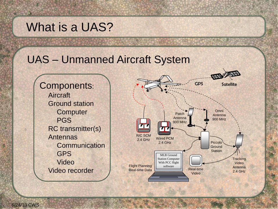
UAS – Unmanned Aircraft System
Wired PCM
2.4 GHz
R/C SCM
2.4 GHz
Tracking
Video
Antenna
2.4 GHz Real-time
Video
Piccolo
Ground
Station
Flight Planning
Real-time Data
GPS
MLB Ground
Station Computer
With PCC flight
software
Components:
Aircraft
Ground station
Computer
PGS
RC transmitter(s)
Antennas
Communication
GPS
Video
Video recorder
What is a UAS?
6/24/10 CWS
Patch
Antenna
900 MHz
Omni
Antenna
900 MHz
Satellite

UAV – Unmanned Aerial Vehicle
Unmanned Aircraft
What is a UAV or UA?
A component of the Unmanned Aircraft System
10/16/06 JORNEX Playa

RPA – Remotely Piloted Aircraft
ROA – Remotely Operated Aircraft
What is an RPA or ROA?
Military terminology for UAV
10/17/06 Bajada

Common designation for UAS, UAV, UA,
RPA, ROA; originally an unpiloted aerial target.
What is a Drone?
10/16/06 JORNEX Tarbush

FAA Requirements for UAS Flights in the National Airspace System (NAS):
Crew – Flights under 400’ Above Ground Level
FAA Private Pilot Knowledge test – 2 year
FAA Class 2 medical – commercial, 1 year
Flights above 400’ AGL
FAA Private Pilot Knowledge test
FAA Class 2 medical
FAA Private Pilot certification - current
6/24/10 CWS

8/20/10 SCAN
Certificate of Authorization
Only public agencies may receive a COA.
A COA is for a specific location, aircraft, and time.
Public agencies are government agencies, or academic
institutions that receive government funding.
Three to six months for approval.
Recipient is responsible for all FAA notifications and reports.
FAA Requirements for UAS Flights in the National Airspace System (NAS), continued:

8/20/10 TFT
UAS Registration
A new requirement for unmanned aircraft flown
under a COA.
Submit documentation to the FAA to receive an
aircraft N-number (tail number).
Another FAA Requirement for UAS flights in the NAS:

National Airspace System
A Certificate of Authorization (COA)
The COA covering the Jornada belongs to NMSU
Physical Science Laboratory UAS Flight Test Center
and covers all of southern NM.
• PSL FTC participation is required for all Jornada
flights.
• They are responsible for all FAA interactions.
• They supply a Mission Commander, data collector,
and observers, if necessary.
8/28/13 JAS
Requirements for UAS Flights on the Jornada:

National Airspace System
Qualified Jornada crew:
• Pilot in Command (licensed pilot)
• External Pilot – radio control of aircraft
• Internal Pilot – computer flight control
• Visual Observer – incoming aircraft alert
Additional crew:
• Ground support – aircraft setup and checks
• Payload specialist – ground station setup,
preflight and post-flight checks
• EP comms – communication between EP and IP
9/10/10 TW
More requirements for UAS Flights on the
Jornada:
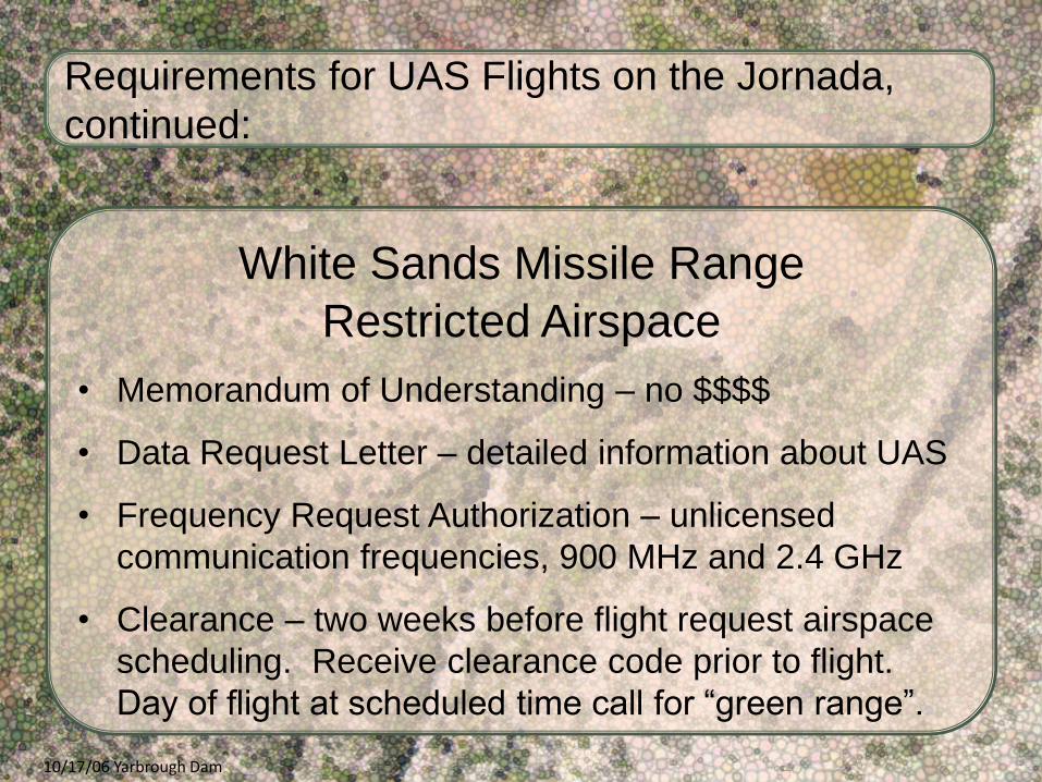
White Sands Missile Range
Restricted Airspace
• Memorandum of Understanding – no $$$$
• Data Request Letter – detailed information about UAS
• Frequency Request Authorization – unlicensed
communication frequencies, 900 MHz and 2.4 GHz
• Clearance – two weeks before flight request airspace
scheduling. Receive clearance code prior to flight.
Day of flight at scheduled time call for “green range”.
10/17/06 Yarbrough Dam
Requirements for UAS Flights on the Jornada,
continued:

Jornada Experimental Range
White Sands Missile Range
White Sands Missile Range
Las Cruces
National Airspace System
Restricted Airspace
Restricted Airspace
Restricted Airspace
JER / WSMR buffer
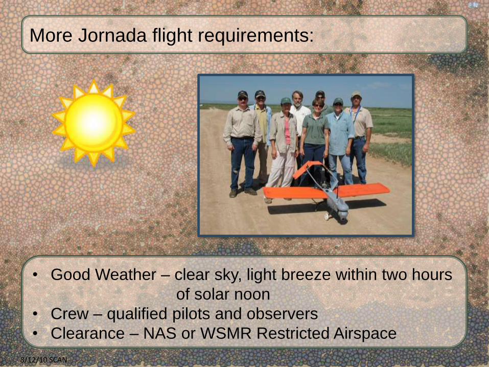
More Jornada flight requirements:
• Good Weather – clear sky, light breeze within two hours
of solar noon
• Crew – qualified pilots and observers
• Clearance – NAS or WSMR Restricted Airspace
8/12/10 SCAN
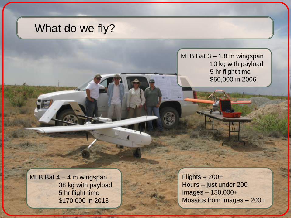
MLB Bat 4 – 4 m wingspan
38 kg with payload
5 hr flight time
$170,000 in 2013
MLB Bat 3 – 1.8 m wingspan
10 kg with payload
5 hr flight time
$50,000 in 2006
What do we fly?
Flights – 200+
Hours – just under 200
Images – 130,000+
Mosaics from images – 200+

6/3/10
MLB Bat 3 – catapult launched
6-band multispectral camera mounted in nose
Canon SD900 mounted in wing

MLB Bat 4 – manual rolling take off, runway required
6-band multispectral camera mounted in payload bay
Canon EOS 5D Mark II mounted in payload bay

Canon SD900 10 mp Bat 3
Tetracam mini-MCA 6-band multi-spectral Bat 3, Bat 4
Canon EOS 5D Mark II 21 mp Bat 4
Video Bat 3, Bat 4
Sensors
10/16/2006 JORNEX Tarbush

LIDAR - Light Detection and Ranging
Thermal infrared
Color Infrared – converting SLR with internal filter change
Stereo camera
Potential Sensors
5/26/10 SCAN

Mobile ground control unit.
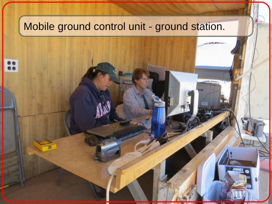
Mobile ground control unit - ground station.

FAA approved transport flightplan – Sense and avoid requirement

Acquire imagery for mosaics.
What do we do?
75% forward lap
40% side lap
8/12/10 SCAN

Outlined area covered by previous slide.
Mosaic finished product from previous imagery.

Data Applications
Watching grass grow
Invasive species detection and monitoring
Monitoring soil disturbance and erosion
Extraction of fine-detail digital surface models
Phenology
Comparing data collection techniques
9/10/10 TW

Red Green Blue Color Infrared Normalized Difference
Vegetation Index
May
20
11
P
re-m
on
soo
n
Au
gust
20
11
La
te-m
on
soo
n
Aerial imagery collected by the Jornada Experimental Range UAS team and prepared by Craig Winters and Amy Slaughter.
Watching grass grow….

JER Vegetation and Soil Classification Map Invasive Species Detection and Monitoring – Object Based Image Analysis
Aerial imagery collected by the Jornada Experimental Range UAS team and prepared by Amy Slaughter. 11/3/11 P9E

Zoomed-in View
11/3/11 P9E

WGEW Classification Map
10/19/11 WGEW

Zoomed-in View
10/19/11 WGEW
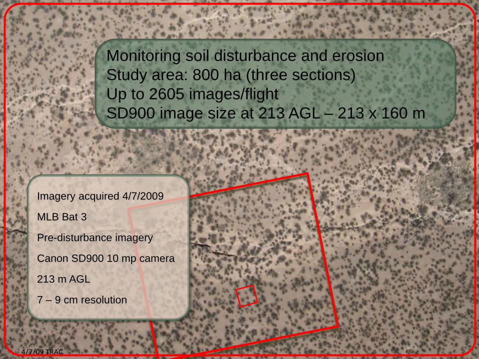
Imagery acquired 4/7/2009
MLB Bat 3
Pre-disturbance imagery
Canon SD900 10 mp camera
213 m AGL
7 – 9 cm resolution
Monitoring soil disturbance and erosion
Study area: 800 ha (three sections)
Up to 2605 images/flight
SD900 image size at 213 AGL – 213 x 160 m
4/7/09 TRAC

• Imaged six 50m x 50m test plots
• 152.4 m flying height (500 ft) • 2.7 cm resolution • ~20 images used to reconstruct Digital Elevation Models for each plot
• Images acquisition was very haphazard due to wind
10 meters
Aerial imagery collected by the Jornada Experimental Range UAS team and prepared by Jeff Gillan.

1 meter
Surface Point Cloud using Agisoft PhotoScan

-0.1
0
0.1
0.2
0.3
0 2 4 6 8
REL
ATI
VE
ELEV
ATI
ON
(M
) TRANSECT DISTANCE (M)
Plot 216-Erosion Bridge 5
Erosion Bridge Aerial DEM
-0.1
0
0.1
0.2
0.3
0 2 4 6 8
REL
ATI
VE
ELEV
ATI
ON
(M
)
TRANSECT DISTANCE (M)
Plot 216-Erosion Bridge 4
Erosion Bridge Aerial DEM
-0.10
0.10.20.30.4
0 2 4 6 8
REL
ATI
VE
ELEV
ATI
ON
(M
)
TRANSECT DISTANCE (M)
Plot 216-Erosion Bridge 3
Erosion Bridge Aerial DEM
-0.10
0.10.20.30.4
0 2 4 6 8
REL
ATI
VE
ELEV
ATI
ON
(M
)
TRANSECT DISTANCE (M)
Plot 216-Erosion Bridge 2
Erosion Bridge Aerial DEM
0
0.5
1
0 2 4 6 8
REL
ATI
VE
ELEV
ATI
ON
(M
)
TRANSECT DISTANCE (M)
Plot 216-Erosion Bridge 1
Erosion Bridge Aerial DEM
Erosion Bridge
v.
1
2
3
4 5

Remote
Sensing
and
Phenology
9/11/14 PAS9
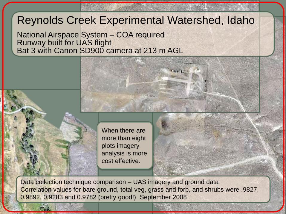
Reynolds Creek Experimental Watershed, Idaho
National Airspace System – COA required Runway built for UAS flight Bat 3 with Canon SD900 camera at 213 m AGL
Data collection technique comparison – UAS imagery and ground data
Correlation values for bare ground, total veg, grass and forb, and shrubs were .9827,
0.9892, 0.9283 and 0.9782 (pretty good!) September 2008
When there are
more than eight
plots imagery
analysis is more
cost effective.

6-band multispectral
RGB
Walnut Gulch Experimental Watershed, AZ
National Airspace System – COA required Used local road as runway Bat 3 with Tetracam 6-band MCA (Multi-Camera Array) and Canon SD900 at 213 m AGL
Multispectral
Methods for identifying and monitoring invasive species – UAS imagery and ground data October 2011
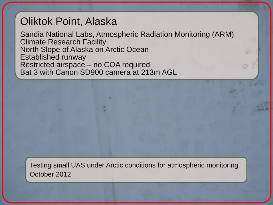
Oliktok Point, Alaska
Sandia National Labs, Atmospheric Radiation Monitoring (ARM) Climate Research Facility North Slope of Alaska on Arctic Ocean Established runway Restricted airspace – no COA required Bat 3 with Canon SD900 camera at 213m AGL
Testing small UAS under Arctic conditions for atmospheric monitoring
October 2012
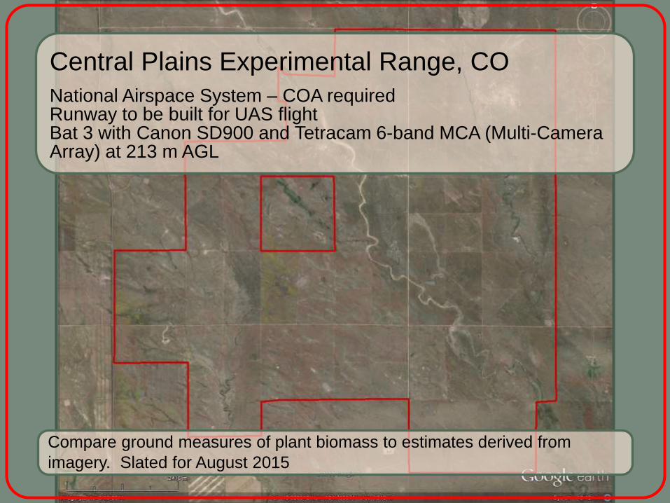
Central Plains Experimental Range, CO
National Airspace System – COA required Runway to be built for UAS flight Bat 3 with Canon SD900 and Tetracam 6-band MCA (Multi-Camera Array) at 213 m AGL
Compare ground measures of plant biomass to estimates derived from
imagery. Slated for August 2015

Commercial Exemptions issued by FAA
Fourteen issued within the last few months for:
Film and video production
Aerial surveying
Construction-site monitoring
Oil-rig inspections
Real estate photography
Precision agriculture
Much easier to obtain for remote, unpopulated areas.
9/14/06 JAS
What do you do if you’re not a public agency?
Myths
Myth #1: The FAA doesn't control airspace below 400 feet
Fact—The FAA is responsible for the safety of U.S. airspace from the ground up. Myth #2: Commercial UAS flights are OK if I'm over private property and stay below 400 feet.
Fact—Commercial operations are only authorized on a case-by-case basis. Requires - a certified aircraft a licensed pilot operating approval
You may not fly a UAS for commercial purposes by claiming that you’re operating according to the Model Aircraft guidelines (below 400 feet, 3 miles from an airport, away from populated areas).
2/28/14 TRAC
More Myths…
Myth #3: Commercial UAS operations are a “gray area” in FAA regulations.
Fact—There are no shades of gray in FAA regulations. Anyone who wants to fly an aircraft—manned or unmanned—in U.S. airspace needs some level of FAA approval. Private sector (civil) users can obtain an experimental airworthiness certificate to conduct research and development, training and flight demonstrations.
Flying model aircraft solely for hobby or recreational reasons does not require FAA approval. Hobbyists are advised to operate according to the Model Aircraft guidelines. Read more myths at: http://www.faa.gov/news/updates/?newsId=76240
6/3/10 GRN

DJI Phantom $759 - $1359
So, you really want to fly some sort of UA……
senseFly eBee $12,000
Zephyr 2 UAV $17,995
Wish List: Inexpensive
Simple to operate
Reliable
Durable
Portable
Long-lasting battery
Payload
10/16/06 JORNEX TRAN

What we’ve seen….
The beautiful Jornada
Unmanned aircraft
FAA requirements
How we conduct flights on the Jornada
How the imagery is used in data
applications
Possibilities
7/31/12 TRAC

Acknowledgements:
Jornada Bat Flight Crew
NMSU PSL UAS FTC
Craig Winters
Amy Slaughter
Dawn Browning
Jeff Gillan
Andrea Laliberte
Thank
You!!
8/26/10 GIBPE