westconnex m4 east environmental impact statement
TRANSCRIPT
WestConnexM4 East Environmental Impact Statement
City of SydneyTown Hall House 456 Kent Street Sydney NSW 2000
City of Sydney submission to Department of Planning and Environment

1 / City of Sydney submission on WestConnex M4 East Environmental Impact Statement
Contents Executive summary ........................................................................................................... 2
Chapter 1: Introduction ..................................................................................................... 4
Chapter 2: Assessment process ....................................................................................... 4
Chapter 3: Strategic context and project need .................................................................. 4
Chapter 4: Project development and alternatives ............................................................. 6
Chapter 5: Project description ........................................................................................... 7
Chapter 6: Construction .................................................................................................... 7
Chapter 7: Consultation .................................................................................................... 7
Chapter 8: Traffic and transport ........................................................................................ 7
Chapter 9: Air quality ...................................................................................................... 10
Chapter 10: Noise and vibration ..................................................................................... 10
Chapter 11: Human health .............................................................................................. 10
Chapter 12: Property and land use ................................................................................. 10
Chapter 13: Urban design and visual amenity ................................................................ 11
Chapter 14: Social and economic ................................................................................... 11
Chapter 15: Soil and water quality .................................................................................. 11
Chapter 16: Contamination ............................................................................................. 11
Chapter 17: Flooding and drainage ................................................................................ 11
Chapter 18: Groundwater ............................................................................................... 11
Chapter 19: Non-Aboriginal heritage .............................................................................. 11
Chapter 20: Biodiversity .................................................................................................. 12
Chapter 21: Greenhouse gas .......................................................................................... 12
Chapter 22: Aboriginal heritage ...................................................................................... 12
Chapter 23: Resource use and waste minimisation ........................................................ 12
Chapter 24: Climate change risk and adaptation ............................................................ 12
Section 25: Hazards and risks ........................................................................................ 12
Section 26: Cumulative impacts ...................................................................................... 13
Section 27: Sustainability ................................................................................................ 13

2 / City of Sydney submission on WestConnex M4 East Environmental Impact Statement
Executive summary
The City of Sydney does not support the WestConnex project. The strategic justification for the M4 East is weak and inconsistent with the NSW Government’s strategic planning and policy framework. The evidence provided by the EIS in support of the M4 East is incomplete and unbalanced, selectively including and excluding impacts from subsequent planned stages of the WestConnex project. The analysis of strategic alternatives in the EIS is cursory and fails to demonstrate the M4 East extension is the best option. WestConnex is Australia’s largest ever tollroad project. The City is very concerned that no business case or holistic traffic modelling for the WestConnex project have been made publicly available, and environmental assessments are being done on individual stages in a way that does not consider the full impacts of the entire proposed project.
Impacts on the City of Sydney
While the M4 East extension is outside the boundaries of the City of Sydney LGA, it will have significant impacts on the City of Sydney and the especially the CBD. It will lead to increased private vehicle traffic travelling into the City along the two western CBD gateways – Parramatta Road and the Anzac Bridge - and will see an increase in the number of buses entering the city centre along Parramatta Road. However, there is no detailed assessment of the impacts on residents and businesses in central Sydney, and in particular the Sydney CBD. The M4 East EIS assumes that by 2031 the full WestConnex project will be complete. This includes the New M5 and St Peters Interchange (Stage 2) and M4-M5 Link (Stage 3), both of which will have additional significant impacts on residents and businesses in the City of Sydney LGA, including some of Australia’s fastest growing, and already congested, urban areas such as Green Square. Nowhere in the EIS are these impacts adequately considered.
Failure to assess the project
The M4 East project is described in Volume 1, Chapter 4. The Project under assessment does not include bus lanes on Parramatta Road or Stages 2 and 3 of WestConnex which are currently un-funded. Despite this the transport modelling scenarios presented in the EIS include these elements at 2021 and 2031, respectively. Therefore, the EIS does not present an assessment of the M4 East Project; that is, what would happen if the M4 was built without these other stages. This is a major failing that must be addressed. WestConnex is presented as a ‘transformational’ infrastructure project, but no modelling assessment is provided beyond 2031. Additionally, the EIS refers to the additional stages of WestConnex in terms of the benefits they deliver in the context of the M4 East assessment, but does not consider the negative impacts.
Strategic justification for the project
The strategic justification for the M4 East appears to be the provision of an additional road connection to the city centre for workers travelling from the west. This ignores the evidence that of the seven per cent of western Sydney workers who travel to the CBD for work, approximately 89 per cent use public transport and would be far better served by improvements to those services. The M4 East will not benefit Western Sydney residents travelling to work by car as these trips are predominantly local and the M4 East is located well outside the Western Sydney area.

3 / City of Sydney submission on WestConnex M4 East Environmental Impact Statement
The strategic justification for the project is also inconsistent with the NSW Government’s strategic planning and policy framework. The city centre is highly constrained with limited road space and parking. The CBD and South East Light Rail Project will further reduce road space, and the Government is consequently implementing measures to reduce bus numbers, peak traffic and reorganise road space in the CBD away from private parking towards priority uses such as freight. The City Centre Access Strategy reflects the fact that only 14 per cent of people commuting to the CBD during the peaks travel by car, and the proportion is falling. The EIS for the M4 East makes it clear that this project is predicated on ‘other WestConnex projects’ including the Southern Gateway, Southern Extension and the Western Harbour Crossing. The M4 East will lock Sydney into a multi-billion dollar road building future.
Conclusion
The inadequacy of the M4 EIS is so profound that the City of Sydney does not believe it can be used as the basis for a ministerial determination as to whether the project should be approved.
4 / City of Sydney submission on WestConnex M4 East Environmental Impact Statement
Response to Environmental Impact Statement
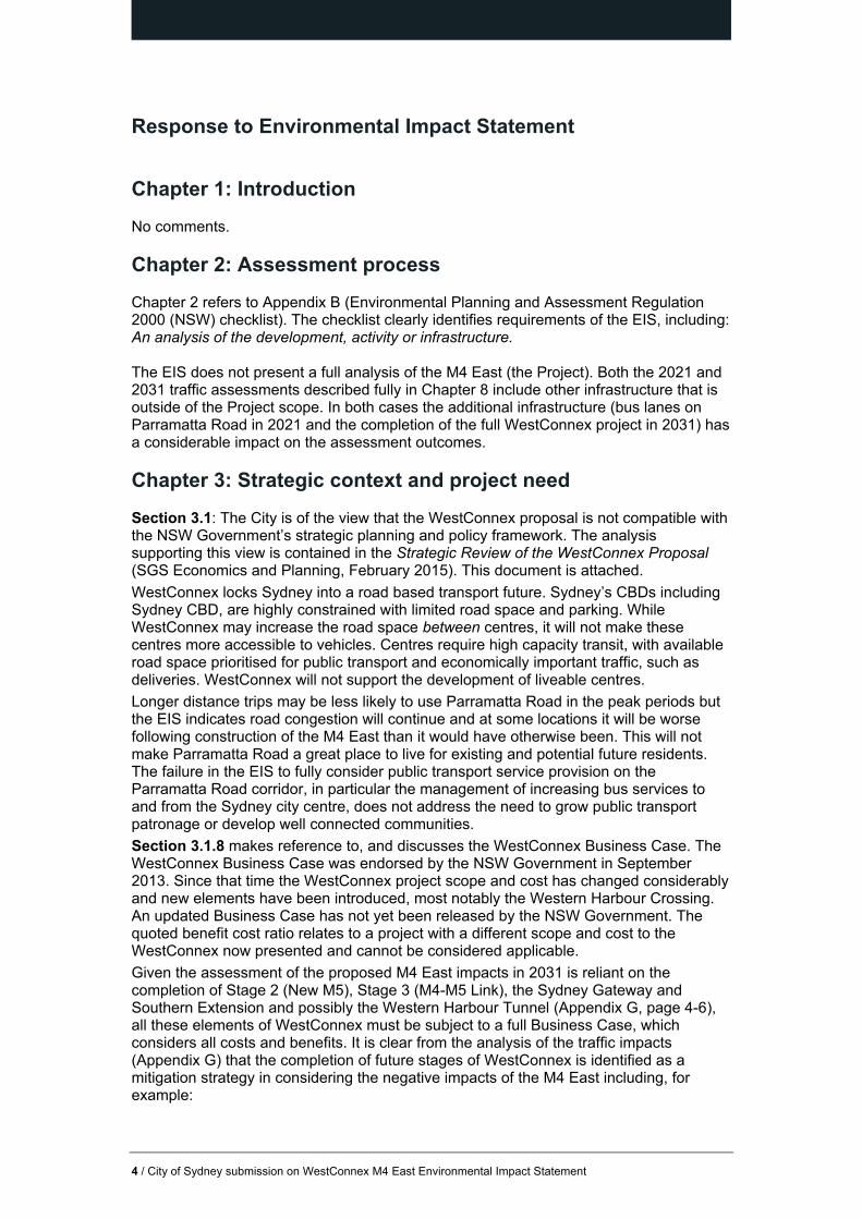
Chapter 1: Introduction
No comments.
Chapter 2: Assessment process
Chapter 2 refers to Appendix B (Environmental Planning and Assessment Regulation 2000 (NSW) checklist). The checklist clearly identifies requirements of the EIS, including: An analysis of the development, activity or infrastructure. The EIS does not present a full analysis of the M4 East (the Project). Both the 2021 and 2031 traffic assessments described fully in Chapter 8 include other infrastructure that is outside of the Project scope. In both cases the additional infrastructure (bus lanes on Parramatta Road in 2021 and the completion of the full WestConnex project in 2031) has a considerable impact on the assessment outcomes.
Chapter 3: Strategic context and project need
Section 3.1: The City is of the view that the WestConnex proposal is not compatible with the NSW Government’s strategic planning and policy framework. The analysis supporting this view is contained in the Strategic Review of the WestConnex Proposal (SGS Economics and Planning, February 2015). This document is attached.
WestConnex locks Sydney into a road based transport future. Sydney’s CBDs including Sydney CBD, are highly constrained with limited road space and parking. While WestConnex may increase the road space between centres, it will not make these centres more accessible to vehicles. Centres require high capacity transit, with available road space prioritised for public transport and economically important traffic, such as deliveries. WestConnex will not support the development of liveable centres.
Longer distance trips may be less likely to use Parramatta Road in the peak periods but the EIS indicates road congestion will continue and at some locations it will be worse following construction of the M4 East than it would have otherwise been. This will not make Parramatta Road a great place to live for existing and potential future residents. The failure in the EIS to fully consider public transport service provision on the Parramatta Road corridor, in particular the management of increasing bus services to and from the Sydney city centre, does not address the need to grow public transport patronage or develop well connected communities.
Section 3.1.8 makes reference to, and discusses the WestConnex Business Case. The WestConnex Business Case was endorsed by the NSW Government in September 2013. Since that time the WestConnex project scope and cost has changed considerably and new elements have been introduced, most notably the Western Harbour Crossing. An updated Business Case has not yet been released by the NSW Government. The quoted benefit cost ratio relates to a project with a different scope and cost to the WestConnex now presented and cannot be considered applicable.
Given the assessment of the proposed M4 East impacts in 2031 is reliant on the completion of Stage 2 (New M5), Stage 3 (M4-M5 Link), the Sydney Gateway and Southern Extension and possibly the Western Harbour Tunnel (Appendix G, page 4-6), all these elements of WestConnex must be subject to a full Business Case, which considers all costs and benefits. It is clear from the analysis of the traffic impacts (Appendix G) that the completion of future stages of WestConnex is identified as a mitigation strategy in considering the negative impacts of the M4 East including, for example:

5 / City of Sydney submission on WestConnex M4 East Environmental Impact Statement
‘Prior to the opening of M4-M5, significant additional congestion is forecast at the Parramatta Road/Crystal Street intersection.’ (Volume 1, page 11-5)
And:
‘The proposed M4-M5 Link design is not yet finalised and yet to be endorsed. As a consequence, the functionality of a future CBD connection is not yet determined. Due to capacity constraints on the ANZAC and Sydney Harbour bridges the provision of this connection is not possible without an additional harbour crossing.’ (Volume 2, Appendix G, page 4-6)
Section 3.2 considers why the project is needed. While the EIS makes reference to the unsuitability of public transport for ‘a large proportion of travellers due to the diverse nature of employment and variety of purposes of travel’ (Volume 1, p3-12), no data is presented. Further, the EIS refers to the attractiveness of the Sydney CBD as a trip destination in the WestConnex modelling, a destination well served by public transport:
‘There is a need to provide a link between Western Sydney and other centres in Sydney such as the Sydney CBD…’ (Volume 1, page 3-14)
The City is particularly concerned about the ability of people to reach employment in the Sydney city centre and surrounding commercial areas such as Surry Hills and Ultimo-Pyrmont. Businesses in these locations rely on access to a large and diverse workforce and this workforce predominantly uses public transport. The Sydney City Centre Access Strategy (NSW Government, 2013) recognises the fact that 80% of people commuting to the city centre in the peaks use public transport with a further 6% walking and cycling. Just 14% travel by car, a proportion that has reduced from 17% in 2001.
As the M4 East EIS states, ‘residents in Sydney’s west are far more car dependent for work’ (Volume 1, page 3-14). However, the Western Sydney workforce is highly self-contained; only 30% of employed residents work outside Western Sydney, with just 6% of the Western Sydney workforce working in Inner Sydney (WSROC Community Profile (http://profile.id.com.au/wsroc/residents) accessed 21 October 2015). Analysis of Journey to Work data indicates 89% of people travelling from Western Sydney to employment in the Sydney CBD use public transport.
The M4 East will not benefit Western Sydney residents travelling to work by car as these trips are predominantly more local in nature and the M4 East is located well outside the Western Sydney area.
A view that suggests there will be an increase in car use for travel to work in the city centre in the future is contrary to current trends (see the Sydney City Centre Access Strategy, page 10) and does not recognise the capacity constraints on both road space and parking in the city centre. An increasing reliance on car use raises equity issues and would leave the workforce vulnerable to oil shocks and disruptions in the fuel supply. Without this workforce the Sydney CBD would be compromised with potentially national economic implications. There is an implicit assumption within the EIS that the current reliance on car travel should be maintained into the future. This is risky and unsustainable.
Section 3.2.4 considers freight, commercial and business services. The EIS makes assertions regarding the proposed Western Sydney Airport and its potential implications for the movement of freight around Sydney, concluding that:
Overall, the movement of freight around Sydney is not considered to be significantly altered by the introduction of the new airport, for the following reasons:
The operation of the of the proposed Western Sydney Airport would be staged, ramping up over time, with initial operations only commencing in the mid-2020s (a minimum of five years after the completion of the project)
Freight arriving at the new airport would still have destinations across wider Sydney
Port Botany and Sydney Airport would still be key freight entry and exit points, with the new airport to complement the existing airport. (Volume 1, page 3-15)

6 / City of Sydney submission on WestConnex M4 East Environmental Impact Statement
The City considers these justifications to be weak. The recently released Western Sydney Airport Environmental Impact Statement indicates: ‘Sydney Airport has limited ability to handle further passenger growth due to the physical constraints at the existing site. The limitations of existing infrastructure are becoming apparent at peak times and are expected to become more pronounced over the coming decades.’ (Western Sydney Airport EIS, Executive Summary, page 7)
The critical M4-M5 Link and Sydney Gateway connect the M4 East with Port Botany and Sydney Airport and will be completed much later than the M4 East. Until these connections are in place the M4 East does not offer a viable alternative to travel between Western Sydney, and the Port and Sydney Airport. The reference to a minimum of five years between the completion of WestConnex and the commencement of operations at Western Sydney Airport is incorrect; the actual gap is much less and may not exist at all.
Freight arriving at the new airport will have very different movement patterns to the freight arriving at Sydney Airport, given the considerable difference in origin/destination locations. Freight travelling to and from the Western Sydney Airport will mostly be concentrated on the roads serving the new airport.
Given the very recent release of a plan for the Western Sydney Airport and recognising the airport will operate without a curfew, the assumption that the role of the new airport will be limited appears premature.
In section 3.2.6 (transport improvements in the Parramatta Road corridor) reference is made to the traffic reductions on Parramatta Road following the completion of the M4 East and ‘other WestConnex projects’. Throughout the EIS it is unclear what is included in these ‘other WestConnex projects’, but they seem to include the Sydney Gateway, Southern Extension and potentially the Western Harbour Crossing. Each of these elements of WestConnex are outside the current announced cost, subject to design, costing and a business case. The EIS is clear that any public transport benefits of the M4 East are only realised following much more extensive road building, that is, the completion of WestConnex, and as such the broader impacts of the further road building should also be made clear.
Chapter 4: Project development and alternatives
Section 4.1.4 (WestConnex and the M4 East) provides and outline of the WestConnex proposal in its entirety and the current status of other components of the project. The current status of the Western Harbour Tunnel, Sydney Gateway (to Port Botany and Sydney Airport) and the Southern Extension) are omitted.
This is an omission given the assessment of traffic and transport impacts (Appendix G) assumes these projects are in place by 2031.
Section 4.2 (Strategic alternatives) fails to fully canvas and explore the potential of strategic alternatives to a major multi-billion dollar motorway construction program. Each alternative is treated in isolation from the others when in reality an holistic future strategy would encompass elements of each ‘alternative’. For example; investment in public transport and the freight rail network (Alternative 3) should be accompanied by demand management (Alternative 4) to maximise the public investment in existing and new transport infrastructure. As described in the EIS, improvements to the existing arterial road network (Alternative 2) to relieve ‘pinch points’ and congestion hotspots can be high value investments and may be complementary to Alternatives 3 and 4.
Demand management combined with investment in public transport could be particularly effective in reducing peak period commuter road use, freeing up road capacity for delivery and service vehicles. This improved use of existing road infrastructure by economically important traffic should be fully explored prior to pursuing a major program of road building at a high cost to taxpayers in NSW and across Australia.

7 / City of Sydney submission on WestConnex M4 East Environmental Impact Statement
The opportunities to expand rail freight do not appear to be fully considered given the development of the Moorebank Intermodal Terminal and the recently announced Asciano plan to build a $100 million terminal at St Marys. There is excess rail capacity to move containerised freight to and from Port Botany and the viability of doing so will be enhanced by these new intermodal facilities in the future.
Chapter 5: Project description
The Project under assessment in the M4 East EIS is clearly defined in Chapter 5.
The Project does not include any reconfiguration of Parramatta Road, including the implementation bus lanes on Parramatta Road or any future WestConnex projects beyond the M4 and M4 East. This is at odds with the assessment of the Project in Appendix G. Appendix G does not provide an assessment of the Project impacts; in 2021 the M4 East is assessed alongside the reconfiguration of Parramatta Road and in 2031 the M4 East is assessed alongside the full WestConnex project.
The EIS does not present an assessment of the Project as required in the Secretary’s Environmental Assessment Requirements (SEARs). The City cannot assess the impacts of the M4E on the City of Sydney LGA in the short term (2021) or the long term (2031) as they are not presented in the EIS as required. The EIS makes reference to increases in bus and general traffic travelling to and from the CBD due to the Project, changes in traffic volumes entering the City of Sydney LGA as a result of the project and increased congestion on the ANZAC and Sydney Harbour bridges, again as a result of the Project. These impacts are not presented with any clarity or detail.
Chapter 6: Construction
No comments.
Chapter 7: Consultation
No comments.
Chapter 8: Traffic and transport (including Appendix G: Traffic and transport assessment) Chapter 8 and Appendix G do not provide an assessment of the future project impacts; in 2021 the M4 East is assessed alongside the reconfiguration of Parramatta Road and in 2031 the M4 East is assessed alongside the full WestConnex project.
In failing to assess the future operational impacts of the M4 East, the EIS is flawed and does not address the requirements of the SEARS, specifically:
‘An assessment and modelling of operational traffic and transport impacts on the local and regional road network...’

8 / City of Sydney submission on WestConnex M4 East Environmental Impact Statement
In addition, while the EIS states there will be increased traffic flows on the ANZAC bridge and SHB, and that traffic will be attracted to CBD (Appendix G, page 4-6) and increased bus frequency on the Parramatta Road corridor facilitated by the M4 East (Appendix G, page 10-21) there is no detailed assessment of these impacts on residents and businesses within the City of Sydney LGA. There is no assessment of the impacts on central Sydney, and in particular the Sydney CBD. There is no consideration of how additional buses (outside the scope of the Project but identified as a benefit of the M4 East) will enter the CBD. This is in the context of the implementation of the City and South East Light Rail and the Government’s objectives to reduce bus numbers and peak period traffic in the CBD as road capacity reduces. This message has been clearly articulated by the NSW Government through the ‘Tomorrow’s Sydney’ campaign.
Section 8.1.1 (Determine existing and future traffic volumes) presents six modelling scenarios.
None of these scenarios presents an assessment of the Project. In both the 2021 and 2031 ‘do something’ scenarios additional infrastructure, bus lanes on Parramatta Road and the full WestConnex project respectively, are included.
The 2021 ‘do something’ scenario does not assess the impacts of the M4 East given the inclusion of bus lanes on Parramatta Road which are explicitly excluded from the WestConnex project. The bus lanes reduce the available capacity of Parramatta Road and so will have an impact on the modelled traffic flows on Parramatta Road, but as the EIS states the bus lanes are not part of the Project, are to be delivered by others and will only be delivered after completion of the construction of the M4 East. The actual process through which the bus lanes will be assessed and delivered is not articulated in the EIS.
The 2031 ‘do something’ scenario includes multiple WestConnex elements that are beyond the M4 East EIS, including the New M5, M4 – M5 Link, Sydney Gateway and Southern Extension, and possibly the Western Harbour Tunnel. The Sydney Gateway connection between St Peters Interchange and Port Botany and Sydney Airport is currently subject to design and is uncosted. Similarly the Southern Extension does not to have been subject to design and costing. Investigations into the Western Harbour Tunnel are at an early stage. These additional projects are only presented in terms of the benefits they deliver in the context of the M4 East assessment – the assessment ignores the negative impacts and uncertainty of each of these projects.
In particular the M4-M5 Link and the New M5 will have direct impacts on the residents and businesses of the City of Sydney.
The EIS suggests the 2031 ‘do something’ scenario assessment represents a ‘cumulative traffic impact assessment for WestConnex’ (Volume 1, page 8-34). Given the very limited extent of the traffic study area this is clearly not the case and should not be presented as such. The M4 East EIS does not identify all the cumulative traffic impacts resulting from the WestConnex project.
WestConnex is presented as a ‘transformational’ infrastructure project, however, no modelling assessment is provided beyond 2031. The 2031 ‘do something’ scenario, while flawed in its assessment of the M4 East Project, indicates significant impacts on the local road network, extending into the Sydney CBD. It is appropriate to consider the longer term impacts of the Project, say to, 2041.
Section 8.2. Figure 8-1 presents the traffic study area. This area of assessment is very limited, particularly given the Project is expected to attract traffic accessing the Sydney CBD. Reference is also made to future increased traffic on the ANZAC and Sydney Harbour bridges. No assessment of the impact of the project on the City of Sydney LGA is presented despite indications that there will be a future detrimental impact. The extent of traffic surveys (Figure 8.2) is similarly limited given the extent of impacts and assumptions around the completion of multiple stages of the WestConnex project by 2031.

9 / City of Sydney submission on WestConnex M4 East Environmental Impact Statement
Traffic reductions on Parramatta Road (Appendix G, page viii) are largely commensurate with the reduction in capacity as a result of the implementation of bus lanes (removing one-third of the lanes). While there are suggestions in the EIS that early traffic modelling established the feasibility of the bus lanes due to reductions in traffic flows on Parramatta Road, this assessment has not been included in the EIS. The EIS also contains conflicting statements suggesting the reduction in capacity due to the implementation of bus lanes reduces traffic.
Regardless, without an assessment of the M4 East in the absence of additional bus lanes on Parramatta Road, it is unclear to what extent the removal of capacity on Parramatta Road has resulted in traffic reductions. If these reductions in traffic are not achieved in line with the EIS, bus lanes will not be implemented. Public transport for those accessing the Sydney CBD for employment and other purposes will not be improved as a result of the Project.
Section 8.4: Assessment of operation aspects Section 8.4.1: Road and intersection performance. The Project will only result in a reduction in traffic on some sections of Parramatta Road: the large reductions (around one-third) are achieved only in some sections. The reductions in traffic on Parramatta Road ‘reflect the transfer of traffic to the M4 East and the reduction of capacity on Parramatta Road brought about by bus lane provision’ (Appendix G, page viii). If the bus lanes are not implemented it seems unlikely the traffic reductions on Parramatta Road will be realised.
The down-stream impacts of the Project are described; acknowledging that the road network beyond the Project, to the east, cannot accommodate the increased traffic volumes resulting from the M4 East, with resultant ‘exit and merge issues’ (Volume 1, page 8-19).
The summary of intersection performance (Volume 1, page 8-25) is concerning. The EIS states: a number of intersections have been assessed as presenting challenging conditions for the ‘do something’ scenarios (Volume 1, page 8-25). The 2031 ‘do something’ scenario includes the completion of multiple sections of WestConnex yet intersections in the study area remain congested with acknowledged impacts on bus travel times. This will have a detrimental effect on public transport servicing the city centre. There is no assessment of the potentially detrimental impacts on intersections and public transport beyond the limited study area.
Tables 8.9 – 8.12 highlight the limited nature of mid-block and intersection improvements that will result from the Project in 2021.
Table 8.14 highlights the benefits of the M4-M5 Link in 2031 in mitigating the impacts of the M4 East. The M4-M5 Link cannot be presented as mitigation for localised impacts resulting directly from the construction of the M4 East. The M4-M5 Link is still subject to detailed design. Information already available indicates there will be multiple connections to the road network west of the city centre. The M4-M5 Link must be assessed in its entirety, taking into account impacts and benefits. The M4 East must be assessed independently of other parts of WestConnex.
Travel times
The ‘example’ trips identified in Figures 8-4 and 8-5 (Volume 1) suggest the M4 East will result in considerable travel time savings for commuters. The trips that will particularly benefit have destinations in Sydney CBD and Surry Hills. Both these locations have highly constrained parking with little supply in excess of demand. In addition both Surry Hills and the Sydney CBD are well served by rail and future planned public transport improvements being delivered through the City and South East Light Rail and Sydney Metro. Employment growth in the Sydney city centre and surrounding commercial precincts will necessarily be supported by public transport improvements.

10 / City of Sydney submission on WestConnex M4 East Environmental Impact Statement
Analysis of the 2011 Journey to Work data (Bureau of Transport Statistics) indicates these trips are not representative. On Census day in August 2011, just 269 people from Penrith LGA indicated they worked in Surry Hills. Of these people, 208 (77%) caught a train to work. Only 37 people (13%) indicated they travelled by car.
The same data indicates that in 2011, 3,624 people lived in the Penrith LGA and worked in central Sydney. Of these 2,814 (78%) caught a train to work. Only 349 (10%) travelled by car.
The travel time savings as presented are misleading. The example trips shown are made by very few people and most of the people making these trips use public transport. These theoretical and large travel time savings will not be realised in practice.
Section 8.4.2: Public transport. Bus travel times presented show little reduction in the peak directions with the Project, despite the inclusion of kerbside bus lanes in the assessment. In 2021, the travel time saving due to the completion of the M4 East is under three minutes in the morning peak direction (Volume 1, table 8.15, page 8-31). In 2031, the equivalent travel time saving is just five minutes and three seconds, despite the assumed completion of the full WestConnex project.
It is unclear if the EIS takes full account of additional future bus services (mooted in Appendix G, Section 10.5) or the increase in population resulting from the Parramatta Road urban renewal project. Both of these factors would impact on future bus travel times and public transport access to the Sydney city centre for the existing and future residents.
Section 8.4.3: Pedestrian and cyclist facilities. The City of Sydney recognises cycling as a legitimate and efficient way to travel. In particular cycling complements other modes and can offer relief to congested roads and public transport services. Cycling to and from the Sydney CBD is to be encouraged given this the most congested part of the public and road transport networks. Cycling essentially frees up capacity for longer distance travellers and economically important freight traffic.
The M4 East EIS suggests ‘cyclists can expect to benefit from… the ability to use the bus lanes on Parramatta Road which would be facilitated by the Project’ (Volume 1, page 8-32). The bus lanes on Parramatta Road (which are not part of the Project) will be carrying a high volume of buses, and will not offer a suitable cycle environment. The Project should look to deliver suitable separated cycle facilities, seamlessly connected to the Sydney CBD cycle network. Cycle facilities should be delivered as an integrated part of the Project.
Improvements to pedestrian facilities and the network are described in vague terms in the EIS. Creating a good pedestrian environment is also essential to realising the potential of the planned urban renewal in the Parramatta Road corridor.
Chapter 9: Air quality
The City of Sydney notes that the Project will induce increased traffic and as such will reduce air quality locally to the project and across much wider areas of Metropolitan Sydney.
Chapter 10: Noise and vibration
No comments.
Chapter 11: Human health
No comments.
Chapter 12: Property and land use
No comments.
11 / City of Sydney submission on WestConnex M4 East Environmental Impact Statement
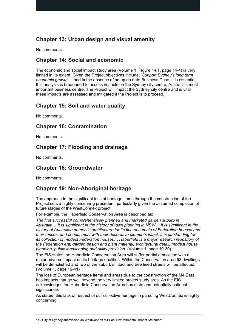
Chapter 13: Urban design and visual amenity
No comments.
Chapter 14: Social and economic
The economic and social impact study area (Volume 1, Figure 14.1, page 14-4) is very limited in its extent. Given the Project objectives include; ‘Support Sydney’s long term economic growth…’ and in the absence of an up do date Business Case, it is essential this analysis is broadened to assess impacts on the Sydney city centre, Australia’s most important business centre. The Project will impact the Sydney city centre and is vital these impacts are assessed and mitigated if the Project is to proceed.
Chapter 15: Soil and water quality
No comments.
Chapter 16: Contamination
No comments.
Chapter 17: Flooding and drainage
No comments.
Chapter 18: Groundwater
No comments.
Chapter 19: Non-Aboriginal heritage
The approach to the significant loss of heritage items through the construction of the Project sets a highly concerning precedent, particularly given the assumed completion of future stages of the WestConnex project.
For example, the Haberfield Conservation Area is described as:
The first successful comprehensively planned and marketed garden suburb in Australia… It is significant in the history of town planning in NSW… It is significant in the history of Australian domestic architecture for its fine ensemble of Federation houses and their fences, and shops, most with their decorative elements intact. It is outstanding for its collection of modest Federation houses… Haberfield is a major research repository of the Federation era, garden design and plant material, architectural detail, modest house planning, public landscaping and utility provision. (Volume 1, page 19-30)
The EIS states the Haberfield Conservation Area will suffer partial demolition with a major adverse impact on its heritage qualities. Within the Conservation area 53 dwellings will be demolished and two of the suburb’s intact and tree lined streets will be affected. (Volume 1, page 19-41)
The loss of European heritage items and areas due to the construction of the M4 East has impacts that go well beyond the very limited project study area. As the EIS acknowledges the Haberfield Conservation Area has state and potentially national significance.
As stated, this lack of respect of our collective heritage in pursuing WestConnex is highly concerning.
12 / City of Sydney submission on WestConnex M4 East Environmental Impact Statement
Chapter 20: Biodiversity
The City is concerned that WestConnex will result in a cumulative detrimental impact on biodiversity over time through the reduction of available habitat, reduction of habitat connectivity and the further fragmentation of remaining habitat. The assessment of the cumulative impacts on biodiversity (Volume 1, page 26-10) is very brief and as a result weak.
Chapter 21: Greenhouse gas
The EIS calculates future GHG emissions based on outputs from the traffic modelling as described in Chapter 8. As discussed, the modelling is flawed as none of the future scenarios listed assess the M4 East Project. The assumed bus lanes on Parramatta Road reduce road capacity and therefore traffic on Parramatta Road. The bus lanes are not part of the Project and should be excluded from the assessment.
Section 21.4.2 addresses emissions from vehicles during operation and states that the project will reduce overall traffic emissions to 2031. In stating that fuel efficiency is anticipated to improve, the analysis overlooks the known fact that building more, high capacity roads encourages greater car use and facilitates ongoing development of residential, commercial and industrial development that is poorly serviced by public transport options. The Project may temporarily reduce congestion in some areas, but it will inevitably increase traffic volumes if significant and systematic investment in public transport does not accompany it. Despite setting out apparent short term emission savings through the reduction of congestion along the existing Parramatta Road corridor. It is misleading to over-emphasise the long-term emission savings delivered by the M4 East and WestConnex as a whole.
Chapter 22: Aboriginal heritage
No comments.
Chapter 23: Resource use and waste minimisation
No comments.
Chapter 24: Climate change risk and adaptation
The climate change risk assessment has followed a conventional risk methodology. It captures the likely risks for the project itself, however it does not address the complexity of likely interdependent risks. As a piece of linear infrastructure, the M4 East will not operate in isolation of other infrastructure systems and networks. Not addressing this interdependence is an oversight.
For example, the assessment of flooding impacts on the M4 East does not consider flooding of feeder roads and alternative routes, which will likely have major knock-on impacts on the operations of the tunnel, even if the M4 East itself is not flooded. Similarly, impacts on local energy, storm water, sewer, telecommunications and public transport will all have a bearing on the operation of the M4 East.
Section 25: Hazards and risks
No comments.
13 / City of Sydney submission on WestConnex M4 East Environmental Impact Statement
Section 26: Cumulative impacts
The EIS describes a range of cumulative impacts that may exist. These include, ‘impacts on local, regional and State traffic and transport and road users’. (Section 26.1, Volume 1, page 26-1)
The EIS suggests these impacts have been assessed as the EIS has assumed all components of WestConnex are completed by 2031. The EIS fails to identify impacts beyond the very small study area of the M4 East. The EIS does not, for example, consider impacts on the Sydney city centre despite making it clear there will be congestion issues on the ANZAC and Sydney Harbour bridges, bus numbers using Parramatta Road and entering the city centre will increase and traffic will be attracted to the CBD as a direct result of the Project.
The discussion on cumulative impacts does not recognise that the construction of the M4 East and M4-M5 Link will increase pressure on the ANZAC and Sydney Harbour bridges to the extent an additional road crossing, the Western Harbour Tunnel, will be necessitated (Volume 2, Appendix G, page 4-6).
Section 27: Sustainability
The EIS takes a very narrow view of sustainability despite acknowledging the precautionary principle and inter-generational equity. The construction of the M4 East locks Sydney into a future of major road building, with the EIS assuming construction of future components of the WestConnex project and also the Western Harbour Tunnel. The M4 East project will not deliver improvements to Sydney’s public transport network. The analysis of strategic alternatives (Chapter 4) fails to take into account long-term, metropolitan wide sustainability based on the precautionary principle and inter-generational equity.

150344-M4 East EIS Review Final Report
M4 East EIS Review Final Report City of Sydney October 2015

150344-M4 East EIS Review Final Report
This report has been prepared for City of Sydney. SGS Economics and Planning has taken all due care in the preparation of this report. However, SGS and its associated consultants are not liable to any person or entity for any damage or loss that has occurred, or may occur, in relation to that person or entity taking or not taking action in respect of any representation, statement, opinion or advice referred to herein. SGS Economics and Planning Pty Ltd ACN 007 437 729 www.sgsep.com.au Offices in Canberra, Hobart, Melbourne and Sydney

M4 East EIS Review
TABLE OF CONTENTS
EXECUTIVE SUMMARY 1 1 INTRODUCTION 3 2 IDENTIFIED ISSUES 5
No real analysis on assessment of alternatives to the M4 East 5
Assumptions that all sections of WestConnex completed by 2031 6
The forecasted peak traffic patterns appear to be counter intuitive 10
The origin and destination of the users of the M4 East is not explained in any detail 11
Toll levels and people’s perceptions of tolls are not explained 12
Lack of sensitivity tests 13
Impacts on public transport 14
Longer term assessment 15
Avoided car crash benefits 15
3 MODEL COMPARISON 16 4 CONCLUSION 20

M4 East EIS Review
LIST OF FIGURES
FIGURE 1 WESTCONNEX ALIGNMENT (DECEMBER 2014) 3 FIGURE 2 IMPACT OF M4 AND M5 TOLLED (BASE CASE) 6 FIGURE 3 VISION FOR SYDNEY ’S MOTORWAY NETWORK 7 FIGURE 4 VOLUME CAPACITY RATI O 2026 (PROJECT STAG E 1 & 2) 8 FIGURE 5 CHANGE IN VOLUMES 20 26 (STAGE 1 & 2 VS BASE) 9 FIGURE 6 M4 EAST E IS ECONOMIC & SOCIAL IMPACT ASSE SSMENT STUDY AREA 10 FIGURE 7 WESTCONNEX CATCHMENT 2026 (PROJECT STAGE 1 & 2) 12 FIGURE 8 SYDNEY’S POPULATION GROWTH FORECAST (201 1–2031) 14 FIGURE 9 COMPARISON OF DO NOT HING AND PROJECT CASE FOR 203 1 18 FIGURE 10 ZENITH FORECASTS OF DIVERSIONS 18 FIGURE 11 M4 EAST E IS FORECAST S OF DIVERSIONS 19
LIST OF TABLES
TABLE 1 WESTCONNEX REFERENCE TOLLING SCENARIO 13 TABLE 2 EASTBOUND DAILY TRAFFIC VOLUME S (CLOCKWISE) 15 TABLE 3 WESTBOUND DAILY TRAF FIC VOLUMES (COUNTER CLOCKWISE) 15

M4 East EIS Review 1
EXECUTIVE SUMMARY
First announced in 2012, WestConnex is a suite of projects, including the M4 Widening, the M4 East, the new M5, a M4-M5 Link, a Western Harbour Tunnel, the Southern Gateway (a link to the Illawarra), the Sydney Gateway (a link to the port and airport. Should all stages of WestConnex be completed it would be the largest continuous motorway in Australia. The Environmental Impact Statement (EIS) for the M4 East was released on the 10th of September, 2015. The purpose of the EIS is to identify comprehensive mitigation and management measures that would be implemented to avoid, manage, mitigate, offset and/or monitor impacts during construction and operation of the project. The M4 East EIS followed the release of the M4 Widening EIS in August 2014. These two documents and the Strategic Review and Transport Modelling of WestConnex prepared by SGS Economics & Planning and Veitch Lister Consulting comprise the only detailed public information on the potential impacts of WestConnex. A review of the transport and socioeconomic sections of the M4 East EIS has highlighted a number of issues:
The M4 East EIS mentions alternatives to the M4 East (public transport and freight rail improvements and demand management policies) but provides no information on the outcomes of these alternatives. It is merely stated that the M4 East is the best solution to the challenges facing the corridor.
The M4 East EIS has assumed that all sections of WestConnex listed above (with the possible exception of the Western Harbour Tunnel)1 are completed by 2031. Given the scale of building required and early stages of planning of many sections of WestConnex this creates project risks. If all sections are not completed simultaneously the traffic flowing from the M4 East will have adverse impacts on the inner west and central Sydney. The M4 East EIS has not addressed the risks in terms of the traffic and socioeconomic impact of the whole project.
The M4 East is only evaluated post 2021 in combination with other WestConnex sections. There are risks that the M4 East will generate additional traffic that will only be addressed by other sections of WestConnex.
The M4 East EIS itself acknowledges that the forecasted peak traffic patterns appear to be counter intuitive – westbound in the morning peak and eastbound in the afternoon peak. When compared to recent traffic trends in Sydney this outcome is hard to comprehend. The EIS explanation of this outcome is contrived and complicated and a more likely explanation is a miscalculation in the transport modelling.
The origin and destination of the users of the M4 East is not explained in any detail within the M4 East EIS. Without this it is difficult to understand the impacts on the broad road network in eastern or western Sydney.
1 The status of this project is not clearly defined in the M4 East EIS

M4 East EIS Review 2
The M4 East EIS does not explain how toll levels and people’s perception of tolls changes into the future. Given the impacts this can have on existing surface roads and the recent toll road failures in Sydney this appears a significant omission.
Assumptions around the location, supply and cost of car parking (a key component of travel cost to eastern Sydney) is not explained by the M4 East EIS.
The M4 East EIS documents make no reference to sensitivity tests, nor does the EIS list any results. It should be expected that in a project of this significance, the sensitivity of the model to various assumptions would be tested and potential alternative outcomes be tested in some detail. In particular, the sensitivities to the impacts on the road network of differing toll levels and land use changes along Parramatta Road would be significant.
The transport model used by the M4 East EIS does not include public transport assignment or even public transport demand forecasting. The M4 East EIS provides no information about the impact on public transport demand, including whether tolls would induce some people to switch to public transport. Due to the lack of a mode split process in the transport modelling, the competing disbenefits of traffic congestion and rail crowding have not been tested for the EIS.
The M4 East EIS inclusion of bus lanes along Parramatta Road, which are not part of the project (or Westconnex), does reduce road space and traffic flows assuming that traffic does in fact divert into the M4 East tunnel. Based on public information, when these bus lanes will be delivered is unclear.
The implications of increased bus traffic along Parramatta Road into the Sydney city centre are not addressed by the M4 East EIS. How the central city road network will deal with increased bus traffic is unknown.
The M4 East EIS avoided car crash benefit has been based on total daily vehicle kilometres travelled and average crash severity. However, crashes in the off-peak periods are likely to be much more severe (and therefore more costly) because of higher possible speeds. If more crashes along the corridor occur in peak period then the car crash benefit could be overstated.
The absence of a long term modelling (for example 2041) from the M4 East EIS means that any longer term traffic or socioeconomic impacts are not being identified, mitigated or monitored.
The information contained in the EIS does not reduce any of the concerns around the adverse impacts previously raised in the Strategic Review and Transport Modelling of WestConnex prepared by SGS Economics & Planning and Veitch Lister Consulting. That is, WestConnex will not address the transport challenges being faced by Sydney in the future.

M4 East EIS Review 3
1 INTRODUCTION
The purpose of the Environmental Impact Statement (EIS) is to identify comprehensive mitigation and management measures that would be implemented to avoid, manage, mitigate, offset and/or monitor impacts during construction and operation of the project. The EIS for the M4 East section (see Figure 1) of WestConnex was released on the 10th of September, 2015.
FIGURE 1 WESTCONNEX ALIGNMENT (DECEMBER 2014)
Source: WestConnex Delivery Authority, 2014
The M4 East is a complex road project, with a number of key features, including:
The widening and realignment of the M4 between Homebush Bay Drive and Underwood Road at Homebush.
Construction of two 5.5 km three-lane tunnels extending from west of Underwood Road at Homebush to near Alt Street at Haberfield.
The upgrade of the existing Homebush Bay Drive interchange connecting the western end of the M4 East to the existing M4 and Homebush Bay Drive.
An interchange at Concord Road at North Strathfield/Concord. Access to the existing M4 to Concord Road would be maintained via Sydney Street.
An interchange at Wattle Street (City West Link) at Haberfield.
An interchange at Parramatta Road at Ashfield/Haberfield. The M4 East will also interact with a number of other proposed projects, including a new M5, a M4-M5 Link, a Western Harbour Tunnel, the Southern Gateway (a link to the Illawarra) and the Sydney Gateway (a link to the port and airport).

M4 East EIS Review 4
The EIS is prepared as per the provisions made for environmental assessment of State Significant Infrastructure projects under Part 5.1 of the Environmental Planning and Assessment Act 1979. The Act stipulates that the EIS be prepared to provide assessment of all potential environmental issues identified during the planning and assessment of the project. The public exhibition of the EIS commenced on the 10th of September and has been extended until the 2nd of November due to its complex nature and missing information not included in the 10th of September release. The EIS focuses on the impacts, not the net community benefit of the proposed M4 extension. This report provides a peer review of the material contained within the EIS and its supporting documents, with foci on the key transport outcomes and socio-economic narrative for the project.

M4 East EIS Review 5
2 IDENTIFIED ISSUES
This section presents a range of issues identified during the review. To highlight the various issues material has been drawn from the M4 East EIS and previous SGS Economics and Planning and Veitch Lister Consulting reports which examined the impact of WestConnex. These reports2 are:
1. Strategic Review of the WestConnex Proposal: Final Report 2. WestConnex Transport Modelling: Summary report 3. WestConnex Transport Modelling: Technical report
No real analysis on assessment of alternatives to the M4 East
The M4 East EIS states a number of different alternatives to the project were considered but provides no information on the outcomes of these alternatives. These include:
Improving the existing arterial roads, such as upgrading Parramatta Road, Victoria Road and/or alternative road corridors such as Patterson Street, Queens Road and Ramsay Road.
Investing in public transport and freight rail improvements in isolation, without any improvement to the road network.
Demand management policies which are intended to reduce individual trips and make alternative mode options more viable.
However, no real analysis of these options is presented. One would expect the type of analysis shown below on the topic of demand management to be considered by the M4 East EIS.
Demand Management Option Assessment
The Bureau of Transport Statistics has previously produced research drawing from Household Travel Surveys that shows there are still a number of discretionary trips being made in peak periods that could be shifted to non-peak times. Rather than increasing road capacity by building new road infrastructure, congestion on the existing road network may be better managed through a new or updated price mechanism. The Zenith model shows a major driver of improved volume-to-capacity ratio on the M4 is the introduction of tolls. If this were desired, a reduction in usage could be achieved simply by tolling the motorway without upgrading. Figure 2 shows the impact of the introduction of tolls on the full length of the M4 and on the M5 East from Beverly Hills to Princes Highway in the base case (i.e. without WestConnex). The model predicts a heavy reduction on the M4 (of about 40 per cent) and an increase on the Great Western Highway (of about 50 per cent). There will be a small reduction on Parramatta Road, mainly due to the reduction in traffic coming from the M7 via the M4. Other local roads will see a slight increase in traffic volumes.
2 http://www.cityofsydney.nsw.gov.au/council/news-and-updates/featured-articles/westconnex-wont-benefit-sydney

M4 East EIS Review 6
FIGURE 2 IMPACT OF M4 AND M5 TOLLED (BASE CASE)
Source: Veitch Lister Consulting
Assumptions that all sections of WestConnex completed by 2031
The M4 East EIS is assessing a Do something compared with a Do minimum to understand the impacts of the M4 East. These two scenarios are defined below:
Do minimum: A future network scenario including the King Georges Road Interchange Upgrade and the M4 Widening projects and some upgrades to the broader transport network over time. However, this scenario does not include the M4 East or subsequent WestConnex projects. This represents the future conditions without the projected environmental assessment measure. Do something: As per the 'do minimum', but with the project complete and open to traffic. Additionally, this scenario excludes subsequent WestConnex projects in 2021, but assumes all WestConnex projects are complete (including the Sydney Gateway and the Southern Extension) by 2031. This represents the operational impacts of the environmental assessment measure. It is unclear if the Western Harbour Tunnel is included in the Do something.
Future motorway extensions related to WestConnex (namely the Western Harbour Tunnel, Sydney Gateway and the Southern Gateway) are shown in Figure 3. Below is a brief summary of the status of each of the projects contained within the Do something scenario. WestConnex Stage 2 – M5 East The second stage of the WestConnex project, the construction of new tunnels on the eastern section of the M5 from Beverly Hills to St Peters, has commenced in part, with construction being undertaken on the upgrade of the Kingsgrove interchange of the existing M5. A commitment deed has been signed with

M4 East EIS Review 7
the selected joint venture between Leighton, Samsung and Dragados, though no contract has yet been signed for the completion of the work and an EIS has not yet been exhibited for the project. WestConnex Stage 3 – M4 to M5 Link: The third stage of the WestConnex project, a link between the M4 and M5 extensions which comprise Stages 1 and 2 of WestConnex, has featured in several of the State’s strategic documents, including the State Infrastructure Strategy Update (the Strategy Update 2014) and A Plan for Growing Sydney (2014). As yet there have been no detailed arrangements made for funding or construction of the project, nor has there been a specific alignment for the project produced, aside from broad indications of the location of interchanges and connections with other parts of the road network.
FIGURE 3 VISION FOR SYDNEY ’S MOTORWAY NETWORK
Source: INSW, 2014 (adapted from TfNSW 2012)
Western Harbour Tunnel: The Strategy Update has identified that a third road harbour crossing is under investigation by the State Government as part of its strategic motorway planning program. It is undergoing investigation for the viability of the project, with the Strategy Update identifying that a business case should be prepared to assess the project in conjunction with or immediately after the delivery of the WestConnex Stage 3. At this stage there is no design or costing for this project. Southern Gateway: The Strategy Update identifies that the government is undertaking detailed investigation as to the potential options for providing increased connectivity to the Sutherland Shire and Illawarra Regions via the A1 (Princes Highway), A3 (King Georges Road), A6 (Alfords Point Road) and F6 Corridors. The Strategy Update notes that substantial upgrades to these corridors are likely to be very expensive. The investigative study is yet to be completed. At this stage there is no design or costing for this project. Sydney Gateway: The Sydney Gateway is identified in the Strategy Update only as an indicative alignment for which further investigation is required. It has also appeared in the 2012 NSW Long Term Transport Master Plan, as a potential alignment to be investigated for “enhanced Port Botany links”, with no detailed description being provided. At this stage there is no design or costing for this project.

M4 East EIS Review 8
Parramatta Road Bus Rapid Transit: Sydney’s Bus Future (2013) identifies the implementation of Bus Rapid Transit infrastructure along Parramatta Road as a potential option for investment for investigation over the long term. The Strategy Update also reiterates the potential for a BRT line along Parramatta Road, dependent on its viability in light traffic conditions after the implementation of the various stages of WestConnex. There is no detail in terms of the design of these projects presented in the EIS. For example:
… the proposed M4-M5 Link design is not yet defined and is yet to be endorsed. As a consequence, the functionality of a future CBD connection is not yet determined. Due to capacity constraints on the ANZAC and Sydney Harbour bridges the provision of this connection is not possible without an additional harbour crossing3.
Given the scale of building required and early stages of planning of many sections of WestConnex, expecting all sections to be completed by 2031 is somewhat ambitious. This creates project risks which the M4 East EIS should have considered. If all sections are not completed simultaneously the traffic flowing from the M4 East will have adverse impacts on the inner west and central Sydney. Also any adverse impacts from the M4 East’s opening in 2021 are not assessed by the M4 East EIS. The M4 East is only evaluated post 2021 in combination with other WestConnex sections. There are risks that the M4 East will generate additional traffic (see Figure 5) that will only be addressed by other sections of WestConnex.
FIGURE 4 VOLUME CAPACITY RATIO 2026 (PROJECT STAGE 1 & 2)
Source: Veitch Lister Consulting
Traffic conditions in the rest of Sydney will deteriorate quickly during the construction phase. This will continue after the completion of the M4 East (Stage 1) and M5 Stage 2. This deterioration will be alleviated in part when WestConnex Stage 3 is complete. The benefits of WestConnex accrue primarily
3 Volume 2A Appendix G Part 1 page 4-6

M4 East EIS Review 9
once the entire project has been constructed. At the completion of just Stages 1 and 2, roads in the inner Sydney area are more likely to be at capacity, as depicted in the map below. The M4 East EIS has not addressed the risks in terms of the traffic and socioeconomic impact of the project. Figure 5 provides an example of impacts which are not being considered by the EIS. Figure 5 shows the change in traffic volumes if only WestConnex Stage 1 and 2 are operational. WestConnex Stage 1 and 2 create two distinct corridors on the local network (highlighted in Figure 5):
the first one (in red) where the traffic volumes generally decrease by a small amount;
the second one (in light blue), between Haberfield and St Peters precincts, where volumes generally increase.
There are risks that EIS should have identified around increased surface road traffic (and associated amenity and possible business impacts) which could result if Stage 3 of WestConnex is not completed at the same time as the M4 East.
FIGURE 5 CHANGE IN VOLUMES 20 26 (STAGE 1 & 2 VS B ASE)
Source: Veitch Lister Consulting
It should be noted that the area impacted by the increase in traffic flows shown in the previous maps is outside of the study area for socio-economic impacts. This is despite the M4 East EIS stating that dealing with access to Sydney Airport and Port Botany, population growth and transport demand in Western Sydney is a key reason for the M4 East project.

M4 East EIS Review 10
FIGURE 6 M4 EAST E IS ECONOM IC & SOCIAL IMPACT ASSESS MENT STUDY AREA
Source: M4 East EIS
The forecasted peak traffic patterns appear to be counter intuitive
The M4 East EIS itself acknowledges that the forecasted peak traffic patterns appear to be counter intuitive. That is, westbound in the morning peak and eastbound in the afternoon peak. When compared to recent traffic trends in Sydney this outcome is hard to comprehend. The following four reasons are provided on page 4-7 of Appendix G explaining why forecast traffic flows are higher in the off-peak direction than in the peak direction.
1. The foundation of the future year traffic forecasts are the base matrices. These have been calibrated against existing traffic flows. However, on highly constrained transport corridors such as Parramatta Road, the flow across the stopline in the peak direction is actually lower than the counter peak, not because of lower demand, but because of road network constraints. Therefore the counter peak demand is accurately captured in the counter peak direction but flow rather than demand is captured in the peak direction
2. As these base matrices form the foundation of future demands, as population growth is factored in the counter intuitive peaks are retained
3. The induced demand method utilised is elasticity based and the magnitude is directly related to the original forecast demands which further skews the volumes in favour of the counter peak direction
4. The counter peak direction draws more traffic from parallel routes than the peak direction. The explanations provided in these bullet points are not coherent. The first bullet point argues that in highly congested road networks, flows across the stopline in the peak direction are lower because of road network restrictions. These road network restrictions are not identified. In any case, it is difficult to understand why a lower demand in the peak direction is not captured correctly, when a higher demand in the off-peak period is captured correctly. This would impact the base year count, and therefore cause errors in the traffic origin destination matrix estimation. To know and
M4 East EIS Review 11
acknowledge that there are errors in the counts that distort the matrix estimation but not take actions to correct them seems highly inappropriate. The second bullet point attributes the counter-intuitive direction demands to unbalanced base year counts, exacerbated by growth rates over 20 years to the forecast horizon. That is, the M4 East EIS appears to be suggesting that there is an error in the current traffic data which only grows into the future. The third bullet point argues that the number of induced vehicles is proportional to the original traffic demand and is therefore higher in the counter-peak direction. This may be so at a trivial level (10 per cent of a big number is bigger than 10 per cent of a small number) but our understanding of the modelling procedure is that the induced trips were only applied to the project cases, not the base case, which is apparently being discussed here. In any case, determination of induced traffic is the travel time elasticity of demand and so the elasticity should be dependent on the change in travel times, which are presumably lower for the more highly trafficked counter-peak direction than the peak direction. The fourth bullet point argues that the counter-peak direction draws more traffic from parallel routes than the peak direction. This argument is not consistent with the fact that the counter-peak traffic flow is higher than the peak, therefore offering lower travel speeds than in the peak direction. The arguments presented in the four bullet points are contrived and complicated. It is a much more likely and simple explanation that the traffic flows are the result of erroneous matrix estimation, the demographic growth patterns contained in the model or both. In addition, the asymmetric tolling regime on the Harbour crossings and on the Eastern Distributor has reasonably far-flung ramifications on the road network. The ANZAC Bridge, for example, carries 10,000 vehicles per day more in the eastbound direction (into the CBD) than the westbound direction, a direct result of those who can avoiding the southbound toll on the Harbour Bridge and Tunnel but using the toll-free northbound direction on the return trip. The M4 corridor was similarly affected, at least on its eastern sections. Without a great deal of further investigation, it is difficult to assess whether the toll regime does, in fact affect the directional flow in the M4 East corridor.
The origin and destination of the users of the M4 East is not explained in any detail
The origin and destination of the users of the M4 East is not explained in any detail within the M4 East EIS. Without this it is difficult to understand the impacts on the broad road network in eastern or western Sydney. For example, Figure 7 shows the WestConnex volumes and trip origins in the M4 East (Stage 1) and New M5 (Stage 2). Within the figures the bandwidths show the expected routes of WestConnex users, from where their trip originates to their final destination. The size of the ‘pies’ is proportional to the number of trips originating in the travel zones that use WestConnex. The slices of the pies are coloured in the same way as the bandwidths. Trips made on WestConnex in a clockwise direction are coloured in shades of blue depending on the WestConnex section they access first; anticlockwise trips are coloured in shades of purple.

M4 East EIS Review 12
The results are: Clockwise
Trips accessing WestConnex Stage 1 and travelling eastbound are coloured dark blue, even if they keep travelling on Stage 3 and 2,
Trips accessing WestConnex Stage 2 and travelling westbound are coloured light blue,
Trips accessing WestConnex Stage 3 and travelling southbound are coloured in a blue in between dark and light, even if they keep travelling on Stage 2.
Anticlockwise
Trips accessing WestConnex Stage 1 and travelling westbound are coloured dark purple,
Trips accessing WestConnex Stage 2 and travelling eastbound are coloured light purple, even if they keep travelling on Stage 3 and 1,
Trips accessing WestConnex Stage 3 and travelling northbound are coloured in a purple in between dark and light, even if they keep travelling on Stage 1.
Figure 7 makes it clear that Stages 1 and 2 serve different markets. Stage 1 provides access to Parramatta and Haberfield, with vehicles at the end of Stage 1 at Frederick Street dispersing across the local network. Stage 2 serves mainly Sydney airport, Green Square and other eastern suburbs.
FIGURE 7 WESTCONNEX CATCHMENT 2026 (PROJECT STAGE 1 & 2)
Source: Veitch Lister Consulting
This analysis highlights that there are risk from the project to other parts of Sydney road network which are not being considered by the EIS.
Toll levels and people’s perceptions of tolls are not explained
The M4 East EIS does not explain how toll levels and people’s perception of tolls changes into the future. Given the impacts this can have on existing surface roads and the recent toll road failures in Sydney this appears a significant omission. Assumptions around the location, supply and cost of car parking (a key component of travel cost to eastern Sydney) are not explained in the M4 East EIS.

M4 East EIS Review 13
It can only be assumed that the toll levels similar to those reported in the public documents (Table 1) have been used as reference to calculate the toll value on each WestConnex section:
Stage 1: 55 c/km;
Stage 2: about 45 c/km;
Stage 3: about 50 c/km;
With a toll cap of $7.35.
TABLE 1 WESTCONNEX REFERENCE TOLLING SCENARIO
Source: WestConnex Delivery Authority
Lack of sensitivity tests
The M4 East EIS documents make no reference to sensitivity tests, nor does the EIS list any results. It should be expected that in a project of this significance, the sensitivity of the model to various assumptions would be tested and potential alternative outcomes be tested in some detail. In particular, the sensitivities to the impacts on the road network of differing toll levels and land use changes along Parramatta Road would be significant. For example, the East West Link – Eastern Section Business Case (a similar project to the M4 East) produced sensitivities based on the introduction of other potential road and public transport projects, alternative land use outcomes, and differing tolling schemes. These types of sensitivity tests are missing from the M4 East EIS. Of particular interest is the lack of land use scenarios. The EIS states:
The project, as part of WestConnex, would act as a catalyst for urban revitalisation in the Parramatta Road corridor, which has the potential to significantly alter land use4.
But the standard land use projections shown in Figure 8 indicate that there would clearly be implications for travel demand along the Parramatta Road Corridor and M4 East if there were an additional 70,000 residents5 along Parramatta Road. Assessing this project risk should have been part of the M4 EIS.
4 Volume 1A page X 5 https://newparrard.com.au/wp-content/uploads/2015/10/150930_DPRUT_Strategy.pdf page 3

M4 East EIS Review 14
FIGURE 8 SYDNEY’S POPULATION GROWTH FORECAST (201 1–2031)
Source: Transport Master Plan
Impacts on public transport
The transport model used by the M4 East EIS does not include public transport assignment or even public transport demand forecasting. The M4 East EIS provides no information about the impact on public transport demand. That is, whether tolls would induce some people to switch to public transport. Due to the lack of a mode split process in the transport modelling, the competing disbenefits of traffic congestion and rail crowding have not been tested for the EIS. The M4 East EIS inclusion of bus lanes along Parramatta Road, which are explicitly excluded from the project, does reduce road space and surface traffic flows, assuming that traffic does in fact divert into the M4 East tunnel. The implications of increased bus traffic along Parramatta Road and travelling into the Sydney city centre are not addressed by the M4 East EIS. How the central city road network will deal with increased bus traffic is unknown. It needs to be noted that text associated with Figure 3.2, page 3-2 of Appendix G of Volume 2-A of the EIS document, implies that public transport will be particularly crowded in the do-nothing case.
M4 East EIS Review 15
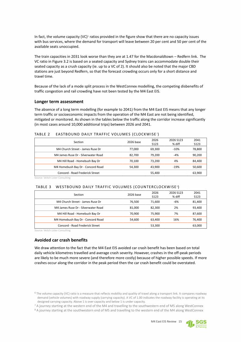
In fact, the volume capacity (VC)6 ratios provided in the figure show that there are no capacity issues with bus services, where the demand for transport will leave between 20 per cent and 50 per cent of the available seats unoccupied. The train capacities in 2031 look worse than they are at 1.47 for the Macdonaldtown – Redfern link. The VC ratio in Figure 3.2 is based on a seated capacity and Sydney trains can accommodate double their seated capacity as a crush capacity (ie. up to a VC of 2). It should also be noted that the major CBD stations are just beyond Redfern, so that the forecast crowding occurs only for a short distance and travel time. Because of the lack of a mode split process in the WestConnex modelling, the competing disbenefits of traffic congestion and rail crowding have not been tested by the M4 East EIS.
Longer term assessment
The absence of a long term modelling (for example to 2041) from the M4 East EIS means that any longer term traffic or socioeconomic impacts from the operation of the M4 East are not being identified, mitigated or monitored. As shown in the tables below the traffic along the corridor increase significantly (in most cases around 10,000 additional trips) between 2026 and 2041.
TABLE 2 EASTBOUND DAILY TRAFFIC VOLUME S (CLOCKWISE 7)
Section 2026 base 2026 S123
2026 S123 % diff
2041 S123
M4 Church Street - James Ruse Dr 77,000 69,300 -10% 78,800
M4 James Ruse Dr - Silverwater Road 82,700 79,200 -4% 90,200
M4 Hill Road - Homebush Bay Dr 70,100 73,200 4% 84,400
M4 Homebush Bay Dr - Concord Road 54,300 43,900 -19% 50,600
Concord - Road Frederick Street 55,400 63,900
Source: Veitch Lister Consulting
TABLE 3 WESTBOUND DAILY TRAFFIC VOLUMES ( COUNTERCLOCKWISE 8)
Section 2026 base 2026 S123
2026 S123 % diff
2041 S123
M4 Church Street - James Ruse Dr 76,500 71,600 -6% 81,400
M4 James Ruse Dr - Silverwater Road 81,000 82,300 2% 93,400
M4 Hill Road - Homebush Bay Dr 70,900 75,900 7% 87,600
M4 Homebush Bay Dr - Concord Road 54,600 63,400 16% 76,400
Concord - Road Frederick Street 53,300 63,000
Source: Veitch Lister Consulting
Avoided car crash benefits
We draw attention to the fact that the M4 East EIS avoided car crash benefit has been based on total daily vehicle kilometres travelled and average crash severity. However, crashes in the off-peak periods are likely to be much more severe (and therefore more costly) because of higher possible speeds. If more crashes occur along the corridor in the peak period then the car crash benefit could be overstated.
6 The volume capacity (VC) ratio is a measure that reflects mobility and quality of travel along a transport link. It compares roadway
demand (vehicle volumes) with roadway supply (carrying capacity). A VC of 1.00 indicates the roadway facility is operating at its designed carrying capacity. Above 1 is over capacity and below 1 is under capacity.
7 A journey starting at the western end of the M4 and travelling to the southwestern end of M5 along WestConnex 8 A journey starting at the southwestern end of M5 and travelling to the western end of the M4 along WestConnex
M4 East EIS Review 16
3 MODEL COMPARISON
In the previous section results from the comprehensive modelling of WestConnex from the Zenith model were used to interpret results from the M4 East EIS traffic model. This section presents a comparison of the various assumptions, inputs and outputs from the two transport models. While there are a range of differences the models appear to be producing a broadly consistent picture of traffic travelling along the M4 East. Before focussing on specific differences, there are some general observations to be made on the EIS processes and the document. These are discussed below. The Modelling Process
The M4 East EIS Road Traffic modelling has: a) Extracted a base case road traffic trip matrix from Strategic Travel Model (STM)9;
b) Refined the trip matrix through matrix estimation;
c) Introduced induced trips into the project case using travel time elasticities of demand for travel
by car;
d) Forecast detailed volumes and turning movements by applying growth calculated from the
difference in base year and future year to the base year values. The EIS document is not clear
on how volumes and turning movements on new roads and intersections are estimated.
The M4 East EIS Road Traffic Model, a purely traffic assignment model, is then used to assign the trip matrix to the road network and to provide more detailed toll choice modelling than can be achieved within the capabilities of the STM. The M4 East EIS Road Traffic Model process, while acceptable, includes many implicit assumptions, including that provision of significant transport infrastructure will not impact on growth rates of demand. Zenith is a multi-modal, 4-step model and, in the modelling of WestConnex, has implemented all four steps within a single model. These differences will undoubtedly be the source of some of the differences between the M4 East EIS Road Traffic Model and Zenith forecasts. Extent of Model
The Zenith Westconnex Model (ZWM) includes the Illawarra Region, the Central Coast and the Hunter Region. The STM, which provided the base case trip matrix, has roughly the same coverage as ZWM. The M4 East EIS Road Traffic Model, however, includes the Sydney Metropolitan Area only. The major issue with the limited coverage is that the M4 East EIS Road Traffic Model has no mechanism to include route shifting between corridors. The most significant of these are the choice of route for travel between:
Sydney Metropolitan Area and the Illawarra Region, where there is a choice between the Hume Highway and the F6;
Sydney Metropolitan Area and northern areas of Central Coast and the Hunter Region, where there is the choice between the Princes Highway and the F2.
However, since these are reasonably remote from the M4 East corridor, it is unlikely that they will have a significant impact on the outputs of the models.
9 More information on the STM can be found here http://www.bts.nsw.gov.au/Publications/Latest-publications/default.aspx

M4 East EIS Review 17
Differences in the Models We have identified several differences in the assumptions contained in the two models and the procedures that were used to provide forecasts of traffic demand. These are itemised below. Network Coding
The alignment of M4 East in the M4 East EIS Road Traffic Model is located south of Parramatta Road. In ZWM it is north of Parramatta Road. This is unlikely to produce significantly different outputs. The Eastern Portal Interchange: The M4 East EIS Road Traffic Model connects Westconnex to Wattle Street and Parramatta Road via long ramps. In Zenith, Westconnex is linked to the Wattle Street/Ramsay Street Intersection. There may be minor differences in travel times as a result of this difference, but these should not be significant enough to result in major differences in assigned volumes. The M4 East EIS states that some changes were made to the surface road network, including some turn bans. However, the changes have not been specifically identified in the document. In ZWM, the surface road network was unaltered. The M4 East EIS Road Traffic Model includes bus lanes on Parramatta Road (thereby reducing capacity of these links in the model) while Zenith does not.
Mode choice
M4 East EIS Road Traffic Model uses elasticities to calculate induced traffic, which includes the shift from public transport to cars. ZWM contains mode split within the model. Tolls and Toll Strategy
The M4 East EIS does not explain how tolls and perceptions of them changes into the future (see page 13 for a possible tolling strategy used in the M4 East EIS). We understand from other sources that there is an assumption that income increases in real terms by 1 per cent per year. Zenith does take into account changes in perceptions of tolls and willingness to pay. Direct Comparisons
The figure below compares the volumes across the four screenlines out of the two models. The two sets of results are very similar. The figure below can be compared to Figure 8.2 in the EIS document. It shows that the forecasts of diversions to the new road infrastructure are consistent.

M4 East EIS Review 18
FIGURE 9 COMPARISON OF DO NOT HING AND PROJECT CAS E FOR 2031
Source: Veitch Lister Consulting and M4 East EIS
FIGURE 10 ZENITH FORECASTS OF DIVERSI ONS
Source: Veitch Lister Consulting

M4 East EIS Review 19
FIGURE 11 M4 EAST E IS FORECASTS OF DIVERSI ONS
Source: Veitch Lister Consulting

M4 East EIS Review 20
4 CONCLUSION
The purpose of the M4 East EIS is to identify comprehensive mitigation and management measures that would be implemented to avoid, manage, mitigate, offset and/or monitor impacts during construction and operation of the project. A review of the transport and socioeconomic sections of the M4 East EIS has highlighted a number of issues. Of most concern are:
The M4 East EIS itself acknowledges that the forecasted peak traffic patterns appear to be counter intuitive – westbound in the morning peak and eastbound in the afternoon peak. When compared to recent traffic trends in Sydney this outcome is hard to comprehend. The EIS explanation of this outcome is contrived and complicated is likely due to a miscalculation in the transport modelling.
Alternatives to the M4 East (public transport and freight rail improvements and demand management policies) are not assessed in any depth. The M4 East EIS merely states that the M4 East is the best solution to the challenges facing the corridor.
The M4 East EIS has assumed that all sections of WestConnex listed above are completed by 2031. If all sections are not completed simultaneously, the traffic flowing from the M4 East will have adverse impacts on the inner west and central Sydney. The M4 East EIS has not addressed the risks in terms of the traffic and socioeconomic impact of the project.
The M4 East EIS does not explain how toll levels and people’s perception of tolls changes into the future. Given the impacts this can have on existing surface roads and the recent toll road failures in Sydney this appears a significant omission. Assumptions around the location, supply and cost of car parking (a key component of travel cost to eastern Sydney) is not explained by the M4 East EIS.
The M4 East EIS documents make no reference to sensitivity tests. It should be expected that a project of this significance, the sensitivity of the model to various assumptions and potential alternative outcomes would be tested in detail. In particular, the sensitivities to the impacts on the road network of differing toll levels and land use changes would be significant.
The transport model used by the M4 East EIS does not include public transport assignment or even public transport demand forecasting. Due to the lack of a mode split process in the transport modelling, the competing disbenefits of traffic congestion and rail crowding has not been tested for the EIS.
The implications of increased bus traffic along Parramatta Road into the central city are not addressed by the M4 East EIS. How the central city road network will deal with increased bus traffic is unknown.
The absence of long term modelling (for example to 2041) in the M4 East EIS means that any longer term traffic or socioeconomic impacts are not being identified, mitigated or monitored.
The information contained in the EIS does not reduce any of the concerns around the adverse impacts previously raised in the Strategic Review and Transport Modelling of WestConnex prepared by SGS Economics & Planning and Veitch Lister Consulting. That is, WestConnex will not address the transport challenges being faced by Sydney in the future.

M4 East EIS Review 21
Contact us CANBERRA
Level 6, 39 London Circuit Canberra ACT 2601
+61 2 6263 5940 [email protected]
HOBART
PO Box 123 Franklin TAS 7113
+61 421 372 940 [email protected]
MELBOURNE
Level 14, 222 Exhibition Street Melbourne VIC 3000
+61 3 8616 0331 [email protected]
SYDNEY
209/50 Holt Street Surry Hills NSW 2010
+61 2 8307 0121 [email protected]