wfo mhx coastal flood program. what is coastal flooding? national weather service instruction 10-320...
TRANSCRIPT
WFO MHX Coastal Flood Program
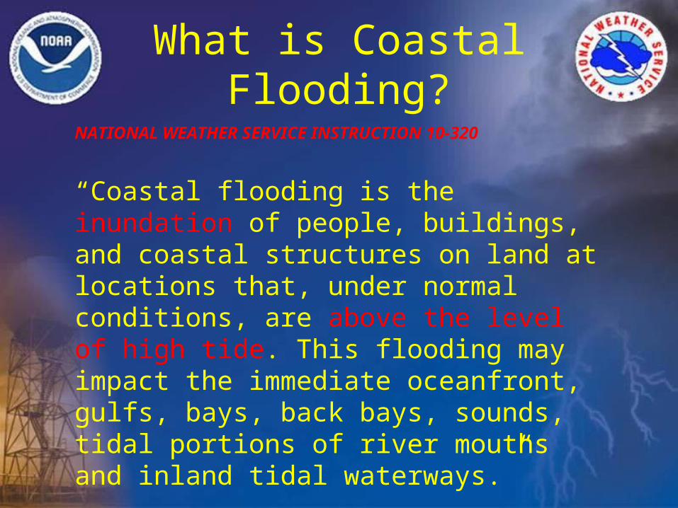
What is Coastal Flooding?
NATIONAL WEATHER SERVICE INSTRUCTION 10-320
“Coastal flooding is the inundation of people, buildings, and coastal structures on land at locations that, under normal conditions, are above the level of high tide. This flooding may impact the immediate oceanfront, gulfs, bays, back bays, sounds, tidal portions of river mouths and inland tidal waterways.”
Coastal flooding is categorized into Minor, Moderate, or Major/Severe
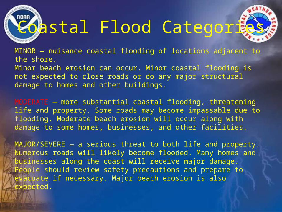
Coastal Flood Categories
MINOR — nuisance coastal flooding of locations adjacent to the shore.Minor beach erosion can occur. Minor coastal flooding is not expected to close roads or do any major structural damage to homes and other buildings.
MODERATE — more substantial coastal flooding, threatening life and property. Some roads may become impassable due to flooding. Moderate beach erosion will occur along with damage to some homes, businesses, and other facilities.
MAJOR/SEVERE — a serious threat to both life and property. Numerous roads will likely become flooded. Many homes and businesses along the coast will receive major damage. People should review safety precautions and prepare to evacuate if necessary. Major beach erosion is also expected.
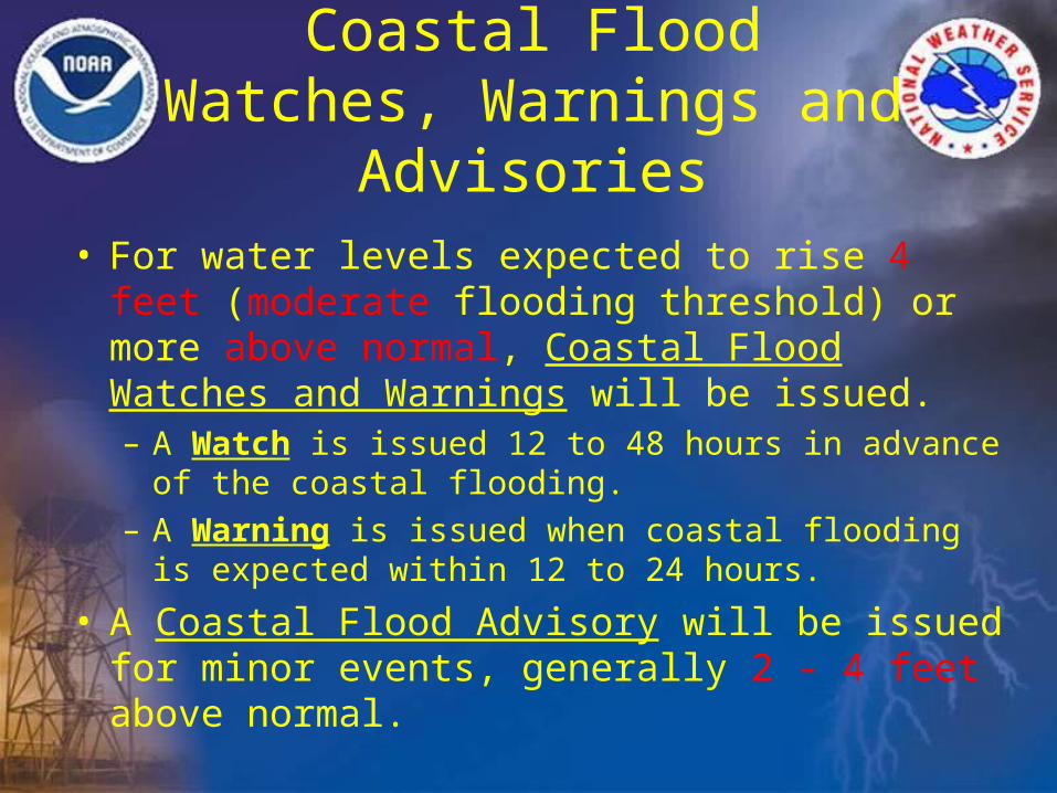
Coastal Flood Watches, Warnings and Advisories
• For water levels expected to rise 4 feet (moderate flooding threshold) or more above normal, Coastal Flood Watches and Warnings will be issued. – A Watch is issued 12 to 48 hours in advance of the
coastal flooding. – A Warning is issued when coastal flooding is
expected within 12 to 24 hours.
• A Coastal Flood Advisory will be issued for minor events, generally 2 - 4 feet above normal.
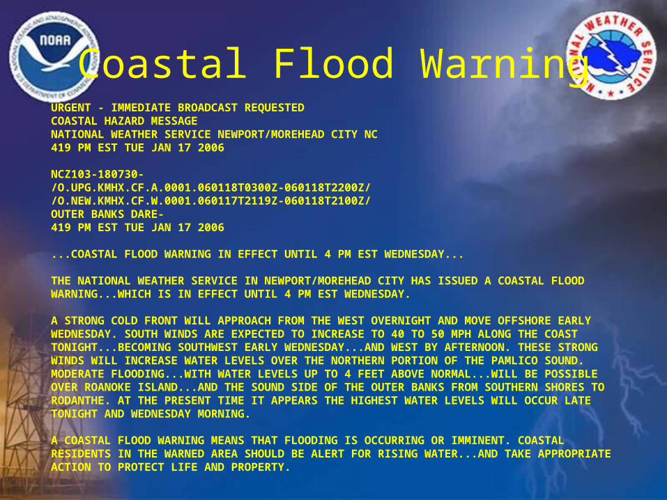
Coastal Flood WarningURGENT - IMMEDIATE BROADCAST REQUESTED COASTAL HAZARD MESSAGE NATIONAL WEATHER SERVICE NEWPORT/MOREHEAD CITY NC419 PM EST TUE JAN 17 2006
NCZ103-180730-/O.UPG.KMHX.CF.A.0001.060118T0300Z-060118T2200Z/ /O.NEW.KMHX.CF.W.0001.060117T2119Z-060118T2100Z/ OUTER BANKS DARE-419 PM EST TUE JAN 17 2006
...COASTAL FLOOD WARNING IN EFFECT UNTIL 4 PM EST WEDNESDAY...
THE NATIONAL WEATHER SERVICE IN NEWPORT/MOREHEAD CITY HAS ISSUED A COASTAL FLOOD WARNING...WHICH IS IN EFFECT UNTIL 4 PM EST WEDNESDAY.
A STRONG COLD FRONT WILL APPROACH FROM THE WEST OVERNIGHT AND MOVE OFFSHORE EARLY WEDNESDAY. SOUTH WINDS ARE EXPECTED TO INCREASE TO 40 TO 50 MPH ALONG THE COAST TONIGHT...BECOMING SOUTHWEST EARLY WEDNESDAY...AND WEST BY AFTERNOON. THESE STRONG WINDS WILL INCREASE WATER LEVELS OVER THE NORTHERN PORTION OF THE PAMLICO SOUND. MODERATE FLOODING...WITH WATER LEVELS UP TO 4 FEET ABOVE NORMAL...WILL BE POSSIBLE OVER ROANOKE ISLAND...AND THE SOUND SIDE OF THE OUTER BANKS FROM SOUTHERN SHORES TO RODANTHE. AT THE PRESENT TIME IT APPEARS THE HIGHEST WATER LEVELS WILL OCCUR LATE TONIGHT AND WEDNESDAY MORNING.
A COASTAL FLOOD WARNING MEANS THAT FLOODING IS OCCURRING OR IMMINENT. COASTAL RESIDENTS IN THE WARNED AREA SHOULD BE ALERT FOR RISING WATER...AND TAKE APPROPRIATE ACTION TO PROTECT LIFE AND PROPERTY.
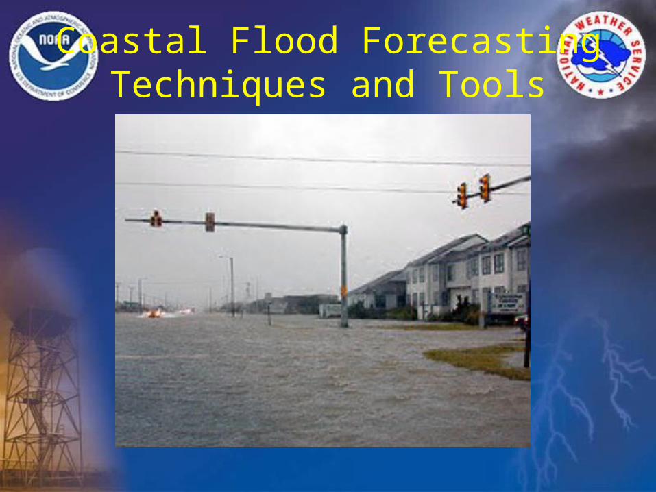
Coastal Flood Forecasting Techniques and Tools
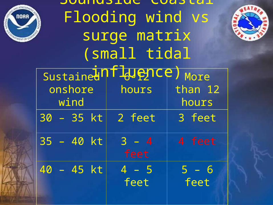
Soundside Coastal Flooding wind vs surge matrix(small tidal influence)
Sustained onshore wind
6-12 hours More than 12 hours
30 – 35 kt 2 feet 3 feet
35 – 40 kt 3 – 4 feet 4 feet
40 – 45 kt 4 – 5 feet 5 – 6 feet
45 – 50 kt 5 – 6 feet 7 feet +
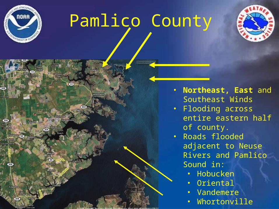
Pamlico County
• Northeast, East and Southeast Winds
• Flooding across entire eastern half of county.
• Roads flooded adjacent to Neuse Rivers and Pamlico Sound in:• Hobucken• Oriental • Vandemere• Whortonville
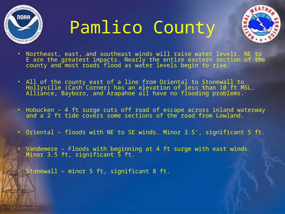
Pamlico County• Northeast, east, and southeast winds will raise water levels. NE to E are the
greatest impacts. Nearly the entire eastern section of the county and most roads flood as water levels begin to rise.
• All of the county east of a line from Oriental to Stonewall to Hollyville (Cash Corner) has an elevation of less than 10 ft MSL. Alliance, Bayboro, and Arapahoe all have no flooding problems.
• Hobucken – 4 ft surge cuts off road of escape across inland waterway and a 2 ft tide covers some sections of the road from Lowland.
• Oriental – floods with NE to SE winds. Minor 3.5’, significant 5 ft.
• Vandemere – Floods with beginning at 4 ft surge with east winds. Minor 3.5 ft, significant 5 ft.
• Stonewall – minor 5 ft, significant 8 ft.
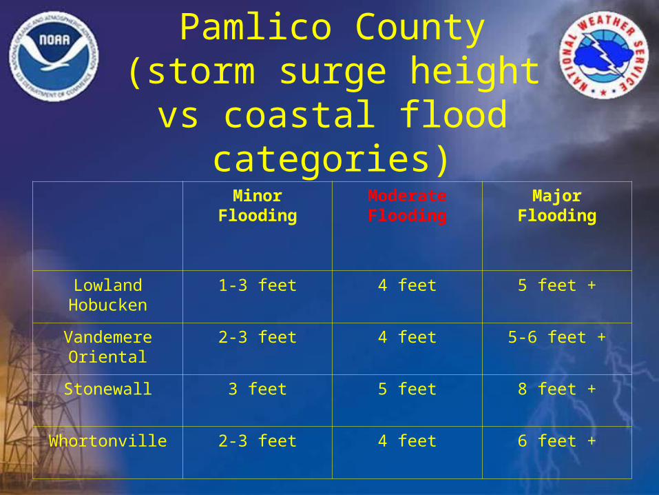
Pamlico County (storm surge height vs coastal
flood categories)
Minor Flooding Moderate Flooding
Major Flooding
LowlandHobucken
1-3 feet 4 feet 5 feet +
VandemereOriental
2-3 feet 4 feet 5-6 feet +
Stonewall 3 feet 5 feet 8 feet +
Whortonville 2-3 feet 4 feet 6 feet +
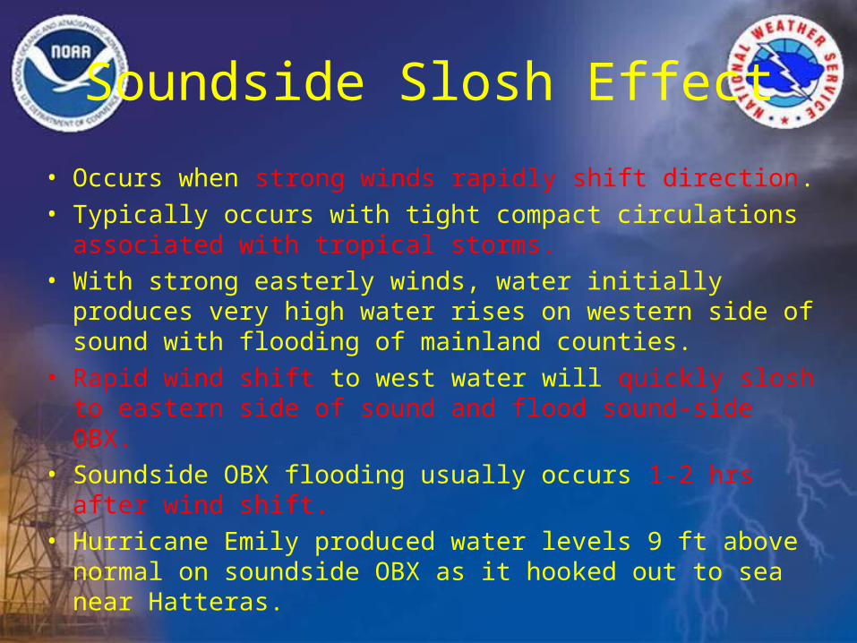
Soundside Slosh Effect
• Occurs when strong winds rapidly shift direction.• Typically occurs with tight compact circulations associated
with tropical storms.• With strong easterly winds, water initially produces very
high water rises on western side of sound with flooding of mainland counties.
• Rapid wind shift to west water will quickly slosh to eastern side of sound and flood sound-side OBX.
• Soundside OBX flooding usually occurs 1-2 hrs after wind shift.
• Hurricane Emily produced water levels 9 ft above normal on soundside OBX as it hooked out to sea near Hatteras.
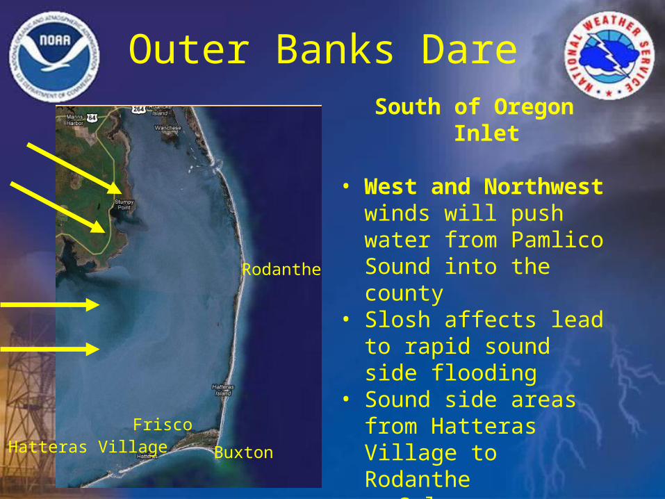
Outer Banks Dare South of Oregon Inlet
• West and Northwest winds will push water from Pamlico Sound into the county
• Slosh affects lead to rapid sound side flooding
• Sound side areas from Hatteras Village to Rodanthe• Salvo• Frisco• Hatteras Village
Rodanthe
Buxton
FriscoHatteras Village
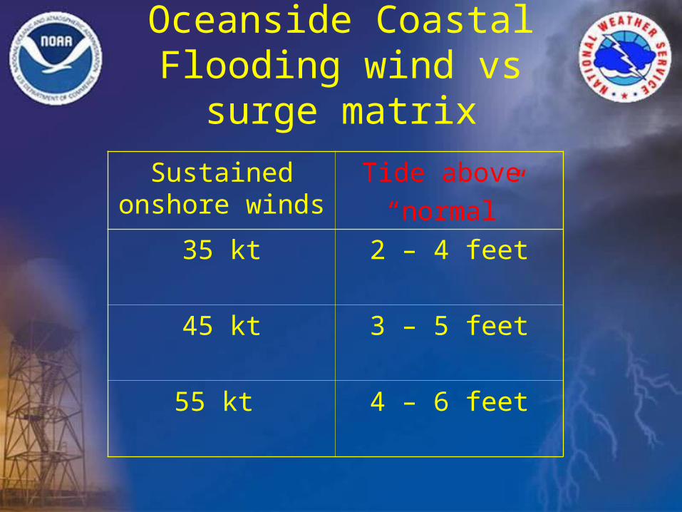
Oceanside Coastal Flooding wind vs surge matrix
Sustained onshore winds
Tide above
“normal”
35 kt 2 – 4 feet
45 kt 3 – 5 feet
55 kt 4 – 6 feet
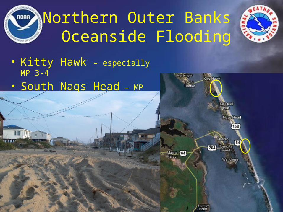
Northern Outer Banks Oceanside Flooding
• Kitty Hawk – especially MP 3-4
• South Nags Head – MP 16-18
Rodanthe
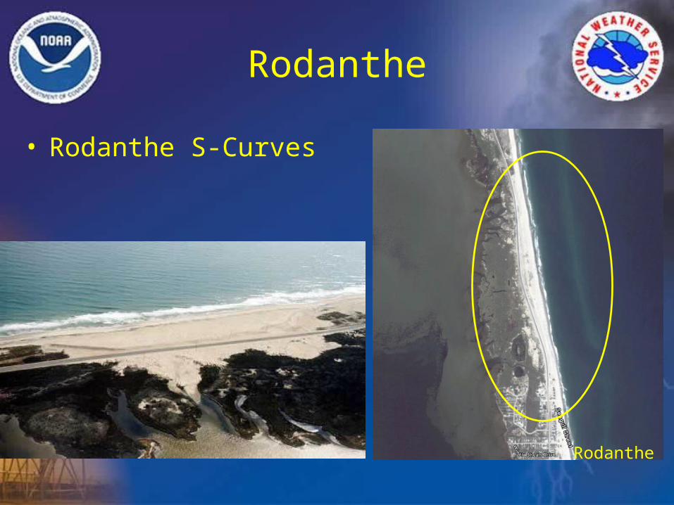
Rodanthe
• Rodanthe S-Curves
Rodanthe
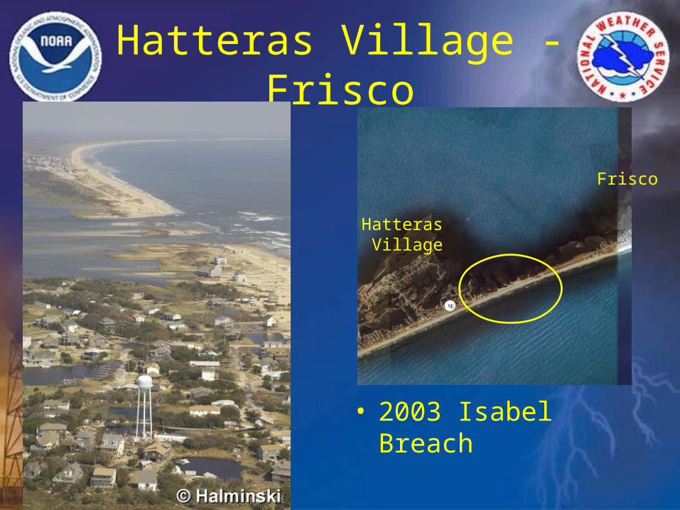
Hatteras Village - Frisco
• 2003 Isabel Breach
Hatteras Village
Frisco
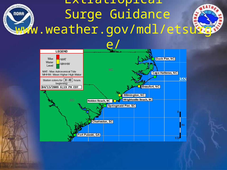
Extratropical Surge Guidance
www.weather.gov/mdl/etsurge/
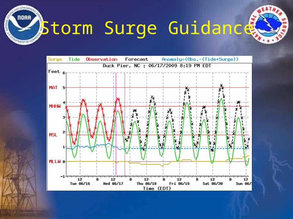
Storm Surge Guidance
MDL ET Surge Graph Key• MLLW, MSL, MHHW, and MAT. These stand for the Mean Lower
Low Water, Mean Sea Level, Mean Higher High Water, and Maximum Astronomical Tide. The thought is that there is probably flooding if the total water level crosses MAT.
• Red observation line. If there is no red line, then either Tides Online does not have data for that station, or there has been a communications break down.
• Green Tide line. This is the astronomical tide at every hour. • Gold storm surge curve, difference between astronomical tide and
water level. • Blue curve, simply the observation - (tide + storm surge). • Black forecast curve. This is what we are really interested in, which
is the total water level created by adding the 5 day average anomaly to the predicted tide, and the predicted storm surge.
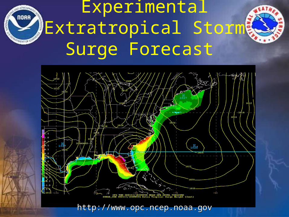
Experimental Extratropical Storm Surge Forecast
http://www.opc.ncep.noaa.govhttp://www.opc.ncep.noaa.gov
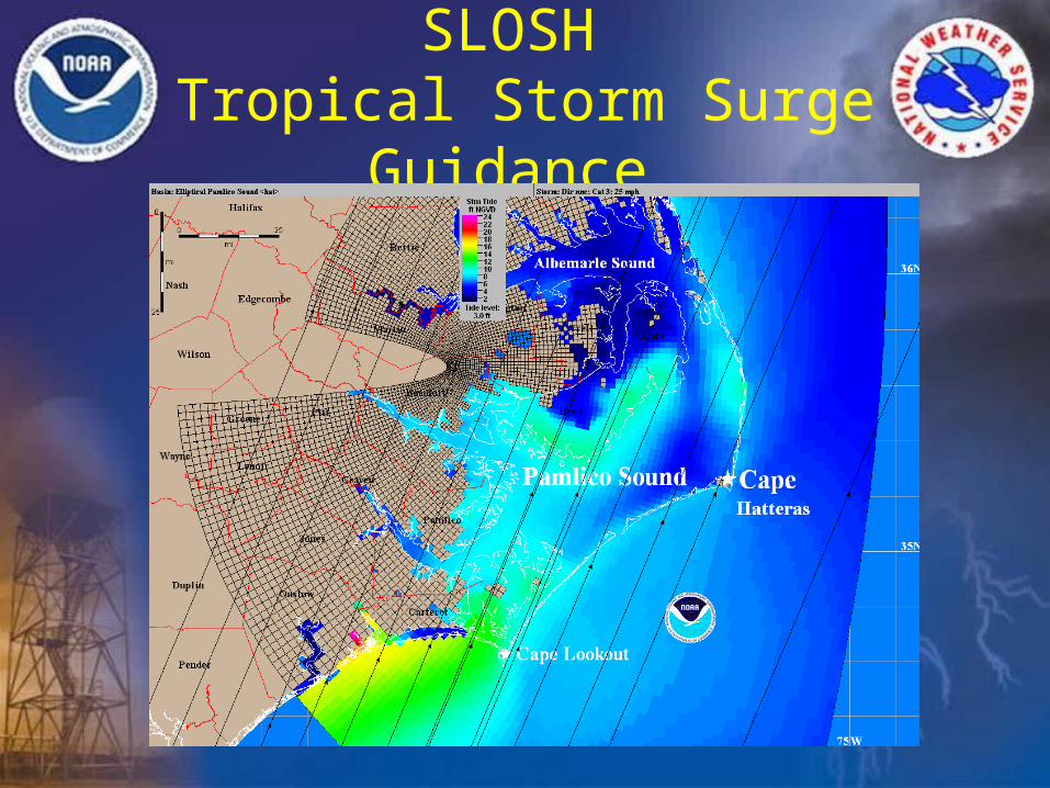
SLOSH Tropical Storm Surge Guidance
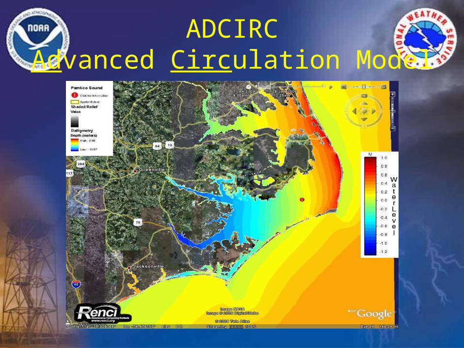
ADCIRCAdvanced Circulation Model
Water Level Monitoring
• NOS Tide Gauges
• River Gauges/APHS/Hydroview
• NC ST RTRM (Neuse River)
• Staff Gauges
• WebCams
• Storm Surge Inundation Mapping
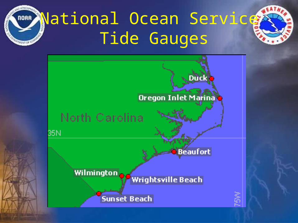
National Ocean Service Tide Gauges
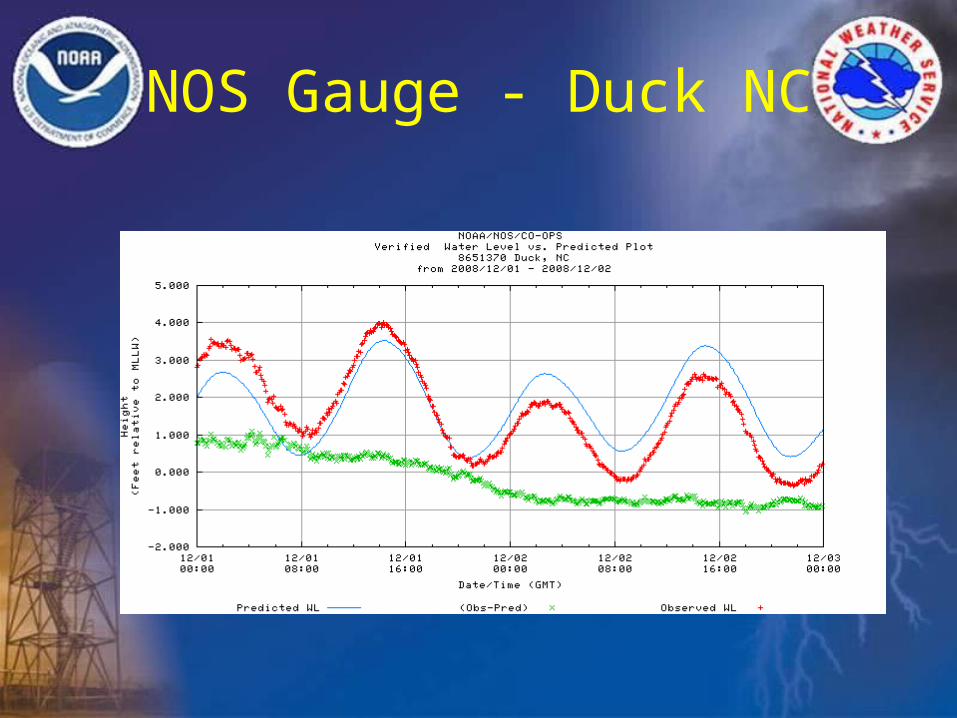
NOS Gauge - Duck NC
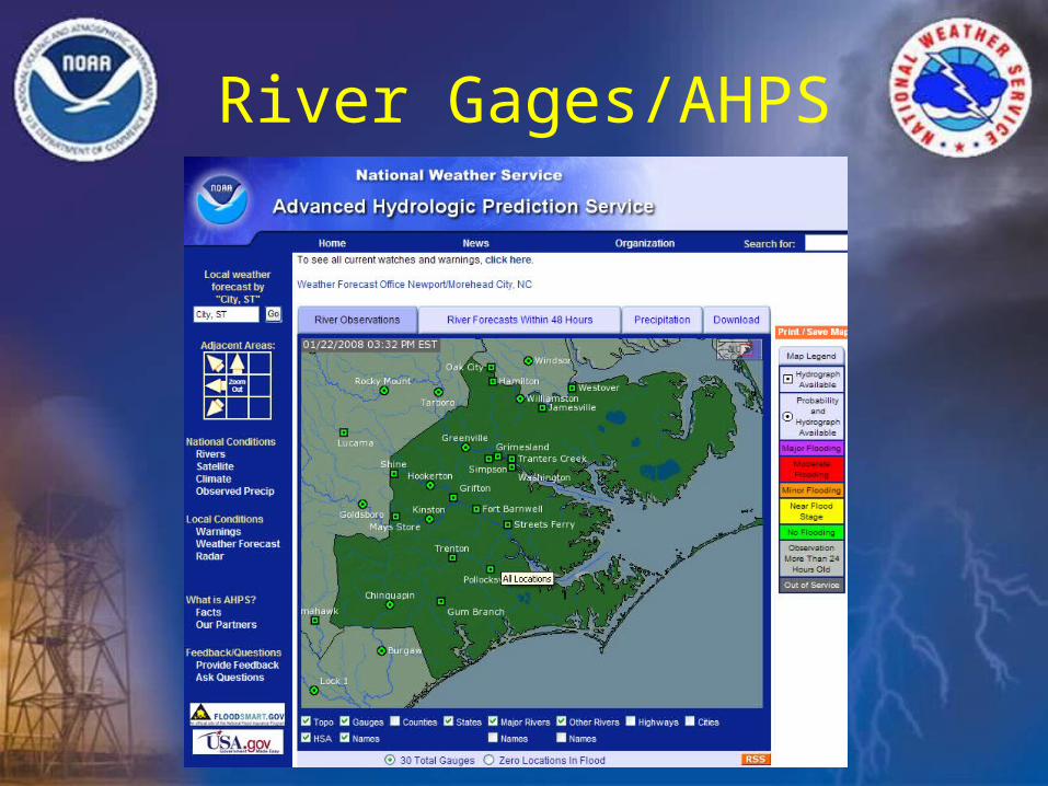
River Gages/AHPS
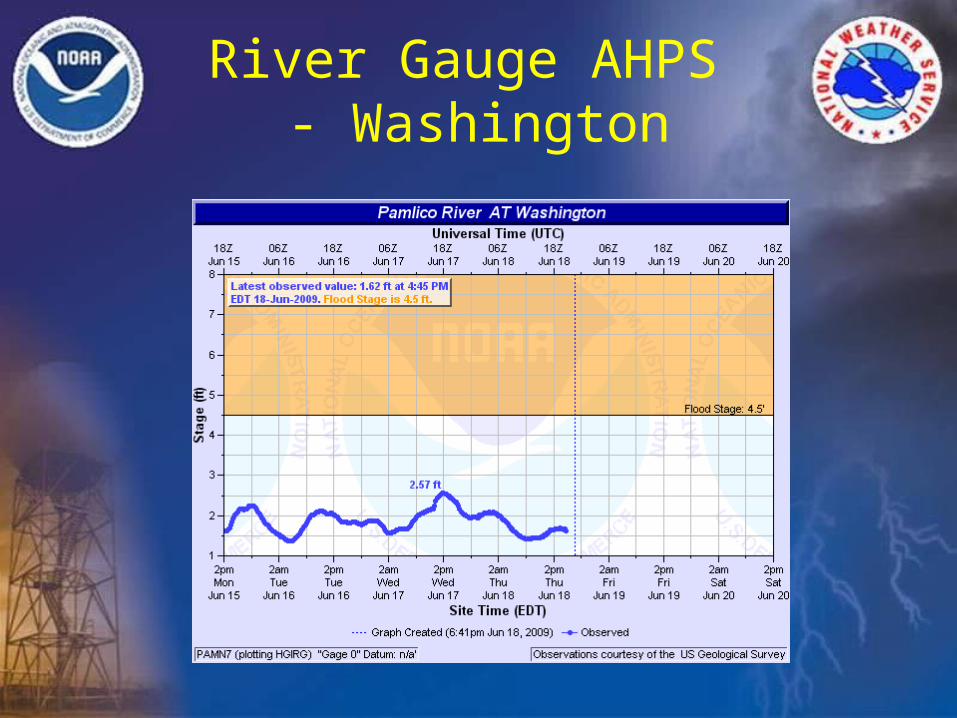
River Gauge AHPS - Washington
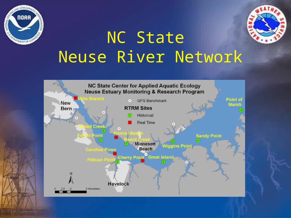
NC State Neuse River Network
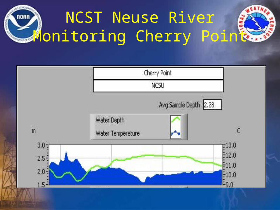
NCST Neuse River Monitoring Cherry Point
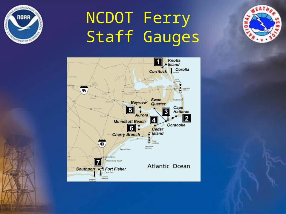
NCDOT Ferry Staff Gauges
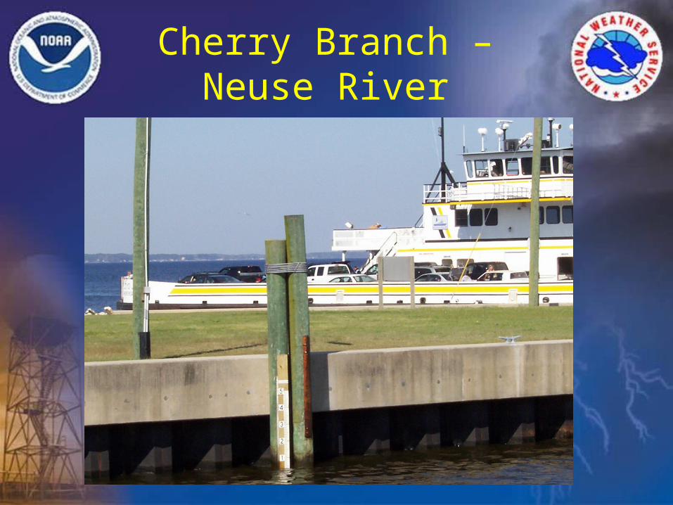
Cherry Branch – Neuse River
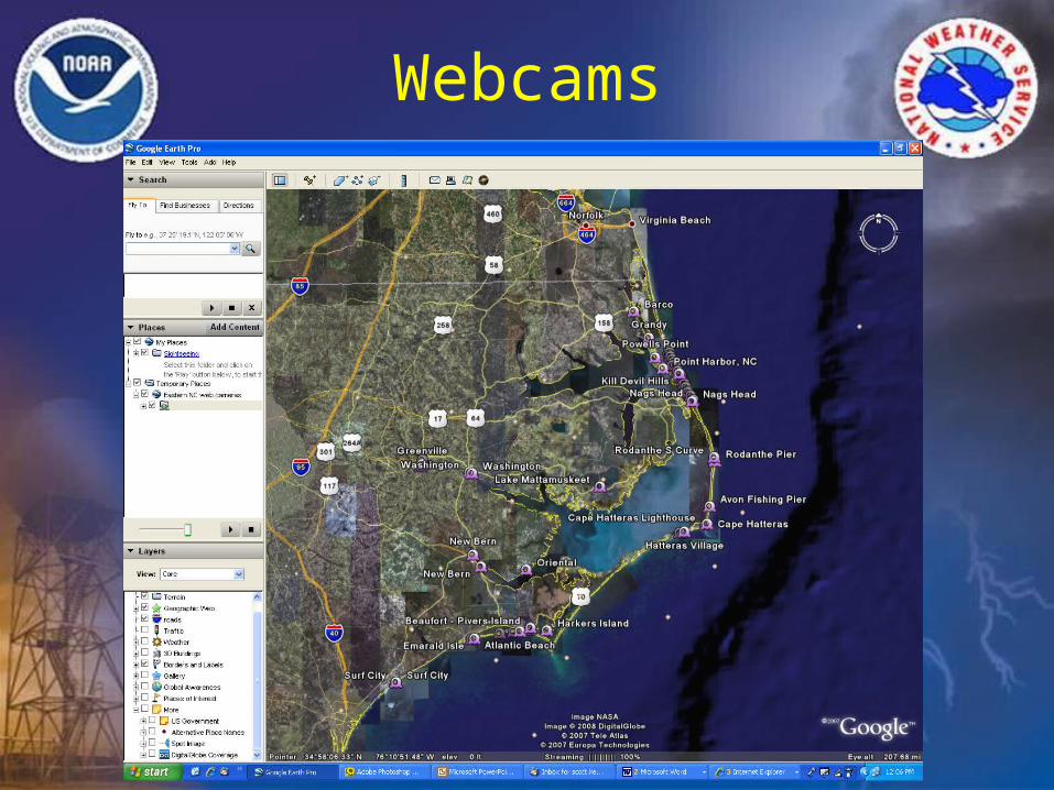
Webcams
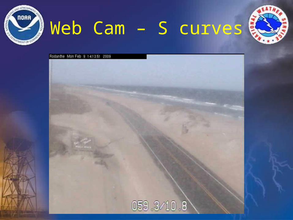
Web Cam – S curves
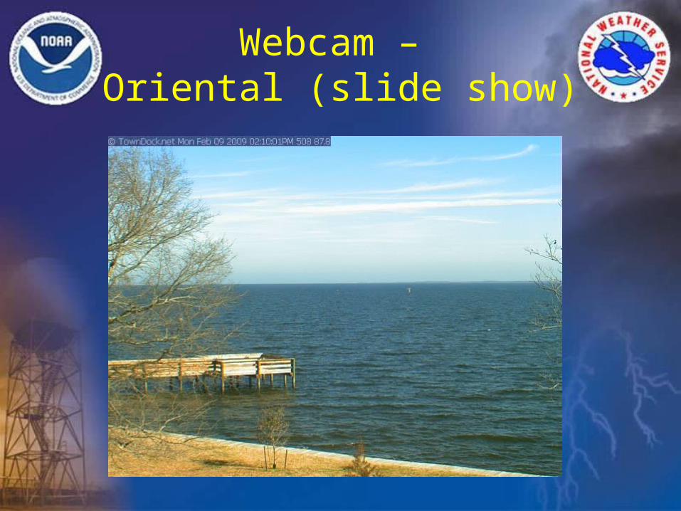
Webcam – Oriental (slide show)
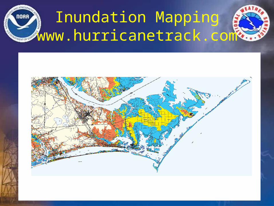
Inundation Mappingwww.hurricanetrack.com