what is surveying ? · 2017-10-31 · reporting (conclusion of the task) measurements &...
TRANSCRIPT
What is Surveying ?
Geodesy & Surveying
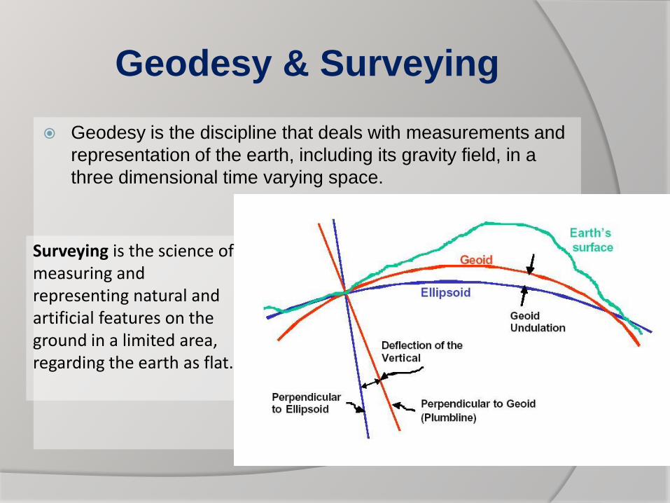
Geodesy is the discipline that deals with measurements and
representation of the earth, including its gravity field, in a
three dimensional time varying space.
Surveying is the science of measuring and representing natural and artificial features on the ground in a limited area, regarding the earth as flat.
Geodesy & Surveying
If the area that you are interested in is small
enough, the techniques of surveying are used.
That is to say you have horizontal planes and
straight vertical lines parallel to each other.
If the area you are interested in is larger or if you
are interested in the shape, size, and the gravity
field of the earth, recognizing their time variant
aspects. Then measuring techniques and
mathematical models of geodesy are used.
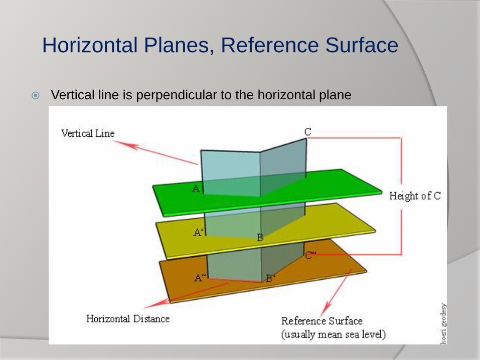
Horizontal Planes, Reference Surface
Vertical line is perpendicular to the horizontal plane
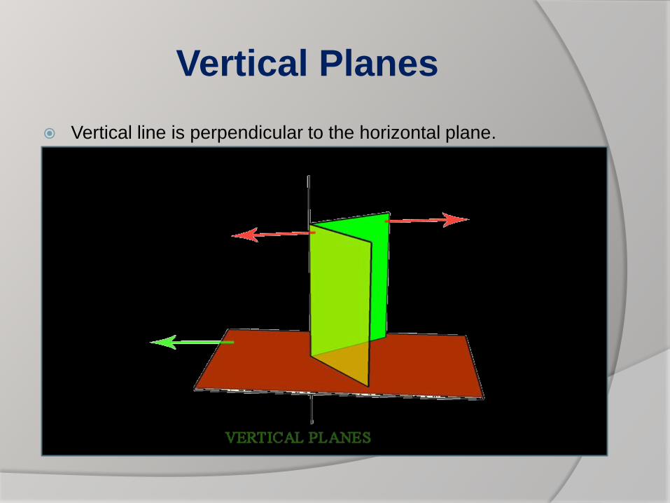
Vertical Planes
Vertical line is perpendicular to the horizontal plane.
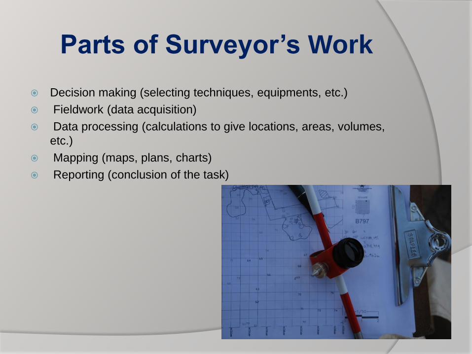
Parts of Surveyor’s Work
Decision making (selecting techniques, equipments, etc.)
Fieldwork (data acquisition)
Data processing (calculations to give locations, areas, volumes,
etc.)
Mapping (maps, plans, charts)
Reporting (conclusion of the task)
Measurements & Instrumentation
What is measured?
• Distances
• to calculate areas, volumes, etc.
• to draw plans, maps, etc.
• Angles
• both horizontal and vertical
• Heights
• levels or elevations (the third
dimension)
How are these measured and
which instrument should I use?
• Distances
taping (steel tape), tacheometry
(theodolite), electronic (EDM,
GPS)
• Angles
tacheometry (theodolite)
• Heights
leveling (level, theodolite)
Techniques
Techniques in surveying are mainly divided into two
categories
Operations of horizontal position fixing, i.e. measurements in
plan (as a professional term we call it planimetric position
fixing)
Operations of vertical position fixing, i.e. measurements for
fixing heights or relative differences in level (as a
professional term we call it leveling)
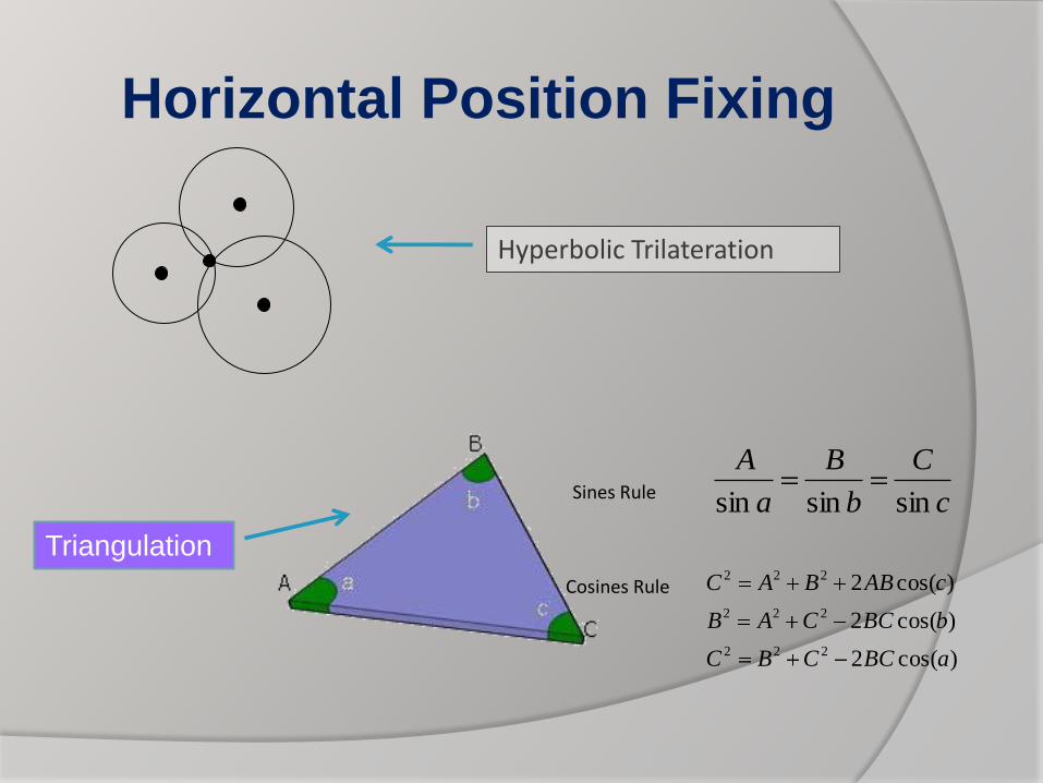
Horizontal Position Fixing
Hyperbolic Trilateration
TriangulationA
B
Ca
b
c
c
C
b
B
a
A
sinsinsin
)cos(2
)cos(2
)cos(2
222
222
222
aBCCBC
bBCCAB
cABBAC
Sines Rule
Cosines Rule
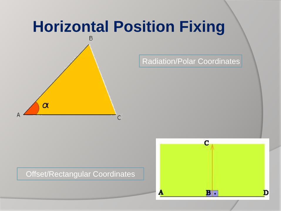
Horizontal Position Fixing
Radiation/Polar Coordinates
Offset/Rectangular Coordinates
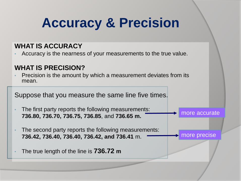
Accuracy & Precision
WHAT IS ACCURACY• Accuracy is the nearness of your measurements to the true value.
WHAT IS PRECISION?• Precision is the amount by which a measurement deviates from its
mean.
Suppose that you measure the same line five times.
• The first party reports the following measurements:
736.80, 736.70, 736.75, 736.85, and 736.65 m.
• The second party reports the following measurements:
736.42, 736.40, 736.40, 736.42, and 736.41 m.
• The true length of the line is 736.72 m
more precise
more accurate
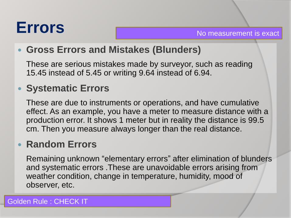
Errors
Gross Errors and Mistakes (Blunders)
These are serious mistakes made by surveyor, such as reading 15.45 instead of 5.45 or writing 9.64 instead of 6.94.
Systematic Errors
These are due to instruments or operations, and have cumulative effect. As an example, you have a meter to measure distance with a production error. It shows 1 meter but in reality the distance is 99.5 cm. Then you measure always longer than the real distance.
Random Errors
Remaining unknown “elementary errors” after elimination of blunders and systematic errors .These are unavoidable errors arising from weather condition, change in temperature, humidity, mood of observer, etc.
No measurement is exact
Golden Rule : CHECK IT
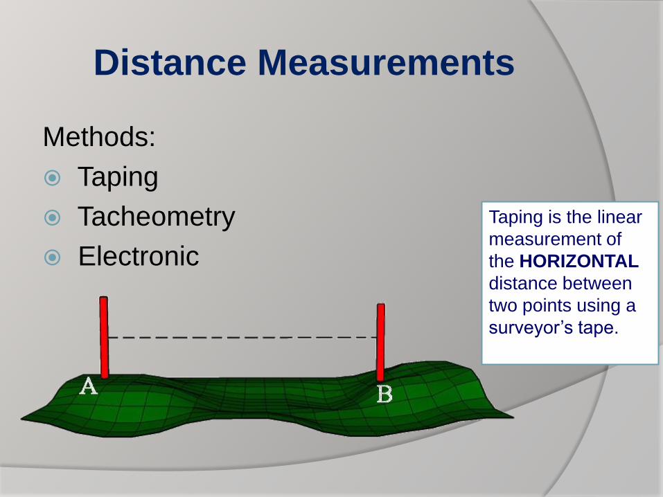
Distance Measurements
Methods:
Taping
Tacheometry
Electronic
Taping is the linear
measurement of
the HORIZONTAL
distance between
two points using a
surveyor’s tape.
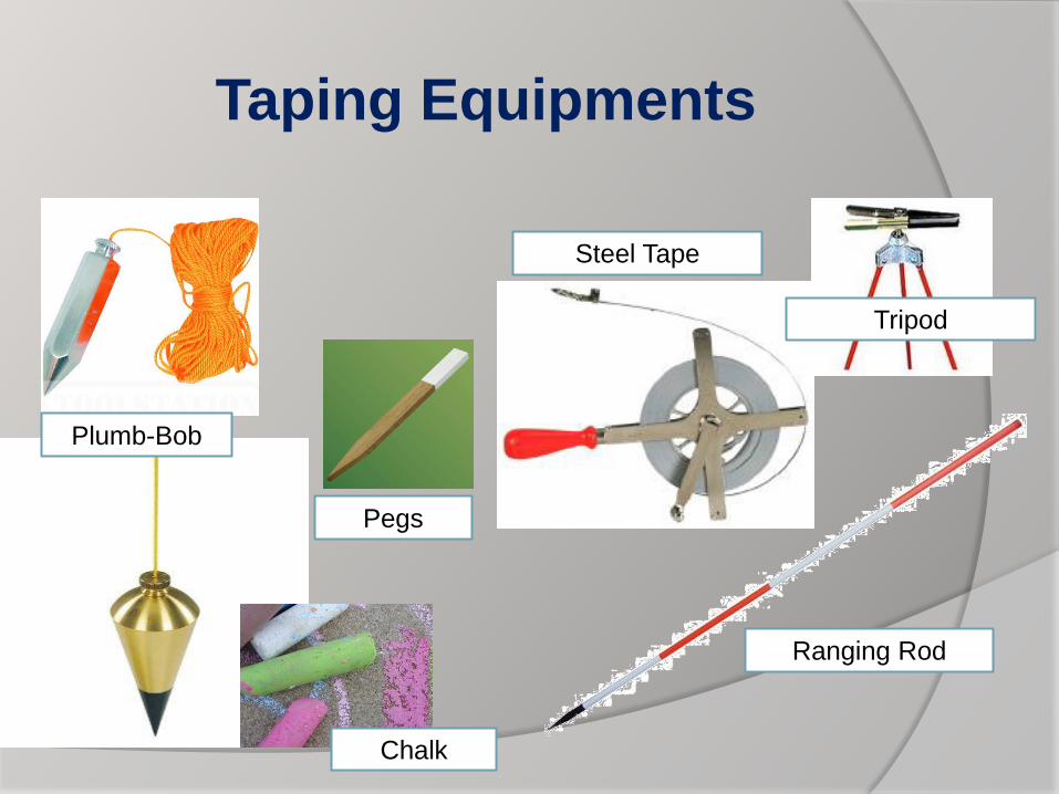
Taping Equipments
Ranging Rod
Steel Tape
Tripod
Pegs
Chalk
Plumb-Bob
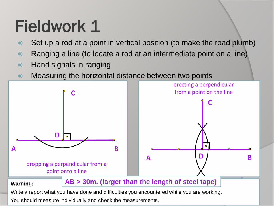
Fieldwork 1 Set up a rod at a point in vertical position (to make the road plumb)
Ranging a line (to locate a rod at an intermediate point on a line)
Hand signals in ranging
Measuring the horizontal distance between two points
A B
C
D
dropping a perpendicular from a point onto a line
A B
C
D
erecting a perpendicular from a point on the line
Warning:
Write a report what you have done and difficulties you encountered while you are working.
You should measure individually and check the measurements.
AB > 30m. (larger than the length of steel tape)