willow pond - storage.googleapis.com · additional information • five parcels of land, 4 access...
TRANSCRIPT
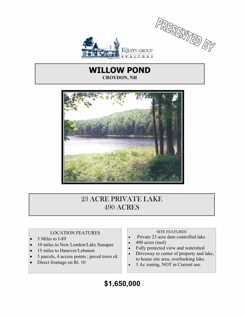
WILLOW POND CROYDON, NH
23 ACRE PRIVATE LAKE 490 ACRES
LOCATION FEATURES • 3 Miles to I-89 • 10 miles to New London/Lake Sunapee • 15 miles to Hanover/Lebanon • 5 parcels, 4 access points ; paved town rd. • Direct frontage on Rt. 10
$1,650,000
SITE FEATURES • Private 23 acre dam controlled lake • 490 acres (mol) • Fully protected view and watershed • Driveway to center of property and lake,
to house site area, overlooking lake. • 3 Ac zoning, NOT in Current use.

REMARKS
DIRECTIONS
FEATURES
Description:Land Type:
Water Frontage:Road:Gas:
Water/Sewer:
Restrictions:
Shore Rights:Electric:
Surveyor:
Easements:Power Company:
Square Feet:Road Frontage:Estimated Open Space %:
Zoning:
Exposure:
Acres:
Assessment Year:
SchDist: Newport
Tax Reduction:
Book:Page:Map:Lot:
1124
341
0
0
Elem:Jr High:High School:
Croydon Village
Newport Middle
Newport Middle
Permit Number:
Pole Number:
Tax Rate:
Amenities:Development Potential:
Location:
Water Body:Owned:Shared:Flood Zone:
Financing:
Block:
FROM I-89 SOUTH AT EXIT 13, ABOUT 3 MILES. TAKE LEFT ONTO OLD RT. 10, ABOIUT 1M TO ENTRANCE ON LEFT, ACROSS FROM HISTORIC FARM
LAKEFRONT RETREAT. IDEAL HOME SITE(S) OVERLOOKING YOUR OWN 23 AC LAKE & MEADOWS. SURROUNDED BY RIDGELINE BOWL. 3 AC ZONING DRIVEWAY TO LAKE ALONG CASCADING BROOK. 3 ACCESS POINTS. 3 M TO I-89. NOT IN CURRENT USE. PART RESTRICTED. INFO AT OUR WEBSITE.
474.00020647440
949
RURAL
2551
04 Taxes $6000.00No
Devel.Poten., Rec, Res, WtrFrntLakes, Mountain, Pasture/Field, View, Valley
Rural, NearGolf
OnSiteSepNeeded, O.S.WellNeeded
U
AtStreetNonePri
BoatLaunchOther
5
N
South
LA
ND
The Equity Group Realtors276 Newport Rd, The Gallery Ste 103 New London,NH 03257Phone: 603-526-4000 Fax: 603-526-4462
08/11/05
194089
100 OLD RT. 10 Croydon NH 03753
James Ward
WILLOW POND
MLS: Current
List Price: $1,650,000
Exclusions/Public Notes:Virtual Tour: http://vtour.cisdata.net/bin/egg/tour.php?acnt=AR118338&listing_id=REAOAK4128512
Subject to errors, omissions, prior sale, change or withdrawal without notice. The agency whose name appears at the top of this page may or may not be the listing agency for this property
Copyright Quest Technologies Inc ©1996-2005
Occ.Restrictions:
Lister: James Ward of The Equity Group Realtors

All information deemed reliable but not guaranteed.


ADDITIONAL INFORMATION
• Five parcels of land, 4 access points on town maintained roads. 4 of 5 • Lake & dam was constructed about 10 years ago in the amount of $200,000 • Subsequent owner timbered property • Dam was permitted. Currently dam has wash out. To repair would need new permit. • Was built for “kingdom” house site, about 100 yards to left of dam., along north shore. • Fields were created along shore. • Approximately 30 acres in the area along the shore, overlooking the lake, with distant views to the west. Due south exposure with full view of the protected woodland bowl. • Entire bowl (ridge line) is part of the property. Field was spread from peat taken from pond. Estimated at 5000 yards, all organic. Needs lime. Bottom of pond is 10+ feet of peat, 30,000 plus years old. North shore was dredged to about 8 feet to 50-75 feet from shore. Allows trout to sur-vive. May still be some rainbow trout. Middle of pond averages 4 feet deep. Dam area is deeper. • Dam was controlled, so could empty pond. Dam spillway was rock lined. Dam is clay lined. • Lyme Timber also owns 25 Acres across Rt. 10. Under conservation easement. Will sell for $9000. Scott McCampbell is available to answer questions.


COPYRIGHT 2004 Economic & Labor Market Information Bureau, NH Employment Security. All Rights Reserved. Updated 06/23/04
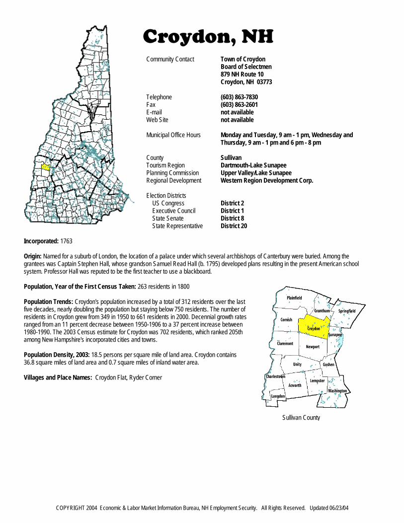
Croydon, NHCommunity Contact Town of Croydon
Board of Selectmen879 NH Route 10Croydon, NH 03773
Telephone (603) 863-7830Fax (603) 863-2601E-mail not availableWeb Site not available
Municipal Office Hours Monday and Tuesday, 9 am - 1 pm, Wednesday andThursday, 9 am - 1 pm and 6 pm - 8 pm
County SullivanTourism Region Dartmouth-Lake SunapeePlanning Commission Upper Valley/Lake SunapeeRegional Development Western Region Development Corp.
Election DistrictsUS Congress District 2Executive Council District 1State Senate District 8State Representative District 20
Incorporated: 1763
Origin: Named for a suburb of London, the location of a palace under which several archbishops of Canterbury were buried. Among thegrantees was Captain Stephen Hall, whose grandson Samuel Read Hall (b. 1795) developed plans resulting in the present American schoolsystem. Professor Hall was reputed to be the first teacher to use a blackboard.
Population, Year of the First Census Taken: 263 residents in 1800
Population Trends: Croydon's population increased by a total of 312 residents over the lastfive decades, nearly doubling the population but staying below 750 residents. The number ofresidents in Croydon grew from 349 in 1950 to 661 residents in 2000. Decennial growth ratesranged from an 11 percent decrease between 1950-1906 to a 37 percent increase between1980-1990. The 2003 Census estimate for Croydon was 702 residents, which ranked 205thamong New Hampshire's incorporated cities and towns.
Population Density, 2003: 18.5 persons per square mile of land area. Croydon contains36.8 square miles of land area and 0.7 square miles of inland water area.
Villages and Place Names: Croydon Flat, Ryder Corner
Sullivan County

COPYRIGHT 2004 Economic & Labor Market Information Bureau, NH Employment Security. All Rights Reserved. Updated 06/23/04
MUNICIPAL SERVICESType of Government Selectmen2001 Annual Budget $317,883Zoning Ordinance 1989Master Plan 1981Capital Improvement Plan NoIndustrial Plans Reviewed By
Boards and CommissionsElected: Board of SelectmenAppointed: Planning Board
Public Library No Library
EMERGENCY SERVICESPolice Department Part-timeFire Department VolunteerTown Fire Insurance Rating 9/10Emergency Medical Service Volunteer
Nearest Hospital(s):New London Hospital, New LondonDistance: 20 miles Staffed Beds: 15
UTILITIESElectric Supplier PSNHNatural Gas Supplier NoneWater Supplier Private wells
Sanitation Private septicMunicipal Wastewater Treatment Plant NoSolid Waste Disposal
Curbside Trash Pickup NonePay-As-You-Throw Program NoRecycling Program None
Telephone Company VerizonCellular Telephone Access LimitedCable Television Access NoHigh Speed Internet Service: Business No
Residential No
PROPERTY TAXES2003 Total Tax Rate (per $1000) $28.292003 Equalization Ratio 64.82003 Full Value Tax Rate (per $1000) $18.18
2003 Percent of Property Valuation by TypeResidential Land and Buildings 93.0%Commercial Land and Buildings 3.4%Other Property including Utilities 3.6%
HOUSING2002 Total Housing Units 364
2002 Single-Family Units 308Building Permits Issued 1
2002 Multi-Family Units 2Building Permits Issued 0
2002 Manufactured Housing Units 54
DEMOGRAPHICSTotal Population Community County
2003 702 42,0482000 661 40,4581990 627 38,5921980 457 36,0631970 396 30,949
Census 2000 DemographicsPopulation by Gender
Male 345 Female 316
Population by Age GroupUnder age 5 32Age 5 to 19 128Age 20 to 34 109Age 35 to 54 228Age 55 to 64 83Age 65 and over 81
Median Age 40.9 years
Educational Attainment, population 25 years and overHigh school graduate or higher 86.2%Bachelor's degree or higher 13.2%
ANNUAL INCOME, 1999 (Census 2000)Per capita income $21,403Median 4-person family income $50,556Median household income $49,688
Median Earnings, full-time, year-round workersMale $31,992Female $26,544
Families below the poverty level 2.5%
LABOR FORCEAnnual Average 1993 2003
Civilian labor force 313 333Employed 297 323Unemployed 16 10Unemployment rate 5.1% 3.0%
EMPLOYMENT & WAGES 1993 2003Goods Producing Industries
Average Employment n 29Average Weekly Wage n $497
Service Providing IndustriesAverage Employment n 27Average Weekly Wage n $352
Total Private IndustryAverage Employment 10 56Average Weekly Wage $218 $428
Government (Federal, State, and Local)Average Employment 11 26Average Weekly Wage $147 $122
Total, Private Industry plus GovernmentAverage Employment 21 82Average Weekly Wage $181 $332n = indicates that data does not meet disclosure standards
COPYRIGHT 2004 Economic & Labor Market Information Bureau, NH Employment Security. All Rights Reserved. Updated 06/23/04
EDUCATION AND CHILD CARESchools students attend: Croydon operates grades K-3; grades 4-12 are tuitioned to Newport District: SAU 43Career Technology Center(s): Sugar River Valley Tech Center Region: 10
Educational Facilities Elementary Middle/Junior High High School Private/ParochialNumber of Schools 1Grade Levels K 1-3Total Enrollment 28
NH Licensed Child Care Facilities, 2003: Total Facilities: 1 Total Capacity: 17
Nearest Community/Technical College: ClaremontNearest Colleges or Universities: Dartmouth; Colby-Sawyer; Lebanon
LARGEST EMPLOYERS PRODUCT/SERVICE EMPLOYEES ESTABLISHEDNot available
TRANSPORTATIONRoad Access Federal Routes
State Routes 10Nearest Interstate, Exit I-89, Exit 13
Distance 4 miles
Railroad NoPublic Transportation No
Nearest Airport ClaremontRunway 3,100 feetLighted? Yes Navigational Aids? Yes
Nearest Commercial Airport LebanonDistance 17 miles
Driving distance to select cities:Manchester, NH 61 milesPortland, Maine 153 milesBoston, Mass. 111 milesNew York City, NY 264 milesMontreal, Quebec 205 miles
COMMUTING TO WORK (Census 2000)Workers 16 years and over
Drove alone, car/truck/van 82.1%Carpooled, car/truck/van 11.9%Public transportation 0.0%Walked 1.6%Other means 0.0%Worked at home 4.3%
Mean Travel Time to Work 33.8 minutes
Percent of Working Residents:Working in community of residence 10%Commuting to another NH community 86%Commuting out-of-state 3%
RECREATION, ATTRACTIONS, AND EVENTSMunicipal Parks
X YMCA/YWCABoys Club/Girls ClubGolf CoursesSwimming: Indoor FacilitySwimming: Outdoor FacilityTennis Courts: Indoor FacilityTennis Courts: Outdoor FacilityIce Skating Rink: Indoor FacilityBowling FacilitiesMuseumsCinemasPerforming Arts FacilitiesTourist AttractionsYouth Organizations (i.e., Scouts, 4-H)Youth Sports: BaseballYouth Sports: SoccerYouth Sports: FootballYouth Sports: BasketballYouth Sports: Hockey
X CampgroundsX Fishing/Hunting
Boating/MarinasX Snowmobile Trails
Bicycle TrailsCross Country SkiingBeach or Waterfront Recreation Area
Nearest Ski Area(s): Mount Sunapee
Other: