wisconsin mapping bulletin mapping · · 2017-07-24january, 1996 wisconsin mapping bulletin
TRANSCRIPT
-: Cartographer's Office
January, 1996Vol. 22, No.1
Wisconsin
MAPPING BULLETINReporting onMapping andLand Informationin Wisconsin
'\
Mapping hits the Internet
by Jim JordanEvery week we learnabout more Internet "web sites" witha mapping flavor. This is part of the well-publicized general trend of growth in use of the Internet, and the mappingniche has somevery interesting developments.
There are now sites you can "visit" that are earlyexamplesof what will likely be common in the future. These inelude clearinghouses with sample images of geographicdata sets, maps made on-the-fly, scanned aerial photographs, searches for place names, and the list goes on.
In Wisconsin, the seo and the Land Information Boardhavejoined in starting a clearinghouse accessible over theInternet. The goal is to link county.Land Information Offices and others so that ideas, questions, answers, advice,metadata, and data canall be shared. At the SCO, wemaintain another site that is specific to our office.
On page 7 of this issue you will findreferences to selected World Wide Web sites thatyou can access withanInternet connection andbrowsing software. Often, one sitewillprovide links to other sites, making it easyfor you tojump around the Internet without typing in the oftenlongand complex addresses.
Prospecting by "search engine"Mapping resources on the Internet are increasing continually. Thecapacity to locate digital dataand images willmeana major increase in the use of these data. Effectivesearching strategies are the way to fmd whatyou're interestedin. Finding datafor a region or topic is a relativelysimple matter. "Search engines" suchas the WorldWideWeb Worm and WebCrawler, which you access over theInternet without having the searching software on yourown computer, let youperform a net-wide query based onkey words.
See examples at WLIAIf you don't have access to the Internet yet, you can stillget a glimpse of whatthe future holds. The SCOwillpresent "GIS Resources on the Internet" on March 7 as partofthe WLIAConference in Oshkosh. See page 12for a general conference preview.
Have you returned your subscription card? In ourprevious issue, we announced our need to streamline themailing list for the Bulletin. We appreciate the manypeople who returned the response card, as we requested.
However, some of you have not let us know if you wantto continue receiving this newsletter. Since we bear theentirecost of preparing, printing,andmailing, your role isto give us a positive response in order to stay on themailing list.
Look at the bottom of pages 15 and 16. If you didn'treturn the similar card from the October '95 issue, this isyour last chance to continue your subscription. Cut outthe card from this issue, and return it in an envelope. Ordetach the card from the October issue and mail it.
Complete and return card at bottom of pages 15 & 16
i
l
TssltamC1"pSSi
I s::'! IStateCartographer'sOfficeUniversity of Wisconsin-MadisonRm. 160ScienceHall550 N. Park StreetMadison, WI 53706-1491
If we don't hear from you soon, we will remove yourname from the mailing list!
January, 1996 Wisconsin Mapping Bulletin
WLIB News
by TedKoch
Board MeetingsThe Wisconsin Land Information Board held its most recent meeting on December 11 in Madison. The board'snext meeting is scheduled for February 21, also in Madison. A meeting schedule for the remainder of this year hasnot yet been set.
Grant AwardsAt its December 11 meeting, the board approved 13 of the34 grant applications received from local governments (primarily counties) in the July 1995 application period. The34 grant applications requested funding exceeding $2.8 million. For the 13 approved grants, the board awarded a total of $716,693 with none of the projects receiving fullfunding. This is the lowest amount approved by the boardsince the first grant period in October 1991, when a total of$600,000 was awarded to 6 counties.
Among the grants approved in December were awards tofive counties which had not previously received a grant:Ashland, Bayfield, Forest, Green and Washburn. All but 5of the state's 72 counties have now received at least onegrant from the WLIB.
In slightly more than four years ,the board has awarded130 local government grants in nine grant periods, totaling$9,830,784. Adding that to the more than $20 million infees retained by local governments, the land informationprogram statewide has funneled more than $30 million intolocal land records modernization projects.
StandardsIn conjunction with the Wisconsin Department of Administration (DOA), the board has formed an 8-member GISData Interchange Standards Committee. The committee,which held its first meeting on January 8, is charged withrecommending standards for GIS data exchange amongWisconsin state agencies, and with recommending standards for GIS data exchange between local units of government and Wisconsin state agencies. The committee is expects to complete its work no later than June 30 this year.
The committee's recommendations will be delivered tothe board for review, which may include soliciting comments from the Wisconsin Land Information Association.The board's final recommendations will then be referred toDOA for incorporation into the state's information technology standards.
State Agency Integration PlanningThe board's Integration/Clearinghouse Committee has assisted in drawing-up instructions for the next round of stateagency land information integration plans. The plans areto be prepared by eleven agencies and delivered to theboard by the end of March this year. In a departure frompast practice, this year's plans will be incorporated intoeach agency's broader information technology plan.
Wisconsin Mapping Bulletin 2
CommunicationsEarlier this month, Executive Director Doug King issuedthe first edition of Land Information Program Happenings, four pages of news and commentary on changes hehas implemented or is considering. Many of the initialchanges involve communications, such as improved faxingand voice mail, opportunities for counties to connect to theInternet, and use of telephone/video conference calls. Infact, Happenings itself was sent via fax.
One change already made involves telephone access.The WLIB staff's primary telephone number, 608/2672707, now supports general fax and voice mail.
Policy IssuesIn Happenings, King also mentioned the need to discusssome fundamental policy issues and the opportunity to dothis at the upcoming WLIA conference (see page 12 for details). Some of these issues are covered in more detail inthe GuestInterview beginning on the next page.
StaffKimberly Keehn has joined the WLIB staff as half-time assistant through June.
ClearinghouseThe prototype clearinghouse developed by the SCO withfunds from the FGDC and the WLIB has been moved to acomputer maintained by DOA. The new address is:http://badger.state.wi.us/agencies/wlib/sco/pages/wisclinc.html.
January, 1996
I\
- Guest Interview -
( What's aheadfor the 1V1sconsin Land Information Program?
You've been on the hot seat, directingthe Wisconsin Land Information Program, for almost three months now.What has beenyour biggest surprise?
Doug-
You already said it. The hot seat! I amamazed at the level of rigor, competitionand political concern relative to theamount of money involved in the program.I've managed grant programs with severalother agencies, each one involving muchmore money than this one, yet .in eachcase the entire process was much lesscomplex, anxious, and painful for everyonethan it is presently in this program. Wejust don't have to make it this hard. Whyare we doing this to ourselves?
Recently, my office received a letter ofprotest regarding a grant not funded by theWLiB. Legislators became involved. Sofar, we've spent 120 staff hours handlingall the actions this one letter produced.And now we're working with the Legislative Audit Bureau on it, so we aren't evendone yet. I can think of far better thingsto do with three weeks of staff time.
Wisconsin's program is recognizedaround the country and beyond. Werethere particular strengths in the program that drewyou to be interested inbeing its director?
Doug-
Yes. I have been a supporter of the objectives of this program since working onwhat was then the State Bureau of Planning's Wisconsin Land Use InformationSystem in 1973 and on the "Larsenreport"
,in 1978.
January, 1996
The WL/P is a culmination of the "Wisconsin Idea" of state and local governmentand the university working together as apartnership for the benefit of ordinary citizens. The program's strength comes fromits grass-roots constituency. Its customers are regular folks. It has put resourcesinto the hands of local governments toaccomplish things "down the road" forneighbors.
I am impressed with the people in theprogram. I've known many of them fortwenty years or more. They're good people. They care. I like that a lot.
Speaking of that, let me be very clearabout something. Bill Holland [the previous Executive Director] and I have beenfriends and colleagues for many years. Itry to be straight, so I am not going to duckyour questions. When I tell you aboutproblems I see in the program, please understand that I am not talking about problems Bill created. He faced many of thesame obstacles earlier that I am facingnow. He tried his best to overcome themand so willI.
With more use offax, Internet, conference calls and such,you've been tryingto streamline communications. Whatreactions haveyou receivedfrom thecounty Land Information Offices?
Doug-
I am delighted with the comments I havereceived. They have all been very positivewith two exceptions. Quite a few peoplehave called or written to say they really likethese improvements. So that's good.
One person did remind me that it would bea good idea to have a second conferencecall after preliminary grant results areknown just in case the grant evaluationcommittee missed something. We will dothat next time.
Another person expressed concerns abouta "DOA takeover" because it looked like alot of communications were being"electronically centralized." That one reallybothers me.
My whole point in trying to get theseelectronic tools into the hands of localgovernment is so that everyone can communicate with each other as a "community", not so DOA can centralize communication.
Just because I arrange to set it up throughDOA does not mean that DOA is going to
3
control what is said by L10s via fax, voicemail or Internet. What it does mean is thatthe DOA has the resources to make thishappen for all of us.
If some people feel the DOA cannot betrusted, well then I guess I'm just going tohave to "dance with the devil" to get whatwe want. I've done it successfully before,and I can do it again.
Speaking of local government, what isyour view of the role ofmunicipal governments in modernizing land information under Wisconsin's program?
Doug-
They playa key role. They have a greatresponsibility for making sure that modernization efforts happen together. The grantprogram encourages inter-governmentalcooperation, but I hope we will see muchmore robust and formal arrangements.
There are over two thousand local units ofgovernment. If land records modernization occurs without close workinqrelationships, we could make things worseinstead of better. You need a picture before you can fit puzzle pieces together.
Something else about municipalities is alsoimportant to remember. We are going tohave to think about fundamentally enhancing the nature of the WL/P to accommodate the interest of municipalities in participating in the program.
This last July there were about 35 grantapplications. The program had all it coulddo to deal with them. What happenswhen, say, 100 municipalities are interested too? When that happens we exceedstaff capacity, the scoring system breaksdown and the funding mechanism is insufficient. We are setting ourselves up forfailure. I am not going to let that happen.
Technical assistance has always been achallenging part ofmaking sensiblemodernization happen, since the problems and solutions are complex, andthe people involved comefrom so manydifferent disciplines. Given limited re-
continued...
Wisconsin Mapping Bulletin
- Guest Interview, continued -
sources, what methods wouldyou liketo consider to address this challenge?
Doug-
You pushed one of my buttons. Let's faceit. Putting a staff position in the WLiBoffice for the purpose of providing technical support is a pipe dream. It isn't goingto happen in this fiscal climate. And if itcould happen, it wouldn't work anyway.
We need assistance on 72 county plans,180 bi-annual progress reports on 90 ongoing grant projects, 70 grant applications, 11 state agency land integration.plans, and 26 priority projects in the WLiBstrategic plan. There are not enough daysin a year for a single position to possiblyhandle the load. Is there even a singleperson who has the breadth and depth ofexpertise necessary?
Technical support is very important to me,so let me expand on this point. First, itshould become an explicit "foundationalelement" of the program. Some local unitsof government have been spending part oftheir retained fees to buy it. Some grantees have been given funds as part of thegrant to buy it done. But we need to domuch more to encourage that. It should bean explicitly funded part of the program.In fact, it should be a requirement forparticipation in the WLiP.
Second, much of the work can be done byvendors who are acceptable to the program and meet standards set by the Boardusing competitive procurement practices.Let me say in making that suggestion thatI am not going to sign one purchase orderfor a project whose vendors do not meetstate standards, who are not authorized tobid and who were not selected using competitive procurement practices.
Now, before I get the vendor communityall wound up, let me emphasize that competitive procurement does not mean lowbid. I've been through all that with computing technology acquisitions, and lowbid doesn't always make sense. An RFPprocess (request for proposals) can be justas competitive as an RFB (request for bids)process. But I am concerned about someof the sole sourcing.
Third, once we have the Ciearinghouse upand running, we will be forming an electronic community for ourselves. We willcreate an Internet "list-server" to whichanyone can post technical questions andget answers. And not just from other LIDseither. But from experts throughout boththe public and private sectors. Anyone
Wisconsin Mapping Bulletin
will be welcome to participate, and everyone will benefit. The Clearinghouse will bea powerful tool for all of us to help eachother with technical support.
Fourth, training to build technical supportcapacity should be an eligible activity forfunding under the "technical support"foundational element I am advocating. Infact, I think it should a WLiP requirementthat an in-house technical training programoccur as a condition of participation in theprogram. I would like to see free technicaltraining provided for the LIDs. This wouldensure that the program develops andgrows technical support capability at thelocal government level.
Finally, if I am successful in obtaining areinstatement of the funding for a technical support position staffer through theBudget Adjustment Bill, it'll be for someone who can build technology tools for usall to use to provide technical support foreach other as a community, not to be thesole provider of technical support. As thesaying goes, "instead of digging holes,build and pass out shovels."
People in other states have often remarked that one of the great strengthsof Wisconsin's program is the Wisconsin Land Information Association.How can the 'WLIA be most effective?
Doug-
Several ways. First, the WLiA has resources to achieve fundamental change inthe program. Take the Clearinghouse, forexample .. The WLiA could cost-share itsoperation for the benefit of the greatercommunity. This would benefit the WLiAdirectly, and would increase its visibility toa broader audience. There is no reasonwhy we cannot put a funding packagetogether right now with WLlA, WLlB, SCDand DDA to get it running.
I've already partnered with the SCD onthis. The SCD Web Site is up. Building onthat, the Wisconsin Land Information andGIS Clearinghouse will have been createdby the time people read this.
The WLiA also has expertise to contribute.Why doesn't WLiA play a larger role ingrant evaluation? For that matter, I don'tthink my office should even be directlyinvolved in grant evaluation in the firstplace. As an advisor, sure. But makingthe recommendations? I don't think so.
Second, what about County Plan evaluation? When I was at the UW, we used anationally accepted "peer review" processwherein each of the 26 campuses wouldlook at the other 25 and vice versa. Veryeducational and fair.
I would invite the WLiA to do a regularreview of County Plans instead of the
4
current process of bringing them to ouroffice and then to the Board. The planscould go to the WLiA for a collegial peerreview. Heck, it's our colleagues in thecommunity that can give the best review,ideas and suggestions for improvement,not my office and not the Board either.
How do we enhance expertise of WLiA.members to best handle grant and planreview? By asking all LIDs to becomeWLiA members, and by forming a LandInformation Dfficers' Council. Councilmembers could receive free trainingthrough, for example, the UW's Land Information and Computer Graphics Facilityand the State GIS Service Center, in exchange for their assistance. Wouldn't thatbe a real win-win?
Third, WLiA has a very important role insorting out who is speaking for whom.The LIDs are the primary customers of theWLiP. But what about the WLiA Boardrelative to the WLlB? Who are their respective customers and what is their relationship? Who is making what kind ofpolicy? And what about the Associationitself? Who is it speaking for?
The WLiB has a policy-making responsibility and I do not think it has done enough inthis area. The WLlB's primary customersare the LIDs. The WLiB is also responsibleto the taxpayers. It is analogous to theDNR Board's responsibility to look out forall of our interests as citizens no matterhow large the memberships of the Wisconsin Sportsmen's Association or the Wisconsin Manufacturers' Association are.We need to be very careful sorting out whois the "community" and I welcome theWLlA's assistance in that.
Prior to joining the 'WLIB staff, youwere involved in a major effortwithinthe state's Dept. ofAdministration toset a variety of information technologystandards. What doyou see as themajor benefits, and the major drawbacks, to setting standards in the landinformation arena?
Doug-
I co-authored the Governor's Executive Order #242: Statement of Direction on Information Technology. I've led and participated in the establishment of 23 information technology standards used by 60agencies that were set in over 100 meetings involving about 6-10 people permeeting-a big investment of staff time.
No administration would invest that kind oftime and effort unless there was a payoff.There is, and it comes in two parts.
First, the time and money savings resultingfrom the reduction in duplication, incom- (patibility and conversion achieved by shar-
January, 1996
ing common technology standards across60 agencies is huge.
Second, about 70% of the cost of operat'no a technology is in its support. And it isalso huge. We're talking millions of dollarsin savings.
And guess what? The WLiP is building aninformation technology infrastructure incounties, cities, villages, and towns acrossWisconsin. And you know what? They areall in for a great big surprise when they seewhat it is going to cost them to operateand maintain this infrastructure.
The cheapest way to do it is for everyoneto share common technologies by adopting standards so that a much smaller number of people can provide the supportneeded from shared services and fromeach other. The most expensive way todo it is for everyone to do their own thing.
If 60 agencies can agree to cooperate forthe sake of the taxpayers, so can 72 counties. If not, I hope everyone has lots ofmoney to collect from their constituentsfor MIS and GIS position salaries. And agood explanation too.
As far as drawbacks of standards go, thereare obvious effects on vendors becausethere are winners and losers. But the stateagencies and vendor community are already dealing with this by migrating to thestandards over an agreed upon four-yeartimeframe, which gives vendors time toadjust, reposition themselves, and developmarketing arrangements and partnerships.
In addition, all vendors are still free to dobusiness with any agencies not wishing tomove to the standards for good reasons,or who want to use their own money topurchase technology rather than using additional money for standard technologiesavailable to them from the InformationTechnology Fund.
You've organized a committee to recommend a GIS Data Interchange Standardfor state agencies. That committeeincludes three representatives oflocalgovernment. How will this committee's work affect local governments?
Doug-
I formed this committee as part of myprevious position as a Senior TechnologyConsultant with the DOA. Upon taking mynew position, I immediately asked that thecommittee be reconstituted to include representatives of local government. I askedWUA for nominations and placed all threeof its nominees on the committee.
This is a DOA committee acting as anagent of the WLiB with an arrangementthat the WLiA will advise the WLiB and the""VUB will advise the DOA. What will happen is that the committee will recommend
January, 1996
- Guest Interview, continued -
an interagency interchange standard. Ican assure you that the recommendationwill be acted on and a standard will be set.
Then the committee will be asked to recommend an agency-local and local-localinterchange standard. What happens tothat recommendation is up to the WLiBafter soliciting advice from WLiA.
I hope the WLiA and WLiB have the courage to recommend a data interchangestandard. If they do, the effect on local
government will be to bring them a tremendous benefit because everyone will beable to exchange data without conversion.
Isn't that what we meant when we said akey objective of this program was to "integrate data both horizontally and vertically?" That ability is expected of us bythose watching this program as well as bythe taxpayers. This is a strategic objectivewhose accomplishment is critical to ourprogram's political survival.
While electroniccommunications canstreamline the Wisconsin pmgram,land information systems are muchmore than a technologicalsolution.What doyou see as the most imposinginstitutional challenges to reaching theWisconsin program's goals?
Doug-
My answer to this is very simple. Thereare three institutional challenges: vision,focus, and ourselves.
We need to have a vision of what we aretrying to build. We need to focus on doinga few things well. And we need to controlourselves and our tendency to make listsof everything we can think of that is important to some community of interest forsome reason however good it may be.
This program is all over the map. It israining committees and task forces. It haslots of meetings and lots of reports. Itproduces too much paper and has toomuch "process." If the state's biennialbudget involved as much process to makedecisions on $100 million as we gothrough for $100 thousand, it would bethe next century until it was done.
And it produces lots of projects too---goodones! But are we supposed to be fundingthe best thing that comes through the doorat any time, or are we supposed to befunding what everyone agrees is the mostimportant thing that needs to comethrough the door at a particular time?Right now, we fund whatever is best, as itcomes in.
5
First, let's talk about the need for vision.For example, what if the Board said thatbuilding the foundational element of "geographic framework" everywhere in thestate was a priority and that it was mostimportant to complete statewide geodeticcontrol coverage before doing anythingelse? If that were the vision then fundswould go to those projects as a priority.Sure, some counties that had already completed theirs would have to wait until others finished. On the other hand, the program funded most or all of their work in thefirst place.
If the Board were to establish such a visionlinked to the grant program, we wouldn'teven need competitive grants. The moneycould be allocated on a programmatic basis to, for example, geodetic control projects on a first come, first served basisuntil it was all done everywher.e no matterhow small a county's retained fees were.Then we'd go on to completing the nextfoundational element.
On that note, there are several other waysto move money out to local units of government without a competitive grant program, and still achieve the program's objectives. We need to reconsider whetherthe time, effort, anxiety, and divisivenessinherent in our current system is reallycounter-productive in the long term.
It is obvious that the current grantprogramcannot survive an increase in applicationsalong with the continued improvement inscores, anyway. We don't have the resources to deal with it. A clear visionabout what we are trying to accomplishwould address this critical and fast approaching problem.
Second, let's talk about focus. We needto pick one or two critical things and dothem well, even if that makes some peopleunhappy, rather than work on all kinds ofthings to keep lots of people happy whilejust getting by on all of these fronts.
Remember, the Legislature gave us a fivepart charge: (1) implement a grants program, (2) modernize land records throughcounty planning, (3) produce state agencyland information integration plans, (4) establish a clearinghouse, and (5) providetechnical support to local government.
I see a grants program. I see county plansand modernization happening. Butwhere's the clearinghouse? Where's theoverall technical support? Where's thestate agency integration planning effortthat is supposed to help local government?
The Legislature had a vision. It was thevision of the community where all of thesepieces fit together and formed a wholegreater than the sum of its parts. To fulfillthat vision, we need to get back to basics.
continued...
Wisconsin Mapping Bulletin
For starters, we need much less of meetings, paper processing, travel, committees, task forces, and talking. Instead, weneed to refocus on the vision, the mission,and the goals.
Finally, the third challenge is ourselves.We are our own worst enemies. We try todo too much at once. It's one thing tothrow a new ball in the air at everyWLlBand WLiA meeting. That feels good untilafter a few years when the balls are all inthe air and it becomes a burden just tryingto keep them all off the floor. That's howwe can get distracted from our direction.·
Here's what I intend to do to refocus. I amgoing to put the energies of the WLiBoffice into the five components of ourlegislated mission and get them done, oneat a time. If that means reallocating mylast travel dollar intended for the nextconference or meeting, and using it to buya modem to connect an L10.to the Internetso they can have access to a Clearinghouse, then so be it.
The WLIB conducted its 2nd annualstrategic planning retreat last June.Will·the issues identified at that retreat form the foundation of WLIBpolicy this year, or doyou anticipatedeveloping a new set of issues after thisspring's WLIA conference?
Doug-
We're going to be looking at a new set ofissues. The Board made a good start at astrategic plan, but the issues are just a listof issues, not a strategic plan.
I have a good bit of experience facilitatingthe development of strategic business andinformation technology plans. I've donethis in both the public and private sectors.
I've learned that there is a great deal ofdifference between a list of issues, a longrange plan and a strategic plan. A list ofissues in priority order is not a strategicplan. Neither does long range planningmake something strategic.
The differences between the two lists ofissues the Board created at its 1994 and1995 strategic planning sessions are substantial enough that by definition they cannot form the basis for strategy and policy.And having a WLiB retreat to look into thefuture doesn't make them strategic either.I want to help the Board develop a trulystrategic plan that will be a reliable guidefor our near-term efforts.
What's strategic? The approaching impossibility of maintaining the grant program in its current form in the face ofincreased competition, greater scrutiny,higher scoring, and more applications isstrategic. The Clearinghouse is strategic.
Wisconsin Mapping Bulletin
- Guest Interview, continued -
Technical support is strategic. Qualitycontrol audits on work performed withWLiP funds both retained and granted arestrategic. All of these things are critical tothe WLiP meeting its mission.
There has been much concern expressedover the schedulefor updating countywide plans and making some adjustments to the grants process. Can youput a timeframe on when new guidelines in these two areas can be expected?
Doug-
After the WLiA Conference, I will be travelling out to the counties to meet on-sitewith LIDs and local government representatives. During the same period I expect the Board will have a chance to talkabout a real strategic plan. So I'd saywe're looking at somewhere around fall of1996 to deal with the county plans, manyof which are now almost five years old.
As far as the grant program goes, I will bediscussing major changes in this area withthe board and at the conference. As youknow, there has been some streamliningalready. There will be more for the Julygrant period. But the major changes willcome in the fall of 1996 if the WLiB iswilling to tackle them. I'm talking aboutthe possibility of major change here. Forexample, I think there are several goodways to quickly put funds needed to accomplish the program's objectives into thehands of local government without goingthrough a competitive grant program at all.
Some people have asked why didn't Itackle the county planning instructionsright away, in time for the WLiA conference. Because when I took this job I sawa program I admired under threat of asunset again. And it was very vulnerable.So here's what I did.
My first priority was to protect the positions we have. Then to protect the budgetwe have. Then to do something about thethree legislative charges still unfulfilled.
By doing this, when the time came to makethe decision on the program's future, I andeveryone else could stand up say, "Yes,our positions are under recruitment so wedon't want to lose any. Yes our budgetdoes not need your additional scrutiny soyou don't need to mess with it. Yes, wehave created a clearinghouse so just giveus time to get it operating. Yes, we dohave effective state agency land information integration planning, just give us 1996and we'll deliver on this. And yes, wehave a mechanism to provide technicalsupport to local units of government in theform of a memorandum of understandingwith DOT, the inclusion of technical support as a funded foundational element in
6
grants to local units of government, and inthe creation of a clearinghouse that can beused for technical support questions and'answers among the community." I,
County plans can continue in the absenceof new instructions and they will be justfine for a while. At least we can say wehave them. These other things are not justfine. They need attention right now andthat is what I am doing.
Let me say, though, that I am lookingforward to working on the instructions forthe new five-year plans from the counties.This program has come a long way sincethe original plans were approved, and I'mconfident that by addressing these otherissues first, the next round of county planswill provide a much clearer and more integrated game plan for everyone than if werushed into developing them right now.
Is there any particular messageyouwant to leave with people to help prepare them to discuss policy issues atthe WLIA conference in March?
Doug-
Yes. Two things. Think outside the box!Change the paradigm! What worked toget the program going is not the same aswhat works to keep it going. The programis maturing. It is time to reconsider someof the rules, processes, and priorities thaIwere appropriate six years ago but may nolonger be appropriate today.
Someone said that when your childrengrow up, if you really love them you needto let them go. It is time for us to do someof that. Let's look for ways to let go ofsome of the processes the program imposes on local government and then usethe time saved to provide local assistanceand ensure product quality. Bring yourideas to the conference!
Second, find noble purpose: There are UWcampus buildings that I personally helpeddesign, justify, legislate for, and build. Icame to see my own daughters performingon those stages and learning in those laboratories. What a feeling that was. Therewas a noble purpose to my work. Whatdoes that have to do with WLlP?
The annual WLiP surveys tell us thatmoney is being spent on land records modernization. That's important to know, butit doesn't really measure progress. Nor isit very inspiring. We need to hear aboutthe noble purposes. We need to hear howthe WLiP saved a life, protected a naturalresource, attracted a major industry, enhanced the welfare of a community, improved agriculture, or saved real money forthe taxpayers. We need everyone to hearthese stories. Bring your stories to th~,
conference!
January, 1996
State Government News
Part of overall info-tech management
State sets GIS software standardsby Ted KochThe Wisconsin Department of Administration(DOA)hasbeen busy over the past six months adopting a series ofstandards to better direct and manage the growth of information technology within state government. To date,DOA has adopted 23 standards defining the technical requirements for desktop systems, electronic networks, fax,printers, voice mail, support services, and training. DOAadopted each standard based on recommendations fromsmall committeesassigned to study the issues.
Standards for desktop systems include office software(word processor, spreadsheet, scheduler, email, and presentation graphics), operating system, PC and mobile computers, and graphical user interface, as well as geographic informationsystems (GIS) software.
The GIS software standard is divided into two functionalcategories: presentation and analytic. PresentationGISisdefmed in the standard by four characteristics:
• Access and use of data ("enterprise data") held byvarious agencies
• Capacity to support simple custom application development.
• Capability to conduct relatively basic queriesandanalysis, and basic display and analysis.
• Typical user is a manager or analyst using the software to understand problems or issues.
The software standard for presentation GIS will be ArcView 2 produced by Environmental Systems Research Institute, Inc. (ESRI). ArcView 2 represents over 98% of theapproximately 150 copies of presentation software currently in use by state agencies. Given this high percentage,the GIS Standards Committee did not have a need to recommend a migration strategy. With this standard in place, allfuture purchases for presentation GIS will be ArcView2.
Analytic GIS is defmed by four major characteristics:• Developmentand management of data used by
multiple agencies, an enterprise approach.• Development of complex and custom applications.• Simple to complex data analysis, graphic display
andoutput capability.• The developer is typically a specialist in GIS.
The software standard chosen for analytic GIS applications is Arc/Info, also produced by ESRI. Currently, allstate agencies with analytic GIS capability are usingArc/Infowith approximately 100.installations in use.
The standards adopted by DOA provide a statementof direction for information technology within state government. They are intended to initiate agencies to move toward compliance with the standards, usually within a threeto five year time frame. They are not intended for immediate compliance. Each standard has a stated migrationstrategy, migrationpath, and migration schedule.
January, 1996 7
Internet Developments
Use the SeQ's home page as a guide
Interesting, useful Web sites aboundbyBob GurdaAs profiled in our cover story, mapping has arrived on theWorld Wide Web. The number and variety of sites is toolarge to list here, so we are beginning an annotated linkedlisting on the SCO "home page". You can now connect at
http://feature.geography.wise. edu/seo/seo. html.Once connected, you can review our comments on vari
ous sites, then link to those you choose.Here is a glimpse of sites we've visited: GIS data clear
inghouses in other states; traffic maps of Seattle, updatedevery 10 minutes; a big list of GIS sites; aerial photographs available over pools on the upper MississippiRiver; professional organizations such as URISA andACSM; departmentsand campuses in the UW system; various federal organizations including USGS, NASA,NOAA, EPA, and JPL; maps of ski areas worldwide .Some of these sites allow downloading of data sets.
If after viewing our list you want to recommend additional sites for us to publicize, let us know!!
Data and maps both viewable
GNIS arrives on the WebbyBob GurdaYou can now use the World Wide Web to search formapped features anywhere in the country. The U.S. Geological Survey has developeda HTML applicationthat accesses GNIS, the Geographic Names Information System.It further links to another site that can retrieve a generalized color map of any target area.
For instance, you decide to search on "Medford", andfurther identify it as a "PPL" (for "populatedplace"). Thesystem responds with a list of places named Medford alongwith the latitude and longitude, elevation, state, county,and related USGS 7.5-minute topographic map names foreach.
You can then click on the listing for Medford, Wisconsin, and retrieve two maps showing its location. One covers most of the country, and the other is much more localized. The features on the more local map are quite generalized, since they are derived from paper maps at a scale of1:2,000,000 (1" = about 32 miles).
To access this site, enter the address below into yourWeb browser software:
http://www-nmd/usgs/govlwww/gnis/GNIS is also availableon CD-ROM, and GNIS data sets
can be downloadedvia ftp over the Internet. GNIS aloneholds only the feature data described above, and does notincludeany maps.
(source: USGS)
Wisconsin Mapping Bulletin
New Geodetic Control Products from the SCQ
ne w... enhanced... reformatted... updated
SCO offers new products for users ofgeodetic controlSurveyors, engineers, field GPS users, and others can nowacquire improved and updated products supporting theiruse of federal geodetic control points.
The SCO, the National Geodetic Survey (NGS), and theWisconsin Department of Transportation (DOT) have alldeveloped new products in this area. Included are newsoftware packages, fresher databases, and user guides.Prices listed below do no include shipping or sales tax. Toorder, ask for our orderform.
In brief, the new products are:
• WISCON-a new software package developed forDOT that transforms coordinates between datums andcoordinate systems. Price $165.
• SCO's statewide NGS package-a practical way toacquire software and data produced by the NGS. Included is a new software/data product produced bythe SCO, called PLSS2GEO, which greatly facilitatessearching for NGS control points in the vicinity ofany PLSS section in the state. Other features areboth a listing and a map of HARN stations. Price$50.
• SCO's statewide USGS package-a replacement forour previous offering of over 1,000 photocopiedpages describing 3rd Order level lines. This package complements the NGS statewide package and includes text data files, a state index map, a user guide,and 316 level line diagrams. Price $50.
• NGS' 1995 CD-ROM-containing data sheets forgeodetic control points in 13 states from Montana toIndiana, plus software. The SCO's new statewideNGS package (see above) includes all Wisconsin datasheets contained on this CD-ROM. Price $50.
To acquire any of these new products, each of which isdescribed in more detail to the right, you will need a copyof our order form, which we can fax or mail to you.
If you have any general questions about available geo-detic control information, give us a call.
State Cartographer's OfficeRm. 160 Science Hall550 N. Park StreetMadison, WI 53706-1491
phone: 608/262-3065fax: 608/262-5205bbs: 608/265-2807
Wisconsin Mapping Bulletin 8
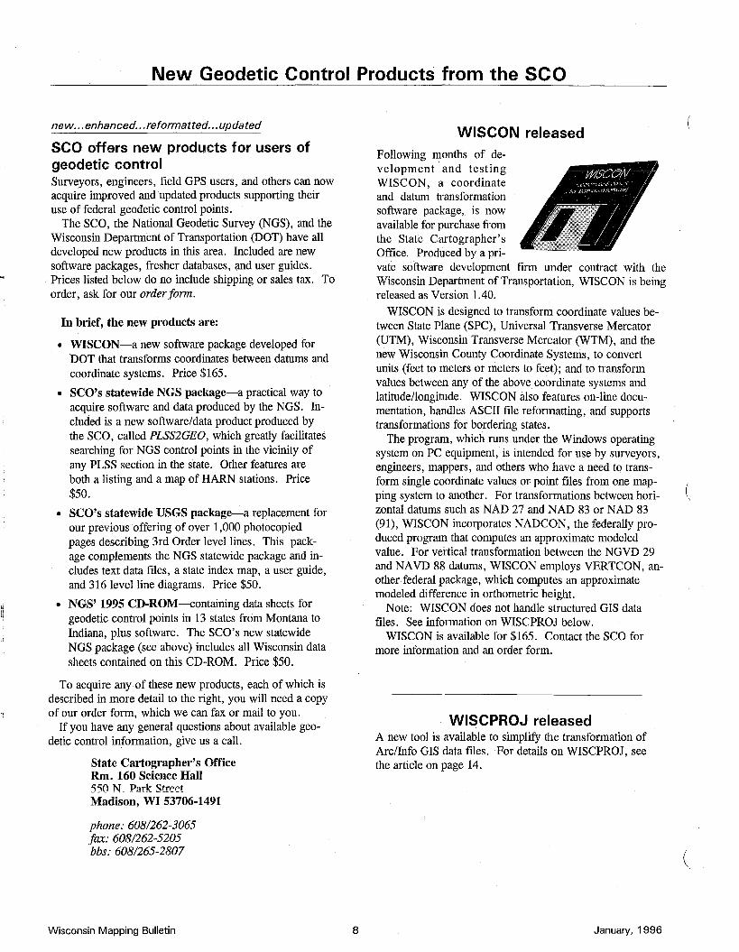
WISCON releasedFollowing months of development .and testingWISCON, a coordinatearid datum transformationsoftware package, is nowavailable for purchase fromthe State Cartographer'sOffice. Produced by a private software development firm under contract with theWisconsin Department of Transportation, WISCON is beingreleased as Version 1.40.
WISCON is designed to transform coordinate values between State Plane (SPC), Universal Transverse Mercator(UTM), Wisconsin Transverse Mercator (WTM), and thenew Wisconsin County Coordinate Systems, to convertunits (feet to meters or meters to feet); and to transformvalues between any of the above coordinate systems andlatitude/longitude. WISCON also features on-line documentation, handles ASCII me reformatting, and supportstransformations for bordering states.
The program, which runs under the Windows operatingsystem on PC equipment, is intended for use by surveyors,engineers, mappers, and others who have a need to transform single coordinate values or point files from one mapping system to another. For transformations between horizontal datums such as NAD 27 and NAD 83 or NAD 83(91), WISCON incorporates NADCON, the federally produced program that computes an approximate modeledvalue. For vertical transformation between the NGVD 29and NAVD 88 datums, WISCON employs VERTCON, another federal package, which computes an approximatemodeled difference in orthometric height.
Note: WISCON does not handle structured GIS datameso See information on WISCPROJ below.
WISCON is available for $165. Contact the SCO formore information and an order form.
WISCPROJ releasedA new tool is available to simplify the transformation ofArc/Info GIS data meso For details on WISCPROJ, seethe article on page 14.
January, 1996
(
New Geodetic Control Products from the SeQ
(
(
USGS/SCO 3rd order vertical geodeticcontrol data files
[and retrieval tools for Wisconsin]
Information on U.S. Geological Survey (USGS)3rd Order vertical controlstations statewide is nowavailable in digital formfrom the State Cartographer's Office. Packagedin a single user's guide,USGS control station information is now stored
on two 3.5 II PC diskettes in standard ASCII text computerfiles. The user's guide also contains a quadrangle indexmap and set of level-line diagrams as an aid in accessingthe files. The diskettes contain only USGS data files.These files can be searched, sorted or otherwise manipulated with common text editor or word processor programs.
The 3rd Order Vertical Control Packageincludes:
• 79 pages of 3rd Order level-line diagrams, four to a page, in alphabeticalorder by IS-minute quad map name.
• Topographic Maps Index showingthe 7.5' & 15' USGS topographicquadrangle name and coverage.
• two 3.5" DOS-compatible diskettescontaining ASCII text computer files.
• installation and access instructions.
This package costs $50. Contact the SCO for details orfor an order form.
NGS/SCO geodetic control data sheets[and retrieval software for Wisconsin]
Software (for DOS)• DSX [extracts control station information ofa given
type, accuracy, area, or number]
• DSSELECT [generates customized listings]
• DSPLOT [displays selecteddata graphically]
• PLSS2GEO ("PLSS-to-GEOgraphic) [to produce anapprox. centroid (in latitude & longitude) for any PLSSsection in the state].
Data files• Structured text II data sheets", grouped by county, de
scribing all Wisconsin geodetic control stations in theNational Spatial Reference System (NSRS) database,maintained by NGS [we extracted thesedata sheetsfrom the most recentNGS CD-ROM]
• A listing ofWisconsin High Accuracy Reference Network (HARN) stations
• A statewide HARN location map
• note: the database includes horizontal control stations[Order A, B and 1st through 4th], and vertical controlstations [Ist and 2nd Order]. A data sheet includes information on theposition, location, physical setting,and historyfor a particularcontrolpoint.
The price for this package is $50. Contact the SCO for details or for an order form.
NGS 1995 geodetic control data sheets on CD-ROM for North Central u.s.Geodetic control station information maintained by the National Geodetic Survey (NGS) is available on CDROM. The North Central U.S. CD-ROM includes data sheets for all National Spatial Reference System(NSRS) geodetic control stations in 13 states: Illinois, Indiana, Iowa, Kansas, Michigan, Minnesota, Missouri, Montana, Nebraska, North Dakota, South Dakota, Wisconsin, and Wyoming. The data sheets included on the current CD were extracted from the NGS database in October 1995.
The NGS CD-ROM includes the following: Master index files for all points contained on the CD;text files explaining data sheet items and county FIPS codes; calibration base line data; the program DSX forextracting control station information of a given type and/or accuracy within a specified radius or rectangulararea, or by station name or station identifier (PID); the program DSSELECT, for generating customized datalistings from data sheet files, (especially helpful for managing geodetic data, building databases, or developing GIS applications), and DSPLOT, to graphically display the extracted data on screen. This disc sells for$50. Contact the SCO for details or an order form.
January, 1996 9 Wisconsin Mapping Bulletin
Electronic Connections to the SCQChange your address listings fff
WISClINC, SCQ home pages are movingby HughPhillipsWe have moved the homepages for both WISCLINC and theSCO. Their new addresses are listed below.
TheSCO home page is nowhttp://feature.geogra-phy.wise. edu/seo/seo.html,and the WISCLINC homepage is nowhttp://badger.state.wi.us/agencies/wlib/seo/pages/wiscline.html.
These changes result fromthe fact that the computer we used for our clearinghouse development work is no longer available. Further, we arehappy to have found cooperators willing to share the burden of maintaining a web site.
As background, we were fortunate the Minneapolis office of Environmental Systems Research Institute (ESRI)loaned us a Sun workstation for a year. This computer,which was invaluable for prototyping the WAIS and Webservers as part of the Wisconsin Land Information Clearinghouse Initiative, is now going back to ESRI.
That computer was critical to our success in providing anin-house demonstration platform for the Clearinghouse, fortesting metadata entry tools, for providing ftp capabilitiesfor cooperators to obtain metadata templates and uploadmetadata, and for providing a superb tool to investigateGIS and metadata activities through the Internet.
Our own SCO Web pages were also housed on the ESRImachine. Now, the clearinghouse page is based on a computer managed by the Wis. Dept. of Administration, an arrangement facilitated by the Wisconsin Land InformationBoard. The SCO page is now relocated to a computer operated by the UW-Madison Geography Department.
SCQ staff changesby Bob GurdaWith the end of 1995 came graduations of two SCO student employees. Monique Melum was with us for twoyears, and Rob Lawrence for almost that long. Eachearned a Bachelor's degree in Cartography.
Both of these students worked on a wide variety of projects while here. Monique's most recent efforts focused onour new USGS vertical geodetic control information package, and GIS viewing developments. Rob recently finished writing the software program "PLSS2GEO" which ispart of our new NGS control information package.
We have hired two new undergraduate students, A. J.Wortley and Jason Laux. After completing their initialwork on a digitizing project with Reese Hirth, they will begin branching out into other areas.
Wisconsin Mapping Bulletin 10
More "conferences" now available
SurveyNet back online through the SCQby Jim Jordan
Recent callers. to our BBS may have been wondering aboutthe lack of activity during the past month or so arisingfrom our connection to SurveyNet. We are happy to report that this valuable service is available once again.
This feature of the SCO BBS allows you to send or simply observe message traffic amongst surveyors on a rangeof topics. People from allover the country participate anduseful information is passed from one person to another.
Since the operation of SurveyNet changed hands in October (see October 1995 issue), our system has experiencedproblems in executing its daily link with the replacementsite, due in part to changes made to the list of conferencesavailable and to how our software was written.
We now have our link with SurveyNet reestablished andencourage you to check out the revised selection of topics.We have added an additional four SurveyNet conferencesto the 18 that were previously available, and continue tomaintain the 12 "local" SCO message areas.
SurveyNet offers an important venue for the discussionof current surveying and mapping topics from a widevariety of individuals and perspectives. Several bulletin boardsystems from around the country participate in this"echomail" network, and joining the discussion is as easyas making a call to the SCO BBS.
From our Main Menu, go to the Messages and Conferences area. Once there, select (A)rea and you will see thelocal and echoed conferences that we maintain. Messageareas with an asterisk contain at least one message that youhave not read.
Randy Orvis, of Farmington, NH, is now running SurveyNet from his BBS "Totalstation" (603/859-2361; settings 28.8k, N-8-1, 24hrs, for anyone wanting to connectdirectly to his BBS). He has been busy streamlining the operation of SurveyNet and would be happy to hear from pastand present users.
Leave a message on SCO BBS or contact our office at608/262-3065 if you'd like additional information aboutSurveyNet.
BBS statisticsHere are some BBS statistics for your consideration (all ofthese continue to grow)
• Number of registered users: 654 (337 of the 654 totalregistered users have access to the Internet. Of the remaining 317 users who currently don't have access tothe Internet, 240 hope to have access soon).
• Total number of calls to date: 3567
• Most popular file: files.zip
• Other popular files: list.zip, pspro200.zip,vmapl20.zip
• Total files on BBS: 270
January, 1996
(
(
(
Questions & Answers
(
(
Does the Public Land Survey System'stier numbering scheme in Wisconsinmesh with Minnesota's?
The answer to your question depends which part of the Wisconsin-Minnesota border you're talking about.
From the southern border of Wisconsin north to the junctionof the St. Croix and Mississippi Rivers, the two numberingschemes don't have any direct relationship on the ground,even though they are based on the same model of a baselineand a principal meridian. Wisconsin and most of Minnesotause different base lines and different principal meridians, fromwhich the township or tier number was figured at the time theoriginal land surveyors did their work. As the surveyorsmeasured and marked off each township going north from thebaseline, they incremented thetier number by one.
Wisconsin's base line is at the southern edge of the state,while the one used in southern and western Minnesota is in Arkansas. As a result, Iowa's tier numbers are simply continuednorthward into Minnesota. The effect of this difference is thatat comparable latitudes a township in southeastern Minnesotahas a much higher tier number than a township to its east inWisconsin.
For instance, along the Mississippi River in Wisconsin, opposite the Minnesota-Iowa border, you are part way into Township 12 North, Range8 West (in section 21, more precisely).Across the river is the south edge of Township 101 North,Range 3 West in Minnesota, and the north edge of Township100 North, Range 3 West in Iowa.
Going north from the St. Croix-Mississippi junction, the PLSSin Wisconsin and Minnesota are linked. The pattern begun insouthern Wisconsin extends westward across the St. CroixRiver into Minnesota, and covers the east central and northeastern parts of that state.
The tier numbering in both Illinois and Michigan are also independent of Wisconsin's.
These factors can create some fairly confusing situations formapping and map reading along state boundaries. A particular challenge is the Mississippi River corridor, where islandshave changed shape over the last 150 years and dams have altered the water levels. Our state boundary is not always easyto delineate today (and in some cases it never was), and thechannel(s) of the river mayhave moved over the years.
Nevertheless, the Public Land Survey persists for legal purposes as itwas originally laid out, despite difficulties in depicting it on maps. In fact, an intent of the original survey wasthe written description of land parcels, and those descriptionsrefer to the appropriate principal meridian. On the otherhand, when the USGS later made topographic maps over Wisconsin it did not include any reference to a principal meridianas part of its depiction of the PLSS.
January, 1996 11
I need a map showing the tracts (and blockswithin tracts) used for the 1990 Census. Ineed this for several areas in my vicinity. Iknow the Census was managed with computer maps, but can I get paper copies?
The maps you're interested in are readily available from an office in Madison: the Wisconsin Integrated Legislative Information Systems (WILlS).
There are about 1800 such maps for Wisconsin. The numberof sheets per county varies, in several cases more than forty.There is also an index sheet for each county. Each sheet is 36inches wide by at least 36 inches long.
WILlS charges $3.25 per sheet (no quantity discount) plus afixed shipping charge of $3.00. You can order by telephone.Be prepared with a description of the area(s) you are interestedin, since the maps you need may easily be identified over thephone.
The copies you order will be mailed with an invoice.
Contact WILlS, which is located at 17 S. Fairchild Street inMadison, by calling Lori at 608/264-8582.
1:1 How can I acquire copies ofDEMs produced.. by the USGS from their 1:24,000-scale topo
graphic map series?
More and more Digital Elevation Model computer files are becoming available for Wisconsin. Much of the productionwork is in areas where digital orthophotos are being produced,since the DEMs are needed to differentially rectify aerial photographs. Call us at the SCO if you want to know about availability for a particular area. There are some alternative products, also.
Like any other federally produced information, the USGSDEMs are in the public domain, so they cannot be copyrightand anyone can freely make copies.
Completed DEMs are archived at the EROS Data Center inSioux Falls, South Dakota. You can order them from that facility. They charge a modest fee to cover costs of reproduction. Contact 605/594-6151.
At least one private firm collects and redistributes DEMs produced by the federal government, and promises faster deliveryat competitive prices. Contact Micropath Corporation at303/526-5454.
Editor's Note: Ifyou have a question, or had a questionfor which you found an answer that might be bf interestto others, please let us know.
Wisconsin Mapping Bulletin
Events
Will "weather" the elements
WliA to Convenein Oshkoshby Ted KochThe Oshkosh Hilton andConvention Center is thesite of the 9th annual conference of the Wisconsin LandInformation Association(WLIA). Scheduled to run
from March 5-8, this gathering of a wide range of profes~ionals working with land related information applications,IS expected to draw more than 500 participants and 35 exhibitors.
The conference theme this year is "Weathering the Elements-A forecast for Land Records". Following a format begun last year in Middleton, a series of half-day preconference workshops will be held on Tuesday, March 5.Workshops include a session on digitalorthophotography,"blue booking" county geodetic network data, a review ofthe newly proposed federal geopositioning standard, andan introduction to land records modernization.
The conference itself will open on Wednesday morning,March 6, with a Land Records Forum. The purpose of theforum is to initiate discussions on policy issue alternatives .for the state's land information program. Issues identifiedin this session will be further evaluated during a Forum/Town Meeting session to be held on Friday morning,March 8.
The Wednesday morning forum will be followed by aluncheon featuring keynote speaker, Richard Vam. Varn,Director of Communications at Northern Iowa University,previously served for 12 years in the Iowa legislaturewhere he held the position of Majority Whip and chairedthe Communication and Information Policy Committee.
Vam has also served on a number of national information technology task forces and panels, and is consideredto be one of the nation's leading policy makers and speakers on issues related to information technology and its impact on government and society.
General sessions featuring tracks on program management, orthophotography, new technologies and local experiences, will run Wednesday afternoon and all day Thursday. Business exhibitors will sponsor the conference'sopening reception on Wednesday evening.
The conference will conclude on Friday morning with"Breakfast with the Land Information Board", the previously mentioned Member Forum/Town Meeting, and theannual member business meeting.
For details, contact WLIA at 800/344-0421.
Wisconsin Mapping Bulletin 12
Expands correspondence offerings
EPD offers more surveying coursesThe University of Wisconsin-Madison's Engineering Professional Development (EPD) program has added twomore surveying courses to its catalog. With continuing assistance from retired professor Paul Wolf, EPD now hasSurveying 2 and Advanced Surveying.
Both courses use a textbook and written assignments,and the advanced course includes exercises requiring amodest personal computer.
For details, telephone Judy Faber at 608/262-1735' orfax to 608/263-3160 or 608/265-2293. '
(source: EPD)
Satellite broadcast from Madison
2nd national seminar set for AprilAre you trying to tackle LIS issues such as data standardsand maintenance, geographic reference systems, and streetaddressing? Help is on the way via another nation-wideseminar presented by the University ofWisconsin-Madison.
On April 11, the university's Land Information and Computer Graphics Facility will present "Land Information Systems for Local Government: Issues and Interfaces". Theseminar will be broadcast via satellite uplink from 12:30 to5:00 pm CST.
The program takes up where earlier work left off. Thefirst hour provides a primer for local elected and appointedofficials who oversee GIS/LIS programs. Live discussionwill be augmented with video clips of activities around Wisconsin in various settings. Fax and phone questions willbe accepted from the audience during the seminar.
This seminar is appropriate for anyone involved in theimplementation of GIS/LIS in a local government. Thosewho should attend include land use and land records professionals, elected and appointed officials, utilities and facilities managers, and directors of information management.
The uplink is sponsored by UW-Extension, AM/FM International, URISA, and NCRI. In Wisconsin, contactyour County Extension office for details. In other states,contact chapter headquarters of AM/FM International orURISA. For further information on sites or becoming asite, contact the UW CALS Conference Office by phone at(608) 263-1672 or by fax at (608) 262-5088.
(source: LICGF)
January, 1996
(
Selected* Conferences, Technical Meetings, and Classes
(
(
February 20-22. Nebraska GIS Symposium will be held at the Cornhusker Hotel in Lincoln, NE. Contact: Bernice Goemann at 402/4728197.
February 20-23. Michigan Society of Professional Surveyors, 55thAnnual Meeting will be held in Lansing, MI. Contact: Roland f.Self, 517-484-2413.
February 21-24. Illinois Professional Land Surveyors AssociationAnnual Conference will be held in Springfield, IL. Contact: RobertE. Church at 217-498-8102; fax 217-498-8489.
February 28 - March 1. Minnesota Society of Professional Surveyors 44th Annual Meeting will be held in St. Louis Park, MN. Contact: Sharon Harris at 612-890-6991.
February 29 - March 1. Second Annual California GIS Conferencewill be held at the Golden Gateway Holiday Inn, San Francisco, CA.Contact: Mark Safran at 510/638-6122.
March 5-8. Wisconsin Land Infonnation Association's Annual Conference will beheld at the Oshkosh Hilton & Convention Center inOshkosh, WI. Contact: WLIA at 800/344-0421.
March 18-21. Tenth Annual GIS Conference will be held in Vancouver, British Columbia, Canada. Contact: Beverly Williams, GISWorld, Inc. at 970-223-4848; fax 970/223-5700.
March 25-28. AM/FM International Annual Conference XIX willbe held at the Washington State Convention Center, Seattle, WA.Contact: Cindy Achten, AM/FM International, Aurora, CO, 303/3370513; fax 303/337-4001.
March 25-29. The 26th International Symposium On Remote Sensing of Environment & The 18th Annual Symposium of the Canadian Remote Sensing Society will jointly be held at the Hotel Vancouver, Vancouver, British Columbia, Canada.
April 9-14. 92nd AAG Annual Conference will be held in Charlotte,NC. Contact: Association of American Geographers at 202/234-1450;fax 2021234-2744.
April 11. live satellite conference on Land Infonnation Sytems forLocal Government: Issues and Interfaces will be held. Contact:Ben Niemann or Celeste Kirk at the UW-Madison, Land Information& Computer Graphics Facility at 608/263-5534; fax 608/262-2500.
April 16-17. WAUG Spring Conference will be held at the ValleyInn, Neenah, WI. Contact: George GIocka at 414/781-1000, fax:414/781-8466.
April 20-26. ASPRS/ACSM Annual Convention and Exhibitionwill be held at the Baltimore Convention Center, Baltimore, MD.Contact: American Congress on Surveying and Mapping, 5410 Grosvenor Lane, Suite 100, Bethesda,MD 20814,3011493-0200, fax301/493-8245.
April 28-May 1. Mid-America GIS Symposium will be held at theHyatt Regency Hotel at Crown Center, KansasCity, MO. Contact:URISA at 202/289-1685, fax: 202/842-1850.
May 20-24. ESRI 16th Annual User Conference will be held at theWyndham Hotel and Palm Springs Convention Center, Palm Springs,CA. Contact: ESRI at 909/793-2853, fax: 909/793-5953.
May 21-23. Second International Symposium on Spatial AccuracyAssessment in Natural Resources and Environmental Sciences willbe held in Fort Collins, CO. Contact: H. Todd Mowrer at 970/4981100, fax: 970/498-1010.
May 28-31. Fifth Annual Business Geographics Conference and Exposition will be held in Chicago, IL. Contact: Conference Dept. at970/223-4848, fax: 970-223-5700.
January, 1996 13
June 6-7. Wisconsin Land Information Association Quarterly Meeting will be held at the Point Hotel in Minocqua, WI. Contact: WLIAat 800/344-0421.
June 18-20. The Institute of Navigation - 52nd Annual Meeting willbe held at the Royal Sonesta Hotel in Cambridge, MA. Contact Dr.Alison Brown, General Chair at 719/481-4877, fax: 719/481-4908.
June 22-28. 6th International GPS/GIS Conference will be held inBillings, MT and Yellowstone National Park. Contact: GeoResearchat 3011320-0911; fax 3011320-0922.
July 9-27. 18th Congress of the International Society for Photogrannnetry and Remote Sensing will be held in Vienna, Austria.Contact: Peter Waldhaeusl, fax: 43 1 505-5268.
July 27-August 1. URISA Annual Conference will be held at the SaltPalace Convention Center, Salt Lake City, UT. Contact: URISA at202/289-1685, fax: 202/842-1850.
September 5-6. Wisconsin Land Information Association QuarterlyMeeting will be held at the Country Inn Suites in Hayward, WI. Contact: WLIA at 800/344-0421.
September 17-20. Institute of Navigation (ION) GPS '96 Conference will be held at the Kansas City Convention Center. Contact: Dr.PeninaAxelrad, Program Chair at 303-492-6872; fax 303-492-2825.
September 22-26. 32nd Annual Conference & Symposium: "GISand Water Resources" will be held in Fort Lauderdale, FL. Contact: American Water Resources Association at 703/904-1228.
October 2-4. Trimble '96 Surveying & Maping Users Conference& Exposition will be held at the San Jose Convention Center. Contact: 408-481-8465; fax 408-481-8488.
November 16-22. ACSM/ASPRS Fall Meeting and GIS/LIS '96will be held at the Denver Convention Center, Denver, CO. Contact:GIS/LIS at 3011493-0200; fax 301/493-8245.
December 5-6. Wisconsin Land Information Association QuarterlyMeeting will be held in Southwestern Wisconsin. Contact: WLIA at800/344-0421.
1997March 4~7. Wisconsin Land Information Association's AnnualConference will be held at the Grand Geneva Conference Center inLake Geneva, WI. Contact: WLIA at 800/344-0421.
March 25-28. AM/FM Annual Conference will be held in Nashville,TN.
April 1-5. AAG Annual Conference will be held in Ft. Worth, TX.
July 20-24. URISA Annual Conference will be held in Toronto, Canada.
October 16-22. GIS/US Annual Conference will be held in Cincinnati,OH.
Wisconsin Mapping Bulletin
Publications and Products
Planning begins for additional themes
WISCLANO products begin to appearby Bob Gurda
As we go to print, some GIS data products developedthrough cooperative work under WISCLAND are becoming available. In addition, partners in WISCLAND are laying plans to coordinate work on additional themes of thestate's landscape.
WISCLAND is an acronym for The Wisconsin Initiativefor Statewide Cooperation on Landscape ANalysis andData. Numerous organizations are joining together to develop needed GIS databases and analysis techniques.
Land cover mapping leads offLand cover interpretation, statewide, was the initial reasonfor forming WISCLAND. The products from this cooperatively funded activity will be released over the next year ortwo. The first areas available are for the far northwesternpart of out state.
To view color plots of the first land cover maps, attendthe WLIA Conference in early March (see page 14). Atthat time we will provide specific information on the characteristics of the digital files already available as a standardproduct. We will also present a projected timetable forcompletion of the remaining areas e ,
Most wetland map conversion finishedAs a prelude to the land cover mapping, WISCLANDhelped fund the conversion of the Wis. DNR's wetlandmaps to digital form. This process is almost completestatewide, with 64 counties available. The eight countiesremaining include five where remapping is in progress(Marathon, Adams, Juneau, Monroe and La Crosse), andthree which are in the digitizing phase (Wood, Waupaca,and Outagamie). Contact Calvin Lawrence at 608/2660756 for details.
Other theme areas moving forwardStatewide hydrography and Digital Raster Graphics aretwo aspects of WISCLAND that are making rapid strides,although the recent shut-down of the federal governmenthas caused some delays.
WLiA presentationThere will be a WISCLAND session at the WLIA Conference in early March in Oshkosh (see page 12 for details).This session will be held from 1:30 - 3:00 pm on Wed.,March 6. We will be showcasing the latest products andexplaining opportunities for expanding cooperative activilies to develop more landscape data.
Wisconsin Mapping Bulletin 14
Fifteen experts collaborate
Engineer's guide to GPS forthcomingA new publication on use of the Global Positioning System(GPS) will be available soon. Designed for engineers, Understanding GPS:' Principles andApplications will be~bout 570 pages including 203 illustrations and 613 equauons.. This guide is authored by 15 experts and edited by El
liott Kaplan of the Mitre Corporation. It covers details ofthe satellite signals and their reception, performance of different types of receivers and methods, integration of GPSwith other sensors, and the various satellite systems including GLONASS and INMARSAT.
The publisher, Artech House, Inc., indicates that thisguide should be available in March for $95.00 with a prepublication discounted price of $81.00 (before February29). For details, contact Artech at 800/225-9977, Ext.4002.
(source: Artech)
New county plat booksThe following 1995 Wisconsin County Land Atlas and PlatBooks are now available, for $25 plus tax and shipping:
Columbia, Oneida, Polk, Sauk, and Vilas Counties. Forordering details, contact: Rockford Map Publishers, Inc.,P.O. Box 6126, Rockford, IL 61125, phone (orders only)800/321-1MAP; for customer service information, call815/399-4614.
Transforms Arc/Info coverages
DOT completes "WISCPROJ"A new software tool is now available to simplify performing tranformations of Arc/Info coverages. Developed byLee Samson at the Wisconsin Department of Transportation, the free AML "WISCPROJ" is available for download from the both the SCO's BBS and our WWW site (seepage 15 for contact information).
Built with a customized interface, this software simplifies the process of converting Arc/Info GIS data (a "coverage") from one coordinate system or datum to another.WISCPROJ will also handle text files. It accommodatestraditional coordinate systems and the new WisconsinCounty Coordinate System as well as NAD 27, NAD 83(1986) and NAD 83 (1991), and can produce projectionfiles as another form of output.
WISCPROJ operates under UNIX Arc/Info softwareversion 7.02 and higher, and has been tested only on 'HP/UX 9.01.
January, 1996
(
(
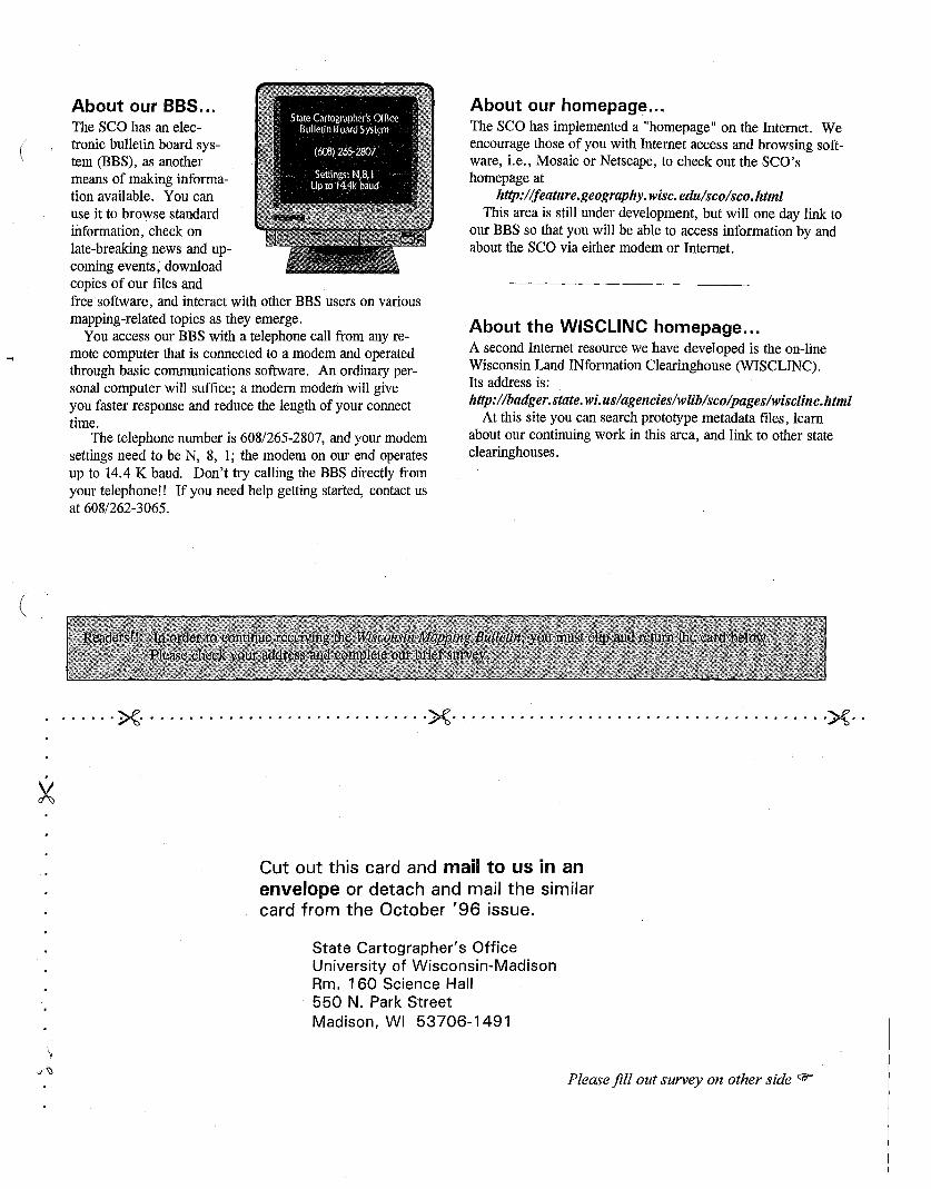
About our BBS...The scahas an electronic bulletin board system (BBS), as anothermeans of making information available. You canuse it to browse standardinformation, check onlate-breaking news and upcoming events, downloadcopies of our files andfree software, and interact with other BBS users on variousmapping-related topics as they emerge.
You access our BBS with a telephone call from any remote computer that is connected to a modem and operatedthrough basic communications software. An ordinary personal computer will suffice; a modern modem will giveyou faster response and reduce the length of your connecttime.
The telephone number is 608/265-2807, and your modemsettings need to be N, 8, 1; the modem on our end operatesup to 14.4 K baud. Don't try calling the BBS directly fromyour telephone!! If you need help getting started, contact usat 608/262-3065.
About our homepage...The SCQ has implemented a "homepage" on the Internet. Weencourage those of you with Internet access and browsing software, i.e., Mosaic or Netscape, to check out the SCQ'shomepage at
http://feature.geography. wise. edu/seo/seo.htmlThis area is still under development, but will one day link to
our BBS so that you will be able to access information by andabout the SCQ via either modem or Internet.
About the WISCLINC homepage...A second Internet resource we have developed is the on-lineWisconsin Land INformation Clearinghouse (WISCLINC).Its address is:http://badger.state.wi.us/agencies/wlib/seo/pages/wiseline.html
At this site you can search prototype metadata files, learnabout our continuing work in this area, and link to other stateclearinghouses.
(
······x······························x·······································X··
Cut out this card and mail to us in anenvelope or detach and mail the similarcard from the October '96 issue.
State Cartographer's OfficeUniversity of Wisconsin-MadisonRm. 160 Science Hall550 N. Park StreetMadison, WI 53706-1491
Please fill out survey on other side rJfr
About the seQ...The State Cartographer's Qffice (SCQ), established in 1973,is a unit of the University of Wisconsin-Madison. The SCQis located on the 1st Floor of Science Hall.
Our permanent staff consists of five people-Ted Koch,State Cartographer (608/262-6852), Bob Gurda, AssistantState Cartographer (608/262-6850), Hugh Phillips, Information Processing Consultant (608/262-8776), BrendaHemstead, Administrative Assistant (608/262-3065), and LizKrug, Program Assistant (608/262-3065), plus several parttime graduate and undergraduate students.
The State Cartographer's position and mission is describedin Wis. Statute 36.25 (l2m). In addressing this role, theSCQ functions in a number of ways:
• publishes the Wisconsin Mapping Bulletin, catalogs,guides, brochures, and other documents to inform
. the mapping community.
• inventories mapping practices, methods, accomplishments, experience, and expertise, and further acts asa clearinghouse by providing information and advicein support of sound mapping practices and map use.
• participates on committees, task forces, boards, etc.The State Cartographer is one of the 13 voting members of the Wisconsin Land Information Board.
• develops experimental and prototype products.
• serves as the state's affiliate for cartographic information in the U.S. Geological Survey's Earth Science Information Center (ESIC) network.
State Cartographer's OfficeUniv. of Wisconsin-MadisonRm. 160 Science Hall550N. ParkStreetMadison, W153706-1491
ADDRESS CORRECTION REQUESTED
Nonprofit OrganizationU,S.POSTAGE
PAIDMadison, Wisconsin
Permit No. 6B8
X··············,I.,I···················X····,II' ,II ••• ,IIII ••• ,'~II ••
Please keep me on your mailing list for the WMB. CJ YES CJ NOTo help us know yourinterests, please complete the four questions below
1. Indicate your level of interest in the following topicalcategories of the Mapping Bulletin content.
(none) low medium high0 0 0 0 Wis. Land Info. Program News0 0 0 0 Mapping & GIS Project Reports0 0 0 0 Commentaries & Guest Columns0 0 0 0 Questions & Answers0 0 0 0 Bulletin Board System0 0 0 0 Internet Resources0 0 0 0 Aerial PhotographyU U U 0 Remote Sensing0 0 0 0 Geodetic Control0 0 0 0 People & Organization News0 0 0 0 New Products & Publications0 0 0 0 Event Reports & Previews0 0 0 0 Events & Conference Calendar0 0 0 0 Other:
2. Do you use theseo's electronicBulletin BoardService?
[J Yes[J No
3. The SeQ now has anInternet home pege.Do you have accessto the Internet?
[J Yes, at work[J Yes, at home
[J No
4. We must have astreet address. Ifnot shown on yourlabel. please IncludeIt on the line below: