wms benchmarking - foss4g2010.foss4g.org/presentations/benchmarking2010.pdf · open source...
TRANSCRIPT
Open Source Geospatial FoundationOpen Source Geospatial Foundation 11
Cadcorp GeognoSIS, Contellation-SDI,ERDAS APOLLO, GeoServer, Mapnik, MapServer, Oracle MapViewer, QGIS MapServer
WMS Benchmarking
Open Source Geospatial FoundationOpen Source Geospatial Foundation 22
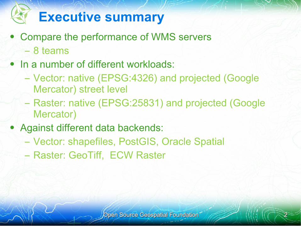
Executive summary
• Compare the performance of WMS servers
– 8 teams• In a number of different workloads:
– Vector: native (EPSG:4326) and projected (Google Mercator) street level
– Raster: native (EPSG:25831) and projected (Google Mercator)
• Against different data backends:
– Vector: shapefiles, PostGIS, Oracle Spatial
– Raster: GeoTiff, ECW Raster
Open Source Geospatial FoundationOpen Source Geospatial Foundation 33
Benchmarking History
• 4th FOSS4G benchmarking exercise. Past exercises included:
– FOSS4G 2007: Refractions Research run and published the first comparison with the help of GeoServer and MapServer developers. Focus on big shapefiles, postgis, minimal styling
– FOSS4G 2008: OpenGeo run and published the second comparison with some review from the MapServer developers. Focus on simple thematic mapping, raster data access, WFS and tile caching
– FOSS4G 2009: MapServer and GeoServer teams in a cooperative benchmarking exercise
• Friendly competition: goal is to improve all software
Open Source Geospatial FoundationOpen Source Geospatial Foundation 44
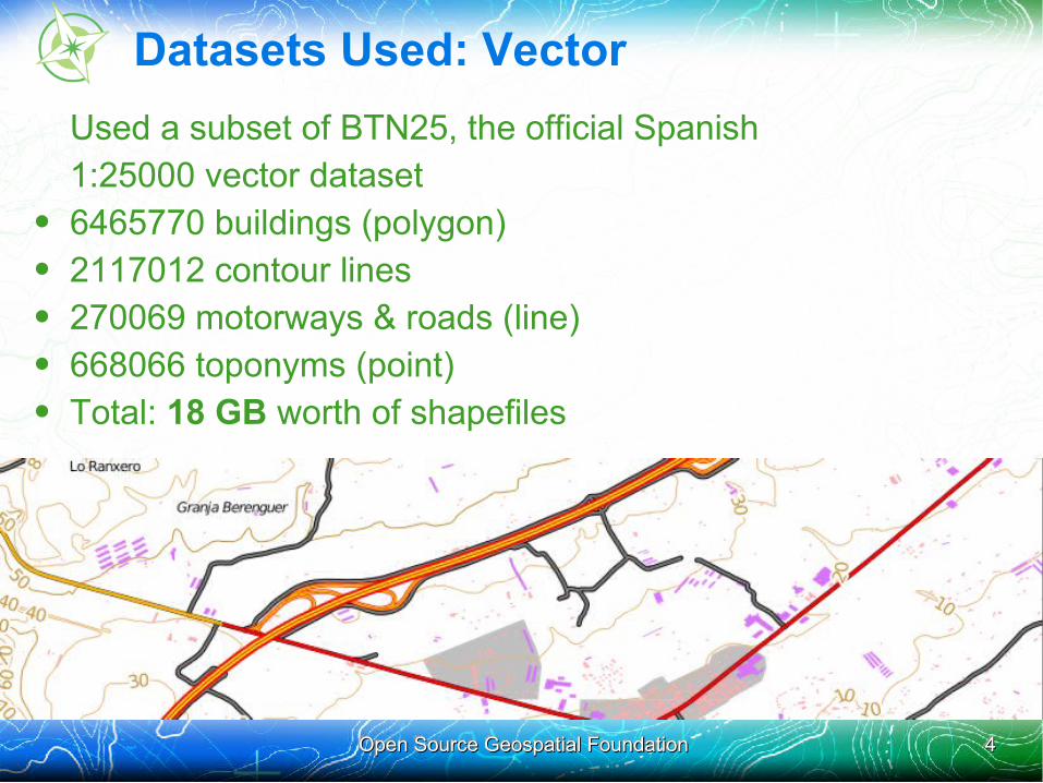
Datasets Used: Vector
Used a subset of BTN25, the official Spanish 1:25000 vector dataset • 6465770 buildings (polygon)• 2117012 contour lines• 270069 motorways & roads (line)• 668066 toponyms (point)• Total: 18 GB worth of shapefiles
Open Source Geospatial FoundationOpen Source Geospatial Foundation 55
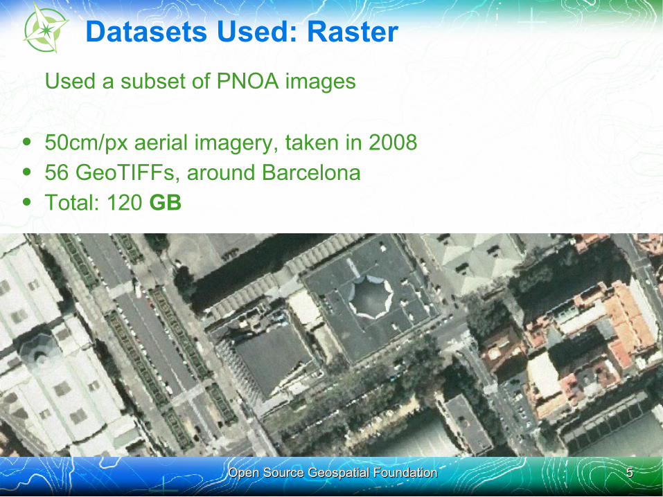
Datasets Used: Raster
Used a subset of PNOA images
• 50cm/px aerial imagery, taken in 2008• 56 GeoTIFFs, around Barcelona• Total: 120 GB
Open Source Geospatial FoundationOpen Source Geospatial Foundation 66
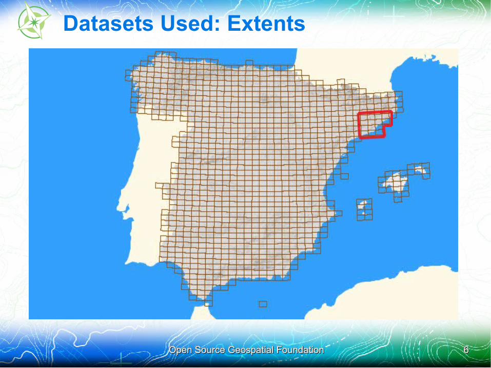
Datasets Used: Extents

Open Source Geospatial FoundationOpen Source Geospatial Foundation 77
Datasets Used: Extents
Canary Islands areover there, butthey are always
left out
Open Source Geospatial FoundationOpen Source Geospatial Foundation 88
Datasets Used: Credits
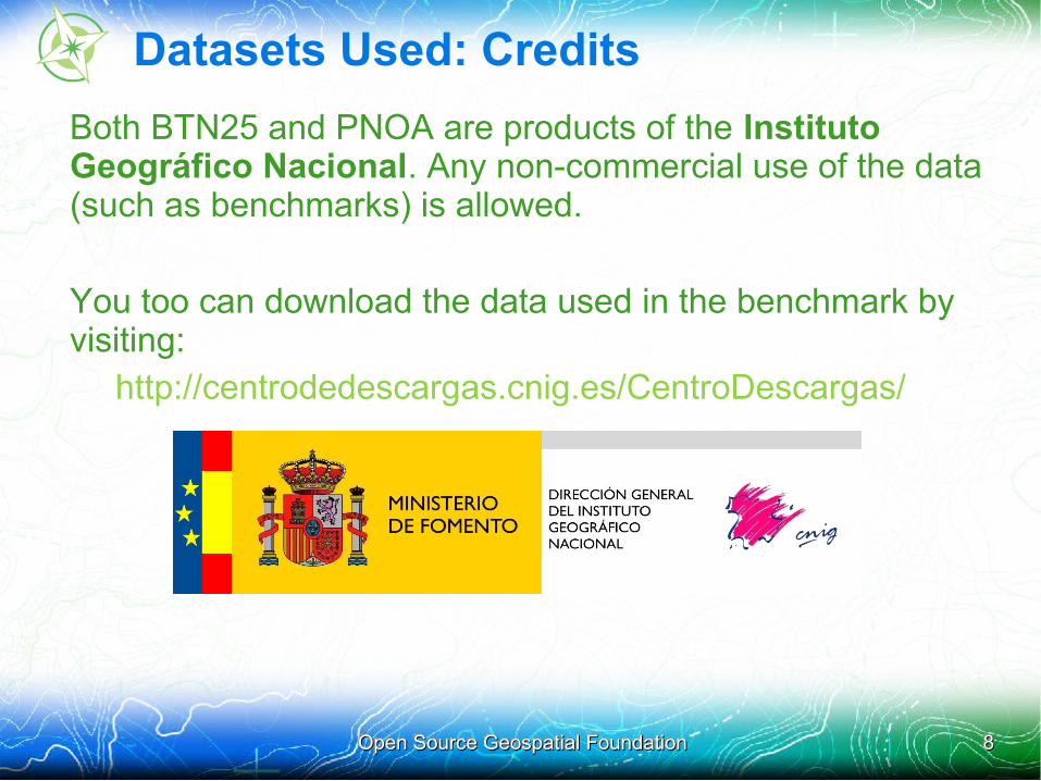
Both BTN25 and PNOA are products of the Instituto Geográfico Nacional. Any non-commercial use of the data (such as benchmarks) is allowed.
You too can download the data used in the benchmark by visiting:
http://centrodedescargas.cnig.es/CentroDescargas/
Open Source Geospatial FoundationOpen Source Geospatial Foundation 99
Datasets Used: Issues
• Real data, real problems
• .shp files bigger than 2 GB
– Contours had to be split in 7 shapefiles
• .dbf files bigger than 2GB
– Problems accessing the attributes of some features
– Caused some servers to not filter features by attribute
• Non-ASCII characters (ó, ñ, ç) not in UTF-8
– Some servers had problems rendering these characters
Open Source Geospatial FoundationOpen Source Geospatial Foundation 1010
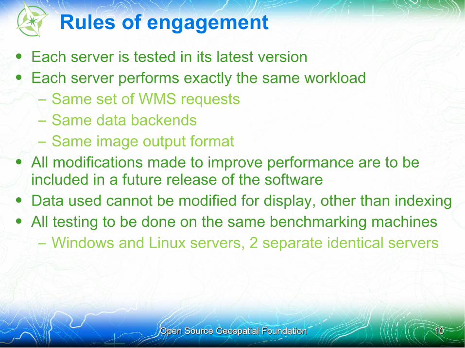
Rules of engagement
• Each server is tested in its latest version • Each server performs exactly the same workload
– Same set of WMS requests
– Same data backends
– Same image output format• All modifications made to improve performance are to be
included in a future release of the software• Data used cannot be modified for display, other than indexing• All testing to be done on the same benchmarking machines
– Windows and Linux servers, 2 separate identical servers
Open Source Geospatial FoundationOpen Source Geospatial Foundation 1111
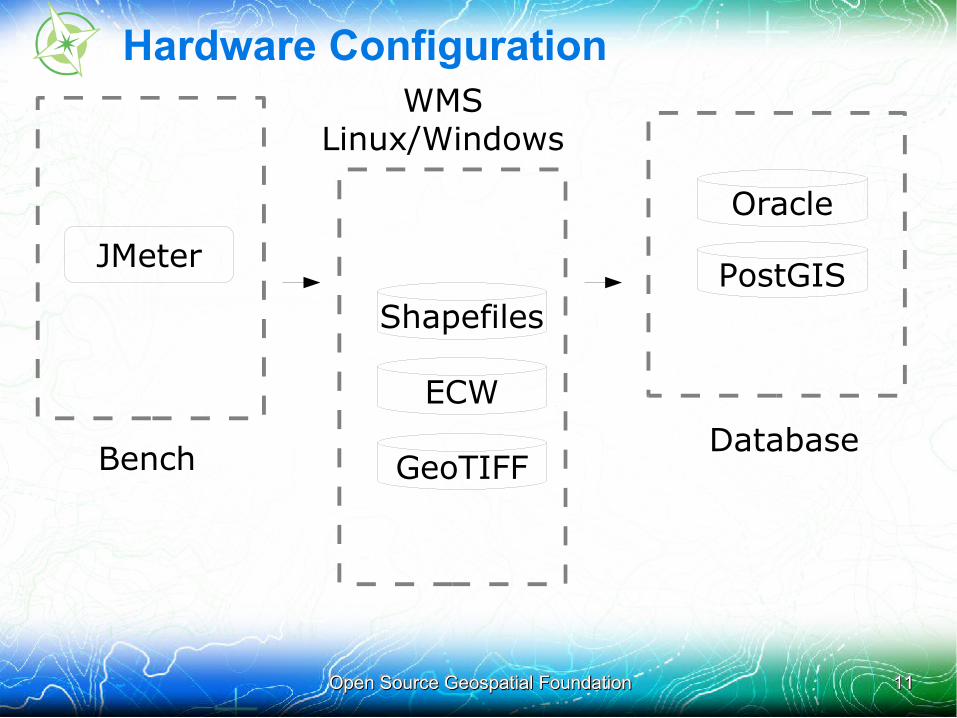
Hardware Configuration
JMeter
Shapefiles
ECW
GeoTIFF
Oracle
PostGIS
Bench
WMS Linux/Windows
Database
Open Source Geospatial FoundationOpen Source Geospatial Foundation 1212
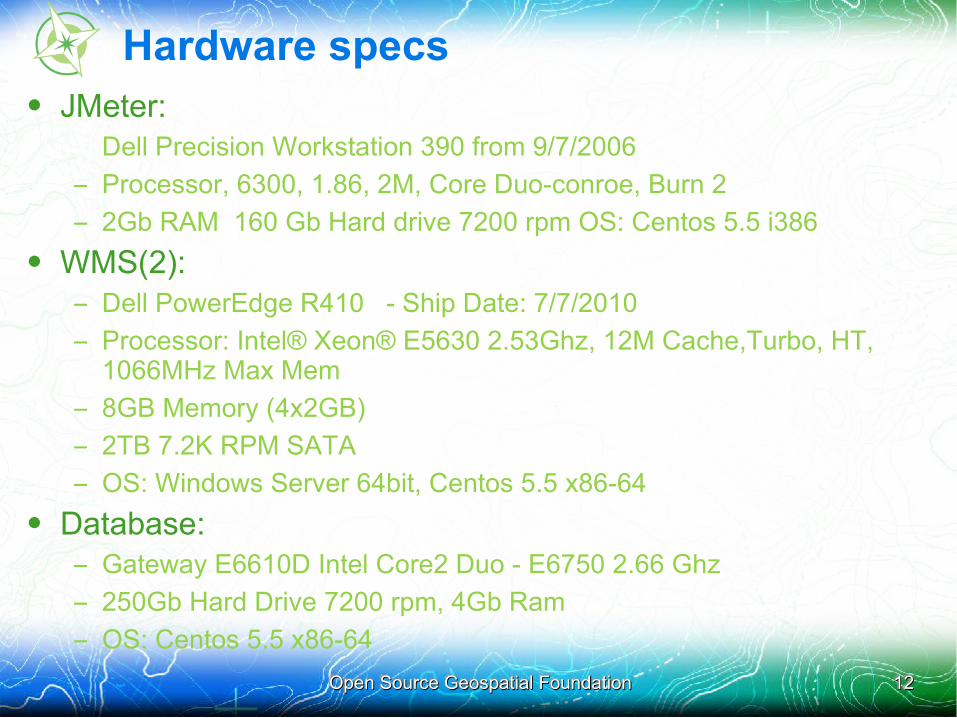
Hardware specs• JMeter:
Dell Precision Workstation 390 from 9/7/2006
– Processor, 6300, 1.86, 2M, Core Duo-conroe, Burn 2
– 2Gb RAM 160 Gb Hard drive 7200 rpm OS: Centos 5.5 i386
• WMS(2):– Dell PowerEdge R410 - Ship Date: 7/7/2010
– Processor: Intel® Xeon® E5630 2.53Ghz, 12M Cache,Turbo, HT, 1066MHz Max Mem
– 8GB Memory (4x2GB)
– 2TB 7.2K RPM SATA
– OS: Windows Server 64bit, Centos 5.5 x86-64
• Database:– Gateway E6610D Intel Core2 Duo - E6750 2.66 Ghz
– 250Gb Hard Drive 7200 rpm, 4Gb Ram
– OS: Centos 5.5 x86-64
Open Source Geospatial FoundationOpen Source Geospatial Foundation 1313
Methodology
• Each test run performs requests with 1, 2, 4, 8, 16, 32 and 64 parallel clients (for a total of 2152 requests)
• Each test uses a random set of requests stored in a CSV file: no two requests in the same run are equal, but all servers perform the same workload
• For each request the random factors are:
– The image size (between 640x480 and 1024x768)
– The geographic envelope (extent)• Each test is run three times in a row, the results of the third run are
used for the comparison: this benchmark assumes full file system caches (“hot” benchmark)
• The other GIS server is shut down while the tests are run
Open Source Geospatial FoundationOpen Source Geospatial Foundation 1414
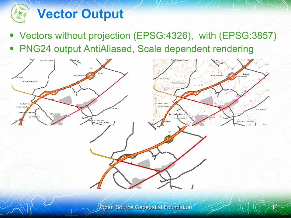
Vector Output
• Vectors without projection (EPSG:4326), with (EPSG:3857)• PNG24 output AntiAliased, Scale dependent rendering
Open Source Geospatial FoundationOpen Source Geospatial Foundation 1515
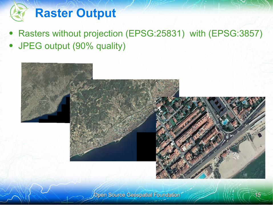
Raster Output
• Rasters without projection (EPSG:25831) with (EPSG:3857)• JPEG output (90% quality)
Open Source Geospatial FoundationOpen Source Geospatial Foundation 1616
Resource consumption notes
• During a benchmark usually a single resource is used to its limits and plays the bottleneck
• Common bottlenecks are the CPU, the disk access, the network access, the remote database access
• Looking at system monitoring on the WMS machines during the benchmark runs, the disk was playing the role of the bottleneck in most tests. For some servers, for some runs, the data became fully cached and performance increased dramatically
Open Source Geospatial FoundationOpen Source Geospatial Foundation 1717
Disk-bound v.s. unbound scenarios
• The initial bottleneck in the benchmark tests was the disk read access
• Some teams managed to turn this disk-bound scenario into a disk-unbound scenario, allowing servers to fully run in memory, with no disc access and putting all load on the CPU
•
• Results observed in the disk-unbound scenario were 5 to 10 times better than in the disk-bound scenario
•
• This was possible thanks to the conjunction of the following:– the Red Hat Enterprise Linux sever is efficiently caching data blocks
at the OS level
– the 2000 WMS requests are the exact same between all runs
– the Server RAM memory is of 8GB
Open Source Geospatial FoundationOpen Source Geospatial Foundation 1818
Disk-bound v.s. unbound scenarios
• Unfortunately, the Windows server did not behave the same way as RHEL
•• The Windows server was down in the last benchmark days,
preventing some teams to try to reproduce the disk unbound scenario
•• As apples cannot be compared to oranges, all participants
did agree that teams were not mandatory to publish their benchmark results in the final presentation
Open Source Geospatial FoundationOpen Source Geospatial Foundation 1919
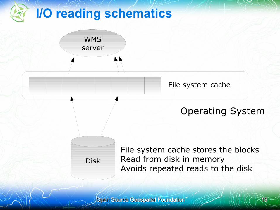
I/O reading schematics
WMSserver
Disk
File system cache
Operating System
●File system cache stores the blocks●Read from disk in memory●Avoids repeated reads to the disk
Open Source Geospatial FoundationOpen Source Geospatial Foundation 2020
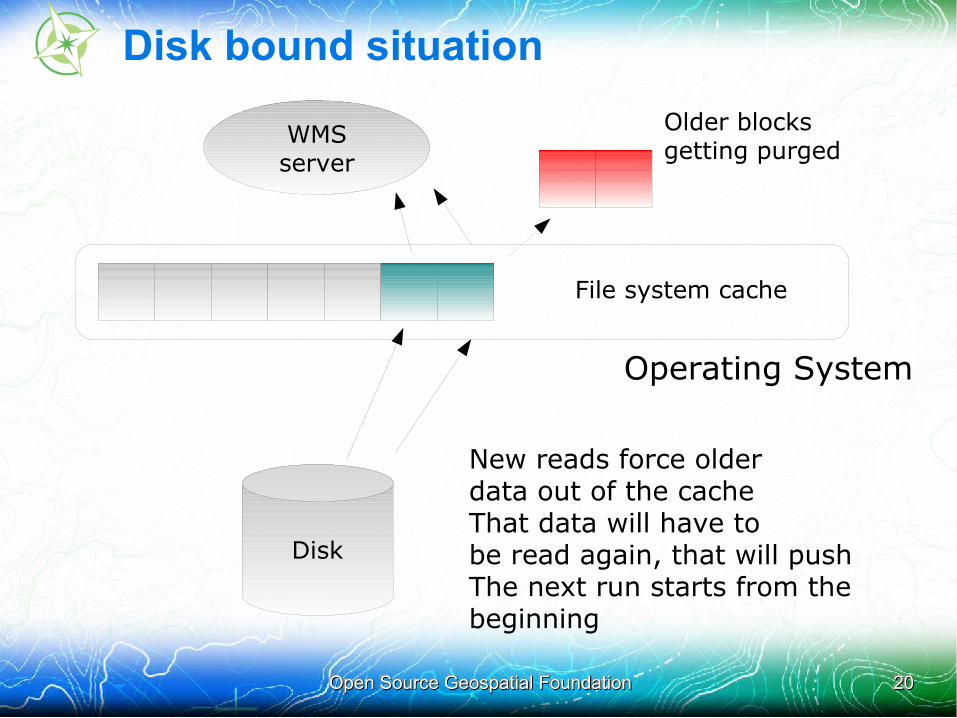
Disk bound situation
WMSserver
Disk
File system cache
●New reads force older●data out of the cache●That data will have to ●be read again, that will push●The next run starts from the ●beginning
●Older blocks●getting purged
Operating System

Open Source Geospatial FoundationOpen Source Geospatial Foundation 2121
CPU bound situation
WMSserver
Disk
File system cache
●All the data fits in the cache●Subsequent reads will be●performed from the cache only
●All the data fits in the cache●Subsequent reads will be●performed from the cache only●No more disk access!
Operating System
●No disk reads!
Open Source Geospatial FoundationOpen Source Geospatial Foundation 2222
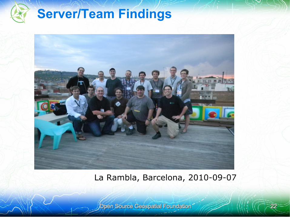
Server/Team Findings
La Rambla, Barcelona, 2010-09-07
Open Source Geospatial FoundationOpen Source Geospatial Foundation 2323
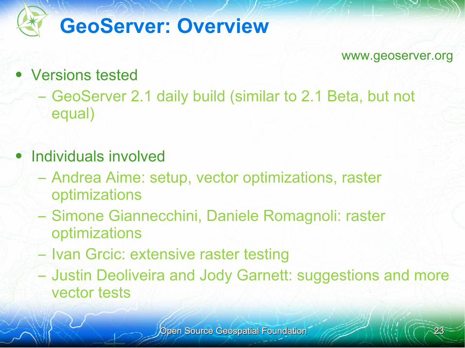
GeoServer: Overviewwww.geoserver.org
• Versions tested
– GeoServer 2.1 daily build (similar to 2.1 Beta, but not equal)
• Individuals involved
– Andrea Aime: setup, vector optimizations, raster optimizations
– Simone Giannecchini, Daniele Romagnoli: raster optimizations
– Ivan Grcic: extensive raster testing
– Justin Deoliveira and Jody Garnett: suggestions and more vector tests
Open Source Geospatial FoundationOpen Source Geospatial Foundation 2424
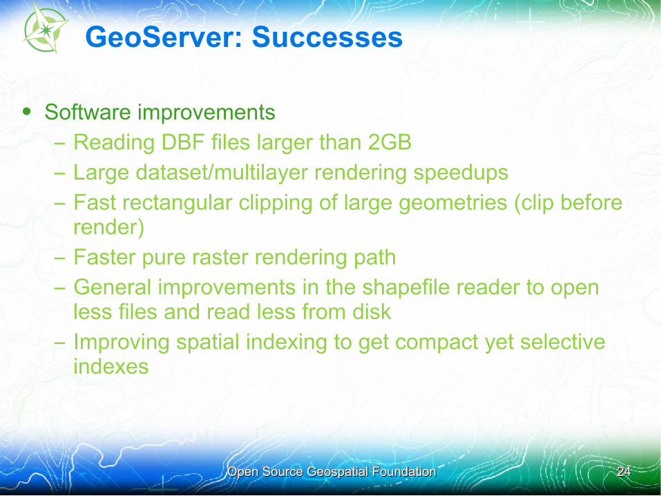
GeoServer: Successes
• Software improvements
– Reading DBF files larger than 2GB
– Large dataset/multilayer rendering speedups
– Fast rectangular clipping of large geometries (clip before render)
– Faster pure raster rendering path
– General improvements in the shapefile reader to open less files and read less from disk
– Improving spatial indexing to get compact yet selective indexes
Open Source Geospatial FoundationOpen Source Geospatial Foundation 2525
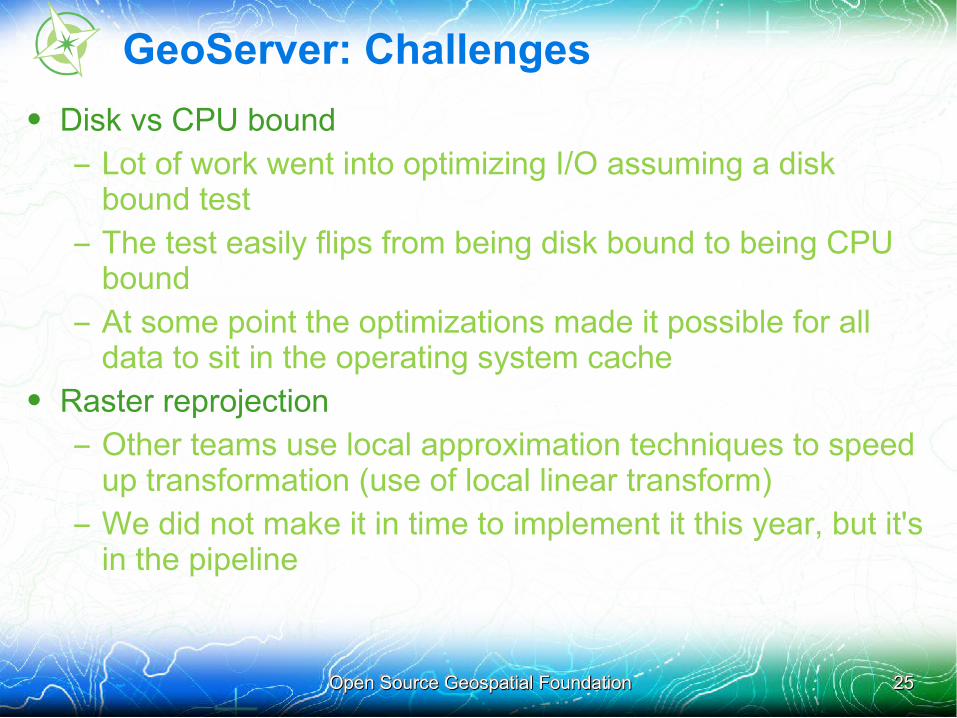
GeoServer: Challenges
• Disk vs CPU bound
– Lot of work went into optimizing I/O assuming a disk bound test
– The test easily flips from being disk bound to being CPU bound
– At some point the optimizations made it possible for all data to sit in the operating system cache
• Raster reprojection
– Other teams use local approximation techniques to speed up transformation (use of local linear transform)
– We did not make it in time to implement it this year, but it's in the pipeline
Open Source Geospatial FoundationOpen Source Geospatial Foundation 2626
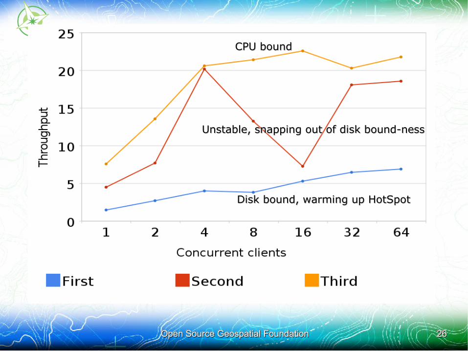
Disk bound, warming up HotSpotDisk bound, warming up HotSpot
Unstable, snapping out of disk bound-nessUnstable, snapping out of disk bound-ness
CPU boundCPU bound
Open Source Geospatial FoundationOpen Source Geospatial Foundation 2727
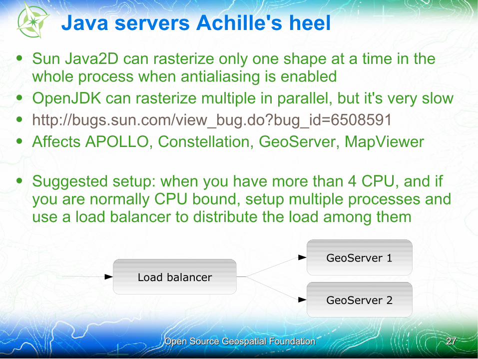
Java servers Achille's heel
• Sun Java2D can rasterize only one shape at a time in the whole process when antialiasing is enabled
• OpenJDK can rasterize multiple in parallel, but it's very slow• http://bugs.sun.com/view_bug.do?bug_id=6508591• Affects APOLLO, Constellation, GeoServer, MapViewer
• Suggested setup: when you have more than 4 CPU, and if you are normally CPU bound, setup multiple processes and use a load balancer to distribute the load among them
GeoServer 1
GeoServer 2
Load balancer
Open Source Geospatial FoundationOpen Source Geospatial Foundation 2828
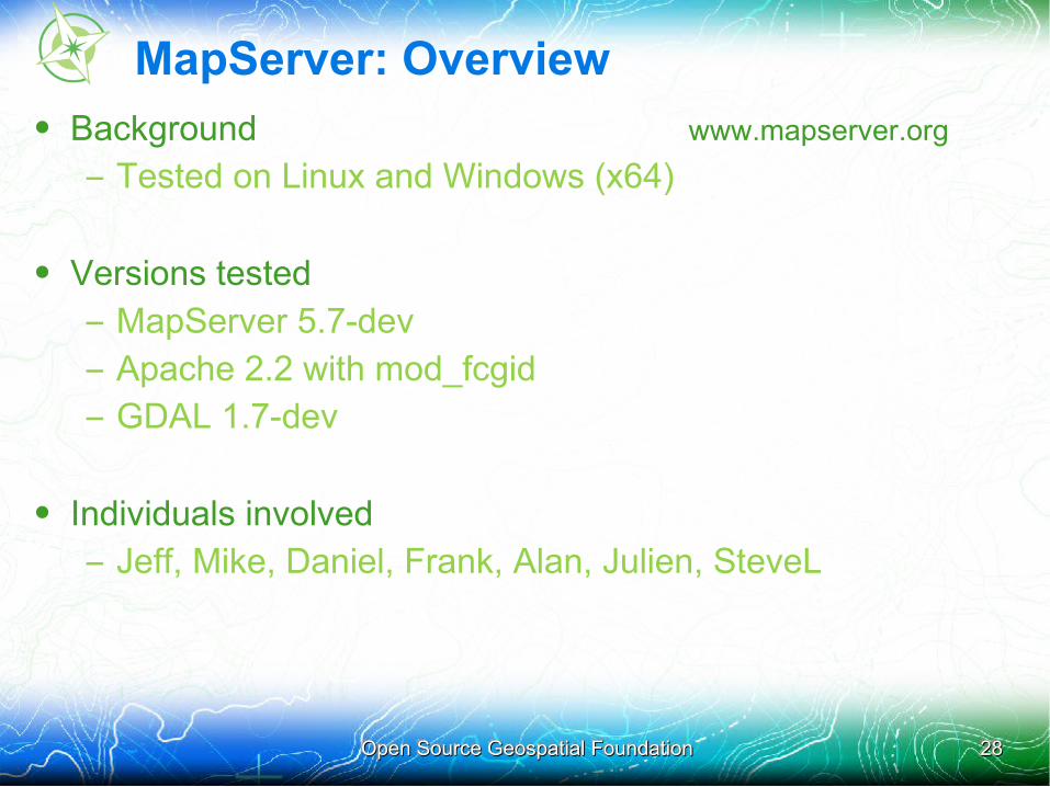
MapServer: Overview
• Background www.mapserver.org
– Tested on Linux and Windows (x64)
• Versions tested
– MapServer 5.7-dev
– Apache 2.2 with mod_fcgid
– GDAL 1.7-dev
• Individuals involved
– Jeff, Mike, Daniel, Frank, Alan, Julien, SteveL
Open Source Geospatial FoundationOpen Source Geospatial Foundation 2929
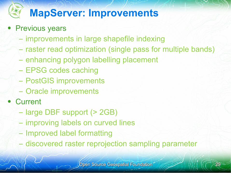
MapServer: Improvements
• Previous years
– improvements in large shapefile indexing
– raster read optimization (single pass for multiple bands)
– enhancing polygon labelling placement
– EPSG codes caching
– PostGIS improvements
– Oracle improvements• Current
– large DBF support (> 2GB)
– improving labels on curved lines
– Improved label formatting
– discovered raster reprojection sampling parameter
Open Source Geospatial FoundationOpen Source Geospatial Foundation 3030
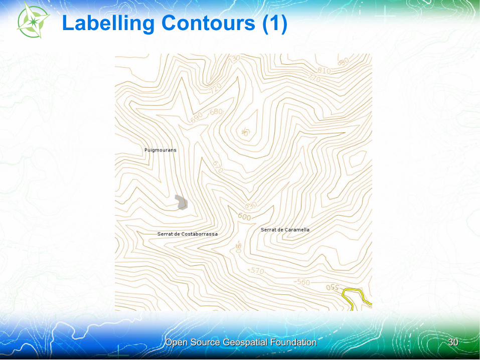
Labelling Contours (1)
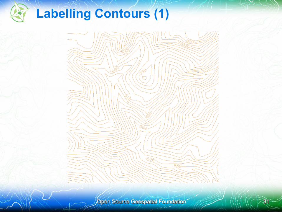
Open Source Geospatial FoundationOpen Source Geospatial Foundation 3131
Labelling Contours (1)
Open Source Geospatial FoundationOpen Source Geospatial Foundation 3232
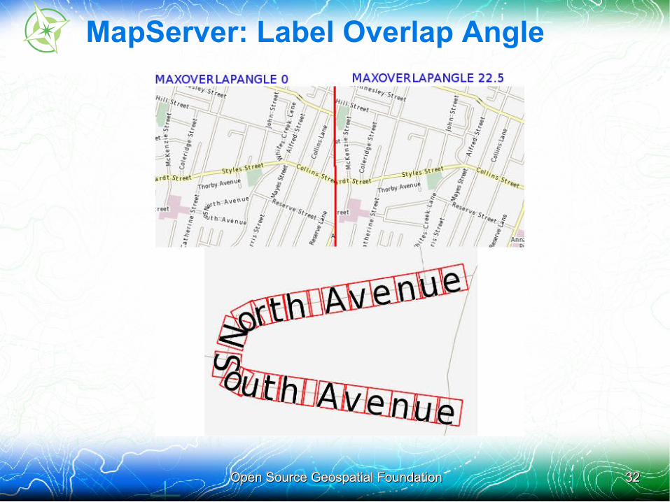
MapServer: Label Overlap Angle
Open Source Geospatial FoundationOpen Source Geospatial Foundation 3333
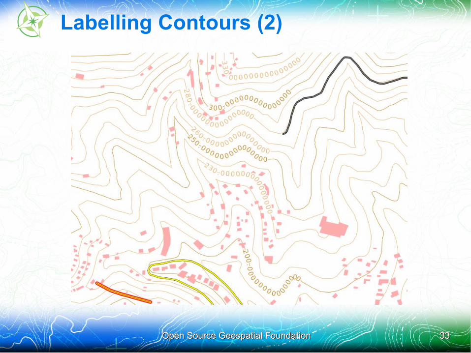
Labelling Contours (2)

Open Source Geospatial FoundationOpen Source Geospatial Foundation 3434
Labelling Contours (2)
Open Source Geospatial FoundationOpen Source Geospatial Foundation 3535
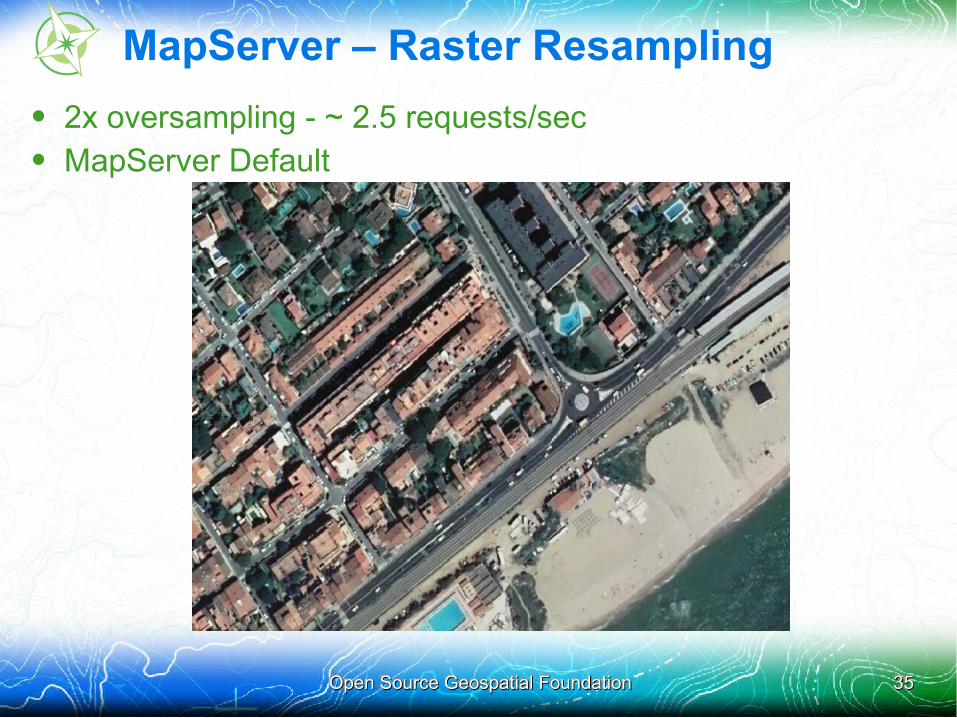
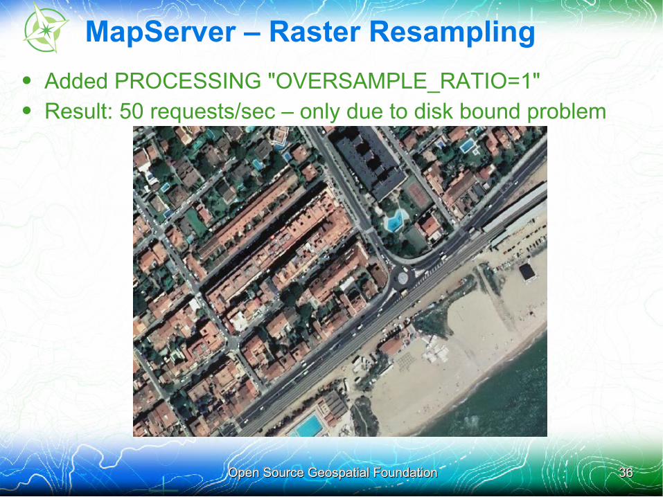
MapServer – Raster Resampling
• 2x oversampling - ~ 2.5 requests/sec• MapServer Default
Open Source Geospatial FoundationOpen Source Geospatial Foundation 3636
MapServer – Raster Resampling
• Added PROCESSING "OVERSAMPLE_RATIO=1"• Result: 50 requests/sec – only due to disk bound problem
Open Source Geospatial FoundationOpen Source Geospatial Foundation 3737
MapServer: Challenges
• Not enough time in the day to run all tests
• Debate: speed optimization vs map image output quality
• No time spent on a “best run”, although a lot of optimization was performed for “base run”
• Having been involved in previous years, able to complete more tests than some newcomers, but we were still incomplete

Open Source Geospatial FoundationOpen Source Geospatial Foundation 3838
Mapnik: Overview
• Background www.mapnik.org
– Tested on Linux (windows next year)
– Written in C++, boost, agg, cairo
• Versions tested
– Rendering library: Mapnik trunk (aka Mapnik2)
– Server: Paleoserver 0.1 (boost::asio multithreaded http)
– Server2: mod_mapnik_wms (apache module)
• Individuals involved
– Matt Kenny (mkgeomatics.com/) designed styles
– Artem Pavlenko and Robert Coup - features and fixes
Open Source Geospatial FoundationOpen Source Geospatial Foundation 3939
Mapnik: Successes
• Lessons:
– First year – awesome, humbling, excited for next
– Collaboration takes commitment and positive attitude
• Software improvements
– New C++ async, threaded WMS server (paleoserver)
– More efficient shapefile reading
– Caching of features when >1 style applied to layer
• Benefits for team, for users, for community...
– Paleoserver scales excellently, light threading model ++
– Mapnik + PostGIS + 32 threads (Cores * 4) = FAST
Open Source Geospatial FoundationOpen Source Geospatial Foundation 4040
Mapnik: Challenges
• Tiles, PostGIS, OSM
• Too many threads (Cores*2) with shapefiles == disk bound
• Rasters and vector reprojection need attention
Open Source Geospatial FoundationOpen Source Geospatial Foundation 4141
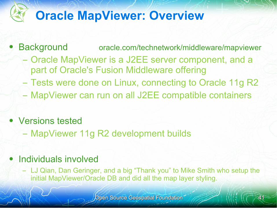
Oracle MapViewer: Overview
• Background oracle.com/technetwork/middleware/mapviewer
– Oracle MapViewer is a J2EE server component, and a part of Oracle's Fusion Middleware offering
– Tests were done on Linux, connecting to Oracle 11g R2
– MapViewer can run on all J2EE compatible containers
• Versions tested
– MapViewer 11g R2 development builds
• Individuals involved – LJ Qian, Dan Geringer, and a big “Thank you” to Mike Smith who setup the
initial MapViewer/Oracle DB and did all the map layer styling.
Open Source Geospatial FoundationOpen Source Geospatial Foundation 4242
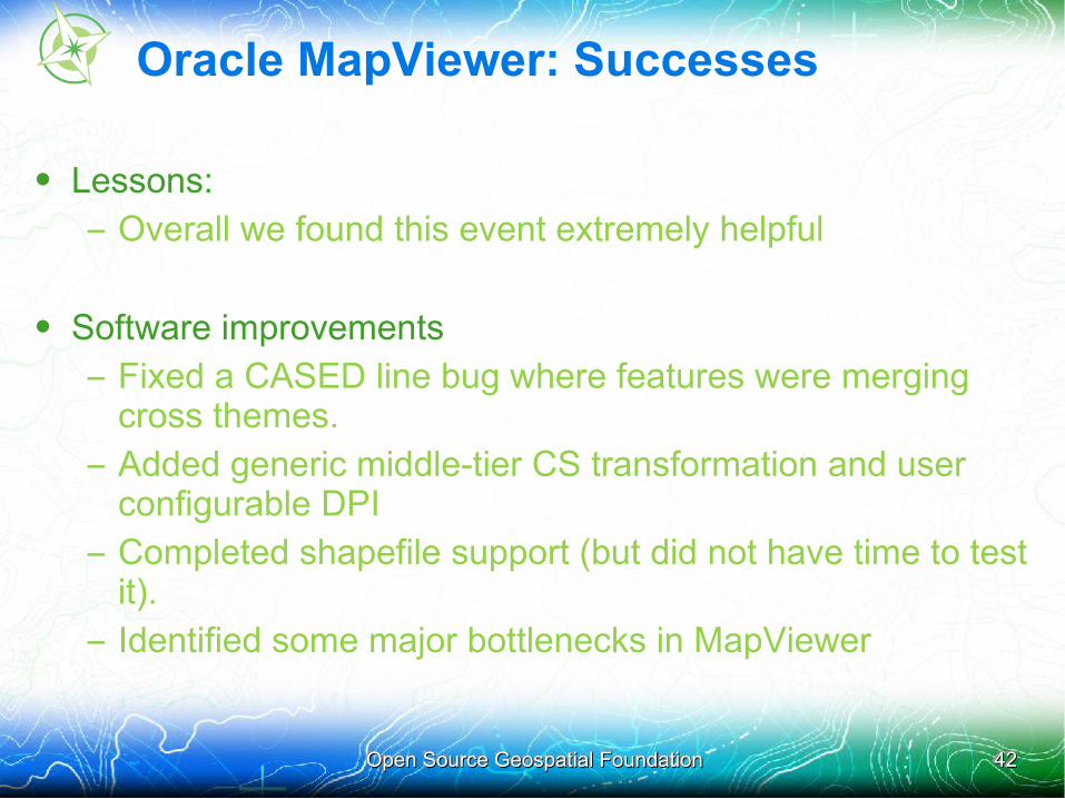
Oracle MapViewer: Successes
• Lessons:
– Overall we found this event extremely helpful
• Software improvements
– Fixed a CASED line bug where features were merging cross themes.
– Added generic middle-tier CS transformation and user configurable DPI
– Completed shapefile support (but did not have time to test it).
– Identified some major bottlenecks in MapViewer
Open Source Geospatial FoundationOpen Source Geospatial Foundation 4343
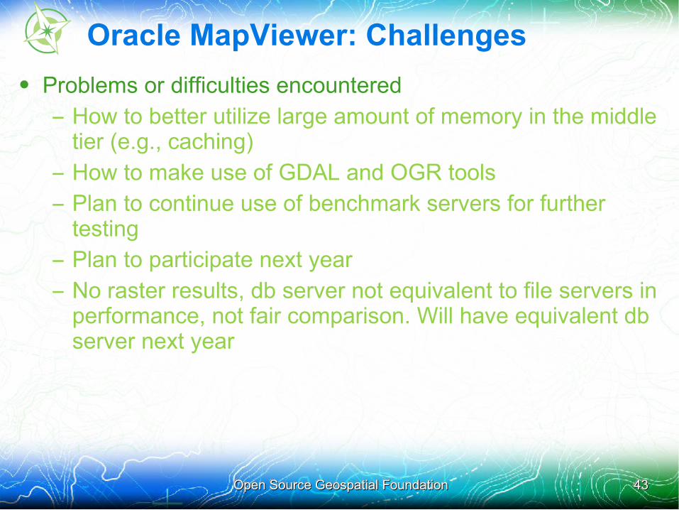
Oracle MapViewer: Challenges
• Problems or difficulties encountered
– How to better utilize large amount of memory in the middle tier (e.g., caching)
– How to make use of GDAL and OGR tools
– Plan to continue use of benchmark servers for further testing
– Plan to participate next year
– No raster results, db server not equivalent to file servers in performance, not fair comparison. Will have equivalent db server next year

Open Source Geospatial FoundationOpen Source Geospatial Foundation 4444
Oracle MapViewer: Results
• We average 17 requests /s for both 4326 and 3857 vector tests, connecting to Oracle Spatial via JDBC thin driver.
• MapViewer was running with JDK 6, with 1.2GB of heap memory.
• A database connection pool of 16 was used by MapViewer• There is definitely room for improvements!
Open Source Geospatial FoundationOpen Source Geospatial Foundation 4545
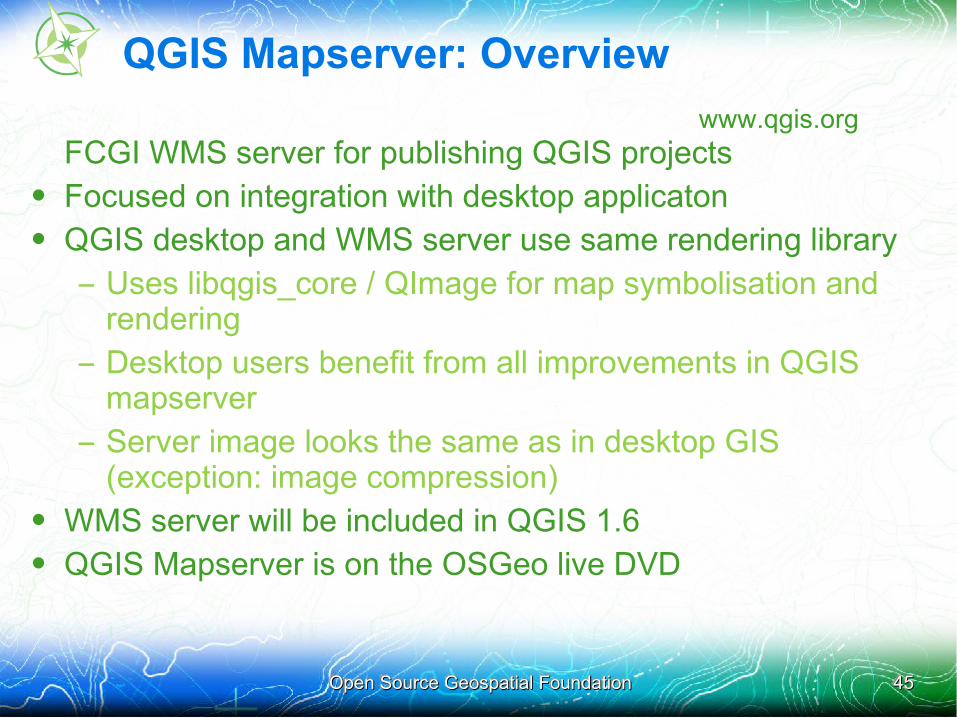
QGIS Mapserver: Overview
www.qgis.orgFCGI WMS server for publishing QGIS projects
• Focused on integration with desktop applicaton• QGIS desktop and WMS server use same rendering library
– Uses libqgis_core / QImage for map symbolisation and rendering
– Desktop users benefit from all improvements in QGIS mapserver
– Server image looks the same as in desktop GIS (exception: image compression)
• WMS server will be included in QGIS 1.6• QGIS Mapserver is on the OSGeo live DVD
Open Source Geospatial FoundationOpen Source Geospatial Foundation 4646
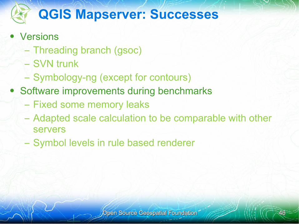
QGIS Mapserver: Successes
• Versions
– Threading branch (gsoc)
– SVN trunk
– Symbology-ng (except for contours)• Software improvements during benchmarks
– Fixed some memory leaks
– Adapted scale calculation to be comparable with other servers
– Symbol levels in rule based renderer
Open Source Geospatial FoundationOpen Source Geospatial Foundation 4747
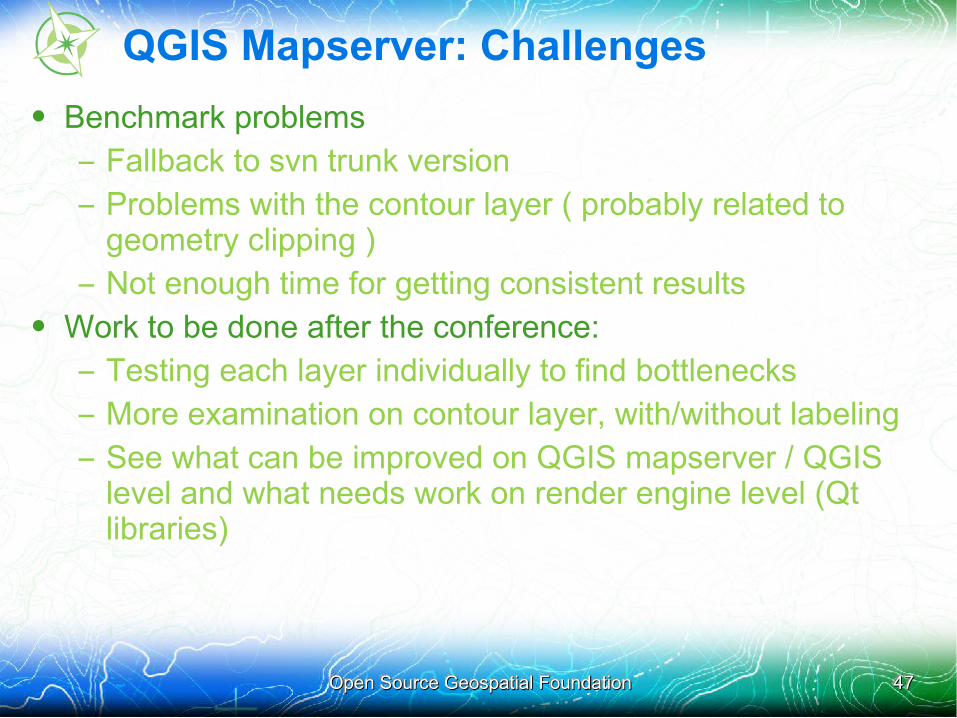
QGIS Mapserver: Challenges
• Benchmark problems
– Fallback to svn trunk version
– Problems with the contour layer ( probably related to geometry clipping )
– Not enough time for getting consistent results• Work to be done after the conference:
– Testing each layer individually to find bottlenecks
– More examination on contour layer, with/without labeling
– See what can be improved on QGIS mapserver / QGIS level and what needs work on render engine level (Qt libraries)
Open Source Geospatial FoundationOpen Source Geospatial Foundation 4848
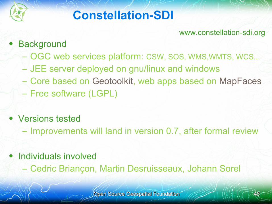
Constellation-SDIwww.constellation-sdi.org
• Background
– OGC web services platform: CSW, SOS, WMS,WMTS, WCS...
– JEE server deployed on gnu/linux and windows
– Core based on Geotoolkit, web apps based on MapFaces
– Free software (LGPL)
• Versions tested
– Improvements will land in version 0.7, after formal review
• Individuals involved
– Cedric Briançon, Martin Desruisseaux, Johann Sorel
Open Source Geospatial FoundationOpen Source Geospatial Foundation 4949
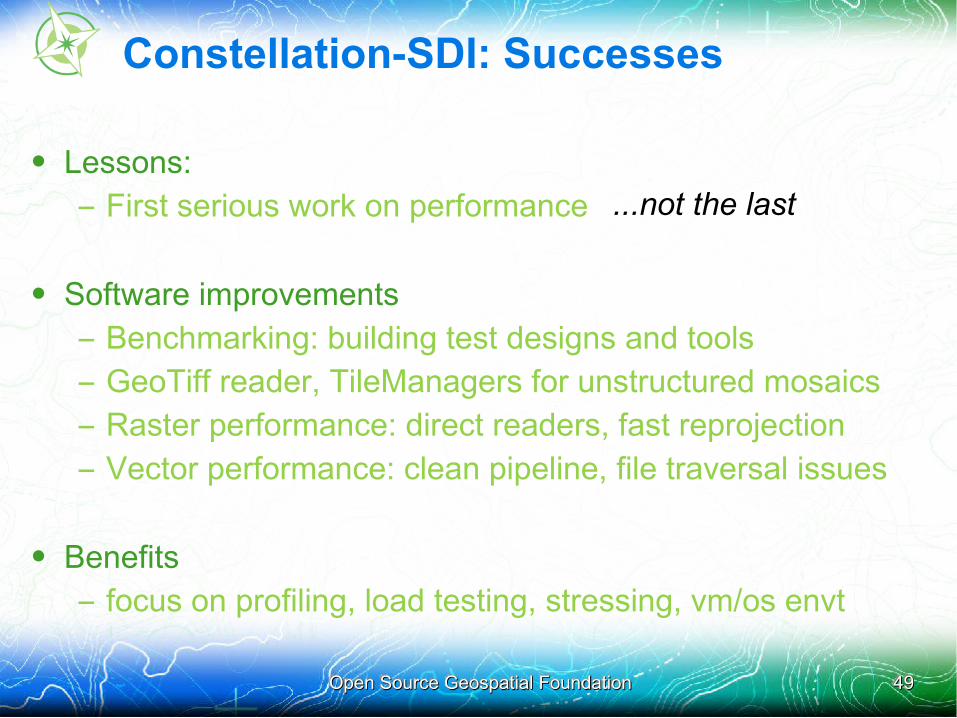
Constellation-SDI: Successes
• Lessons:
– First serious work on performance
• Software improvements
– Benchmarking: building test designs and tools
– GeoTiff reader, TileManagers for unstructured mosaics
– Raster performance: direct readers, fast reprojection
– Vector performance: clean pipeline, file traversal issues
• Benefits
– focus on profiling, load testing, stressing, vm/os envt
...not the last
Open Source Geospatial FoundationOpen Source Geospatial Foundation 5050
Constellation-SDI: Challenges
• Good testing is hard
– WMS is a portrayal service.
• WMS output is not identical, cannot be basis of test
• Output image size and compression vary
• Raster images vary in quality
• Vector plots vary in generalization, symbology
=> Tried to harmonize styles, forgot to check image sizes and compression levels, avoided discussions of quality although it is key to some participants
Open Source Geospatial FoundationOpen Source Geospatial Foundation 5151
Constellation-SDI: Challenges
• Good testing is hard
– WMS is a portrayal service
– WMS servers designed for many scales and uses
• serve small datasets or national data repositories
• use existing (ancillary) data or build custom data
=> Tests will be different to address performance of these different environment
Open Source Geospatial FoundationOpen Source Geospatial Foundation 5252
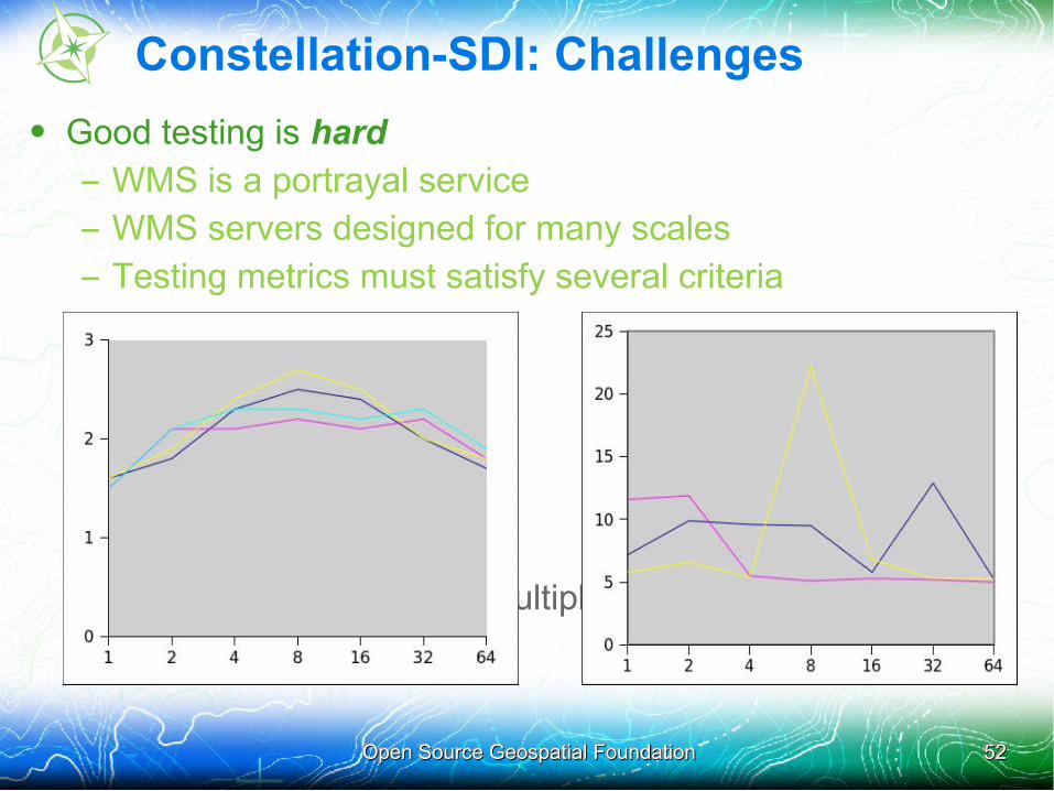
Constellation-SDI: Challenges
• Good testing is hard
– WMS is a portrayal service
– WMS servers designed for many scales
– Testing metrics must satisfy several criteria
• repeatable,
• reliable,
• specific,
• discriminatory
=> Need good tests, multiple runs
Open Source Geospatial FoundationOpen Source Geospatial Foundation 5353
Constellation-SDI: Challenges
• Good testing is hard
– WMS is a portrayal service
– WMS servers designed for many scales
– Testing metrics must satisfy several criteria
– Testing takes time, addressing issues takes work
The 2010 testing regime was inprecise and insufficient, servers were down in the last critical hours, community organization unclear. => some teams did not obtain final results => mean as metric not great, results unstable => next time around we hope to do better
Open Source Geospatial FoundationOpen Source Geospatial Foundation 5454
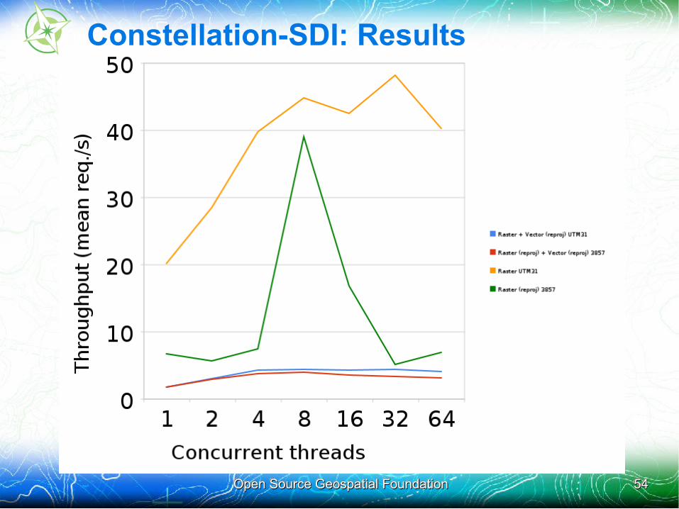
Constellation-SDI: Results
Open Source Geospatial FoundationOpen Source Geospatial Foundation 5555
Cadcorp GeognoSIS: Overview
www.cadcorp.com
• Background
– Entered to compete and to learn
– Tested on Windows
– C++• Versions tested
– 7.0 (current production release)
• Individuals involved
– Two Martins: Daly and Schäfer
Open Source Geospatial FoundationOpen Source Geospatial Foundation 5656
Cadcorp GeognoSIS: Successes• Lessons:
– Rock solid stability up to 256 threads (in some unofficial tests)
• Software improvements– Handle DBF files > 2Gb; Support PostGIS geometry columns with 4D
(XYZM) geometry type; Improved DBF string encoding handling; Cache DBF record data for the current SHP record; Allow Label Theme to use fill brush and/or outline pen from other Overlay Themes; Improved Label Theme "along lines" option, to better suit contour data
• Benefits for team, for users, for community...
– Programmers using the product suite for a “real” project led to a few UI/UX improvements in desktop SIS
– Miscellaneous bugfixes and improvements, above
Open Source Geospatial FoundationOpen Source Geospatial Foundation 5757
Cadcorp GeognoSIS: Challenges
• Our raster layer (above GDAL) is not as efficient as it could be
– mloskot – behind you! - has already rewritten it since joining, for the next version of SIS: 7.1
• Very large shapefiles is not a typical use case for us• We could not handle DBF files > 2Gb, so we fixed it• Our Label Theme was poor for contour lines and only
supported homogeneous styling, so we fixed those too

Open Source Geospatial FoundationOpen Source Geospatial Foundation 5858
Cadcorp GeognoSIS: Results
• Getting a kicking, as predicted • We should just use SHP .QIX files (viz shptree) and be
done with it• We’ve got plenty of work to do• You can help!
– http://blog.lostinspatial.com/2010/09/07/cadcorp-is-recruiting-2/
• We will be careful not to target this one (shapefiles and TIF mosaic) scenario
09/09/201009/09/2010 Open Source Geospatial FoundationOpen Source Geospatial Foundation 5959
ERDAS : Overview
• Background
– First participation
– Tested on Windows server
– Java based for vector and native code for raster
• Versions tested
– ERDAS APOLLO Essentials SDI & IWS 10.1
• Individuals involved
– Anne-Sophie Collignon for the configurations, issues follow-up and tests runs
– Liège and Perth APOLLO development teams for software improvements
– Luc Donea for the overall follow-up
09/09/201009/09/2010 Open Source Geospatial FoundationOpen Source Geospatial Foundation 6060
ERDAS : Successes• Lessons & benefits:
• Exciting project, good discussion/collaboration between teams
• Allow to concentrate on the software performance and rendering quality improvements.
• Allow to experiment different server setup and document the preferred configuration for this kind of use-case
• Software improvements
• For APOLLO IWS :
• Upgrade to GDAL 1.7.2
• Direct access to GDAL for Geotiff reader
• Improved the mosaicing of TIF datasets to remove seam lines
• For APOLLO SDI :
• Tomcat 6 and Java 6: improved performances over Tomcat 5.5 and Java 5Rendering :
• Clash management for contour labels
• Multipath rendering optimisation
• Low level code optimisation
• New option for shape index in memory
09/09/201009/09/2010 Open Source Geospatial FoundationOpen Source Geospatial Foundation 6161
ERDAS: Challenges
• Problems or difficulties encountered
– Low resources : product release period coupled with holidays
– First participation in FOSS4G WMS Shootout
– Huge disk read bottleneck reducing rendering optimizations effects on the overall performances
– Tests started very late because of data availability. As a result, issues were discovered late in the test design leaving no time to fix.

09/09/201009/09/2010 Open Source Geospatial FoundationOpen Source Geospatial Foundation 6262
ERDAS: Disk bound vs. CPU bound
• Some teams do experiment disk bounds scenarios while some others are running in a CPU bounds scenario
• ERDAS did experiment disk bound scenario on windows and was unable to investigate a CPU bound scenario : not enough time and Windows server down the last days.
• A usual use-case would be to have different requests using random BBOX. In this case, the OS data block caching would be a lot less effective bringing the servers back to a disk bound scenario
09/09/201009/09/2010 Open Source Geospatial FoundationOpen Source Geospatial Foundation 6363
ERDAS: Disk bound vs. CPU bound
• The use-cases met by ERDAS usually involve datasets that are bigger than the machine memory (RAM), and random distribution of the request BBOX. That’s why ERDAS believes that the CPU bound scenario is not representative of ERDAS customers needs.
• As apples cannot be compared to oranges, disk bound scenario cannot be compared to CPU bound scenario.
09/09/201009/09/2010 Open Source Geospatial FoundationOpen Source Geospatial Foundation 6464
ERDAS: Conclusion
• As the benchmark participants could not reach a consensus on the results validity, the participants agreed that teams were not mandatory to publish their benchmark results in the final presentation
• Given the inconsistencies in the tests conception that were discussed, ERDAS is concerned that the different throughput results between server applications might confuse the community and mislead the community.
• ERDAS plans to conduct a webinar in the future to review the methodology and results of the FOSS4G benchmark. ERDAS will also provide analysis and ideas for future improvements.
Open Source Geospatial FoundationOpen Source Geospatial Foundation 6565
Results
Open Source Geospatial FoundationOpen Source Geospatial Foundation 6666
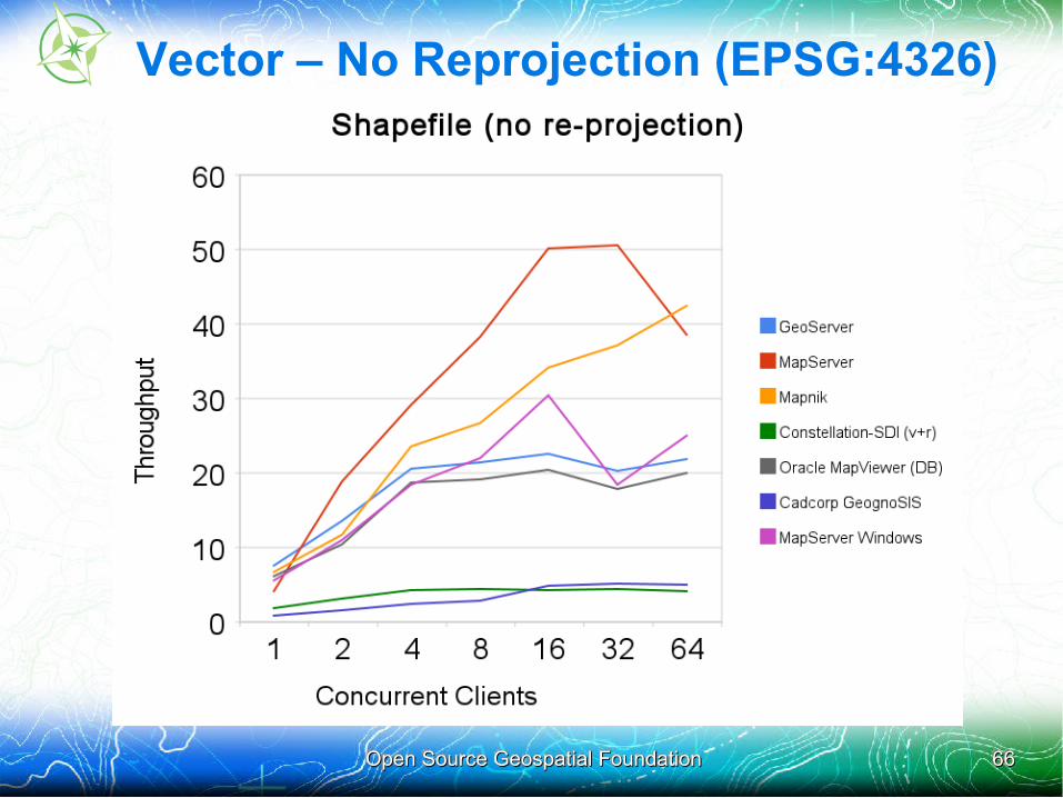
Vector – No Reprojection (EPSG:4326)
Open Source Geospatial FoundationOpen Source Geospatial Foundation 6767
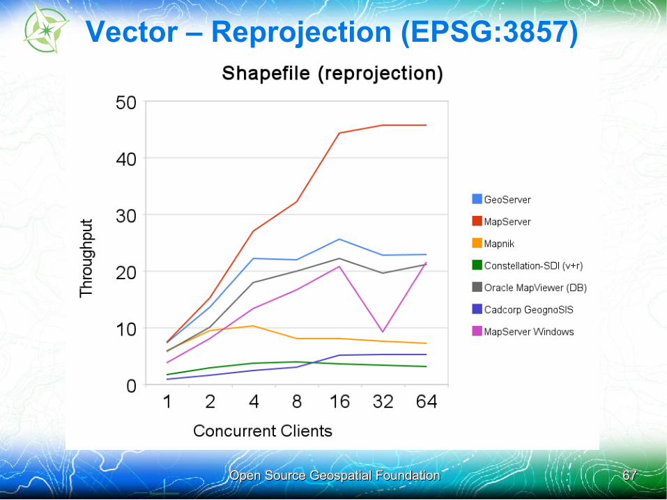
Vector – Reprojection (EPSG:3857)
Open Source Geospatial FoundationOpen Source Geospatial Foundation 6868
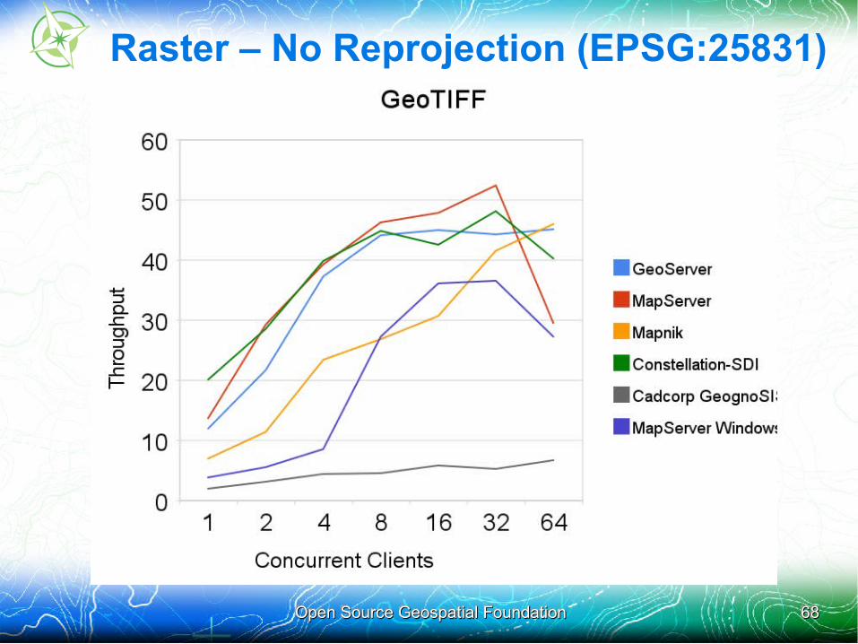
Raster – No Reprojection (EPSG:25831)
Open Source Geospatial FoundationOpen Source Geospatial Foundation 6969
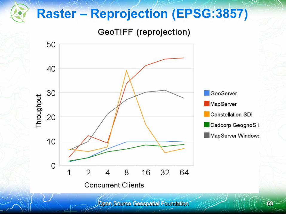
Raster – Reprojection (EPSG:3857)
Open Source Geospatial FoundationOpen Source Geospatial Foundation 7070
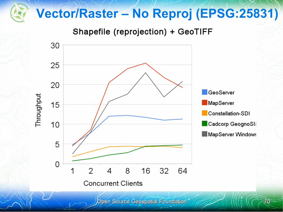
Vector/Raster – No Reproj (EPSG:25831)
Open Source Geospatial FoundationOpen Source Geospatial Foundation 7171
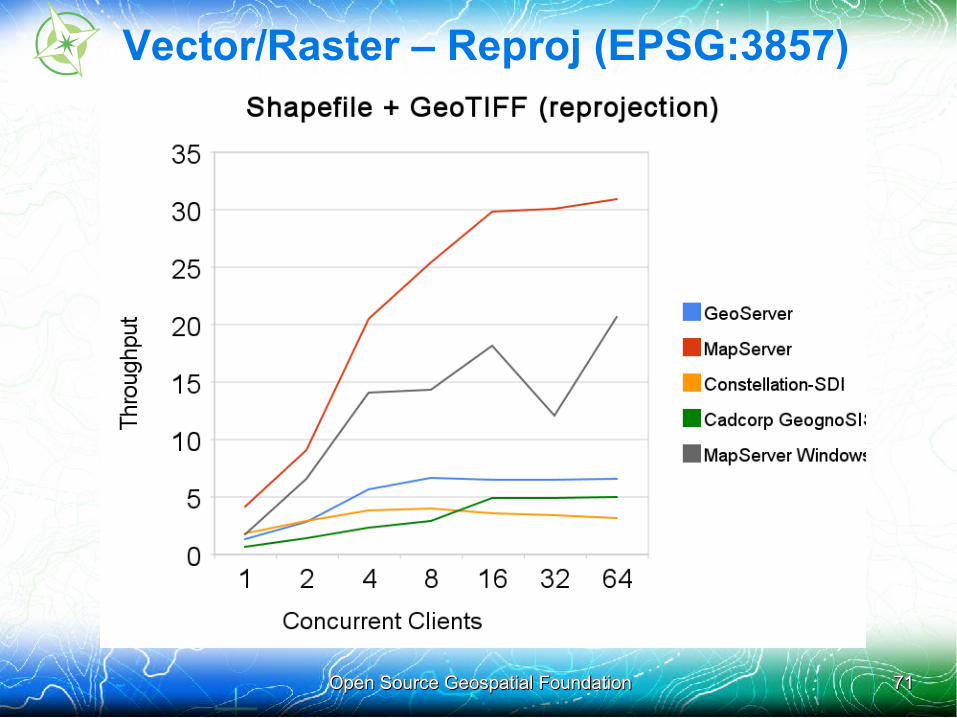
Vector/Raster – Reproj (EPSG:3857)

Open Source Geospatial FoundationOpen Source Geospatial Foundation 7272
Vector – PostGIS – No Reproj (EPSG:4326)
Open Source Geospatial FoundationOpen Source Geospatial Foundation 7373
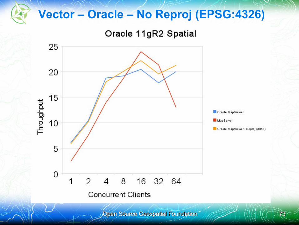
Vector – Oracle – No Reproj (EPSG:4326)
Open Source Geospatial FoundationOpen Source Geospatial Foundation 7474
Hopeful Changes for Next Shootout
• Servers available early in the process (now)
• Data available VERY early in the process
• Initial test runs performed early in the process
• More participation/review throughout entire process
• Design of testing parameters agreed upon early on
Open Source Geospatial FoundationOpen Source Geospatial Foundation 7575
More Information
• Scripts, configuration files, results stored in OSGeo SVN:http://svn.osgeo.org/osgeo/foss4g/benchmarking/
• Wiki home: http://wiki.osgeo.org/wiki/Benchmarking_2010
• Mailing list: http://lists.osgeo.org/mailman/listinfo/benchmarking

Post Presentation Slides
09/09/201009/09/2010 Open Source Geospatial FoundationOpen Source Geospatial Foundation 7777
FOSS4G benchmark: Navigation Movie• The following screen demo was captured on 8th September when no
other testing was taking place.
• The test client is built using OpenLayers widgets
• All maps are synchronized to the top left master.
• There is no delay in requesting maps so it is a true performance indicator based on when maps are returned
• Two servers are running on the Windows box
– MapServer Windows
– ERDAS APOLLO
• The two other servers are running on Red Hat Enterprise Linux
– MapServer RHEL
– GeoServer
• This movie also demonstrates the efforts that were done by each team to reach rendering quality, and styling compliance with the benchmark specifications