wye neighbourhood plan - ashford€¦ · summary it is very clear that the unique setting and...
TRANSCRIPT
1
Wye Neighbourhood Plan
The Report by the Independent Examiner
Richard High BA MA MRTPI
January 2016

2
3
Contents
Summary 5
Introduction 7
Appointment of Independent Examiner 7
The Scope of the Examination 8
The Preparation of the Plan 11
Public Consultation 11
The Development Plan 13
The Basic Conditions Test 14 Compatibility with European Union Obligations 14 Vision and Principles 19 The Neighbourhood Plan Policies 21
WNP1a Village Envelope 21 WNP1b Views 29 WNP2 High Quality Design 30 WNP3 Traffic Impact 30 WNP4 Supporting Business 31 WNP5 Integrated Housing 31 WNP6 Mixed Development 32 WNP7 Community Support 33 WNP8 Countryside and Environment 34 WNP9 Housing: Phasing 37 WNP10 Housing: Density and Layout 38 WNP11 The Imperial College London Campus at Wye 39
Summary and Referendum 44
Appendix 1 47

4
5
Summary
It is very clear that the unique setting and history of Wye make it a special place and there is
a very obvious desire that future development should not be detrimental to the unique
character of the village. At the same time the village has experienced major change as a
result of the closure of Wye College which has undermined its economic base and the future
use of the Wye College site presents both opportunities and challenges. The preparation of a
neighbourhood plan which allows the community to help shape the future of the village is an
opportunity to address these opportunities and challenges.
The preparation of a neighbourhood plan is a major undertaking for a small community and
requires a huge commitment of time and energy from those who lead the process. It is very
clear from the documentation which provides numerous background papers and full details of
the consultation that has been carried out that there has been a great effort to ensure that the
Plan satisfies the procedural requirements and to assemble an extensive evidence base to
inform the development of policies. The Plan has been prepared in the absence of strategic
policies which cover the whole of the Plan period. It has also had to address the uncertainty
surrounding the future of the former college site and to help shape its future while leaving
sufficient flexibility for a masterplan for the site. Both of these factors have added to the
difficulty of preparing an effective plan, and I congratulate the Neighbourhood Plan Group on
what it has achieved.
The Basic Conditions Statement sets clearly how the Plan has regard to the NPPF and the
ACS and demonstrates very clearly how the principles of sustainable development underpin
the WNP.
I have found it necessary to recommend some modifications to enable the Plan to meet the
basic conditions and other legal requirements. In some cases, these have been because,
notwithstanding the extensive background work, there has been insufficient justification for
the proposals. The planning system is based on a presumption in favour of sustainable
development and in this context policies which are not supported by evidence or are based
on somewhat arbitrary standards are unlikely to be enforceable. In other cases proposed
modifications reflect changes in circumstances since the Plan was submitted both within Wye
and in terms of the law and guidance to which the Plan must have regard.
I anticipate that some of the modifications that I have suggested may give rise to some
disappointment, but I am satisfied that they are necessary and do not undermine the
essential aims of the Plan.
6
I have concluded that, if the modifications that I have recommended are made, the Wye
Neighbourhood Plan:
• has been prepared in accordance with Sections 38A and 38B of the Town and
Country Planning Act 1990 and the Neighbourhood Planning Regulations
2012;
• has regard to national policies and advice contained in guidance issued by the
Secretary of State;
• contributes to the achievement of sustainable development;
• is in general conformity with the strategic policies of the development plan for
the area;
• does not breach and is compatible with European Union obligations and the
European Convention on Human Rights.
I am therefore able to recommend that the Wye Neighbourhood Plan should proceed to a referendum subject to the modifications that I have recommended.
I am also required to consider whether or not the Referendum Area should extend beyond
the Neighbourhood Plan Area. The whole of the parish of Wye with Hinxhill is included and
the policies of the Plan will not in my view have “a substantial, direct and demonstrable
impact beyond the neighbourhood area”. 1 I therefore conclude that there is no need to
extend the referendum area.
1 Reference ID: 41-059-20140306
7
Introduction
1. The Localism Act 2011 has provided local communities with the opportunity to have a
stronger say in their future by preparing neighbourhood plans which contain policies
relating to the development and use of land.
2. The Wye Neighbourhood Development Plan 2015-2030 (which I shall refer to as the
WNP or the Plan) has been prepared by Wye with Hinxhill Parish Council. The Plan
area covers the whole of the parish of Wye with Hinxhill. The village of Wye has a
population of about 2,300 and lies about 4 miles north-east of the expanding town of
Ashford. It occupies a very distinctive position in the valley of the River Stour, where it
passes through a gap in the North Downs, and within the Kent Downs Area of
Outstanding Natural Beauty (AONB). The A28 Ashford to Canterbury main road
passes about 1 mile to the west of Wye and the village is served by the railway
between Ashford and Canterbury. The main entrance to the village by car is by a
manned level crossing at the western edge of the village and the delays caused by the
frequent closure of this crossing are a major issue. These locational factors present a
very distinct set of issues to be addressed by the WNP.
3. If, following a recommendation from this examination, the Plan proceeds to a local
referendum and receives the support of over 50% of those voting, it can be made and
will then form part of the statutory development plan. As such it will be an important
consideration in the determination of planning applications, as these must be
determined in accordance with development plan policies unless material
considerations indicate otherwise.
Appointment of the Independent Examiner
4. I have been appointed by Ashford Borough Council (ABC) and Wye with Hinxhill
Parish Council (WHPC) to carry out the independent examination of the WNP. I have
been appointed through the Neighbourhood Planning Independent Examiner Referral
Service (NPIERS).
5. I confirm that I am independent of both ABC and WHPC and have no interest in any
land which is affected by the WNP.
6. I am a Chartered Town Planner with over 30 years’ experience in local government,
working in a wide range of planning related roles, including 15 years as a chief officer.
Since 2006 I have been an independent planning and regeneration consultant. I have
8
completed seven neighbourhood plan examinations and three health checks. I
therefore have the appropriate qualifications and experience to carry out this
examination.
The Scope of the Examination
7. The nature of the independent examination is set out in Sections 8-10 of Schedule 4B
to the Town and Country Planning Act 1990.
8. I must:
a) decide whether the Plan complies with the provisions of Sections
38A and 38B of the Planning and Compulsory Purchase Act 2004.
These requirements relate primarily, but not exclusively, to the
process of preparing the Plan and I shall deal with these first.
b) decide whether the Neighbourhood Development Plan meets the
basic conditions contained in Schedule 4B paragraph 8(2) of the
Town and Country Planning Act 1990. This element of the
examination relates to the contents of the Plan.
c) make a recommendation as to whether the Plan should be
submitted to a referendum, with or without modifications, and
whether the area for the referendum should extend beyond the plan
area.
9. The Plan meets the basic conditions if:
a) having regard to national policies and advice contained in guidance
issued by the Secretary of State it is appropriate to make the plan;
b) the making of the plan contributes to sustainable development;
c) the making of the plan is in general conformity with the strategic
policies contained in the development plan for the area of the
authority (or any part of that area);
d) the making of the plan does not breach, and is otherwise
compatible with, EU obligations.
10. Paragraph 9 of Schedule 4B indicates that as a general rule the examination should be
carried out on the basis of written representations unless a hearing is necessary to
9
allow adequate consideration of an issue or to allow a person a fair chance to put a
case. In carrying out the examination I came to the conclusion that a hearing was
necessary in order to
• Explore in more detail the procedures that had been followed in carrying out
the Strategic Environmental Assessment Screening Assessment and the
preparation of the Strategic Environmental Assessment itself;
• Consider the issues relating to the concept of the walkable village and the
400m or 5 minute walking time threshold;
• Allow interested parties to comment on the correction to drawing to figure 5.1
in the submitted Plan.
11. The hearing was held on 8 December 2015 at the Julie Rose Stadium in Ashford.
12. The documents which I have referred to in the examination are listed below.
• Letter from Wye with Hinxhill Parish council dated 26 October 2012 seeking designation of the parish as a Neighbourhood Area and accompanying plan
• Wye Neighbourhood Development Plan 2015-2030
• Appendix A Glossary
• Appendix B Projects and developer contributions
• Appendix C Summary of Neighbourhood Development Plan Policies
• Appendix D Planning Guidance from the Village Design Statement
• Appendix E Planning Context Information
• Appendix F Designation of Local Green Space
• Appendix G Outline proposals for WYE3
• Background Document (BD) 1 Questionnaire and results
• BD2 Workshop output and community engagement
• BD3 The environment and the AONB
• BD4 Transport and traffic appraisal with attachments BDA4a, BDA4b and BDA4c
• BD5 Employment and Housing
• BD6 Local Housing Needs Survey – produced by Action with Communities in Rural Kent
10
• BD7 Rural Economic Assessment – produced by Nathaniel Lichfield and Partners
• BD8 Wye Village Design Statement – produced by Wye Village Design Group 2000
• BD9 Strategic Environmental Assessment
• BD9a Strategic Environmental Assessment Scoping Document
• BD10 Our Place: Wye Business Plan 2015-2018 produced jointly by Kent County Council, Ashford Clinical Commissioning Group and Wye with Hinxhill Parish Council
• BD11 Consultations with major landowners in the Parish
• BD12 Maps of brownfield sites on WYE3
• BD13 Site policies for WYE1, WYE2 and Naccolt Brickworks
• BD14 Basic Conditions Statement
• BD15 SEA/HRA Screening Report
• BD16 Consultation Statement
• Responses received to Regulation 16 Consultation
• E mail dated 25 September 2014 from ABC to WPC
• E mail dated 25 July from John Mansfield to Katy Wiseman (ABC)
• Ashford Borough Core Strategy adopted in 2008
• Tenterdon and Rural Sites Development Plan Document 2010
• Sustainability Appraisal: Tenterdon and Rural Sites Development Pan Document Regulation 27 Version
• Ashford Borough Council Housing Land Supply Paper April 2015
• Department of Communities and Local Government. The National Planning Policy Framework (NPPF)
• Department of Communities and Local Government. Online Planning Practice Guidance (PPG)
• The Neighbourhood Planning (General) Regulations 2012 amended in March 2015 (NPR)
• The Environmental Assessment of Plans and Programmes Regulations (EAPPR) 2004
• A Practical Guide to the Strategic Environmental Assessment Directive 2005
11
13. I made an unaccompanied visit to Wye to familiarise myself with the plan area and its
surroundings on 6 October 2015. I spent most of a day walking round the village and
its surroundings to view all the key locations referred to in the Plan.
The Preparation of the Plan
14. An application for the designation of the whole of the parish of Wye with Hinxhill as a
Neighbourhood Area was sent to ABC on 26 October 2012. ABC published the
application on its website and carried out consultation in accordance with the
requirements of regulation 6 of the NPR from 9 November to 21 December 2012. The
results of the consultation were reported to the Council’s Cabinet on 10 January 2013
where the designation was formally approved.
15. As required under Section 38B (1) (a) of the Planning and Compulsory Purchase Act
2004 the Plan clearly states the period to which it relates, which is 2015-2030.
16. The Plan must not include any provision about development that is excluded
development as defined in Section 61K, which is inserted into the 1990 Town and
Country Planning Act. Excluded development includes “county matters” such as
mineral extraction and waste disposal and major infrastructure projects. I am satisfied
that the submitted plan contains no such provision.
17. I am also satisfied that the WNP does not relate to more than one neighbourhood
area.
18. The Plan has been produced by the Wye Neighbourhood Plan Group, which is a
working group of the Parish Council. It was set up in spring 2012 and consists of 8-12
parish councillors and residents.
Public Consultation
19. The preparation of the WNP has involved an extensive programme of public
consultation and involvement, which has been successful in securing the views of a
large proportion of the community.
20. Before the village was formally designated as a Neighbourhood Area, a questionnaire
was distributed in July 2012. Just over 75% of all households responded to the
questionnaire which in my experience is an exceptionally high level of involvement.
The responses show a high degree of consensus around the main issues for the
village.
12
21. Following the questionnaire there was a series of 6 workshops between October 2012
and November 2013 to engage the community in the development of the Plan. The
first workshop looked at three possible scenarios for future development in terms of
the scale and form of development, opportunities and constraints and was followed by
an exhibition in the church for two weeks which presented these scenarios. The
second workshop looked at a draft vision and developed a set of possible principles for
future development. Again this was followed by an exhibition which resulted in a clear
consensus on the preferred approach. The third fourth and fifth workshops helped to
develop the vision into more specific proposals addressing different key issues in each
workshop and the final workshop drew together these conclusions and considered the
traffic impact of new development.
22. The first workshop was attended by 50 people but I have no information on how well
attended the others were. However, they clearly provided the opportunity for genuine
community engagement in the development of the Plan. In addition, there were no
less than 15 public meetings, including annual parish meetings, between December
2011 and May 2015, at which progress on the Plan was reported and there were
opportunities to comment. In all this amounted to an impressive commitment to
community engagement.
23. The Consultation Statement (BD16) and the three appendices attached to it sets out in
detail the process of consultation on the pre-submission plan, the responses that were
received and the way in which these responses influenced the submitted version of the
Plan.
24. Pre-submission consultation took place between 30 January 2015 and 13 March 2015.
A summary of the plan was delivered to all households in the parish together with a
simple response form. The form asked people to state whether they generally
supported the plan and it gave them the opportunity to comment on it in more detail.
The summary version of the Plan was quite extensive and it offered a link to the full
plan and supporting documents which could be viewed online or in several public
buildings in the village. 729 people out of an adult population of 1890 responded to
the consultation draft and 88% were generally in support of the plan. In my experience
this is again an exceptionally high level of response at this stage and demonstrates
very effective engagement with the community. There were also several detailed
responses both from statutory consultees and individuals and these are reported fully
in the Consultation Statement.
13
25. While I found it somewhat difficult to find my way around the document, because the
demarcation of the appendices is not very clear I am satisfied that the consultation
process was entirely in accordance with regulation 14 of the NPG and the Consultation
Statement complies with the requirements of regulation 15.
26. Publicity following the submission of the Plan was carried out by ABC between 15
June and 10 August 2015. The original period of 6 weeks required by the regulations
was extended by two weeks following a change of ownership of an important site. All
of the comments received at this stage have been sent to me in accordance with the
regulations, and while I have not referred directly to all of them I have taken them into
account.
The Development Plan
27. The statutory development plan is made up of:
• The Ashford Borough Core Strategy 2008 (ACS) – which provides strategic
policies for the borough of Ashford between 2006 and 2021.
• The Saved policies of the Ashford Borough Local Plan 2000 – this plan had
a planning horizon of 2006 and is thus out of date, but some policies from it
are saved and form part of the development plan. The list of saved policies
was updated in 2014
• The Tenterdon and Rural Sites Development Plan Document 2010
(TRSDPD) – which sets out site specific policies for the areas of Ashford
which lie outside the growth area up to 2021.
• Kent Waste Local Plan adopted in March 1998
• Kent Minerals Plan 1997
28. The policies of the ACS and TRSDPD only relate to the period up to 2021 and they
therefore do not provide an up to date strategic context for the whole of the plan period
of the WNP up to 2030. The ACS and the TRSDPD will in due course be superseded
by the Ashford Local Plan which will have a horizon of 2030. This Plan is at a
relatively early stage of preparation and a draft for consultation is expected during
2016. The WNP must be in general conformity with the strategic policies of the ACS
and the TRSDPD insofar as those policies can be regarded as up to date and are not
14
in conflict with the NPPF. In the absence of fully up to date development plan policies,
the relationship between the WNP and the NPPF will be particularly important in my
examination.
29. The policies of the Kent Minerals and Waste Plans are also out of date and these
plans will be replaced by the Kent Minerals and Waste Plan which will also relate to
the period up to 2030.
The Basic Conditions Test
30. I shall consider the compatibility of the Neighbourhood Plan with basic conditions a), b)
and c) in relation to each of its policies but will first consider whether it meets
European Union obligations.
European Union Obligations 31. A Strategic Environmental Assessment (SEA) Screening Report and a Habitats
Regulations Assessment Screening Report were prepared by ABC on behalf of Wye
Parish Council in September 2014. WHPC provided ABC with the objectives of the
WNDP and an indication of the overall quantum of development, which suggested up
to 175 new dwellings. The SEA Screening Report concluded that the proposals in the
WNP could have significant environmental effects and that, in accordance with
regulation 5 of the EAPPR, an SEA would be necessary.
32. This conclusion was communicated to WPC in an e mail dated 25 September 2014.
This was referred to on P3 of BD15 as a formal screening opinion but not originally
submitted to me. A copy has been sent to me on request and is attached as
Appendix 1. I have difficulty in regarding this as a determination of the need for a SEA
in accordance with regulation 9 of the EAPPR as this clearly states that before making
such a determination the consultation bodies should be consulted. In fact the
consultation bodies were consulted on it between 29 September 2014 and 3
November 2014, after ABC issued its screening opinion. However, the response of
the consultation bodies reinforced the conclusions of the screening opinion and thus
there has been no conflict with the aims of the EAPPR.
33. A scoping report for the SEA (BD9a) was prepared in November 2014 and the
consultation bodies were consulted on it in accordance with regulation 12 (5) of the
EAPPR. Comments were received from both the Environment Agency and Natural
England and these were taken into account in the SEA that was prepared.
15
34. Regulation 12 and Schedule 2 of the EAPPR set out the requirements for the
Environmental Report which must be included in the SEA. I have considered the SEA
against these requirements taking account of the Practical Guide to the Strategic
Environmental Assessment Directive 2005 and PPG.
35. The SEA sets out the objectives of the WNP and sets out the main environmental
considerations to be addressed, having regard to the Scoping Report and the
comments of the consultation bodies. It considers in some detail the characteristics of
all the sites with environmental designations including Special Areas of Conservation,
Special Protection Areas and Ramsar Sites within 20km of Wye, looking at the
potential direct effects of the WNP on these areas and the potential for any cumulative
impact. This assessment concludes that the Plan could have significant effects on the
Wye and Crundale Downs SAC, Stodmarsh SAC and Stodmarsh SPA, but that as the
proposals are in line with the existing development plan the cumulative effect is
unlikely to be significant.
36. I have given extended consideration to whether the environmental report has properly
described and evaluated the environmental effects of “reasonable alternatives taking
into account the objectives and the geographical scope of the plan or programme”2.
PPG suggests that where an SEA is necessary work should begin at an early stage so
that the assessment can inform the choices being made in the Plan3. In the case of
Wye, and many other neighbourhood plans, the need for a SEA was only identified at a
relatively late stage in the plan preparation process. The screening assessment report
was completed in late September 2014 and was followed by consultation with the
statutory bodies.
37. The environmental report was prepared in November and December 2014 just before
the start of regulation 14 consultation which took place between 29 January and 13
March 2015. At this stage the direction of the Plan had been determined and the main
alternatives eliminated. It would have been helpful if the reasoning which had led to
the rejection of these alternatives had been included in the SEA. For instance, the first
phase of public engagement put forward three scenarios for future development based
on: satellite settlements, linear growth and concentric growth. It is evident that the
third option attracted the most favourable response but no other rationale for the
rejection of the other options has been presented in the environmental report.
2 EAPPR regulation 12 (2) (b) 3 PPG Reference ID 11-029-20150209
16
38. However, it is evident that a significant part of the evidence base for the Plan and the
environmental report was the evaluation of all the possible sites for residential
development that were considered in the TRSDPD. The SEA sets out the conclusions
of this assessment in summary form and comments with regard to the WNP. All of
these sites were considered in the SEA relating to the TRSDPD and there is therefore
no need to repeat that assessment in full.
39. The only differences in the conclusions of this assessment relate to three small sites.
Site WYE01 is a small site on the south-eastern edge of the village that the TRSDPD
Sustainability Appraisal considered unsuitable for development, mainly because of its
landscape impact and because of its position to the rear of existing development. The
WNP considers the site suitable for development if the access is improved. I see no
reason to suppose that the small scale of development that could be accommodated
would be likely to have significant environmental effects or that its inclusion in the
WNP would undermine the requirement for general conformity with the strategic
policies of the development plan. Similarly, site WYE18 lies just to the south of
WYE01 and to the east of the doctors’ surgery. It was considered unsuitable for
development in the TRSDPD Sustainability Appraisal but in the WNP is considered
suitable for a possible extension to the surgery. Finally, site WYE06c is included in the
WNP assessment but not in the TRSDPD. This small area lying adjacent to the school
playing field and the sewage treatment works is considered unsuitable for
development.
40. As a result of this appraisal the relatively small number of sites where development is
proposed in the Plan are identified and the detailed assessment of the TRSDPD
SA/SEA is presented for these sites, with a supplementary comment on the effects of
the WNP. These sites are: WYE1, WYE2 and WYE3 of the WNP.
41. On sites WYE1 and WYE2, planning permission has already been granted. More
detailed consideration is given to site WYE3, the former Wye College site which
includes several component parts: the land on both sides of Olantigh Road and the
Withersdane site. The detailed appraisal for all 3 sites from the TRSDPD is
reproduced in the SEA with some amendments to reflect the indicative proposals in
the Plan. The TRSDPD appraisal did not make specific assumptions on the scale or
form of any future development. However, the WNP appraisal worked on the following
assumptions regarding the scale of development: 50 new dwellings, the Free School
with 600 pupils and 90 staff, 5,000sq m of business space in the Kempe Centre and
other sites including Withersdane and 2,500 sq m of business and community use of

17
the Grade 1 listed buildings. The proposals are thus rather more specific than for the
assessment in the TRSDPD and additional comments are attached to it to reflect this.
The assessment is done on the assumption that the Free School is located on the
west side of Olantigh Road, with housing and business space to the east, but the
report acknowledges the possibility that these uses may be reversed and suggests
that if the overall quantum of development is unchanged the environmental impact
would be the same.
42. The assessment of the environmental effects covers short, medium and long term
effects and positive and negative effects in accordance with paragraph 6 of Schedule 2
of the EAPPR. It also indicates the magnitude of the effects on a 6 point scale from ++
to --, although the range on the sites appraised only shows results between + and -.
The report includes an executive summary which could be regarded as the non-
technical summary suggested by paragraph 12 of Schedule 2 of the EAPPR. The
SEA, along with other background documents was also the subject of consultation at
the time of regulation 14 consultation on the Pre-submission plan in accordance with
EAPPR regulation 13.
43. I shall return to the proposals for site WYE3 in more detail when I consider the policies
of the WNP, but it could be argued that further alternatives could have been
considered, in particular in relation to the scale of development on the parts of the
WYE 3 site on either side of Olantigh Road and the potential uses of the former ADAS
site. However, other such variations would fall within the scope of the TRSDPD
Sustainability Appraisal as it simply defined the boundary of the sites and assessed
the environmental effects of development without defining scale or form. Most
importantly that appraisal concluded for all three sites that the potential for reuse or
redevelopment of existing buildings or new development could only be assessed in the
light of a comprehensive evaluation of the future of the campus.
44. Although the assumptions of the WNP SEA are more specific that the TRSDPD
Sustainability Appraisal, the scoring of the environmental effects is the same. It is
evident to me from both the submitted documentation and discussion at the hearing
that there was the potential for a wider range of options to be considered, particularly
with regard to the potential use of the ADAS site. However, because the sites that
comprise WYE 3 in the WNP have been assessed in the TRSDPD I do not consider
that this means that the Plan has failed to meet European Obligations. It will however
be necessary for the environmental impact of the specific proposals for the sites that
emerge from the proposed master plan to be assessed in detail.
18
45. The SEA also looks at the effects of the plan proposals on congestion by modelling
traffic generation in a number of scenarios. These include a fallback position based on
a fully active Wye College and various levels of housing development on Site WYE 3
ranging from 50 dwellings to 200 dwellings. There is therefore an inconsistency
between the approach taken to the evaluation of alternatives for traffic and that taken
for other environmental effects.
46. It is clear to me that the way the environmental report is presented having regard to
the assessment of reasonable alternatives is not fully in accordance with the
regulations or PPG. The latter indicates that “reasonable alternatives must be
considered and assessed in the same level of detail as the preferred approach” and
“the strategic environmental assessment should outline the reasons the alternatives
were selected, the reasons the rejected options were not taken forward and the
reasons for selecting the preferred alternatives”.4 However, I have also taken into
account the relationship of the Plan to the TRSDPD with regard to the generation of
alternatives and the Plan reflects both the options and the conclusions of the SEA that
was previously undertaken. Moreover, the guidance I have referred to was not
published until February 2015, after the SEA had been prepared. I also accept that
there is some difficulty in defining what would be reasonable alternatives. The
constraints on development in and around Wye are substantial because of the
significance of the AONB which includes the village and all the countryside
immediately surrounding it. It is evident from the responses to the Plan and the SEA
that higher levels of development than those considered are likely to attract concern
from Natural England and may not therefore be reasonable alternatives.
47. In summary, for the most part, I am satisfied that the SEA has been prepared in
accordance with the EAPPR having regard to the PPG which states that “It does not
need to be done in any more detail, or using more resources, than is considered to be
appropriate for the content and level of detail in the neighbourhood plan.”5 In some
respects the WNP has not followed the procedures set out in the EAPPR to the letter.
I consider that the approach to the evaluation of reasonable alternatives could have
been more thorough and would have been more useful if it had been started earlier in
the plan process. The evaluation has followed the formulation of policies rather than
helped to define them. However, the scope of the policies does not extend
significantly beyond that of the policies of the TRSDPD which was subject to a full
4 PPG Reference ID: 11-038-20150209 5 PPG Paragraph 031 Reference ID: 11-031-20140306
19
sustainability appraisal. Moreover, it is not possible to fully assess the impact of the
most significant proposals for new development until the comprehensive approach to
the development of the former Wye College site has been developed. It is clear that,
the scale of the development envisaged for the WYE3 site and its location within an
AONB mean that any planning application should be subject to screening of the need
for an Environmental Impact Assessment (EIA)6. I shall return to this in considering
policies for the WYE 3 site.
48. I therefore conclude that while there are deficiencies in the approach to the SEA which
I have outlined they do not constitute a clear breach of the European Obligations
having regard to the scope of the Plan and the Sustainability Assessment previously
carried out into the TRSDPD.
49. The Habitats Regulations Assessment concludes that the proposals of the WNP will
not have an adverse effect on the integrity of internationally designated sites either on
its own or in combination with other plans. However, should the content of the Plan
change significantly the scoping report would need to be revisited.
50. I am also satisfied that nothing in the plan is in conflict with the European Convention
on Human Rights.
51. I therefore conclude that the Plan is compatible with and does not breach European
Union obligations.
Vision and Principles
52. The Plan sets out an overall vision for Wye, which is set out in 6 bullet points, and then
defines a series of development principles which define in simple terms the sort of
development that the Plan seeks to achieve. Neither the Vision nor the Principles are
presented as policies and so they will not carry weight as part of the statutory
development plan if the WNP is made. They are, however, clearly of fundamental
importance in defining the direction of the Plan and I have therefore considered them
in relation to the basic conditions.
53. The Vision is a clear statement of intention regarding the character of the village and I
find it consistent with the basic conditions with one exception. In the first bullet point
the meaning of the reference to “definite” boundaries is somewhat unclear. It could
6 PPG Reference ID 4-031-20140306
20
suggest completely inflexible boundaries or simply a clear distinction between the
village and the surrounding countryside. The first interpretation would almost amount
to a policy and would imply a degree of rigidity that would not be consistent with the
presumption in favour of sustainable development. The second interpretation would
be more appropriate for a vision and raise no such concerns.
Recommendation Reword the first bullet point of the vision set out in paragraph 3.1 to read “Wye village should remain a distinct settlement with a clear division between the village and the surrounding countryside”.
54. The principles for development are set out in two groups, the first relating to the type
and form of development that will be encouraged, and the second to design principles.
For the most part the principles are expressed in sufficiently general terms to be
clearly principles rather than policies. However, the second bullet point refers to
residents being “able to walk to the centre within five minutes”. This is very specific
and amounts to a policy. This principle is very important in the later policies in the
Plan and I shall return to it in more detail when I consider them, but is inappropriately
precise for a general principle.
55. The sixth bullet point relates to sustainability standards and the application of CO2
neutral principles. Following the Housing Standards Review the Ministerial Statement
of 25 March 2015 announced that energy efficiency standards should be controlled
through building regulations and that development plans should not include policies on
energy standards.7 The inclusion of a principle on an issue in which there is now no
local discretion therefore serves no purpose and would be contrary to the basic
conditions.
Recommendations
• Reword the second bullet point of paragraph 3.2.1 to read “Development should be generally concentric around the historic centre so that residents can easily walk to facilities in the centre of the village.”
• Delete the sixth bullet point in paragraph 3.2.1.
56. The principles for the design of development are generally consistent with the
approach taken in the NPPF and raise no concerns.
7 Planning Update 2015. Ministerial Statement, section headed Plan Making, “local planning authorities and qualifying bodies preparing neighbourhood plans should not set in their emerging Local Plans, neighbourhood plans or supplementary planning documents any additional technical standards or requirements relating to the construction, internal layout or performance of new buildings.
21
The Policies of the Plan
57. The policies of the Plan are arranged in three groups: core policies, general policies
and site policies. The core policies each relate to a key objective. I shall consider
each of the policies having regard to the basic conditions. I am only empowered to
recommend modifications where they are necessary to enable the Plan to meet the
basic conditions. Many of the changes and additions suggested by consultees relate
to the supporting text and background documents and appendices. While these and
some of the suggested modifications to policies may have merit I can only recommend
those that are necessary to meet the basic conditions. For the most part these relate
to the policies themselves rather than the supporting text. I am, however, able to
correct errors and have recommended some modifications to correct information that
was correct at the time the Plan was submitted but has now been superseded.
58. Planning Practice Guidance suggests that policies “should be drafted with sufficient
clarity to allow a decision maker to apply it consistently and with confidence in
determining planning applications.”8 In a number of cases the modifications I suggest
are intended to achieve this clarity.
Core Policies Policy WNP1a Village Envelope
59. This policy relates to an objective to “Protect and enhance the village of Wye’s sense
of place within the parish and its surrounding countryside”. The policy is quite wide in
its scope and aims to prevent development outside the village envelope except in
exceptional circumstances or where it is necessary to meet utility infrastructure needs;
the policy in effect defines the village envelope by cross referring to Fig 4.1. The
policy also designates several Green Spaces within the village. These are two very
different proposals and I shall deal with them separately.
60. Fig 4.1 draws the village envelope very tightly around the built up area of the village for
the most part, but includes sites WYE19 and WYE 2 which were recognised as suitable
for development in the TRSDPD and on which planning permission has subsequently
been granted. It also includes a small area at the south eastern corner of the village
8 Planning Practice Guidance Reference ID: 41-041-20140306 9 The numbering I have used relates to that used in the policies of the Wye Neighbourhood Plan and not that
used in the evaluation of sites in the TRSDPD and shown on Fig 2.8.
22
(Site WYE01 and a small part of Site WYE18 in the TRSPD site evaluation), which
was originally excluded, in response to representations at the regulation 14
consultation. The boundary is drawn through the former Wye College site, excluding a
large part of the land to the east of Olantigh Road. I shall consider this section of the
boundary in more detail later. The village envelope excludes some open spaces which
have a strong relationship to the village, notably the Village Playing Field and the
School Playing Field, but includes the Churchfield Allotments which are on the edge of
the village.
61. The wording of the policy is very restrictive and somewhat ambiguous. In restricting
development other than in exceptional circumstances, the policy is much more
restrictive than the overall approach to development in the countryside which is set out
in the NPPF. While Paragraph 115 of the NPPF aims to resist major developments in
Areas of Outstanding Natural Beauty, not all development is precluded and there is
encouragement elsewhere for development in rural areas, notably in paragraph 28, in
relation to economic growth in rural areas, and in paragraph 54, in relation to
affordable housing on exception sites. As the policy is worded it could preclude
development that would be appropriate in the countryside and development at the
Village Playing Field or School Playing Field which would be entirely consistent with
the function of these spaces. It is unclear whether this wording is intended to preclude
the provision of affordable housing to meet local needs on exception sites. This could
be construed to be “exceptional circumstances”, but the reasoning in relation to Policy
WNP5 suggests that such development is not envisaged. A policy to preclude rural
exception sites would not be consistent with national guidance. I have suggested a
modification which would align the policy with the guidance in the NPPF.
62. The reference in this paragraph to development which would be beyond a 5 minute
walk (ca.400m) from the centre of the village (the Church Street/ Bridge junction) is
also somewhat ambiguous. As it reads, development outside the village development
area but within a 5 minute walk of the centre would not be subject to the restrictions of
this policy. While there may be few locations where this would be the case, there are
some, notably to the west of the Churchfield Allotments and part of the school playing
field. It is not clear what policy would apply in these circumstances. It was agreed at
the hearing that this wording is ambiguous and requires amendment.
63. On the basis of the submitted documents I was not satisfied that there was a clear
justification for the use of the threshold of 400m in defining the village envelope. This
23
was also an issue raised in consultation by Telereal Trillium, the new owners of the
Wye College Site. I decided that this issue should be explored further at the hearing.
64. It was explained to me that considerable thought had gone into this definition with
reference to research on acceptable walking distances and the characteristics of the
existing village. Acceptable walking distances are generally considered to be between
5 and 10 minutes and obviously vary for individuals. A 5 minute walking distance
would mean a 10 minute walk for a return trip. Also, although many of the facilities in
the village are in the centre, several are actually some distance from it, notably the
primary school, village hall, railway station and doctors’ surgery. The walking distance
to these facilities from the other side of the village would be more than 5 minutes. I
was also concerned that the use of the Church Street/ Bridge Street junction to define
a 5 minute walking distance was unduly arbitrary and wondered if a 5 minute walking
distance from the centre of the village as defined by the roughly square area enclosed
by Church Street, High Street and Bridge Street would be more appropriate. It was
explained that the facilities outside the centre are to the south and west of the village
and the Church Street/ Bridge Street junction is at the south western corner of the area
I have defined.
65. On this basis I am satisfied that there is a strong justification for the concept of the
walkable village, and that there is sound reasoning to relate this to a walking distance
of approximately 5 minutes from the centre of the village as defined in the plan. I also
accept that it reflects the way in which Wye has grown and functions. In many ways it
reflects the principles in the NPPF and Policy CS1 of the ACS regarding maximising
the potential for the use of walking, cycling and public transport and the promotion of
healthy life styles. However as regards the existing village, the reference to this
distance in the policy only leads to the ambiguity I have described earlier in paragraph
56. Moreover, where the definition of the village envelope includes undeveloped land
where the principle of development is accepted at site WYE1 and sites WYE 01 and
WYE 1810 the land lies just outside the 5 minute radius from the centre. It is thus a
concept that has, quite rightly been applied flexibly, and the use of the threshold in
rigid terms in the wording of the policy cannot be justified, provides no useful policy
guidance and is not consistent with the presumption in favour of sustainable
development.
10 WYE 01 and WYE 18 relate to site numbers used in the TRSDPD whereas WYE 1 relates to numbering used in the WNP.
24
66. At the hearing I explored the approach to the definition of the village envelope where it
passes through the former Wye College site to the East of Olantigh Road. Here it was
explained that the line was determined to include the brownfield land on the WYE3
site, with the exception of the site of the former ADAS buildings, and in doing so some
greenfield land is also included. The envelope is drawn at approximately 700m from
the centre of the village as defined in the Plan. The Former ADAS site is about 850m
from the centre. It is evident that the definition has applied the 5 minute threshold with
some flexibility, but I have difficulty with the definition of a firm village envelope through
an area which is to be the subject of a detailed masterplan to develop proposals for a
mix of land uses. There is an inevitable element of arbitrariness in such a definition
and it is likely that when the masterplan is prepared it would exclude areas where
sustainable development would be appropriate or include areas where development is
not proposed.
67. I do not accept the suggestion of Telereal Trillium that the village envelope should be
defined to include the whole of the former Wye College site to the east of Olantigh
Road. That would not be consistent with the concept of the walkable village and could
imply a presumption in favour of development that could have a harmful effect on the
AONB. I shall consider the approach to the former ADAS site in the context of policies
WNP6 and WNP11. However, I am not satisfied that it is appropriate at this stage to
define a firm village envelope through the WYE3 site to the east of Olantigh Road. I
therefore recommend some modifications to address the concerns I have raised and to
satisfy the basic conditions.
Recommendations • Reword the first sentence of policy WNP1a to read “Development outside
the village envelope, as defined in Figure 4.1 will only be permitted in accordance with development plan and national policies for development in the countryside and the AONB. Between Olantigh Road and Scotton Street the village envelope will be defined by the masterplan referred to in policy WNP6.”
• Amend Figure 4.1 to replace the red line defining the village envelop between Olantigh road and the eastern end of the development on the north side of Scotton Street with a straight dotted red line and annotate this to say “this section of the village envelope to be defined through the masterplan referred to in Policy WNP6.”
25
68. Although presented under the heading “Village envelope” the second part of Policy
WNP1a relates to the designation of Local Green Spaces, which is a matter quite
separate from the village envelope, though it is clearly related to the objective to
“protect and enhance the village of Wye’s sense of place within the parish and its
surrounding countryside.” I therefore suggest that it is presented as a separate policy.
69. The policy lists a number of areas to be allocated as Local Green Spaces, to be
protected from development. The NPPF sets out specific criteria for the designation of
Local Green Spaces in paragraphs 76 and 77. Importantly it makes it clear that “Local
Green Space designation will not be appropriate for most green areas or open space
and should only be used • Where the green space is in reasonably close proximity to the community it
serves; • Where the green area is demonstrably special to the local community and
holds a particular local significance, for example because of its beauty,
historic significance, recreational value (including as a playing field),
tranquillity or the richness of its wildlife; and • Where the green area concerned is local in character and is not an
extensive tract of land. 70. It is clear that these criteria set the bar at a high level for Local Green Space
designation. However, the WNP contains no evaluation of the spaces proposed for
designation against these criteria and I have therefore carried out this exercise as part
of my examination. Each of the spaces is considered in turn using the numbering on
the map in Appendix F.
71. 1. Havillands Meadow This is an area of informal open space which appears to have
been laid out relatively recently in association with the development of Havillands
Place. It is evident that this is an important green lung for a fairly high density
residential development. I am satisfied that it meets the criteria for designation as a
Local Green Space.
72. 2. Riverside Access This is an area of meadow between the built up area of the village
and the River Stour, which offers public access to the river. It is important to the visual
setting of the village and to its relationship with the river, and this gives it a special
character which justifies designation as a Local Green Space.
73. 3 Bridge Street Allotments This small area of allotments between Bridge Street and
Churchfield Way enjoys protection from its status as allotments, but I am not
26
persuaded that it is demonstrably special other than this and does not in my view
justify designation as a Local Green Space.
74. 4 Village Playing Field This fairly large area on the south-western edge of the village
is evidently very important to the life of the community. It contains floodlit tennis courts
and has potential for a very wide range of uses. It clearly meets the criteria for a Local
Green Space.
75. 5 School Playing Field and Adjacent Land The school playing field adjoins the village
playing field and it is unusual in that it is open to public access and is clearly used as
an informal recreational area. It should be considered in association with the village
playing field and I am satisfied with its designation as a Local Green Space. However,
the small rectangular area at the southern edge between the sewage treatment works
and the houses at the end of Little Chequers is physically separate from the playing
field, heavily overgrown, apparently unused and cannot be described as demonstrably
special. It should therefore be excluded from the designation.
76. 6 Long’s Acre Green This is a small triangular area of amenity land with trees on its
south-western boundary which lies at the north-eastern corner of site WYE2 which has
been identified for residential development. It is a pleasing amenity space and its
significance could increase as a result of the development of WYE 2. I am satisfied
that it meets the requirements for Local Green Space designation.
77. 7 Little Chequers Green Little Chequers Green is a rectangular area of amenity space
with mature rowan trees. It is an important design feature in the development of
bungalows on both sides of Little Chequers Road lending character to an otherwise
unremarkable development. It is thus clearly demonstrably special in its context and
meets the criteria for designation as a Local Green Space.
78. 8 Churchfield Green This is a large area of public amenity space bordered on three
sides by the Churchfield housing development, close to the heart of the village. It
provides a sense of space that helps to define the character of the village and is
clearly a very important community asset that meets the criteria for Local Green
Spaces.
79. 9 Gregory Court Green This small amenity area adjacent to the Co-op supermarket
and public conveniences is a tranquil grassed area with some mature trees in the
centre of the village which also makes a significant contribution to its character. While
27
modest in scale I am satisfied that it is appropriate for designation as a Local Green
Space.
80. 10 Churchfield Allotments This large area of allotments lies on the edge of the village
to the north of the churchyard and west of the former Wye College buildings. It enjoys
protection as an allotment site but in my judgement does not have any demonstrably
special quality to merit designation as a Local Green Space.
81. 11 St Gregory and St Martin Churchyard The churchyard and adjoining burial ground
are clearly special in terms of the architectural heritage of the village and the distinctive
character of its centre. While enjoying protection as the curtilage of a listed building
they also merit Local Green Space status.
82. 12 The Green, 13 Ambrose Green and 14 Imperial College Gardens These three
spaces have similar characteristics as small square or rectangular areas of green
space occupying prominent corner sites in the centre of the village. Each is well
planted with mature trees and provides an air of peace and tranquillity in the heart of
the village. All three merit justify designation as Local Green Spaces.
83. 15 Beanfield Allotments This is another large area of allotments close to the centre of
the village. As with the other allotment sites, while they merit protection as allotments
the site is not demonstrably special in terms of its character and I do not consider that
there is a clear justification for Local Green Space designation.
84. 16 Covenanted Horticultural Land This area of land to the east of the Beanfield
allotments is described as “covenanted land (reserved by Parish Council for
agricultural/ horticultural uses only in perpetuity)”. The nature of this covenant
apparently provides protection from development, but the site did not seem to be
easily accessible to the public. I have been sent an amended version of the map in
Appendix F in relation to this site which includes part of the area of glass houses
currently in horticultural business use as well as an area of grass/woodland. While this
accurately reflects the area of covenanted land it does not comprise a coherent space
of a distinctive character and I can see no particular characteristics relating to either
definition of the area that make it demonstrably special. On the basis of the very
limited evidence I have seen designation as a Local Green Space is not justified.
85. 17Jarman’s Fields These three small areas of green space are amenity areas for a
residential development served by a private road. It is evident to me that they are
there to serve the residents of the adjoining dwellings and are not in any sense a

28
public amenity. They are not prominent in the village scene and are a private asset
rather than a community one; they are not therefore appropriate for Local Green
Space designation.
86. 18 Horton Meadow (cricket ground) This large ground surrounded by housing is clearly
an important village facility. While not publicly accessible for much of the time, its
position in the heart of the village with views of the surrounding downland makes it
special and worthy of Local Green Space designation.
87. 19 College Playing Field The College Playing Field is a large rectangular area of
grassland with a small pavilion outside the built up area on the eastern side of the
village. There was one football pitch on the site when I visited but, while the site
appears well maintained it appears to be only lightly used as the College is now
closed. I understand that it is used by the village football team and that some use is
apparently made by the Wye Free School, though it is unclear whether this will be long
term as playing fields are envisaged within the site. It has no particular physical
characteristics, is somewhat detached from the village outside the proposed village
envelope. It enjoys protection by virtue of its countryside location and use as a sports
field but from what I could see does not justify Local Green Space designation.
88. I appreciate that my conclusions on some of the Local Green Space designations may
cause disappointment, but it is important to recognise the guidance in the NPPF that
this designation will not be appropriate for most open spaces. Moreover, most of the
sites which I have not accepted are already protected in some way. Even with the
omission of these sites the number of spaces that are retained for designation is large
for a village of this size. There are however some inconsistencies between the sites
listed in the existing policy and the areas shown on the map in Appendix F.
89. As it stands the policy is worded too strongly to be compatible with the NPPF which
suggests that policy for managing development in Local Green Spaces should be
consistent with policy for Green Belts. Within Green Belts some categories of
development are considered appropriate and, while not all of these may be suitable on
Local Green Spaces as the latter are small and more closely related to the built up
area, there may also be some small scale development that is appropriate in Local
Green Spaces. I have noted the points raised by Southern Water regarding the
possible need for essential utility infrastructure. I accept that this may fall under the
general heading of “very special circumstances” but it is not necessary to specifically
refer to one category of development under this heading when there may well be
others.
29
90. To address the points concerns that I have raised on Local Green Spaces I have
recommended a number of modifications in order to meet the basic conditions.
Recommendations: • Renumber Policy WNP1a from the second sentence onwards as policy
WNP1b Local Green Spaces, and replace the existing wording with: “The following areas shown on the map in Appendix F are allocated as Local Green Spaces: • Havillands Meadow • Meadow between Churchfield Lane and River Stour • Churchfield Green • Playing Fields: Village Playing Field, School Playing Field, Horton
Meadow Cricket Ground • Churchyard and Burial Ground • Central Green Spaces: Gregory Court Green, The Green, Imperial
College Gardens, Ambrose Green • Longs Acre Green, Little Chequers Green
Within these areas new development will only be permitted in very special circumstances or where it is compatible with their character and function as Local Green Spaces. The Bridge Street, Churchfield and Beanfield allotments will be retained as allotments.” • Amend the drawing at Appendix F to exclude the areas which are not
accepted as Local Green Spaces and annotate the three allotment areas separately as allotments.
• The last two lines of the policy as submitted refer to Planning Practice Guidance and are effectively explanation rather than policy and should be moved to the italic text which follows the original policy.
Policy WNP 1b Views
91. This policy should be renumbered to WNP1c as a result of the recommended changes
to the previous policy.
92. The identification of key views and vistas to be protected is a good way of capturing
local distinctiveness and is entirely appropriate in Wye where the views both into and
out of the village are fundamental to its character. There is, however a danger that
30
any change will be viewed as harmful and new buildings can sometimes contribute
positively to the setting of a town or village and become part of a treasured view. It is
important therefore, to be consistent with the presumption in favour of sustainable
development, that the policy does not read as a ban on any development that would
affect a view or vista and I have therefore suggested minor modifications. Recommendations • Renumber policy WNP 1b to policy WNP1c. • Reword the first sentence to read “Developments that significantly detract
from the following views into, out of and within the village (shown on Fig 2.3), by failing to respect their distinctive characteristics will not be supported.”
Policy WNP 2 High Quality Design
93. The policy seeks to ensure that new development is well designed and respects the
character of the village and the surrounding countryside. I am satisfied that it meets
the basic conditions except for two small amendments. The reference in the first bullet
point to renewable energy technologies is now not appropriate, following the ministerial
statement to which I have already referred in paragraph 55. The requirement for an
illustrated statement linking the development to the Village Design Statement could be
regarded as unduly onerous for some very small scale development, though I
recognise that, even in the case of small scale extensions, respect for local
distinctiveness is important. I have suggested a minor amendment to clarify that this
may not be an onerous requirement.
Recommendations • In policy the first bullet point of policy WNP2 delete “renewable energy
technologies”. • In the final bullet point after “…include a” insert “proportionate”.
94. The second bullet point which relates specifically to proposals for renewable energy
generation, may sit more comfortably as a separate policy but this change is not
essential to meet the basic conditions. Policy WNP 3 Traffic Impact
95. Policy WNP3 aims to ensure that new development does not result in serious road
congestion or harm to highway safety. This policy needs to be read in the context of
31
paragraph 32 of the NPPF which points out that development should only prevented
on transport grounds where the residual cumulative impacts of development are
severe. However, BD4 “Transport and Traffic Appraisal” documents in some detail the
traffic and transport issues affecting the village and in particular the degree to which
the village is reliant on access over the manned level crossing. It is evident that the
level crossing already causes serious traffic delays and that additional development
would add to this. In this context I have noted the comments of Father Ambrose
regarding the extent to which the ‘school run’ contributes to the level of traffic delays
and the potential for this to be mitigated by reducing the need for cars to go over the
crossing for this purpose at peak hours. I am satisfied that the policy is consistent with
the basic conditions subject to one minor modification to achieve conformity with the
NPPF.
Recommendation In the second bullet point of Policy WNP3 delete “creation of highway safety issues” and insert “serious harm to highway safety”. Policy WNP 4 Supporting business
96. This policy offers general support for new business development, to replace jobs lost
through the closure of Wye College and refers specifically to the need to conform to
Policy WNP3. There is no clear reason for picking out Policy WNP3 for particular
consideration here. It clearly relates to all development proposals as do other policies
in the Plan. However, in view of the strongly positive wording for the creation of new
business it is appropriate to clarify that this does not override other policies in the Plan.
Recommendation In Policy WNP4 amend the last line to read “…will be supported providing that they conform to other policies in this plan.” Policy WNP5 Integrated housing
97. This policy recognises that there is a need to make provision for affordable housing
including housing for local needs. It is based on the conclusion that it has not been
possible to identify any suitable rural exception sites and seeks to provide Local Needs
Housing within the affordable housing component of new developments within the
village envelope.
98. The policy as worded expresses a sustainable intention and the choice based lettings
policy of ABC provides for priority to be given to those with genuine local connections.
32
However, I am not sure that it is possible to conclude that there cannot be any rural
exception sites. The policy implies this rather than states it, but I am not satisfied that
the assessment of the sites in figure 2.8 is sufficiently robust to reach this conclusion.
This assessment considered some quite large tracts of land and, while there are
undoubtedly substantial constraints and it would not be easy to identify such suitable
sites, I am not satisfied that it is possible to conclude that it is not possible to identify
any smaller sites. The Basic Conditions Statement refers to Policy TRS4 of the
TRSDPD, which provides for rural exception sites, but does not state how the WNP
relates to it. In my view there is a conflict between Policy TRS4 and the WNP in
relation to the possibility of exception sites. The amendment I have suggested to
Policy WNP1a would provide for the possibility of affordable housing on local
exception sites if suitable sites are identified and I recommend further minor
amendment to Policy WNP5 and the supporting text to reflect this.
Recommendations • Amend the last two lines of the supporting text of WNP5 to read: “ The
analysis of available sites(2.4) suggests that it will not be easy to identify suitable exception sites for local needs housing. While this possibility cannot be excluded, the integration of affordable and local needs housing in developments within the village is the approach supported by the Parish Council.
• In Policy WNP5 insert “mainly” between “should” and “be”.
Policy WNP6 Mixed development 99. This policy seeks the redevelopment of the WYE3 site for a mix of uses and requires it
to be delivered in a phased manner and in accordance with an agreed masterplan and
the concept of a walkable, concentric village. While I have expressed some concern
about the rigidity of a 5 minute walking distance or 400m the concept of a walkable
village is entirely appropriate for a neighbourhood plan. The concept of a masterplan
rather than piecemeal approach to the development of the Wye College site also
clearly makes sense because of the complexity of the site, the range of uses that it
may accommodate and the need to consider the impact of the development of the site
as a whole on the character of the village and the AONB. As phrased it is not clear
what the phrase “…an agreed and adopted masterplan for the site as a whole” means
in terms of who it is agreed and adopted by. I have therefore suggested a modification
to clarify that it would be a Supplementary Planning Document to be adopted by ABC
and this would no doubt involve consultation with the Parish Council.
33
100. I referred at the end of my consideration of the SEA in paragraph 47 to the need for
any proposed development as part of an agreed masterplan to be subject to screening
on the need for an EIA. I have therefore recommended an addition to the policy to
clarify this requirement.
101. In considering this policy, Policy WNP11 and other policies which relate to the former
Imperial College site I have taken careful account of the representations and
suggested changes requested by Telereal Trillium. In a number of cases I have
accepted suggested changes to correct inaccuracies which have arisen as a result of
changed circumstances since the submission of the WNP. In other cases, I have
recommended modifications which differ from those suggested but cover the point
being addressed.
Recommendation Reword the last three lines of Policy WNP6 to read “…a phased manner in accordance with a masterplan that has been adopted as a Supplementary Planning Document11 by Ashford Borough Council. Prior to any planning application pursuant to the agreed masterplan an application for a screening determination regarding the need for an Environmental Impact Assessment shall be made to Ashford Borough Council. Subject to that opinion any application should be accompanied with an appropriate Environmental Impact Assessment.”
General policies Policy WNP7 Community support
102. The policy identifies priorities for the improvement of community facilities where
funding is available from the Community Infrastructure Levy. (CIL) or Section 106
agreements. While it may be some time before any funding is available through the
CIL in Ashford, as it is being progressed in parallel with the Ashford Local Plan, it is
helpful for the policy to have clear priorities for its use. Appendix B addresses the
issue of developer contributions in more detail and acknowledges that Section 106
agreements will only be applicable where they meet the legal requirements set out in
paragraphs 203 and 204 of the NPPF. However, it is misleading to conclude, in the
way that Appendix B does that certain types of contribution do meet these criteria
without knowing what the proposed development is. In order to make it clear that each 11 As defined in Annex 2 Glossary to Planning Practice Guidance
34
case must be considered against the legal requirements the following modification is
necessary.
Recommendation In Policy WNP7 delete “and where appropriate Section 106” and insert in its place “and Section 106 agreements where the legal requirements in paragraphs 203 and 204 of the National Planning Policy Framework are met having regard to the development proposed.
Policy WNP8 Countryside and environment
103. This policy sets out proposals to ensure that new development does not have a
harmful impact on the countryside in general and the areas with national or European
environmental designations in particular. I shall deal with its provisions in turn.
104. The first point requires planning application documentation to specifically address the
impact of new development on the Wye and Crundale Downs SAC, NNR and SSSI.
While reference is made in the supporting text to the importance of the Kent Downs
AONB and document BD3 addresses the relationship between the WNP and the
AONB, the policies of the WNP make no direct reference to the AONB. While there is
no need to repeat the guidance in the NPPF which stresses the weight to be attached
to conserving the landscape and scenic beauty of AONBs, the absence of any
reference in Policy WNP 8 is an omission that would mean that the WNP is not fully
aligned with the NPPF. In this context I note the comment of the Kent Downs AONB
unit that in Figure 2.1 it is not clear that the AONB includes the built up area of Wye
and it should therefore be amended for clarity.
Recommendation In Policy WNP8 insert a new point a) to read • “All new development will respect the qualities of the Kent Downs AONB
and development that is harmful to these qualities will only be permitted in exceptional circumstances” renumber the existing point a) as b) insert after “…and SSSI” “and on the Kent Downs AONB having regard to the Kent Downs Management Plan”.
• In Figure 2.1 amend the overlay defining the built up area to make it clearer that the AONB includes the built up area.
105. The original part b) of Policy WNP8 largely reiterates the intentions of Policy WNP1b
(as re-numbered) subject to the modifications I have proposed, and no purpose is
35
served by retaining it.
Recommendation Delete Policy WNP8b).
106. WNP 8c) sets out detailed requirements for a landscaping strategy to be submitted
with planning applications for more than 5 houses. The requirements are appropriate
given the sensitive landscape around the village and I am satisfied that they meet the
basic conditions for full applications. It would, however, be unduly onerous to require
this level of detail for an outline application and the modification I have suggested
makes provision for this.
Recommendation Amend WNP 8c) to read “Details of landscaping for developments of more than five houses should include a landscape strategy which will incorporate the following details:…”
107. WNP 8d) relates to the need to address potential ecological impacts. I am satisfied
that it meets the basic conditions.
Housing Policies The scale of development
108. Section 5.3 of the Plan relates to policies for new housing. Table 5.1 gives indicative
numbers of dwellings up to 2030. The table is not presented as a policy or referred to
directly in any policy, but it does provide the clear context for policies WP9, WNP10
and WNP11. The amount of development envisaged is very specific at 152 dwellings
and the supporting text frequently refers to the development “proposed”. It is made up
of: the development already permitted on sites WYE1 and WYE2, amounting to 52
dwellings, provision for development on site WYE3, the former Imperial College site,
and an allowance for new dwellings from the change of use of existing buildings and
windfall developments. It is clear to me that it is the intention of this section to define
the scale of development that is envisaged and if this is the case it should be
expressed as a policy.
109. Determining an appropriate scale of development for Wye, and of new housing in
particular, is clearly a sensitive issue. The Ashford Core Strategy only provides a
strategic context up to 2021 and the emerging Ashford Local Plan is at a relatively
early stage of preparation. The Core Strategy identifies Wye as one of the larger
villages with a good range of services capable of accommodating “modest”
development and makes provision for 110 dwellings between 2006 and 2021. It is
36
possible that the Local Plan will include a requirement for additional housing in Wye as
it is one of the larger villages in the District. However, the constraints imposed by the
AONB and by the difficulties of vehicular access to the village are real and suggest
that large scale development is likely to be unsustainable. The concern of residents
about the future scale of development is therefore understandable.
110. At the same time, the closure of Wye College resulted in a sharp decline in economic
activity in the village and a slight reduction in the population of the village. It is clear
that the redevelopment and reuse of the Wye College site represents the major
development opportunity in the village. There is evidently an aspiration for the site to
accommodate a mix of uses, to meet a range of objectives entirely consistent with
sustainable development and at this stage it is not possible to be clear about what this
mix might be. Many variables will influence this, not least the viability and deliverability
of the package as a whole. In terms of overall capacity and sustainability it may be
that less of one use will mean more of another.
111. In order to satisfy the basic conditions on this issue the Plan “should not provide for
less development than is set out in the Local Plan or undermine its strategic policies”12.
I have taken account of the representations by DHA Planning and Development
Consultants on behalf of Harville Farms to the effect that the neighbourhood plan
should not be based on the policies of the out of date Ashford Core Strategy.
However, there is no requirement for the Plan to anticipate any additional requirements
that may be identified by the emerging Local Plan and to make provision for
substantial additional growth could well run counter to strategic and national policies to
protect the AONB. I do not accept that aligning the WNP with the existing
development plan documents is in conflict with the basic conditions. Where existing
local plans are out of date it is particularly important to have regard to the policies of
the NPPF and to national planning guidance, but there is nothing to suggest, and legal
judgements have confirmed, that the absence of an up to date local plan does not
preclude the preparation of a neighbourhood plan.13 It may, however, mean that the
neighbourhood plan will become out of date when a new local plan emerges. That is
the nature of planning.
12 NPPF paragraph 184 13 R (Gladman Developments Ltd) v Aylesbury Vale District Council (CO/3104/2014) 22 July 2014 and BDW Trading Ltd v Chester West and Chester Borough Council (2014)
37
112. Looking at the components of the proposed housing development, the assumption of
35 dwellings arising from change of use is backed up by evidence of buildings where
proposals are being considered but there is very little evidence to justify the figure of
50 dwellings for the WYE3 site. Reference is made to the need to accommodate
employment. Other elements of the rationale given for the actual number chosen are:
that taken with the other development envisaged it would result in a rate of
development of about 50 new dwellings every 5 years, which is close to the long term
average for the village, and the need to prevent traffic generation that would be
substantially greater than that from the original college use. This is not a rigorous basis
for defining a specific figure, particularly when this figure, when linked to the term up to
152 units in the supporting text, becomes the basis for subsequent policies. While
there are clear constraints on the amount of development that can be accommodated
sustainably, there is insufficient evidence to define what that level should be with any
precision. I have no basis for selecting a higher or a lower figure but it is clear to me
that it would not be consistent with positive planning and the presumption in favour of
sustainable development to set a precise upper limit on the amount of development at
this stage.
113. For these reasons I suggest modifications which make it clear that Table 5.1 is a policy
and to recognise the need for more flexibility on the scale of development overall.
Recommendations • Insert a new policy WNP9 The scale of housing development
“The Neighbourhood Plan proposes the development of approximately 150 dwellings over the period up to 2030 as set out in Table 5.1.”
• In Table 5.1 insert a footnote against WYE3 “subject to masterplan” and after the numbers proposed for WYE3, Change of use and Windfall insert “approximately” in each case. Against total replace “152” with “150 approximately”.
• Change the first line of the paragraph after Table 5.1 to read “The construction of approximately 150 new dwellings in total…”
Policy WNP9 Phasing 114. This policy aims to ensure that the new development proposed is spread over the Plan
period so that its impact can be gradually absorbed without detriment to the character
of the village. While I understand the thinking behind this, there is no evidence of any
particular threshold in terms of traffic impact or other infrastructure which would clearly
38
justify withholding consent for otherwise sustainable development14. The main
concern identified as a reason for the proposed phasing is concern that the impact of
new development traffic congestion in the form of tail backs from the level crossing are
monitored. However this is addressed specifically in Policy WNP 3 and it may be that
during the Plan period there are changes to the traffic situation. Clearly development
of the WYE3 site will not take place until a masterplan has been agreed and
subsequent planning permissions approved. It therefore seems likely that as a result
new development could well be 2-3 years away. However, the presumption in favour
of sustainable development may mean that there is no demonstrable justification for
delaying the release of land, particularly if there is not a 5 year supply of housing land.
Recommendation Delete Policy WNP9. Either delete the supporting text or modify it to refer to the table as an indication of anticipated phasing, rather than a policy.
115. The last sentence under the heading Tenure and housing type, relating to access to
super-fast broadband is phrased as a policy but not presented as one. While clearly
desirable, it is not clear that it is deliverable. It would be unduly restrictive to prevent
development because it did not have access to super-fast broadband.
Recommendation Amend the last sentence of section 5.3.2 to read: “Wherever possible it is desirable that new development should be accessible to the super-fast broadband network.” Policy WNP10 Density and Layout
116. This policy aims to ensure that new development reflects the character of the village in
terms of density and layout. It is consistent with the basic conditions except for the last
part of the first bullet point relating to density. No evidence is given to justify the upper
limit of 20 dwellings per hectare (dph) for developments on the edge of the village, but
a minor amendment to indicate that densities of below 20 dph would be acceptable at
the edge of the village would provide some flexibility.
Recommendation
Reword the last sentence of the first bullet point to read “Densities of below 20 dwellings per hectare will be acceptable in developments on the edge of the village.”
14 Paragraph 32 of the NPPF states that “Development should only be prevented or refused on transport grounds where the residual cumulative impacts of development are severe.
39
Site Policies
117. The introduction to the site policies refers to planning permissions for residential
development granted during the preparation of the WNP on sites WYE1, WYE2 and the
Naccolt Brickworks and makes a reference to Background Document BD13 which
contains detailed policies for these sites. These policies have been overtaken by the
planning permissions that have been granted and it has been clarified to me that they
are now not intended to form part of the Plan. It is important that there is no confusion
in the documentation as the status was not clear to me until I sought clarification.
Several respondents to the regulation 16 consultation have expressed the same
concerns.
Recommendation Either delete Background Document BD13 or modify it to make it clear that it provides background information only. This would require the following changes to be applied throughout the document:
• Change the title to read “Sites WYE1, WYE2 and Naccolt Brickworks” • In the sub-headings in red delete the Policy number leaving only the
descriptive heading • Delete the policies themselves • Delete the section headed outline plan for the WYE1 site.
Policy WNP11 The Imperial College London Campus at Wye
118. The future use of the former Wye College buildings is clearly of great importance to the
future of the village and therefore a particularly significant component of the WNP.
The positive use of the site and in particular the complex of listed buildings, some
going back to the fifteenth century, is important to the life and character of the village.
It is very clear that a great deal of thought and evaluation has gone into the possible
uses and their distribution.
119. The extent of this site is shown in Fig 5.1 on page 42 of the Plan, excluding the
Withersdane site which lies outside the main village. During the examination an error
on this drawing was pointed out to me. At the northern end of the site the red line
includes a strip of land to the north of the ADAS buildings which was not part of the
former Imperial College London campus. It is also evident that the drawing should
40
have been numbered 6.1 as the second paragraph of section 6.1 refers to the drawing
and subsequent drawings in this section are numbered 6.2 and 6.3.
120. I am satisfied that this is an error and does not amount to a fundamental change to the
WNP which would require the Regulation 16 publicity to be repeated, as the intentions
of the drawing are explained in the text. However, to ensure that the correction was
publicised and that interested parties could have an opportunity to comment, I
requested that the change should be publicised for the three weeks in advance of the
hearing and that interested parties should have the opportunity to comment on the
correction at the hearing. No comments were received resisting this correction.
121. Much of the detail set out in the outline proposals in Appendix G is based on the
permanent location of the Secondary School being on the west side of Olantigh Road
and making use of part of the listed building complex. However, the representations of
Telereal Trillium indicate clearly that a decision has been made to locate the school to
the east of Olantigh Road using the Kempe Centre and erecting new buildings. It was
confirmed by all the parties at the hearing that this position is accepted and that while
this is subject to planning permission there is no objection to it in policy terms. This
being the case, Figure 6.4 of the WNP and the detailed drawings of potential
development in Appendix G are no longer applicable.
122. I have already expressed my concerns regarding the village envelope and in particular
its definition as it passes through the WYE3 site in relation to Policy WNP 1a). The
redevelopment and re-use of the WYE3 site is to be determined by a comprehensive
masterplan and I have already suggested a modification to leave the extent of the
village envelope undefined through the WYE 3 site and to be determined by the
proposed masterplan.
123. Policy WNP11 does not make specific reference to the site of the former ADAS
buildings, but paragraph 6.1.3 refers to the conclusion of the evaluation of potential
development sites which concluded that because the site lies outside the 5 minute
walking distance from the centre of the village it would be unsuitable for intensive
business or residential use. I am not satisfied that this conclusion has sufficient regard
to the core planning principle in the NPPF or Policy CS1 of the ACS to encourage the
effective use of land by reusing land that has been previously developed (brownfield
land), providing it is not of high environmental value. In this context permission has
recently been granted for the development of 8 new dwellings on the site of the former
Naccolt brickworks which lies within the Plan area. The approach in paragraph 6.1.3
also does not take into account the established office use or the provisions in the
41
General Permitted Development Order 2015 that the change of use of buildings and
land within their curtilage from office to residential should be permitted development
subject to prior approval by the local planning authority15. The only matters to which
the local planning authority should have regard in this process are: transportation and
highways impacts, contamination risks and flood risks.
124. The site lies in the AONB, and is therefore sensitive, but it is also well screened and
the implications of Policy WNP1a and the conclusions in paragraph 6.1.3 for the site
are not consistent with the guidance of the NPPF or Policy CS1 of the ACS regarding
the presumption in favour of sustainable development and the reuse of brownfield
land. Moreover the evaluation of the WYE3 site in the SEA included the ADAS
buildings and, although it was based on specific land use assumptions which did not
include development of the ADAS site there was no differentiation from the evaluation
in the TRSDPD. It therefore does not provide any support for the conclusions
reached in paragraph 6.1.3. There is definitely a difficult balance to strike on the future
of the site of the ADAS buildings. The arguments in favour of the walkable village are
sound and coherent, but there is a tension between them and national policies and
guidance relating both to the reuse of brownfield land and the definitions of permitted
development. To overcome these concerns a positively worded addition to Policy
WNP11 is necessary to guide the form of any re-use or redevelopment of the ADAS
site.
124. The wording of Policy WNP11 sets out in some detail principles for the development of
WYE3 but at the same time retains considerable flexibility to enable the Masterplan to
consider a fairly wide range of possibilities. For the most part I am satisfied that the
policy satisfies the basic conditions, but I have suggested some modifications based
mainly on the decision on the permanent location of the secondary school and to
provide an appropriate policy context for the ADAS site. I have also taken note of the
need to manage recreational pressures as well as the landscape impact on the AONB
as a result of new development, taking account of the comments of the Kent Downs
AONB Unit. The proposals are quite specific about the quantum of development
relating to different uses but as I suggested in relation to Policy WNP6 there is scope
for flexibility so that, in terms of environmental capacity more of one use may be
acceptable if there is less of another. At the same time, an appropriate balance
between residential, business and community uses is a key element of the Plan.
15 Town and Country Planning (General Permitted Development) (England) Order 2015 Schedule 2 Part 3 Class O
42
125. Sections h), i) and j) do not follow the same grammatical structure as the other points
as they do not properly follow from the introduction to the policy that “development
proposals shall…”. I have therefore suggested minor amendments to correct this.
Recommendations • In the third paragraph of the introduction to section 6 Site Policies insert
after “…the major landholdings of Imperial College London at Wye” “have been acquired by Telereal Trillium” for accuracy.
• Amend the heading of section 6.1 to read “The former Imperial College London campus at Wye, the WYE 3 site” for accuracy.
• In paragraph 6.1.3 delete “laboratory” and insert “office” for accuracy. In the bullet point following paragraph 6.1.3, delete the last sentence as it is effectively a policy, but not presented as such.
• In the second paragraph of section 6.3.1 delete all the text after “…for 3 years” and replace with “The EFA, United Learning and Telereal Trillium have agreed that, subject to planning permission, the Wye School will be permanently located in the former Kempe Centre building with additional buildings to be constructed, together with new playing fields, to support its expansion” to accurately reflect the up to date position.
• Delete the first paragraph of section 6.3.2. to reflect the up to date position. • Delete the last sentence of the first paragraph of section 6.3.3 to reflect the
up to date position. • Reword the heading to the policy to “The former Imperial College London
campus at Wye”. • Delete Figures 6.3 and 6.4 as they relate to options for the site no longer
being considered and would therefore be misleading. • At first end of the first paragraph of Policy WNP11 insert after “…shall:”
“…,subject to viability:” • In Policy WNP11 b) delete the bullet point which follows the first line;
Reword the first part of e) to read “Achieve the positive re-use of the Grade 1 listed and other unused Edwardian buildings of the former Wye College by a mix of community, residential and business uses. In the first bullet point of e) delete the reference to Fig 6.3 and in the second bullet point replace “live work” with “live/work;
43
• in g) insert “approximately” before “50”. Delete the rest of g) after the first line.
• After g) insert a new section h) to read “achieve appropriate reuse of the site of the former ADAS buildings having regard to the concept of the walkable village” and renumber sections h), i) and j) as i), j) and k). Reword the beginning of the existing section h) to read “Pay particular attention to the potential for innovation in materials and form in the design of new buildings and should where possible…”.
• Reword the existing section i) to read “Ensure that all additional landscaping provided across the site is of high quality given its setting within the AONB, is comprised of species native to this area of the Kent Downs and is of a design, scale and format appropriate to its setting close to the SAC. Applications should demonstrate how proposed landscaping has been designed to enhance views from the AONB”.
• Reword the beginning of the existing section j) to read “Where appropriate having regard to the statutory requirements, be subject to Section 106 agreements to support traffic calming on Olantigh Road….”.
Other Modifications
126. The modifications that I have recommended will result in some inconsistency between
the Plan and the appendices and background papers. Some discretion is available in
the way in which these are dealt with as these documents will not form part of the
statutory development plan. However, it would be appropriate to ensure that Appendix
C is consistent with any changes that are made to the policies as it is clearly intended
to provide a summary. In the case of Appendix G, it may be appropriate to either omit
it or to indicate that it has been superseded in some respects by the decision on the
intended location of the Wye Free School. Changes to background papers are not
essential as they are part of the evidence base.
127. I also note the typographical errors in paragraphs to which my attention has been
drawn in an e mail from John Mansfield to Katy Wiseman dated 25 July 2015. These
relate to: • Section 1.6 paragraph 2 which should refer to the “Consultation Statement”
rather than the “Consultation Document,
Accepted

44
• Policy WNP8(b)
This correction is not necessary as I have recommended the deletion of Policy WNP8(b)
• Site Policies line 1 which should refer to Figure 2.8
Accepted • BD11, under the heading Ed Cyster (WYE2 and 2a) where in paragraph 2
line 2 the reference should be to Figure 2.8 (not 2.2)
Accepted
Summary and Referendum
128. It is very clear that the unique setting and history of Wye make it a special place and
there is a very obvious desire that future development should not be detrimental to the
unique character of the village. At the same time the village has experienced major
change as a result of the closure of Wye College which has undermined its economic
base and the future use of the Wye College site presents both opportunities and
challenges. The preparation of a neighbourhood plan which allows the community to
help shape the future of the village is an opportunity to address these opportunities
and challenges.
129. However, the preparation of a neighbourhood plan is a major undertaking for a small
community and requires a huge commitment of time and energy from those who lead
the process. It is very clear from the documentation which provides numerous
background papers and full details of the consultation that has been carried out that
there has been a great effort to ensure that the Plan satisfies the procedural
requirements and to assemble an extensive evidence base to inform the development
of policies. The Plan has been prepared in the absence of strategic policies which
cover the whole of the Plan period. It has also had to address the uncertainty
surrounding the future of the former college site and to help shape its future while
leaving sufficient flexibility for a masterplan for the site. Both of these factors have
added to the difficulty of preparing an effective plan, and I congratulate the
Neighbourhood Plan Group on what it has achieved.
130. The Basic Conditions Statement sets clearly how the Plan has regard to the NPPF and
the ACS and demonstrates very clearly how the principles of sustainable development
underpin the WNP.
45
131. I have found it necessary to recommend some modifications to enable the Plan to
meet the basic conditions and other legal requirements. In some cases, these have
been because, notwithstanding the extensive background work, there has been
insufficient justification for the proposals. The planning system is based on a
presumption in favour of sustainable development and in this context policies which
are not supported by evidence or are based on somewhat arbitrary standards are
unlikely to be enforceable. I anticipate that some of the modifications that I have
suggested may give rise to some disappointment, but I am satisfied that they are
necessary and do not undermine the essential aims of the Plan.
132. Other changes reflect changes in circumstances since the Plan was submitted both
within Wye and in terms of the law and guidance to which the Plan must have regard
133. I have concluded that, if the modifications that I have recommended are made, the
Wye Neighbourhood Plan:
• has been prepared in accordance with Sections 38A and 38B of the Town
and Country Planning Act 1990 and the Neighbourhood Planning
Regulations 2012;
• has regard to national policies and advice contained in guidance issued by
the Secretary of State;
• contributes to the achievement of sustainable development;
• is in general conformity with the strategic policies of the development plan
for the area;
• does not breach and is compatible with European Union obligations and
the European Convention on Human Rights.
134. I am therefore able to recommend that the Wye Neighbourhood Plan should proceed to a referendum subject to the modifications that I have recommended.
135. I am also required to consider whether or not the Referendum Area should extend
beyond the Neighbourhood Plan Area. The whole of the parish of Wye with Hinxhill is
included and the policies of the Plan will not in my view have “a substantial, direct and

46
demonstrable impact beyond the neighbourhood area”. 16 I therefore conclude that
there is no need to extend the referendum area.
Richard High January 2016
16 Reference ID: 41-059-20140306
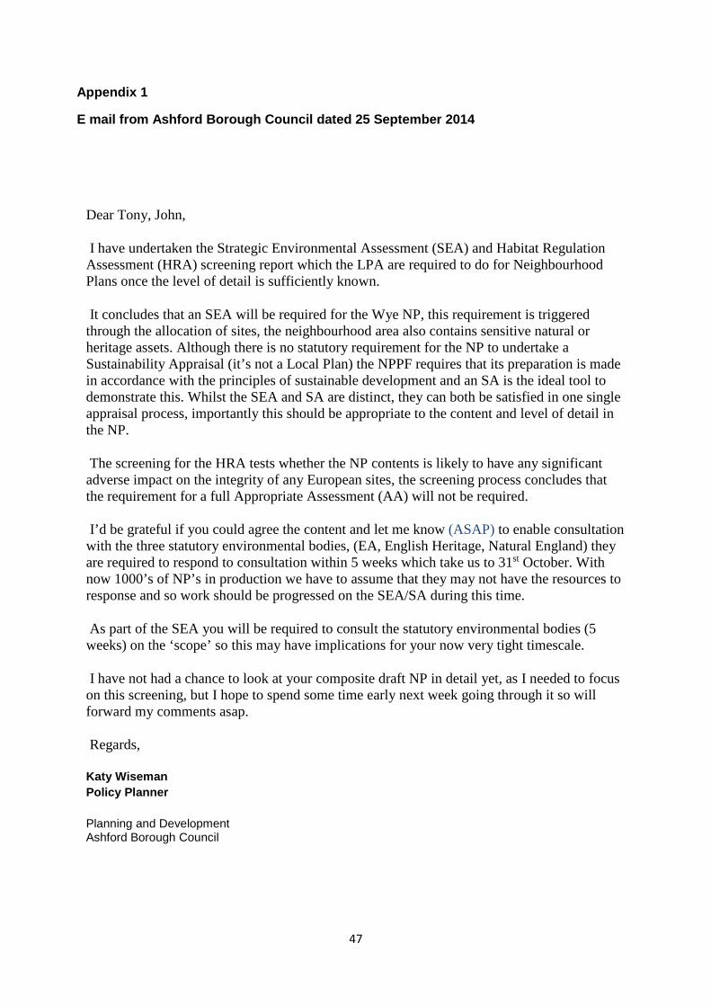
47
Appendix 1
E mail from Ashford Borough Council dated 25 September 2014
Dear Tony, John,
I have undertaken the Strategic Environmental Assessment (SEA) and Habitat Regulation Assessment (HRA) screening report which the LPA are required to do for Neighbourhood Plans once the level of detail is sufficiently known.
It concludes that an SEA will be required for the Wye NP, this requirement is triggered through the allocation of sites, the neighbourhood area also contains sensitive natural or heritage assets. Although there is no statutory requirement for the NP to undertake a Sustainability Appraisal (it’s not a Local Plan) the NPPF requires that its preparation is made in accordance with the principles of sustainable development and an SA is the ideal tool to demonstrate this. Whilst the SEA and SA are distinct, they can both be satisfied in one single appraisal process, importantly this should be appropriate to the content and level of detail in the NP.
The screening for the HRA tests whether the NP contents is likely to have any significant adverse impact on the integrity of any European sites, the screening process concludes that the requirement for a full Appropriate Assessment (AA) will not be required.
I’d be grateful if you could agree the content and let me know (ASAP) to enable consultation with the three statutory environmental bodies, (EA, English Heritage, Natural England) they are required to respond to consultation within 5 weeks which take us to 31st October. With now 1000’s of NP’s in production we have to assume that they may not have the resources to response and so work should be progressed on the SEA/SA during this time.
As part of the SEA you will be required to consult the statutory environmental bodies (5 weeks) on the ‘scope’ so this may have implications for your now very tight timescale.
I have not had a chance to look at your composite draft NP in detail yet, as I needed to focus on this screening, but I hope to spend some time early next week going through it so will forward my comments asap.
Regards,
Katy Wiseman Policy Planner
Planning and Development Ashford Borough Council

48

49