yavapai county flood control district fema workshop...
TRANSCRIPT
1
YAVAPAI COUNTY FLOOD CONTROL DISTRICT
FEMA WORKSHOP SEMINAR
November 1st, 2016
2
• YCFCD first adopted its Flood Damage Prevention Ordinance in 1981
• Responsible for:– Floodplain Management / Development Review under the
Nat’l Flood Insurance Program and adopted Ordinance
– Provide information and guidance for activity and development within flood hazard areas
– Keep flood hazard mapping resources modern so they accurately represent areas at high risk
– Providing real-time weather data and pertinent storm water runoff information
– Regulate and review storm water runoff from both a quality and quantity standpoint
Yavapai County Flood Control District
3
• Joined National Flood Insurance Program in 1985
– Agree to map the flood hazards and manage the
floodplain to FEMA’s minimum standard
– In return, citizens have access to federal flood
insurance and disaster assistance for floods
• Joined the Community Rating System in 1991;
receive credits for going beyond the minimum
standards; now a Class 7
– Benefits:
• Policyholders in high-risk areas receive 15% discount
• County’s flood risk is reduced and community is more
resilient
Yavapai County Flood Control District
4
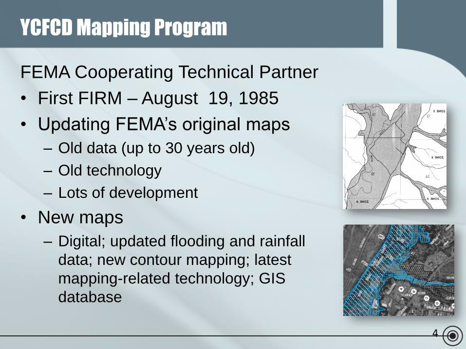
FEMA Cooperating Technical Partner
• First FIRM – August 19, 1985
• Updating FEMA’s original maps
– Old data (up to 30 years old)
– Old technology
– Lots of development
• New maps
– Digital; updated flooding and rainfall
data; new contour mapping; latest
mapping-related technology; GIS
database
YCFCD Mapping Program
Benefits of Improved Mapping
• Knowing the current flood risk….
– Community officials use updated codes to help
ensure safer building and a more resilient community
– Improve emergency planning and response
– Realty, Insurance and Lending professionals are
better able to inform clients around buying/selling and
flood insurance requirements and options
– Residents and business owners make more informed
decisions to protect their most valuable assets
• YCFCD is here to provide info and expertise
5
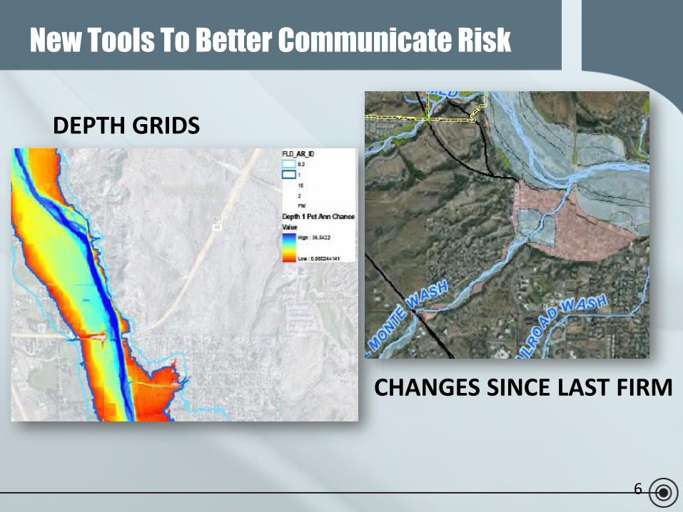
New Tools To Better Communicate Risk
DEPTH GRIDS
CHANGES SINCE LAST FIRM
6
Results of new or restudy mapping
• For properties newly identified to be in a FEMA,
high-risk flood hazard area
– Insurance and building implications
• Changes in Base Flood Elevation may occur
– Insurance and building implications
• Properties that are newly identified as moderate-
or low risk (coming OUT of the mapped high
hazard)
– Risk is only reduced, not removed
• Properties with no change – but time to review
your risk!7
8
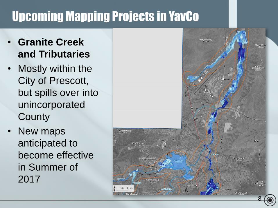
• Granite Creek
and Tributaries
• Mostly within the
City of Prescott,
but spills over into
unincorporated
County
• New maps
anticipated to
become effective
in Summer of
2017
Upcoming Mapping Projects in YavCo
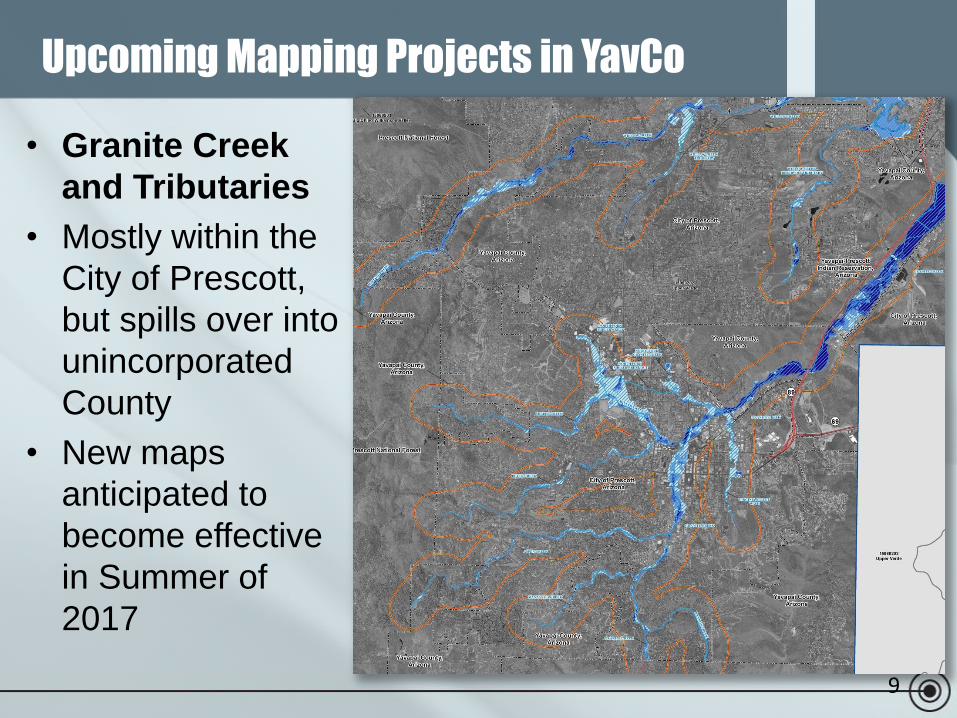
9
• Granite Creek
and Tributaries
• Mostly within the
City of Prescott,
but spills over into
unincorporated
County
• New maps
anticipated to
become effective
in Summer of
2017
Upcoming Mapping Projects in YavCo
10
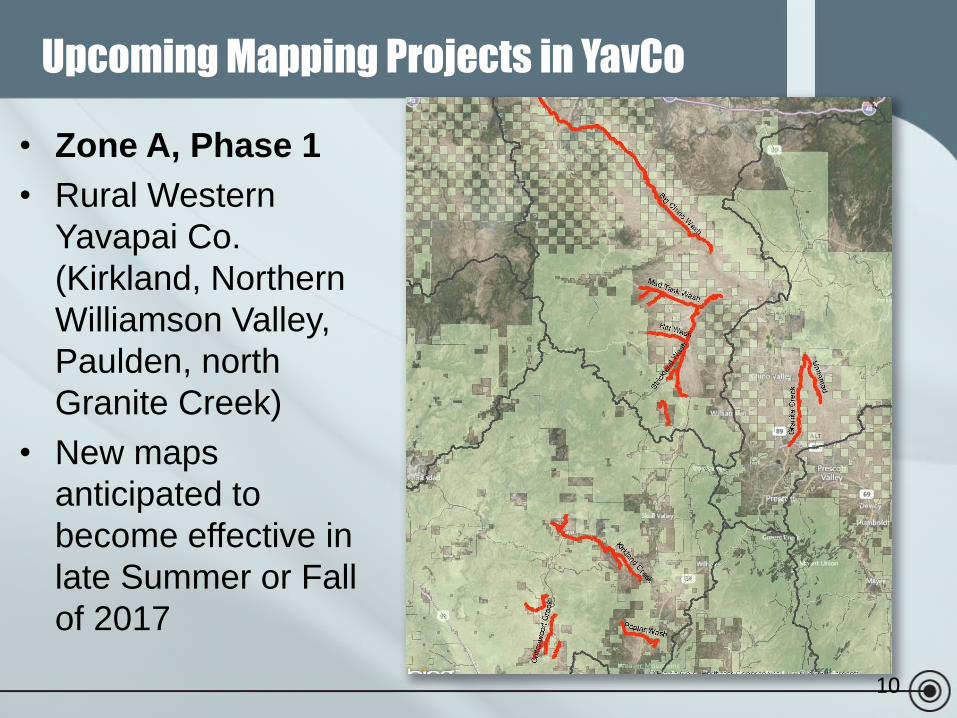
• Zone A, Phase 1
• Rural Western
Yavapai Co.
(Kirkland, Northern
Williamson Valley,
Paulden, north
Granite Creek)
• New maps
anticipated to
become effective in
late Summer or Fall
of 2017
Upcoming Mapping Projects in YavCo
11
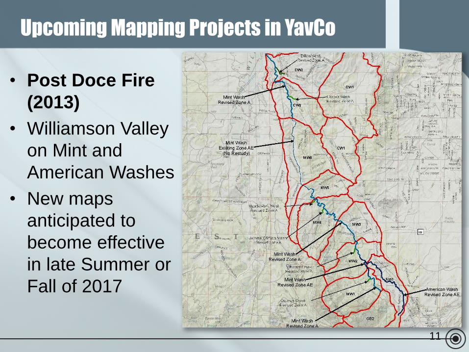
• Post Doce Fire
(2013)
• Williamson Valley
on Mint and
American Washes
• New maps
anticipated to
become effective
in late Summer or
Fall of 2017
Upcoming Mapping Projects in YavCo
12
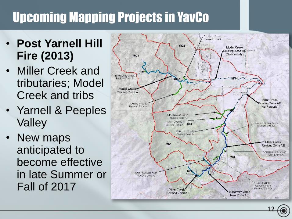
• Post Yarnell Hill Fire (2013)
• Miller Creek and tributaries; Model Creek and tribs
• Yarnell & PeeplesValley
• New maps anticipated to become effective in late Summer or Fall of 2017
Upcoming Mapping Projects in YavCo
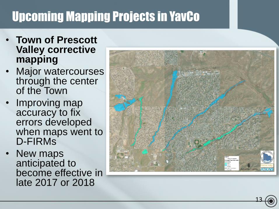
13
• Town of Prescott Valley corrective mapping
• Major watercourses through the center of the Town
• Improving map accuracy to fix errors developed when maps went to D-FIRMs
• New maps anticipated to become effective in late 2017 or 2018
Upcoming Mapping Projects in YavCo
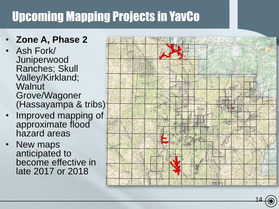
14
• Zone A, Phase 2
• Ash Fork/ JuniperwoodRanches; Skull Valley/Kirkland; Walnut Grove/Wagoner (Hassayampa & tribs)
• Improved mapping of approximate flood hazard areas
• New maps anticipated to become effective in late 2017 or 2018
Upcoming Mapping Projects in YavCo
15
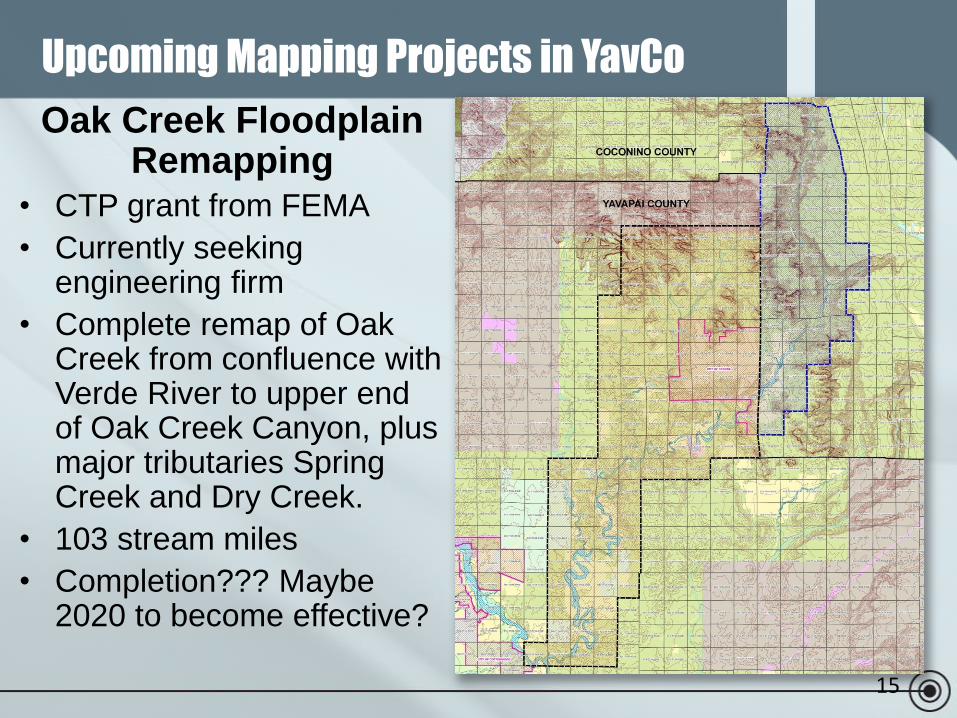
Oak Creek Floodplain Remapping
• CTP grant from FEMA
• Currently seeking engineering firm
• Complete remap of Oak Creek from confluence with Verde River to upper end of Oak Creek Canyon, plus major tributaries Spring Creek and Dry Creek.
• 103 stream miles
• Completion??? Maybe 2020 to become effective?
Upcoming Mapping Projects in YavCo
16
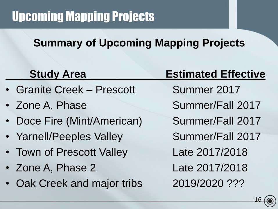
Summary of Upcoming Mapping Projects
Study Area Estimated Effective
• Granite Creek – Prescott Summer 2017
• Zone A, Phase Summer/Fall 2017
• Doce Fire (Mint/American) Summer/Fall 2017
• Yarnell/Peeples Valley Summer/Fall 2017
• Town of Prescott Valley Late 2017/2018
• Zone A, Phase 2 Late 2017/2018
• Oak Creek and major tribs 2019/2020 ???
Upcoming Mapping Projects
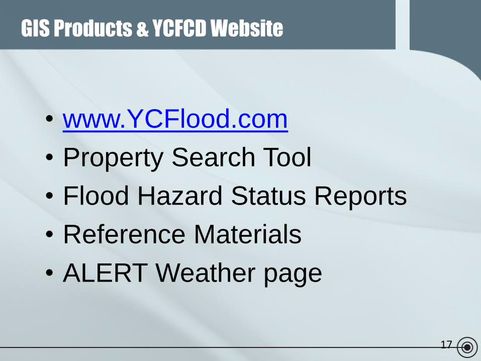
17
• www.YCFlood.com
• Property Search Tool
• Flood Hazard Status Reports
• Reference Materials
• ALERT Weather page
GIS Products & YCFCD Website