yellowstone science - national park service
TRANSCRIPT

Yellowstone ScienceA quarterly publication devoted to the natural and cultural sciences
Volume 1 Number 2
Understanding LandscapesWolves! wolves. wolves?Documentary EcologyElk Calf Perils
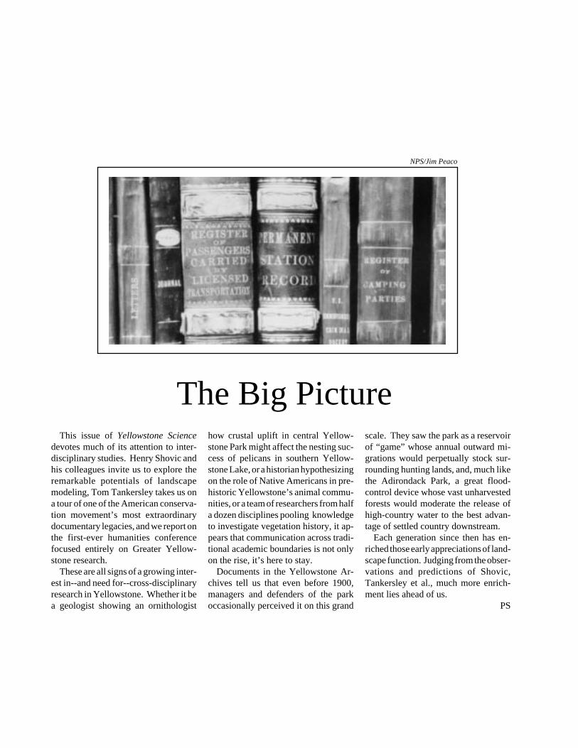
The Big Picturehow crustal uplift in central Yellow-stone Park might affect the nesting suc-cess of pelicans in southern Yellow-stone Lake, or a historian hypothesizingon the role of Native Americans in pre-historic Yellowstone’s animal commu-nities, or a team of researchers from halfa dozen disciplines pooling knowledgeto investigate vegetation history, it ap-pears that communication across tradi-tional academic boundaries is not onlyon the rise, it’s here to stay.
Documents in the Yellowstone Ar-chives tell us that even before 1900,managers and defenders of the parkoccasionally perceived it on this grand
scale. They saw the park as a reservoirof “game” whose annual outward mi-grations would perpetually stock sur-rounding hunting lands, and, much likethe Adirondack Park, a great flood-control device whose vast unharvestedforests would moderate the release ofhigh-country water to the best advan-tage of settled country downstream.
Each generation since then has en-riched those early appreciations of land-scape function. Judging from the obser-vations and predictions of Shovic,Tankersley et al., much more enrich-ment lies ahead of us.
PS
This issue of Yellowstone Sciencedevotes much of its attention to inter-disciplinary studies. Henry Shovic andhis colleagues invite us to explore theremarkable potentials of landscapemodeling, Tom Tankersley takes us ona tour of one of the American conserva-tion movement’s most extraordinarydocumentary legacies, and we report onthe first-ever humanities conferencefocused entirely on Greater Yellow-stone research.
These are all signs of a growing inter-est in--and need for--cross-disciplinaryresearch in Yellowstone. Whether it bea geologist showing an ornithologist
NPS/Jim Peaco

Yellowstone ScienceA quarterly publication devoted to the natural and cultural sciences
Table of Contents
Yellowstone Science is published quarterly, and submissions are welcome from all investigatorsconducting formal research in the Yellowstone area. Editorial correspondence and requests for
information about how to receive this publication should be sent to the Editor, YellowstoneScience, Division of Research, P.O. Box 168, Yellowstone National Park, WY 82190.
The opinions expressed in Yellowstone Science are those of the authors, and do not necessarilyreflect either National Park Service policy or the opinions of any or all members of the Division
of Research. All photos courtesy of the National Park Service unless otherwise noted.
Support for Yellowstone Science is provided by the Yellowstone Association for NaturalScience, History & Education, a non-profit educational organization dedicated to serving the
park and its visitors. For more information about the Yellowstone Association, includingmembership, write to P.O. Box 117, Yellowstone National Park, WY 82190.
1
Volume 1 Number 2 Winter 1993
Biscuit Basin Leak; see page 21
A New Look at an Old Land 2Landscape ecology, conservation biology, and other broad-baseddisciplines demand new technologies to manage and interpret a worldof information.by Henry Shovic, Mark Johnson, and Helen Hadley Porter
Dishrags and Popcorn 7Grizzly bears, black bears, coyotes, mountian lions, and even eaglesprey on elk calves every year, but nobody knew how, exactly when,how many, or why. A recently completed study found out, but firstthey had to catch the calves...interview with biologist Bert Harting
The Yellowstone Archives 14For more than 120 years, Yellowstone administrators have beengenerating paperwork and filing it away. Now it constitutes one ofthe foremost documentary treasures in the history of the Americanconservation movement, and can teach us things about Yellowstonethat its originators never imagined.by Tom Tankersley
News and Notes 18Greater Yellowstone Humanities Workshop • another problematicwolf • Second Biennial Scientific Conference • end of the MargaretHolland era • Biscuit Basin drill hole leak • research prescribed fireescapes • research division reorganization • Greater Yellowstonearcheology symposium • more
EditorPaul Schullery
Art DirectorRenee EvanoffAssociate Editor
Sarah BroadbentResearch
Mark JohnsonPrinting
Artcraft Inc.Bozeman, Montana
On the cover: GIS-generated view ofthe Gardner River drainage in northernYellowstone National Park, lookingsouth from several hundred feet abovethe 45th parallel bridge. Vertical reliefhas been doubled to highlight topo-graphical features. See landscape mod-elling article beginning on page 2.Courtesy of Montana State UniversityGeographic Information Analysis Labo-ratory, Bozeman, Montana.
NPS/Jim Peaco

2 Yellowstone Science
In the past, we often visualizedwildland ecosystems from some rela-tively narrow perspective, such as thehome range of a threatened species, orthe site of a specific vegetation type, orthe distribution of a certain soil classifi-cation. The “grizzly bear ecosystem,”the “lodgepole pine ecosystem,” or the“Cryoroboll-Cryochrept ecosystem”were representations of geographicalareas based on one element of the set-ting that seemed most important tosomeone at the time they were defined.
As our understanding of wildland eco-systems increased, and as the humanpressures on those systems intensified,the limitations of this narrow approachbecame apparent. For example, thegrizzly bear ecosystem is a combinationof high-elevation landforms, the habi-tats of many other animals, and myriadvegetation types and soils, and it existsin the face of an ongoing level of humandisturbance. The challenge we face,now that we appreciate this complexity,is finding ways to organize and analyzethe information we have accumulated.
It is also becoming apparent that thespatial arrangement of ecosystems is atleast as important as their individualcharacteristics. For example, thoughthe individual ecosystems in the Greater
Yellowstone National Park is a vastcollection of such landscapes. Its unique-ness and importance are the result ofthe broad diversity and spatial connec-tions of these landscapes, which arerelatively free from human distur-bance.
The diversity of Yellowstone is oftensubtle. Most of the land is covered inlodgepole pine forests, but there is muchdiversity in the landscapes that occurwithin that vegetation type. Some areasare in relatively flat, plateau-like ter-rain, while others include very steepbreaks or mountainsides. Therefore,for the purposes of scientific inquiry, itis often beneficial to view them as acollection of interrelated landscapes(or landscape ecosystems) rather thanas one large ecosystem.
In addition to new landscape per-spectives for studying our wildlands,methods are emerging to representtheir complexities. Geographic infor-mation systems (GIS) have revolution-ized our ability to organize and viewlarge amounts of data. The technologyis now available to deal with the largedata sets required, and this technologyis accessible to all users willing to learnthe sometimes difficult systems. UsingGIS to produce maps (and some rather
by Henry Shovic, Mark Johnson, and Helen Hadley Porter
A New View of an Old Land
Ansel Adams photo of Mt. Sheridan from the Mural Project, courtesy National Archives
The promising future of landscape ecology in Yellowstone
Yellowstone Area are unique, their con-figuration in relation to each other(that is, how they fit together and inter-act) makes them much more valuablethan a listing of their individual charac-teristics might at first reveal. This wholereally is greater than the apparent sumof its parts. Again, the challenge isfinding ways to understand and mea-sure the character and value of the whole.
The relatively new science of land-scape ecology embraces this broaderview. When we picture landscapes inour minds, we tend to imagine a scenicpanorama, or just a large area of landin general. Many interpretations arepossible, but all have in common aholistic view of the land.
By most formal definitions, a land-scape has the following characteristics:1) repeating patterns of vegetative andsoil ecosystem types, 2) similar climate,geomorphology (landform characteris-tics), and 3) types of disturbances--ei-ther natural- or human-caused.
These landscape systems repeat them-selves in great numbers across a region,and are a square mile or more in size.Resident animals and plants live inthese landscapes, not merely in a singlevegetation type, or a soil type, or even aclimatic type.

Winter 1993 3
good looking ones) is now relativelycommon. A competent technician cannow produce maps that are of highvisual impact in a variety of motifs.
But GIS can be much more than amap making system, creating ever moreindividual “layers” of information. Theexploration of the analytical capabilityof these tools has just begun. Eachlayer (for example, soils, vegetation,slope, climate) represents a part of thelandscape. Though these systems com-bine in complex ways, and cover largeareas, a GIS can easily integrate them,thus simulating landscape ecosystems.The potential is tremendous for thevisual and quantitative representationof these landscapes, thus multiplyingthe usefulness of all layers in scienceand management.
A Three-Dimensional View
This year, some of us initiated aproject designed to add to our knowl-edge base of ecosystems in Yellow-stone. This is a cooperative projectbetween the Division of Research inYellowstone, the GIS Laboratory in thepark, and Montana State UniversityGeographic Information AnalysisLaboratory.
Thanks to this project, we now havethe beginnings of the newest Yellow-stone GIS layer: detailed landforms(geomorphology) and soil matrix com-position. Landforms are identifiablecombinations of related surface fea-tures. Soil matrix represents the uncon-solidated, earthy material that rests onthe bedrock. Both are necessary tocomplete the Yellowstone soil survey,and to support other related researchefforts.
Landforms in this layer are inher-ently visual entities. They are combi-nations of characteristics of slopes, as-pects, and elevations. Written descrip-tions and “flat” maps of them are use-ful, but three-dimensional imageshave much more impact, and are oftenmuch more readily understood. A GIShas the capacity to portray these land-forms in a three-dimensional view. Eachlandform can be visualized, described,and named mentally with only slighteffort.
Landscape Modelling
The next logical step is to use the GISto portray not only landforms, but land-scapes. We propose to integrate thevarious parts of Yellowstone’s land-scape ecosystems--soils, vegetation,landforms, and many others--into oneeasily usable and visual model.
The individual parts have already beenstudied intensively. We know a greatdeal about such things as large mammal
distribution, road systems, vegetationtypes, historic structures, and streamsystems. However, we have difficultystudying the integrated whole, partlybecause it has been almost impossibleto portray that much information in acomprehensible fashion.
Many of the parts of the whole--thatis, many of the specific elements of theYellowstone setting--are now layers inour GIS. What remains is to integratethem,using the immense data storage,
Planimetric (two-dimensional) view of the Mt. Everts area, just east of MammothHot Springs. The lines on this map delineate the various landform/soil matrixcombinations (known as map units) that occur on this landscape. For the purposeof this illustration, the map units have been left unlabelled (north is the top of theimage). All GIS images in this article are courtesy of the Montana State UniversityGeographic Information Analysis Laboratory, Bozeman, Montana.
In this image, the map units portrayed in the upper illustration are here drapedover a three-dimensional topographic model of Mount Everts. Notice that thelong, narrow map units along the bottom (southern) edge of the image are nowrevealed as following a distinctly visible drainage (in this case, the Lava Creek/Gardner River system, tributary to the Yellowstone River).

4 Yellowstone Science
A GIS PrimerThe abbreviation GIS stands for Geographic Information
System. A GIS is any information management system that can1) collect, store, and retrieve information based on its spatiallocation (that is, its location in a given space); 2) identifylocations within a targeted environment that meet specificcriteria; 3) analyze this information; and 4) display the selectedenvironment either graphically or numerically before or afteranalysis. Most GIS systems are computer based and are capableof handling large amounts of data.
Like most special disciplines, the world of GIS has its ownvocabulary. There are two common kinds of GIS. “Raster”systems break a land area into small cells, or “pixels.” Allinformation is referenced to those cells. “Vector” systems groupsimilar land areas into polygons, which are usually much largerthan cells. The kind you choose depends on your needs.
A “layer” or “coverage” is a GIS spatial data base that containsmap features that have a common reference system. This meanseach layer portrays a set of features that can be overlaid on theother layers. Picture a set of maps, each showing differentfeatures of a landscape; one may show rivers, another roads,another buildings, another vegetation, and so on. The GIS cansuperimpose and manipulate such maps, adding many elementsnot possible with simple flat clear overlays.
A “planimetric” representation is a two-dimensional depic-tion of a layer. The road maps sold in gas stations are probablythe most common planimetric representations most people dealwith. Elevation is shown schematically by contour lines or pointelevation markers.
A “three-dimensional” representation is a layer or layers“draped” over a simulated topography, usually based on anelevation layer. The image on the cover of this issue ofYellowstone Science is a three-dimensional simulation of topog-raphy around Mammoth Hot Springs.
Geographic Information Systems are only as good, or ashelpful, as the data they are fed. Before a GIS can analyze orotherwise use a set of data, the data must be collected, usuallythrough a variety of traditional field techniques, such as a soilsurvey or a vegetation mapping project, in which researcherscreate maps (planimetric representations) that are then “digi-tized” so the computer can work with them.
A GIS requires a relatively powerful computer system. Apersonal computer (PC) can run a GIS for small projects with aDOS operating system, 2 megabytes of memory, a speed of 16megahertz, and disk space of 40 megabytes. A large, complexproject requires a computer with a more powerful operatingsystem (for example, UNIX) memory greater than 32 mega-bytes, processor speeds faster than 25 megahertz, and disk spacegreater than 1 gigbyte (1,000 megabytes).
Henry Shovic
analysis potential, and information dis-play power of the GIS.
This potential model for Yellowstoneprovides a structure for organizing anddisplaying the large number of layers ina realistic and usable way. This modelwould be accessible to all scientists,resource managers, and the public. Theanalytical power of the GIS would beharnessed to increase each layer’s us-ability when combined with other lay-ers.
One of the limitations of hand drawnmaps (or for that matter, of single-layermaps drawn by the GIS) is that eachmap has a required theme. A soil scien-tist might desire a map that emphasizessoil-map units with some description ofvegetation types. A plant ecologistmight believe that habitat types shouldbe the central focus, with secondarydescriptions of slopes and soils. Bothmaps are alternative representations ofan ecosystem, firmly biased towards aparticular use or need. The advantageof GIS is that it can produce maps onmany alternative “themes,” with identi-cal accuracy and reliability. The basiclandscape model does not change.Rather, the maps created from that modelvary with the viewpoint of the user.
Applications
The landscape model can be com-posed of layers of data from research,resource management, planning, inter-pretation, maintenance, visitor protec-tion, or administration, meaning thatthe model can also benefit all aspects ofthe park operation. Picture, if you will,a three-dimensional map that could por-tray any combination of information ongeology, topography, roads, human de-velopments, historical activity, locationof cultural resources, average snowcover, animal movements or locations,vegetation condition, fire history, andhuman-use patterns. This visually in-teresting and easily understood portrayalwould be supported by quantitative dataand would be centralized in a usableformat. Not only could researcherscorrelate activities and information, butall park divisions could share informa-tion on historical, contemporary, and
5Winter 1993
even proposed conditions, and depict itdraped on the landscape.
The potential for three-dimensionallandscape modeling is endless. A fewexamples might help suggest the rangeof functions.
With sufficient data on roads, vegeta-tion types, and ponds, we could graphi-cally display the landscape of the Mam-moth area as if the viewer were flyingover the complex (see for example theimage on the cover of this issue ofYellowstone Science, which shows anextremely simplistic view of a few ele-ments of the setting).
The interpretive opportunities alone
are considerable; imagine being able togive visitors an aerial tour, not merelyof the drainages, but of the seasonalmovements of various animals, and howthose movements are related to snowcover, temperature, timing of vegeta-tion growth, hiking activities, fire his-tory, and any number of other factors.
Planners could likewise find the sys-tem very useful. Such a landscape modelwould permit visual perspectives onproposed developments. With the GIScapability for depicting the view of anygiven site from any other given site (aswell as from any altitude above anygiven site), planners could determine
the visibility of a proposed structure byincluding it in the GIS landscape view.They could “draw it into” the model,experimenting with a variety of size andheight structures until the least obtru-sive design was identified.
Wildlife biologists may be interestedin evaluating habitat for potential spe-cies introduction. The GIS is capable ofextracting the location of landscapeswith required habitat components, aswell as their spatial relationship to othercritical components. The GIS couldselect geographic areas that have theappropriate relationships and graphi-cally depict them for further analysis.
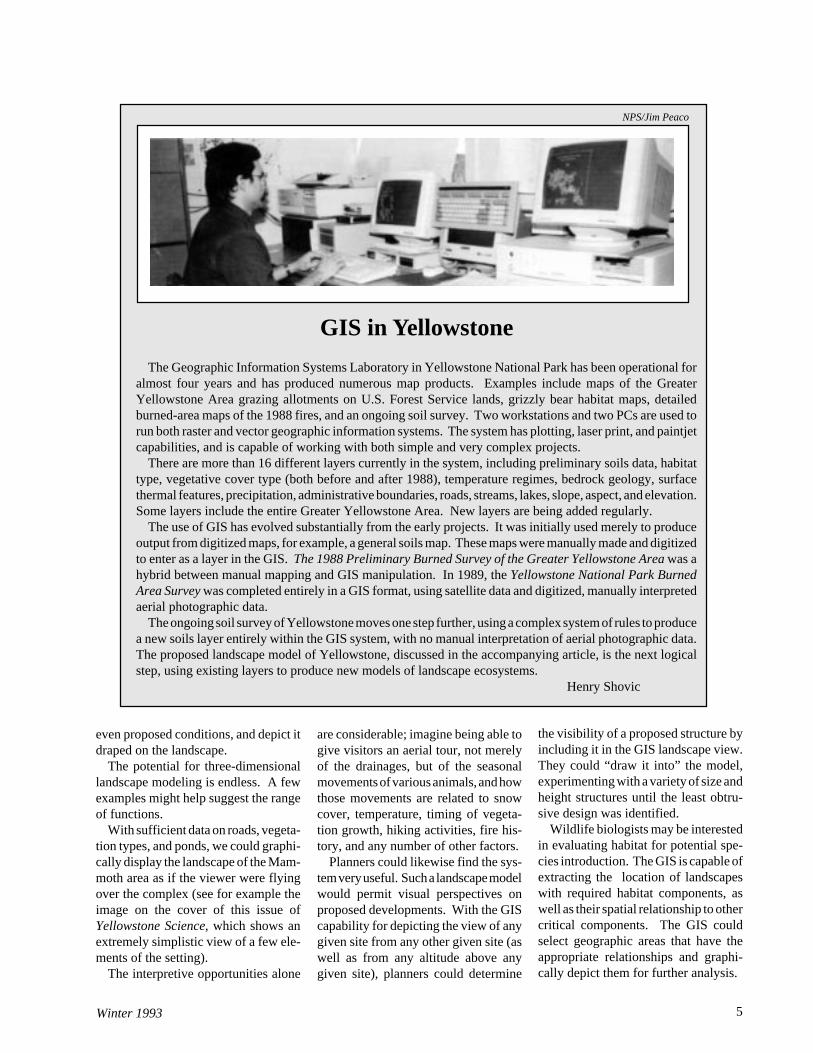
GIS in Yellowstone
The Geographic Information Systems Laboratory in Yellowstone National Park has been operational foralmost four years and has produced numerous map products. Examples include maps of the GreaterYellowstone Area grazing allotments on U.S. Forest Service lands, grizzly bear habitat maps, detailedburned-area maps of the 1988 fires, and an ongoing soil survey. Two workstations and two PCs are used torun both raster and vector geographic information systems. The system has plotting, laser print, and paintjetcapabilities, and is capable of working with both simple and very complex projects.
There are more than 16 different layers currently in the system, including preliminary soils data, habitattype, vegetative cover type (both before and after 1988), temperature regimes, bedrock geology, surfacethermal features, precipitation, administrative boundaries, roads, streams, lakes, slope, aspect, and elevation.Some layers include the entire Greater Yellowstone Area. New layers are being added regularly.
The use of GIS has evolved substantially from the early projects. It was initially used merely to produceoutput from digitized maps, for example, a general soils map. These maps were manually made and digitizedto enter as a layer in the GIS. The 1988 Preliminary Burned Survey of the Greater Yellowstone Area was ahybrid between manual mapping and GIS manipulation. In 1989, the Yellowstone National Park BurnedArea Survey was completed entirely in a GIS format, using satellite data and digitized, manually interpretedaerial photographic data.
The ongoing soil survey of Yellowstone moves one step further, using a complex system of rules to producea new soils layer entirely within the GIS system, with no manual interpretation of aerial photographic data.The proposed landscape model of Yellowstone, discussed in the accompanying article, is the next logicalstep, using existing layers to produce new models of landscape ecosystems.
Henry Shovic
NPS/Jim Peaco

Yellowstone Science6
Research personnel could use thelandscape model to apply site specificpredictive models to an appropriate area.The process of choosing study siteswould be simplified by selecting three-dimensional views having landscapecharacteristics of interest and impor-tance, thereby saving valuable field timeand enhancing applicability.
An investigator could aggregate land-scapes to any level of generalization inorder to customize map products toresearch needs. New indices of land-scape configuration could be developed;for example, a “remoteness” index couldbe generated to measure the degree ofisolation of any feature or set of fea-tures from human activity areas. Thelist of potential uses is limited only bythe development and degree of usabil-ity of the underlying landscape model.
Making it Happen
What we have been describing hereis more than a dream. The technology,tools, and much of the raw informationexist already, and all three are con-stantly being refined and improvedupon.
Yellowstone is poised to take on aremarkable challenge: integrating ahost of datasets, from clear across thescholarly disciplines, into one dynamicsystem that will empower all aspects ofpark operations to previously impos-sible levels of interaction. As so oftenhappens, the obstacle is not technologi-cal or scientific, but fiscal.
Perhaps the interdisciplinary breadthof the model should serve as our ex-ample. Rather than attempt to wringenough money for this project from oneagency or institution, the most produc-tive and sensible course would be for abroad-based support system, in whichmany interested parties contributeaccording to their abilities and needs.
It is our hope to pursue such avenuesfor developing the model, and we wouldbe pleased to hear from fellow investi-gators who share our ambitions for thiswork.
Contact us, in care of the senior au-thor, Henry Shovic, Gallatin NationalForest, P.O. Box 130, Bozeman, Mon-tana 59715.
In this map of the same Mt. Everts area, habitat types and contour lines are addedto the landform/soil matrix map shown on the upper map on page 3. Because it istwo-dimensional, the image is relatively confusing and does not give much visual"feel" for the landscape. Slope, aspect, and slope curvature must be inferred fromthe contour intervals and directions. These problems are largely solved in theimage below.
A three-dimensional representation of the same data layers, with roads (dottedlines) added. Slope and aspect are now obvious. Rangers, planners, resourcemanagers, and researchers in many fields will readily imagine many other layersof information, such as cultural resource sites, wildlife migratory patterns, picnicareas, and backcountry use patterns, that could be added to maps of this type.
Henry Shovic works for the GallatinNational Forest and YellowstoneNational Park, and is currently over-seeing a soil survey of Yellowstone.Mark Johnson, Yellowstone Sciencewriter and researcher, is with the Re-search Division in Yellowstone Na-tional Park. Helen Hadley Porterteaches writing in the English Depart-ment at Montana State University,Bozeman.
Yellowstone Science Interview:Bert Harting
Winter 1993 7
BH It was, and they were terrificpeople, every single one of them overthe four years of the study.YS Who else was involved?BH The study was a cooperative effortbetween the National Park Service andthe U.S. Forest Service. The ForestService field investigator was DanTyers, a wildlife biologist on theGardiner District of the Gallatin Na-tional Forest.YS Of course, the northern Yellow-stone elk herd has been controversialfor a long time, and your study was partof the Congressionally funded initiativeto try to settle some of the long-standingquestions about this herd and its effectson the range. Why was studying elk calfmortality an important part of that?BH To learn more about what regulatedthe population. It had been known fora long time that there was pretty highmortality in the elk calf populationover the summer. There were datafrom back in the sixties when animalswere being trapped and removed. A lotof the animals were pregnancy tested[which shows reproductive rates--Ed.].There was also information fromBarmore’s and Houston’s work [Wil-liam Barmore, NPS biologist in the1960s, and Douglas Houston, NPS bi-ologist in the 1970s], Frank Singer’s
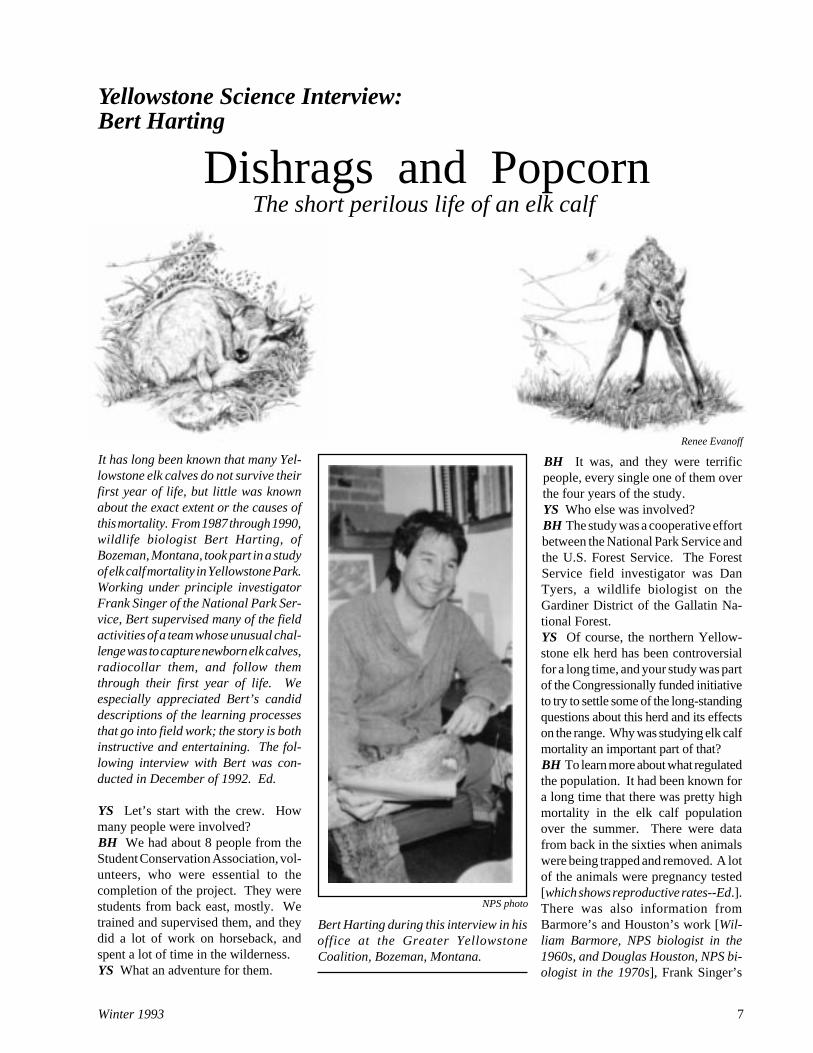
It has long been known that many Yel-lowstone elk calves do not survive theirfirst year of life, but little was knownabout the exact extent or the causes ofthis mortality. From 1987 through 1990,wildlife biologist Bert Harting, ofBozeman, Montana, took part in a studyof elk calf mortality in Yellowstone Park.Working under principle investigatorFrank Singer of the National Park Ser-vice, Bert supervised many of the fieldactivities of a team whose unusual chal-lenge was to capture newborn elk calves,radiocollar them, and follow themthrough their first year of life. Weespecially appreciated Bert’s candiddescriptions of the learning processesthat go into field work; the story is bothinstructive and entertaining. The fol-lowing interview with Bert was con-ducted in December of 1992. Ed.
YS Let’s start with the crew. Howmany people were involved?BH We had about 8 people from theStudent Conservation Association, vol-unteers, who were essential to thecompletion of the project. They werestudents from back east, mostly. Wetrained and supervised them, and theydid a lot of work on horseback, andspent a lot of time in the wilderness.YS What an adventure for them.
Dishrags and Popcorn The short perilous life of an elk calf
NPS photo
Bert Harting during this interview in hisoffice at the Greater YellowstoneCoalition, Bozeman, Montana.
Renee Evanoff

8 Yellowstone Science
predecessors, on the calf ratios in theearly spring and then again in the fall.Doug Houston had documented lowcow-calf ratios in the fall, and our mainobjective was to learn what portion ofthe calf crop failed to survive the sum-mer, and why.YS Where did you go for advice andideas on how to get the job done?BH Frank had worked in Alaska on acaribou calf study, and so he broughtsome expertise, and a lot of the tech-niques used in Yellowstone were takenfrom earlier studies elsewhere. We alsoconsulted with the people at Telonics,the company that made the radiocollars.YS What made the collars a specialconcern?BH We wanted them to fall off after aset period of time, and we wanted themto tell us when the animal died. We alsowanted them to be expandable, becausewhen these elk calves are young, theygrow rapidly.YS How can one collar send a differentmessage from a live elk than from adead one?BH These are motion-sensing collars;there’s a switch inside them that indi-cates if the animal has moved or if it hasbeen completely stationary. When theanimal quits moving, the switch insidethe collar changes the pulse rate, and weknow immediately that something hashappened to the animal.YS Yellowstone is a mighty big place,and elk are pretty good at hiding theircalves from predators. How did you goabout finding brand new elk calves?BH Despite all the earlier studies, westill had a lot to learn. We initiallyintended to capture all of our elk calvesfrom horseback.YS We better make this clear rightaway; that sounds like the Old West,with lariats and pounding hooves, butyou don’t mean chasing them down androping them or jumping on them.BH No. One of the major objectiveswas to disturb these calves as little aspossible. We didn’t want to cause anydisruptions between the cow and thecalf, and we also didn’t want to disturbthe herd at large.
The idea was to get to a good vantagepoint on horseback at daybreak, oftenbefore daybreak, and use binoculars to
scan areas where we suspected therewould be some new calves. We hadquite a bit of information on the tradi-tional calving areas, from the work ofHouston and Barmore, and the rangerswere really helpful, especially the guyswho had been around a long time, likeJohn Donaldson and Joe Fowler. Frankdid several reconnaissance flights in aSuper Cub with Dave Stradley and BillChapman [contract pilots who fre-quently work with park researchers--Ed.] to locate likely calving areas.YS Where did the study take place?BH We had two main study areas.There was a lower-elevation study areaaround Gardners Hole, on the westernside of the northern range, and a higher-elevation study area in the Lamar Val-ley, from Tower Junction up the LamarRiver, Soda Butte Creek, and CacheCreek.YS Why two study areas?BH The elk in those two areas havedifferent migratory patterns, and there’sa difference in the density of predators.It’s been suspected for a long time thatthose different segments of the popula-
The elements of a low-impact captureincluded latex gloves, which served sev-eral purposes. They prevented passingone calf's scent to another, thus ensur-ing that cows recognized their calves.They also limited human scent on thecalf to reduce risk of abandonment bythe cow as well as to avoid attractingpredators.
Frank Singer weighing an elk calf.
tion behaved differently, and so thepopulation regulatory mechanisms mayhave been fairly distinct between thetwo areas.YS So what was a typical capture like?BH We’d go in early in the morning,generally in teams of three to fourpeople--always at least two people percapture team. We’d glass the area withbinoculars, looking for calves or forcows that were behaving suspiciously.YS Most people may not be able toimagine a cow elk looking suspicious;what did they do to make themselvesnoticeable?BH Usually a cow that was about togive birth, or just had given birth, was aloner. In some cases we were lucky andwe’d see her walk over and nurse thecalf. Sometimes, as she became awareof our presence, she’d glance back andforth to a certain area, suggesting to usthat the calf must be bedded there.Another clue was that a cow would trotback toward a certain area.

Winter 1993 9
calf? What all were you interested in?BH We documented everything on aform, including the characteristics ofthe site: slope, aspect, topography, veg-etation type, how far the calf was fromtrees, how far away the cow was, thebehavior of the cow, and so on. Keep-ing track of the cow was important,because if the cow was obviously vigi-lant about the welfare of the calf, thenwe were pretty sure that they would bereunited successfully.
Of course we needed to age the calf.Earlier studies had shown what to lookfor: if the teeth were still fully coveredby a thin membrane connected to thegums, the condition of the dew clawsand the feet, and if the calf was wet orhad matted hair because the cow hadn’thad time to clean it up. In some casesthe afterbirth would still be there.
We would also weigh the calf, be-cause we knew from other studies, andit proved to be true in Yellowstone, thatthe birth weight of the calf was an im-portant factor in its summer survival.YS How long did all this take?BH The average capture time, fromwhen we grabbed the calf until we let itgo and cleared out of there, was a littlemore than eleven minutes the first twoyears. It dropped to around six minutesover the four years of the study.YS Did you also get better at findingthem?BH Yes. Pretty quickly, we discoveredthe calving areas that are used year afteryear. There were spots in GardinersHole, for example, that we could goback to almost any morning and capturea new elk calf, but we didn’t want to hitthose areas so frequently and so inten-sively that we were going to disrupt thecalving activity there. We just learnedhow to identify the characteristics of agood calving area.YS What were they?BH Cows like to have a good vantagepoint to watch for predators. They alsoneed to have good shrub cover, likesagebrush or cinquefoil.YS Speaking of cover, your studyspanned the fires of 1988. How did theloss of cover affect cows in the calvingareas?BH Cows tended to avoid the burnedareas and hide their calves in unburned
Once we had a pretty good idea ofwhere the calf might be bedded, wewould move in on horseback. We’dsystematically work through the sage-brush, in either a spiral or a criss-crosspattern. Sometimes, because of theclues the cow gave us, we’d go right tothe calf. Other times, we’d search forhalf an hour and, though we were stillpretty certain that there was calf beddedthere, we’d abandon the search. Wedidn’t want to keep the cow separatedfrom the calf for long.YS Did the cows stay pretty closeduring the search?BH Yes. Most of the time the cowstrotted off a little ways and looked backat us and barked.YS What did you do when you foundthe calf?BH Usually the calf would be hunkereddown next to a sagebrush; when they’rebedded they either curl up like a dog orflatten out with their head sort of be-tween their legs. The person that spot-ted the calf would motion to the otherperson, pointing to where it was. Thenwe’d back off a little ways, tie up thehorses, and go in on foot, usually oneperson from each side. Eventually, oneof us would grab the calf.YS Where did you grab them? On theshoulders?BH Yes. Ideally the calf would nevereven get up.
YS So they wouldn’t have a chance tostruggle.BH Right. We never injured a calf outof all the 131 calves that we capturedduring the study.YS Did you have any jump up?BH Yes. Dan Tyers developed aninformal terminology to describe theirbehavior. After a couple of frustratingnoncaptures where the calf escaped, Dansaid, “You know, I think we’re dealingwith two different populations of elkcalves here. For lack of a better term,I’ll call one set dishrags. They’re theones that just lie there, that you can pickup and they just dangle. And then thereare the popcorn. The popcorn are theones that you get close and right whenyou least expect it, just like a kernel ofcorn that’s finally gotten hot enough,they pop up straight in the air and they’rejust gone.”
They ran so fast that if we could grabthem in about ten seconds of pursuit wewould, but between 24 and 48 hours ofage, their stature and stability improvedso much that we couldn't capture themany more. In fact, we didn’t really wantto, because the idea was to capture calvesas young as possible so that we couldlearn what the causes of death were, andmost of those causes, predation for ex-ample, were most pronounced on thevery young calves.YS What did you do once you caught a

Yellowstone Science
shrub and tree patches. Apparently,there are a number of factors involvedin a cow’s decision of where to givebirth, and good cover is one of themost important considerations.
It would be interesting to know if thecalves learn those calving sites by somematernal education, or if there are otherfactors that draw them back to thosesites when they grow up and have theirown calves.YS What you have described so far stillsounds pretty routine, but I gather thatin some aspects of the study your learn-ing curve was pretty steep as you fig-ured out how to get the job done.BH There was lots of learning. Ourambition was to put out 30 collars thefirst year, 15 in each study area. About10 to 14 days into the study we realizedthat we weren’t going to accomplishthat objective unless we changed ourmethods, because we weren’t gettingenough calves by searching for them onhorseback.
So we started capturing from helicop-ters, which was much more efficient,both in terms of time expended and inactual cost. We caught about two-thirdsof the calves with the helicopter.YS How did the helicopter affect theelk.BH Actually, it was much less disruptivefor the elk because it took so little time.Each year we were able to make all of thehelicopter captures in two days, ratherthan spreading them out over two weeksor more if we used horses.YS When did the captures take place?BH We captured the first calves aroundMay 18, and by about the 12th or 15th ofJune calving was pretty much over.YS Why did the helicopter work better?BH We could cover a lot more countrya lot faster. We’d spot a single cow, andrather than watch her for an extendedperiod of time, we’d watch her just aminute, and get an idea of where the calfmight be.
Occasionally, the helicopter woulddisturb the elk and they would start toget up and move away with the calves.If there was a newborn calf this wouldbe no problem, because they were soslow and unsteady that we could still setdown and just walk over and pick themup. In cases where the calf was maybe
a day old and could move a bit better,then we would get the cow and calf in theprop wash of the helicopter, and usuallythat would be enough to cause the calf toimmediately bed down.YS After the first year did you usehorses at all?BH From about May 20 to June 1,before there were enough calves on theground to justify using the helicopter,we’d work on horseback and pick up afew calves. After that first year, wealways scheduled the helicopter for twodays. The first day would be May 31 orJune 1, and the second day would be 7 to10 days later.YS Did you feel confident that most ofthe calves got back with their mothers?BH In most cases, the calves reunitedimmediately with the cow. As weworked on the calf, we’d turn it so that itwas aimed at the cow. We would get onthe opposite side of the calf as soon aswe were ready to release it, and it wouldget up and naturally run away from usand toward the cow.
Out of all those 131 calves we cap-tured, we had only four where abandon-ment was suspected--where we felt likeit was even a possibility. Even in thosecases, we never absolutely establishedthat a calf died because it was abandoned.YS Most of the cows must have stayedin sight.BH Usually they did. Sometimes we’dhave a timid cow that would move out ofsight, over the top of a rise.YS But that’s not outside the realm oftheir behavior anyway; they leave thecalves a lot.BH Right. Lots of times in the nurserygroups there’s what is called a sentrycow that will remain behind and staycloser to the calves while the other cowsforage. There will be six to a dozencalves bedded together and one cow willstay behind to alert the rest if any preda-tors come by.
But cows also bed calves down indi-vidually and just trust to luck. One timeDan Tyers and I were up on Cache-Calfee Ridge. I was working on one sideof a big group of trees and Dan wentanother direction. I stopped my horsefor a second to glass an area, and veryfaintly heard Dan yelling, “Bert! Bert!”I rode back as fast as I could, and I saw
Dan down in this little basin, wherehe’d found an elk calf.
He had tied up his horse and wasdown in a linebacker position, squaredoff with an elk calf that was just stand-ing there staring at him. The calf wouldmove a little ways, Dan would move alittle ways, then the calf would movethe other way, and Dan would move theother way, and neither of them wasgaining any ground whatsoever. It wasa complete standoff between Dan andthis funny little elk calf. So I tied up myhorse and joined him, and then the twoof us were squared off with the calf andnot gaining any ground.
This went on for a couple minutes,until finally I had an inspiration. Ibleated like a cow elk, and the calfwalked right up to me, so I grabbed it.
After we finished with the calf and itran back to its mother, Dan said, “Youknow, that was really kind of a sickthing you did. You were like a motherterrorist.”
Another time Dan and I spent fourhours up on Mount Norris without see-ing any cows. Finally, we tied up thehorses and sat down on a knob to eatlunch. While we were sitting there,here came a cow and calf elk out of agrove of trees, and because we werejust sitting quietly, she didn’t see us.When she was about 150 feet in front ofus, she bedded the calf down and walkedaway. We just put down our lunchesfor a minute, and walked down thereand captured the calf.YS But in a trial-and-error project likethis there must have been some prettyinteresting problems. Care to share anyof those?BH The least successful methodologywas probably the volleyball net meth-odology. We were running into somany of the popcorn calves, the oneswe weren’t able to capture, that some-body came up with the idea that twopeople with a net could capture them ifsomeone would run them toward thenet.
The only net on hand was a volley-ball net, and so we carried this long netaround on our horses for three or fourdays. But the sagebrush was usually sothick that you couldn’t get the net downto ground level. We ran several calves
10

Winter 1993 11
under the net before we gave up.YS How did you detect mortalities?BH We had our contract pilot, BillChapman, fly the areas every morning,usually at dawn during the peak of thepredation period, and again at dusk.He’d monitor the calves from the airand give the locations so we knew ifthey’d moved since the last radioloca-tion. He’d also note if he could see themwith a group of cows, so we knew theyhadn’t been abandoned.
Most important, he’d monitor the sig-nal to check if there was a mortalitypulse or an active pulse.YS The mortality pulse only signalledlack of motion. How could you tell asleeping calf from a dead calf?BH That took some adjustment. Thefirst year, the switch time on the collarswas only one hour, and that turned outto be too short; sometimes the cowswould nurse and bed the calves, and thecalves wouldn’t move at all for morethan an hour. That meant we got somefalse mortality signals.
Once we had a mortality signal wecould count on, we had our act togetherto where we could mobilize the forcesvery rapidly. The more time that elapsedbetween the mortality and when we gotto the site, the less likely we were to beable to determine absolutely what thecause of death was. We were able to geton the horses and be out in the field in anhour, usually less.YS Grizzly bears must have addedsome spice to the investigations.BH We had to exercise a lot of caution,because grizzlies were the greatest causeof summer mortality. Both Dan and Ihad worked for the Interagency GrizzlyBear Study Team, and Frank had donework in grizzly country in Alaska andMontana, so we were pretty familiarwith bears We had to be careful that wedidn’t walk into a fresh kill with a griz-zly bear still bedded in the trees 20 feetaway. In some cases it was obvious wewere in there right on the heels of thebear.
Once it was safe to enter the area,we’d park the horses, move in, and juststart going through it with a fine-toothcomb. Sometimes it was a real trick justto find the calf carcass, because at closerange telemetry gets pretty strange; you
get a lot of signal bounce as the signalgets strong, so that the ability to discernthe direction with the antenna gets prettypoor.
When we found the collar, we’d startsearching for signs of what caused themortality. We’d look for tracks. We’dcrawl around trying to find hair samples.If there was blood on the vegetation, orif there was blood smeared on the car-cass hair, or blood on the collar, thatsuggested that the animal was alive andable to bleed when the predator hit it, asopposed to the animal dying from someother nonpredation cause and beingscavenged later.YS How could you tell which predatorhad been involved?BH Bear mortalities were distinctivein a number of ways. They tended toskin the elk calves. We’d find the hideinverted backwards, just peeled back asif it was cased by a trapper. They’d ripit open at the hindquarters and just tearit off. Most of the bones would becrushed. Sometimes the only boneswe’d find would be a rib or two, or thehooves.
Bear mortalities also tended to showmore sign of disturbance. We’d findthe vegetation completely flattened, andthe dirt would be more disturbed.
At a bear kill, the calf skin wouldusually be lying there more or lessintact; it wouldn't be torn up. A bearwould rip the whole hide off, whereascoyotes would have to tear it apart.
Rita Habermann, Student ConservationAssociation volunteer, holding a "calfcasing" that is typical of a grizzly bearkill; the whole skin, with feet, head, andeven collar, were in one piece. Below:Bert on Cache-Calfee Ridge recordingdata near a calf carcass, assumed to bethe remains of a golden-eagle kill (seepage 12).

Yellowstone Science12
The scattered condition of this carcass,caused by scavengers, demonstratedhow difficult it often was to determinethe true cause of death. The radiocollar (small white box near right edgeof photograph) worn by this calf waslater found to be punctured by thetalons of a golden eagle.
most intense mortality, and most of thatwas due to predation. That was theperiod when the predators seemed to behoming in on the elk calves and that’sbeen well described by the Frenches[Steve and Marilynn French, of the Yel-lowstone Grizzly Foundation--Ed.] andothers. We saw the same thing.YS What else killed them?BH We had several cases of disease
and starvationduring the sum-mer, includingone stomach tor-sion in an uncol-lared calf that wei n c i d e n t a l l yfound inGardiners Hole.Most of the win-ter mortalities,about 15 calves,were from mal-nutrition, and an-other four calveswere harvestedby hunters in thefall or winternorth of park. We also h a done late-wintermountain lion
predation. That was really the onlymountain lion predation that we docu-mented, though we know from Kerry’s[Kerry Murphy, of the Wildlife ResearchInstitute, studying mountain lions inYellowstone--Ed.] studies that moun-tain lions prey extensively on calves.YS So if you’re an elk calf, what areyour best hopes of survival?BH Animals that were born early in thecalving period stood a better chance ofsurviving than animals that were bornlate. Predation intensity seemed to in-crease, as the predators discovered therewere elk calves available. Also, thecalves with the heavier birth weightshad higher survival rates, probably for avariety of reasons. They were moremobile. Judging from how much betterthe large calves were at outrunning bi-ologists, they were probably better ableto outrun a predator.YS What do you think were the limita-tions of the study?BH You know how different things are
Where it became tougher was beingsure that the bear or the coyote was thecause of death--that’s the distinctionbetween predation and scavenging. Andthat’s where we had to do some realbioforensics, if there is such a word. Weexamined the vegetation to see if therewas any blood around. We examinedthe calf, to see if there was any kind ofsubcutaneous [under the skin--Ed.]hemorag ing,because if theanimal was stillalive when thebear or the coy-ote started totake it apart,we’d be able tosee the bruisearound the siteof the clawingor bite.
Even then,sometimes thepredators madeit impossible forus to figure outwhat had hap-pened. We hada really puzzlingmortality onCache-CalfeeRidge. We detected the signal in onedirection and followed it, but suddenlythe signal was from another direction.At the same time, the signal was chang-ing back and forth from mortality signalto active sign. We finally figured outthat adult coyotes had preyed on the elkcalf, at a site that we never did deter-mine, and either they or the pups broughtthe collar back to the den. They had justbeen playing with it.YS You reported one eagle kill. Howdid you determine that an eagle did it?BH There was an eagle feather or twoat the site, and it was obviously a preda-tion because of the hemorrhaging andthe blood around the site. Later we sentthe collar back to Telonics, and whenthey took off the tape around the mainpart of the collar, you could actually seewhere the talons of the eagle had punc-tured it. They’re incredibly strong.YS Did you ever arrive while the coy-otes were still on the carcass?BH That happened a number of times.
In some cases, the calf had the bad luckto wander near a coyote den; severalcalves were killed right in the vicinity ofcoyote dens.YS So when you tallied up all the data,what did you find?BH We had 31 percent summer mortal-ity, and another 20 percent died duringthe winter.YS Was that summer mortality mostlyin the first few weeks of life?BH Yes. Virtually all of them hap-pened within 28 days. The predationrate rose linearly between 3 to 10 daysand then it started to taper off from 10days to 28 days. Bear predation hap-pened up to about 28 days, and coyotepredation went up to about 22 days. Theone lion predation was on a calf nearlya year old. We didn’t have any mortali-ties between the 43- and 188-day pe-riod. In other words, if a calf survivedthat long, then it had a free ride untilwinter. That early period, from birth toabout 10 days, was the period of the

13Winter 1993
animals in poorer condition tend toconceive later than animals in bettercondition. That suggests that the cowson the eastern end of the northern rangemay be in poorer condition, on the aver-age. It’s an intriguing scenario.YS What about the calves that didn’tdie--the ones that were still wearingcollars after a year? How long do theyhave to wear them?BH Those collars were designed to falloff. They were stitched with a canvasband in them, where the thread or theband itself would rot.YS Did the signal last long enough thatyou could pick them up after they felloff?BH We did pick them up, which wasimportant because they were a $350dollar item and could be reconditionedand used again.
every year in the park; you go out therein the spring and there’s still about 10inches of snow on the ground on theBlacktail Plateau, and the weather’shorrendous. Other years it’s not. I don’tthink that four years was really enoughto fully cover the entire battery of pos-sible climatic/population scenarios ifyou really wanted a complete portrayalof what goes on.YS Did you trap enough animals for agood sample?BH We actually got an average of alittle over 30 calves a year, and I thinkthat was a good number. We were ableto do good analysis with good statisticswith 30 animals a year. Obviously itwould have been great to have 50 or 75,but we wouldn’t have been able to keepup with them given the resources andpersonnel we had.YS What questions would you likebetter answers to?BH There were some things that I'mstill really intrigued by. We captured alot more male calves than female calves,especially in the Lamar, where we caughtsignificantly more male calves than fe-males. That’s a puzzle. Studies of reddeer and mule deer suggest that theones that conceive later tend to givebirth to more males than females. Also,
Below: Yellowstone SuperintendentHorace Albright and elk calf, 1923.
Renee Evanoff
Bert Harting is currently with theGreater Yellowstone Coalition inBozeman, Montana, as the GreaterYellowstone Tomorrow Project Assis-tant. The scientific paper containingthe complete results of this study,co-authored by Frank Singer, KateSymonds, and Bert Harting, wasnearing completion at the time of thisinterview.
Photographs for this article by DanTyers unless otherwise credited.
NPS Photo

Yellowstone Science14
TheYellowstoneArchivesA study indocumentaryecology
NPS/Jim Peaco photos
by Tom Tankersleythe region, as well as the early journalsand other records of EuroAmerican trav-elers, provide a foundation for currentdocumentary resources.
Following the survey of Yellowstoneby the Hayden Expedition in 1871,which scientifically verified Yellow-stone’s unique properties for a doubt-ing world, Congress establishedYellowstone National Park onMarch 1, 1872. Unfortunately, Con-gress created the world’s first nationalpark without appropriating funds for itsmanagement, and so for 14 years theadministration of the park fell into thehands of well-intended and oftenignored civilian superintendents, wholeft relatively few records.
To the Rescue
As knowledge of the wonders of Yel-lowstone spread, and population in theregion expanded, it became apparent
Our quest to understand the resourcesof Yellowstone National Park and therelationship between those resourcesand humankind seems endless. Be-cause of the diversity of Yellowstone’sresources, and because of the region’srich human history, research concern-ing Yellowstone National Park has manydimensions. Billions of years arereflected in the geological history,millions of years are reflected in thebiological history, and thousands ofyears are reflected in the cultural his-tory of Yellowstone National Park.
Since the last glacial period, morethan 10,000 years ago, humans havebeen left many kinds of records in Yel-lowstone. The prehistoric record liessilent in the landscape, awaiting ar-cheological discovery and evaluation.While much of the Native Americanstory is lost to us, the oral traditions ofthe Bannock-Shoshoni, Crow, NezPerce, Blackfeet, and other people of

15Winter 1993
The Yellowstone Park Company recordsrepresent perhaps the most exhaustivesurviving documentation of any long-term concessioner in the history of thenational parks.
done park history as much of a serviceby saving all this material as by writinghis highly regarded books. Prior toAubrey’s efforts, there were even in-stances when records packed for ship-ment to the National Archives wereinadvertently sent to the incinerator,and Aubrey himself noted that someearly document boxes were singed, hav-ing been rescued from the flames at thevery last second.
The surviving records provide aremarkable wealth of information thatdocuments the operations, programs,special events, and evolving philoso-phy for the management of the park.
A Yellowstone Satellite
Since 1977, Yellowstone NationalPark had a special relationship with theNational Archives and Records Ad-ministration. Yellowstone serves as asatellite branch of the National Archives.The extraordinary nature of thisrelationship, and the significance of thearchives, become apparent in thisarrangement, because only four othercollections hold this satellite status:West Point Military Academy,Annapolis Naval Academy, the Span-ish Land Grant records in New Mexico,and the Five Civilized Tribes recordsin Oklahoma.
Records in the Yellowstone Archivesare organized into 13 series, which re-flect the various periods of park admin-istration and concessioner records.Obvious major chronological divisionsinclude the management of Yellowstone
National Park by the U.S. Army be-tween 1886 and 1916, the YellowstonePark Company from 1900 to 1980, andthe NPS from 1916 to the present.
The Army in Yellowstone
The U. S. Army records are organizedas one series. This one 75 linear-footseries includes records from the estab-lishment of the park to the establishmentof the NPS. While relatively few recordsrepresent the period prior the arrival ofthe army in 1886, this series provides acomprehensive documentary biographyof the 30 years of army administration.
Under the military administration,policies were established concerningthe management of concessioners, wild-life, fires, visitors, and violators of parkregulations. The management of Yel-lowstone by the army was accomplishedwithout benefit of an established policy,and so serves as a reflection of prevail-ing philosophies and attitudes at anygiven time.
These first managers generally fo-cused their energy on the needs of spe-cific resources, rather than worryingabout broader concepts such as ecologi-cal systems. To a large extent, themilitary management of Yellowstonewas accomplished through trial and er-ror. Though successful in many ways,
that good intentions and noble effortswere not sufficient for the protection of“Wonderland.” In 1886, as if staged bya Hollywood producer, Captain MosesHarris arrived at Mammoth Hot Springswith Company M of the 1st U.S. Cav-alry to rescue the park from destructionthrough lack of interest. Not only werethese blue-clad champions armed withsabres and Spencer carbines, theybrought in their caissons an arsenal ofbureaucracy, and bureaucracy thriveson documenting itself.
Unlike the archeological record ofprevious millennia, and unlike the wildtales of wandering and wonderingmountain men, these military recordsnever lack for fascinating detail: thedaily activities, management decisions,and philosophical development of parkmanagement from 1886 until 1918.They also now provide baseline dataabout park resources, data being put touses that those vigilant soldiers couldnot have imagined so long ago.
The records generated by CaptainHarris and subsequent military superin-tendents have been preserved through acombination of luck and foresight. In1916, when the army was turning theadministration of Yellowstone over tothe newly created National Park Ser-vice (NPS), future superintendent andpark service director Horace Albrightwas on hand to insist that records per-taining to the administration of the parkremain. For many years, the armyrecords and early NPS records werestored in closets and sheds throughoutthe park.
The National Archives Act in 1935was a step in the right direction, but itonly brought about half-hearted andless than ideal management of the park’shistoric record. The objective of theNational Archives Act was to provide asystematic and centralized processfor the preservation of records that docu-mented government administration.However, in Yellowstone, recordswere placed out of sight and out of minduntil the 1960s, when park historianAubrey Haines began consolidating therecords from scattered locations.
Aubrey, who was working on hismilestone two-volume history, The Yel-lowstone Story, at the time, may have

Yellowstone Science16
The archives chronicle the complex evolution of parkmanagement. In 1908, President Theodore Roosevelt wrotethe superintendent about not killing too many predators,but, as excerpts from this 1915 scout's diary show, predatorcontrol was daily business for years thereafter.
there were several problems in this rela-tionship.
First, the assignment of troops for themanagement of the park was an unor-thodox mission, one not conducive tomaintaining the sorts of skills and disci-plines required of troopers. Second,from the standpoint of the Secretary ofthe Interior, military management wasnot considered to be a permanent ar-rangement. Though well intended andoften quite effective, the military ad-ministration was not equipped to pro-vide the expertise and skill necessaryfor management of natural resources.
Through the records in this series, wecan trace the dilemmas facing the mili-tary superintendents, and gain an inti-mate understanding of the daily func-tion of the army in this unusual assign-ment. Soldier station reports reveal thedaily operations of the park; scout dia-ries reveal resource management objec-tives, as well as local conditions en-countered by patrols; entrance stationlogs reveal visitation trends and thestates of origin of visitors.Superintendent’s annual reports revealnot only the processes but the rationalefor locating and building roads.
This 75 linear-foot series of military
records has also been placed on micro-film through a cooperative agreementwith Montana State University. Thefilms are available at the YellowstoneResearch/Reference Library and at theMontana State University Libraries, orthrough inter-library loan.
Historic Concessioners
The Yellowstone Park CompanyRecords are also organized as one se-ries. Among the concessioners associ-ated with Yellowstone National Park,none have enjoyed as long or as politi-cally involved a relationship with thefederal government and the public asdid the Yellowstone Park Company.The company’s roots date back to the1880s, and its association with the North-ern Pacific Railroad.
Though in various forms and piecesthis concession operated under severalnames, including Yellowstone ParkTransportation Company, YellowstonePark Camping Company, YellowstonePark Hotel Company, Yellowstone ParkLodge and Camps Company, they allfall under the archival umbrella of theYellowstone Park Company.
The Yellowstone Park Company op-
erated in Yellowstone until their leasewas terminated in 1980. At that time theUnited States Government purchasedall of their property--everything fromhotels to vehicles to pillow cases to awealth of administrative records. Thefiles in this series were included in thistransfer.
The Yellowstone Park Company se-ries consists of approximately 175 lin-ear feet of files, ledgers, and invento-ries, the bulk of which cover the yearsbetween 1920 and 1960.
This series has recently been orga-nized and inventoried. Its wealth ofinformation has yet to be tapped byscholars or administrators. For example,architectural historians will at last beable to answer long-standing questionsabout the renowned architect RobertReamer’s involvement in remodelingthe Mammoth Motor Inn in the 1930s.
The National Park Service Records
There have been many changes in themanagement of Yellowstone since theNational Park Service was created in1916. These changes have been theresult of an evolving philosophy, andthe NPS materials in the Yellowstone

Winter 1993 17
Archives are the documentary biogra-phy of this evolution, an extraordinaryresource for scholars in many disci-plines.
Eleven series, encompassing morethan 560 linear feet of record, documentthe past 75 years of management. Theseseries employ the present file system ofthe NPS and are organized in the fol-lowing subjects: Administration andManagement, 52 linear feet; Conces-sions, 12 linear feet; Development andMaintenance, 32 linear feet; Fiscal, 4linear feet; History and Archeology, 8linear feet; Interpretation and Informa-tion, 28 linear feet; Lands and Recre-ation Planning, 12 linear feet; Naturaland Social Sciences, 56 linear feet; Per-sonnel, 4 linear feet; Law and LegalMatters, 72 linear feet; Forestry, 280linear feet. These records are an incred-ible source for understanding manage-ment priorities and objectives, as wellas for learning just what existed in physi-cal property and operations.
History and Science in Partnership
Yellowstone’s natural resources havea history too. The management of natu-ral resources is specifically reflected inthree series, but probably no other eventin the history of Yellowstone has beenas thoroughly documented as were the1988 fires. The Forestry series includesmore than 200 feet of fire records.
Lands and Recreation Planningrecords are the primary source for is-sues relating to water rights and bound-
Recently acquired mobile shelvingallows for greatly increased storagecapacity; a few turns of each shelf'scrank handle will open any sectiondesired.
aries. Natural and Social Sciencesrecords will facilitate research on broadissues, such as elk and bison manage-ment, or a host of tightly focused topics,such as coyote stomach contents be-tween 1927 and 1938, or pocket gophermanagement in 1946. Whatever thescope of a new research project in Yel-lowstone, there is probably a historicrecord that will illuminate theresearcher’s path.
Following the Federal Records Dis-position Schedule established by theNational Archives and the NPS, all per-manent records are transferred from thepark’s active central files directly to thepark archives when eight years old. Inaddition, the archives serves as a reposi-tory for retired field records, often es-sential in resource inventories and re-search.
The Future
The volume of records maintained inthe Yellowstone Archives is growingrapidly. More than 300 linear feet ofrecords currently being held in the RockyMountain Regional Records Center inDenver will soon be “repatriated” to thearchives.
As historians gain a better under-standing of how they might assist
scientists, and as scientists become moredependent on historical research andmethodologies, the resulting interdisci-plinary cooperation will result inprofoundly significant new uses ofthe archives. Data Base software, GISprograms, and CD Rom’s are increas-ing the ease of manipulating the datacontained in historic records.
The Yellowstone Archives is locatedin the Albright Visitor Center, alongwith the Yellowstone Research/Refer-ence Library, and the park’s museumcollection, both of which also comple-ment research efforts.
The Archives and Research/Refer-ence Library are open Monday, Wednes-day, and Friday from 1:00 to 5:00, Tues-day and Thursday from 8:30 to 12:00.The library may be reached at 1-307-344-2264, and the archivist at 1-307-344-2261. Special arrangements foruse of rare collections may be made bycontacting us in advance. Use of archi-val materials, as well as of rare li-brary and museum materials, followsaccepted professional standards ofsupervision.
Tom Tankersley has worked in severalNPS historical sites, and has beenYellowstone’s historian-archivist since1989.

18
¬esNEWSWorkshop Considers GreaterYellowstone HumanitiesResearch
On December 10 and 11, 1992, hu-manities specialists met at Montana StateUniversity in a workshop entitled, “TheHumanities and the Greater Yellow-stone Ecosystem: Defining a ResearchAgenda.”
The opening event was an eveningaddress by A. Hunter Dupree, GeorgeL. Littlefield Professor of History(Emeritus), Brown University, on “Fed-eral Science Policy and the NationalParks.” Dr. Dupree, author of the au-thoritative book Science in the FederalGovernment (1957), presented a broad-ranging view of Yellowstone’s place inmodern resource-management thinking.
In his welcoming remarks, MSU VicePresident for Research Bob Swensonemphasized the need for an expandedhumanities component in Greater Yel-lowstone research. Observing that “sci-ence asks what and how; the humanitiesask why,” Swenson noted that increas-ing interest in and pressure on GreaterYellowstone provide compelling causefor deeper understanding of the culturalissues that influence the direction of theregion.
The workshop was attended by about40 specialists and scholars in such dis-ciplines as archeology, anthropology,oral history, archives, library sciences,,park management, and environmentalhistory. Round-table sessions weredevoted to “History and the GreaterYellowstone Ecosystem,” “PreservingGreater Yellowstone’s HistoricRecord,” “Oral History in the Greater
The details of the reorganization areincomplete at press time, but the fol-lowing elements should be of interest toall Yellowstone researchers.
The current Research Division willdissolve, with its personnel going totwo other management entities, depend-ing upon their duties. Research-gradescientists will be assigned to one ormore university Cooperative Park Stud-ies Units (CPSU). It is anticipated theywill be supervised by a CPSU unit leader,whose supervisor will be the regionalchief scientist in the Rocky MountainRegional Office, Denver. The CPSUarrangement has recently been adoptedas the norm throughout the service.
Non-research-grade personnel willbecome part of a newly created, and asof press time structurally undefined,resources unit under park administra-tion. Current researchers will in alllikelihood notice little change in theirrelationship with Yellowstone. Yellow-stone Science will report on this reorga-nization as it continues.
In January of 1993, SuperintendentRobert Barbee convened an interdivi-sional team to advise him on a restruc-turing of the Research and ResourceManagement functions in the park. Thismeeting was the culmination of severalmonths of deliberations and meetings inthe park, beginning with a special NPSreview team that analyzed these parkoperations in August of 1992.
MSU Vice President Bob Swenson welcomesworkshop participants.
MargaretHollandRetires
In October of1992, the Re-search Divisionsaid farewell toour long-timemanagement assistant and budget ana-lyst, Margaret Holland, who was retir-ing after a long career of federal service.Margaret first came to the division in1979, and very quickly became a cen-tral force in the operation. For manyvisiting researchers, especially thosewho dealt with the division long-dis-tance by phone or correspondence,Margaret truly was the voice of re-search in the park.
At her farewell party, Division ChiefJohn Varley listed her essential profes-sional role in the management of a rap-idly growing division, but all of us whoworked with her will remember her just
Yellowstone,” and “Archeology and theGreater Yellowstone Ecosystem. TheYellowstone Center for Mountain En-vironments hosted a luncheon, at whichDan Flores, Hammond Professor ofWestern History at the University ofMontana was the guest speaker.
Concluding remarks were by GordonBrittan, Regents Professor of Philoso-phy at Montana State University. Brittansaid that the workshop “undermined olddivisions between cultural and naturalhistory,” and that “we need a humani-ties research agenda because the hu-manities and the sciences, in an envi-ronmental perspective, cannot besharply separated." He concluded that“a main result of the conference was abroadening of disciplinary boundaries,the result of a deeper reflection on theways in which the sciences and thehumanities contribute to the answeringof ecological questions.”
The program committee, in consulta-tion with the moderators of the roundtables, is preparing an agenda of re-search directions and needs for GreaterYellowstone, to be circulated in 1993.
The workshop was sponsored by Jimand Anne Banks, along with the Depart-ment of History and Philosophy (MSU),the Yellowstone-MSU CooperativePark Studies Unit, the YellowstoneCenter for Mountain Environments, theYellowstone Association, Montananson a New Track for Science, and theMuseum of the Rockies.
Research and ResourceManagement ReorganizationUnderway
NPS
Sue Mills
News and Notes

19
¬esNEWSas much for her quick sense of humorand her wisdom about human nature.
Margaret brought a great and consis-tent cheerfulness to our offices. Which-ever of the park’s constituencies wascertain the sky was falling, whatever thecontroversy d’jour, Margaret neverfailed to remind us of the extreme im-portance of other things, like laughingon a regular basis, and rememberingeach other’s birthdays and other specialevents in our lives. Whether in thesmoke of 1988 or in the endless wranglesof bureaucracy, Margaret always helpedus keep our sense of balance.
Margaret and her husband Dave, whoalso recently retired from the NationalPark Service, will be indulging their joyin traveling for some time, and willlikely settle on their property outside ofBend, Oregon. They will both be missedby their many Yellowstone friends.
Wayne Hamilton Honored forYellowstone Research
Yellowstone Research GeologistWayne Hamilton was named scientistof the year in the Rocky Mountain Re-gion of the NPS for 1992. The nomina-tion cited Wayne’s innovative work inmapping geothermal aquifer boundaries,especially as that work influenced on-going dialogues about geothermal de-velopment near the park. The nomina-tion also pointed out a little-known butfar-reaching contribution of Wayne’sto the course of the geothermal devel-opment issue, as follows:
“It was largely due to his scientificperceptions and foresight that in 1987,all of Yellowstone National Park, ratherthan merely the immediate vicinity ofprominent geothermal features, wasdefined as a significant geothermal fea-ture. It was that unprecedented butcrucial breadth of definition that gavethe National Park Service the leeway toadopt an adequately comprehensiveview of just what resources needed pro-tection in Yellowstone Park during thecongressional debates of 1991.”
Among Wayne’s other achievementswere the development of an annual sym-posia on physical sciences in Yellow-stone, the creation of the Yellowstone
of the Society of American Archeolo-gists, April 21-24, in St. Louis, Missouri.For more information, contact KenCannon or Melissa Connor, MidwestArcheological Center, Federal Build-ing, Room 474, 100 Centennial MallNorth, Lincoln, Nebraska 68508-3873.
Research Fire Escapes
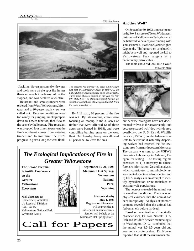
A small prescribed research fire wasset on the Buffalo Plateau in Yellow-stone Park on Wednesday, September23 at 2:30 p.m. The fire was intended toburn grasses and sagebrush within a 4-acre containment line. However, a spotfire driven by high winds jumped thefire line, resulting in a wildfire thatburned 480 acres, 99 percent of whichwas in grasslands. The fire was vari-ously reported in the media; this reviewmay be of interest to our readers.
Following the 1988 fires, consider-able effort has gone into studying fire-driven changes in ecosystem processes.One project, entitled “The Interactionof Fire, Vegetation, and Large Mamma-lian Herbivores onYellowstone’s North-ern Range,” was underway in the area ofthe prescribed burn, under the directionof Dr. Samuel McNaughton of Syra-cuse University.
Dr. McNaughton and his colleagues,under contract with the NPS, have beenstudying the flux and recycling of nutri-ents after a fire. Because many chemi-cal reactions, such as nitrogen mineral-ization and other elemental reactionsrelating to soil nutrient availability, oc-cur soon after a fire, the investigatorsdetermined it was necessary to “recre-ate” a small fire to measure reactions asthey occurred.
On the morning of the prescribedburn, the spot forecast called for a highof 72°F minimum relative humidity of25 to 30 percent, and winds from thesoutheast to southwest at 3 to 6 mph,gusting to 12 mph. Based on thatmorning’s weather forecast, an ap-proaching cold front with stronger, gustywinds was not expected to arrive untilWednesday night or Thursday morn-ing. However, pre-frontal winds ar-rived about 3:00 p.m., much earlier thanpredicted. A 30-mph gust hit the burnand caused a spot fire across the
Physical Sciences Laboratory, and pio-neering research into the paleohistoryof the park’s groundwater systems.
ReporttoCongressonWolfReintroduction
A symposium on archeology in theGreater Yellowstone Area will be heldin conjunction with the annual meeting
Greater YellowstoneArcheology Symposium
“Wolves for Yellowstone? VolumeIV,” a 750-page report to Congress con-tributed to by many researchers, is nowavailable. The report contains 18 newstudies in prehistory, history, econom-ics, disease, prey base, taxonomy, live-stock depredation, management, and avariety of other topics, all part of theongoing Congressionally mandated re-search effort to determine the possibleeffects of reintroducing wolves to Yel-lowstone National Park.
The studies were conducted by 20investigators from the NPS and severaluniversities. Investigators were notasked to evaluate the desirability ofwolf recovery, but to answer specificquestions relating to wolves and theireffects.
A 16-page digest that summarizes thereport very briefly, is available at nocharge from the Superintendent, P.O.Box 168, Yellowstone National Park,Wyoming 82190. The 63-page execu-tive summary of the report, entitled“Wolves for Yellowstone? Volume III,Executive Summary” ($5.00), and thereport itself ($20.00) can be purchasedfrom the Yellowstone Association, P.O.Box 117, Yellowstone National Park,Wyoming 82190.
¬esNEWS
blackline. Seven personnel with waterand tools were on the spot fire in lessthan a minute, but the burn could not bestopped, and was declared a wildfire.
Retardant and smokejumpers wereordered from West Yellowstone, Mon-tana, and a 20-person park crew wascalled out. Because conditions weretoo windy for jumping, smokejumpersdrove to Tower Junction, then flew tothe scene by helicopter. Fire retardantwas dropped four times, to prevent thefire’s northeast corner from enteringtimber and to minimize the fire’sprogress in grass along the west flank.
20
By 7:13 p.m., 99 percent of the firewas out. By late evening, crews werefocusing on mopup in the 3 acres oftimber that were affected (2 of theseacres were burned in 1988), and werecontrolling burning grass on the westflank. On Thursday, heavy rains allowedall personnel to leave the area.
NPS/Jim Peaco Another Wolf?
September 19-21, 1993Mammoth Hot Springs
YellowstoneNational
Park,Wyoming
The Ecological Implications of Fire inGreater Yellowstone
Call for Papers
Abstracts due byMay 1, 1993
Registration informationwill be provided in
subsequent announcements.Session will be held at the
Mammoth Hot Springs Hotel.
The Second BiennialScientific Conferenceon theGreaterYellowstoneEcosystem
Mail abstracts to:Conference Committeec/o Research DivisionP.O. Box 168Yellowstone National Park,Wyoming 82190
NPS/John Mack
On September 30, 1992, a moose hunterin the Fox Park area of Teton Wilderness,just south of Yellowstone Park, shot whathe believed to be a coyote running withsimilar animals. It was black, and weighed92 pounds. The hunter then concluded itmight be a wolf and reported the kill toYellowstone Park rangers at abackcountry patrol cabin.
The male canid did look like a wolf,
but because biologists have not docu-mented wolves in the area recently, andbecause escaped wolf-dog hybrids are apossibility, the U. S. Fish & WildlifeService (USFWS) conducted extensivetests to determine if naturally dispers-ing wolves had reached the Yellow-stone area from northwestern Montana.The carcass was sent to the USFWSForensics Laboratory in Ashland, Or-egon, for testing. The testing regimeconsisted of 1) a necropsy to collectforensic information; 2) skull analysis,which contributes to morphologic as-sessment of species and subspecies; and3) DNA analysis in an attempt to iden-tify hybridization or relationships toexisting wolf populations.
The necropsy revealed the animal wasin excellent condition. There was nophysical evidence that the animal hadbeen in captivity. Analysis of stomachcontents revealed that the animal hadfed on an elk before its death.
Based on examination of the skull'scharacteristics, Dr. Ron Nowak, U. S.Fish and Wildlife Service mammalogistin Washington, D. C., concluded thatthe animal was 2.5-3.5 years old andwas not a coyote or dog. Dr. Nowakreported that skull measurements “fall
The escaped fire burned 480 acres on the slopejust east of Hellroaring Creek; in this view, theLittle Buffalo Creek drainage is on the far right.Three acres of forest burned on the west end (farleft) of the fire. The planned research burn is thesmall horizontal band of black just downhill fromthe main burned area.

¬esNEWS
Biscuit Basin Drill Hole SpringsLeak
On November 5, 1992, YellowstonePark Research Geologist, RickHutchinson, discovered that a researchdrill hole near Biscuit Basin, drilled in1967, was vigorously billowing steamfrom the concrete box enclosing it.
In 1967 and 1968, the U.S. Geologi-cal Survey drilled a total of 13 researchholes (named Y-1 through Y-13) to
within the range of variation of Canislupus, but some are considerably smallerthan what would be expected for a malewolf of the current population in west-ern Montana.” While stating that “it isreasonable to suppose that the specimenrepresents dog-wolf hybridization,”Nowak also said that “other alternativescan not be ruled out. The animal couldconceivably be an unusually small rep-resentative of the west Canada-Mon-tana population, or it might be a mem-ber (somewhat inbred?) of a populationthat had survived in the wild in theYellowstone area or that had been re-leased from captivity.”
DNA tests completed after Dr.Nowak’s report was submitted suggestthat the animal was not related to wolvesfrom Montana or western Canada. Theforensic lab also concluded that the ani-mal was not a coyote-wolf or gray wolf-red wolf hybrid. Because domesticdogs are most closely related to graywolves, DNA tests could not conclu-sively determine if the animal was ge-netically related to domestic dogs.Additional testing will compare theanimal’s genetic make-up with that ofYellowstone wolves killed near the turnof the century. Additional comparisonswith dog DNA will be also be made.
Several days after the Fox Park inci-dent, several rangers reported seeingsimilar animals in the region. Groundsurveys were conducted by experiencedwolf biologists immediately after, witha fresh cover of snow, yet no signs oractivity suggested that wolves were inthe area. Also, wolf biologists agreethat the dead animal was not the canidphotographed by Busch Productions,Inc., and reported in our previous issue.
study geothermal dynamics of aquifersin the park. A great deal of data wasobtained from many of these holes, butas data collection was completed orvalves and casings presented potentialthreats, six of the holes were perma-nently plugged, and one self-sealed byinternal deposition of minerals.
Y-8, the drill hole that recently leaked,was approximately 503 feet (154 meters)deep. Hutchinson estimated that it prob-ably failed less than 2 hours before itwas discovered. Park managers werenotified immediately, and a park volun-teer, Mary Ann Moss, monitored theeruptive activity of nearby Rusty Gey-ser to determine if any changes devel-oped in its behavior; none did. A dropin the water level of Jewel Geyser (acrossthe Firehole River) occurred about aweek later, but there were no apparentchanges in the geyser’s intervals. Both
geysers will be monitored, and the re-maining five drill holes will be exam-ined in the spring.
On November 12, Tonto Drilling Ser-vices, Inc. from Salt Lake City, Utah,and NPS personnel opened the box cov-ering the drill hole. The unhamperedcolumn of steam and water rose about52 feet (16 meters). Inspection revealedthat a corroded casing below the valveassembly was the source of all discharge.
On November 20, NPS personnel andcrew members of Tonto Drilling Co.used guy lines to position a speciallyconstructed valve/deflector pipe assem-bly over Y-8. Both vertical and deflec-tor pipe valves were opened to channelsteam through these vents. The valveswere closed and the drill hole was filledwith a high-temperature cement. Thisspring, the area of the drill hole will becovered and reclaimed.
21
NPS/Jim Peaco photos
Above: Front-end loader and work crew wereengulfed in steam as they unlocked and openedthe lid covering the drill hole. Crew memberswore fire suits and helmets for safety. The obscur-ing steam required NPS personnel to remove thepadlock by feel. Below: The temporary valveassembly is in place, with steam rising 16 metersas the crew prepared to plug the drill hole. Thevertical valve was open so pipe could be con-nected to a horizontal deflector valve that woulddivert steam away from the valve assembly.
Above: Steam was deflected through a horizontalpipe to allow workers to see and avoid beingscalded. The drilling rig, attached to the tempo-rary valve assembly, removed scaly deposits andobstructions from inside the casing before high-temperature cement was pumped under pressureinto the drill hole. Steam in the (left) backgroundis from the area of Cauliflower Geyser, Below:Yellowstone Park, showing sites of research drillholes and associated geothermal areas. U.S.Geological Survey holes are numbered Y-1 to Y-13 in order of drilling. Holes drilled by theCarnegie Institute of Washington in 1929-30 aredesignated C-I and C-II. USGS map.

A New View of an Old Land4
Dishrags and Popcorn9
Yellowstone Archives16
News and Notes20