your campus and the living atlas of the world mark stewart
TRANSCRIPT

Your Campus and theLiving Atlas of the WorldMark Stewart

Overview
• The living atlas of the world and Esri Community MapsThe living atlas of the world and Esri Community Maps
• Campuses in the living atlasCampuses in the living atlas
• How to participateHow to participate
Get Your Campus on the Map!

Remember your old atlas?

• And you can help build it!
ArcGIS includes living atlas of the world
Basemaps
Imagery
People
Earth
Life
A
Community Maps

Campuses and the Living Atlas• Provide authoritative large scale content that make the Living Atlas unique
• A way for small organizations to easily leverage their content online
Iowa State University
University of Alabama
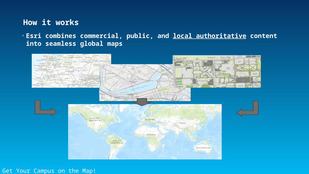
How it works
• Esri combines commercial, public, and local authoritative content into seamless global maps
Get Your Campus on the Map!

What can you contribute?
Your content makes the Living Atlas better
A

Living Atlas benefits
• Your basemap content hosted online for free
• You retain ownership of your map data
• Leverage your online content to build applications
• Easy to participate

Campus Basemap Tour
Demo One

Getting Started with Community Maps
Get Your Campus on the Map!
Apply ReviewUpload Publish
A

Applying to Esri Community Maps
• Do you have any of the appropriate map layers?
Get Your Campus on the Map!
• Parking lots
• Walkways
• Pavement lines
• Buildings
• Landscape and hardscape features
• You only contribute the layers you want
A

Preparing basemap data – Two choices
• Community Maps accepts two types of data submissions for basemap contributions
Local GovernmentLocal GovernmentInformation ModelInformation Model Community MapsCommunity Maps
Carto ModelCarto Model
Choose whichworks best for you
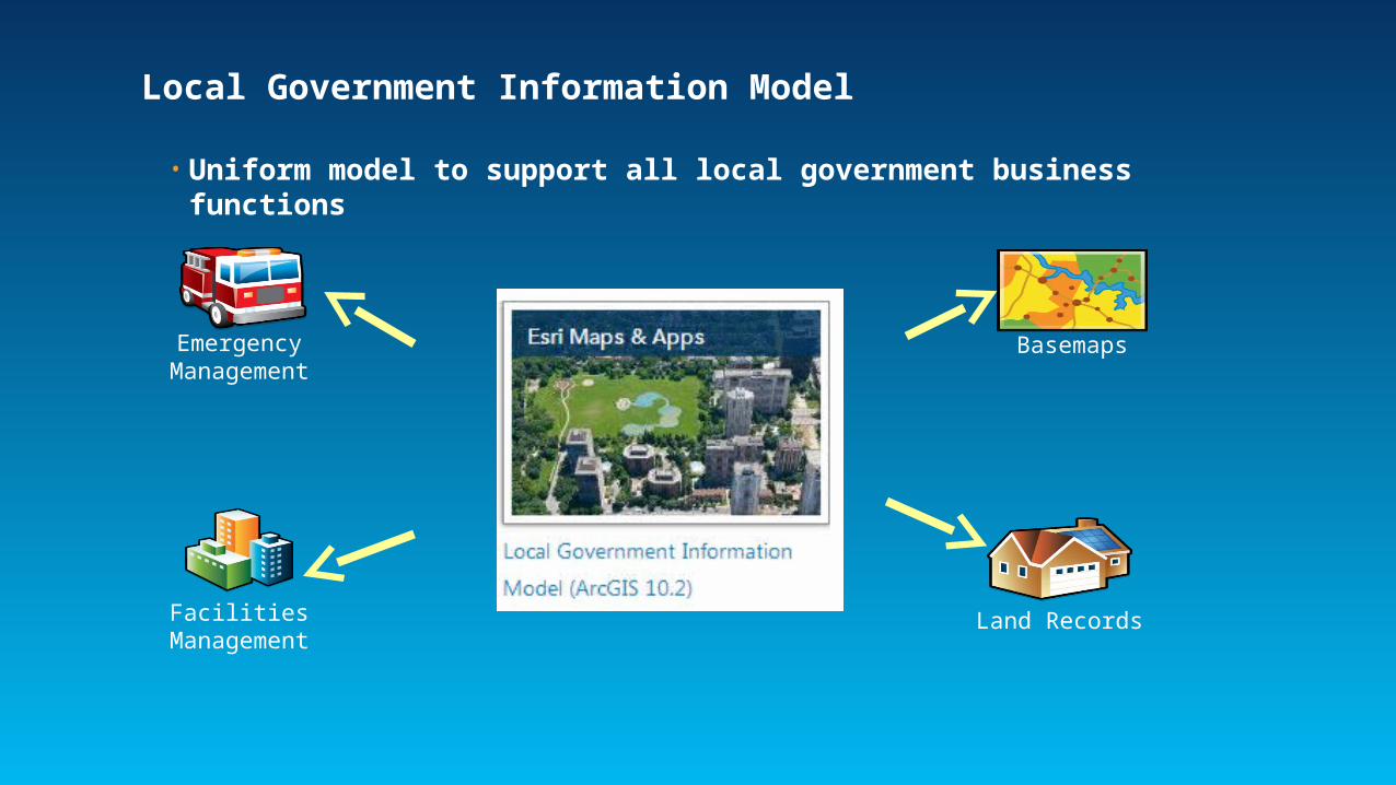
Local Government Information Model
• Uniform model to support all local government business functions
BasemapsEmergency Management
Facilities Management
Land Records
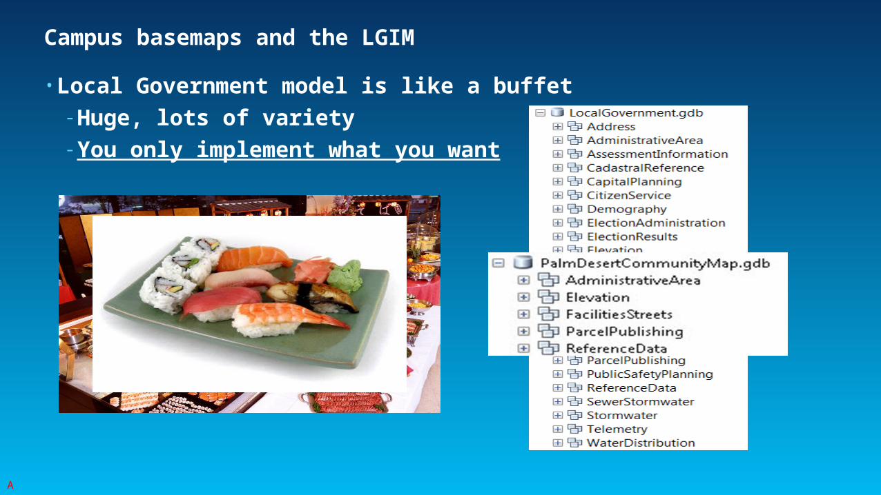
Campus basemaps and the LGIM
• Local Government model is like a buffet- Huge, lots of variety- You only implement what you want
A

Community Maps Carto Model
• Based on schema for Community Maps cartographic geodatabase
• Emphasis on simplicity and performance- Symbology bases on integer fields, not text
• Relevant only to Community Maps map production- Not a general purpose schema

Migrating source data to CM Carto geodatabase
• Free geoprocessing tools simplify the process
• Output data is suitable for Community Maps submission- Not much else
CommunityGDBFinal

Uploading map data to Community Maps
• Put your basemap layers in a file geodatabase- Use the Community Maps Carto or Local Government Information Model schema
• Esri will do the rest
Local GovernmentInformation Model
OrCarto Model
Migrate Author MapPublish
ArcGIS Online
You Esri

Reviewing Your Contribution
Get Your Campus on the Map!
Apply ReviewUpload Publish
A
DataReview
MapReview

Published output
• Current output is World Topographic Map Service
• More coming soon
Esri Community Maps
Your Map Data
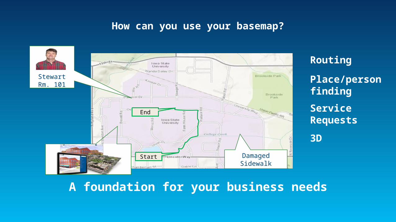
How can you use your basemap?
Start
End
StewartRm. 101
Damaged Sidewalk
A foundation for your business needs
Routing
Place/personfinding
Service Requests
3D

Campus application examples
Demo
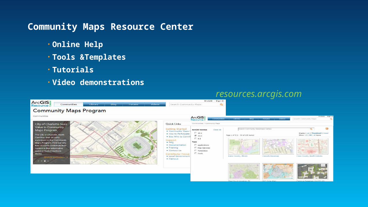
Community Maps Resource Center
• Online Help
• Tools &Templates
• Tutorials
• Video demonstrations
resources.arcgis.com

Community Maps Self-paced Learning
• The best way to get started with authoring your map!- Building a Campus Basemap
- Preparing Data for Esri Community Maps with the Local Government Information Model

Get Started at the UC• Opportunities to learn more and start this week
• Community Maps Special Interest Group- Wednesday 12:00 – 1:00
• Community Maps Tech Workshop- Getting to Know Esri Community Maps
• Demo theaters too!- Check the agenda
• Visit us at Ed UC and UC Showcases- Content Island
Get Your Campus on the Map!

Thanks for attending!
Please fill out the session evaluation
Session Offering ID: 1096
Online – www.esri.com/ucsessionsurverysPaper – pick up and put in drop box
