© 2009 by south-western, cengage learning samirlander chapter 10
TRANSCRIPT
© 2009 by South-Western, Cengage Learning
SAMSAMIRLANDERIRLANDER
Chapter 10Chapter 10
Florida Real Estate:Florida Real Estate: Principles, Practices and Principles, Practices and
License LawLicense Law
Chapter 10Chapter 10
Property DescriptionProperty Description
© 2009 by South-Western, Cengage Learning

© 2009 by South-Western, Cengage Learning
Key TermsKey Terms
Base line
Benchmarks
Block
Check
Correction lines
Government rectangular survey system
Legal descriptions
Lots
Monument
Point of beginning
Principal meridian
Range
Sections
Tier
Township
Township lines

© 2009 by South-Western, Cengage Learning
Methods of descriptionMethods of description
© 2009 by South-Western, Cengage Learning
Methods of descriptionMethods of description
© 2009 by South-Western, Cengage Learning
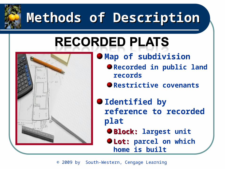
Methods of DescriptionMethods of Description
Map of subdivisionRecorded in public land records
Restrictive covenants
Identified by reference to recorded plat
Block: Block: largest unit
Lot: Lot: parcel on which home is built
© 2009 by South-Western, Cengage Learning
Methods of DescriptionMethods of Description
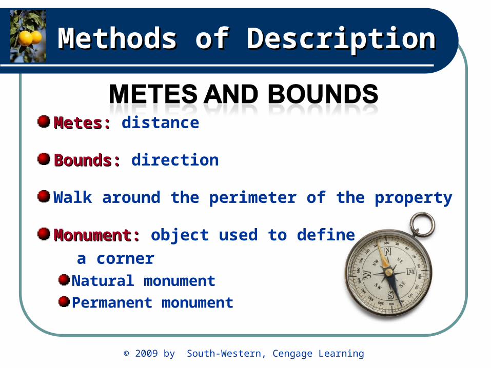
Metes: Metes: distance
Bounds: Bounds: direction
Walk around the perimeter of the property
Monument: Monument: object used to define
a cornerNatural monument
Permanent monument
© 2009 by South-Western, Cengage Learning
Methods of DescriptionMethods of Description
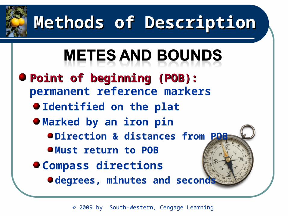
Point of beginning (POB): Point of beginning (POB): permanent reference markers
Identified on the plat
Marked by an iron pinDirection & distances from POB
Must return to POB
Compass directions degrees, minutes and seconds

© 2009 by South-Western, Cengage Learning
Methods of DescriptionMethods of Description
1780’s created by Congress
Intersecting principalprincipal meridiansmeridians and base linesbase lines
Florida intersects in Tallahassee
© 2009 by South-Western, Cengage Learning
Methods of DescriptionMethods of Description
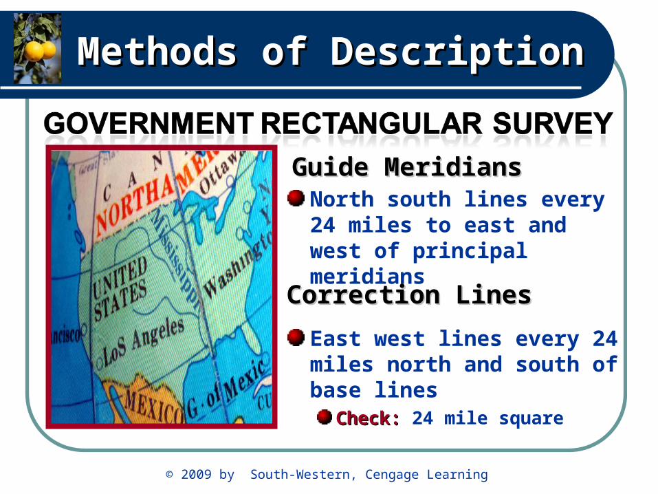
North south lines every 24 miles to east and west of principal meridians
East west lines every 24 miles north and south of base lines
Check:Check: 24 mile square
Correction LinesCorrection Lines
Guide MeridiansGuide Meridians

© 2009 by South-Western, Cengage Learning
Methods of DescriptionMethods of Description
Range: Range: north and south
Tier: Tier: east and westAKA: TownshipTownship
6 miles square formed by intersecting range and township linestownship lines
Row of townships
running east and west
Ranges and TiersRanges and Tiers

© 2009 by South-Western, Cengage Learning
Methods of DescriptionMethods of Description
Base lineBase line
Each square in the grid Each square in the grid is called a township is called a township
TownshipTownship
Principal MeridianPrincipal Meridian

© 2009 by South-Western, Cengage Learning
Methods of DescriptionMethods of Description
Base lineBase line
TownshipTownship
Principal MeridianPrincipal Meridian
Each township is 6 miles long Each township is 6 miles long on each side. The total area of on each side. The total area of a township is 36 miles square a township is 36 miles square

© 2009 by South-Western, Cengage Learning
Methods of DescriptionMethods of Description
Township have 36 sections
Section is 1 mile square
Sections are numbered 1 - 36

© 2009 by South-Western, Cengage Learning
Methods of DescriptionMethods of Description
Legal description of a section
1. Section number
2.Tier referenced by number and direction
3. Range number and direction
© 2009 by South-Western, Cengage Learning
Methods of DescriptionMethods of Description
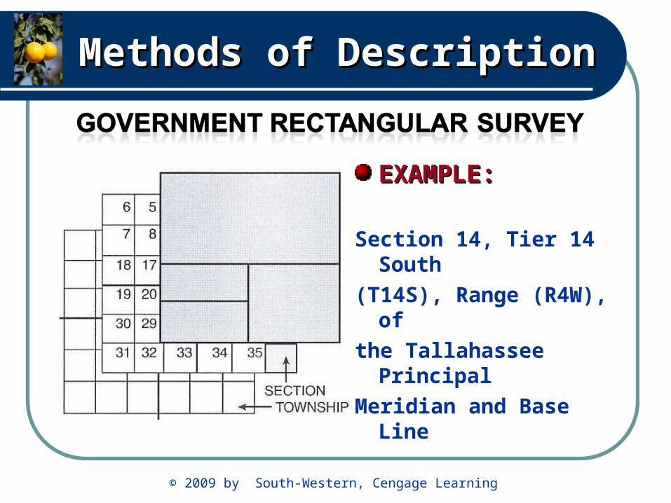
EXAMPLE:EXAMPLE:
Section 14, Tier 14 South
(T14S), Range (R4W), of
the Tallahassee Principal
Meridian and Base Line
© 2009 by South-Western, Cengage Learning
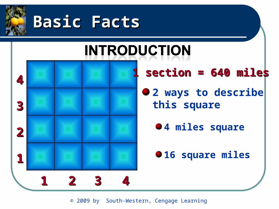
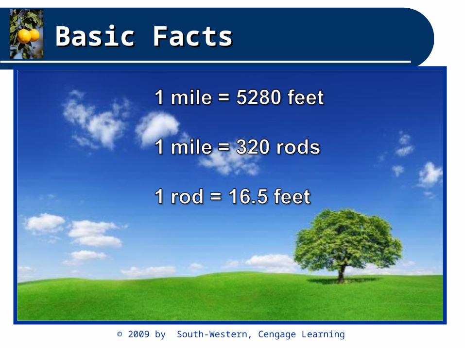
Basic FactsBasic Facts
2 ways to describe this square
4 miles square
16 square miles11
11 22
22
33
33
44
441 section = 640 miles1 section = 640 miles
© 2009 by South-Western, Cengage Learning
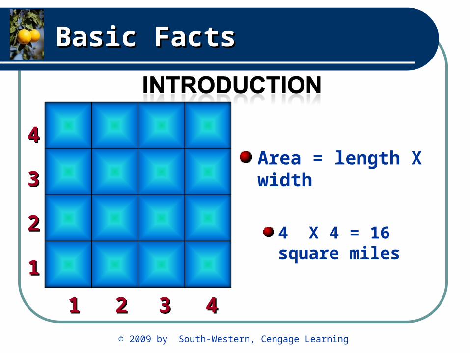
Basic FactsBasic Facts
Area = length X width
4 X 4 = 16 square miles
11
11 22
22
33
33
44
44
© 2009 by South-Western, Cengage Learning
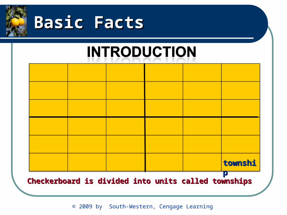
Basic FactsBasic Facts
Checkerboard is divided into units called townshipsCheckerboard is divided into units called townships
townshiptownship
© 2009 by South-Western, Cengage Learning
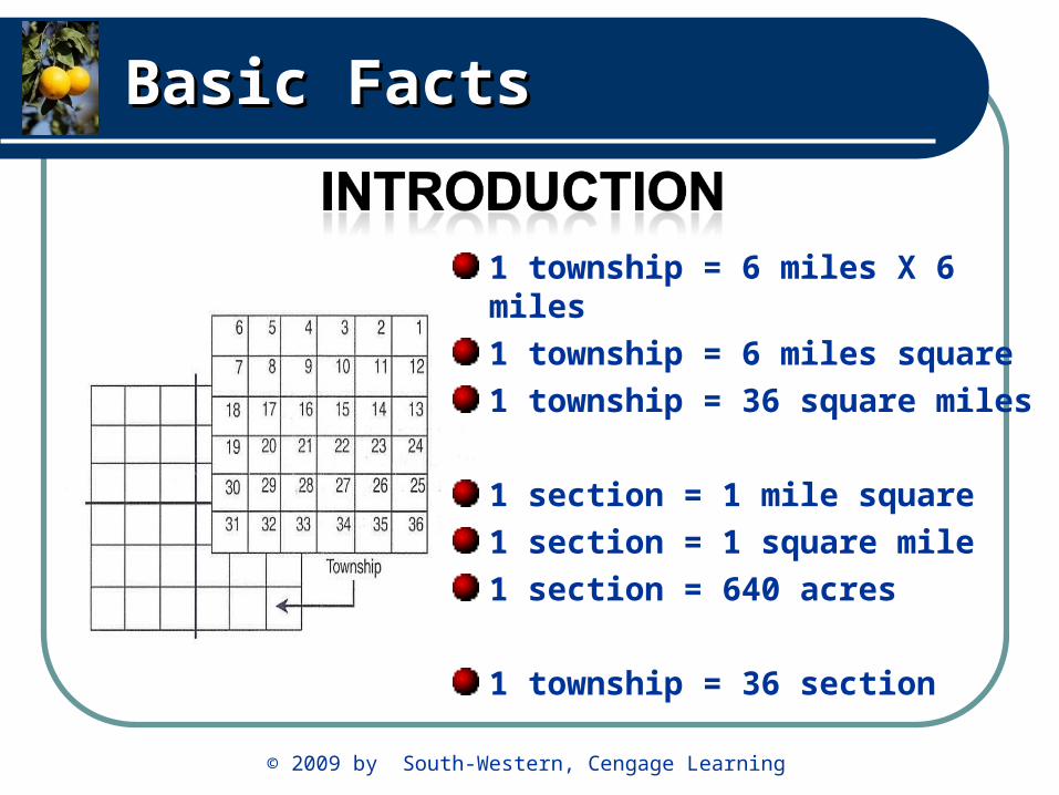
Basic FactsBasic Facts
1 township = 6 miles X 6 miles
1 township = 6 miles square
1 township = 36 square miles
1 section = 1 mile square
1 section = 1 square mile
1 section = 640 acres
1 township = 36 section

© 2009 by South-Western, Cengage Learning
Basic FactsBasic Facts
Quarter sections
¼ of ¼ of a section
¼ of ¼ of ¼ of a section
= 160 acres= 160 acres
160160 44
= 40 acres= 40 acres
640640 44
4040 44
= 10 acres= 10 acres

© 2009 by South-Western, Cengage Learning
Basic FactsBasic Facts
Northeast quarter of section 6
Southwest quarter of the northeast quarter of section 6
= 160 acres= 160 acres
160160 44
= 40 acres= 40 acres
640640 44
= 160 acres= 160 acres640640 44
4040acresacres

© 2009 by South-Western, Cengage Learning
Basic FactsBasic Facts
The tract contains 40 acres
= 160 acres= 160 acres
160160 44
= 40 acres= 40 acres
640640 4440 40
acresacres

© 2009 by South-Western, Cengage Learning
Basic FactsBasic Facts
© 2009 by South-Western, Cengage Learning
Basic FactsBasic Facts