12.0 wind energy, part 1 frank r. leslie, b. s. e. e., m. s. space technology, ls ieee 2/23/2010,...
Post on 19-Dec-2015
213 views
TRANSCRIPT

12.0 Wind Energy, Part 1
Frank R. Leslie, B. S. E. E., M. S. Space Technology, LS IEEE
2/23/2010, Rev. 2.0.3
fleslie @fit.edu; (321) 674-7377
www.fit.edu/~fleslie
Wind Resources
In Other News . . .
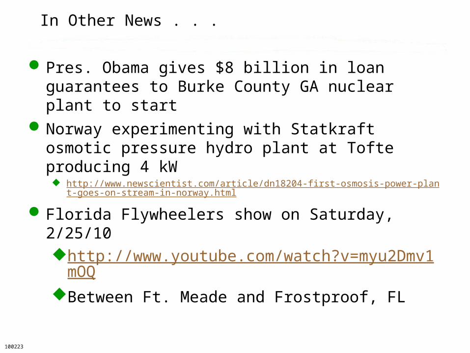
Pres. Obama gives $8 billion in loan guarantees to Burke County GA nuclear plant to start
Norway experimenting with Statkraft osmotic pressure hydro plant at Tofte producing 4 kW http://www.newscientist.com/article/dn18204-first-osmosis-power-plant-goes-on-
stream-in-norway.html
Florida Flywheelers show on Saturday, 2/25/10http://www.youtube.com/watch?v=myu2Dmv1
mOQBetween Ft. Meade and Frostproof, FL
100223
12 Overview: Wind Resources
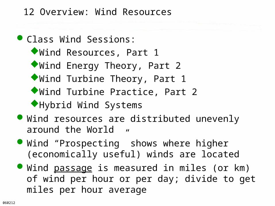
Class Wind Sessions:Wind Resources, Part 1Wind Energy Theory, Part 2Wind Turbine Theory, Part 1Wind Turbine Practice, Part 2Hybrid Wind Systems
Wind resources are distributed unevenly around the World
Wind “Prospecting” shows where higher (economically useful) winds are located
Wind passage is measured in miles (or km) of wind per hour or per day; divide to get miles per hour average
060212

12.0 About This Presentation
12.0.1 Wind Resources12.0.2 US State Wind Maps12.0.3 European Wind Maps12.0.4.1 Other Areas: India12.0.5.1 Wind Statistics12.0.6.1 Wind Analysis 12.0 Conclusion
060212

12.0.2 Wind Resources (a larger view)
030220
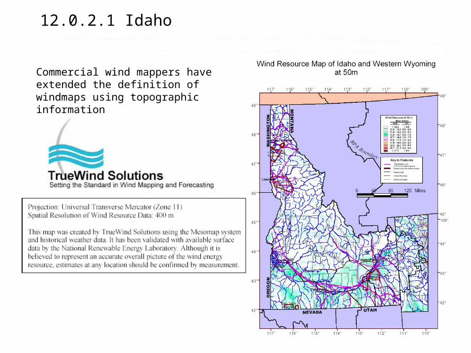
12.0.2.1 Idaho
Commercial wind mappers have extended the definition of windmaps using topographic information

12.0.2.1 Idaho Wind Speed and Power Maps
http://www.windpowermaps.org/windmaps/IDwindpower50_big.htm

12.0.2.2 Washington
030220
http://www.windpowermaps.org/windmaps/states.asp

12.0.2.3 Oregon
http://www.windpowermaps.org/windmaps/states.asp
060212

12.0.2.5 Montana
http://www.windpowermaps.org/windmaps/states.asp
060212

12.0.2.6 Northeast United States
The Cape Wind Project is planned for the red area near Nantucket MA
Wind power density is shown rather than wind speed
The strong red density shows high power that is economical

12.0.2.7 New York (Lake Effect Example)
http://www.awstruewind.com/inner/windmaps/maps/NorthAmerica/UnitedStates100218

12.0.2.8 South Carolina (Ocean Example)
http://www.awstruewind.com/inner/windmaps/maps/NorthAmerica/UnitedStates100218

12.0.2.9 Wyoming
030220
http://www.windpowermaps.org/windmaps/states.asp

12.0.2.10 Wind Energy in Texas
AEI
030220

12.0.2.11.1 Florida Has Marginal Wind Energy
These wind energy maps are available for each state and for the World
Coastal Florida is Class 2 with seabreeze and storm front passages
Summer ground heating results in ~10 mph seabreezes and storms
Winter is calmer, with frontal storm passages averaging every four days
From the PNNL Wind Energy Atlas
060212

12.0.3.1 Europe Wind Resource
http://www.windpower.dk/tour/wres/euromap.htm030220

12.0.4.1 India
060212 http://www.windpowerindia.com/statwind.asp

12.0.5.1 Wind Statistics and Assessment
Wind speed and direction are measured by an anemometerSpeed is derived from rotating cups or a
spinning propeller driving an interrupter device or a small electric generator
Data are logged electronically for later processingThe mean (average) and peak (gust) speeds
are of the greatest importanceTurbulence may affect turbine efficiency, but
yawing points the turbine into the average windTen-minute averages are used for power
assessment, while gust studies may require two to ten points per second
060212

12.0.6.1 A Sample Day’s Sea Breeze Wind Profile From the FSEC MET System in Cocoa, FL
Ref.: FSEC
Effective wind is from 9 a.m. to ~5 p.m.
030219
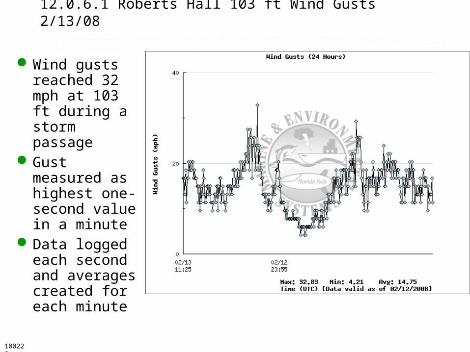
12.0.6.1 Roberts Hall 103 ft Wind Gusts 2/13/08
Wind gusts reached 32 mph at 103 ft during a storm passage
Gust measured as highest one-second value in a minute
Data logged each second and averages created for each minute100222

12.0.5.2 Wind Statistics and Assessment
Dataloggers have a limit to storage, and more points per second means storage fills faster
The memory can be filled and stop recording, or better, the memory can over-write the earliest dataIf a major storm passes, the data may be
downloaded shortly thereafterDataloggers write and store data in a
compressed format that is often proprietaryA proprietary program is then used to export the
data on a serial link as a text file that can later be interpreted by other programs, like MS Excel
060212

12.0.5.2.1 Serial Data Stream at 9600 bps
Roberts Hall Data ID Year DOY HHMM Speed Gust Drct Solar Temp Rain test PV_V Ipv Iwt Pwt 24VBat Ibat 12VBat Relay Clip CMIN CMAX 24Min 24Max 24Sd EST mph mph deg W/m2 degC inch mV V A A W V A V 0_26 V V V V V V ---------------------------------------------------------------------------------------------------------------------------------------------[ID Year DOY HHMM Speed Gust Drct Solar Temp Rain]103 2006 43 1449 11.63 14.94 290.8 796 12.01 0 13.59 43.79 8.69 .889 24.68 27.77 -.185 13.73 27.43 5.004 6.593 4.971 27.68 27.81 .026
103 2006 43 1450 11.42 14.94 294.9 753 12.12 0 13.52 43.64 -6999 .881 24.36 27.66 -.651 13.68 27.34 4.978 4.992 4.971 26.64 27.73 .14
103 2006 43 1451 17.86 29.25 301.2 464.4 12.16 0 13.39 46.19 3.39 19.02 581.6 27.46 -3.561 13.58 27.12 4.977 4.986 4.971 25.27 32.36 2.018
Latest observations from Roberts Hall Roof (~102 ft) Time
(UTC)
Wind Speed(mph)
Windgust(mph)
Wind Direction
(deg)
Temp.(deg F)
Precip*(mm)
Turbine Power(watts)
PV Power(watts)
Solar Radiation(w/m^2)
20:00 12.9 14.9 286.2 53 0.34 23 208.78 676.9
19:45 18.4 25.7 291.7 53 0.34 25 239.91 756.0

12.0.5.3 Wind Statistics and Assessment
Once the data are in the processing format, they must be screened to detect missing or bad data to prevent contamination of the results
These series strings of data may then be processed to determine key statistics:Highest speeds, averages, medians, modes,
histograms, exceedance curves, etc.
050215

12.0.5.4 Statistical Exceedance Curves
Accumulated data can be sorted by value to gain an understanding of the statistical distributionNo distribution must
be assumed --- known as nonparametric statistics
Compute the percentile exceeded for each value and plot the values vs. the percentiles from 0% to 100%
Determine the minimum, maximum, median, 10%-tile, and 90%-tile values
A Weibull curve may be fit to the data to suggest a distribution
100218Enlarged Plot follows

12.0.5.4.1 Statistical Exceedance Curves
080212

12.0.6.2 Sample of Roberts Hall Seabreeze Winds
Roberts Hall Wind 031110Seabreeze: 9 am to 1 pm
y = -0.0623x + 17.318
R2 = 0.1188
0.0
5.0
10.0
15.0
20.0
25.0
0 20 40 60 80 100 120 140
Direction, degrees
Sp
ee
d, m
ph
040216

12.0.6.3 Roberts Hall: 13 Days of Winds 030903
040216
Wind Speed vs Direction
0
10
20
30
40
50
0 60 120 180 240 300 360
Wind Direction, degrees
Sp
ee
d, m
ph

12.0.6.4 Predominant Wind Energy DirectionDetermines the Site Selected
The energy rose is the cube of the wind speed (flower-like) rose
In Palm Bay, Florida, this one-day wind data sample shows the main wind direction at 150 degrees azimuth
An FPL WindLogics report shows Ft. Pierce FL annual estimates for 80 meters
Several years of data are averaged to get a useful sample; 30 years desirable
In obstructed areas, the site selection is critical to obtain the maximum wind energy
Available Relative Wind Energy
0
5000
10000
15000
20000
0
23
45
68
90
113
135
158
180
203
225
248
270
293
315
338
N
S
090805 http://www.fpl.com/news/pdf/Windlogics_Results.pdf

12.0 Conclusion: Wind Resources 1
Wind resources vary greatly with latitude, season, and surrounding terrain
Extensive data and wind maps exist for wind prospecting
At the mesoscale level, topographic information is being used to create predictions of wind speed from scattered real data
Anemometers can be erected to obtain wind speeds in a likely locale for comparison to NWS long-term records
An alternative is to erect a small wind turbine to sample the energy and help determine where a large turbine should be placed
Wind resources may be excellent, but there is much more to installing a turbine
050215
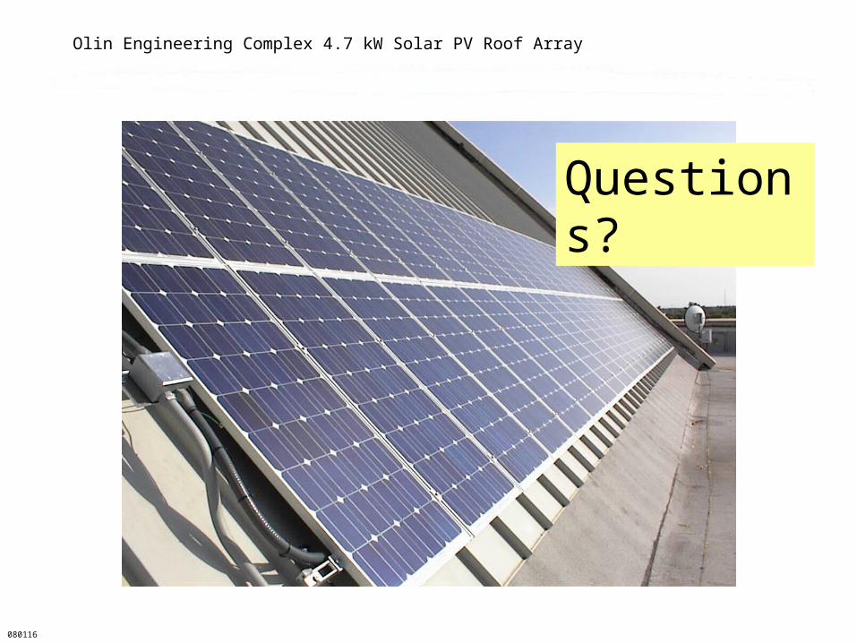
Olin Engineering Complex 4.7 kW Solar PV Roof Array
080116
Questions?

References: Books
Brower, Michael. Cool Energy. Cambridge MA: The MIT Press, 1992. 0-262-02349-0, TJ807.9.U6B76, 333.79’4’0973.
Gipe, Paul. Wind Energy for Home & Business. White River Junction, VT: Chelsea Green Pub. Co., 1993. 0-930031-64-4, TJ820.G57, 621.4’5
Patel, Mukund R. Wind and Solar Power Systems. Boca Raton: CRC Press, 1999, 351 pp. ISBN 0-8493-1605-7, TK1541.P38 1999, 621.31’2136
Sørensen, Bent. Renewable Energy, Second Edition. San Diego: Academic Press, 2000, 911 pp. ISBN 0-12-656152-4.
030219
References: Websites, etc.
http://www.idwr.state.id.us/energy/wind/wind_speed_map.pdf
http://www.windpower.org/index.htm
[email protected]. Wind Energy [email protected]. Wind energy home powersite elistgeothermal.marin.org/ on geothermal energymailto:[email protected] rredc.nrel.gov/wind/pubs/atlas/maps/chap2/2-01m.html PNNL wind energy map of
CONUS [email protected]. Elist for wind energy experimenters
www.dieoff.org. Site devoted to the decline of energy and effects upon populationwww.ferc.gov/ Federal Energy Regulatory Commissionwww.hawaii.gov/dbedt/ert/otec_hi.html#anchor349152 on OTEC systemstelosnet.com/wind/20th.htmlwww.google.com/search?q=%22renewable+energy+course%22solstice.crest.org/dataweb.usbr.gov/html/powerplant_selection.htmlwww.homepower.com/files/windsiteanalysis.pdf
060212

Slide stockpile follows!
Older slides follow this one. Look at these if you have interest or time. It’s difficult to decide what to leave out of the lecture to save time!