20 - panorama necto 14 geo-analytics - visualization & data discovery solution
TRANSCRIPT

Necto TrainingModule 20: Map component (GIS)

Objectives
By the end of this lesson you will be able to: Use the Map component
Map designer Templates Base map Zoom to selection

Agenda
Short review Adding the map component and
understanding it Using the map designer Using templates Base maps Zooming to selection and on click menu

Using the Map component

What is the map component?
Geographical information system practice
I wish I was able to see my data on a geographical scale..

Add the component along a view
Drag the components to the workboard
Make sure the geography dimension is on y-axis and that there is no nesting on it

The map
Zoom in or out of an area
Scale Show legend Show legend

Map designer
Optional zooming
The view this map is based on
Add visualizations
Select which member of the x-axis to assign the property to
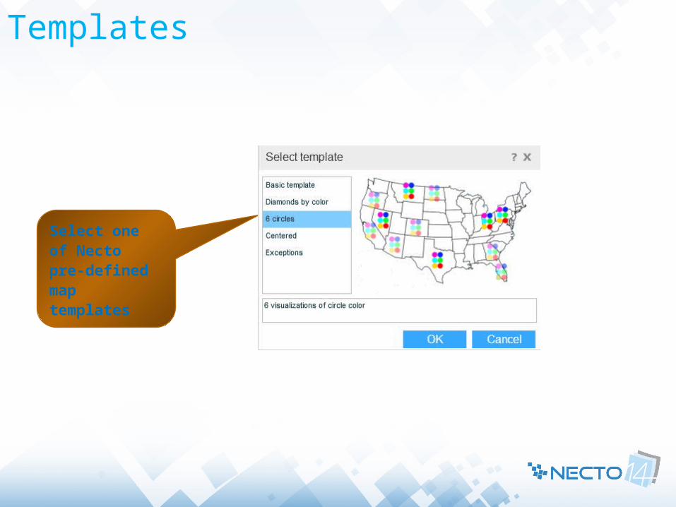
Templates
Select one of Necto pre-defined map templates
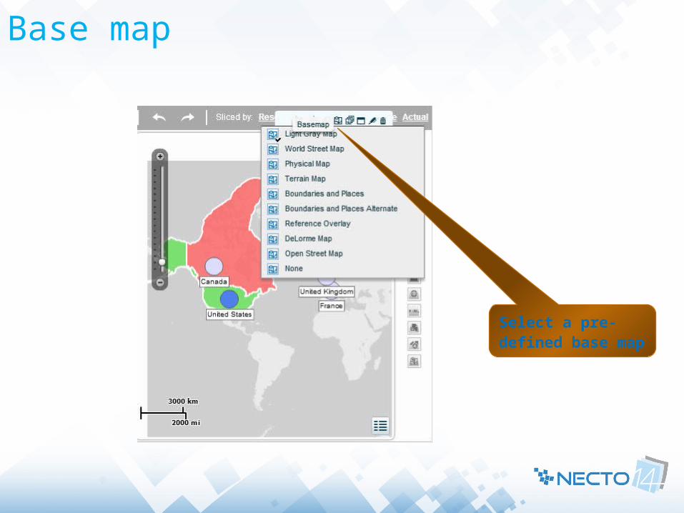
Base map
Select a pre-defined base map

Zoom back to selection and on-click menu
Zoom back to chart selection
Click to allow further drilling
Exercise
Add map component to a Workboard Change the area color Assign it to the last member on x-axis Add new shape size visualization and
change at will Change base map to terrain map Drill to a lower level in the geography
dimension using the map Zoom back

Thank youAny Questions?