2011 stormtracker 33 hurricane guide
DESCRIPTION
Your local resource for all the information you need to keep you safe this hurricane season.TRANSCRIPT
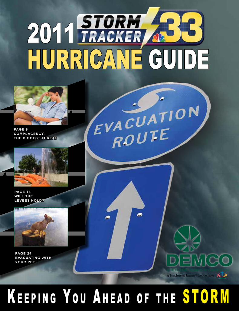
Page 8 ComPlaCenCy- the biggest threat
Page 18Will the levees hold?
Page 24evaCuating With your Pet
2011
HURRICANE GUIDE
DIXIE ELECTRIC MEMBERSHIP CORPORATION
A
K e e p i n g Y o u A h e A d o f t h e S to R M

2

w w w . n b c 3 3 t v . c o m 3
Evacuees need to consider the projected path of the hurricane when choosing an evacuation route and destination. Evacuation studies estimate that it takes between 18 and 30 hours to evacuate the coastal bend in advance of tropical storm force winds. This underscores the need for coastal residents to have an evacuation plan. When evacuating, be sure to check local weather and highway conditions before departing. When local authorities order an evacuation of your area, leave immediately!
Evacuation Map / Emergency Numbers
National Hurricane Centerhttp://www.nhc.noaa.gov/504.522.7330
National Weather Servicehttp://www.nws.noaa.gov/504.522.7330
Federal Emergency Management Agencyhttp://www.fema.gov/800.621.FEMA (3362)
Capital Area United Wayhttp://cauw.org/225.923.2114 or toll-free877.923.2114 to get help American Red Crosshttp://www.redcross.org/800.REDCROSS [733.2767]
City tOWN WEb SitES
bAkER - www.cityofbakerla.net
bAtON ROUgE - www.brgov.com
DENHAM SPRiNgS - www.denhamsprings.us
gONzAlES - www.gonzalesla.com
HAMMOND - www.hammond.org
lAFAyEttE - www.lafayettela.gov
NEW ORlEANS - www.cityofno.com
OPElOUSAS - www.cityofopelousas.com
SliDEll - www.slidell.la.us
zACHARy - www.zacharyla.com
For more tips on how to plan for an emer-gency visit the Governor’s Office of Home-land Security and Emergency Preparedness at www.getagameplan.org.
iMPORtANt NUMbERS
Police 225.389.2000Fire 225.354.1400Acadian Ambulance 800.259.3333Animal Control 225.774.7700baton Rouge general Hospital (Mid-City) 225.387.7000 (bluebonnet) 225.763.4000lane Regional Medical Center 225.658.4000Ochsner Medical Center 225.752.2470Emergency Preparedness Off. 225.389.2100Our lady of the lake Reg. Medical Center 225.765.6565Sheriff’s Office 225.389.5000Waste Management 225.664.8802Water 225.925.2011West baton Rouge Sheriff 225.343.9234Woman’s Hospital 225.927.1300
2 0 1 1 H u r r i c a n e T r a c k e r 2 0 11 H u r r i c a n e T r a c k e r
2 0 1 1 H u r r i c a n e T r a c k e r 2 0 11 H u r r i c a n e T r a c k e r
w w w . n b c 3 3 t v . c o m4
lafaso, american
BEAU JARDINLANDSCAPING
L A N D S C A P I N G | D R A I N A G E | I R R I G A T I O N
Mike Wilson | 573-7008 Kimberly Jenkins | 287-9912
b e a u _ j a r d i n 2 0 0 0 @ y a h o o . c o m
BEAU JARDINLANDSCAPING
L A N D S C A P I N G | D R A I N A G E | I R R I G A T I O N
Mike Wilson | 573-7008 Kimberly Jenkins | 287-9912
b e a u _ j a r d i n 2 0 0 0 @ y a h o o . c o m
1140 North Sherwood Ave • Suite A • Baton Rouge
Personal InjuryWorkers Compensation
225-293-6330
Lofaso Law Firm
Matt Lofaso
Hurricanes form over warm ocean waters, like those found in the Gulf of Mexico. Hurricane season starts June 1 and ends November 30th. The peak threat for Louisiana’s coast exists from August through September. Decrease in wind shear from July to August produces a significant increase of tropical activity. The peak of the hurricane season occurs in September and corresponds to low wind shear and the warmest sea surface temperatures. The month of September sees an average of 3 storms a year. By September 24, the average season sees 7 named systems, 4 of which are hurricanes. In addition, two major hurricanes occur on average by September 28. However, hurricanes can and have struck Louisiana during every month of hurricane season.
Above: High resolution satellite image of Hurricane Ike over the northwest Gulf of Mexico. Image--NASA
Definitions to Know
Facts About Hurricanes
Hurricane force winds of 74 mph or more can destroy buildings, mobile homes, trees and power poles. Debris such as signs, roofing material, siding, and small items left outside become flying missiles in a hurricane. The strongest winds occur in a region of the hurricane called the eyewall. Wind gusts in the right side of the eyewall are the most destructive. Hurricane force winds can be felt as far as 150 miles from the coast.
It is imperative to ensure your home or business is well constructed to minimize the damage from the wind. See page 10 in this guide for cost effective home improvement tips that can help you reduce your damage from a hurricane.
No mobile home or manufactured home - no matter how new it is - can provide safe shelter from hurricane force winds. Straps or other tie-downs will not protect a mobile home from the high winds associated with a hurricane.
destructive winds
TROPICAL STORM: An organized system of strong thunderstorms with a well defined circulation and maximum sustained winds of 39 to 73 mph.
TROPICAL DEPRESSION: An organized system of persistent thunderstorms with a closed low-level circulation and maximum winds of 38 mph or less.
HURRICANE: An intense tropical weather system with a well defined circulation and sustained winds of 74 mph or higher.
TROPICAL CYCLONE: A term used to describe a tropical depression, tropical storm, or hurricane.
HURRICANE/TROPICAL STORM WATCH: Hurricane or Tropical Storm conditions are possible in the watch area within 36 hours.
HURRICANE/TROPICAL STORM WARNING: Hurricane or Tropical Storm conditions are possible in the warning area within 24 hours. hours.
Category 1
Category 2
Category 3
Category 4
Category 5
Winds 74 to 95 mph
Winds 96 to 110 mph
Winds 111 to 130 mph
Winds 131 to 155 mph
Winds greater than 155 mph
Saffir-Simpson Hurricane Scale
1140 North Sherwood Ave • Suite A • Baton Rouge
Personal InjuryWorkers Compensation
225-293-6630
Lofaso Law Firm
Matt Lofaso

GOT PAIN?G E T R E L I E F !
6233 Harry Drive, Suite C • Baton Rouge • 225-201-0210
Health Care for the Entire Family WooddalE CHiropraCtiC CliniCdr. paul Matthews
w w w . n b c 3 3 t v . c o m 5
Securities products, Investment Advisory Services, and Fee Based Financial Planning offered through MetLife Securities, Inc.(MSI) Member FINRA/SIPC. A Registered Investment Adviser. MLIC and MSI are MetLife Companies. L1010138816[exp1012][All States][DC] 0709-5871 ©UFS
As Life Changes, So Do Your Financial Needs
For the if in life.®
Call Clyde today at (225) 368-2261
Clyde J. Bohne IIIFinancial Services RepresentativeRegistered Representative9100 Bluebonnet Ctr Blvd S400,Baton Rouge, LA 70809(225)[email protected]
2 0 1 1 H u r r i c a n e T r a c k e r 2 0 11 H u r r i c a n e T r a c k e r

w w w . n b c 3 3 t v . c o m6
Are you preparedMedicAl Needs?
for your
Visit ololrmc.com for hurricane preparedness information.
Preparation in advance of hurricane season is essential, especially for people with special needs. It is essential that a destination is identified ahead of time that can accommodate people with special needs. Shelters should be considered as a last resort because many cannot provide the attention required. Assisting elderly
neighbors and acquaintances with pre-hurricane preparations is encouraged.
Important SpecIal needS tIpS
Identify with whom you will stay in the event an evacuation becomes necessary.
Make sure you have the following items that should be stored in advance:
Make arrangements for transportation in the event you must evacuate. Make sure that your transportation can accommodate any equipment or other supplies that need to be taken with you.
Extra copies of your prescriptions in case your physician’s office is damaged and not operational.
At least a 1 month supply of medications.Identification.
PrEPArAtioNS For PEoPlE witH SPEciAl NEEdS2 0 11 H u r r i c a n e T r a c k e r
Being there is why I’m here.
P097193 06/09State Farm Mutual Automobile Insurance Company, State Farm Indemnity Company, Bloomington, IL
Whether you need a question answered, a problem solved or a claim reported, my job is to make it happen. Like a good neighbor, State Farm is there.® CALL FOR A QUOTE 24/7.
Joe Skibinski, Agent1953 Perkins Rd
Baton Rouge, LA 70808Bus: 225-387-0201

w w w . n b c 3 3 t v . c o m 7
• Alarm clock (battery operated)• Baby food, diapers and formula• Battery operated radio and TV• Batteries, enough for radio, TV, and flashlights for several days• Blankets and pillows• Bleach (no lemon or additives)• Butane Lighter• Canned and dried food• Cans, gas and oil• Cash, credit cards• Cellular phones• Cooler for water• Drivers license• Eating and cooking utensils• Emergency cooking facilities (grill or camp stove)
• Extra pet food• Fire extinguisher• First Aid Kit and manual• Flashlights (one for every member in the family)• Fuel up the car• Gas for the grill (fill the tank)• Glasses or contact lenses
• Heavy work boots or shoes• Important phone numbers• Medicines and prescriptions• Social Security cards• Birth certificates• Marriage and death records• Wills • Insurance policies• Deeds and mortgages• Stocks and bonds• Small valuables, jewelry• Inventory of household goods• Computer file backups• Pictures (both personal and of belongings, pre-disaster)• Savings and checking booksOpen Monday-Friday 8-8, Saturday & Sunday 9-5
• Bio-Scan • Sauna Treatment• Ionic Footbath • Massage
GiftCertificates
Wishing all Happy ... Healthy
Holidays!
Reduce stress and keep the holidays happy by giving the gift of health this season.
Treat yourself to a stress reducing massage or purchase a gift certificate for your friends or family.
Show the one’s you love how much you care this Holiday Season by giving a gift of health from Nature’s Wellness.
2610 Ruby St • Gonzales • (225) 647-6879
COURSeS OFFeReD:
Medical billing and Coding
Healthcare Reimbursement
Medical Assistant
Medical Office Administration
Pharmacy Technician
Surgical Technology
Administrative Office Management
Your success starts here!
batonrouge.vc.edu225-236-39009501 Cortanta Place
www.partytimebr.com
MAKE YOUR OWN HOLIDAY GOODIES
Premium Chocolatemilk, white, dark
Crushed Peppermintred, green
Gift Boxes
Tins
Candy MoldsCandy Molds
So Much more!
3350 Bluebonnet Blvd. - off Airline Hwy. . 927-3270
PEPPERMINT BARK Melt white chocolate and
add crushed peppermint.
Mix. Place on cookie sheet covered with
wax paper. Let Cool and break
into pieces.
Medical Billingand Coding
HealthcareReimbursement
Medical Assistant
Medical OfficeAdministration
Pharmacy Technician
SurgicalTechnology
AdministrativeOffice Management
Cosmetology
9501 Cortana Place
HUrricANE SUPPlY Kit
2 0 1 1 H u r r i c a n e T r a c k e r 2 0 11 H u r r i c a n e T r a c k e r

w w w . n b c 3 3 t v . c o m8
2 0 1 1 H u r r i c a n e T r a c k e r 2 0 11 H u r r i c a n e T r a c k e r
Hurricane MytHs DebunkeD:
A Category 1 or 2 hurricane shouldn’t do much damage because the storm surge won’t be too high.
FALSE: Don’t always look at only the category when planning for a hurricane. Always look at how intense the storm was at a certain time in its life. Just because a storm may not be a “major” storm at the time of landfall that does not mean it’s not bringing the surge of a “major” storm. Two great examples are Hurricane’s Katrina and Ike. Katrina was a Category 3 at landfall, but it brought the surge of a Category 5 storm. Just because the winds died down in the storm, does not mean the surge goes down instantly along with it. Also, Ike was a Category 2 storm at landfall, but it brought the surge of a Category 4 storm.
The forecast cone is 100% accurate, so if I’m not in it I can stop watching the news.
FALSE: The forecast cone is nowhere near 100% accurate. Just because your city may not be in one forecast cone, that does not mean in the next update you will not be in the dead center. The cone is a way to give the viewers a general direction in which the storm will be moving. It’s important to monitor every update from the National Hurricane Center and your local news to see if the cone has shifted one way or the other. Remember, Louisiana was not even in the forecast cone for Katrina at the beginning of the forecast.
Crisscrossing your windows with masking tape is a great form of protection.
FALSE: It’s a waste of time when you could be spending your time doing something that might actually protect your home. All you will get for your troubles is windows covered with hard-to-remove gunk. Tape does NOT protect your windows. The best protection is to cover the windows with 5/8” plywood or special hurricane shutters.
For South louisianans, every summer isa roll of the dice. that’s when hurricaneseason is in full swing. Each day the threatof a storm is present as families go about their day-to-day lives. Although louisiana has witnessed direct hits several times inthe past, many still do not heed the warningfrom officials when an evacuation order isgiven.
Betsy, Andrew, Rita, and Katrina.
those four names will make any personfrom Louisiana anxious as they are thenames that evoke the most powerful memories.
Ivan, Georges, Opal, and Isidore.
those are four names of storms alsoremembered, but not in the way meteorologists,or officials, hope.
the Near-Miss Dilemma is the feelingpeople get when they evacuate for a bigstorm spinning their way, but the stormeither shifts away from their city, or doesnot do much damage at all. this will givepeople the idea that evacuating for the nextstorm is not necessary, creating a sense ofcomplacency.
Every storm has its own story, identity,
and unfortunately, its own damage path.Although Hurricane Rita was tragic forlouisiana, it was a welcomed missto galveston, tX. that miss, however,spawned the Near-Miss Dilemma inresidents, creating greater devastation justthree years later.
in 2005, Hurricane Rita churned her waytowards galveston, and mandatory evacuations were issued. toward the end of theforecast period, it became clear that Ritawas not going to directly impact the area.Although some fringe effects were felt,the true damage was brought about by the fact that many felt as though the evacuation was a waste of time and money.
In 2008, once again a major hurricane, Ike,was churning its way toward galveston.Once again the mandatory evacuation wasissued, but this time, the reaction was muchdifferent.
Despite warning from the National WeatherService saying that residents living insingle-family homes in some parts ofcoastal Texas faced “certain death” if theydid not heed orders to evacuate, manystayed, fearing it was going to be a replayof Rita. Sadly, 112 people lost their livesand 23 are still missing to this day. Most
NEw StorM,
NEw dANgEr...
ComplaCenCy is your greATesT ThreAT By Jesse VinturellaSTORMTRACKER33 Meteorologist
9
2 0 1 1 H u r r i c a n e T r a c k e r 2 0 11 H u r r i c a n e T r a c k e r
NEw StorM,
NEw dANgEr...
of that loss could have been avoided had people evacuated in time.
For louisiana, the game changer was katrina. the devastation caused by the storm surge/levee failure is etched into the collective minds of not only the nation, but the entire world, as the media documented the torture experienced by those who stayed behind in the inundated city.
Not only do many compare future storms to katrina, but some are unwilling to evacuate unless the storm is expected to be as bad. This can be a dangerous proposition. you’ll hear people make comments about potential storms such as, “Is it as bad as Katrina?”, or “I made it through Katrina, I can make it through this one.”
Although many people will stay behind for any number of reasons, it is important to always remember that every storm is unique, and comparing one to another can cost you greatly. Remember, it is better to lose some money on an evacuation that may not have been necessary, than to lose your life.
Hurricane MytHs DebunkeD (continueD):Once a hurricane passes, the worst is over.
FALSE: Survivors of Hurricane Katrina will beg to differ with you on this. Sometimes the worst is just beginning once the storm passes. The stron-gest winds may have died down, but there can be tornadoes, rain and flooding after a hurricane. It may be days, weeks, even months before the power comes back on and your home is repaired and life returns to normal.
Only coastal areas are at risk from hurricanes.
FALSE: While the drama of a hurricane crashing into a coastal area makes compelling front page news, the effects are felt far inland. In fact, strong winds, heavy rain, tornadoes, and inland flooding can spread hundreds of miles from the coast, leaving extensive damage and death in their wake. Estimates by the National Hurricane Center of the effects of Tropical Storm Allison on the city of Houston, far removed from where the storm made landfall, is estimated at $4.8 billion.

w w w . n b c 3 3 t v . c o m10
www.royalfurnitureBRcom
19th and Main StDowntown
Baton Rouge225-344-4374
Furniture man says...
“No Gimmicks No Tricks, JusT GreaT saviNGs!”
2 0 1 1 H u r r i c a n e T r a c k e r 2 0 11 H u r r i c a n e T r a c k e r
• Wood Fences• PVC / Vinyl Fences• Chain-link Fences(AKA cyclone & hurricane)• Aluminum Fences• Wrought Iron Fences• Barbed Wire• Rail (Farm Style)• Automatic Gates• & Anything else you need
All our fences include a 1 year warranty on workmanship and many include a LIFETIME WARRANTY on materials!
Call (225) 683-6769 to schedule your no obligation FREE ESTIMATE!
BEST FENCES Build / RepaiR / Remove
AcRoSS ThE EnTIRE ATLAnTIc BASIn FoR
ThE SIx monTh SEASon, noAA IS pREdIcTInG ThE FoLLowInG RAnGES ThIS
yEAR:
• 12 to 18 named storms (wIndS oF 39 mph oR
hIGhER), oF whIch:
• 6 to 10 could become hurricanes (winds
oF 74 mph oR hIGhER), including:
• 3 to 6 major hurricanes (category 3, 4 or 5; winds of 111
mph oR hIGhER)

11

We’ll come to your home and do
it all - from concept to
completion.
Custom window treatments,
furniture and floor coverings,
lighting, accessories and more.
Call for a complimentary
consultation with your personal
decorator.
www.Decorat ingDen.com
WHAT’S
HOT?
Creating Beautiful Rooms Since 1969
Custom Window Treatments | Furniture | Lighting | Floor Coverings | Accessories
Denise E Smith | 225-450-2512
www.ConcreteDesignSolutions.co


2 0 1 1 H u r r i c a n e T r a c k e r 2 0 11 H u r r i c a n e T r a c k e r
When it comes to hurricanes, most people believe the strong winds that come along with it will produce the
most damage. However, it is usually the storm surge, the wall of water produced by a hurricane, which does the most harm. In recent years, most hurricane forecasters used satellite imagery and other storm data collection technology to predict the storm’s path and intensity. Now, forecasters have a new tool in the belt.
High resolution modeling has become an integral part in providing better accuracy of strength, intensity, and landfall of hurricanes. Researchers at Louisiana State University and the National Weather Service have teamed up to create a computerized numerical model that estimates the storm surge heights by using historical, hypothetical, or predicted hurricanes.
It takes in account a variety of atmospheric variables including hurricane pressure, size, forward speed, winds, and track data. The ingenious model also takes into account the unique features of coastlines that make one place different from another. In other words, the model is able to differentiate between the marsh-like shoreline
of Louisiana versus the sandy shoreline of the Florida Panhandle by being fed the parameters of a specific location. The model understands and recognizes jagged bay and river basins, water depths, bridges, roads, levees, and other physical features. This state of the art model is fittingly called SLOSH.
SLOSH is an acronym for Sea, Lake, and Overland Surges from Hurricanes.
The SLOSH model has been used in recent years and proved to be a valuable asset in the proper evaluation of the need for a hurricane evacuation. Ahead of a hurricane, decision making in a timely manner is invaluable. Since every second counts, it is important that emergency and government officials make the decision quickly.
To make better evaluations, quick and accurate information is needed. However, at the time the decision is made, the error in the hurricane’s track and intensity may be large. So to aid emergency managers in planning for hurricanes, the potential surge for an area is computed. This is done by running SLOSH with hypothetical hurricanes with various landfall directions and locations, Saffir-
Simpson categories, forward speeds, sizes, and tide levels.
Each individual run generates an example of a possible hurricane storm surge, providing government officials, first responders, and emergency management the necessary information when planning an evacuation. They can use current hurricane information and compare it with past storms to find the best answer. The best answer may save millions of people from packing up their belongings and leaving town. It also saves millions in evacuation costs.
The SLOSH model has been applied to and encompasses the entire U.S. coastline from northern Maine to southern Texas. In addition, the coverage extends to Hawaii, Guam, Puerto Rico, and the U.S. Virgin Islands. By covering the entire coastline, it becomes much easier to prepare for any storm track and its intensity. The best part about the computerized model is its proficiency.
“The SLOSH model is computationally efficient; resulting in fast computer runs which makes it an ideal operational system. It is able to resolve flow through barriers, gaps, and passes and
New Tools for Forecasters Help Keep YOU Ahead of the StormBy Jesse GunkelSTORMTRACKER33 Meteorologist
w w w . n b c 3 3 t v . c o m14

models deep passes between bodies of water. It also resolves inland inundation and the overtopping of barrier systems, levees, and roads,” says the Storm Surge Unit, a department of the National Weather Service.
The SLOSH model is also accurate to within plus or minus 20 percent, which is extremely rare in long range modeling. To put that into perspective, the model calculates a peak 10 foot storm surge, you can expect the observed peak to range from 8 to 12 feet. When understanding the power of a storm surge, a few feet of water can make a huge difference. A foot of water can sweep away a car, while a few feet of water can sweep away a house. However, the model does have a few limitations. The Storm Surge Unit notes, “The SLOSH model does not explicitly model the impacts of waves on top of the surge, it does not account for normal river flow or rain flooding, nor does it explicitly model the astronomical tide.”
In addition, the point of a hurricane’s landfall is crucial to determining which areas will be inundated by the storm surge. When the hurricane forecast track is inaccurate, the SLOSH model results will be inaccurate, too. T he SLOSH model, therefore, is best used for defining the potential maximum surge for a location. Future advancements for the SLOSH model are already in progress and will patch up some of these limitations.
As we all know, preparation is the best policy. You can never be over prepared. The SLOSH model helps to reduce error estimates and gives a high resolution snapshot of possible flooding dangers. It has become a great tool in the fight for hurricane safety.
2 0 1 1 H u r r i c a n e T r a c k e r 2 0 11 H u r r i c a n e T r a c k e r
w w w . n b c 3 3 t v . c o m 15


2011 ATLANTIC
HURRICANE NAMES
Arlene
Bret
Cindy
Don
Emily
Franklin
Gert
Harvey
Irene
Jose
Katia
Lee
Maria
Nate
Ophelia
Philippe
Rina
Sean
Tammy
Vince
Whitney
You Can Count On w w w . g e r r y L a n e . c o m

2 0 11 H u r r i c a n e T r a c k e r
Will The
Levees Hold?
w w w . n b c 3 3 t v . c o m18
Fears of catastrophic flooding due to record breaking water levels in the Mississippi kept one question in the minds of Louisianians throughout the month of May; “Will the levees hold?”
Although Hurricane Season just began on June 1, parts of Louisiana are still working to repair damage made from the record snow fall and rains. The melting snow and rainwater was collected in The Missouri Valley, Ohio River Valley, and the Tennessee Valley, which all funnel into the Mississippi River. That caused the water levels to rise to a degree compa-rable to the Great Flood of 1927.
The current levee system did not truly exist in 1927. A vital component of the system, the use of spillways, is spillways is what saved us from witnessing a landscape lost. But the opening of the Morganza and Bonnet Carre Spillways would cause their own damage, so the decisions to open them were not taken lightly by the Army Corps of Engineers and the Governor’s Office. However, it was a necessary call to avoid the possible over-topping or breach of levees surrounding major cities, affecting hundreds of thousand of people. In the
days following the opening of those spillways, the forecast improved, but the crisis was far from over.
“This is a serious water event,” Governor Jindal said dur-ing a press conference. “Even though the forecast has gotten modestly better for Louisiana, they’re still setting records that have been in place since 1927 in many communities. There’s still an awful lot of water headed our way and it’s going to be in many cases for weeks, not just a few days.”
Still, thousands have been affected. From homes and prop-erty swept under water, to crops and seafood lost to flooding and fresh water incursion from the opening of the spillway, Louisiana is facing yet another tough road to rebuild and recover. The one positive note to come from this devastation is that people in the flood path heeded the warnings, and conse-quently, the damage was reduced in lives saved human.
To learn more about the impact of the flooding, log on to www.nbc33tv.com and look for the “Mississippi Rising” tab.
Flood prevention 2011

19
Boom, such as what was used during the BP oil spill cleanup, was utilized on the levee in Baton Rouge for the first time.
w w w . n b c 3 3 t v . c o m
Wildlife was pushed
out of habitats due
to the flood waters. In
some cases, National
Guardsmen had
to perform rescue
operations
to prevent
animals from
drowning.

Above and Below: Flooding in the lower portion of St. Francisville is a yearly reality for residents, but this year, the waters were higher than has been seen in years, due to the high level of the Mississippi River.
w w w . n b c 3 3 t v . c o m20

The opening of the Morganza Spillway flooded several small towns in the Atchafalaya Basin. Just two days after the spillway opened, homes in Butte La Rose began seeing fast-approaching water.
A new product called R.I.B.S. was used for the first time to combat the flood waters caused by the Mississippi River. The product used soil rather than sand and is put in place 10 times faster than the average sandbagging effort.
w w w . n b c 3 3 t v . c o m 21

2 0 1 1 H u r r i c a n e T r a c k e r 2 0 11 H u r r i c a n e T r a c k e r
Acoustical Specialties & Supply, Inc. Since 1975
12434 S. Choctaw Dr. • Baton Rouge, LA 70815(225) 272-9545 • Hours: M-F 8-5
Serving Louisiana for over 35 years
drywallfireplace
countertopsmantelsgranite
stonequartz
insulationbrick
marblestucco
flooringsealants
acoustical ceilings
w w w . a c o u s t i c a l s p e c i a l t i e s . c o m
your source for:
the 2011 hurricane season has arrived, and just like the forecasters predicted, we have
transitioned from a la Niña to a neutral phase. So what does this mean as far as activity is concerned? It would seem that a neutral phase would mean fewer hurricanes this season, but this may not be the case. it’s important not to put too much stock in numbers predicted in the early season. Rather, it’s the time to prepare for the upcoming season regardless of preseason forecasts.
la Niña is characterized by cooler ocean waters located in the Central and Eastern Pacific. This is due to stronger easterly trade winds pushing the warmer water toward the west, allowing the cooler waters to rise to the surface. this creates less of a gradient between the cold air and water to the north and the now cooler water temperatures and air to the South. therefore, in the middle of
the two will be weaker upper level winds moving toward the Atlantic basin, which is conducive to tropical development.
El Niño is basically the total opposite. the easterly trade winds become weak which keeps the warm ocean water in place in the Central and Eastern Pacific. Therefore, there is a significant gradient between the cold air and water to the north and the warmer water temperatures and air to the south. this creates a gradient between the two, and can create very high winds in the upper levels moving toward the Atlantic basin which can rip off the tops of developing tropical systems.
A neutral is located somewhere in the middle, creating a normal weather pattern with no significant affects from ocean currents. El Niño will definitely decrease tropical activity in the Atlantic basin, but how much of a difference is there between
a La Niña year and a neutral phase? A valid question for sure, since la Niña has faded and has been replaced by a more neutral phase for this year.
“La Niña, which causes more hurricanes, had turned into a neutral phase for this season. This means fewer hurricanes”, is a quote you may hear during this season. As a meteorologist, i do not agree with this statement, because it gives a false sense of security. there are a few things to consider as we journey through the 2011 hurricane season.
Let’s examine some storm numbers by season from 1995-2005. you can also reference the bar graph image for a more detailed view. During a la Niña phase there was an average of about 4 major storms formed during those seasons. Shockingly, there were actually more storms during a neutral phase, which we are currently in,
Early prEdictions: thE transition from la niña to nEutralBy Jesse Vinturella StORMtRACkER33 Meteorologist
w w w . n b c 3 3 t v . c o m22

w w w . n b c 3 3 t v . c o m 23
2 0 1 1 H u r r i c a n e T r a c k e r 2 0 11 H u r r i c a n e T r a c k e r
than there were during the dreaded la Niña years, about 4.5 on average. there was a slight drop off for a Weak to Moderate El Niño phase. the biggest and most noticeable drop came during a Strong El Niño phase, which we are certainly not going to experience this season.
the second thing we need to understand
is each season has a mind of its own. Each storm has a respective life journey. No one could have predicted the ridiculous activity during the 2005 season, or the incredible luck that the U.S. experienced during last year’s season. Nineteen named storms formed across the Atlantic in 2010. twelve of those were hurricanes, and yet the U.S. was not affected by any of them. So although
2010’s prediction of being the one of the worst seasons in history was in fact true, as far as people affected by the systems it was over hyped.
in 1992 only seven storms formed, and only one land falling hurricane. However, that hurricane was Andrew. Although the numbers were down that year, it was one of the most devastating seasons in history as far as louisiana and South Florida are concerned.
the same can be said for 2005, which was quite a year as far as storms go. twenty-eight storms made their journey across the Atlantic, a staggering record that probably won’t be touched anytime soon. Remember that la Niña is one of the causes of increased hurricane activity. 2005, however, was not a la Niña year.
Although it can be entertaining to read preseason predictions when it comes to each hurricane season, always remember prediction is not an exact science. Every season has a different story. Every storm has a unique lifespan. And these story lines cannot be written before June arrives. We must all just sit back, and watch how each

PET CARE AFTER THE STORM•Bring pets indoor well in advance of a storm, reassure them and help them remain calm.
• Walk pets on a leash until they become reoriented to their home, often familiar scents and landmarks may be altered and pets could easily be confused and become lost. Also, downed power lines, reptiles brought in with high water and debris can all pose a threat for animals.
• After a disaster animals can become aggressive or defensive - monitor their behavior and keep them on a leash until they are settled.
• If pets cannot be found or run off after a disaster, contact the local animal control to find out where lost animals can be recovered. bring a picture of your pet if possible.
• Plan for your pet needs. Specialized pet shelters, animal control shelters, veterinary clinics, friends and relatives are potential refuge during a disaster.
• Make sure that your pets are current on their vaccinations, since pet shelters may require proof.
• Have a current photograph of your pet, keep a collar with identification on your pet and have a leash to control your pet when making stops.
• Have a properly-sized pet carrier for each animal, enough for the animal to stand in and turn around.
• Be prepared with the following for a kennel - Proper identification collar and rabies tag, identification on all belongings, a carrier, a leash, an ample supply of food, water and food bowls, any medications, specific care instructions and newspaper or bags for clean-up.
PEt EvAcUAtioNDon’t wait until a storm is approaching to make important decisions concerning the care and well being of your pets. From livestock to the family pet ... plan, preapare and protect all of the animals in your care.
EVACUATING WITH PETS
No one disputes that the human devastation as a result of Hurricane katrina was anything less than catastrophic. but there were other victims, too – those of the four-legged variety. Alongside the humans unable to evacuate were the pets left behind. No one could have predicted the massive damage katrina would cause, but many also underestimated the unpredictable nature and ferocity of a hurricane.
images of people and pets stranded on rooftops for days on end are burned into the nation’s memory. thousands of beloved pets either
died or were lost because of the sudden evacuation and also because many shelters would not allow pets.
Five years later and animal shelters are still trying to place rescued pets. Although the water is gone and the city is nearly repaired, the animals still waiting for the owners who may never return serve as a constant reminder of how important it is to have a solid evacuation plan. What’s more, that plan should include every member of the family – especially the ones who cannot ask for help.
2 0 1 1 H u r r i c a n e T r a c k e r 2 0 11 H u r r i c a n e T r a c k e r
w w w . n b c 3 3 t v . c o m2024

3803 S Sherwood Forest Blvd, Baton Rouge, LA 70816 (225)293-7747
EMERGENCY VETERINARIAN AND STAFF ON-SITE AT ALL TIMES
ULTRASOUND, ENDOSCOPY AND DIGITAL RADIOLOGY
FULL IN-HOUSE LABORATORY AND PHARMACY
PLASMA AND BLOOD TRANSFUSIONS
TOTAL O2 ENVIRONMENT CAGES
EMERGENCY SURGICAL SUITES
24 / 7 EMERGENCY AND CRITICAL CARE
WHOLE BUILDING BACKUP GENERATORS
VETERINARY SUPERVISED PET BOARDING FACILITIES
SHERWOOD SOUTH ANIMAL EMERGENCY AND CRITICAL CARE CENTER IS EQUIPPED TO HANDLE A VARIETY OF PET EMERGENCIES, FROM POISONINGS, TO BITE WOUNDS, BROKEN BONES AND OTHER TRAUMATIC INJURIES. OUR HOSPITAL ALSO PROVIDES CARE TO PATIENTS WITH ACUTE OR CHRONIC ILLNESSES, SUCH AS DIABETES, KIDNEY FAILURE, CONGESTIVE HEART FAILURE AND GASTROINTESTINAL UPSET. THERE ARE OTHER EMERGENCIES AS WELL, SUCH AS DAMAGED HOMES, DOWNED FENCES, FLOODING AND POWER OUTAGES. OUR TEAM OF VETERINARIANS AND VETERINARY TECHNICIANS ARE TRAINED TO ASSESS YOUR PET'S CONDITION UPON ARRIVAL AND PROVIDE IMMEDIATE, LIFE-SAVING TREATMENT IF NECESSARY. WE ARE ALSO FULLY EQUIPPED WITH AN IN-HOUSE LABORATORY, WHICH ALLOWS US IMMEDIATE ACCESS YOUR PET'S BLOODWORK RESULTS. OUR STATE-OF-THE-ART DIGITAL X-RAY SYSTEM PROVIDES QUICK, CLEAR RADIOGRAPHS THAT CAN SAVE PRECIOUS MOMENTS. WE ALSO HAVE TECHNOLOGICALLY ADVANCED ULTRASOUND AND ENDOSCOPY EQUIPMENT. SO WHETHER IT BE A HOLIDAY, BALL GAME, BIRTHDAY PARTY OR HURRICANE, JUST KNOWING THAT WHEN YOUR FOUR LEGGED FRIEND NEEDS HELP, SHERWOOD SOUTH ANIMAL EMERGENCY AND CRITICAL CARE CENTER IS ALWAYS HERE FOR YOU.
“WHEN EVERY SECOND COUNTS, YOU CAN COUNT ON US”
w w w . n b c 3 3 t v . c o m 25
2 0 1 1 H u r r i c a n e T r a c k e r 2 0 11 H u r r i c a n e T r a c k e r

in case of eVacuationWhat is best for you is almost always going to be what’s best for your pets as well. If you evacuate, take animals with you if you can. Identify friends or family members that are willing to take in you and your pets – if you go to a public shelter, your animals may not be allowed inside. Research ahead of time to find pet-friendly accommodations (www.pets-welcome.com) and the names and contact information of veterinarians and emergency clinics (veccs.org) near your route and destination.
Put contact information for these in a waterproof container or plastic bag in your pet’s kit as well.
Look in to having your pets implanted with a microchip. It is an inex-pensive, indisputable and permanent form of identification that can be obtained through your veterinarian. If you have a microchipped pet, make sure you are enrolled in a national recovery database with current contact information, including cell phone and secondary contact number for some-one outside of the area. www.petmicrochiplookup.org is a national registry of most available databases, and is most likely to be consulted by someone who has found an animal with a microchip. The site has a listing of all par-ticipating companies – prices range from $10-$20 for lifetime registration, including a variety of additional services. Most allow information updates at no additional cost.
Utilize a “buddy system” with friends, family or neighbors to make sure some-one will tend to your pets if you can’t.
Talk to your buddy about your evacuation plans and preparations.Explain any special needs your pet has. Show them where the relevant information and your pet’s emergency supply kit is locatedDesignate specific locations where you will meet up with them (have one location in the neighborhood and another farther away)
creating your Pet’s emergency suPPly KitConsider making two kits – in one place, put supplies your pets will need if you stay where you are and lose power. In another kit, pack a lightweight, smaller version that you can take with you if you and your pets have to evacuate. Review contents regularly to ensure that everything (especially foods and medicines) are fresh
Phone numbers:my VETERInARIAn:MY EMERGENCY CLINIC (see list of local facilities):ANIMAL POISON CONTROL CENTER: 1-888-ANI-HELP (888-426-4435) (there may be a fee for calls to this number)
Food And wATER – Stock enough for at least 3 days per pet. Make sure you have water for your pet in addition to the water you stock for family members. Several companies offer collapsible travel bowls that can be included in the kit as well.
cRATE oR oThER pET cARRIER- If you evacuate, you will need a way to safely confine your pet, in the car as well as at evacuation facilities or boarding facilities that are likely to already be overflowing with boarders.
ExTRA LEASh And coLLAR with ID tag for each animal (In addition to their regular collar and tags, which should be kept on them at all times)
Pet sanitation suPPlies: Litter box and litter (small portable ones that already contain litter are available), newspaper, trash bags, odor neutral-izing spray or wipes, and bleach that can be mixed with water will make weathering the storm safer and more bearable for everyone.
a Photo of you and your Pet together to help locate pets if they should get lost, as well as to confirm ownership.
mEdIcATIonS: Keep an extra supply of medicines your pet takes regu-larly. Also include flea and heartworm preventation for each pet, including cats you ordinarily keep indoors – fleas can run rampant in pet-friendly hotels. With the heat, moisture, and less-than-ideal living conditions, mosquito and intestinal parasite exposure is almost certain to be higher in a post-hurricane situation.
VAccInATIon And mEdIcAL REcoRdS: Keep copies of vaccination records, medical records, adoption papers, and current registration papers in a plastic bag or other waterproof container. East Baton Rouge Parish requires that all dogs and cats have a current (within one year) registration tag and associated Rabies vaccine) Particularly if your pet has a chronic illness that is being managed by a veterinarian, have copies of recent blood test results and a copy of the actual medical record including doc-tor’s notes and disease, NOT just an invoice). Your veterinarian’s office can provide this on request.
Through many clinics, you can now access to your pet’s records on the internet – if this is an option, learn how to log in and access the information, but have a printed copy in your kit as well.
WEATHERING THE STORM WITH YOUR PETS-Carrie Schultz, dVM, “The Housepet Housevet”
Assembling and maintaining a pet emergency supply kit and making evacuation arrangements in advance can make sure that our animal family
members don’t get ignored or lost in the shuffle or cause unnecessary anxiety for you when the unexpected does arise.
LOCAL VETERINARY EMERGENCY CARE FACILITIES

23
baton rougelsu Veterinary teaching hospital (S. Stadium Dr. Between Nicholson & River Rd) 225-578-9600
sherwood south animal emergency cen-ter 3803 S. Sherwood Forest Blvd. (south of I-12) 225-293-7747
baton rouge Pet emergency hospital1514 Cottondale (off of Airline, north of I-12) 225-925-5566
mAndEVILLElouisiana Veterinary referral center2611 Florida St. 985-626-4862
LAFAyETTElafayette animal emergency clinic206 Winchester Dr. 337-989-0992
LA pLAcEriverlands animal hospital1112 W. Airline Hwy. 985-652-6369
mETAIRIEsoutheast Veterinary emergency & critical care3409 Division Rd. (Just behind Barnes & Noble) 504-219-0444
metairie small animal hospital101 Metairie Rd.504-835-4266
animal emergency clinic 1955 Veterans Memorial Blvd504-835-8508
first aid suPPlies: Keep your pet’s first aid kit fully stocked and next to your family first aid kit.Talk to your veterinarian about any additional items you should have for your pet’s specific circumstances. Basic supplies should include: • gauze pads and rolled gauze • nonstick bandage pads (eg Telfa™ pads) • adhesive bandage tape • tweezers • milk of magnesia • hydrogen peroxide • a digital thermometer Other helpful items would include a muzzle, extra leash, elastic bandage material, tongue depressors or other material that could act as a splint, topi-cal antibiotic ointment, instant cold pack activated charcoal, an eye drop-per or large syringe without needle to clean wounds or administer medica-tion, and something that could be used as a stretcher (depending on size, an extra blanket or sheet may suffice) . Also, consider taking a Pet First Aid training class, offered through some groups or businesses. Pet first aid kits can also be purchased pre-assembled from a variety of online shops; how-ever, you may already have these supplies in your family kit, or ned only a few additions.
LOCAL VETERINARY EMERGENCY CARE FACILITIES Items to Keep Safe to Assure Your
Financial Life is Not Disrupted: • Cash, Checks, Debit and Credit Cards
• Id Cards, Birth/Marriage Certificates, Wills, and Insurance Papers
• Safe Deposit Box Key
Financial Services Checklist to Make Life a Bit Easier During an Emergency: • Direct Deposit
• Online Banking and Bill Pay
• Mobile Banking
• e-Statements
• Service Center Locations and ATM Access
• Automated Account Telephone System
Preparation is Your Best Defense!

2 0 1 1 H u r r i c a n e T r a c k e r 2 0 11 H u r r i c a n e T r a c k e r
Though it may knock the wind out of us, we’re never down for long.
Cox is prepared to meet the full force of a hurricane with our own full force. If one threatens, we will monitor its every move. If one hits, crews in our
service area will switch into overdrive, maintaining our systems to minimize outages. You can expect a swift and forceful response from us.
Remember, in the event of an evacuation, make safety your response: unplug all electrical appliances including your cable receiver and cable modem,
then monitor cox.com for updates.
You can count on Cox to keep you connected, locally and around the world.
cox.com
COX238_Hurricane Ad Update.indd 1 5/9/11 3:15 PM
w w w . n b c 3 3 t v . c o m28

Though it may knock the wind out of us, we’re never down for long.
Cox is prepared to meet the full force of a hurricane with our own full force. If one threatens, we will monitor its every move. If one hits, crews in our
service area will switch into overdrive, maintaining our systems to minimize outages. You can expect a swift and forceful response from us.
Remember, in the event of an evacuation, make safety your response: unplug all electrical appliances including your cable receiver and cable modem,
then monitor cox.com for updates.
You can count on Cox to keep you connected, locally and around the world.
cox.com
COX238_Hurricane Ad Update.indd 1 5/9/11 3:15 PM

Hurricane Quiz TesT Your “sTorm sense”1. What is a hurricane? a) wind storm with a funnel B) severe thunderstorm with wind c) storm with winds of 75 mph or more
2. What areas of the world have the most hurricanes? a) areas near the poles B)AreasnearthePacificOcean c) areas near the equator
3. When is the main hurricane season in the north atlantic? a) June to november B) may to september c) July to December
4. What is the name of the scale used to rank hurricanes and measure their damage potential? a) Fahrenheit scale B) saffri-simpson c) Beaufort scale
5.WhatarehurricanescalledinthewesternPacificOcean? •Cyclones •Westernhurricanes •Typhoons
6. What causes the most deaths from a hurricane? a) strong winds B) storm surge c) Falling trees and buildings
7. What is a major cause of hurricane formation? a) changes in barometric pressure B) Bad thunderstorms c) Warm ocean water
8. What does a hurricane hunter do? •Watchesforahurricanetoform •Fliesaplaneintoahurricane •Followsahurricane
9. What is a storm surge? a) spiraling air which creates rainbands B) strong winds and heavy rain C)Severefloodingcausedbyhightides
10. Where are the worst winds in a hurricane found? a) The eyewall around the eye of the hurricane B) inside the eye of the hurricane c) around the outside edges of the hurricane
Quiz answers: 1.c, 2.c, 3.a, 4.B, 5. c, 6. B, 7. c, 8.B, 9.c, 10.a
Just ask
JesseGot a weather question?
email me and i’ll be sure to [email protected]
HURRICANE CROSSWORD
Across: 1. Eye, 3. Storm, 5. Light, 7. FEMA, 8. Power, 9. Generator, 11. Radio, 12. Candles, 14. BathtubDown:1. Emergency, 2. Shutters, 3. Shelter, 4. Five, 6. Africa, 13. November, 15. Water
30
Jesse GunkelChief Meteorologist

w w w . n b c 3 3 t v . c o m 31
Easy Prescription Transfers to any of our 26 locations in the
Baton Rouge area including five 24 hour stores... or to any of our 7000+ locations nationwide.
Emergency Essentials such as water and canned goods, batteries and flashlights, or your baby and pet needs.
Email and/or Text Alerts to let you know when your prescription is ready.
1-866-wAg-yEss (866-924-9377) available 24 hours a day, 365 days a year to answer questions about
medicines, products, services or locations
preparing for a storm?need a prescription?running low on milk and bread?
There for you during emergencies and everyday life
1-800-WALGREENS • 1-800-925-4733 • WWW.WALGREENS.com
There’s a waytm
2 0 11 H u r r i c a n e T r a c k e r
