2014 model regulations - montana dnrc
TRANSCRIPT
Model Regulations Feb 20 2014.doc
1 February 20, 2014
2014 MODEL REGULATIONS September 3, 2013
Revision February 20, 2014
FLOODPLAIN HAZARD
MANAGEMENT REGULATIONS MONTANA DEPARTMENT OF NATURAL RESOURCES AND CONSERVATION WATER RESOURCES DIVISION 1424 9TH Avenue P.O. Box 201601 Helena, Montana 59620-1601 http://www.mtfloodplain.mt.gov

Model Regulations Feb 20 2014.doc
2 February 20, 2014
2014 Model Regulations
Purpose and Considerations
PURPOSE: • Provide communities with current (2013) Model Regulations; the 1989,
1990, 1992 and 2006 versions are obsolete. Draft versions of the 2014 Model were utilized in 2012 and 2013 by several communities and should be updated.
• Provides a model and template for local land use regulations for local floodplain hazard management.
• Communities participating in the National Flood Insurance Program are required to have up to date floodplain management regulations.
• Includes State and FEMA minimum procedural and development standards. CONSIDERATIONS: • Substantial adherence to the Model will facilitate reviews by DNRC and
FEMA. • Legal cites to supporting federal and state statutes and regulations are
noted in the Model and are for reference during drafting and should be removed before final adoption. The information within the boxes is informational and should be removed as well.
• Communities may adopt higher standards pursuant to 76-5-301(1), MCA and are denoted as “(Higher Standard)” following the specific regulation in this model. Higher standards as well as those suggested in the Model may have health and safety as well as economic and ecological benefits to the community. Those communities may have to make findings of fact when adopting floodplain management regulations as to why the higher standards are appropriate in their community.
• The Regulated Flood Hazard Area is required to be specifically described and updated if necessary.
• Local regulations require local notice and adoption. • The special review panel needs to be specified in the Variance and
Administrative Appeals Sections.

Model Regulations Feb 20 2014.doc
3 February 20, 2014
• DNRC must find the local Floodplain Hazard Mitigation Regulations are adequate before local adoption, allow 30 days for review.
• FEMA Region VIII must find the regulations adequate and acceptable before community adoption as well, allow 30 days for review.
• Local regulations are required to be updated to the current State and FEMA minimum regulatory standards within 6 months of a State or FEMA revision or update to the Regulated Flood Hazard Area.
• Adopting the requirements by regulation, resolution or ordinance as the appropriate vehicle must be determined by the political subdivision.
Model Regulations Feb 20 2014.doc
4 February 20, 2014
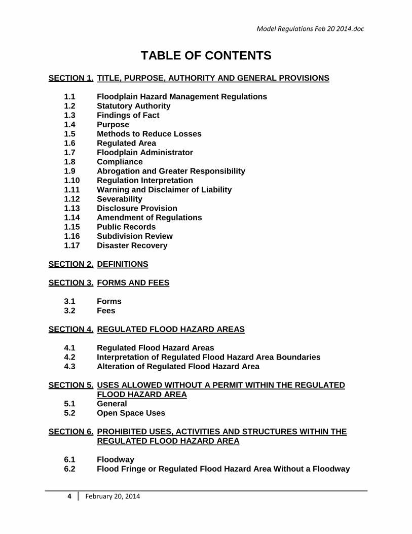
TABLE OF CONTENTS
SECTION 1. TITLE, PURPOSE, AUTHORITY AND GENERAL PROVISIONS 1.1 Floodplain Hazard Management Regulations 1.2 Statutory Authority 1.3 Findings of Fact 1.4 Purpose 1.5 Methods to Reduce Losses 1.6 Regulated Area 1.7 Floodplain Administrator 1.8 Compliance 1.9 Abrogation and Greater Responsibility 1.10 Regulation Interpretation 1.11 Warning and Disclaimer of Liability 1.12 Severability 1.13 Disclosure Provision 1.14 Amendment of Regulations 1.15 Public Records 1.16 Subdivision Review 1.17 Disaster Recovery
SECTION 2. DEFINITIONS
SECTION 3. FORMS AND FEES
3.1 Forms 3.2 Fees
SECTION 4. REGULATED FLOOD HAZARD AREAS
4.1 Regulated Flood Hazard Areas 4.2 Interpretation of Regulated Flood Hazard Area Boundaries 4.3 Alteration of Regulated Flood Hazard Area
SECTION 5. USES ALLOWED WITHOUT A PERMIT WITHIN THE REGULATED
FLOOD HAZARD AREA 5.1 General 5.2 Open Space Uses
SECTION 6. PROHIBITED USES, ACTIVITIES AND STRUCTURES WITHIN THE REGULATED FLOOD HAZARD AREA
6.1 Floodway 6.2 Flood Fringe or Regulated Flood Hazard Area Without a Floodway

Model Regulations Feb 20 2014.doc
5 February 20, 2014
SECTION 7. FLOODPLAIN PERMIT APPLICATION REQUIREMENTS
7.1 General 7.2 Required Floodplain Permit Application Information
SECTION 8. APPLICATION EVALUATION
8.1 Floodplain Permit Application Review 8.2 Notice Requirements for Floodplain Permit Applications 8.3 Floodplain Permit Criteria 8.4 Decision 8.5 Floodplain Permit Conditions and Requirements
SECTION 9. DEVELOPMENT REQUIREMENTS IN THE FLOODWAY
9.1 Uses Requiring Permits 9.2 General Requirements 9.3 Mining Of Material Requiring Excavation From Pits Or Pools 9.4 Railroad, Highway And Street Stream Crossings 9.5 Limited Filling For Road And Railroad Embankments 9.6 Buried Or Suspended Utility Transmission Lines 9.7 Storage Of Materials And Equipment 9.8 Domestic Water Supply Wells 9.9 Buried And Sealed Vaults For Sewage Disposal in Campgrounds
and Recreational Areas 9.10 Public and Private Campgrounds 9.11 Structures Accessory Or Appurtenant 9.12 Construction Of Or Modifications To Surface Water Diversions 9.13 Flood Control And Stream Bank Stabilization Measures 9.14 Stream and Bank Restoration 9.15 Existing Residential and Nonresidential Buildings
SECTION 10. DEVELOPMENT REQUIREMENTS IN THE FLOOD FRINGE OR
REGULATED FLOOD HAZARD AREA WITH NO FLOODWAY
10.1. Uses Requiring Permits 10.2. General Requirements 10.3. Residential Building, Exceptions and Additional Requirements 10.4. Non-Residential Building, Exceptions and Additional Requirements
SECTION 11. EMERGENCIES
11.1 General 11.2 Emergency Notification and Application Requirements

Model Regulations Feb 20 2014.doc
6 February 20, 2014
SECTION 12. VARIANCES
12.1 General 12.2 Variance Application Requirements 12.3 Notice Requirements for Floodplain Variance Application 12.4 Evaluation of Variance Application 12.5 Decision 12.6 Judicial Review
SECTION 13. ADMINISTRATIVE APPEALS
13.1 General 13.2 Appeals Requirements 13.3 Notice and Hearing 13.4 Decision 13.5 Judicial Review
SECTION 14. ENFORCEMENT
14.1. Investigation Request 14.2. Notices To Enter And Investigate Lands Or Waters 14.3. Notice To Respond And Order To Take Corrective Action 14.4. Administrative Review 14.5. Appeal of Administrative Decision 14.6. Failure to Comply With Order to Take Corrective Action 14.7. Judicial Review 14.8. Other Remedies
SECTION 15. PENALTIES
15.1 Misdemeanor 15.2 Declaration to the Federal Flood Insurance Administrator

Model Regulations Feb 20 2014.doc
7 February 20, 2014
SECTION 1. TITLE, PURPOSE, AUTHORITY AND GENERAL PROVISIONS 1.1 FLOODPLAIN HAZARD MANAGEMENT REGULATIONS These regulations are known and may be cited as the “Floodplain Hazard Management Regulations;” hereinafter referred to as “these regulations.”
1.2 STATUTORY AUTHORITY 1. Floodplain and Floodway Management is incorporated in Montana Code
Annotated (MCA) Title 76, Chapter 5 and describes the authority, procedures and minimum standards for local regulations and is further described in Montana Administrative Rule (ARM) 36, Chapter 15.
2. The authority to regulate development in specifically identified flood hazard areas
has been accepted pursuant to 76-5-301, MCA.
1.3 FINDINGS OF FACT 1. Flood hazard areas specifically adopted herein as Regulated Flood Hazard Areas
have been delineated and designated by order or determination of the Department of Natural Resources and Conservation (DNRC) pursuant to MCA 76-5-201 et.seq.
2. These regulations have been reviewed by Montana Department of Natural Resources and Conservation and the Federal Emergency Management Agency. The Montana Department of Natural Resources and Conservation has found the regulations acceptable in meeting the Department minimum standards. The Federal Emergency Management Agency finds that these regulations are adequate and consistent with the comprehensive criteria for land management and use pursuant to the standards established in 44 CFR 60.3. (76-5-302, MCA, ARM 36.15.202, 44 CFR60.1(b), 42USC 4022)
1.4 PURPOSE The purpose of these regulations is to promote public health, safety and general welfare of the residents and minimize public and private losses due to flood conditions in Regulated Flood Hazard Areas. These Regulations are intended to:
1. Protect human life and health;
2. Minimize expenditure of public money for costly flood control projects;
3. Minimize the need for rescue and relief efforts associated with flooding and generally undertaken at the expense of the general public;
4. Minimize prolonged business and public service interruptions;
Model Regulations Feb 20 2014.doc
8 February 20, 2014
5. Minimize damage to public facilities and utilities such as water and gas mains, electric, telephone and sewer lines, streets and bridges;
6. Help maintain a stable tax base by providing for the sound use and development of flood-prone areas in such a manner as to minimize future flood disruptions; and to
7. Ensure compliance with the minimum standards for the continued participation in the National Flood Insurance Program for the benefit of the residents.
1.5 METHODS TO REDUCE LOSSES In accordance with 76-5-102, MCA, these regulations are intended to reduce flood losses through the following methods:
1. Restrict or prohibit uses that are dangerous to health, safety or property in times of flooding or that may cause excessive increases in flood heights or velocities;
2. Require that uses of land vulnerable to floods, including public facilities, be developed or constructed to at least minimum standards or to otherwise minimize flood damage;
3. Regulate the alteration of natural floodplains, stream channels, and natural protective barriers which are needed to accommodate floodwaters;
4. Regulate filling, grading, dredging and other development which may increase flood damage;
5. Prevent or regulate the construction of flood barriers which will impact other land, flood water depth or velocity of floodwaters;
6. Distinguish between the land use regulations applied to the floodway within the Regulated Flood Hazard Area and those applied to that portion of the Regulated Flood Hazard Area not contained in the floodway;
7. Apply more restrictive land use regulations within the floodway of the Regulated Flood Hazard Area; and
8. Ensure that regulations and minimum standards balance the greatest public good with the least private injury.
1.6 REGULATED AREA These regulations apply only to the flood hazard areas specifically adopted herein as Regulated Flood Hazard Areas which are more fully and specifically described in Section 4. Requirements and approvals for alterations to the Regulated Flood Hazard Area are specified in Section 4. The Regulated Flood Hazard Area includes areas specifically identified, labeled and illustrated on maps such as Floodplain, Floodway, or Flood Fringe that have differing uses allowed and minimum building standards that apply. The Regulated Flood Hazard Area is the geographic area inundated by the Flood of 100-year Frequency illustrated and depicted in the referenced studies and maps. The Regulated Flood Hazard Area supporting study and maps illustrating the regulatory area are based on studies and maps that have been specifically adopted pursuant to 76-5-201et.seq. The maps and accompanying study become the Regulated Flood

Model Regulations Feb 20 2014.doc
9 February 20, 2014
Hazard Area only when formally adopted by DNRC and subsequently by the political subdivision by these regulations. The original source of studies and data may be from a Flood Insurance Study by FEMA, or other studies by Corps of Engineers, Soil Conservation, United States Geological Service or other federal or state agency. 1.7 FLOODPLAIN ADMINISTRATOR A Floodplain Administrator is hereby officially appointed and is the responsibility of the office of __________. The Floodplain Administrator’s duty is to administer and implement the provisions of these regulations. The Floodplain Administrator must serve to meet and maintain the commitments pursuant to 44 CFR 59.22(a) to FEMA to remain eligible for National Flood Insurance for individuals and business within the political subdivision. ((44 CFR 59.22(b)(1)) (ARM 36.15.204(2)(h))
1.8 COMPLIANCE Development, New Construction, Alteration or Substantial Improvement may not commence without full compliance with the provisions of these regulations.
1.9 ABROGATION AND GREATER RESPONSIBILITY It is not intended by these regulations to repeal, abrogate, or impair any existing easements, covenants, deed restrictions, zoning or other regulations in effect. However, where these regulations impose greater restrictions, the provision of these regulations must prevail. (44 CFR 60.1(d))
1.10 REGULATION INTERPRETATION In the interpretation and application of these regulations, all provisions shall be: (1) considered as minimum requirements; (2) liberally construed in favor of the governing body; and (3) deemed neither to limit nor repeal any other powers granted under state statutes. (44 CFR 60.1)
1.11 WARNING AND DISCLAIMER OF LIABILITY These regulations do not imply that land outside the Regulated Flood Hazard Areas or uses permitted within such areas will be free from flooding or flood damages. These regulations shall not create liability on the part of the community or any official or employee thereof for any flood damages that result from reliance on these regulations or any administrative decision lawfully made hereunder.
1.12 SEVERABILITY If any section, clause, sentence, or phrase of these regulations is held to be invalid or unconstitutional by any court of competent jurisdiction, then said holding will in no way affect the validity of the remaining portions of these regulations.
1.13 DISCLOSURE PROVISION All property owners or their agents in the Regulated Flood Hazard Areas shall notify potential buyers or their agents that such property, including any permitted uses transferred, is located within the Regulated Flood Hazard Area and is subject to regulation and any permitted uses that are transferred. Information regarding

Model Regulations Feb 20 2014.doc
10 February 20, 2014
Regulated Flood Hazard Area and the repository for Floodplain maps is available in the Floodplain Administrator’s office. (ARM 36.15.204(2)(g))
1.14 AMENDMENT OF REGULATIONS These regulations may be amended after notice and public hearing in regard to the amendments to these regulations. The amendments must be found adequate and acceptable by DNRC and FEMA to be effective and must be submitted for review at least 30 days prior to official adoption.
1.15 PUBLIC RECORDS Records, including permits and applications, elevation and flood proofing certificates, certificates of compliance, fee receipts, and other matters relating to these regulations must be maintained by the Floodplain Administrator and are public records and must be made available for inspection and for copies upon reasonable request. A reasonable copying cost for copying documents for members of the public may be charged and may require payments of the costs before providing the copies. (44 CFR 60.3(b)(5)(iii) & 44 CFR 59.22 (a)(9)(iii))
1.16 SUBDIVISION REVIEW
Within the Regulated Flood Hazard Area, subdivisions including new or expansion of existing manufactured home parks, must be designed to meet the following criteria:
1. The Base Flood Elevations and boundary of the Regulated Flood Hazard area
must be determined and considered during lot layout and building location design;
2. Locations for future structures and development must be reasonably safe from
flooding; (44CFR 60.3(a)(4))
3. Adequate surface water drainage must be provided to reduce exposure to flood hazards; (44 CFR 60.3 (a)(4)(iii))
4. Public utilities and facilities such as sewer, gas, electrical and water systems
must be located and constructed to minimize or eliminate flood damage; and (44 CFR 60.3(a)(4)(ii))
5. Floodplain permits must be obtained according to these regulations before
development occurs that is within the Regulated Flood Hazard Area. (44 CFR 60.3(b))
FOR INFORMATIONAL PURPOSES ONLY Consider a companion regulation in the subdivision regulations.

Model Regulations Feb 20 2014.doc
11 February 20, 2014
1.17 DISASTER RECOVERY In the event of a natural or man-made disaster, the Floodplain Administrator should participate in the coordination of assistance and provide information to structure owners concerning Hazard Mitigation and Recovery measures with the Federal Emergency Management Agency, Montana Disaster Emergency Services, Montana Department of Natural Resources and Conservation, and other state, local and private emergency service organizations. Upon completion of cursory street view structure condition survey within the Regulated Flood Hazard Area, the Floodplain Administrator shall notify owners that a permit may be necessary for an alteration or substantial improvement before repair or reconstruction commences on damaged structures because of damages caused by natural or man-made disasters such as floods, fires or winds.
Owners should be advised that structures that have suffered substantial damage and will undergo substantial improvements require a floodplain application and permit and must be upgraded to meet the minimum building standards herein during repair or reconstruction.((MCA 76-5-404(3)(b) (ARM 36.15.702) (44 CFR 60.3(c)(2 and 3))
FOR INFORMATIONAL PURPOSES ONLY The National Flood Insurance Program (NFIP) program standard for community Floodplain management ordinances specifies that the local government is to consider flood hazards when reviewing and approving subdivisions within the Special Flood Hazard Area. Floodplain Administrators should check their subdivision ordinances to ensure flood hazards outside of Regulated Flood Hazard Areas are addressed in development proposals. For example, the Montana Model Subdivision Regulations suggests that for any portion of a proposed subdivision that is within 2,000 horizontal feet and 20 vertical feet of a stream draining an area of 25 square miles or more, where no official floodplain studies of the stream have been made, the subdivider may be required to conduct a flood hazard evaluation study. The Montana Department of Natural Resources and Conservation may, if requested, review the flood hazard analysis on the merit of its technical adequacy and make a recommendation back to the Floodplain Administrator. A technical review by DNRC is not intended to be a formal designation of a floodplain or floodway pursuant to MCA 76-5-201 et.seq. for floodplain management regulatory purposes unless specifically requested and subsequently adopted by DNRC.

Model Regulations Feb 20 2014.doc
12 February 20, 2014
SECTION 2. DEFINITIONS
Unless specifically defined below, words or phrases used in these regulations shall be interpreted as to give them the meaning they have in common usage and the most reasonable application. For the purpose of these regulations, the following definitions are adopted: 100-year Flood – One percent (1%) annual chance flood. See Base Flood Alteration – Any change or addition to an artificial obstruction that either increases its external dimensions or increases its potential flood hazard. (ARM 36.15.101(2)) Appurtenant Structure – A structure in which the use is incidental or accessory to the use of a principal structure. (44 CFR 59.1) Artificial Obstruction – Any obstruction which is not natural and includes any development, dam, diversion, wall, riprap, embankment, levee, dike, pile, abutment, projection, revetment, excavation, channel rectification, road, bridge, conduit, culvert, building, refuse, automobile body, fill or other analogous structure or matter in, along, across, or projecting into any Regulated Flood Hazard Area that may impede, retard, or change the direction of the flow of water, either in itself or by catching or collecting debris carried by the water, or that is placed where the natural flow of the water would carry the same downstream to the damage or detriment of either life or property. See also Development. (ARM 36.15.101(3) & MCA 76-5-103(1))
FOR INFORMATIONAL PURPOSES ONLY There is a large list of definitions of terms and nomenclature normally used in floodplain hazard management guidelines and explanations. Be aware the same word may mean something different when applied to flood insurance, minimum standards, or a regulatory requirement.
The definitions in 76-5-103, MCA and ARM 36.15.101 where applicable may be considered however several of those definitions are specifically for describing the role and responsibility of the DNRC in regard to development and adoption of flood hazard studies and map and other responsibilities.
FEMA definitions 44 CFR 59.1 may be considered. Definitions are used to describe the FEMA minimum standards for floodplain management if communities want to join the National Flood Insurance Program so individuals and businesses are eligible for flood insurance in that community. However, some definitions are specifically for insurance purposes under the National Flood Insurance Program. Another source of information including definitions is the FEMA National Flood Insurance Manual.

Model Regulations Feb 20 2014.doc
13 February 20, 2014
Base Flood (Flood of 100 Year Frequency) – A flood having a one percent (1%) chance of being equaled or exceeded in any given year (ARM 36.15.101(4) & (44 CFR 59.1) Base Flood Elevation (BFE) – The elevation above sea level of the Base Flood in relation to the National Geodic Vertical Datum of 1929 or the North American Vertical Datum of 1988 or unless otherwise specified. (ARM 36.15.101(5)) Basement – Any area of a building, except a crawl space, as having its Lowest floor below ground level on all sides. (44 CFR 59.1) (NFIP Insurance Manual, Rev. May 2013) Building – A walled and roofed structure, including a gas or liquid storage tank that is principally above ground, as well as a manufactured home. (44 CFR 59.1) Channel – The geographical area within either the natural or artificial banks of a watercourse or drain way. (MCA 76-5-103(2)) Crawl Space – An enclosure that has its interior floor area no more than 5 feet below the top of the next highest floor. See Enclosure and Sub grade Crawlspace. (NFIP Insurance Manual, Rev. May 2013) DNRC – Montana Department of Natural Resources and Conservation Development –Any man-made change to improved or unimproved real estate, including but not limited to buildings or other structures, mining, dredging, filling, grading, paving, excavation or drilling operations or storage of equipment or materials. See also Artificial Obstruction. (44 CFR59.1) Elevated Building – A building that has no Basement and that has it lowest elevated floor raised above ground level by foundation walls, shear walls, posts, piers, pilings or columns. A building on a crawlspace is considered an elevated building. (NFIP Insurance Manual, Rev. May 2013) Enclosure – That portion below the lowest elevated floor of an elevated building that is either partially or fully shut in by rigid walls including a crawlspace, sub grade crawlspace, stairwell, elevator or a garage below or attached. Encroachment – Activities or construction within the Regulated Flood Hazard Area including fill, new construction, substantial improvements, and other development. Encroachment Analysis – A hydrologic and hydraulic analysis performed by an engineer to assess the effects of the proposed artificial obstruction or nonconforming use on Base Flood Elevation, flood flows and flood velocities.

Model Regulations Feb 20 2014.doc
14 February 20, 2014
Establish – To construct, place, insert, or excavate. (MCA 76-5-103(7) (ARM 36.15.101(9)) Existing Artificial Obstruction or Nonconforming Use – An artificial obstruction or nonconforming use that was established before land use regulations were adopted pursuant to Section 76-5-301(1), MCA. (MCA 76-5-404(3)) FEMA – Federal Emergency Management Agency Flood Fringe – The identified portion of the Floodplain of the Regulated Flood Hazard Area outside the limits of the Floodway. (ARM 36.15.101(10)) Flood of 100 Year Frequency (Base Flood) – A flood magnitude expected to recur on the average of once every 100-years or a flood magnitude that has a 1% chance of occurring in any given year. (MCA 76-5-103(9)) (44 CFR 59.1) Floodplain – The area of the Regulated Flood Hazard Area including and adjoining the watercourse or drainway that would be covered by the floodwater of a Base Flood. The area is partitioned into a Flood Fringe and Floodway where specifically designated. See Regulated Flood Hazard Area. Floodway – The identified portion of the Floodplain of the Regulated Flood Hazard Area that is the channel and the area adjoining the channel that is reasonably required to carry the discharge of the Base Flood without cumulatively increasing the water surface by more than one half foot. (MCA 76-5-103(11)) (MCA 76-5-103(5)) Floodplain Administrator – Community official or representative appointed to administer and implement the provisions of this ordinance. Flood Proofing – Any combination of structural and non-structural additions, changes, or adjustments to structures which reduce or eliminate flood damage to real estate or improved real property, water and sanitary facilities, electrical, plumbing, HVAC systems, structures and their contents. The term includes wet flood proofing, dry flood proofing and elevation of structures. ((44 CFR 59.1) Letter of Map Change (LOMC) – An official response from FEMA that amends or revises the FEMA Special Flood Hazard Area and FEMA Flood Insurance Study for flood insurance purposes and/or flood risk hazard. FEMA Letters of Map Change specific to an amendment or revision include:
Letter of Map Amendment (LOMA) – A letter of determination from FEMA issued in response to a request that a property or structure is not subject to the mandatory flood insurance requirement because it was inadvertently located in the effective FEMA Special Flood Hazard Area. The material submitted and response from FEMA may be considered by the Floodplain Administrator for

Model Regulations Feb 20 2014.doc
15 February 20, 2014
determining if a property or structure is within the Regulated Flood Hazard area and subject to these regulations. Letter of Map Revision Based on Fill (LOMR-F) – A letter of approval from FEMA removing the mandatory requirement for flood insurance on property based on placement of fill or an addition. Placement of fill or an addition must be preceded by a permit pursuant to these regulations. Placement of fill does not remove the development from the Regulated Flood Hazard Area or these regulations. Letter of Map Revision (LOMR) – An official FEMA amendment to the currently effective FEMA Flood Insurance Rate Map or FEMA Flood Boundary Map based on a physical change to the floodplain of the Special Flood Hazard Area. It is issued by FEMA and changes flood zones, delineations, and elevations on the FEMA Flood Insurance Rate Map or FEMA Flood Boundary Map and may amend the FEMA Flood Insurance Study. It must be preceded by an approved alteration of the designated floodplain from DNRC and subsequently an amendment to the Regulated Flood Hazard Area. Conditional Letter of Map Revision (CLOMR) – A FEMA letter of approval for a proposed physical change that when completed would propose to change the flood zones, delineation or elevations on the FEMA Flood Insurance Rate Map or FEMA Flood Boundary Map and may amend the FEMA Flood Insurance Study through a subsequent LOMR,. The CLOMR may be considered in an evaluation by DNRC and the Floodplain Administrator during consideration of a proposed alteration to the Regulated Flood Hazard Area.
Lowest Floor – Any floor of a building including a basement used for living purposes, storage, or recreation. This includes any floor that could be converted to such a use. ((ARM 36.15.101(14)) (44 CFR 59.1)) Manufactured Home Park or Subdivision – Includes the construction of facilities for servicing the manufactured home lots and at a minimum includes the installation of utilities, the construction of streets, and either final site grading or the pouring of concrete pads. (44 CFR 59.1) Manufactured or Mobile Home – A building that may be residential or non-residential, is transportable in one or more sections, built on a permanent chassis, and designed to be used with or without a permanent foundation when connected to the required utilities and includes park trailers, travel trailers, and other similar vehicles placed on a site for greater than 180 consecutive days. (ARM 36.15.101(15)) New Construction – Structures for which the commencement of clearing, grading, filling, or excavating to prepare a site for construction occurs on or after the effective date of these regulations and includes any subsequent improvements to such structures. (ARM 36.15.101(20)) (44 CFR 59.1) New Manufactured Home Park Or Subdivision – A manufactured home park or subdivision for which the construction of facilities for servicing the lots on which the

Model Regulations Feb 20 2014.doc
16 February 20, 2014
manufactured homes are to be affixed includes at a minimum, the installation of utilities, the construction of streets, and either final site grading or the pouring of concrete pads and is completed on or after the effective date of floodplain management regulations adopted by a community. (44 CFR 59.1) Non-Residential– Buildings including manufactured homes that are not residential including commercial, agricultural, industrial buildings and accessory buildings. See Residential. Owner – Any person who has dominion over, control of, or title to an artificial obstruction. (MCA 76-5-103(13)) Person – Includes any individual, or group of individuals, corporation, partnership, association or any other entity, including State and local governments and agencies. (44 CFR 59.1) Recreational Vehicle – A park trailer, travel trailer, or other similar vehicle which is (a) built on a single chassis; (b) 400 square feet or less when measured at the largest horizontal projections; (c) designed to be self-propelled or permanently towable by a motorized vehicle; and (d) designed primarily for use as temporary living quarters for recreation, camping, travel, or seasonal use, not for use as a permanent dwelling. (44 CFR 59.1) Regulated Flood Hazard Area – A Floodplain whose limits have been designated pursuant to Part 2, Chapter 5 of Title 76, MCA, and is determined to be the area adjoining the watercourse that would be covered by the floodwater of a Base Flood. The Regulated Flood Hazard Area consists of the Floodway and Flood Fringe where specifically designated. (MCA 76-5-103(4)), (MCA 76-5-103(10), (ARM 36-15-101(11)) Residential Building – A dwelling or building for living purposes or place of assembly or permanent use by human beings and including any mixed use of residential and non-residential use. All other buildings are non-residential. Riprap – Stone, rocks, concrete blocks, or analogous materials that are placed along the bed or banks of a watercourse or drainway for the purpose of preventing or alleviating erosion. (ARM 36.15.101(18)) Scour Depth – The maximum depth of streambed scour caused by erosive forces of the Base Flood. Special Flood Hazard Area – Land area which has been specifically identified by the Federal Emergency Management Agency as the floodplain within a community subject to a 1 percent or greater chance of flooding in any given year. It is useful for the purposes of identifying flood hazards by local subdivisions of government for regulatory purposes as well as use by the National Flood Insurance Program for establishing risk zones and flood insurance premium rates. The FEMA flood hazard area zone

Model Regulations Feb 20 2014.doc
17 February 20, 2014
designation or flood risk potential is as illustrated on FEMA’s Flood Hazard Boundary Map or Flood Insurance Rate Map. Structure – Any Artificial Obstruction. Sub grade Crawlspace – A Crawlspace foundation enclosure that has its interior floor no more than 5 feet below the top of the next higher floor and no more than 2 feet below the lowest adjacent grade on all sides. A foundation exceeding either dimension is a Basement. (NFIP Insurance Manual, Rev. May 2013) Substantial Damage – Damage of any origin sustained by a structure whereby the cost of restoring the structure to its before-damaged condition would exceed 50 percent of the market value of the structure before the damage occurred. (44 CFR 59.1) Substantial Improvement – Any repair, reconstruction or improvement of a structure where the cost equals or exceeds fifty percent (50) of the market value of the structure either before the improvement or repair is started or if the structure has been damaged, and is being restored, before the damage occurred;
1. Substantial improvement is considered to occur when the first construction of any wall, ceiling, floor or other structural part of the building commences;
2. The term does not include: 1. Any project for improvement of a structure to comply with existing state or
local health, sanitary, or safety code specifications which are solely necessary to assure safe living conditions; or
2. Any alteration of a structure listed on the national register of historic places or state inventory of historic places. (ARM 36.15.101(21)) (44 CFR 59.1))
Suitable Fill – Fill material which is stable, compacted, well graded, and pervious, not adversely affected by water and frost, devoid of trash or similar foreign matter, tree stumps or other organic material; and is fitting for the purpose of supporting the intended use and/or permanent structure. (ARM 36.15.101(22)) Variance – Means a grant or relief from the development requirements of these regulations which would permit construction in a manner that would be otherwise prohibited by these regulations by an approval pursuant Section 12. (ARM 36.15.101(23)) Violation – A finding and order pursuant to the regulations against the owner or responsible party of the failure of a structure or other development to be fully compliant with these regulations. (44 CFR 59.1)

Model Regulations Feb 20 2014.doc
18 February 20, 2014
SECTION 3. FORMS AND FEES 3.1 Forms The following forms may be required by the Floodplain Administrator:
1. Floodplain Permit Application Form –The “Joint Application for Proposed Work in Montana’s Steams, Wetlands, Regulated Flood Hazard Areas, and Other Water Bodies”, or other designated application form. A completed FEMA MT-1 form may be required to accompany the application when required by the Floodplain Administrator.
2. Floodplain Permit Compliance Report – A report required to be submitted by the Applicant to the Floodplain Administrator once the permitted project in the Regulated Flood Hazard Area is completed or within the designated time stipulated on the Floodplain permit. A compliance report including an elevation and or flood proofing certificate may be required where specified for the purpose of documenting compliance with the requirements of the permit.
3. Floodplain Variance Application Form – An application submitted by the Applicant to the Floodplain Administrator to initiate a proposed variance from the requirements of these regulations as described in Section 12 .
4. Floodplain Appeal Notice Form– A form submitted by the Applicant or an aggrieved party to initiate the appeal process described in Section 13.
5. Floodplain Emergency Notification Form– A written notification form required pursuant to Section 11 of these regulations.
6. Official Complaint Form – A form that may be used by any person to notify the Floodplain Administrator of an activity taking place that appears to be noncompliant with the requirements of these regulations.
3.2 Fees
A reasonable application fee for processing of permit applications may be imposed. Fees may be adopted for costs of permit applications, notices, variances, inspections, certifications or other administrative actions required by these regulations. (ARM 36.15.204(3)(b))

Model Regulations Feb 20 2014.doc
19 February 20, 2014
SECTION 4. REGULATED FLOOD HAZARD AREA 4.1 REGULATED FLOOD HAZARD AREAS
1. The Regulated Flood Hazard Areas are the 100-year floodplains illustrated and referenced in the following specific studies and reports described as follows: 1. Specific title and Order date of specific flood study including maps and areas
of the 100-year floodplain, and 1. A list of subsequent amendments to the Regulated Flood Hazard Area;
and 2. Other specific studies or and Orders.
2. The Regulated Flood Hazard Areas specifically described or illustrated in the above referenced studies and maps of the 100-year floodplain have been delineated, designated and established by order or determination by the DNRC pursuant to 76-5-201et.seq., MCA.
3. Use allowances, design and construction requirements specifically in Sections 5, 6, 9, and 10 in these regulations vary by the specific Floodplain areas including areas identified as Floodway and Flood Fringe within the Regulated Flood Hazard Area.
4.2 INTERPRETATION OF REGULATED FLOOD HAZARD AREA BOUNDARIES
1. The mapped boundaries of the Floodplain illustrated in the referenced studies and maps in this Section are a guide for determining whether property is within the Regulated Flood Hazard Area.
2. A determination of the outer limits and boundaries of the Regulated Flood
Hazard Area or the Flood Fringe and Floodway within the Regulated Flood Hazard Area includes an evaluation of the maps as well as the particular study data referenced in this Section. Supporting study material for Base Flood Elevations takes precedence over any map illustrations if it exists.
EXAMPLE FOR INFORMATIONAL PURPOSES ONLY 1. August 16, 2014 FEMA Flood Insurance Study (FIS) and Flood
Insurance Rate Maps (FIRMs) for Missoula County, Montana, and 1. As amended in conformance with DNRC Approval dated July
15, 2015 and FEMA Conditional Letter of Map Revision (CLOMR) dated August 16, 2015; and
2. Floodplain Management Study for Swan River adopted by DNRC on July 10, 2016.

Model Regulations Feb 20 2014.doc
20 February 20, 2014
3. The Regulated Flood Hazard Area boundary is delineated by the Base Flood Elevation. The physical field regulatory boundary of the Regulated Flood Hazard Area is the actual intersection of the applicable study Base Flood Elevation with the existing adjacent terrain of the watercourse or drainway. (ARM 36.15.501(6))
4. The Floodway boundary where identified within the Floodplain is as illustrated on the referenced maps and studies. Since the Floodway boundary is a study feature, the location of the boundary may be physically located by referencing the study data to a ground feature. The Floodplain Administrator’s interpretation of the boundary and decision may be appealed as set forth in Section 13.
5. The Floodplain Administrator may request additional information described below to determine whether or not the proposed development is within the Regulated Flood Hazard Area: 1. Where Base Flood Elevations exist, the property owner may provide
additional information which may include elevation information provided by an engineer or land surveyor in order to determine if the proposed development is subject to these regulations. (ARM 36.15.501(6))
2. Where Base Flood Elevations do not exist, the property owner may provide additional information to be considered to determine the location of the regulatory boundary or alternatively provide a computed Base Flood Elevation provided by an engineer.
3. The Floodplain Administrator’s interpretation of the boundaries and decision may be appealed as set forth in Section 13.
6. Any owner or lessee of property who believes his property has been inadvertently included in the Regulated Flood Hazard Area including the Floodway or Flood Fringe may submit scientific and/or technical information to the Floodplain Administrator for a determination if the property is appropriately located. Scientific or technical information submitted to FEMA by an owner to affect the insurance rating for insurance purposes may be considered by the Floodplain Administrator. A determination by the Floodplain Administrator is independent of any determination by FEMA for insurance purposes.
FOR INFORMATIONAL PURPOSES ONLY When property located within the Regulated Flood Hazard area is naturally above the Base Flood Elevation as proven by a certified elevation survey provided by an engineer or land surveyor, the property owner may submit a Letter of Map Amendment (LOMA) to FEMA in order to affect the flood risk designation for insurance purposes. Information on the process and requirements are available through FEMA.

Model Regulations Feb 20 2014.doc
21 February 20, 2014
4.3 ALTERATION OF REGULATED FLOOD HAZARD AREA
1. Revisions or updates to the specific maps and data that alter the established Floodplains or Floodway of the Regulated Flood Hazard Area requires DNRC approval pursuant to 75-5-203, MCA. An alteration of the Regulated Flood Hazard Area is a DNRC approved amendment to the DNRC order that originally delineated and designated the 100-year floodplain and is the basis of the Regulated Flood Hazard Area referenced in Section 4.1.2. A DNRC approved alteration consists of revisions or updates to the specific maps and data of the referenced studies in this Section and forms the basis for an amendment to the Regulated Flood Hazard Area in these regulations; (ARM 36.15.505)
2. Any change to the Regulated Flood Hazard Area as a result of a DNRC
alteration is effective upon amendment to the Regulated Flood Hazard Area described in Section 4.1.1;
3. Substantial natural physical change or new technical or scientific flood data
showing that the Base Flood Elevation has or may be changed or was erroneously established shall be brought to the attention of DNRC and FEMA; (ARM 36.15.505(1)(a)) (44 CFR 65.3)
4. Any Floodplain permit application for a proposed development or artificial obstruction must be denied until a DNRC alteration pursuant to 76-5-203, MCA is approved if it causes an increase of 0.5 feet or more to the Base Flood Elevation of a Regulated Flood Hazard Area without a Floodway or an increase of more than 0.00 feet to the Base Flood Elevation of a Floodway.
5. To propose an alteration a petition must be submitted to DNRC and must
include the following information:
1. Certification that no buildings are located in the areas which would be impacted by the increased Base Flood Elevation; (44 CFR 65.12(a)(5)
2. Evidence of notice to all property and land owners of the proposed
impacts to their properties explaining the proposed impact on their property; (44 CFR 65.12(a)(3))
3. Information that demonstrates that alternatives are not feasible; (44
CFR 65.12(2))
4. Information that demonstrates that development is for a public use or benefit; and
5. Any other supporting information and data as needed for approvals.

Model Regulations Feb 20 2014.doc
22 February 20, 2014
((ARM 36.15.505) (44 CFR 60.3(c)(10)) (44 CFR 60.3(d)(3)) (44 CFR 65.7(3)) (44 CFR 65.12))
6. The Floodplain Administrator may represent the permit authority for any necessary applications, approvals or endorsements such as the FEMA Community Acknowledgement Form to FEMA where affecting the FEMA Special Flood Hazard Area;
7. A determination by the Floodplain Administrator that land areas located within
the Regulated Flood Hazard Area are above the Base Flood Elevation as proven by a certified elevation survey does not constitute or require an alteration or an amendment of the Regulated Flood Hazard Area and may be maintained as a public record that more explicitly defines the Regulated Flood Hazard Area boundary; and
8. Elevating with suitable fill as permitted does not alter the Regulated Flood Hazard Area or remove the elevated area from the Regulated Flood Hazard Area. (ARM 36.15.505(2))
9. A floodplain permit implementing the physical change cannot be approved
until a CLOMR has been issued by FEMA.
FOR INFORMATIONAL PURPOSES ONLY Once DNRC approves an Alteration and the community amends the Regulated Flood Hazard Area, the community is then required per agreement between the community and FEMA to obtain approval by CLOMR from FEMA before there is any physical change to the Special Flood Hazard Area. (44 CFR 59.21, 44 CFR 65.12)

Model Regulations Feb 20 2014.doc
23 February 20, 2014
SECTION 5. USES ALLOWED WITHOUT A PERMIT WITHIN THE REGULATED FLOOD HAZARD AREA
5.1 - GENERAL Existing artificial obstructions or nonconforming uses established before land use regulations pursuant to Section 76-5-301, MCA were effective, are allowed without a permit. However, alteration or substantial improvement of an existing artificial obstruction or nonconforming use requires a floodplain permit. Maintenance of an existing artificial obstruction or nonconforming use does not require a floodplain permit if it does not cause an alteration or substantial improvement. (MCA 76-5-404(3) 5.2 OPEN SPACE USES The following open space uses shall be allowed without a permit in the Regulated Flood Hazard Area, provided that such uses are not prohibited by any other regulation or statute, do not require structures, and do not require fill, grading, excavation or storage of materials or equipment: ((ARM 36.15.601) (ARM 36.15.701)(1) (MCA 76-5-401) (MCA 76-5-404(3))
1. Agricultural uses, not including related structures, such as tilling, farming, irrigation, ranching, harvesting, grazing, etc; ((ARM 36.15.601(1)(a)) (MCA 76-5-401(1)))
2. Accessory uses, not including structures, such as loading and parking areas, or
emergency landing strips associated with industrial or commercial facilities; ((ARM 36.15.601(1)(b)) (MCA 76-5-401(2),))
3. Forestry, including processing of forest products with portable equipment; ((ARM
36.15.601(1)(d)) (MCA 76-5-401(4))) 4. Recreational vehicle use provided that the vehicle is on the site for fewer than
180 consecutive days and the vehicle is fully licensed and ready for highway use. A recreational vehicle is ready for highway use if it is on its wheels or jacking system with wheels intact, is attached to the site only by quick disconnect type utilities and security devices, and has no permanently attached additions; (44 CFR 60.3(c)(14))
5. Residential uses such as lawns, gardens, parking areas, and play areas; ((ARM
36.15.601(1)(e)) (MCA 76-5-401(5))) 6. Maintenance of the existing state of an existing open space uses including
preventive maintenance activities such as bridge deck rehabilitation and roadway pavement preservation activities. Maintenance cannot increase the external size or increase the hazard potential of the existing open space use; (MCA 76-5-404(3)(b))
7. Public or private recreational uses not requiring structures such as picnic
grounds, swimming areas, boat ramps, parks, campgrounds, golf courses,

Model Regulations Feb 20 2014.doc
24 February 20, 2014
driving ranges, archery ranges, wildlife management and natural areas, alternative livestock ranches (game farms), fish hatcheries, shooting preserves, target ranges, trap and skeet ranges, hunting and fishing areas, and hiking and horseback riding trails; (ARM 36.15.601(a)(c)) (MCA 76-5-401,))
8. Fences that have a low impact to the flow of water such as barbed wire fences
and wood rail fences, and not including permanent fences crossing channels. Fences that have the potential to stop or impede flow or debris such as a chain link or privacy fence requires a floodplain permit and meet the requirements of Section 9.11; (ARM 36.15.601(2)(b)) (MCA 76-5-401))
9. Addition of highway guard rail, signing and utility poles that have a low impact to
the flow of water along an existing roadway. 10. Irrigation and livestock supply wells, provided that they are located at least 500
feet from domestic water supply wells and with the top of casing 18” above the Base Flood Elevation. ((ARM 36.15.601(2)(a)) (MCA 76-5-401) (ARM 36.21.647))
Model Regulations Feb 20 2014.doc
25 February 20, 2014
SECTION 6. PROHIBITED USES, ACTIVITIES AND STRUCTURES WITHIN THE REGULATED FLOOD HAZARD AREA 6.1 FLOODWAY The following artificial obstructions and nonconforming uses are prohibited in the Floodway of the Regulated Flood Hazard Area, except for those established before land use regulations pursuant to Section 76-5-301, MCA have been adopted: (MCA 76-5-404(3))
1. A building for residential or non-residential purposes; (MCA 76-5-403(1), (ARM
36.15.605)(1a)), (ARM 36.15.605(2b), (ARM 36.15.605(2)(a)).
2. A structure, fill, or excavation that would cause water to be diverted from the Floodway, cause erosion, obstruct the natural flow of waters or reduce the carrying capacity of the Floodway. Notwithstanding these requirements, excavation or fill may be allowed when it is a component to a permitted use allowed in these regulations; (MCA 76-5-403(2)).
3. The construction or storage of an object (artificial obstruction) subject to flotation or movement during flood level periods; (MCA 76-5-403(3) and ARM 36.15.605(1)(c))
4. Solid and hazardous waste disposal and individual and multiple family sewage disposal systems unless the systems meet the local health and sanitation regulations and when permitted pursuant to these regulations and are designed to minimize or eliminate infiltration of flood waters and avoid impairment or contamination; ((ARM 36-15-605(2c)) (44 CFR 60.3(a)(3)))
5. Storage of toxic, flammable, hazardous or explosive materials; and (ARM 36.15.605(2d))
6. Cemeteries, mausoleums, or any other burial grounds. (Higher Standard) 6.2 FLOOD FRINGE OR REGULATED FLOOD HAZARD AREA WITHOUT A FLOODWAY The following artificial obstructions and nonconforming uses are prohibited in the Flood Fringe or Regulated Flood Hazard Area without a Floodway, except for those established before land use regulations have been adopted: (MCA 76-5-404(3))
1. Solid and hazardous waste disposal and individual and multiple family sewage disposal systems unless the systems meet the local health and sanitation regulations and when permitted pursuant to these regulations and are designed to minimize or eliminate infiltration of flood waters and avoid impairment or contamination; ((ARM 36-15-703(1)) (44 CFR 60.3(a)(3)))
Model Regulations Feb 20 2014.doc
26 February 20, 2014
2. Storage of toxic, flammable, hazardous or explosive materials; (ARM 36-15-703(2))
3. The construction or storage of an artificial obstruction subject to flotation or movement during flood level periods; (Higher Standard)
4. Cemeteries, mausoleums, or any other burial grounds; and (Higher Standard)
5. Critical facilities, including buildings and associated structures that provide essential community care and emergency operation functions such as schools, hospitals, nursing home facilities, fire stations and police stations. ( Higher Standard) (44CFR 60.22(a)(2))

Model Regulations Feb 20 2014.doc
27 February 20, 2014
SECTION 7. FLOODPLAIN PERMIT APPLICATION REQUIREMENTS
7.1 GENERAL
1. A Floodplain permit is required for a person to establish, alter or substantially improve an artificial obstruction, nonconforming use or development within the Regulated Flood Hazard Area; ((44 CFR 60.1) (MCA 76-5-404) (ARM 36.15.204(2)(a)))
2. A Floodplain permit is required for artificial obstructions, developments and uses not specifically listed in Sections 9 and 10, except as allowed without a Floodplain permit in Section 5, or as prohibited as specified in Section 6, within the Regulated Flood Hazard Area;
3. Artificial obstructions and nonconforming uses in a Regulated Flood Hazard Area not exempt under Section 5 are public nuisances unless a Floodplain permit has been obtained; (MCA 76-5-404(1))
4. A Floodplain permit is required for an alteration of an existing artificial obstruction or nonconforming use that increases the external size or increases its potential flood hazard and not exempt under Section 5; ((MCA 76-5-404(3)(b)) (ARM 36.15.204(2)(a)))
5. A Floodplain permit is required to reconstruct or repair an existing artificial obstruction that has experienced substantial damage and will undergo substantial improvement; and
6. Maintenance of an existing artificial obstruction or use that is a substantial improvement or an alteration requires a Floodplain permit. (MCA 76-5-404(3)(b))
7.2 REQUIRED FLOODPLAIN PERMIT APPLICATION INFORMATION
1. A Floodplain permit application shall include, but is not limited to the following:
1. A completed and signed Floodplain Permit Application;
2. The required review fee;
3. Plans in duplicate drawn to scale showing the location, dimensions, and elevation of the proposed project including landscape alterations, existing and proposed structures, and the location of the foregoing in relation to the
Model Regulations Feb 20 2014.doc
28 February 20, 2014
Regulated Flood Hazard Areas and if applicable the Floodway boundary; ((MCA 76-5-405) (ARM 36.15.216))
4. A copy of other applicable permits or pending applications required by Federal or State law as submitted which may include but are not limited to a 310 permit, SPA 124 permit, Section 404 Permit, 318 Authorization, 401 Certification or a Navigable Rivers Land Use License or Easement for the proposed project; and the applicant must show that the Floodplain permit application is not in conflict with the relevant and applicable permits; and (44 CFR 60.3(a)(2))
5. Additional information related to the specific use or activity that demonstrates the design criteria and construction standards are met or exceeded as specified in Sections 9 and 10. ((MCA 76-5-405) (ARM 36.15.216))

Model Regulations Feb 20 2014.doc
29 February 20, 2014
SECTION 8. FLOODPLAIN PERMIT APPLICATION EVALUATION
8. 1 FLOODPLAIN PERMIT APPLICATION REVIEW
1. The Floodplain Administrator shall review and evaluate the Floodplain permit application and shall approve, approve with conditions, or deny the application within (180 days or a time specified) of receipt of a correct and complete application. (MCA 76-5-405(2))
2. The Floodplain Administrator shall determine whether the Floodplain permit application contains the applicable elements required in these regulations and shall notify the applicant of the Floodplain Administrator's determination.
3. If the Floodplain permit application is found to be missing the required elements and if the applicant corrects the identified deficiencies and resubmits the Floodplain application, the Floodplain Administrator shall notify the applicant whether the resubmitted Floodplain application contains all the elements required by these regulations, as applicable.
4. This process shall be repeated until the applicant submits a completed Floodplain permit application containing all the elements required by these regulations, or the application is withdrawn.
5. If after a reasonable effort the Floodplain Administrator determines that the Floodplain application remains incomplete, the Floodplain Administrator shall deny the Floodplain permit application and notify the applicant of missing elements. No further action shall be taken on the Floodplain permit application by the Floodplain Administrator until the Floodplain permit application is resubmitted.
6. A determination that a Floodplain permit application is correct and complete for review does not ensure that the Floodplain permit application will be approved or conditionally approved and does not limit the ability of the Floodplain Administrator to request additional information during the review process.
8.2. NOTICE REQUIREMENTS FOR FLOODPLAIN PERMIT APPLICATIONS:
1. Upon receipt of a complete application for a Floodplain permit, the Floodplain Administrator shall prepare a notice containing the facts pertinent to the Floodplain permit application and shall:
1. Publish the notice at least once in a newspaper of general circulation in the
area; (ARM 36.15.204(2)(c))

Model Regulations Feb 20 2014.doc
30 February 20, 2014
2. Serve notice by first-class mail upon adjacent property owners; (ARM
36.15.204(2)(c)) 3. Serve notice to the State National Flood Insurance Program Coordinator
located in DNRC by the most efficient method. Notice to other permitting agencies or other impacted property owners may be provided; and
4. Prior to any alteration or relocation of a watercourse in the Regulated Flood
Hazard Area, additionally provide notice to FEMA and adjacent communities. (44 CFR 60.3 (b)(6))
2. The notice shall provide a reasonable period of time, not less than 15 days, for
interested parties to submit comments on the proposed activity. (ARM 36.15.204(2)(c))
8. 3 FLOODPLAIN PERMIT CRITERIA
1. Floodplain permit applications shall be approved provided the proposed new construction, substantial improvement, or alteration of an artificial obstruction meets the requirements of the minimum standards and criteria in Sections 9 and 10 and other requirements of these regulations. ((MCA 76-5-406) (44 CFR 60.3))
2. A Flood Plain permit application for a development that will cause an increase of more than 0.00 feet to the Base Flood Elevation of the Floodway or more than 0.50 feet to the Base Flood Elevation of the Regulated Flood Hazard Area without a Floodway shall not be approved until approval for an Alteration pursuant to Section 4.3 has been approved, the Regulated Flood Hazard Area is amended and a FEMA CLOMR where required is issued.
3. The Floodplain Administrator shall determine that all necessary permits have been received from those governmental agencies from which approval is required by Federal or State law, including section 404 of the Federal Water Pollution Control Act Amendment of 1972, 36 U.S.C. 1334.(44 CFR 60.3(a)(2)
8.4 DECISION
1. The Floodplain Administrator shall approve, conditionally approve, or deny the proposed Floodplain permit application. The Floodplain Administrator shall notify the applicant of his action and the reasons thereof within (180 days or time specified) of receipt of a correct and complete Floodplain permit application unless otherwise specified. A copy of the approved Floodplain permit must be provided to DNRC. ((MCA 76-5-405(2)) (ARM 36.15.204(2)(e))

Model Regulations Feb 20 2014.doc
31 February 20, 2014
2. The approval of a Floodplain permit application does not affect any other type of approval required by any other statute or ordinance of the state or any political subdivision or the United States, but is an added requirement. (MCA 76-5-108)
8.5 FLOODPLAIN PERMIT CONDITIONS AND REQUIREMENTS 1. Upon approval or conditional approval of the Floodplain permit application, the
Floodplain Administrator shall provide the applicant with a Floodplain permit with applicable specific requirements and conditions including but not limited to the following:
1. The Floodplain permit will become valid when all other necessary permits
required by Federal or State law are in place;(44 CFR 60.3(a)(2)
2. Completion of the development pursuant to the Floodplain permit shall be completed within one year from the date of Floodplain permit issuance or a time limit commensurate with the project construction time line for completion of the project or development. The applicant may request an extension for up to an additional year. The request must be made at least 30 days prior to the permitted completion deadline;
3. The applicant shall notify subsequent property owners and their agents and
potential buyers of the Floodplain development permit issued on the property and that such property is located within a Regulated Flood Hazard Area and shall record the notice with the Floodplain Administrator; (ARM 36.15.204(2)(g))
4. The applicant shall maintain the artificial obstruction or use to comply with the
conditions and specifications of the permit; 5. The applicant shall allow the Floodplain Administrator to perform on site
inspections at select intervals during construction or completion; 6. The applicant shall provide periodic engineering oversight and/or interim
reports during the construction period to be submitted to the Floodplain Administrator to confirm constructed elevations and other project elements;
7. The applicant shall submit a compliance report including certifications where
required and applicable including flood proofing, elevation, surface drainage, proper enclosure openings and materials to the Floodplain Administrator within 30 days of completion or other time as specified;
8. The applicant shall submit an annual performance and maintenance report on
bank stabilization or other projects utilizing maturing vegetative components to the Floodplain Administrator for a period of 5 years or a time specified in the permit; or
Model Regulations Feb 20 2014.doc
32 February 20, 2014
9. The applicant shall submit evidence of a submittal of a FEMA Letter of Map
Revision (LOMR) to FEMA and applicable fees within 6 months of project completion and proceed with due diligence for acceptance of the document and necessary supporting materials by FEMA. (44 CFR 65.3)

Model Regulations Feb 20 2014.doc
33 February 20, 2014
SECTION 9. DEVELOPMENT REQUIREMENTS IN THE FLOODWAY
9.1 USES REQUIRING PERMITS Artificial obstructions including alterations and substantial improvements specifically listed in Sections 9.3 to 9.15 may be allowed by permit within the Floodway, provided the General Requirements in Section 9.2 and the applicable requirements in Sections 9.3 to 9.15 are met. 9.2 GENERAL REQUIREMENTS An application for a permit shall meet the following requirements:
1. All projects shall be designed and constructed to ensure that they do not adversely affect the flood hazard on other properties and are reasonably safe from flooding;
2. All projects shall assure that the carrying capacity of the Floodway is not reduced. All projects in the Floodway shall meet the following: 1. Demonstrate that the project does not increase the Base Flood Elevation by
conducting an encroachment analysis certified by an engineer. A minimal or qualitative encroachment analysis may be accepted when the project or development does not require a structure, alteration of the Floodway, involve fill, grading, excavation or storage of materials or equipment but is also certified by an engineer to not exceed the allowable encroachment to the Base Flood Elevation; and
2. The allowable encroachment to the Base Flood Elevation is 0.00 feet, and no significant increase to the velocity or flow of the stream or water course unless approval of an alteration of the Regulated Flood Hazard Area pursuant to Section 4.3 and an approved FEMA Conditional Letter of Map Revision occurs before permit issuance; and
((ARM 36.15.604) (ARM 36.15.505) (ARM 36.15.605(b)) (44 CFR 60.3(a)(3 and 4)) (44CFR 65.12(a))
3. An application for a Floodplain permit must also demonstrate the following factors are considered and incorporated into the design of the use or artificial obstruction in the Floodway:
1. The danger to life and property due to backwater or diverted flow caused by
the obstruction or use; ((MCA 76-5-406(1)) (ARM 36.15.216(2)(a))) 2. The danger that the obstruction or use may be swept downstream to the injury
of others; ((MCA 76-5-406(2)) (ARM 36.15.216(2)(b))) 3. The availability of alternative locations; ((MCA 76-5-406(3)) (ARM
36.15.216(2)(c))

Model Regulations Feb 20 2014.doc
34 February 20, 2014
4. Construct or alter the obstruction or use in such manner as to lessen the
flooding danger; ((MCA 76-5-406(4)) (ARM 36.15.216(2)(d))) 5. The permanence of the obstruction or use and is reasonably safe from
flooding; ((MCA 76-5-406(5) (ARM 36.15.216(2e))) 6. The anticipated development in the foreseeable future of the area which may
be affected by the obstruction or use; ((MCA 76-5-406(6)) (ARM 36.15.216(2f)))
7. Relevant and related permits for the project have been obtained; (44 CFR 60.3(a)(2))
8. Such other factors as are in harmony with the purposes of these regulations, the Montana Floodplain and Floodway Management Act, and the accompanying Administrative Rules of Montana; and ((MCA 76-5-406(7)) (ARM 36.15.216(2)(g)))
9. The safety of access to property in times of flooding for ordinary and emergency services. (44CFR 60.22 (c)(7)) (Higher Standard)
9.3 MINING OF MATERIAL REQUIRING EXCAVATION FROM PITS OR POOLS provided, in addition to the requirements of Section 9.2, that:
1. A buffer strip of undisturbed land of sufficient width as determined by an engineer to prevent flood flows from channeling into the excavation is left between the edge of the channel and the edge of the excavation; (ARM 36.15.602(1)(a))
2. The excavation meets all applicable laws and regulations of other local and state agencies; and (ARM 36.15.602(1)(b))
3. Excavated material may be processed on site but is stockpiled outside the
Floodway.(ARM 36.15.602(1)(c))
9.4 RAILROAD, HIGHWAY AND STREET STREAM CROSSINGS, including other transportation related crossings provided, in addition to the requirements of Section 9.2, that:
1. Crossings are designed to offer minimal obstructions to the flood flow; (ARM 36.15.602(2))
2. Where failure or interruption of public transportation facilities would result in danger to public health or safety and where practicable and in consideration of FHWA Federal-Aid Policy Guide 23CFR650A:

Model Regulations Feb 20 2014.doc
35 February 20, 2014
1. Bridge lower chords shall have freeboard to at least two (2) feet above the Base Flood Elevation to help pass ice flows, the base flood discharge and any debris associated with the discharge; and
2. Culverts shall be designed to pass the Base Flood discharge and maintain at least two (2) feet freeboard on the crossing surface;
3. Normal overflow channels, if possible are preserved to allow passage of
sediments to prevent aggradations; and
4. Mid stream supports for bridges, if necessary, have footings buried below the maximum scour depth.
9.5 LIMITED FILLING FOR ROAD AND RAILROAD EMBANKMENTS, including other transportation related embankments not associated with stream crossings and bridges provided, in addition to the requirements of Section 9.2, that:
1. The fill is suitable fill; 2. Reasonable alternate transportation routes outside the floodway are not
available; and (ARM 36.15.602(3)) 3. The encroachment is located as far from the stream channel as possible. (ARM
36.15.602(3))
9.6 BURIED OR SUSPENDED UTILITY TRANSMISSION LINES provided, in addition to the requirements of Section 9.2, that:
1. Suspended utility transmission lines are designed such that the lowest point of
the suspended line is at least six (6) feet higher than the Base Flood Elevation; (ARM 36.15.602(4))
2. Towers and other appurtenant structures are designed and placed to withstand and offer minimal obstruction to flood flows; (ARM 36.15.602(4))
3. Alternatives such as alternative routes, directional drilling, and aerial crossings are considered when technically feasible; and
4. Utility transmission lines carrying toxic or flammable materials are buried to a depth of at least twice the calculated maximum scour depth determined by an engineer for the Base Flood. (ARM 36.15.602(4))
9.7 STORAGE OF MATERIALS AND EQUIPMENT provided, in addition to the requirements of Section 9.2, that:

Model Regulations Feb 20 2014.doc
36 February 20, 2014
1. The material or equipment is not subject to major damage by flooding and is properly anchored to prevent flotation or downstream movement; or (ARM 36.15.602(5)(a))
2. The material or equipment is readily removable within the limited time available after flood warning. Storage of flammable, toxic or explosive materials shall not be permitted.(ARM 36.15.602(5)(b))
9.8 DOMESTIC WATER SUPPLY WELLS provided, in addition to the requirements of
Section 9.2, that:
1. They are driven or drilled wells located on ground higher than surrounding ground to assure positive drainage from the well; (ARM 36.15.602(6))
2. They require no other structures (e.g. a well house); (ARM 36.15.602(6))
3. Well casings are water tight to a distance of at least twenty five (25) feet below the ground surface and the well casing height is a minimum of two (2) feet above the Base Flood Elevation or capped with a watertight seal and vented two (2) feet above the Base Flood Elevation; ((ARM 36.15.602(6)) )
4. Water supply lines have a watertight seal where the lines enter the casing; (ARM 36.15.602(6))
5. All pumps and electrical lines and equipment are either of the submersible type or are adequately flood proofed; and (ARM 36.15.602(6))
6. Check valves are installed on main water lines at wells and at all building entry locations. ((44 CFR 60.3 (a)(5)) (ARM 36.15.602(6)))
9.9 BURIED AND SEALED VAULTS FOR SEWAGE DISPOSAL IN CAMPGROUNDS AND RECREATIONAL AREAS provided, in addition to the requirements of Section 9.2, demonstrate approval by Montana Department of Environmental Quality and local health and sanitation permits or approvals. ((44 CFR 60.3(a)(6)) (ARM 36.15.602(7)))
9.10 PUBLIC AND PRIVATE CAMPGROUNDS provided, in addition to the requirements of Section 9.2, that:
1. Access roads require only limited fill and do not obstruct or divert flood waters;
(ARM 36.15.602(8))
2. The project meets the accessory structures requirements in this Section;
3. No dwellings or permanent mobile homes are allowed; (ARM 36.15.602(8))

Model Regulations Feb 20 2014.doc
37 February 20, 2014
4. Recreational vehicles and travel trailers are ready for highway use with wheels intact, with only quick disconnect type utilities and securing devices, and have no permanently attached additions; and (44 CFR 60.3(c)(14))
5. There is no large-scale clearing of riparian vegetation within 50 feet of the mean annual high water mark. (Higher Standard)
9.11 STRUCTURES ACCESSORY OR APPURTENANT to permitted uses such as boat docks, loading and parking areas, marinas, sheds, emergency airstrips, permanent fences crossing channels that may impede or stop flows or debris, picnic shelters and tables and lavatories, that are incidental to a principal structure or use, provided in addition to the requirements of Section 9.2, that:
1. The structures are not intended for human habitation or supportive of human
habitation; (ARM 36.15.602(9))
2. The structures will have low flood damage potential; (ARM 36.15.602(9))
3. The structures will, insofar as possible, be located on ground higher than the surrounding ground and as far from the channel as possible; (ARM 36.15.602(9))
4. The structures will be constructed and placed so as to offer a minimal obstruction to flood flows; (ARM 36.15.602(9))
5. Only those wastewater disposal systems that are approved under health and sanitation regulations are allowed;
6. Service facilities within these structures such as electrical, heating and plumbing are flood proofed according to the requirements in Section 10; (ARM 36.15.602(9))
7. The structures are firmly anchored to prevent flotation; (ARM 36.15.602(9))
8. The structures do not require fill and/or substantial excavation;
9. The structures or use cannot be changed or altered without permit approval; and
10. There is no clearing of riparian vegetation within 50 feet of the mean annual high water mark. (Higher Standard)
9.12 CONSTRUCTION OF OR MODIFICATIONS TO SURFACE WATER DIVERSIONS provided, in addition to the requirements of Section 9.2, that the design is reviewed and approved by an engineer and includes:
1. Measures to minimize potential erosion from a Base Flood; and (ARM
36.15.603(3)(b))

Model Regulations Feb 20 2014.doc
38 February 20, 2014
2. Designs and plans that demonstrate any permanent structure in the stream is
designed to safely withstand up to the Base Flood considering the forces associated with hydrodynamic and hydrostatic pressures including flood depths, velocities, impact, ice buoyancy, and uplift forces associated with the Base Flood. ((ARM 36.15.603(3)(c) ((CFR 60.3(a)(3) (CFR 60.3(d)(3)))
9.13 FLOOD CONTROL AND STREAM BANK STABILIZATION MEASURES provided, in addition to the requirements of Section 9.2, that the design is reviewed and approved by an engineer and constructed to substantially resist or withstand the forces associated with hydrodynamic and hydrostatic pressures, including flood depths, velocities, impact, ice, buoyancy, and uplift associated with the Base Flood. The design must also show compliance with the following applicable criteria: ((CFR 60.3(a)(3) (CFR 60.3(d)(3)) (ARM 36.15.606))
1. LEVEE AND FLOODWALL construction or alteration: 1. Must be designed and constructed with suitable fill and be designed to safely
convey a Base Flood; (ARM 36.15.606(1)(a))
2. Must be constructed at least 3 feet higher than the elevation of the Base Flood unless the levee or floodwall protects agricultural land only; (ARM 36.15.606(2)(a))
3. Must meet state and federal levee engineering and construction standards
and be publically owned and maintained if it protects structures of more than one landowner; and
(ARM 36.15.505(1)(c)(ii)and (iii)) 4. For any increase in the elevation of the Base Flood, an alteration of the
Regulated Flood Hazard Area requires approvals pursuant to Section 4.3.
2. STREAM BANK STABILIZATION, PIER AND ABUTMENT PROTECTION
projects: 1. Must be designed and constructed using methods and materials that are the
least environmentally damaging yet practicable, and should be designed to withstand a Base Flood once the project’s vegetative components are mature within a period of up to 5 years or other time as required by the Floodplain Administrator. Once vegetation is mature and established it should not require substantial yearly maintenance after the initial period;
2. Materials for the project may be designed to erode over time but not fail catastrophically and impact others. Erosion, sedimentation, and transport of the materials may be designed to be at least similar in amount and rate of existing stable natural stream banks during the Base Flood;

Model Regulations Feb 20 2014.doc
39 February 20, 2014
3. Must not increase erosion upstream, downstream, across from or adjacent to
the site in excess of the existing stable natural stream bank during the Base Flood; and (ARM 36.15.606(1)(b))
4. Materials for the project may include but are not limited to riprap, root wads,
brush mattresses, willow wattles, natural woody debris or combinations of analogous materials.
3. CHANNELIZATION PROJECTS where the excavation and/or construction of an
channel is for the purpose of diverting the entire or a portion of the flow of a stream from its established course, the project must: 1. Not increase the magnitude, velocity, or elevation of the Base Flood; and
2. Meet the requirements of Section 9.13.2.
(ARM 36.15.101(7)) (ARM 36.15.606(1)(c))
4. DAMS: 1. The design and construction shall be in accordance with the Montana Dam
Safety Act and applicable safety standards; and
2. The project shall not increase flood hazards downstream either through operational procedures or improper hydrologic/hydraulic design. (ARM 36.15.606(1)(d)
9.14 STREAM AND BANK RESTORATION projects intended to reestablish the terrestrial and aquatic attributes of a natural stream and not for protection of a structure or development provided, in addition to the requirements of Section 9.2, that:
1. The project will not increase velocity or erosion upstream, downstream, across from or adjacent to the site; (ARM 36.15.606(1)(b))
2. Materials may include but are not limited to boulders, rock cobble, gravel, native stream bed materials, root wads, brush mattresses, willow wattles, natural woody debris or combinations of analogous materials and that reasonably replicates the bed and bank of the natural stream;
3. Erosion, sedimentation, and transport of the materials are not more than the amount and rate of existing natural stream banks during the Base Flood; and
4. The project may be designed to allow vegetative materials to mature within a period up to 5 years or other time as required by the Floodplain Administrator. Once vegetation is mature and established it should not require substantial yearly maintenance after the initial period.

Model Regulations Feb 20 2014.doc
40 February 20, 2014
9.15 EXISTING RESIDENTIAL AND NON-RESIDENTIAL BUILDINGS IN THE FLOODWAY any alteration or substantial improvement to an existing building must meet the requirements of Section 9.2 and the applicable requirements in Section 10 for residential or non-residential buildings. (MCA76-5-404(3)(b))

Model Regulations Feb 20 2014.doc
41 February 20, 2014
SECTION 10. DEVELOPMENT REQUIREMENTS IN THE FLOOD FRINGE OR REGULATED FLOOD HAZARD AREA WITH NO FLOODWAY
10.1 USES REQUIRING PERMITS – All uses allowed by permit in the Floodway shall also be allowed by permit within the Flood Fringe or Regulated Flood Hazard Area with no Floodway. Such uses are subject to the requirements in Section 9, with the exception of the encroachment limit of Section 9.2.2. Instead, such uses are subject to the encroachment limits of this Section 10.2.9.
Except for prohibited artificial obstructions in Section 6.2, all other artificial obstructions including new construction, substantial improvements, alterations to residential, and nonresidential structures including manufactured homes, and related suitable fill or excavation shall be allowed by permit and are subject to the requirements in this Section and General Requirements of Section 9.2, with the exception of the encroachment limit of Section 9.2.2. (ARM 36.15.701(2))
10.2 GENERAL REQUIREMENTS An application for a Floodplain permit must demonstrate or meet the following applicable requirements:
1. Base Flood Elevation Where necessary to meet the appropriate elevation
requirement in these regulations, the Base Flood Elevation(s) must be determined by an engineer and utilized in the design and layout of the project demonstrating the design and construction criteria herein are met. For Regulated Flood Hazard Areas that do not have computed and published Base Flood Elevations in the adopted flood hazard study referenced in Section 4, a Base Flood Elevation must be determined or obtained from a reliable source, utilizing appropriate engineering methods and analyses;
2. Flood Damage Structures must be constructed by methods and practices that minimize flood damage and structures must be reasonably safe from flooding; ((44 CFR 60.3(a)) (44 CFR 60.3(a)(3)(iii)))
3. Surface Drainage Adequate surface drainage must be provided around structures;
4. Materials Structures must be constructed with materials resistant to flood damage; ((44 CFR 60.3(a)) (44 CFR 60.3(a)(3)(ii))
5. Artificial Obstructions Structures, excavation or fill must not be prohibited by any other statute, regulation, ordinance, or resolution; and must be compatible with subdivision, zoning and any other land use regulations, if any; (ARM 36.15.701(3)(a)) ((ARM 36.15.701(3)(b))

Model Regulations Feb 20 2014.doc
42 February 20, 2014
6. Anchoring All construction and substantial improvements must be designed and adequately anchored to prevent flotation, collapse, or lateral movement of the structure resulting from hydrodynamic and hydrostatic loads, including the effects of buoyancy;(44CFR 60.3(a)(3)
7. Certification Certification by an engineer, architect, land surveyor, or other qualified person must accompany the application where required including for an encroachment analysis, adequacy of structural elevations, Base Flood Elevation determinations, flood-proofing, enclosure flood openings and design and construction to withstand the hydrodynamic forces and hydrostatic pressures of flood depths, velocities, impact, buoyancy, uplift forces associated with the Base Flood and surface drainage. A certification is not intended to constitute a warranty or guarantee of performance, expressed or implied; ((ARM 36.15.606(1) (ARM 36.15.702(2)(c)) (ARM 36.15.801(3)(b)) (44 CFR 60.3(c)(3 &4)) (44 CFR 60.3 (d)(3)))
8. Access Structures must have safe access during times of flooding up to the Base Flood for ordinary and emergency services provided there are no reasonable alternate locations for structures; (Higher Standard)
9. Encroachment Analysis 1. All applications in the Regulated Flood Hazard Area without a Floodway must
be supported by an encroachment analysis of the proposed use, a thorough hydrologic and hydraulic analysis except as provided in following paragraph 4, Section 10.2.9.4, prepared by an engineer to demonstrate the effect of the structure on flood flows, velocities and the Base Flood Elevation; ((ARM 36.15.604) (44 CFR 60.3(a)(3))
2. The maximum allowable encroachment is certified to be at or less than 0.5 feet increase to the Base Flood Elevation unless approval of an alteration of the Regulated Flood Hazard Area pursuant to Section 4 and an approved FEMA Conditional Letter of Map Revision occurs before permit issuance; ((ARM 36.15.604) (ARM 36.15.505) (44 CFR 60.3(c)(13)))
3. An encroachment analysis is not required for any development in the Flood Fringe where an accompanying Floodway has been designated within the Regulated Flood Hazard Area; and
4. Although all other development standards herein apply, a minimal or qualitative encroachment analysis may be accepted when the project or development does not require a structure, alteration of the Floodplain, involve fill, grading, excavation or storage of materials or equipment and also is certified by an engineer to not exceed the allowable encroachment.

Model Regulations Feb 20 2014.doc
43 February 20, 2014
10. Electrical Systems Flood Proofing All electrical service materials, equipment and installation for uses in a Regulated Flood Hazard Area must be certified to meet the following requirements:
1. All incoming power service equipment including all metering equipment,
control centers, transformers, distribution and lighting panels and all other stationary equipment must be located at least two feet above the Base Flood Elevation; (ARM 36.15.901(1)(a))
2. Portable and movable electrical equipment may be placed below the Base Flood Elevation, provided that the equipment can be disconnected by a single plug and socket assembly of the submersible type; (ARM 36.15.901(1)(b))
3. The main power service lines must have automatically operated electrical disconnect equipment or manually operated electrical disconnect equipment located at an accessible remote location outside the Regulated Flood Hazard Area or two feet above the Base Flood Elevation; and (ARM 36.15.901(1)(c))
4. All electrical wiring systems installed below the Base Flood Elevation must be
suitable for continuous submergence and may not contain fibrous components. (ARM 36.15.901(1)(d))
11. Heating and Cooling Systems Flood Proofing Heating and cooling systems
for uses in a Regulated Flood Hazard Area must be certified to meet the following requirements:
1. Float operated automatic control valves must be installed so that fuel supply is
automatically shut off when flood waters reach the floor level where the heating and cooling systems are located; (ARM36.15.902(1)(a))
2. Manually operated gate valves must be installed in gas supply lines. The gate valves must be operable from a location above the Base Flood Elevation; (ARM36.15.902(1)(b))
3. Electrical Systems flood proofing must be met; and (ARM36.15.902(1)(c))
4. Furnaces and cooling units must be installed at least two (2) feet above the
Base Flood Elevation and the ductwork installed above the Base Flood Elevation.
12. Plumbing Systems Flood Proofing Plumbing systems for uses in the
Regulated Flood Hazard Area must be certified to meet the following requirements:

Model Regulations Feb 20 2014.doc
44 February 20, 2014
1. Sewer lines, except those to a buried and sealed vault, must have check valves installed to prevent sewage backup into permitted structures; and (ARM 36.15.903(1)(a))
2. All toilets, stools, sinks, urinals, vaults, and drains must be located so the
lowest point of possible flood water entry is at least two (2) feet above the Base Flood Elevation. (ARM 36.15.903(1)(b))
13. Structural Fill Flood Proofing Fill used to elevate structures, including but not
limited to residential and non-residential buildings must be certified to meet the following requirements:
1. The filled area must be at or above the Base Flood Elevation and extend at
least fifteen (15) feet beyond the structure in all directions;
2. Fill material must be suitable fill, that is stable, compacted, well graded, and pervious, not adversely affected by water and frost, devoid of trash or similar foreign matter, tree stumps or other organic material; and is fitting for the purpose of supporting the intended use and/or permanent structure. (ARM 36.15.101(22))
3. The fill must be compacted to minimize settlement and compacted to 95
percent of the maximum density. Compaction of earthen fill must be certified by a engineer;
4. No portion of the fill is allowed within the floodway;
5. The fill slope must not be steeper than 1 ½ horizontal to 1 vertical unless
substantiating data justifying a steeper slope is provided and adequate erosion protection is provided for fill slopes exposed to floodwaters; and
6. The fill must be a minimum of 0.5 feet above the Base Flood Elevation and
extend at least fifteen (15) feet beyond the structure in all directions. (Higher Standard—replace sentence number 1. above)
14. Wet Flood Proofing Building designs with an enclosure below the lowest floor
must be certified to meet the following:
1. Materials used for walls and floors are resistant to flooding to an elevation two (2) feet or more above the Base Flood Elevation; (ARM 36.15.702(2)(a))
2. The enclosure must be designed to equalize hydrostatic forces on walls by allowing for entry and exit of floodwaters. Opening designs must either be certified by an engineer or architect or meet or exceed the following: 1. Automatically allow entry and exit of floodwaters through screens, louvers,
valves, and other coverings or devices;

Model Regulations Feb 20 2014.doc
45 February 20, 2014
2. Have two (2) or more openings with a total net area of not less than one
(1) square inch for every one (1) square foot of enclosed area below the Lowest Floor, except if the enclosure is partially subgrade, a minimum of 2 openings may be provided on a single wall; and
3. Have the bottom of all openings no higher than one (1) foot above the
higher of the exterior or interior adjacent grade or floor immediately below the openings.
(44 CFR 60.3(c)(5)) (NFIP Insurance Manual, Rev. May 2013)
15. Dry Flood Proofing Building designs that do not allow internal flooding must be certified according to these regulations to meet the following: 1. Building use must be for non-residential use only and does not include mixed
residential and non-residential use;
2. Be Flood Proofed to an elevation no lower than two (2) feet above the Base Flood Elevation;
3. Be constructed of impermeable membranes or materials for floors and walls
and have water tight enclosures for all windows, doors and other openings; and
4. Be designed to withstand the hydrostatic pressures and hydrodynamic forces
resulting from the Base Flood and the effects of buoyancy. ((ARM 36.15.702(2)(b)) (44 CFR 60.3(c)(3))
16. Elevation of the Lowest Floor Elevating the lowest floor may be by either
suitable fill, foundation wall enclosure, stem walls, pilings, posts, piers, columns or other acceptable means; ((MCA 76-5-402(2)(b)) (44 CFR 60.3(b)(8)) (44 CFR 60.3(c)(6)))
17. Crawl Spaces Crawl space foundation enclosures including sub grade crawlspace enclosures below the lowest floor must meet the wet flood proofing requirements and be designed so that the crawl space floor is at or above the Base Flood Elevation. Crawl space foundations must have an inside dimension of not more than five (5) feet from the ground to the top of the living floor level and a sub grade crawlspace must also have the interior ground surface no more than two (2) feet below the exterior lowest adjacent ground surface on all sides. A sub grade foundation exceeding either dimension is a basement;
18. Manufactured Home Anchors For new placement, substantial improvement
or replacement of manufactured homes for residential or nonresidential use including additions, the chassis must be secure and must resist flotation, collapse or lateral movement by anchoring with anchoring components capable of carrying a force of 4,800 pounds and as follows:

Model Regulations Feb 20 2014.doc
46 February 20, 2014
1. For manufactured homes less than fifty (50) feet long, over-the-top ties to
ground anchors are required at each of the four (4) corners of the home, with two additional ties per side at intermediate locations; or
2. For manufactured homes more than fifty (50) feet long, frame ties to ground
anchors are required at each corner of the home with five (5) additional ties per side at intermediate points; and
((CFR 60.3(b)(8)) CFR 60.3(c)(6)))
19. Access Access for emergency vehicles is provided. For manufactured homes, access for a manufactured home hauler is also provided. (Higher Standard)
10.3 RESIDENTIAL BUILDING, EXCEPTIONS OR ADDITIONAL REQUIREMENTS New construction, alterations, and substantial improvements of residential dwellings, manufactured homes, including replacement of manufactured homes, must be constructed such that:
1. Elevation of the Lowest Floor The Lowest Floor of the building including an
attached garage or basement must be two (2) feet or more above the Base Flood Elevation; (ARM 36.15.701(3))
2. Enclosure Enclosures of elevated buildings cannot be dry flood proofed. Use for an enclosure is limited to facilitating building component access. The enclosure including a crawlspace must be wet flood proofed and the enclosure floor must be at or above the Base Flood Elevation. An attached garage floor must be two (2) or more feet above the Base Flood Elevation; and
3. Recreation Vehicles Recreational vehicles on site for more than 180 days or not ready for highway use must meet the requirements for manufactured homes for residential use.
10.4 NON-RESIDENTIAL BUILDING, EXCEPTIONS OR ADDITIONAL REQUIREMENTS New construction, alterations, and substantial improvements of non-residential including agricultural, commercial and industrial buildings and residential and non-residential accessory buildings must be constructed such that:
1. Elevation of the Lowest Floor The Lowest Floor of the building must be elevated two (2) feet above the Base Flood Elevation or adequately dry flood proofed according to this Section. The Lowest Floor may be wet proofed provided the use is limited to only parking, loading and storage of equipment or materials not appreciably affected by floodwater; ((ARM 36.15.702(2) (44 CFR 60.3(c)(3)(ii) (44 CFR 60.3(c)(3) & (4)))
2. Enclosure Enclosures below the Lowest Floor on elevated buildings must be wet flood proofed and the use must be limited to parking, access or storage or must be adequately dry flood proofed according to this Section;

Model Regulations Feb 20 2014.doc
47 February 20, 2014
3. Manufactured homes Manufactured homes proposed for use as non-residential
buildings cannot be dry flood proofed; and
4. Agricultural structures Agricultural structures not intended to be insurable, used solely for agricultural purposes, having low flood damage potential, used exclusively in connection with the production, harvesting, storage, drying, or raising of agricultural commodities including raising of livestock, and not intended for human habitation are exempt from the elevation requirement, dry or wet flood proofing, but shall:
1. Be located on higher ground and as far from the channel as possible;
2. Offer minimal obstruction to flood flows;
3. Be adequately anchored to prevent flotation or collapse;
4. Where electrical, heating and plumbing systems are installed, meet the flood
proofing requirements in Sections 10.2.10, 10.2.11, and 10.2.12; and
5. Meet the elevation or dry flood proofing requirements if the structure is an animal confinement facility.
((ARM 36.15.602(9) (ARM 36.15.701(3)(e)) (ARM 36.15.702(2))

Model Regulations Feb 20 2014.doc
48 February 20, 2014
SECTION 11. EMERGENCIES
11.1 General
1. Emergency repair and replacement of severely damaged artificial obstructions and development in the Regulated Flood Hazard Area, including public transportation facilities, public water and sewer facilities, flood control works, and private projects are subject to the permitting requirements of these regulations.(ARM 36.15.217)
2. The provisions of these regulations are not intended to affect other actions that are necessary to safeguard life or structures during periods of emergency.
11.2 Emergency Notification and Application Requirements
1. The property owner and or the person responsible for taking emergency action must notify the Floodplain Administrator prior to initiating any emergency action in a Regulated Flood Hazard Area normally requiring a Floodplain permit. An Emergency Notification Form must be submitted to the Floodplain Administrator within five (5) days of the action taken as a result of an emergency.
2. Unless otherwise specified by the Floodplain Administrator, within 30 days of
initiating the emergency action, a person who has undertaken an emergency action must submit a Floodplain Permit Application that describes what action has taken place during the emergency and describe any additional work that may be required to bring the project in compliance with these regulations.
3. A person who has undertaken an emergency action may be required to modify or remove the project in order to meet the permit requirements.

Model Regulations Feb 20 2014.doc
49 February 20, 2014
SECTION 12. VARIANCES
12.1 GENERAL - A variance from the minimum development standards of these regulations may be allowed. An approved variance would permit construction in a manner otherwise as required or prohibited by these regulations. ((44 CFR 59.1) (ARM 36.15.218))
12.2 VARIANCE APPLICATION REQUIREMENTS:
1. Prior to any consideration of a variance from any development standard in these regulations, a completed Floodplain Permit application and required supporting material must be submitted.
2. Additionally, supporting materials in a Variance application specific to the variance request including facts and information addressing the criteria in this Section must be submitted.
3. If the Floodplain permit application and Variance application is deemed not correct and complete, the Floodplain Administrator shall notify the applicant of deficiencies within a reasonable time not to exceed 30 days. Under no circumstances should it be assumed that the variance is automatically granted.
12.3 NOTICE REQUIREMENTS FOR FLOODPLAIN VARIANCE APPLICATION Public Notice of the Floodplain permit application and Variance application shall be given pursuant to Section 8.2.
12.4 EVALUATION OF VARIANCE APPLICATION
1. A Floodplain permit and Variance shall only be issued upon a determination that the variance is the minimum allowance necessary, considering the flood hazard, to afford relief from these regulations and provided all of the following criteria are met:
1. There is a good and sufficient cause. Financial hardship is not a good and
sufficient cause; (44 CFR 60.6(a)(3))
2. Failure to grant the variance would result in exceptional hardship to the applicant; (44 CFR 60.3(a)(3)) & ARM 36.15.218(b))
3. Residential and nonresidential buildings are not in the Floodway except for
alterations or substantial improvement to existing buildings, Residential dwellings including basements and attached garages do not have the lowest floor elevation below the Base Flood Elevation;

Model Regulations Feb 20 2014.doc
50 February 20, 2014
4. Any enclosure including a crawl space must meet the requirements of Section 10.2.14, Wet Flood Proofing if the enclosure interior grade is at or below the Base Flood Elevation;
5. Granting of a variance will not result in increased flood heights to existing buildings, additional threats to public safety, extraordinary public expense, create nuisances, cause fraud on or victimization of the public, or conflict with other existing local laws or ordinances; (44 CFR 60.6 (a)(3) & (ARM 36.15.218(a))
6. The proposed use is adequately flood proofed; (ARM 36.15.218(c))
7. The variance is the minimum necessary, considering the flood hazard, to afford relief; (44 CFR 60.6(a)(4))
8. Reasonable alternative locations are not available; (MCA 76-5-406(3) &
ARM 36.15.218(d))
9. An encroachment does not cause an increase to the Base Flood Elevation that is beyond that allowed in these regulations; and (44 CFR 60.6(a)(1))
10. All other criteria for a Floodplain permit besides the specific development standard requested by variance are met.
2. An exception to the variance criteria may be allowed as follows:
1. For either new construction of a structure outside of the Floodway only or
for substantial improvements or an alteration of a structure, on a lot of one-half acres or less that is contiguous to and surrounded by lots with existing structures constructed below the Base Flood Elevation; or (44 CFR 60.6(a).
2. For Historic Structures – variances may be issued for the repair or
rehabilitation of historic structures upon a determination that the proposed repair or rehabilitation will not preclude the structure's continued designation as a historic structure and the variance is the minimum relief necessary to preserve the historic character and design of the structure. The historic nature of the building must be designated as a preliminary or historic structure by U.S. Secretary of Interior or an approved state or local government historic preservation program. (44 CFR 60.6(a))
12.5 DECISION
1. The {Board of Adjustment, County Commission, or other panel} shall:
1. Evaluate the Floodplain permit application and Variance application using

Model Regulations Feb 20 2014.doc
51 February 20, 2014
the criteria in Section 12.4, and the application requirements and minimum development standards in Section 9 and 10;
2. Make findings, and approve, conditionally approve or deny a Floodplain permit and variance within 180 days of a complete application.
3. If approved, attach conditions to the approval of Floodplain permit and
Variance including a project completion date and inspections during and after construction.
4. Notify the applicant that the issuance of a Floodplain permit and Variance
to construct a structure not meeting the minimum building requirements in these regulations may result in increased premium rates for flood insurance and that flood insurance premiums are determined by actuarial risk and will not be modified by the granting of a variance. (44CFR 60.6(a))
5. Submit to the Floodplain Administrator a record of all actions involving a
Floodplain permit and variance, including the findings and decision and send a copy of each variance granted to DNRC.(44 CFR 60.6(a)(6) & MCA 76-5-405)
12.6 JUDICIAL REVIEW Any person or persons aggrieved by the Floodplain permit and variance decision may appeal such decision in a court of competent jurisdiction.
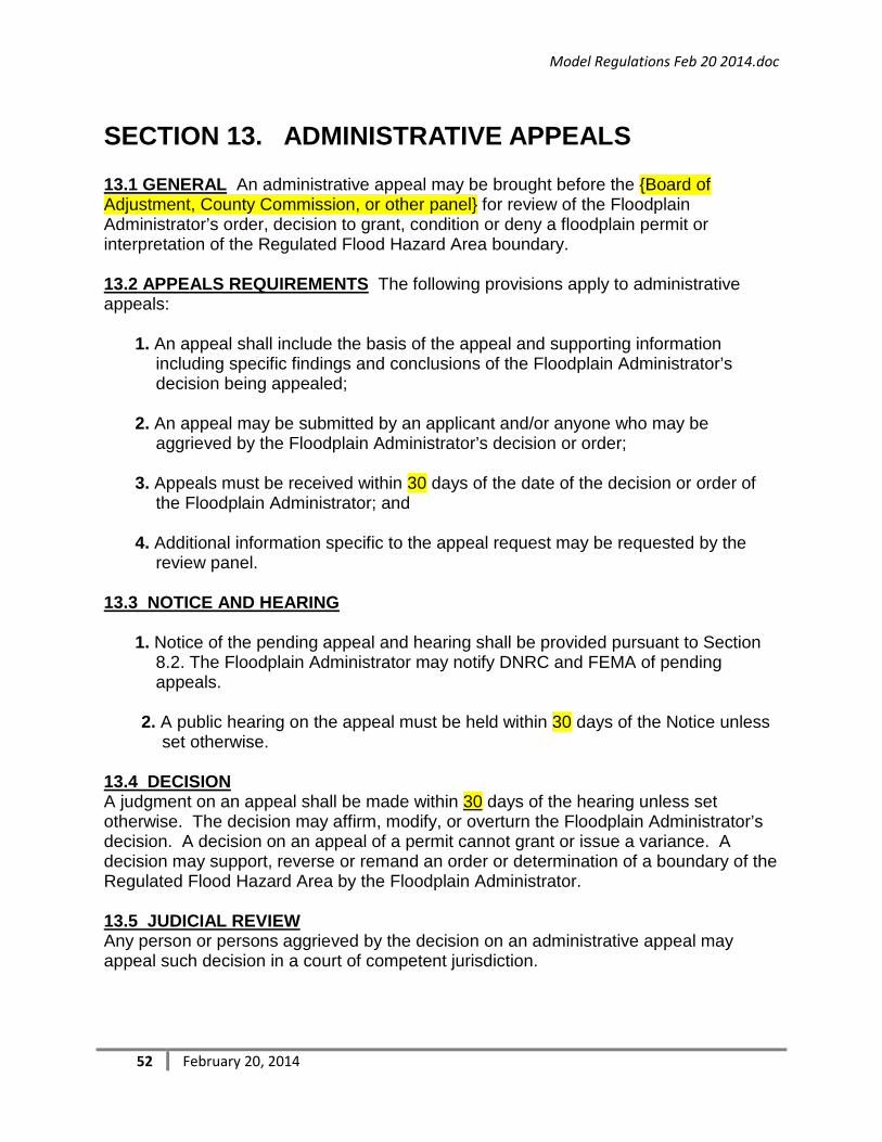
Model Regulations Feb 20 2014.doc
52 February 20, 2014
SECTION 13. ADMINISTRATIVE APPEALS
13.1 GENERAL An administrative appeal may be brought before the {Board of Adjustment, County Commission, or other panel} for review of the Floodplain Administrator’s order, decision to grant, condition or deny a floodplain permit or interpretation of the Regulated Flood Hazard Area boundary.
13.2 APPEALS REQUIREMENTS The following provisions apply to administrative appeals:
1. An appeal shall include the basis of the appeal and supporting information
including specific findings and conclusions of the Floodplain Administrator’s decision being appealed;
2. An appeal may be submitted by an applicant and/or anyone who may be aggrieved by the Floodplain Administrator’s decision or order;
3. Appeals must be received within 30 days of the date of the decision or order of
the Floodplain Administrator; and
4. Additional information specific to the appeal request may be requested by the review panel.
13.3 NOTICE AND HEARING
1. Notice of the pending appeal and hearing shall be provided pursuant to Section
8.2. The Floodplain Administrator may notify DNRC and FEMA of pending appeals.
2. A public hearing on the appeal must be held within 30 days of the Notice unless set otherwise.
13.4 DECISION A judgment on an appeal shall be made within 30 days of the hearing unless set otherwise. The decision may affirm, modify, or overturn the Floodplain Administrator’s decision. A decision on an appeal of a permit cannot grant or issue a variance. A decision may support, reverse or remand an order or determination of a boundary of the Regulated Flood Hazard Area by the Floodplain Administrator.
13.5 JUDICIAL REVIEW Any person or persons aggrieved by the decision on an administrative appeal may appeal such decision in a court of competent jurisdiction.

Model Regulations Feb 20 2014.doc
53 February 20, 2014
SECTION 14. ENFORCEMENT
14.1 INVESTIGATION REQUEST An investigation to determine compliance with these regulations for an artificial obstruction or nonconforming use within the Regulated Flood Hazard Area may be made either on the initiative of the Floodplain Administrator or on the written request of three titleholders of land which may be affected by the activity. The names and addresses of the persons requesting the investigation shall be released if requested. (MCA 76-5-105)(2)
14.2 NOTICE TO ENTER AND INVESTIGATE LANDS OR WATERS The Floodplain Administrator may make reasonable entry upon any lands and waters for the purpose of making an investigation, inspection or survey to verify compliance with these regulations. (MCA 76-5-105(1))
1. The Floodplain Administrator shall provide notice of entry by mail, electronic mail,
phone call, or personal delivery to the owner, owner’s agent, lessee, or lessee’s agent whose lands will be entered.
2. If none of these persons can be found, the Floodplain Administrator shall affix a copy of the notice to one or more conspicuous places on the property.
3. If the owners do not respond, cannot be located or refuse entry to the Floodplain
Administrator, the Floodplain Administrator may initiate a Search Warrant. (Higher Standard)
14.3 NOTICE TO RESPOND AND ORDER TO TAKE CORRECTIVE ACTION When the Floodplain Administrator determines that a violation may have occurred, the Floodplain Administrator may issue written notice to the owner or an agent of the owner, either personally or by certified mail. Such notice shall cite the regulatory offense and include an order to take corrective action within a reasonable time or to respond by requesting an administrative review by the Floodplain Administrator.
14.4 ADMINISTRATIVE REVIEW The order to take corrective action is final, unless within five (5) working days or any granted extension, after the order is received, the owner submits a written request for an administrative review by the Floodplain Administrator. A request for an administrative review does not stay the order.
14.5 APPEAL OF ADMINISTRATIVE DECISION Within ten (10) working days or any granted extension of receipt of the Floodplain Administrator’s decision concluding the administrative review, the property owner or owner’s agent may appeal the decision pursuant to Section 13.
14.6 FAILURE TO COMPLY WITH ORDER TO TAKE CORRECTIVE ACTION If the owner fails to comply with the order for corrective action, remedies may include administrative or legal actions, or penalties through court.

Model Regulations Feb 20 2014.doc
54 February 20, 2014
14.7 OTHER REMEDIES This section does not prevent efforts to obtain voluntary compliance through warning, conference, or any other appropriate means. Action under this part shall not bar enforcement of these regulations by injunction or other appropriate remedy.

Model Regulations Feb 20 2014.doc
55 February 20, 2014
SECTION 15. PENALTIES
15.1 MISDEMEANOR Violation of the provisions of these regulations or failure to comply with any of the requirements, including failure to obtain permit approval prior to development in the Regulated Flood Hazard Area except for an emergency, shall constitute a misdemeanor and may be treated as a public nuisance.
Any person who violates these regulations or fails to comply with any of its requirements shall, upon conviction thereof, be fined not more than $100 or imprisoned for not more than 10 days or both. Each day’s continuance of a violation shall be deemed a separate and distinct offense. (MCA 76-5-110)
15.2 DECLARATION TO THE FEDERAL FLOOD INSURANCE ADMINISTRATOR Upon finding of a violation and failure of the owner to take corrective action as ordered, the Floodplain Administrator may submit notice and request a 1316 Violation Declaration to the Federal Insurance Administrator. The Federal Insurance Administrator has the authority to deny new and renewal flood insurance for a structure upon finding a valid violation declaration. (44 CFR 73.3)
The Floodplain Administrator shall provide the Federal Insurance Administrator the following:
1. The name(s) of the property owner(s) and address or legal description of the property sufficient to confirm its identity and location;
2. A clear and unequivocal declaration that the property is in violation of a cited State or local law, regulation or ordinance;
3. A clear statement that the public body making the declaration has authority to do so and a citation to that authority;
4. Evidence that the property owner has been provided notice of the violation and the prospective denial of insurance; and
5. A clear statement that the declaration is being submitted pursuant to section 1316 of the National Flood Insurance Act of 1968, as amended.