2040 long range transportation plan executive...
TRANSCRIPT


Blueprint 2040 ............................................................................................................................................................Page 1
Planning Today to Shape Tomorrow: Charting a Course for 2040 .....................................................................Page 2
Listen and Collaborate: Reaching Out to the Public ...........................................................................................Page 6
Grow with the Flow: Moving Traffic on Our Roads ..............................................................................................Page 8
Tech It Up a Notch: Management & Operations ...............................................................................................Page 10
Ticket to Ride: Connecting with Transit ...............................................................................................................Page 12
Pedal to Work or Ride for Fun: Cyclist & Pedestrian Power ............................................................................Page 16
In It for the Long Haul: Freight Planning .............................................................................................................Page 18
In Memoriam, Funding Partners, Project Team, Legal Info .............................................................................Page 20
For More Information .............................................................................................................................................Page 21
TABLE OF CONTENTS
METROPLAN ORLANDO BLUEPRINT 2040
Before a building comes to life, it first exists as a blueprint – a promise of things to come. Similarly, the transportation system needs careful forethought and planning. The blueprints for our current transportation system were created long ago by people who laid the groundwork for future generations. And now, we’ve created a Long Range Transportation Plan called Blueprint 2040 to guide planning efforts for Central Florida’s year 2040 transportation system, which will carry a million more people than today.
MetroPlan Orlando leads regional transportation planning efforts for Orange, Osceola, and Seminole counties through close coordination with local governments, transportation operating agencies, business and civic communities, and members of the public. We work hard at cultivating effective partnerships to accomplish our vision of a seamless transportation system that safely and efficiently moves people and goods through a variety of travel options.
After an intensive three-year planning and community outreach process, the MetroPlan Orlando Board officially adopted the 2040 Long Range Transportation Plan by a unanimous vote on June 11, 2014. The plan includes an assessment of needs and an accounting of projects that we can afford, called the cost feasible plan. This executive summary provides an overview of key elements in the plan. More detailed information, including technical reports, can be found at www.MetroPlanOrlando.com.
Our Vision:A regional transportation system that safely and efficiently moves people and goods through a variety of options that support the region’s vitality
Our Mission:To provide leadership in transportation planning by engaging the public and fostering effective partnerships
BLUEPRINT 2040
PAGE 1
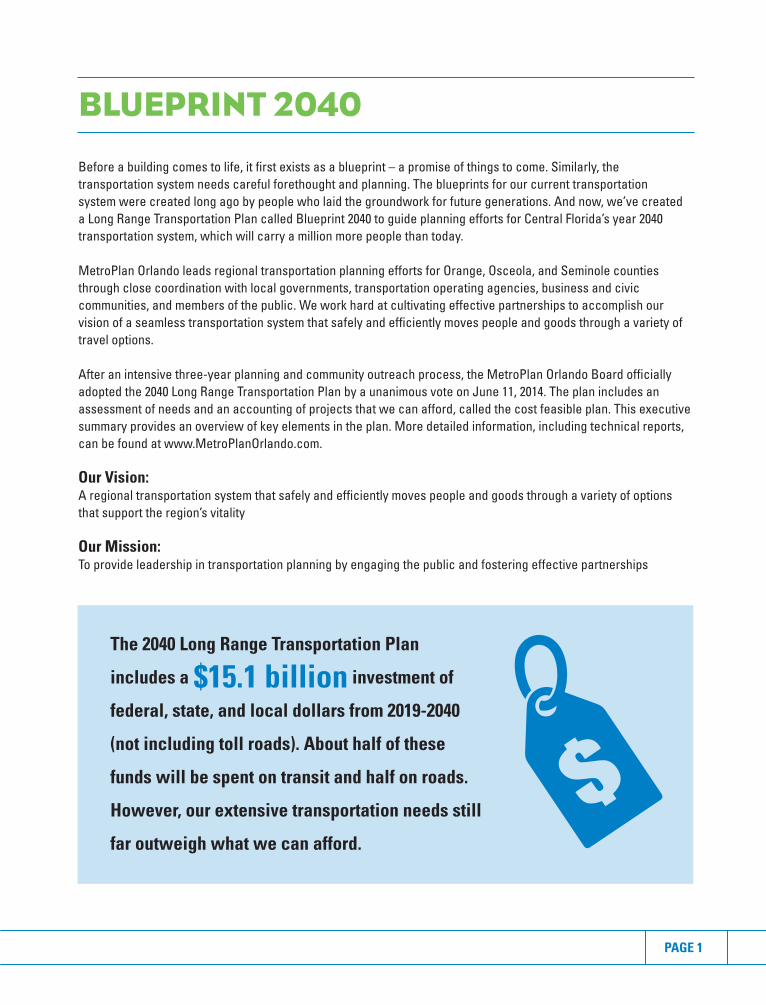
The 2040 Long Range Transportation Plan
includes a $15.1 billion investment of
federal, state, and local dollars from 2019-2040
(not including toll roads). About half of these
funds will be spent on transit and half on roads.
However, our extensive transportation needs still
far outweigh what we can afford.

METROPLAN ORLANDO BLUEPRINT 2040

Producing the Long Range Transportation Plan required widespread collaboration to ensure that the course being charted for 2040 reflected the region’s vision for the future. At key points in the planning process, the MetroPlan Orlando Board and advisory committees were asked to steer the plan in the right direction for Central Florida, weighing in on policy issues and advising if any course corrections were needed. This teamwork resulted in a plan that meets federal requirements, addresses projected growth, makes the most of available funding, and contains several transformational projects.
Meeting Federal RequirementsFederal law requires organizations like MetroPlan Orlando to update long range plans every five years to keep up with the changing transportation needs in metropolitan areas across the country. Guidelines are given for public involvement and the technical process used to create the plan. (See the next section, Listen and Collaborate, for more information on public outreach.)
The phases of technical development include:1. Forecast travel demand. Complex computer models estimate future travel demand by using population
projections, land use forecasts, employment projections, and income levels.2. Identify transportation needs. The model then uses the expected travel demand to determine where the
transportation system will experience high levels of congestion and identifies corridors needing improvement.3. Coordination with partners. We work with local governments to refine and prioritize needed improvements. 4. Match projects to anticipated funding. The last step involves producing a cost feasible plan by matching
available funding to projects. The Florida Department of Transportation provides revenue forecasts for federal and state funds. Local government partners provide revenue forecasts for local funds.
Funding the PlanFor the most part, transportation has historically been funded by federal, state, and local gas taxes. Additionally, tolls have become a reliable way to expedite new roads in our region as gas tax revenues have continued to decline in recent decades. Tolls are currently only allowed to be reinvested in the toll road system. Looking to the future, tolls and local funding sources will become increasingly important to expand and maintain highway, transit, bicycle, and pedestrian projects.
The MetroPlan Orlando Board directed that a conservative approach be taken for the plan, using mainly existing funding sources. Of the $15.1 billion in the 2040 Long Range Transportation Plan, federal and state funds account for 37%, with the rest coming from local sources. These funding options are assumed for the local share of the plan:
• Orange County: Local gas taxes, impact fees, general fund• Osceola County: Local gas taxes, infrastructure sales tax, charter county transportation surtax, designated ad
valorem tax, general fund• Seminole County: Local gas taxes, infrastructure sales tax, general fund• City of Orlando: Local gas taxes, impact fees, Downtown Community Redevelopment Agency funds,
general fund
CHARTING A COURSE FOR 2040
PAGE 3

Transformational ProjectsWhile the cost feasible Blueprint 2040 Plan contains many projects, there are a few that define the plan and will transform transportation in Central Florida. These projects come in many forms (see map), but they all share two characteristics – large scale and regional impact. These projects are discussed in the Grow with the Flow and Ticket to Ride chapters of this executive summary report.
More information about projects, funding, and land use is found at www.MetroPlanOrlando.com in these reports (a comprehensive listing of technical documents is found on page 21):
• Technical Report 1: Sustainable Land Use Forecast• Technical Report 2: Financial Resources• Technical Report 3: Plan Development & Cost Feasible Projects• Technical Report 5: Transit Element• Technical Report 8: Model Validation & Application Guidelines
METROPLAN ORLANDO BLUEPRINT 2040
WHAT WILL CENTRAL FLORIDA LOOK LIKE IN 2040?
Population in Orange, Osceola,
and Seminole counties will grow
by more than 1 million
residents. Osceola County’s
population will double.
High density growth will be
concentrated along major
transportation corridors.
Number of jobs in the three-
county area will increase by
almost 60 percent.
It will be easier to live, work,
and play in the same area.

PAGE 5

METROPLAN ORLANDO BLUEPRINT 2040

Central Floridians learn about and react to transportation in different ways, so our outreach team developed several approaches to listen to the public and collaborate on solutions. The main ways we involved the public in the 2040 Long Range Transportation Plan were:
• Community Conversations: We gave presentations to groups that included live polling on issues and other feedback opportunities. Special emphasis was placed on reaching traditionally underserved groups.
• Event Booths: Our outreach team set up booths at regional events, where we took surveys, gave out information, and answered questions about 2040 initiatives.
• Youth Outreach: An art contest for elementary and middle school students focused on future transportation challenges and urged kids to offer ideas.
• Interactive Town Hall: MetroPlanLIVE! connected with residents via telephone and webcast to present information about the 2040 Plan and respond to questions.
• Social Media: Throughout the 2040 Plan development, we used social media to post links to documents and videos, note plan milestones, and invite people to events. Our Facebook and Twitter followings grew steadily.
• Public Hearing: The hearing featured stations where residents talked with planners about transportation, followed by a presentation and public comments.
For reports on individual events, public comments, and survey results, see the Public Involvement Report on www.MetroPlanOrlando.com.
REACHING OUT TO THE PUBLIC
PAGE 7
PUBLIC INVOLVEMENT BY THE NUMBERS
In 16 months,
our staff reached
2,406 residents
at 48 events and
an extra 1,510
through a phone
survey
1,600+
website visits
per month
400+ people
participated in
MetroPlanLIVE!
Almost 100
residents attended
the public hearing
3,700+
interactions on
social media

METROPLAN ORLANDO BLUEPRINT 2040

The 2040 Plan emphasizes travel choices, but roads will remain the mainstay of Central Florida’s transportation system for many years.
As the region grows, our roads take on more traffic than they were built to accommodate. Constructing new roads is difficult, given limited funding, safety concerns, and the fact many roads have already reached the maximum number of lanes. Three major areas will account for the bulk of new road construction in the 2040 Plan.
I-4 Ultimate Covering 21 miles in Orange and Seminole counties, this $2 billion project brings a new type of highway to the region. To keep traffic flowing, the reconstructed road will use express lanes with variable tolling. Drivers who choose these lanes can expect a faster commute than in the un-tolled lanes, and experience indicates traffic flow will improve in all the lanes. Construction begins on the project, which also includes bridge and interchange work, in 2015 and is expected to take about six years.
Another innovation with I-4 Ultimate is a public/private partnership for funding, which allows the road to be completed much sooner than if only public funds were used. FDOT has partnered with a team of private companies, who are investing in the project and assuming responsibilities for operations and maintenance. Wekiva ParkwayThe $1.7 billion parkway completes a beltway around metropolitan Orlando, with a 25-mile toll road through parts of Orange, Seminole, and Lake counties. It is expected to be complete in 2021, relieving congestion on US 441, State Road 46, I-4, and other local roads. Much of the parkway travels through the environmentally-sensitive Wekiva River Basin, so 3,400 acres have been set aside for conservation.
Toll Road AuthoritiesWith limited funds for construction and maintenance, the future will bring more roads financed through user fees or tolls. Toll roads account for much of the activity in our region’s transportation system. The Osceola County Expressway Authority began looking toward 2040 with its first master plan. To prepare for rapid growth in Osceola County, the authority targeted four expressway segments, forming a 57-mile ring around the county’s interior urban growth boundary. They are Poinciana Parkway, Osceola Parkway Extension, Southport Connector Expressway, and Northeast Connector Expressway. The first segment of Poinciana Parkway is under construction, and the project should be complete by 2016, improving access to I-4.
After MetroPlan Orlando’s 2040 Plan was adopted, Florida’s Legislature created the Central Florida Expressway Authority combining toll road oversight for Orange, Osceola, Seminole, and Lake counties. As the region transitions to this new entity, Osceola will continue to follow its master plan.
The other toll authority in the region is the Florida’s Turnpike Enterprise, responsible for about 600 miles of road and 80% of all toll facilities in the state.
For lists of road projects in the 2040 Plan, see Technical Report 3: Plan Development & Cost Feasible Projects on www.MetroPlanOrlando.com.
MOVING TRAFFIC ON OUR ROADS
PAGE 9

METROPLAN ORLANDO BLUEPRINT 2040

As Central Florida’s transportation system matures, making the most of our existing infrastructure becomes increasingly important. That’s where management and operations strategies come in. This approach aims to use technology to improve the performance of the transportation system, reduce congestion, and improve safety. These fixes are generally relatively affordable, giving the region exceptional value for the investment.
Congestion Management ProcessKnowing where and when congestion occurs is key to relieving traffic tie-ups in our region. We know that major causes of congestion include bottlenecks, crashes, bad weather, work zones, and poor traffic signal timing. The congestion management process (CMP) works to help traffic flow with these steps:
• Develop Regional Objectives: Regional congestion management goals and objectives are set by MetroPlan Orlando’s Management & Operations Subcommittee for all transportation modes.
• Define Regional CMP Network: Federal law requires the congestion management process to be defined in geographic scope and system elements to be analyzed.
• Develop Multimodal Performance Measures: The 2040 Long Range Transportation Plan contains measurements so our region can monitor system performance and gauge progress. Examples of measures include travel time reliability, injuries and fatalities, and on-time transit performance.
• Collect Data & Monitor System Performance: Data is collected, and the defined performance measures are regularly evaluated.
• Analyze Congestion Problems & Needs: An analysis of where congestion problems are helps identify needed improvements.
• Identify & Assess Strategies: A toolbox of various strategies is available to help the region find the right solutions for congested locations.
• Program & Implement Strategies: MetroPlan Orlando allocates 20% of its share of directly-controlled federal funds to management and operations projects. This ensures a continuous funding stream.
• Evaluate Strategy Effectiveness: An annual congestion management process report will be developed to evaluate and monitor the congestion management process.
This process is flexible and is constantly being re-evaluated so that it can evolve over time and better meet the needs of the transportation system.
SafetySafety has long been an emphasis area for MetroPlan Orlando in long- and short-term planning. Projects addressing safety are typically coordinated by the Management & Operations Subcommittee of technical experts.
We launched a regional crash database in 2010 to help target low-cost engineering solutions for crash trouble spots and to suggest larger scale projects that could have significant safety impacts on high-crash corridors. Our partners have access to the detailed crash reports to conduct their own analyses as needed.
In addition to engineering, our organization remains committed to safety through education and is active in several community safety education programs. See Pedal to Work or Ride for Fun section for more about safety education.
For more details, see Technical Report 4: Congestion Management Process on www.MetroPlanOrlando.com.
MANAGEMENT & OPERATIONS
PAGE 11
METROPLAN ORLANDO BLUEPRINT 2040

A highly-connected public transportation system, envisioned in the 2040 Plan, would provide residents with an array of travel options. This concept – called the 2040 Transit Blueprint – updates the LYNX 2030 Vision Plan. It analyzes various regional corridors to determine how transit could improve traffic flow. This analysis offers a template for connecting residential, work, and recreation centers throughout the metro area.
The funding available for transit, however, falls short of what’s needed to complete all of our regional priorities. Transit is very dependent on local funding, which means it can be unpredictable in a region without a dedicated funding source. The accompanying project list shows which projects are targeted for completion under the cost feasible plan and the year they are expected to finish, given current funding projections.
Central Florida’s transit options are becoming more diverse. A regional bus system with new specialty offerings, the area’s first commuter rail service, and some new privately financed offerings will all provide tickets to connect.
Cost Feasible Transit Projects
Project Details Year
SunRail: Phases 1&2 Commuter rail line from Volusia County to Osceola County, 2014-2017 including feeder bus service
LYNX Existing Service 2014 level of service, including LYMMO East/West and 2014 Parramore Extensions
SunRail: Phase 3 Rail service from Meadow Woods Station to OIA Intermodal Terminal 2026
U.S. 192 Bus Rapid BRT along U.S. 192 corridor, serving Four Corners, SunRail, 2026 Transit (BRT) Disney World and Kissimmee Intermodal Facility
OrIando International Transit connecting Orange County Convention Center and OIA 2031 Airport (OIA) Corridor Intermodal Facility
Kissimmee Circulator: Transit providing local access to SunRail and increasing mobility 2036 Phases 1&2 in multimodal transportation district
LYNX Bus Service: Osceola Involves 1 Link and 1 NeighborLink 2036
U.S. 441 Corridor Transit connecting Lake County with northwest Orange County 2036 and downtown Orlando
LYNX Bus Service: Orange Involves 2 Links and 3 Circulators 2036
LYNX Bus Service: Seminole Involves 2 Links 2036
All Aboard Florida Privately funded rail transit between Orlando and Miami TBD
American Maglev Privately funded magnetic levitation (maglev) trains serving OIA, TBD Florida Mall, and International Drive area
CONNECTING WITH TRANSIT
PAGE 13
The cost feasible transit projects shown in the map will greatly expand public transportation options for Central Floridians and visitors. In addition to these major projects, the region also benefits from an extensive three-county network of LYNX bus routes.
The Current PictureLYNX operates 77 local bus routes, 12 NeighborLinks providing access to main routes, two LYMMO routes, three FastLinks (bus routes with reduced stops), express bus service, ACCESS LYNX paratransit, and commuter assistance vanpools.
Through an agreement with FDOT, LYNX implemented a network of feeder routes to improve connectivity from SunRail stations to the riders’ final destinations. These routes were designed to provide “last mile” transportation for transit passengers.
SunRail is a 61.5-mile commuter rail line connecting Volusia, Seminole, Orange, and Osceola counties. SunRail construction has been divided into two phases. Phase l currently connects DeBary in Volusia County to Sand Lake Road in Orange County, with 10 stops in between. The second phase will extend the system south from Sand Lake Road to Poinciana in Osceola County and north to the DeLand Amtrak Station in Volusia County, adding five stops. Phase II is expected to open by early 2017.
Based on needs for connecting to Orlando International Airport (OIA) and local attractions, SunRail Phase III is being considered for advancement into the project development and design stages. Local leaders say a connection from the existing SunRail mainline to the future OIA Intermodal Terminal will provide a crucial connection.
Another transformational development, the OIA Intermodal Terminal Facility, will provide increased capacity at the North Terminal to 45 million passengers annually while also providing the first stage of a new South Airport Complex. The 500,000-square-foot facility consists of a dual-platform, 4-track passenger rail system, an automated people mover and accommodations for future rail projects. The facility is slated to start operations in 2017.
Under StudySeveral corridors in the region are undergoing Alternatives Analyses to evaluate transportation options and potential project alignments. To advance, these projects need preliminary and final engineering and design work, as well as adequate local, state, and federal funding. Corridor studies under way are:
• US 441 Alternatives Analysis Study• SR 50/UCF Connector Alternatives Analysis Study• OIA Connector Refresh Alternatives Analysis Study • US 192 Bus Rapid Transit (Locally Preferred Alternative selected)• Kissimmee Circulator • FlexBus Service
Private ProposalsPrivately funded transit projects being reviewed for Central Florida include:
• All Aboard Florida: A proposed high speed rail service - with stops in Miami, Fort Lauderdale, West Palm Beach, and Orlando - plans to use the improved Florida East Coast Railway infrastructure.
• Orlando Maglev (American Maglev): A fully automatic train system powered by magnetic levitation, or maglev, technology proposes to operate near the Orange County Convention Center and eventually expand to other areas.
For information on the 2040 Transit Blueprint, as well as on individual studies and cost feasible projects, see Technical Report 5: Transit Element on www.MetroPlanOrlando.com.
METROPLAN ORLANDO BLUEPRINT 2040

PAGE 15

METROPLAN ORLANDO BLUEPRINT 2040

Central Florida has long been known as a great place for recreational biking and walking. Now more residents also are using active transportation in their daily commutes. The 2040 Plan highlights these goals for bicycle and pedestrian projects:
• Makeconnectionsandclosegapsinthebikelaneandsidewalknetwork.• Identifyareasthathaveahigherpotentialforactivetransportation.• Expandthebicycle/pedestriannetworkandimproveconnectionstotransit,makingtheregionmoreuser-
friendly for multimodal commuter trips.
Prioritizing projects, based on these goals and other criteria, gives shape to the region’s active transportation network. MetroPlan Orlando’s Bicycle & Pedestrian Advisory Committee oversees this process and updates project lists annually.
The bicycle and pedestrian element of the 2040 Plan identifies gaps in the regional bicycle and pedestrian network and shows where improvements are needed. These steps were accomplished through collecting data, analyzing the system, and estimating costs.
Active transportation promotes social benefits such as improved air quality, public health, and overall mobility. As the focus of the region’s transportation planning shifts toward a multimodal approach, bicycling and walking can support transit and make the region more livable.
Safety FirstKeeping bicyclists and pedestrians safe is paramount, and good planning demands that bike and pedestrian projects take safety into account. MetroPlan Orlando also advocates for bicycle and pedestrian safety through education. Public involvement activities for the 2040 Plan showed residents are concerned about bicycle and pedestrian safety and might use active transportation more, if they felt safer.
Community outreach efforts are coordinated with partner agencies that focus on bicycle and pedestrian safety. MetroPlan Orlando provides financial and in-kind support to two safety education programs:
• Best Foot Forward: A pedestrian safety initiative using education, engineering, and enforcement to reduce pedestrian injuries and deaths.
• Cycling Savvy: A traffic cycling course that empowers cyclists as confident road users.
Going Coast-to-CoastAn ambitious project, the Coast-to-Coast Connector, has gained support across the region, including endorsement from the MetroPlan Orlando Board. It will provide a continuous multi-use trail from the Gulf of Mexico to the Atlantic Ocean. The 250-mile trail travels through several counties, including Orange and Seminole. About 75% of the connector is currently in operation or funded for construction. Two gaps are within MetroPlan Orlando’s service area: the Orange Gap (about 3.9 miles) and the Seminole/Volusia Gap (about 0.8 miles). Recent budget approvals allocated funding to the connector, but not enough for the entire project.
For details on the prioritization process, the top sidewalk/bicycle projects in each county, and the top trail/connections projects, see Technical Report 6: Bicycle and Pedestrian Plan on www.MetroPlanOrlando.com.
CYCLIST & PEDESTRIAN POWER
PAGE 17

METROPLAN ORLANDO BLUEPRINT 2040

As Central Florida’s population and employment opportunities grow in the coming decades, so will demand for freight. Everything we buy – clothing, groceries, furniture, and more – comes to the region as freight. The economy thrives when goods and services move efficiently.
Since the completion of the first MetroPlan Orlando freight plan in 2002, the region’s freight needs have been on our radar. When we do freight planning well, it improves safety, economic competitiveness, air quality, and traffic flow. The 2040 Plan sets the foundation for fully integrating freight into the long range planning process, confirming that we’re in it for the long haul when it comes to freight planning.
Assessing Freight NeedsTo get a better grasp of freight needs for the year 2040, we first had to understand the current situation. The planning process began with an assessment of the types of goods coming to and through the region, where they come from, and how freight moves. This identified freight deficiencies in the transportation system.
Results showed that of the more than 200 million tons of freight flowing throughout our region each year, about 95% of our goods move by truck, with the remaining 5% moving by rail, sea, and air. A breakdown of what types of materials move in Central Florida is found in the accompanying chart. The freight needs assessment revealed three areas of deficiency: 1) capacity and congestion; 2) community impacts, including air quality and safety; and 3) institutional and regulatory bottlenecks.
Multiple Solutions Addressing current and future freight needs requires complex solutions from several areas:
• Infrastructure: Investments in the physical transportation system, such as new facilities (roads, rails, ports), reconstructing existing ones, or maintaining the current system in good repair.
• Operational: Solutions that focus on improving efficiency and flow of the existing system, including synchronizing traffic signals, improving signage, or providing real-time traffic data to dispatchers and drivers.
• Institutional: Solutions focusing on policies, regulations, and governance issues at the regional, state, and federal levels.
FREIGHT PLANNING
PAGE 19
Freight GrowthPreparing for freight growth will put Central Florida in a position to prosper economically. By 2040, freight demand is expected to grow between 35% on the low end and 61% on the high end. This growth will generate jobs and income. For every 1 million tons of freight moved in Central Florida, 155 direct transportation jobs and $7 million in direct income are created.
For more details on the freight piece of the long range plan, see Technical Report 7: Freight Mobility on www.MetroPlanOrlando.com.
TYPES OF FREIGHT ON THE MOVE IN CENTRAL FLORIDA
56%
27%
11%
6%
Construction Materials
Consumer Goods
Fuels & Chemicals
Other
IN MEMORY OF DENNIS W. HOOKER
Federal Highway Administration (FHWA)Federal Transit Administration (FTA)Florida Department of Transportation (FDOT)Orange CountyOsceola CountySeminole County City of Altamonte SpringsCity of ApopkaCity of KissimmeeCity of OrlandoCity of SanfordCentral Florida Expressway AuthorityCentral Florida Regional Transportation Authority (LYNX)Greater Orlando Aviation Authority Sanford Airport Authority
Leftwich Consulting EngineersCambridge SystematicsCanin AssociatesThe Corradino GroupKimley-Horn & AssociatesTindale-Oliver & AssociatesTranSystemsQuest Corporation of AmericaPopcorn Initiative
The preparation of this report has been financed in part through grants from the Federal Highway Administration and Federal Transit Administration, U.S. Department of Transportation, under the State Planning and Research Program, Section 505 [or Metropolitan Planning Program, Section 104(f)] of Title 23, U.S. Code. The contents of this report do not necessarily reflect the official views or policy of the U.S. Department of Transportation.
This document was developed for use by MetroPlan Orlando for planning purposes.
MetroPlan Orlando is not liable for any direct, indirect, special, incidental or consequential damages (such as, but not limited to, damages of loss of profits, business savings or data) related to the use of this document or information produced as a result of this document or its interpretation. This information is publicly available and is provided with no warranty or promises of any kind whatsoever, express or implied, including warranties for merchantability or fitness for a particular purpose.
While every effort is made to confirm the accuracy of the information provided within this document and any analytical methods used to develop the information, no assurance of accuracy can be or is given. By using this document and the information in any way, the user is acknowledging this limitation, and is agreeing to use the document and the information therein at his or her own risk.
MetroPlan Orlando lost a dear member of our family in May 2014 – Dennis W. Hooker, longtime
manager of long range planning. He served as project manager of the 2040 Long Range
Transportation Plan until his retirement in August 2013. Over his 37-year transportation planning
career, Dennis displayed passion and dedication in his work to make life better for Central
Floridians. We dedicate the 2040 Long Range Transportation Plan to Dennis, whom we deeply miss.
FUNDINGPARTNERS
PROJECT TEAM
LEGALINFORMATION
METROPLAN ORLANDO BLUEPRINT 2040

Visit www.MetroPlanOrlando.com and click on Long Range Transportation Plan for more detailed technical information, including:
Public Involvement ReportGoals, objectives, and evaluation of community outreach process Technical Report 1: Sustainable Land Use ForecastDetails on how a sustainable land use could reduce urban sprawl
Technical Report 2: Financial ResourcesVarious options available for funding the 2040 Plan, including assumed local revenues
Technical Report 3: Plan Development & Cost Feasible ProjectsProcess used to develop the plan, including needs and cost feasible project lists
Technical Report 4: Congestion Management ProcessWays to improve traffic flow in the existing transportation system, including addressing safety
Technical Report 5: Transit ElementIncludes the 2040 Transit Blueprint outlining transit needs and the cost feasible transit network
Technical Report 6: Bicycle & PedestrianAnalysis to improve connectivity and identify gaps in bicycle, pedestrian, and trail networks
Technical Report 7: Freight MobilityInformation on freight, including commodity flows, freight facilities, and forecasts
Technical Report 8: OUATS Model Validation / GuidelinesDetails on computer travel demand models used to forecast future trips and needed improvements
FOR MORE INFORMATION
PAGE 21
VISIT US ONLINE ANYTIME
www.MetroPlanOrlando.com
315 EAST ROBINSON STREET, SUITE 355 • ORLANDO, FLORIDA 32801 • 407-481-5672 • WWW.METROPLANORLANDO.COM