4 gis technologies and their environmental applications · management based on spatiotemporal...
TRANSCRIPT

Watershed-scale nonpoint source pollution
management based on spatiotemporal
parameter model and CIS linkage
Jaewan Yoon
Assistant professor, Department of Civil and
Environmental Engineering, Old Dominion University,
Norfolk, VA 23529, <[email protected]>
AbstractMethods were developed for directly linking the distributed parametermodel, AGNPS with a Geographic Information System (GIS) and arelational database management system (RDBMS) to investigate anonpoint source pollution problem. AGNPS (Agricultural NonpointSource model) is an event-based model that simulates runoff and thetransport of sediment and pollutants from mainly agricultural watersheds.Distributed parameter models such as AGNPS are often applied to largeproblem domains. Linking such models to GIS and database managementsystem can facilitate better data storage, manipulation and analysis thanconventional methods. In this study, rather than manually implementingAGNPS, extracted data are integrated in an automatic fashion through adirect linking between the AGNPS model engine and GIS. This directlinkage results in a powerful, up-to-date tool that would be capable ofmonitoring and instantaneously visualizing the transport of any pollutantthat AGNPS can simulate. Thereby, it reduces the time required toanalyze the numerical output from AGNPS, and enables users to identifycritical areas of nonpoint source (NPS) pollution and furthermore, toperform various "what if scenarios to support the decision makingprocesses such as Best Management Practices (BMP) for the watershed. Acase study was performed on a watershed of 98.1 km* (=24240 acres) inthe upper segment of the Sand Hill River Subbasin in Minnesota by usingthis linkage implementation. Simulated results showed that the optimalBMP scenario achieved an average reduction of about 26% from currentnonpoint source pollutant levels on soluble and sediment-attached nitrogen
Transactions on Information and Communications Technologies vol 18, © 1998 WIT Press, www.witpress.com, ISSN 1743-3517

4 GIS Technologies and their Environmental Applications
and phosphorous. Especially, this optimal BMP scenario was mosteffective in controlling the erosion and sediment yield. As a result, amaximum 50% reduction of sediment yield was observed.
IntroductionNonpoint source pollution (NFS) is a type of the pollution
generated from diffused sources in the public and private domain.The Environmental Protection Agency (EPA) defines the nonpointsource pollution as pollution originating from urban runoff,
construction, hydrologic modification, silviculture, mining,agriculture, irrigation return flows, solid waste disposal,
atmospheric deposition, stream bank erosion, and individual
sewage disposal. More than fifty percent of the pollution enteringthe nation's waters comes from nonpoint sources (Tyler, 1992), andit is responsible for almost two-thirds of the pollution that preventsachievement of water quality standards (Aim, 1990).
Nonpoint Source Pollution management is highly
dependent on hydrologic simulation models. Evaluating alternative
management strategies through experiments and a limited amountof field measurements is not feasible, and a modeling study is oftenthe only viable means of providing input to management decisions.The hydrologic system was commonly simplified in the past as a"lumped model." Under this simplification, the spatial distributionof parameters lost their real meaning in hydrologic modeling. Incontrast to this simplification, a distributed parameter model
maintains the spatial distribution of the parameters. Therefore, theapplication of distributed parameter models is of practical necessityespecially in case of the nonpoint source pollution management.The major disadvantage of distributed parameter models are thelarge amounts of time required for assembling and manipulating theinput data sets. The distributed nonpoint source pollution modelsused to study pollutant transport and erosion easily generatetowering amounts of data for analysis in even a small watershed.On a large non-homogeneous watershed, a complete simulation andanalysis can be very time consuming.
A logical step in improving the quality of the hydrologicmodeling would be the integration of spatially distributedparameter models with practical data management scheme such asthe geographic information system (GIS) and database managementsystem (DBMS). This integration of distributed hydrologic model-
Transactions on Information and Communications Technologies vol 18, © 1998 WIT Press, www.witpress.com, ISSN 1743-3517

GIS Technologies and their Environmental Applications 5
GIS-DBMS can be defined as a tool to collect, manage, analyze,
simulate and display spatially varying information. This paper
describes direct Model-GIS-DBMS linkage to: (1) effectivelypinpoint critical areas where resources are threatened, (2) give thenecessary information instantaneously based on BMP scenario
simulations for further remediation and conservation efforts, (3)provide quality information to decision-makers cost effectively,and (4) help impartially distribute incentives and regulations usedfor water quality management.
Study WatershedThe Sand Hill River Watershed District of the North
Central Minnesota had proposed building a dam which will create a
permanent pool of 5 knf (=1,217 acres) near the northwesternMinnesota town of Winger for flood protection on the main stem ofthe Red River of the North basin. The feasibility of the damproject has been controversial since it was first proposed more than10 years ago due to concerns regarding low annual average flowrate and water quality problems. No definite solutions oralternatives for alleviating these problems have been investigated(Polk County Water Planning Task Force, 1990). This paper willinvestigate the application of a distributed parameter hydrologicmodel, AGNPS (Agricultural Nonpoint Source Pollution Model)and GIS-DBMS direct linkage to the upper segment area of 98.1km^ (=24,240 acres) which has an outlet at the proposed dam site.
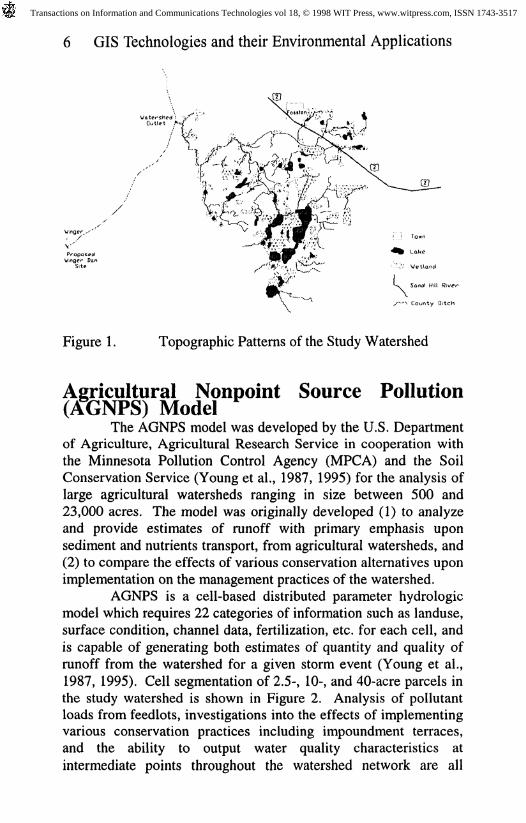
The upper segment has a complex topographic patternwhich consists of moraines, potholes, small lakes, wetlands andmarshes that affects its hydrologic characteristics substantially(Figure 1). For the analysis of such complex topographic features,a spatially distributed model such as AGNPS is more suitable thana conventional lumped model. Also nonpoint source pollutionmanagement on such complex topography is difficult to plan andhighly dependent on simulation models because nonpoint sourcepollution is site specific. Evaluating alternative management plansthrough field experiments is usually not feasible, and thussimulation study is often the only practicable means of providinginput to management decisions. In this sense, AGNPS is an idealdistributed parameter model for the study area to pinpoint "critical"areas of sediment and nutrient production in a watershed, and toestimate the potential benefits of implementing Best Management
Practices (BMP) to alleviate current water quality problems.
Transactions on Information and Communications Technologies vol 18, © 1998 WIT Press, www.witpress.com, ISSN 1743-3517
6 GIS Technologies and their Environmental Applications
VProposedW,nger Dan
Figure 1. Topographic Patterns of the Study Watershed
Agricultural Nonpoint Source Pollution(AfcNPS) Model
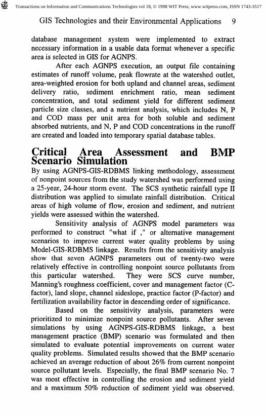
The AGNPS model was developed by the U.S. Departmentof Agriculture, Agricultural Research Service in cooperation withthe Minnesota Pollution Control Agency (MPCA) and the SoilConservation Service (Young et al., 1987, 1995) for the analysis oflarge agricultural watersheds ranging in size between 500 and23,000 acres. The model was originally developed (1) to analyzeand provide estimates of runoff with primary emphasis uponsediment and nutrients transport, from agricultural watersheds, and(2) to compare the effects of various conservation alternatives uponimplementation on the management practices of the watershed.
AGNPS is a cell-based distributed parameter hydrologicmodel which requires 22 categories of information such as landuse,surface condition, channel data, fertilization, etc. for each cell, andis capable of generating both estimates of quantity and quality ofrunoff from the watershed for a given storm event (Young et al.,1987, 1995). Cell segmentation of 2.5-, 10-, and 40-acre parcels inthe study watershed is shown in Figure 2. Analysis of pollutantloads from feedlots, investigations into the effects of implementingvarious conservation practices including impoundment terraces,and the ability to output water quality characteristics at
intermediate points throughout the watershed network are all
Transactions on Information and Communications Technologies vol 18, © 1998 WIT Press, www.witpress.com, ISSN 1743-3517

GIS Technologies and their Environmental Applications 7
within the model's capabilities. The erosion component in the
AGNPS model assumes overland erosion, channel erosion anddeposition in impoundments. Field topography is the major factorin determining the type of flow, i.e. overland, overland-channel,overland-channel-impoundment, etc.
Watershed ^Outlet "
Sand Hilt Riv
County Ditch\ 40-acre cell
Figure 2. Cell Segmentation of 2.5-, 10-, and 40-acre Parcelsin the Study Watershed
Direct Linkage Between MODELS andGIS
There have been several attempts to integrate GIS withexisting hydrologic models for the watershed modeling andsimulation. Hydrologic modelings were performed with theextracted data from the GIS to execute available models. In most
cases, either the data manipulations were done manually before
running models, or all necessary data manipulation schemes suchas transformation of data formats and extraction of usable data forexisting models had to be provided by specially written software.
In summary, the main focus in the GIS usage with existingmodels has been one-directional data extraction to the model ratherthan direct data exchange to and from the model. It is imperative todevelop data handling procedures to prepare inputs to the model,
Transactions on Information and Communications Technologies vol 18, © 1998 WIT Press, www.witpress.com, ISSN 1743-3517

8 GIS Technologies and their Environmental Applications
and to effect changes in watersheds, and procedures to analyze anddisplay corresponding model results within the GIS environment.This bilateral linkage approach through effective use of DBMS willcontribute to better hydrologic modeling and water resourcesmanagement.
In this study, methods were developed for directly linkingthe distributed parameter model, AGNPS with the vector-basedGIS, Geo/SQL (Generation 5 Technology, 1990) and the relational
database management system (RDBMS), ORACLE in terms of pre
and postprocessing of data, in applying the GIS to the ongoing
water resources planning and decision making process in the studyarea. This direct linkage results in a powerful, up-to-date tool thatwould be capable of monitoring and instantaneously visualizing thetransport of any pollutant that AGNPS can simulate. Thus, thelinkage is truly bilateral rather than the conventional one-way dataextraction setup for input preparation. The advantage of linkage isthat because the distributed parameter model such as AGNPS isoften applied to large problem domains, a linkage to GIS and
RDBMS may be a more appropriate tool for data storage,
manipulation and analysis than a collection of many input and
output files.Visualization of the spatially varying data and time-
dependent data such as runoff or sediment yield at the outlet willgreatly enhance the ability of conservation managers to makefurther analyses and to make proper decisions. Furthermore, thegraphical display may provide an indication of problems due toerosion and pollutant movement on a watershed and help pinpoint
critical locations for further study and/or control action (Yoon andDisrud, 1994).
MethodologyThe basic data layers for the study area were developed by
digitizing the relevant maps, including USGS-10 foot intervalcontour quadrangle maps of 1:24000 scale and SCS Soil maps.The spatial land cover/land use data were compiled fromLANDS AT thematic maps. Prepared data were inserted intoORACLE database as separate characteristic data groups so thatthe maximum flexibility can be assured when various scenarios areapplied later. Then data from the database and digital base layerswere georeferenced to create a spatial database of study area. Setsof programmed SQL (structured query language) of the ORACLE
Transactions on Information and Communications Technologies vol 18, © 1998 WIT Press, www.witpress.com, ISSN 1743-3517
GIS Technologies and their Environmental Applications 9
database management system were implemented to extract
necessary information in a usable data format whenever a specificarea is selected in GIS for AGNPS.
After each AGNPS execution, an output file containingestimates of runoff volume, peak flowrate at the watershed outlet,area-weighted erosion for both upland and channel areas, sedimentdelivery ratio, sediment enrichment ratio, mean sedimentconcentration, and total sediment yield for different sedimentparticle size classes, and a nutrient analysis, which includes N, Pand COD mass per unit area for both soluble and sedimentabsorbed nutrients, and N, P and COD concentrations in the runoffare created and loaded into temporary spatial database tables.
Critical Area Assessment and BMPScenario Simulation
By using AGNPS-GIS-RDBMS linking methodology, assessmentof nonpoint sources from the study watershed was performed usinga 25-year, 24-hour storm event. The SCS synthetic rainfall type IIdistribution was applied to simulate rainfall distribution. Criticalareas of high volume of flow, erosion and sediment, and nutrientyields were assessed within the watershed.
Sensitivity analysis of AGNPS model parameters wasperformed to construct "what if ," or alternative managementscenarios to improve current water quality problems by usingModel-GIS-RDBMS linkage. Results from the sensitivity analysisshow that seven AGNPS parameters out of twenty-two wererelatively effective in controlling nonpoint source pollutants fromthis particular watershed. They were SCS curve number,Manning's roughness coefficient, cover and management factor (C-factor), land slope, channel sideslope, practice factor (P-factor) andfertilization availability factor in descending order of significance.
Based on the sensitivity analysis, parameters wereprioritized to minimize nonpoint source pollutants. After sevensimulations by using AGNPS-GIS-RDBMS linkage, a bestmanagement practice (BMP) scenario was formulated and thensimulated to evaluate potential improvements on current waterquality problems. Simulated results showed that the BMP scenarioachieved an average reduction of about 26% from current nonpointsource pollutant levels. Especially, the final BMP scenario No. 7was most effective in controlling the erosion and sediment yieldand a maximum 50% reduction of sediment yield was observed.
Transactions on Information and Communications Technologies vol 18, © 1998 WIT Press, www.witpress.com, ISSN 1743-3517

10 GIS Technologies and their Environmental Applications
Various rainfall frequencies including 1-, 2-, 5-, 10-, 25- and 100-year return periods were also investigated to determine the effect ofvarious return periods on the current watershed response.
The direct AGNPS-GIS-RDBMS linkage developed in thisstudy is a powerful tool that would be capable of monitoring thepollutant and sediment transports within the watershed. Inaddition, this system will be capable of effectively pinpointingareas of concern. The overall long range benefit will be easierinformation management for storing, retrieving, analyzing,updating and maintaining of various watershed related data, and
more effective and flexible methods for water resources planningand management. Furthermore, the GIS would be advantageouswhen study areas are large, analysis and modeling are performedrepeatedly, or if alternative "what if" landuse/landcover scenariosare explored. Further diversified modeling and simulationactivities can be done based on the established database.
Summary and ConclusionsMethods were developed for directly linking the distributed
parameter model, AGNPS with a GIS and a relational databasemanagement system (RDBMS) to investigate a nonpoint sourcepollution problem. AGNPS is an event-based model that simulatesrunoff and the transport of sediment and pollutants from mainlyagricultural watersheds. Distributed parameter models such asAGNPS are often applied to large problem domains. Linking suchmodels to GIS and relational database management system canfacilitate better data storage, manipulation and analysis thanconventional methods. Rather than manually implementingAGNPS, extracted data are integrated in an automatic fashionthrough a direct linking between the AGNPS model engine andGIS. Thus, the linkage is truly bilateral rather than theconventional one-way data extraction setup for input preparation.Thereby, it reduces the time required to analyze the numericaloutput from AGNPS, and enables users to assess critical areas ofnonpoint source (NPS) pollution and furthermore, to performvarious "what if" scenarios to develop best management practices(BMP) for the watershed.
A case study was performed on a watershed of 98.1 km%(=24,240 acres) in the upper segment of the Sand Hill RiverSubbasin in Minnesota by using this linkage implementation.Simulated results showed that the optimal BMP scenario achieved
Transactions on Information and Communications Technologies vol 18, © 1998 WIT Press, www.witpress.com, ISSN 1743-3517

GIS Technologies and their Environmental Applications 11
an average reduction of about 26% from current nonpoint sourcepollutant levels on soluble and sediment-attached nitrogen andphosphorous (Figure 4). Especially, this optimal BMP scenariowas most effective in controlling the erosion and sediment yield.As a result, a maximum 50% reduction of sediment yield wasobserved.
CL
CD
o c5 8
CL CL
Figure 3. Magnitude of Reductions (%) made by the FinalBMP Scenario to Base Values at Watershed Outlet
Current Critical Area
Max, 4.90 Min.: 0.00
y-'̂ K̂
""VV 4 "%%%"-f^>
Critical Areas FromScenario no. 7applied to entire watershed
Max 3.39 Min,: 0.00
Scenario no. 7areas only
Max ' 4.38 Min.: 000
Nitrogen-SolubleYield at Cells
in Ibs/acre > 4.5Town Sv Sand Hill River
Lake /-->. County Ditch
Figure 4. Soluble Nitrogen Reduction Based one OptimalBMP Scenario
Transactions on Information and Communications Technologies vol 18, © 1998 WIT Press, www.witpress.com, ISSN 1743-3517
12 GIS Technologies and their Environmental Applications
ReferencesAim, A.L., 1990. Nonpoint Sources of Pollution, EnvironmentalSciences and Technology, 24(7):967.
Generation 5 Technology, 1990. Geo/SQL Geographic InformationSystem, User's Guide, Westminster, CO.
Polk County Comprehensive Local Water Planning Task Force,1990. Polk County Comprehensive Water Plan.
Tyler, E.L., 1992. Re-Authorization of the Clean Water Act, TheUniversities Council on Water Resources, Water ResourcesUpdate, Spring 1992, Issue No. 88, pp. 7-15.
Yoon, J. and Disrud, L.A., 1994. Fates of Nonpoint SourcePollutants based on Cascade Routing Model Formulation,Proceedings in National Symposium on Water Quality, 30thAnnual AWRA Conference November, 6-10, 1994, Chicago, EL
Young, R. A., Onstad, C. A., Bosch, D. D., and Anderson, W. P.,1987. AGNPS, Agricultural Nonpoint Source Pollution Model; ALarge Watershed Analysis Tool, Conservation Research Report 35,Agricultural Research Service, U.S. Department of Agriculture,Washington, D.C.
Young, R. A., Onstad, C. A., Bosch, D. D., and Anderson, W. P.,1995. AGNPS User's Guide, Version 5.00, 1995, AgriculturalResearch Service, U.S. Department of Agriculture, Morris, MN.
Transactions on Information and Communications Technologies vol 18, © 1998 WIT Press, www.witpress.com, ISSN 1743-3517