a look past and a look forward - lcluc programlcluc.umd.edu/sites/default/files/lcluc_documents/nasa...
TRANSCRIPT

A look past and a look forward
David Skole
Michigan State University

Antecedents ca. 1988-94• There were important
antecedents to the NASA LCLUC program
• Two important drivers:• Large scale Landsat databases
were being used to quantify land cover changes at continental scales, including time series
• Developing analysis, conceptual frameworks and models for studying the “other global change”: land transformation
IGBP Report 8. 1988. Pilot Studies for Remote Sensing and Data Management

Pattern to Process• Global change research
agenda was being developed with a focal point on climate change.
• US: US Global Change Research Program, Global Change Research Act of 1990
• International: International Geosphere-Biosphere Programme: Report 12, Core Projects 1990.

Large scale remote sensing
• The GIMMS Group: developing global scale land cover datasets from NOAA/ NDVI
• Tucker, Townshend, Justice et al. were developing the continental scale land cover
• Malingreau and others developing tropical deforestation maps from 1 km datasets
• Landsat community also began developing continental scale deforestation mapping for the tropics from 30 m datasets

Remote sensing influences LUCC
• IGBP DIS was developing new international programs around global change monitoring with Earth Observations
• Global processing of 1 km AVHRR datasets
• Early pathfinding for Landsat scale
• Landsat 7 was defined as a global mission 1996

Datasets and observations
• Experience with 1 km IGBP Land Cover dataset
• Now we are doing that with Landsat with Matt Hansen’s work.

Land Transformation
• To some degree these Earth Observations and datasets started the community thinking about drivers of these observations• The processes behind the patterns
• At the same time: Earth as Transformed by Human Actionalso 1990
• Snowmass workshop and book, Changes in Land Use and Land Cover 1994

• The concept was good but early focus on Markov chain models, some agent based models
• How to link the remote sensing with process level understanding

Relating Land Use and Global Land Cover Change
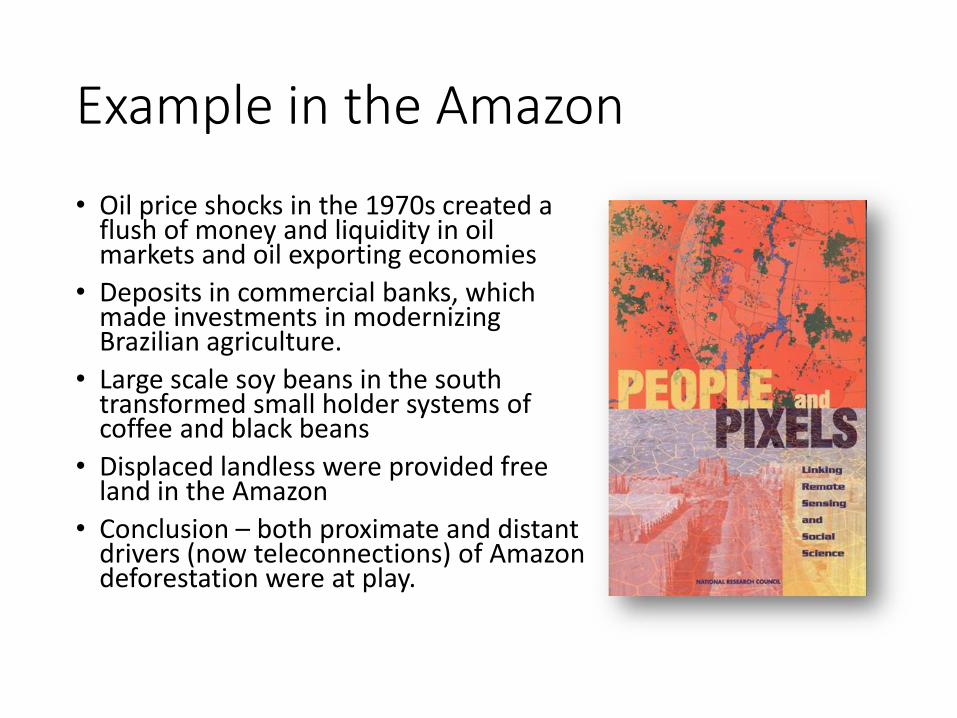
Example in the Amazon
• Oil price shocks in the 1970s created a flush of money and liquidity in oil markets and oil exporting economies
• Deposits in commercial banks, which made investments in modernizing Brazilian agriculture.
• Large scale soy beans in the south transformed small holder systems of coffee and black beans
• Displaced landless were provided free land in the Amazon
• Conclusion – both proximate and distant drivers (now teleconnections) of Amazon deforestation were at play.

The stage was set
• IGBP and IHDP Core Project on LUCC
• Snowmass and the book was in some ways a breakthrough. • Showed a path for linking social and biophysical sciences in a
single interdisciplinary topic important to global change research
• The USGCRP and International focus was lead by the carbon cycle science community, terrestrial ecosystems, plus atmospheric chemistry and global hydrology
• LUCC was the other global change • Important in its own right!• Note – not until the second ten year plan for USGCRP would
LUCC/LCLUC be placed explicitly into it own agenda as single Theme – NB it is no longer.

LCLUC
• A response to the need for this topic in the USGCRP
• A source of funding for a growing community of scholars in 1996.
• Intensified in with the drafting of the second GCRP Strategic Plan in 2000. LCLUC was a single “Theme”


LCLUC moves the EO agenda
• On the EO pathway, there have been two major trends:• Moving from forest-non forest to a continuum of changes
including degradation – e.g. selective logging
• The inclusion of the urban environment and changes there
• The addition of urban, and other “non frontier” landscapes has been important
• Note about “my dinner with Andre”
• The inclusion of urban and other has in turn driven the LCLUC agenda on the model side – and for other land uses (e.g. IFs)

LCLUC moves the Process agenda
• The LBA as a major campaign brought to light the need to link pattern to process.
• And linking explicitly observations and process studies with biogeochemistry and the other aspects of global change.
• Focus for interdisciplinary models and understanding of the drivers.
• Campaign gave regional focus
• As did the regional networks, which created a sense of focus on “scales that matter”

Where are we now• Some new and interesting developments:
• Much stronger interdisciplinary community, emerging focal points on teleconnections and moving the science to non-land cover aspects
• The program has left its mark on science. The regional networks cannot be ignored. They have been almost a unique aspect of this program
• This program is providing funding for social science integration like not other agencies are (except perhaps NSF)
• A lot has been achieved but we still find ourselves trying to “make the case”• The LCLUC elements of the next Decadal Survey will be shoe horned
in with “terrestrial and marine ecosystems and natural resources management”
• And making the interdisciplinary linkages with the social sciences has been an on going struggle.
New pathways
• There are two opportunities:• Making the science more relevant. Linking closer to policy and
applications; to the development agenda• Expanding the observations and models outside the comfort zone
of closed forest systems.
• The first: making the work link to climate change policy –e.g. REDD+
• The second: developing more observations of open woodlands and managed systems• IFs as one area already being tackled• But also agricultural landscapes; and not just urban but extending
the current urban to settlements
• Trees outside of Forests
• In other words: places where people live

REDD+ using IPCC definitions
Conservation
REDD
Forest management Enhancement of forest carbon stocks


Three Pillars of a the MRV Function in a National Forest Monitoring System
• Emissions factors
• Field sample plots
• Allometry for carbon
National Forest Inventory
• Activity data
• Deforestation, degradation mapping
• Forest carbon mapping
Satellite Forest Cover Monitoring
• Emissions, removals estimation
• Reporing using standard IPCC
• Tools for computation, data management
GHG Inventory and Reporting


Degradation of carbon stocks

Woodlands - TOF


Carbon map for block 4 & 5 in the Sokone site
25

New 2013-2015 fC Mosaic

Malawi National Database

fC Tool Database
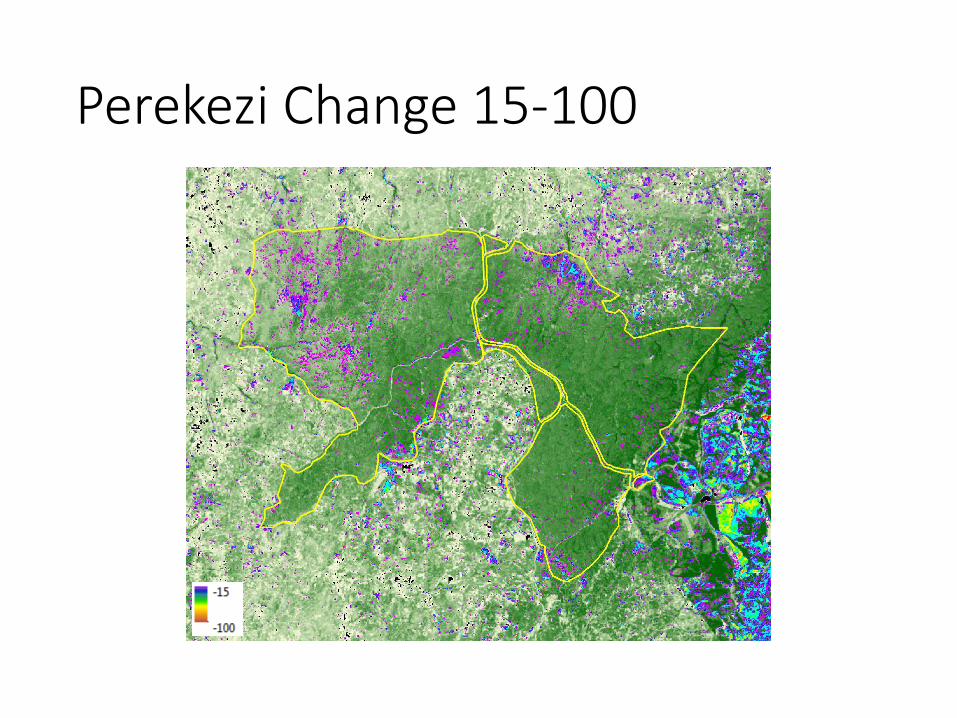
Perekezi Change 15-100

Perekezi: Change Algorithm v3 ResultsMinimum Detected Change: 15Non-forest Threshold: 15

Industrial Forests
• Shifting geography, drivers:• Source regions matching demand regions
• Changes in policies
• Changes in investments
• Changes in silvaculture
• But not all places respond as might be expected• Indonesia: “chaotic” policies responding to a plethora of
drivers: most important “actor” looks like governance and new emphasis on community-located forest enerterprises (cf. the HTR’s over the HTI’s)

Directly supporting climate mitigation actions
• Assessment of current and past rates and locations of deforestation and forest degradation
Identification of “hot spots” to guide household surveys and focus group interviews down to village level
Identification and quantification of types of forest change
Creates a framework for Activity Data for both Deforestation and Degradation
• Other uses:• Measurement and mapping of Activity Data for estimation of GHG, and
monitoring
• Supports baseline estimation and RELs
• Measurement of Emission Factors based on forest carbon stocks AGB mapping
• Creating a basis for the Field Inventory plot allocations – pre-sample requirements in conjunction with the sample estimator tool

The (new) “Other” Global Change• Whats going on at NSF
• Three areas: improving forecasts, changing the forecast through active design, and enabling the future
• A time in which human society and technology are increasing the pace and rate of environmental change in ways for which no precedent exists,
• Human systems are becoming dominant forces in ecosystems and the environment resulting in novel landscapes, natural and managed ecosystems,

The (new) other global change
• So linking patter to process is no longer good enough.
• The patterns have to be better, for sure• Land transformation beyond converting forests
• Settlements, urban areas, and other managed landscapes
• The agricultural landscape is important
• But the processes are more complex, if not more interesting:• Coupling LCLUC to policy needs, Not just REDD+ MRV, but
also governance, poverty and other development goals
• Understanding a globally teleconnected world, which is (by the way) not new, but perhaps the community is now ready.
