a303 amesbury to berwick down · volume content 1 application information the completed application...
TRANSCRIPT
A303 Amesbury to Berwick DownTR010025
1.1 Introduction to the Application
APFP Regulation 5(2)(q)
Planning Act 2008
Infrastructure Planning (Applications: Prescribed Forms and Procedure) Regulations 2009
October 2018
Volu
me
1
Infrastructure Planning
Planning Act 2008
The Infrastructure Planning(Applications: Prescribed
Forms and Procedure)Regulations 2009
A303 Amesbury to Berwick DownDevelopment Consent Order 20[xx]
INTRODUCTION TO THE APPLICATION
Regulation Number: Regulation 5(2)(q)Planning Inspectorate SchemeReference
TR010025
Application Document Reference 1.1
Author: A303 Amesbury to Berwick Down ProjectTeam, Highways England
Version Date Status of VersionRev 0 October 2018 Application issue

A303 Amesbury to Berwick Down
1.1 Introduction to the Application, October 2018
Table of contentsChapter Pages1 Introduction 1-11.1 Purpose of this document 1-11.2 Structure of this document 1-12 The Scheme 2-12.1 Scheme description 2-13 The Applicant 3-13.1 Highways England 3-13.2 The Project Team 3-14 Overview of the Application Documentation 4-15 Application Documents 5-16 Volume 1 Application Information 6-17 Volume 2 Plans / Drawings / Sections 7-18 Volume 3 Draft DCO and Related Documents 8-19 Volume 4 Compulsory Acquisition Information 9-110 Volume 5 Consultation Report 10-111 Volume 6 Environmental Statement and Related Documents 11-111.1 Environmental Statement 11-111.2 Environmental Statement Figures 11-211.3 Environmental Statement Appendices 11-211.4 Non-technical Summary 11-311.5 Statement of Statutory Nuisance 11-312 Volume 7 Other Documents 12-1Appendix A Scheme boundary planAppendix B Tables of ES Figures and Appendices

A303 Amesbury to Berwick Down
1.1 Introduction to the Application, October 2018
Table of TablesTable 4-1 Summary of Contents of DCO Application ....................................................4-1Table 5-1 Summary of DCO Application Documents ....................................................5-1Table B-1 Environmental Statement Figures .............................................................. B2Table B-2 Environmental Statement Appendices ..................................................... B15
A303 Amesbury to Berwick Down
1.1 Introduction to the Application, October 2018 1-1
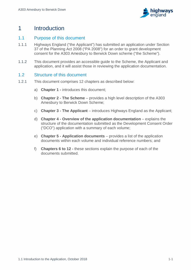
1 Introduction1.1 Purpose of this document
Highways England (“the Applicant”) has submitted an application under Section1.1.137 of the Planning Act 2008 (“PA 2008”) for an order to grant developmentconsent for the A303 Amesbury to Berwick Down scheme (“the Scheme”).
This document provides an accessible guide to the Scheme, the Applicant and1.1.2application, and it will assist those in reviewing the application documentation.
1.2 Structure of this documentThis document comprises 12 chapters as described below:1.2.1
Chapter 1 - introduces this document;a)
Chapter 2 - The Scheme – provides a high level description of the A303b)Amesbury to Berwick Down Scheme;
Chapter 3 - The Applicant – introduces Highways England as the Applicant;c)
Chapter 4 - Overview of the application documentation – explains thed)structure of the documentation submitted as the Development Consent Order(“DCO”) application with a summary of each volume;
Chapter 5 - Application documents – provides a list of the applicatione)documents within each volume and individual reference numbers; and
Chapters 6 to 12 - these sections explain the purpose of each of thef)documents submitted.

A303 Amesbury to Berwick Down
1.1 Introduction to the Application, October 2018 2-1
2 The Scheme2.1 Scheme description
The A303 Amesbury to Berwick Down scheme (“the Scheme”) forms part of a2.1.1programme of improvements for upgrading the A303/A358 corridor, improvingthis vital connection between the South West and London and the South Eastand including the upgrade of remaining single carriageway sections on the routeto dual carriageway. This investment is stated as a priority project in the NationalInfrastructure Plan and Government’s commitment is confirmed in the RoadInvestment Strategy (2015-2020). Subject to achieving an approvedDevelopment Consent Order (“DCO”), preliminary works are planned to start in2020 with the main construction works following in 2021, and the Scheme is dueto open to traffic in 2026.
Objectives for the Scheme have been formulated both to address identified2.1.2problems and to take advantage of the opportunities that new infrastructurewould provide. The objectives are defined by the Department for Transport's(“DfT”):
· Transport - To create a high quality reliable route between the South Eastand the South West that meets the future needs of traffic;
· Economic Growth - to enable growth in jobs and housing by providing afree flowing and reliable connection between the South East and theSouth West.
· Cultural Heritage - To help conserve and enhance the World HeritageSite and to make it easier to reach and explore; and
· Environment and Community - To improve biodiversity and provide apositive legacy for nearby communities.
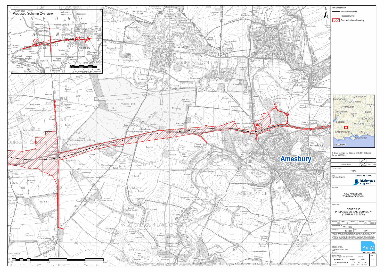
The objectives would be achieved by providing a high quality, two-lane dual2.1.3carriageway on the A303 trunk road between Amesbury and Berwick Down inWiltshire. The Scheme would resolve traffic problems and, at the same time,protect the Stonehenge, Avebury and Associated Sites World Heritage Site,(“WHS”). The Scheme would be approximately 8 miles (13km) long and comprisethe following key components:
A northern bypass of Winterbourne Stoke with a viaduct over the River Tilla)valley;
A new junction between the A303 and A360 to the west of and outside theb)WHS, replacing the existing Longbarrow roundabout;
A twin-bore tunnel approximately 2miles (3.3km) long, past Stonehenge;c)and
A new junction between the A303 and A345 at the existing Countessd)roundabout.
Figure 2.1A-C in Appendix A shows the full red line boundary of the Scheme.2.1.4

A303 Amesbury to Berwick Down
1.1 Introduction to the Application, October 2018 3-1
3 The Applicant3.1 Highways England
Highways England is the strategic highways company charged with operating,3.1.1maintaining and improving England’s motorways and major A roads. Formerlythe Highways Agency, Highways England became a Government ownedcompany in April 2015. Highways England is responsible for operation,maintenance and improvements to the motorways and major (trunk) roads inEngland.
The existing A303 is part of the trunk road network for which Highways England3.1.2is responsible.
The Scheme contact details are:3.1.3
A303 Amesbury to Berwick Down Project TeamHighways EnglandTemple Quay HouseBristolBS1 6HAEmail: [email protected]: 0300 123 5000 (Highways England Information Line)
3.2 The Project TeamThe Scheme is managed by Highways England from its Bristol office by the A3033.2.1Amesbury to Berwick Down Project Team, which is responsible for delivering theproject in accordance with the Scheme’s requirements.
The AECOM, Mace, WSP consortium (“AmW”) has been appointed by Highways3.2.2England as Technical Partner to prepare the DCO design and the application fordevelopment consent, and support Highways England through the Examinationprocess.
Together, Highways England and AmW make up the Project Team.3.2.3
A303 Amesbury to Berwick Down
1.1 Introduction to the Application, October 2018 4-1
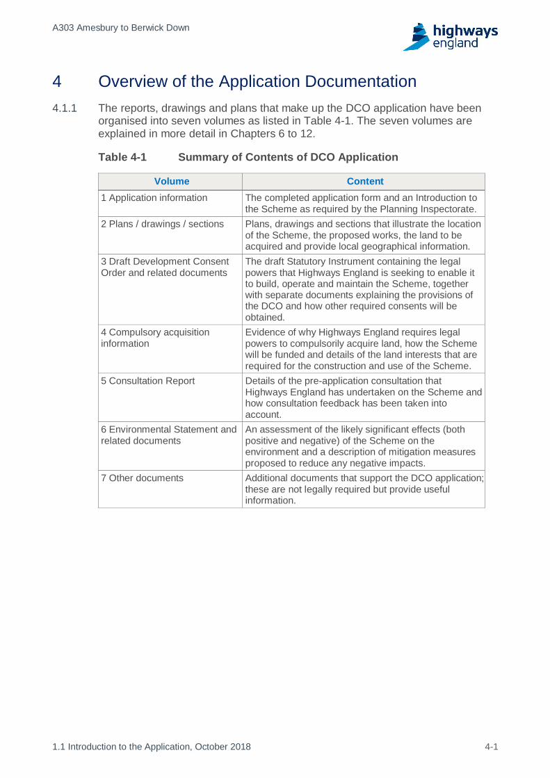
4 Overview of the Application DocumentationThe reports, drawings and plans that make up the DCO application have been4.1.1organised into seven volumes as listed in Table 4-1. The seven volumes areexplained in more detail in Chapters 6 to 12.
Table 4-1 Summary of Contents of DCO Application
Volume Content1 Application information The completed application form and an Introduction to
the Scheme as required by the Planning Inspectorate.2 Plans / drawings / sections Plans, drawings and sections that illustrate the location
of the Scheme, the proposed works, the land to beacquired and provide local geographical information.
3 Draft Development ConsentOrder and related documents
The draft Statutory Instrument containing the legalpowers that Highways England is seeking to enable itto build, operate and maintain the Scheme, togetherwith separate documents explaining the provisions ofthe DCO and how other required consents will beobtained.
4 Compulsory acquisitioninformation
Evidence of why Highways England requires legalpowers to compulsorily acquire land, how the Schemewill be funded and details of the land interests that arerequired for the construction and use of the Scheme.
5 Consultation Report Details of the pre-application consultation thatHighways England has undertaken on the Scheme andhow consultation feedback has been taken intoaccount.
6 Environmental Statement andrelated documents
An assessment of the likely significant effects (bothpositive and negative) of the Scheme on theenvironment and a description of mitigation measuresproposed to reduce any negative impacts.
7 Other documents Additional documents that support the DCO application;these are not legally required but provide usefulinformation.
A303 Amesbury to Berwick Down
1.1 Introduction to the Application, October 2018 5-1
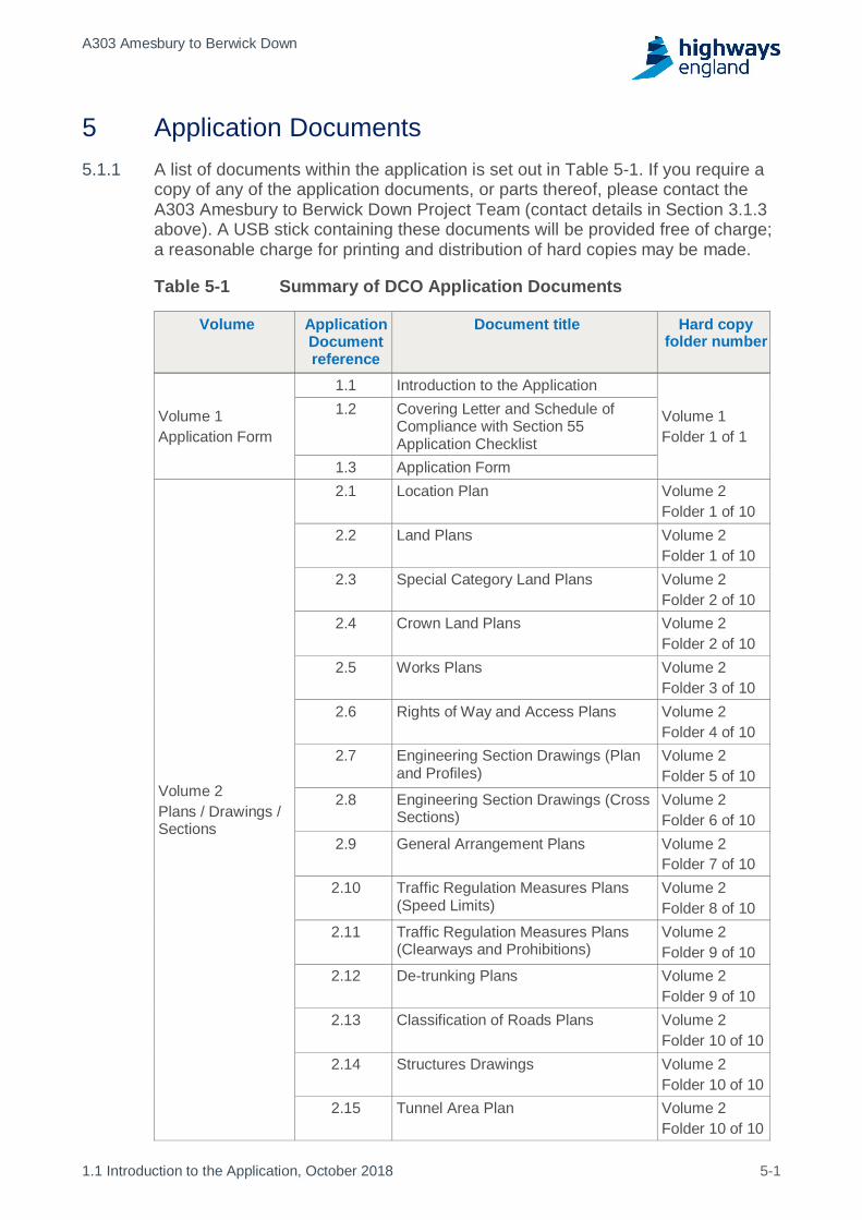
5 Application DocumentsA list of documents within the application is set out in Table 5-1. If you require a5.1.1copy of any of the application documents, or parts thereof, please contact theA303 Amesbury to Berwick Down Project Team (contact details in Section 3.1.3above). A USB stick containing these documents will be provided free of charge;a reasonable charge for printing and distribution of hard copies may be made.
Table 5-1 Summary of DCO Application Documents
Volume ApplicationDocumentreference
Document title Hard copyfolder number
Volume 1Application Form
1.1 Introduction to the Application
Volume 1Folder 1 of 1
1.2 Covering Letter and Schedule ofCompliance with Section 55Application Checklist
1.3 Application Form
Volume 2Plans / Drawings /Sections
2.1 Location Plan Volume 2Folder 1 of 10
2.2 Land Plans Volume 2Folder 1 of 10
2.3 Special Category Land Plans Volume 2Folder 2 of 10
2.4 Crown Land Plans Volume 2Folder 2 of 10
2.5 Works Plans Volume 2Folder 3 of 10
2.6 Rights of Way and Access Plans Volume 2Folder 4 of 10
2.7 Engineering Section Drawings (Planand Profiles)
Volume 2Folder 5 of 10
2.8 Engineering Section Drawings (CrossSections)
Volume 2Folder 6 of 10
2.9 General Arrangement Plans Volume 2Folder 7 of 10
2.10 Traffic Regulation Measures Plans(Speed Limits)
Volume 2Folder 8 of 10
2.11 Traffic Regulation Measures Plans(Clearways and Prohibitions)
Volume 2Folder 9 of 10
2.12 De-trunking Plans Volume 2Folder 9 of 10
2.13 Classification of Roads Plans Volume 2Folder 10 of 10
2.14 Structures Drawings Volume 2Folder 10 of 10
2.15 Tunnel Area Plan Volume 2Folder 10 of 10

A303 Amesbury to Berwick Down
1.1 Introduction to the Application, October 2018 5-2
Volume ApplicationDocumentreference
Document title Hard copyfolder number
2.16 Tunnel Limits of Deviation Plan Volume 2Folder 10 of 10
Volume 3Draft DevelopmentConsent Order andrelated documents
3.1 Draft Development Consent Order –pdf version
Volume 3Folder 1 of 1
3.1 Draft Development Consent Order –Word version
3.2 Explanatory Memorandum to draftDevelopment Consent Order
3.3 Consents and Agreements PositionStatement
Volume 4Compulsoryacquisitioninformation
4.1 Statement of ReasonsVolume 4Folder 1 of 1
4.2 Funding Statement
4.3 Book of Reference
Volume 5Consultation Reportand relateddocuments
5.1
Consultation Report Volume 5Folder 1 of 4
Consultation Report AppendicesAppendix A
Volume 5Folder 2 of 4
Consultation Report AppendicesAppendix BConsultation Report AppendicesAppendix CConsultation Report AppendicesAppendix DConsultation Report AppendicesAppendix EConsultation Report AppendicesAppendix F
Volume 5Folder 3 of 4
Consultation Report AppendicesAppendix GConsultation Report AppendicesAppendix HConsultation Report AppendicesAppendix IConsultation Report AppendicesAppendix JConsultation Report AppendicesAppendix K
Volume 5Folder 4 of 4
Volume 6EnvironmentalStatement andrelated documents
6.1 Environmental StatementChapters 1 to 16
Volume 6Folder 1 of 17
6.2Environmental Statement FiguresChapters 1 to 16
Volume 6Folder 2 of 17
6.3 Environmental Statement AppendicesAppendix 1.1 to 5.5
Volume 6Folder 3 of 17

A303 Amesbury to Berwick Down
1.1 Introduction to the Application, October 2018 5-3
Volume ApplicationDocumentreference
Document title Hard copyfolder number
6.3 Environmental Statement AppendicesAppendix 6.1
Volume 6Folder 4 of 17
6.3Environmental Statement AppendicesAppendix 6.1 – figures
Volume 6Folder 5 of 17
6.3 Environmental Statement AppendicesAppendix 6.1 – Annexes 1 to 3
Volume 6Folder 6 of 17
6.3Environmental Statement AppendicesAppendix 6.1 – Annex 4 to appendix6.3
Volume 6Folder 7 of 17
6.3 Environmental Statement AppendicesAppendix 6.4 to 6.9
Volume 6Folder 8 of 17
6.3Environmental Statement Appendices6.10 to 7.7
Volume 6Folder 9 of 17
6.3 Environmental Statement Appendices7.8 to 7.11
Volume 6Folder 10 of 17
6.3 Environmental Statement Appendices8.1 to 8.15
Volume 6Folder 11 of 17
6.3Environmental Statement Appendices8.16A to 8.26
Volume 6Folder 12 of 17
6.3 Environmental Statement Appendices9.1 to 10.1
Volume 6Folder 13 of 17
6.3 Environmental Statement Appendices10.2 to 11.2
Volume 6Folder 14 of 17
6.3Environmental Statement Appendices11.3 to 15.2
Volume 6Folder 15 of 17
6.4 Environmental StatementNon-Technical Summary
Volume 6Folder 16 of 17
6.5 Statement of Statutory Nuisance Volume 6Folder 17 of 17
Volume 7Other documents
7.1 Case for the Scheme and NPSaccordance table
Volume 7Folder 1 of 2
7.2 Design and Access Statement7.3 Equality Impact Assessment7.4 Transport Assessment
7.5 Combined Modelling and AppraisalReport
7.5 Appendix A
7.5 Appendix B – D Volume 7Folder 2 of 2

A303 Amesbury to Berwick Down
1.1 Introduction to the Application, October 2018 6-1
6 Volume 1 Application InformationThe Introduction to the Application (Application Document 1.1) (i.e. this6.1.1document) provides a summary of all the documentation provided for the DCOapplication.
The Covering Letter has the Schedule of Compliance with Section 556.1.2Checklist (Application Document 1.2). This schedule is completed by HighwaysEngland to evidence how the application fulfils the conditions for acceptance bythe Planning Inspectorate (“the Inspectorate”) under Section 55 of the PA 2008.This will aid the Planning Inspectorate complete their Schedule of Compliancewith Section 55 on receipt of the DCO application.
The Application Form (Application Document 1.3) is a standard form and6.1.3provides a high level summary of the Scheme and the documents that have beensubmitted.

A303 Amesbury to Berwick Down
1.1 Introduction to the Application, October 2018 7-1
7 Volume 2 Plans / Drawings / SectionsThere is a Location Plan and 15 sets of plans (Application Documents 2.1 to7.1.12.16, as described below). Where a plan comprises three or more separatesheets, a key plan is provided, showing the relationship between the differentsheets. Each plan (and each sheet within a set of plans) includes a key, whichexplains the use of symbols/lines/shading to denote features and information inthe plans. The exceptions to this are: the Location Plan, the Classification ofRoads Plan; the Tunnel Area Plan; and the Tunnel Limits of Deviation Plan(Application Documents 2.1, 2.13, 2.15 and 2.16 respectively) which do not haveor require a key plan because each of them comprises a plan shown on a singlesheet.
The Location Plan (Application Document 2.1) identifies the location of the7.1.2proposed development in its wider context.
The Land Plans (Application Document 2.2) correspond to the Book of7.1.3Reference (Application Document 4.3) and, in summary, set out:
the land required for, or affected by, the Scheme;a)
any land over which it is proposed to exercise powers of compulsoryb)acquisition or any right to use the land (including the right to take temporarypossession of the land); and
any land impacted by the removal of private land rights over that land.c)
The Special Category Land Plans (Application Document 2.3) show the areas7.1.4of special category land (open space and National Trust land held inalienably)within the DCO limits, which are proposed to be compulsorily acquired, or overwhich rights are proposed to be acquired compulsorily. In respect of the openspace land that is proposed to be acquired, and in respect of the open spaceland that is proposed to be subject to the acquisition of rights, replacement landwill be given in exchange (pursuant to sections 131(4) and 132(4) of the PA2008) for the purposes of the Scheme.
The Crown Land Plans (Application Document 2.4) show the areas of Crown7.1.5land which are required for the purposes of the Scheme.
The Works Plans (Application Document 2.5) show the route and alignment of7.1.6the proposed development and works, and the limits of deviation within which thedevelopment and works may be carried out.
The Rights of Way and Access Plans (Application Document 2.6) show any7.1.7new or altered means of access, stopping up of streets, roads and anydiversions, extinguishment or creation of rights of way.

A303 Amesbury to Berwick Down
1.1 Introduction to the Application, October 2018 7-2
The Engineering Section Drawings (Plan and Profiles) and the Engineering7.1.8Section Drawings (Cross Sections) (Application Documents 2.7 and 2.8) showthe levels of the proposed works including:
Road levels;a)
The height of proposed bridges and viaducts;b)
The depth of cuttings; andc)
Depth of the tunnel (see the Tunnel Limits of Deviation Plan (Applicationd)Document 2.16) for details of the proposed depth of the bored section of thetunnel).
The General Arrangement Drawings (Application Document 2.9) provide a7.1.9technical illustration of the Scheme shown against an Ordnance Survey basemap.
The Traffic Regulation Measures Plans (Speed Limits) (Application Document7.1.102.10) are provided to show the speed limits which are proposed to be applied bythe Scheme.
The Traffic Regulation Measures Plans (Clearways and Prohibitions)7.1.11(Application Document 2.11) show the clearways, and prohibitions proposed tobe imposed by the Scheme to regulate traffic, as well as revocations of existingtraffic regulation orders that are required in connection with the implementation ofthe Scheme.
The De-Trunking Plans (Application Document 2.12) show the lengths of the7.1.12existing A303 which are to cease to have trunk road status upon theimplementation of the Scheme.
The Classification of Roads Plan (Application Document 2.13) show highways7.1.13classifications which are proposed to accommodate the Scheme within theexisting highway network - these include the application of appropriateclassifications to new highways and the amendment of existing highways' currentclassifications, where necessary to accommodate the Scheme.
The Structures Drawings (Application Document 2.14) provide an indication of7.1.14the location and proposed form of key features of the Scheme, such as the RiverTill viaduct, the Green Bridges, the tunnel and variable message sign supportstructures.
The Tunnel Area Plan (Application Document 2.15) shows the area which is7.1.15proposed to be subject to the tunnel byelaws which are included in the draftOrder.
The Tunnel Limits of Deviation Plan (Application Document 2.16) shows thelimits of deviation prescribing the area of land (subsoil) within which the length ofbored tunnel is proposed to be constructed.

A303 Amesbury to Berwick Down
1.1 Introduction to the Application, October 2018 8-1
8 Volume 3 Draft DCO and Related DocumentsThe Draft Development Consent Order (Application Document 3.1) sets out the8.1.1powers that Highways England is seeking to enable it to construct and operatethe Scheme. It sets out the parameters for what development would bepermitted. It is accompanied by 12 schedules as outlined below:
Schedule 1 Authorised development – lists the works that would bea)authorised by the grant of development consent, which are shown on theworks plans and to which the schedule refers.
Schedule 2 Requirements – sets out the conditions that Highways Englandb)would be required to accord with when implementing the developmentauthorised by the DCO.
Schedule 3 Permanent stopping up of highways and private means ofc)access and provision of new highways and private means of access –sets out the highways and accesses which Highways England wouldpermanently stop up as a result of the Scheme, and provides how HighwaysEngland would replace them (where necessary). Should be read inconjunction with the Rights of Way and Access Plans.
Schedule 4 Land in which only new rights etc., may be acquired – setsd)out the land over which Highways England is seeking to acquire new landrights only (such as the rights to maintain infrastructure) rather than acquiringthe entire freehold interest in that land. Should be read in conjunction with theLand Plans.
Schedule 5 Modification of compensation and compulsory purchasee)enactments for the creation of new rights – amends relevant compulsorypurchase legislation to ensure that it can apply to the DCO (particularly inconnection with land and rights compulsorily acquired under the DCO).
Schedule 6 Land in which only subsoil or new rights in and abovef)subsoil or new rights in and above subsoil and surface may beacquired – sets out the land in which Highways England is only seeking toacquire subsoil and, above such subsoil, new land rights for the purposes ofthe Scheme.
Schedule 7 Land of which only temporary possession may be taken –g)sets out the land which Highways England is seeking to possess temporarilyfor the purpose of constructing the Scheme.
Schedule 8 Byelaws – sets out the byelaws Highways England is seeking toh)apply to users of the A303 tunnel to ensure safety etc.
Schedule 9 Classification of roads etc. – lists the road classification (e.g.i)road numbers) by which the new and altered highways would be identifiedand sets out how the Scheme would be integrated into the existing networkof highway classifications. Should be read in conjunction with theClassification of Roads Plan and the De-trunking Plans.
A303 Amesbury to Berwick Down
1.1 Introduction to the Application, October 2018 8-2
Schedule 10 Traffic regulation measures – sets out the traffic regulationj)measures (e.g. speed limits, clearways etc.) to which the Scheme would besubject and which would be required on the surrounding highway network inconsequence of the Scheme. Should be read in conjunction with the TrafficRegulation Measures Plans.
Schedule 11 Protective provisions - includes provisions to protect thek)interests of various bodies (e.g. statutory undertakers) in the context of theScheme.
Schedule 12 Documents to be certified - contains a list of documents thatl)would be ‘certified’ under the relevant article of the DCO, if the DCO is madeby the Secretary of State.
The Explanatory Memorandum to the Draft Development Consent Order8.1.2(Application Document 3.2) – explains the purpose and effect of each provision inthe draft DCO including why it is considered necessary.
Highways England requires a range of consents and agreements to construct8.1.3and operate the Scheme. Some of these are included in the draft DCO andwould therefore be granted to Highways England as part of the developmentconsent. However, there are a range of other consents from different regulatoryorganisations that will be required separate to the DCO. For example, licenceswill be required from Natural England. Highways England’s proposed approach toobtaining these is explained in the Consents and Agreements PositionStatement (Application Document 3.3).
A303 Amesbury to Berwick Down
1.1 Introduction to the Application, October 2018 9-1
9 Volume 4 Compulsory Acquisition InformationIn order to implement the Scheme, Highways England will need to use statutory9.1.1powers to acquire land and rights in land, and to possess and use landtemporarily. Highways England is required to provide evidence that the use ofthese powers would be justified, proportionate and in the public interest, and thisevidence is set out in a Statement of Reasons (Application Document 4.1),Funding Statement (Application Document 4.2) and Book of Reference(Application Document 4.3) as explained below.
The Statement of Reasons (Application Document 4.1) – explains that therea)is a compelling case in the public interest which would justify HighwaysEngland's exercise of powers of compulsory acquisition in order to acquireland and rights permanently and to use land temporarily to enable it toconstruct, operate and maintain the Scheme.
The Funding Statement (Application Document 4.2) – explains how theb)Scheme, including any compulsory acquisition, would be funded.
The Book of Reference (Document Reference 4.3) – identifies, on a plot byc)plot basis, each person having an interest in a plot of land within the Orderlimits. It also lists the persons with an interest in land outside the Order limitswho may be entitled to make a relevant claim, as defined in section 57 of thePA 2008, and being a claim for compensation due to the effects ofconstruction on the value of their property; or due to diminution in the value oftheir property arising from the use of the Scheme. It is structured in five partsin compliance with the Infrastructure Planning (Applications: PrescribedForms and Procedure) Regulations 2009. The five parts are:
i. Part 1: Contains the names and addresses of each person withinCategories 1 and 2, as set out in Section 57 of the PA 2008, along withthe area of each plot of land in which the development is proposed tobe carried out.
ii. Part 2: Contains the names and addresses (if known by the Applicant)of each person within Category 3, as defined by Section 57 of the PA2008. A person is within Category 3 if the Applicant believes that, if theDCO were to be made and fully implemented, they would or might beentitled to make a relevant claim as defined in Section 57(6) of the PA2008. A relevant claim is a claim under section 10 of the CompulsoryPurchase Act 1965, a claim under Part 1 of the Land Compensation Act1973, or a claim under section 152(3) of the PA 2008.
iii. Part 3: Contains the names of all those with easements or other privaterights over land which it is proposed shall be extinguished, suspendedor interfered with pursuant to the exercise of the powers in the DCO.
iv. Part 4: Specifies the names and addresses of the owner of any Crowninterest in the land which is proposed to be used for the purposes of theDCO for which the application is being made.
A303 Amesbury to Berwick Down
1.1 Introduction to the Application, October 2018 9-2
v. Part 5: Specifies land that as part of the DCO is proposed to beacquired but which may be subject to special parliamentary procedure,is special category land or is replacement land.

A303 Amesbury to Berwick Down
1.1 Introduction to the Application, October 2018 10-1
10 Volume 5 Consultation ReportThe Consultation Report (Application Document 5.1) provides an account of the10.1.1pre-application consultation undertaken on the Scheme. The report includesdetails of the statutory consultation which Highways England is required toundertake in accordance with the 2008 Act, the informal engagement that hastaken place, and how the Scheme has been amended to reflect commentsreceived. The chapters of the Consultation Report are as follows:
Chapter 1 introduces the Consultation Report, the Scheme, the Applicant anda)compliance with regulatory requirements. The chapter outlines the structureof the Consultation Report.
Chapter 2 outlines the background, objectives and the evolution of theb)Scheme. The chapter describes the process for non-statutory engagementthat Highways England has implemented to develop and shape the Schemethrough face-to-face engagement as well as other methods.
Chapter 3 explains how Highways England undertook the statutoryc)consultation on the Scheme.
Chapter 4 provides a quantitative summary of the responses received to thed)statutory consultation; describes the methodology used for their analysis andidentifies the main themes arising from the feedback received.
Chapter 5 addresses the matters arising from the statutory consultation,e)collated under the themes identified in Chapter 4. The chapter then goes onto provide Highways England’s response to the matters raised, providing asummary of design changes as a result of consultation and the issues raisedthat did not lead to design change with explanation.
Chapter 6 describes the supplementary consultation undertaken in relation tof)three specific proposed changes to the scheme following the statutoryconsultation.
Chapter 7 provides details of how Highways England carried out consultationg)in accordance with the requirements of the Infrastructure Planning(Environmental Impact Assessment) Regulations 2017 (“EIA Regulations”).This includes details of the request for a Scoping Opinion and the preparationof a Preliminary Environmental Information Report to support the statutoryconsultation.
Chapter 8 concludes the report, providing an overview of the consultationh)which has taken place and the compliance with the relevant legislation.
An Executive Summary is provided with the Consultation Report.10.1.2
A range of appendices that support the report are provided in the Consultation10.1.3Report Appendices (Application Documents 5.2 – 5.5) and as described below:
Appendix A Compliance checklist;a)
A303 Amesbury to Berwick Down
1.1 Introduction to the Application, October 2018 10-2
Appendix B Consultation and engagement overview;b)
Appendix C Development of the Statement of Community Consultationc)(“SOCC”) including a copy of the published SOCC;
Appendix D Consultation maps;d)
Appendix E Section 42 consultation – comprises of a list of statutorye)consultees that were consulted about the Scheme such as local authorities,environmental organisations, landowners and utilities companies;
Appendix F Section 47 consultation – provides sample letters and notices tof)demonstrate how the correct legal procedures have been followed;
Appendix G Consultation material – includes copies of the consultationg)questionnaire, leaflet, brochure and other consultation material that wasavailable through the statutory consultation process;
Appendix H Additional consultees;h)
Appendix I Extended consultation;i)
Appendix J Supplementary consultation; andj)
Appendix K responses to consultation – provides a summary of all commentsk)received during the statutory consultation. This includes all commentsreceived from local authorities, statutory consultees such as environmentalorganisations, persons with an interest in the land affected (includinglandowners and tenants) and the wider public.

A303 Amesbury to Berwick Down
1.1 Introduction to the Application, October 2018 11-1
11 Volume 6 Environmental Statement and RelatedDocuments
11.1 Environmental StatementHighways England has undertaken an environmental impact assessment (“EIA”)11.1.1of the Scheme which considered the environmental baseline conditions, potentialimpacts as a result of construction, operation and maintenance of the Schemeand any residual environmental effects. The Environmental Statement(Application Document 6.1) reports the findings of the EIA. The findings of theEIA are also summarised in the Environmental Statement Non-TechnicalSummary (Application Document 6.4).
The EIA and the Environmental Statement are legal requirements and accord11.1.2with relevant legislation and current guidance. Both the Scoping Opinion andcomments provided by statutory consultees to the Inspectorate (as included inAppendix 2 to the Scoping Opinion) have been considered in undertaking the EIAand in preparing the Environmental Statement. The Scoping Opinion has beenincluded in the Environmental Statement Appendices, (Application Document 6.3Appendix 4.1).
The Environmental Statement also provides general information on the Scheme11.1.3including context, description of the Scheme and its construction, alternativesconsidered and technical information and assessment on a range of topics. Thischapter provides an overview of the structure of the document to assist withnavigation.
The Environmental Statement includes the following introductory chapters:11.1.4
Chapter 1 Introduction;a)
Chapter 2 The Scheme;b)
Chapter 3 Assessment of Alternatives; andc)
Chapter 4 Environmental Assessment Methodology.d)
The following technical topic based chapters set out the environmental effects of11.1.5each topic listed:
Chapter 5 Air Quality;a)
Chapter 6 Cultural Heritage;b)
Chapter 7 Landscape and visual;c)
Chapter 8 Biodiversity;d)
Chapter 9 Noise and vibration;e)
Chapter 10 Geology and soils;f)
Chapter 11 Road Drainage and Water Environment;g)
A303 Amesbury to Berwick Down
1.1 Introduction to the Application, October 2018 11-2
Chapter 12 Materials, Assets and Waste;h)
Chapter 13 People and communities; andi)
Chapter 14 Climate.j)
The following chapters conclude and summarise the environmental effects:11.1.6
Chapter 15 Cumulative Effects; anda)
Chapter 16 Summary.b)
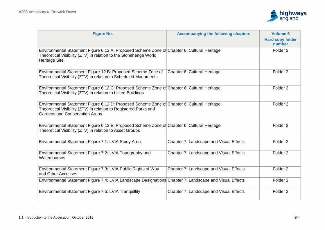
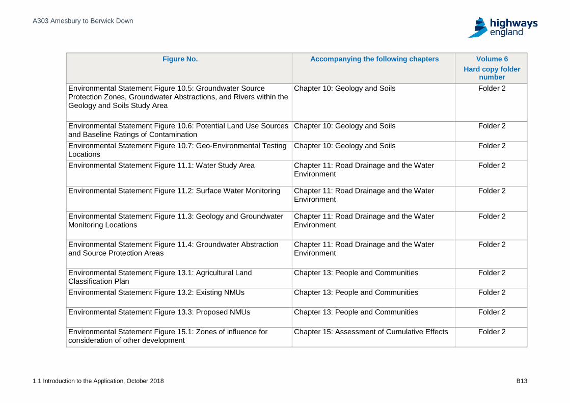
11.2 Environmental Statement FiguresThe Environmental Statement is accompanied by a series of figures whichsupport the findings of the EIA. These are provided in the EnvironmentalStatement Figures (Application Document 6.2) as summarised in Appendix BTable B-1.
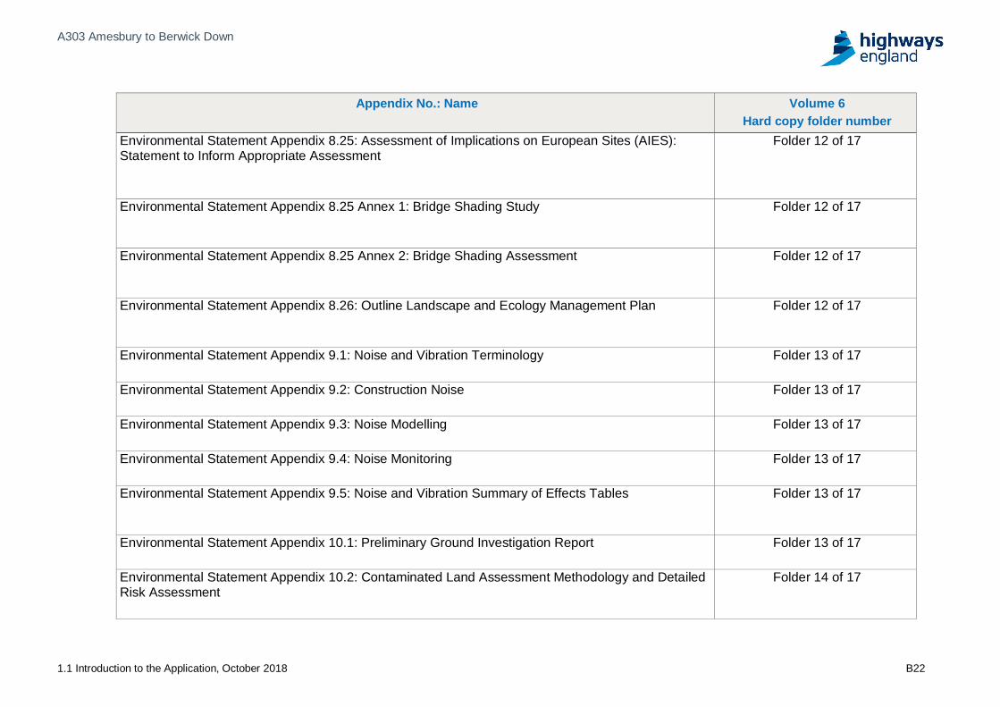
11.3 Environmental Statement AppendicesThe Environmental Statement is accompanied by a series of appendices which11.3.1support the findings of the EIA. These are provided in the EnvironmentalStatement Appendices (Application Document 6.3) as summarised in AppendixB Table B-2. Notable appendices include:
Appendix 2.1, Environmental Mitigation Schedule;a)
Appendix 2.2, Outline Environmental Management Plan;b)
Appendix 4.1, Scoping opinion and late scoping consultation responses;c)
Appendix 6.1, Heritage Impact Assessment;d)
Appendix 6.11, Outline Archaeological Mitigation Strategy;e)
Appendix 8.23, Summary of non-significant effects for construction andf)operation;
Appendix 8.24, Habitats Regulations Assessment;g)
Appendix 8.25, Assessment of implications on European Sites Statement toh)Inform Appropriate Assessment; and
Appendix 11.2, Water Framework Directive Compliance Assessment.i)

A303 Amesbury to Berwick Down
1.1 Introduction to the Application, October 2018 11-3
11.4 Non-technical SummaryThe full findings of the EIA are reported in the Environmental Statement11.4.1(Application Document 6.1); the Non-technical Summary (ApplicationDocument 6.4) is a concise document which summarises the main findings of theEnvironmental Statement in non-technical language.
11.5 Statement of Statutory NuisanceA Statement of Statutory Nuisance (Application Document 6.5) identifies the11.5.1matters set out in Section 79 of the Environmental Protection Act 1990 in respectof statutory nuisances and considers whether the proposed development wouldengage one or more of those matters. Where any matters may be potentiallyengaged, this statement sets out its proposals for mitigating or limiting them.

A303 Amesbury to Berwick Down
1.1 Introduction to the Application, October 2018 12-1
12 Volume 7 Other DocumentsA number of additional documents have been submitted with the Development12.1.1Consent Order application. These documents are not legally required, but areintended to provide useful information on the Scheme and aid detailedunderstanding of the application and its justification.
The Case for the Scheme (Application Document 7.1) sets out the need for the12.1.2Scheme, the objectives that it seeks to address, options and alternativesconsidered and an explanation of the Scheme’s development over time. It alsosets out how the Scheme meets its objectives and how it aligns with governmentpolicy.
As per section 104 of the PA 2008, the National Policy Statement for National12.1.3Networks (“NPSNN”) provides the primary basis for the Examining Authority(“ExA”) to examine the DCO application and the Secretary of State to determinethe application for the Scheme; as well as other important and relevantconsiderations. The NPS Accordance Table is appended to the Case for theScheme (Application Document 7.1) and demonstrates the Scheme’s alignmentand conformity with planning policy, in particular the NPSNN.
The Design and Access Statement (“DAS”) (Application Document 7.2)12.1.4presents the Scheme in design and access terms, demonstrating how theScheme meets relevant design requirements, whilst achieving the schemeobjectives. It also explains how the proposed design has been informed by anunderstanding of the relevant planning policies.
The Equality Impact Assessment (Application Document 7.3) provides the12.1.5assessment of compliance with current national legislation set out under theEquality Act 2010 and associated Public Sector Equality Duty.
The Transport Assessment (Application Document 7.4) assesses the impact of12.1.6the Scheme on the strategic and local highway network, road safety, and localsustainable modes of transport.
The Combined Modelling and Appraisal report (Application Document 7.5)12.1.7details the transport modelling and economic assessment undertaken for thescheme, including:
Appendix A, Traffic Data Packagea)
Appendix B, Transport Model Packageb)
Appendix C, Transport Forecasting Packagec)
Appendix D, Economic Appraisal Packaged)

A303 Amesbury to Berwick Down
1.1 Introduction to the Application, October 2018
Appendices
A303 Amesbury to Berwick Down
1.1 Introduction to the Application, October 2018
Appendix A Scheme boundary plan

Berwick Down
Winterbourne Stoke
Filename: pw:\\UKLON3AP114.aecomonline.local:PWAECOM_EU\Documents\60541439-A303 Stonehenge Technical Partner\0300 Non Deliverables\0330 Environmental Management Team\GIS\Figures\HE551506-AMW-DR-GI-00252.mxd0.5 0 0.5 1 1.5 2 km
±
1:25,000 SW60541200
HS KD CC WB 30/08/18
FIGURE 2.1APROPOSED SCHEME BOUNDARY
(WESTERN SECTION)
FINAL
HE551506 AMW GENSCHEME WIDE DR GI 00252
01
© Crown copyright and database rights 2017 Ordnance Survey 100030649.
Revision Details SuffixDateByCheck
Purpose of issue
ClientHighways England
Project Title
Drawing Title
Designed Drawn Checked Approved Date
Internal Project No.
Scale @ A3 Zone
THIS DOCUMENT HAS BEEN PREPARED PURSUANT TO AND SUBJECT TO THETERMS OF AECOM'S APPOINTMENT BY ITS CLIENT. AECOM ACCEPTS NO
LIABILITY FOR ANY USE OF THIS DOCUMENT OTHER THAN BY ITS ORIGINALCLIENT OR FOLLOWING AECOM'S EXPRESS AGREEMENT TO SUCH USE, ANDONLY FOR THE PURPOSES FOR WHICH IT WAS PREPARED AND PROVIDED.
Drawing NumberHighways England PIN | Originator | Volume
Location | Type | Role | Number
Rev
Highways EnglandTemple Quay House2 The Square, Temple QuayBristolBS1 6HA
Proposed Scheme Overview
1:5,000,000
NOTES / LEGENDIndicative centrelineProposed tunnelProposed scheme boundary
A303 AMESBURY TO BERWICK DOWN
1 0 1 2 3 4 5 km
Amesbury
Filename: pw:\\UKLON3AP114.aecomonline.local:PWAECOM_EU\Documents\60541439-A303 Stonehenge Technical Partner\0300 Non Deliverables\0330 Environmental Management Team\GIS\Figures\HE551506-AMW-DR-GI-00252.mxd0.5 0 0.5 1 1.5 2 km
±
1:25,000 SW60541200
HS KD CC WB 30/08/18
FIGURE 2.1BPROPOSED SCHEME BOUNDARY
(CENTRAL SECTION)
FINAL
HE551506 AMW GENSCHEME WIDE DR GI 00252
01
© Crown copyright and database rights 2017 Ordnance Survey 100030649.
Revision Details SuffixDateByCheck
Purpose of issue
ClientHighways England
Project Title
Drawing Title
Designed Drawn Checked Approved Date
Internal Project No.
Scale @ A3 Zone
THIS DOCUMENT HAS BEEN PREPARED PURSUANT TO AND SUBJECT TO THETERMS OF AECOM'S APPOINTMENT BY ITS CLIENT. AECOM ACCEPTS NO
LIABILITY FOR ANY USE OF THIS DOCUMENT OTHER THAN BY ITS ORIGINALCLIENT OR FOLLOWING AECOM'S EXPRESS AGREEMENT TO SUCH USE, ANDONLY FOR THE PURPOSES FOR WHICH IT WAS PREPARED AND PROVIDED.
Drawing NumberHighways England PIN | Originator | Volume
Location | Type | Role | Number
Rev
Highways EnglandTemple Quay House2 The Square, Temple QuayBristolBS1 6HA
Proposed Scheme Overview
1:5,000,000
NOTES / LEGENDIndicative centrelineProposed tunnelProposed scheme boundary
A303 AMESBURY TO BERWICK DOWN
1 0 1 2 3 4 5 km

Amesbury
Filename: pw:\\UKLON3AP114.aecomonline.local:PWAECOM_EU\Documents\60541439-A303 Stonehenge Technical Partner\0300 Non Deliverables\0330 Environmental Management Team\GIS\Figures\HE551506-AMW-DR-GI-00252.mxd0.5 0 0.5 1 1.5 2 km
±
1:25,000 SW60541200
HS KD CC WB 30/08/18
FIGURE 2.1CPROPOSED SCHEME BOUNDARY
(EASTERN SECTION)
FINAL
HE551506 AMW GENSCHEME WIDE DR GI 00252
01
© Crown copyright and database rights 2017 Ordnance Survey 100030649.
Revision Details SuffixDateByCheck
Purpose of issue
ClientHighways England
Project Title
Drawing Title
Designed Drawn Checked Approved Date
Internal Project No.
Scale @ A3 Zone
THIS DOCUMENT HAS BEEN PREPARED PURSUANT TO AND SUBJECT TO THETERMS OF AECOM'S APPOINTMENT BY ITS CLIENT. AECOM ACCEPTS NO
LIABILITY FOR ANY USE OF THIS DOCUMENT OTHER THAN BY ITS ORIGINALCLIENT OR FOLLOWING AECOM'S EXPRESS AGREEMENT TO SUCH USE, ANDONLY FOR THE PURPOSES FOR WHICH IT WAS PREPARED AND PROVIDED.
Drawing NumberHighways England PIN | Originator | Volume
Location | Type | Role | Number
Rev
Highways EnglandTemple Quay House2 The Square, Temple QuayBristolBS1 6HA
Proposed Scheme Overview
1:5,000,000
NOTES / LEGENDIndicative centrelineProposed tunnelProposed scheme boundary
A303 AMESBURY TO BERWICK DOWN
1 0 1 2 3 4 5 km

A303 Amesbury to Berwick Down
1.1 Introduction to the Application, October 2018
Appendix B Tables of ES Figures andAppendices

A303 Amesbury to Berwick Down
1.1 Introduction to the Application, October 2018 B2
Table B-1 Environmental Statement Figures
Figure No. Accompanying the following chapters Volume 6Hard copy folder
numberEnvironmental Statement Figure 1.1: Proposed scheme in relationto the Stonehenge, Avebury, and associated sites World HeritageSite
Chapter 1: Introduction Folder 2
Environmental Statement Figure 2.1: Proposed scheme boundary Chapter 2: The Scheme Folder 2
Environmental Statement Figure 2.2 A-U: Engineering plan &profiles
Chapter 2: The Scheme Folder 2
Environmental Statement Figure 2.5 A-S: Environmentalmasterplan
Chapter 2: The Scheme Folder 2
Environmental Statement Figure 2.6: High load and diversionaryroute
Chapter 2: The Scheme Folder 2
Environmental Statement Figure 2.7 A-E: Illustrative constructionlayout including compounds and haul routes
Chapter 2: The Scheme Folder 2
Environmental Statement Figure 5.1: Air quality study area Chapter 5: Air Quality Folder 2
Environmental Statement Figure 5.2 A-H: Air quality Baseline Chapter 5: Air Quality Folder 2
Environmental Statement Figure 5.3 A-H: Air quality modelling(operational)
Chapter 5: Air Quality Folder 2
Environmental Statement Figure 5.4 A-H: Air quality modelling(construction phase 1)
Chapter 5: Air Quality Folder 2
Environmental Statement Figure 5.5 A-H: Air quality modelling(construction phase 2)
Chapter 5: Air Quality Folder 2

A303 Amesbury to Berwick Down
1.1 Introduction to the Application, October 2018 B3
Figure No. Accompanying the following chapters Volume 6Hard copy folder
numberEnvironmental Statement Figure 6.1: Cultural Heritage Study Areas Chapter 6: Cultural Heritage Folder 2
Environmental Statement Figure 6.2: Scheduled MonumentsOverview Sheet
Chapter 6: Cultural Heritage Folder 2
Environmental Statement Figure 6.3 A-E: Scheduled Monuments Chapter 6: Cultural Heritage Folder 2
Environmental Statement Figure 6.4: Designated Historic BuildingsOverview Sheet
Chapter 6: Cultural Heritage Folder 2
Environmental Statement Figure 6.5 A-E: Designated HistoricBuildings
Chapter 6: Cultural Heritage Folder 2
Environmental Statement Figure 6.6: Cultural Heritage AssetGroups
Chapter 6: Cultural Heritage Folder 2
Environmental Statement Figure 6.7: 500m Study Area OverviewSheet
Chapter 6: Cultural Heritage Folder 2
Environmental Statement Figure 6.8 A-E: Archaeological Assetswithin 500m Study Area
Chapter 6: Cultural Heritage Folder 2
Environmental Statement Figure 6.9 A-E: Historic Buildings withinthe 500m Study Area
Chapter 6: Cultural Heritage Folder 2
Environmental Statement Figure 6.10: Historic LandscapeCharacterisation
Chapter 6: Cultural Heritage Folder 2
Environmental Statement Figure 6.11 A-E: Historic LandscapeCharacter Areas
Chapter 6: Cultural Heritage Folder 2
A303 Amesbury to Berwick Down
1.1 Introduction to the Application, October 2018 B4
Figure No. Accompanying the following chapters Volume 6Hard copy folder
numberEnvironmental Statement Figure 6.12 A: Proposed Scheme Zone ofTheoretical Visibility (ZTV) in relation to the Stonehenge WorldHeritage Site
Chapter 6: Cultural Heritage Folder 2
Environmental Statement Figure 12 B: Proposed Scheme Zone ofTheoretical Visibility (ZTV) in relation to Scheduled Monuments
Chapter 6: Cultural Heritage Folder 2
Environmental Statement Figure 6.12 C: Proposed Scheme Zone ofTheoretical Visibility (ZTV) in relation to Listed Buildings
Chapter 6: Cultural Heritage Folder 2
Environmental Statement Figure 6.12 D: Proposed Scheme Zone ofTheoretical Visibility (ZTV) in relation to Registered Parks andGardens and Conservation Areas
Chapter 6: Cultural Heritage Folder 2
Environmental Statement Figure 6.12 E: Proposed Scheme Zone ofTheoretical Visibility (ZTV) in relation to Asset Groups
Chapter 6: Cultural Heritage Folder 2
Environmental Statement Figure 7.1: LVIA Study Area Chapter 7: Landscape and Visual Effects Folder 2
Environmental Statement Figure 7.2: LVIA Topography andWatercourses
Chapter 7: Landscape and Visual Effects Folder 2
Environmental Statement Figure 7.3: LVIA Public Rights of Wayand Other Accesses
Chapter 7: Landscape and Visual Effects Folder 2
Environmental Statement Figure 7.4: LVIA Landscape Designations Chapter 7: Landscape and Visual Effects Folder 2
Environmental Statement Figure 7.5: LVIA Tranquillity Chapter 7: Landscape and Visual Effects Folder 2

A303 Amesbury to Berwick Down
1.1 Introduction to the Application, October 2018 B5
Figure No. Accompanying the following chapters Volume 6Hard copy folder
numberEnvironmental Statement Figure 7.6: LVIA County LandscapeCharacter Areas
Chapter 7: Landscape and Visual Effects Folder 2
Environmental Statement Figure 7.7: LVIA District LandscapeCharacter Areas
Chapter 7: Landscape and Visual Effects Folder 2
Environmental Statement Figure 7.8: LVIA Local LandscapeCharacter Areas
Chapter 7: Landscape and Visual Effects Folder 2
Environmental Statement Figure 7.9: LVIA Zone of TheoreticalVisibility Proposed Scheme
Chapter 7: Landscape and Visual Effects Folder 2
Environmental Statement Figure 7.10: LVIA Visual ReceptorOverview
Chapter 7: Landscape and Visual Effects Folder 2
Environmental Statement Figure 7.11: LVIA Visual Receptors -Sheet 1
Chapter 7: Landscape and Visual Effects Folder 2
Environmental Statement Figure 7.12: LVIA Visual Receptors -Sheet 2
Chapter 7: Landscape and Visual Effects Folder 2
Environmental Statement Figure 7.13: LVIA Visual Receptors -Sheet 3
Chapter 7: Landscape and Visual Effects Folder 2
Environmental Statement Figure 7.14: Representative Viewpoint 1 Chapter 7: Landscape and Visual Effects Folder 2
Environmental Statement Figure 7.15: Representative Viewpoint 2 Chapter 7: Landscape and Visual Effects Folder 2
Environmental Statement Figure 7.16: Representative Viewpoint 3 Chapter 7: Landscape and Visual Effects Folder 2
Environmental Statement Figure 7.17: Representative Viewpoint 4 Chapter 7: Landscape and Visual Effects Folder 2

A303 Amesbury to Berwick Down
1.1 Introduction to the Application, October 2018 B6
Figure No. Accompanying the following chapters Volume 6Hard copy folder
numberEnvironmental Statement Figure 7.18: Representative Viewpoint 5 Chapter 7: Landscape and Visual Effects Folder 2
Environmental Statement Figure 7.19: Representative Viewpoint 6 Chapter 7: Landscape and Visual Effects Folder 2
Environmental Statement Figure 7.20: Representative Viewpoint 7 Chapter 7: Landscape and Visual Effects Folder 2
Environmental Statement Figure 7.21: Representative Viewpoint 8 Chapter 7: Landscape and Visual Effects Folder 2
Environmental Statement Figure 7.22: Representative Viewpoint 9 Chapter 7: Landscape and Visual Effects Folder 2
Environmental Statement Figure 7.23: Representative Viewpoint 10 Chapter 7: Landscape and Visual Effects Folder 2
Environmental Statement Figure 7.24: Representative Viewpoint 11 Chapter 7: Landscape and Visual Effects Folder 2
Environmental Statement Figure 7.25: Representative Viewpoint 12 Chapter 7: Landscape and Visual Effects Folder 2
Environmental Statement Figure 7.26: Representative Viewpoint 13 Chapter 7: Landscape and Visual Effects Folder 2
Environmental Statement Figure 7.27: Representative Viewpoint 14 Chapter 7: Landscape and Visual Effects Folder 2
Environmental Statement Figure 7.28: Representative Viewpoint 15 Chapter 7: Landscape and Visual Effects Folder 2
Environmental Statement Figure 7.29: Representative Viewpoint 16 Chapter 7: Landscape and Visual Effects Folder 2
Environmental Statement Figure 7.30: Representative Viewpoint 17 Chapter 7: Landscape and Visual Effects Folder 2
Environmental Statement Figure 7.31: Representative Viewpoint 18 Chapter 7: Landscape and Visual Effects Folder 2

A303 Amesbury to Berwick Down
1.1 Introduction to the Application, October 2018 B7
Figure No. Accompanying the following chapters Volume 6Hard copy folder
numberEnvironmental Statement Figure 7.32: Representative Viewpoint 19 Chapter 7: Landscape and Visual Effects Folder 2
Environmental Statement Figure 7.33: Representative Viewpoint 20 Chapter 7: Landscape and Visual Effects Folder 2
Environmental Statement Figure 7.34: Representative Viewpoint 21 Chapter 7: Landscape and Visual Effects Folder 2
Environmental Statement Figure 7.35: Representative Viewpoint 22 Chapter 7: Landscape and Visual Effects Folder 2
Environmental Statement Figure 7.36: Representative Viewpoint 23 Chapter 7: Landscape and Visual Effects Folder 2
Environmental Statement Figure 7.37: Representative Viewpoint 24 Chapter 7: Landscape and Visual Effects Folder 2
Environmental Statement Figure 7.38: Representative Viewpoint 25 Chapter 7: Landscape and Visual Effects Folder 2
Environmental Statement Figure 7.39: Representative Viewpoint 26 Chapter 7: Landscape and Visual Effects Folder 2
Environmental Statement Figure 7.40: Representative Viewpoint 27 Chapter 7: Landscape and Visual Effects Folder 2
Environmental Statement Figure 7.41: Representative Viewpoint 28 Chapter 7: Landscape and Visual Effects Folder 2
Environmental Statement Figure 7.42: Representative Viewpoint 29 Chapter 7: Landscape and Visual Effects Folder 2
Environmental Statement Figure 7.43: Representative Viewpoint 30 Chapter 7: Landscape and Visual Effects Folder 2
Environmental Statement Figure 7.44: Representative Viewpoint 31 Chapter 7: Landscape and Visual Effects Folder 2
Environmental Statement Figure 7.45: Representative Viewpoint 32 Chapter 7: Landscape and Visual Effects Folder 2

A303 Amesbury to Berwick Down
1.1 Introduction to the Application, October 2018 B8
Figure No. Accompanying the following chapters Volume 6Hard copy folder
numberEnvironmental Statement Figure 7.46: Representative Viewpoint 33 Chapter 7: Landscape and Visual Effects Folder 2
Environmental Statement Figure 7.47: Representative Viewpoint 34 Chapter 7: Landscape and Visual Effects Folder 2
Environmental Statement Figure 7.48: Representative Viewpoint 35 Chapter 7: Landscape and Visual Effects Folder 2
Environmental Statement Figure 7.49: Representative Viewpoint 36 Chapter 7: Landscape and Visual Effects Folder 2
Environmental Statement Figure 7.50: LVIA Dark Skies Chapter 7: Landscape and Visual Effects Folder 2
Environmental Statement Figure 7.51: Viewpoint 05 Winter ViewSouth from the B3083
Chapter 7: Landscape and Visual Effects Folder 2
Environmental Statement Figure 7.52: Viewpoint 05 Summer ViewSouth from the B3083
Chapter 7: Landscape and Visual Effects Folder 2
Environmental Statement Figure 7.53: Viewpoint 08 Winter ViewNorth-east from the A303 River Till Road Bridge on the EasternEdge of Winterbourne Stoke.
Chapter 7: Landscape and Visual Effects Folder 2
Environmental Statement Figure 7.54: Viewpoint 08 Summer ViewNorth-east from the A303 River Till Road Bridge on the EasternEdge of Winterbourne Stoke
Chapter 7: Landscape and Visual Effects Folder 2
Environmental Statement Figure 7.55: Viewpoint 10 Winter ViewEast from Byway WSTO6A Adjacent to Hill Farm Cottages
Chapter 7: Landscape and Visual Effects Folder 2
Environmental Statement Figure 7.56: Viewpoint 10 Summer ViewEast from Byway WSTO6A Adjacent to Hill Farm Cottages
Chapter 7: Landscape and Visual Effects Folder 2

A303 Amesbury to Berwick Down
1.1 Introduction to the Application, October 2018 B9
Figure No. Accompanying the following chapters Volume 6Hard copy folder
numberEnvironmental Statement Figure 7.57: Viewpoint 13 Winter viewsouth-west from the Stonehenge, Avebury and Associated SitesWorld Heritage Site Interpretation Panel Viewpoint Located at theNorthern End of the Winterbourne Stoke Group
Chapter 7: Landscape and Visual Effects Folder 2
Environmental Statement Figure 7.58: Viewpoint 13 Summer viewsouth-west from the Stonehenge, Avebury and Associated SitesWorld Heritage Site Interpretation Panel Viewpoint Located at theNorthern End of the Winterbourne Stoke Group
Chapter 7: Landscape and Visual Effects Folder 2
Environmental Statement Figure 7.59: Viewpoint 14 Winter Viewsouth-east from open access land east of the pedestrian accessgate to the Winterbourne Stoke Group
Chapter 7: Landscape and Visual Effects Folder 2
Environmental Statement Figure 7.60: Viewpoint 14 Summer Viewsouth-east from open access land east of the pedestrian accessgate to the Winterbourne Stoke Group
Chapter 7: Landscape and Visual Effects Folder 2
Environmental Statement Figure 7.61: Viewpoint 19 winter vieweast adjacent to the Stonehenge monument
Chapter 7: Landscape and Visual Effects Folder 2
Environmental Statement Figure 7.62: Viewpoint 19 summer vieweast adjacent to the Stonehenge monument
Chapter 7: Landscape and Visual Effects Folder 2

A303 Amesbury to Berwick Down
1.1 Introduction to the Application, October 2018 B10
Figure No. Accompanying the following chapters Volume 6Hard copy folder
numberEnvironmental Statement Figure 7.63: Viewpoint 23 winterview west from the Stonehenge, Avebury and Associated SitesWorld Heritage Site Interpretation Panel Viewpoint located wherethe avenue crosses King Barrow Ridge
Chapter 7: Landscape and Visual Effects Folder 2
Environmental Statement Figure 7.64: Viewpoint 23 summer viewwest from the Stonehenge, Avebury and Associated Sites WorldHeritage Site Interpretation Panel Viewpoint located where theavenue crosses King Barrow Ridge
Chapter 7: Landscape and Visual Effects Folder 2
Environmental Statement Figure 7.65: Viewpoint 26 winter viewsouth from bridleway AMES9A North of the Nile Clumps
Chapter 7: Landscape and Visual Effects Folder 2
Environmental Statement Figure 7.66: Viewpoint 26 summer viewsouth from bridleway AMES9A North of the Nile Clumps
Chapter 7: Landscape and Visual Effects Folder 2
Environmental Statement Figure 7.67: Viewpoint 30 winter viewsouth from the A345 at the exit to Countess Services on the Northside of the Countess roundabout
Chapter 7: Landscape and Visual Effects Folder 2
Environmental Statement Figure 7.68: Viewpoint 30 summer viewsouth from the A345 at the exit to Countess Services on the Northside of the Countess roundabout
Chapter 7: Landscape and Visual Effects Folder 2
Environmental Statement Figure 8.1: Statutory Designated Sites ofInternational Importance
Chapter 8: Biodiversity Folder 2
Environmental Statement Figure 8.2: Statutory Designated Sites ofNational Importance
Chapter 8: Biodiversity Folder 2

A303 Amesbury to Berwick Down
1.1 Introduction to the Application, October 2018 B11
Figure No. Accompanying the following chapters Volume 6Hard copy folder
numberEnvironmental Statement Figure 8.3: Non-statutory DesignatedSites
Chapter 8: Biodiversity Folder 2
Environmental Statement Figure 8.4: Habitats of PrincipalImportance
Chapter 8: Biodiversity Folder 2
Environmental Statement Figure 8.5 A-D: Phase 1 Habitat Surveys Chapter 8: Biodiversity Folder 2
Environmental Statement Figure 8.6 A-D: Botany and lichen surveyareas and important hedgerows
Chapter 8: Biodiversity Folder 2
Environmental Statement Figure 8.7: Locations of macro-invertebrate, fish, Desmoulin's Snail and terrestrial invertebratesurveys
Chapter 8: Biodiversity Folder 2
Environmental Statement Figure 8.8: Great Crested Newt SurveyResults
Chapter 8: Biodiversity Folder 2
Environmental Statement Figure 8.9: Reptiles Habitat Suitability Chapter 8: Biodiversity Folder 2
Environmental Statement Figure 8.10: Barn Owl Habitat Suitabilityand Road Casualties
Chapter 8: Biodiversity Folder 2
Environmental Statement Figure 8.11: Schedule 1 and Annex 1Bird Species
Chapter 8: Biodiversity Folder 2
Environmental Statement Figure 8.12: Badger Setts Chapter 8: Biodiversity Folder 2
Environmental Statement Figure 8.13 A-D: Bat Roost SurveyResults
Chapter 8: Biodiversity Folder 2
Environmental Statement Figure 8.14: Bat Activity Transects andBat Crossing Point Surveys
Chapter 8: Biodiversity Folder 2

A303 Amesbury to Berwick Down
1.1 Introduction to the Application, October 2018 B12
Figure No. Accompanying the following chapters Volume 6Hard copy folder
numberEnvironmental Statement Figure 8.15 A-B: Bat activity staticmonitoring survey
Chapter 8: Biodiversity Folder 2
Environmental Statement Figure 8.16: Water vole survey results Chapter 8: Biodiversity Folder 2
Environmental Statement Figure 8.17: Otter survey results Chapter 8: Biodiversity Folder 2
Environmental Statement Figure 9.1: Noise Location Plan Chapter 9: Noise and Vibration Folder 2
Environmental Statement Figure 9.2: Noise Affected Routes Chapter 9: Noise and Vibration Folder 2
Environmental Statement Figure 9.3: Long term change in do-minimum traffic noise levels - 2041 do-minimum minus 2026 do-minimum
Chapter 9: Noise and Vibration Folder 2
Environmental Statement Figure 9.4: Short term change in trafficnoise levels - 2026 do-something minus 2026 do-minimum
Chapter 9: Noise and Vibration Folder 2
Environmental Statement Figure 9.5: Long term change in trafficnoise levels - 2041 do-something minus 2026 do minimum
Chapter 9: Noise and Vibration Folder 2
Environmental Statement Figure 10.2: Geology and Soils StudyArea
Chapter 10: Geology and Soils Folder 2
Environmental Statement Figure 10.3: Early Phase GroundInvestigation Exploratory Hole Plan
Chapter 10: Geology and Soils Folder 2
Environmental Statement Figure 10.4 A-B: Historical ExploratoryHole Location Plan Sheet
Chapter 10: Geology and Soils Folder 2
A303 Amesbury to Berwick Down
1.1 Introduction to the Application, October 2018 B13
Figure No. Accompanying the following chapters Volume 6Hard copy folder
numberEnvironmental Statement Figure 10.5: Groundwater SourceProtection Zones, Groundwater Abstractions, and Rivers within theGeology and Soils Study Area
Chapter 10: Geology and Soils Folder 2
Environmental Statement Figure 10.6: Potential Land Use Sourcesand Baseline Ratings of Contamination
Chapter 10: Geology and Soils Folder 2
Environmental Statement Figure 10.7: Geo-Environmental TestingLocations
Chapter 10: Geology and Soils Folder 2
Environmental Statement Figure 11.1: Water Study Area Chapter 11: Road Drainage and the WaterEnvironment
Folder 2
Environmental Statement Figure 11.2: Surface Water Monitoring Chapter 11: Road Drainage and the WaterEnvironment
Folder 2
Environmental Statement Figure 11.3: Geology and GroundwaterMonitoring Locations
Chapter 11: Road Drainage and the WaterEnvironment
Folder 2
Environmental Statement Figure 11.4: Groundwater Abstractionand Source Protection Areas
Chapter 11: Road Drainage and the WaterEnvironment
Folder 2
Environmental Statement Figure 13.1: Agricultural LandClassification Plan
Chapter 13: People and Communities Folder 2
Environmental Statement Figure 13.2: Existing NMUs Chapter 13: People and Communities Folder 2
Environmental Statement Figure 13.3: Proposed NMUs Chapter 13: People and Communities Folder 2
Environmental Statement Figure 15.1: Zones of influence forconsideration of other development
Chapter 15: Assessment of Cumulative Effects Folder 2
A303 Amesbury to Berwick Down
1.1 Introduction to the Application, October 2018 B14
Figure No. Accompanying the following chapters Volume 6Hard copy folder
numberEnvironmental Statement Figure 15.2: Other development withpotential for cumulative effects
Chapter 15: Assessment of Cumulative Effects Folder 2

A303 Amesbury to Berwick Down
1.1 Introduction to the Application, October 2018 B15
Table B-2 Environmental Statement Appendices
Appendix No.: Name Volume 6Hard copy folder number
Environmental Statement Appendix 1.1: Competent expert table Folder 3 of 17
Environmental Statement Appendix 2.1: Environmental Mitigation Schedule Folder 3 of 17
Environmental Statement Appendix 2.2: Outline Environmental Management Plan (OEMP) Folder 3 of 17
Environmental Statement Appendix 2.1 Annex A.1: Outline Site Waste Management Plan Folder 3 of 17
Environmental Statement Appendix 4.1: Scoping Opinion and Late Scoping Consultation Responses Folder 3 of 17
Environmental Statement Appendix 4.2: Major Accidents and Disasters Long List Folder 3 of 17
Environmental Statement Appendix 5.1: Air quality monitoring data Folder 3 of 17
Environmental Statement Appendix 5.2: Air quality methodology Folder 3 of 17
Environmental Statement Appendix 5.3: Air quality results tables Folder 3 of 17
Environmental Statement Appendix 5.4: Construction air quality and mitigation Folder 3 of 17
Environmental Statement Appendix 5.5: Non-significant effects Folder 3 of 17
Environmental Statement Appendix 6.1: Heritage Impact Assessment Folder 4 of 17

A303 Amesbury to Berwick Down
1.1 Introduction to the Application, October 2018 B16
Appendix No.: Name Volume 6Hard copy folder number
Environmental Statement Appendix 6.1: Heritage Impact Assessment - Figures Folder 5 of 17
Environmental Statement Appendix 6.1 Annex 1: Heritage and tourism planning and policy context Folder 6 of 17
Environmental Statement Appendix 6.1 Annex 2: Inventory with summary descriptions Folder 6 of 17
Environmental Statement Appendix 6.1 Annex 3: Summary of assessment of impact and effects Folder 6 of 17
Environmental Statement Appendix 6.1 Annex 4: Previous archaeological and antiquarianinvestigations within the Stonehenge part of the WHS
Folder 7 of 17
Environmental Statement Appendix 6.1 Annex 5: Astronomy and Archaeoastronomy (Chadburn &Ruggles, 2017).
Folder 7 of 17
Environmental Statement Appendix 6.1 Annex 6: Influences of the monuments and landscape of theStonehenge part of the Word Heritage Site on architects, historians and archaeologists
Folder 7 of 17
Environmental Statement Appendix 6.1 Annex 7: Influences of the monuments and landscape of theStonehenge part of the World Heritage Site on artists
Folder 7 of 17
Environmental Statement Appendix 6.1 Annex 8: Influences of the monuments and landscape of theStonehenge part of the World Heritage Site on literature and popular culture
Folder 7 of 17

A303 Amesbury to Berwick Down
1.1 Introduction to the Application, October 2018 B17
Appendix No.: Name Volume 6Hard copy folder number
Environmental Statement Appendix 6.1 Annex 9: Tourism and Visitor Experience Folder 7 of 17
Environmental Statement Appendix 6.2: Archaeology Baseline Report Folder 7 of 17
Environmental Statement Appendix 6.3: Gazetteer of Archaeological Assets Folder 7 of 17
Environmental Statement Appendix 6.4: Historic Buildings Baseline Report Folder 8 of 17
Environmental Statement Appendix 6.5: Gazetteer of Historic Buildings Folder 8 of 17
Environmental Statement Appendix 6.6: Historic Landscape Baseline Report Folder 8 of 17
Environmental Statement Appendix 6.7: Gazetteer of Asset Groups Folder 8 of 17
Environmental Statement Appendix 6.8: Cultural Heritage - Summary of non-significant effects Folder 8 of 17
Environmental Statement Appendix 6.9: Cultural Heritage Setting Assessment Folder 8 of 17
Environmental Statement Appendix 6.10: Previous archaeological and antiquarian investigations withinthe Stonehenge World Heritage Site and its environs
Folder 9 of 17
Environmental Statement Appendix 6.11: Outline Archaeological Mitigation Strategy Folder 9 of 17
Environmental Statement Appendix 7.1: LVIA Policy Folder 9 of 17

A303 Amesbury to Berwick Down
1.1 Introduction to the Application, October 2018 B18
Appendix No.: Name Volume 6Hard copy folder number
Environmental Statement Appendix 7.2: LVIA Methodology Folder 9 of 17
Environmental Statement Appendix 7.3 LVIA Area of Search Folder 9 of 17
Environmental Statement Appendix 7.4: Published Landscape Character Assessments Folder 9 of 17
Environmental Statement Appendix 7.5: Local Landscape and Townscape Character Areas defined byField Work
Folder 9 of 17
Environmental Statement Appendix 7.6: Visual Baseline Folder 9 of 17
Environmental Statement Appendix 7.7: Schedule of Landscape Effects Folder 9 of 17
Environmental Statement Appendix 7.8: Schedule of Visual Effects Folder 10 of 17
Environmental Statement Appendix 7.9: Future Baseline Schemes Folder 10 of 17
Environmental Statement Appendix 7.10: Arboricultural Impact Assessment Folder 10 of 17
Environmental Statement Appendix 7.10 Annex 7.10.1: Tree constraints plan Folder 10 of 17
Environmental Statement Appendix 7.10 Annex 7.10.2: Tree survey schedule Folder 10 of 17
Environmental Statement Appendix 7.10 Annex 7.10.3: Tree removal plan Folder 10 of 17

A303 Amesbury to Berwick Down
1.1 Introduction to the Application, October 2018 B19
Appendix No.: Name Volume 6Hard copy folder number
Environmental Statement Appendix 7.10 Annex 7.10.4: Outline tree protection measures Folder 10 of 17
Environmental Statement Appendix 7.11: Visually verifiable montage methodology Folder 10 of 17
Environmental Statement Appendix 8.1A: Desk study summary tables Folder 11 of 17
Environmental Statement Appendix 8.1B: Baseline valuation Folder 11 of 17
Environmental Statement Appendix 8.2A: Stonehenge lichen report Folder 11 of 17
Environmental Statement Appendix 8.2B: Beacon Hill lichen report Folder 11 of 17
Environmental Statement Appendix 8.2C: Parsonage Down lichen report Folder 11 of 17
Environmental Statement Appendix 8.3A: Phase 1 habitat survey report Folder 11 of 17
Environmental Statement Appendix 8.3B: Update surveys technical note Folder 11 of 17
Environmental Statement Appendix 8.4: Botanical survey report Folder 11 of 17
Environmental Statement Appendix 8.5: Hedgerow survey report Folder 11 of 17
Environmental Statement Appendix 8.6A: River Habitat Survey River Avon Folder 11 of 17

A303 Amesbury to Berwick Down
1.1 Introduction to the Application, October 2018 B20
Appendix No.: Name Volume 6Hard copy folder number
Environmental Statement Appendix 8.6B: River Habitat Survey River Till Folder 11 of 17
Environmental Statement Appendix 8.7A: Aquatic macrophyte survey River Avon Folder 11 of 17
Environmental Statement Appendix 8.7B: Aquatic macrophyte survey River Till Folder 11 of 17
Environmental Statement Appendix 8.8: Desmoulin’s whorl snail survey report Folder 11 of 17
Environmental Statement Appendix 8.9A: Aquatic macro-invertebrate survey River Avon Folder 11 of 17
Environmental Statement Appendix 8.9B: Aquatic macro-invertebrate survey River Till Folder 11 of 17
Environmental Statement Appendix 8.9C: Aquatic macro-invertebrate survey Amesbury springs Folder 11 of 17
Environmental Statement Appendix 8.10: White clawed crayfish survey report Folder 11 of 17
Environmental Statement Appendix 8.11: Invertebrate survey report Folder 11 of 17
Environmental Statement Appendix 8.12A: Fish survey report River Avon Folder 11 of 17
Environmental Statement Appendix 8.12B: Fish survey reports River Till Folder 11 of 17
Environmental Statement Appendix 8.13: Amphibian survey report Folder 11 of 17

A303 Amesbury to Berwick Down
1.1 Introduction to the Application, October 2018 B21
Appendix No.: Name Volume 6Hard copy folder number
Environmental Statement Appendix 8.14: Reptiles survey report (2003) Folder 11 of 17
Environmental Statement Appendix 8.15: (Confidential) Breeding bird and quail survey report Folder 11 of 17
Environmental Statement Appendix 8.16A: (Confidential) Badger survey report Folder 12 of 17
Environmental Statement Appendix 8.16B: (Confidential) Badger and otter survey report update 2018 Folder 12 of 17
Environmental Statement Appendix 8.17: Bat activity report Folder 12 of 17
Environmental Statement Appendix 8.18: Bat crossing point survey report Folder 12 of 17
Environmental Statement Appendix 8.19: (Confidential) Advanced bat survey report Folder 12 of 17
Environmental Statement Appendix 8.20: (Confidential) Bat roost survey report Folder 12 of 17
Environmental Statement Appendix 8.21: Hazel dormouse survey report Folder 12 of 17
Environmental Statement Appendix 8.22: (Confidential) Riparian mammal survey report Folder 12 of 17
Environmental Statement Appendix 8.23: Summary of non-significant effects for construction andoperation
Folder 12 of 17
Environmental Statement Appendix 8.24: Habitats Regulations Assessment (HRA) Likely SignificantEffects Report
Folder 12 of 17
A303 Amesbury to Berwick Down
1.1 Introduction to the Application, October 2018 B22
Appendix No.: Name Volume 6Hard copy folder number
Environmental Statement Appendix 8.25: Assessment of Implications on European Sites (AIES):Statement to Inform Appropriate Assessment
Folder 12 of 17
Environmental Statement Appendix 8.25 Annex 1: Bridge Shading Study Folder 12 of 17
Environmental Statement Appendix 8.25 Annex 2: Bridge Shading Assessment Folder 12 of 17
Environmental Statement Appendix 8.26: Outline Landscape and Ecology Management Plan Folder 12 of 17
Environmental Statement Appendix 9.1: Noise and Vibration Terminology Folder 13 of 17
Environmental Statement Appendix 9.2: Construction Noise Folder 13 of 17
Environmental Statement Appendix 9.3: Noise Modelling Folder 13 of 17
Environmental Statement Appendix 9.4: Noise Monitoring Folder 13 of 17
Environmental Statement Appendix 9.5: Noise and Vibration Summary of Effects Tables Folder 13 of 17
Environmental Statement Appendix 10.1: Preliminary Ground Investigation Report Folder 13 of 17
Environmental Statement Appendix 10.2: Contaminated Land Assessment Methodology and DetailedRisk Assessment
Folder 14 of 17
A303 Amesbury to Berwick Down
1.1 Introduction to the Application, October 2018 B23
Appendix No.: Name Volume 6Hard copy folder number
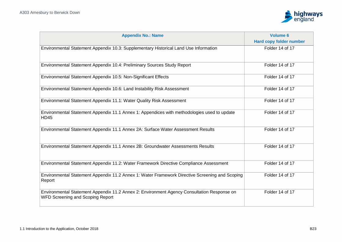
Environmental Statement Appendix 10.3: Supplementary Historical Land Use Information Folder 14 of 17
Environmental Statement Appendix 10.4: Preliminary Sources Study Report Folder 14 of 17
Environmental Statement Appendix 10.5: Non-Significant Effects Folder 14 of 17
Environmental Statement Appendix 10.6: Land Instability Risk Assessment Folder 14 of 17
Environmental Statement Appendix 11.1: Water Quality Risk Assessment Folder 14 of 17
Environmental Statement Appendix 11.1 Annex 1: Appendices with methodologies used to updateHD45
Folder 14 of 17
Environmental Statement Appendix 11.1 Annex 2A: Surface Water Assessment Results Folder 14 of 17
Environmental Statement Appendix 11.1 Annex 2B: Groundwater Assessments Results Folder 14 of 17
Environmental Statement Appendix 11.2: Water Framework Directive Compliance Assessment Folder 14 of 17
Environmental Statement Appendix 11.2 Annex 1: Water Framework Directive Screening and ScopingReport
Folder 14 of 17
Environmental Statement Appendix 11.2 Annex 2: Environment Agency Consultation Response onWFD Screening and Scoping Report
Folder 14 of 17
A303 Amesbury to Berwick Down
1.1 Introduction to the Application, October 2018 B24
Appendix No.: Name Volume 6Hard copy folder number
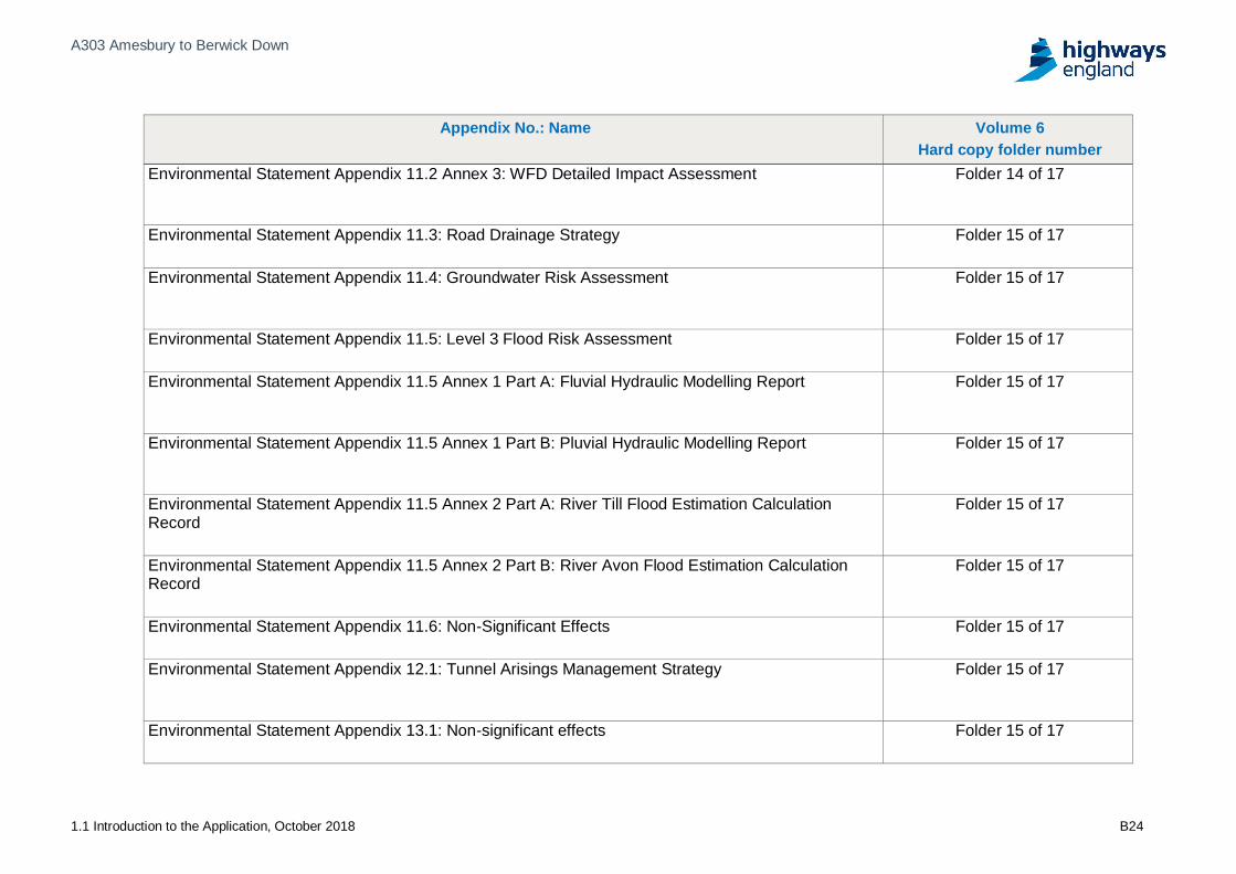
Environmental Statement Appendix 11.2 Annex 3: WFD Detailed Impact Assessment Folder 14 of 17
Environmental Statement Appendix 11.3: Road Drainage Strategy Folder 15 of 17
Environmental Statement Appendix 11.4: Groundwater Risk Assessment Folder 15 of 17
Environmental Statement Appendix 11.5: Level 3 Flood Risk Assessment Folder 15 of 17
Environmental Statement Appendix 11.5 Annex 1 Part A: Fluvial Hydraulic Modelling Report Folder 15 of 17
Environmental Statement Appendix 11.5 Annex 1 Part B: Pluvial Hydraulic Modelling Report Folder 15 of 17
Environmental Statement Appendix 11.5 Annex 2 Part A: River Till Flood Estimation CalculationRecord
Folder 15 of 17
Environmental Statement Appendix 11.5 Annex 2 Part B: River Avon Flood Estimation CalculationRecord
Folder 15 of 17
Environmental Statement Appendix 11.6: Non-Significant Effects Folder 15 of 17
Environmental Statement Appendix 12.1: Tunnel Arisings Management Strategy Folder 15 of 17
Environmental Statement Appendix 13.1: Non-significant effects Folder 15 of 17

A303 Amesbury to Berwick Down
1.1 Introduction to the Application, October 2018 B25
Appendix No.: Name Volume 6Hard copy folder number
Environmental Statement Appendix 13.2: Human Health Folder 15 of 17
Environmental Statement Appendix 14.1: Climate resilience baseline Folder 15 of 17
Environmental Statement Appendix 14.2: Summary of climate impact effects Folder 15 of 17
Environmental Statement Appendix 15.1: Matrix of other development Folder 15 of 17
Environmental Statement Appendix 15.2: Assessment matrix Folder 15 of 17

If you need help accessing this or any other Highways England information,please call 0300 123 5000 and we will help you.
© Crown copyright 2018.You may re-use this information (not including logos) free of charge inany format or medium, under the terms of the Open GovernmentLicence. To view this licence:visit www.nationalarchives.gov.uk /doc/open-government-licence/write to the Information Policy Team, The National Archives,Kew, London TW9 4DU, or [email protected].
This document is also available on our website at www.gov.uk /highways
If you have any enquiries about this document email [email protected] call 0300 123 5000*.
*Calls to 03 numbers cost no more than a national rate call to an 01 or02 number and must count towards any inclusive minutes in thesame way as 01 and 02 calls.These rules apply to calls from any type of line including mobile, BT, other fixed line orpayphone. Calls may be recorded or monitored.