alaska seismic hazards safety commissionseismic.alaska.gov/download/ashsc_meetings_minutes/… ·...
TRANSCRIPT

Alaska Seismic Hazards Safety Commission
Report to the Governor and State LegislatureFEBRUARY 2011
Government Hill School in Anchorage was destroyed by a landslide triggered by the 1964 great Alaska earthquake. Because the earthquake occurred at 5:36 p.m. on Good Friday, no students were in the school and no injuries resulted. School seismic safety is a centerpiece of the Commission’s policy recommendations. Photo from USGS Photo Archive.


ALASKA SEISMIC HAZARDS SAFETY COMMISSIONReport to the Governor and Legislature
FEBRUARY 2011
EXECUTIVE SUMMARY
This annual report to the Governor and Legislature from the Alaska Seismic Hazards Safety Commission (ASHSC) reiterates the priority issues and goals of the Commission and identifies its 2010 accomplishments. The report updates the history and status of the Commission, identifies the current membership, lists the accomplishments to date, describes various committee functions, and presents the Commission’s recommendations to improve seismic safety in Alaska.
The Federal Emergency Management Agency (FEMA) has estimated in FEMA 366-HAZUS MH Estimated Annualized Earthquake Losses in the United States that with its present infrastructure and policies, Alaska will have the second highest average annualized earthquake-loss ratio (ratio of average losses to infrastructure) in the country. Reducing these losses requires public commitment to earthquake-conscious siting, design, and construction. The Seismic Hazards Safety Commission is committed to addressing these issues. Earthquake-risk mitigation measures developed by similar commissions in other states have prevented hundreds of millions of dollars in losses and significant reductions in casualties when compared to other seismically active areas of the world that do not implement effective mitigation measures.
The Commission operates under the powers and duties prescribed by its enacting legislation (Appendix A) and is guided by its Charter (Appendix B) which provides a clear understanding of the Commission’s roles and expectations, empowers Commission members, and provides operating guidelines agreed to by all members.
During the past year the Commission has invited numerous governmental and private organizations to give presentations describing their approaches to seismic risk mitigation. These briefings have provided the members of the Commission with opportunities to gain an understanding of current programs and various approaches to seismic risk mitigation, to identify areas of concern, and to focus initial mitigation efforts in these areas. Most of these briefings are available for viewing on the Commission website (http://www.seismic.alaska.gov).
The Commission’s efforts in 2010 have reinforced its belief that seismic risk mitigation issues can be addressed in an economical way that will result in improving the quality of life and public safety in Alaska. The Commission presents the following policy recommendations:
Policy Recommendation 1:Given that schools in Alaska serve not only as educational facilities but also as gathering places for the general public, and that many are designated as emergency shelters in case of a natural disaster, the Commission recommends that the State appropriate the resources necessary to identify those school facilities most at risk from earthquakes.
Policy Recommendation 2:The Commission recommends that all future school design, construction, and major renovation project funding include monies allotted for seismic risk mitigation tasks, to include:
• Seismic design by a structural engineer proficient in the design and detailing required for earthquake engineering tasks.

2 Alaska Seismic Hazards Safety Commission Report to the Governor and State Legislature
• An independent peer review of seismic design calculations and detailing by a qualified structural engineer.
• On-site observation of as-constructed earthquake engineering details during construction by a qualified inspector to ensure they are constructed in accordance with the contract documents.
These and other policy recommendations continue to be addressed through the following Commission Standing Committees:
• Insurance• Schools• Earthquake Scenarios• Education and Outreach• Hazards Identification• Response and Recovery• Partnership
The 2010 activities of these committees are described in more detail in subsequent paragraphs.
Our basic public-policy goal areas remain unchanged from the 2008 Commission report:• Education • Guidance• Assistance• Implementation
INTRODUCTION
The Alaska Seismic Hazards Safety Commission (“the Commission”) is charged by statute (AS 44.37.067; Appendix A) to recommend goals and priorities for seismic hazard mitigation to the public and private sectors; recommend policies to the Governor and the Legislature, including needed research, mapping, and monitoring programs; review the practices for recovery and reconstruction after a major earthquake; recommend improvements to mitigate losses from similar future events; and to gather, analyze, and disseminate information of general interest on seismic hazard mitigation, among other duties, to reduce the state’s vulnerability to damage from earthquakes.
The Commission consists of eleven members appointed by the Governor from the public and private sectors for three-year terms. It is administered by the Department of Natural Resources, Division of Geological & Geophysical Surveys (DGGS).
Commission members include: A representative from the University of Alaska, three representatives from local government; a representative from the Department of Natural Resources; a representative of the Division of Homeland Security and Emergency Management; a representative from an appropriate federal agency; a representative of the insurance industry; and three members of the public who are experts in the fields of geology, seismology, hydrology, geotechnical engineering, structural engineering, emergency services, or planning. Six members constitute a quorum. The Commission membership elects its own chair and vice-chair. There is no executive director, although DGGS provides administrative, travel, and publication support.

February 2011 3
HISTORY AND STATUS OF THE COMMISSION
In 2002, the 22nd Alaska Legislature passed, and the Governor signed into law, House Bill 53 establishing the Alaska Seismic Hazards Safety Commission with nine members. The legislation originally placed the Commission in the Office of the Governor, but in January 2003, Governor Frank Murkowski issued Executive Order Number 105 transferring the Commission to the Department of Natural Resources. Governor Murkowski appointed the first nine members to the Commission in 2005.
In 2005, the Alaska House of Representatives passed House Bill 83 (HB 83) to extend the Commission to June 30, 2008, add tsunami risks to its purview, and provide two additional Commission positions representing local government. In 2006, the Senate passed a substitute version of HB 83 including the two additional local government positions but omitting specific mention of tsunamis in the Commission’s powers and duties. The Senate bill extended the Commission through June 30, 2012. The House concurred with the Senate version and Governor Murkowski signed the bill into law at a Commission meeting on June 16, 2006. Although the revised statute does not specifically include tsunami hazards in the Commission’s powers and duties, the definitions in AS 44.37.069 include tsunami inundation as a seismic hazard. Consequently, the Commission addresses tsunamis in its discussions and recommendations. As a result of passage of HB 83, the Commission currently has 11 members.
The Commission first met on October 28, 2005, at which time it elected a Chair and Vice Chair, listened to briefings from the California Seismic Safety Commission and various state and local agencies in Alaska with responsibilities in earthquake-risk mitigation, and began developing goals and priorities for its activities. There were 12 meetings of the Commission through December 2006, six of which were via teleconference. Since 2006, the Commission has held eight to ten meetings annually, generally all but two of which have been via teleconference. Two-day, face-to-face meetings are held twice annually, normally in Anchorage.
The Commission published its first annual report to the Governor and Legislature on April 18, 2006, and has since published reports annually during the state Legislative sessions. A Commission website posts basic information about its mission, earthquake risk in Alaska, meeting agendas, minutes, presentations, and appropriate links. The website address is:
http://www.seismic.alaska.gov
COMMISSION MEMBERSHIP
Name Representation Contact information
John L. Aho Chair, CH2M HILL Public member 949 East 36th Ave, Suite 500 Anchorage, AK 99508 Phone (907) 230-2432 [email protected]
Gary A. Carver Public member Carver Geologic, Inc. P.O. Box 52 Kodiak, AK 99615 Phone: (907) 487-4551 [email protected]

4 Alaska Seismic Hazards Safety Commission Report to the Governor and State Legislature
Gay O. Dunham Local government City of Valdez P.O. Box 2975 Valdez, AK 99686 Phone: (907) 835-2339 [email protected]
Roger A. Hansen University of Alaska UAF, Geophysical Institute P.O. Box 757320 Fairbanks, AK 99709 Phone: (907) 474-5533 [email protected]
Laura W. Kelly Vice-chair; U.S. Coast Guard Federal agency P.O. Box 195025 Kodiak, AK 99619-5025 Phone: (907) 487-5320 [email protected]
Richard D. Koehler Alaska Department of Div. of Geological & Geophysical Surveys Natural Resources 3354 College Rd. Fairbanks, AK 99709-3707 Phone: (907) 451-5006 [email protected]
Daniel Mahalak Local government Kenai Peninsula Borough Water Resources Manager P.O. Box 2646 Seward, AK 99664-2646 Phone: (907) 224-9515 [email protected]
David E. Miller Local government City and Borough of Sitka 839 Lincoln Street Sitka, AK 99835 Phone: (907) 738-6890 [email protected]
Mark Roberts Alaska Department of Division of Homeland Security & Military & Veterans Affairs Emergency Management P.O. Box 5750 Fort Richardson, AK 99505 Phone: (907) 428-7016 [email protected]
Robert L. (Buzz) Scher Public member R&M Consultants, Inc. 9101 Vanguard Drive Anchorage, AK 99507 Phone: (907) 522-1707 [email protected]

February 2011 5
Gayle L. White Insurance industry State Farm Insurance Co. 3340 Spinnaker Drive Anchorage, AK 99516 Phone: 907-261-3871 [email protected]
EARTHQUAKE RISK IN ALASKA
Alaska has more earthquakes than any other region of the United States and is, in fact, one of the most seismically active areas of the world. The devastating January 2010 earthquake in Haiti is a grim reminder of what can happen when a society is not prepared for the furies of nature. The second largest earthquake ever recorded occurred on the Prince William Sound portion of the Alaska–Aleutian megathrust in southern Alaska on March 27th, 1964, with a moment magnitude of 9.2. The largest on-land earthquake in North America in almost 150 years occurred on the Denali fault in central Alaska on November 3rd, 2002, with a magnitude of 7.9. In February through October, 2010, the Alaska Earthquake Information Center recorded 26,077 earthquakes, for an average of 2,900 monthly, including 270 events with magnitude 4.0 or greater, 35 events of magnitude 5.0 or greater and 8 events of magnitude 6.0 or greater. It is not possible to predict the time and location of the next big earthquake, but the active geology of Alaska guarantees that major, potentially damaging earthquakes will continue to occur. The risks to public safety and infrastructure from these future events can be greatly reduced through proper planning, design, and construction.
Alaska has changed significantly since the great 1964 earthquake. The population has more than doubled, but many new buildings are designed to prevent collapse during intense shaking. Some older buildings have been reinforced, and development has been discouraged in some particularly hazardous areas. However, despite these improvements, and because practices to reduce vulnerability to damage from earthquakes and tsunamis are not applied uniformly in regions of high risk, future earthquakes may still cause life-threatening damage to buildings, cause items within buildings to be dangerously tossed about, and disrupt the basic utilities and critical facilities that we take for granted.
In addition to the 1964 and 2002 ruptures, there are other sources of potentially damaging earthquakes in Alaska. These include the Castle Mountain fault in the lower Matanuska–Susitna valley, the Wadati–Benioff zone beneath Anchorage, the active belt of faulting and folding in northern Cook Inlet, the Fairbanks seismic zone, and the Yakataga seismic gap near Yakutat, among others. While the seismic provisions of current Alaska building codes are largely geared toward preventing collapse from the types of shaking that occurred in 1964, earthquakes on these other sources may affect structures differently, in ways that may or may not be ameliorated by the current codes.
Earthquakes of magnitudes that could cause major structural damage and injury to residents continue to occur in Alaska. The interested reader is directed to Appendix C for additional information concerning Alaska earthquake activity in 2010.
SOME ADDITIONAL EARTHQUAKE STATISTICS FOR ALASKA
• Eleven percent of the world’s recorded earthquakes have occurred in Alaska.• Alaska has more frequent earthquakes than the rest of the United States combined.• Three of the eight largest earthquakes in the world were in Alaska.• Seven of the ten largest earthquakes in the United States were in Alaska.

6 Alaska Seismic Hazards Safety Commission Report to the Governor and State Legislature
Since 1900, Alaska has had an average of:
• One “great” (magnitude 8 or larger) earthquake every 13 years.• One magnitude 7 to 8 earthquake every two years.• Six magnitude 6 to 7 earthquakes per year.• Fifty magnitude 5 to 6 earthquakes per year.• Three hundred magnitude 4 to 5 earthquakes per year.• Approximately 2,000 earthquakes recorded in Alaska each month.
It is not possible to predict the time and location of the next big earthquake, but the active geology of Alaska guarantees that major potentially damaging earthquakes will continue to occur. Scientists generally know where large earthquakes are most likely to occur, and have mapped the probable levels of ground shaking to be expected in the state (see centerfold map). With this information, as well as information on soil properties and landslide potential, it is possible to estimate earthquake risks in any given area. It is also possible to estimate the potential for earthquakes to generate tsunamis, and to model the extent to which tsunamis will inundate coastal areas.
COMMISSION ACCOMPLISHMENTS IN 2010
The Commission’s standing committees continued to be active in 2010. Sam Kito from the Alaska Department of Education and Early Development continued to assist the Schools Committee and Joanne Bennett from the Alaska Division of Insurance has been an active participant on the Insurance Committee. Both of these individuals bring a wealth of experience to committee activities.
2010 accomplishments include:
1. Held five telephonic and two face-to-face (two day) meetings of the Commission.2. Participated in the following briefings on seismic risk mitigation from the following agencies and
discussed the Commission’s activities as they relate to work being accomplished elsewhere:a. United States Geological Survey (USGS) Advanced National Seismic System (ANSS)
(1) Up-to-date Synopsis of Alaska Seismic Network Issues—Bill Leath/USGS(2) Future of the Strong Motion Program in Alaska—Erol Kalkan/USGS
b. Alyeska Pipeline Service Company and Alaska Earthquake Information Center (AEIC)(1) Seismic Monitoring of the Alyeska Pipeline—Jim Roddick/Alyeska, Roger Hansen/AEIC
c. Alaska Division of Geological & Geophysical Surveys (ADGGS)(1) Active Fault Identification in Alaska and Haiti Earthquake Briefing—Rich Koehler/ADGGS
d. Oregon Department of Geology and Mineral Industries (DOGAMI)(1) Seismic Risk Mitigation in Oregon Schools—Yumei Wang/DOGAMI
e. California Earthquake Authority (CEA)(1) Earthquake Insurance—Glenn Pomeroy/CEA
f. West Coast and Alaska Tsunami Warning Center (WCATWC)(1) Update of WCAWTC Activities—Bill Knight/WTCTWA
g. United States Geological Survey (USGS)(1) Earthquake Hazards Work in Alaska—Peter Haeussler/USGS
h. Alaska Department of Natural Resources (ADNR)(1) Proposed Underground Natural Gas Storage Facility Permitting—Tom Crafford/ADNR
i. Chugach Electric Association (CEA)(1) Utilities Seismic Risk Mitigation Activities—Kevin Dunham/CEA

February 2011 7
3. The Commission sponsored, in conjunction with the Earthquake Engineering Research Institute and the University of Alaska Anchorage School of Engineering, the Joyner Lecture presented by Art Frankel/USGS, titled Progress and Controversy in Seismic Hazard Mapping.
4. The Commission Chair gave 1-hour earthquake briefing presentations to each of the following organizations:a. Alaska Partnership for Infrastructure Protection (APIP)b. Chugach Electric Association (CEA)c. Pioneers of Alaska Igloos 4 and 15d. Alaskan Command and Joint Task Force-Elmendorf AFB
5. The Commission Chair prepared the training material for a 2-day Commission-sponsored course on Post-disaster Safety Assessment of Facilities, for presentation February 23–24, 2011.
6. The Commission Chair developed and facilitated a meeting of other state seismic risk mitigation agency members at the 2010 annual meeting of the Western States Seismic Policy Council (WSSPC) in Denver, Colorado. Attendees included representatives from Alaska, California, Colorado, Hawaii, Nevada, Oregon, Utah, Washington, the Federal Emergency Management Agency (FEMA), and the Western States Seismic Policy Council (WSSPC).
7. Developed and published the fifth annual report to the Governor and Legislature in January 2010.8. The Commission began discussions with the Kodiak Island Borough concerning developing an
earthquake planning scenario to be used as a tool for developing seismic risk mitigation policies and response plans.
9. Collaborated with the Alaska Board of Education and Early Development (ADEED) in developing a new capital improvement project application form for districts that specifically addresses seismic issues. Continued working with ADEED to prioritize the identification of schools at greatest seismic risk.
10. Communicated with other state seismic hazard safety commissions, including Oregon’s, to identify best means for improving the seismic safety of schools. Topics included legislation, identification, prioritization, funding, and retrofit.
11. Established a link with the Division of Insurance to their publication: 2009 Homeowners Insurance Guide, which includes a section on earthquake insurance.
12. Established a liaison with the Division of Insurance to develop a relationship to facilitate pursuit of Insurance Committee goals.
13. Exercised the procedure for convening the Commission rapidly in the event of a significant seismic event in the State to provide immediate advice to the Governor during the incident response and recovery phase. The procedure was successfully exercised during the Statewide Tsunami Warning test on March 24, 2010, and during the Statewide Alaska Shield/Northern Edge Exercise the week of April 26–30, 2010.
14. Reviewed and sent forward to the entire Commission for comment, the seismic sections of the draft State Hazard Mitigation Plan 2010 update. The seismic hazard descriptions, goals, and objectives were reviewed and revised by the entire Commission and forwarded to the State Division of Homeland Security and Emergency Management for inclusion in the FEMA-approved State plan.
15. Provided an opportunity for the Commission to review the seismic sections of community Emergency Operations Plans as requested.
16. Provided an opportunity for Commissioners to enroll in and complete the National Incident Management System (NIMS) training in Incident Command System course 100 (ICS 100) in a step to bring the Commission into accreditation with federal and State NIMS requirements.
17. Co-sponsored a training course on hospital structural and non-structural earthquake mitigation for the primary healthcare providers in Southcentral Alaska.
18. Continued to support Commission representation on the State Hazard Mitigation Advisory Committee (SHMAC) that advises the Governor’s Disaster Policy Cabinet on use of State mitigation funds, policy, and planning.

8 Alaska Seismic Hazards Safety Commission Report to the Governor and State Legislature
COMMITTEE ACTIVITIESSchools Committee
Assessing and minimizing loss due to structural instability of critical facilities in the event of a major seismic incident is a major priority of the Commission. Critical facilities of concern are schools, hospitals, clinics; fire, rescue, and police stations; plus jails and detention facilities. Other important infrastructure at potential risk also includes military bases, airports, college complexes, harbors, and utility systems (communications, electric, oil, transportation, water, and wastewater). Schools remain a major focus, however, due to the number of facilities within the state, their high occupancies, and common designation as emergency shelters (see centerfold map).
In an effort to begin mitigating earthquake risk to critical facilities, the following approaches for addressing the issue include:
• Assist in prioritizing the identification and mitigation of at-risk facilities; initially focusing on schools, due to high occupancies and common use as emergency shelters.
• Develop work plan(s) in collaboration with state and local agencies/governments.• Advocate cost-benefit analyses for both existing and new construction. • Identify current legislation/programs, including those adopted by other states/countries. Foster
contacts with successful proponents.• Identify pertinent code and construction requirements and potential limitations.• Recommend improvements including policy changes, legislation, and public outreach.
The Commission believes that focusing on schools will provide the greatest potential cost/benefit to the State. Schools, especially in smaller communities, tend to be some of the most important and most heavily occupied structures. Collapse during an earthquake would not only be devastating to the occupants, but also to the recovery of a community if the structure could no longer be used for emergency shelter in Alaska’s harsh climate and isolated communities. Globally, schools are becoming the main focus for prioritizing structural mitigation, especially given widespread collapses during recent earthquakes in China (2008) and Haiti (2010). Even damage to schools during past smaller U.S. earthquakes, such as the 2001 Nisqually (Seattle) Earthquake, have highlighted the need.
Schools Committee Activities in 2010:
• Collaborated with the Alaska Department of Education and Early Development (ADEED) in developing a new capital improvement project application form for districts that specifically addresses seismic issues. Requirements were added to include costs to professionally assess seismic hazards, and mitigate seismic risk via investigation, design, and special construction inspections for any major project involving a school facility. The recommended changes are scheduled for implementation in 2012.
• Continued working with ADEED to prioritize identifying schools at greatest seismic risk.• Communicated with other state seismic hazard safety commissions, including Oregon’s, to identify
best means for improving the seismic safety of schools. Topics included legislation, identification, prioritization, funding, and retrofit.
• Arranged for Yumei Wang, Geotechnical Engineer, Oregon Department of Geology and Mineral Industries, to speak to the Commission about Oregon’s public schools and emergency facilities seismic-risk mitigation program.

February 2011 9
Schools Committee Plan for 2011 (see pages 16–17 for map showing public schools and earthquake hazards in Alaska):
• Continue work with ADEED to identify existing at-risk school structures and prioritize seismic mitigation.
• Maintain and foster relationships with other organizations and commissions involved with improving school seismic safety.
• Further review state policies and procedures related to constructing and maintaining critical facilities and infrastructure, with a focus on identifying and improving resiliency in the event of a major earthquake.
• Continue to seek funding to identify and retrofit critical structures at risk of damage or collapse during a major seismic event.
• Continue to advocate policy changes, legislation, and public outreach that mitigates earthquake risk.
Insurance Committee
As part of the Alaska Seismic Hazard Safety Commission’s Charter, the Insurance Committee seeks to bring awareness of issues concerning availability and its importance to Alaskans through ongoing education. The committee set three goals at the outset of the year. These were:
1. Provide basic information on the ASHSC website that is easily accessible to the above audience concerning earthquake exposures, insurance availability, and personal safety measures. Consider links to other State of Alaska sites.
2. Publish an informational brochure for the public about earthquake and tsunami risks, insurance, and choice. Find venues for distributing this information.
3. Work with the Division of Insurance to provide information on hazards throughout the state, define steps that can mitigate those hazards, and assist as needed to attract additional carriers to the Alaska market who will provide affordable earthquake insurance to citizens throughout the state.
In working toward these goals, the committee this year accomplished the following:
• Presented to the ASHSC a video interview of the Division of Insurance Commissioner about earthquake insurance in Alaska.
• Facilitated a presentation from Glenn Pomeroy, CEO of the California Earthquake Authority, about their unique system and how it might be adapted for Alaska.
• Established a link with the Division of Insurance to their publication, 2009 Homeowners Insurance Guide, which includes a section on earthquake insurance.
• Established a liaison with the Division of Insurance to develop a relationship through which to pursue goals 2 and 3 in the next year.
The white paper originally written for the ASHSC website in 2006 was updated with current information about insurance in Alaska as well as effects felt from the most recent global events.
Earthquake Scenario Committee
An earthquake scenario is a planning tool that helps people understand earthquakes and plan for the future. Earthquake scenarios have been used successfully in several areas of the U.S. to identify weaknesses in the

10 Alaska Seismic Hazards Safety Commission Report to the Governor and State Legislature
built environment as well as vulnerable interdependencies among utility and transportation systems that could result in multiple or cascading failures even if only one system fails. Communities, state and federal agencies, private industry, and emergency response organizations use scenarios as tools to increase public awareness, develop risk-reduction strategies, and plan for response and mitigation. The Western States Seismic Policy Council, in its adopted Policy Recommendation 09-1, recommends “that each member state, province, and territory establish an active program to produce Earthquake Planning Scenarios for areas with high risk of earthquake losses.”
Projected Annualized Earthquake Loss Ratio (AELR) by State from FEMA 366 report.
Earthquake scenarios begin by defining a hypothetical but geologically realistic earthquake suitable for the purpose of the scenario. Depending on the complexity and desired results, a scenario may describe the types and severity of shaking and ground breakage likely to result; the likely impacts to facilities, including types and extent of damage to buildings according to building type and age; and disruptions to utilities and transportation systems. A scenario may also describe secondary effects such as tsunamis, fire, and toxic materials release; estimate the numbers of deaths, injuries, and dollar value of losses by building type; and estimate the long-term business losses and socioeconomic consequences. The resulting information provides the basis for planning earthquake-response exercises, prioritizing and pre-locating response resources, and developing mitigating measures for reducing vulnerability to future earthquakes.
Developing an earthquake scenario requires assembling pertinent geologic and seismologic data for a realistic event, compiling and updating building and utility system inventory information for the affected region, assigning seismic fragilities to the building stock, and assembling current data on population demographics. Loss-estimation technology such as FEMA’s HAZUS software is often used to model the event, incorporating all the compiled data. The results are then documented in one or more reports and presentations to all interested groups. If done effectively, a scenario helps decision makers visualize specific impacts that are based on currently accepted scientific and engineering knowledge, providing a powerful tool for private industry, government officials, and the general public to develop effective mitigation policies and programs.

February 2011 11
Scenario Committee Activities in 2010
The Earthquake Scenario committee is working on ways to promote the development of scenarios that help identify and mitigate seismic risk in Alaska. During 2010, the committee performed the following tasks:
• Following its plan for 2010 as stated in the Commission’s 2009 annual report, the committee worked toward promoting earthquake scenarios. In view of the limited resources likely available, the committee decided to start with relatively small, community-based scenarios that are limited in scope, such as by focusing on certain types of facilities or small areas.
• In recognition of community interest, recent successful work on school seismic safety, and support from the U.S. Coast Guard, the committee decided to promote and, to the extent possible, support development of a HAZUS Level 2 scenario for the Kodiak area.
• The committee drafted a letter, which was signed and sent by the Commission chair to the Community Development director for the Kodiak Island Borough, offering to help coordinate and oversee development of a scenario as described above.
• FEMA offered to run the HAZUS Level 2 loss estimation for Kodiak once the input data, such as earthquake source model, building inventory, and demographic data, are provided. The committee contacted FEMA to indicate its interest in helping to develop the scenario and to make it clear that the Commission will take an active role in monitoring the process and reviewing the draft products.
Scenario Committee Plan for 2011
The scenario committee will help coordinate a community approach to development of an earthquake scenario for Kodiak, involving scientists, engineers, policy makers, and emergency managers, and soliciting as much volunteer support as possible. The committee will work with the Kodiak Island Borough, U.S. Coast Guard, City of Kodiak, FEMA, and other interested parties to develop the input data needed for a HAZUS Level 2 loss estimation for Kodiak and surrounding area including the Coast Guard base. In moving forward, a significant portion of the effort will be to generate interest and solicit involvement by community organizations, local professionals, and businesses. The committee will consider submitting proposals to the National Earthquake Hazard Reduction Program and Earthquake Engineering Research Institute for support in developing this scenario.
Hazards Identification Committee
Seismic hazards include a number of physical phenomena generated by earthquakes that have the potential to cause damage to the state’s infrastructure and compromise the safety of Alaska’s residents and visitors. The most common and widespread seismic hazard is strong ground motion. Surface fault rupture, seismically triggered landslides and snow avalanches, ground failure including liquefaction, ground settlement, and subsidence, and seiches and tsunamis are also significant seismic hazards in many regions of the state. Identification and characterization of seismic hazards is fundamental to developing mitigation strategies and reducing losses from earthquakes.
The Hazards Identification committee was established to provide guidance through the Commission to the Governor, the Legislature, and the public regarding location and characteristic of the state’s seismic hazards. The committee includes commission members with expertise in earthquake geology, seismicity, engineering, and seismic hazard mitigation.

12 Alaska Seismic Hazards Safety Commission Report to the Governor and State Legislature
The goals of the Hazards Identification Committee are to promote:• Identification and characterization of seismic hazards in Alaska• Definition and description of seismic risks• Seismic risk and hazard research• Dissemination of seismic hazard and risk information to the state and local governments, the public,
business and industry, and the scientific and professional communities.
Hazards Identification Committee Activities in 2010
In 2010 the Hazards Identification Committee focused its efforts on improving the understanding of Alaska’s seismic hazards and the state’s seismic risks. This effort included gathering information and continuing the discussion of the present state of knowledge regarding seismic sources. This effort is directed toward the development of a comprehensive overview of the seismic hazards and risks in Alaska and an approach to effectively communicate this information to private and public users.
One of the primary goals of the ASHSC is reduction of future earthquake losses in Alaska. In 2008 the commission recognized the urgent need to better understand sources of potentially damaging earthquakes in Alaska to meet this goal. In 2009 the Hazards Identification Committee encouraged the State Geologist to resurrect a previously initiated program by the Alaska Division of Geological and Geophysical Surveys (ADGGS) to develop an inventory and database of active and potentially active faults in the state and to initiate a field program aimed at evaluating fault hazards affecting infrastructure development. These efforts are now being addressed by ADGGS with the addition of a new position to their professional staff. This new addition to ADGGS’s professional staff is to complete the database of active and potentially active faults in Alaska in 2011. Committee members were also active in preparing for the Association of Environmental and Engineering Geologists (AEG) annual national meeting to be held in Anchorage in September 2011.
Hazards Identification Committee Plan for 2011
To further address its goals the committee has started the development of a comprehensive white paper summarizing the present state of knowledge of the state’s seismic hazards and risks. A draft of this paper is in progress and partially completed. Completion of the white paper will be one of the principal objectives of the committee in the coming year.
The chair of the Hazards Identification Committee, in collaboration with the newly hired ADGGS paleoseismologist, plan to sponsor and co-chair a technical session and symposium on seismic hazards and risks in Alaska at the Association of Environmental and Engineering Geologists (AEG) annual national meeting in Anchorage in September 2011.
Denali fault displacement on Canwell Glacier.

February 2011 13
Hazards Identification Committee Challenges
One of the principal challenges to seismic hazard identification and risk definition in Alaska is the limited database and lack of a comprehensive inventory of information concerning seismic sources and their characteristics. The size of Alaska, the limited access in much of the state, and the very small community of earthquake scientists and engineers working in the state also present a significant challenge to meeting the goals of the ASHSC Hazards Identification Committee.
Response and Recovery Committee
Committee Activities in 2010:
• Exercised the procedure for convening the Commission rapidly in the event of a significant seismic event in the state to provide immediate advice to the Governor during the incident response and recovery phase. The procedure was successfully exercised during the Statewide Tsunami Warning test on March 24, 2010, and during the Statewide Alaska Shield/Northern Edge Exercise the week of April 26–30, 2010. A two-thirds Commission quorum was achieved in both exercise tests. The Committee also hosted a discussion of the Commission’s role in the month following a significant seismic event including draft proposed legislation and policy recommendations.
Denali fault earthquake schedule for response team investigations (photo by John Aho).
• Reviewed and sent forward to the entire Commission for comment, the seismic sections of the draft State Hazard Mitigation Plan 2010 update. The seismic hazard descriptions, goals, and objectives were reviewed and revised by the entire Commission and forwarded to the State Division of Homeland Security and Emergency Management for inclusion in the FEMA-approved State plan.
• Provided an opportunity for the Commission to review the seismic sections of community Emergency Operations Plans as requested.

14 Alaska Seismic Hazards Safety Commission Report to the Governor and State Legislature
• Participated in the curriculum revision and training schedule for the State Post Disaster Damage Assessment (PDDA) program.
• Provided an opportunity for Commissioners to enroll in and complete the National Incident Management System (NIMS) training in Incident Command System course 100 (ICS 100) in a step to bring the Commission into accreditation with federal and State NIMS requirements.
• Co-sponsored a training course on hospital structural and non-structural earthquake risk mitigation for the primary healthcare providers in south-central Alaska.
• Continued support for Commission representation on the State Hazard Mitigation Advisory Committee (SHMAC) that advises the Governor’s Disaster Policy Cabinet on use of State mitigation funds, policy, and planning.
• Continued support for Commission representation on the Alaska Partnership for Infrastructure Protection (APIP), an Alaska Emergency Management–private sector stakeholder partnership.
Planned Committee Activities in 2011:
• Refine the Commission’s role one month and six months following a significant seismic event in the state, including draft legislation and policy recommendations that can be proposed.
• Draft a “Continuity of Operations” (COOP) plan to provide for continuing critical Commission functions in the event of an interruption of standard Commission operation.
• Provide an annual review of the seismic sections of the State Hazard Mitigation Plan goals that related to the Seismic Safety Hazards Commission.
• Co-sponsor Post Disaster Damage Assessment (PDDA) training in Anchorage in 2011.• Co-sponsor earthquake structural and non-structural mitigation training in Fairbanks in 2011.• Co-sponsor PDDA training in Fairbanks in 2011.• Support planning for the 2014 anniversary of the 1964 great Alaska earthquake to include training
and outreach on earthquake and tsunami emergency response.• Continue the Commission’s availability for review of seismic sections of community emergency
operations plans.• Continue the Commission’s availability for consultation on emergency response exercises to seismic
events.• See all Commissioners successfully complete the Incident Command System (ICS) 100 course.• Develop a post earthquake data clearinghouse process that sets in place a procedure, structure, and
organization to capture—for Alaska State use—all data, photos, records, and notes produced from post earthquake investigations conducted in Alaska following a significant seismic event.
• Test the Commission’s significant earthquake incident procedure during the March 2011 tsunami warning “live code” test during Tsunami Awareness week—the week of the anniversary of the 1964 great Alaska earthquake.
Education and Outreach Committee
The committee continues to focus on developing information for the Governor’s office, Legislators, administrative agencies, local governments, local emergency planning groups, and industry groups. Activities were somewhat limited due to the Committee Chair spending much of his time outside of Alaska as a member of the Gulf Oil Spill cleanup advisory team.

February 2011 15
Education and Outreach Committee Activities in 2010
Activities included:
• Working with the University of Alaska Anchorage School of Engineering, the Earthquake Engineering Research Institute and Art Frankel of the USGS to have the 2010 Joyner Lecture—Progress and Controversy in Seismic Hazard Mapping—presented in Anchorage.
• Delivered earthquake briefing presentations to several public, private, and Federal agencies. • Continued to work with the Earthquake Engineering Research Institute on sponsorship of the 2014
National Conference on Earthquake Engineering to be held in Anchorage, Alaska.
One of the Denali fault earthquake response teams in Mentasta, Alaska (photo by John Aho).
Committee Plan for 2011
The committee will continue to address the following items:
• Complete development of the Post Disaster Safety Assessment Training Program• Present training for individuals interested in the training program noted above.• Continue to have briefings from outside interests that are concerned with seismic risk mitigation
issues.• Continue to present earthquake briefings as requested.• Develop an informative brochure that describes the Commission and its activities.• Develop an Alaska Seismic Hazards Safety Commission (ASHSC) Glossary of Terms• Work with the University of Alaska Anchorage and the Earthquake Engineering Research Institute
to invite the 2011 Joyner Lecturer to Anchorage for their presentation.
Partnership Committee
The Commission’s enacting legislation charges them to “establish and maintain necessary working relationships with other public and private agencies.” The purpose of the ASHSC Partnership Committee is to investigate potential relationships.


18 Alaska Seismic Hazards Safety Commission Report to the Governor and State Legislature
The basic goals of developing partnerships are to:
• Promote combined efforts to reduce the loss of life and property• Conduct education efforts to motivate key decision makers to reduce risks associated with earthquakes• Foster productive connections between scientists, critical infrastructure providers, businesses, and
government agencies to improve the viability of communities after an earthquake event.
Partnership Committee Activities in 2010
The committee was involved in the following activities:
• The ASHSC Chair developed the agenda and facilitated a meeting of seismic commission and agency individuals at the Western States Seismic Policy Council (WSSPC) annual meeting in Denver, Colorado
• Continued to address planning aspects for the 2014 National Conference on Earthquake Engineering.• Became actively involved in the Alaska Partnership for Infrastructure Protection (APIP).• Through involvement in APIP, the ASHSC Chair was asked to give several earthquake briefing
presentations during 2010.
Partnership Plan for 2011
The following tasks will be addressed in 2011:
• Will continue to seek partnership opportunities with organizations, agencies, and public entities.• Will make formal contact with seismic safety commissions in other areas of the United States as a
follow-up to the Denver meeting identified above.• Work will continue on the 2014 National Conference on Earthquake Engineering, expected to draw
1,000–1,500 professionals to Anchorage from around the world.• Continue to develop relationships within the Alaska Partnership for Infrastructure Protection (APIP).
SEISMIC-RISK ISSUES BEING ADDRESSED BY THE ALASKA SEISMIC HAZARDS SAFETY COMMISSION
The following issues relating to seismic risk mitigation have served as a guide to developing the path forward for the Commission and for the formation of standing committees.
1. Assess the Structural Stability of Critical Facilities
Description of the Issue: Some existing critical buildings in the state may not be constructed in a manner to withstand future earthquake and tsunami events. A specific concern is school buildings. Hospitals, clinics, and fire, rescue, and police stations across the state are also vulnerable to failure. Also at possible risk are large Federal, State, and private complexes such as military bases, Coast Guard stations, airports, college campuses, harbors, power-generating stations, communication centers, water and waste-water treatment facilities, jails and detention facilities, pipelines, and highways and bridges.
Importance of the Issue: If attention is not brought to bear on this issue before a damaging earthquake or tsunami, communities in the state could see massive structural failure of important community facilities,
February 2011 19
resulting in human casualties, economic loss, and environmental damage. Furthermore, Alaska’s remote nature and extreme weather conditions can cause delays in response efforts and put displaced building occupants at severe risk from exposure. Adequate preparedness is imperative to timely rapid response and recovery from a significant seismic event.
Benefits of Addressing the Issue: Some private and public entities have taken important steps to improve the seismic resistance of key facilities and infrastructure. For example, prior to constructing the Trans-Alaska Pipeline System, Alyeska hired geologists and engineers to specifically address seismic hazards. The resulting design and earthquake-resistant construction prevented the spillage of any oil during the magnitude 7.9 Denali fault earthquake of November 3, 2002. The Alaska Department of Transportation & Public Facilities is undertaking a seismic retrofit program for State-owned bridges, and is focusing on upgrading bridges that provide critical access to communities. Some boroughs and cities across the State have taken the initiative to identify and begin retrofitting seismically vulnerable school buildings and other essential facilities.
Despite the newness of most construction in Alaska and implementation of modern building codes, many buildings and key parts of our infrastructure remain vulnerable due to proximity to seismic hazards, some of which are known and others of which are poorly understood. Building codes continue to change and have been significantly upgraded in the period between 1976 and 1997. The Federal Emergency Management Agency (FEMA) and earthquake consortia such as the Cascadia Regional Earthquake Workgroup (CREW) in the Pacific Northwest have long recognized that addressing the problems prior to a catastrophic event can have longstanding benefits in the future. However, building codes are often inadequately implemented and recommendations of advisory bodies are often ignored.
How the Commission Can/Will Address the Issue: The Commission will encourage mitigation efforts by presenting information about earthquake hazards and risk and suggesting approaches to addressing the strengthening of at-risk critical facilities. Public education must include the correct mix of information on potential damage and suggestions of effective actions to be taken.
2. Address the Importance of Earthquake Insurance
Description of the Issue: Catastrophic natural perils, particularly earthquakes, are unpredictable, relatively infrequent, and can be financially disastrous. Earthquake risk is especially difficult to insure against because insurers are unable to accumulate adequate reserves for losses of such high severity and low frequency.
Importance of the Issue: Insurers are unwilling to provide insurance in a market where premium rates are inadequate to create the reserves necessary to pay for damages in the event of a major earthquake. This can create a severe deficiency in availability of insurance as existing insurers withdraw from the market and new insurers are unwilling to enter.
Benefits of Addressing the Issue: Improved pre-loss mitigation efforts, such as retrofitting existing structures; emergency planning to speed post-loss recovery; and actuarially sound earthquake insurance rates encourage additional insurers to enter the market. This in turn improves availability of insurance products and results in more competitive premiums.

20 Alaska Seismic Hazards Safety Commission Report to the Governor and State Legislature
How the Commission Can/Will Address the Issue: The Commission can encourage development of public–private partnerships that provide education and mitigate the potential impact of future events. We will examine the seismic-hazard information needs of the insurance industry and provide recommendations for improvement.
3. Approaches to Seismic Risk Mitigation in Future Building Construction
Description of the Issue: Sustainable development entails maintaining environmental quality, improving a community’s quality of life, and fostering social equity while maintaining a healthy economy. Therefore, sustainable development includes incorporating disaster resilience and mitigation into a community’s decisions and actions. Building codes normally have a performance goal of life safety, which is considered a minimum safety level, but are typically the maximum level to which buildings are designed. Codes do not appropriately address the effects of ground failure or ground-shaking amplification, or provide guidance to designers and construction contractors.
Importance of the Issue: Communities need to know the potential earthquake risk and impacts at a structure site and should implement appropriate standards to mitigate the identified risk so new buildings are not subjected to the effects of massive ground failure and strong ground shaking.
Benefits of Addressing the Issue: The results of addressing the issue are more effective mitigation and an assurance that countermeasures are not only adequate but that the cost of implementation is not prohibitive.
How the Commission Can/Will Address the Issue: The Commission will encourage continued Federal, State, and private partnerships in updating ground-failure susceptibility mapping of Anchorage, ground shaking characterization in high-risk Alaskan communities, and determination of structural response of buildings and bridges. We will work with the technical community and the construction industry to inform, educate, and work with communities to provide guidance to improve building and land-use codes.
4. Response and Recovery Practices to Mitigate Future Seismic Risk
Description of the Issue: Communities don’t have a good understanding of the costs and resources needed for response and recovery. First responders to a damaging earthquake in one of Alaska’s major cities will be overwhelmed in the initial hours following the event. Damage to transportation systems will make movement of people and goods difficult. Demand for emergency shelter, food, and water will strain a community’s resources. Disruptions to lifeline systems will complicate recovery.
Importance of the Issue: An understanding of response and recovery issues is critical to assessing the impacts to State and local resources.
Benefits of Addressing the Issue: Implementing effective response and recovery practices will reduce economic and social costs of recovery and will help mitigate risks from future events.
How the Commission Can/Will Address the Issue: The Commission will promote and assist in the development and use of “earthquake planning scenarios” to define the impact of future damaging earthquakes and will communicate lessons learned from past events to provide guidance to communities on recovery planning and preparation.
February 2011 21
5. Hazard Identification and Public Education
Description of the Issue: A damaging earthquake has not affected a major population region in Alaska since 1964. The majority of the population is unaware of the consequences of a major seismic event. The 2002 Denali fault earthquake resulted in relatively minor damage to smaller rural communities but had little effect in larger communities such as Anchorage and Fairbanks. It was evident, during damage-assessment evaluations after the Denali fault event, that the residents of the smaller at-risk communities had little understanding of the earthquake hazard, had not implemented measures to mitigate damage, and were unprepared to respond to the consequences of damage. It is important that the population of Alaska be aware of the earthquake hazard and be informed of the measures that can be taken to mitigate risk.
Importance of the Issue: There is a high probability that Alaskans will experience the results of a damaging earthquake in the future. All Alaskans will be better prepared to take preventive measures ahead of time to reduce losses and casualties and to respond to the event if they are informed of, and truly understand, the hazard and the resultant risk.
Benefits of Addressing the Issue: An educated public has a greater potential of responding appropriately before, during, and after a damaging earthquake. Improved knowledge and public awareness of hazard and risk can change behavior and lead to more cost-effective mitigation.
How the Commission Can/Will Address the Issue: The Commission will examine the need for greater public investment in identification and assessment of earthquake hazards, and the most effective ways of communicating this information to the public. The Commission will examine and promote the concept of seismic resilience of communities, addressing reduced failure probabilities, reduced consequences of failure, and reduced time to recovery.
6. Recommended Public-policy Goals of the Commission
a. Education l Develop an effective public education and outreach program. l Convey scientific and technical information from credible authorities. l Communicate information in a manner that is understandable by the public. b. Guidance l Provide advice on seismic risk mitigation and recommend policies to improve preparedness. l Recommend goals and priorities for risk mitigation to public and private sectors. l Recommend needed research, mapping, and monitoring programs. l Offer advice on coordinating disaster preparedness and seismic risk mitigation. c. Assistance l Review seismic- and tsunami-hazard notifications and recommend appropriate response. l Review predictions and warnings and suggest appropriate responses. d. Implementation l Establish and maintain working relationships with other private and public agencies. l Gather, analyze, and disseminate information. l Conduct public hearings. l Appoint committees from Commission membership and/or external advisory committees to
address risk mitigation issues. l Accept grants, contributions, and appropriations.

INTENTIONALLY LEFT BLANK

February 2011 23
APPENDIX A
Alaska Seismic Hazards Safety Commission statute
Sec. 44.37.065. Commission established; membership. (a) The Alaska Seismic Hazards Safety Commission is established in the Department of
Natural Resources. The Department of Natural Resources shall provide staff support to the commission.
(b) The commission is composed of 11 members appointed by the governor for terms of three years. A vacancy is filled for the unexpired term.
(c) The governor shall appoint to the commission (1) a representative from the University of Alaska; (2) three representatives, each from a local government in a separate seismically active
region of the state; (3) a representative from the Department of Natural Resources; (4) a representative from the Department of Military and Veterans’ Affairs; (5) a representative from an appropriate federal agency; (6) a representative of the insurance industry; and (7) three members from members of the public who are expert in the fields of geology,
seismology, hydrology, geotechnical engineering, structural engineering, emergency services, or planning.
(d) The commission shall elect annually from its members a chair and vice-chair. A majority of the commission may vote to replace an officer of the commission.
(e) Six members constitute a quorum. (f) Members of the Alaska Seismic Hazards Safety Commission serve without compensation but
are entitled to per diem and travel expenses authorized for boards and commissions under AS 39.20.180.
Sec. 44.37.067. Powers and duties. (a) The commission shall (1) recommend goals and priorities for seismic hazard mitigation to the public and private
sectors; (2) recommend policies to the governor and the legislature, including needed research,
mapping, and monitoring programs; (3) offer advice on coordinating disaster preparedness and seismic hazard mitigation
activities of government at all levels, review the practices for recovery and reconstruction after a major earthquake, and recommend improvements to mitigate losses from similar future events;
(4) gather, analyze, and disseminate information of general interest on seismic hazard mitigation;
(5) establish and maintain necessary working relationships with other public and private agencies;
(6) review predictions and warnings issued by the federal government, research institutions, and other organizations and persons and suggest appropriate responses at the state and local levels; and
(7) review proposed seismic hazard notifications and supporting information from state agencies, evaluate possible socioeconomic consequences, recommend that the governor

24 Alaska Seismic Hazards Safety Commission Report to the Governor and State Legislature
issue formal seismic hazard notifications when appropriate, and advise state and local agencies of appropriate responses.
(b) The commission may (1) advise the governor and the legislature on disaster preparedness and seismic hazard
mitigation and on budgets for those activities and may recommend legislation or policies to improve disaster preparedness or seismic hazard mitigation;
(2) conduct public hearings; (3) appoint committees from its membership and appoint external advisory committees of ex-
officio members; and (4) accept grants, contributions, and appropriations from public agencies, private foundations,
and individuals.
Sec. 44.37.069. Definitions.In AS 44.37.065 - 44.37.069, (1) “commission” means the Alaska Seismic Hazards Safety Commission; (2) “disaster preparedness” means establishing plans and programs for responding to and
distributing funds to alleviate losses from a disaster as defined in AS 26.23.900 ; (3) “seismic hazard” means an earthquake-induced geologic condition that is a potential danger
to life and property; in this paragraph, “geologic condition” includes strong ground shaking, landslide, avalanche, liquefaction, tsunami inundation, fault displacement, and subsidence;
(4) “seismic hazard mitigation” or “mitigation” mean activities that prevent or alleviate the harmful effects of seismic hazards to persons and property, including identification and evaluation of the seismic hazards, assessment of the risks, and implementation of measures to reduce potential losses before a damaging event occurs;
(5) “tsunami” means a large ocean wave produced by an earthquake, landslide, or volcanic eruption.

February 2011 25 1
Key Success Factors and Measures of Success
Success Factor MeasureStakeholder Satisfaction Facilitate Governor and Legislature understanding of
seismic risk mitigation issues; Meet or exceed SOA expectations; Advice is sought; Advice is accepted; SOA endorsement; and; Positive feedback from staff.
Advocate of Risk Mitigation Provide advocacy for seismic risk mitigation programs; Create opportunities for seismic risk mitigation advocacy; Become familiar with current existing programs; and Develop stakeholder support.
Advocate Public Outreach Programs Encourage social environment where seismic risk mitigation is accepted;
Examine existing programs within the State; and Be available for public education presentations.
Promote Development of Earthquake Scenarios
Complete earthquake scenarios for realistic events in high-risk areas;
Use scenario results to reduce earthquake risk; and Seek community involvement in scenario development and
application of results. Facilitate Partnerships for Seismic risk Reduction
Identify potential partners to assist in addressing Commission goals; and
Involve Federal, State, municipal, and private sector in addressing goals.
Critical Facilities Earthquake Risk Reduction
Assist in prioritizing, identifying, and mitigating risks in facilities with life safety issues;
Develop work plans in collaboration with State and local agencies/governments;
Identify current legislation/programs adopted by other states/countries;
Foster contacts with proponents who have had seismic risk mitigation successes;
Identify pertinent code and construction requirements and potential limitations; and
Recommend improvements including policy changes, legislation, and public outreach.
Earthquake Insurance in Alaska Review current trends and provide advice; Review existing “white paper” and update as appropriate;
and Develop “pros and cons” brochure describing earthquake
insurance issues. Promote Seismic Hazard Identification Identification and characterization of seismic risk hazards;
Definition and description of seismic risks; Seismic risk and hazard research; and Dissemination of seismic risk and hazard information to
State and local governments, the public, and industry and scientific and professional community.

INTENTIONALLY LEFT BLANK
February 2011 27
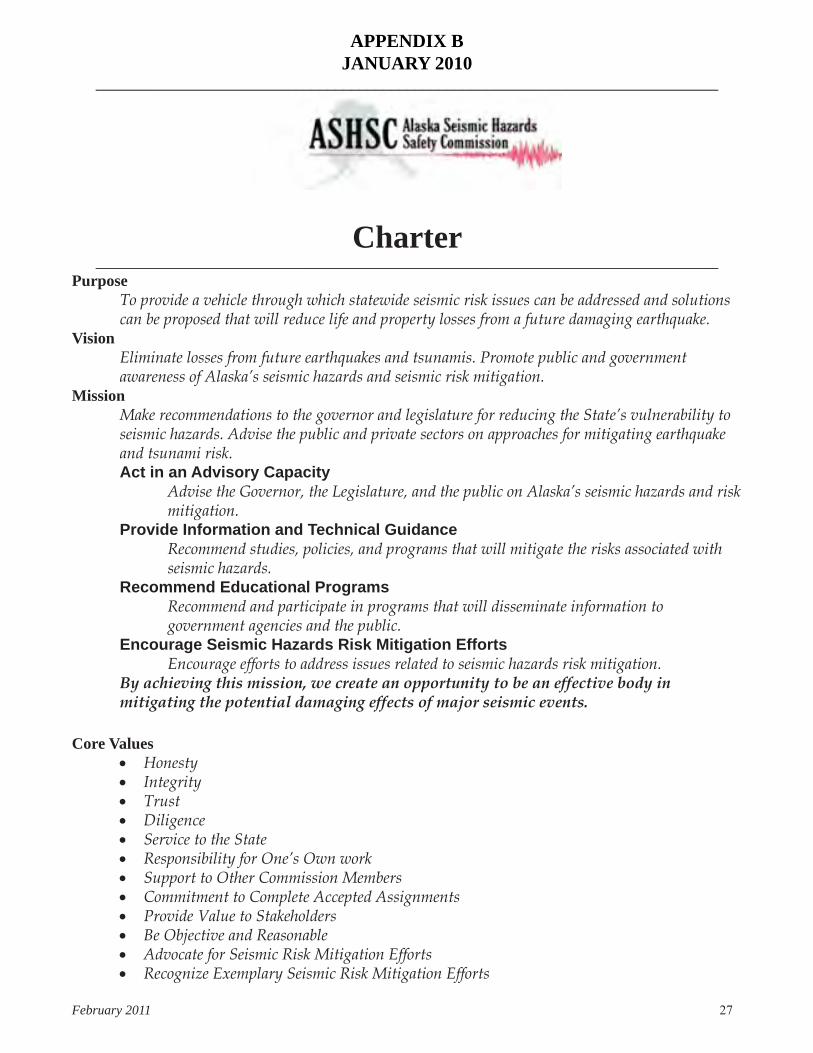
APPENDIX BJANUARY 2010
______________________________________________________________________________
Charter______________________________________________________________________________
PurposeTo provide a vehicle through which statewide seismic risk issues can be addressed and solutions can be proposed that will reduce life and property losses from a future damaging earthquake.
VisionEliminate losses from future earthquakes and tsunamis. Promote public and government awareness of Alaska’s seismic hazards and seismic risk mitigation.
MissionMake recommendations to the governor and legislature for reducing the State’s vulnerability to seismic hazards. Advise the public and private sectors on approaches for mitigating earthquake and tsunami risk.Act in an Advisory Capacity
Advise the Governor, the Legislature, and the public on Alaska’s seismic hazards and risk mitigation.
Provide Information and Technical GuidanceRecommend studies, policies, and programs that will mitigate the risks associated with seismic hazards.
Recommend Educational ProgramsRecommend and participate in programs that will disseminate information to government agencies and the public.
Encourage Seismic Hazards Risk Mitigation EffortsEncourage efforts to address issues related to seismic hazards risk mitigation.
By achieving this mission, we create an opportunity to be an effective body in mitigating the potential damaging effects of major seismic events.
Core Values• Honesty• Integrity• Trust• Diligence• Service to the State• Responsibility for One’s Own work• Support to Other Commission Members• Commitment to Complete Accepted Assignments• Provide Value to Stakeholders• Be Objective and Reasonable• Advocate for Seismic Risk Mitigation Efforts • Recognize Exemplary Seismic Risk Mitigation Efforts

28 Alaska Seismic Hazards Safety Commission Report to the Governor and State Legislature
ENDORSEMENTWe, the members of the Alaska Seismic Hazards Safety Commission, enthusiastically and fully endorse this Commission Charter for guiding and enhancing efforts in natural hazards risk mitigation.
John Aho/Chair Laura Kelly/Vice Chair Gary Carver David Cole Rod Combellick Gay Dunham Roger Hansen David Miller Mark Roberts Gayle White

February 2011 29
APPENDIX C
EARTHQUAKE ACTIVITY IN 2010
Summary Statistics for Regional/Urban Seismic Network (see figure C1)
• Total number of stations operated and/or recorded: 540• Total number of channels recorded: 1,325• Number of short-period (SP) stations: 283• Number of broadband (BB) stations: 154• Number of stations maintained and operated by network: 540• Number of stations maintained and operated as part of ANSS: 130• Total data volume archived (MBytes/day) 9,000
Figure C1. Seismic stations in Alaska.

30 Alaska Seismic Hazards Safety Commission Report to the Governor and State Legislature
Additional Information
From February 1, 2010, through October 31, 2010, the Alaska Earthquake Information Center (AEIC) reported a total of 26,077 events within the combined seismic network (figure C2). The events range in depth from 0 to 260 km, with the deepest earthquakes located in the central Aleutian arc. The magnitude range of reported events is between -0.2 and 6.7. There were 270 events with magnitude 4.0–4.9 (~30 events per month on average); 35 events had magnitude 5.0–5.9 (~4 events per month on average); and eight events had magnitude 6.0 or above. The largest earthquakes (magnitude 6.7) occurred on July 18, 2010, in the Fox Islands region of the Aleutian Islands. The magnitude of completeness of the AEIC earthquake catalog for the reported time period is estimated to be 1.4 for the authoritative region and 2.5 for the Aleutians.
Figure C2. AEIC reported earthquakes between February 1 and October 31, 2010. The box outlines AEIC’s authoritative region for earthquake submissions.
The Alaska Earthquake Information Center recorded an unusual sequence of earthquakes about 260 km (160 miles) west of St. Matthew Island that began on April 30, 2010 (figure C3). The mainshock, magnitude 6.5, occurred on April 30 at 23:11:44 UTC. It was preceded by a magnitude 4.3 foreshock, 1 minute earlier, and followed by a magnitude 6.3 aftershock, 5 minutes later. Due to the offshore location of these earthquakes, only larger events (magnitude 3.5 and greater) can be located. The nearest seismic stations are about 350 miles away, at Gambell and St. Paul. As of May 5, 2010, only 10 aftershocks have been located by AEIC. All have large location uncertainties. Both the mainshock and largest aftershock are strike-slip earthquakes.
The faulting can be associated either with the right-lateral motion on the southwest–northeast-trending fault or the left-lateral motion on the southeast–northwest-trending fault. The central region of the Bering

February 2011 31
Sea is virtually aseismic. In the north a wide, diffuse zone of seismicity extends from western Alaska across the Bering Strait into eastern Russia. This zone is believed to mark the northern boundary of the Bering microplate. The southern edge of the Bering Sea is marked by the Aleutian Arc, where seismicity is associated with the ongoing subduction processes. In 1991, a magnitude 6.6 earthquake occurred about 210 km (150 miles) to the southeast of the April 30, 2010, earthquakes. The 1991 and 2010 earthquakes indicate north–south extension and east–west compression of the crust. The source area of the April 30, 2010, event might be structurally linked to the graben-like structure that underlies the headwall area of the Zhemchug Canyon, which is the largest submarine canyon (by volume) in the world. The structural grain of the headwall structures is northwest–southeast, parallel to the left-lateral nodal plane of the April 30 events. The right-lateral nodal plane is parallel to the crustal fabric of the hypothetical offshore continuation of the great family of northeast–southwest-trending strike-slip faults of western Alaska (Kaltag, Kobuk, Denali, etc.). If these crustal structures continue offshore, they may be the source of the April 30 earthquakes. There were no ‘felt reports’ for these earthquakes.
Figure C3. April 30, 2010, M6.5 and M6.3 Bering Sea earthquakesyellow circles - background seismicitysmall orange stars - past M4.0-4.9 eventsmedium orange stars - past M5.0-5.9 eventslarge orange stars - past M6.0-6.9 eventsred stars - April 2010 events

32 Alaska Seismic Hazards Safety Commission Report to the Governor and State Legislature
A magnitude 6.7 earthquake occurred on Saturday, July 18, 2010, at 9:56 pm AKDT (July 18, 05:56 am UTC) in the Fox Islands region of Alaska (red star farthest to left on figure C4; remaining red stars denote largest aftershocks). It was located 60 km (38 miles) west–southwest of Nikolski and 248 km (155 miles) west–southwest of Dutch Harbor. It was preceded by a magnitude 4 foreshock on July 17 at 14:44 UTC. AEIC located nearly 3,200 aftershocks through the end of July, including about 60 aftershocks with magnitudes 4.0 or greater. The largest aftershock, of magnitude 6.0, occurred on July 18 at 19:48. This is the largest event to occur in the region since the magnitude 6.5 earthquake on October 13, 2009 (yellow star). Magnitude 6.4 earthquakes occurred in the region on May 10, 2006, and December 26, 2007 (yellow stars). The 2006, 2007, and 2009 earthquakes occurred on a convergent boundary between the subducting Pacific and overriding North American crustal plates. This region, where the Pacific plate is being forced beneath the North American plate, is one of the world’s most active seismic zones. In 1957, a magnitude 8.6 Andreanof Islands earthquake ruptured a ~600-km-long portion of the plate boundary in the central Aleutian Islands. The current sequence of earthquakes is above the ruptured portion of the megathrust. The earthquake depths are shallow, indicating that they occurred in the crust of the North American plate.
Based on the waveform modeling, the mainshock and largest aftershocks are characterized by normal faulting on a north-northwest–south-southeast-oriented fault plane. The magnitude 6.7 earthquake was reported felt in Unalaska (intensity IV, light) and Dutch Harbor (intensity II, weak).
Figure C4. July 18, 2010 M6.7 Fox Islands earthquake.
7