an inspire integrate approach to environmental analysis cipolloni.pdf · c. cipolloni, c. iadanza,...
TRANSCRIPT
C. Cipolloni, C. Iadanza, M. Pantaloni, A. Trigila
ISPRA – Geological Survey of Italy
An INSPIRE integrate approach to
Environmental Analysis
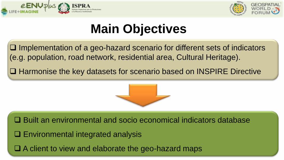
Implementation of a geo-hazard scenario for different sets of indicators
(e.g. population, road network, residential area, Cultural Heritage).
Harmonise the key datasets for scenario based on INSPIRE Directive
Main Objectives
Built an environmental and socio economical indicators database
Environmental integrated analysis
A client to view and elaborate the geo-hazard maps
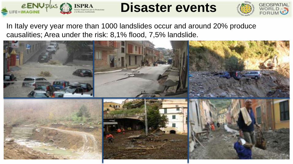
Disaster events
In Italy every year more than 1000 landslides occur and around 20% produce
causalities; Area under the risk: 8,1% flood, 7,5% landslide.
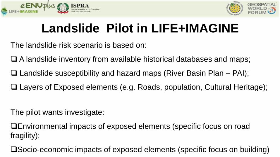
The landslide risk scenario is based on:
A landslide inventory from available historical databases and maps;
Landslide susceptibility and hazard maps (River Basin Plan – PAI);
Layers of Exposed elements (e.g. Roads, population, Cultural Heritage);
The pilot wants investigate:
Environmental impacts of exposed elements (specific focus on road
fragility);
Socio-economic impacts of exposed elements (specific focus on building)
Landslide Pilot in LIFE+IMAGINE
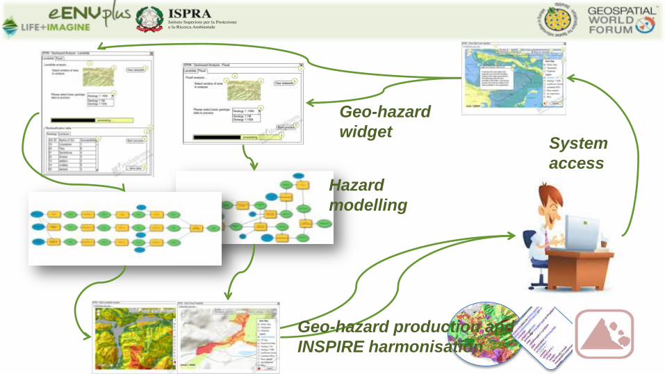
System
access
Geo-hazard
widget
Hazard
modelling
Geo-hazard production and
INSPIRE harmonisation
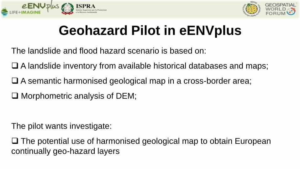
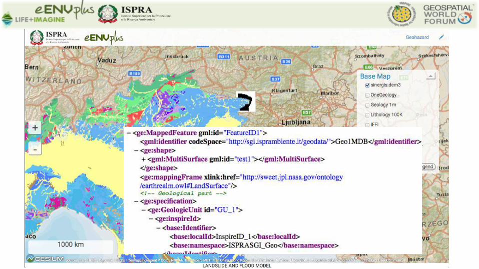
The landslide and flood hazard scenario is based on:
A landslide inventory from available historical databases and maps;
A semantic harmonised geological map in a cross-border area;
Morphometric analysis of DEM;
The pilot wants investigate:
The potential use of harmonised geological map to obtain European
continually geo-hazard layers
Geohazard Pilot in eENVplus
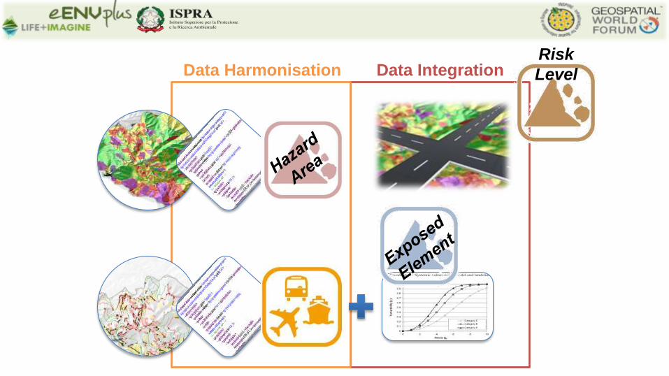
Data Integration Data Harmonisation Risk
Level
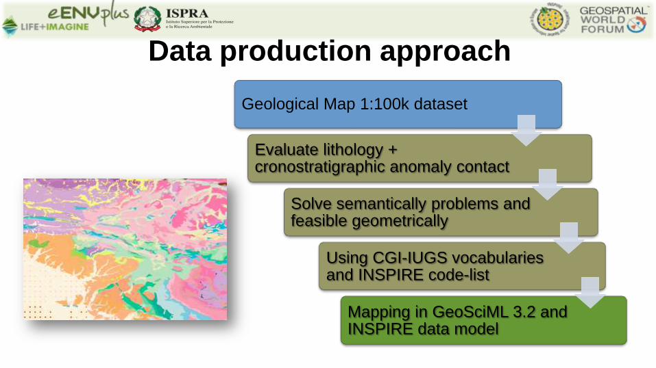
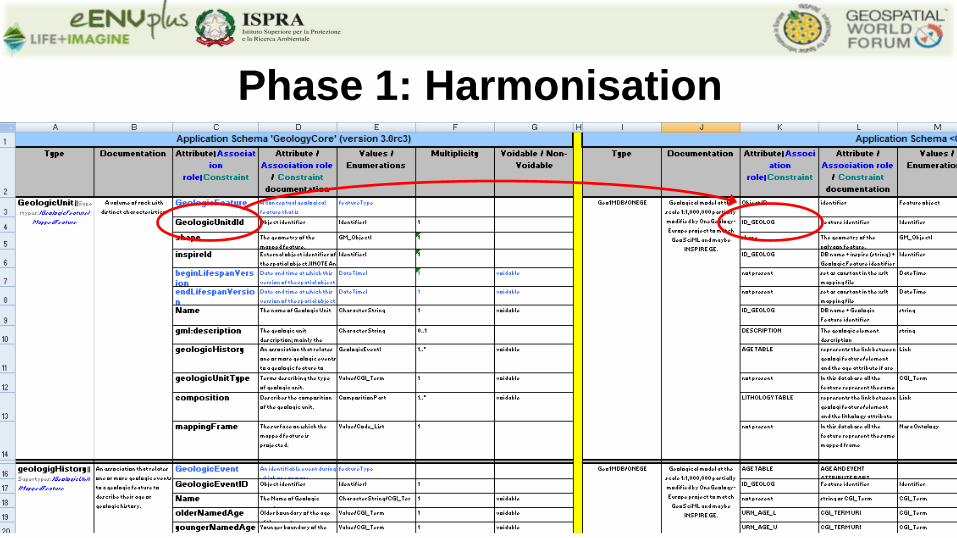
Geological Map 1:100k dataset
Evaluate lithology + cronostratigraphic anomaly contact
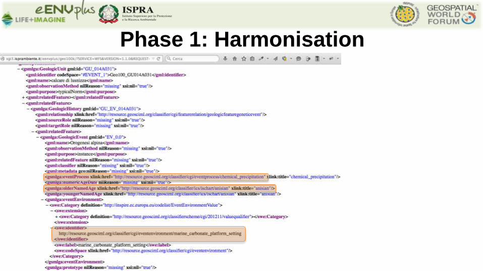
Solve semantically problems and feasible geometrically
Using CGI-IUGS vocabularies and INSPIRE code-list
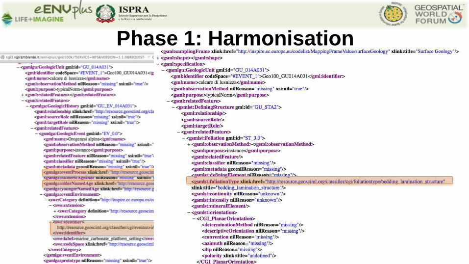
Mapping in GeoSciML 3.2 and INSPIRE data model
Data production approach
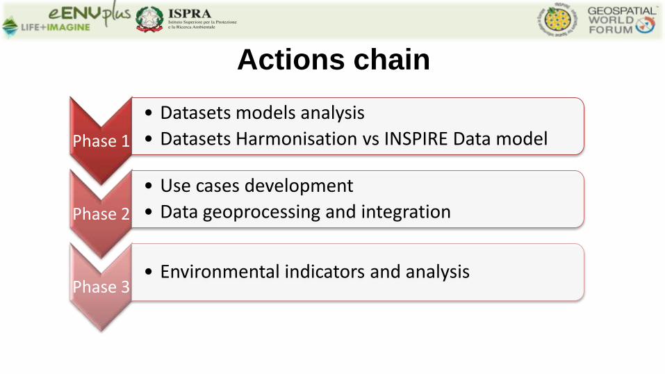
Actions chain
Phase 1
• Datasets models analysis
• Datasets Harmonisation vs INSPIRE Data model
Phase 2
• Use cases development
• Data geoprocessing and integration
Phase 3 • Environmental indicators and analysis
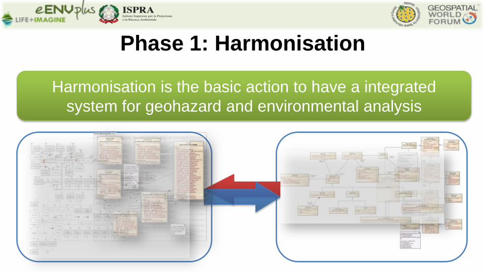
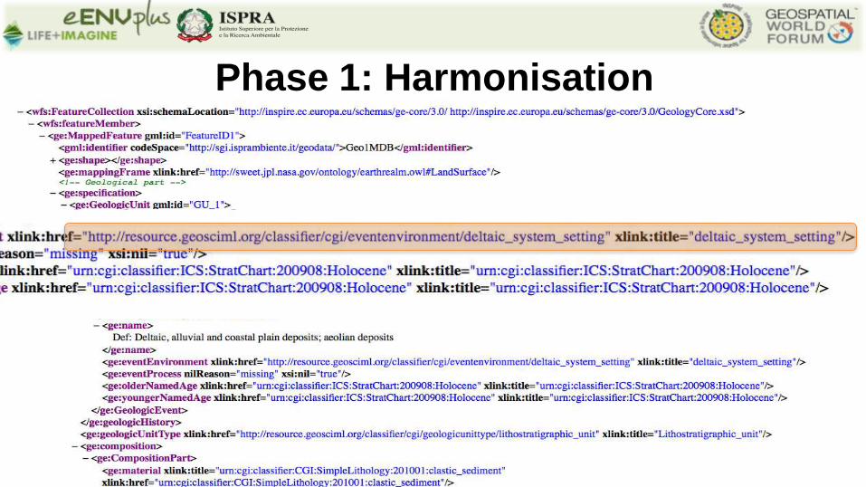
Phase 1: Harmonisation
Harmonisation is the basic action to have a integrated
system for geohazard and environmental analysis
Phase 1: Harmonisation
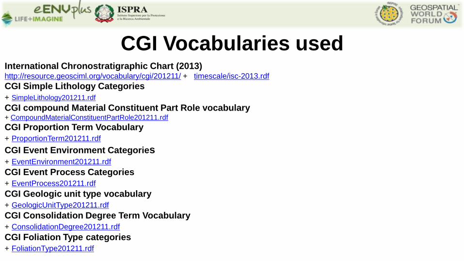
CGI Vocabularies used International Chronostratigraphic Chart (2013) http://resource.geosciml.org/vocabulary/cgi/201211/ + timescale/isc-2013.rdf
CGI Simple Lithology Categories
+ SimpleLithology201211.rdf
CGI compound Material Constituent Part Role vocabulary + CompoundMaterialConstituentPartRole201211.rdf
CGI Proportion Term Vocabulary
+ ProportionTerm201211.rdf
CGI Event Environment Categories + EventEnvironment201211.rdf
CGI Event Process Categories
+ EventProcess201211.rdf
CGI Geologic unit type vocabulary
+ GeologicUnitType201211.rdf
CGI Consolidation Degree Term Vocabulary
+ ConsolidationDegree201211.rdf
CGI Foliation Type categories
+ FoliationType201211.rdf
Phase 1: Harmonisation
Phase 1: Harmonisation
Phase 1: Harmonisation
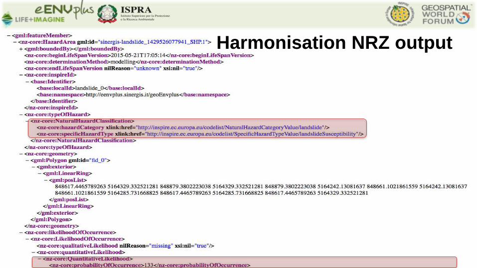
Harmonisation NRZ output
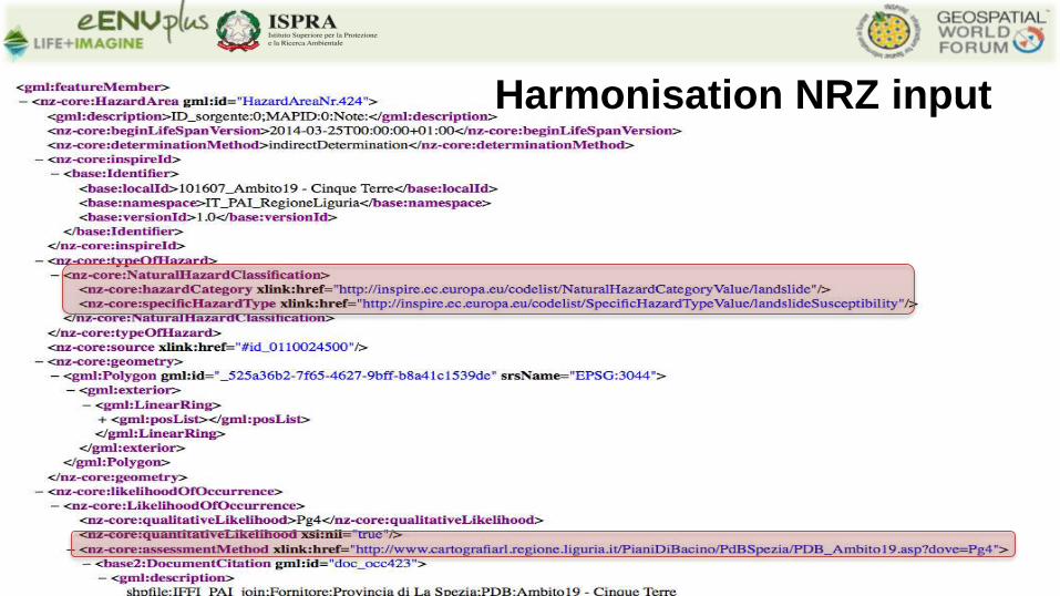
Harmonisation NRZ input
B -
extr
aurb
ana
prin
cipa
le
C -
extr
aurb
ana
seco
ndar
ia
E -
stra
de u
rban
e di
qua
rtie
re
F - s
trad
e lo
cali
(via
b. m
inor
e)
Fbis
- st
rade
cic
lope
dona
li
TOTA
LE
Ferr
ovia
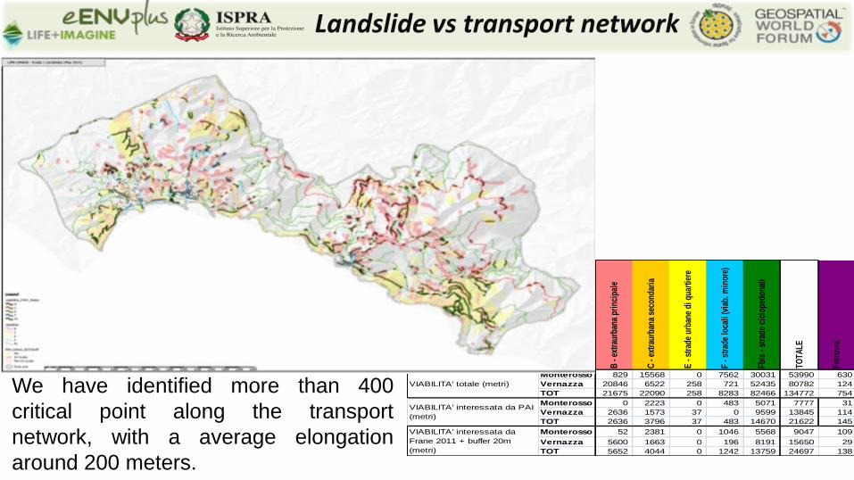
Monterosso 829 15568 0 7562 30031 53990 630
Vernazza 20846 6522 258 721 52435 80782 124
TOT 21675 22090 258 8283 82466 134772 754
Monterosso 0 2223 0 483 5071 7777 31
Vernazza 2636 1573 37 0 9599 13845 114
TOT 2636 3796 37 483 14670 21622 145
Monterosso 52 2381 0 1046 5568 9047 109
Vernazza 5600 1663 0 196 8191 15650 29
TOT 5652 4044 0 1242 13759 24697 138
VIABILITA' totale (metri)
VIABILITA' interessata da PAI
(metri)
VIABILITA' interessata da
Frane 2011 + buffer 20m
(metri)
We have identified more than 400
critical point along the transport
network, with a average elongation
around 200 meters.
Landslide vs transport network
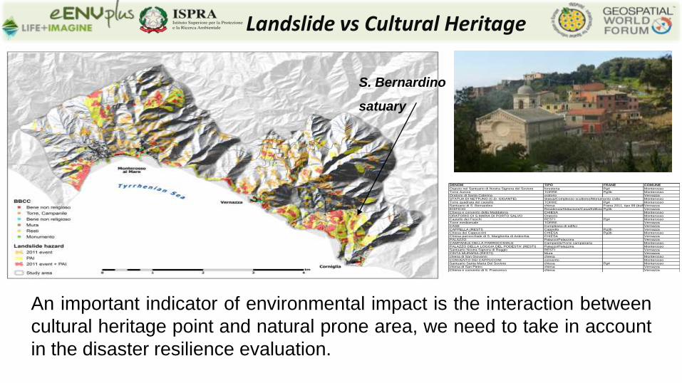
An important indicator of environmental impact is the interaction between
cultural heritage point and natural prone area, we need to take in account
in the disaster resilience evaluation.
Landslide vs Cultural Heritage
S. Bernardino
satuary
DENOM TIPO FRANE COMUNE
Ospizio nel Santuario di Nostra Signora del Soviore foresteria Pg4 Monterosso
Torre Aurora TORRE Pg3b Monterosso
Oratorio di Santa Caterina oratorio Vernazza
STATUA DI NETTUNO (C.D. GIGANTE) Statua/Complesso scultoreo/Monumento civile Monterosso
Torre quadrata del castello TORRE Pg4 Monterosso
Santuario di S. Bernardino chiesa Frana 2011, tipo 99 (buffer) + Pg3aVernazza
EDIFICIO Residenza/Abitazione/Casa/Edificio Pg3b Vernazza
Chiesa e convento della Maddalena CHIESA Monterosso
ORATORIO DI S.MARIA DI PORTO SALVO Oratorio Monterosso
Castello dei Fieschi RESTI Pg4 Monterosso
Torre medioevale TORRE Vernazza
CASE Complesso di edifici Vernazza
CAPPELLA (RESTI) Cappella Pg3b Vernazza
Chiesa dei Cappuccini CHIESA Pg3b Monterosso
Chiesa parrocchiale di S. Margherita di Antiochia CHIESA Vernazza
PALAZZO Palazzo/Palazzina Vernazza
CAMPANILE DELLA PARROCCHIALE Campanile/Torre campanaria Monterosso
PALAZZO DELLA LOGGIA DEL PODESTA' (RESTI) Palazzo/Palazzina Monterosso
Santuario Nostra Signora di Reggio RESTI Vernazza
CINTA MURARIA (RESTI) Mura Vernazza
chiesa di San Giovanni chiesa Monterosso
CONVENTO DEI CAPPUCCINI convento Monterosso
Santuario Santa Maria Del Soviore chiesa Pg4 Monterosso
chiesa di San Pietro chiesa Vernazza
Chiesa e convento di S. Francesco chiesa Vernazza
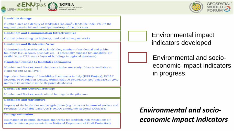
Name of the indicator Score
Landslide damage
Number, area and density of landslides (no./km2), landslide index (%) in the
regional, provincial and municipal territory of the pilot area
Landslides and Communication Infrastructures
Critical points along the highway, road and railway networks
Landslides and Residential Areas
Urbanised surface affected by landslides, number of residential and public
buildings (i.e. schools, hospitals etc…) potentially exposed by landslides, (if
available the CTR vector layer of buildings in regional databases)
Population exposed to landslides phenomena
Number and % of exposed inhabitants in the area (only if data is available at
Regional and Local level)
Input data: Inventory of Landslides Phenomena in Italy (IFFI Project), ISTAT
Sections of Population Census, Administrative Boundaries, geo-database of civic
numbers (if available in the Regional databases)
Landslides and Cultural Heritage
Number and % of exposed cultural heritage in the pilot area
Landslides and Agriculture:
Impacts of the landslides on the agriculture (e.g. terraces) in terms of surface and
revenues (if available Land Use 1:10.000 among the Regional Database)
Damage estimation:
Estimation of potential damages and works for landslide risk mitigations (if
available data on past events from National Department of Civil Protection)
Box for comments and integrations to the proposed list of indicators for the Landslides
Scenario
Environmental and socio-economic impact indicators
Environmental impact
indicators developed
Environmental and socio-
economic impact indicators
in progress
Development of landslide risk analysis models, based on datasets
compliant with the INSPIRE Directive or OGC standard;
Development a common Environmental (geohazard) Analysis system;
Definition of a procedure to evaluate environmental impacts, with a set of
indicators, to estimate the % of population, urban areas, infrastructures,
terraces and Cultural Heritage affected by landslide events;
Improve stakeholder and citizen awareness;
Improve the land use planning processes in the long-term, by suggesting
interventions aimed at mitigating the impacts;
Major outcomes
24
Project reference
Web: http://www.eenvplus.eu
http://www.life-imagine.eu
Thank you for the attention!
? Questions ?