antonine aw.indd
DESCRIPTION
The purpose of this form is to enable States Parties to submit to the World Heritage Committee nominations of properties situated in their territory and suitable for inclusion in the World Heritage List. Nomination Form UNITED NATIONS EDUCATIONAL SCIENTIFIC AND CULTURAL ORGANISATION Convention concerning the protection of the world cultural and natural heritage. The form has been completed in English and is sent in four copies to:-TRANSCRIPT
WORLD HERITAGE LIST
Nomination Form
Convention concerning the protection of the world cultural and natural heritage.
Under the terms of the Convention concerning the Protection of the World Cultural and Natural Heritage, adopted by the General Conference of UNESCO in 1972, the Intergovernmental Committee for the Protection of the World Cultural and Natural Heritage, called ‘the World Heritage Committee’ shall establish, under the title of ‘World Heritage List’, a list of properties forming part of the cultural and natural heritage which it considers as having outstanding universal value in terms of such criteria as it shall have established.
The purpose of this form is to enable States Parties to submit to the World Heritage Committee nominations of properties situated in their territory and suitable for inclusion in the World Heritage List.
This ‘Nomination Document’ has been prepared in accordance with the ‘Format for the nomination of cultural and natural properties for inscription on the World Heritage list’ issued by UNESCO.
The form has been completed in English and is sent in four copies to:-
The SecretariatWorld Heritage CentreUNESCO7 place de Fontenoy75352 Paris 07 SPFrance
UNITED NATIONS EDUCATIONAL SCIENTIFIC AND CULTURAL ORGANISATION
The nomination documents for the proposed
extension of the Frontiers of the Roman Empire
World Heritage Site through the addition of the
Antonine Wall (UK) are published in 2007 by
Historic Scotland, Longmore House, Salisbury Place,
Edinburgh EH9 1SH
Historic Scotland is an executive agency of the
Scottish Executive charged with safeguarding the
nation’s historic environment on behalf of Scottish
Ministers, and promoting its understanding and
enjoyment.
www.historic-scotland.gov.uk
© Crown Copyright Historic Scotland. All
rights reserved. No part of this publication may
be reproduced, stored, or transmitted in any
form, or by any means, electronic, mechanical or
photocopying, recording or otherwise, without the
express permission of the publisher
ISBN-13 978 1 904966 38 8
The following organisations are committed to the nomination of the Antonine Wall for World Heritage Status as an extension of the Frontiers of the Roman Empire World Heritage Site.
THE ▲ANTONINE▲
WALLVOLUME I
F RO N T I E R S O F T H E RO M A N E M P I R E WO R L D H E R I TA G E S I T EP RO P O S E D E X T E N S I O N
N O M I N AT I O N F O R E X T E N S I O N O F T H E WO R L D H E R I TA G E S I T E
2 T H E A N T O N I N E W A L L
T H E A N T O N I N E W A L L 3
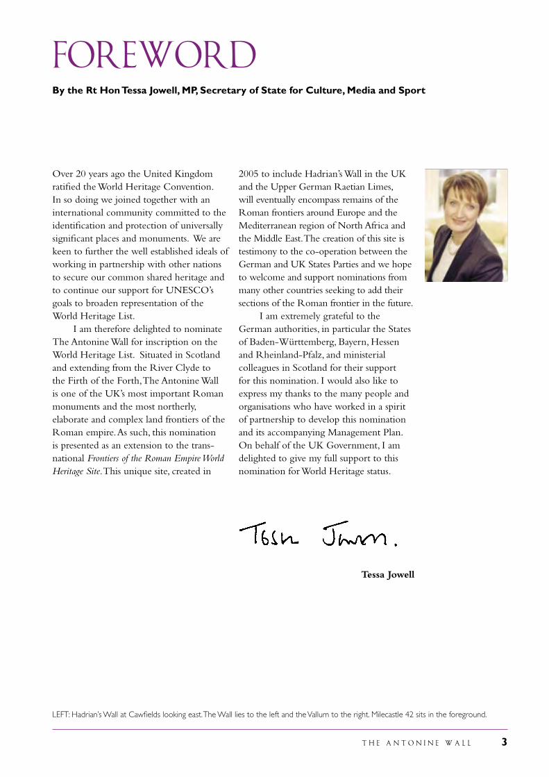
FOREWORDBy the Rt Hon Tessa Jowell, MP, Secretary of State for Culture, Media and Sport
Over 20 years ago the United Kingdom ratified the World Heritage Convention. In so doing we joined together with an international community committed to the identification and protection of universally significant places and monuments. We are keen to further the well established ideals of working in partnership with other nations to secure our common shared heritage and to continue our support for UNESCO’s goals to broaden representation of the World Heritage List. I am therefore delighted to nominate The Antonine Wall for inscription on the World Heritage List. Situated in Scotland and extending from the River Clyde to the Firth of the Forth, The Antonine Wall is one of the UK’s most important Roman monuments and the most northerly, elaborate and complex land frontiers of the Roman empire. As such, this nomination is presented as an extension to the trans-national Frontiers of the Roman Empire World Heritage Site. This unique site, created in
2005 to include Hadrian’s Wall in the UK and the Upper German Raetian Limes, will eventually encompass remains of the Roman frontiers around Europe and the Mediterranean region of North Africa and the Middle East. The creation of this site is testimony to the co-operation between the German and UK States Parties and we hope to welcome and support nominations from many other countries seeking to add their sections of the Roman frontier in the future. I am extremely grateful to the German authorities, in particular the States of Baden-Württemberg, Bayern, Hessen and Rheinland-Pfalz, and ministerial colleagues in Scotland for their support for this nomination. I would also like to express my thanks to the many people and organisations who have worked in a spirit of partnership to develop this nomination and its accompanying Management Plan. On behalf of the UK Government, I am delighted to give my full support to this nomination for World Heritage status.
Tessa Jowell
LEFT: Hadrian’s Wall at Cawfields looking east. The Wall lies to the left and the Vallum to the right. Milecastle 42 sits in the foreground.
4 T H E A N T O N I N E W A L L
T H E A N T O N I N E W A L L 5
Doris AhnenMinisterin für Bildung, Wissenschaft, Jugend und Kultur Rheinland Pfalz
Udo Corts Hessischer Minister für Wissenschaft und Kunst
Dr. Thomas Goppel Bayerischer Staatsminister für Wissenschaft, Forschung und Kunst
Ernst Pfister, MdL Wirtschaftsminister des Landes Baden-Württemberg
Statement of SUPPORT
In 2005 the Upper German-Raetian Limes (Obergermanisch-Raetischer Limes) in Germany was declared a World Heritage Site. It joined Hadrian’s Wall in the UK as the next section of the frontiers of the Roman empire to become a World Heritage Site, both stretches of the frontier combining to form the new trans-national Frontiers of the Roman Empire World Heritage Site. Germany, and in particular the four Länder through which the frontier passes, Rheinland-Pfalz, Hessen, Baden-Württemberg and Bayern, are delighted to be part of this innovatory approach which may well result in the world’s longest if not largest trans-national World Heritage Site. We look forward to cooperating with many other countries in Europe, the Middle East and north Africa in order to bring all the various sections of the frontiers of the Roman empire together into this new international community. This wider cooperation has already commenced with the formation of a German-UK Inter-Governmental Committee responsible for the management infrastructure and development of the Frontiers of the Roman Empire World Heritage Site. The committee is supported by the ‘Bratislava Group’, a scientific committee which provides professional advice on technical, archaeological and scientific matters relating to the site. As part of this group, German archaeologists have provided advice to their colleagues in Scotland on the nomination of the Antonine Wall and have seen and approved the final
documentation. They are also involved in ongoing discussions on the creation of a research strategy for Roman frontiers, under the aegis of the European Archaeological Association. Germany is also a partner in the European Commission’s Culture 2000 project, the Frontiers of the Roman Empire. Such projects are a valuable way of sharing knowledge and experience as well as raising the profile of this important part of our shared heritage. Scotland and Germany have close ties in their special interest in the frontiers of the Roman empire as both countries lay on the edge, partly within but mostly outside of that empire. The Antonine Wall in Scotland was erected in the second century during the reign of the Emperor Antoninus Pius, when the Upper German-Raetian Limes in Germany was built. Men recruited in north Britain served on the German frontier. We, the responsible authorities for World Heritage affairs in the four Länder through which the Upper German-Raetian Limes passes, confirm that in our view the Antonine Wall has outstanding universal value and therefore fully support the proposal to extend the Frontiers of the Roman Empire through the addition of the Antonine Wall, and that the Management Plan for the property confirms to the principles set down in the Summary Nomination Statement for Frontiers of the Roman Empire World Heritage Site.
We wish our colleagues in the UK every success.
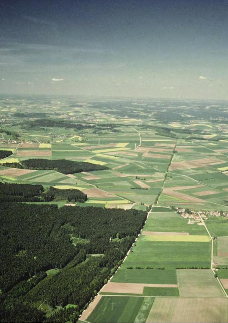
LEFT: The German frontier still survives as a defining feature within the landscape today.
6 T H E A N T O N I N E W A L L
T H E A N T O N I N E W A L L 7
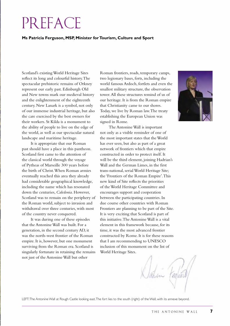
PREFACEMs Patricia Ferguson, MSP, Minister for Tourism, Culture and Sport
Scotland’s existing World Heritage Sites reflect its long and colourful history. The spectacular prehistoric remains of Orkney represent our early past. Edinburgh Old and New towns mark our medieval history and the enlightenment of the eighteenth century. New Lanark is a symbol, not only of our immense industrial heritage, but also the care exercised by the best owners for their workers. St Kilda is a monument to the ability of people to live on the edge of the world, as well as our spectacular natural landscape and maritime heritage. It is appropriate that our Roman past should have a place in this pantheon. Scotland first came to the attention of the classical world through the voyage of Pytheas of Marseille 300 years before the birth of Christ. When Roman armies eventually reached this area they already had considerable geographical knowledge, including the name which has resonated down the centuries, Caledonia. However, Scotland was to remain on the periphery of the Roman world, subject to invasion and withdrawal over three centuries, with most of the country never conquered. It was during one of these episodes that the Antonine Wall was built. For a generation, in the second century AD, it was the north-west frontier of the Roman empire. It is, however, but one monument surviving from the Roman era. Scotland is singularly fortunate in retaining the remains not just of the Antonine Wall but other
Roman frontiers, roads, temporary camps, two legionary bases, forts, including the world famous Ardoch, fortlets and even the smallest military structure, the observation tower. All these structures remind of us of our heritage. It is from the Roman empire that Christianity came to our shores. Today, we live by Roman law. The treaty establishing the European Union was signed in Rome. The Antonine Wall is important not only as a visible reminder of one of the most important states that the World has ever seen, but also as part of a great network of frontiers which that empire constructed in order to protect itself. It will be the third element, joining Hadrian’s Wall and the German Limes, in the first trans-national, serial World Heritage Site; the ‘Frontiers of the Roman Empire’. This new kind of Site reflects the priorities of the World Heritage Committee and encourages support and cooperation between the participating countries. In due course other countries with Roman Frontiers are planning to be part of the Site. It is very exciting that Scotland is part of this initiative. The Antonine Wall is a vital element in this framework because, for its time, it was the most advanced frontier constructed by Rome. It is for these reasons that I am recommending to UNESCO inclusion of this monument on the list of World Heritage Sites.
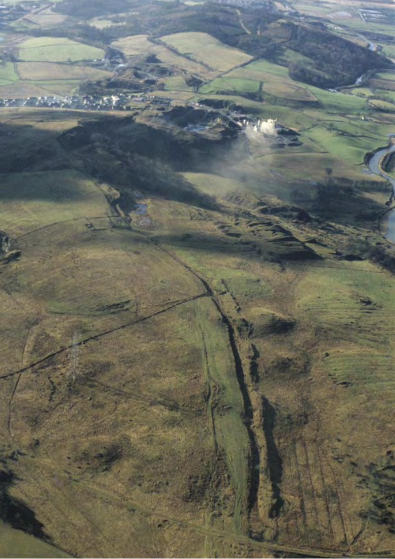
LEFT: The Antonine Wall at Rough Castle looking east. The fort lies to the south (right) of the Wall, with its annexe beyond.
8 T H E A N T O N I N E W A L L
T H E A N T O N I N E W A L L 9
Contents
Foreword 3
Statement of Support 5
Preface 7
Introduction 11
Executive Summary 15
1. Identification of the Property 19
2. Description 25
3. Justification for Inscription 71
4. State of Conservation and factors affecting the Property 81
5. Protection and Management of the Property 85
6. Monitoring 115
7. Documentation 117
8. Contact information of responsible authorities 123
9. Signatures on behalf of the State Party 125
Acknowledgements 126
Appendix I: Event mapping along the Antonine Wall 129
Appendix II: Early Visitors to the Antonine Wall 131
Appendix III: Frontiers of the Roman Empire World Heritage Site 133
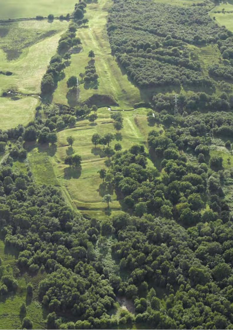
LEFT: The Antonine Wall crossing Croy Hill looking west
10 T H E A N T O N I N E W A L L
T H E A N T O N I N E W A L L 11
frontiers, and they were once manned by soldiers whose duties were to protect the empire and implement the regulations which governed movement across the frontier, including collecting customs duties. Successive emperors sought to protect their empire not only by fighting wars but also by building new and more elaborate defensive structures. Occasionally, they explicitly stated their intent as is attested by a series of inscriptions in Pannonia (modern Hungary) which record that under the emperor Commodus (180-192) towers were erected along the banks of the Danube to prevent the incursions of brigands.
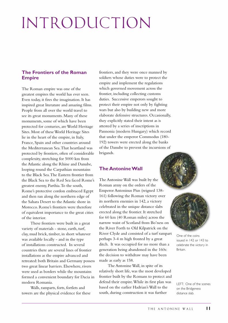
The Antonine Wall
The Antonine Wall was built by the Roman army on the orders of the Emperor Antoninus Pius (reigned 138-161) following the Roman victory over its northern enemies in 142, a victory celebrated in the unique distance slabs erected along the frontier. It stretched for 60 km (40 Roman miles) across the narrow waist of Scotland from Bo’ness on the River Forth to Old Kilpatrick on the River Clyde and consisted of a turf rampart perhaps 3-4 m high fronted by a great ditch. It was occupied for no more than a generation being abandoned in the 160s: the decision to withdraw may have been made as early as 158. The Antonine Wall, in spite of its relatively short life, was the most developed frontier built by the Romans to protect and defend their empire. While its first plan was based on the earlier Hadrian’s Wall to the south, during construction it was further
INTRODUCTION
The Frontiers of the Roman Empire
The Roman empire was one of the greatest empires the world has ever seen. Even today, it fires the imagination. It has inspired great literature and amazing films. People from all over the world travel to see its great monuments. Many of these monuments, some of which have been protected for centuries, are World Heritage Sites. Most of these World Heritage Sites lie in the heart of the empire, in Italy, France, Spain and other countries around the Mediterranean Sea. That heartland was protected by frontiers, often of considerable complexity, stretching for 5000 km from the Atlantic along the Rhine and Danube, looping round the Carpathian mountains to the Black Sea. The Eastern frontier from the Black Sea to the Red Sea faced Rome’s greatest enemy, Parthia. To the south, Rome’s protective cordon embraced Egypt and then ran along the northern edge of the Sahara Desert to the Atlantic shore in Morocco. Rome’s frontiers were therefore of equivalent importance to the great cities of the interior. These frontiers were built in a great variety of materials - stone, earth, turf, clay, mud brick, timber, in short whatever was available locally - and in the type of installations constructed. In several countries there are several lines of frontier installations as the empire advanced and retreated: both Britain and Germany possess two great linear barriers. Elsewhere, rivers were used as borders while the mountains formed a convenient boundary for Dacia in modern Romania. Walls, ramparts, forts, fortlets and towers are the physical evidence for these
One of the coins issued in 142 or 143 to celebrate the victory in Britain.
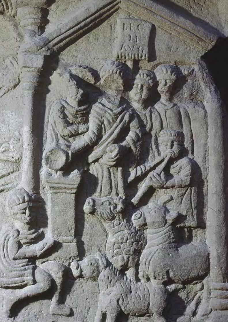
LEFT: One of the scenes on the Bridgeness distance slab.
12 T H E A N T O N I N E W A L L
developed in several ways. Yet, following its abandonment, these new elements were not incorporated into later alterations to Hadrian’s Wall, or the German frontier. In that way, the Antonine Wall sits at one end of a pendulum reflecting the development of Roman frontiers. Hadrian’s Wall and the Antonine Wall were complementary and study of both allows the development of Roman frontiers to be better understood. The Antonine Wall is the most complex of all Roman frontiers, even more so than Hadrian’s Wall. Its forts were closer together than on any frontier. They vary considerably in size, defensive arrangement and plan, unlike the forts on Hadrian’s Wall. Many, perhaps most, had an annexe attached to one side: a feature not to be found in this form on any other Roman frontier line. Unlike on Hadrian’s Wall, the forts were linked by a road from the beginning. The rampart itself was of an ‘improved’ type – certainly an improvement on the turf sector of Hadrian’s Wall - with a stone base and culverts. The Antonine Wall also possessed other several unique features in the expansions and small enclosures. The survival of many distance slabs provides information on the way the soldiers divided up the work of constructing the Wall. The known labour camps, uniquely identified on the Antonine Wall, help flesh out the details of the division of labour during its construction. The Antonine Wall was an achievement of what the historian Edward Gibbon called the Roman Empire’s
“Golden Age”. But that Age was not as peaceful as Gibbon believed and the Antonine Wall both reflects the disturbed state of the frontier regions and also the measures taken by the Romans to protect their empire and ensure peaceful lives for its inhabitants. These protective actions were acknowledged by writers of the reign of Antoninus Pius such as Aelius Aristides and Appian who described how the Romans protected their empire by camps and walls.
The temple erected by Antoninus Pius in the Forum in Rome to the memory of his wife. After his death the temple was re-dedicated to the imperial couple.
T H E A N T O N I N E W A L L 13
The Antonine Wall is also a physical manifestation of the change in frontier policy inaugurated by the Emperor Antoninus Pius. Hadrian had clearly decided that his empire should have limits. His successor, Antoninus Pius, overturned his policy, expanding the empire in both Britain and Germany, where his frontier is already part of the Frontiers of the Roman Empire World Heritage Site. This decision probably reflects the weak position of Antoninus Pius when he succeeded Hadrian. He had no military experience and little of any other form of imperial service. His acclamation as Imperator, Conqueror, was the only such title he accepted in his long reign of 23 years in spite of waging wars on other frontiers and his extension of the empire in Germany. The special nature of the distance slabs which record the fighting, the Roman victory and the support of the gods is not only a testimony to the achievements of the Roman army but to the unique position of its commander-in-chief, the Emperor Antoninus Pius. The Antonine Wall forms an important and visible feature in Scotland’s countryside. It survives as a monumental testimony to the military power of one of the world’s greatest states, sitting within a
landscape once highly industrialised, and yet its value has always been recognised. The Antonine Wall not only symbolises the continuing value of heritage in the midst of commercial development but is now a significant element in the regeneration of the landscape in which it sits. It is valued as such by its local community and as an important historical monument, a powerful educational tool and source of recreation. The Antonine Wall divided Scotland between the south which was part of the Roman empire from the north which was never fully conquered. It thus not only represents a division still relevant in today’s Scotland, but also a shared European heritage and accordingly has considerable potential to foster understanding of our past, present and future. Today, the Antonine Wall is visible for over a third of its total length. Some 17 km of the 60 km length of the Antonine Wall are in public ownership or guardianship and open to the public. Elsewhere, old roads and tracks perpetuate the line of the Wall, their names, such as Grahamsdyke Road, acknowledging the mythical history of the monument, and now supplemented by such as Roman Road and Antonine Court in modern housing developments.
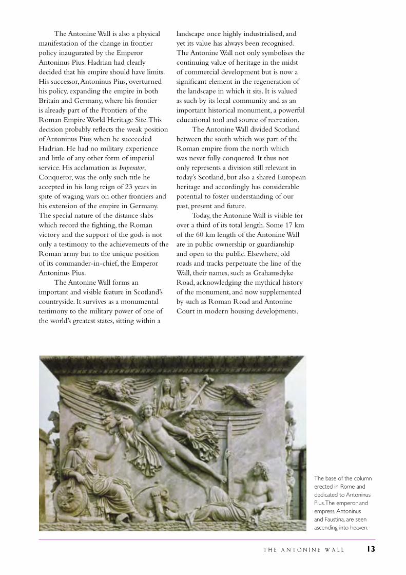
The base of the column erected in Rome and dedicated to Antoninus Pius. The emperor and empress, Antoninus and Faustina, are seen ascending into heaven.
14 T H E A N T O N I N E W A L L
T H E A N T O N I N E W A L L 15
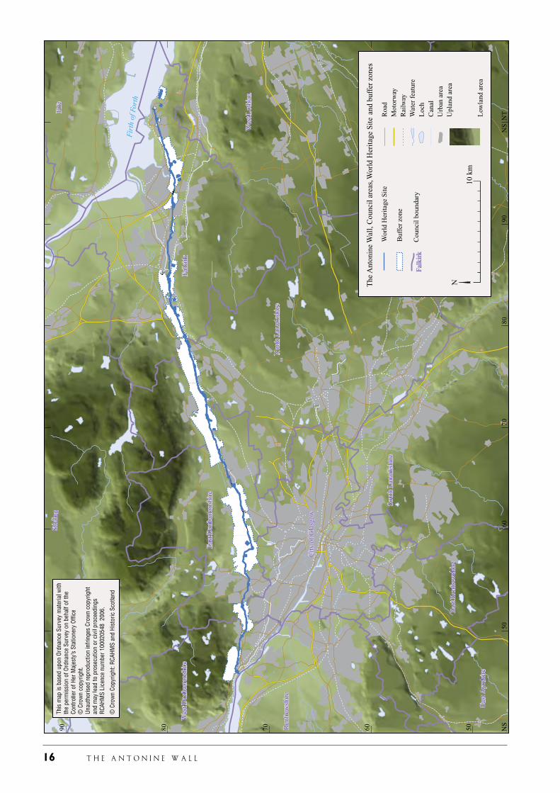
The World Heritage Site has been defined in the following way. Along the line of the Wall the southern boundary of the World Heritage Site has been placed 5 m to the south of the rampart and then projected 50 m to the north of this line creating a corridor 50 m wide. This corridor includes the three main linear features together with other elements that are likely to lie immediately beyond the known archaeology. The corridor is widened where necessary to include forts, fortlets, the Military Way and other elements of the frontier which are attached to the linear barrier. Camps, usually placed at some distance from the Wall, are defined separately. The corridor is also widened to incorporate within the proposed World Heritage Site, areas protected through scheduling under the Ancient Monuments and Archaeological Areas Act 1979. In such circumstances the proposed Site extends to the whole size of the scheduled area except where that area relates to a monument of a different period.
Maps of the nominated Property, showing boundaries and buffer zones
The maps relating to the nomination are included in Volume II of the nomination.
Executive Summary
Geographical co-ordinates to the nearest second
The east end of the Antonine Wall lies at National Grid Reference NT 032 807 at a latitude of 56˚ 00' 35" north and a longitude of 3˚ 33' 8" west.
The west end of the Antonine Wall lies at National Grid Reference NS 458 730 at a latitude of 55˚ 55' 32" north and a longitude of 4˚ 28' 41" west.
Textual description of the boundaries of the nominated Property
The proposed Site extends for a distance of 60 km from the eastern end of the Antonine Wall, in the modern town of Bo’ness on the Firth of Forth, to Old Kilpatrick on the River Clyde. The proposed Site includes all the linear elements of the frontier, that is the rampart, ditch and outer mound, and the Military Way where its location is recorded, together with the forts, fortlets, expansions and small enclosures, civil settlements where known, and the temporary camps along the Wall used by the soldiers building the frontier.
State Party United Kingdom
State, province or region Scotland
Name of property Frontiers of the Roman Empire World Heritage Site: The Antonine Wall
LEFT: The fort and annexe at Rough Castle looking west.
16 T H E A N T O N I N E W A L L
T H E A N T O N I N E W A L L 17
Justification
Statement of Outstanding Universal Value
The Antonine Wall, as a Roman Frontier, is a physical and visual testimony to the former extent of one of the world’s greatest states, the Roman empire. It formed part of a frontier system which surrounded and protected that empire. The Antonine Wall has a particular value in being the most highly developed frontier of the Roman empire: it stands at the end of a long period of development over the previous hundred years and therefore facilitates a better understanding of the development of Roman frontiers in Britain and beyond. It is one of only three artificial barriers along the 5000 km European, North African and Middle Eastern frontiers of the Roman empire. These systems are unique to Britain and Germany, though more fragmentary linear barriers are known in Algeria and Romania. Built following an invasion of what is now Scotland during 139-142 and occupied for possibly only 20 years, it served as the most northerly frontier of the Roman empire at the high point of its power and influence in the ancient world. It has many unique features which demonstrate the versatility of the Roman army, while its short life is of considerable value in offering a snap-shot of a Roman frontier in its most advanced state. As the most northerly frontier, it stands as an example of Rome’s stated intention to rule the world. The Antonine Wall has a distinctive value as a unique physical testimony to the nature of the constitution of the Roman empire and the requirement of the emperor for military prestige. The abandonment of Hadrian’s Wall and the construction of a new northern frontier at the behest of a new emperor reflects the realities of power politics in Rome during Edward Gibbon’s “Golden Age”. It also stands as a physical manifestation of the statements of writers flourishing during the reign of Antoninus Pius about the measures which Rome took
to protect its inhabitants, even those living in its most distant province. The Antonine Wall is of significant value in terms of its rarity, scale, preservation, and historical and archaeological value; the engineering and planning skills of its builders; the understanding of Roman frontier policy and management, and its influence on the landscape and history of local peoples during the Roman period and beyond; and also in terms of its contribution to the economic, educational and social values of today’s society.
Criteria under which Property is nominated
ii on the basis that the Antonine Wall is the most complex and developed of all Roman frontiers;
iii as the most northerly frontier of the Roman empire, the Antonine Wall reflects the wish of Rome to rule the world; and is a physical manifestation of a change in Roman imperial foreign policy following the death of the emperor Hadrian in 138;
iv on the basis that the Antonine Wall was constructed at the time when writers were extolling the virtues of Roman frontiers; that it bears an exceptional testimony to the military traditions of Rome; and is an exceptional example of the methods developed by the Romans to protect their empire.
Name and contact information of official local institution/agency
Organisation: Historic ScotlandAddress: Longmore House Salisbury Place Edinburgh EH9 1SH UK
Tel: 0044 131 668 8724Fax: 0044 131 668 8730
E-mail: [email protected] address: www.historic-scotland.gov.uk
LEFT: the proposed World Heritage Site and its buffer zone.
18 T H E A N T O N I N E W A L L
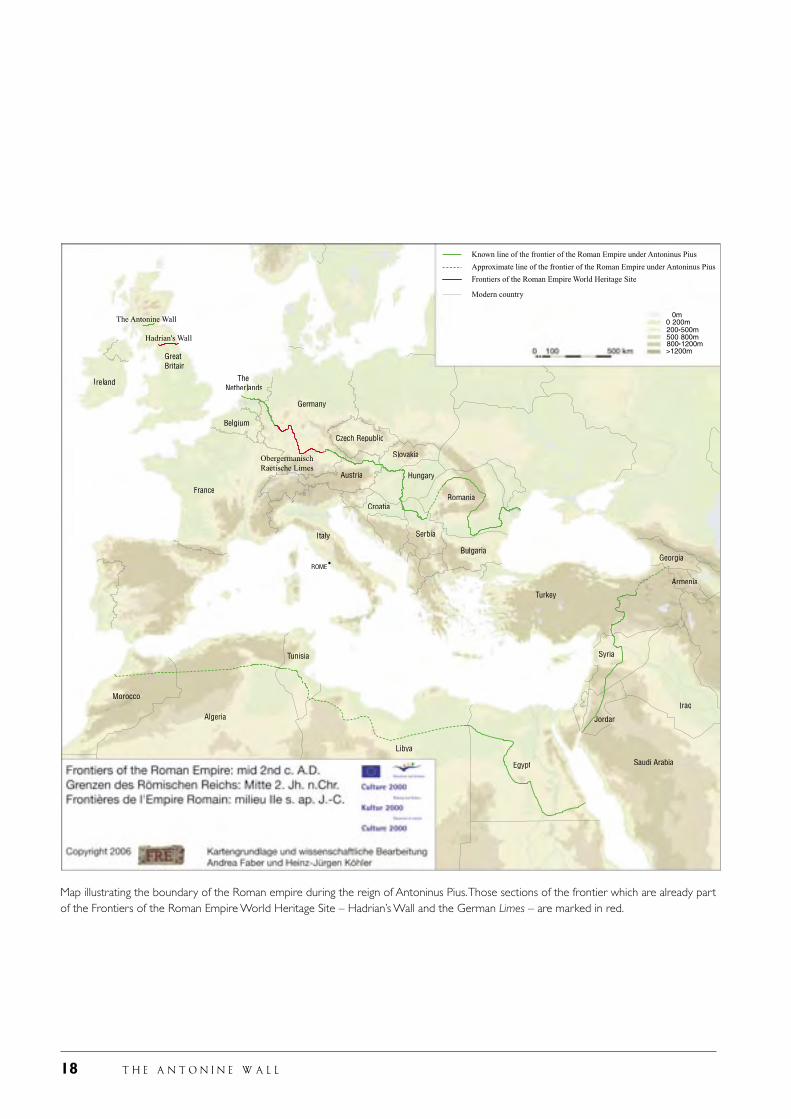
Map illustrating the boundary of the Roman empire during the reign of Antoninus Pius. Those sections of the frontier which are already part of the Frontiers of the Roman Empire World Heritage Site – Hadrian’s Wall and the German Limes – are marked in red.
T H E A N T O N I N E W A L L 19
I Identification of the Property
accompanying features and local authority Council areas
III.2 The Antonine Wall and
accompanying features, the scheduled areas, the buffer zones and local authority Council areas
IV Index map to the 1:25,000 maps IV.1.1-8 Eight maps of the Antonine Wall
at a scale of 1:25,000 showing the proposed World Heritage Site, known forts and fortlets, camps, other features and the buffer zones
IV.2.1-8 Eight maps of the Antonine Wall
at a scale of 1:25,000 showing the proposed World Heritage Site, known forts fortlets, camps, other features, the scheduled areas and the buffer zones
V Index map to the 1:5,000 maps V.1-39 Thirty-nine maps of the
Antonine Wall and all known features at a scale of 1:5,000 showing the scheduled areas and the proposed World Heritage Site
The detailed maps are coded to differentiate between visible remains (the various elements being colour coded); no surface remains; unconfirmed line.
1. f Area of site proposed for inscription (ha) and of the proposed buffer zone (ha) The proposed Site consists of the entire length of the Antonine Wall, 60 km/40 Roman miles/37 statute miles long, from Bridgeness, Bo’ness on the Firth of Forth to Old Kilpatrick on the River Clyde.
1. a Country United Kingdom 1. b State, province or region Scotland
1. c Name of Property Frontiers of the Roman Empire World Heritage Site: The Antonine Wall 1. d Geographical co-ordinates to the nearest second
The Antonine Wall crosses Scotland from modern Bo’ness on the Firth of Forth to Old Kilpatrick on the River Clyde. The east end of the Antonine Wall lies at latitude of 56˚ 00' 35" north and a longitude of 3˚ 33' 8" west (National Grid Reference NT 032 807). The west end of the Antonine Wall lies at a latitude of 55˚ 55' 32" north and a longitude of 4˚ 28' 4" west (National Grid Reference NS 458 730 ).
1. e Maps and plans, showing the boundaries of the nominated property and buffer zone These maps are included in Volume II of the nomination. They show the position and course of the Antonine Wall at various scales: I The position of the Antonine
Wall in the Roman empire
II The location of the Antonine Wall and Hadrian’s Wall in north Britain
III.1 The Antonine Wall and
20 T H E A N T O N I N E W A L L
It includes the main linear elements: the rampart, ditch and outer mound, and also the Military Way where it is known. The proposed Site also includes the remains of the 16 surviving forts together with their accompanying annexes and civil settlements and other external features where known, 9 fortlets, 6 expansions, 2 smaller enclosures, and part or all of the 16 surviving labour camps in the vicinity of the Wall. The proposed World Heritage Site does not include those parts of the Antonine Wall which have been destroyed. These sections include small lengths quarried away and narrow sectors removed in the cuttings for canals, railways and roads. These total only 2 km of the whole length of the Antonine Wall. These stretches are included in the buffer zone. The World Heritage Site has been defined in the following way. Along the line of the Wall the southern boundary of the World Heritage Site has been placed 5 m to the south of the rampart and then projected 50 m to the north of this line creating a corridor 50 m wide. This corridor includes the three main linear features together with other elements that are likely to lie immediately beyond the known archaeology. The corridor is widened where necessary to include forts, fortlets, the Military Way and other elements of the frontier which are attached to the linear barrier. Camps, usually placed
at some distance from the Wall, are defined separately as parts of the proposed Site. The corridor is also widened to incorporate within the proposed World Heritage Site areas protected through scheduling under the Ancient Monuments and Archaeological Areas Act 1979: in such circumstances the proposed Site extends to the whole size of the scheduled area except where that area relates to a monument of a different period. The proposed World Heritage Site does not include the modern buildings which lie within its boundaries, but only the underlying Roman archaeology. The proposed World Heritage Site is protected through two primary UK items of legislation: the Ancient Monuments and Archaeological Areas Act 1979 and the Town and Country Planning (Scotland) Act 1997. The former Act in the main protects those parts of the Antonine Wall sitting in countryside or within open ground in urban settings. All scheduled sections of the Antonine Wall, including its associated camps, form part of the proposed World Heritage Site. Within urban contexts, the five local authorities along the line of the Antonine Wall all have policies which protect the Antonine Wall under the provisions of the Town and Country Planning (Scotland) Act 1997. Through the use of these two pieces of primary legislation the surviving 58 km of the original total length of 60 km of the Antonine Wall are provided with robust legal protection for their inclusion in the proposed World Heritage Site. The 2 km of the Wall which have been destroyed, mainly through quarrying, canals, roads and railways, are included in the buffer zone. In this way, the linear integrity of the monument will be maintained. This approach is in keeping with the definition of the German section of the Frontiers of the Roman Empire World Heritage Site. The Hadrian’s Wall part of the Frontiers of the Roman Empire World Heritage Site, however, consists of only the scheduled sections of the monument. As a result, much of the Wall in urban areas is excluded from the Site. This reflects the conditions pertaining
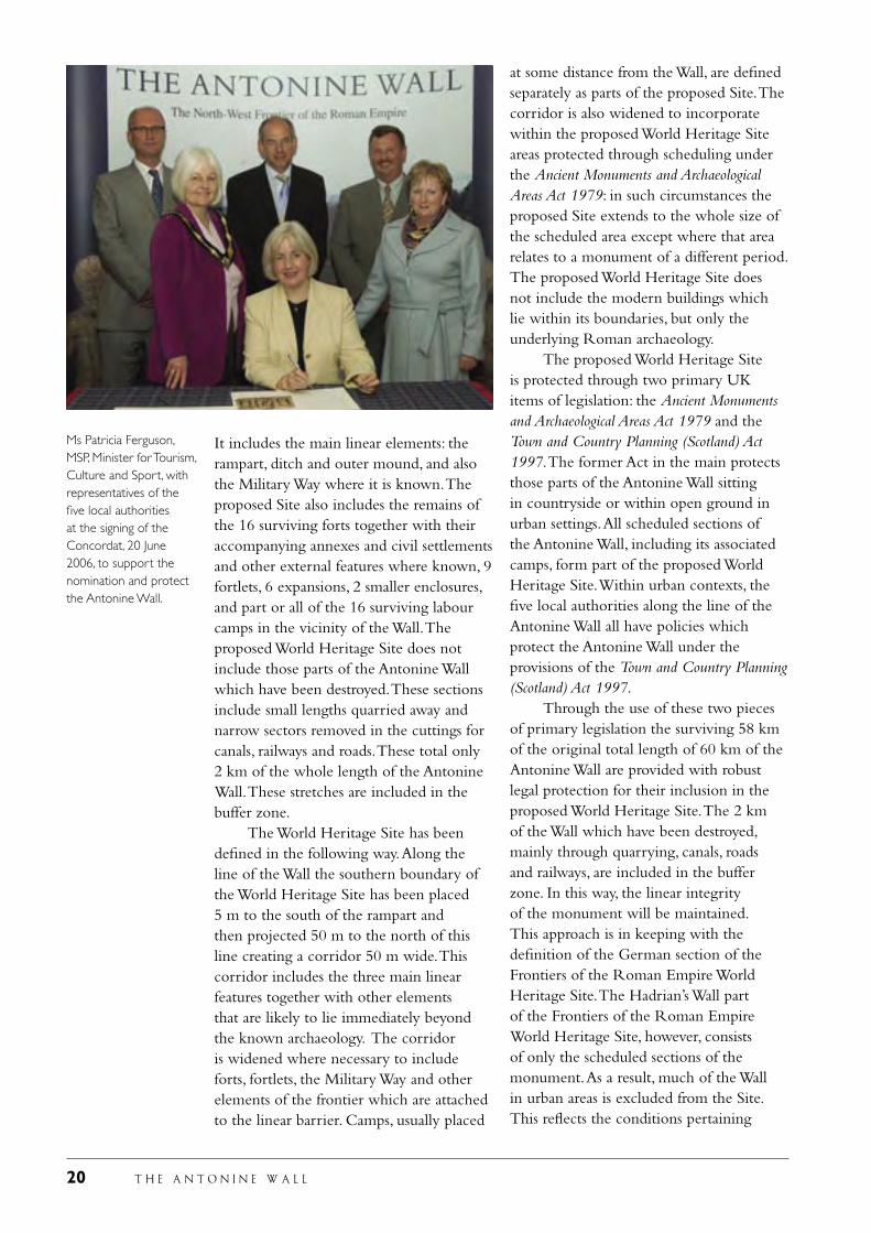
Ms Patricia Ferguson, MSP, Minister for Tourism, Culture and Sport, with representatives of the five local authorities at the signing of the Concordat, 20 June 2006, to support the nomination and protect the Antonine Wall.
T H E A N T O N I N E W A L L 21
in the early 1990s when its boundary was defined. Since then, protection of archaeological remains through the spatial planning system has become an integral part of the UK approach to conservation. The current Hadrian’s Wall World Heritage Site Management Plan states that it is the intention to seek to extend the boundaries of the Site to include surviving but unscheduled stretches in the urban areas on the same basis as is proposed for the Antonine Wall part of the World Heritage Site. The proposed World Heritage Site is defined in relation to existing information. As knowledge about the Antonine Wall grows, the areas of protection will change and, as past experience demonstrates, be expanded. This, in turn, may lead to small-scale amendments to the boundaries of the proposed World Heritage Site. The buffer zone along the Antonine Wall has been defined in relation to local circumstances, including the landscape and modern features such as towns and villages, roads and railways. The aim, as with all buffer zones, is to protect the setting of the monument and, in this case, continue to allow understanding of why the Antonine Wall was erected in a particular location. The protection of amenity areas to each side of the Wall has been an important element of central government’s protection for the monument for the last 50 years.
These amenity zones, already incorporated into the development control strategies of the five local authorities along the line of the Antonine Wall, form the basis of the buffer zones now proposed. The size and location of the buffer zone has been reconsidered as part of the exercise of preparing this nomination document. It has been defined only in relation to the archaeological remains in the countryside as it is not possible to define buffer zones in urban areas. However, those sections of the Wall which have been destroyed are included in the buffer zone in order to maintain the linearity of the monument. The buffer zone is protected through UK legislation. All separate parts of the buffer zone are already zoned under the Town and Country Planning (Scotland) Act 1997 as countryside or green belt by the five local authorities along the line of the Antonine Wall. Within the terms of the World Heritage Committee 2005 decision concerning the nature of the Frontiers of the Roman Empire (Germany) World Heritage Site, medieval and modern buildings within the proposed World Heritage Site serve as an overlying buffer zone.
Area of nominated property: 526.9 ha. Buffer zone: 5229 ha.Total: 5755.9 ha.
22 T H E A N T O N I N E W A L L
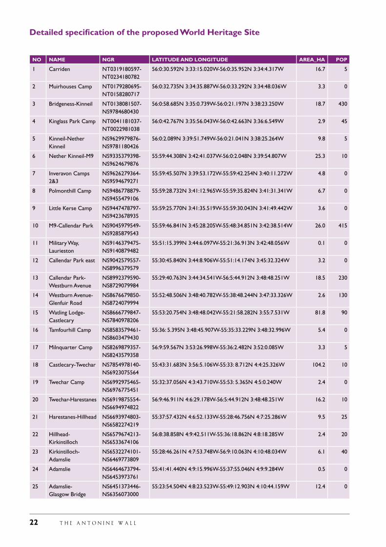
Detailed specification of the proposed World Heritage Site
NO NAME NGR LATITUDE AND LONGITUDE AREA_HA POP
1 Carriden NT0319180597-NT0234180782
56:0:30.592N 3:33:15.020W-56:0:35.952N 3:34:4.317W 16.7 5
2 Muirhouses Camp NT0179280695-NT0158280717
56:0:32.735N 3:34:35.887W-56:0:33.292N 3:34:48.036W 3.3 0
3 Bridgeness-Kinneil NT0138081507-NS9784680430
56:0:58.685N 3:35:0.739W-56:0:21.197N 3:38:23.250W 18.7 430
4 Kinglass Park Camp NT0041181037-NT0022981038
56:0:42.767N 3:35:56.043W-56:0:42.663N 3:36:6.549W 2.9 45
5 Kinneil-Nether Kinneil
NS9629979876-NS9781180426
56:0:2.089N 3:39:51.749W-56:0:21.041N 3:38:25.264W 9.8 5
6 Nether Kinneil-M9 NS9335379398-NS9624679876
55:59:44.308N 3:42:41.037W-56:0:2.048N 3:39:54.807W 25.3 10
7 Inveravon Camps 2&3
NS9626279364-NS9594679271
55:59:45.507N 3:39:53.172W-55:59:42.254N 3:40:11.272W 4.8 0
8 Polmonthill Camp NS9486778879-NS9455479106
55:59:28.732N 3:41:12.965W-55:59:35.824N 3:41:31.341W 6.7 0
9 Little Kerse Camp NS9447478797-NS9423678935
55:59:25.770N 3:41:35.519W-55:59:30.043N 3:41:49.442W 3.6 0
10 M9-Callendar Park NS9045979549-NS9285879543
55:59:46.841N 3:45:28.205W-55:48:34.851N 3:42:38.514W 26.0 415
11 Military Way, Laurieston
NS9146379475-NS9140879482
55:51:15.399N 3:44:6.097W-55:21:36.913N 3:42:48.056W 0.1 0
12 Callendar Park east NS9042579557-NS8996379579
55:30:45.840N 3:44:8.906W-55:51:14.174N 3:45:32.324W 3.2 0
13 Callendar Park-Westburn Avenue
NS8992379590-NS8729079984
55:29:40.763N 3:44:34.541W-56:5:44.912N 3:48:48.251W 18.5 230
14 Westburn Avenue-Glenfuir Road
NS8676679850-NS8724079994
55:52:48.506N 3:48:40.782W-55:38:48.244N 3:47:33.326W 2.6 130
15 Watling Lodge-Castlecary
NS8666779847-NS7840978206
55:53:20.754N 3:48:48.042W-55:21:58.282N 3:55:7.531W 81.8 90
16 Tamfourhill Camp NS8583579461-NS8603479430
55:36: 5.395N 3:48:45.907W-55:35:33.229N 3:48:32.996W 5.4 0
17 Milnquarter Camp NS8269879357-NS8243579358
56:9:59.567N 3:53:26.998W-55:36:2.482N 3:52:0.085W 3.3 5
18 Castlecary-Twechar NS7854978140-NS6923075564
55:43:31.683N 3:56:5.106W-55:33: 8.712N 4:4:25.326W 104.2 10
19 Twechar Camp NS6992975465-NS6976775451
55:32:37.056N 4:3:43.710W-55:53: 5.365N 4:5:0.240W 2.4 0
20 Twechar-Harestanes NS6919875554-NS6694974822
56:9:46.911N 4:6:29.178W-56:5:44.912N 3:48:48.251W 16.2 10
21 Harestanes-Hillhead NS6693974803-NS6582274219
55:37:57.432N 4:6:52.133W-55:28:46.756N 4:7:25.286W 9.5 25
22 Hillhead- Kirkintilloch
NS6579674213-NS6533674106
56:8:38.858N 4:9:42.511W-55:36:18.862N 4:8:18.285W 2.4 20
23 Kirkintilloch- Adamslie
NS6532274101-NS6469773809
55:28:46.261N 4:7:53.748W-56:9:10.063N 4:10:48.034W 6.1 40
24 Adamslie NS6464673794-NS6453973761
55:41:41.440N 4:9:15.996W-55:37:55.046N 4:9:9.284W 0.5 0
25 Adamslie- Glasgow Bridge
NS6451373446-NS6356073000
55:23:54.504N 4:8:23.523W-55:49:12.903N 4:10:44.159W 12.4 0
T H E A N T O N I N E W A L L 23
26 Glasgow Bridge-Cadder
NS6354672985-NS6180272661
55:41:40.330N 4:10:18.956W-55:17:56.177N 4:10:37.361W 12.6 0
27 Cadder-Wilderness Plantation
NS6155672562-NS6026072277
55:47:1.551N 4:12:31.669W-55:49:9.505N 4:13:53.638W 8.6 5
28 Wilderness Plantation-Bearsden
NS5983872152-NS5491372026
55:37:17.924N 4:13:36.021W-55:23:44.621N 4:17:28.836W 43.9 50
29 Balmuildy Camp NS5842272177-NS5886072195
55:28:39.245N 4:14:26.507W-55:49:8.039N 4:15:14.020W 8.5 0
30 Bearsden- Old Kilpatrick
NS5491072041-NS4629573341
55:22:7.643N 4:17:23.229W-56:7:45.348N 4:28:29.321W 60.8 190
31 Old Kilpatrick, A 82-railway
NS4619373344-NS4610073315
56:7:45.348N 4:28:29.321W-55:16:34.767N 4:25:22.927W 0.8 500
32 Old Kilpatrick fort NS4606573308-NS4586973077
55:51:35.556N 4:27:39.046W-55:53:44.604N 4:27:58.735W 5.1 140
33 Old Kilpatrick, River Clyde
NS4586173060-NS4583473020
55:49:26.048N 4:27:42.361W-55:34:53.392N 4:26:47.643W 0.2 0
TOTAL 2350
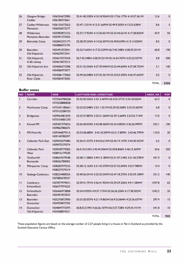
Buffer zonesNO NAME NGR LATITUDE AND LONGITUDE AREA_HA POP
1 Carriden NT0364780628-NT0228880828
55:42:50.556N 3:32: 4.469W-56:4:55.371N 3:34:18.026W 63.3 0
2 Muirhouses Camp NT0181180661-NT0152280725
55:23:25.048N 3:33: 1.551W-55:29:20.568N 3:33:32.603W 6.8 0
3 Bridgeness NS9963081059-NT0154081270
55:33:37.887N 3:35:31.260W-55:39: 2.669N 3:33:55.714W 17.0 0
4 Kinneil-M9 NS9307379653-NS9862980675
55:56:40.034N 3:42:48.360W-55:33:4.803N 3:36:26.999W 532.1 100
5 M9-Mumrills NS9346879313-NS9140780297
55:53:58.680N 3:42:18.209W-55:21:7.809N 3:42:46.799W 110.0 20
6 Callendar Park East NS9043679480-NS9075279274
55:36:41.537N 3:44:24.613W-55:45:19.147N 3:44:30.432W 6.2 0
7 Callendar Park West
NS9038779582-NS8916179528
56:4:10.510N 3:45:44.506W-55:50:8.846N 3:46:15.369W 24.6 550
8 Tamfourhill- Bonnyside
NS8647679548-NS8262780003
55:58:11.580N 3:49:13.180W-55:31:47.218N 3:51:36.578W 341.9 0
9 Milnquarter Camp NS8283979232-NS8237579219
55:38:12.163N 3:51:43.370W-55:57:35.694N 3:53:7.980W 13.4 0
10 Seabegs-Castlecary NS8224480055-NS7885678537
55:40:56.541N 3:52:25.542W-55:47:18.275N 3:55:59.108W 331.2 140
11 Castlecary- Kirkintilloch
NS7877979031-NS6577974225
55:59:41.791N 3:56:41.955W-55:59:29.326N 4:9:11.804W 1597.8 65
12 Kirkintilloch- Bearsden
NS6466973808-NS5491872033
55:54:4.955N 4:9:57.173W-55:26:26.250N 4:17:38.202W 1542.2 35
13 Bearsden- Duntocher
NS5276872900-NS4939872750
55:53:20.057N 4:21:19.865W-56:9:25.864N 4:25:36.037W 297.4 15
14 Duntocher- Old Kilpatrick
NS4849773397-NS4508874331
56:8:52.519N 4:26:26.107W-56:3:57.728N 4:29:24.141W 341.8 10
TOTAL 925
These population figures are based on the average number of 2.27 people living in a house or flat in Scotland as provided by the Scottish Executive Census Office.
24 T H E A N T O N I N E W A L L
T H E A N T O N I N E W A L L 25
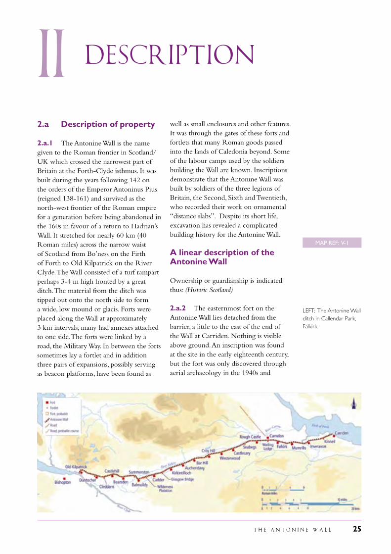
ii Description
well as small enclosures and other features. It was through the gates of these forts and fortlets that many Roman goods passed into the lands of Caledonia beyond. Some of the labour camps used by the soldiers building the Wall are known. Inscriptions demonstrate that the Antonine Wall was built by soldiers of the three legions of Britain, the Second, Sixth and Twentieth, who recorded their work on ornamental “distance slabs”. Despite its short life, excavation has revealed a complicated building history for the Antonine Wall.
A linear description of the Antonine Wall
Ownership or guardianship is indicated thus: (Historic Scotland)
2.a.2 The easternmost fort on the Antonine Wall lies detached from the barrier, a little to the east of the end of the Wall at Carriden. Nothing is visible above ground. An inscription was found at the site in the early eighteenth century, but the fort was only discovered through aerial archaeology in the 1940s and
2.a Description of property
2.a.1 The Antonine Wall is the name given to the Roman frontier in Scotland/UK which crossed the narrowest part of Britain at the Forth-Clyde isthmus. It was built during the years following 142 on the orders of the Emperor Antoninus Pius (reigned 138-161) and survived as the north-west frontier of the Roman empire for a generation before being abandoned in the 160s in favour of a return to Hadrian’s Wall. It stretched for nearly 60 km (40 Roman miles) across the narrow waist of Scotland from Bo’ness on the Firth of Forth to Old Kilpatrick on the River Clyde. The Wall consisted of a turf rampart perhaps 3-4 m high fronted by a great ditch. The material from the ditch was tipped out onto the north side to form a wide, low mound or glacis. Forts were placed along the Wall at approximately 3 km intervals; many had annexes attached to one side. The forts were linked by a road, the Military Way. In between the forts sometimes lay a fortlet and in addition three pairs of expansions, possibly serving as beacon platforms, have been found as
LEFT: The Antonine Wall ditch in Callendar Park, Falkirk.
MAP REF: V-1
26 T H E A N T O N I N E W A L L
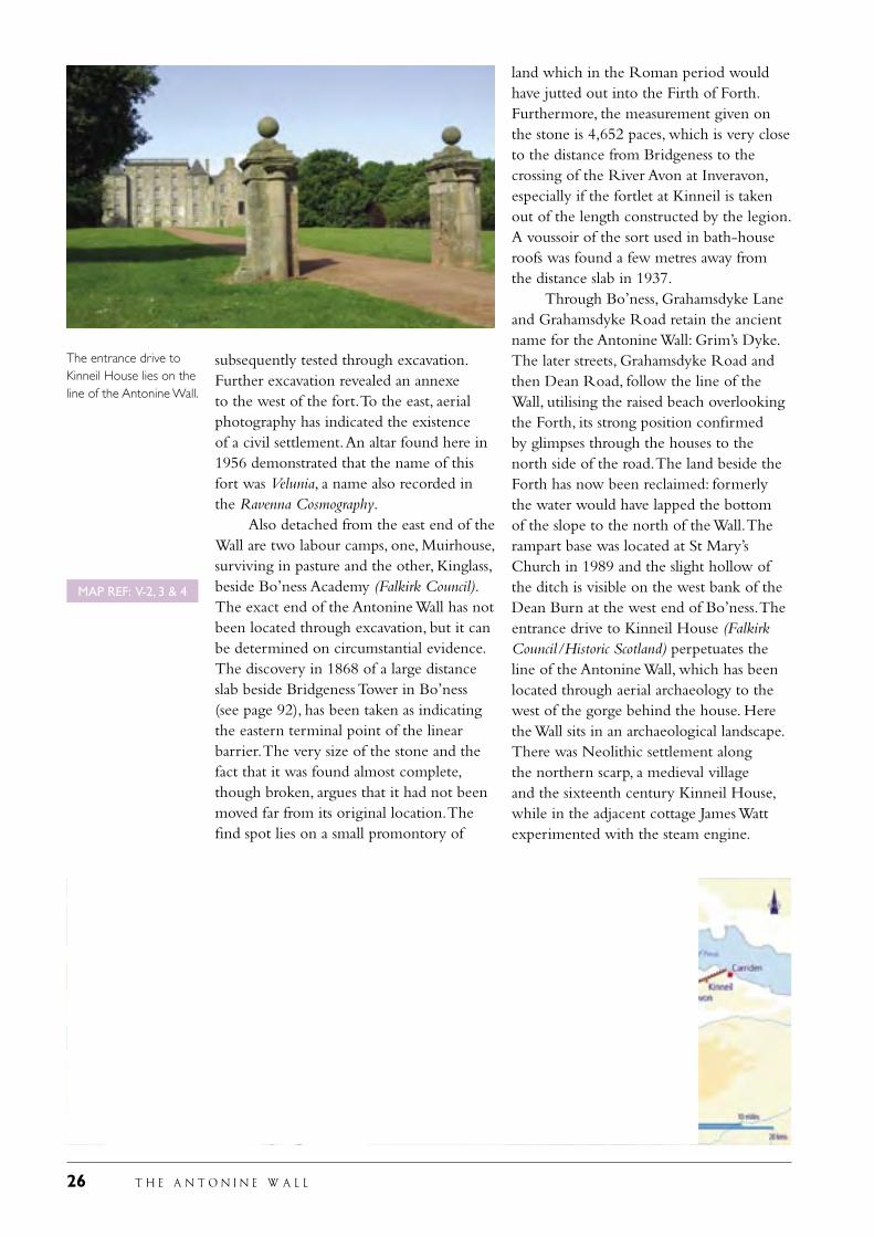
subsequently tested through excavation. Further excavation revealed an annexe to the west of the fort. To the east, aerial photography has indicated the existence of a civil settlement. An altar found here in 1956 demonstrated that the name of this fort was Velunia, a name also recorded in the Ravenna Cosmography. Also detached from the east end of the Wall are two labour camps, one, Muirhouse, surviving in pasture and the other, Kinglass, beside Bo’ness Academy (Falkirk Council). The exact end of the Antonine Wall has not been located through excavation, but it can be determined on circumstantial evidence. The discovery in 1868 of a large distance slab beside Bridgeness Tower in Bo’ness (see page 92), has been taken as indicating the eastern terminal point of the linear barrier. The very size of the stone and the fact that it was found almost complete, though broken, argues that it had not been moved far from its original location. The find spot lies on a small promontory of
land which in the Roman period would have jutted out into the Firth of Forth. Furthermore, the measurement given on the stone is 4,652 paces, which is very close to the distance from Bridgeness to the crossing of the River Avon at Inveravon, especially if the fortlet at Kinneil is taken out of the length constructed by the legion. A voussoir of the sort used in bath-house roofs was found a few metres away from the distance slab in 1937. Through Bo’ness, Grahamsdyke Lane and Grahamsdyke Road retain the ancient name for the Antonine Wall: Grim’s Dyke. The later streets, Grahamsdyke Road and then Dean Road, follow the line of the Wall, utilising the raised beach overlooking the Forth, its strong position confirmed by glimpses through the houses to the north side of the road. The land beside the Forth has now been reclaimed: formerly the water would have lapped the bottom of the slope to the north of the Wall. The rampart base was located at St Mary’s Church in 1989 and the slight hollow of the ditch is visible on the west bank of the Dean Burn at the west end of Bo’ness. The entrance drive to Kinneil House (Falkirk Council/Historic Scotland) perpetuates the line of the Antonine Wall, which has been located through aerial archaeology to the west of the gorge behind the house. Here the Wall sits in an archaeological landscape. There was Neolithic settlement along the northern scarp, a medieval village and the sixteenth century Kinneil House, while in the adjacent cottage James Watt experimented with the steam engine.
The entrance drive to Kinneil House lies on the line of the Antonine Wall.
MAP REF: V-2, 3 & 4
T H E A N T O N I N E W A L L 27
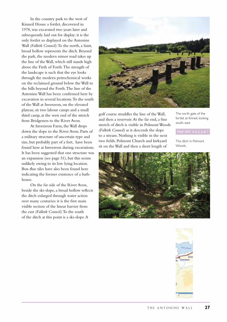
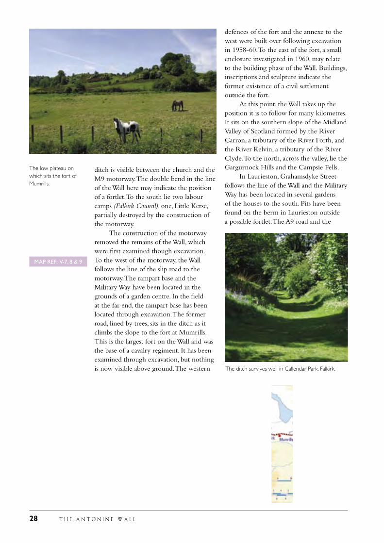
In the country park to the west of Kinneil House a fortlet, discovered in 1978, was excavated two years later and subsequently laid out for display: it is the only fortlet so displayed on the Antonine Wall (Falkirk Council). To the north, a faint, broad hollow represents the ditch. Beyond the park, the modern minor road takes up the line of the Wall, which still stands high above the Firth of Forth. The strength of the landscape is such that the eye looks through the modern petrochemical works on the reclaimed ground below the Wall to the hills beyond the Forth. The line of the Antonine Wall has been confirmed here by excavation in several locations. To the south of the Wall at Inveravon, on the elevated plateau, sit two labour camps and a small third camp, at the west end of the stretch from Bridgeness to the River Avon. At Inveravon Farm, the Wall drops down the slope to the River Avon. Parts of a military structure of uncertain type and size, but probably part of a fort, have been found here at Inveravon during excavations. It has been suggested that one structure was an expansion (see page 51), but this seems unlikely owing to its low lying location. Box-flue tiles have also been found here indicating the former existence of a bath-house. On the far side of the River Avon, beside the ski-slope, a broad hollow reflects the ditch enlarged through water action over many centuries: it is the first main visible section of the linear barrier from the east (Falkirk Council). To the south of the ditch at this point is a ski-slope. A
golf course straddles the line of the Wall, and then a reservoir. At the far end, a fine stretch of ditch is visible in Polmont Woods (Falkirk Council) as it descends the slope to a stream. Nothing is visible in the next two fields. Polmont Church and kirkyard sit on the Wall and then a short length of
The north gate of the fortlet at Kinneil, looking south.-east
The ditch in Polmont Woods.
MAP REF: V-4, 5, 6 & 7
28 T H E A N T O N I N E W A L L
ditch is visible between the church and the M9 motorway. The double bend in the line of the Wall here may indicate the position of a fortlet. To the south lie two labour camps (Falkirk Council), one, Little Kerse, partially destroyed by the construction of the motorway. The construction of the motorway removed the remains of the Wall, which were first examined though excavation. To the west of the motorway, the Wall follows the line of the slip road to the motorway. The rampart base and the Military Way have been located in the grounds of a garden centre. In the field at the far end, the rampart base has been located through excavation. The former road, lined by trees, sits in the ditch as it climbs the slope to the fort at Mumrills. This is the largest fort on the Wall and was the base of a cavalry regiment. It has been examined through excavation, but nothing is now visible above ground. The western
defences of the fort and the annexe to the west were built over following excavation in 1958-60. To the east of the fort, a small enclosure investigated in 1960, may relate to the building phase of the Wall. Buildings, inscriptions and sculpture indicate the former existence of a civil settlement outside the fort. At this point, the Wall takes up the position it is to follow for many kilometres. It sits on the southern slope of the Midland Valley of Scotland formed by the River Carron, a tributary of the River Forth, and the River Kelvin, a tributary of the River Clyde. To the north, across the valley, lie the Gargurnock Hills and the Campsie Fells. In Laurieston, Grahamsdyke Street follows the line of the Wall and the Military Way has been located in several gardens of the houses to the south. Pits have been found on the berm in Laurieston outside a possible fortlet. The A9 road and the
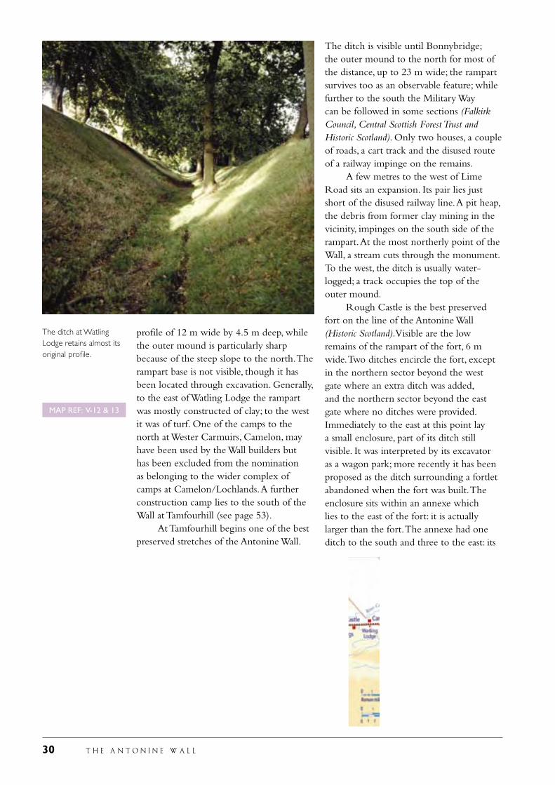
The ditch survives well in Callendar Park, Falkirk.
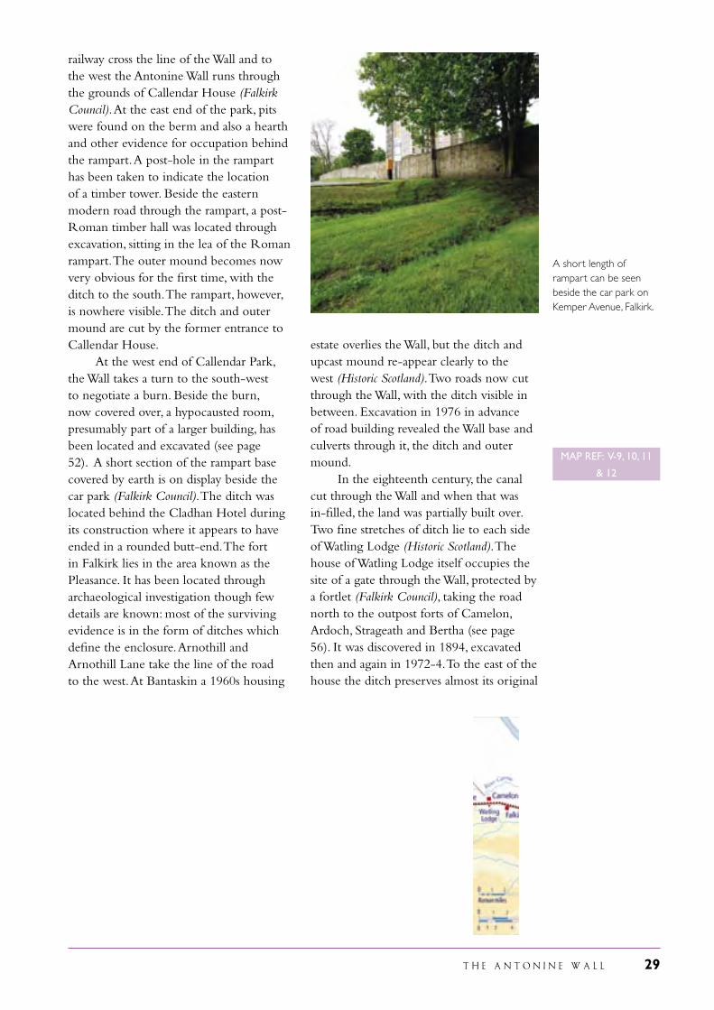
The low plateau on which sits the fort of Mumrills.
MAP REF: V-7, 8 & 9
T H E A N T O N I N E W A L L 29
railway cross the line of the Wall and to the west the Antonine Wall runs through the grounds of Callendar House (Falkirk Council). At the east end of the park, pits were found on the berm and also a hearth and other evidence for occupation behind the rampart. A post-hole in the rampart has been taken to indicate the location of a timber tower. Beside the eastern modern road through the rampart, a post-Roman timber hall was located through excavation, sitting in the lea of the Roman rampart. The outer mound becomes now very obvious for the first time, with the ditch to the south. The rampart, however, is nowhere visible. The ditch and outer mound are cut by the former entrance to Callendar House. At the west end of Callendar Park, the Wall takes a turn to the south-west to negotiate a burn. Beside the burn, now covered over, a hypocausted room, presumably part of a larger building, has been located and excavated (see page 52). A short section of the rampart base covered by earth is on display beside the car park (Falkirk Council). The ditch was located behind the Cladhan Hotel during its construction where it appears to have ended in a rounded butt-end. The fort in Falkirk lies in the area known as the Pleasance. It has been located through archaeological investigation though few details are known: most of the surviving evidence is in the form of ditches which define the enclosure. Arnothill and Arnothill Lane take the line of the road to the west. At Bantaskin a 1960s housing
estate overlies the Wall, but the ditch and upcast mound re-appear clearly to the west (Historic Scotland). Two roads now cut through the Wall, with the ditch visible in between. Excavation in 1976 in advance of road building revealed the Wall base and culverts through it, the ditch and outer mound. In the eighteenth century, the canal cut through the Wall and when that was in-filled, the land was partially built over. Two fine stretches of ditch lie to each side of Watling Lodge (Historic Scotland). The house of Watling Lodge itself occupies the site of a gate through the Wall, protected by a fortlet (Falkirk Council), taking the road north to the outpost forts of Camelon, Ardoch, Strageath and Bertha (see page 56). It was discovered in 1894, excavated then and again in 1972-4. To the east of the house the ditch preserves almost its original
A short length of rampart can be seen beside the car park on Kemper Avenue, Falkirk.
MAP REF: V-9, 10, 11
& 12
30 T H E A N T O N I N E W A L L
profile of 12 m wide by 4.5 m deep, while the outer mound is particularly sharp because of the steep slope to the north. The rampart base is not visible, though it has been located through excavation. Generally, to the east of Watling Lodge the rampart was mostly constructed of clay; to the west it was of turf. One of the camps to the north at Wester Carmuirs, Camelon, may have been used by the Wall builders but has been excluded from the nomination as belonging to the wider complex of camps at Camelon/Lochlands. A further construction camp lies to the south of the Wall at Tamfourhill (see page 53). At Tamfourhill begins one of the best preserved stretches of the Antonine Wall.
The ditch is visible until Bonnybridge; the outer mound to the north for most of the distance, up to 23 m wide; the rampart survives too as an observable feature; while further to the south the Military Way can be followed in some sections (Falkirk Council, Central Scottish Forest Trust and Historic Scotland). Only two houses, a couple of roads, a cart track and the disused route of a railway impinge on the remains. A few metres to the west of Lime Road sits an expansion. Its pair lies just short of the disused railway line. A pit heap, the debris from former clay mining in the vicinity, impinges on the south side of the rampart. At the most northerly point of the Wall, a stream cuts through the monument. To the west, the ditch is usually water-logged; a track occupies the top of the outer mound. Rough Castle is the best preserved fort on the line of the Antonine Wall (Historic Scotland). Visible are the low remains of the rampart of the fort, 6 m wide. Two ditches encircle the fort, except in the northern sector beyond the west gate where an extra ditch was added, and the northern sector beyond the east gate where no ditches were provided. Immediately to the east at this point lay a small enclosure, part of its ditch still visible. It was interpreted by its excavator as a wagon park; more recently it has been proposed as the ditch surrounding a fortlet abandoned when the fort was built. The enclosure sits within an annexe which lies to the east of the fort: it is actually larger than the fort. The annexe had one ditch to the south and three to the east: its
The ditch at Watling Lodge retains almost its original profile.
MAP REF: V-12 & 13
T H E A N T O N I N E W A L L 31
rampart is not visible. Stone and timber buildings have been found in the fort and annexe during excavations. None is now visible, though the Military Way can be seen passing through both fort and annexe. Beyond the north defences of the fort are ten rows of defensive pits, usually called lilia (see page 61). Only about one third of the total length of the lines of pits is revealed today. To the south-east of the fort is a field system of at least two phases, visible today as a series of low mounds and shallow ditches. Excavation led to the suggestion of a prehistoric date, but the existence of a metalled path through the field system, running at right-angles to the Military Way, might be thought to support a Roman date. Rough Castle fort sits above the Rowan Tree Burn. Immediately to the west
of the burn, the Military Way runs across the open ground; beside it sit the footings of a later medieval or early modern house. In this area the rampart is well preserved and stands to its greatest height along the line of the Wall, just short of 2 m. In the ditch and behind the rampart are the faint traces of two more later medieval or modern houses. An expansion lies to the west of the cattle grid: it was excavated in 1957. From here to the end of the section in state care, several shallow pits can be seen to the south of the rampart (see page 43); a further pit was found below the expansion. These are the quarry pits from which the gravel was extracted to construct the Military Way which at this point lies underneath the cart track. Excavation has demonstrated that the stones and gravel of the road sit on a bed of turf. The second
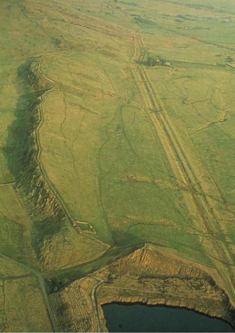
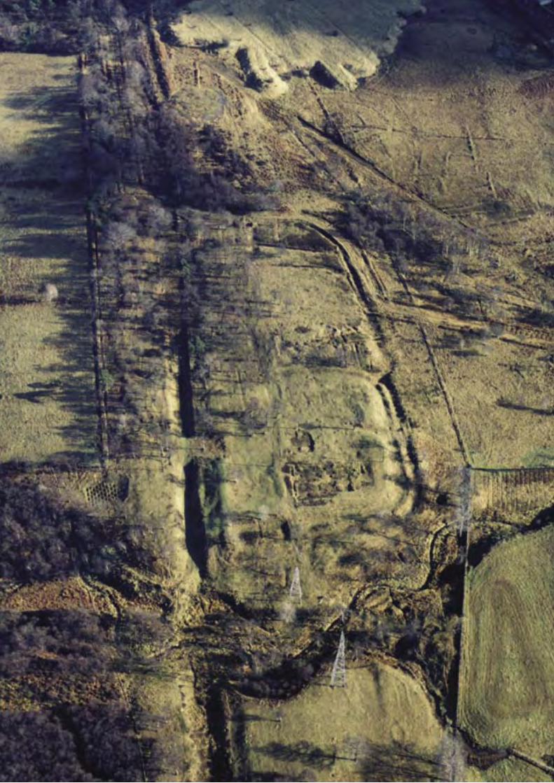
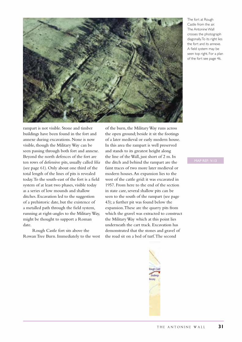
The fort at Rough Castle from the air. The Antonine Wall crosses the photograph diagonally. To its right lies the fort and its annexe. A field system may be seen top right. For a plan of the fort see page 46.
MAP REF: V-13
32 T H E A N T O N I N E W A L L
expansion of the pair lies in the grounds of Bonnyside House a few metres beyond the sector in state care. The access track crosses the Wall, which continues in a westerly direction, the ditch clearly visible, to the north of Elf Hill (Falkirk Council). It then runs through housing to pass by the Antonine Primary School, where a medieval motte sits on the outer mound (Falkirk Council). A camp lies
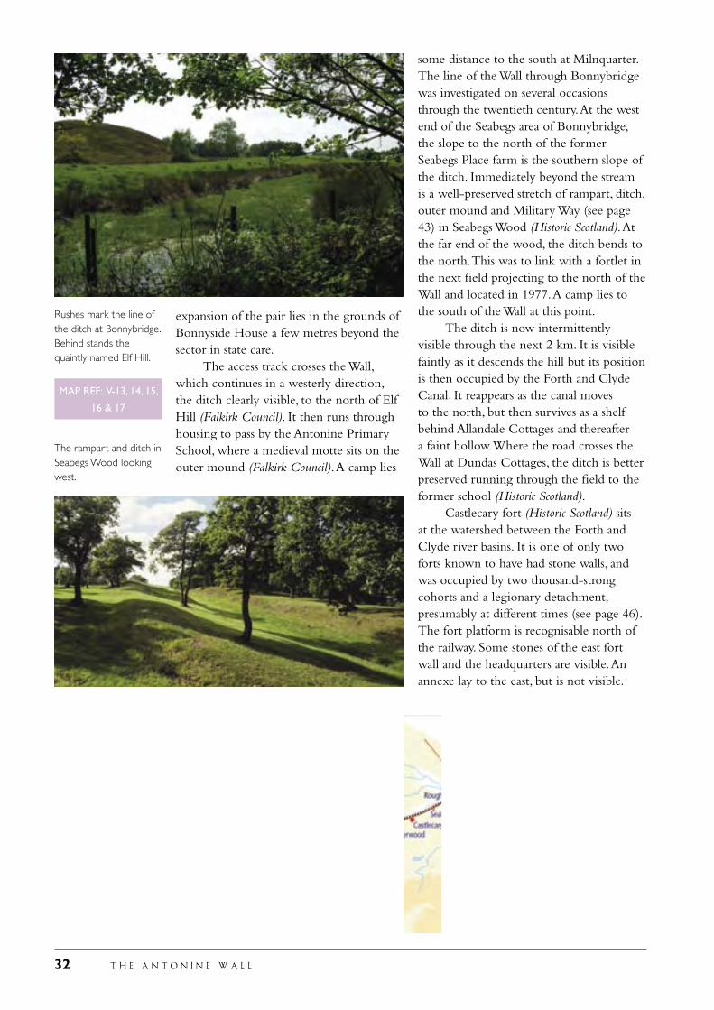
some distance to the south at Milnquarter. The line of the Wall through Bonnybridge was investigated on several occasions through the twentieth century. At the west end of the Seabegs area of Bonnybridge, the slope to the north of the former Seabegs Place farm is the southern slope of the ditch. Immediately beyond the stream is a well-preserved stretch of rampart, ditch, outer mound and Military Way (see page 43) in Seabegs Wood (Historic Scotland). At the far end of the wood, the ditch bends to the north. This was to link with a fortlet in the next field projecting to the north of the Wall and located in 1977. A camp lies to the south of the Wall at this point. The ditch is now intermittently visible through the next 2 km. It is visible faintly as it descends the hill but its position is then occupied by the Forth and Clyde Canal. It reappears as the canal moves to the north, but then survives as a shelf behind Allandale Cottages and thereafter a faint hollow. Where the road crosses the Wall at Dundas Cottages, the ditch is better preserved running through the field to the former school (Historic Scotland). Castlecary fort (Historic Scotland) sits at the watershed between the Forth and Clyde river basins. It is one of only two forts known to have had stone walls, and was occupied by two thousand-strong cohorts and a legionary detachment, presumably at different times (see page 46). The fort platform is recognisable north of the railway. Some stones of the east fort wall and the headquarters are visible. An annexe lay to the east, but is not visible.
Rushes mark the line of the ditch at Bonnybridge. Behind stands the quaintly named Elf Hill.
The rampart and ditch in Seabegs Wood looking west.
MAP REF: V-13, 14, 15,
16 & 17
T H E A N T O N I N E W A L L 33
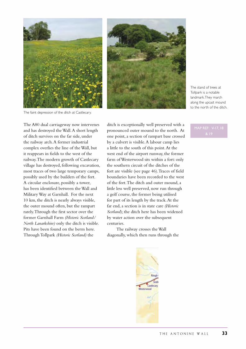
The A80 dual carriageway now intervenes and has destroyed the Wall. A short length of ditch survives on the far side, under the railway arch. A former industrial complex overlies the line of the Wall, but it reappears in fields to the west of the railway. The modern growth of Castlecary village has destroyed, following excavation, most traces of two large temporary camps, possibly used by the builders of the fort. A circular enclosure, possibly a tower, has been identified between the Wall and Military Way at Garnhall. For the next 10 km, the ditch is nearly always visible, the outer mound often, but the rampart rarely. Through the first sector over the former Garnhall Farm (Historic Scotland/North Lanarkshire) only the ditch is visible. Pits have been found on the berm here. Through Tollpark (Historic Scotland) the
ditch is exceptionally well preserved with a pronounced outer mound to the north. At one point, a section of rampart base crossed by a culvert is visible. A labour camp lies a little to the south of this point. At the west end of the airport runway, the former farm of Westerwood sits within a fort: only the southern circuit of the ditches of the fort are visible (see page 46). Traces of field boundaries have been recorded to the west of the fort. The ditch and outer mound, a little less well preserved, now run through a golf course, the former being utilised for part of its length by the track. At the far end, a section is in state care (Historic Scotland); the ditch here has been widened by water action over the subsequent centuries. The railway crosses the Wall diagonally, which then runs through the
The faint depression of the ditch at Castlecary.
The stand of trees at Tollpark is a notable landmark. They march along the upcast mound to the north of the ditch.
MAP REF: V-17, 18
& 19
34 T H E A N T O N I N E W A L L
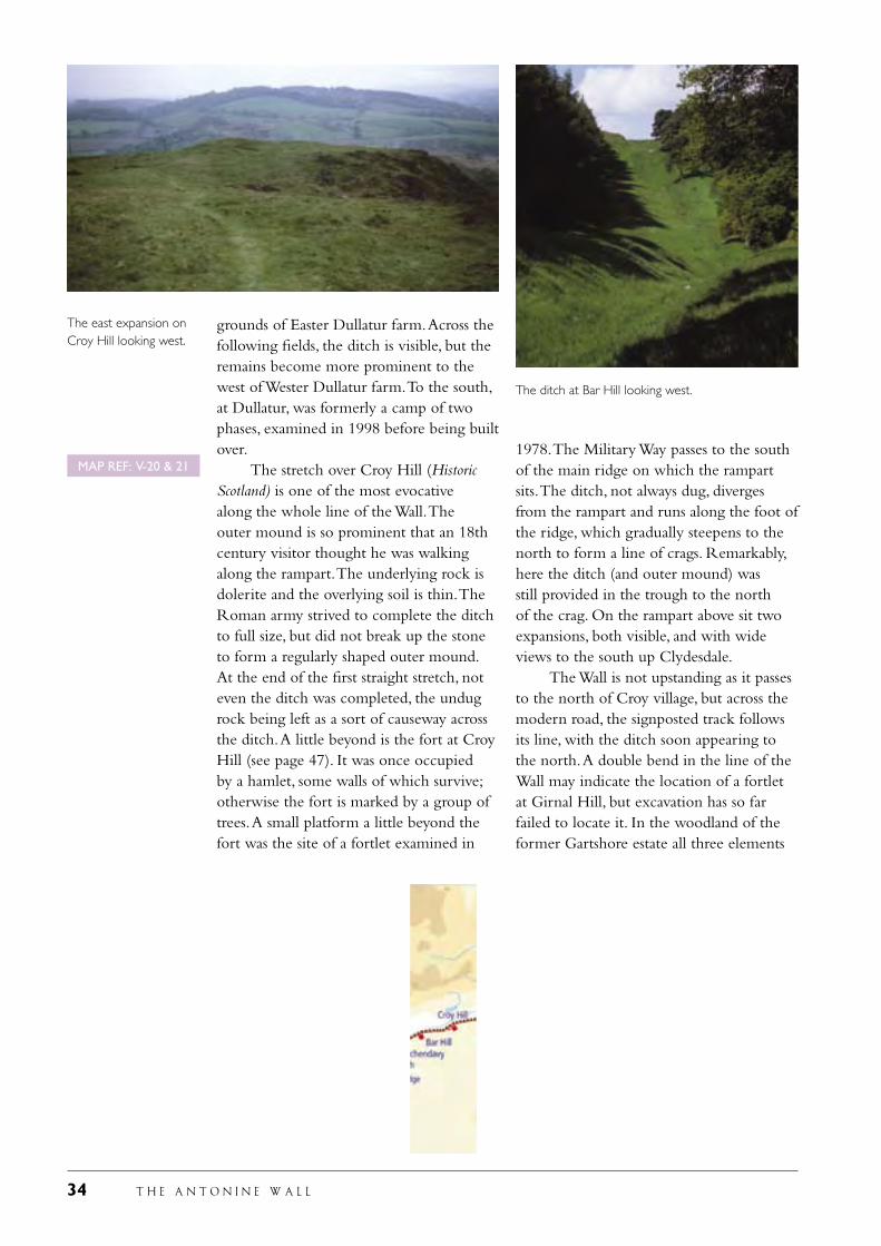
grounds of Easter Dullatur farm. Across the following fields, the ditch is visible, but the remains become more prominent to the west of Wester Dullatur farm. To the south, at Dullatur, was formerly a camp of two phases, examined in 1998 before being built over. The stretch over Croy Hill (Historic Scotland) is one of the most evocative along the whole line of the Wall. The outer mound is so prominent that an 18th century visitor thought he was walking along the rampart. The underlying rock is dolerite and the overlying soil is thin. The Roman army strived to complete the ditch to full size, but did not break up the stone to form a regularly shaped outer mound. At the end of the first straight stretch, not even the ditch was completed, the undug rock being left as a sort of causeway across the ditch. A little beyond is the fort at Croy Hill (see page 47). It was once occupied by a hamlet, some walls of which survive; otherwise the fort is marked by a group of trees. A small platform a little beyond the fort was the site of a fortlet examined in
1978. The Military Way passes to the south of the main ridge on which the rampart sits. The ditch, not always dug, diverges from the rampart and runs along the foot of the ridge, which gradually steepens to the north to form a line of crags. Remarkably, here the ditch (and outer mound) was still provided in the trough to the north of the crag. On the rampart above sit two expansions, both visible, and with wide views to the south up Clydesdale. The Wall is not upstanding as it passes to the north of Croy village, but across the modern road, the signposted track follows its line, with the ditch soon appearing to the north. A double bend in the line of the Wall may indicate the location of a fortlet at Girnal Hill, but excavation has so far failed to locate it. In the woodland of the former Gartshore estate all three elements
The east expansion on Croy Hill looking west.
The ditch at Bar Hill looking west.
MAP REF: V-20 & 21
T H E A N T O N I N E W A L L 35
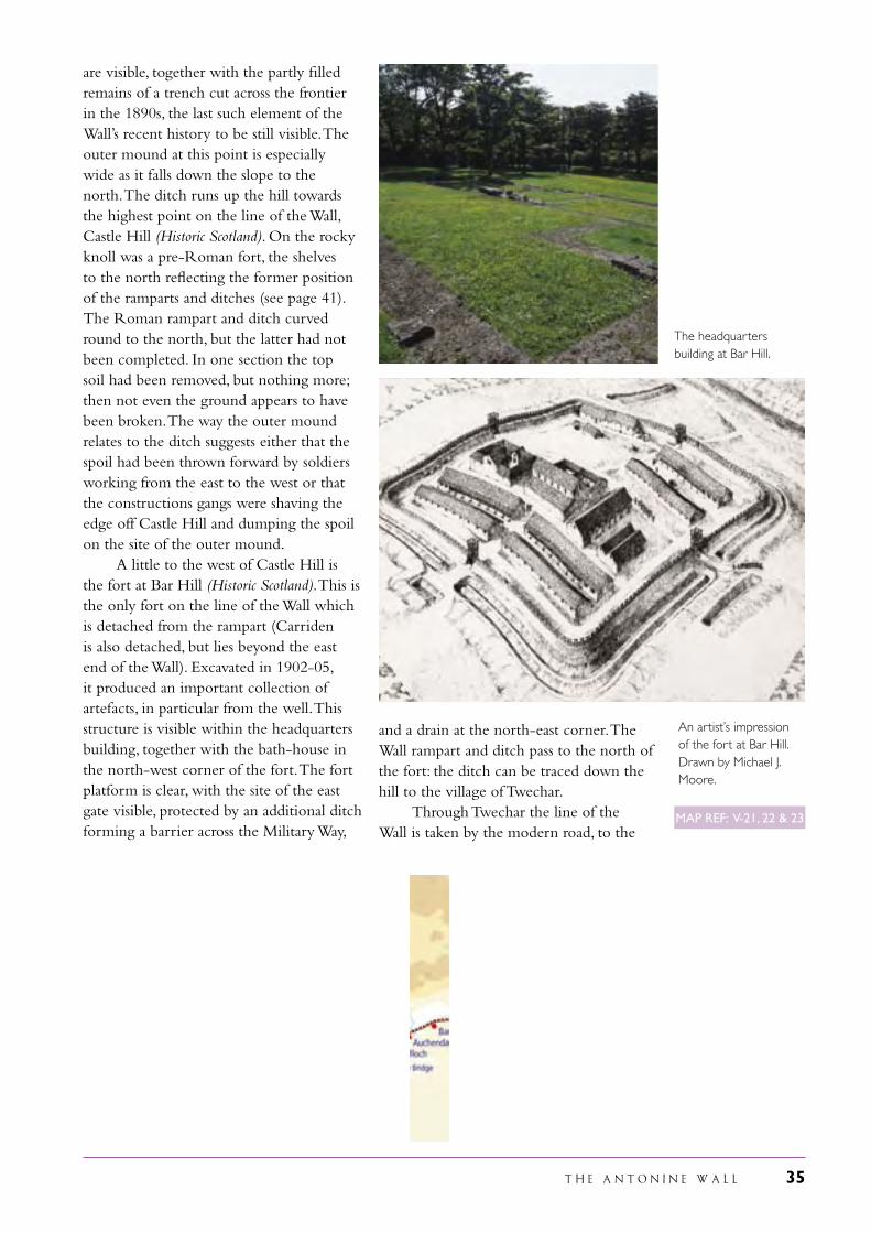
are visible, together with the partly filled remains of a trench cut across the frontier in the 1890s, the last such element of the Wall’s recent history to be still visible. The outer mound at this point is especially wide as it falls down the slope to the north. The ditch runs up the hill towards the highest point on the line of the Wall, Castle Hill (Historic Scotland). On the rocky knoll was a pre-Roman fort, the shelves to the north reflecting the former position of the ramparts and ditches (see page 41). The Roman rampart and ditch curved round to the north, but the latter had not been completed. In one section the top soil had been removed, but nothing more; then not even the ground appears to have been broken. The way the outer mound relates to the ditch suggests either that the spoil had been thrown forward by soldiers working from the east to the west or that the constructions gangs were shaving the edge off Castle Hill and dumping the spoil on the site of the outer mound. A little to the west of Castle Hill is the fort at Bar Hill (Historic Scotland). This is the only fort on the line of the Wall which is detached from the rampart (Carriden is also detached, but lies beyond the east end of the Wall). Excavated in 1902-05, it produced an important collection of artefacts, in particular from the well. This structure is visible within the headquarters building, together with the bath-house in the north-west corner of the fort. The fort platform is clear, with the site of the east gate visible, protected by an additional ditch forming a barrier across the Military Way,
and a drain at the north-east corner. The Wall rampart and ditch pass to the north of the fort: the ditch can be traced down the hill to the village of Twechar. Through Twechar the line of the Wall is taken by the modern road, to the
The headquarters building at Bar Hill.
An artist’s impression of the fort at Bar Hill. Drawn by Michael J. Moore.
MAP REF: V-21, 22 & 23
36 T H E A N T O N I N E W A L L
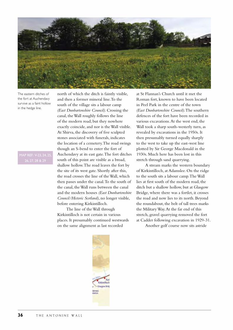
north of which the ditch is faintly visible, and then a former mineral line. To the south of the village sits a labour camp (East Dunbartonshire Council). Crossing the canal, the Wall roughly follows the line of the modern road, but they nowhere exactly coincide, and nor is the Wall visible. At Shirva, the discovery of five sculpted stones associated with funerals, indicates the location of a cemetery. The road swings though an S-bend to enter the fort of Auchendavy at its east gate. The fort ditches south of this point are visible as a broad, shallow hollow. The road leaves the fort by the site of its west gate. Shortly after this, the road crosses the line of the Wall, which then passes under the canal. To the south of the canal, the Wall runs between the canal and the modern houses (East Dunbartonshire Council/Historic Scotland), no longer visible, before entering Kirkintilloch. The line of the Wall through Kirkintilloch is not certain in various places. It presumably continued westwards on the same alignment as last recorded
at St Flannan’s Church until it met the Roman fort, known to have been located in Peel Park in the centre of the town (East Dunbartonshire Council). The southern defences of the fort have been recorded in various excavations. At the west end, the Wall took a sharp south-westerly turn, as revealed by excavations in the 1950s. It then presumably turned equally sharply to the west to take up the east-west line plotted by Sir George Macdonald in the 1930s. Much here has been lost in this stretch through sand quarrying. A stream marks the western boundary of Kirkintilloch, at Adamslee. On the ridge to the south sits a labour camp. The Wall lies at first south of the modern road, the ditch but a shallow hollow, but at Glasgow Bridge, where there was a fortlet, it crosses the road and now lies to its north. Beyond the roundabout, the belt of tall trees marks the Military Way. At the far end of this stretch, gravel quarrying removed the fort at Cadder following excavation in 1929-31. Another golf course now sits astride
The eastern ditches of the fort at Auchendavy survive as a faint hollow in the hedge line.
MAP REF: V-23, 24, 25,
26, 27, 28 & 29
T H E A N T O N I N E W A L L 37
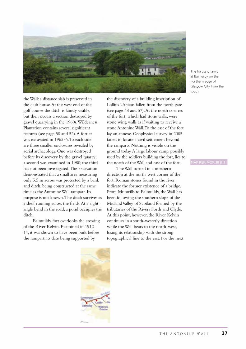
the Wall: a distance slab is preserved in the club house. At the west end of the golf course the ditch is faintly visible, but then occurs a section destroyed by gravel quarrying in the 1960s. Wilderness Plantation contains several significant features (see page 50 and 52). A fortlet was excavated in 1965/6. To each side are three smaller enclosures revealed by aerial archaeology. One was destroyed before its discovery by the gravel quarry; a second was examined in 1980; the third has not been investigated. The excavation demonstrated that a small area measuring only 5.5 m across was protected by a bank and ditch, being constructed at the same time as the Antonine Wall rampart. Its purpose is not known. The ditch survives as a shelf running across the fields. At a right-angle bend in the road, a pond occupies the ditch. Balmuildy fort overlooks the crossing of the River Kelvin. Examined in 1912-14, it was shown to have been built before the rampart, its date being supported by
the discovery of a building inscription of Lollius Urbicus fallen from the north gate (see page 48 and 57). At the north corners of the fort, which had stone walls, were stone wing walls as if waiting to receive a stone Antonine Wall. To the east of the fort lay an annexe. Geophysical survey in 2005 failed to locate a civil settlement beyond the ramparts. Nothing is visible on the ground today. A large labour camp, possibly used by the soldiers building the fort, lies to the north of the Wall and east of the fort. The Wall turned in a northern direction at the north-west corner of the fort. Roman stones found in the river indicate the former existence of a bridge. From Mumrills to Balmuildy, the Wall has been following the southern slope of the Midland Valley of Scotland formed by the tributaries of the Rivers Forth and Clyde. At this point, however, the River Kelvin continues in a south-westerly direction while the Wall bears to the north-west, losing its relationship with the strong topographical line to the east. For the next
The fort, and farm, at Balmuildy on the northern edge of Glasgow City from the south.
MAP REF: V-29, 30 & 31
38 T H E A N T O N I N E W A L L
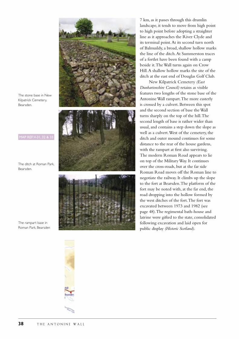
7 km, as it passes through this drumlin landscape, it tends to move from high point to high point before adopting a straighter line as it approaches the River Clyde and its terminal point. At its second turn north of Balmuildy, a broad, shallow hollow marks the line of the ditch. At Summerston traces of a fortlet have been found with a camp beside it. The Wall turns again on Crow Hill. A shallow hollow marks the site of the ditch at the east end of Douglas Golf Club. New Kilpatrick Cemetery (East Dunbartonshire Council) retains as visible features two lengths of the stone base of the Antonine Wall rampart. The more easterly is crossed by a culvert. Between this spot and the second section of base the Wall turns sharply on the top of the hill. The second length of base is rather wider than usual, and contains a step down the slope as well as a culvert. West of the cemetery, the ditch and outer mound continues for some distance to the rear of the house gardens, with the rampart at first also surviving. The modern Roman Road appears to lie on top of the Military Way. It continues over the cross-roads, but at the far side Roman Road moves off the Roman line to negotiate the railway. It climbs up the slope to the fort at Bearsden. The platform of the fort may be noted with, at the far end, the road dropping into the hollow formed by the west ditches of the fort. The fort was excavated between 1973 and 1982 (see page 48). The regimental bath-house and latrine were gifted to the state, consolidated following excavation and laid open for public display (Historic Scotland).
The stone base in New Kilpatrick Cemetery, Bearsden.
The ditch at Roman Park, Bearsden.
The rampart base in Roman Park, Bearsden
MAP REF: V-31, 32 & 33
T H E A N T O N I N E W A L L 39
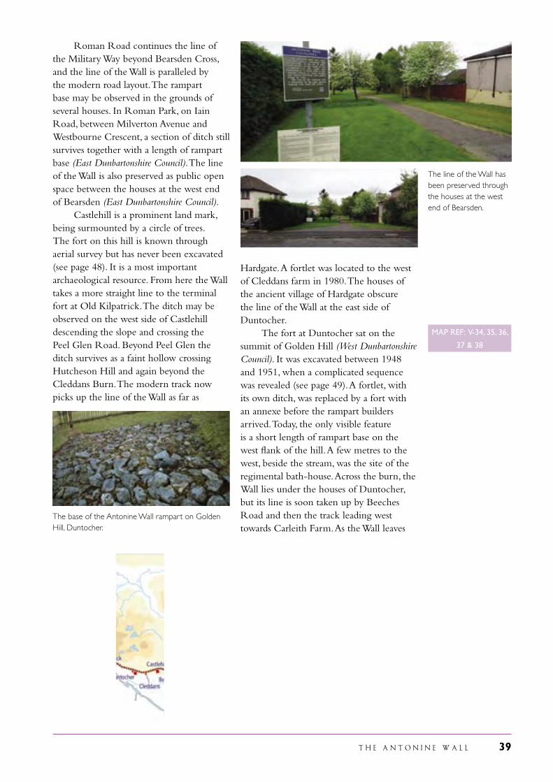
Roman Road continues the line of the Military Way beyond Bearsden Cross, and the line of the Wall is paralleled by the modern road layout. The rampart base may be observed in the grounds of several houses. In Roman Park, on Iain Road, between Milverton Avenue and Westbourne Crescent, a section of ditch still survives together with a length of rampart base (East Dunbartonshire Council). The line of the Wall is also preserved as public open space between the houses at the west end of Bearsden (East Dunbartonshire Council). Castlehill is a prominent land mark, being surmounted by a circle of trees. The fort on this hill is known through aerial survey but has never been excavated (see page 48). It is a most important archaeological resource. From here the Wall takes a more straight line to the terminal fort at Old Kilpatrick. The ditch may be observed on the west side of Castlehill descending the slope and crossing the Peel Glen Road. Beyond Peel Glen the ditch survives as a faint hollow crossing Hutcheson Hill and again beyond the Cleddans Burn. The modern track now picks up the line of the Wall as far as
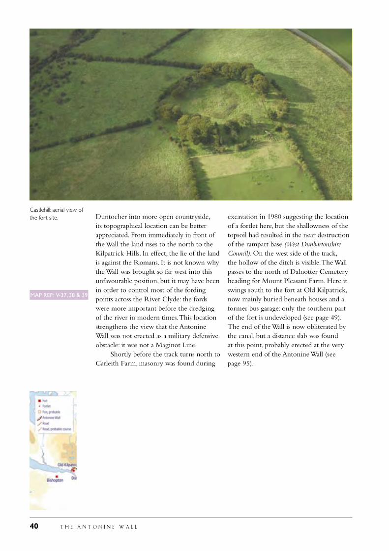
Hardgate. A fortlet was located to the west of Cleddans farm in 1980. The houses of the ancient village of Hardgate obscure the line of the Wall at the east side of Duntocher. The fort at Duntocher sat on the summit of Golden Hill (West Dunbartonshire Council). It was excavated between 1948 and 1951, when a complicated sequence was revealed (see page 49). A fortlet, with its own ditch, was replaced by a fort with an annexe before the rampart builders arrived. Today, the only visible feature is a short length of rampart base on the west flank of the hill. A few metres to the west, beside the stream, was the site of the regimental bath-house. Across the burn, the Wall lies under the houses of Duntocher, but its line is soon taken up by Beeches Road and then the track leading west towards Carleith Farm. As the Wall leaves
The line of the Wall has been preserved through the houses at the west end of Bearsden.
The base of the Antonine Wall rampart on Golden Hill, Duntocher.
MAP REF: V-34, 35, 36,
37 & 38
40 T H E A N T O N I N E W A L L
Duntocher into more open countryside, its topographical location can be better appreciated. From immediately in front of the Wall the land rises to the north to the Kilpatrick Hills. In effect, the lie of the land is against the Romans. It is not known why the Wall was brought so far west into this unfavourable position, but it may have been in order to control most of the fording points across the River Clyde: the fords were more important before the dredging of the river in modern times. This location strengthens the view that the Antonine Wall was not erected as a military defensive obstacle: it was not a Maginot Line. Shortly before the track turns north to Carleith Farm, masonry was found during
excavation in 1980 suggesting the location of a fortlet here, but the shallowness of the topsoil had resulted in the near destruction of the rampart base (West Dunbartonshire Council). On the west side of the track, the hollow of the ditch is visible. The Wall passes to the north of Dalnotter Cemetery heading for Mount Pleasant Farm. Here it swings south to the fort at Old Kilpatrick, now mainly buried beneath houses and a former bus garage: only the southern part of the fort is undeveloped (see page 49). The end of the Wall is now obliterated by the canal, but a distance slab was found at this point, probably erected at the very western end of the Antonine Wall (see page 95).
Castlehill: aerial view of the fort site.
MAP REF: V-37, 38 & 39
T H E A N T O N I N E W A L L 41
Environmental background
2.a.3 The economic expansion in the region occurred in the later Iron Age, demonstrably before Roman military occupation. This expansion developed from Bronze Age and earlier Iron Age small-scale farms and gathered pace in the last 200-300 years BC, for crop growing as well as pasture, and was continued rather than intensified in the first two centuries AD. It is difficult to see differences in this economic expansion north and south of the Antonine Wall itself, or east and west of the Forth-Clyde isthmus, but it is tentatively suggested that in the foothills of the Southern Uplands the Romans entered a landscape already decaying. Roman influence is perhaps recognisable at some localities in a reduction of cereal production and the expansion of grazed pasture, assumed to represent a restructuring of the native economy to support a new market. It is presumed that imports of foodstuffs continued to be important to Roman forces during the Antonine occupation, although possible reconstructions of the sediments in the
Forth and Clyde estuaries suggest these may not have provided coast lines ideal for harbours, though such harbours are believed to have existed at Inveresk on the Firth of Forth and at an unlocated place on the River Clyde. There is little evidence that this increased pastoral economy imposed stresses on soils or plant communities, and the market seems to have been readily supplied within the agricultural capacity of the landscape. Nevertheless, the native economy was probably artificially buoyed by the Roman presence, and withdrawal eventually led to what is best described as an agricultural recession, not population collapse.
The construction of the Antonine Wall would have required the felling of many trees.
Fig seeds found in the sewage of the latrine at Bearsden: the figs were probably imported from the continent.
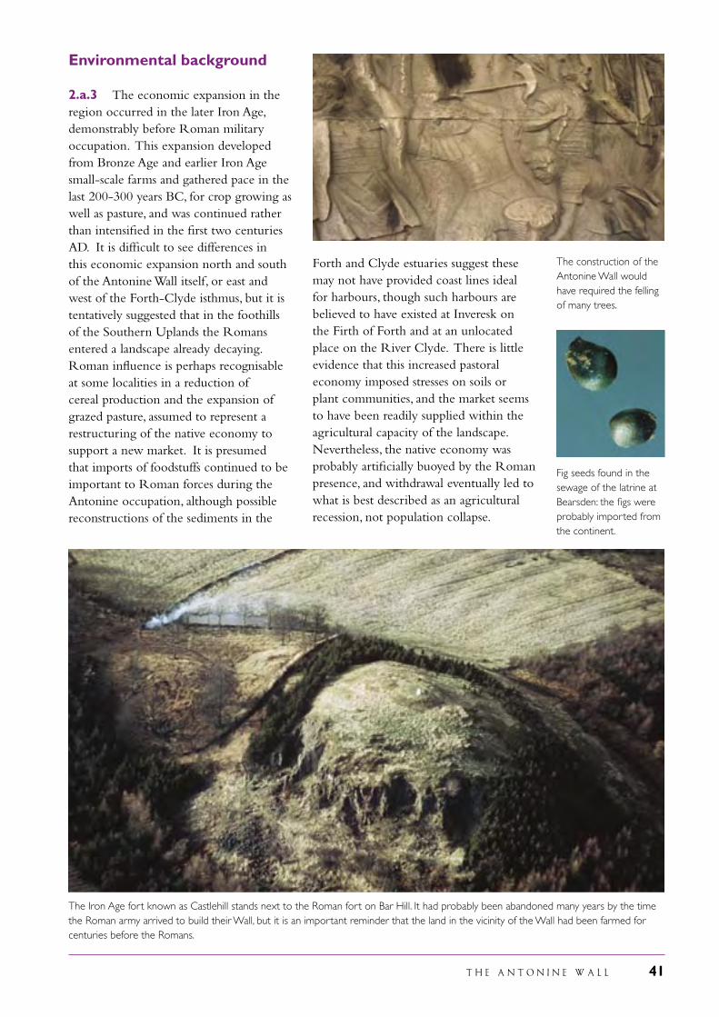
The Iron Age fort known as Castlehill stands next to the Roman fort on Bar Hill. It had probably been abandoned many years by the time the Roman army arrived to build their Wall, but it is an important reminder that the land in the vicinity of the Wall had been farmed for centuries before the Romans.
42 T H E A N T O N I N E W A L L
The individual elements of the Antonine Wall
Rampart and ditch2.a.4 The Antonine Wall was actually a rampart of turf, as stated by the Historia Augusta, Life of Antoninus Pius 5, 4. While turf was the most commonly used material in the construction of the rampart, sometimes the turf only formed the cheeks of a rampart of earth while several kilometres at the eastern end were of clay. The rampart was placed on a stone base probably intended to be 15 Roman feet wide (4.4 m). Occasionally the junction between two work gangs can be recognised mainly through the use of different sizes of stones. At various places culverts have been recorded in the base: no regularity can be discerned. It is not known how the top
of the rampart was finished off. In several places excavation has revealed evidence for repair of the rampart. In some instances this occurs beside culverts and suggests damage by water action.
2.a.5 The rampart survives as a mound for about 6 km. Stretches of the stone base are visible in New Kilpatrick Cemetery (each with a culvert), at Iain Road in Bearsden, on Golden Hill, Duntocher, and at Tollpark (also with a culvert) while stone settings for the edge of the rampart may be seen at Kemper Avenue in Falkirk.
2.a.6 In front of the rampart lay a wide and deep ditch. In the central sector it was 12 m wide and up to 3.6 m deep. To the east, however, it was no more than 9 m wide while in the western sector it rarely achieved a width of over 7.5 m. About 22 km of the ditch are still visible.
2.a.7 The material from the ditch was tipped out onto the north side to form a low mound or glacis, usually called the upcast or outer mound. This varies in width depending upon the size of the ditch. Measurements range from 9.5 m to 23 m. Where the ground sloped steeply to the north, the material was generally heaped higher into a sharply pointed mound.
2.a.8 The space between the rampart and the ditch is known as the berm. It was 6 m wide in the central sector but broadened to east and west where the ditch narrowed. This suggests that the main fixed lines were the centre of the ditch and the front edge of the rampart. An important recent discovery has been pits on the berm
A culvert crossing the base of the Antonine Wall in New Kilpatrick Cemetery, Bearsden.
Pits found on the berm immediately in front of the Antonine Wall rampart, in Falkirk.
Professor Anne Robertson’s section through the Antonine Wall at Tentfield Plantation, east of Rough Castle, in 1959 reveals many layers of turf work erected on a stone base. These turves provide valuable information on the nature of the vegetation at the time the Romans started to build the Wall.
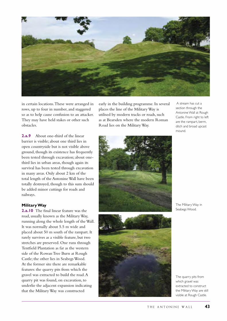
T H E A N T O N I N E W A L L 43
in certain locations. These were arranged in rows, up to four in number, and staggered so as to help cause confusion to an attacker. They may have held stakes or other such obstacles.
2.a.9 About one-third of the linear barrier is visible; about one third lies in open countryside but is not visible above ground, though its existence has frequently been tested through excavation; about one-third lies in urban areas, though again its survival has been tested through excavation in many areas. Only about 2 km of the total length of the Antonine Wall have been totally destroyed, though to this sum should be added minor cuttings for roads and railways.
Military Way2.a.10 The final linear feature was the road, usually known as the Military Way, running along the whole length of the Wall. It was normally about 5.5 m wide and placed about 50 m south of the rampart. It rarely survives as a visible feature, but two stretches are preserved. One runs through Tentfield Plantation as far as the western side of the Rowan Tree Burn at Rough Castle; the other lies in Seabegs Wood. At the former site there are remarkable features: the quarry pits from which the gravel was extracted to build the road. A quarry pit was found, on excavation, to underlie the adjacent expansion indicating that the Military Way was constructed
A stream has cut a section through the Antonine Wall at Rough Castle. From right to left are the rampart, berm, ditch and broad upcast mound.
early in the building programme. In several places the line of the Military Way is utilised by modern tracks or roads, such as at Bearsden where the modern Roman Road lies on the Military Way.
The Military Way in Seabegs Wood.
The quarry pits from which gravel was extracted to construct the Military Way are still visible at Rough Castle.
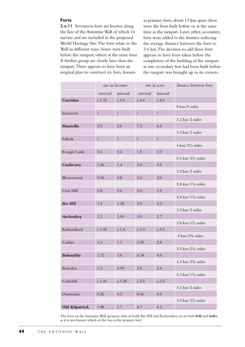
44 T H E A N T O N I N E W A L L
Forts2.a.11 Seventeen forts are known along the line of the Antonine Wall of which 16 survive and are included in the proposed World Heritage Site. The forts relate to the Wall in different ways. Some were built before the rampart; others at the same time. A further group are clearly later than the rampart. There appears to have been an original plan to construct six forts, known
size in hectares size in acres distance between forts
external internal external internal
Carriden c.1.76 c.1.6 c.4.4 c.4.0
8 km/5 miles
Inveravon ? ? ? ?
3.2 km/2 miles
Mumrills 2.9 2.6 7.3 6.5
3.2 km/2 miles
Falkirk ? ? ? ?
4 km/21⁄2 miles
Rough Castle 0.6 0.4 1.5 1.0
5.6 km/31⁄2 miles
Castlecary 1.56 1.4 3.9 3.5
3.2 km/2 miles
Westerwood 0.96 0.8 2.4 2.0
2.8 km/13⁄4 miles
Croy Hill 0.8 0.6 2.0 1.5
2.8 km/13⁄4 miles
Bar Hill 1.4 1.28 3.5 3.2
3.2 km/2 miles
Auchendavy 1.2 1.09 3.0 2.7
2.8 km/13⁄4 miles
Kirkintilloch c.1.55 c.1.4 c.3.9 c.3.5
4 km/23⁄8 miles
Cadder 1.3 1.1 3.35 2.8
3.5 km/21⁄4 miles
Balmuildy 1.72 1.6 4.34 4.0
4.2 km/33⁄4 miles
Bearsden 1.2 0.95 2.8 2.4
2.3 km/11⁄2 miles
Castlehill c.1.41 c.1.28 c.3.5 c.3.2
3.2 km/2 miles
Duntocher 0.26 0.2 0.66 0.5
3.5 km/21⁄4 miles
Old Kilpatrick 1.88 1.7 4.7 4.2 The forts on the Antonine Wall (primary forts in bold; Bar Hill and Auchendavy are in both bold and italics as it is not known which of the two is the primary fort)
as primary forts, about 13 km apart: these were the forts built before or at the same time as the rampart. Later, other, secondary, forts were added to the frontier reducing the average distance between the forts to 3.6 km. The decision to add these forts appears to have been taken before the completion of the building of the rampart as one secondary fort had been built before the rampart was brought up to its corners.
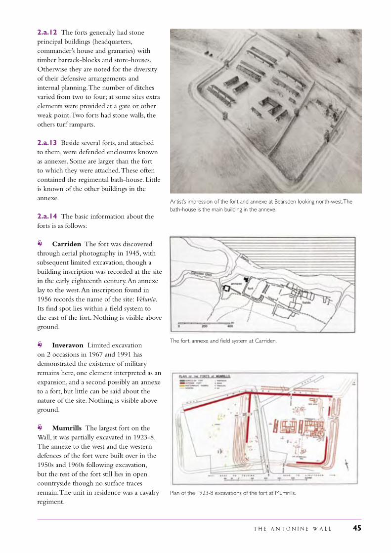
T H E A N T O N I N E W A L L 45
2.a.12 The forts generally had stone principal buildings (headquarters, commander’s house and granaries) with timber barrack-blocks and store-houses. Otherwise they are noted for the diversity of their defensive arrangements and internal planning. The number of ditches varied from two to four; at some sites extra elements were provided at a gate or other weak point. Two forts had stone walls, the others turf ramparts.
2.a.13 Beside several forts, and attached to them, were defended enclosures known as annexes. Some are larger than the fort to which they were attached. These often contained the regimental bath-house. Little is known of the other buildings in the annexe.
2.a.14 The basic information about the forts is as follows:
Carriden The fort was discovered through aerial photography in 1945, with subsequent limited excavation, though a building inscription was recorded at the site in the early eighteenth century. An annexe lay to the west. An inscription found in 1956 records the name of the site: Velunia. Its find spot lies within a field system to the east of the fort. Nothing is visible above ground.
Inveravon Limited excavation on 2 occasions in 1967 and 1991 has demonstrated the existence of military remains here, one element interpreted as an expansion, and a second possibly an annexe to a fort, but little can be said about the nature of the site. Nothing is visible above ground.
Mumrills The largest fort on the Wall, it was partially excavated in 1923-8. The annexe to the west and the western defences of the fort were built over in the 1950s and 1960s following excavation, but the rest of the fort still lies in open countryside though no surface traces remain. The unit in residence was a cavalry regiment.
The fort, annexe and field system at Carriden.
Plan of the 1923-8 excavations of the fort at Mumrills.
Artist’s impression of the fort and annexe at Bearsden looking north-west. The bath-house is the main building in the annexe.
46 T H E A N T O N I N E W A L L
Falkirk The defences of the fort were located in the Pleasance area of Falkirk between 1989 and 2000. The fort is mostly built over and not visible.
Rough Castle This fort has been the site of 4 series of excavations, in 1902-33, 1920, 1932-3 and 1957-61. These demonstrated that the fort was secondary, an addition to the original series. It contained a headquarters building, commander’s house, granary and barrack-blocks, all within a small area. Part of an inscription found in the well in 1903 demonstrated for the first time within the Roman empire that the correct name of the headquarters building was principia not praetorium as had hitherto been supposed. (see page 68). The regimental bath-house lay in the annexe to the east. The site is unusual on the Antonine Wall in that the whole circuit of the defences of the fort and the annexe are visible; a small enclosure within the annexe may be the remains of an earlier fortlet. Defensive pits, generally known as lilia, are uniquely visible beyond the north gate.
Castlecary One of only two forts to be protected by stone walls, this fort was examined in 1902, the internal bath-house having been planned in 1769. An annexe lay to the east. Both fort and annexe are today bisected by the Edinburgh-Glasgow railway. The fort is unusual in having attested at it two thousand-strong auxiliary units as well as a legionary detachment: this may relate to its strategic position on the watershed between the Forth and Clyde river basins. The low mound of the east wall of the fort together with some stones of the same wall and parts of the headquarters building are visible.
Westerwood The defences of the fort were examined in 1932, the internal bath-house located in 1987 and the civilian settlement to the west partially investigated in 1986-8. The buildings of the former farm of Westerwood still stand within the fort. The southern half of the circuit of the defences is faintly visible.
Plan of Castlecary fort and annexe.
Plan of the fort at Westerwood.
Plan of the 1903 excavations of the fort at Rough Castle.
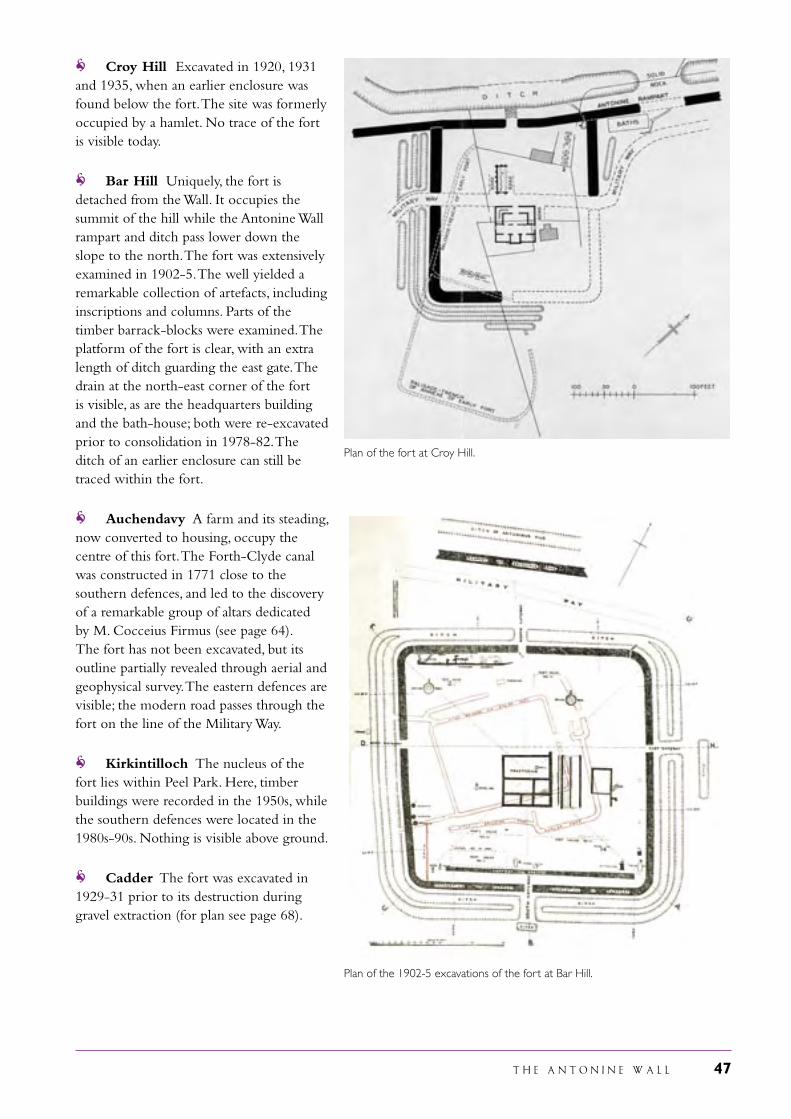
T H E A N T O N I N E W A L L 47
Plan of the fort at Croy Hill.
Croy Hill Excavated in 1920, 1931 and 1935, when an earlier enclosure was found below the fort. The site was formerly occupied by a hamlet. No trace of the fort is visible today.
Bar Hill Uniquely, the fort is detached from the Wall. It occupies the summit of the hill while the Antonine Wall rampart and ditch pass lower down the slope to the north. The fort was extensively examined in 1902-5. The well yielded a remarkable collection of artefacts, including inscriptions and columns. Parts of the timber barrack-blocks were examined. The platform of the fort is clear, with an extra length of ditch guarding the east gate. The drain at the north-east corner of the fort is visible, as are the headquarters building and the bath-house; both were re-excavated prior to consolidation in 1978-82. The ditch of an earlier enclosure can still be traced within the fort.
Auchendavy A farm and its steading, now converted to housing, occupy the centre of this fort. The Forth-Clyde canal was constructed in 1771 close to the southern defences, and led to the discovery of a remarkable group of altars dedicated by M. Cocceius Firmus (see page 64). The fort has not been excavated, but its outline partially revealed through aerial and geophysical survey. The eastern defences are visible; the modern road passes through the fort on the line of the Military Way.
Kirkintilloch The nucleus of the fort lies within Peel Park. Here, timber buildings were recorded in the 1950s, while the southern defences were located in the 1980s-90s. Nothing is visible above ground.
Cadder The fort was excavated in 1929-31 prior to its destruction during gravel extraction (for plan see page 68).
Plan of the 1902-5 excavations of the fort at Bar Hill.
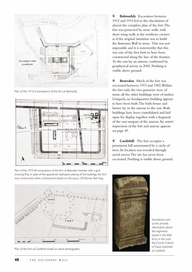
48 T H E A N T O N I N E W A L L
Balmuildy Excavation between 1912 and 1914 led to the elucidation of almost the complete plan of the fort. The fort was protected by stone walls, with short wing-walls at the northern corners as if the original intention was to build the Antonine Wall in stone. This was not impossible and it is noteworthy that this was one of the first forts to have been constructed along the line of the frontier. To the east lay an annexe, confirmed by geophysical survey in 2005. Nothing is visible above ground.
Bearsden Much of the fort was excavated between 1973 and 1982. Within the fort only the two granaries were of stone, all the other buildings were of timber. Uniquely, no headquarters building appears to have been built. The bath-house and latrine lay in the annexe to the east. Both buildings have been consolidated and laid open for display, together with a fragment of the east rampart of the annexe. An artist’s impression of the fort and annexe appears on page 45.
Castlehill The fort occupies a prominent hill surmounted by a circle of trees. Its location was revealed through aerial survey. The site has never been excavated. Nothing is visible above ground.
Plan of the 1912-4 excavations of the fort at Balmuildy.
Plan of the 1973-83 excavations of the fort at Bearsden overlain with a grid showing that, in spite of the apparently haphazard placing of the buildings, the fort was constructed within a framework based on the actus, 120 Roman feet long.
Plan of the fort at Castlehill, based on aerial photographs.
Inscriptions such as this provide information about the regiments based in the Wall forts, in this case the Fourth Cohort of Gauls stationed at Castlehill.
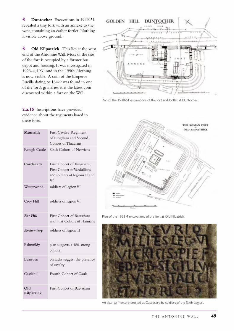
T H E A N T O N I N E W A L L 49
Duntocher Excavations in 1949-51 revealed a tiny fort, with an annexe to the west, containing an earlier fortlet. Nothing is visible above ground.
Old Kilpatrick This lies at the west end of the Antonine Wall. Most of the site of the fort is occupied by a former bus depot and housing. It was investigated in 1923-4, 1931 and in the 1990s. Nothing is now visible. A coin of the Emperor Lucilla dating to 164-9 was found in one of the fort’s granaries: it is the latest coin discovered within a fort on the Wall.
2.a.15 Inscriptions have provided evidence about the regiments based in these forts.
Mumrills First Cavalry Regiment of Tungrians and Second Cohort of Thracians
Rough Castle Sixth Cohort of Nervians
Castlecary First Cohort of Tungrians, First Cohort of Vardullians and soldiers of legions II and VI
Westerwood soldiers of legion VI
Croy Hill soldiers of legion VI
Bar Hill First Cohort of Baetasians and First Cohort of Hamians
Auchendavy soldiers of legion II
Balmuildy plan suggests a 480-strong cohort
Bearsden barracks suggest the presence of cavalry
Castlehill Fourth Cohort of Gauls
Old Kilpatrick
First Cohort of Baetasians
Plan of the 1948-51 excavations of the fort and fortlet at Duntocher.
Plan of the 1923-4 excavations of the fort at Old Kilpatrick.
An altar to Mercury erected at Castlecary by soldiers of the Sixth Legion.
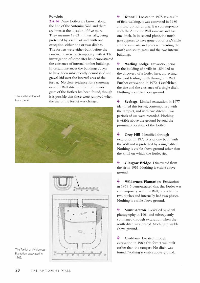
50 T H E A N T O N I N E W A L L
Fortlets2.a.16 Nine fortlets are known along the line of the Antonine Wall and there are hints at the location of five more. They measure 18-21 m internally, being protected by a rampart and, with one exception, either one or two ditches. The fortlets were either built before the rampart or were contemporary with it. The investigation of some sites has demonstrated the existence of internal timber buildings. In certain instances the buildings appear to have been subsequently demolished and gravel laid over the internal area of the fortlet. No clear evidence for a causeway over the Wall ditch in front of the north gates of the fortlets has been found, though it is possible that these were removed when the use of the fortlet was changed.
Kinneil Located in 1978 as a result of field walking, it was excavated in 1980 and laid out for display. It is contemporary with the Antonine Wall rampart and has one ditch. In its second phase, the north gate appears to have gone out of use. Visible are the ramparts and posts representing the north and south gates and the two internal buildings.
Watling Lodge Excavation prior to the building of a villa in 1894 led to the discovery of a fortlet here, protecting the road leading north through the Wall. Further excavation in 1972-4 established the size and the existence of a single ditch. Nothing is visible above ground.
Seabegs Limited excavation in 1977 identified this fortlet, contemporary with the rampart, and with two ditches. Two periods of use were recorded. Nothing is visible above the ground beyond the prominent location of the fortlet.
Croy Hill Identified through excavation in 1977, it is of one build with the Wall and is protected by a single ditch. Nothing is visible above ground other than the knoll on which the fortlet sits.
Glasgow Bridge Discovered from the air in 1951. Nothing is visible above ground.
Wilderness Plantation Excavation in 1965-6 demonstrated that this fortlet was contemporary with the Wall, protected by two ditches and internally had two phases. Nothing is visible above ground.
Summerston Revealed by aerial photography in 1961 and subsequently confirmed through excavation when the south ditch was located. Nothing is visible above ground.
Cleddans Located through excavation in 1980, this fortlet was built earlier than the rampart. No ditch was found. Nothing is visible above ground.
The fortlet at Wilderness Plantation excavated in 1965.
The fortlet at Kinneil from the air.
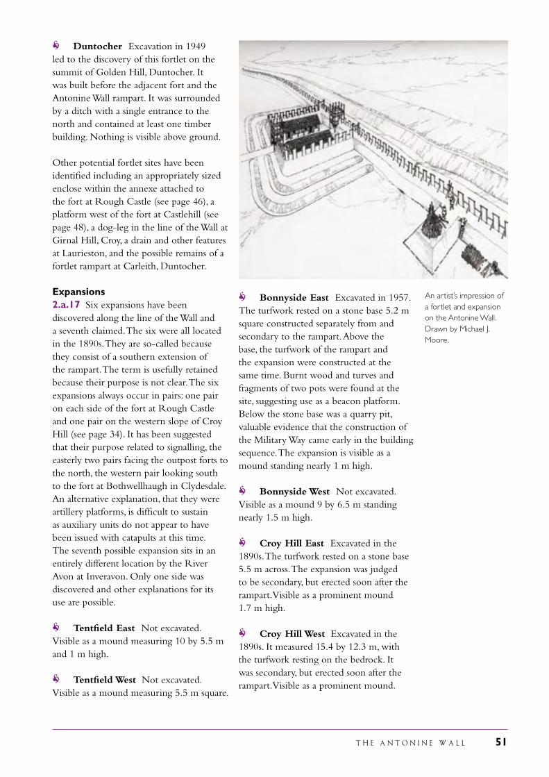
T H E A N T O N I N E W A L L 51
Duntocher Excavation in 1949 led to the discovery of this fortlet on the summit of Golden Hill, Duntocher. It was built before the adjacent fort and the Antonine Wall rampart. It was surrounded by a ditch with a single entrance to the north and contained at least one timber building. Nothing is visible above ground.
Other potential fortlet sites have been identified including an appropriately sized enclose within the annexe attached to the fort at Rough Castle (see page 46), a platform west of the fort at Castlehill (see page 48), a dog-leg in the line of the Wall at Girnal Hill, Croy, a drain and other features at Laurieston, and the possible remains of a fortlet rampart at Carleith, Duntocher.
Expansions2.a.17 Six expansions have been discovered along the line of the Wall and a seventh claimed. The six were all located in the 1890s. They are so-called because they consist of a southern extension of the rampart. The term is usefully retained because their purpose is not clear. The six expansions always occur in pairs: one pair on each side of the fort at Rough Castle and one pair on the western slope of Croy Hill (see page 34). It has been suggested that their purpose related to signalling, the easterly two pairs facing the outpost forts to the north, the western pair looking south to the fort at Bothwellhaugh in Clydesdale. An alternative explanation, that they were artillery platforms, is difficult to sustain as auxiliary units do not appear to have been issued with catapults at this time. The seventh possible expansion sits in an entirely different location by the River Avon at Inveravon. Only one side was discovered and other explanations for its use are possible.
Tentfield East Not excavated. Visible as a mound measuring 10 by 5.5 m and 1 m high.
Tentfield West Not excavated. Visible as a mound measuring 5.5 m square.
Bonnyside East Excavated in 1957. The turfwork rested on a stone base 5.2 m square constructed separately from and secondary to the rampart. Above the base, the turfwork of the rampart and the expansion were constructed at the same time. Burnt wood and turves and fragments of two pots were found at the site, suggesting use as a beacon platform. Below the stone base was a quarry pit, valuable evidence that the construction of the Military Way came early in the building sequence. The expansion is visible as a mound standing nearly 1 m high.
Bonnyside West Not excavated. Visible as a mound 9 by 6.5 m standing nearly 1.5 m high.
Croy Hill East Excavated in the 1890s. The turfwork rested on a stone base 5.5 m across. The expansion was judged to be secondary, but erected soon after the rampart. Visible as a prominent mound 1.7 m high.
Croy Hill West Excavated in the 1890s. It measured 15.4 by 12.3 m, with the turfwork resting on the bedrock. It was secondary, but erected soon after the rampart. Visible as a prominent mound.
An artist’s impression of a fortlet and expansion on the Antonine Wall. Drawn by Michael J. Moore.
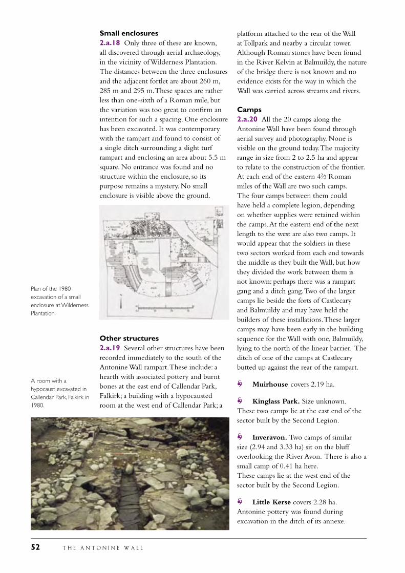
52 T H E A N T O N I N E W A L L
Small enclosures2.a.18 Only three of these are known, all discovered through aerial archaeology, in the vicinity of Wilderness Plantation. The distances between the three enclosures and the adjacent fortlet are about 260 m, 285 m and 295 m. These spaces are rather less than one-sixth of a Roman mile, but the variation was too great to confirm an intention for such a spacing. One enclosure has been excavated. It was contemporary with the rampart and found to consist of a single ditch surrounding a slight turf rampart and enclosing an area about 5.5 m square. No entrance was found and no structure within the enclosure, so its purpose remains a mystery. No small enclosure is visible above the ground.
Other structures2.a.19 Several other structures have been recorded immediately to the south of the Antonine Wall rampart. These include: a hearth with associated pottery and burnt bones at the east end of Callendar Park, Falkirk; a building with a hypocausted room at the west end of Callendar Park; a
platform attached to the rear of the Wall at Tollpark and nearby a circular tower. Although Roman stones have been found in the River Kelvin at Balmuildy, the nature of the bridge there is not known and no evidence exists for the way in which the Wall was carried across streams and rivers.
Camps2.a.20 All the 20 camps along the Antonine Wall have been found through aerial survey and photography. None is visible on the ground today. The majority range in size from 2 to 2.5 ha and appear to relate to the construction of the frontier. At each end of the eastern 42⁄3 Roman miles of the Wall are two such camps. The four camps between them could have held a complete legion, depending on whether supplies were retained within the camps. At the eastern end of the next length to the west are also two camps. It would appear that the soldiers in these two sectors worked from each end towards the middle as they built the Wall, but how they divided the work between them is not known: perhaps there was a rampart gang and a ditch gang. Two of the larger camps lie beside the forts of Castlecary and Balmuildy and may have held the builders of these installations. These larger camps may have been early in the building sequence for the Wall with one, Balmuildy, lying to the north of the linear barrier. The ditch of one of the camps at Castlecary butted up against the rear of the rampart.
Muirhouse covers 2.19 ha.
Kinglass Park. Size unknown. These two camps lie at the east end of the sector built by the Second Legion.
Inveravon. Two camps of similar size (2.94 and 3.33 ha) sit on the bluff overlooking the River Avon. There is also a small camp of 0.41 ha here.These camps lie at the west end of the sector built by the Second Legion.
Little Kerse covers 2.28 ha. Antonine pottery was found during excavation in the ditch of its annexe.
A room with a hypocaust excavated in Callendar Park, Falkirk in 1980.
Plan of the 1980 excavation of a small enclosure at Wilderness Plantation.
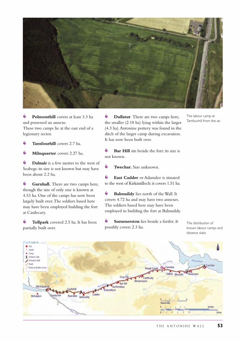
T H E A N T O N I N E W A L L 53
Polmonthill covers at least 3.3 ha and possessed an annexe.These two camps lie at the east end of a legionary sector.
Tamfourhill covers 2.7 ha.
Milnquarter covers 2.27 ha.
Dalnair is a few metres to the west of Seabegs: its size is not known but may have been about 2.2 ha.
Garnhall. There are two camps here, though the size of only one is known at 4.53 ha. One of the camps has now been largely built over. The soldiers based here may have been employed building the fort at Castlecary.
Tollpark covered 2.5 ha. It has been partially built over.
Dullatur There are two camps here, the smaller (2.18 ha) lying within the larger (4.3 ha). Antonine pottery was found in the ditch of the larger camp during excavation. It has now been built over.
Bar Hill sits beside the fort: its size is not known.
Twechar. Size unknown.
East Cadder or Adamslee is situated to the west of Kirkintilloch: it covers 1.51 ha.
Balmuildy lies north of the Wall. It covers 4.72 ha and may have two annexes. The soldiers based here may have been employed in building the fort at Balmuildy.
Summerston lies beside a fortlet. It possibly covers 2.3 ha.
The labour camp at Tamfourhill from the air.
The distribution of known labour camps and distance slabs.
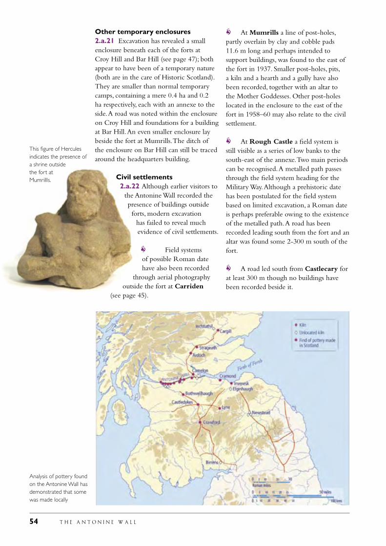
54 T H E A N T O N I N E W A L L
Other temporary enclosures2.a.21 Excavation has revealed a small enclosure beneath each of the forts at Croy Hill and Bar Hill (see page 47); both appear to have been of a temporary nature (both are in the care of Historic Scotland). They are smaller than normal temporary camps, containing a mere 0.4 ha and 0.2 ha respectively, each with an annexe to the side. A road was noted within the enclosure on Croy Hill and foundations for a building at Bar Hill. An even smaller enclosure lay beside the fort at Mumrills. The ditch of the enclosure on Bar Hill can still be traced around the headquarters building.
Civil settlements2.a.22 Although earlier visitors to
the Antonine Wall recorded the presence of buildings outside forts, modern excavation
has failed to reveal much evidence of civil settlements.
Field systems of possible Roman date have also been recorded
through aerial photography outside the fort at Carriden
(see page 45).
At Mumrills a line of post-holes, partly overlain by clay and cobble pads 11.6 m long and perhaps intended to support buildings, was found to the east of the fort in 1937. Smaller post-holes, pits, a kiln and a hearth and a gully have also been recorded, together with an altar to the Mother Goddesses. Other post-holes located in the enclosure to the east of the fort in 1958–60 may also relate to the civil settlement.
At Rough Castle a field system is still visible as a series of low banks to the south-east of the annexe. Two main periods can be recognised. A metalled path passes through the field system heading for the Military Way. Although a prehistoric date has been postulated for the field system based on limited excavation, a Roman date is perhaps preferable owing to the existence of the metalled path. A road has been recorded leading south from the fort and an altar was found some 2-300 m south of the fort.
A road led south from Castlecary for at least 300 m though no buildings have been recorded beside it.
This figure of Hercules indicates the presence of a shrine outside the fort at Mumrillls.
Analysis of pottery found on the Antonine Wall has demonstrated that some was made locally
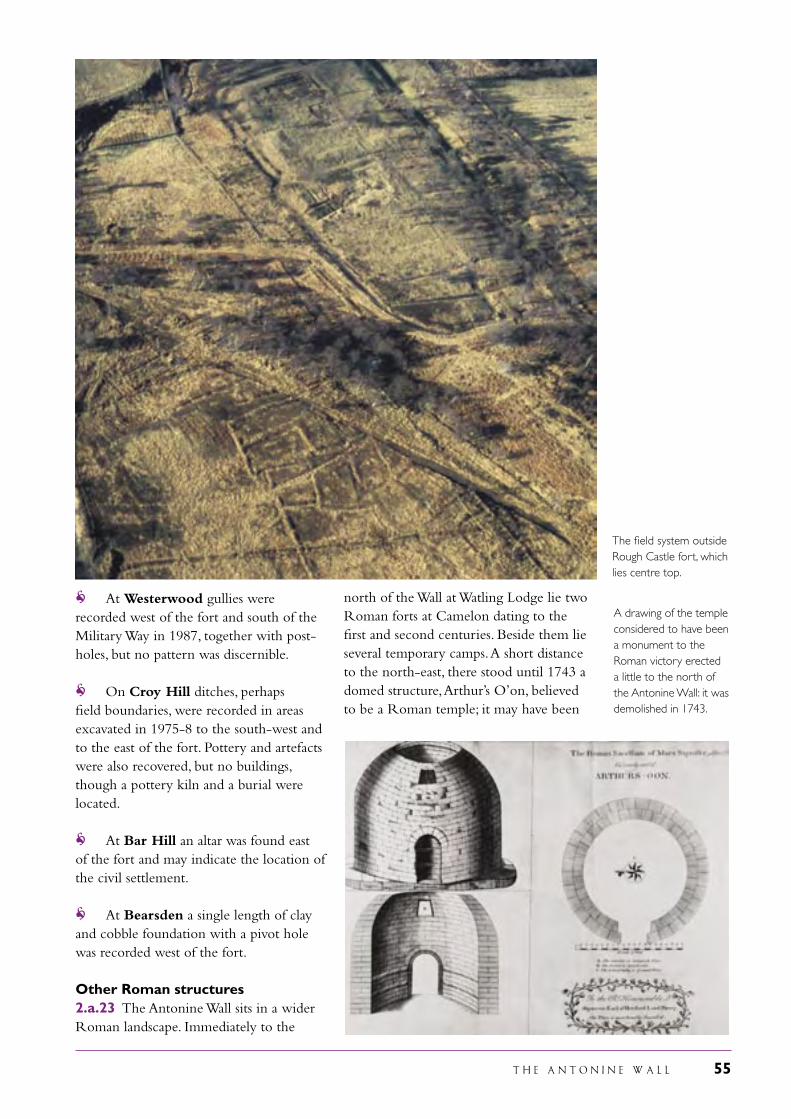
T H E A N T O N I N E W A L L 55
The field system outside Rough Castle fort, which lies centre top.
At Westerwood gullies were recorded west of the fort and south of the Military Way in 1987, together with post-holes, but no pattern was discernible.
On Croy Hill ditches, perhaps field boundaries, were recorded in areas excavated in 1975-8 to the south-west and to the east of the fort. Pottery and artefacts were also recovered, but no buildings, though a pottery kiln and a burial were located.
At Bar Hill an altar was found east of the fort and may indicate the location of the civil settlement.
At Bearsden a single length of clay and cobble foundation with a pivot hole was recorded west of the fort.
Other Roman structures2.a.23 The Antonine Wall sits in a wider Roman landscape. Immediately to the
north of the Wall at Watling Lodge lie two Roman forts at Camelon dating to the first and second centuries. Beside them lie several temporary camps. A short distance to the north-east, there stood until 1743 a domed structure, Arthur’s O’on, believed to be a Roman temple; it may have been
A drawing of the temple considered to have been a monument to the Roman victory erected a little to the north of the Antonine Wall: it was demolished in 1743.
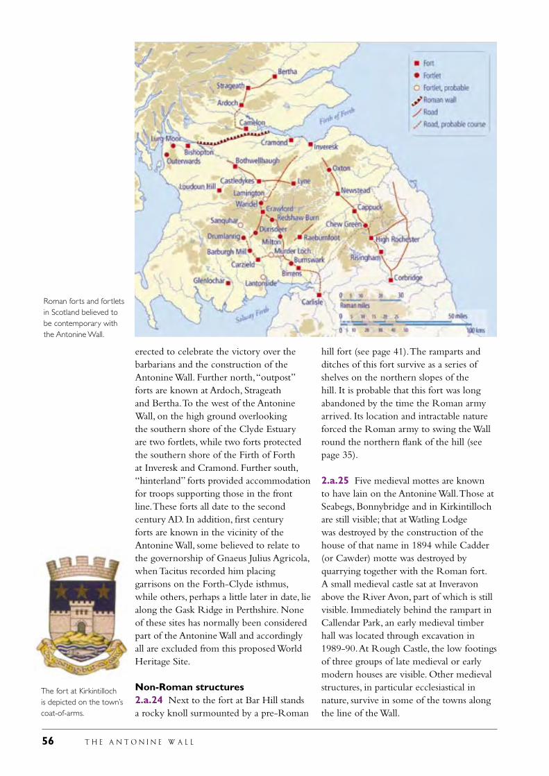
56 T H E A N T O N I N E W A L L
erected to celebrate the victory over the barbarians and the construction of the Antonine Wall. Further north, “outpost” forts are known at Ardoch, Strageath and Bertha. To the west of the Antonine Wall, on the high ground overlooking the southern shore of the Clyde Estuary are two fortlets, while two forts protected the southern shore of the Firth of Forth at Inveresk and Cramond. Further south, “hinterland” forts provided accommodation for troops supporting those in the front line. These forts all date to the second century AD. In addition, first century forts are known in the vicinity of the Antonine Wall, some believed to relate to the governorship of Gnaeus Julius Agricola, when Tacitus recorded him placing garrisons on the Forth-Clyde isthmus, while others, perhaps a little later in date, lie along the Gask Ridge in Perthshire. None of these sites has normally been considered part of the Antonine Wall and accordingly all are excluded from this proposed World Heritage Site.
Non-Roman structures2.a.24 Next to the fort at Bar Hill stands a rocky knoll surmounted by a pre-Roman
hill fort (see page 41). The ramparts and ditches of this fort survive as a series of shelves on the northern slopes of the hill. It is probable that this fort was long abandoned by the time the Roman army arrived. Its location and intractable nature forced the Roman army to swing the Wall round the northern flank of the hill (see page 35).
2.a.25 Five medieval mottes are known to have lain on the Antonine Wall. Those at Seabegs, Bonnybridge and in Kirkintilloch are still visible; that at Watling Lodge was destroyed by the construction of the house of that name in 1894 while Cadder (or Cawder) motte was destroyed by quarrying together with the Roman fort. A small medieval castle sat at Inveravon above the River Avon, part of which is still visible. Immediately behind the rampart in Callendar Park, an early medieval timber hall was located through excavation in 1989-90. At Rough Castle, the low footings of three groups of late medieval or early modern houses are visible. Other medieval structures, in particular ecclesiastical in nature, survive in some of the towns along the line of the Wall.
The fort at Kirkintilloch is depicted on the town’s coat-of-arms.
Roman forts and fortlets in Scotland believed to be contemporary with the Antonine Wall.
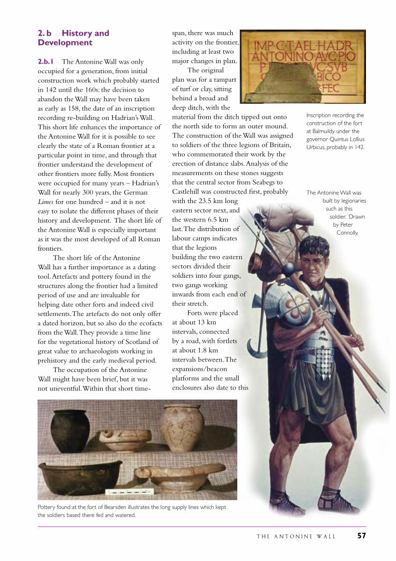
T H E A N T O N I N E W A L L 57
Pottery found at the fort of Bearsden illustrates the long supply lines which kept the soldiers based there fed and watered.
2. b History and Development
2.b.1 The Antonine Wall was only occupied for a generation, from initial construction work which probably started in 142 until the 160s: the decision to abandon the Wall may have been taken as early as 158, the date of an inscription recording re-building on Hadrian’s Wall. This short life enhances the importance of the Antonine Wall for it is possible to see clearly the state of a Roman frontier at a particular point in time, and through that frontier understand the development of other frontiers more fully. Most frontiers were occupied for many years – Hadrian’s Wall for nearly 300 years, the German Limes for one hundred – and it is not easy to isolate the different phases of their history and development. The short life of the Antonine Wall is especially important as it was the most developed of all Roman frontiers. The short life of the Antonine Wall has a further importance as a dating tool. Artefacts and pottery found in the structures along the frontier had a limited period of use and are invaluable for helping date other forts and indeed civil settlements. The artefacts do not only offer a dated horizon, but so also do the ecofacts from the Wall. They provide a time line for the vegetational history of Scotland of great value to archaeologists working in prehistory and the early medieval period. The occupation of the Antonine Wall might have been brief, but it was not uneventful. Within that short time-
span, there was much activity on the frontier, including at least two major changes in plan. The original plan was for a rampart of turf or clay, sitting behind a broad and deep ditch, with the material from the ditch tipped out onto the north side to form an outer mound. The construction of the Wall was assigned to soldiers of the three legions of Britain, who commemorated their work by the erection of distance slabs. Analysis of the measurements on these stones suggests that the central sector from Seabegs to Castlehill was constructed first, probably with the 23.5 km long eastern sector next, and the western 6.5 km last. The distribution of labour camps indicates that the legions building the two eastern sectors divided their soldiers into four gangs, two gangs working inwards from each end of their stretch. Forts were placed at about 13 km intervals, connected by a road, with fortlets at about 1.8 km intervals between. The expansions/beacon platforms and the small enclosures also date to this
The Antonine Wall was built by legionaries such as this
soldier. Drawn by Peter Connolly.
Inscription recording the construction of the fort at Balmuildy under the governor Quintus Lollius Urbicus, probably in 142.
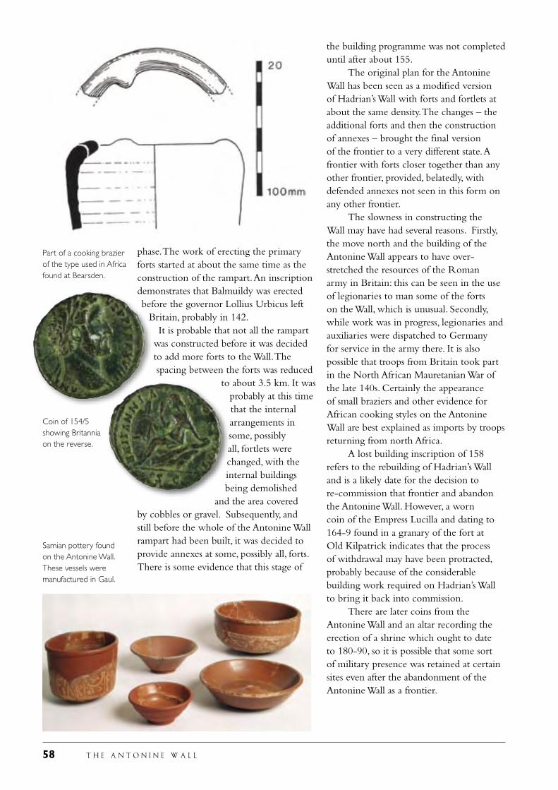
58 T H E A N T O N I N E W A L L
phase. The work of erecting the primary forts started at about the same time as the construction of the rampart. An inscription demonstrates that Balmuildy was erected before the governor Lollius Urbicus left
Britain, probably in 142. It is probable that not all the rampart was constructed before it was decided to add more forts to the Wall. The spacing between the forts was reduced
to about 3.5 km. It was probably at this time that the internal arrangements in some, possibly all, fortlets were changed, with the internal buildings being demolished
and the area covered by cobbles or gravel. Subsequently, and still before the whole of the Antonine Wall rampart had been built, it was decided to provide annexes at some, possibly all, forts. There is some evidence that this stage of
the building programme was not completed until after about 155. The original plan for the Antonine Wall has been seen as a modified version of Hadrian’s Wall with forts and fortlets at about the same density. The changes – the additional forts and then the construction of annexes – brought the final version of the frontier to a very different state. A frontier with forts closer together than any other frontier, provided, belatedly, with defended annexes not seen in this form on any other frontier. The slowness in constructing the Wall may have had several reasons. Firstly, the move north and the building of the Antonine Wall appears to have over-stretched the resources of the Roman army in Britain: this can be seen in the use of legionaries to man some of the forts on the Wall, which is unusual. Secondly, while work was in progress, legionaries and auxiliaries were dispatched to Germany for service in the army there. It is also possible that troops from Britain took part in the North African Mauretanian War of the late 140s. Certainly the appearance of small braziers and other evidence for African cooking styles on the Antonine Wall are best explained as imports by troops returning from north Africa. A lost building inscription of 158 refers to the rebuilding of Hadrian’s Wall and is a likely date for the decision to re-commission that frontier and abandon the Antonine Wall. However, a worn coin of the Empress Lucilla and dating to 164-9 found in a granary of the fort at Old Kilpatrick indicates that the process of withdrawal may have been protracted, probably because of the considerable building work required on Hadrian’s Wall to bring it back into commission. There are later coins from the Antonine Wall and an altar recording the erection of a shrine which ought to date to 180-90, so it is possible that some sort of military presence was retained at certain sites even after the abandonment of the Antonine Wall as a frontier.
Samian pottery found on the Antonine Wall. These vessels were manufactured in Gaul.
Part of a cooking brazier of the type used in Africa found at Bearsden.
Coin of 154/5 showing Britannia on the reverse.
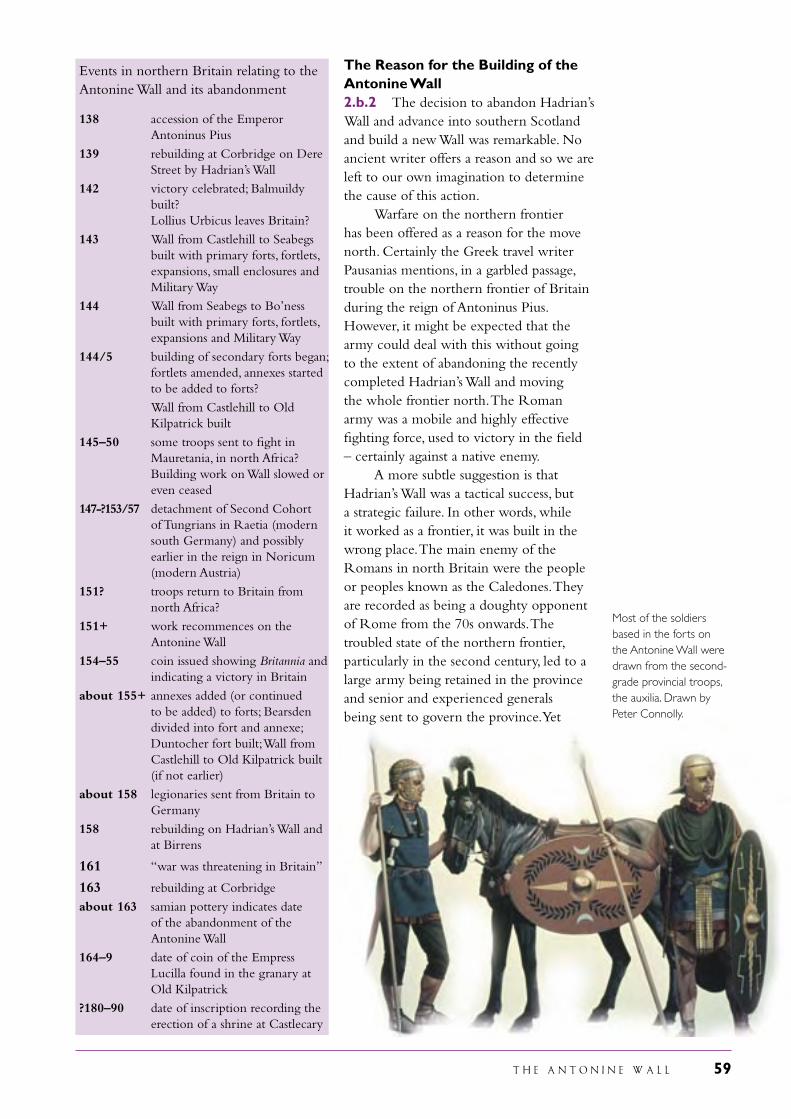
T H E A N T O N I N E W A L L 59
Events in northern Britain relating to the Antonine Wall and its abandonment
138 accession of the Emperor Antoninus Pius
139 rebuilding at Corbridge on Dere Street by Hadrian’s Wall
142 victory celebrated; Balmuildy built? Lollius Urbicus leaves Britain?
143 Wall from Castlehill to Seabegs built with primary forts, fortlets, expansions, small enclosures and Military Way
144 Wall from Seabegs to Bo’ness built with primary forts, fortlets, expansions and Military Way
144/5 building of secondary forts began; fortlets amended, annexes started to be added to forts?
Wall from Castlehill to Old Kilpatrick built
145–50 some troops sent to fight in Mauretania, in north Africa? Building work on Wall slowed or even ceased
147-?153/57 detachment of Second Cohort of Tungrians in Raetia (modern south Germany) and possibly earlier in the reign in Noricum (modern Austria)
151? troops return to Britain from north Africa?
151+ work recommences on the Antonine Wall
154–55 coin issued showing Britannia and indicating a victory in Britain
about 155+ annexes added (or continued to be added) to forts; Bearsden divided into fort and annexe; Duntocher fort built; Wall from Castlehill to Old Kilpatrick built (if not earlier)
about 158 legionaries sent from Britain to Germany
158 rebuilding on Hadrian’s Wall and at Birrens
161 “war was threatening in Britain”
163 rebuilding at Corbridge
about 163 samian pottery indicates date of the abandonment of the Antonine Wall
164–9 date of coin of the Empress Lucilla found in the granary at Old Kilpatrick
?180–90 date of inscription recording the erection of a shrine at Castlecary
The Reason for the Building of the Antonine Wall2.b.2 The decision to abandon Hadrian’s Wall and advance into southern Scotland and build a new Wall was remarkable. No ancient writer offers a reason and so we are left to our own imagination to determine the cause of this action. Warfare on the northern frontier has been offered as a reason for the move north. Certainly the Greek travel writer Pausanias mentions, in a garbled passage, trouble on the northern frontier of Britain during the reign of Antoninus Pius. However, it might be expected that the army could deal with this without going to the extent of abandoning the recently completed Hadrian’s Wall and moving the whole frontier north. The Roman army was a mobile and highly effective fighting force, used to victory in the field – certainly against a native enemy. A more subtle suggestion is that Hadrian’s Wall was a tactical success, but a strategic failure. In other words, while it worked as a frontier, it was built in the wrong place. The main enemy of the Romans in north Britain were the people or peoples known as the Caledones. They are recorded as being a doughty opponent of Rome from the 70s onwards. The troubled state of the northern frontier, particularly in the second century, led to a large army being retained in the province and senior and experienced generals being sent to govern the province. Yet
Most of the soldiers based in the forts on the Antonine Wall were drawn from the second-grade provincial troops, the auxilia. Drawn by Peter Connolly.

60 T H E A N T O N I N E W A L L
the Caledones lived nearly 200 km north of Hadrian’s Wall. On the basis of this argument, the frontier was moved north to be in closer proximity to an enemy which continued to annoy Rome. An altogether different theory, based on politics in Rome itself, argues that the Emperor Antoninus Pius had a small war in Britain in order to offer a sop to Trajan’s generals who had been rendered inactive through Hadrian’s peaceful frontier policies. The new emperor, with no military experience, indulged in a short war in order to placate these powerful men. A development of this suggestion is that the war in Britain was simply to provide the new emperor with a military victory. While it may be too simple to describe the Roman empire as a military dictatorship, certainly the holding of power depended on the support of the army. Antoninus Pius, chosen by Hadrian to be his successor only 5 months before his death, had never served in the army, indeed had only been out of Italy once, so far as we know. A victory would allow him to be acclaimed Imperator, Conqueror, and
strengthen his position: as Suetonius said about Claudius exactly one hundred years before, “the emperor required a triumph”. The acclamation of Antoninus Pius as Imperator in 142 was the only time that he was to take such a title during his reign in spite of warfare on other borders, and also the movement of the frontier forward in Germany. This points to the special nature of the British adventure. This may be underlined by the unusual nature of the distance slabs which had been found on the Antonine Wall and are not replicated on any other Roman frontier (see pages 91, 92, 93, 95 and 97). They not only record details of its construction – date, builder, length of rampart constructed – but visually depict the Roman victory. The enemy are shown slaughtered, captive, in a state of submission; the Romans are shown sacrificing to their gods, fighting, victorious, supported by their gods. The sculptures were surely erected to mark not just the victory of Roman arms, but the victory of the army of the Emperor Antoninus Pius, whose name is prominently displayed on every stone.
The goddess Victory places a laurel wreath in the beak of the legion’s eagle, watched by a captured enemy.
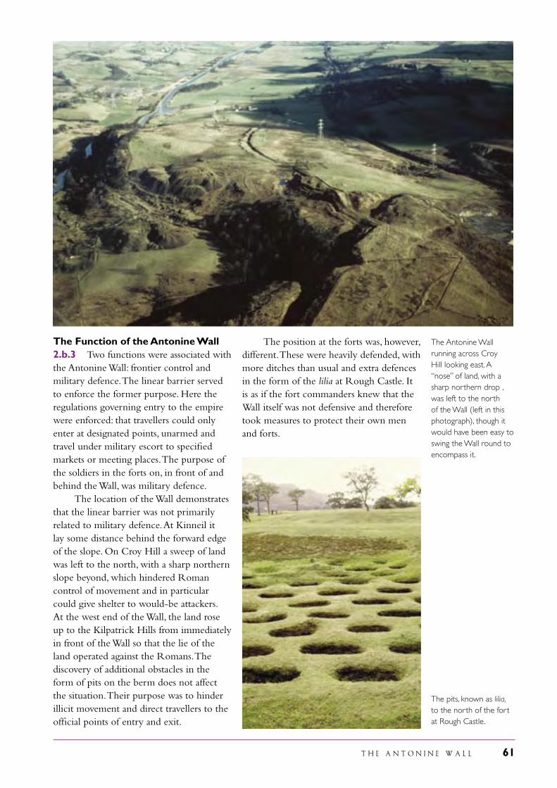
T H E A N T O N I N E W A L L 61
The position at the forts was, however, different. These were heavily defended, with more ditches than usual and extra defences in the form of the lilia at Rough Castle. It is as if the fort commanders knew that the Wall itself was not defensive and therefore took measures to protect their own men and forts.
The Antonine Wall running across Croy Hill looking east. A “nose” of land, with a sharp northern drop , was left to the north of the Wall (left in this photograph), though it would have been easy to swing the Wall round to encompass it.
The pits, known as lilia, to the north of the fort at Rough Castle.
The Function of the Antonine Wall2.b.3 Two functions were associated with the Antonine Wall: frontier control and military defence. The linear barrier served to enforce the former purpose. Here the regulations governing entry to the empire were enforced: that travellers could only enter at designated points, unarmed and travel under military escort to specified markets or meeting places. The purpose of the soldiers in the forts on, in front of and behind the Wall, was military defence. The location of the Wall demonstrates that the linear barrier was not primarily related to military defence. At Kinneil it lay some distance behind the forward edge of the slope. On Croy Hill a sweep of land was left to the north, with a sharp northern slope beyond, which hindered Roman control of movement and in particular could give shelter to would-be attackers. At the west end of the Wall, the land rose up to the Kilpatrick Hills from immediately in front of the Wall so that the lie of the land operated against the Romans. The discovery of additional obstacles in the form of pits on the berm does not affect the situation. Their purpose was to hinder illicit movement and direct travellers to the official points of entry and exit.

62 T H E A N T O N I N E W A L L
The Later History of the Antonine Wall2.b.4 The first certain reference to the Antonine Wall after the end of Roman Britain was by the Venerable Bede. Writing at the twin monastery of Jarrow/Wearmouth in about 730, he stated that in the fifth century a Roman army returned to Britain to deal with an invasion of the Picts and Scots and advised the Britons to build a Wall for protection. “The islanders built this wall as they had been instructed, but having no engineers capable of so great an undertaking, they built it of turf and not stone, so that it was of small value. However, they built it for many miles between the two estuaries, hoping that where the sea provided no protection, they might use the rampart to preserve their borders from hostile attack. Clear traces of this wide and lofty earthwork can be seen to this day. It begins about two miles west of the monastery of Aebbercurnig [Abercorn] at a place which the Picts called Peanfahel and the English Penneltun, and runs westward to the vicinity of the city of Alcluith [Dumbarton].” It is doubtful if Bede ever saw the Antonine Wall – the furthest north he is known to have travelled is Lindisfarne – but his testimony that it survived to his day is valuable. Indeed, the Wall survived
for another 800 years and was visible to Timothy Pont who included it on his map of Scotland in the sixteenth century. In 1755 William Roy could still map it from end to end, observe the Military Way and prepare plans of ten forts. Roy had such a good eye for the ground that his surmise at the location of the Wall even when nothing was visible was usually correct. The eastern end of the Wall had already been lost to knowledge, but Roy assumed that it ended at Carriden. To that date damage had been piecemeal. The forts certainly provided a useful source of building stone, but elsewhere the Wall was utilised in different ways. An underground passage (souterrain) using Roman stones was built within the ditch at Shirva: it may have been used for storage by the occupants of an adjacent farm. In the Middle Ages those concerned with defence erected castle mounds on the Wall, at Inveravon, Watling Lodge, Seabegs, Kirkintilloch and Cadder: those at Seabegs and Kirkintilloch still survive. The Agricultural Revolution and the Industrial Revolution both affected the Antonine Wall. The late eighteenth century witnessed serious damage to the Roman earthworks in the face of improved methods of ploughing, and this continued well into the twentieth century.
William Roy surveyed the Antonine Wall in 1755. His map of the Wall was accompanied by plans of the forts and sections across the frontier. This section illustrates the central sector.
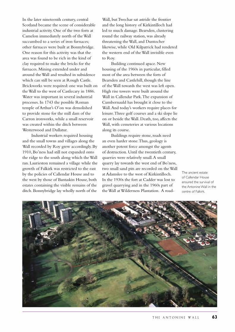
T H E A N T O N I N E W A L L 63
The ancient estate of Callendar House ensured the survival of the Antonine Wall in the centre of Falkirk.
In the later nineteenth century, central Scotland became the scene of considerable industrial activity. One of the two forts at Camelon immediately north of the Wall succumbed to a series of iron furnaces; other furnaces were built at Bonnybridge. One reason for this activity was that the area was found to be rich in the kind of clay required to make the bricks for the furnaces. Mining extended under and around the Wall and resulted in subsidence which can still be seen at Rough Castle. Brickworks were required: one was built on the Wall to the west of Castlecary in 1886. Water was important in several industrial processes. In 1743 the possible Roman temple of Arthur’s O’on was demolished to provide stone for the mill dam of the Carron ironworks, while a small reservoir was created within the ditch between Westerwood and Dullatur. Industrial workers required housing and the small towns and villages along the Wall recorded by Roy grew accordingly. By 1910, Bo’ness had still not expanded onto the ridge to the south along which the Wall ran. Laurieston remained a village while the growth of Falkirk was restricted to the east by the policies of Callendar House and to the west by those of Bantaskin House, both estates containing the visible remains of the ditch. Bonnybridge lay wholly north of the
Wall, but Twechar sat astride the frontier and the long history of Kirkintilloch had led to much damage. Bearsden, clustering round the railway station, was already threatening the Wall, and Duntocher likewise, while Old Kilpatrick had rendered the western end of the Wall invisible even to Roy. Building continued apace. New housing of the 1960s in particular, filled most of the area between the forts of Bearsden and Castlehill, though the line of the Wall towards the west was left open. High rise towers were built around the Wall in Callendar Park. The expansion of Cumbernauld has brought it close to the Wall. And today’s workers require places for leisure. Three golf courses and a ski slope lie on or beside the Wall. Death, too, affects the Wall, with cemeteries at various locations along its course. Buildings require stone, roads need an even harder stone. Thus, geology is another potent force amongst the agents of destruction. Until the twentieth century, quarries were relatively small. A small quarry lay towards the west end of Bo’ness, two small sand pits are recorded on the Wall at Adamslee to the west of Kirkintilloch. In the 1930s the fort at Cadder was lost to gravel quarrying and in the 1960s part of the Wall at Wilderness Plantation. A road-
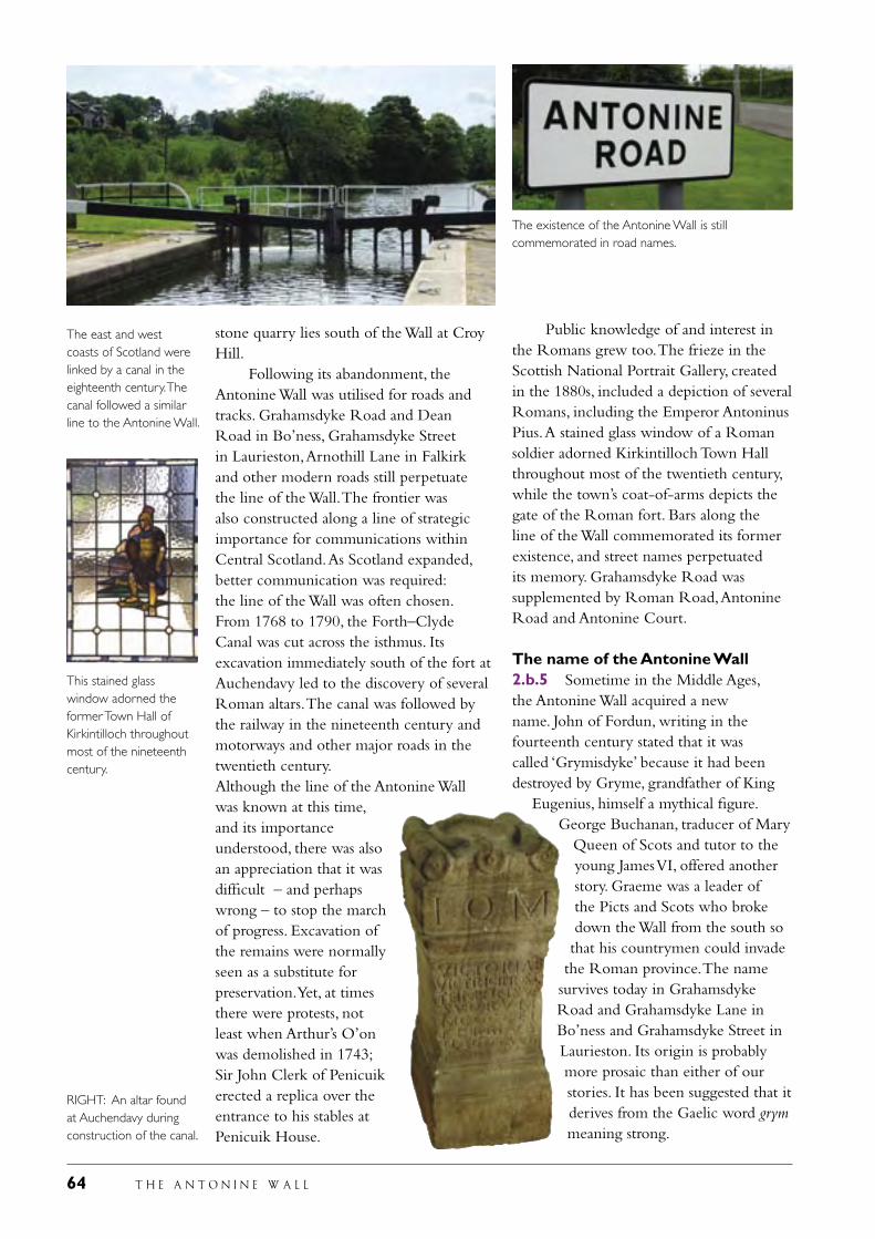
64 T H E A N T O N I N E W A L L
stone quarry lies south of the Wall at Croy Hill. Following its abandonment, the Antonine Wall was utilised for roads and tracks. Grahamsdyke Road and Dean Road in Bo’ness, Grahamsdyke Street in Laurieston, Arnothill Lane in Falkirk and other modern roads still perpetuate the line of the Wall. The frontier was also constructed along a line of strategic importance for communications within Central Scotland. As Scotland expanded, better communication was required: the line of the Wall was often chosen. From 1768 to 1790, the Forth–Clyde Canal was cut across the isthmus. Its excavation immediately south of the fort at Auchendavy led to the discovery of several Roman altars. The canal was followed by the railway in the nineteenth century and motorways and other major roads in the twentieth century.Although the line of the Antonine Wall was known at this time, and its importance understood, there was also an appreciation that it was difficult – and perhaps wrong – to stop the march of progress. Excavation of the remains were normally seen as a substitute for preservation. Yet, at times there were protests, not least when Arthur’s O’on was demolished in 1743; Sir John Clerk of Penicuik erected a replica over the entrance to his stables at Penicuik House.
Public knowledge of and interest in the Romans grew too. The frieze in the Scottish National Portrait Gallery, created in the 1880s, included a depiction of several Romans, including the Emperor Antoninus Pius. A stained glass window of a Roman soldier adorned Kirkintilloch Town Hall throughout most of the twentieth century, while the town’s coat-of-arms depicts the gate of the Roman fort. Bars along the line of the Wall commemorated its former existence, and street names perpetuated its memory. Grahamsdyke Road was supplemented by Roman Road, Antonine Road and Antonine Court.
The name of the Antonine Wall2.b.5 Sometime in the Middle Ages, the Antonine Wall acquired a new name. John of Fordun, writing in the fourteenth century stated that it was called ‘Grymisdyke’ because it had been destroyed by Gryme, grandfather of King
Eugenius, himself a mythical figure. George Buchanan, traducer of Mary
Queen of Scots and tutor to the young James VI, offered another story. Graeme was a leader of the Picts and Scots who broke down the Wall from the south so that his countrymen could invade
the Roman province. The name survives today in Grahamsdyke Road and Grahamsdyke Lane in Bo’ness and Grahamsdyke Street in Laurieston. Its origin is probably more prosaic than either of our stories. It has been suggested that it derives from the Gaelic word grym meaning strong.
The east and west coasts of Scotland were linked by a canal in the eighteenth century. The canal followed a similar line to the Antonine Wall.
This stained glass window adorned the former Town Hall of Kirkintilloch throughout most of the nineteenth century.
The existence of the Antonine Wall is still commemorated in road names.
RIGHT: An altar found at Auchendavy during construction of the canal.
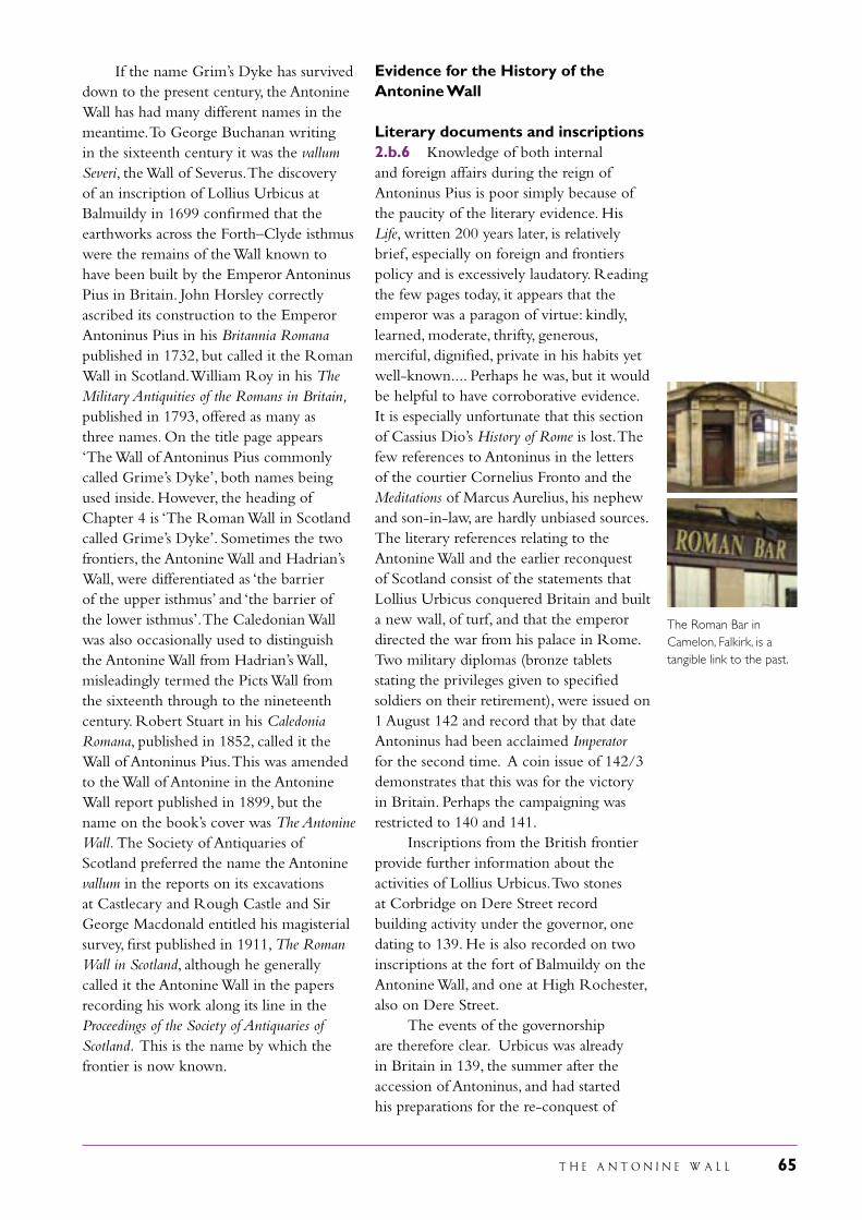
T H E A N T O N I N E W A L L 65
If the name Grim’s Dyke has survived down to the present century, the Antonine Wall has had many different names in the meantime. To George Buchanan writing in the sixteenth century it was the vallum Severi, the Wall of Severus. The discovery of an inscription of Lollius Urbicus at Balmuildy in 1699 confirmed that the earthworks across the Forth–Clyde isthmus were the remains of the Wall known to have been built by the Emperor Antoninus Pius in Britain. John Horsley correctly ascribed its construction to the Emperor Antoninus Pius in his Britannia Romana published in 1732, but called it the Roman Wall in Scotland. William Roy in his The Military Antiquities of the Romans in Britain, published in 1793, offered as many as three names. On the title page appears ‘The Wall of Antoninus Pius commonly called Grime’s Dyke’, both names being used inside. However, the heading of Chapter 4 is ‘The Roman Wall in Scotland called Grime’s Dyke’. Sometimes the two frontiers, the Antonine Wall and Hadrian’s Wall, were differentiated as ‘the barrier of the upper isthmus’ and ‘the barrier of the lower isthmus’. The Caledonian Wall was also occasionally used to distinguish the Antonine Wall from Hadrian’s Wall, misleadingly termed the Picts Wall from the sixteenth through to the nineteenth century. Robert Stuart in his Caledonia Romana, published in 1852, called it the Wall of Antoninus Pius. This was amended to the Wall of Antonine in the Antonine Wall report published in 1899, but the name on the book’s cover was The Antonine Wall. The Society of Antiquaries of Scotland preferred the name the Antonine vallum in the reports on its excavations at Castlecary and Rough Castle and Sir George Macdonald entitled his magisterial survey, first published in 1911, The Roman Wall in Scotland, although he generally called it the Antonine Wall in the papers recording his work along its line in the Proceedings of the Society of Antiquaries of Scotland. This is the name by which the frontier is now known.
Evidence for the History of the Antonine Wall
Literary documents and inscriptions2.b.6 Knowledge of both internal and foreign affairs during the reign of Antoninus Pius is poor simply because of the paucity of the literary evidence. His Life, written 200 years later, is relatively brief, especially on foreign and frontiers policy and is excessively laudatory. Reading the few pages today, it appears that the emperor was a paragon of virtue: kindly, learned, moderate, thrifty, generous, merciful, dignified, private in his habits yet well-known.... Perhaps he was, but it would be helpful to have corroborative evidence. It is especially unfortunate that this section of Cassius Dio’s History of Rome is lost. The few references to Antoninus in the letters of the courtier Cornelius Fronto and the Meditations of Marcus Aurelius, his nephew and son-in-law, are hardly unbiased sources.The literary references relating to the Antonine Wall and the earlier reconquest of Scotland consist of the statements that Lollius Urbicus conquered Britain and built a new wall, of turf, and that the emperor directed the war from his palace in Rome. Two military diplomas (bronze tablets stating the privileges given to specified soldiers on their retirement), were issued on 1 August 142 and record that by that date Antoninus had been acclaimed Imperator for the second time. A coin issue of 142/3 demonstrates that this was for the victory in Britain. Perhaps the campaigning was restricted to 140 and 141. Inscriptions from the British frontier provide further information about the activities of Lollius Urbicus. Two stones at Corbridge on Dere Street record building activity under the governor, one dating to 139. He is also recorded on two inscriptions at the fort of Balmuildy on the Antonine Wall, and one at High Rochester, also on Dere Street. The events of the governorship are therefore clear. Urbicus was already in Britain in 139, the summer after the accession of Antoninus, and had started his preparations for the re-conquest of
The Roman Bar in Camelon, Falkirk, is a tangible link to the past.
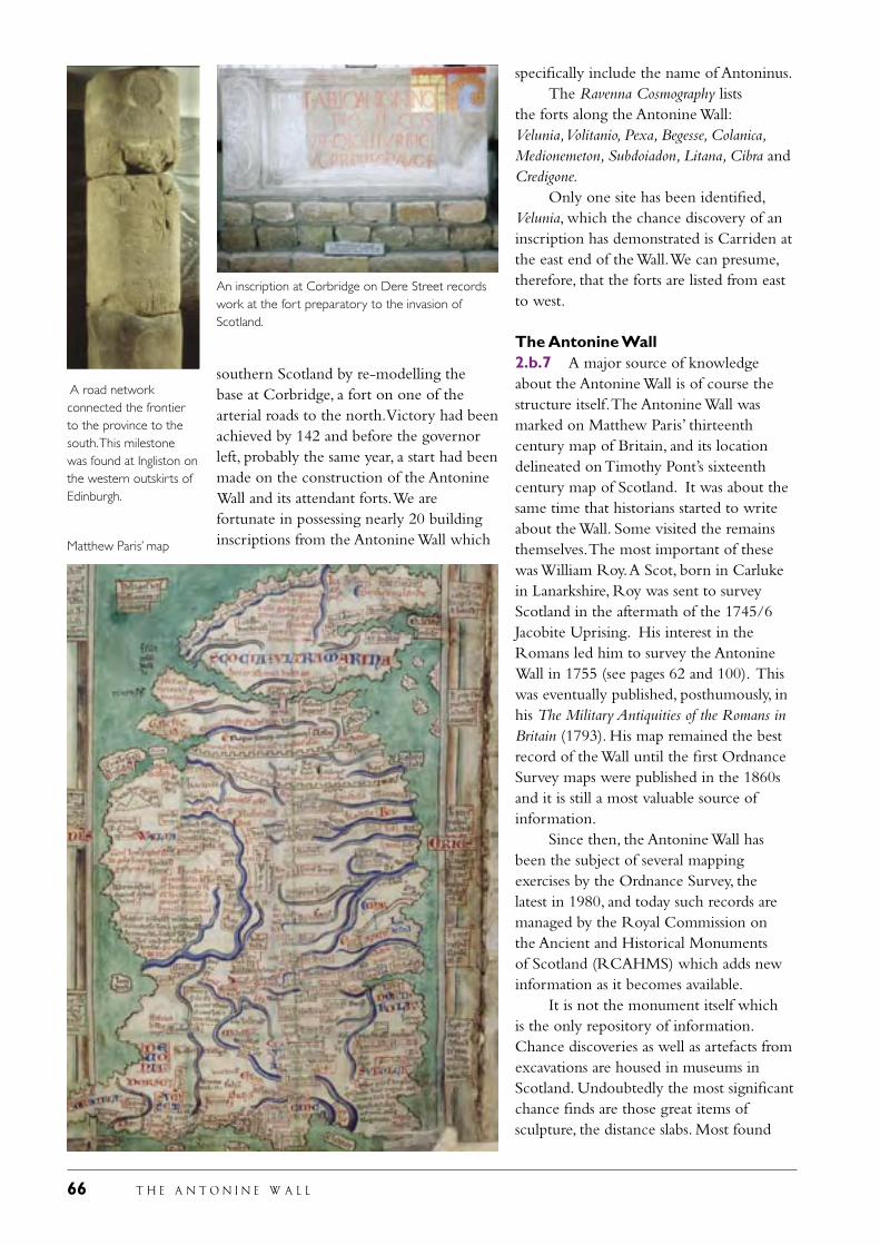
66 T H E A N T O N I N E W A L L
southern Scotland by re-modelling the base at Corbridge, a fort on one of the arterial roads to the north. Victory had been achieved by 142 and before the governor left, probably the same year, a start had been made on the construction of the Antonine Wall and its attendant forts. We are fortunate in possessing nearly 20 building inscriptions from the Antonine Wall which
specifically include the name of Antoninus. The Ravenna Cosmography lists the forts along the Antonine Wall: Velunia, Volitanio, Pexa, Begesse, Colanica, Medionemeton, Subdoiadon, Litana, Cibra and Credigone. Only one site has been identified, Velunia, which the chance discovery of an inscription has demonstrated is Carriden at the east end of the Wall. We can presume, therefore, that the forts are listed from east to west.
The Antonine Wall2.b.7 A major source of knowledge about the Antonine Wall is of course the structure itself. The Antonine Wall was marked on Matthew Paris’ thirteenth century map of Britain, and its location delineated on Timothy Pont’s sixteenth century map of Scotland. It was about the same time that historians started to write about the Wall. Some visited the remains themselves. The most important of these was William Roy. A Scot, born in Carluke in Lanarkshire, Roy was sent to survey Scotland in the aftermath of the 1745/6 Jacobite Uprising. His interest in the Romans led him to survey the Antonine Wall in 1755 (see pages 62 and 100). This was eventually published, posthumously, in his The Military Antiquities of the Romans in Britain (1793). His map remained the best record of the Wall until the first Ordnance Survey maps were published in the 1860s and it is still a most valuable source of information. Since then, the Antonine Wall has been the subject of several mapping exercises by the Ordnance Survey, the latest in 1980, and today such records are managed by the Royal Commission on the Ancient and Historical Monuments of Scotland (RCAHMS) which adds new information as it becomes available. It is not the monument itself which is the only repository of information. Chance discoveries as well as artefacts from excavations are housed in museums in Scotland. Undoubtedly the most significant chance finds are those great items of sculpture, the distance slabs. Most found
An inscription at Corbridge on Dere Street records work at the fort preparatory to the invasion of Scotland.
A road network connected the frontier to the province to the south. This milestone was found at Ingliston on the western outskirts of Edinburgh.
Matthew Paris’ map
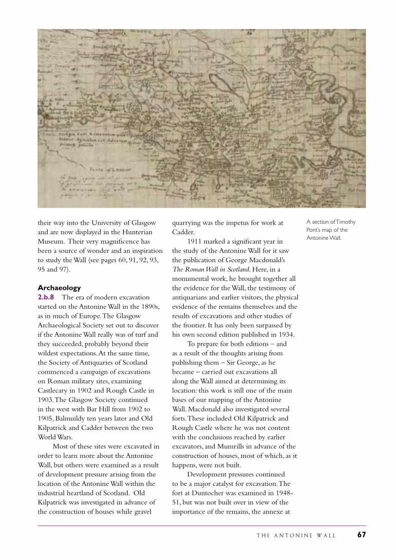
T H E A N T O N I N E W A L L 67
A section of Timothy Pont’s map of the Antonine Wall.
their way into the University of Glasgow and are now displayed in the Hunterian Museum. Their very magnificence has been a source of wonder and an inspiration to study the Wall (see pages 60, 91, 92, 93, 95 and 97). Archaeology2.b.8 The era of modern excavation started on the Antonine Wall in the 1890s, as in much of Europe. The Glasgow Archaeological Society set out to discover if the Antonine Wall really was of turf and they succeeded, probably beyond their wildest expectations. At the same time, the Society of Antiquaries of Scotland commenced a campaign of excavations on Roman military sites, examining Castlecary in 1902 and Rough Castle in 1903. The Glasgow Society continued in the west with Bar Hill from 1902 to 1905, Balmuildy ten years later and Old Kilpatrick and Cadder between the two World Wars. Most of these sites were excavated in order to learn more about the Antonine Wall, but others were examined as a result of development pressure arising from the location of the Antonine Wall within the industrial heartland of Scotland. Old Kilpatrick was investigated in advance of the construction of houses while gravel
quarrying was the impetus for work at Cadder. 1911 marked a significant year in the study of the Antonine Wall for it saw the publication of George Macdonald’s The Roman Wall in Scotland. Here, in a monumental work, he brought together all the evidence for the Wall, the testimony of antiquarians and earlier visitors, the physical evidence of the remains themselves and the results of excavations and other studies of the frontier. It has only been surpassed by his own second edition published in 1934. To prepare for both editions – and as a result of the thoughts arising from publishing them – Sir George, as he became – carried out excavations all along the Wall aimed at determining its location: this work is still one of the main bases of our mapping of the Antonine Wall. Macdonald also investigated several forts. These included Old Kilpatrick and Rough Castle where he was not content with the conclusions reached by earlier excavators, and Mumrills in advance of the construction of houses, most of which, as it happens, were not built. Development pressures continued to be a major catalyst for excavation. The fort at Duntocher was examined in 1948-51, but was not built over in view of the importance of the remains, the annexe at
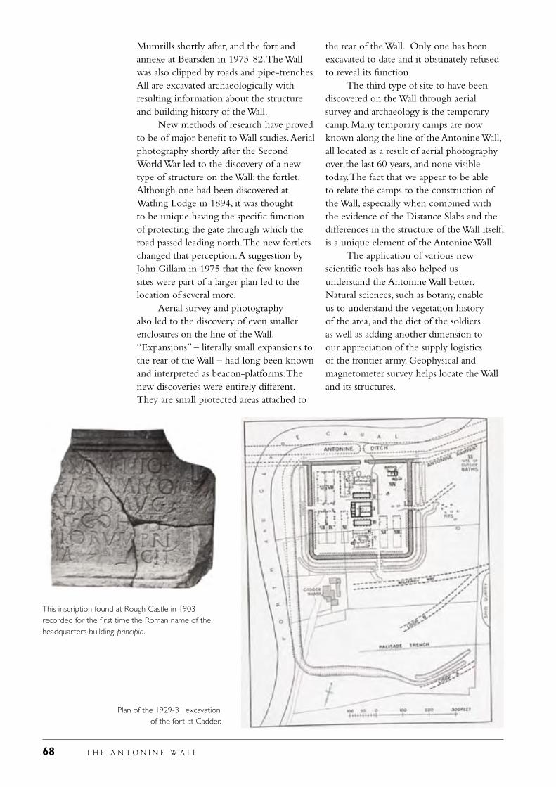
68 T H E A N T O N I N E W A L L
Mumrills shortly after, and the fort and annexe at Bearsden in 1973-82. The Wall was also clipped by roads and pipe-trenches. All are excavated archaeologically with resulting information about the structure and building history of the Wall. New methods of research have proved to be of major benefit to Wall studies. Aerial photography shortly after the Second World War led to the discovery of a new type of structure on the Wall: the fortlet. Although one had been discovered at Watling Lodge in 1894, it was thought to be unique having the specific function of protecting the gate through which the road passed leading north. The new fortlets changed that perception. A suggestion by John Gillam in 1975 that the few known sites were part of a larger plan led to the location of several more. Aerial survey and photography also led to the discovery of even smaller enclosures on the line of the Wall. “Expansions” – literally small expansions to the rear of the Wall – had long been known and interpreted as beacon-platforms. The new discoveries were entirely different. They are small protected areas attached to
the rear of the Wall. Only one has been excavated to date and it obstinately refused to reveal its function. The third type of site to have been discovered on the Wall through aerial survey and archaeology is the temporary camp. Many temporary camps are now known along the line of the Antonine Wall, all located as a result of aerial photography over the last 60 years, and none visible today. The fact that we appear to be able to relate the camps to the construction of the Wall, especially when combined with the evidence of the Distance Slabs and the differences in the structure of the Wall itself, is a unique element of the Antonine Wall. The application of various new scientific tools has also helped us understand the Antonine Wall better. Natural sciences, such as botany, enable us to understand the vegetation history of the area, and the diet of the soldiers as well as adding another dimension to our appreciation of the supply logistics of the frontier army. Geophysical and magnetometer survey helps locate the Wall and its structures.
This inscription found at Rough Castle in 1903 recorded for the first time the Roman name of the headquarters building: principia.
Plan of the 1929-31 excavation of the fort at Cadder.
T H E A N T O N I N E W A L L 69
A section across the Antonine Wall rampart and ditch at Rough Castle cut during the 1903 excavations.
Archaeological research has continued. The promulgation of a new theory about the building of the Wall in 1975 brought archaeologists into the field to test it through application of the spade, and in that they were successful. Perseverance has finally led to the location of the long-lost fort in Falkirk. Sometimes wholly new and unexpected discoveries are made. One of these has been the location of pits on the berm, the space between the rampart and the ditch (see page 42). These indicate that the Wall was more complex than hitherto understood and they help us understand its function better. The artefacts – sculpture, coins, weapons, brooches, pottery, and so on
– recovered during excavations have long been studied. The earliest reports from the 1890s contain accounts of these items. The pottery from the Antonine Wall has a particular interest as it is dated to such a short period, the relatively brief life of the Wall. However, pottery can provide other insights as well. It can, for example, inform us about supply too and about the cooking methods of the soldiers and it has thus been realised that some vessels indicate that cooking was undertaken in an African style, with important implications for several different aspects of the occupation of the Antonine Wall (see page 58).
RIGHT: A statue of Mars found in the annexe at Balmuildy (partly restored).
LEFT: Arrowheads dumped in one of the fort ditches at Bearsden when the fort was abandoned.
70 T H E A N T O N I N E W A L L
T H E A N T O N I N E W A L L 71
iiI Justification
foR Inscription
resulted in a very different frontier, with a density of structures – and soldiers – not paralleled on any other Roman frontier. The Antonine Wall marks a particular limit in the development of Roman frontiers and was not repeated on any later frontier: certainly not on Hadrian’s Wall re-occupied on the abandonment of the Antonine Wall. The short life of the Antonine Wall allows this particular stage in frontier development, by one of the world’s greatest armies, to be studied more cogently than on longer-occupied frontiers where all the evidence cannot be so sifted out from the hundred or more years of continuous occupation.
(iii) bear a unique or at least exceptional testimony to a cultural tradition or to a civilisation which is living or which has disappeared
The Summary Nomination Statement for the Frontiers of the Roman Empire World Heritage Site states: “the Roman frontier is the largest monument of the Roman Empire, one of the greatest of the world’s pre-industrial empires. The physical remains of the frontier line, of the forts and fortresses along it, as well as of the cities, towns and settlements associated with it, and dependent upon it, demonstrate the complexities of Roman culture and the spread of Roman culture across Europe and the Mediterranean world. Unlike the great monuments from the urban centres around the Mediterranean already inscribed as World Heritage Sites, the frontiers show a more mundane aspect of Roman culture, both military and civilian. As such they are evidence of the spread of Roman culture and its adoption by the Empire’s subject
3.a Criteria under which inscription is proposed (and justification for inscription under these criteria)
(ii) exhibit an important interchange of human values, over a span of time or within a cultural area of the world, or developments in architecture or technology, monumental arts, town planning or landscape design
The Summary Nomination Statement for the Frontiers of the Roman Empire World Heritage Site states: “taken as a whole, the frontiers of the Roman Empire show the development of Roman military architecture from temporary camps through winter quarters for whole armies to the establishment of permanent forts and fortresses. These show through time a development from simple defenses to much more complex arrangements.”
The Antonine Wall is the most complex and developed of all Roman frontiers: it marks the apogee of Roman frontier construction, and, as the most developed Roman frontier, is a unique example of this type of ensemble. It is therefore an exceptional testimony to the monumental arts of one of the world’s greatest states. The short span of occupation allows significant conclusions to be reached about the nature of Roman frontiers. This is of especial importance as the Antonine Wall can be compared to Hadrian’s Wall as well as to the German Limes. The Antonine Wall appears to have been planned as a replica of Hadrian’s Wall, with some minor changes. At least two significant amendments to the Antonine Wall during its construction
LEFT: The fort and annexe at Rough Castle looking south. The lilia are visible towards the bottom right.
72 T H E A N T O N I N E W A L L
peoples. Inscriptions and other evidence demonstrate the extent to which the frontier led to an interchange of peoples across the Empire. To a large extent, this was the result of the movement of military units (e.g. British units in Romania, or Iraqi boatmen in northern Britain) but there is also strong evidence of civilian movement (e.g. merchants from the Middle East who settled in Britain, Germany and Hungary). The frontiers also acted as the base for the movement of Roman goods (and presumably ideas) to pass well beyond the Empire.”
As the most northerly frontier of the Roman empire, the Antonine Wall reflects the wish of Rome to rule the world, as Virgil and other Augustan poets stated. Yet, at the same time, it has mundane features in that many of the elements which made up the frontier can be found elsewhere. Inscriptions and sculpture from the Antonine Wall both emphasise its links to the rest of the empire and, at the same time, underline its unique qualities. These include the distance slabs found along this frontier. Scotland lay on the edge of the Roman empire and most of the Roman remains within the country, and certainly all visible remains, are military in origin. They include camps, fortresses, forts, fortlets, towers, and the largest of all, the Antonine Wall. This frontier is the physical manifestation of this phenomenon, the edge of empire. The erection of the Antonine Wall is also a physical manifestation of a change in Roman imperial foreign policy following the death of the emperor Hadrian in 138. Almost immediately, his successor determined on a new frontier policy, abandoning Hadrian’s Wall, moving northwards into Scotland and building a new Wall, this time of turf (Historia Augusta, Life of Antoninus Pius). The distance slabs found on the Antonine Wall underline the significance of this event. They all bear the name of the emperor who ordered the advance of the frontier in Britain and display the events of the campaign: the sacrifice to Roman gods, fighting, the defeat and submission of the
enemy, the Roman victory blessed by the gods. These items of sculpture are unique to the Antonine Wall and are not replicated on any other Roman frontier. (iv) be an outstanding example of a type of building or architectural or technological ensemble or landscape which illustrates a significant stage in human history
The Summary Nomination Statement for the Frontiers of the Roman Empire World Heritage Site states: “the physical remains of the frontiers of the Roman Empire demonstrate the power and might and civilization of the Romans. As such, they are evidence of the development of the Roman Empire and its spread across much of Europe and parts of Asia and Africa. They therefore illustrate the spread of classical culture and of Romanisation which shaped much of the subsequent development of Europe.”
The Antonine Wall was constructed at the time when writers were extolling the virtues of Roman frontiers. During the reign of Antoninus, Appian started to write his History of Rome. He wrote, “...in general, possessing by good government the most important parts of land and sea, they prefer to preserve their empire rather than extend it indefinitely to poor and profitless barbarian peoples. I have seen embassies from some of these in Rome offering themselves as subjects, and the emperor refusing them, on the grounds that they would be of no use to him. For other peoples, limitless in number, the emperors appoint the kings, not requiring them for the empire.... They surround the empire with a circle of great camps and guard so great an area of land and sea like an estate.” The Antonine Wall was the physical manifestation of that statement. The Antonine Wall also bears an exceptional testimony to the military traditions of Rome which helped the empire survive so long. It demonstrates the flexibility of the Roman military mind in the complicated history of its construction, indicating how the army responded to problems as they developed.
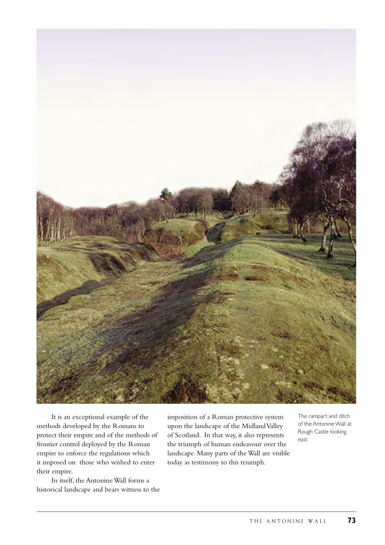
T H E A N T O N I N E W A L L 73
It is an exceptional example of the methods developed by the Romans to protect their empire and of the methods of frontier control deployed by the Roman empire to enforce the regulations which it imposed on those who wished to enter their empire. In itself, the Antonine Wall forms a historical landscape and bears witness to the
imposition of a Roman protective system upon the landscape of the Midland Valley of Scotland. In that way, it also represents the triumph of human endeavour over the landscape. Many parts of the Wall are visible today as testimony to this triumph.
The rampart and ditch of the Antonine Wall at Rough Castle looking east.
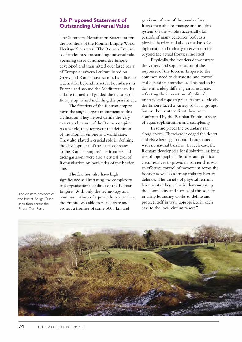
74 T H E A N T O N I N E W A L L
3.b Proposed Statement of Outstanding Universal Value
The Summary Nomination Statement for the Frontiers of the Roman Empire World Heritage Site states: “The Roman Empire is of undoubted outstanding universal value. Spanning three continents, the Empire developed and transmitted over large parts of Europe a universal culture based on Greek and Roman civilisation. Its influence reached far beyond its actual boundaries in Europe and around the Mediterranean. Its culture framed and guided the cultures of Europe up to and including the present day. The frontiers of the Roman empire form the single largest monument to this civilisation. They helped define the very extent and nature of the Roman empire. As a whole, they represent the definition of the Roman empire as a world state. They also played a crucial role in defining the development of the successor states to the Roman Empire. The frontiers and their garrisons were also a crucial tool of Romanisation on both sides of the border line. The frontiers also have high significance as illustrating the complexity and organisational abilities of the Roman Empire. With only the technology and communications of a pre-industrial society, the Empire was able to plan, create and protect a frontier of some 5000 km and
garrisons of tens of thousands of men. It was then able to manage and use this system, on the whole successfully, for periods of many centuries, both as a physical barrier, and also as the basis for diplomatic and military intervention far beyond the actual frontier line itself. Physically, the frontiers demonstrate the variety and sophistication of the responses of the Roman Empire to the common need to demarcate, and control and defend its boundaries. This had to be done in widely differing circumstances, reflecting the interaction of political, military and topographical features. Mostly, the Empire faced a variety of tribal groups, but on their eastern front they were confronted by the Parthian Empire, a state of equal sophistication and complexity. In some places the boundary ran along rivers. Elsewhere it edged the desert and elsewhere again it ran through areas with no natural barriers. In each case, the Romans developed a local solution, making use of topographical features and political circumstances to provide a barrier that was an effective control of movement across the frontier as well as a strong military barrier defence. The variety of physical remains have outstanding value in demonstrating the complexity and success of this society in using boundary works to define and protect itself in ways appropriate in each case to the local circumstances.”
The western defences of the fort at Rough Castle seen from across the Rowan Tree Burn.
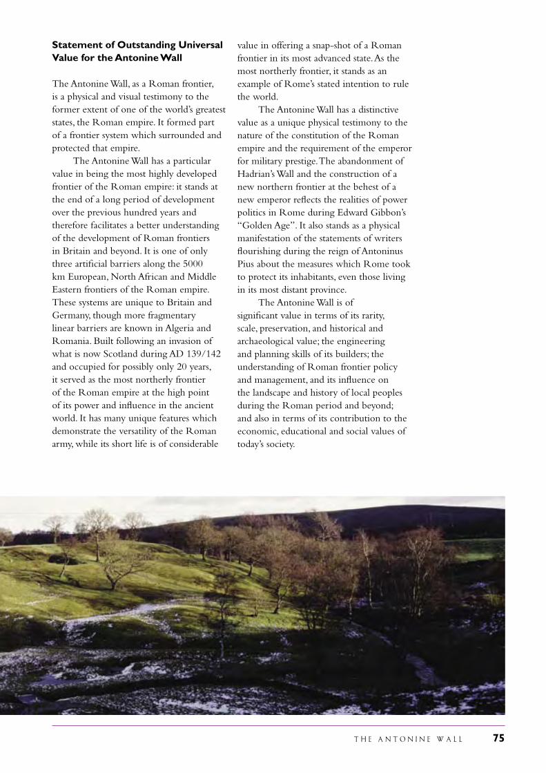
T H E A N T O N I N E W A L L 75
Statement of Outstanding Universal Value for the Antonine Wall
The Antonine Wall, as a Roman frontier, is a physical and visual testimony to the former extent of one of the world’s greatest states, the Roman empire. It formed part of a frontier system which surrounded and protected that empire. The Antonine Wall has a particular value in being the most highly developed frontier of the Roman empire: it stands at the end of a long period of development over the previous hundred years and therefore facilitates a better understanding of the development of Roman frontiers in Britain and beyond. It is one of only three artificial barriers along the 5000 km European, North African and Middle Eastern frontiers of the Roman empire. These systems are unique to Britain and Germany, though more fragmentary linear barriers are known in Algeria and Romania. Built following an invasion of what is now Scotland during AD 139/142 and occupied for possibly only 20 years, it served as the most northerly frontier of the Roman empire at the high point of its power and influence in the ancient world. It has many unique features which demonstrate the versatility of the Roman army, while its short life is of considerable
value in offering a snap-shot of a Roman frontier in its most advanced state. As the most northerly frontier, it stands as an example of Rome’s stated intention to rule the world. The Antonine Wall has a distinctive value as a unique physical testimony to the nature of the constitution of the Roman empire and the requirement of the emperor for military prestige. The abandonment of Hadrian’s Wall and the construction of a new northern frontier at the behest of a new emperor reflects the realities of power politics in Rome during Edward Gibbon’s “Golden Age”. It also stands as a physical manifestation of the statements of writers flourishing during the reign of Antoninus Pius about the measures which Rome took to protect its inhabitants, even those living in its most distant province. The Antonine Wall is of significant value in terms of its rarity, scale, preservation, and historical and archaeological value; the engineering and planning skills of its builders; the understanding of Roman frontier policy and management, and its influence on the landscape and history of local peoples during the Roman period and beyond; and also in terms of its contribution to the economic, educational and social values of today’s society.
76 T H E A N T O N I N E W A L L
3.c Comparative analysis
The Summary Nomination Statement for the Frontiers of the Roman Empire World Heritage Site provides a comparative analysis of Roman frontiers. This detailed exercise is not repeated here, but is included within the appendix. The following statement places the Antonine Wall within the context of other Roman frontiers.
3.c.1 The Antonine Wall is one of only 3 artificial frontiers constructed by the Roman army in Europe. Hadrian’s Wall was inscribed as a World Heritage Site in 1987 and the German Limes in 2005. Interrupted lines survive in north Africa, the Fossatum Africae, and are perhaps connected to transhumance. Fragmentary barriers have also been recognised in the Carpathian Mountains of Romania: they appear to have been intended to help control access points through passes.
3.c.2 The Antonine Wall sits within the broad framework of Roman frontiers, but it also contains many unique or unusual elements. These mainly relate to the structure itself:
The Antonine Wall was built within 20 years of Hadrian’s Wall, and, in its general framwork, bears some features in common, but in many aspects it is clearly a development of Hadrian’s Wall and is different in many ways, reflecting a more complicated frontier complex;
The Antonine Wall is the only frontier to have had a turf rampart erected on a stone base. Hadrian’s Wall was of stone in the eastern part and turf in the west, but the turf wall was built directly on the ground - though short stretches of cobble foundations have been found at two locations - and was wider than the Antonine Wall. The Outer Limes in Germany was a timber palisade in its primary phase. The purpose of the stone base may have been to add stability to the superstructure, or to aid drainage through the barrier;
The forts are more densely spaced on the Antonine Wall than on any other frontier of the Roman empire;
Unlike on Hadrian’s Wall the forts are diverse in their sizes, defences and internal arrangements;
Unusually, many forts have annexes attached to them. Annexes have been recorded at many forts but not at those on linear barriers, but no such structures were constructed on Hadrian’s Wall and they do not exist in the same form on the German Limes;
Six expansions, probably used for signalling, are known: these structures are unique to the Antonine Wall;
The three small enclosures discovered in one section of the Antonine Wall are unique on Roman frontiers;
The short life of the Antonine Wall, coupled with the location and morphology of the known camps, enables most to be definitively identified as labour camps used by the soldiers building the frontier. As a result, it is possible to offer suggestions on the organisation of labour, which is not possible on other frontiers. Many temporary camps are known along the line of Hadrian’s Wall (few are recorded in Germany), but the long history of that frontier renders it difficult to disentangle labour camps from marching camps and practice camps;
The Antonine Wall was the shortest occupied linear frontier in the Roman empire and is thus a unique archaeological resource. 3.c.3 The labour camps discovered on the Antonine Wall are particularly important in relation to the final unique element, the twenty Distance Slabs which are known either whole or in part from the Antonine Wall. These record the lengths of Wall built by each of the three legions of Britain, the Second, Sixth and Twentieth.
T H E A N T O N I N E W A L L 77
They are not, though, simple records, but highly decorated and sculptured stones which depict events during the military campaigning and form one of the most important collections of Roman military sculpture from any frontier of the Roman empire. Together with the evidence of the labour camps, they allow important conclusions to be reached about the construction of the Antonine Wall which are unique to this frontier. They are also an important element in any consideration of the reason for the construction of the Antonine Wall, which is generally believed to relate to the personal position of the new Emperor Antoninus Pius. On one interpretation, they glorify the success of Roman arms on behalf of the emperor, whose name appears on all the inscriptions, over the enemies of Rome and emphasise the support of the gods, and in particular the goddess Victory, for the Romans and their emperor. However, as the known distance slabs have been removed from the monument and placed in museums for their protection, they are not included in the proposed World Heritage Site.
3.d Integrity and/or authenticity
Authenticity3.d.1 The proposed Antonine Wall World Heritage Site has a high level of authenticity. Its design is unique to a particular period of Roman frontier development, the mid-second century AD. 1900 years have, naturally, taken their toll on a monument which was mostly constructed of earth. Yet, the Antonine Wall survives well. It is visible as a feature in the landscape in some form for over one-third of its total length, while archaeological excavations undertaken over the last 100 years have demonstrated that it survives well beneath both fields and settlements. The proposed Site clearly demonstrates the strategic/tactical and engineering/logistical planning of the Roman empire at the height of its power. Although sitting in a highly varied modern landscape, the
relationship of the Wall to its landscape setting is for the most part intact and therefore authentic.
DesignThe design of the Antonine Wall represents the final and most developed stage of all linear frontiers constructed by the Romans. Taking advantage of the Forth-Clyde isthmus in its design, the surveyors and builders utilised the topography to construct a more economical frontier, but just as impressively defensive, 60 km long rather than the 130 km length of Hadrian’s Wall. In doing so, the army improved on Hadrian’s Wall, built a generation before, to incorporate new features into its design such as the use of fortified annexes which are unique in Roman linear frontier systems. Again uniquely, the construction process can be traced through the location of temporary camps placed at regular intervals usually to the south of the Wall, and the survival of distance slabs which record the lengths of Wall constructed by a specific unit. The design of the frontier is clearly demonstrated by the surviving elements above and below ground.
MaterialThe materials used in the construction of the Wall and associated sites are local stone, turf, earth and wood. The Wall was not used after this time and, given the short duration of the frontier installations, the materials are highly authentic to the primary use of the monument in the mid to late second century AD. Although the remains have eroded over time and subject to some development, much of the Wall remains undisturbed as archaeological deposits. Currently displayed elements of the frontier have been undertaken on the basis of full documentation through modern excavation. Recent interventions are conservation orientated and kept to a minimum.
WorkmanshipThe location of the remains at the shortest point in northern Britain, allowing a shorter Wall (60 km as opposed to the
78 T H E A N T O N I N E W A L L
130 km of Hadrian’s Wall) and a greater density of military force, displays high level of strategic thinking by the Romans. The scale and complexity of the monument, with its attendant construction camps, impressively displays the logistical and construction skills of the Roman army. The tactical planning of the Romans is seen in the use of landscape to best effect.
SettingAs a military frontier system, the Antonine Wall is heavily influenced by its landscape and thus there is considerable significance in the setting of the monument. Although the monument sits in a highly varied modern urban and rural landscape the setting of monument has been largely retained across the length of the Wall allowing the mindset of the Roman engineers to be envisaged and its scale and setting appreciated.
IntegrityThe proposed Antonine Wall World Heritage Site property retains its integrity. It includes all elements necessary to express its outstanding universal value - all elements associated with linear frontiers and the attendant construction camps. The proposed World Heritage Site includes all elements of Roman linear frontier systems, as understood through contemporary sources and modern academic analysis. These include the rampart, berm, ditch, upcast mound, forts and annexes and fortlets, Military Way and quarry pits, beacon platforms, small enclosures and construction camps, together with civil settlements and field systems. The proposed World Heritage Site is of adequate size to ensure the complete representation of the features and process which convey the significance of the property: all the archaeological remains of the monument, within present understanding of the site, are contained within the proposed World Heritage Site boundary. The proposed World Heritage Site buffer zones provide protection for the setting of the monument. Accordingly, this proposed World Heritage Site and its buffer
zone is adequately and properly protected through current UK legislation and is conserved to a satisfactory standard. Although the proposed World Heritage Site sits within a once highly industrialised landscape, the value of the site has been recognised since the seventeenth century. Therefore it is has been preserved through many years of antiquarian and archaeological documentation, and has been protected as a heritage resource for the last 100 years.
The current state of survival of the Antonine Wall3.d.3 The invasion of southern Scotland and the construction of the Antonine Wall are mentioned in ancient literature (Historia Augusta, Life of Antoninus, Cornelius Fronto, Orations). The successful conquest of southern Scotland was celebrated by a coin issue in 142/3, some of which have been found on the Antonine Wall. The building of the Wall is recorded on inscriptions, in particular on the distinctive distance slabs of which all or parts of 20 have been found along the frontier. Other inscriptions record the construction of forts; two indicate that fort building started under Quintus Lollius Urbicus, the general responsible for the successful campaigning.
3.d.4 Twenty-two km of the Wall are still visible, though for nearly half that length it is the ditch which survives as a faint depression. In many places, the upcast mound is a more distinctive feature than the rampart. Mapping in the eighteenth and nineteenth centuries recorded the location of the Wall before modern agricultural, industrial and urban developments. Since the 1890s, excavation supplemented by aerial archaeology and survey, including geophysical survey, has confirmed the line of the Wall and provided considerable information on its method of construction: such excavation has also demonstrated the good survival of the Antonine Wall even in urban areas. Only about 2 km of its original 60 km length has been completely destroyed.
T H E A N T O N I N E W A L L 79
3.d.5 Two lengths of Military Way are visible, together, at one site, with the quarry pits beside it from which the gravel was extracted for use in the road. Both these sections are in state care. Its line is known in many other locations through antiquarian records and modern investigations including geophysical prospection. 3.d.6 Seventeen forts are known along the line of the Antonine Wall. One has been destroyed. Three are wholly or largely built over, three partially built over: all these lie within the proposed Site. Annexes are known beside at least eight forts and are included in the proposed WHS.
3.d.7 Nine fortlets are known. Only one has been completely excavated and placed on public display. The others are not visible but their existence has been confirmed through aerial survey and photography and/or excavation.
3.d.8 Six expansions are known and visible. Excavation has led to the tentative identification of a seventh. 3.d.9 Three small enclosures have been recorded. One has been destroyed and a second excavated.
3.b.10 Twenty camps have been located through aerial photography but few have been examined through excavation. All surviving 16 camps are protected and to be included in the proposed World Heritage Site. 3.d.11 Little is known about civil settlements along the line of the Antonine Wall. All sites which have produced some evidence are protected and are included in the proposed WHS.
3.d.12 The Antonine Wall forms an archaeological resource of the highest scientific value. The earliest known map of the Antonine Wall dates to the thirteenth century. Antiquarian accounts form a valuable source of information from the seventeenth century onwards. The
collections of inscriptions and artefacts from the Antonine Wall began in the eighteenth century. In the 1890s the era of scientific excavation began. The nature of the barrier itself was examined while several forts were investigated during this initial period of exploration. This research has continued to the present day. Aerial survey and photography, ground-level survey and geophysical prospection form valuable tools to aid understanding of the Wall without the need for intrusive methods such as excavation. 3.d.13 As a result of over 300 years of survey and over 100 years of excavation, a vast archaeological resource has been created. Surveys, plans, inscriptions, artefacts and environmental evidence as well as the monument itself provide an enormous amount of information about the monument and act too as a bench mark for the study of Roman Scotland and the periods both before and after. In effect, the Antonine Wall forms a dated horizon across Scotland aiding the study of other periods. 3.d.14 Further, the Antonine Wall provides a crucial resource for the study of Roman frontiers, particularly in relation to Hadrian’s Wall and the German Limes. In Britain, it is possible to investigate the development of Roman frontiers through the analysis of both Hadrian’s Wall and the Antonine Wall. These frontiers offer a comparison to the contemporary German frontiers and allow us to study the differences and similarities between the Roman frontiers of different provinces and help us understand more clearly the arrangements the Romans made to protect their empire as well as the relationship between broad principles and distinct local requirements.
3.d.15 In a wider consideration, these three frontiers also can be compared to the measures Rome took to defend her empire where rivers such as the Rhine and Danube formed the frontier. Here arrangements could be different and through the study of all frontiers we can understand more clearly how they worked.
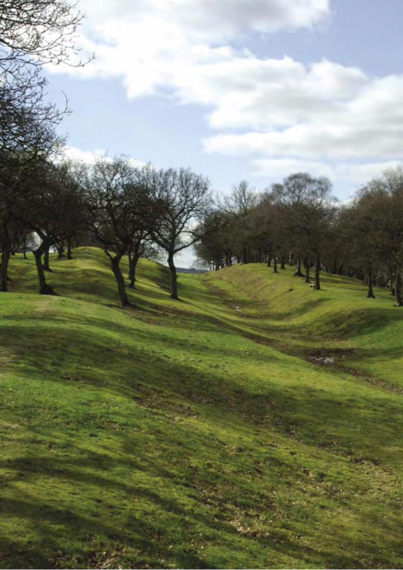
80 T H E A N T O N I N E W A L L
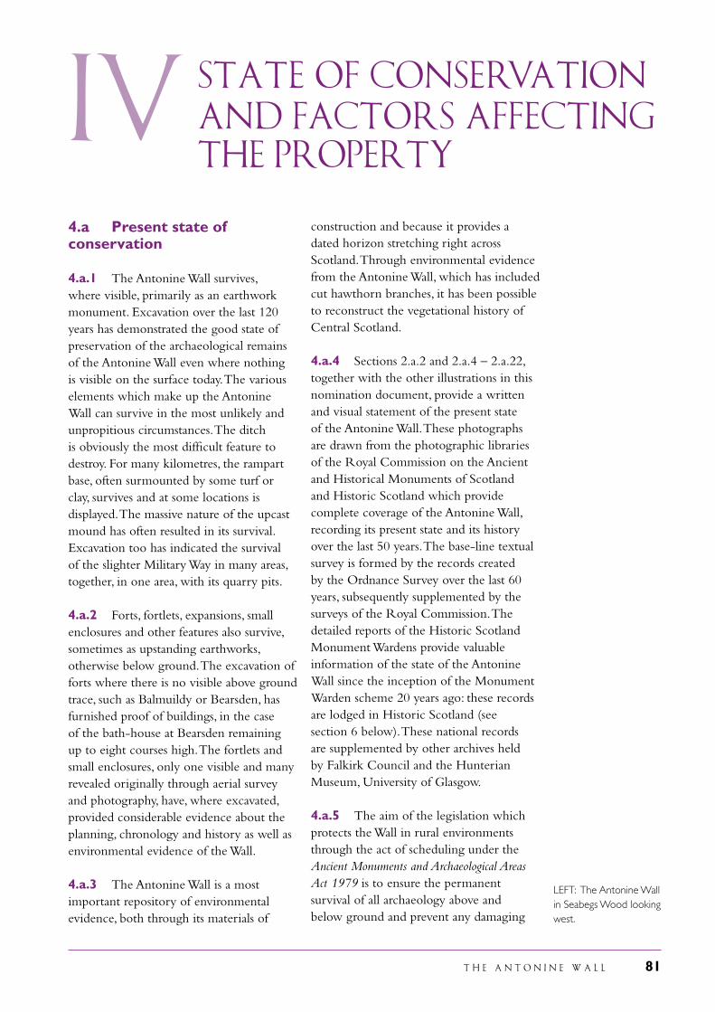
T H E A N T O N I N E W A L L 81
iV State of conservation
and factors affecting the property
construction and because it provides a dated horizon stretching right across Scotland. Through environmental evidence from the Antonine Wall, which has included cut hawthorn branches, it has been possible to reconstruct the vegetational history of Central Scotland.
4.a.4 Sections 2.a.2 and 2.a.4 – 2.a.22, together with the other illustrations in this nomination document, provide a written and visual statement of the present state of the Antonine Wall. These photographs are drawn from the photographic libraries of the Royal Commission on the Ancient and Historical Monuments of Scotland and Historic Scotland which provide complete coverage of the Antonine Wall, recording its present state and its history over the last 50 years. The base-line textual survey is formed by the records created by the Ordnance Survey over the last 60 years, subsequently supplemented by the surveys of the Royal Commission. The detailed reports of the Historic Scotland Monument Wardens provide valuable information of the state of the Antonine Wall since the inception of the Monument Warden scheme 20 years ago: these records are lodged in Historic Scotland (see section 6 below). These national records are supplemented by other archives held by Falkirk Council and the Hunterian Museum, University of Glasgow.
4.a.5 The aim of the legislation which protects the Wall in rural environments through the act of scheduling under the Ancient Monuments and Archaeological Areas Act 1979 is to ensure the permanent survival of all archaeology above and below ground and prevent any damaging
4.a Present state of conservation
4.a.1 The Antonine Wall survives, where visible, primarily as an earthwork monument. Excavation over the last 120 years has demonstrated the good state of preservation of the archaeological remains of the Antonine Wall even where nothing is visible on the surface today. The various elements which make up the Antonine Wall can survive in the most unlikely and unpropitious circumstances. The ditch is obviously the most difficult feature to destroy. For many kilometres, the rampart base, often surmounted by some turf or clay, survives and at some locations is displayed. The massive nature of the upcast mound has often resulted in its survival. Excavation too has indicated the survival of the slighter Military Way in many areas, together, in one area, with its quarry pits.
4.a.2 Forts, fortlets, expansions, small enclosures and other features also survive, sometimes as upstanding earthworks, otherwise below ground. The excavation of forts where there is no visible above ground trace, such as Balmuildy or Bearsden, has furnished proof of buildings, in the case of the bath-house at Bearsden remaining up to eight courses high. The fortlets and small enclosures, only one visible and many revealed originally through aerial survey and photography, have, where excavated, provided considerable evidence about the planning, chronology and history as well as environmental evidence of the Wall.
4.a.3 The Antonine Wall is a most important repository of environmental evidence, both through its materials of
LEFT: The Antonine Wall in Seabegs Wood looking west.
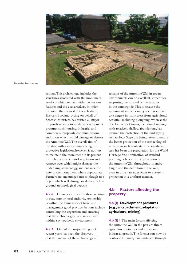
82 T H E A N T O N I N E W A L L
actions. This archaeology includes the structures associated with the monument, artefacts which remain within its various features and the eco-artefacts. In order to ensure the survival of these features, Historic Scotland, acting on behalf of Scottish Ministers, has resisted all major proposals relating to modern development pressures such housing, industrial and commercial proposals, communications and so on which would damage or destroy the Antonine Wall. The overall aim of the state authorities administering the protective legislation, however, is not just to maintain the monument in its present form, but also to control vegetation and remove trees which might damage the underlying archaeology, and enhance the state of the monument where appropriate. Farmers are encouraged not to plough to a depth which will damage or destroy below ground archaeological deposits.
4.a.6 Conservation within those sections in state care or local authority ownership is within the framework of basic land management good practice. Actions include controlling the vegetation and ensuring that the archaeological remains survive within a sympathetic environment.
4.a.7 One of the major changes of recent years has been the discovery that the survival of the archaeological
remains of the Antonine Wall in urban environments can be excellent, sometimes surpassing the survival of the remains in the countryside. This is because the monument in the countryside has suffered to a degree in many areas from agricultural activities, including ploughing, whereas the development of towns, including buildings with relatively shallow foundations, has ensured the protection of the underlying archaeology. Steps are being taken to ensure the better protection of the archaeological remains in such contexts. One significant step has been the preparation, for the World Heritage Site nomination, of standard planning policies for the protection of the Antonine Wall throughout its entire length and the definition of the Wall, even in urban areas, in order to ensure its protection in a uniform manner.
4.b Factors affecting the property
4.b.(i) Development pressures (e.g., encroachment, adaptation, agriculture, mining)
4.b.(i)1 The main factors affecting the Antonine Wall in the past are three: agricultural activities and urban and industrial growth. The former can now be controlled in many circumstances through
Bearsden bath-house
T H E A N T O N I N E W A L L 83
discussions between Historic Scotland and the owners and occupiers, supported where appropriate by management agreements which are permitted under the Ancient Monuments and Archaeological Areas Act 1979.
4.b.(i)2 Historic Scotland has long had a policy of opposing all urban developments which would destroy the Antonine Wall. It has protected the Antonine Wall and its setting through the use of successive Ancient Monuments and Planning Acts. Using the powers provided by such national legislation, over the last 50 years, it has defended the line of the Antonine Wall, including at public local enquiries where it has successfully opposed proposals which would have an adverse effect on the monument and its environs. No significant section of the Antonine Wall has succumbed to housing or industrial development for 40 years. Some modern threats are difficult to prevent. These include new roads and pipelines. These, however, are very limited in scale in relation to the size of the monument. Where visible stretches of the Wall remain, it is Historic Scotland’s normal procedure to have any pipeline thrust bored underneath the archaeological remains.
4.b.(ii) Environmental pressures (e.g., pollution, climate change, desertification)
4.b.(ii)1 It is unlikely that climate change would have a serious effect on the archaeological remains which form the Antonine Wall. A warmer climate might affect the dampness which helps preserve particular deposits such as pollen, but this is unlikely to happen in the foreseeable future.
4.b.(ii)2 The Antonine Wall sits within the former heartland of industrial Scotland. The iron furnaces which were such a feature of the area until the 1970s have now largely disappeared, and with them the likeliehood of local pollution. At the east end of the Wall, however, sits the massive petro-chemical works of Grangemouth.
Modern control mechanisms are in place to ensure the safety of this large-scale industrial complex.
4. b.(iii) Natural disasters and risk preparedness (e.g., earthquakes, floods, fire, etc)
4.b.(iii)1 The Antonine Wall does not sit in an area of earthquake activity. It generally sits in an elevated position, not prone to flooding. As an earthwork structure it is not likely to be seriously damaged by fire.
4. b.(iv) Visitor/tourism pressuresAt present, the number of visitors to the proposed Site is relatively low. Those parts of the proposed Site which lie on publicly maintained land are regularly inspected and show no signs of visitor pressure. It is anticipated that World Heritage Site status would lead to an increase in numbers though not of a great proportion. Plans are already in hand for managing larger visitor numbers and providing appropriate facilities such as car parks. In this, advice will be taken from experienced bodies such as Europarcs. The Wall throughout all its length lies close to urban areas. Many sectors, especially those in public ownership or care, are important in providing areas of recreation and relaxation for local people in these peri-urban zones. Both these aspects, and other elements relating to the management of the Antonine Wall are considered in the Management Plan submitted with this nomination.
4.b(v) Number of inhabitants within the property and the buffer zoneEstimated population located within:Area of nominated property: 2,350Buffer zone: 925Total: 3,275Year: 2001
Details of the number of inhabitants in each parcel of land comprising the proposed Site are provided on pages 22 and 23.
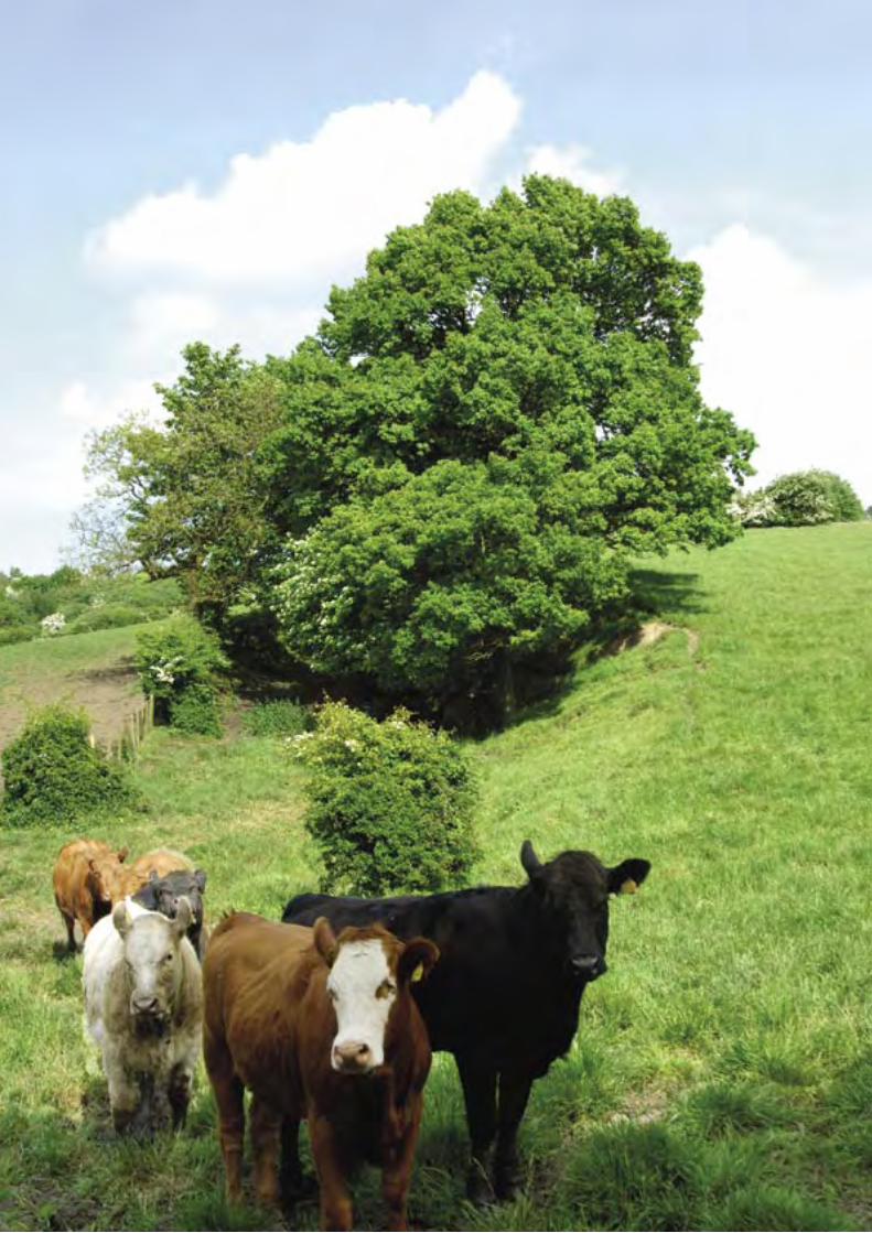
84 T H E A N T O N I N E W A L L
T H E A N T O N I N E W A L L 85
Protection and Management of the Property
Rough Castle fort, Bonnybridge: best surviving fort earthworks together with annexe; expansion; rampart, ditch and outer mound; Military Way and quarry pits
Seabegs Wood, Bonnybridge: rampart, ditch, outer mound and Military Way
Castlecary fort and annexe: some stonework is visible in the east wall of the fort and at the headquarters building
Garnhall: rampart, ditch, outer mound and Military Way: only the ditch is visible
Tollpark: ditch and outer mound
Dullatur: rampart, ditch and Military Way: only the ditch is visible
Croy Hill: rampart, ditch, outer mound, Military Way, fort, fortlet and two expansions and the presumed location of the civil settlement: the main visible features are the ditch and outer mound
Bar Hill, Twechar: fort, rampart, ditch, outer mound, Military Way, Iron Age hill-fort, and the probable location of the civil settlement: the fort, ditch and Iron Age hill-fort are the main visible features
Hillhead, Kirkintilloch: rampart, ditch and outer mound, but none is visible
Bearsden: bath-house, latrine, and part of annexe rampart base: all are visible
5.a.3 Falkirk Council owns 5.4 km/40 ha including the only visible fortlet:
Kinneil House and Country Park, Dean Burn to Upper Kinneil: rampart, ditch
5.a Ownership
5.a.1 Most of the Antonine Wall is in private ownership. All owners of scheduled sections of the Antonine Wall have been informed of the intention to nominate it as a World Heritage Site. All local authorities who administer the planning laws affecting the remaining sections of the Wall have advertised the level of protection they provide and the intention to nominate the Wall as a World Heritage Site. A booklet on the proposals was published in 2004 and over 4,000 copies have been distributed along the Wall and beyond. Several high-profile events involving Scottish Ministers have been held since 2003. In addition, lectures have been given at many locations along the Wall and articles published in the local newspapers about the proposals over the last four years.
5.a.2 Nearly 7.7 km of the Wall, totalling 72 ha, are in state care being managed by Historic Scotland. The first stretches were taken into care in 1953 and the holding now includes the best stretches of the rampart and ditch, the two visible sections of the Military Way, the four forts which have elements visible, three expansions and the site of one fortlet. All these elements are actively managed and conserved by Historic Scotland mainly through its own monument conservation team. Kinneil House, Bo’ness: line of Wall and
ditch: not visible
Bantaskin, Falkirk: ditch and outer mound
Watling Lodge, Falkirk: best surviving length of ditch
V
LEFT: The ditch at Twechar looking east
86 T H E A N T O N I N E W A L L
and outer mound, fortlet and Military Way: the fortlet and the faint hollow of the ditch are visible
Polmont, River Avon to Millhall Burn, rampart, ditch and upcast mound: a section of the ditch is visible in Polmont Woods
Callendar Park: rampart, ditch, outer mound: the latter two elements are particularly clear
Kemper Avenue: short length of rampart base: visible
Watling Lodge: fortlet: not visible
Tamfourhill Road: rampart, ditch and outer mound: all well preserved
Elf Hill: rampart, ditch and outer mound: all visible
Seabegs: rampart and ditch; medieval motte: only the motte is visible
Kinglass: camp: not visible
Polmonthill: camp: not visible
Little Kerse: camp: not visible
5.a.4 North Lanarkshire Council owns 0.6 km/12.5 ha comprising:
Garnhall: rampart, ditch and Military Way: only the ditch is visible
5.a.5 East Dunbartonshire Council owns 2.2 km/17 ha including:
Hillhead, Kirkintilloch: rampart and ditch but not visible
Kirkintilloch: part of the fort; medieval motte
New Kilpatrick Cemetery: two stretches of the stone base are on display
Bearsden: part of fort
Iain Road: length of base, ditch and outer mound are all visible
Antonine Road: rampart and ditch, but not visible
Hutcheson Hill: rampart, ditch and outer mound: only the ditch is visible
Twechar: camp: not visible
5.a.6 Glasgow City Council owns 0.07 km/0.16 ha at Cleddans Burn
5.a.7 West Dunbartonshire Council owns 0.8 km/4.8 ha including:
Duntocher: fort, annexe and fortlet: the ramparts of the fort are marked through differentive grass cutting
Beeches Avenue: line of ditch but not visible
Carleith: rampart base, rampart and ditch but not visible
The total length of the Antonine Wall in the public ownership or guardianship of either central or local government bodies is 17 km out of a total length for the frontier of 60 km. The remaining 44 km are in private ownership, only one body owning more than 1.5 km length of the Wall.
5.b Protective designation
5.b.1 The UK has had a statutory system of protecting ancient monuments for over 120 years and for the control of development for around 60 years. All the archaeological remains, the line and the setting of the Antonine Wall forming the proposed World Heritage Site and its buffer zone are protected by UK Acts of Parliament, supplemented by National Planning Policy Guidelines, which together form a coherent framework for the protection of the whole of the proposed World Heritage Site and its buffer zone. These laws and guidelines are operated by both central and local government bodies who co-operate through formal mechanisms to ensure that all laws and regulations are correctly administered. Together, they give protection to World Heritage Sites as a whole, over and beyond specific designation of individual properties or areas within them.
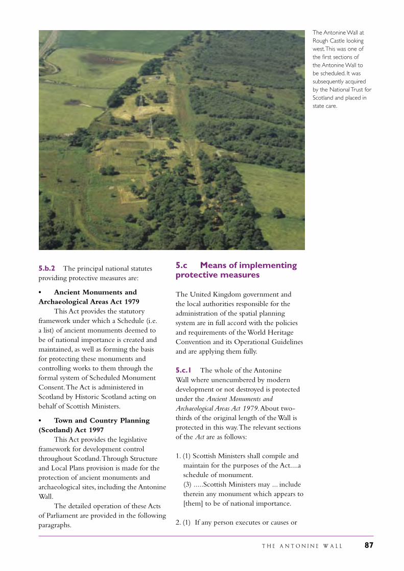
T H E A N T O N I N E W A L L 87
5.b.2 The principal national statutes providing protective measures are:
• Ancient Monuments and Archaeological Areas Act 1979 This Act provides the statutory framework under which a Schedule (i.e. a list) of ancient monuments deemed to be of national importance is created and maintained, as well as forming the basis for protecting these monuments and controlling works to them through the formal system of Scheduled Monument Consent. The Act is administered in Scotland by Historic Scotland acting on behalf of Scottish Ministers.
• Town and Country Planning (Scotland) Act 1997 This Act provides the legislative framework for development control throughout Scotland. Through Structure and Local Plans provision is made for the protection of ancient monuments and archaeological sites, including the Antonine Wall. The detailed operation of these Acts of Parliament are provided in the following paragraphs.
5.c Means of implementing protective measures
The United Kingdom government and the local authorities responsible for the administration of the spatial planning system are in full accord with the policies and requirements of the World Heritage Convention and its Operational Guidelines and are applying them fully.
5.c.1 The whole of the Antonine Wall where unencumbered by modern development or not destroyed is protected under the Ancient Monuments and Archaeological Areas Act 1979. About two-thirds of the original length of the Wall is protected in this way. The relevant sections of the Act are as follows:
1. (1) Scottish Ministers shall compile and maintain for the purposes of the Act....a schedule of monument.
(3) .....Scottish Ministers may ... include therein any monument which appears to [them] to be of national importance.
2. (1) If any person executes or causes or
The Antonine Wall at Rough Castle looking west. This was one of the first sections of the Antonine Wall to be scheduled. It was subsequently acquired by the National Trust for Scotland and placed in state care.
88 T H E A N T O N I N E W A L L
permits to be executed any works to which this section applies he shall be guilty of an offence unless the works are authorised under this Part of the Act.
(2) This section applies to any of the following works, that is to say-
(a) any works resulting in the demolition of destruction of or any damage to a scheduled monument;
(b) any works for the purpose of removing or repairing a scheduled monument or any part of it or of making any alterations or additions thereto; and
(c) any flooding or tipping operations on land in, on or under which there is a scheduled monument.
(3) ....works to which this section applies are authorised under this Part of the Act if-
(a) Scottish Ministers have granted written consent (scheduled monument consent) for the execution of the works; and
(b) the works are executed in accordance with the terms of the consent and of any conditions attached to the consent.
(6) ... if a person executing or causing or permitting to be executed any works to which a scheduled monument consent relates fails to comply with any condition attached to the consent he shall be guilty of an offence, unless he proves that he took all reasonable precautions and exercised all due diligence to avoid or prevent damage to the monument.
The provisions of the Act are administered in Scotland by Historic Scotland, an executive agency within the Scottish Executive.
5.c.2 Historic Scotland and its predecessors have sought to ensure the survival of the Antonine Wall through scheduling the monument under the provisions of the Ancient Monuments Acts over the past 80 years. The first sections of the Antonine Wall were scheduled in the 1920s. Following the preparation of an internal report in 1957, a scheduling programme was undertaken to embrace all these parts of the frontier which
were considered worthy of protection. The Antonine Wall was re-scheduled in the 1970s and again in the 1990s. These successive programmes of work have been undertaken to ensure that the Antonine Wall is as fully protected as possible through the use of the Ancient Monuments and Archaeological Areas Act 1979. These actions have also been undertaken to reflect changing views on the nature of the protective measures. Before 1957, 12 km of the Wall were either scheduled or in state care. Following 1957, this was increased to 30 km. The total length protected now stands at 40 km. The scheduling of the Antonine Wall continues to be revised as new information comes to light.
5.c.3 The Ancient Monuments and Archaeological Areas Act 1979 also provides for the control of works affecting scheduled monuments Section (2 (3) above). Historic Scotland would normally refuse scheduled monument consent for any actions which were inimical to the Antonine Wall. This has not always been easy owing to the location of the Antonine Wall in relation to the towns and villages of central Scotland. Nevertheless, compromises have often been reached which ensured the survival of the monument. At Duntocher and at Bearsden in the 1950s and 1960s the line of the Wall was left undeveloped within new housing estates. The archaeological remains were carefully avoided when the high rise flats were erected at Callendar Park, Falkirk, in the same decade. If necessary, Historic Scotland would maintain its opposition to damaging developments up to and including at public local enquiries at which the case is argued in a public forum. For example, the construction of a housing estate at Hillhead, Kirkintilloch, over the Antonine Wall, which was here badly preserved although of special archaeological interest, was opposed and in 1966 the Secretary of State for Scotland refused consent for the development. From the early 1970s up to the present day, a route for the new M80 which would result in damage to the Antonine Wall has been successfully opposed. These successful
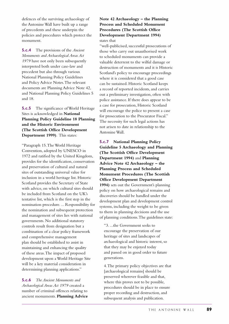
T H E A N T O N I N E W A L L 89
defences of the surviving archaeology of the Antonine Wall have built up a range of precedents and these underpin the policies and procedures which protect the monument.
5.c.4 The provisions of the Ancient Monuments and Archaeological Areas Act 1979 have not only been subsequently interpreted both under case-law and precedent but also through various National Planning Policy Guidelines and Policy Advice Notes. The relevant documents are Planning Advice Note 42, and National Planning Policy Guidelines 5 and 18.
5.c.5 The significance of World Heritage Sites is acknowledged in National Planning Policy Guideline 18 Planning and the Historic Environment (The Scottish Office Development Department 1999). This states:
“Paragraph 15. The World Heritage Convention, adopted by UNESCO in 1972 and ratified by the United Kingdom, provides for the identification, conservation and preservation of cultural and natural sites of outstanding universal value for inclusion in a world heritage list. Historic Scotland provides the Secretary of State with advice, on which cultural sites should be included from Scotland on the UK’s tentative list, which is the first step in the nomination procedure. ... Responsibility for the nomination and subsequent protection and management of sites lies with national governments. No additional statutory controls result from designation but a combination of a clear policy framework and comprehensive management plan should be established to assist in maintaining and enhancing the quality of these areas. The impact of proposed development upon a World Heritage Site will be a key material consideration in determining planning applications.”
5.c.6 The Ancient Monuments and Archaeological Areas Act 1979 created a number of criminal offences relating to ancient monuments. Planning Advice
Note 42 Archaeology – the Planning Process and Scheduled Monument Procedures (The Scottish Office Development Department 1994) states that “well-publicised, successful prosecutions of those who carry out unauthorised work to scheduled monuments can provide a valuable deterrent to the wilful damage or destruction of monuments and it is Historic Scotland’s policy to encourage proceedings where it is considered that a good case can be sustained. Historic Scotland keeps a record of reported incidents, and carries out a preliminary investigation, often with police assistance. If there does appear to be a case for prosecution, Historic Scotland will encourage the police to present a case for prosecution to the Procurator Fiscal.” The necessity for such legal actions has not arisen to date in relationship to the Antonine Wall.
5.c.7 National Planning Policy Guideline 5 Archaeology and Planning (The Scottish Office Development Department 1994) and Planning Advice Note 42 Archaeology – the Planning Process and Scheduled Monument Procedures (The Scottish Office Development Department 1994) sets out the Government’s planning policy on how archaeological remains and discoveries should be handled under the development plan and development control systems, including the weight to be given to them in planning decisions and the use of planning conditions. The guidelines state:
“3. ...the Government seeks to encourage the preservation of our heritage of sites and landscapes of archaeological and historic interest, so that they may be enjoyed today and passed on in good order to future generations.
4. The primary policy objectives are that [archaeological remains] should be preserved wherever feasible and that, where this proves not to be possible, procedures should be in place to ensure proper recording and destruction, and subsequent analysis and publication.
90 T H E A N T O N I N E W A L L
12. It is the Government’s aim to accommodate development without eroding environmental assets, and this includes Scotland’s archaeological heritage.
14. Planning authorities should ensure that archaeological factors are as thoroughly considered as any other material factor in both the development planning and the development control processes.
16. It is also important that the integrity of the setting of archaeological sites should be safeguarded.
17. Scheduled ancient monuments are of national importance and it is particularly important that they are preserved in situ and within an appropriate setting.Many significant archaeological sites.... will not merit scheduling under the criteria for national importance but may nevertheless be of importance in a regional or local context. Such sites should be defined and justified through development plan policies with priority also given to their preservation within an appropriate setting...
18. The preservation in situ of important archaeological remains is always to be preferred. ...
20. A primary function of development plans is to reconcile the requirements for development land with the conservation of our natural and built heritage. These plans provide the policy framework for authorities to safeguard archaeological sites and monuments in their areas.
21. Structure plans ... should ... include relevant general protection policies for nationally important remains and their settings; for unscheduled sites of regional and local importance and their settings, and also for landscapes of historic importance.
22. Local plans should include policies for the protection, preservation and, where appropriate, enhancement of all nationally important sites of archaeological interest and their settings; and also for other unscheduled remains and their settings identified as particularly worthy of preservation.
25. The preservation of ancient monuments and their setting is a material consideration in determining planning applications and appears, whether a monument is scheduled or not.”
5.c.8 The Town and Country Planning (Scotland) Act 1997 is the primary legislation for spatial planning. It provides for the zoning of the landscape into different activities and provides mechanisms for development control. Within the framework of this Act, the five local authorities along the line of the Antonine Wall - East Dunbartonshire, Falkirk, Glasgow, North Lanarkshire and West Dunbartonshire – protect nearly 20 km of the proposed World Heritage Site, primarily those sections which lie within urban environments, together with the buffer zones, while providing additional protection for those sections which are scheduled under the Ancient Monuments and Archaeological Areas Act 1979. All five local authorities have policies with a presumption against any development which would have an adverse impact on the proposed World Heritage Site. The relevant sections of these policies are as follows.
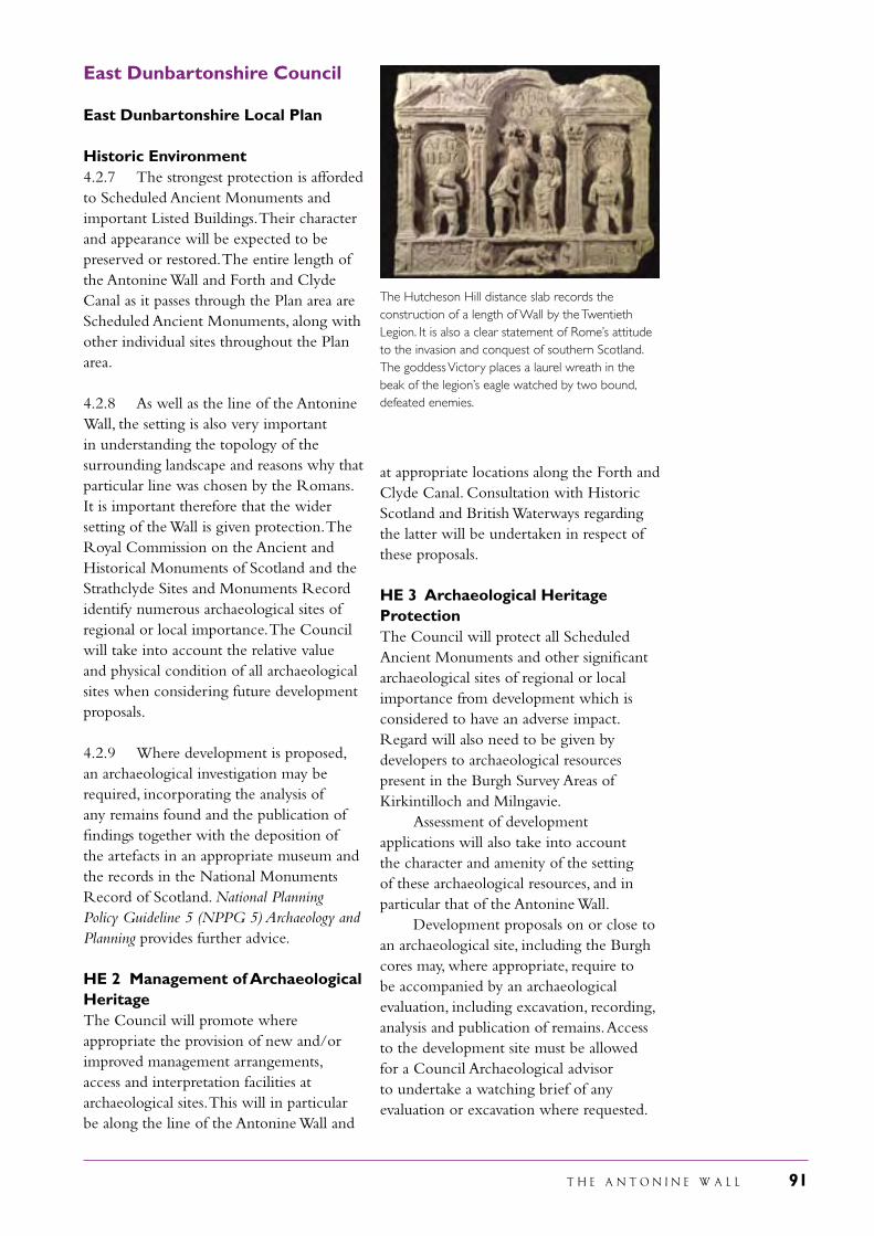
T H E A N T O N I N E W A L L 91
East Dunbartonshire Council
East Dunbartonshire Local Plan
Historic Environment4.2.7 The strongest protection is afforded to Scheduled Ancient Monuments and important Listed Buildings. Their character and appearance will be expected to be preserved or restored. The entire length of the Antonine Wall and Forth and Clyde Canal as it passes through the Plan area are Scheduled Ancient Monuments, along with other individual sites throughout the Plan area.
4.2.8 As well as the line of the Antonine Wall, the setting is also very important in understanding the topology of the surrounding landscape and reasons why that particular line was chosen by the Romans. It is important therefore that the wider setting of the Wall is given protection. The Royal Commission on the Ancient and Historical Monuments of Scotland and the Strathclyde Sites and Monuments Record identify numerous archaeological sites of regional or local importance. The Council will take into account the relative value and physical condition of all archaeological sites when considering future development proposals.
4.2.9 Where development is proposed, an archaeological investigation may be required, incorporating the analysis of any remains found and the publication of findings together with the deposition of the artefacts in an appropriate museum and the records in the National Monuments Record of Scotland. National Planning Policy Guideline 5 (NPPG 5) Archaeology and Planning provides further advice.
HE 2 Management of Archaeological HeritageThe Council will promote where appropriate the provision of new and/or improved management arrangements, access and interpretation facilities at archaeological sites. This will in particular be along the line of the Antonine Wall and
at appropriate locations along the Forth and Clyde Canal. Consultation with Historic Scotland and British Waterways regarding the latter will be undertaken in respect of these proposals.
HE 3 Archaeological Heritage ProtectionThe Council will protect all Scheduled Ancient Monuments and other significant archaeological sites of regional or local importance from development which is considered to have an adverse impact. Regard will also need to be given by developers to archaeological resources present in the Burgh Survey Areas of Kirkintilloch and Milngavie. Assessment of development applications will also take into account the character and amenity of the setting of these archaeological resources, and in particular that of the Antonine Wall. Development proposals on or close to an archaeological site, including the Burgh cores may, where appropriate, require to be accompanied by an archaeological evaluation, including excavation, recording, analysis and publication of remains. Access to the development site must be allowed for a Council Archaeological advisor to undertake a watching brief of any evaluation or excavation where requested.
The Hutcheson Hill distance slab records the construction of a length of Wall by the Twentieth Legion. It is also a clear statement of Rome’s attitude to the invasion and conquest of southern Scotland. The goddess Victory places a laurel wreath in the beak of the legion’s eagle watched by two bound, defeated enemies.
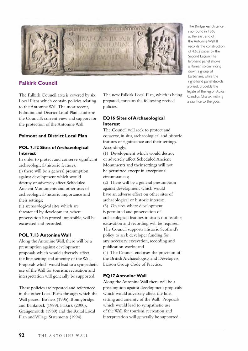
92 T H E A N T O N I N E W A L L
Falkirk Council
The Falkirk Council area is covered by six Local Plans which contain policies relating to the Antonine Wall. The most recent, Polmont and District Local Plan, confirms the Council’s current view and support for the protection of the Antonine Wall.
Polmont and District Local Plan
POL 7.12 Sites of Archaeological InterestIn order to protect and conserve significant archaeological/historic features:(i) there will be a general presumption against development which woulddestroy or adversely affect Scheduled Ancient Monuments and other sites of archaeological/historic importance and their settings;(ii) archaeological sites which are threatened by development, wherepreservation has proved impossible, will be excavated and recorded.
POL 7.13 Antonine WallAlong the Antonine Wall, there will be a presumption against developmentproposals which would adversely affect the line, setting and amenity of the Wall. Proposals which would lead to a sympathetic use of the Wall for tourism, recreation and interpretation will generally be supported.
These policies are repeated and referenced in the other Local Plans through which the Wall passes: Bo’ness (1995), Bonnybridge and Banknock (1989), Falkirk (2000), Grangemouth (1989) and the Rural Local Plan and Village Statements (1994).
The Bridgeness distance slab found in 1868 at the east end of the Antonine Wall. It records the construction of 4,652 paces by the Second Legion. The left-hand panel shows a Roman soldier riding down a group of barbarians, while the right-hand panel depicts a priest, probably the legate of the legion Aulus Claudius Charax, making a sacrifice to the gods.
The new Falkirk Local Plan, which is being prepared, contains the following revised policies.
EQ16 Sites of Archaeological InterestThe Council will seek to protect and conserve, in situ, archaeological and historic features of significance and their settings. Accordingly:(1) Development which would destroy or adversely affect Scheduled Ancient Monuments and their settings will not be permitted except in exceptional circumstances;(2) There will be a general presumption against development which would have an adverse effect on other sites of archaeological or historic interest;(3) On sites where development is permitted and preservation of archaeological features in situ is not feasible, excavation and recording will be required. The Council supports Historic Scotland’s policy to seek developer funding for any necessary excavation, recording and publication works; and(4) The Council endorses the provision of the British Archaeologists and Developers Liaison Group Code of Practice.
EQ17 Antonine WallAlong the Antonine Wall there will be a presumption against development proposals which would adversely affect the line, setting and amenity of the Wall. Proposals which would lead to sympathetic use of the Wall for tourism, recreation and interpretation will generally be supported.
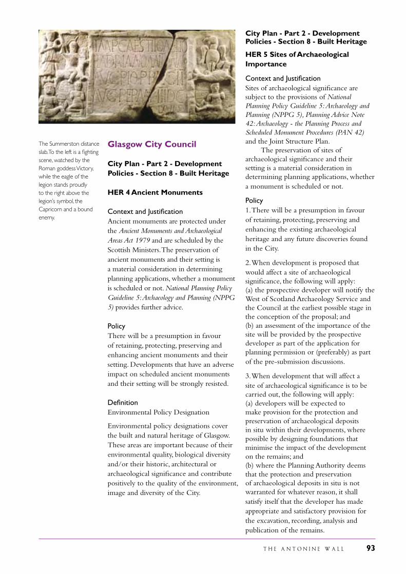
T H E A N T O N I N E W A L L 93
Glasgow City Council
City Plan - Part 2 - Development Policies - Section 8 - Built Heritage HER 4 Ancient Monuments
Context and Justification Ancient monuments are protected under the Ancient Monuments and Archaeological Areas Act 1979 and are scheduled by the Scottish Ministers. The preservation of ancient monuments and their setting is a material consideration in determining planning applications, whether a monument is scheduled or not. National Planning Policy Guideline 5: Archaeology and Planning (NPPG 5) provides further advice. Policy There will be a presumption in favour of retaining, protecting, preserving and enhancing ancient monuments and their setting. Developments that have an adverse impact on scheduled ancient monuments and their setting will be strongly resisted. Definition Environmental Policy Designation Environmental policy designations cover the built and natural heritage of Glasgow. These areas are important because of their environmental quality, biological diversity and/or their historic, architectural or archaeological significance and contribute positively to the quality of the environment, image and diversity of the City.
City Plan - Part 2 - Development Policies - Section 8 - Built Heritage HER 5 Sites of Archaeological Importance
Context and Justification Sites of archaeological significance are subject to the provisions of National Planning Policy Guideline 5: Archaeology and Planning (NPPG 5), Planning Advice Note 42: Archaeology - the Planning Process and Scheduled Monument Procedures (PAN 42) and the Joint Structure Plan. The preservation of sites of archaeological significance and their setting is a material consideration in determining planning applications, whether a monument is scheduled or not. Policy 1. There will be a presumption in favour of retaining, protecting, preserving and enhancing the existing archaeological heritage and any future discoveries found in the City.
2. When development is proposed that would affect a site of archaeological significance, the following will apply: (a) the prospective developer will notify the West of Scotland Archaeology Service and the Council at the earliest possible stage in the conception of the proposal; and (b) an assessment of the importance of the site will be provided by the prospective developer as part of the application for planning permission or (preferably) as part of the pre-submission discussions.
3. When development that will affect a site of archaeological significance is to be carried out, the following will apply: (a) developers will be expected to make provision for the protection and preservation of archaeological deposits in situ within their developments, where possible by designing foundations that minimise the impact of the development on the remains; and(b) where the Planning Authority deems that the protection and preservation of archaeological deposits in situ is not warranted for whatever reason, it shall satisfy itself that the developer has made appropriate and satisfactory provision for the excavation, recording, analysis and publication of the remains.
The Summerston distance slab. To the left is a fighting scene, watched by the Roman goddess Victory, while the eagle of the legion stands proudly to the right above the legion’s symbol, the Capricorn and a bound enemy.
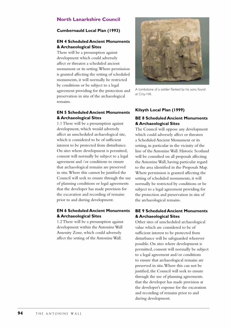
94 T H E A N T O N I N E W A L L
North Lanarkshire Council
Cumbernauld Local Plan (1993)
EN 4 Scheduled Ancient Monuments & Archaeological SitesThere will be a presumption against development which could adversely affect or threaten a scheduled ancient monument or its setting. Where permission is granted affecting the setting of scheduled monuments, it will normally be restricted by conditions or be subject to a legal agreement providing for the protection and preservation in situ of the archaeological remains.
EN 5 Scheduled Ancient Monuments & Archaeological Sites1.1 There will be a presumption against development, which would adversely affect an unscheduled archaeological site, which is considered to be of sufficient interest to be protected from disturbance. On sites where development is permitted, consent will normally be subject to a legal agreement and /or conditions to ensure that archaeological remains are preserved in situ. Where this cannot be justified the Council will seek to ensure through the use of planning conditions or legal agreements that the developer has made provision for the excavation and recording of remains prior to and during development.
EN 6 Scheduled Ancient Monuments & Archaeological Sites1.2 There will be a presumption against development within the Antonine Wall Amenity Zone, which could adversely affect the setting of the Antonine Wall.
Kilsyth Local Plan (1999)
BE 8 Scheduled Ancient Monuments & Archaeological SitesThe Council will oppose any development which could adversely affect or threaten a Scheduled Ancient Monument or its setting, in particular in the vicinity of the line of the Antonine Wall. Historic Scotland will be consulted on all proposals affecting the Antonine Wall, having particular regard to the area identified in the Proposals Map. Where permission is granted affecting the setting of scheduled monuments, it will normally be restricted by conditions or be subject to a legal agreement providing for the protection and preservation in situ of the archaeological remains.
BE 9 Scheduled Ancient Monuments & Archaeological SitesOther sites of unscheduled archaeological value which are considered to be of sufficient interest to be protected from disturbance will be safeguarded wherever possible. On sites where development is permitted, consent will normally be subject to a legal agreement and/or conditions to ensure that archaeological remains are preserved in situ. Where this can not be justified, the Council will seek to ensure through the use of planning agreements. that the developer has made provision at the developer’s expense for the excavation and recording of remains prior to and during development.
A tombstone of a soldier flanked by his sons, found at Croy Hill.
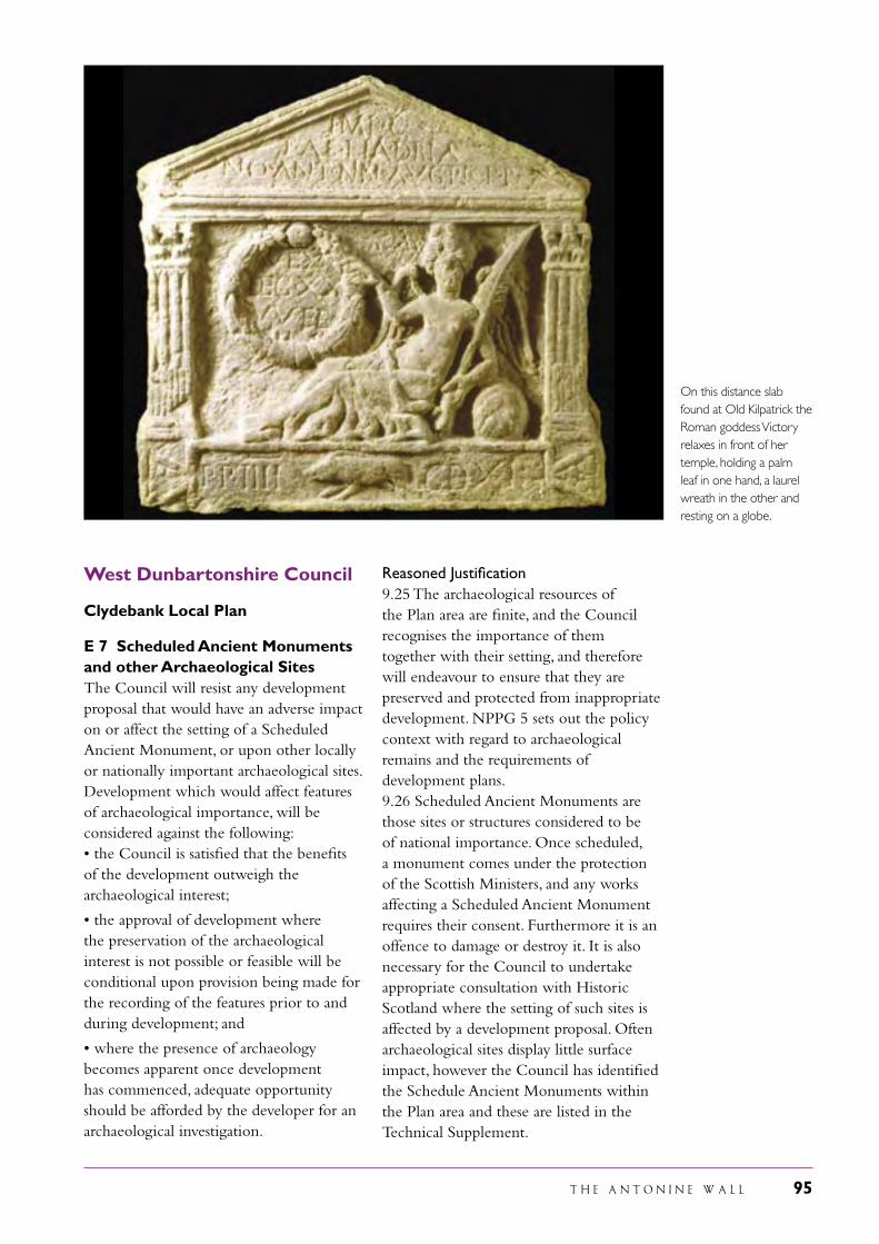
T H E A N T O N I N E W A L L 95
West Dunbartonshire Council
Clydebank Local Plan
E 7 Scheduled Ancient Monuments and other Archaeological SitesThe Council will resist any development proposal that would have an adverse impact on or affect the setting of a Scheduled Ancient Monument, or upon other locally or nationally important archaeological sites. Development which would affect features of archaeological importance, will be considered against the following:• the Council is satisfied that the benefits of the development outweigh the archaeological interest;
• the approval of development where the preservation of the archaeological interest is not possible or feasible will be conditional upon provision being made for the recording of the features prior to and during development; and
• where the presence of archaeology becomes apparent once development has commenced, adequate opportunity should be afforded by the developer for an archaeological investigation.
Reasoned Justification9.25 The archaeological resources of the Plan area are finite, and the Council recognises the importance of them together with their setting, and therefore will endeavour to ensure that they are preserved and protected from inappropriate development. NPPG 5 sets out the policy context with regard to archaeological remains and the requirements of development plans.9.26 Scheduled Ancient Monuments are those sites or structures considered to be of national importance. Once scheduled, a monument comes under the protection of the Scottish Ministers, and any works affecting a Scheduled Ancient Monument requires their consent. Furthermore it is an offence to damage or destroy it. It is also necessary for the Council to undertake appropriate consultation with Historic Scotland where the setting of such sites is affected by a development proposal. Often archaeological sites display little surface impact, however the Council has identified the Schedule Ancient Monuments within the Plan area and these are listed in the Technical Supplement.
On this distance slab found at Old Kilpatrick the Roman goddess Victory relaxes in front of her temple, holding a palm leaf in one hand, a laurel wreath in the other and resting on a globe.
96 T H E A N T O N I N E W A L L
9.27 Only parts of the Antonine Wall within the Plan area are “scheduled”, however, the entire Wall within the Plan area is identified as an archaeological resource. Where developments that may affect the setting of the identified route of the Wall are proposed the advice of West of Scotland Archaeological Service will be sought and Historic Scotland will be consulted.
E 8 Landscape CharacterDevelopment within the Green Belt, wider countryside and green corridors through the urban area, will have particular regard to the landscape character and distinctiveness of the Plan area. Proposals should positively contribute to conservation or regeneration of these landscapes. Proposals which are detrimental to the landscape character will not generally be supported unless they are supported by other Local Plan policies. Where such circumstances exist, measures should be proposed to minimise adverse impacts.
Reasoned Justification9.28 Clydebank is heavily influenced and physically contained by elements of the Kilpatrick Hills. A landscape character assessment has been undertaken for the entire Glasgow and Clyde Valley area (Glasgow and the Clyde Valley Landscape Assessment 1999), which has identified three landscape character areas. Green Corridors through the urban area include the River Clyde, Duntocher Burn and the Forth and Clyde Canal. Drumlin foothills cover the northeast of the Plan area, with rugged moorland hills in the remaining greenbelt and wider countryside. The Council consider it important to offer general protection to the character of the landscape around Clydebank and the wider countryside and will support proposals to enhance the landscape setting of Clydebank.
A new Plan for this part of the Antonine Wall is being prepared, the West Dunbartonshire Local Plan, and this is currently out for consultation. The above policies remain within the new Plan, but will be supplemented bt the following new policy:
BE 6 Antonine Wall Amenity ZonesDevelopment within the Antonine Wall Amenity Zones which has an adverse impact on the Scheduled Ancient Monument or its setting as identified on the Proposals Map will be considered contrary to the Plan.
Reasoned Justification9.32 Amenity zones have been identified by Historic Scotland to offer protection to the setting of the Antonine Wall. The Antonine Wall has been proposed for World Heritage Status as part of the Roman Frontiers and will be considered for such status during the life span of this Plan. Careful consideration is required of any development within these zones to ensure that there will be no adverse effects which would undermine the importance of the Antonine Wall and potentially compromise the World Heritage proposals. The majority of the area included in the Amenity zones is covered by Green Belt and open space policies through which there is a general presumption against development. The Local Plan recognises the importance of protecting this landscape both for the conservation of the Scheduled Monument/proposed World Heritage Site at an international level and also the contribution the landscape makes to the local environment.
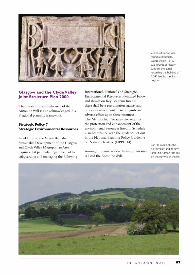
T H E A N T O N I N E W A L L 97
Glasgow and the Clyde Valley Joint Structure Plan 2000
The international significance of the Antonine Wall is also acknowledged in a Regional planning framework:
Strategic Policy 7 Strategic Environmental Resources
In addition to the Green Belt, the Sustainable Development of the Glasgow and Clyde Valley Metropolitan Area requires that particular regard be had to safeguarding and managing the following
International, National and Strategic Environmental Resources identified below and shown on Key Diagram Inset D; there shall be a presumption against any proposals which could have a significant adverse effect upon these resources. The Metropolitan Strategy also requires the protection and enhancement of the environmental resources listed in Schedule 7, in accordance with the guidance set out in the National Planning Policy Guideline on Natural Heritage (NPPG 14)
Amongst the internationally important sites is listed the Antonine Wall.
Bar Hill overlooks the Kelvin Valley and its farm-land. The Roman fort lies on the summit of the hill.
On this distance slab found at Braidfield, Duntocher, in 1812, two figures of Victory support the panel recording the building of 3,240 feet by the Sixth Legion.
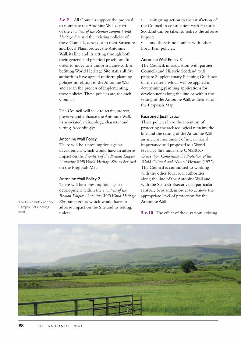
98 T H E A N T O N I N E W A L L
5.c.9 All Councils support the proposal to nominate the Antonine Wall as part of the Frontiers of the Roman Empire World Heritage Site and the existing policies of these Councils, as set out in their Structure and Local Plans, protect the Antonine Wall, its line and its setting through both their general and practical provisions. In order to move to a uniform framework as befitting World Heritage Site status all five authorities have agreed uniform planning policies in relation to the Antonine Wall and are in the process of implementing these policies. These policies are, for each Council:
The Council will seek to retain, protect, preserve and enhance the Antonine Wall, its associated archaeology, character and setting. Accordingly:
Antonine Wall Policy 1There will be a presumption against development which would have an adverse impact on the Frontiers of the Roman Empire (Antonine Wall) World Heritage Site as defined on the Proposals Map.
Antonine Wall Policy 2There will be a presumption against development within the Frontiers of the Roman Empire (Antonine Wall) World Heritage Site buffer zones which would have an adverse impact on the Site and its setting, unless:
• mitigating action to the satisfaction of the Council in consultation with Historic Scotland can be taken to redress the adverse impact;• and there is no conflict with other Local Plan policies.
Antonine Wall Policy 3The Council, in association with partner Councils and Historic Scotland, will prepare Supplementary Planning Guidance on the criteria which will be applied in determining planning applications for development along the line or within the setting of the Antonine Wall, as defined on the Proposals Map.
Reasoned JustificationThese policies have the intention of protecting the archaeological remains, the line and the setting of the Antonine Wall, an ancient monument of international importance and proposed as a World Heritage Site under the UNESCO Convention Concerning the Protection of the World Cultural and Natural Heritage (1972). The Council is committed to working with the other four local authorities along the line of the Antonine Wall and with the Scottish Executive, in particular Historic Scotland, in order to achieve the appropriate level of protection for the Antonine Wall.
5.c.10 The effect of these various existing
The Kelvin Valley and the Campsie Fells looking west.
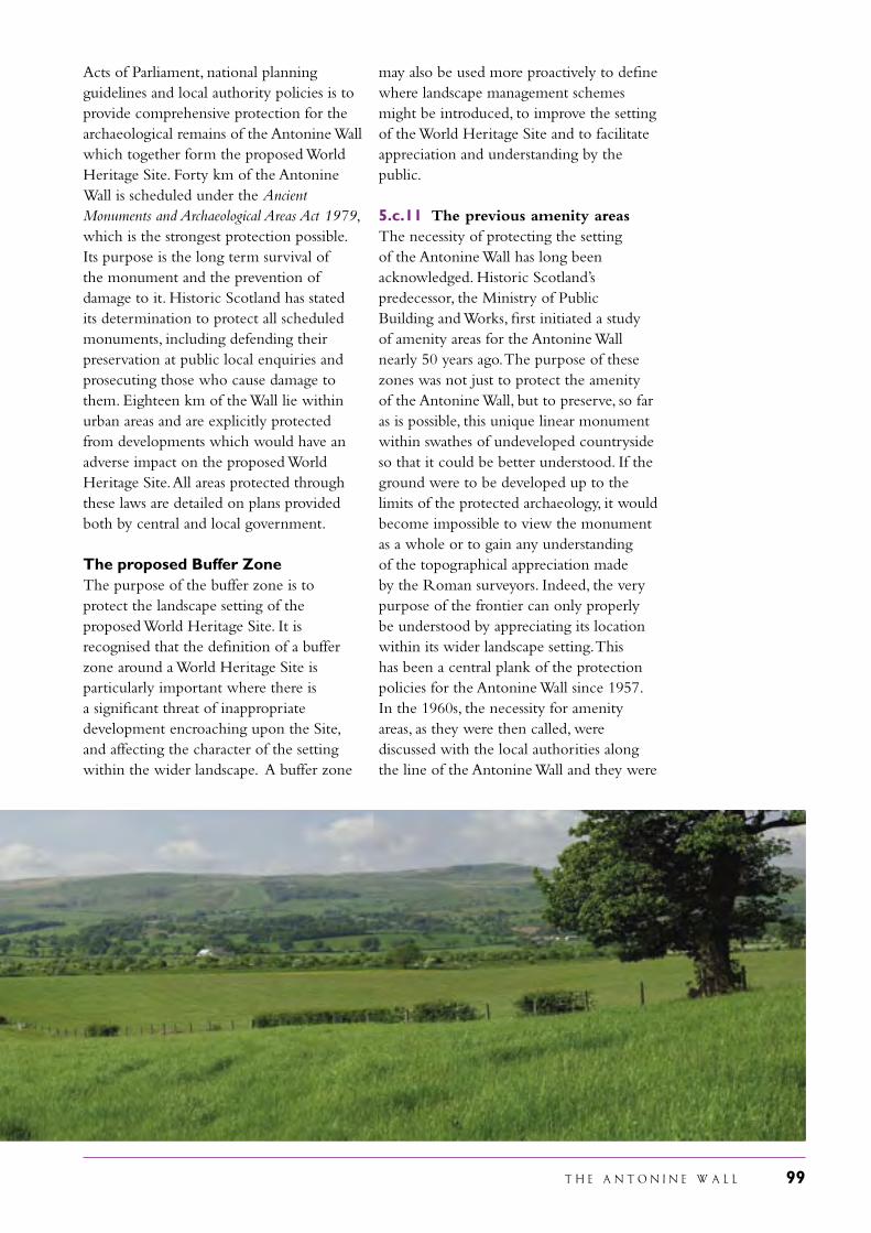
T H E A N T O N I N E W A L L 99
Acts of Parliament, national planning guidelines and local authority policies is to provide comprehensive protection for the archaeological remains of the Antonine Wall which together form the proposed World Heritage Site. Forty km of the Antonine Wall is scheduled under the Ancient Monuments and Archaeological Areas Act 1979, which is the strongest protection possible. Its purpose is the long term survival of the monument and the prevention of damage to it. Historic Scotland has stated its determination to protect all scheduled monuments, including defending their preservation at public local enquiries and prosecuting those who cause damage to them. Eighteen km of the Wall lie within urban areas and are explicitly protected from developments which would have an adverse impact on the proposed World Heritage Site. All areas protected through these laws are detailed on plans provided both by central and local government. The proposed Buffer ZoneThe purpose of the buffer zone is to protect the landscape setting of the proposed World Heritage Site. It is recognised that the definition of a buffer zone around a World Heritage Site is particularly important where there is a significant threat of inappropriate development encroaching upon the Site, and affecting the character of the setting within the wider landscape. A buffer zone
may also be used more proactively to define where landscape management schemes might be introduced, to improve the setting of the World Heritage Site and to facilitate appreciation and understanding by the public.
5.c.11 The previous amenity areasThe necessity of protecting the setting of the Antonine Wall has long been acknowledged. Historic Scotland’s predecessor, the Ministry of Public Building and Works, first initiated a study of amenity areas for the Antonine Wall nearly 50 years ago. The purpose of these zones was not just to protect the amenity of the Antonine Wall, but to preserve, so far as is possible, this unique linear monument within swathes of undeveloped countryside so that it could be better understood. If the ground were to be developed up to the limits of the protected archaeology, it would become impossible to view the monument as a whole or to gain any understanding of the topographical appreciation made by the Roman surveyors. Indeed, the very purpose of the frontier can only properly be understood by appreciating its location within its wider landscape setting. This has been a central plank of the protection policies for the Antonine Wall since 1957. In the 1960s, the necessity for amenity areas, as they were then called, were discussed with the local authorities along the line of the Antonine Wall and they were
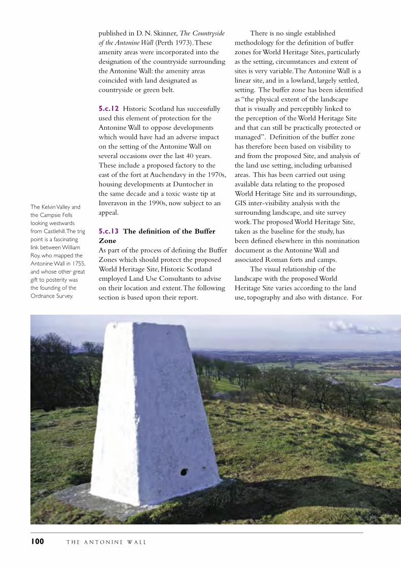
100 T H E A N T O N I N E W A L L
published in D. N. Skinner, The Countryside of the Antonine Wall (Perth 1973). These amenity areas were incorporated into the designation of the countryside surrounding the Antonine Wall: the amenity areas coincided with land designated as countryside or green belt.
5.c.12 Historic Scotland has successfully used this element of protection for the Antonine Wall to oppose developments which would have had an adverse impact on the setting of the Antonine Wall on several occasions over the last 40 years. These include a proposed factory to the east of the fort at Auchendavy in the 1970s, housing developments at Duntocher in the same decade and a toxic waste tip at Inveravon in the 1990s, now subject to an appeal.
5.c.13 The definition of the Buffer ZoneAs part of the process of defining the Buffer Zones which should protect the proposed World Heritage Site, Historic Scotland employed Land Use Consultants to advise on their location and extent. The following section is based upon their report.
There is no single established methodology for the definition of buffer zones for World Heritage Sites, particularly as the setting, circumstances and extent of sites is very variable. The Antonine Wall is a linear site, and in a lowland, largely settled, setting. The buffer zone has been identified as “the physical extent of the landscape that is visually and perceptibly linked to the perception of the World Heritage Site and that can still be practically protected or managed”. Definition of the buffer zone has therefore been based on visibility to and from the proposed Site, and analysis of the land use setting, including urbanised areas. This has been carried out using available data relating to the proposed World Heritage Site and its surroundings, GIS inter-visibility analysis with the surrounding landscape, and site survey work. The proposed World Heritage Site, taken as the baseline for the study, has been defined elsewhere in this nomination document as the Antonine Wall and associated Roman forts and camps. The visual relationship of the landscape with the proposed World Heritage Site varies according to the land use, topography and also with distance. For
The Kelvin Valley and the Campsie Fells looking westwards from Castlehill. The trig point is a fascinating link between William Roy, who mapped the Antonine Wall in 1755, and whose other great gift to posterity was the founding of the Ordnance Survey.
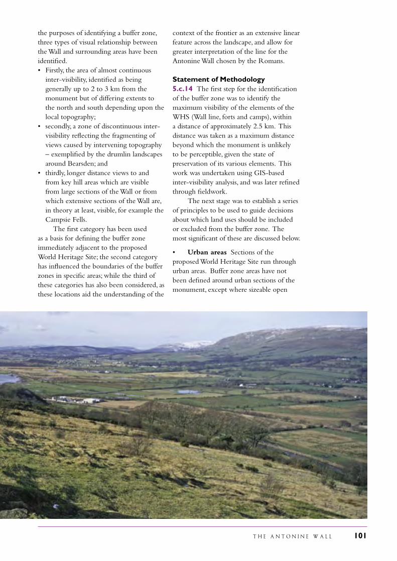
T H E A N T O N I N E W A L L 101
the purposes of identifying a buffer zone, three types of visual relationship between the Wall and surrounding areas have been identified. • Firstly, the area of almost continuous
inter-visibility, identified as being generally up to 2 to 3 km from the monument but of differing extents to the north and south depending upon the local topography;
• secondly, a zone of discontinuous inter-visibility reflecting the fragmenting of views caused by intervening topography – exemplified by the drumlin landscapes around Bearsden; and
• thirdly, longer distance views to and from key hill areas which are visible from large sections of the Wall or from which extensive sections of the Wall are, in theory at least, visible, for example the Campsie Fells.
The first category has been used as a basis for defining the buffer zone immediately adjacent to the proposed World Heritage Site; the second category has influenced the boundaries of the buffer zones in specific areas; while the third of these categories has also been considered, as these locations aid the understanding of the
context of the frontier as an extensive linear feature across the landscape, and allow for greater interpretation of the line for the Antonine Wall chosen by the Romans.
Statement of Methodology5.c.14 The first step for the identification of the buffer zone was to identify the maximum visibility of the elements of the WHS (Wall line, forts and camps), within a distance of approximately 2.5 km. This distance was taken as a maximum distance beyond which the monument is unlikely to be perceptible, given the state of preservation of its various elements. This work was undertaken using GIS-based inter-visibility analysis, and was later refined through fieldwork. The next stage was to establish a series of principles to be used to guide decisions about which land uses should be included or excluded from the buffer zone. The most significant of these are discussed below.
• Urban areas Sections of the proposed World Heritage Site run through urban areas. Buffer zone areas have not been defined around urban sections of the monument, except where sizeable open
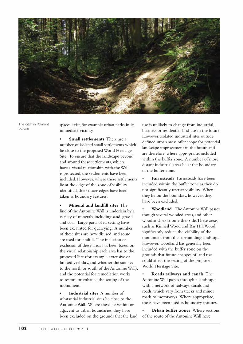
102 T H E A N T O N I N E W A L L
spaces exist, for example urban parks in its immediate vicinity.
• Small settlements There are a number of isolated small settlements which lie close to the proposed World Heritage Site. To ensure that the landscape beyond and around these settlements, which have a visual relationship with the Wall, is protected, the settlements have been included. However, where these settlements lie at the edge of the zone of visibility identified, their outer edges have been taken as boundary features.
• Mineral and landfill sites The line of the Antonine Wall is underlain by a variety of minerals, including sand, gravel and coal. Large parts of its setting have been excavated for quarrying. A number of these sites are now disused, and some are used for landfill. The inclusion or exclusion of these areas has been based on the visual relationship each area has to the proposed Site (for example extensive or limited visibility, and whether the site lies to the north or south of the Antonine Wall), and the potential for remediation works to restore or enhance the setting of the monument.
• Industrial sites A number of substantial industrial sites lie close to the Antonine Wall. Where these lie within or adjacent to urban boundaries, they have been excluded on the grounds that the land
use is unlikely to change from industrial, business or residential land use in the future. However, isolated industrial sites outside defined urban areas offer scope for potential landscape improvement in the future and are therefore, where appropriate, included within the buffer zone. A number of more distant industrial areas lie at the boundary of the buffer zone.
• Farmsteads Farmsteads have been included within the buffer zone as they do not significantly restrict visibility. Where they lie on the boundary, however, they have been excluded.
• Woodland The Antonine Wall passes though several wooded areas, and other woodlands exist on either side. These areas, such as Kinneil Wood and Bar Hill Wood, significantly reduce the visibility of the monument from the surrounding landscape. However, woodland has generally been included with the buffer zone on the grounds that future changes of land use could affect the setting of the proposed World Heritage Site.
• Roads railways and canals The Antonine Wall passes through a landscape with a network of railways, canals and roads, which vary from tracks and minor roads to motorways. Where appropriate, these have been used as boundary features.
• Urban buffer zones Where sections of the route of the Antonine Wall have
The ditch in Polmont Woods.
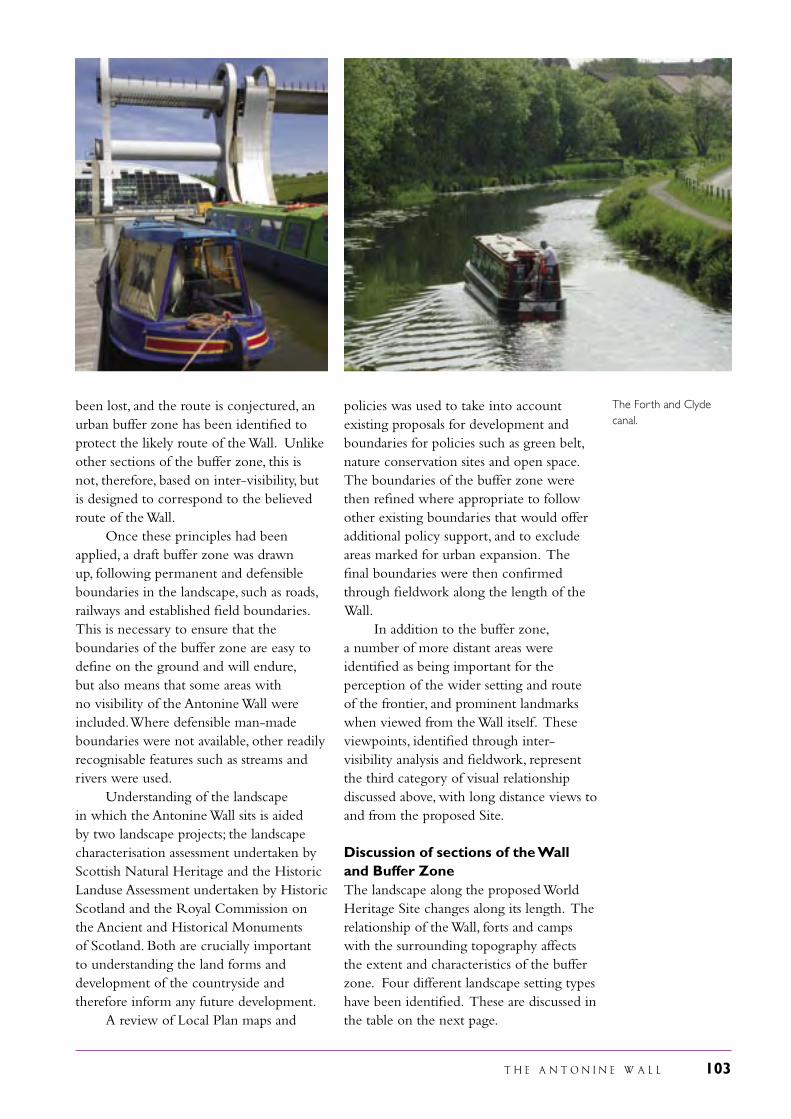
T H E A N T O N I N E W A L L 103
been lost, and the route is conjectured, an urban buffer zone has been identified to protect the likely route of the Wall. Unlike other sections of the buffer zone, this is not, therefore, based on inter-visibility, but is designed to correspond to the believed route of the Wall. Once these principles had been applied, a draft buffer zone was drawn up, following permanent and defensible boundaries in the landscape, such as roads, railways and established field boundaries. This is necessary to ensure that the boundaries of the buffer zone are easy to define on the ground and will endure, but also means that some areas with no visibility of the Antonine Wall were included. Where defensible man-made boundaries were not available, other readily recognisable features such as streams and rivers were used. Understanding of the landscape in which the Antonine Wall sits is aided by two landscape projects; the landscape characterisation assessment undertaken by Scottish Natural Heritage and the Historic Landuse Assessment undertaken by Historic Scotland and the Royal Commission on the Ancient and Historical Monuments of Scotland. Both are crucially important to understanding the land forms and development of the countryside and therefore inform any future development. A review of Local Plan maps and
policies was used to take into account existing proposals for development and boundaries for policies such as green belt, nature conservation sites and open space. The boundaries of the buffer zone were then refined where appropriate to follow other existing boundaries that would offer additional policy support, and to exclude areas marked for urban expansion. The final boundaries were then confirmed through fieldwork along the length of the Wall. In addition to the buffer zone, a number of more distant areas were identified as being important for the perception of the wider setting and route of the frontier, and prominent landmarks when viewed from the Wall itself. These viewpoints, identified through inter-visibility analysis and fieldwork, represent the third category of visual relationship discussed above, with long distance views to and from the proposed Site.
Discussion of sections of the Wall and Buffer ZoneThe landscape along the proposed World Heritage Site changes along its length. The relationship of the Wall, forts and camps with the surrounding topography affects the extent and characteristics of the buffer zone. Four different landscape setting types have been identified. These are discussed in the table on the next page.
The Forth and Clyde canal.
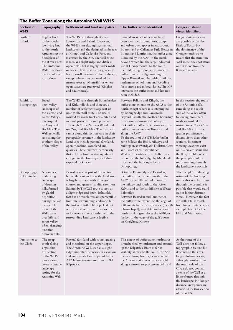
104 T H E A N T O N I N E W A L L
The Buffer Zone along the Antonine Wall WHSSection of WHS
Topography Settlement and land use pattern The buffer zone identified Longer distance views identified
Forth to Falkirk
Higher land to the south, low lying land to the north representing the floodplain of the River Forth. The Antonine Wall runs along the top of steep scarp slope.
The WHS runs through Bo’ness, Laurieston and Falkirk. Between, the WHS runs through agricultural landscapes and the designed landscapes at Kinneil and Callendar Park, and is crossed by the M9. The Wall route is seen as a slight ridge and ditch in open fields, but is largely under roads or tracks. Forts and camps generally have a small presence in the landscape, except where they are marked by mature trees (at Mumrills) or where open spaces are preserved (Kinglass and Muirhouse).
Limited areas of buffer zone have been identified around forts, camps and urban open spaces in and around Bo’ness and at Callendar Park. Between Bo’ness and Laurieston, the buffer zone is limited by the A904 to the north, beyond which lies the large industrial site at Grangemouth. To the south, the undulating topography limits the buffer zone to a ridge running past Upper Kinneil and Avondale, until the settlements of Polmont and Redding form strong urban boundaries. The M9 intersects the buffer zone and has not been included.
Longer distance views are possible across the Firth of Forth, but the dominance of the Grangemouth works means that the Antonine Wall route does not stand out in views from the Kincardine area.
Falkirk to Bishopbriggs
Broad open valley landscapes of the Carron and Kelvin Valleys, interrupted by Croy and Bar Hills. The Wall generally runs along the southern slopes of the valley.
The WHS runs through Bonnybridge and Kirkintilloch, and there are a number of settlements adjacent or near to the Wall route. The Wall is marked by roads, tracks or a ditch and mound, particularly well preserved at Rough Castle, Seabegs Wood, and on Croy and Bar Hills. The forts and camps along this section vary in their perceptible presence in the landscape. Land uses include pastoral farmland, open moorland, woodland and quarries. These quarries, particularly that at Croy, have created significant changes to the landscape, including exposed rock faces.
Between Falkirk and Kilsyth, the buffer zone extends to the A803 to the north, except where it is interrupted by Bonnybridge and Banknock. Beyond Kilsyth, the northern boundary runs along a dismantled railway to Kirkintilloch. West of Kirkintilloch, the buffer zone extends to Torrance and along the A807.To the south of the WHS, the buffer zone follows the B816, railways, and built up areas (Wardpark, Dullatur, Croy and Twechar) to Kirkintilloch.West of Kirkintilloch, the buffer zone extends to the hill ridge by Meiklehill Farm and the built up edge of Bishopbriggs.
In this section, the route of the Antonine Wall runs along the south side of the valley, often following prominent roads, or marked by mature trees. Over Croy and Bar Hills, it has a greater prominence in distant views than other sections. Important viewing locations exist on Blairskaith Muir and the Kilsyth Hills, where the perception of the route running through the landscape is possible.
Bishopbriggs to Duntocher
A complex, undulating landscape of drumlin hills, formed by glacial deposition during the last ice age. The route of the Wall passes over hills and across valleys, often changing direction between hills.
Bearsden covers part of this section, but to the east and west the landcover is largely pastoral, with three golf courses and quarry/ landfill sites near Balmuildy. The Wall route is seen as a slight ridge and ditch. Balmuildy fort has no visible remains perceptible from the surrounding landscape, but the fort on Castle Hill is picked out with a stand of mature trees, so that its location and relationship with the surrounding landscape is legible.
Between Balmuildy and Bearsden, the buffer zone extends north to the A807 or the hills behind it, west to the railway, and south to the River Kelvin and to the landfill site at Wester Balmuildy.Between Bearsden and Duntocher, the buffer zone extends to the edge of settlements to the east (Bearsden), south (Drumchapel), west (Duntocher) and north to Hardgate, along the A810, or further to the edge of the golf course on Craighead Knowe.
The complex undulating nature of the landscape means that no clear route through the drumlins is possible that would stand out in longer distance views. However, the fort at Castle Hill is visible from longer distances, for example from Cochno Hill and Muirhouse.
Duntocher to the Clyde
The steep south-facing slopes that this section of the WHS passes along create a unique landscape setting for the Antonine Wall.
Pastoral farmland with rough grazing and moorland on the upper slopes. The Antonine Wall, seen as a slight ridge and ditch, decreases in elevation and runs parallel and adjacent to the A82, before turning south into Old Kilpatrick.
The extent of buffer zone northwards is unchecked by settlement and extends up the Kilpatrick Braes as far as visibility allows. To the south, the A82 forms a strong barrier, beyond which the Antonine Wall is only perceptible along a narrow strip of green belt land.
As the route of the Wall does not follow a topographic feature, but descends to the river, longer distance views, although possible from the south side of the Clyde do not contain a sense of the Wall as a linear feature through the landscape. No longer distance viewpoints are identified for this section of the WHS.
T H E A N T O N I N E W A L L 105
Following the methodology described above, the buffer zone has been defined as a series of zones along the Wall, up to approximately 1-1.5 km from the Wall to the north and south. These areas are fragmented by existing settlements, roads, and areas marked for urban expansion. Fourteen zones have been described, including small parks or open spaces within settlements, to extensive strips of land between settlements. In order to maintain a general constancy of width, and to create a robust planning boundary that can be more strongly defended, the buffer zones have been defined as tight areas around the archaeological remains, and boundary features include roads, railways and the Forth and Clyde Canal. The main landform features that have influenced the buffer zone definition are the escarpment slope that runs between Bo’ness and Falkirk, the Carron and Kelvin valleys, the drumlin landscape around Bearsden, and the south facing slopes of the Kilpatrick Hills. The main landform feature not encompassed by the buffer zone is the range of hills to the north of the Wall, the Campsie Fells. At over 7 km away, these hills are too far from the Wall to be covered by the focused planning protection measures proposed for the buffer zone. As a result, fourteen areas of buffer zone have been defined to protect the setting and amenity of the Antonine Wall within the highly developed central belt of Scotland. The definition of each area of buffer zone is based upon the relationship of the archaeological remains to the landform, existing and proposed settlements and built developments and to the existing protection policies along the Antonine Wall. In all cases, these buffer zones conform to existing countryside and greenbelt designations and are therefore already protected against inimical developments. These policies are all listed in the nomination document and enshrined in the new, over-arching Policy 2 for the protection of the proposed World Heritage Site and its buffer zones. Furthermore, the buffer zones conform closely to the amenity areas for the
protection of the environs of the Antonine Wall first published over 30 years ago. The newly defined buffer zones take forwards and strengthen the existing protective framework for the setting ot the Antonine Wall in the light of new legislation. It is not practical to define buffer zones for the urban areas through which the Antonine Wall passes. Nevertheless, the environs of the Antonine Wall, that it is to say, its setting, in these sectors receive some protection through the planning policies of the five local authorities along the line of the Wall which seek to prevent any developments which would have an adverse impact on the monument. Further, as noted above, the existing conservation areas and listed historic buildings along the line of the Antonine Wall provide an additional level of protection for the area of the monument in urban areas.
5.d Existing plans related to municipality and region in which the proposed property is located (e.g., regional or local plan, conservation plan, tourism development plan)
Existing Structure and Local Plans (see 5.c.8 and 9) contain policies for the protection of the Antonine Wall. It is the intention to develop conservation and tourism development plans for the Antonine Wall.
5.e Property management plan or other management system
A full Management Plan for the proposed Site has been prepared and accompanies this nomination document. The production of the Management Plan was overseen by the Steering Group which supervised the production of this nomination document: wider consultation was also undertaken. The Plan follows the recommended guide-lines and stipulates 32 actions for the improved management of the property
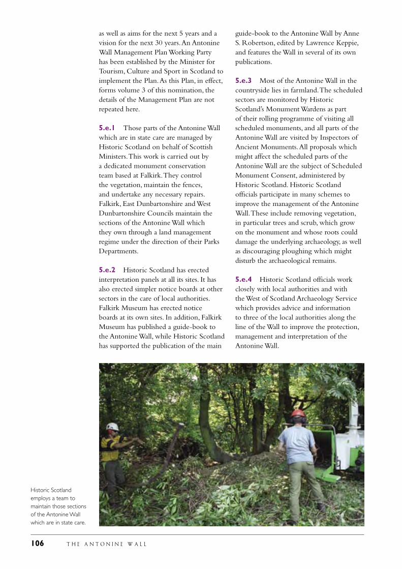
106 T H E A N T O N I N E W A L L
guide-book to the Antonine Wall by Anne S. Robertson, edited by Lawrence Keppie, and features the Wall in several of its own publications.
5.e.3 Most of the Antonine Wall in the countryside lies in farmland. The scheduled sectors are monitored by Historic Scotland’s Monument Wardens as part of their rolling programme of visiting all scheduled monuments, and all parts of the Antonine Wall are visited by Inspectors of Ancient Monuments. All proposals which might affect the scheduled parts of the Antonine Wall are the subject of Scheduled Monument Consent, administered by Historic Scotland. Historic Scotland officials participate in many schemes to improve the management of the Antonine Wall. These include removing vegetation, in particular trees and scrub, which grow on the monument and whose roots could damage the underlying archaeology, as well as discouraging ploughing which might disturb the archaeological remains.
5.e.4 Historic Scotland officials work closely with local authorities and with the West of Scotland Archaeology Service which provides advice and information to three of the local authorities along the line of the Wall to improve the protection, management and interpretation of the Antonine Wall.
as well as aims for the next 5 years and a vision for the next 30 years. An Antonine Wall Management Plan Working Party has been established by the Minister for Tourism, Culture and Sport in Scotland to implement the Plan. As this Plan, in effect, forms volume 3 of this nomination, the details of the Management Plan are not repeated here.
5.e.1 Those parts of the Antonine Wall which are in state care are managed by Historic Scotland on behalf of Scottish Ministers. This work is carried out by a dedicated monument conservation team based at Falkirk. They control the vegetation, maintain the fences, and undertake any necessary repairs. Falkirk, East Dunbartonshire and West Dunbartonshire Councils maintain the sections of the Antonine Wall which they own through a land management regime under the direction of their Parks Departments.
5.e.2 Historic Scotland has erected interpretation panels at all its sites. It has also erected simpler notice boards at other sectors in the care of local authorities. Falkirk Museum has erected notice boards at its own sites. In addition, Falkirk Museum has published a guide-book to the Antonine Wall, while Historic Scotland has supported the publication of the main
Historic Scotland employs a team to maintain those sections of the Antonine Wall which are in state care.
T H E A N T O N I N E W A L L 107
5.e.5 In order to improve the provision of information which will aid decisions to be taken on all proposals which might affect the Antonine Wall, the mapping of the monument has been upgraded. The 1980 Ordnance Survey map of the Antonine Wall has been digitised by the Royal Commission on the Ancient and Historical Monuments of Scotland (RCAHMS). In a separate exercise, undertaken by RCAHMS in conjunction with Historic Scotland, all post 1980 interventions along the line of the Antonine Wall have been digitised, together with all pre 1980 interventions where sufficient information is available to allow the action to be mapped. The map, which will be made available on line, will lead the enquirer through to the RCAHMS data base which will furnish information about each intervention. Appendix 1 provides further information.
5.e.6 The purpose of this operation is to improve the level of information available to all involved in the protection, management, conservation, presentation and interpretation of the Antonine Wall and facilitate the decision-making process.
5.e.7 The Frontiers of the Roman Empire project worth 1.35 m euros and operating under the aegis of the European Union’s Culture 2000 programme has four main tasks:
the establishment of a web site for the frontiers of the Roman empire in Europe and the linking of national and local data bases
the creation of an exhibition on Roman frontiers
the improved documentation of Roman frontiers in Europe
the preparation of guide-lines for the protection, management, presentation and interpretation of Roman frontiers.
5.e.8 The later two tasks will be of material benefit to the better management of the Antonine Wall; the first two tasks
will lead to the provision of more and better information about Roman frontiers which should lead, though better public knowledge, to the improved protection of the Antonine Wall.
5.e.9 The Antonine Wall Management Plan Group, representing all relevant parties with an interest in the proposed Site, will oversee the implementation of the Management Plan.
5.f Sources and levels of finance
Ms Patricia Ferguson, MSP, Minister for Tourism, Culture and Sport, representing the Scottish Executive on 20 June 2006 signed a concordat with representatives of the five local authorities whereby all six bodies pledged themselves to undertake the necessary actions to protect and manage the Antonine Wall (see pages 20 and 21). All six bodies have already placed resources at the disposal of the project in a variety of ways, through the provision of staff to prepare the nomination document, to undertake specific actions to improve the protection of the Antonine Wall, to conserve the monument and to improve access to those sections in public care or ownership. All have committed further funds to continue this work. The main focus of the activities of these six bodies is: the implementation of the statutory protective measures for the Antonine Wall
the funding of additional advice in relation to planning
the care and maintenance of those sections of the Antonine Wall which lie in the ownership or guardianship: these sections add up to a total of about 17 km in public care
the interpretation of these sections of the Antonine Wall through on site notices, guide-books and the web
in addition, all have agreed to finance the preparation of Supplementary Planning Guidance for the Wall.
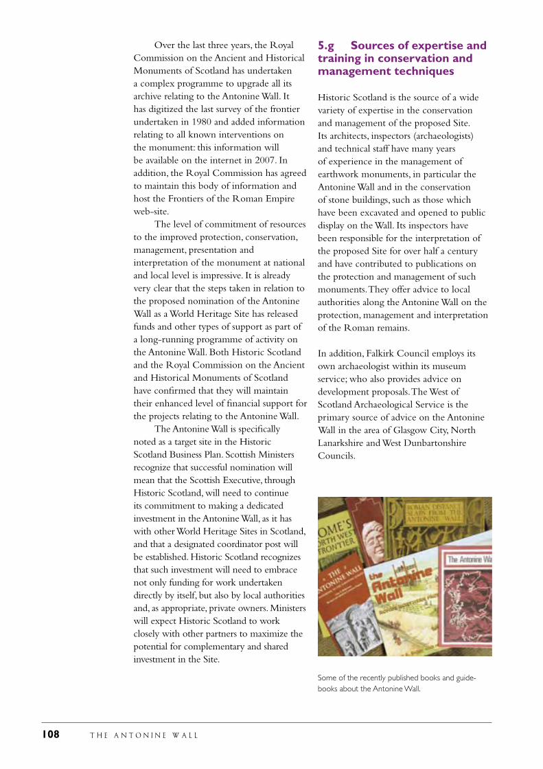
108 T H E A N T O N I N E W A L L
Over the last three years, the Royal Commission on the Ancient and Historical Monuments of Scotland has undertaken a complex programme to upgrade all its archive relating to the Antonine Wall. It has digitized the last survey of the frontier undertaken in 1980 and added information relating to all known interventions on the monument: this information will be available on the internet in 2007. In addition, the Royal Commission has agreed to maintain this body of information and host the Frontiers of the Roman Empire web-site. The level of commitment of resources to the improved protection, conservation, management, presentation and interpretation of the monument at national and local level is impressive. It is already very clear that the steps taken in relation to the proposed nomination of the Antonine Wall as a World Heritage Site has released funds and other types of support as part of a long-running programme of activity on the Antonine Wall. Both Historic Scotland and the Royal Commission on the Ancient and Historical Monuments of Scotland have confirmed that they will maintain their enhanced level of financial support for the projects relating to the Antonine Wall. The Antonine Wall is specifically noted as a target site in the Historic Scotland Business Plan. Scottish Ministers recognize that successful nomination will mean that the Scottish Executive, through Historic Scotland, will need to continue its commitment to making a dedicated investment in the Antonine Wall, as it has with other World Heritage Sites in Scotland, and that a designated coordinator post will be established. Historic Scotland recognizes that such investment will need to embrace not only funding for work undertaken directly by itself, but also by local authorities and, as appropriate, private owners. Ministers will expect Historic Scotland to work closely with other partners to maximize the potential for complementary and shared investment in the Site.
5.g Sources of expertise and training in conservation and management techniques
Historic Scotland is the source of a wide variety of expertise in the conservation and management of the proposed Site. Its architects, inspectors (archaeologists) and technical staff have many years of experience in the management of earthwork monuments, in particular the Antonine Wall and in the conservation of stone buildings, such as those which have been excavated and opened to public display on the Wall. Its inspectors have been responsible for the interpretation of the proposed Site for over half a century and have contributed to publications on the protection and management of such monuments. They offer advice to local authorities along the Antonine Wall on the protection, management and interpretation of the Roman remains.
In addition, Falkirk Council employs its own archaeologist within its museum service; who also provides advice on development proposals. The West of Scotland Archaeological Service is the primary source of advice on the Antonine Wall in the area of Glasgow City, North Lanarkshire and West Dunbartonshire Councils.
Some of the recently published books and guide-books about the Antonine Wall.
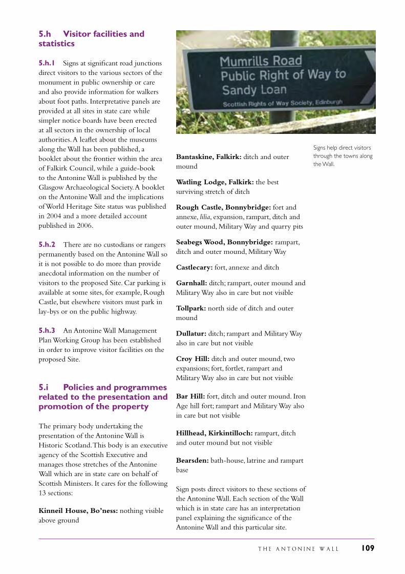
T H E A N T O N I N E W A L L 109
Signs help direct visitors through the towns along the Wall.
5.h Visitor facilities and statistics
5.h.1 Signs at significant road junctions direct visitors to the various sectors of the monument in public ownership or care and also provide information for walkers about foot paths. Interpretative panels are provided at all sites in state care while simpler notice boards have been erected at all sectors in the ownership of local authorities. A leaflet about the museums along the Wall has been published, a booklet about the frontier within the area of Falkirk Council, while a guide-book to the Antonine Wall is published by the Glasgow Archaeological Society. A booklet on the Antonine Wall and the implications of World Heritage Site status was published in 2004 and a more detailed account published in 2006.
5.h.2 There are no custodians or rangers permanently based on the Antonine Wall so it is not possible to do more than provide anecdotal information on the number of visitors to the proposed Site. Car parking is available at some sites, for example, Rough Castle, but elsewhere visitors must park in lay-bys or on the public highway.
5.h.3 An Antonine Wall Management Plan Working Group has been established in order to improve visitor facilities on the proposed Site.
5.i Policies and programmes related to the presentation and promotion of the property
The primary body undertaking the presentation of the Antonine Wall is Historic Scotland. This body is an executive agency of the Scottish Executive and manages those stretches of the Antonine Wall which are in state care on behalf of Scottish Ministers. It cares for the following 13 sections:
Kinneil House, Bo’ness: nothing visible above ground
Bantaskine, Falkirk: ditch and outer mound
Watling Lodge, Falkirk: the best surviving stretch of ditch
Rough Castle, Bonnybridge: fort and annexe, lilia, expansion, rampart, ditch and outer mound, Military Way and quarry pits Seabegs Wood, Bonnybridge: rampart, ditch and outer mound, Military Way
Castlecary: fort, annexe and ditch
Garnhall: ditch; rampart, outer mound and Military Way also in care but not visible
Tollpark: north side of ditch and outer mound
Dullatur: ditch; rampart and Military Way also in care but not visible
Croy Hill: ditch and outer mound, two expansions; fort, fortlet, rampart and Military Way also in care but not visible
Bar Hill: fort, ditch and outer mound. Iron Age hill fort; rampart and Military Way also in care but not visible
Hillhead, Kirkintilloch: rampart, ditch and outer mound but not visible
Bearsden: bath-house, latrine and rampart base
Sign posts direct visitors to these sections of the Antonine Wall. Each section of the Wall which is in state care has an interpretation panel explaining the significance of the Antonine Wall and this particular site.
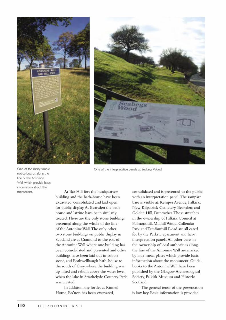
110 T H E A N T O N I N E W A L L
At Bar Hill fort the headquarters building and the bath-house have been excavated, consolidated and laid open for public display. At Bearsden the bath-house and latrine have been similarly treated. These are the only stone buildings presented along the whole of the line of the Antonine Wall. The only other two stone buildings on public display in Scotland are at Cramond to the east of the Antonine Wall where one building has been consolidated and presented and other buildings have been laid out in cobble-stone, and Bothwellhaugh bath-house to the south of Croy where the building was up-lifted and rebuilt above the water level when the lake in Strathclyde Country Park was created. In addition, the fortlet at Kinneil House, Bo’ness has been excavated,
consolidated and is presented to the public, with an interpretation panel. The rampart base is visible at: Kemper Avenue, Falkirk; New Kilpatrick Cemetery, Bearsden; and Golden Hill, Duntocher. Those stretches in the ownership of Falkirk Council at Polmonthill, Millhill Wood, Callendar Park and Tamfourhill Road are all cared for by the Parks Department and have interpretation panels. All other parts in the ownership of local authorities along the line of the Antonine Wall are marked by blue metal plates which provide basic information about the monument. Guide-books to the Antonine Wall have been published by the Glasgow Archaeological Society, Falkirk Museum and Historic Scotland. The general tenor of the presentation is low key. Basic information is provided
One of the many simple notice boards along the line of the Antonine Wall which provide basic information about the monument.
One of the interpretative panels at Seabegs Wood.
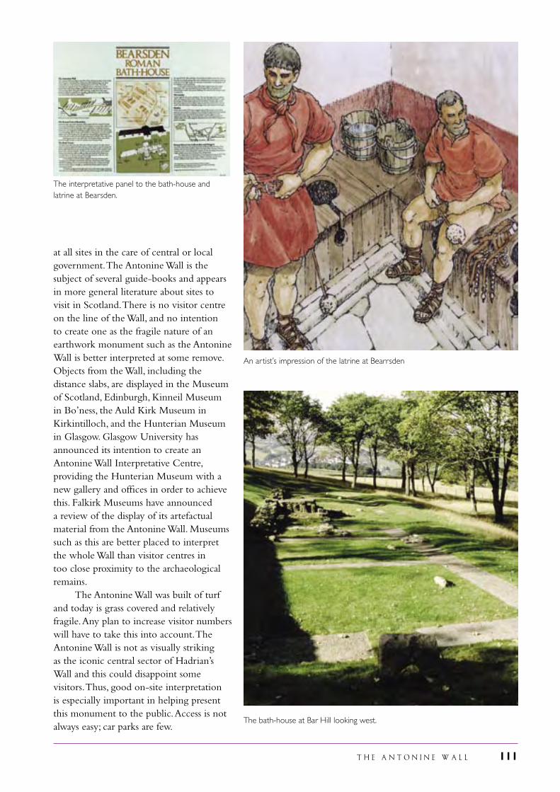
T H E A N T O N I N E W A L L 111
at all sites in the care of central or local government. The Antonine Wall is the subject of several guide-books and appears in more general literature about sites to visit in Scotland. There is no visitor centre on the line of the Wall, and no intention to create one as the fragile nature of an earthwork monument such as the Antonine Wall is better interpreted at some remove. Objects from the Wall, including the distance slabs, are displayed in the Museum of Scotland, Edinburgh, Kinneil Museum in Bo’ness, the Auld Kirk Museum in Kirkintilloch, and the Hunterian Museum in Glasgow. Glasgow University has announced its intention to create an Antonine Wall Interpretative Centre, providing the Hunterian Museum with a new gallery and offices in order to achieve this. Falkirk Museums have announced a review of the display of its artefactual material from the Antonine Wall. Museums such as this are better placed to interpret the whole Wall than visitor centres in too close proximity to the archaeological remains. The Antonine Wall was built of turf and today is grass covered and relatively fragile. Any plan to increase visitor numbers will have to take this into account. The Antonine Wall is not as visually striking as the iconic central sector of Hadrian’s Wall and this could disappoint some visitors. Thus, good on-site interpretation is especially important in helping present this monument to the public. Access is not always easy; car parks are few.
An artist’s impression of the latrine at Bearrsden
The interpretative panel to the bath-house and latrine at Bearsden.
The bath-house at Bar Hill looking west.
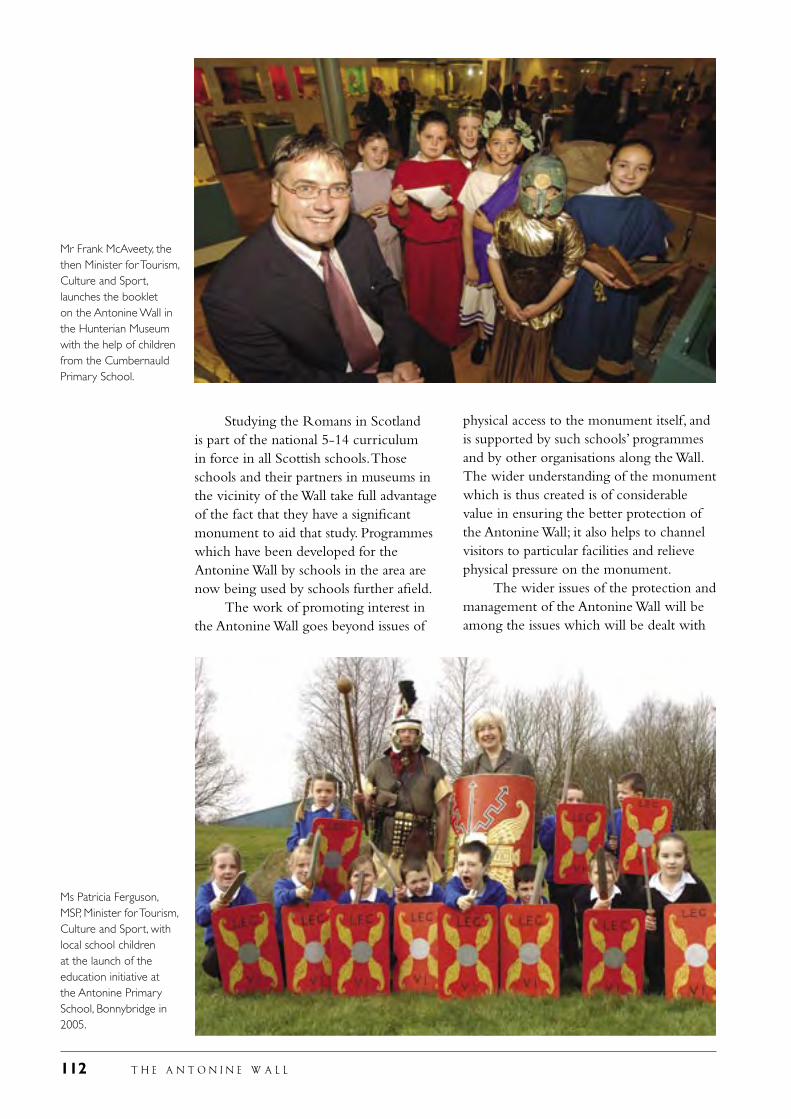
112 T H E A N T O N I N E W A L L
Studying the Romans in Scotland is part of the national 5-14 curriculum in force in all Scottish schools. Those schools and their partners in museums in the vicinity of the Wall take full advantage of the fact that they have a significant monument to aid that study. Programmes which have been developed for the Antonine Wall by schools in the area are now being used by schools further afield. The work of promoting interest in the Antonine Wall goes beyond issues of
physical access to the monument itself, and is supported by such schools’ programmes and by other organisations along the Wall. The wider understanding of the monument which is thus created is of considerable value in ensuring the better protection of the Antonine Wall; it also helps to channel visitors to particular facilities and relieve physical pressure on the monument. The wider issues of the protection and management of the Antonine Wall will be among the issues which will be dealt with
Mr Frank McAveety, the then Minister for Tourism, Culture and Sport, launches the booklet on the Antonine Wall in the Hunterian Museum with the help of children from the Cumbernauld Primary School.
Ms Patricia Ferguson, MSP, Minister for Tourism, Culture and Sport, with local school children at the launch of the education initiative at the Antonine Primary School, Bonnybridge in 2005.
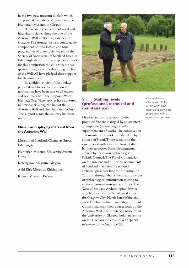
T H E A N T O N I N E W A L L 113
in the two new museum displays which are planned, by Falkirk Museum and the Hunterian Museum in Glasgow. There are several archaeological and historical societies along the line of the Antonine Wall, at Bo’ness, Falkirk and Glasgow. The frontier forms a considerable component of their lecture and tour programmes of these societies, and of the Society of Antiquaries of Scotland based in Edinburgh. As part of the preparation work for this nomination the co-ordinator has spoken to eight such bodies along the line of the Wall. All have pledged their support for the nomination. In addition, copies of the booklet prepared by Historic Scotland on the nomination have been sent to all owners and occupiers with the proposed World Heritage Site. Many articles have appeared in newspapers along the line of the Antonine Wall and elsewhere in Scotland. The support across the country has been uniform. Museums displaying material from the Antonine Wall
Museum of Scotland, Chambers Street, Edinburgh
Hunterian Museum, University Avenue, Glasgow
Kelvingrove Museum, Glasgow
Auld Kirk Museum, Kirkintilloch
Kinneil Museum, Bo’ness
5.j Staffing levels (professional, technical and maintenance)
Historic Scotland’s sections of the proposed Site are managed by an architect, an inspector (archaeologist) and a superintendent of works. The conservation and maintenance work is undertaken by a squad of 5 staff. Those sections in the care of local authorities are looked after by their respective Parks Departments, advised by their own archaeologist in Falkirk Council. The Royal Commission on the Ancient and Historical Monuments of Scotland maintains the national archaeological data base for the Antonine Wall and through that is the major provider of archaeological information relating to cultural resource management issues. The West of Scotland Archaeological Service, which provides an archaeological service for Glasgow City, North Lanarkshire and West Dunbartonshire Councils, and Falkirk Council maintain their own records on the Antonine Wall. The Hunterian Museum in the University of Glasgow holds an archive on the Romans in Scotland, with special reference to the Antonine Wall.
One of the many interviews with the media which have taken place during the preparation of this nomination document.
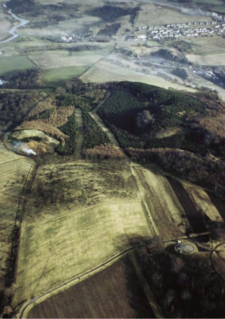
114 T H E A N T O N I N E W A L L
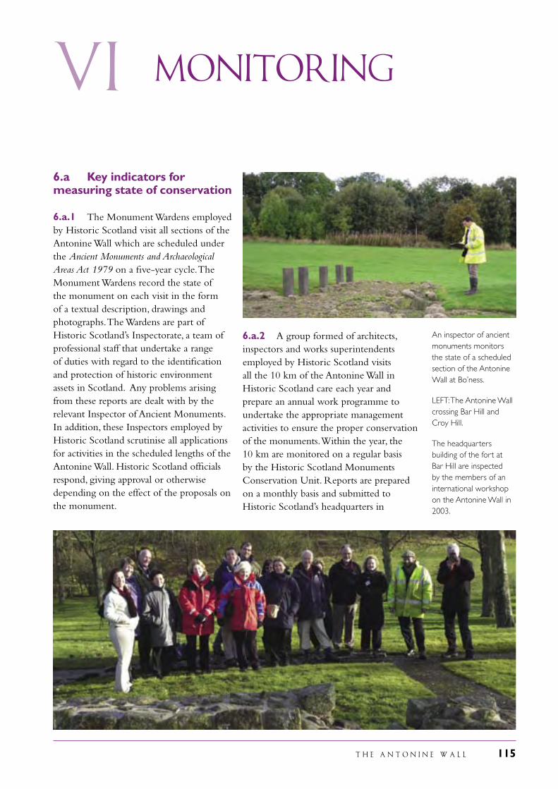
T H E A N T O N I N E W A L L 115
vi Monitoring
6.a Key indicators for measuring state of conservation
6.a.1 The Monument Wardens employed by Historic Scotland visit all sections of the Antonine Wall which are scheduled under the Ancient Monuments and Archaeological Areas Act 1979 on a five-year cycle. The Monument Wardens record the state of the monument on each visit in the form of a textual description, drawings and photographs. The Wardens are part of Historic Scotland’s Inspectorate, a team of professional staff that undertake a range of duties with regard to the identification and protection of historic environment assets in Scotland. Any problems arising from these reports are dealt with by the relevant Inspector of Ancient Monuments. In addition, these Inspectors employed by Historic Scotland scrutinise all applications for activities in the scheduled lengths of the Antonine Wall. Historic Scotland officials respond, giving approval or otherwise depending on the effect of the proposals on the monument.
6.a.2 A group formed of architects, inspectors and works superintendents employed by Historic Scotland visits all the 10 km of the Antonine Wall in Historic Scotland care each year and prepare an annual work programme to undertake the appropriate management activities to ensure the proper conservation of the monuments. Within the year, the 10 km are monitored on a regular basis by the Historic Scotland Monuments Conservation Unit. Reports are prepared on a monthly basis and submitted to Historic Scotland’s headquarters in
An inspector of ancient monuments monitors the state of a scheduled section of the Antonine Wall at Bo’ness.
LEFT: The Antonine Wall crossing Bar Hill and Croy Hill.
The headquarters building of the fort at Bar Hill are inspected by the members of an international workshop on the Antonine Wall in 2003.
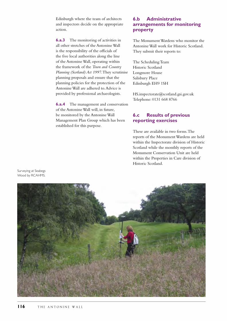
116 T H E A N T O N I N E W A L L
Edinburgh where the team of architects and inspectors decide on the appropriate action.
6.a.3 The monitoring of activities in all other stretches of the Antonine Wall is the responsibility of the officials of the five local authorities along the line of the Antonine Wall, operating within the framework of the Town and Country Planning (Scotland) Act 1997. They scrutinise planning proposals and ensure that the planning policies for the protection of the Antonine Wall are adhered to. Advice is provided by professional archaeologists.
6.a.4 The management and conservation of the Antonine Wall will, in future, be monitored by the Antonine Wall Management Plan Group which has been established for this purpose.
6.b Administrative arrangements for monitoring property
The Monument Wardens who monitor the Antonine Wall work for Historic Scotland. They submit their reports to:
The Scheduling TeamHistoric ScotlandLongmore HouseSalisbury PlaceEdinburgh EH9 1SH
[email protected]: 0131 668 8766
6.c Results of previous reporting exercises
These are available in two forms. The reports of the Monument Wardens are held within the Inspectorate division of Historic Scotland while the monthly reports of the Monument Conservation Unit are held within the Properties in Care division of Historic Scotland.
Surveying at Seabegs Wood by RCAHMS.
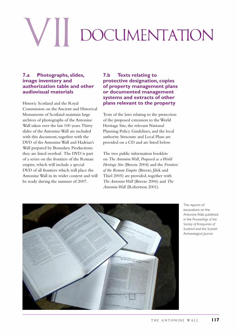
T H E A N T O N I N E W A L L 117
VII Documentation
7.a Photographs, slides, image inventory and authorization table and other audiovisual materials
Historic Scotland and the Royal Commission on the Ancient and Historical Monuments of Scotland maintain large archives of photographs of the Antonine Wall taken over the last 100 years. Thirty slides of the Antonine Wall are included with this document, together with the DVD of the Antonine Wall and Hadrian’s Wall prepared by Boundary Productions: they are listed overleaf. The DVD is part of a series on the frontiers of the Roman empire, which will include a special DVD of all frontiers which will place the Antonine Wall in its wider context and will be ready during the summer of 2007.
7.b Texts relating to protective designation, copies of property management plans or documented management systems and extracts of other plans relevant to the property
Texts of the laws relating to the protection of the proposed extension to the World Heritage Site, the relevant National Planning Policy Guidelines, and the local authority Structure and Local Plans are provided on a CD and are listed below.
The two public information booklets on The Antonine Wall, Proposed as a World Heritage Site (Breeze 2004) and the Frontiers of the Roman Empire (Breeze, Jilek and Thiel 2005) are provided, together with The Antonine Wall (Breeze 2006) and The Antonine Wall (Robertson 2001).
The reports of excavations on the Antonine Wall, published in the Proceedings of the Society of Antiquaries of Scotland and the Scottish Archaeological Journal.
118 T H E A N T O N I N E W A L L
IMAGE INVENTORY AND PHOTOGRAPH AND AUDIOVISUAL AUTHORIZATION FORM
Id.no. Format Caption Date Photographer Copyright owner Contact
1 slide Rough Castle 8/2006 R. Adam RCAHMS see p. 123
2 slide Watling Lodge ditch 6/2006 D. Henrie Historic Scotland see p. 123
3 slide Rough Castle rampart & ditch
6/2006 D. Henrie Historic Scotland see p. 123
4 slide Polmont Woods ditch 6/2006 D. Henrie Historic Scotland see p. 123
5 slide Callendar Park aerial 12/2006 R. Adam RCAHMS see p. 123
6 slide Callendar Park ditch 5/2006 D. Henrie Historic Scotland see p. 123
7 slide Seabegs Wood 6/2006 D. Henrie Historic Scotland see p. 123
8 slide Tollpark 8/2006 D. Henrie Historic Scotland see p. 123
9 slide Bar Hill ditch 8/2006 D. Henrie Historic Scotland see p. 123
10 slide Iain Road, Bearsden 5/2006 D. Henrie Historic Scotland see p. 123
11 slide Iain Road, Bearsden from the air
10/2006 R. Adam RCAHMS see p. 123
12 slide Wall base, Bearsden 6/2006 D. Henrie Historic Scotland see p. 123
13 slide Wall base, Falkirk 8/2006 D. Henrie Historic Scotland see p. 123
14 slide Seabegs Wood Military Way
8/2006 D. Henrie Historic Scotland see p. 123
15 slide Rough Castle fort from the air
8/2006 R. Adam RCAHMS see p. 123
16 slide Rough Castle, lilia 7/1986 D. Henrie Historic Scotland see p. 123
17 slide Mumrills fort 6/2006 D. Henrie Historic Scotland see p. 123
18 slide Balmuildy fort 8/2006 D. Henrie Historic Scotland see p. 123
19 slide Castlehill from the air 10/2006 R. Adam RCAHMS see p. 123
20 slide Duntocher fort from the air
10/2006 R. Adam RCAHMS see p. 123
21 slide Bar Hill HQ 8/2006 D. Henrie Historic Scotland see p. 123
22 slide Bar Hill bath-house 8/2006 D. Henrie Historic Scotland see p. 123
23 slide Bearsden bath-house 8/1994 D. Henrie Historic Scotland see p. 123
24 slide Kinneil fortlet 6/2006 D. Henrie Historic Scotland see p. 123
25 slide Tamfourhill camp 7/1977 J. Mackie RCAHMS see p. 123
26 slide Kirkintilloch motte 3/2006 D. Henrie Historic Scotland see p. 123
27 slide Bo’ness 2/1997 R. Adam RCAHMS see p. 123
28 slide Bantaskin, Falkirk 10/2006 R. Adam RCAHMS see p. 123
29 slide Croy Hill 10/2006 R. Adam RCAHMS see p. 123
30 slide Kelvin Valley 8/2006 D. Henrie Historic Scotland see p. 123
31 DVD Roman Frontiers 2004 E. Dobat Boundary Productions www.boundary.de
It is not possible to transfer copyright or reproduction fees of photographs which are Crown Copyright to a third party. However, UNESCO is granted the right to reproduce, and allow to be reproduced, items 1-30 free of charge and individual elements of the DVD free of charge for the purposes of this nomination.
T H E A N T O N I N E W A L L 119
7.c Form and date of most recent records or inventory of property
There are two main repositories of information about the Antonine Wall. Records of surveys and excavations are housed in the national archaeological record, the Royal Commission on the Ancient and Historical Monuments of Scotland. In conjunction with the preparation of the nomination document and the Management Plan, the Royal Commission on the Ancient and Historical Monuments of Scotland have been preparing a new digitised map of the Antonine Wall. This provides an accurate depiction of the Antonine Wall in map form based on the 1980 survey of the frontier supplemented by later surveys and excavations, information on the state of survival of the monument, and access to the basic reports on interventions to the monument. This map is available on-line and is a powerful tool in the protection and management of the proposed Site. The second main collection of records is the Hunterian Museum in the University of Glasgow. This houses a special archive containing publications and records relating to the Antonine Wall. All finds from excavations along the line of the Antonine Wall are donated to local museums. Traditionally, the National Museums of Scotland have collected the material from the east half of the Wall while the Hunterian Museum has acquired artefacts from the west end. Other museums holding material from the Antonine Wall are: Falkirk Museums, the Auld Kirk Museum in Kirkintilloch and Kelvingrove Museum in Glasgow.
7.d Address where inventory, records and archives are held
Royal Commission on the Ancient and Historical Monuments of ScotlandJohn Sinclair House16 Bernard TerraceEdinburgh EH8 9NX
The Photographic LibraryHistoric ScotlandLongmore HouseSalisbury PlaceEdinburgh EH16 5NL
Hunterian MuseumUniversity of GlasgowGlasgow G12 8QQ
7.e Bibliography
There is an extensive bibliography for the Antonine Wall. This is available on the internet through the two websites of the Royal Commission on the Ancient and Historical Monuments of Scotland, CANMORE and CANMAP. The guide-book to the Antonine Wall (Roberston 2001) provides a detailed bibliography, in particular for individual sites. Below are listed the main books and the more recent articles.
Books
Bailey, G. B., The Antonine Wall: Rome’s Northern Frontier (Falkirk, 2003)
Breeze, D. J., The Antonine Wall, Proposed as a World Heritage Site (Edinburgh, 2004)
Breeze, D. J., The Antonine Wall (Edinburgh, 2006)
Buchanan, J., ‘Notice of the barrier of Antoninus Pius’, Archaeological Journal 15 (1868) 25-36
Glasgow Archaeological Society, The Antonine Wall Report (Glasgow 1899)
Gordon, A., Itinerarium Septentrionale (London 1726)
Hanson, W. S., and Maxwell, G. S., The Antonine Wall (Edinburgh, 1986)
LEFT: Trajan’s Column in Rome provides valuable contemporary evidence for the building of turf structures such as the Antonine Wall.
120 T H E A N T O N I N E W A L L
Horsley, J., Britannia Romana (London 1732)
Keppie, L., Roman Inscribed and Sculptured Stones in the Hunterian Museum, University of Glasgow (London, 1998)
Keppie, L. J. F. and Arnold, B. J., Corpus Signorum Imperii Romani, Great Britain, vol. 1, fasc. iv, Scotland (Oxford 1984)
Macdonald, G., The Roman Wall in Scotland (London, 1934)
Maitland, W., History and Antiquities of Scotland (London 1757)
Robertson, A. S., revised by Keppie, L., The Antonine Wall (Glasgow, 2001)
Roy, W., The Military Antiquities of the Romans in Britain (London, 1793)
Skinner, D. N., The Countryside of the Antonine Wall (Perth, 1973)
Stuart, R., Caledonia Romana (second edition, Edinburgh and London 1852)
University of Glasgow, Monumenta Romani Imperii (Glasgow 1768)
Articles
Abdy, R., ‘A survey of the coin finds from the Antonine Wall’, Britannia 33 (2002), 189–217
Bailey, G., ‘The provision of fort annexes on the Antonine Wall’, Proceedings of the Society of Antiquaries of Scotland 124 (1994), 299-314
Bailey, G. B., ‘Stream crossing on the Antonine Wall’, Proceedings of the Society of Antiquaries of Scotland 126 (1996) 347-69
Breeze, David J. and Dobson, B., “The Development of the Mural Frontier in Britain from Hadrian to Caracalla”, Proceedings of the Society of Antiquaries of Scotland 102 (1969-70) 109-21
Dunwell, A., Bailey, G., Leslie, A., and Smith, A., ‘Some excavations on the line of the Antonine Wall, 1994–2001’, Proceedings of the Society of Antiquaries of Scotland 132 (2002), 259–304
Gillam, J. P. ‘Possible changes in plan in the course of the construction of the Antonine Wall’, Scottish Archaeological Forum 7 (1975) 51-6
Glendinning, B., ‘Investigations of the Antonine Wall and medieval settlement at Kinneil House, Bo’ness, Falkirk’, Proceedings of the Society of Antiquaries of Scotland 130 (2000), 509–24
Hanson, W. S. and Maxwell, G. S., ‘Minor enclosures on the Antonine Wall at Wilderness Plantation’, Britannia 14 (1983) 227-43
Hassall, M., ‘The building of the Antonine Wall’, Britannia 14 (1983) 262–4
Jones, R. H., ‘Temporary camps on the Antonine Wall’, in Visy, Zs., (ed), Limes XIX (Pécs, 2005) 551-60
Keppie, L. J. F., ‘New light on excavations at Bar Hill Roman fort on the Antonine Wall, 1902–05’, Scottish Archaeological Journal 24.1 (March 2002), 21–48
Keppie, L. J. F.,‘A walk along the Antonine Wall in 1825: the travel journal of the Rev John Skinner’, Proceedings of the Society of Antiquaries of Scotland 133 (2003), 205–44
Keppie, L. J. F., ‘A Roman bath-house at Duntocher on the Antonine Wall’, Britannia 35 (2004), 179–224
Keppie, L. J. F., Bailey, G. B., Dunwell, A. J., McBrien, J. H. and Speller, K., ‘Some excavations on the line of the Antonine Wall, 1985-93’, Proceedings of the Society of Antiquaries of Scotland 125 (1995) 601-72
Keppie, L. J. F., and Breeze, D. J., ‘Some excavations on the line of the Antonine Wall, 1957-80’, Proceedings of the Society of Antiquaries of Scotland 111 (1981) 229-47
Keppie, L. J. F. and Walker, J. J., ‘Some excavations along the line of the Antonine Wall, 1981-85’, Proceedings of the Society of Antiquaries of Scotland 119 (1989) 143-59
Linge, J., ‘The Cinderella Service: the Ordnance Survey and the mapping of the Antonine Wall’, Proceedings of the Society of Antiquaries of Scotland 134 (2004), 161–71
T H E A N T O N I N E W A L L 121
Steer, K. A., ‘The nature and purpose of the expansions on the Antonine Wall’, Proceedings of the Society of Antiquaries of Scotland 90 (1957) 161-9
Swan, Vivien G., ‘The Twentieth Legion and the history of the Antonine Wall reconsidered’, Proceedings of the Society of Antiquaries of Scotland 129 (1999), 399–480
Tipping, R., ‘The form and fate of Scottish woodlands’, Proceedings of the Society of Antiquaries of Scotland 124 (1994), 1–54
Tipping, R. and Tinsdall, E., ‘The landscape context of the Antonine Wall: a review of the literature’, Proceedings of the Society of Antiquaries of Scotland 135 (2005) 443-69
Woolliscroft, D. J., ‘Signalling and the Design of the Antonine Wall’, Britannia 27 (1996), 153–77
The Romans in Scotland
Breeze, D. J., Roman Scotland: Frontier Country (London, 2006)
Keppie, Lawrence, The Legacy of Rome: Scotland’s Roman Remains (Edinburgh, 2004)
Maxwell, G. S., The Romans in Scotland (Edinburgh, 1998)
Robertson, A. S., ‘The Romans in North Britain: The Coin Evidence’, in Temporini, H., and Haase, W., (eds.), Aufstieg und Niedergang der Römischen Welt II, 3 (Berlin and New York, 1975) 364–426
Antoninus Pius
‘Antoninus Pius’, Lives of the Later Caesars (= Historia Augusta), translated by Birley, A., (London, 1997)
Birley, A. R., Marcus Aurelius (London, 1987)
Birley, A. R., Hadrian, the Restless Emperor (London and New York, 1997)
Bryant, E. E., The Reign of the Emperor Antoninus Pius (Cambridge, 1895)
Hüttl, W., Antoninus Pius (Prague, 1933 and 1936)
Acts of Parliament
Ancient Monuments and Archaeological Areas Act 1979
Town and Country Planning (Scotland) Act 1997
Planning (Listed Buildings and Conservation Areas) (Scotland) Act 1997
National Planning Policy Guidelines
National Planning Policy Guideline 5 Archaeology and Planning (The Scottish Office Development Department 1994)
Planning Advice Note 42 Archaeology – the Planning Process and Scheduled Monument Procedures (The Scottish Office Development Department 1994)
National Planning Policy Guideline 18 Planning and the Historic Environment (The Scottish Office Development Department 1999)
Local Authority Structure and Local Plans
Clydebank Local Plan (2004)
Cumbernauld Local Plan (1993)
East Dunbartonshire Local Plan (2004)
Glasgow City Plan (2003)
Glasgow and the Clyde Joint Structure Plan (2000)
Kilsyth Local Plan (1999)
Polmont and District Local Plan (2001)
Natural Heritage
Three reports on landscape character assessment published by Scottish Natural Heritage cover the area occupied by the Antonine Wall:
116, Glasgow and the Clyde Valley landscape assessment (1999)
123, Central Region landscape character assessment (1999)
124, Stirling and Grangemouth landscape character assessment (1999)
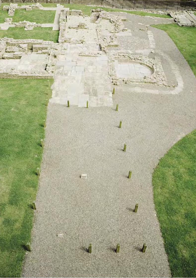
122 T H E A N T O N I N E W A L L
T H E A N T O N I N E W A L L 123
VIII
8.a Preparer
Name: Professor David J BreezeTitle: Head of Special Heritage ProjectsAddress: Historic Scotland, Longmore House Salisbury PlaceCity: Edinburgh EH9 1SH Country: UKTel: 0044 131 668 8724Fax: 0044 131 668 8730E-mail: [email protected]
8.b Official local institution/agency
Historic Scotland, Longmore House, Salisbury Place, Edinburgh EH9 1SH
8.c Other local institutions
East Dunbartonshire CouncilCommunity Planning, Tom Johnston House, Civic Way, Kirkintilloch, G66 4TJhttp://www.eastdunbartonshire.gov.ukE-mail: [email protected]
Falkirk CouncilDevelopment Services, Abbotsford House, David Loan, Falkirk FK2 7YZhttp://www.falkirk.gov.ukE-mail: [email protected]
Community ServicesE-mail: [email protected]
Contact information
of responsible authorities
Glasgow City CouncilPlanning and Development, George Street, Glasgow http://www.glasgow.gov.ukE-mail: [email protected]
North Lanarkshire Council, Fleming House, 2 Tryst Road, Cumbernauld G67 1TWhttp://www.northlan.gov.ukE-mail: [email protected]
West Dunbartonshire CouncilDepartment of Planning and Building Standards, Garshake Road, Dumbarton G82 3PUhttp://www.wdcweb.infoE-mail: [email protected]
8.d Official web address
http://www.historic-scotland.gov.ukContact name: Professor David J. Breezee-mail: [email protected]
The maps of the proposed World Heritage Site were prepared by:Royal Commission on the Ancient and Historical Monuments of Scotland,John Sinclair House, 16 Bernard Terrace, Edinburgh EH8 9NXhttp://www.RCAHMS.gov.ukE-mail: [email protected]
LEFT: The bath-house at Bearsden. The changing room lies in the foreground with the cold room beyond. To the left is the hot dry room and to the right the cold bath, with the hot steam range at the far end. Top left is part of an earlier bath building and top right the latrine.
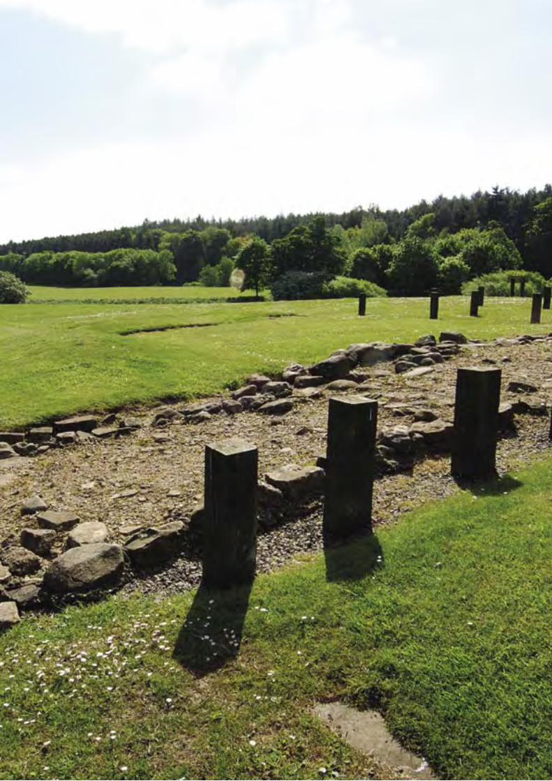
124 T H E A N T O N I N E W A L L
T H E A N T O N I N E W A L L 125
IX Signatures on behalf
of the State Party
Full name: Tessa Jowell
Title: Secretary of State for Culture, Media and Sport
Date: 8 January 2007
LEFT: The fortlet at Kinneil.
126 T H E A N T O N I N E W A L L
Acknowledgements
The preparation of the Nomination Document was overseen by a Steering Group consisting of:
Professor David Breeze, Historic Scotland
Ms Deirdre Craddock, Glasgow City Council
Ms Gillian Dick, Glasgow City Council
Dr George Findlater, Historic Scotland
Mr Ian Ludbrook, Falkirk Council
Ms Katrina Marshall, Scottish Natural Heritage
Ms Lyndsay Noble, North Lanarkshire Council
Mr Graham Shankland, East Dunbartonshire Council
Mr Mark Smith, West Dunbartonshire Council
Mr Peter Stott, Falkirk Council
The maps of the proposed World Heritage Site to accompany the Nomination Document were prepared by the Royal Commission on the Ancient and Historical Monuments of Scotland under the oversight of a Steering Group consisting of:
Professor David Breeze, Historic ScotlandDr George Findlater, Historic ScotlandDr Rebecca Jones, RCAHMSMr Peter McKeague, RCAHMS
The work of producing all the maps in both the volume of maps and the Nomination Document was undertaken by Ms Georgina Brown.
The Nomination Document and the Management Plan were written by Professor David Breeze, who would like to thank the following for assistance and advice: Professor Bill Hanson, Professor Lawrence Keppie, Ms Beatrice Dower and her colleagues in Land Use Consultants for the report on the buffer zones, Mr Jim Devine and colleagues in the Hunterian Museum, University of Glasgow, Dr Richard Tipping of the University of Stirling, Dr Carol Swanson and her colleagues in the West of Scotland Archaeology Service, Mr Geoff Bailey of Falkirk Museum, Dr Richard Jones of Glasgow University, Mr Peter Marsden in the UK Department for Culture, Media and Sport, Dr Christopher Young of English Heritage, Dr Andreas Thiel of the Deutsches Limeskommission, Dr Sonja Jilek and Mgr Klaus Behrbohm of the Culture 2000 Frontiers of the Roman Empire project, and colleagues in Historic Scotland and the Royal Commission on the Ancient and Historical Monuments of Scotland, in particular Dr George Findlater, Mr David Henrie amd Mr Richard Strachan of Historic Scotland and Dr Rebecca Jones of RCAHMS.
Historic Scotland is grateful to the following for permission to reproduce illustrations: Auld Kirk Museum, Kirkintilloch (page 56 bottom, page 64 stained glass), the British Library (page 66), Falkirk Museum (page 54), the National Library of Scotland (page 67), the National Museums of Scotland (pages 10, 66, 92 and 94) Römisch-Germanischen Zentralmuseum, Mainz (pages 57 and 59), Society of Antiquaries of London (page 62).
All other photographs, maps and plans ©Crown Copyright (Historic Scotland Images or Royal Commission on the Ancient and Historical Monuments of Scotland) or Hunterian Museum, University of Glasgow. Most of the photographs were taken specially for this Nomination Document.

T H E A N T O N I N E W A L L 127
APPENDICES
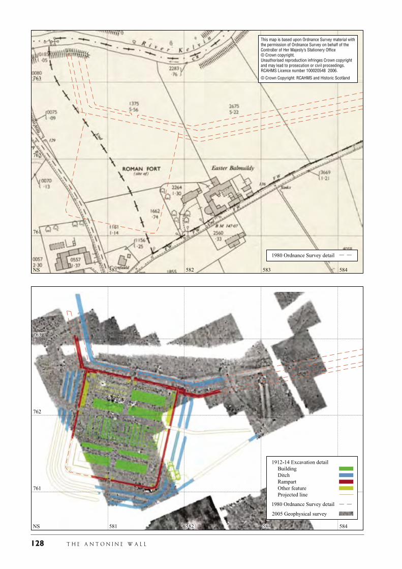
128 T H E A N T O N I N E W A L L
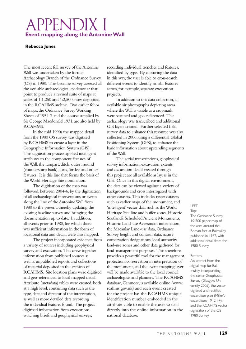
T H E A N T O N I N E W A L L 129
Appendix I Event mapping along the Antonine Wall
Rebecca Jones
The most recent full survey of the Antonine Wall was undertaken by the former Archaeology Branch of the Ordnance Survey (OS) in 1980. This baseline survey assessed all the available archaeological evidence at that point to produce a revised suite of maps at scales of 1:1,250 and 1:2,500, now deposited in the RCAHMS archive. Two earlier folios of maps, the Ordnance Survey Working Sheets of 1954-7 and the course supplied by Sir George Macdonald 1931, are also held by RCAHMS. In the mid 1990s the mapped detail from the 1980 OS survey was digitised by RCAHMS to create a layer in the Geographic Information System (GIS). This digitisation process applied intelligent attributes to the component features of the Wall, the rampart, ditch, outer mound (counterscarp bank), forts, fortlets and other features. It is this line that forms the basis of the World Heritage Site nomination. The digitisation of the map was followed, between 2004-6, by the digitisation of all archaeological interventions or events along the line of the Antonine Wall from 1980 to the present, thereby updating the existing baseline survey and bringing the documentation up to date. In addition, all events prior to 1980, for which there was sufficient information in the form of locational data and detail, were also mapped. The project incorporated evidence from a variety of sources including geophysical survey and excavation. This drew together information from published sources as well as unpublished reports and collections of material deposited in the archives of RCAHMS. Site location plans were digitised and geo-referenced to local mapped detail. Attribute (metadata) tables were created, both at a high level, containing data such as the type, date and director of the intervention, as well as more detailed data recording the individual features found. The project digitised information from excavations, watching briefs and geophysical surveys,
recording individual trenches and features, identified by type. By capturing the data in this way, the user is able to cross-search different events to identify similar features across, for example, separate excavation projects. In addition to this data collection, all available air photographs depicting areas where the Wall is visible as a cropmark were scanned and geo-referenced. The archaeology was transcribed and additional GIS layers created. Further selected field survey data to enhance this resource was also collected in 2006, using a differential Global Positioning System (GPS), to enhance the basic information about upstanding segments of the Wall. The aerial transcriptions, geophysical survey information, excavation extents and excavation detail created through this project are all available as layers in the GIS. Once in this digital environment, the data can be viewed against a variety of backgrounds and cross interrogated with other datasets. This includes raster datasets such as earlier maps of the monument, and ‘intelligent’ vector data such as the World Heritage Site line and buffer zones, Historic Scotland’s Scheduled Ancient Monuments, Historic Land-use Assessment information, the Macaulay Land-use data, Ordnance Survey height and contour data, nature conservation designations, local authority land-use zones and other data gathered for land-management purposes. This therefore provides a powerful tool for the management, protection, conservation in interpretation of the monument, and the event-mapping layer will be made available to the local council archaeologists and planners. The RCAHMS database, Canmore, is available online (www.rcahms.gov.uk) and each event created for the project has the RCAHMS unique identification number embedded in the attribute table to enable the user to drill directly into the online information in the national database.
LEFTTop: The Ordnance Survey 1:2,500 paper map of the area around the Roman fort at Balmuildy, published in 1967, with additional detail from the 1980 Survey.
Bottom: An extract from the digital map for Bal-muildy incorporating the raster Geophysical Survey (Glasgow Uni-versity 2005), the vector digitised and rectified excavation plan (Miller’s excavations 1912-14), and the RCAHMS vector digitisation of the OS 1980 Survey.
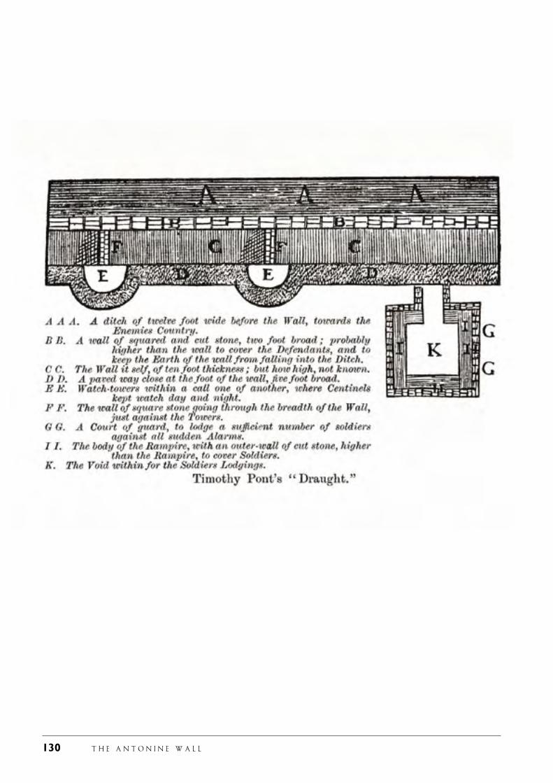
130 T H E A N T O N I N E W A L L
T H E A N T O N I N E W A L L 131
APPENDIX IIEarly Visitors to the Antonine Wall
The Antonine Wall has been visited, recorded and mapped for 500 years. Some of the statements and maps of these early visitors are well known, others less so. Much has never been published. Professor Lawrence Keppie is embarked on a project, funded by the British Academy, in order to research and publish all such early records. Already new information has come to light, about the bath-house at Duntocher, for example. This was found in 1755 and a summary report published. The original records were located by Professor Keppie and a full account published based on this material. One of the earliest known visitors to the Antonine Wall was Timothy Pont. In the late sixteenth century, he not only traced the line of the Wall on his map of Scotland (see page 67), but he also left a detailed record of his observations. His plan may be strange to our eyes, being prepared by a draughtsman on the basis of his description, but we can see that he recognised forts and towers. In his short written account he notes the existence of forts, and even records the location of some. In 1636 Sir William Brereton also visited the Antonine Wall, travelling from Edinburgh to Glasgow, staying in local inns or the houses and castles of the gentry. He stated that there was a fort at every mile and a smaller structure in between. While it is not possible to know what Sir William saw, he certainly recorded a close density of structures, which has since been confirmed through aerial and terrestrial survey. Sixty years later an unknown traveller visited the Wall and also left an important record, which has just been published for the first time. The eighteenth century is dominated by three scholars, of different complexions and reputations. Alexander Gordon published Itinerarium Septentrionale in 1726.
It contained a measured survey of the Antonine Wall. His skill as a field surveyor may be questioned, but his survey was of great value. Just six years later John Horsley published Britannia Romana. A better field worker than Gordon, he visited the Antonine Wall sometime after the publication of Itinerarium Septentrionale and offered further comment in his own publication. It was, however, William Roy, who, as we have seen, produced the best map of the Wall and in many ways is the starting point for any historical cartographical treatment of the Wall. Fortunately, too, his map is accompanied by a textual description of the remains of the Wall as he saw them in 1755. His measurements for the fort at Bearsden (New Kirkpatrick to Roy) have been proved correct to the foot through modern excavation. While these three are well known, an important visitor some years later was Rev. John Skinner of Camerton in Somerset. His record of life in his parish is well known, as is his walk along Hadrian’s Wall, but his tour along the Antonine Wall in 1825 has only just been published. In his journal, he not only recorded the physical remains but recorded these remains and the countryside of the Wall with its modern buildings in a series of sketches which he later coloured. It is a most valuable record. It is clear that there are nuggets still surviving in archives, both public and private, which should help cast light on the history of the Antonine Wall and in particular the elements of the frontier which are now lost. They complement maps, surveys and excavation reports and, furthermore, their hints of long-lost structures can be tested now through non-intrusive survey such as geophysical prospection.
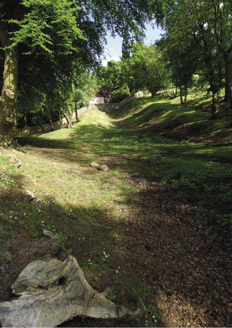
132 T H E A N T O N I N E W A L L
T H E A N T O N I N E W A L L 133
Appendix IIi Frontiers of the Roman Empire World Heritage Site
Hadrian’s Wall (UK) was inscribed as a World Heritage Site (WHS) in 1987. In 2005 the German Limes was also inscribed as a World Heritage Site as an extension to the Hadrian’s Wall WHS. At the same time, the name of the Hadrian’s Wall WHS was changed to Frontiers of the Roman Empire (Hadrian’s Wall/UK), with the German Limes as the first phased, serial extension of this new trans-national World Heritage Site. Other countries have declared their intention to nominate their sections of the European frontiers of the Roman empire as part of this phased, serial trans-national World Heritage Site. These countries are Austria, Croatia, Hungary and Slovakia. In order to obtain a better appreciation of the scale of the potential future extent of this WHS, UNESCO sought the preparation of an over-arching view of the European frontiers of the Roman empire. As a result, the following Summary Nomination Statement was prepared by Professor David Breeze of Historic Scotland and Dr Christopher Young of English Heritage. It was adopted by the World Heritage Committee of UNESCO at its 2005 meeting at Dunbar, South Africa. The new World Heritage Site will be managed by an inter-governmental body appointed by those states whose sections of the frontier are included in the WHS - at present these are Germany and UK - with observers from those other states which have stated their intention to nominate their section of the frontier. This inter-governmental body will be advised by the scientific committee known as the Bratislava Group which was established in 2003 and formed of the archaeological co-ordinators of those countries whose sections of the frontier are already in the FRE WHS or have stated their intention to nominate their section.
Summary Nomination Statement for Frontiers of the Roman Empire WHS
1.a.1. Identification of the Property
1.1 The Roman Empire extended at its height into three continents. During the waxing and waning of Roman power over a period of more than a millennium, a number of different frontier lines were established. At its greatest extent, in the second century AD, the imperial frontier stretched for over 5000 km, starting on the western coast of northern Britain, which it divided into two parts. The frontier in Europe then ran along the rivers Rhine and Danube, looping round the Carpathian mountains to the Black Sea. The Eastern frontier, from the Black Sea to the Red Sea and running through mountains, great river valleys and the desert, faced Rome’s greatest enemy, Parthia. To the south, Rome’s protective cordon embraced Egypt and then ran along the northern edge of the Sahara Desert to the Atlantic shore in Morocco.
1.2 Remains of Roman frontier installations survive and can be seen in the United Kingdom, The Netherlands, Belgium, Germany, Switzerland, Austria, Slovakia, Hungary, Slovenia, Croatia, Serbia, Bulgaria and Romania and possibly others within Europe. East and south of the Mediterranean, there are remains in Turkey, Syria, Jordan, Israel, Iraq, Egypt, Libya, Algeria, Tunisia and Morocco.
1.3 The inscription of the Hadrian’s Wall World Heritage Site has resulted in
LEFT: The Antonine Wall looking east to Watling Lodge.
134 T H E A N T O N I N E W A L L
the definition of what a Frontiers of the Roman Empire World Heritage Site might contain:
• a linear barrier in its entirety;
• sites along a natural boundary, such as a sea or river;
• the network of military installations, other ancillary features and their linking roads, on, behind and beyond the frontiers.
All these may encompass both visible and buried archaeology. Together, all form an extensive historic landscape.
1.4 Detailed location information will be given for each section of the frontier as it is nominated for inscription.
1.5 The Site is known overall as the Frontiers of the Roman Empire World Heritage Site. Individual elements of the Site would be listed by their local names as being part of the Frontiers of the Roman Empire World Heritage Site – Hadrian’s Wall (part of the Frontiers of the Roman Empire World Heritage Site).
2. Justification for inscription
2.a Statement of Significance
2.a.1 The Roman Empire is of undoubted outstanding universal value. Spanning three continents, the Empire developed and transmitted over large parts of Europe a universal culture based on Greek and Roman civilisation. Its influence reached far beyond its actual boundaries in Europe and around the Mediterranean. Its culture framed and guided the cultures of Europe up to and including the present day.
2.a.2 The frontiers of the Roman empire form the single largest monument to this civilisation. They helped define the very extent and nature of the Roman empire. As a whole, they represent the
definition of the Roman empire as a world state. They also played a crucial role in defining the development of the successor states to the Roman Empire. The frontiers and their garrisons were also a crucial tool of Romanisation on both sides of the border line.
2.a.3 The frontiers also have high significance as illustrating the complexity and organisational abilities of the Roman Empire. With only the technology and communications of a pre-industrial society, the Empire was able to plan, create and protect a frontier of some 5000 km and garrisons of tens of thousands of men. It was then able to manage and use this system, on the whole successfully, for periods of many centuries, both as a physical barrier, and also as the basis for diplomatic and military intervention far beyond the actual frontier line itself.
2.a.4 Physically, the frontiers demonstrate the variety and sophistication of the responses of the Roman Empire to the common need to demarcate, and control and defend its boundaries. This had to be done in widely differing circumstances, reflecting the interaction of political, military and topographical features. Mostly, the Empire faced a variety of tribal groups, but on their eastern front they were confronted by the Parthian Empire, a state of equal sophistication and complexity.
2.a.5 In some places the boundary ran along rivers. Elsewhere it edged the desert and elsewhere again it ran through areas with no natural barriers. In each case, the Romans developed a local solution, making use of topographical features and political circumstances to provide a barrier that was an effective control of movement across the frontier as well as a strong military barrier defence. The variety of physical remains have outstanding value in demonstrating the complexity and success of this society in using boundary works to define and protect itself in ways appropriate in each cases to the local circumstances.
T H E A N T O N I N E W A L L 135
2.b Comparative Analysis
2.b.1 Protection of boundaries was a problem common to all pre-industrial empires. Only two (Rome and China) seem to have used the solution of a linear barrier. The only direct comparator to the frontiers of the Roman Empire is therefore the Great Wall of China, inscribed as a World Heritage Site in 1987. The Great Wall is 6,000 km in length, thus forming the largest single military structure in the world.
2.b.2 The frontiers of the Roman Empire, though shorter overall than the Great Wall of China, had to respond to more varied conditions, both political and physical. It therefore uses a wider variety of defensive systems, demonstrating the complexity and organisational ability of the Roman state to these varying conditions. It is possibly a more complex response than that developed by the Chinese.
2.c Authenticity and IntegrityIt will be necessary for each individual nomination of a section of the Frontiers of the Roman Empire World Heritage Site to demonstrate the authenticity and integrity of that section.
2.d Criteria under which inscription is proposed
2.d.1 As a whole, the Frontiers of the Roman Empire World Heritage Site meets three criteria for inscription as a cultural World Heritage Site. These are:
(ii) exhibit an important interchange of human values, over a span of time or within a cultural area of the world, on developments in architecture or technology, monumental arts, town planning or landscape design
2.d.2 Taken as a whole, the frontiers of the Roman Empire show the development of Roman military architecture from temporary camps through winter quarters for whole armies to the establishment of permanent forts and fortresses. These show through time a development from
simple defences to much more complex arrangements.
2.d.3 Linked to this is the development of the infrastructure of roads and waterways along with systems of linear barriers and watch towers. The frontier also promoted the development of urbanisation particularly in central and western Europe from which it had previously been largely absent.
(iii) bear a unique or at least exceptional testimony to a cultural tradition or to a civilisation which is living or which has disappeared
2.d.4 The Roman frontier is the largest monument of the Roman Empire, one of the greatest of the world’s pre-industrial empires. The physical remains of the frontier line, of the forts and fortresses along it, as well as of the cities, towns and settlements associated with it, and dependent upon it, demonstrate the complexities of Roman culture and the spread of Roman culture across Europe and the Mediterranean world.
2.d.5 Unlike the great monuments from the urban centres around the Mediterranean already inscribed as World Heritage Sites, the frontiers show a more mundane aspect of Roman culture, both military and civilian. As such they are evidence of the spread of Roman culture and its adoption by the Empire’s subject peoples.
2.d.6 Inscriptions and other evidence demonstrate the extent to which the frontier led to an interchange of peoples across the Empire. To a large extent, this was the result of the movement of military units (e.g. British units in Romania, or Iraqi boatmen in northern Britain) but there is also strong evidence of civilian movement (e.g. merchants from the Middle East who settled in Britain, Germany and Hungary). The frontiers also acted as the base for the movement of Roman goods (and presumably ideas) to pass well beyond the Empire.
136 T H E A N T O N I N E W A L L
(iv) be an outstanding example of a type of building or architectural or technological ensemble or landscape which illustrates a significant stage in human history
2.d.7 The physical remains of the frontiers of the Roman Empire demonstrate the power and might and civilization of the Romans. As such they are evidence of the development of the Roman Empire and its spread across much of Europe and parts of Asia and Africa. They therefore illustrate the spread of classical culture and of Romanisation which shaped much of the subsequent development of Europe.
3. Description
3.a Description of Property
3.a.1 The Frontiers of the Roman Empire World Heritage Site will embrace the frontier in its entirety, acknowledging that sometimes it was just a linear barrier or even just a line on a map but elsewhere may extend to a broad military zone, which is a network both physical in form but also intangible in nature. This network encompasses a support structure both behind and in front of the barrier, and the effect of the Roman military presence on the people on, behind and in front of the frontier, extending far beyond the formal boundaries of the Roman empire. Thus, the frontier both divides and connects the ancient and modern peoples of Europe and the Mediterranean world.
3.a.2 A mere catalogue does not do justice to the wide range of military and associated civilian remains visible on the frontiers of the Roman Empire. While there are certain generic types – legionary fortresses, forts, fortlets, towers – these are geographically distinct. A tower may be a tower, but it is not the same structure in Britain, Austria or Hungary. Forts follow basic plans, but retain distinctive qualities unique to that part of the empire in which they were constructed. The remains of
the great cities which sprang up outside the fortresses of the middle Danube cannot be found in the United Kingdom do not occur on the frontiers in Britain. The terrain of the frontier – river, marsh, mountain – as well as the climate also dictated the sort of military installations constructed.
3.a.3 In some places, the frontier followed river lines strengthened by fortresses and forts. Elsewhere in desert areas, networks of roads and forts sufficed. In more settled areas without natural defences, more permanent artificial barriers were needed. These could be simple timber or earthworks as in Upper Germany, the Limes and, in Scotland, the Antonine Wall or more elaborate structures such as Hadrian’s Wall in England.
3.a.4 Probably the frontier had different purposes in different parts of the Empire. In some places, it was probably intended principally for simple policing of the border line. Elsewhere, it may have had a more robust military function.
3.a.5 Its role may have changed over time, too. Physical changes over time can also be noted: the great Constantinian and Valentinianic building programmes of the fourth century may be seen in the Rhineland (Germany), Austria and Hungary, but rarely elsewhere. Even later modifications survive on the lower Danube, on the Eastern frontier and in north Africa. Time and space have combined to create a unique range of structures which together form a greater whole and an enormously complex corpus of material for preservation and study.
3.a.6 Remains of Roman frontier installations can be seen in the United Kingdom, The Netherlands, Belgium, Germany, Switzerland, Austria, Slovakia, Hungary, Slovenia, Croatia, Serbia, Bulgaria and Romania within Europe. Along the Eastern frontier, there are remains in Turkey, Syria, Iraq, Jordan and Israel. In north Africa military works survive in Egypt, Libya,
T H E A N T O N I N E W A L L 137
Algeria, Tunisia and Morocco. The state of preservation and knowledge varies greatly from country to country. Much has been destroyed or built over, and is now only accessible through excavation. Even sites that are ploughed flat and are only visible through the media of aerial photography or geophysical research, form extremely significant reserve areas for archaeological research.Yet much stands proud, revealed by excavation or, remarkably, still in use, as the gates and towers of Austria illustrate. They all offer evocative reminders of the former power and greatness of this formidable empire.
3.a.7 Hadrian’s Wall in the United Kingdom is the best preserved frontier. This is largely because it was built in stone. Visible on the ground, in addition to long stretches of the linear barrier itself, are forts such as Housesteads and Chesters, linked by a road, the Military Way, milecastles and turrets (about 6 and 12 visible respectively) and civil settlements, for example Vindolanda; uniquely on this frontier there is an extra earthwork, the Vallum running along the rear of the linear barrier. Beyond the eastern end of the Wall lay a supply base at South Shields, while to the west, on the Cumbrian Coast, is visible the fort at Maryport and an adjacent fortlet. The Antonine Wall in Scotland, constructed of turf, survives remarkably well in many areas. The earthworks of the fort at Rough Castle and bath-houses at Bar Hill and Bearsden are visible, as are six ‘expansions’, which were probably beacon platforms. The type of fortlet/milecastle found on these two frontiers is unique to Britain.
3.a.8 In Germany, several long stretches of the linear barrier are visible and it is often very clear from the air. As a peculiarity its course is often mathematically straight, completely ignoring the topography of the land. Many forts are visible along the frontier line including: The Saalburg, Osterburken, Rainau-Buch, Welzheim, Weissenburg and Eining. Generally the forts and fortlets in Germany are rather larger than in Britain.
Entrances through the linear barrier such as Dalkingen are visible apart from the fort-sites. Towers in various differing states of survival and/or restored at various times, occur (e.g. Bad Hoeningen, Zugmantel, Mahdholz).
3.a.9 Forts are also visible in other European countries along the frontier including: Zwammerdam in The Netherlands; Mautern, Traismauer, Tulln and Zeiselmauer, in Austria; Tokod, Visegrád, Ulcisia Castra, Contra Aquincum and Intercissa, in Hungary; Capidava, Dinogetia, Carsium and Porolissum in Romania. Towers are also visible in Austria (e.g. Bacharnsdorf) and Hungary (e.g. Leányfalu).
3.a.10 Some remains of the large legionary fortresses may be seen, e.g. Vindonissa in Switzerland, Regensburg in Germany, and Aquincum in Hungary while earthworks of others survive at, for example, Inchtuthil in the United Kingdom and Lauriacum in Austria.
3.a.11 The remains include ancillary features such as bath-houses and amphitheatres built by the army. Civilian settlements also lay outside most forts, such as Vindolanda beside Hadrian’s Wall; some grew to great cities such as Carnuntum in Austria and Aquincum in Hungary. Here may be seen houses, shops, markets and temples in once-thriving communities.
3.a.12 In the East and in north Africa, climate and different social traditions often produced forts of different types to those in Europe. On the eastern frontier, troops were frequently quartered in towns such as Dura Europos in Syria and Hatra in Iraq, but elsewhere occur ‘normal’ forts. Legionary fortresses are visible at Satala in Turkey, and El-Lejjun and Udruh in Jordan. Forts include Ain Sinu in Iraq, Sa’neh, Khan el-Hallabat and Deir-Semali in Syria, Qasr el-Azraq, Da’ajaniya and Qasr Bshir in Jordan and Upper Zohar in Israel. Towers often lay beside the roads along the frontier, the Via Novae Traiana and the Strata Diocletiana,
138 T H E A N T O N I N E W A L L
which form an important element in the system and in the remains today.
3.a.13 In north Africa many forts lie in what is today desert. Some, such as Bu Njem and Gheriat el-Garbia (Libya), now lie deep into the Sahara. In Tunisia and Algeria many of the forts which protected the rich coastal cities are still visible, with notable remains at the legionary fortress at Lambaesis; its predecessor, Timgad, was transformed into a Roman colony which is remarkably well preserved. In Algeria and Morocco, too, large stretches survive of the Fossatum Africae, the barrier erected by the Romans to divide the sown from the nomad and control transhumance. The wall incorporated both gates and towers, still visible today. In Egypt forts such as Mons Claudianus were specially constructed to house the troops controlling quarrying.
3.a.14 It must be emphasised that all these visible structural remains are complemented by museums in all countries. Many of these are of international reputation and display material of the highest quality. It is appreciated that museums are not eligible for World Heritage Site status.
3.b History and Development
3.b.1 Rome’s frontiers are indeed a reflection of the empire’s former might. But earlier Romans would not have seen it that way. The ethos of the Roman Republic and the reign of the first Emperor Augustus (27 BC-14 AD) were expansionist. The momentum of the long reign of Augustus ended in two great rebellions towards the close of his life and thereafter the frontiers of the empire gradually consolidated on the borders he established. Regiments stationed in groups with invasion in mind were gradually re-disposed along the frontier. Forts were supplemented by smaller installations such as fortlets and towers. Under Hadrian (117-138), physical barriers were erected in both Germany and Britain, while the Fossatum Africae in Algeria probably dates, at least in part, to the same reign.
3.b.2 The borders of the empire established by Augustus did not remain static. Britain was invaded by his nephew Claudius; Domitian made an advance into Germany; Trajan conquered Dacia in modern Romania and attempted to advance the eastern frontier to the Euphrates and Tigris. Later emperors made other changes. Two important frontiers date to the reign of the Emperor Antoninus Pius, the Antonine Wall in Scotland and the Outer Limes in Germany. In the late Roman period, frontier defences were updated and modernised. In some areas, inner lines were provided while from the third century coastal defences were developed against sea raiders.
3.b.3 As a result there are thousands of military installations spread along the frontiers of the empire. These include camps, frontiers, double and single legionary fortresses, supply bases, forts, fortlets and towers, built and occupied over a period of 400 years from the reign of Augustus to the final years of the fourth century (and, in the East, beyond). They were constructed in a variety of materials - timber, turf, stone, mudbrick – and survive differentially. Some sites are iconic monuments, such as Hadrian’s Wall in Britain, the Saalburg and Eining in Germany, Porolissum in Romania, Qasr Bshir in Jordan and Lambaesis in Algeria. Sometimes the civil settlements associated with the military remains have acquired similar fame: Carnuntum in Austria and Aquincum in Hungary. These are but the tip of an iceberg which contains a vast number of visible military remains.
3.b.4 Since the end of the Roman occupation many great fortresses have become the bases of medieval and modern cities such as Strasbourg in France, Regensburg in Germany, Vienna in Austria, Budapest in Hungary and Belgrade in Serbia. Other parts of the frontier survive as ruins while much more remains as buried archaeology, visible not at all or only as earthworks.
T H E A N T O N I N E W A L L 139
3.c Form and date of most recent records of site
3.c.1 The modern era of excavation began in many countries in the 1890s and has produced a huge body of archaeological material. Many frontiers have been recorded in detail, in particular by the Römisch Germanische Kommission in Germany and the Limes Kommission in Austria, while the Eastern frontier was studied by Antoine Poidebard and the Fossatum Africae by Jean Baradez. Reconstructions of parts of the frontier similarly began early and the fort at The Saalburg, raised at the instigation of Kaiser Wilhelm II, is now a period piece in its own right. Over the last 20 or 30 years, fort gates and towers have been favoured items too for reconstruction.
4. Management
4.1 Responsibility for the management of individual parts of the World Heritage Site must rest with the individual State Parties and be carried out by each in accordance with their legislative and management systems. Equally, it is essential that individual parts of the World Heritage Site are managed within an overall framework of cooperation to achieve common standards of identification, recording, research, protection, conservation, management, presentation and understanding of the Roman frontier, above and below ground, in an inter-disciplinary manner and within a sustainable framework.
4.2 The World Heritage Centre have advised that any future nominations of further parts of the Site must be endorsed and approved by those States Parties who already manage parts of the Site. States Parties wishing to nominate parts of the Frontiers of the Roman Empire World Heritage Site must therefore undertake to work to develop this common framework with existing States Parties of the Site.
4.3 The United Kingdom government and the German authorities have undertaken to work with each other to develop this common framework based on the management principles set out below. As further States Parties propose parts of the frontier for inclusion in the World Heritage Site, the United Kingdom government and the German authorities will discuss with them possibilities of a more formal structure for international cooperation.
4.4 The United Kingdom government and the German authorities will be supported in the development of the Frontiers of the Roman Empire World Heritage Site by the Bratislava Group.
4.5 This international group was created in 2003. So-called after the city in which it first met, it is made up of experts of the history and archaeology of the Roman Frontiers and of those involved in its management. It currently has members from the United Kingdom, Germany, Austria, Slovakia, Hungary and Croatia, but could be expanded to include experts from ICOMOS and the World Heritage Centre as well as from further countries which intend to nominate future sections of the World Heritage Site.
4.6 The Bratislava Group aims to share knowledge and experience of Roman frontiers and their identification, protection, conservation, management and presentation, leading to the distillation of a common viewpoint, and through technical and professional advice provide the scientific framework for the whole World Heritage Site. The Bratislava Group should form the core of an international scientific advisory group on the Frontiers of the Roman Empire World Heritage Site. Its role should be to support States Parties in the creation of the Frontiers of the Roman Empire World Heritage Site by:
• advising States Parties on the significance of the Roman Frontier and on the development of best-
140 T H E A N T O N I N E W A L L
practice guides for its management and improving its understanding;
• developing support structures such as an overall research strategy, an international Roman Frontier database and websites.
Management Principles
4.7 The United Kingdom government and the German authorities propose the following management principles which they will apply to their parts of the Frontiers of the Roman Empire World Heritage Site and which should be applied to future parts of the Site also:
4.7.1 The aim of participating States Parties is, by stages through international co-operation, to create a World Heritage Site encompassing all the frontiers of the Roman Empire, based on its proper identification, recording, protection, conservation, management, presentation and understanding as evidence of the remains of one of the world’s greatest civilisations and as a symbol of a common heritage.
4.7.2 This will be achieved through:
• the establishment of a common approach to the identification, recording, research, protection, conservation, management, presentation and understanding of the Roman frontier, above and below ground, in an inter-disciplinary manner and within a sustainable framework;
• the enhancement of respect for the surviving remains of the frontier and the transmission of these remains to future generations;
• acknowledgement of the Roman Frontier and its associations as a common feature for bringing people together;
• improved public knowledge, utilising modern information systems.
4.7.3 States Parties will be supported in this by the work of the Bratislava Group, augmented as necessary, as an international scientific advisory group.
4.7.4 Any future nominations for extensions of the Frontiers of the Roman Empire World Heritage Site must be endorsed by existing State Parties with the Frontiers of the Roman Empire World Heritage Site who must confirm that they believe that the new nomination has outstanding universal value and that the management proposals for the proposed extension adhere to these management principles. Such nominations would need to demonstrate:
• outstanding universal value of the whole Site;
• the values of the part being nominated;
• authenticity;
• appropriate legal protection and management arrangements for the Site including a Management Plan or other appropriate management system.
4.7.5 Internationally, goals over the next five years are:
• definition of areas of outstanding universal value which could be included in the WHS;
• agreement on an overall statement of outstanding universal value for the whole WHS;
• a common vision for the whole WHS;
• long term aims for the whole WHS;
• support and advice to those preparing nominations for additions to the WHS;
• the creation of a web site;
• the linking of national data bases;
• the development of a trans-European exhibition to raise awareness;
T H E A N T O N I N E W A L L 141
• the development of common standards for identification, recording, conservation, management and display;
• the development of research frameworks for the WHS.
4.7.6 Nationally, the management systems for each part of the Site would need to address, within the overall framework set out above, identification and definition of the area’s significance, as well as its conservation, access to it, the interests and involvement of all appropriate organisations and communities from national to local level, and its sustainable economic use.
4.7.7 Within each State Party’s existing legislative and management systems there should be developed for the nominated extension an appropriate management system, normally expressed through a Management Plan for the identification, protection, conservation and sustainable use of the Site within the context of these management principles. Points (in addition to those outlined in 4.7.4 above) that would normally need to be covered within this include:
• commitment to involvement of local communities (cf Operational Guidelines);
• commitment to achieving appropriate balance between conservation, access, the interests of local communities and sustainable economic use of the Site;
• commitment to co-ordination of activities and participation in the co-ordination mechanism;
• an effective implementation and monitoring system for the Management Plan.

142 T H E A N T O N I N E W A L L
The
Hou
se 1
/07
Prod
uced
from
sus
tain
able
mat
eria
l