appendix 8.2 hydrogeology assessment · 3 regional geology and hydrogeology 3.1 introduction the...
TRANSCRIPT

APPENDIX 8.2
HYDROGEOLOGY ASSESSMENT

Appendix – Hydrogeology
1 BACKGROUND.................................................................................................................12 GEOGRAPHICAL SETTING .............................................................................................13 REGIONAL GEOLOGY AND HYDROGEOLOGY ............................................................2
3.1 Introduction....................................................................................................................23.2 Solid Geology................................................................................................................33.3 Drift Geology .................................................................................................................33.4 Made Ground ................................................................................................................33.5 Structural Features........................................................................................................33.6 Hydrogeological Overview ............................................................................................3
4 BASELINE CONDITIONS .................................................................................................44.1 Introduction....................................................................................................................44.2 Local Geology ...............................................................................................................44.3 Hydrogeology ................................................................................................................44.4 Recharge.......................................................................................................................64.5 Water Quality ................................................................................................................64.6 Surface Water and Groundwater Features ...................................................................7
5 POTENTIAL IMPACTS OF PROPOSED BYPASS ..........................................................75.1 Introduction....................................................................................................................75.2 Potential Impacts Due to Construction..........................................................................75.3 Potential Permanent Impacts Following Bypass Completion .......................................85.4 Impact Prediction and Evaluation ...............................................................................10
6 REFERENCES ................................................................................................................17
Annex 1 Falling Head Test and Soakaway Test Calculations
Tables
Table 3.1: Geological Succession (taken from BGS (1900)) .....................................................2Table 4.1: Areas of Potential Recharge to Groundwater ...........................................................6Table 5.1: Potential Reduction in Permeable Drift and Bedrock Cross-Sectional Area Perpendicular to the Groundwater Flow Direction Following Bypass Construction...................9Table 5.2: Estimated Groundwater Flow Potentially Intercepted by Cuttings............................9Table 5.3: Impact Magnitude....................................................................................................10Table 5.4: Impact Significance Matrix ......................................................................................11Table 5.5: Effect Significance Categories ................................................................................11Table 5.6: Potential Impacts from the Construction and Operation of the Proposed A82 Crianlarich Bypass ...................................................................................................................12
Figures
Figure 2.1: Location of Proposed BypassFigure 3.1: Site Location and Geology MapFigure 4.1: Geological Cross Section along line of Proposed RoadFigure 4.2: Section A – Geological Cross Section Perpendicular to Line of Proposed RoadFigure 4.3: Section B – Geological Cross Section Perpendicular to Line of Proposed RoadFigure 4.4: Groundwater Levels at Southern End of Proposed RouteFigure 4.5: Groundwater Levels at Northern End of Proposed RouteFigure 4.6: Groundwater levels associated with the monitoring of BH203 in the southern section of the proposed A82 Crianlarich bypassFigure 4.7: Groundwater levels associated with the monitoring of BH208 in the northern section of the proposed A82 Crianlarich bypass

A82(T) Crianlarich Bypass Environmental Statement Appendix 8.2
1
1 BACKGROUNDThis appendix provides a contextual outline of the hydrogeological characteristics of the area against which the potential hydrogeological impacts of the proposals can be assessed.
The purpose of this assessment is to: Assess the availability and adequacy of the existing information on the
possible hydrogeological issues associated with the construction and operation of the proposed bypass;
identify surface water and groundwater features which may potentially be adversely affected by the scheme during construction and following completion;
assess the extent and likelihood of pollution risk; assess the impact of the proposed bypass on groundwater movement within
the local catchment; and outline potential mitigation measures, if required.
The proposed bypass route corridor is located immediately to the west of the village of Crianlarich, Stirlingshire. Crianlarich is located in Strath Fillan at its convergence with Glen Falloch and Glen Dochart.
Crianlarich is located approximately 72km north east of Stirling, and lies at the junction of two of the main routes from the lowlands to the north-west Highlands. The A85 from Perth approaches from the east along Glen Dochart, and the A82 from Glasgow from the south along the banks of Loch Lomond and Glen Falloch. These roads meet at Crianlarich and then continue as the A82 north-west along Strath Fillan to Tyndrum, Fort William and Oban.
2 GEOGRAPHICAL SETTINGThe village of Crianlarich lies in the lea of several of the Munro hills, including Ben More, Stob Binnein and Cruach Ardrain within Strath Fillan. The route corridor of the proposed bypass lies on the lower reaches of a hillside above the village of Crianlarich, and above the existing A82 truck road. The ground is hummocky, particularly at the southern end of the route where large mounds are separated by flatter hollows. At the northern end of the route corridor, the ground is more even and slopes down towards the village. The majority of the route comprises rough grassland and lies just below the tree line, except in the central section where the route passes through coniferous forest.
The ground is frequently saturated in parts, with areas of standing water. A number of small streams cross the area, discharging to the River Fillan. Some of these watercourses are seasonal.
The geographical setting of the Crianlarich and the proposed route of the bypass are shown in Figure 2.1. The proposed bypass route is delineated by the following OS National Grid References:
North-western limit (on A82 to Fort William and Oban) NN 378 256 Southern limit (on A85 to Glasgow) NN 381 245

A82(T) Crianlarich Bypass Environmental Statement Appendix 8.2
2
Figure 2.1 Location of Proposed Bypass
Based upon Ordnance Survey Mapping with The Permission of The Controller of Her Majesty’s Stationary Office © Crown Copyright. Grontmij Licence No: WU298492
3 REGIONAL GEOLOGY AND HYDROGEOLOGY3.1 Introduction
The geology of the Strath Fillan area is shown in Figure 3.1 (BGS, 1900) and summarised in Table 3.1. The area is underlain by metamorphic basement, the Southern Highland Group. This is largely overlain by drift deposits comprising glacial moraine, glaciolacustrine clay silt and sand and peat.
Table 3.1: Geological Succession (taken from BGS (1900))
Facies / Formation Approximate Thickness
Rock Type/Description
PeatGenerally <1m but can be >5m in hollows
Peat
River terrace deposits
<3m Stratified gravel, sand and silts
Glacial moraine < 10mMounded deposits of highly heterogeneous sands, silt, gravel and boulders.
Quaternary and Recent Drift
Glaciolacustrine clay, silt and sand
< 3 m Beds of clay, silt and sand
Bedrock (Dalradian)
Southern Highland Group
Semipelite and psammite

A82(T) Crianlarich Bypass Environmental Statement Appendix 8.2
3
3.2 Solid GeologyThe area is underlain by the Precambrian Dalradian Southern Highland Group. These metamorphic strata comprise schistose semipelite to psammite, with more massive layers of psammite up to 1m thick developed locally. The inclination of the layers is steep to sub-vertical (>50-600), dipping typically south-east or north-west. The top 10 metres or so of bedrock are likely to be weathered.
3.3 Drift GeologyBGS mapping sources (BGS, 1900; BGS, 2006) indicate that drift deposits are laterally extensive, although they are thin or absent in places. The Drift mostly comprises peat overlying glacial deposits although alluvium, including river terrace gravels, is also present within the flood plain the River Fillan. Made ground associated with the existing infrastructure development is locally present. Peat overlies the glacial deposits particularly on the lower hill slopes and is typically less than 1m thick, although it can be thicker in hollows with more than 5m proved in some areas. The peat is generally of sedge peat with significant amounts of silt and some sand towards the base (PlantEcol, 2008).
The Glacial Drift generally comprises moraine with some glacio-lacustrine deposits. These mounded deposits produce a hummocky terrain and are highly heterogeneous, exhibiting extremely variable composition, structure, sorting and compaction. They are primarily made up of sands and silts containing gravel and boulders, although discrete beds of sands and gravel with laminae of clay and silt are common. The deposits may grade downwards into glacial till in places. The glaciolacustrine deposits are reworked moraine material found in some of the deeper channels, in the form of bedded silt and sand. This glacial drift is rarely more than 5m thick, although it can be up to 10m thick in some hollows.
3.4 Made GroundIdentified areas of made ground are generally limited to the immediate vicinity of the current road, railway and housing infrastructure. Made ground is rarely more than 3m thick except where significant embankments have been formed along the railway and the existing roads.
3.5 Structural FeaturesBGS mapping sources (BGS, 1900; BGS, 2006) indicate that, although there are a number of major northeast to southwest trending faults in the region, there is no record of faulting or crush in the vicinity of the route of the proposed bypass or the associated groundwater catchment.
3.6 Hydrogeological OverviewThe hydrogeological characteristics of the region are closely related to the geological description outlined above. The Hydrogeological Map of Scotland (BGS, 1988) classes the Precambrian metamorphic strata which form the bedrock as largely impermeable, generally without groundwater except for some limited fracture flow in the weathered zone (upper 10m or so).
The more granular glacial deposits are classed as a locally important aquifer in which intergranular flow is significant. However, these deposits are of limited thickness and due to their laterally discontinuous nature and heterogeneity are unlikely to permit significant groundwater flows on a large scale. Bands of silt and clay may allow for the formation of isolated perched water tables.
Peat within the area contains large volumes of water but has a low permeability, which means run-off is likely to be high. Most groundwater flow in these areas is likely to be below the base of the peat and/or through pipes and other features.
Groundwater levels in the region are generally close to the surface and fluctuate seasonally in response to infiltration. Monitoring data collected during 1986 and 2008

A82(T) Crianlarich Bypass Environmental Statement Appendix 8.2
4
site investigations (J.A Kirkpatrick & Partners, 1990 and Norwest Holst, 2008a), indicate that the groundwater flow direction generally follows the topographical slope, towards the north-east and the River Fillan.
Recorded values of hydraulic conductivity (K) in the glacial sand and gravel deposits vary widely from 1x10⁻⁴ to 1 m/day (BGS, 2006; Robins and Ball, 1991).
Recharge is generally restricted to areas where bedrock outcrops or where permeable drift deposits are present at surface. There is unlikely to be significant recharge through the peat except where features such pipes or desiccation cracks are present (Appendix 7.3, PlantEcol, 2008).
SEPA’s Aquifer Vulnerability Map and associated report (SEPA 2004a and SEPA 2004b) indicates that the uppermost aquifer(s) in the area, mostly the glacial sands and gravels, are in Class 4a or 4b (vulnerable to those pollutants not readily adsorbed or transformed and vulnerable to individual pollution events).
4 BASELINE CONDITIONS
4.1 IntroductionThis section provides a description of the geological and hydrogeological features which are specific to the catchment of the proposed development site. The features are considered in terms of current conditions and following construction of the bypass.
4.2 Local Geology The geology of along the route of the proposed bypass is shown in Figure 3.1, while cross-sections are shown in Figures 4.1 to 4.3 inclusive. The locations of the cross-sections are shown in Figure 3.1. These are based on information available from the BGS (BGS, 2006) and the two ground investigations carried out along the route of the proposed bypass in 1986 (J.A Kirkpatrick & partners, 1990) and 2008 (Norwest Holst, 2008b) respectively. This means that the level of information available to inform the hydrogeological conceptual model is significantly greater along the line of the proposed bypass than in the remainder of the catchment. For the most part the boreholes and trial pits are not directly on the line of the cross sections and therefore the depths of the different strata have been interpolated.
The bedrock beneath the route of the proposed bypass comprises Precambrian psammite and semipelite of the Southern Highland Group. As described previously, the bedrock is mostly overlain by extensive Quaternary Drift, although this is thin or absent in places. River Terrace Deposits are present associated with the River Fillan.Peat deposits are present along the line of the proposed bypass. They are typically less than 1m thick, although up to 5m has been proved in some hollows within the hummocky glacial deposits. The distribution and nature of the peat is described in more detail in (Appendix 7.3, PlantEcol, 2008).
The Quaternary Drift principally comprises glacial moraine deposits. These produce a hummocky terrain and are heterogeneous, exhibiting highly variable composition, structure, sorting and compaction. The cross-sections along the line of, and perpendicular to, the route of the proposed bypass confirm that these deposits chiefly comprise sands and gravels, but that a significant silt horizon is also present. The site investigation results indicate that locally, the glacial sands and gravels have a significant clay and/or silt content, and contain variable proportions of cobbles and boulders. They also indicate that the deposits are rarely more than 5m thick, but can be up to 10m thick in some hollows.
4.3 HydrogeologyThe hydrogeological characteristics of the aquifer units identified within the catchment of the proposed bypass route are outlined below.

A82(T) Crianlarich Bypass Environmental Statement Appendix 8.2
5
Groundwater Levels and FlowThe peat contains a large percentage of water but its low permeability means that there is negligible flow these deposits, except where features such as pipes and desiccation cracks are present. A detailed survey of the peat along the line of the proposed bypass indicates that these are largely absent (Appendix 7.3, PlantEcol, 2008), although some may be present in isolated peat deposits on the hill slope above the proposed route.
Only limited groundwater level information is available at present, with the dataset restricted to the 1986 site investigation and some additional data collected as part of and following the site investigation carried out in May 2008. Minimum and maximum groundwater levels are indicated on the proposed route cross sections provided in Figures 4.1 to 4.3 and Figures 4.4 and 4.5 present the water level data available for the southern and northern ends of the proposed route respectively.
Groundwater flow broadly reflects the topographic gradient, north-east towards the River Fillan. Following the May 2008 ground investigation six observation boreholes along the proposed route were monitored for water levels including two boreholes (BH203 and BH208) which were installed with data loggers. There locations are shown in Figures 4.4 and 4.5. Manual monitoring data is available for the period May 2008 to March 2009 while data loggers were installed in October 2008.
The four boreholes in the south (BH201, BH203, BH205 and BH206) show an annual variation of approximately 0 to 6.7m bGL (below Ground Level) between May 2008 and April 2009. The two boreholes to the north (BH208 and BH210) show an annual variation of 0.3 to 4.5m bGL over the same period.
Groundwater levels recorded at BH203 and BH208 are plotted on Figures 4.6 and 4.7 respectively. The variations between the summer and winter months are clearly exhibited by the manual dip data for both boreholes. The six months of telemetry data available shows an upward trend for the groundwater in the southern section of the proposed bypass (BH203) between October 2008 and April 2009, whilst in the north there is a slight downward trend (BH208). The small fluctuations are likely to be consistent with rainfall to the area.
The limited dataset does indicate that groundwater levels in the glacial moraine are generally close to surface and in hydraulic continuity with the underlying weathered bedrock, although the heterogeneous nature of the drift deposits and the presence of a silt horizon in particular suggest that perched water table(s) may also be present. The fact that the ground along some of the route is waterlogged, particularly along the southern section, suggests either the presence of peat at surface or a perched water table within the glacial moraine.
Collects along the floodplain of the River Fillan indicate that groundwater discharges in this area, although it is likely that groundwater also discharges directly to the river. The presence of sinks nearby suggests that the relationship between local lithological variation, groundwater and surface water levels, and groundwater flow is complex within the River Terrace Deposits.
Aquifer PropertiesFalling head tests (Annex 1) indicate that the aquifer properties of the glacial moraine vary greatly along the line of the proposed bypass. At the northern end, the permeability of the drift deposits was so low that insufficient data could be collected during a soakaway test carried out on TP328 to allow reasonable calculation of the infiltration rate. However, a rough interpolation of the data based on the head losses observed during the early part of the test gave an infiltration rate of approximate 1x10⁻⁶m/day. A falling head test was carried out on BH208, also at the northern end of the proposed route but as with the soakaway test, insufficient data is available to provide an accurate interpretation. Calculations based on the test data gave

A82(T) Crianlarich Bypass Environmental Statement Appendix 8.2
6
hydraulic conductivities between 0.07m/day and 0.4m/day, indicating that the glacial drift deposits are likely to have a significant silt component in this area.
Soakaway tests carried out at the southern end of the proposed route (TP 304, 305 and 309) showed no observable change in water level over the duration of the tests (1 hour) suggesting that the Drift is relatively impermeable in this area. However, given the heterogeneous nature of the glacial moraine deposits, it is not possible to say if this lack of groundwater flow is highly localised or is generic for the whole of the southern end of the proposed route.
4.4 RechargeFigure 3.1 shows the surface water catchments for the proposed drainage along the route corridor, which is expected to be broadly coincident with the groundwater catchment. The identified sub catchments in Table 4.1 correspond to those associated with the proposed drainage system. Direct recharge will occur where weathered bedrock or the more permeable drift deposits outcrop at surface. Little recharge is likely to occur through the peat, except where more transmissive features are present.
Table 4.1: Areas of Potential Recharge to Groundwater
Sub-catchment
Area
Surface Area (km2)
Area of Peat Cover (km2)
Area of Pre-Quaternary
Deposits (km2)
Area for Potential Recharge to Glacial
Drift (km2)1 0.0832 - - 0.08322 0.1331 0.0213 - 0.11183 0.1049 0.0073 - 0.09764 0.0424 - - 0.04335 0.0140 - - 0.02186 0.0842 - - 0.08378 0.2823 - 0.0200 0.2623
Total 0.7441 0.0286 0.0200 0.7037Note: areas of peat cover are based on those identified by the BGS (Figure 3.1). Peat survey work along the route corridor carried out as part of the 2008 site investigation (Appendix 7.3; PlantEcol, 2008) suggests that peat cover may be more extensive.
The Flood Estimation Handbook (FEH, 2005) gives a standard average annual rainfall (1961 – 1990) of 2471mm for the Crianlarich area. Effective recharge to groundwater is estimated by Robins et al. (1987) to range between 100 and 400mm/year across Scotland, depending on the properties of the uppermost aquifer and overlying soils. Based on an average infiltration rate of 200mm/year to the more permeable sands and gravels within the moraine deposits, the long term average infiltration to the groundwater catchment of the proposed bypass is approximately 148,820m3/year.
Given the very heterogeneous nature of the drift deposits, the lack of geological and hydrogeological information away from the route of the proposed bypass and uncertainties as to the degree of baseflow to the River Fillan, streams and drains, it is not possible to carry out more detailed water balance calculations.
4.5 Water QualityLittle groundwater chemistry data is available for the Drift in this area. However Kirkpatrick (1990) and BGS (2006) suggest that the groundwater will have low concentrations of most major elements, that it is fairly soft with a pH close to neutral and low concentrations of nitrate and sulphate. Water within the peat is likely to be acidic, with pH ranging from around 3.5 to 4.6.
River Fillan quality data provided by SEPA between 2005 and 2007 reflects this, with close to neutral pH, low conductivity and low concentrations of nitrate. The SEPA water quality classification for this reach of the river is A1 (excellent).

A82(T) Crianlarich Bypass Environmental Statement Appendix 8.2
7
4.6 Surface Water and Groundwater FeaturesA water features survey covering the route of the proposed bypass, including Crianlarich Village and the adjacent flood plain of the River Fillan, was undertaken by Grontmij in April 2008. This is presented as Appendix 8.1 of the ES
Water features identified during the survey are shown in Figure 4.6. These included the River Fillan, and a number of streams, spreads (springs) and collects (sinks). Surface water features are considered in more detail in the hydrology and flood risk assessment (Appendix 8.6), but it appeared that the streams generally rise from the base of peat deposits or are associated with artificial land drainage systems. One spring was observed issuing from the grassy hillside above the southern roundabout of the proposed bypass, probably at the boundary of the sands and gravels, and a silt horizon within the glacial moraine.
Three septic tanks were identified at the southern end of the proposed route that appeared to discharge to groundwater via a soakaway. Two further septic tanks were identified but one of these (septic tank B) is disused at present and the other (septic tank A) discharges to surface water.
No licensed or unlicensed surface water or groundwater abstractions, or associated source protection zones, were identified within the survey area, either during the survey itself or from publicly available records.
5 POTENTIAL IMPACTS OF PROPOSED BYPASS5.1 Introduction
This section describes the potential impacts on the groundwater regime of the scheme during construction and following completion, and possible measures to mitigate these.
5.2 Potential Impacts Due to ConstructionPotential impacts of construction include dewatering and pollution, including turbidity.
Construction dewatering
Dewatering may be required during the construction of the sections of road in cuttings. Even though groundwater levels are near surface, as the aquifer units(glacial sands and gravels, river terrace deposits and weathered bedrock) are heterogeneous and only of limited thickness, it is unlikely that significant volumes of water would be abstracted during any dewatering operation. However, while dewatering abstractions are likely to be sufficiently short term and small in volume to avoid long-term and significant effects on the aquifer units as a whole, there may be some local impacts on springs and any streams seasonally dependent on baseflow, particularly if dewatering takes place during summer months.
Dewatering will also create a discharge stream which would require disposal. If water is discharged to a surface watercourse then temperature, chemistry and sediment loads may have a detrimental effect on the receiving water body unless mitigation measures such as the provision of settlement tanks are put in place.
Groundwater Pollution
Without proper mitigation measures, construction activities potentially create a significant risk of pollution. The main potential sources of pollution are leakages and spills of fuels and lubricants from plant and vehicles, run-off from operations such as concrete placement and run-off of turbid surface water as a result of the removal of the drift deposits and the peat in particular. Groundwater turbidity is also likely to be an issue during blasting and excavation of bedrock, which can result in the significant movement of fines. The turbidity risk will increase during periods of rainfall.
A82(T) Crianlarich Bypass Environmental Statement Appendix 8.2
8
Although there is a significant risk of causing groundwater turbidity during construction, no groundwater or surface water abstractions have been identified within the catchment downstream of the proposed bypass route that could potentially be adversely impacted by this. The more permeable drift deposits are likely to filter out fines which mean that the impact on baseflow to watercourses is likely to be small except for those watercourses in the immediate vicinity of excavations.
5.3 Potential Permanent Impacts Following Bypass Completion
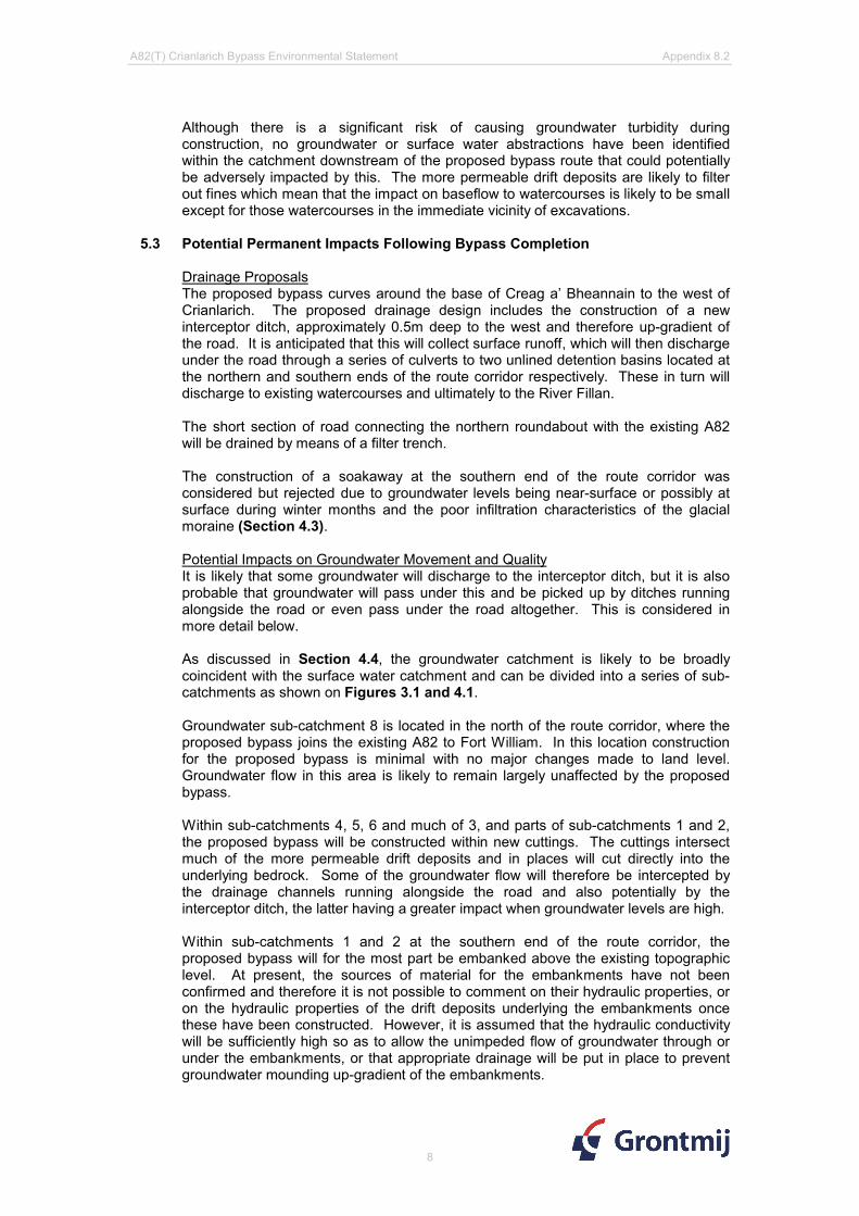
Drainage ProposalsThe proposed bypass curves around the base of Creag a’ Bheannain to the west of Crianlarich. The proposed drainage design includes the construction of a new interceptor ditch, approximately 0.5m deep to the west and therefore up-gradient of the road. It is anticipated that this will collect surface runoff, which will then discharge under the road through a series of culverts to two unlined detention basins located at the northern and southern ends of the route corridor respectively. These in turn will discharge to existing watercourses and ultimately to the River Fillan.
The short section of road connecting the northern roundabout with the existing A82 will be drained by means of a filter trench.
The construction of a soakaway at the southern end of the route corridor was considered but rejected due to groundwater levels being near-surface or possibly at surface during winter months and the poor infiltration characteristics of the glacial moraine (Section 4.3).
Potential Impacts on Groundwater Movement and QualityIt is likely that some groundwater will discharge to the interceptor ditch, but it is also probable that groundwater will pass under this and be picked up by ditches running alongside the road or even pass under the road altogether. This is considered in more detail below.
As discussed in Section 4.4, the groundwater catchment is likely to be broadly coincident with the surface water catchment and can be divided into a series of sub-catchments as shown on Figures 3.1 and 4.1.
Groundwater sub-catchment 8 is located in the north of the route corridor, where the proposed bypass joins the existing A82 to Fort William. In this location construction for the proposed bypass is minimal with no major changes made to land level. Groundwater flow in this area is likely to remain largely unaffected by the proposed bypass.
Within sub-catchments 4, 5, 6 and much of 3, and parts of sub-catchments 1 and 2, the proposed bypass will be constructed within new cuttings. The cuttings intersect much of the more permeable drift deposits and in places will cut directly into the underlying bedrock. Some of the groundwater flow will therefore be intercepted by the drainage channels running alongside the road and also potentially by the interceptor ditch, the latter having a greater impact when groundwater levels are high.
Within sub-catchments 1 and 2 at the southern end of the route corridor, the proposed bypass will for the most part be embanked above the existing topographic level. At present, the sources of material for the embankments have not been confirmed and therefore it is not possible to comment on their hydraulic properties, or on the hydraulic properties of the drift deposits underlying the embankments once these have been constructed. However, it is assumed that the hydraulic conductivity will be sufficiently high so as to allow the unimpeded flow of groundwater through or under the embankments, or that appropriate drainage will be put in place to prevent groundwater mounding up-gradient of the embankments.

A82(T) Crianlarich Bypass Environmental Statement Appendix 8.2
9
Based on the geological cross-section shown in Figure 4.1, Table 5.1 indicates for each sub-catchment the likely reduction in the cross-sectional area of the more permeable drift deposits and bedrock (perpendicular to the groundwater flow direction) following construction of the bypass. This reduction in area will be proportional to the reduction in potential for groundwater flow beneath the bypass.
Table 5.1: Potential Reduction in Permeable Drift and Bedrock Cross-Sectional Area Perpendicular to the Groundwater Flow Direction Following Bypass
Construction
Sub-Catchment
Estimated cross sectional area of aquifer
(Baseline) (m2)
Estimated cross sectional area of aquifer following bypass construction (m2)
Percentage reduction
1 1795 1593 11%2 2145 2004 7%3 2315 1803 22%4 1445 1025 29%5 2378 1196 50%6 1222 888 27%8 533 533 0%
Note: Aquifer refers to permeable drift and upper 5m of bedrock.These calculations assume that fracture flow occurs in the upper 5m of bedrock only.
The estimated groundwater inflow to the cuttings that would be picked up by the road drains is given in Table 5.2 for each of the sub-catchments.
Table 5.2: Estimated Groundwater Flow Potentially Intercepted by Cuttings
Sub-Catchment
Hydraulic Gradient
Groundwater flow
(baseline)
Groundwater flow
(following bypass
construction)
Groundwater flow intercepted by cuttings
(m3/d) (m3/d) (m3/d) (l/s)1 0.21 3.991 3.991 0.000 0.0002 0.15 4.704 4.653 0.050 0.0013 0.21 12.343 11.580 0.763 0.0094 0.12 4.301 4.251 0.050 0.0015 0.13 7.002 6.936 0.067 0.0016 0.1 6.104 6.090 0.014 0.0008 0.12 7.189 7.165 0.024 0.000
Total 45.635 44.667 0.968 0.011Note: Calculations based on Darcy’s Law (Q = KAi)where Q = flow, K = hydraulic conductivity, A = area perpendicular to flow direction, i = hydraulic gradient, Sub-catchment areas (A) perpendicular to groundwater flow direction as Table 5.1.i assumed to be approximately the same as the topographic slope.K (Drift) =0.001m/day (2008 falling head & infiltration tests, and Freeze and Cherry; 1979)K (fractured bedrock) = 0.05 m/day (Freeze and Cherry; 1979)
Given that the two detention basins are unlined, it is likely that they will act as point sources of recharge to the underlying glacial sands and gravels. The rate of recharge will be dependent on the permeability of the deposits (generally fairly low for glacial sands and gravels, as discussed in Section 4.3) and also on whether the water table is below the water level in the detention basin.
The DMRB Method C risk assessment of pollution to groundwater from routine runoff is medium for both detention basins and the filter trench (Appendix 8.4).

A82(T) Crianlarich Bypass Environmental Statement Appendix 8.2
10
Potential Impacts on Water FeaturesTable 5.1 shows that construction of the bypass is likely to have the most impact on groundwater flow within sub-catchments 3, 4, 5, and 6, which corresponds to the centre of the route corridor where it passes to the west of Crianlarich Village, within cuttings. Given the overriding contribution to flow from surface water runoff and that at present, the ground adjacent to the existing road and in the village is generally artificially drained through culverts under the existing A82 trunk road, any potential reduction of groundwater flow and possibly baseflow is not considered likely to have a significant impact on surface water features.
In terms of water features, the sub-catchment of most concern is sub-catchment 2 at the southern end of the route corridor, where features include streams, a spring and three septic tank soakaways. As with the other sub-catchments, the potential reduction in groundwater flow of approximately 7% is not considered likely to have a significant impact on the streams as much of the drainage in this area is controlled by the culverts under the existing A82 and discharge into the railway cutting to the east.
In the case of the septic tanks, the potential reduction in flow available for dilution of the soakaway discharges is considered negligible, particularly as the septic tanks are located to the east of, and down-hydraulic gradient of existing drainage ditches within the village. Indeed, groundwater levels in this area are likely to be controlled to some extent by discharge into the existing railway cutting, as discussed above. Insufficient groundwater level data are available at present to confirm whether this is likely to be the case during and immediately following a prolonged period of dry weather, but if groundwater levels are low then the impact of the road cutting will decrease. The only spring located during the water features survey is located up-gradient of the proposed bypass and therefore is considered unlikely to be adversely impacted by this.
Potential impacts during construction and following completion of the bypass are summarised in Table 5.6 using the criteria set out in Tables 5.3 to 5.5 inclusive.
5.4 Impact Prediction and EvaluationThe prediction and assessment of impacts on hydrology, hydrogeology and other aquatic resources was undertaken using the guideline criteria for impact magnitudes set out in Table 5.3..
Table 5.3: Impact Magnitude
Impact Magnitude
Guideline Criteria
High Total loss of, or alteration to, key features of the baseline resource such that post development characteristics or quality would be fundamentally and irreversibly changed e.g. watercourse realignment
Moderate Loss of, or alteration to, key features of the baseline resource such that post development characteristics or quality would be partially changed e.g. instream permanent bridge works
Low Small changes to the baseline resource, which are detectable but the underlying characteristics or quality of the baseline situation would be similar to pre-development conditions
Negligible A very slight change from baseline conditions, which is barely distinguishable, and approximates to the ‘no-change’ situation e.g. short term compaction from plant movements
Using these criteria, a series of impacts was predicted for the project.
The significance of the predicted impacts was assessed in relation to the sensitivities of the baseline resource. A matrix of impact significance was developed to provide a

A82(T) Crianlarich Bypass Environmental Statement Appendix 8.2
11
consistent framework for the evaluation of impacts, and this is presented in Table 5.4. Guideline criteria for the various impact categories are included in Table 5.5.
Table 5.4: Impact Significance Matrix
Sensitivity of Baseline ResourceMagnitudeHigh Moderate Low Not Sensitive
High Major Major Moderate MinorMedium Major Moderate Minor MinorLow Moderate Minor Minor NoneNegligible Minor Minor None None
Table 5.5: Effect Significance Categories
Significance Definition Guideline CriteriaNone No detectable
change to the environment
No impacts to drainage patterns, surface and groundwater quality or aquatic habitat
Minor A small but detectable change to the environment
Localised changes in drainage patterns or groundwater flows, or changes resulting in minor and reversible impacts to surface and groundwater quality or aquatic habitats
Moderate A larger, but non-material change to the environment
Changes in water quality or quantity affecting part of a catchment or groundwaters of moderate vulnerability, or changes resulting in loss of conservation value to aquatic habitats or designated areas.
Major A material change to the environment
Changes in water quality or quantity affecting widespread catchments or groundwater reserves of strategic significance, or changes resulting in substantial loss of conservation value to aquatic habitats and designations
For the purpose of this assessment, those effects identified as being ‘major’ or ‘moderate’ were evaluated as ‘significant’ . The matrices used to guide the assessment were applied with a degree of flexibility since the evaluation of impacts would always be subject to particular location-specific characteristics which need to be taken into account. Cumulative effects were taken into account through prediction and evaluation of impacts at a catchment-wide level.

A82(T) Crianlarich Bypass Environmental Statement Appendix 8.2
12
Table 5.6: Potential Impacts from the Construction and Operation of the Proposed A82 Crianlarich Bypass
Potential Impacts Relevant activities
Sensitivity of Receptor
Magnitude of Impact
Significance of impact and description
Reduction in groundwater flow
Dewatering of excavations
Low - Moderate Low MinorAreas of high concern: Sub-catchments 3 – 6 inclusive
The relatively short duration and shallowness of excavation makes the long term effect on the aquifer units as a whole of minor significance.There may be minor effects on local springs and streams seasonally dependent on baseflow particularly if dewatering takes place in the summer months.
Reduction in groundwater flow and its effect on water features.
Effect on groundwater level.
Effect on groundwater quality.
Permanent drainage
Not sensitive - Low Low None - Minor
Areas of high concern: Sub-catchments 3 – 6 inclusive
A new system of drainage has been proposed along the route. The impact of the proposed drainage on groundwater levels and flow ranges from low to high in areas where the proposed bypass corridor runs in a cutting (some or all of sub catchments 1 to 6 inclusive). In these areas there is likely to be a high impact on groundwater levels in proximity to the route corridor, where the route runs through a cutting. The impact on groundwater flow is likely to be low in sub-catchments 1 and 2, moderate in sub-catchments 3, 4 and 6, and high in Sub-catchment 5. However the reductions in groundwater flow are not considered to have a significant effect on surface water features due to the overriding impact of surface water runoff and the fact that the ground is already generally artificially drained. The impact on groundwater flow in sub-catchments 1 & 2 is considered to be low due to existing drainage controls associated with the existing A85 and railway cutting. Therefore the effect on water features such as the septic tanks is considered to be minor or none. The impact on flow due to groundwater intercepted by the drainage system will be offset to some extent by recharge through the base of the detention basins.

A82(T) Crianlarich Bypass Environmental Statement Appendix 8.2
13
Potential Impacts Relevant activities
Sensitivity of Receptor
Magnitude of Impact
Significance of impact and description
Reduction in surface water flow
Dewatering of excavations
Moderate - High Low Minor - Moderate
Areas of high concern: Sub-catchments 3 – 6 inclusive
While dewatering activities are likely to be relatively short term and small in volume there may be minor or moderate effects on springs and streams dependant upon seasonally baseflow, particularly if dewatering takes place in the summer months.
Reduction in surface water flow and its effects on surface water features
Reduction in groundwater baseflow
Moderate Low Minor
Areas of high concern: Sub-catchments 3 – 6 inclusive
The ground adjacent to the existing road and in the village is already largely artificially drained through culverts under the existing A82 trunk road and railway, and by the railway cutting. Therefore any potential reduction in groundwater flow and possibly baseflow to watercourses is not considered likely to have a significant effect on surface water features down- gradient of the proposed bypass, particularly given the overriding impact of surface water runoff.
Pathways for groundwater flow
Change in groundwater flow direction.Possible movement of contamination between sub-catchments
Horizontal flow paths created by excavation
Moderate Low Minor
Areas of high concern: Sub-catchments 3 – 6 inclusive
Creation of temporary horizontal flow pathways could cause loss of flow or changes in water chemistry to the surface water tributaries which flow into the River Fillan. The effect on groundwater is considered minor due to the heterogeneous nature of the aquifer and the relatively short duration of likely construction activities.

A82(T) Crianlarich Bypass Environmental Statement Appendix 8.2
14
Potential Impacts Relevant activities
Sensitivity of Receptor
Magnitude of Impact
Significance of impact and description
Horizontal pathways created by bypass bedding material
Low - Moderate Low Minor
Areas of high concern: All of route corridor
Creation of preferential horizontal flow pathways could cause loss of flow to key features down-gradient of the bypass route. There is also a risk of groundwater flooding on the road caused by the potential restrictions to flow due to embankment construction. The effect is not considered to be significant, given the artificial drainage systems already in place, and the comprehensive drainage systems proposed.
Discharge to Groundwater
Discharge of polluting substances from construction activities
Leakage and run off from construction activities.
Low - Moderate High Moderate - Major
Areas of high concern: All of route corridor
Although there is a significant risk of causing groundwater pollution during construction, either through the generation of suspended solids or from spills of oils and other polluting substances. However, these can be mitigated by bunding, storing construction vehicles away from high risk areas of the catchment, protecting excavated materials from the rain, avoiding excavation and the generation of loose material during periods of heavy rain etc. Care may need to be taken when pouring concrete to avoid migration of potential contaminants (or example additives) into surface water or groundwater, particularly when this activity takes place below the water table. Although the effect of groundwater pollution could potentially be moderate to major, the risk of this occurring is considered to be low subject to the implementation of appropriate mitigation measures.

A82(T) Crianlarich Bypass Environmental Statement Appendix 8.2
15
Potential Impacts Relevant activities
Sensitivity of Receptor
Magnitude of Impact
Significance of impact and description
Run-off from permanent structures. Discharge via detention basins
Low - Moderate Negligible None - Minor
Areas of high concern: All of route corridor
With the exception of Sub-catchment 8, run-off from permanent structures to groundwater is unlikely due to the proposed drainage system. Discharge from the roadside drainage is primarily via unlined detention basins and therefore will be to both surface water and groundwater (when basin levels exceed groundwater levels). Road drainage north of the northern roundabout will be by means of a filter trench. The DMRB Method C risk assessment of pollution to groundwater from routine runoff is medium for both detention basins and the filter trench(Appendix 8.4).
Discharge to surface waters
Effect on surface waters due to discharge water, chemistry, temperature and sediment load
Discharge from dewatering systems
Moderate - High Moderate - High Moderate - Major
Areas of high concern: River Fillan and tributaries
The discharge water quality may be poor, particularly with respect to turbidity, unless appropriate mitigation measures are put in place, for example settlement tanks or lagoons. Therefore although the impact on surface waters could potentially be moderate to major, the risk of this occurring is considered to be low subject to the implementation of appropriate mitigation measures.

A82(T) Crianlarich Bypass Environmental Statement Appendix 8.2
16
Potential Impacts Relevant activities
Sensitivity of Receptor
Magnitude of Impact
Significance of impact and description
Discharge of groundwater intercepted by permanent drainage systems.
Moderate Negligible Minor
Areas of high concern: River Fillan and tributaries
Interception of groundwater by drainage systems that subsequently discharge to surface watercourses may by an issue where the groundwater is of poor quality. Little water quality information is available for the glacial deposits but the high water table and potentially rapid through flow suggest that water quality is unlikely to be poor or significantly different from the present baseflow. Therefore the effect is considered to be minor.

A82(T) Crianlarich Bypass Environmental Statement Appendix 8.2
6 REFERENCES
1. BGS (2006) – Scottish Aquifer Properties: 2006 Interim Report. Project WFD27.
2. Robins, N.S and Ball, D.F (1991) – Groundwater in the Quaternary deposits of Scotland: a valuable resource and a potential engineering hazard. Geological Society, London, Engineering Geology Special Publications v. 7 p 251-255.
3. BGS (1900) – Geology Map (Solid and Drift), Sheet 46 Balquhidder, Scale 1:63,360.
4. BGS (1988) – Hydrogeological Map of Scotland. Scale 1:625,000.
5. Association of Directors and River Inspectors of Scotland (1995) – Groundwater Protection Strategy for Scotland, and Groundwater Vulnerability Map of Scotland. Scale 1:625,000.
6. JA Kirkpatrick & Partners – Consultant Engineers (1990) – The Scottish Development Department, Report on Site Investigation for Proposed A82/A85 Crianlarich By-Pass.
7. BGS (2006) – GeoReport, Geological Assessment – Detailed report prepared for Carl Bro Group.
8. Norwest Holst (2008a) – Groundwater readings for new installations – May 2008
9. Norwest Holst (2008b) – Borehole and Trial Pit Logs for SI, 2008
10. Norwest Holst (2008c) – Borehole Falling Head Permeability and Soakaway Test Results
11. Plant Ecol (2008) – Proposed A82 Bypass at Crianlarich: Peat Landslide Hazard and Risk Assessment
12. SEPA (2004a) – Development of a Groundwater Vulnerability Screening Methodology for the Water Framework Directive (Project WFD28)
13. SEPA (2004b) – Vulnerability of Groundwater in the Uppermost Aquifer.
14. FEH (2005) – Flood Estimation Handbook CD ROM v2.0 (2005). Centre for Ecology and Hydrology. Wallingford
15. Freeze, R.A. and Cherry, J.A., 1979. Groundwater

@A@A
EDED
ED
ED
ED
ED
ED
ED
ED
EDED
EDED
ED
EDED
ED
ED
ED
ED
EDED
ED
@A
@A
@A
@A
@A
ED
ED
EDED
@A@A@A@A
@A@A@A@A
@A
ED
ED
ED
ED
ED
ED
ED@A
@A@A
@A
@A
@A
ED
ED
ED
ED
ED
ED
ED
EDED
ED
ED
ED
ED
ED
ED
ED
ED
ED
EDED
EDED
ED
ED
EDED
ED
ED
ED
ED
EDEDED
EDEDED
ED
EDED
@A
@A
@A
@A
@A@A
@A
@A
@A
@A
")
")
")
")
")
")
8
2
3
6
1
4
5
Cross Section A
Cross Section B
BH2BH1
TP5
TP4
TP3
TP2
TP1
TP9
TP8
TP7TP6
TP5A
TP1A
TP9A
TP7ATP6B
TP6A
TP20
TP19
TP18TP17
TP16
TP15
TP14TP13
TP12
TP11
TP10
TP109
TP108
TP107TP106
BH120
BH119
BH110
BH121 BH117
BH118
BH114
BH111
TP112TP111
TP110
BH126
BH125
BH124
BH123
BH122
TP20A
TP19A
CRIANLARICH BH.2CRIANLARICH BH.1
TP 335TP 334
TP 333
TP 332
TP 331
TP 329
TP 327TP 326
TP 325TP 324
TP 323
TP 322TP 321
TP 320TP 319
TP 318
TP 317
TP 315
TP 314
TP 313
TP 312
TP 311
TP 310TP 309
TP 308
TP 307TP 306
TP 305
TP 303
TP 301
BH210
BH209
BH207
BH206BH205
BH203
BH202
BH201E
C
B
A
Spring
238000
238000
7250
00
7250
00
GrontmijGrove HouseMansion Gate DriveLeedsLS7 4DNTel: 0113 262 0000Fax: 0113 307 [email protected]
Client / ProjectTransport ScotlandA82 Crianlarich Bypass
Figure 3.1: Site Location and Geology Map
Drawing Status: FinalTHIS DOCUMENT SHALL NOT BE REPRODUCED, COPIED, LENT,DISCLOSED, PUBLISHED OR USED FOR ANY OTHER PURPOSE THAN FOR WHICHIT IS SPECIFICALLY FURNISHED, EXCEPT ASEXPRESSLY AUTHORISED IN WRITING BY GRONTMIJ
File Ref: Fig_3_1_Site_location&geo_MAY09 Drawing No: 1 Original Size: A3 Scale:
0 75 150 225 300Meters
Rev Amendments By DateApr'dChkd
1:4,500
Legend@ABorehole May 2008 (black labels)EDTrial Pit May 2008 (black labels)@ABorehole 1986 (blue labels)EDTrial Pit 1986 (blue labels)") Key Feature
Cross section along line of proposed roadLine of Cross SectionDrainage areas to proposed schemeProposed A82 Crianlarich Bypass
Superficial Drift DepositsRiver Terrace DepositsPeatPre Quaternary DepositsTillHummocky Glacial DepositsAlluvial Fan Deposits
BedrockSemipelite and psammiteSemipelite
0 First Issue MC July 08HFCHFC
A2 Revised FT Dec 08HFCHFCA1 Revised CW July 08HFCHFC
A3 Final ZR May 09CJOCJO
This drawing has been reproduced from the 1:10,000 Ordnance Survey map, tile NN32NE, NN32SEThis map is based on Ordnance Survey material with the permission of Ordnance Survey on behalf of the Controller of Her Majesty's Stationary Office ©Crown copyright. Unauthorised reproduction infringes Crown copyright and may lead to prosecution or civil proceedings. Scottish Government 100020540 2009.

1000 200 300 400 500 600 700 800 900 1000 1100 1200 1300150
MetresNGR: 237898
725667NGR: 238250,
724619
155
160
165
170
175
180
185
190
195
200
mA
OD
SUB-CATCHMENTS
NO
RTH
RO
UN
DAB
OU
T
BH
126
BH
125BH
124
BH
119
SO
UTH
RO
UN
DAB
OU
T
865321
NG
R:
2382
50, 7
2461
9
SEC
TIO
N "B
"
SEC
TIO
N "A
"
?
?
?
?
?
?
?
?
??
4
max
max
min
?
BH
208
max
min
?
BH
123
BH
122
?
KEY FEATURESB
H20
1
min
BH
120 CDE
max minB
H20
3
BH
205
07.05.2008HFCNWWIA
A82/A85 Crianlarich Bypass
RevisionDateNo. Chk Appd
Grove HouseMansion Gate DriveLeeds LS7 4DN
Tel:Fax:
Web:
0113 262 00000113 262 0737www.grontmij.co.uk
420x297 - A3 As Shown A3
P000034660\A82
Scale : Rev :
File Ref :
Original Size:
P346600\Fig 4.1Drawing No :
HFCNWWP1 May. 08 First Issue
Legend:-
Drawn: Checked: Approved: Date:
Title
Client / Project
Figure 4.1Geological Cross Section Along Line ofProposed Road
THIS DOCUMENT SHALL NOT BE REPRODUCED, COPIED, LENT, DISCLOSED, PUBLISHED OR USEDFOR ANY OTHER PURPOSE THAN FOR WHICH IT IS SPECIFICALLY FURNISHED, EXCEPT ASEXPRESSLY AUTHORISED IN WRITING BY Grontmij. C
Drawing Status
Draft
Drawing Path :C:\Documents and Settings\jii\Desktop\environment\P346600-Fig 4.1 Rev A3 Geo-Logical Cross Section.dwg
Bristol. Cumbria. Dublin. Edinburgh. Glasgow. Leeds. London. Peterborough. Reading. Solihull. Wrexham.
Notes:-
Silt
Peat
Sand and Gravel
Bedrock (Schist)
Inferred GeologyGeologyRockheadGround LevelProposed Road Level
GlacialMoraineDeposits
?
Borehole
Scottish ExecutiveEnterprise Transport
HFCNWWA1 June. 08 Updated following comments
1. Geology derived from site investigation works 1986.
2. Ground water levels are associated with boreholes from 2008 site investigation.
HFCFTA2 Oct. 08 Updated following comments
By
IA
IA
IA
A3 May. 09 Updated following comments JPR
max
min
Note:Borehole locations are notdirectly on line of section.
16/01/09Groundwater levels (manual dips)
20/05/08
Weathered Bedrock
crea
ted
with
Fact
ory
trial
ver
sion
ww
w.p
dffa
ctor
y.co
m

0 100 200
155
150
160
165
170
175
10 20
180
185
190
195
200
15030 40 50 60 70 80 90
RAILWAY
?
?
SW NE
NGR: 237968,725445
NGR: 238087,725628
mA
OD
110 120 130 140 160 170 180 190 210 220
?
DITCH
TP19
PROPOSED ROAD PROPOSED ROAD
??
EDGE OFDETENTION
BASIN
?
?
? ?
TP32
8
TP32
7
BH
210
max
min
?
?
07.05.2008HFCNWWIA
A82/A85 CrianlarichBypass
As Shown
P000034660\A82 P346600\Fig 4.2
Legend:-
Figure 4.2Section A: Geological Cross SectionPerpendicular to Line of Proposed Road
Peat
Glacial Sand and Gravel
Bedrock (Schist)
Inferred Geology
RevisionDateNo. Chk Appd
TitleClient / Project
HFCNWW0 May. 08 First Issue
420x297 - A3 A2Scale : Rev :
File Ref :
Original Size:
Drawing No :
Drawn: Checked: Approved: Date: Grove HouseMansion Gate DriveLeeds LS7 4DN
0113 262 00000113 262 0737www.grontmij.co.uk
Tel:Fax:
Web:THIS DOCUMENT SHALL NOT BE REPRODUCED, COPIED, LENT, DISCLOSED, PUBLISHED OR USEDFOR ANY OTHER PURPOSE THAN FOR WHICH IT IS SPECIFICALLY FURNISHED, EXCEPT ASEXPRESSLY AUTHORISED IN WRITING BY Grontmij. C
Drawing Status
DraftBristol. Cumbria. Dublin. Edinburgh. Glasgow. Leeds. London. Peterborough. Reading. Solihull. Wrexham.
Drawing No :
C:\Documents and Settings\jii\Desktop\environment\P346600-Fig 4.2 Rev A2 Geo-Logical Cross Section.dwg
?
Scottish ExecutiveEnterprise Transport
HFCNWWA1 June. 08 Updated following comments
Proposed Ground level
Notes:-
Geology derived fromsite investigation works1986 & 2008.
By
IA
IA
Borehole/Trialpit
max
min
16/01/09
Groundwater levels(manual dips)
20/05/08
A2 May. 09 Updated following comments JPRExisting Ground level
Weathered Bedrock
crea
ted
with
Fact
ory
trial
ver
sion
ww
w.p
dffa
ctor
y.co
m

0 100
175
10 20
180
185
195
30 40 50 60 70 80 90
NGR: 238236,724719
NGR: 238353,724662
110 120 130 140
mA
OD
NW SE
190
200
177.5
182.5
187.5
192.5
197.5
?
?
?
EXISTING ROAD
TP30
7
TP01
BH
119
TP30
2
TP30
3
PROPOSEDCUTTING
PROPOSEDROAD
TP10
6?
??
?
?
?
?
?
?
?
DITCH
20.06.2008HFCCWIBA
A82/A85 Crianlarich Bypass
RevisionDateNo. Chk Appd
Grove HouseMansion Gate DriveLeeds LS7 4DN
Tel:Fax:
Web:
0113 262 00000113 262 0737www.grontmij.co.uk
420x297 - A3 As Shown A2
P000034660\A82
Scale : Rev :
File Ref :
Original Size:
P346600\Fig 4.3Drawing No :
HFCCWA1 Nov. 08 First Issue
Legend:-
Drawn: Checked: Approved: Date:
Title
Client / Project
Figure 4.3Section B: Geological Cross SectionPerpendicular to Line of Proposed Road
THIS DOCUMENT SHALL NOT BE REPRODUCED, COPIED, LENT, DISCLOSED, PUBLISHED OR USEDFOR ANY OTHER PURPOSE THAN FOR WHICH IT IS SPECIFICALLY FURNISHED, EXCEPT ASEXPRESSLY AUTHORISED IN WRITING BY Grontmij. C
Drawing Status
Draft
Drawing Path :C:\Documents and Settings\jii\Desktop\environment\P346600-Fig 4.3 Rev A2 Geo-Logical Cross Section.dwg
Bristol. Cumbria. Dublin. Edinburgh. Glasgow. Leeds. London. Peterborough. Reading. Solihull. Wrexham.
Notes:-
Silt
Peat
Sand and Gravel
Weathered Bedrock
Inferred Geology
Proposed Road Level
GlacialMoraineDeposits
?
Trial Pits & Borehole
Scottish ExecutiveEnterprise Transport
Geology derived from site investigationworks 1986 & 2008.
By
IA
A2 May. 09 PROFILES REVISED JPR
Note:Borehole and trial pit locations are notdirectly on line of section. Depths havebeen inferred.
Bedrock (Schist)
Existing Ground level
crea
ted
with
Fact
ory
trial
ver
sion
ww
w.p
dffa
ctor
y.co
m

")
")
")
")
@A@A@A@A
@A
@A@A
@A@A
@A
@A@A
E
D
C
B
BH113 176.8
BH120 187.59
BH118 179.19BH116 177.24
BH115 177.25BH114 174.82
BH111 177.09
BH 206: 186.12m (May08), 186.48m (Jan09)BH 205: 184.79m (May08), 184.63m (Jan09)
BH 203: 183.65m (May08), 186.61m (Jan09)
BH 201: 184.69m (May08), 189.11m (Jan09)
7250
00
7250
00
GrontmijGrove HouseMansion Gate DriveLeedsLS7 4DNTel: 0113 262 0000Fax: 0113 307 [email protected]
Figure 4.4: Groundwater Levels at Southern End of Proposed Route
Drawing Status: FinalTHIS DOCUMENT SHALL NOT BE REPRODUCED, COPIED, LENT,DISCLOSED, PUBLISHED OR USED FOR ANY OTHER PURPOSE THAN FOR WHICHIT IS SPECIFICALLY FURNISHED, EXCEPT ASEXPRESSLY AUTHORISED IN WRITING BY GRONTMIJ
File Ref: Fig_4.4_GW_levels_S_A3_MAY09 Drawing No: 1 Original Size: A3 Scale:
0 50 100 150 200Meters
1:2,500
This drawing has been reproduced from the 1:10,000 Ordnance Survey map, tile NN32NE, NN32SEThis map is based on Ordnance Survey material with the permission of Ordnance Survey on behalf of the Controller of Her Majesty's Stationary Office ©Crown copyright. Unauthorised reproduction infringes Crown copyright and may lead to prosecution or civil proceedings. Scottish Government 100020540 2009.
Legend@A Water Levels Min & Max 2008 Boreholes@A Water Level 1986") Septic Tank Location
Proposed Route of Bypass
Client / ProjectTransport ScotlandA82 Crianlarich Bypass
Rev0 First Issue
Amendments By DateApr'dChkdMC 07/08HCZR
A1 Revised CW 07/08HC HCFT 10/08HCUpdated water levelsA2 HC
ZR 05/09CJOFinalA3 CJO
NB: Minimum groundwater levels are associated with May 2008 (20/05/08) and maximum groundwater levels are associated with January 2009 (16/01/09)

")
")
@A
@A
@A@A
@A
@A
B
A
BH126 174.91
BH125 173.72
BH 210: 171.04m (May08), 174.65m (Jan09)
BH 208: 179.17m (May08), 183.24m (Jan09)
BH 206: 186.12m (May08), 186.48m (Jan09)BH 205: 184.79m (May08), 184.63m (Jan09)
238000
238000
GrontmijGrove HouseMansion Gate DriveLeedsLS7 4DNTel: 0113 262 0000Fax: 0113 307 [email protected]
Figure 4.5: Groundwater Levels at Northern End of Proposed Route
Drawing Status: FinalTHIS DOCUMENT SHALL NOT BE REPRODUCED, COPIED, LENT,DISCLOSED, PUBLISHED OR USED FOR ANY OTHER PURPOSE THAN FOR WHICHIT IS SPECIFICALLY FURNISHED, EXCEPT ASEXPRESSLY AUTHORISED IN WRITING BY GRONTMIJ
File Ref: Fig_4.5_GW_levels_N_A3_MAY09 Drawing No: 1 Original Size: A3 Scale:
0 50 100 150 200Meters
Rev0 First Issue
Amendments By DateApr'dChkdMC 07/08HCZR
1:2,500
This drawing has been reproduced from the 1:10,000 Ordnance Survey map, tile NN32NE, NN32SEThis map is based on Ordnance Survey material with the permission of Ordnance Survey on behalf of the Controller of Her Majesty's Stationary Office ©Crown copyright. Unauthorised reproduction infringes Crown copyright and may lead to prosecution or civil proceedings. Scottish Government 100020540 2009.
Legend@A Water Levels Min & Max 2008 Boreholes@A Water Level 1986") Septic Tank Location
Proposed Route of Bypass
A1 Revised CW 07/08HC HCFT 10/08HCUpdated water levelsA2 HC
Client / ProjectTransport ScotlandA82 Crianlarich Bypass
ZR 05/09CJOFinalA3 CJO
NB: Minimum groundwater levels are associated with May 2008 (20/05/08) and maximum groundwater levels are associated with January 2009 (16/01/09)

Figure 4.6: Groundwater levels associated with the monitoring of BH203 in the southern section of the proposed A82 Crianlarich bypass
181.00
182.00
183.00
184.00
185.00
186.00
187.00
Apr-08 May-08 Jul-08 Aug-08 Oct-08 Dec-08 Jan-09 Mar-09Date
Wat
er le
vel (
mA
OD
)
BH203 Telemetry Manual Dips Ground Level
Spurious data

Figure 4.7: Groundwater levels associated with the monitoring of BH208 in the northern section of the proposed A82 Crianlarich bypass
179.00
180.00
181.00
182.00
183.00
184.00
Apr-08 May-08 Jul-08 Aug-08 Oct-08 Dec-08 Jan-09 Mar-09Date
Wat
er L
evel
(mA
OD
)
BH208 Telemetry Manual Dips Ground level

Annex 1
Falling Head Test (BH208) and Soakaway Test (TP328) calculations

Permeability Test Anaysis Using Hvorslev Shape Factors
Borehole Construction Details. Location Details. Shape Factors.Datum description: Borehole ID: BH208Datum: 0.2 magl Site name: A82 CrianlarichBorehole base: 9.2 mbd Phase/area: X-Sectional Area (A): m2
Liner base: 1.4 mbd Project No.: 12.6014.03 Intake Factor (F): 0.14Top of filter pack: 0.8 mbdRest WL: 4.2 mbd Test Details. Basic Time Lag (T): 47 131 286Screen Length: 8.0 m Test type: Estimated from (mins): 0-4 4.5-44.5 19.5-119.5Liner Diameter: 0.05 m Date: (Early) (Mid) (Late)Filter diameter: m Weather: Permeability.Piezometer design: Data collected by: JL K= m/d 4.38E-01 1.57E-01 7.19E-02
m/s 5.06E-06 1.81E-06 8.32E-07
A) Soil flush with bottom at impervious boundaryB) Soil flush with bottom in uniform soil 2DC) Well point or hole extended at impervious boundary2.75DD) Well point or hole extended in uniform soil (2πL) / loge {(2L/D) + √[1+((2L)2/D)]}E) Soil in casing with bottom at impervious boundary(2πL) / loge {(L/D) + √[1+(L/D)2]}F) Soil in Casing with bottom in uniform soil (2D) / 1+(8L/πD)
(2.75D) / 1+(11L/πD)
Permeability Test Results.Time Elapsed Depth toDrawdownDrawdown Time Elapsed Depth to Drawdown Drawdown
Time Water Level (Ho) Ratio (...cont.) Time Water Level (Ho) Ratio(mins) (m) (m) (H/Ho) (min) (m) (m) (H/Ho)
0 0.24 -3.96 1.000.5 0.3 -3.90 0.98
1 0.33 -3.87 0.981.5 0.35 -3.85 0.97
2 0.35 -3.85 0.972.5 0.37 -3.83 0.97
3 0.4 -3.80 0.963.5 0.42 -3.78 0.95
4 0.43 -3.77 0.954.5 0.46 -3.74 0.94
5 0.48 -3.72 0.945.5 0.48 -3.72 0.948.5 0.54 -3.66 0.92
11.5 0.58 -3.62 0.9114.5 0.64 -3.56 0.9019.5 0.7 -3.50 0.8824.5 0.75 -3.45 0.8729.5 0.79 -3.41 0.8644.5 0.89 -3.31 0.8459.5 0.93 -3.27 0.8389.5 0.97 -3.23 0.82
119.5 0.98 -3.22 0.81
Ground Level B) Soil flush with bottom in uniform soil
20/05/02008Fine turning to rain
Falling Head
2.0E-03
0.01
0.10
1.00
0 50 100 150 200 250 300 350 400Elapsed Time (minutes)
H/H
o
31/10/2008 falling head tst-REV 2

Calculation of Infiltration RateSATP328
Excavated in sands and gravels. TP depth = 1.4m Couldn't fill TP above 0.56m head of water (40% of total depth of TP) so assume effective depth = max depth achieved, ie 0.56m
TP Dimensions (m)Length 2.3 75% effective depth 0.42 mWidth 1.1 50% effective depth 0.28 mDepth 0.56 25% effective depth 0.14 m
TimeWater level above TP base
% of full TP depth
(mins) (m)0 0.56 96.4%
0.5 0.54 92.9%1 0.52 92.9%
1.5 0.52 89.3%2 0.5 89.3%
2.5 0.5 87.5%3 0.49 87.5%
3.5 0.49 87.5%4 0.49 87.5%
4.5 0.49 85.7%5 0.48 85.7%
5.5 0.48 85.7%6 0.48 85.7%9 0.48 85.7%
12 0.48
Volume outflowing between 75% and 25% effective depth (Vp75-25):0.7084 m3
Mean surface are through which the outflow occurs, taken to be the TP sidesto 50% effective depth and including the base of the TP (ap50):
4.434 m2WL @ 75% of effective depth 104 minutes
From graph, the time for the outflow between 75% and 25% effective depth (tp75-25): WL @ 25% of effective depth 400000000 minutes399999896 minutes
Soil infiltration rate (f):6.66E-12 m/s 5.75E-07 m/d
Note: Test results show log response due to very low infiltration
Test 1
SATP328 Percolation Tests
y = -0.0335Ln(x) + 0.9231R2 = 0.8411
20.0%
25.0%
30.0%
35.0%
40.0%
45.0%
50.0%
55.0%
60.0%
65.0%
70.0%
75.0%
80.0%
85.0%
90.0%
95.0%
100.0%
0.1 1 10 100 1000 10000 100000 1000000 10000000 100000000 1000000000 10000000000
Time (minutes)
Wat
er le
vel a
s %
of T
P d
epth
Test 1
Log. (Test 1)
SATP328 Percolation Tests
50.0%
55.0%
60.0%
65.0%
70.0%
75.0%
80.0%
85.0%
90.0%
95.0%
100.0%
0 2 4 6 8 10 12 14 16 18 20
Time (minutes)
Wat
er le
vel a
s %
of T
P d
epth
Test 1