atlantic states marine fisheries commission asmfc … · atlantic states marine fisheries...
TRANSCRIPT
Atlantic States Marine Fisheries Commission 1444 Eye St. NW, Sixth Floor
Washington, D.C. 20005 (202) 289-6400 phone
(202) 289-6051 fax
ASMFC Workshop on Fish Passage Issues Impacting Atlantic Coast States
April 3 & 4, 2008
Location: Jacksonville, Florida
Listing of Presentations Session 1. Background on fish passage, focusing on ASMFC managed species 1. Presentation on the State of the Art of Fish Passage, S. Gephard
Brief talk on the common designs for fish passage available today (e.g., dam removal, pool-and-weir, roughened chutes, elevators, nature-like, trap & truck, eel passes) and downstream passage structures.
2. Presentation on Fish Passage Concerns for Striped Bass, W. Laney
Overview of the fish passage designs that work for striped bass, and those that do not. Also covering specific challenges in passage of striped bass. Examples will be given of successful and unsuccessful passage projects.
3. Presentation on Fish Passage Concerns for Shad and River Herring, Atlantic (and
Shortnose) Sturgeon, and American Eel, A. Haro Overview of the fish passage designs that work for shad and river herring, Atlantic sturgeon,
and American eel, and those that do not. Also covering specific passage challenges. Examples will be given of successful and unsuccessful passage projects.
Session 2. Summary and Experiences with the FERC Re-licensing Process 4. Presentation on the FERC Process, M. Pawlowski
Overview of how hydroelectric projects are licensed and re-licensed, what the prescriptive powers are of USFWS and NMFS, how state agencies are consulted and interact with the federal agencies, and what are options for involvement. Additionally, common terms will be defined (e.g., “non-jursidictional,” “exempt,” “intervener,” “re-opener clauses,” etc.).
5. Presentation on Federal FERC Experiences from the Northeast, M. Grader
(S. McDermott and L. Chiarella coauthors) Builds upon the previous descriptive talk to discuss experiences with FERC in the northeast
over the years, including what works and what does not. Speaker will also discuss the advantages of watershed management plans prior to FERC licensing, the advantages
i
of having multiple interveners, how multiple state agencies get involved, how NGOs get involved, where 401 Clean Water Certifications come into play, pre-licensing agreements among parties, evaluation studies, etc.
6. Presentation on Federal FERC Experiences from the Southeast, P. Brownell
(W. Laney coauthor) Builds upon the previous talk to discuss NMFS and USFWS experiences with FERC in the
southeast over the years, including what works and what does not. 7. Presentation on Federal FERC Experiences from the West Coast, S. Edmondson
Builds upon the previous talk to discuss NMFS experiences with FERC in the west over the years, including what works and what does not.
8. FERC Case Studies: Kennebec River, G. Wippelhauser 9. FERC Case Studies: Connecticut River, M. Grader 10. FERC Case Studies: Susquehanna River, M. Hendricks 11. FERC Case Studies: Santee-Cooper River, P. Brownell 12. Presentation on Federal Perspective on Non-Hydropower Dams, J. Catena
Overview of program, process, and examples of passage on non-hydropower dams along the East Coast from a federal perspective through voluntary projects.
13. Presentation on State Perspective on Non-Hydropower Dams, S. Gephard
Overview of program, process, and examples of passage on non-hydropower dams along the East Coast from a state perspective—both through the Connecticut regulatory process and through strictly voluntary projects.
14. Presentation on NGO Perspective on Non-Hydropower Dams, B. Graber
Overview of program, process, and examples of passage on non-hydropower dams along the East Coast from a NGO perspective—both through the regulatory process and through strictly voluntary projects.
Session 3. ASMFC/State Involvement in Improving Fish Passage 15. Presentation of Projects on the Horizon, A. Hoar
Map of upcoming FERC relicensings and discussion of projects in progress, including an overview of fish passage work at the Conowingo Dam on the Susquehanna River, Maryland.
Session 4. Technical Issues Surrounding Passage of American Eel 16. Presentation on Barrier Effects on American Eel Populations, L. Machut
An examination of the ability of American eel to pass barriers in tributaries of the Hudson River that lack eel passage structures, as well as the effects of passage efficiency on demographic characteristics of the eel populations along the length of each river.
ii

17. Follow-up Presentation on American Eel Passage Issues, A. Haro More in-depth discussion of the passage issues presented for American eel in Session 1 of
this workshop. 18. Case Study: Upper Potomac River, A. Hoar
Success story of cooperation between federal agencies, state agencies, the energy industry, and non-governmental organizations to implement goals of the American Eel Fishery Management Plan and restore population abundance in the Potomac River.
iii

1
State of the Art of Fish Passage
(A Brief Primer of Fish Passage Designs)
Steve GephardCTDEP/Inland Fisheries Division
Old Lyme, CT
ASFMC Fish Passage Workshop, April 3-4, 2008 Gephard- “State of the Art of Fish Passage”
Some Common Terms…
Reservoir or headpond
tailwater
tailrace
powerhouse
gatehousePower canal or millrace
spillway
right bank*
left bankFLOW
bypass reach
Fishway Exit
Fishway Entrance
*when looking downstream

2
ASFMC Fish Passage Workshop, April 3-4, 2008 Gephard- “State of the Art of Fish Passage”
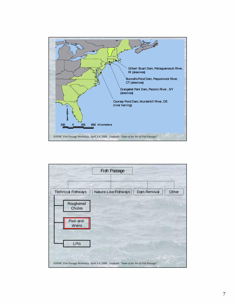
Fish Passage
Technical Fishways Nature-Like Fishways Dam Removal Other
ASFMC Fish Passage Workshop, April 3-4, 2008 Gephard- “State of the Art of Fish Passage”
Fish Passage
Technical Fishways Nature-Like Fishways Dam Removal Other
Roughened Chutes
Pool-and-Weirs
Lifts
3
ASFMC Fish Passage Workshop, April 3-4, 2008 Gephard- “State of the Art of Fish Passage”
SIDE VIEW
END VIEW
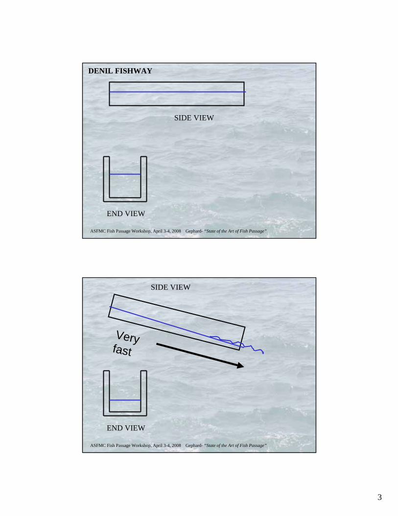
DENIL FISHWAY
ASFMC Fish Passage Workshop, April 3-4, 2008 Gephard- “State of the Art of Fish Passage”
SIDE VIEW
END VIEW
Very fast
4
ASFMC Fish Passage Workshop, April 3-4, 2008 Gephard- “State of the Art of Fish Passage”
SIDE VIEW
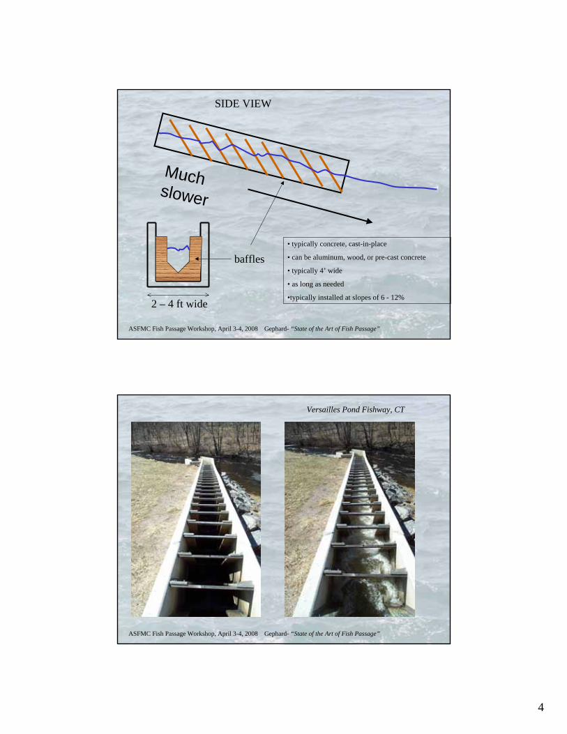
2 – 4 ft wide
Much slower
baffles• typically concrete, cast-in-place
• can be aluminum, wood, or pre-cast concrete
• typically 4’ wide
• as long as needed
•typically installed at slopes of 6 - 12%
ASFMC Fish Passage Workshop, April 3-4, 2008 Gephard- “State of the Art of Fish Passage”
Versailles Pond Fishway, CT
5
ASFMC Fish Passage Workshop, April 3-4, 2008 Gephard- “State of the Art of Fish Passage”
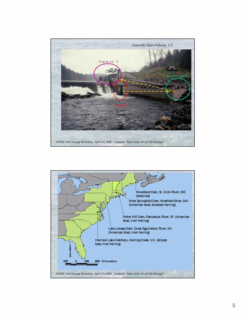
Leesville Dam Fishway, CT
entrance
Turn/resting pool
Trap & exit
ASFMC Fish Passage Workshop, April 3-4, 2008 Gephard- “State of the Art of Fish Passage”
Woodland Dam, St. Croix River, ME (alewives)
Potter Hill Dam, Pawcatuck River, RI (American shad, river herring)
Harrison Lake Hatchery, Herring Creek, VA (striped bass, river herring)
West Springfield Dam, Westfield River, MA (American shad, blueback herring)
Lake Lenape Dam, Great Egg Harbor River, NJ (American shad, river herring)
6
ASFMC Fish Passage Workshop, April 3-4, 2008 Gephard- “State of the Art of Fish Passage”
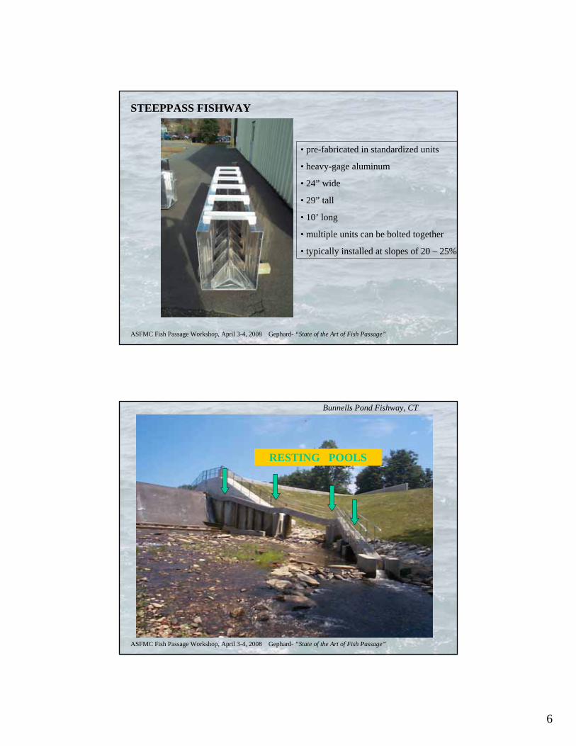
STEEPPASS FISHWAY
• pre-fabricated in standardized units
• heavy-gage aluminum
• 24” wide
• 29” tall
• 10’ long
• multiple units can be bolted together
• typically installed at slopes of 20 – 25%
ASFMC Fish Passage Workshop, April 3-4, 2008 Gephard- “State of the Art of Fish Passage”
Bunnells Pond Fishway, CT
RESTING POOLS
7
ASFMC Fish Passage Workshop, April 3-4, 2008 Gephard- “State of the Art of Fish Passage”
Gilbert Stuart Dam, Pettaquamscutt River, RI (alewives)
Grangebel Park Dam, Peconic River , NY (alewives)
Bunnells Pond Dam, Pequonnock River, CT (alewives)
Coursey Pond Dam, Murderkill River, DE (river herring)
ASFMC Fish Passage Workshop, April 3-4, 2008 Gephard- “State of the Art of Fish Passage”
Fish Passage
Technical Fishways Nature-Like Fishways Dam Removal Other
Roughened Chutes
Pool-and-Weirs
Lifts
8
ASFMC Fish Passage Workshop, April 3-4, 2008 Gephard- “State of the Art of Fish Passage”
pools
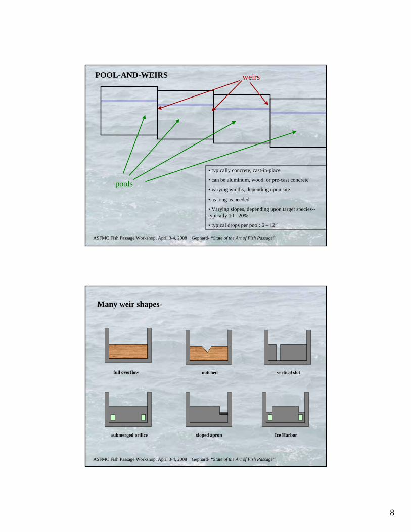
POOL-AND-WEIRS weirs
• typically concrete, cast-in-place
• can be aluminum, wood, or pre-cast concrete
• varying widths, depending upon site
• as long as needed
• Varying slopes, depending upon target species--typically 10 - 20%
• typical drops per pool: 6 – 12”
ASFMC Fish Passage Workshop, April 3-4, 2008 Gephard- “State of the Art of Fish Passage”
Many weir shapes-
full overflow notched vertical slot
submerged orifice sloped apron Ice Harbor
9
ASFMC Fish Passage Workshop, April 3-4, 2008 Gephard- “State of the Art of Fish Passage”
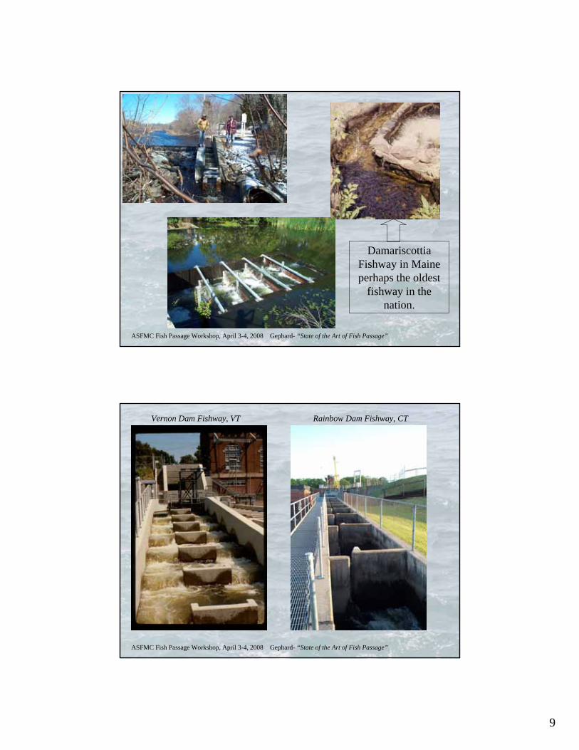
Damariscottia Fishway in Maine perhaps the oldest
fishway in the nation.
ASFMC Fish Passage Workshop, April 3-4, 2008 Gephard- “State of the Art of Fish Passage”
Rainbow Dam Fishway, CTVernon Dam Fishway, VT
10
ASFMC Fish Passage Workshop, April 3-4, 2008 Gephard- “State of the Art of Fish Passage”
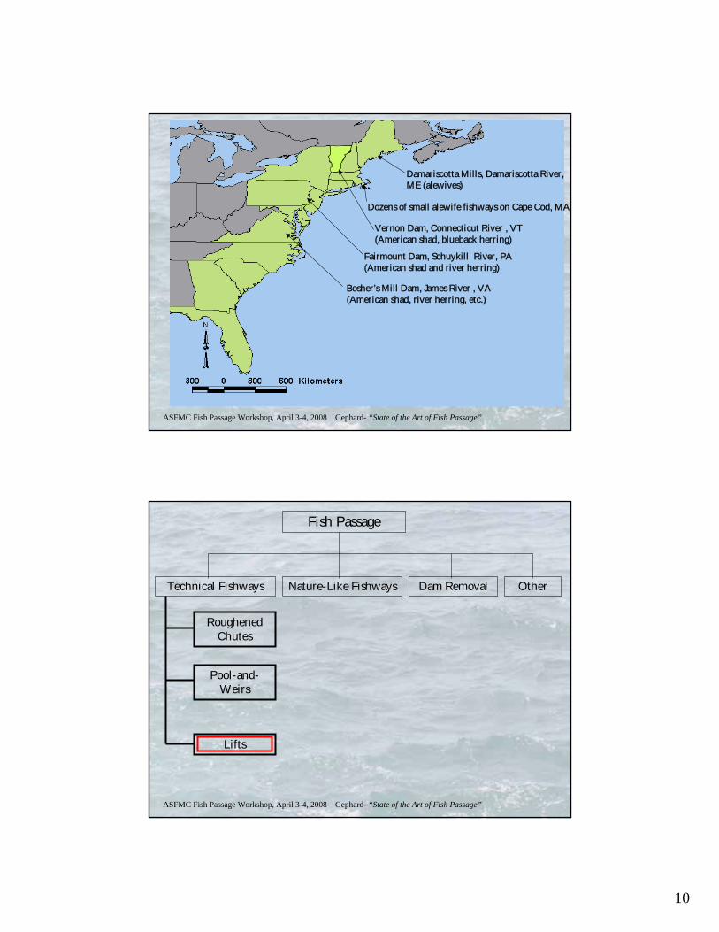
Damariscotta Mills, Damariscotta River, ME (alewives)
Dozens of small alewife fishways on Cape Cod, MA
Vernon Dam, Connecticut River , VT (American shad, blueback herring)
Fairmount Dam, Schuykill River, PA (American shad and river herring)
Bosher’s Mill Dam, James River , VA (American shad, river herring, etc.)
ASFMC Fish Passage Workshop, April 3-4, 2008 Gephard- “State of the Art of Fish Passage”
Fish Passage
Technical Fishways Nature-Like Fishways Dam Removal Other
Roughened Chutes
Pool-and-Weirs
Lifts
11
ASFMC Fish Passage Workshop, April 3-4, 2008 Gephard- “State of the Art of Fish Passage”
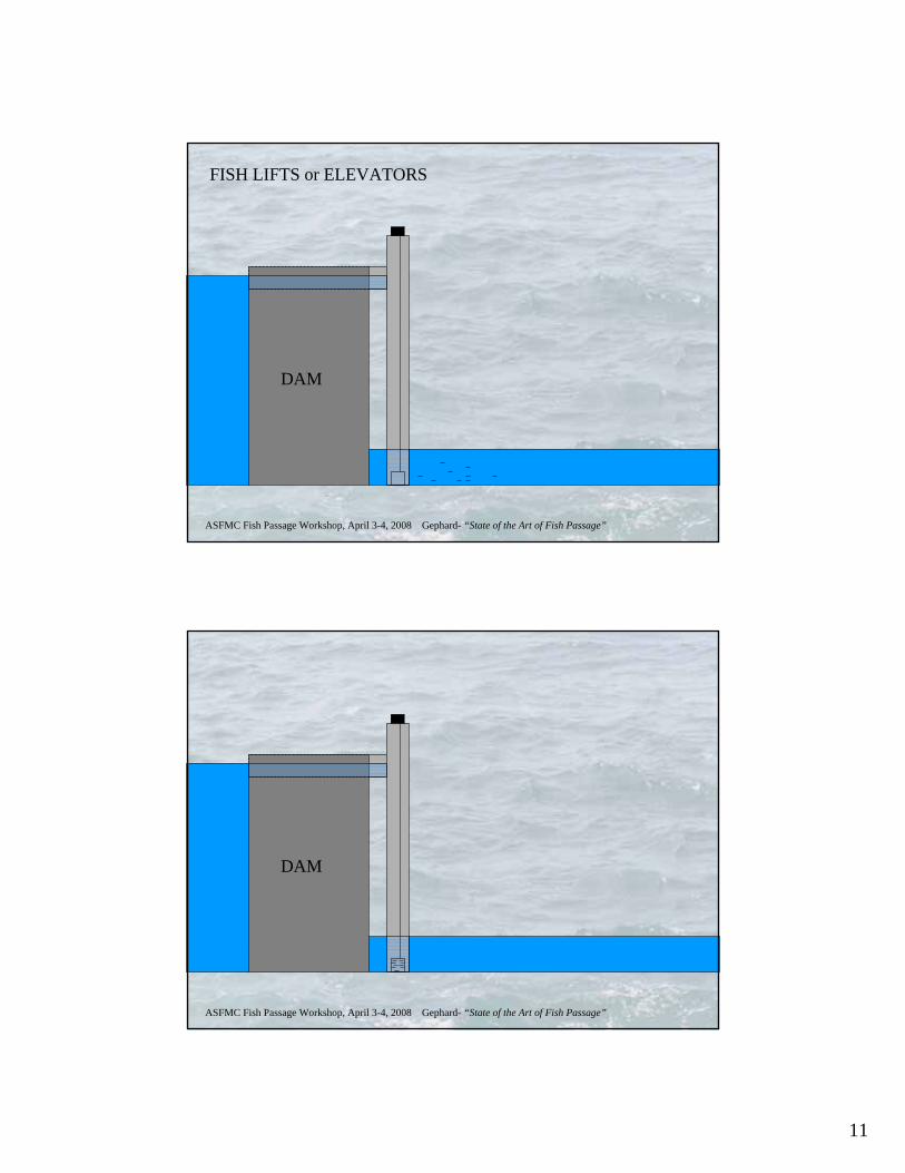
DAM
FISH LIFTS or ELEVATORS
ASFMC Fish Passage Workshop, April 3-4, 2008 Gephard- “State of the Art of Fish Passage”
DAM
12
ASFMC Fish Passage Workshop, April 3-4, 2008 Gephard- “State of the Art of Fish Passage”
DAM
ASFMC Fish Passage Workshop, April 3-4, 2008 Gephard- “State of the Art of Fish Passage”
DAM
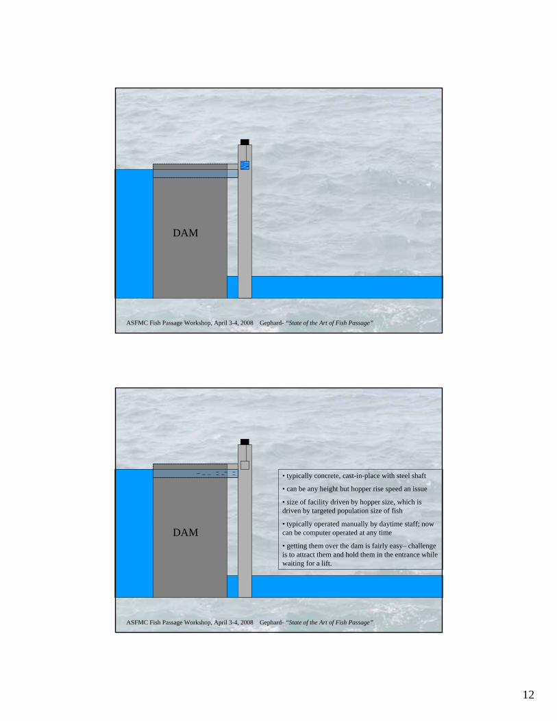
• typically concrete, cast-in-place with steel shaft
• can be any height but hopper rise speed an issue
• size of facility driven by hopper size, which is driven by targeted population size of fish
• typically operated manually by daytime staff; now can be computer operated at any time
• getting them over the dam is fairly easy– challenge is to attract them and hold them in the entrance while waiting for a lift.
13
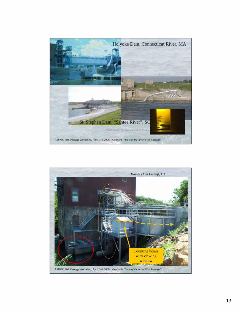
ASFMC Fish Passage Workshop, April 3-4, 2008 Gephard- “State of the Art of Fish Passage”
Holyoke Dam, Connecticut River, MA
St. Stephen Dam, “Santee River”, SCPhotos courtesy of Prescott Brownell, NOAA
ASFMC Fish Passage Workshop, April 3-4, 2008 Gephard- “State of the Art of Fish Passage”
Tunnel Dam Fishlift, CT
Counting house with viewing
window
14
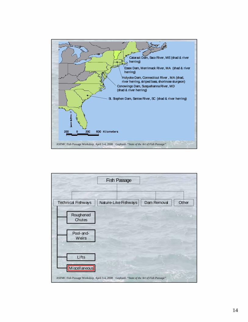
ASFMC Fish Passage Workshop, April 3-4, 2008 Gephard- “State of the Art of Fish Passage”
Cataract Dam, Saco River, ME (shad & river herring)
Essex Dam, Merrimack River, MA (shad & river herring)
Holyoke Dam, Connecticut River , MA (shad, river herring, striped bass, shortnose sturgeon)
Conowingo Dam, Susquehanna River, MD (shad & river herring)
St. Stephen Dam, Santee River, SC (shad & river herring)
ASFMC Fish Passage Workshop, April 3-4, 2008 Gephard- “State of the Art of Fish Passage”
Fish Passage
Technical Fishways Nature-Like Fishways Dam Removal Other
Roughened Chutes
Pool-and-Weirs
Lifts
Miscellaneous
15
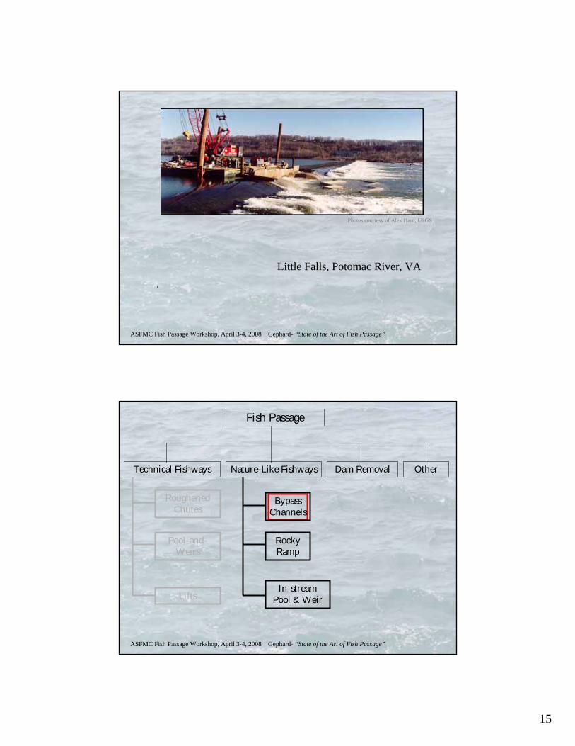
ASFMC Fish Passage Workshop, April 3-4, 2008 Gephard- “State of the Art of Fish Passage”
Little Falls, Potomac River, VA
Photos courtesy of Alex Haro, USGS
ASFMC Fish Passage Workshop, April 3-4, 2008 Gephard- “State of the Art of Fish Passage”
Fish Passage
Technical Fishways Nature-Like Fishways Dam Removal Other
Roughened Chutes
Pool-and-Weirs
Lifts
Bypass Channels
Rocky Ramp
In-stream Pool & Weir
16
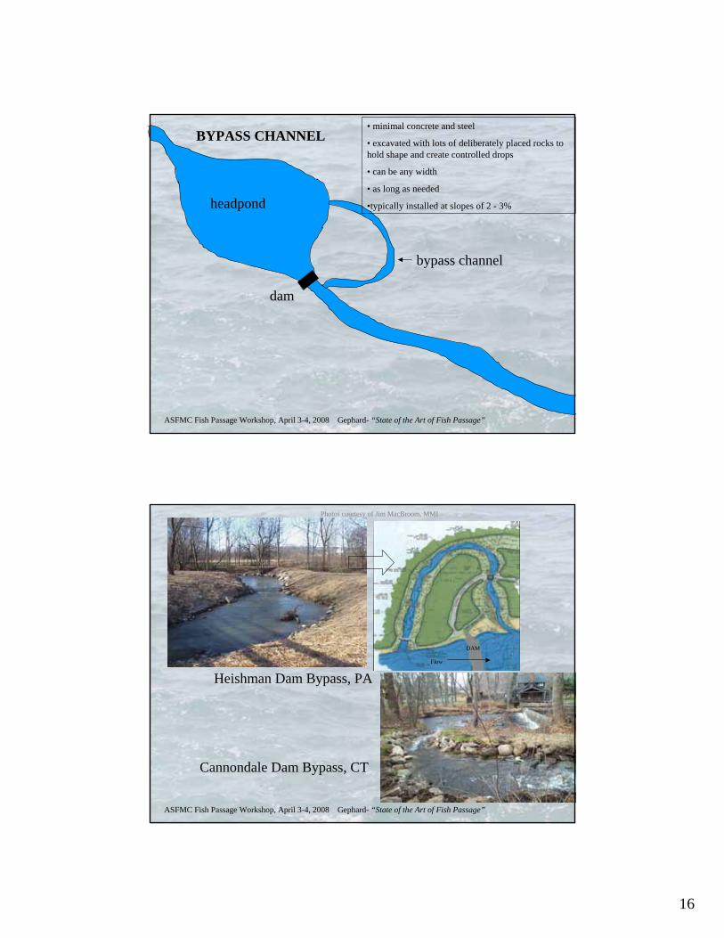
ASFMC Fish Passage Workshop, April 3-4, 2008 Gephard- “State of the Art of Fish Passage”
headpond
dam
bypass channel
BYPASS CHANNEL• minimal concrete and steel
• excavated with lots of deliberately placed rocks to hold shape and create controlled drops
• can be any width
• as long as needed
•typically installed at slopes of 2 - 3%
ASFMC Fish Passage Workshop, April 3-4, 2008 Gephard- “State of the Art of Fish Passage”
Heishman Dam Bypass, PA
Cannondale Dam Bypass, CT
DAM
Flow
Photos courtesy of Jim MacBroom, MMI
17
ASFMC Fish Passage Workshop, April 3-4, 2008 Gephard- “State of the Art of Fish Passage”
Fish Passage
Technical Fishways Nature-Like Fishways Dam Removal Other
Roughened Chutes
Pool-and-Weirs
Lifts
Bypass Channels
Rocky Ramp
In-stream Pool & Weir
ASFMC Fish Passage Workshop, April 3-4, 2008 Gephard- “State of the Art of Fish Passage”
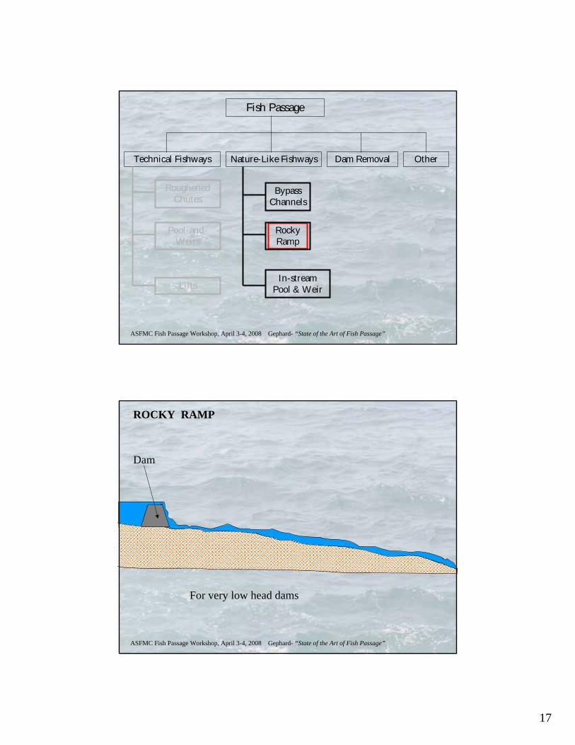
Dam
ROCKY RAMP
For very low head dams
18
ASFMC Fish Passage Workshop, April 3-4, 2008 Gephard- “State of the Art of Fish Passage”
DamRocky ramp
The slope of the ramp is typically 1 to 20 or 1 to 30.
• typically all rock
• ideally ungrouted but some grouting can be done
• typically full-stream width
• as long as needed to achieve proper slope
•typically installed at slopes of 2 - 3%
• if in a large river, requires LOTS of rock placement
ASFMC Fish Passage Workshop, April 3-4, 2008 Gephard- “State of the Art of Fish Passage”
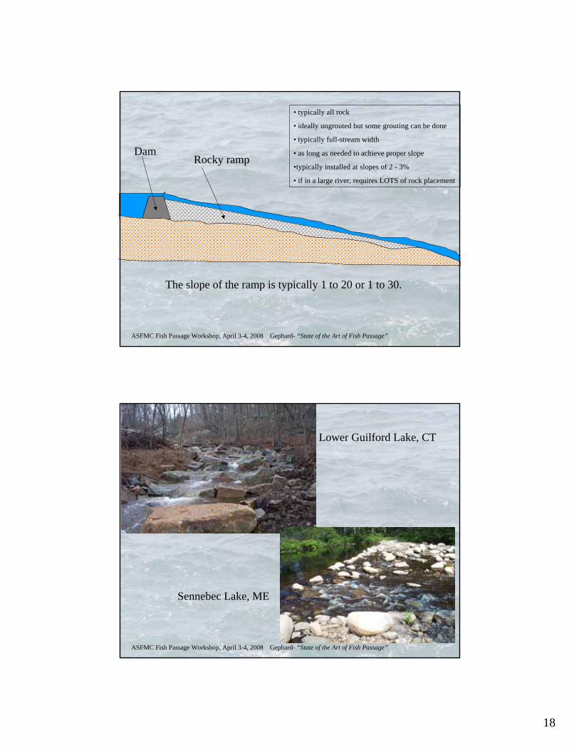
Lower Guilford Lake, CT
Sennebec Lake, ME
19
ASFMC Fish Passage Workshop, April 3-4, 2008 Gephard- “State of the Art of Fish Passage”
Fish Passage
Technical Fishways Nature-Like Fishways Dam Removal Other
Roughened Chutes
Pool-and-Weirs
Lifts
Bypass Channels
Rocky Ramp
In-stream Pool & Weir
ASFMC Fish Passage Workshop, April 3-4, 2008 Gephard- “State of the Art of Fish Passage”
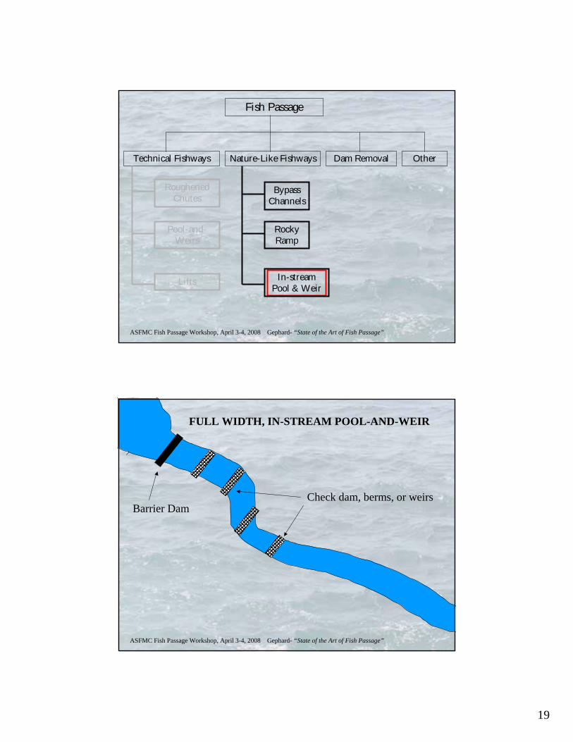
FULL WIDTH, IN-STREAM POOL-AND-WEIR
Check dam, berms, or weirsBarrier Dam
20
ASFMC Fish Passage Workshop, April 3-4, 2008 Gephard- “State of the Art of Fish Passage”
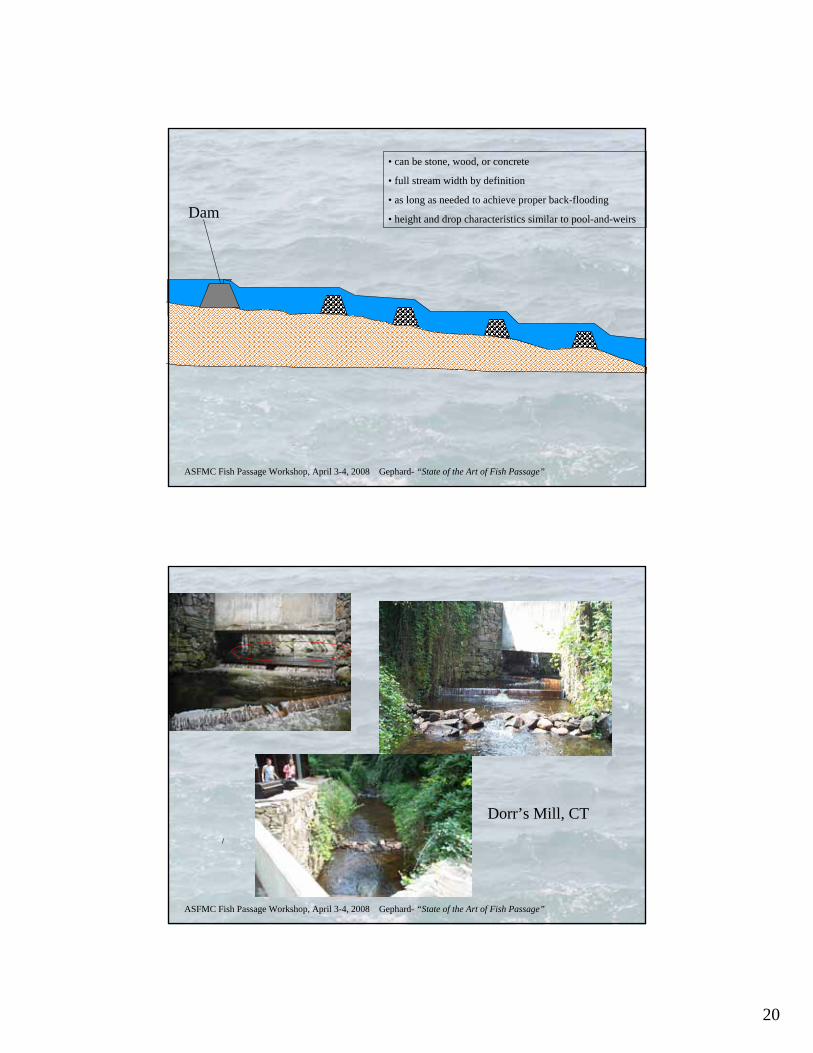
Dam
• can be stone, wood, or concrete
• full stream width by definition
• as long as needed to achieve proper back-flooding
• height and drop characteristics similar to pool-and-weirs
ASFMC Fish Passage Workshop, April 3-4, 2008 Gephard- “State of the Art of Fish Passage”
Dorr’s Mill, CT
21
ASFMC Fish Passage Workshop, April 3-4, 2008 Gephard- “State of the Art of Fish Passage”
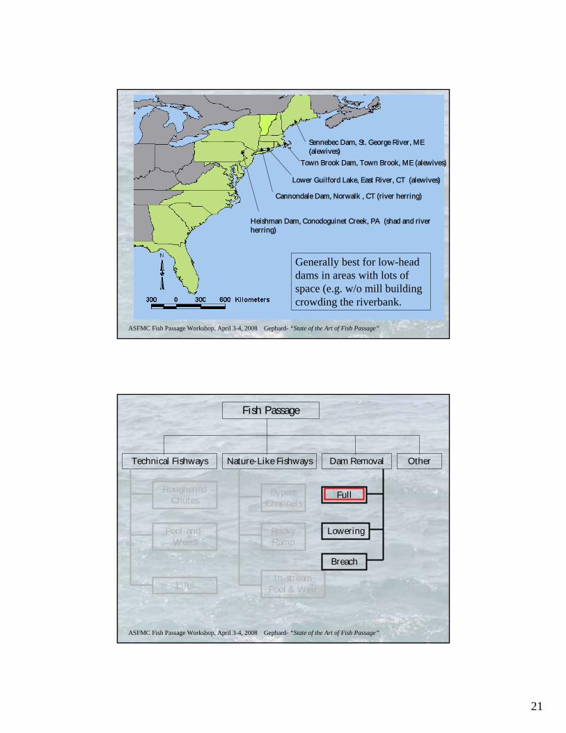
Sennebec Dam, St. George River, ME (alewives)
Town Brook Dam, Town Brook, ME (alewives)
Lower Guilford Lake, East River, CT (alewives)
Cannondale Dam, Norwalk , CT (river herring)
Heishman Dam, Conodoguinet Creek, PA (shad and river herring)
Generally best for low-head dams in areas with lots of space (e.g. w/o mill building crowding the riverbank.
ASFMC Fish Passage Workshop, April 3-4, 2008 Gephard- “State of the Art of Fish Passage”
Fish Passage
Technical Fishways Nature-Like Fishways Dam Removal Other
Roughened Chutes
Pool-and-Weirs
Lifts
Bypass Channels
Rocky Ramp
In-stream Pool & Weir
Full
Lowering
Breach
22
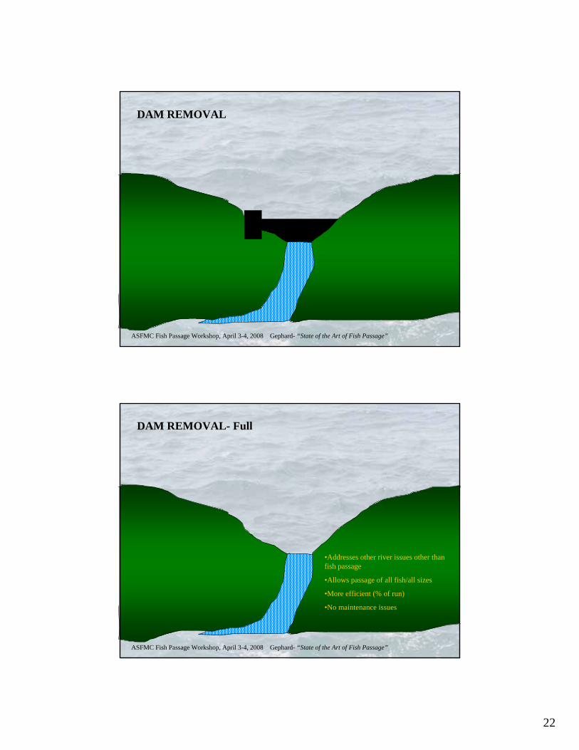
ASFMC Fish Passage Workshop, April 3-4, 2008 Gephard- “State of the Art of Fish Passage”
DAM REMOVAL
ASFMC Fish Passage Workshop, April 3-4, 2008 Gephard- “State of the Art of Fish Passage”
DAM REMOVAL- Full
•Addresses other river issues other than fish passage
•Allows passage of all fish/all sizes
•More efficient (% of run)
•No maintenance issues
23
ASFMC Fish Passage Workshop, April 3-4, 2008 Gephard- “State of the Art of Fish Passage”
Fish Passage
Technical Fishways Nature-Like Fishways Dam Removal Other
Roughened Chutes
Pool-and-Weirs
Lifts
Bypass Channels
Rocky Ramp
In-stream Pool & Weir
Full
Lowering
Breach
ASFMC Fish Passage Workshop, April 3-4, 2008 Gephard- “State of the Art of Fish Passage”
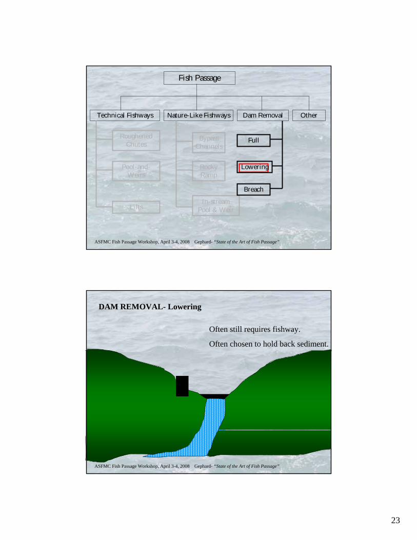
DAM REMOVAL- Lowering
Often still requires fishway.
Often chosen to hold back sediment.

24
ASFMC Fish Passage Workshop, April 3-4, 2008 Gephard- “State of the Art of Fish Passage”
Fish Passage
Technical Fishways Nature-Like Fishways Dam Removal Other
Roughened Chutes
Pool-and-Weirs
Lifts
Bypass Channels
Rocky Ramp
In-stream Pool & Weir
Full
Lowering
Breach
ASFMC Fish Passage Workshop, April 3-4, 2008 Gephard- “State of the Art of Fish Passage”
DAM REMOVAL- breach
To preserve historical resources?

25
ASFMC Fish Passage Workshop, April 3-4, 2008 Gephard- “State of the Art of Fish Passage”Photos courtesy of Laura Wildman, American Rivers
ASFMC Fish Passage Workshop, April 3-4, 2008 Gephard- “State of the Art of Fish Passage”
Edwards Dam, Kennebec River, ME (shad, river herring, striped bass, sturgeon)
Naugatuck River dams (7), Naugatuck River, CT (shad, river herring)
Delaware River watershed (who’s counting?), PA (shad, river herring)
Embry Dam, Rappahannock River, VA (shad, river herring, striped bass)
Quaker Neck Dam, Neuse River, NC (shad, river herring, striped bass, sturgeon)
26
ASFMC Fish Passage Workshop, April 3-4, 2008 Gephard- “State of the Art of Fish Passage”
Fish Passage
Technical Fishways Nature-Like Fishways Dam Removal Other
Roughened Chutes
Pool-and-Weirs
Lifts
Bypass Channels
Rocky Ramp
In-stream Pool & Weir
Full
Lowering
Breach
Locks
Catch & Toss
Trap & Truck
Downstream & Eel
ASFMC Fish Passage Workshop, April 3-4, 2008 Gephard- “State of the Art of Fish Passage”
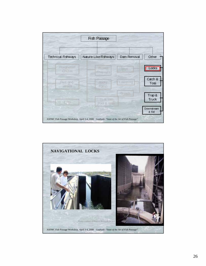
NAVIGATIONAL LOCKS
Photos courtesy of Prescott Brownell, NOAA
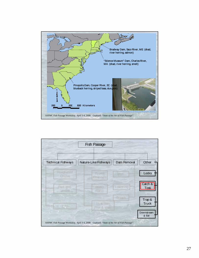
27
ASFMC Fish Passage Workshop, April 3-4, 2008 Gephard- “State of the Art of Fish Passage”
Pinopolis Dam, Cooper River, SC (shad, blueback herring, striped bass, sturgeon)
Bradway Dam, Saco River, ME (shad, river herring, salmon)
“Science Museum” Dam, Charles River, MA (shad, river herring, smelt)
Photo courtesy of Prescott Brownell, NOAA
ASFMC Fish Passage Workshop, April 3-4, 2008 Gephard- “State of the Art of Fish Passage”
Fish Passage
Technical Fishways Nature-Like Fishways Dam Removal Other
Roughened Chutes
Pool-and-Weirs
Lifts
Bypass Channels
Rocky Ramp
In-stream Pool & Weir
Full
Lowering
Breach
Locks
Catch & Toss
Trap & Truck
Downstream & Eel
28
ASFMC Fish Passage Workshop, April 3-4, 2008 Gephard- “State of the Art of Fish Passage”
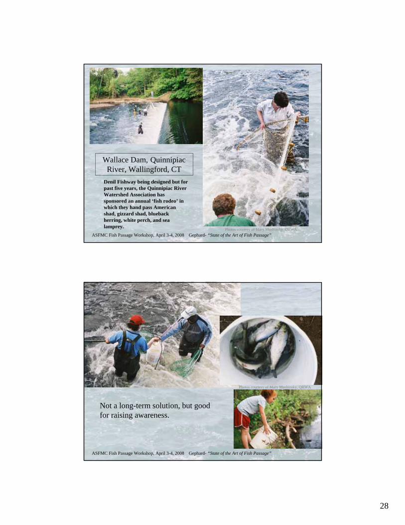
Wallace Dam, Quinnipiac River, Wallingford, CT
Denil Fishway being designed but for past five years, the Quinnipiac River Watershed Association has sponsored an annual ‘fish rodeo’ in which they hand pass American shad, gizzard shad, blueback herring, white perch, and sea lamprey. Photos courtesy of Mary Mushinsky, QRWA
ASFMC Fish Passage Workshop, April 3-4, 2008 Gephard- “State of the Art of Fish Passage”
Not a long-term solution, but good for raising awareness.
Photos courtesy of Mary Mushinsky, QRWA
29
ASFMC Fish Passage Workshop, April 3-4, 2008 Gephard- “State of the Art of Fish Passage”
Fish Passage
Technical Fishways Nature-Like Fishways Dam Removal Other
Roughened Chutes
Pool-and-Weirs
Lifts
Bypass Channels
Rocky Ramp
In-stream Pool & Weir
Full
Lowering
Breach
Locks
Catch & Toss
Trap & Truck
Downstream & Eel
ASFMC Fish Passage Workshop, April 3-4, 2008 Gephard- “State of the Art of Fish Passage”
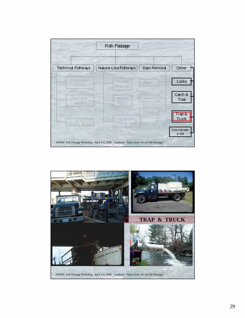
TRAP & TRUCK

30
ASFMC Fish Passage Workshop, April 3-4, 2008 Gephard- “State of the Art of Fish Passage”
PROBLEMS WITH TRAP & TRUCK
• Interrupted & unnatural migration- additional delays inevitable.
• greater potential for injury and post-handling losses (mortality & drop out of system)
• tends to be species-specific
• relies heavily on human interactions– what happens when trucks break down, etc.?
• typically requires a fishway or trap to collect fish
• may return fish to river from which it did not originate– confuse homing mechanism.
DAM WITH FISHWAY &
TRAP
DAM WITHOUT FISHWAY
DAM WITHOUT FISHWAY
Fish returning to trap were hatched hereWhere to you dump fish? After 1 generation, you could release fish from stream 1 into stream 2, causing dropback and no passage.
Stream 1
Stream 2
ASFMC Fish Passage Workshop, April 3-4, 2008 Gephard- “State of the Art of Fish Passage”
DOWNSTREAM PASSAGE
• Passage is needed for juveniles as well as spent adults
• Some fish will come down fishways designed for upstream passage
• Many will not– particularly if there is competing water use, e.g. hydro
• Going over the spillway may be okay– but if the dam is tall, fish may get injured
• Most East Coast downstream passage devices have been some type of surface collection/spill
• Most effective for salmon, shad, and river herring
• Least effective to sturgeon and eel
• More research is needed

31
ASFMC Fish Passage Workshop, April 3-4, 2008 Gephard- “State of the Art of Fish Passage”
(1) Illuminated opening near turbine intakes (gate opens downward)(2) Flows enters sloped pipe that bypasses powerhouse
(3) Pipe discharges into tailwater
ASFMC Fish Passage Workshop, April 3-4, 2008 Gephard- “State of the Art of Fish Passage”
EEL PASSAGE (Upstream)
• Some dams are surmounted by many eels; the ability for eels to get over dams varies widely among dams
•Passage is needed for juveniles– the size of the fish depends on the location in the watershed
• Some eels will use other fishways– esp. nature-like and some pool-and-weirs
• Ideal attraction conditions for eels are different than for shad etc. so even if the fishway is passable to eels, many may not find or enter it
• In most cases, a separate, specially-designed eel pass will be beneficial
• Most eel passes can be quite inexpensive
•Eel passes can also trap Y-O-Y and serve as ASMFC monitoring site
Photos courtesy of Lorenz Photography
32
ASFMC Fish Passage Workshop, April 3-4, 2008 Gephard- “State of the Art of Fish Passage”
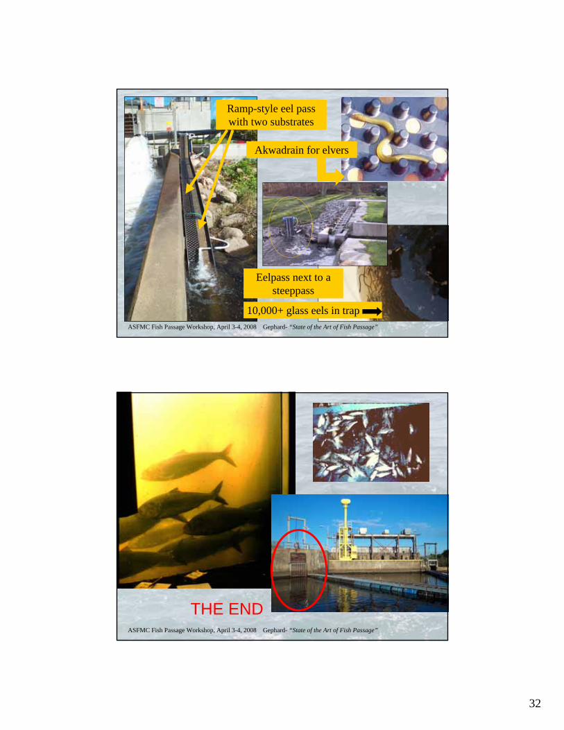
Ramp-style eel pass with two substrates
Akwadrain for elvers
Eelpass next to a steeppass
10,000+ glass eels in trap
ASFMC Fish Passage Workshop, April 3-4, 2008 Gephard- “State of the Art of Fish Passage”
THE END

1
Passage Concerns for Striped BassR.Wilson Laney, Prescott Brownell, Nichola Meserve
With assistance from Alex Haro, Steve Gephard, and Pace Wilber
Atlantic States Marine Fisheries CommissionFish Passage Workshop
April 3, 2008, Jacksonville, Florida[Photo by Matt Breece, U.S. Fish and Wildlife Service]
Presentation Outline• Striped Bass Restoration: How to Define?• Migratory and “Less” Migratory Stripers• Atlantic Migratory Striped Bass: ME-NC• “Less” Migratory Striped Bass: SC-FL• Available Passage Technologies• What Works, What Doesn’t• Existing Projects and Facilities• Challenges
2
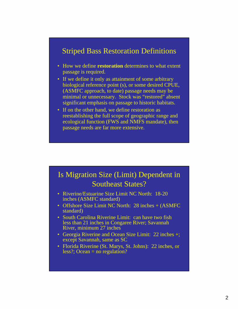
Striped Bass Restoration Definitions
• How we define restoration determines to what extent passage is required.
• If we define it only as attainment of some arbitrary biological reference point (s), or some desired CPUE, (ASMFC approach, to date) passage needs may be minimal or unnecessary. Stock was “restored” absent significant emphasis on passage to historic habitats.
• If on the other hand, we define restoration as reestablishing the full scope of geographic range and ecological function (FWS and NMFS mandate), then passage needs are far more extensive.
Is Migration Size (Limit) Dependent in Southeast States?
• Riverine/Estuarine Size Limit NC North: 18-20 inches (ASMFC standard)
• Offshore Size Limit NC North: 28 inches + (ASMFC standard)
• South Carolina Riverine Limit: can have two fish less than 21 inches in Congaree River; Savannah River, minimum 27 inches
• Georgia Riverine and Ocean Size Limit: 22 inches +; except Savannah, same as SC
• Florida Riverine (St. Marys, St. Johns): 22 inches, or less?; Ocean = no regulation?
3
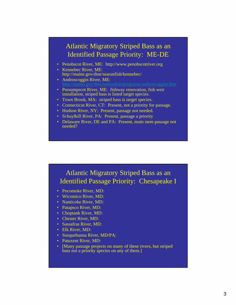
Atlantic Migratory Striped Bass as an Identified Passage Priority: ME-DE
• Penobscot River, ME: http://www.penobscotriver.org• Kennebec River, ME:
http://maine.gov/dmr/searunfish/kennebec/• Androscoggin River, ME:
http://maine.gov/dmr/searunfish/programs/androscoggiin.htm• Presumpscot River, ME: fishway renovation, fish weir
installation, striped bass is listed target species.• Town Brook, MA: striped bass is target species.• Connecticut River, CT: Present, not a priority for passage. • Hudson River, NY: Present, passage not needed.• Schuylkill River, PA: Present, passage a priority • Delaware River, DE and PA: Present, main stem passage not
needed?
Atlantic Migratory Striped Bass as an Identified Passage Priority: Chesapeake I
• Pocomoke River, MD:• Wicomico River, MD:• Nanticoke River, MD:• Patapsco River, MD:• Choptank River, MD:• Chester River, MD:• Sassafras River, MD:• Elk River, MD:• Susquehanna River, MD/PA:• Patuxent River, MD:• [Many passage projects on many of these rivers, but striped
bass not a priority species on any of them.]

4
Atlantic Migratory Striped Bass as an Identified Passage Priority: Chesapeake II
• Potomac River, VA/MD: done, striped bass a target species.
• Rappahannock River, VA: done, striped bass a priority species.
• Mattaponi River (York), VA: present, none needed?• Pamunkey River (York), VA: present, none needed?• York River, VA: present, none needed?• Chickahominy River (James), VA: done, striped bass
using it, Walker’s Dam double Denil fishway• James River, VA: many projects done, striped bass
benefitting
Atlantic Migratory Striped Bass as an Identified Passage Priority: Albemarle
• Blackwater River (Chowan), VA: unknown• Meherrin River (Chowan), VA: lift on
Emporia Reservoir, striped bass not a target• Nottoway River (Chowan), VA: unknown• Chowan River, NC/VA: Present, passage not
needed.• Roanoke River, NC/VA: Present, passage not
a priority.
5
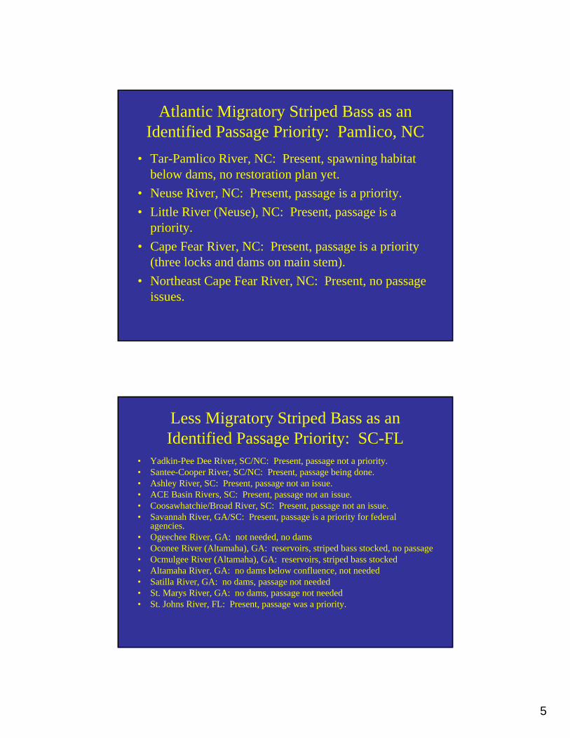
Atlantic Migratory Striped Bass as an Identified Passage Priority: Pamlico, NC
• Tar-Pamlico River, NC: Present, spawning habitat below dams, no restoration plan yet.
• Neuse River, NC: Present, passage is a priority.• Little River (Neuse), NC: Present, passage is a
priority.• Cape Fear River, NC: Present, passage is a priority
(three locks and dams on main stem).• Northeast Cape Fear River, NC: Present, no passage
issues.
Less Migratory Striped Bass as an Identified Passage Priority: SC-FL
• Yadkin-Pee Dee River, SC/NC: Present, passage not a priority.• Santee-Cooper River, SC/NC: Present, passage being done.• Ashley River, SC: Present, passage not an issue.• ACE Basin Rivers, SC: Present, passage not an issue.• Coosawhatchie/Broad River, SC: Present, passage not an issue.• Savannah River, GA/SC: Present, passage is a priority for federal
agencies.• Ogeechee River, GA: not needed, no dams• Oconee River (Altamaha), GA: reservoirs, striped bass stocked, no passage• Ocmulgee River (Altamaha), GA: reservoirs, striped bass stocked• Altamaha River, GA: no dams below confluence, not needed • Satilla River, GA: no dams, passage not needed• St. Marys River, GA: no dams, passage not needed• St. Johns River, FL: Present, passage was a priority.

6
Percent of Rivers with Striped Bass as Priority Species for Passage
• 50 Rivers and/or Streams Surveyed• Striped Bass a Priority Species in 15 (30 %)• Striped Bass not Priority in 32 (64%)• But, some systems (n = 13) don’t have any
passage issues at present, so if we delete those, then percentages are 41 where striped bass is a target species, and 59 where it isn’t.
Available Passage Technologies:Qualitative Ranking Criteria
• Opening Size (the bigger, the better)• Mechanical Complexity (simple is better)• Operations and Maintenance Costs (low long-
term cost is better)• Safe (least stressful is better)• Effectiveness (no data to assess this one)
7
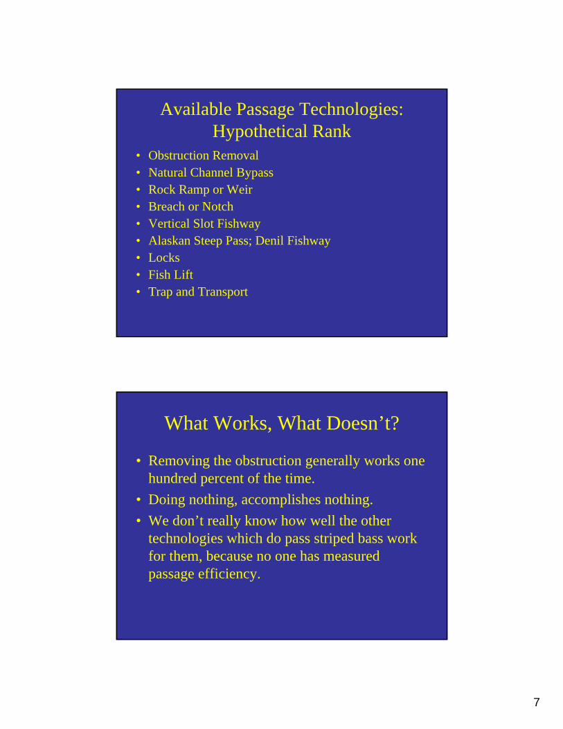
Available Passage Technologies:Hypothetical Rank
• Obstruction Removal• Natural Channel Bypass• Rock Ramp or Weir• Breach or Notch• Vertical Slot Fishway• Alaskan Steep Pass; Denil Fishway• Locks• Fish Lift• Trap and Transport
What Works, What Doesn’t?
• Removing the obstruction generally works one hundred percent of the time.
• Doing nothing, accomplishes nothing.• We don’t really know how well the other
technologies which do pass striped bass work for them, because no one has measured passage efficiency.
8
Facilities Passing Stripers• Lockwood Dam Lift, Kennebec River, ME• Brunswick Dam Fishway, Androscoggin, ME• Fairmount Dam, Vertical Slot Fishway, Schuylkill
River, PA• Conowingo Dam East Facility, Susquehanna, MD• Conowingo Dam West Fish Lift, Susquehanna, MD• Cape Fear River Locks and Dams, NC• St. Stephens Fish Life, Santee River, SC?• Pinopolis Lock, Cooper River, SC?
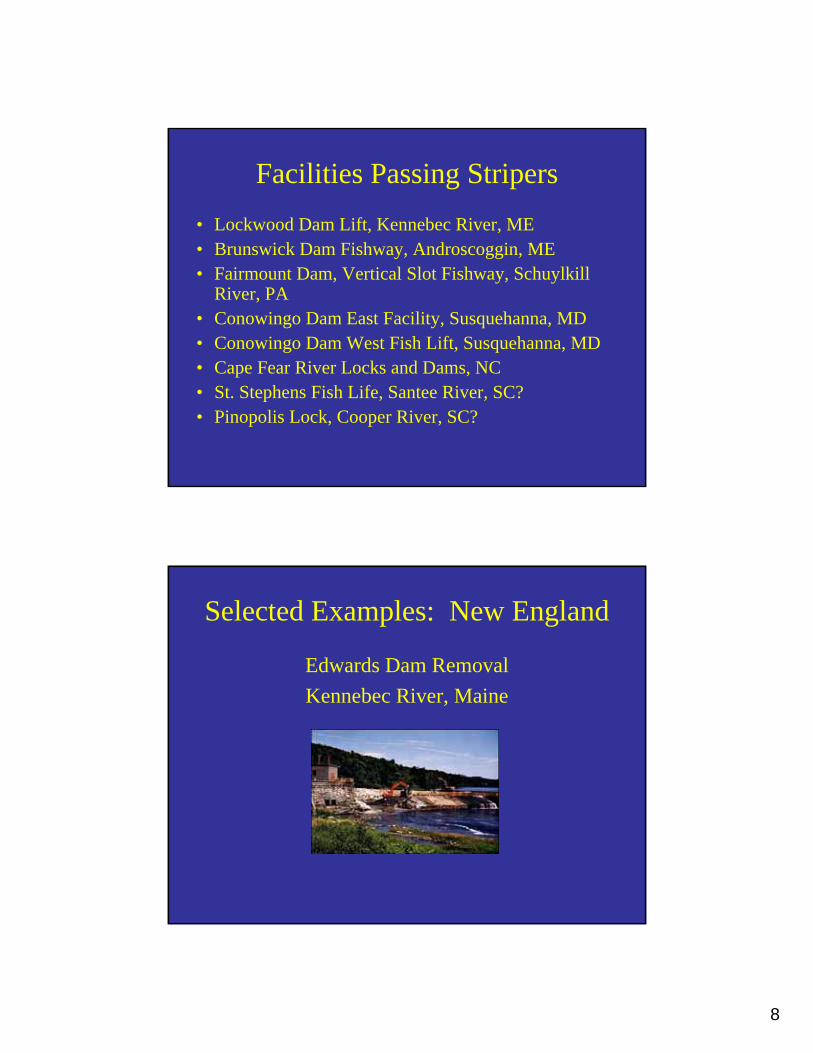
Selected Examples: New England
Edwards Dam RemovalKennebec River, Maine
9
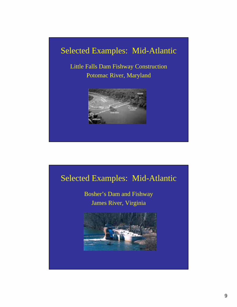
Selected Examples: Mid-Atlantic
Little Falls Dam Fishway ConstructionPotomac River, Maryland
Selected Examples: Mid-Atlantic
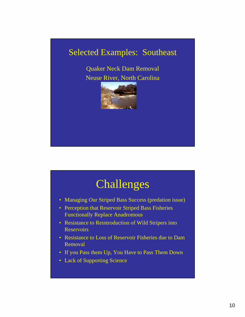
Bosher’s Dam and FishwayJames River, Virginia
10
Selected Examples: Southeast
Quaker Neck Dam RemovalNeuse River, North Carolina
Challenges• Managing Our Striped Bass Success (predation issue)• Perception that Reservoir Striped Bass Fisheries
Functionally Replace Anadromous• Resistance to Reintroduction of Wild Stripers into
Reservoirs• Resistance to Loss of Reservoir Fisheries due to Dam
Removal• If you Pass them Up, You Have to Pass Them Down• Lack of Supporting Science
11
Comments/Questions??
John Christian with new New Jersey state record striped bass, Mays Landing, Great Egg Harbor
River, April 26, 2002
1
Passage Technologies for Shad, River Herring, Sturgeon, and EelAlex HaroS.O. Conte Anadromous Fish Research LaboratoryU.S. Geological Survey – Biological Resources DisciplineTurners Falls, Massachusetts
ASMFC Fish Passage WorkshopJacksonville, Florida April 3-4
WARNINGThis presentation may contain
Yankee geographic bias and ivory tower overgeneralizations
2
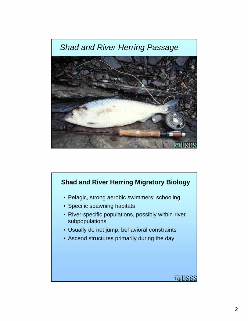
Shad and River Herring Passage
• Pelagic, strong aerobic swimmers; schooling• Specific spawning habitats• River-specific populations, possibly within-river
subpopulations• Usually do not jump; behavioral constraints • Ascend structures primarily during the day
Shad and River Herring Migratory Biology
3
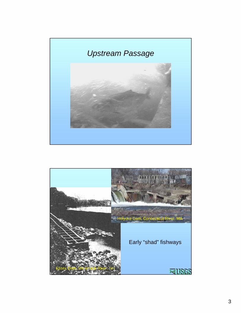
Upstream Passage
Early “shad” fishways
Essex Dam, Merrimack River, NH
Holyoke Dam, Connecticut River, MA
4
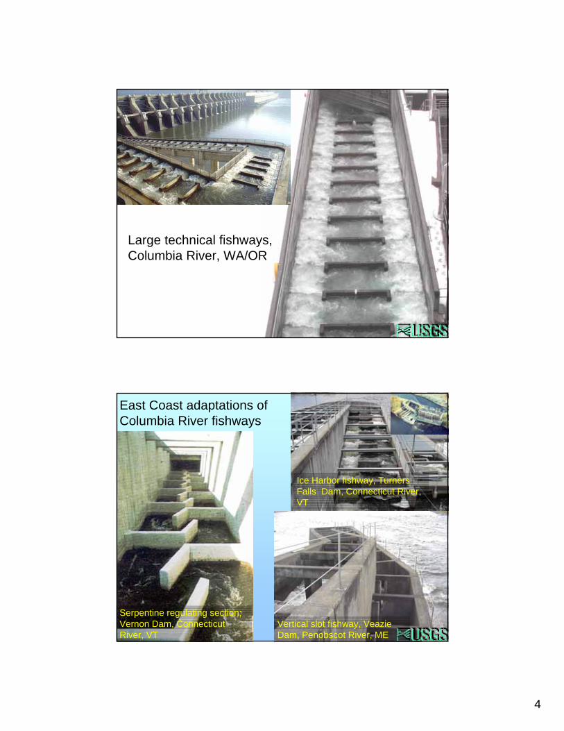
Large technical fishways,Columbia River, WA/OR
East Coast adaptations of Columbia River fishways
Serpentine regulating section; Vernon Dam, Connecticut River, VT
Ice Harbor fishway, Turners Falls Dam, Connecticut River, VT
Vertical slot fishway, VeazieDam, Penobscot River, ME
5
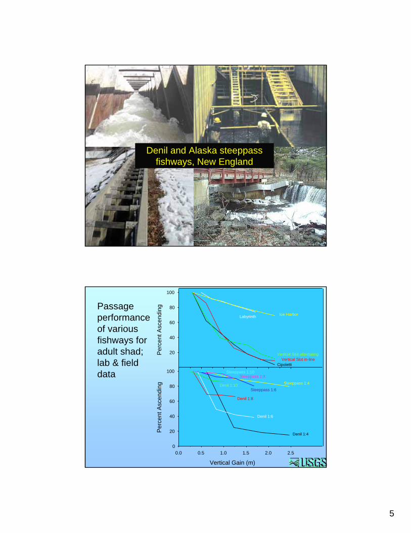
Denil and Alaska steeppassfishways, New England
Per
cent
Asc
endi
ng
20
40
60
80
100
Vertical Gain (m)
0.0 0.5 1.0 1.5 2.0 2.5
Per
cent
Asc
endi
ng
0
20
40
60
80
100Cipoletti
Vertical Slot in-lineVertical Slot alternating
Labyrinth Ice Harbor
1:10 Pool & Weir Fishways
Denil-type Fishways
Steeppass 1:10
Steeppass 1:4Steeppass 1:6
Steeppass 1:8
Denil 1:10
Denil 1:8
Denil 1:6
Denil 1:4
Passage performance of various fishways for adult shad; lab & field data
6
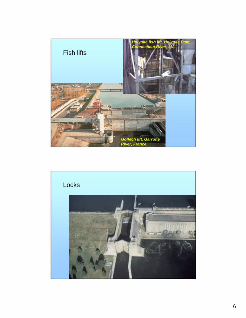
Golfech lift, GarroneRiver, France
Holyoke fish lift, Holyoke Dam, Connecticut River, MA
Fish lifts
Locks
7
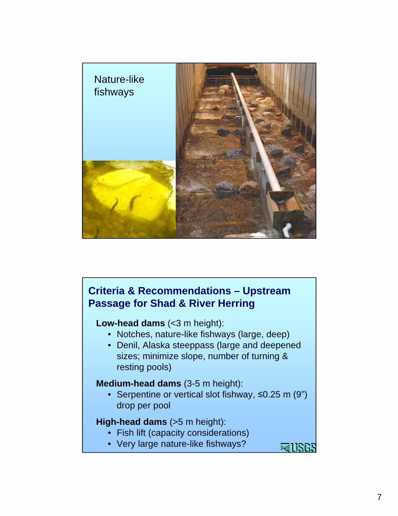
Nature-like fishways
Low-head dams (<3 m height): • Notches, nature-like fishways (large, deep)• Denil, Alaska steeppass (large and deepened
sizes; minimize slope, number of turning & resting pools)
Medium-head dams (3-5 m height): • Serpentine or vertical slot fishway, ≤0.25 m (9”)
drop per pool
High-head dams (>5 m height): • Fish lift (capacity considerations)• Very large nature-like fishways?
Criteria & Recommendations – Upstream Passage for Shad & River Herring
8
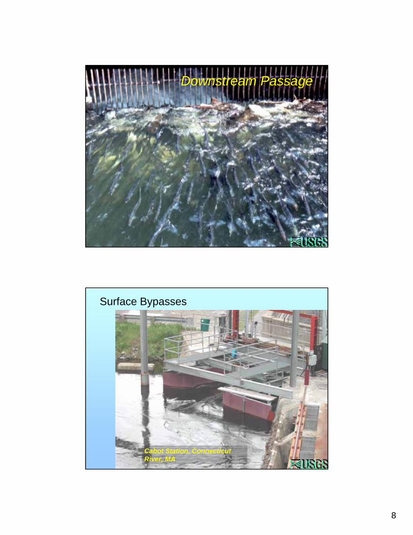
Downstream Passage
Cabot Station, Connecticut River, MA
Surface Bypasses
9
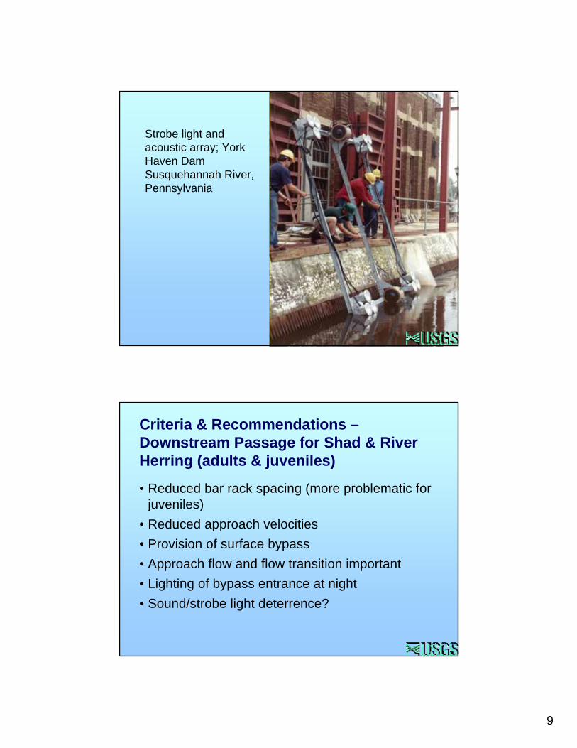
Strobe light and acoustic array; York Haven Dam Susquehannah River, Pennsylvania
• Reduced bar rack spacing (more problematic for juveniles)
• Reduced approach velocities• Provision of surface bypass• Approach flow and flow transition important• Lighting of bypass entrance at night• Sound/strobe light deterrence?
Criteria & Recommendations –Downstream Passage for Shad & River Herring (adults & juveniles)
10
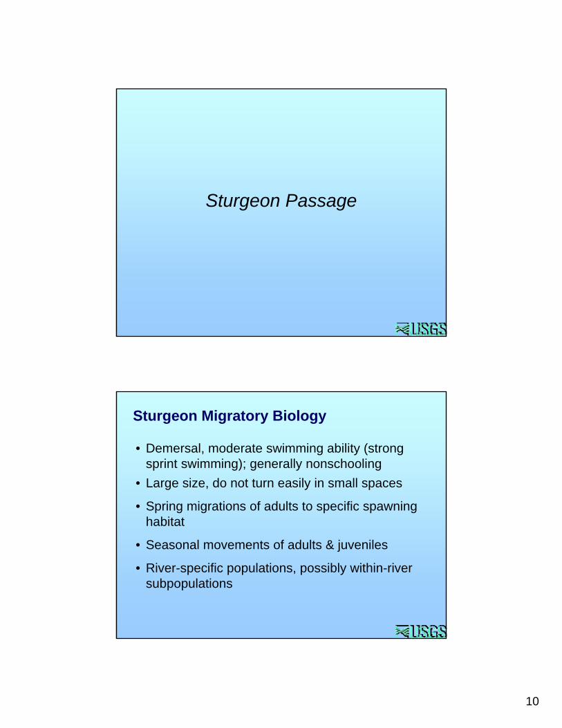
Sturgeon Passage
• Demersal, moderate swimming ability (strong sprint swimming); generally nonschooling
• Large size, do not turn easily in small spaces
• Spring migrations of adults to specific spawning habitat
• Seasonal movements of adults & juveniles
• River-specific populations, possibly within-river subpopulations
Sturgeon Migratory Biology

11
Early attempts with fish locks (Columbia River)
White & Mefford 2002~75 cm shovelnose sturgeon in vertical slot & NLF designs
• Vertical slot prototypes 1.7 m (5.5 ft) wide, 2% slope• 3.7 to 10 cm drop per pool (0.12 to 0.33 ft)• Slot velocities 0.76 to 1.2 m/sec (2.5 to 3.8 ft/sec)• Overall passage in vertical slot prototypes poor• Good passage in NLF
FWS Hell’s Gate Vertical Slot
Chevron Dual Vertical Slot
Nature-Like Fishway; 2% slope

12
• Fishway attraction velocity 2 to 4 ft/s. • Flow depths of about 4 ft or more • Attraction flow should provide a uniform transition
between the fishway and the downstream river flow.
• Fishway flow velocities of between 3.0 to 4.0 ft/s• Substrate, boundary layer may be important
White & Mefford 2002 Recommendations
Experimental side baffle (spiral) fishway• 1:25 slope• Velocities 3-5 ft/sec
13
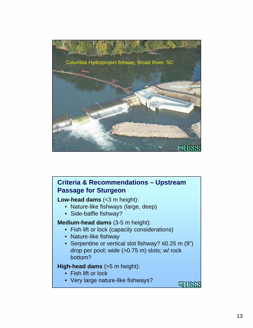
Columbia Hydroproject fishway, Broad River, SC
Low-head dams (<3 m height): • Nature-like fishways (large, deep)• Side-baffle fishway?
Medium-head dams (3-5 m height): • Fish lift or lock (capacity considerations)• Nature-like fishway• Serpentine or vertical slot fishway? ≤0.25 m (9”)
drop per pool; wide (>0.75 m) slots; w/ rock bottom?
High-head dams (>5 m height): • Fish lift or lock• Very large nature-like fishways?
Criteria & Recommendations – Upstream Passage for Sturgeon
14
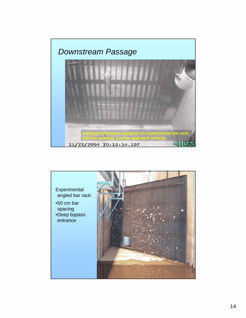
Downstream Passage
Impinged shortnose sturgeon on experimental bar rack; 100 mm spacing, 1 m/sec approach velocity
Experimental angled bar rack:
•50 cm bar spacing
•Deep bypass entrance
15
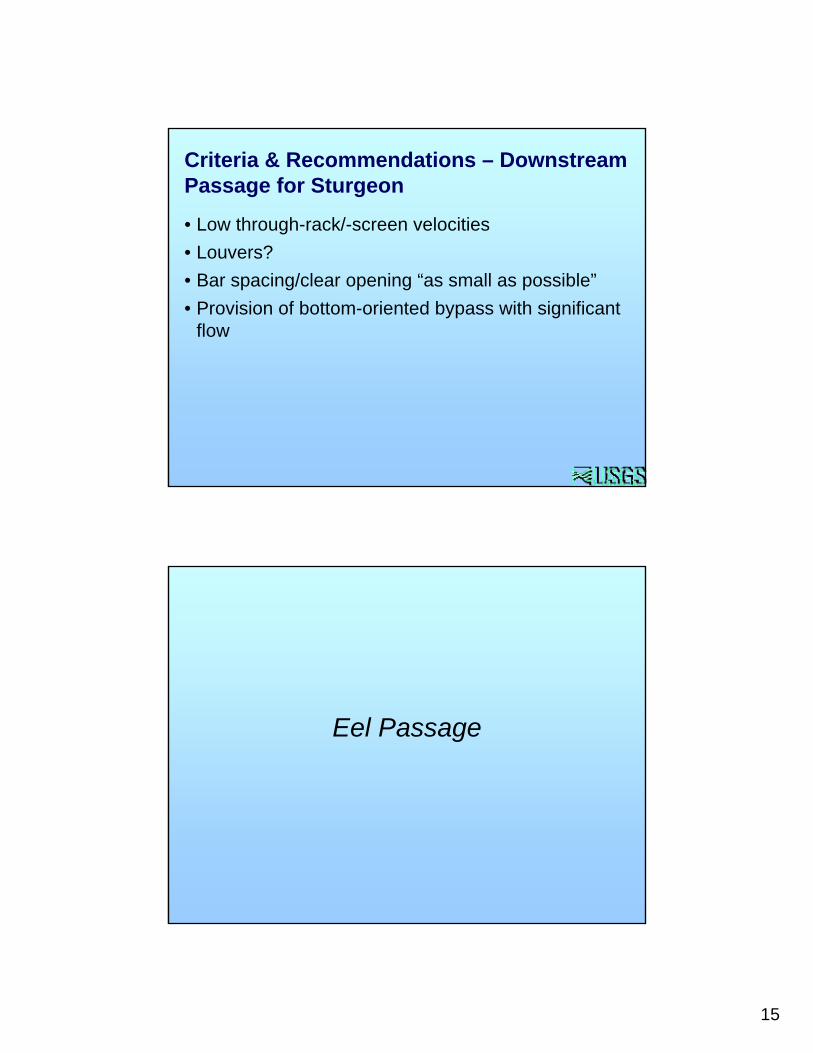
• Low through-rack/-screen velocities• Louvers?• Bar spacing/clear opening “as small as possible”• Provision of bottom-oriented bypass with significant
flow
Criteria & Recommendations – Downstream Passage for Sturgeon
Eel Passage
16
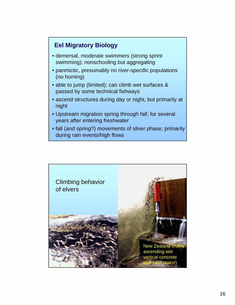
• demersal, moderate swimmers (strong sprint swimming); nonschooling but aggregating
• panmictic, presumably no river-specific populations (no homing)
• able to jump (limited); can climb wet surfaces & passed by some technical fishways
• ascend structures during day or night, but primarily at night
• Upstream migration spring through fall; for several years after entering freshwater
• fall (and spring?) movements of silver phase; primarily during rain events/high flows
Eel Migratory Biology
New Zealand elversascending wet vertical concrete wall (and stairs!)
Climbing behavior of elvers
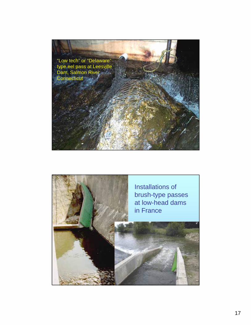
17
“Low tech” or “Delaware” type eel pass at Leesville Dam, Salmon River Connecticut
Installations of brush-type passes at low-head dams in France
18
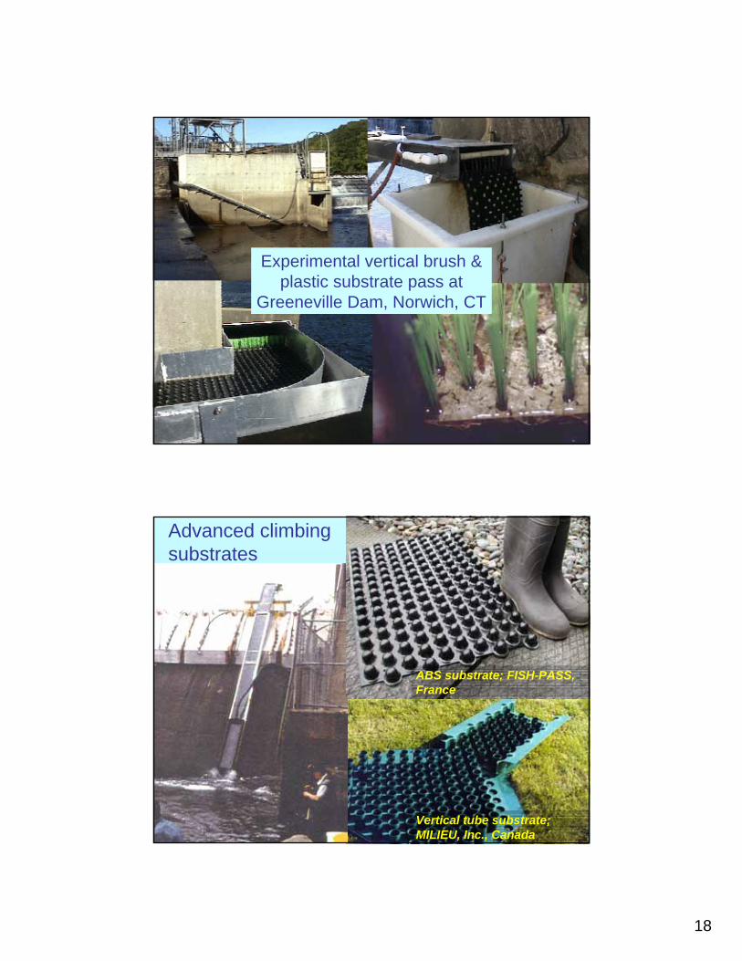
Experimental vertical brush & plastic substrate pass at
Greeneville Dam, Norwich, CT
Advanced climbing substrates
ABS substrate; FISH-PASS, France
Vertical tube substrate; MILIEU, Inc., Canada
19
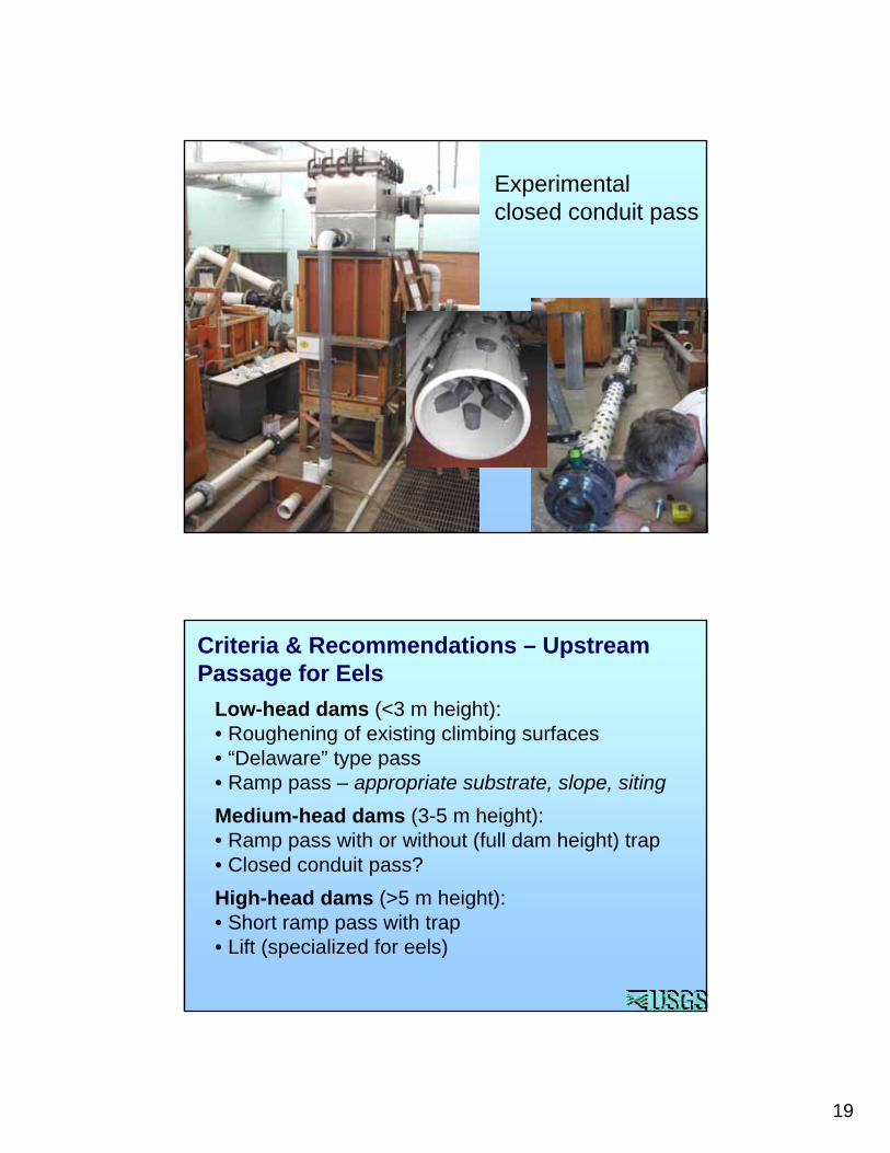
Experimental closed conduit pass
Low-head dams (<3 m height): • Roughening of existing climbing surfaces• “Delaware” type pass• Ramp pass – appropriate substrate, slope, sitingMedium-head dams (3-5 m height): • Ramp pass with or without (full dam height) trap• Closed conduit pass?High-head dams (>5 m height): • Short ramp pass with trap• Lift (specialized for eels)
Criteria & Recommendations – Upstream Passage for Eels
20
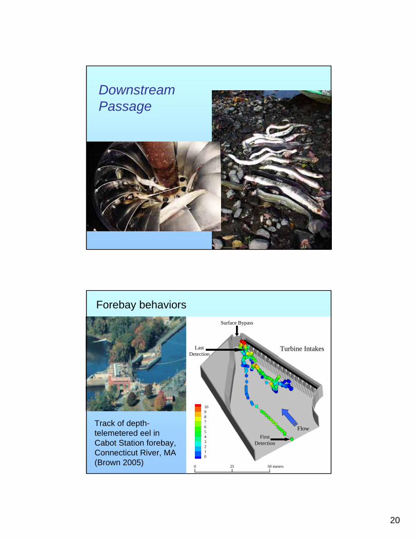
Downstream Passage
Surface Bypass
FlowFirst
Detection
LastDetection
Turbine Intakes
0 25 50 meters
109876543210
Track of depth-telemetered eel in Cabot Station forebay, Connecticut River, MA (Brown 2005)
Forebay behaviors
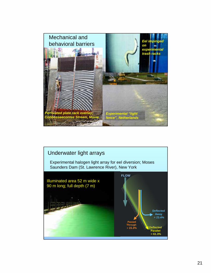
21
Eel impinged on experimental trash racks
Experimental “light fence”, Netherlands
Perforated plate rack overlay; Cobbosseecontee Stream, Maine
Mechanical and behavioral barriers
Illuminated area 52 m wide x 90 m long; full depth (7 m)
Underwater light arraysExperimental halogen light array for eel diversion; Moses Saunders Dam (St. Lawrence River), New York
Deflected Deflected Parallel Parallel = 61.3%= 61.3%
Deflected Deflected Away Away
= 23.4%= 23.4%PassedPassed
Through Through = = 15.3%15.3%
FLOW
22
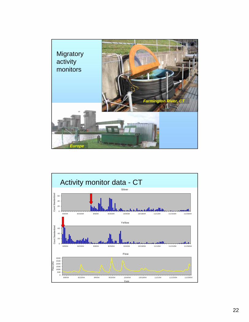
Migratory activity monitors
Farmington River, CT
Europe
Activity monitor data - CTSilver
8/9/04 8/23/04 9/6/04 9/20/04 10/4/04 10/18/04 11/1/04 11/15/04 11/29/04
Cou
nt S
tand
ardi
zed
0
20
40
60
Yellow
8/9/04 8/23/04 9/6/04 9/20/04 10/4/04 10/18/04 11/1/04 11/15/04 11/29/04
Cou
nt S
tand
ardi
zed
0
20
40
60
Flow
Date
8/9/04 8/23/04 9/6/04 9/20/04 10/4/04 10/18/04 11/1/04 11/15/04 11/29/04
Flow
(cfs
)
0500
10001500200025003000
23
• Low through-rack/-screen velocities• Bar spacing/clear opening “as small as possible”;
overlays• European “criteria”: approach velocity <0.5 m/sec &
spacing <2 cm• Provision of bottom-oriented bypass with significant
flow• Light arrays (very special cases only!)• Programmed shutdown/spill
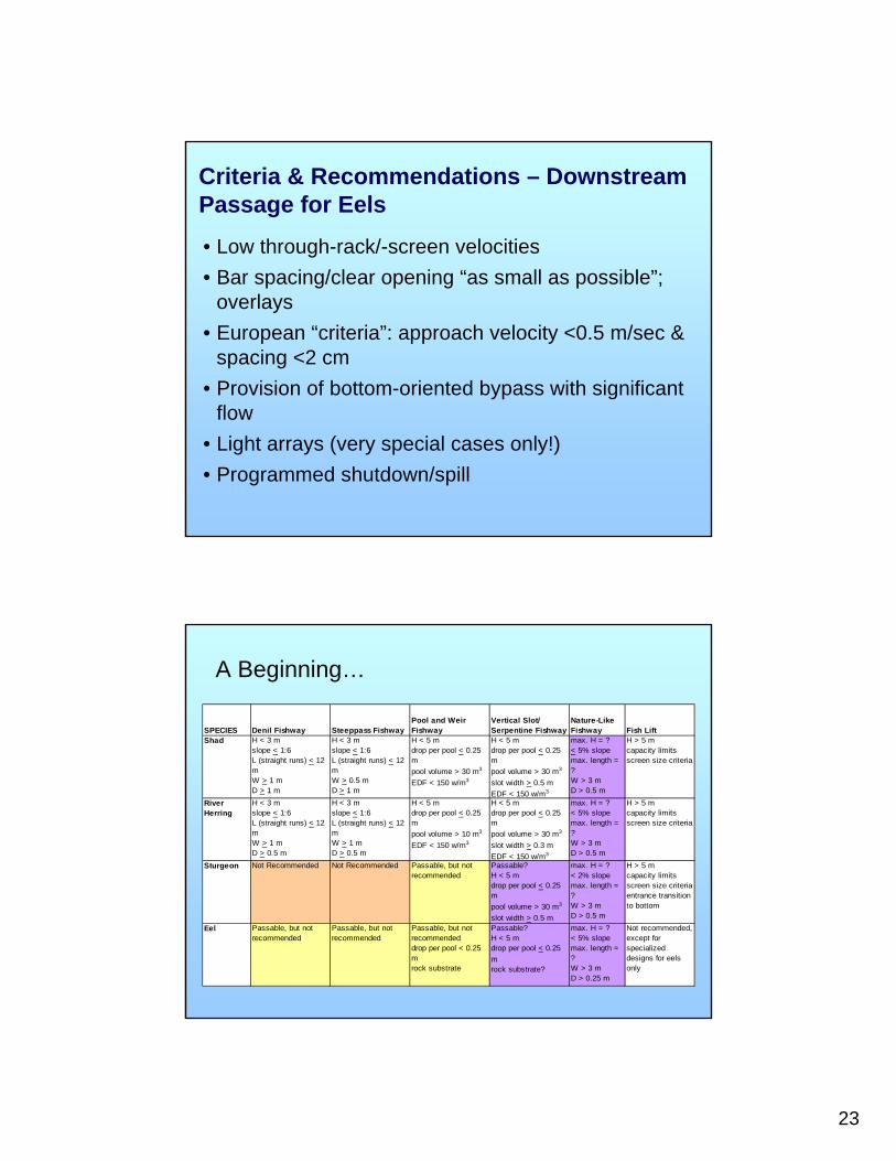
Criteria & Recommendations – Downstream Passage for Eels
SPECIES Denil Fishway Steeppass FishwayPool and Weir Fishway
Vertical Slot/ Serpentine Fishway
Nature-Like Fishway Fish Lift
Shad H < 3 mslope < 1:6L (straight runs) < 12 mW > 1 mD > 1 m
H < 3 mslope < 1:6L (straight runs) < 12 mW > 0.5 mD > 1 m
H < 5 mdrop per pool < 0.25 mpool volume > 30 m3
EDF < 150 w/m3
H < 5 mdrop per pool < 0.25 mpool volume > 30 m3
slot width > 0.5 mEDF < 150 w/m3
max. H = ?< 5% slopemax. length = ?W > 3 mD > 0.5 m
H > 5 mcapacity limitsscreen size criteria
River Herring
H < 3 mslope < 1:6L (straight runs) < 12 mW > 1 mD > 0.5 m
H < 3 mslope < 1:6L (straight runs) < 12 mW > 1 mD > 0.5 m
H < 5 mdrop per pool < 0.25 mpool volume > 10 m3
EDF < 150 w/m3
H < 5 mdrop per pool < 0.25 mpool volume > 30 m3
slot width > 0.3 mEDF < 150 w/m3
max. H = ?< 5% slopemax. length = ?W > 3 mD > 0.5 m
H > 5 mcapacity limitsscreen size criteria
Sturgeon Not Recommended Not Recommended Passable, but not recommended
Passable?H < 5 mdrop per pool < 0.25 mpool volume > 30 m3
slot width > 0.5 m
max. H = ?< 2% slopemax. length = ?W > 3 mD > 0.5 m
H > 5 mcapacity limitsscreen size criteriaentrance transition to bottom
Eel Passable, but not recommended
Passable, but not recommended
Passable, but not recommendeddrop per pool < 0.25 mrock substrate
Passable?H < 5 mdrop per pool < 0.25 mrock substrate?
max. H = ?< 5% slopemax. length = ?W > 3 mD > 0.25 m
Not recommended, except for specialized designs for eels only
A Beginning…
24
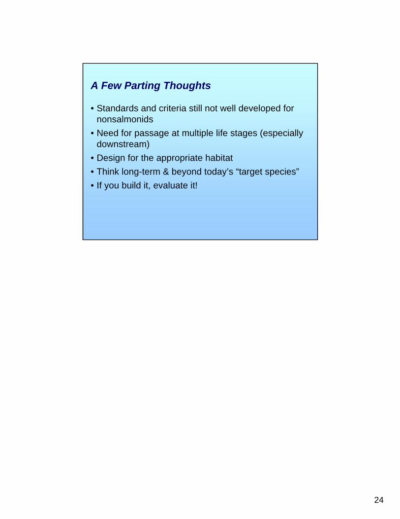
• Standards and criteria still not well developed for nonsalmonids
• Need for passage at multiple life stages (especially downstream)
• Design for the appropriate habitat• Think long-term & beyond today’s “target species”• If you build it, evaluate it!
A Few Parting Thoughts
1
Hydro Licensing in the US:An Overview
Mark Pawlowski
Federal Energy Regulatory Commission
2
DirectorJ. Mark Robinson
202-502-8700Deputy Director
Robert J. Cupina202-502-8700
Division of Pipeline Certificates
Director - Berne L. Mosley202-502-8625
Deputy Dir. – Vacant
Division of Gas-Environment & Engineering
Director - Richard R. Hoffmann202-502-8066
Deputy Dir.– Lauren H. O’Donnell202-502-8325
Division of Hydropower Licensing
Director - Ann F. Miles202-502-6769
Deputy Dir.- Edward A. Abrams202-502-8773
Division of HydropowerAdministration & Compliance
Director - Joseph D. Morgan202-502-6377
Deputy Dir. - Hossein Ildari202-502-8829
Division of Dam Safety& Inspections
Director – Daniel J. Mahoney (Acting)202-502-6743
Deputy Dir. – Daniel J. Mahoney
Energy InfrastructurePolicy Group
Jeff C. Wright202-502-8617
Assistant DirectorManagement & Operations
Thomas E. DeWitt202-502-6070
Certificates Branch 1Michael J. McGehee
202-502-8962
Certificates Branch 2William L. Zoller202-502-8191
Gas Branch 1Michael J. Boyle202-502-8839
Gas Branch 2Alisa M. Lykens202-502-8766
Gas Branch 3Lonnie A. Lister202-502-8587
Hydro East Branch 1Vincent E. Yearick
202-502-6174
Hydro East Branch 2Mark A. Pawlowski
202-502-6052
Hydro West Branch 1Jennifer Hill
202-502-6797
Hydro West Branch 2Timothy J. Welch
202-502-8760
Land ResourcesBranch
John E. Estep202-502-6014
Engineering &Jurisdiction Branch
William Y. Guey-Lee202-502-6064
Biological ResourcesBranch
George H. Taylor202-502-8851
Washington OfficeWilliam H. Allerton
202-502-6025
Atlanta RegionalOffice
Jerrold W. Gotzmer770-452-3777
Chicago RegionalOffice
Peggy A. Harding312-596-4438
New York RegionalOffice
Charles B. Goggins212-273-5910
Portland RegionalOffice
Patrick J. Regan503-552-2741
San FranciscoRegional OfficeTakeshi Yamashita
415-369-3390
LNG ComplianceBranch
Chris M. Zerby202-502-6111
LNG EngineeringBranch
Terry L. Turpin202-502-8558
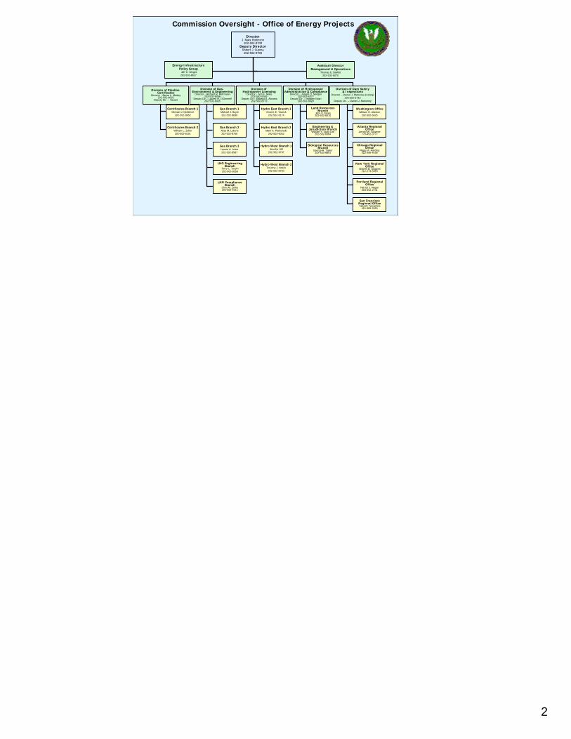
Commission Oversight - Office of Energy Projects
3
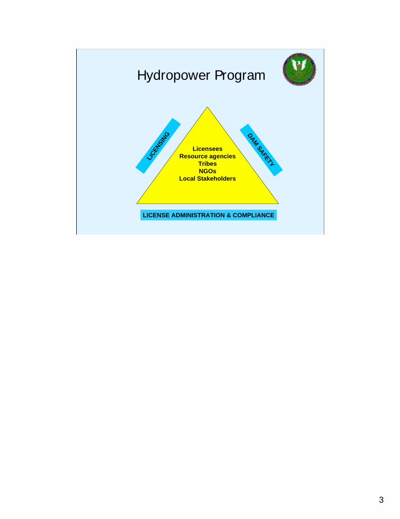
Hydropower Program
LicenseesResource agencies
TribesNGOs
Local Stakeholders
LICEN
SING DAM SAFETY
LICENSE ADMINISTRATION & COMPLIANCE

4
Federal Power Act
5
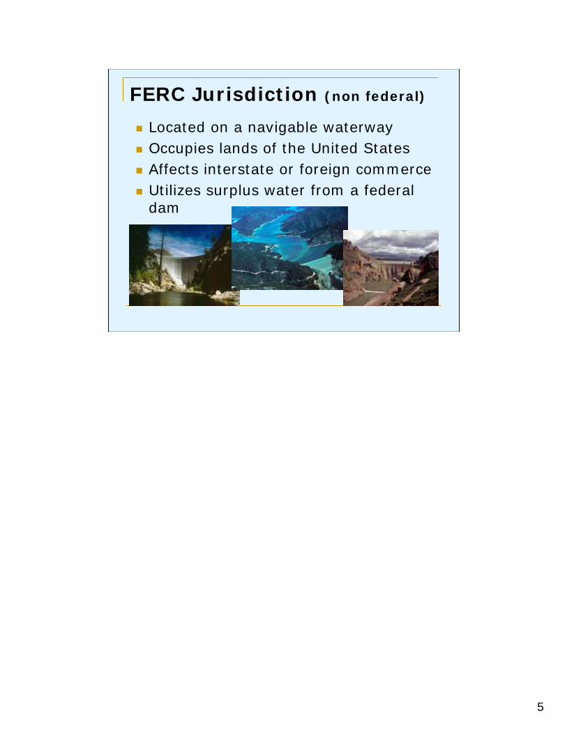
FERC Jurisdiction (non federal)
Located on a navigable waterwayOccupies lands of the United StatesAffects interstate or foreign commerceUtilizes surplus water from a federal dam
6
7
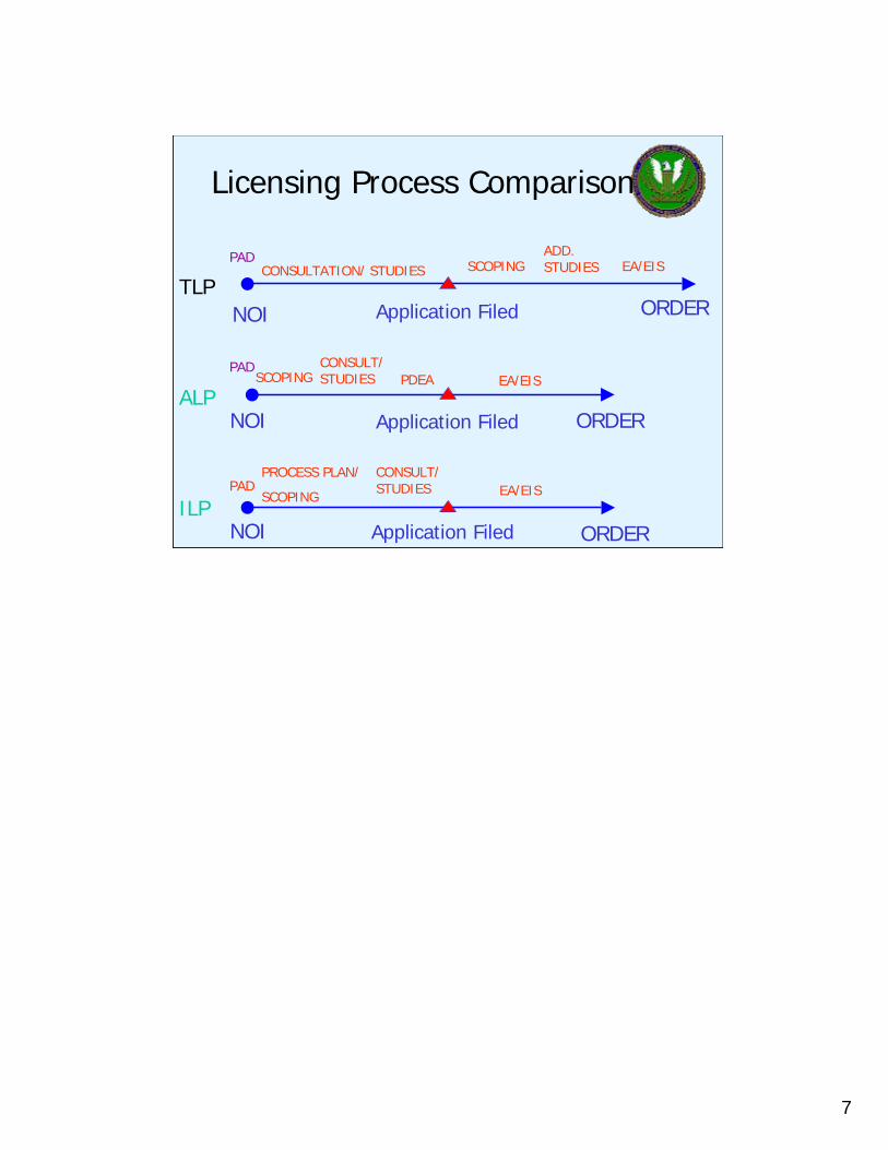
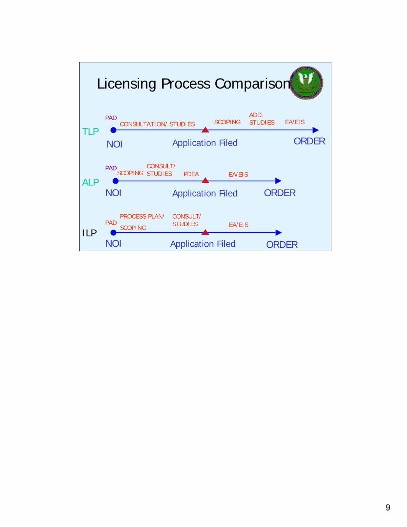
Licensing Process Comparison
TLP
ALP
ILP
NOI
NOI
NOI
ORDER
ORDER
ORDER
Application Filed
Application Filed
Application Filed
PADPROCESS PLAN/
SCOPING EA/EIS
EA/EIS
EA/EIS
CONSULT/STUDIES PDEASCOPING
SCOPING
CONSULT/STUDIES
ADD. STUDIESCONSULTATION/ STUDIES
PAD
PAD

8
Licensing Process Comparison
TLP
ALP
ILP
NOI
NOI
NOI
ORDER
ORDER
ORDER
Application Filed
Application Filed
Application Filed
PADPROCESS PLAN/
SCOPING EA/EIS
EA/EIS
EA/EIS
CONSULT/STUDIES PDEASCOPING
SCOPING
CONSULT/STUDIES
ADD. STUDIESCONSULTATION/ STUDIES
PAD
PAD
9
Licensing Process Comparison
TLP
ALP
ILP
NOI
NOI
NOI
ORDER
ORDER
ORDER
Application Filed
Application Filed
Application Filed
PADPROCESS PLAN/
SCOPING EA/EIS
EA/EIS
EA/EIS
CONSULT/STUDIES PDEASCOPING
SCOPING
CONSULT/STUDIES
ADD. STUDIESCONSULTATION/ STUDIES
PAD
PAD
10
11
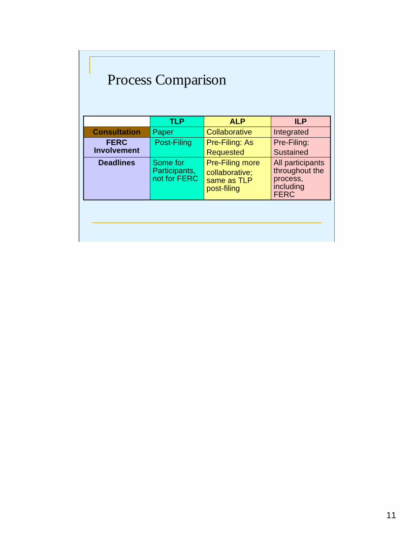
Process Comparison
All participants throughout the process, including FERC
Pre-Filing morecollaborative; same as TLP post-filing
Some for Participants, not for FERC
Deadlines
Pre-Filing: Sustained
Pre-Filing: AsRequested
Post-FilingFERC Involvement
IntegratedCollaborativePaper ConsultationILPALPTLP
12
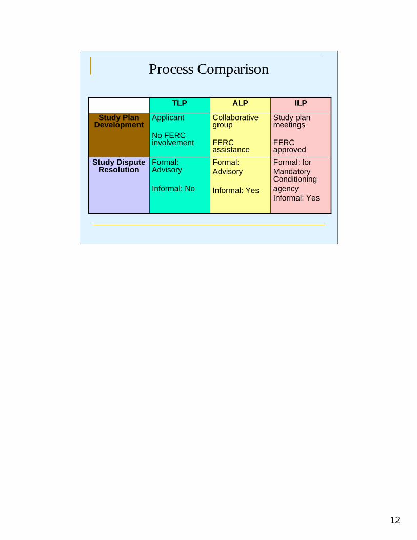
Process Comparison
Formal: for Mandatory Conditioning agencyInformal: Yes
Formal: Advisory
Informal: Yes
Formal: Advisory
Informal: No
Study Dispute Resolution
Study plan meetings
FERC approved
Collaborative group
FERC assistance
Applicant
No FERC involvement
Study Plan Development
ILPALPTLP
13
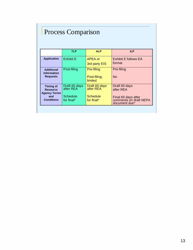
Process Comparison
Draft 60 daysafter REA
Final 60 days after comments on draft NEPA document due*
Draft 60 days after REA
Schedule for final*
Draft 60 days after REA
Schedulefor final*
Timing of Resource
Agency Terms and
Conditions
Pre-filing
No
Pre-filing
Post-filing;limited
Post-filingAdditional Information Requests
Exhibit E follows EA format
APEA or3rd party EIS
Exhibit EApplication
ILPALPTLP
14
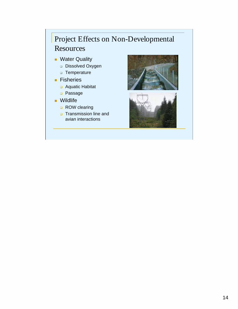
Project Effects on Non-Developmental Resources
Water QualityDissolved OxygenTemperature
FisheriesAquatic Habitat Passage
WildlifeROW clearing Transmission line and avian interactions
15
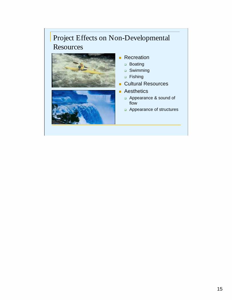
Project Effects on Non-Developmental Resources
RecreationBoatingSwimmingFishing
Cultural ResourcesAesthetics
Appearance & sound of flowAppearance of structures

16
Developmental Resources
Flood Control
Navigation
Water Supply
Energy Production
Irrigation
17
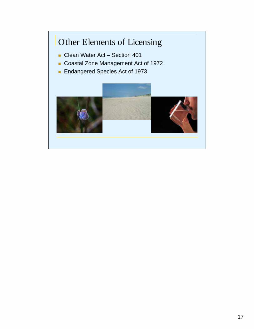
Other Elements of LicensingClean Water Act – Section 401Coastal Zone Management Act of 1972Endangered Species Act of 1973
18
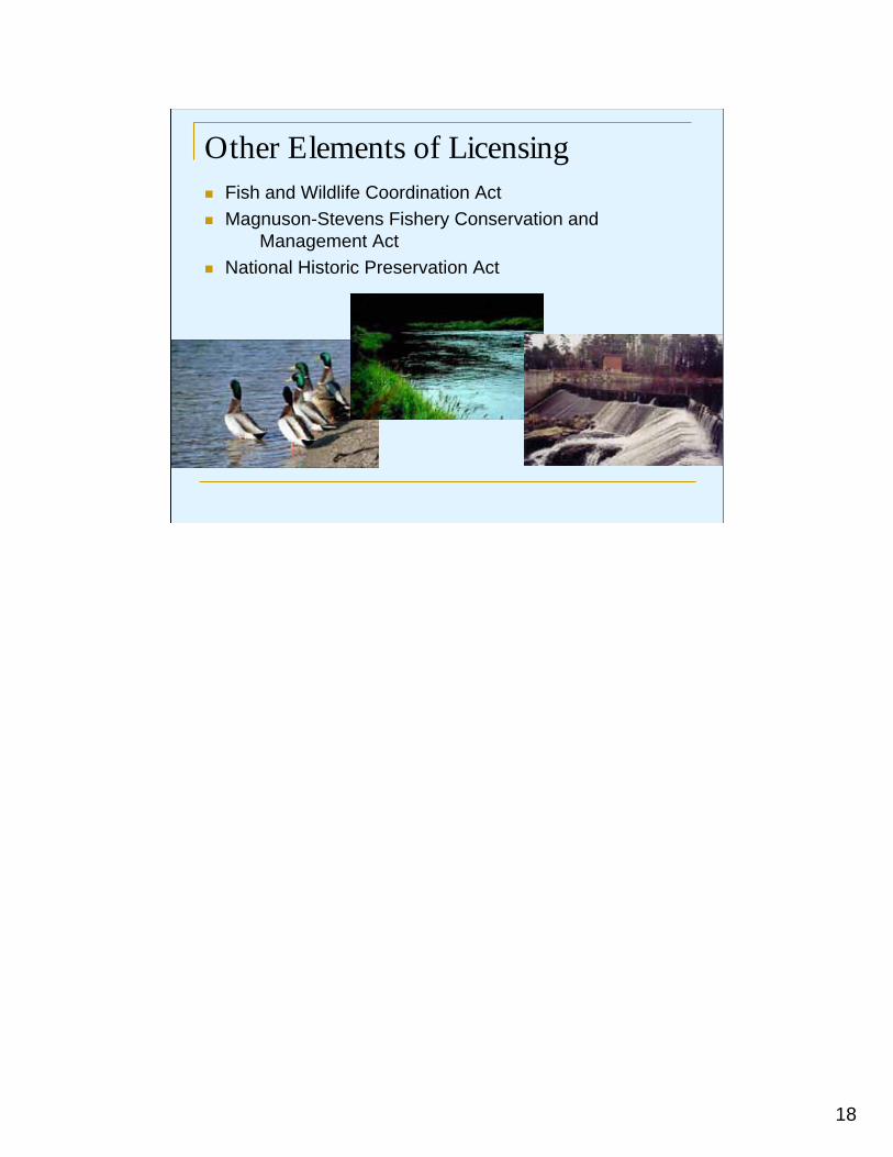
Other Elements of LicensingFish and Wildlife Coordination Act Magnuson-Stevens Fishery Conservation and
Management ActNational Historic Preservation Act

19
Environmental Concerns versus Developmental Concerns
20
Competing Environmental Concerns
21
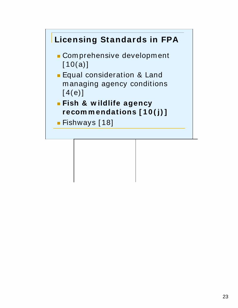
Licensing Standards in FPA
Comprehensive development [10(a)]Equal consideration & Land managing agency conditions [4(e)]State and federal fish & wildlife agency recommendations [10(j)]Fishways [18]
22
Licensing Standards in FPA
Comprehensive development [10(a)]Equal consideration & Land managing agency conditions [4(e)]State and federal fish & wildlife agency recommendations [10(j)]Fishways [18]
23
Licensing Standards in FPA
Comprehensive development [10(a)]Equal consideration & Land managing agency conditions [4(e)]Fish & wildlife agency recommendations [10(j)]Fishways [18]
24
Licensing Standards in FPA
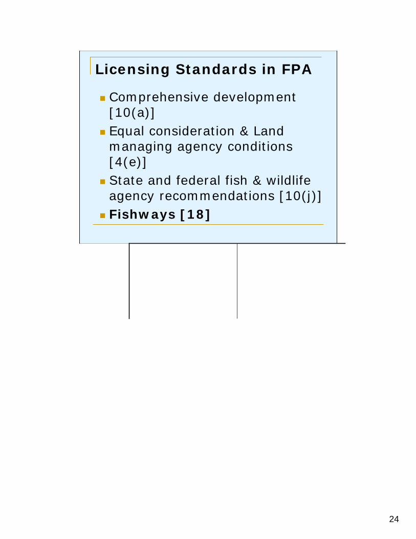
Comprehensive development [10(a)]Equal consideration & Land managing agency conditions [4(e)]State and federal fish & wildlife agency recommendations [10(j)]Fishways [18]
25
Licensing Challenges
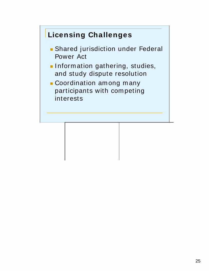
Shared jurisdiction under Federal Power ActInformation gathering, studies, and study dispute resolutionCoordination among many participants with competing interests

26

27
Questions
www.ferc.gov
1
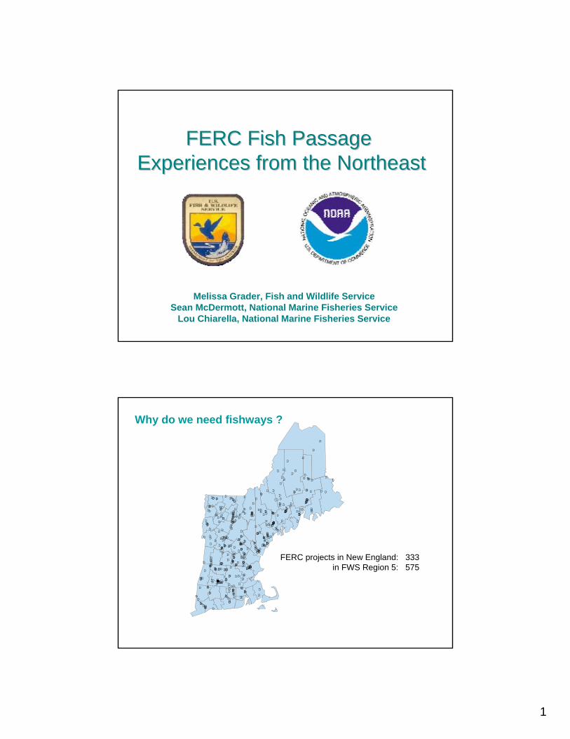
FERC Fish Passage FERC Fish Passage Experiences from the NortheastExperiences from the Northeast
Melissa Grader, Fish and Wildlife ServiceSean McDermott, National Marine Fisheries Service
Lou Chiarella, National Marine Fisheries Service
D
D
DD
DD
D
D
D
D
D
D
D
D
D
D
D
D
D
D
D
D
DD
D
D
DD
D
D D
DD
D
D
D
D
D
D
D
D
D
D
DD DD
D
D
D
D
D
D
D
D
D
D
D
D
D
D
D
D
D
D
D
D
D
D
D
D
D
D
D
D
D
D
D
D
DD
D
D
D
DD
DD
DD
D
DD
D
D
DDDD
DD
D
DD
D
D
DD
D
D
D
D
D
D
D
D
DD
D
D
D
D
D
D
D
D
DD
D
D
D
D
D D D
D
D
D
D
D
D
D
D
D
D
DD
D
DD
D
D
D
D
D
D
D
DD
D
DD
D
D
D
D
D
D
D
D
D
D
D
DDDDDD
DD
D
D
D
D
D
D
D
D
D
D
D
D
D
D
D
DD
D
DDD
D
D
D
D
D
DD
DD
D
D
D
D
D
D
D
D
D
D
D
DD
D
D
D
D
D
D
D
D
D
D
DD
D
D
D
D
D
D
D
D
DD
D
D
D
D
D
D
D
D
DD
D
D
DD
D
D
D
D
D
D
D
D
D
D
D
D
D
DD
D
D
D
D
D
D
D
DD
D
D
D
D
D D
D
D
D
D
D
D
D
D
D
D
D
D
D
DD
D D
DD
D
D
DD
D
D D
DD
D
D
D
D
D
D
D
D
D
D
D
DD
D
DD
D
D
D
D
D
D
D
D
D
D
D
D
D D
D
D
D
D
D
D
D
D
D
DDD
D
D
D
D
D
D
D
D
D
D
D
D
D
D
D
D
D
DD
D
DD
D
DD
D
D
D
D
DD
D
D
D
D
D
D
D
DD
D
D D
D
DD
D
D
D
D
D
DD
D
D
D
D
D
D
D
D
Why do we need fishways ?
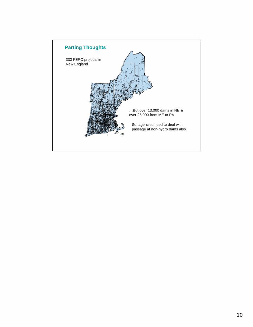
FERC projects in New England: 333in FWS Region 5: 575
2
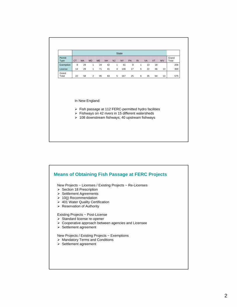
5751364356251675839525822Grand Total
3691346225171064417112914License
20618131861142241298Exemption
Grand TotalWVVTVARIPANYNJNHMEMDMACT
Permit Type
State
In New England:
Fish passage at 112 FERC-permitted hydro facilitiesFishways on 42 rivers in 15 different watersheds108 downstream fishways; 40 upstream fishways
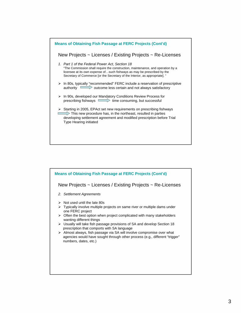
Means of Obtaining Fish Passage at FERC Projects
New Projects ~ Licenses / Existing Projects ~ Re-LicensesSection 18 PrescriptionSettlement Agreements10(j) Recommendation401 Water Quality CertificationReservation of Authority
Existing Projects ~ Post-LicenseStandard license re-openerCooperative approach between agencies and LicenseeSettlement agreement
New Projects / Existing Projects ~ ExemptionsMandatory Terms and ConditionsSettlement agreement
3
Means of Obtaining Fish Passage at FERC Projects (Cont’d)
New Projects ~ Licenses / Existing Projects ~ Re-Licenses
1. Part 1 of the Federal Power Act, Section 18“The Commission shall require the construction, maintenance, and operation by a licensee at its own expense of…such fishways as may be prescribed by the Secretary of Commerce [or the Secretary of the Interior, as appropriate]. “
In 80s, typically “recommended” FERC include a reservation of prescriptive authority outcome less certain and not always satisfactory
In 90s, developed our Mandatory Conditions Review Process for prescribing fishways time consuming, but successful
Starting in 2005, EPAct set new requirements on prescribing fishwaysThis new procedure has, in the northeast, resulted in parties
developing settlement agreement and modified prescription before Trial Type Hearing initiated
Means of Obtaining Fish Passage at FERC Projects (Cont’d)
New Projects ~ Licenses / Existing Projects ~ Re-Licenses
2. Settlement Agreements
Not used until the late 80sTypically involve multiple projects on same river or multiple dams under one FERC projectOften the best option when project complicated with many stakeholders wanting different thingsUsually will take fish passage provisions of SA and develop Section 18prescription that comports with SA languageAlmost always, fish passage via SA will involve compromise over what agencies would have sought through other process (e.g., different “trigger” numbers, dates, etc.)

4
Means of Obtaining Fish Passage at FERC Projects (Cont’d)
New Projects ~ Licenses / Existing Projects ~ Re-Licenses
3. 10(j) Recommendations
Pursuant to this section of the FPA, fish and wildlife recommendations must be included in the license unless inconsistent with other FederalLaw.
Such recommendations must provide for the protection, mitigation, or enhancement of fish and wildlife (including related spawning grounds and habitat). Requires Dispute Resolution with agencies if FERC finds a recommendation inconsistent. If recommendation is not adopted, FERC must make a finding that the conditions it selects meet requirements of Section 10(a).
“best adapted” to the comprehensive development of the waterway
Used when Licensee is in agreement with fish passage provisions and/orin cases where State will issue 401 with fish passage conditionsObviates need to do Section 18Also may be used if cannot fully support a Section 18 prescription due to less clear facts or limited staff resources
New Projects ~ Licenses / Existing Projects ~ Re-Licenses
4. 401 Water Quality Certification
Courts have consistently upheld State’s authority to set conditions at FERCprojects that MUST BE included in any license issuedEach State’s 401 process is different, and the degree to which States usethis authority also variesIf 401 process allows for appeals, WQC can be held up for years (even decades)
Means of Obtaining Fish Passage at FERC Projects (Cont’d)
5
New Projects ~ Licenses / Existing Projects ~ Re-Licenses
5. Reservation of Authority
Used when no active restoration program exists, but river could undergo restoration in the future, or on an upstream dam without a clear timetablefor passage (“deferred” category)Used under EPAct, but not subject to Trial-Type Hearing Process Open question as to how difficult it would be for agencies to use reservedauthority at a later date (EPAct/TTH rules would apply)
Means of Obtaining Fish Passage at FERC Projects (Cont’d)
Means of Obtaining Fish Passage at FERC Projects (Cont’d)
Existing Project ~ Post-License
1. Standard License Re-Opener
Forms L-15 and L-14, Article 11; Form L-4, Article 15“The Licensee shall, for the conservation and development of fish and wildlife resources, construct, maintain, and operate, or arrange for the construction, maintenance, and operation of such reasonable facilities, and comply with such reasonable modifications of the project structures and operation, as may be ordered by the Commission upon its own motion or upon the recommendation of the Secretary of the Interior or the fish and wildlife agency or agencies of any State in which the project or a part thereof is located, after notice and opportunity for hearing.”
Agency would petition FERC to re-open license to require fish passagefacilities
FERC process calls for notice, development of NEPA document, public comment, then notices decision with opportunity for rehearing
Key word is “reasonable” – FERC decides what is reasonableNew England has successfully initiated re-openers at 14 projectsCritical to have strong justification (e.g., State or interagency restoration plan, agency commitment to manage restored resource, etc.)

6
Means of Obtaining Fish Passage at FERC Projects (Cont’d)
Existing Project ~ Post-License
2. Cooperative approach
Used when parties do not want to risk relying on FERC to determine if fish passage should be required or not (by officially initiating re-opener)“informal” – once agreement reached, Licensee would submit an application to amend license to reflect inclusion of fish passage facilitiesCan be long and drawn-out, with many compromises
3. Settlement Agreements
Similar to Cooperative Approach, but more formal, with development of actual legal document codifying conditions each party must adhere toOnce signed by parties to the SA, Licensee would submit to FERC with petition to amend license to incorporate provisions of SA as license conditions Same drawbacks (and benefits) as Cooperative Approach, but may be more costly because lawyers would be involved
Means of Obtaining Fish Passage at FERC Projects (Cont’d)
Existing / New Projects ~ Exemptions
1. Mandatory Terms and Conditions (T&Cs)18 CFR §4.106(b) Article 2“The construction, operation, and maintenance of the exempt project must comply with any terms and conditions that the United States Fish and Wildlife Service, the National Marine Fisheries Service, and any state fish and wildlife agencies have determined are appropriate to prevent loss of, or damage to, fish or wildlife resources or otherwise to carry out the purposes of the Fish and Wildlife Coordination Act…”
Can either require immediate passage or set condition for future fish passageStill should provide justification so decision does not appear arbitrary or capriciousNot subject to EPAct/Trial-Type Hearing ProcessNot subject to FERC’s review or discretionApplicant MUST accept T&Cs or FERC will not grant permitIf triggering an existing fish passage T&C, Exemptee must either (1) abide by condition, (2) surrender exemption, or (3) have permit revoked by FERC
7
Means of Obtaining Fish Passage at FERC Projects (Cont’d)
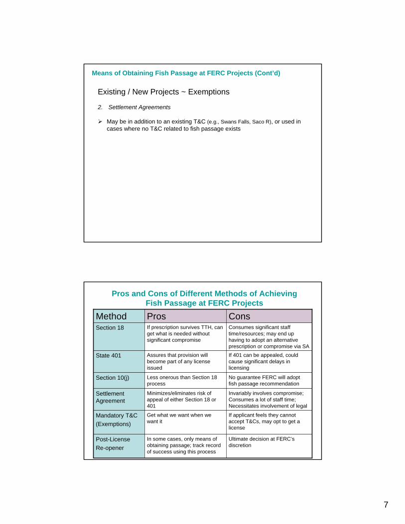
Existing / New Projects ~ Exemptions
2. Settlement Agreements
May be in addition to an existing T&C (e.g., Swans Falls, Saco R), or used in cases where no T&C related to fish passage exists
Pros and Cons of Different Methods of AchievingFish Passage at FERC Projects
Ultimate decision at FERC’s discretion
In some cases, only means of obtaining passage; track record of success using this process
Post-LicenseRe-opener
If applicant feels they cannot accept T&Cs, may opt to get a license
Get what we want when we want it
Mandatory T&C(Exemptions)
Invariably involves compromise; Consumes a lot of staff time; Necessitates involvement of legal
Minimizes/eliminates risk of appeal of either Section 18 or 401
Settlement Agreement
No guarantee FERC will adopt fish passage recommendation
Less onerous than Section 18 process
Section 10(j)
If 401 can be appealed, could cause significant delays in licensing
Assures that provision will become part of any license issued
State 401
Consumes significant staff time/resources; may end up having to adopt an alternative prescription or compromise via SA
If prescription survives TTH, can get what is needed without significant compromise
Section 18
ConsProsMethod

8
SA involving 6 projects, including Bar Mills -project that was under appeal/TTH; after SA filed, NMFS and FWS submitted modified Section 18s
5 Licenses and 1 Relicense
Saco River projects
Triggered passage under “reserved authority” T&CExisting Exemption
Kinneytown, Naugatuck River
FWS and MA DFW submitted nearly identical T&Cs
Section 18 appealed under EPAct; parties reached settlement agreement and FWS issued modified prescription
Section 18 and 401 WQC – relicense was prior to EPAct & CT has no appeals process for 401
Section 18 and 401 WQC; after 401 appealed, reached settlement agreement and submitted modified Section 18 and 401
401 WQC; FWS Section 10(j) recommendations
Method Used
New ExemptionIndian River, Westfield River
RelicenseMerrimack, Merrimack River
RelicenseHousatonic, Housatonic River
RelicenseHolyoke, CT River
Original LicenseOccum, Shetucket River
TimingProject
Key Components to Obtaining Fish Passage
Strong relationship between State and Federal resource agenciesState fisheries and 401 programs
Support from NGO community (e.g., TU, watershed association, etc.)State or interagency fisheries restoration/management plan with clear goals and objectives
These plans should be filed with FERC so they become part of the administrative record
Can never have too much justification (pile it on!)e.g., surveys, stocking records, mgmt plans, historical informationagencies rely on data to support their decisions
Perseverance – these things take time regardless of approach
9
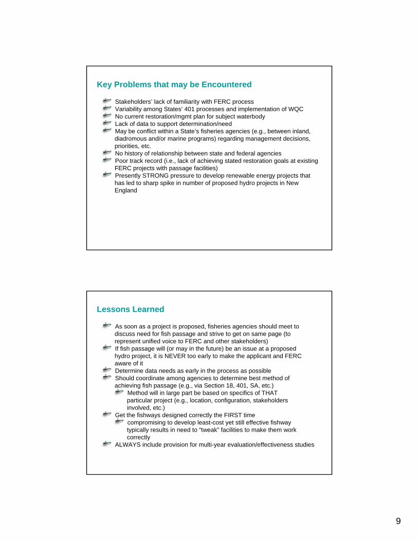
Key Problems that may be Encountered
Stakeholders’ lack of familiarity with FERC processVariability among States’ 401 processes and implementation of WQCNo current restoration/mgmt plan for subject waterbodyLack of data to support determination/needMay be conflict within a State’s fisheries agencies (e.g., between inland, diadromous and/or marine programs) regarding management decisions,priorities, etc.No history of relationship between state and federal agenciesPoor track record (i.e., lack of achieving stated restoration goals at existing FERC projects with passage facilities)Presently STRONG pressure to develop renewable energy projects thathas led to sharp spike in number of proposed hydro projects in NewEngland
Lessons Learned
As soon as a project is proposed, fisheries agencies should meet todiscuss need for fish passage and strive to get on same page (torepresent unified voice to FERC and other stakeholders)If fish passage will (or may in the future) be an issue at a proposedhydro project, it is NEVER too early to make the applicant and FERCaware of itDetermine data needs as early in the process as possible Should coordinate among agencies to determine best method ofachieving fish passage (e.g., via Section 18, 401, SA, etc.)
Method will in large part be based on specifics of THAT particular project (e.g., location, configuration, stakeholdersinvolved, etc.)
Get the fishways designed correctly the FIRST timecompromising to develop least-cost yet still effective fishwaytypically results in need to “tweak” facilities to make them workcorrectly
ALWAYS include provision for multi-year evaluation/effectiveness studies
10
Parting Thoughts
D
D
DD
DD
D
D
D
D
D
D
D
D
D
D
D
D
D
D
D
D
DD
D
D
DD
D
D D
DD
D
D
D
D
D
D
D
D
D
D
DD DD
D
D
D
D
D
D
D
D
D
D
D
D
D
D
D
D
D
D
D
D
D
D
D
D
D
D
D
D
D
D
D
D
DD
D
D
D
DD
DD
DD
D
DD
D
D
DDDD
DD
D
DD
D
D
DD
D
D
D
D
D
D
D
D
DD
D
D
D
D
D
D
D
D
DD
D
D
D
D
D D D
D
D
D
D
D
D
D
D
D
D
DD
D
DD
D
D
D
D
D
D
D
DD
D
DD
D
D
D
D
D
D
D
D
D
D
D
DDDDDD
DD
D
D
D
D
D
D
D
D
D
D
D
D
D
D
D
DD
D
DDD
D
D
D
D
D
DD
DD
D
D
D
D
D
D
D
D
D
D
D
DD
D
D
D
D
D
D
D
D
D
D
DD
D
D
D
D
D
D
D
D
DD
D
D
D
D
D
D
D
D
DD
D
D
DD
D
D
D
D
D
D
D
D
D
D
D
D
D
DD
D
D
D
D
D
D
D
DD
D
D
D
D
D D
D
D
D
D
D
D
D
D
D
D
D
D
D
DD
D D
DD
D
D
DD
D
D D
DD
D
D
D
D
D
D
D
D
D
D
D
DD
D
DD
D
D
D
D
D
D
D
D
D
D
D
D
D D
D
D
D
D
D
D
D
D
D
DDD
D
D
D
D
D
D
D
D
D
D
D
D
D
D
D
D
D
DD
D
DD
D
DD
D
D
D
D
DD
D
D
D
D
D
D
D
DD
D
D D
D
DD
D
D
D
D
D
DD
D
D
D
D
D
D
D
D
#######
#####
#######
######
########
#
######## #### ####
###
# ########## ##
#
###### #
#
##
###### ##
#
############
# ##### ########
#########
###### ######### ####
########
##
#
###### ## ####
#
### #########
#
##
#########
########
###
###########
#
#
###
###
#### #######
###########
#
######### # # ##
##########
########################
######## #
#
###
#########
###
#######
#
######
## ##
## # ####### #
#
#
########
#
##
#
#####
#######
#
######### ############
#####
#
## #### ######
# ###
### #######
###
##
### ###
####
#
#
#######
#
##########
#############
#
#
#
#
##
#
###
###
#
###
#
#
#
#
#
#
#
#
#
##
#
#
######
##
#
###
#####
###
#### ##
## #
#
##
#
##
### ##### # ###
##
###
##
#
# #
######
##
##
###### ##
##
#
##
#
#####
#
#####
##
####
##
#
##
#
###
#
##
##
#
#
##
#
## ##
# ## # #
# ##
#
###
###
###
#
#
#
#
##
#
#
##
#
#
#
## #
#
##
# #
##
##
# ##
#
#### #
###
#
#
# ###
#
#
#
##
#
###
##
#
##
#
##
##
####
#
##
####
###
##### ##########
#
#########
# ##########
####
## ### # ########
#### ####
## ##
#
##### ###
####
########
#####
#
# #######
#
########
####
#
#
#####
##### #####
#
#
###########
#
##
## ######
# ###
#
####
# ####
###
###
### ##### #
#####
#
#####
#
#########
#
#
##
#### #
#
#
#####
## #####
####
#####
##
#
###
# #######
#
#
##
#
##
######
###
########
#######
# ##
#
#
###
##########
###
########
######
## ###
###
###
##### ### #
######
#
###########
###
#####
##
#
########
######
##############
#################
##### # ###
####
###
####
###
########
#
##
##
######
################
##### ####### ##
#
###
#######
###### ## ###
##### #
### ###
#### #
#
#####
######
#############
## ###### ### # #######
#### #########
###
#
##
#### #
### ###
##### #####
######
#####################
########
##
#### ##
#####
##
###### ###
#### #######
####### #### # #
# ### # ### # ## #
#
####
#
#
#####
#
###
###
##
#
#
##
##########
#
#
####
###
#
##
###
##
###
#
#
##
# ##
##
######
#
#
###
#####
###
########
###
######
#### ########
##
#
## ###
# ## # #
##
#########
###################
##
############
#####
######## ########
####
###
###
###
#####
# #####
#####
######
####
#
#
## # #
##
#
###
###
###
# #######
#
###
#
#
#######
#
#
# ##
## #
#
#
##
#
#
#######
#
#
########
#
#### ##
####
##
# ###
##
###
#
#
#
#
####
#
#
######
##
##
##
#
#
###
###
######
###
######
####
## ### ## ####
############
######
#
####
###
#
###
######### #
## ##
## #
###### ###
#########
#####
#
#
## ####### #
##
####
######## ##
### ##
##########
####
#
###
# ##
#
# ##
##
###
#
#
###
# ##
##
#
#
#
####
##
# ##
##
# #
##
###
#
##
###
# #
##
# ##
#
# ##
#
##
##
#
#
###
#
#
###
##
##
#
###
#
#
###
## #
####
######
####
#####
#
#### ## ##
#
########
#
####
###
######
###
##
#
#
###
##
####
##
#
#
###
######
## #
#
#
#
#######
##
##
##
#
###
#####
###
########
###### #
###
#
#
###
#
## ####
##
##
## #
#####
#
#
#######
##
####
##
#
###
######
#
##
#####
#
##
##
#
#
##
##
#####
##
###
#
#####
##
##
##
##
#
#
##
#
###
##
##
#
#
#
# ##
#
####
# #
##
#
##
#### #
#
#
#
#
####
##
######
#
#
#
#
## #
##
#
#
#
####
# #
#
# ##
#
## #
#
#
#
##
#
##
##
#
#
#
###
#
#
##
####
##
#
#
###
#
##
#
#
#
#
#
#
####
###
#
#
#####
#
###
#
##
#
#
#
#
#
##
#
##
#
#
#
#
#
##
##
#
#
#
#
#
#
## ####
##
#
#
#
#
#
#
#
#
## #
#
#
#
#
########
#
## ##
#
##
#
#
#
#
#
#
#
##
#
#
#
#
#
#
##
##
### #
######
#
##
#
#
##
# ##
##
#
#
##
## ###
##
#
#### ####### #
#
#
#
##
##
####
###
#
#
## ###
#
#
#
#
#
###
#
###
#
#
##
#
#
#
#
#
#
#####
###
#
# ###
###
#
#
#######
####
#
##
#
#
#
#
####
#
#
##
###
##
#
######
##
#
#
#
#
#
# #
###
##
##
#
#####
# #### ###
##
#
#
#
##
#
#
#
##
#
##
#
###
##
###
#
#
##
###
#
#####
###
##
#
##
##
##
# #
#
#
#
#
##
#
#
#
###
#
#
#
#
##
#
#
# # #
#
#
#
#
#
## #
#
#
#
##
## #
#
#
##
#
#
#######
##
#
#
#
##### ## #
###
####
###
#
#
#
#
#
#####
#
#
#
##
##
#
#
#
#
#
##
# #
#
#
#
#
## # ## #
###
##
##
#
#
#
# ##
#
#
#
#
#
# #
#
#
#
#
#
#
#
#
#
#
#
#
#
#
##
##
## ####
###
##
#
#
#
#
##
##
#
#
#
#
#
##
# #
#
#
#
#
##
#### ###
###### ##
##
##
#
#
#
##
##
# #
#
##
#
### ## # ##
#######
###
#
###
#
## #
# # #
####
#
#
#
## ## #
#
#
##
#
##
##
#
##
#
####
#
##
##
##
#######
#######
#
#
#
#
#
## #
#
#
#
#
###
#### #
#
#
#
#
##
##
###
#
#
##
# ####
#
##
#
##
# #
#
#
#
# #
##
#
#
#
#
#
##
#
#
# ##
#
###
##
#
##
#
#
### #
#
##
# ##
###
##
##
#
#
#
#
#
#
#
###
#
#
##
##
##
#
#
#
#
##
#
#
#
#
##
#
#
##
# #
#
#
##
##
#
###
#
#
##
######
#
#
#
### #
#
#
#
#
#
#
#
##
#
#
#
##
### ###
####### ### ## ##
### ### ########
#########
##
####### ##
####### ######
########
## #
#########
######
#
#####
########
#
###
##
##
#####
#########
### ##
###
#
## ####
#####
#
#########
#
###
####
###
##
#
##########
#
##
#
#
#
#
#
#
#
#
#
#
#
#
#
#
##
#####
#
#
####
#
##
#
#
#### #
#
#
#
##
#
###
##
##
## ##
###
##
## ###
#
# ##
#
#
#
# #
#
#
#
##
#
#
### #
#
#
#
##
#
#
#
#
#
##
#
#
#
#
#
#
#
##
#
##
##
##
#
#
#
#
#
##
#
#
#
#
#
#
#
#
#
#
#
#
# #
#
#
#
#
####
#
#
#
##
#
#
#
#
#
#
#
##
#
#
##
##
###
#
#
## #
#
##
#
##
# ####
##
#
##
#
#
#
#
#
#
##
##
##
#
## #
##
#
##
#
#
##
#
####
#
#
###
## #### # #
#
#
## #
##
#
#
#
###
#
###
#
#
#
#
#
#
#
##
#
#
#
#
#
##
#
#
#
##
##
#
##
##
#
#
##
##
#
#
#
#
#
#
#
##
##
#
#
##
##
#
#
#
##
#
#
#
##
##
#
#
#
##
#
#
#
#
#
##
#
##
#
##
#
#
#
#
#
#
#
#
#
###
###
#
#
#
Little Ri ve
r
W
orster Bk
Swif
t Ri ve
rWa
r e R ive r
Q ua boag R
i ver
T
wel
v emil
e B k
Broad
Brook
Ch ic
opee B
k
Chic o
pe e R iver
MIL L PO N D DA M (A NT HO N Y)QU ID NI CK P ON D /U PP ER /D AMQU ID NI CK P ON D /LO WE R/D A MCR OM P TO N P ON D/ UP P ER /D AM
CR OM P TO N LO W E R D A MCE NT E RV ILL E PO N D DA MAR CT ICRIV E RP OI NT P ON D U PP ER D A M
333 FERC projects in New England
…But over 13,000 dams in NE &over 26,000 from ME to PA
So, agencies need to deal with passage at non-hydro dams also
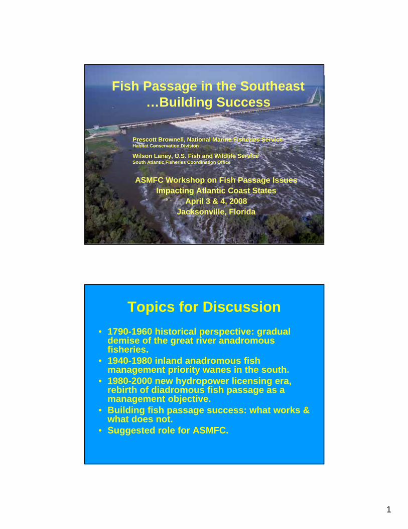
1
Fish Passage in the Southeast…Building Success
ASMFC Workshop on Fish Passage Issues Impacting Atlantic Coast States
April 3 & 4, 2008Jacksonville, Florida
Prescott Brownell, National Marine Fisheries Service Habitat Conservation Division
Wilson Laney, U.S. Fish and Wildlife Service South Atlantic Fisheries Coordination Office
Topics for Discussion• 1790-1960 historical perspective: gradual
demise of the great river anadromous fisheries.
• 1940-1980 inland anadromous fish management priority wanes in the south.
• 1980-2000 new hydropower licensing era, rebirth of diadromous fish passage as a management objective.
• Building fish passage success: what works & what does not.
• Suggested role for ASMFC.

2
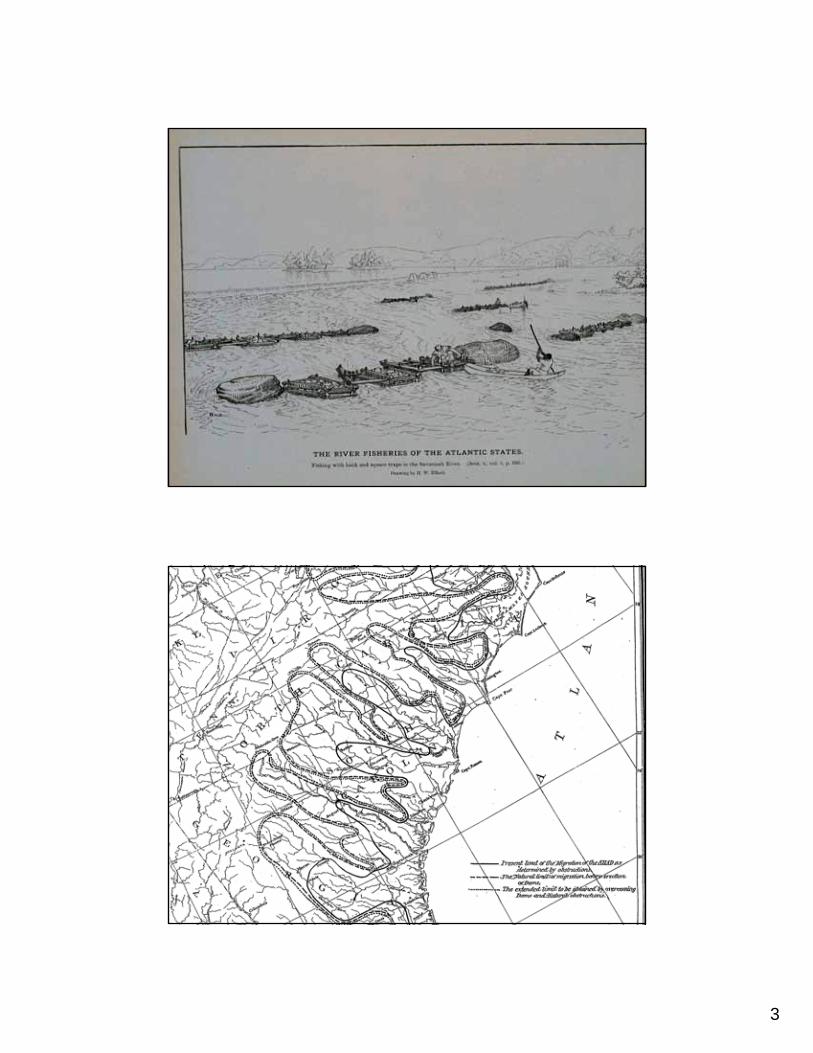
3
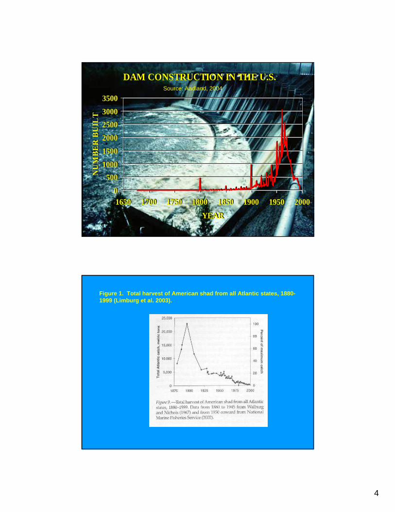
4
DAM CONSTRUCTION IN THE U.S.
0500
100015002000250030003500
1650 1700 1750 1800 1850 1900 1950 2000
YEAR
NU
MB
ER
BU
ILT
DAM CONSTRUCTION IN THE U.S.
0500
100015002000250030003500
1650 1700 1750 1800 1850 1900 1950 2000
YEAR
NU
MB
ER
BU
ILT
Source: Aadland, 2004
Figure 1. Total harvest of American shad from all Atlantic states, 1880-1999 (Limburg et al. 2003).
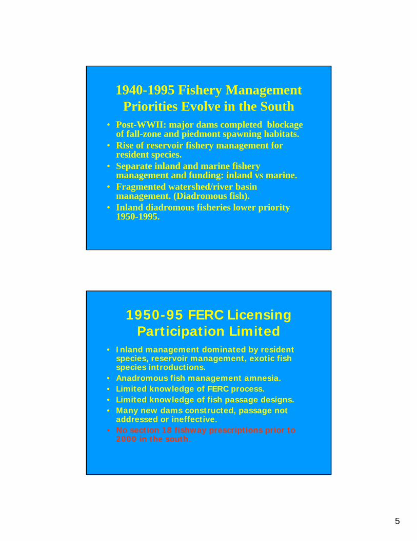
5
1940-1995 Fishery Management Priorities Evolve in the South
• Post-WWII: major dams completed blockage of fall-zone and piedmont spawning habitats.
• Rise of reservoir fishery management for resident species.
• Separate inland and marine fishery management and funding: inland vs marine.
• Fragmented watershed/river basin management. (Diadromous fish).
• Inland diadromous fisheries lower priority 1950-1995.
1950-95 FERC Licensing Participation Limited
• Inland management dominated by resident species, reservoir management, exotic fish species introductions.
• Anadromous fish management amnesia.• Limited knowledge of FERC process.• Limited knowledge of fish passage designs.• Many new dams constructed, passage not
addressed or ineffective.• No section 18 fishway prescriptions prior to
2000 in the south.
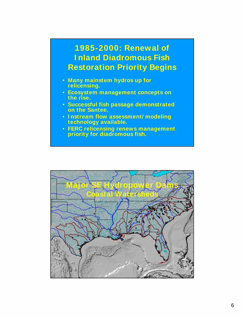
6
1985-2000: Renewal of Inland Diadromous Fish
Restoration Priority Begins• Many mainstem hydros up for
relicensing. • Ecosystem management concepts on
the rise.• Successful fish passage demonstrated
on the Santee.• Instream flow assessment/modeling
technology available.• FERC relicensing renews management
priority for diadromous fish.
Major SE Hydropower DamsCoastal Watersheds
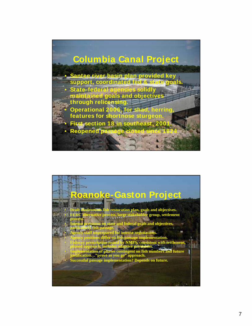
7
Columbia Canal Project
• Santee river basin plan provided key support, coordinated fed & state goals.
• State-federal agencies solidly maintained goals and objectives through relicensing.
• Operational 2006, for shad, herring, features for shortnose sturgeon.
• First section 18 in southeast, 2001.• Reopened passage closed since 1824.
Roanoke-Gaston Project• Draft diadromous fish restoration plan, goals and objectives.• FERC alternative process, large stakeholder group, settlement
process. • Intense pressures on state and federal goals and objectives,
particularly fish passage.• Agency staff unprepared for intense negotiations.• Agency positions differ on fish passage implementation.• Fishway prescription issued by NMFS, consistent with settlement,
phased approach, includes adaptive provisions.• Implementation of phases contingent on fish numbers and future
justification…”prove as you go” approach.• Successful passage implementation? Depends on future.

8
YadkinYadkin--pee Dee Projectpee Dee Project
• Interagency diadromous fish restoration plan developed in close coordination with power company.
• Passage objectives defer decisions pending future fish numbers and assessments.
• Agency positions on passage implementation differ.• Passage prescribed in 2007.• Epact hearing requested by licensee, followed by intense
settlement negotiations.• Fish passage settlement, hearing request withdrawn.• Section 18 prescription sustained in settlement, with
delayed implementation phases.•• Passage success? Depends on future.Passage success? Depends on future.
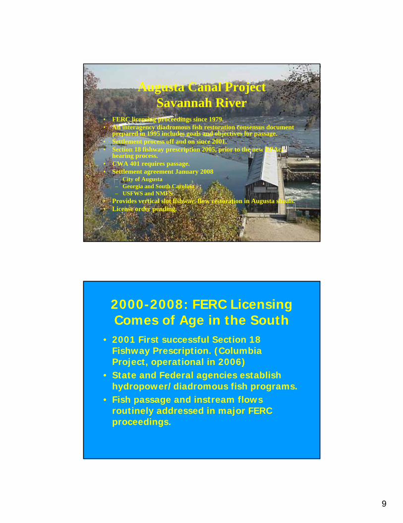
9
Augusta Canal ProjectSavannah River
• FERC licensing proceedings since 1979.• An interagency diadromous fish restoration consensus document
prepared in 1995 includes goals and objectives for passage.• Settlement process off and on since 2001.• Section 18 fishway prescription 2005, prior to the new EPAct
hearing process.• CWA 401 requires passage.• Settlement agreement January 2008
– City of Augusta– Georgia and South Carolina – USFWS and NMFS
• Provides vertical slot fishway, flow restoration in Augusta shoals.• License order pending.
2000-2008: FERC Licensing Comes of Age in the South
• 2001 First successful Section 18 Fishway Prescription. (Columbia Project, operational in 2006)
• State and Federal agencies establish hydropower/diadromous fish programs.
• Fish passage and instream flows routinely addressed in major FERC proceedings.
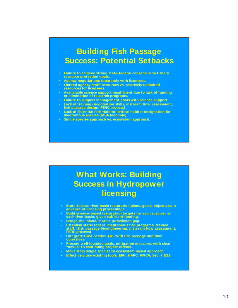
10
Building Fish Passage Success: Potential Setbacks
• Failure to achieve strong state-federal consensus on fishery resource protection goals.
• Agency negotiations separately with licensees.• Limited agency staff/resources vs. relatively unlimited
resources for licensees.• Availalable science support insufficient due to lack of funding
or elimination of research programs.• Failure to support management goals with science support. • Lack of training (negotiation skills, instream flow assessment,
fish passage design, FERC process).• Lack of Essential Fish Habitat/critical habitat designation for
diadromous species (MSA loophole).• Single species approach vs. ecosystem approach.
What Works: Building Success in Hydropower
licensing• State-federal river basin restoration plans, goals, objectives in
advance of licensing proceedings. • Build science-based restoration targets for each species, in
each river basin, given sufficient funding.• Bridge the inland/marine jurisdiction gap.• Establish state/federal diadromous fish programs, trained
staff. (fish passage bioengineering, instream flow assessment, FERC process)
• Integrate CWA Section 401 with fish passage and flow objectives.
• Present well founded goals, mitigation measures with clear “nexus” to continuing project effects.
• Move from single species to ecosystem based approach.• Effectively use existing tools: EFH, HAPC, FWCA, Sec. 7 ESA.

11
Role for ASMFC: Help Build Coordinated State/federal Fish
Passage Success• Coastwide restoration goals, objectives and strategies.• Encourage state-federal river basin habitat protection, restoration
and fishery management plans.• Provide strong policy support for state-federal fish passage
programs.• Document economic and ecological benefits.• Assist in training program development and implementation. (Fish
passage, instream flow assessment, negotiation skills, FERC).• Encourage funding/appropriations for diadromous fish
conservation, restoration, fish passage programs.• Promote designation of essential/critical fish habitats for
diadromous species (ASMFC requests DOC to prepare complementary federal plan, and designate EFH).
Fish Passage in the Southeast…Building Success
Diadromous species represent a vital ecological link connecting inland river basins with coastal marine and estuarine ecosystems
and valuable fisheries.
Restoring productive marine fisheries for future generations of Americans may not be possible without also restoring diadromous
fish populations.
1
Comprehensive Fish Passage Mitigation
in the Context of FERC Relicensing
The Southwest Region PerspectiveThe Southwest Region Perspective
Habitat Conservation ProgramHabitat Conservation Program
Focused on the protection and Focused on the protection and conservation of habitats important to conservation of habitats important to NOAA trust resources.NOAA trust resources.
National Marine Fisheries ServiceNational Marine Fisheries ServiceDedicated to the stewardship of living marine Dedicated to the stewardship of living marine resources through scienceresources through science--based conservation based conservation and management, and the promotion of and management, and the promotion of healthy ecosystems.healthy ecosystems.
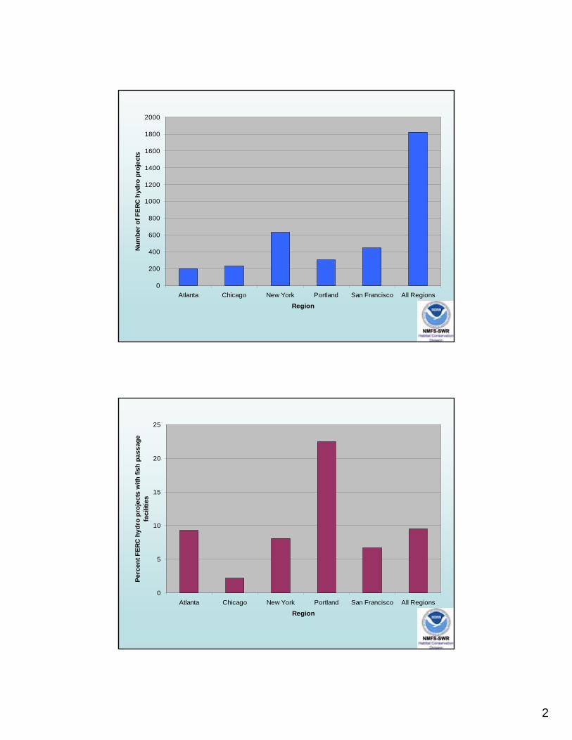
2
0
200
400
600
800
1000
1200
1400
1600
1800
2000
Atlanta Chicago New York Portland San Francisco All Regions
Region
Num
ber o
f FER
C h
ydro
pro
ject
s
0
5
10
15
20
25
Atlanta Chicago New York Portland San Francisco All Regions
Region
Perc
ent F
ERC
hyd
ro p
roje
cts
with
fish
pas
sage
fa
cilit
ies
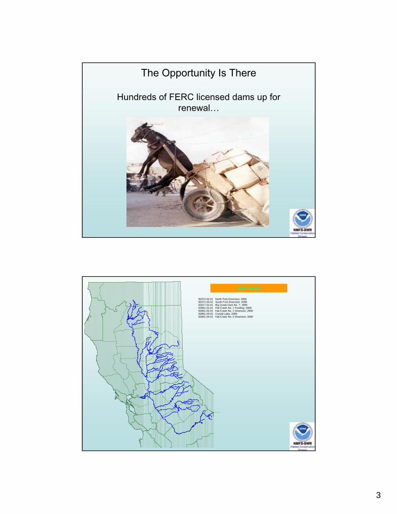
3
The Opportunity Is There
Hundreds of FERC licensed dams up for renewal…
%
%%%%
00372-02-01 North Fork Diversion; 200000372-03-01 South Fork Diversion; 200002017-01-01 Big Creek Dam No. 7; 199902661-01-01 Hat Creek No. 1 Forebay; 200002661-02-01 Hat Creek No. 1 Diversion; 200002661-03-01 Crystal Lake; 200002661-04-01 Hat Creek No. 2 Diversion; 2000
1997-2001
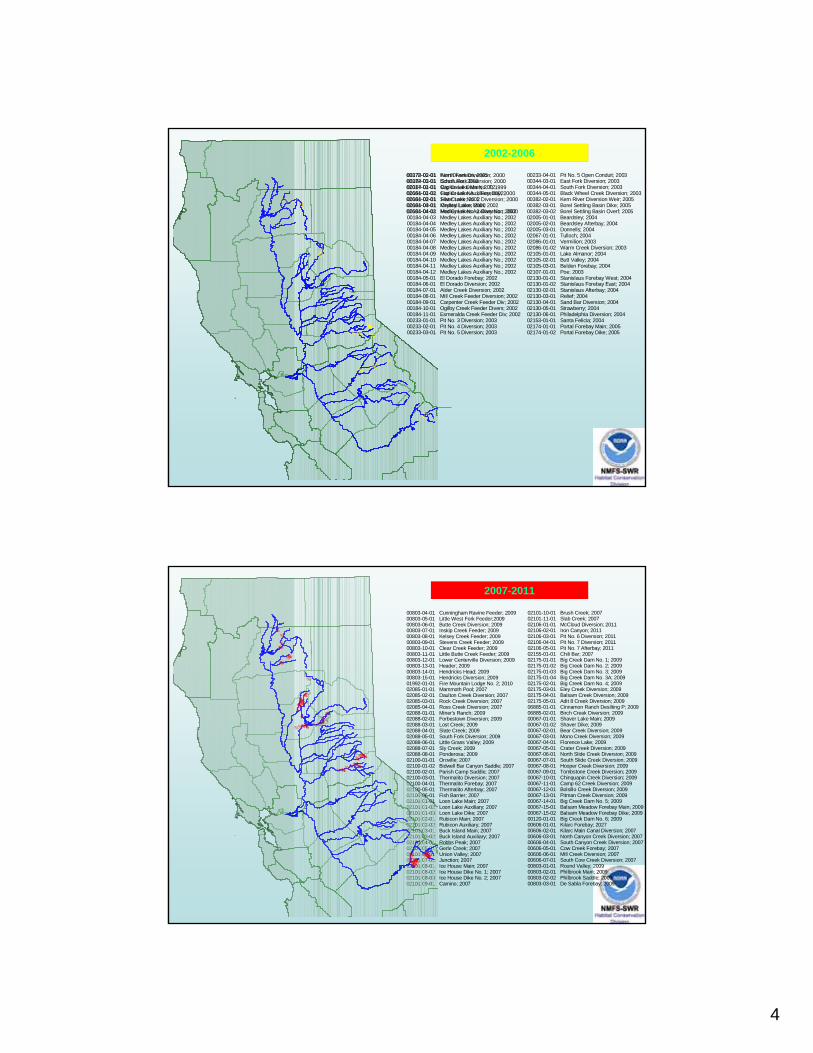
4
%
%%%%
00372-02-01 North Fork Diversion; 200000372-03-01 South Fork Diversion; 200002017-01-01 Big Creek Dam No. 7; 199902661-01-01 Hat Creek No. 1 Forebay; 200002661-02-01 Hat Creek No. 1 Diversion; 200002661-03-01 Crystal Lake; 200002661-04-01 Hat Creek No. 2 Diversion; 2000
1997-2001
%%%%
%%%%%%%%%%%%% %%%%%%
%%%%
%%
%
%
%%
%%%%%
%
%%%
%% %%
%%
00233-04-01 Pit No. 5 Open Conduit; 200300344-03-01 East Fork Diversion; 200300344-04-01 South Fork Diversion; 200300344-05-01 Black Wheel Creek Diversion; 200300382-02-01 Kern River Diversion Weir; 200500382-03-01 Borel Settling Basin Dike; 200500382-03-02 Borel Settling Basin Overf; 200502005-01-01 Beardsley; 200402005-02-01 Beardsley Afterbay; 200402005-03-01 Donnells; 200402067-01-01 Tulloch; 200402086-01-01 Vermilion; 200302086-01-02 Warm Creek Diversion; 200302105-01-01 Lake Almanor; 200402105-02-01 Butt Valley; 200402105-03-01 Belden Forebay; 200402107-01-01 Poe; 200302130-01-01 Stanislaus Forebay West; 200402130-01-02 Stanislaus Forebay East; 200402130-02-01 Stanislaus Afterbay; 200402130-03-01 Relief; 200402130-04-01 Sand Bar Diversion; 200402130-05-01 Strawberry; 200402130-06-01 Philadelphia Diversion; 200402153-01-01 Santa Felicia; 200402174-01-01 Portal Forebay Main; 200502174-01-02 Portal Forebay Dike; 2005
00178-01-01 Kern Diversion; 200500184-01-01 Echo Lake; 200200184-02-01 Caples Lake Main; 200200184-02-02 Caples Lake Auxiliary; 200200184-03-01 Silver Lake; 200200184-04-01 Medley Lakes Main; 200200184-04-02 Medley Lakes Auxiliary No.; 200200184-04-03 Medley Lakes Auxiliary No.; 200200184-04-04 Medley Lakes Auxiliary No.; 200200184-04-05 Medley Lakes Auxiliary No.; 200200184-04-06 Medley Lakes Auxiliary No.; 200200184-04-07 Medley Lakes Auxiliary No.; 200200184-04-08 Medley Lakes Auxiliary No.; 200200184-04-09 Medley Lakes Auxiliary No.; 200200184-04-10 Medley Lakes Auxiliary No.; 200200184-04-11 Medley Lakes Auxiliary No.; 200200184-04-12 Medley Lakes Auxiliary No.; 200200184-05-01 El Dorado Forebay; 200200184-06-01 El Dorado Diversion; 200200184-07-01 Alder Creek Diversion; 200200184-08-01 Mill Creek Feeder Diversion; 200200184-09-01 Carpenter Creek Feeder Div; 200200184-10-01 Ogilby Creek Feeder Divers; 200200184-11-01 Esmeralda Creek Feeder Div; 200200233-01-01 Pit No. 3 Diversion; 200300233-02-01 Pit No. 4 Diversion; 200300233-03-01 Pit No. 5 Diversion; 2003
2002-2006
00803-04-01 Cunningham Ravine Feeder; 200900803-05-01 Little West Fork Feeder;200900803-06-01 Butte Creek Diversion; 200900803-07-01 Inskip Creek Feeder; 200900803-08-01 Kelsey Creek Feeder; 200900803-09-01 Stevens Creek Feeder; 200900803-10-01 Clear Creek Feeder; 200900803-11-01 Little Butte Creek Feeder; 200900803-12-01 Lower Centerville Diversion; 200900803-13-01 Header; 200900803-14-01 Hendricks Head; 200900803-15-01 Hendricks Diversion; 200901992-01-01 Fire Mountain Lodge No. 2; 201002085-01-01 Mammoth Pool; 200702085-02-01 Daulton Creek Diversion; 200702085-03-01 Rock Creek Diversion; 200702085-04-01 Ross Creek Diversion; 200702088-01-01 Miner's Ranch; 200902088-02-01 Forbestown Diversion; 200902088-03-01 Lost Creek; 200902088-04-01 Slate Creek; 200902088-05-01 South Fork Diversion; 200902088-06-01 Little Grass Valley; 200902088-07-01 Sly Creek; 200902088-08-01 Ponderosa; 200902100-01-01 Oroville; 200702100-01-02 Bidwell Bar Canyon Saddle; 200702100-02-01 Parish Camp Saddle; 200702100-03-01 Thermalito Diversion; 200702100-04-01 Thermalito Forebay; 200702100-05-01 Thermalito Afterbay; 200702100-06-01 Fish Barrier; 200702101-01-01 Loon Lake Main; 200702101-01-02 Loon Lake Auxiliary; 200702101-01-03 Loon Lake Dike; 200702101-02-01 Rubicon Main; 200702101-02-02 Rubicon Auxiliary; 200702101-03-01 Buck Island Main; 200702101-03-02 Buck Island Auxiliary; 200702101-04-01 Robbs Peak; 200702101-05-01 Gerle Creek; 200702101-06-01 Union Valley; 200702101-07-01 Junction; 200702101-08-01 Ice House Main; 200702101-08-02 Ice House Dike No. 1; 200702101-08-03 Ice House Dike No. 2; 200702101-09-01 Camino; 2007
02101-10-01 Brush Creek; 200702101-11-01 Slab Creek; 200702106-01-01 McCloud Diversion; 201102106-02-01 Iron Canyon; 201102106-03-01 Pit No. 6 Diversion; 201102106-04-01 Pit No. 7 Diversion; 201102106-05-01 Pit No. 7 Afterbay; 201102155-01-01 Chili Bar; 200702175-01-01 Big Creek Dam No. 1; 200902175-01-02 Big Creek Dam No. 2; 200902175-01-03 Big Creek Dam No. 3; 200902175-01-04 Big Creek Dam No. 3A; 200902175-02-01 Big Creek Dam No. 4; 200902175-03-01 Eley Creek Diversion; 200902175-04-01 Balsam Creek Diversion; 200902175-05-01 Adit 8 Creek Diversion; 200906885-01-01 Cinnamon Ranch Desilting P; 200906885-02-01 Birch Creek Diversion; 200900067-01-01 Shaver Lake Main; 200900067-01-02 Shaver Dike; 200900067-02-01 Bear Creek Diversion; 200900067-03-01 Mono Creek Diversion; 200900067-04-01 Florence Lake; 200900067-05-01 Crater Creek Diversion; 200900067-06-01 North Slide Creek Diversion; 200900067-07-01 South Slide Creek Diversion; 200900067-08-01 Hooper Creek Diversion; 200900067-09-01 Tombstone Creek Diversion; 200900067-10-01 Chinquapin Creek Diversion; 200900067-11-01 Camp 62 Creek Diversion; 200900067-12-01 Bolsillo Creek Diversion; 200900067-13-01 Pitman Creek Diversion; 200900067-14-01 Big Creek Dam No. 5; 200900067-15-01 Balsam Meadow Forebay Main; 200900067-15-02 Balsam Meadow Forebay Dike; 200900120-01-01 Big Creek Dam No. 6; 200900606-01-01 Kilarc Forebay; 202700606-02-01 Kilarc Main Canal Diversion; 200700606-03-01 North Canyon Creek Diversion; 200700606-04-01 South Canyon Creek Diversion; 200700606-05-01 Cow Creek Forebay; 200700606-06-01 Mill Creek Diversion; 200700606-07-01 South Cow Creek Diversion; 200700803-01-01 Round Valley; 200900803-02-01 Philbrook Main; 200900803-02-02 Philbrook Saddle; 200900803-03-01 De Sabla Forebay; 2009
%%
%%%%%%%%%%%
%%%%%
%%%%%%%
%%%
%%%%%%%%%%%
%
%%
%
%%%%%
%%%%%
%
%%%%
%
%%% %
%%%%%%%%%
%% %%%%%%%%
%%%%%
%
%%%%%%%%
2007-2011
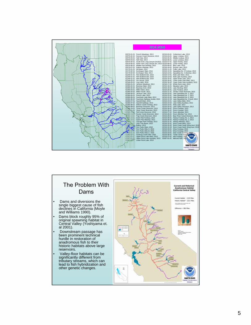
5
02079-01-01 French Meadows; 201302079-02-01 Duncan Creek Diversion; 201302079-03-01 Hell Hole; 201302079-03-01 Hell Hole; 201302079-04-01 South Fork Long Canyon Div201302079-05-01 North Fork Long Canyon Div; 201302079-06-01 Middle Fork Interbay; 201302079-07-01 Ralston Afterbay; 201302179-01-01 McSwain; 201402179-02-01 Exchequer Main; 201402179-02-02 Exchequer Dike; 201402246-01-01 New Bullards Bar; 201602246-01-01 New Bullards Bar; 201602246-01-01 New Bullards Bar; 201602246-02-01 Our House; 201602246-03-01 Log Cabin; 201602266-01-01 Jackson Meadows; 201302266-02-01 Bowman Main; 201302266-02-02 Bowman Arch; 201302266-03-01 Milton Main; 201302266-03-02 Milton South; 201302266-04-01 Jackson Lake; 201302266-05-01 French Lake; 201302266-06-01 Faucherie Lake Main; 201302266-06-02 Faucherie Spillway Auxilia; 201302266-07-01 Sawmill Main; 201302266-07-02 Sawmill Spillway; 201302266-08-01 Wilson Creek Forebay; 201302266-09-01 Bowman Diversion; 201302266-10-01 Texas Creek Diversion; 201302266-11-01 Clear Creek Diversion; 201302266-12-01 Fall Creek Diversion; 201302266-13-01 Rucker Creek Diversion; 201302266-14-01 Trap Creek Diversion; 201302266-15-01 Dutch Flat Forebay; 201302266-16-01 Dutch Flat Afterbay; 201302266-17-01 Chicago Park Forebay; 201302266-18-01 Little York Basin; 201302266-19-01 Rollins; 201302299-01-01 Don Pedro Main; 201602299-01-02 Don Pedro Dike A; 201602299-01-03 Don Pedro Dike B; 201602299-01-04 Don Pedro Dike C; 201602299-02-01 Gasburg Creek Dike; 201602310-01-01 Upper Rock Lake Main; 201302310-01-02 Upper Rock Lake Auxiliary; 201302310-02-01 Lower Rock Lake; 2013
02310-03-01 Culbertson Lake; 201302310-04-01 Upper Lindsey; 201302310-05-01 Middle Lindsey; 201302310-06-01 Lower Lindsey; 201302310-07-01 Upper Feeley; 201302310-08-01 Lower Feeley; 201302310-09-01 Blue Lake; 201302310-10-01 Rucker Lake; 201302310-11-01 Fuller Lake; 201302310-12-01 Spaulding No. 3 Forebay; 201302310-13-01 Spaulding No. 3 Afterbay; 201302310-14-01 Kidd Lake Main; 201302310-14-02 Kidd Lake Auxiliary; 201302310-15-01 Upper Peak Lake; 201302310-16-01 Lower Peak Lake Main; 201302310-16-02 Lower Peak Lake Auxiliary; 201302310-17-01 White Rock Lake; 201302310-18-01 Meadow Lake; 201302310-19-01 Lake Sterling; 201302310-20-01 Lake Fordyce; 201302310-21-01 Jordan Creek Diversion; 201302310-22-01 Lake Spaulding No. 1; 201302310-22-01 Lake Spaulding No. 1; 201302310-22-02 Lake Spaulding No. 2; 201302310-22-03 Lake Spaulding No. 3 Auxil; 201302310-23-01 Lake Valley Main; 201302310-23-02 Lake Valley Auxiliary; 201302310-24-01 Kelly Lake; 201302310-25-01 Lake Valley Diversion; 201302310-26-01 Drum Forebay; 201302310-26-01 Drum Forebay; 201302310-27-01 Drum Afterbay; 201302310-28-01 Drum Afterbay Toe; 201302310-29-01 Bear River Canal Diversion; 201302310-30-01 Halsey Forebay No. 1; 201302310-30-02 Halsey Forebay No. 2; 201302310-31-01 Halsey Afterbay; 201302310-32-01 Rock Creek Main; 201302310-32-02 Rock Creek South Wing Auxi; 201302310-32-03 Rock Creek North Wing Auxi; 201302310-33-01 Wise Forebay; 201302310-33-01 Wise Forebay; 201302310-34-01 Deer Creek Forebay; 201302310-36-01 Towle Canal Diversion; 201302310-37-01 Alta Forebay; 201302467-01-01 Merced Falls; 2014
%%%%%%%%
%%%
%%% %%%
%%%%%%%%%%
%%%%%%%
%%%%%
%%%%%
%%%%%%%%%%%%%% %%%%%%%%%%%%%%%%%%
%%%%%
%%%%%%%%
%%%
%
2012-2016
The Problem WithDams
• Dams and diversions the single biggest cause of fish declines in California (Moyle and Williams 1990).
• Dams block roughly 95% of original spawning habitat in Central Valley (Yoshiyama et. al 2001).
• Downstream passage has been prominent technical hurdle in restoration of anadromous fish to their historic habitats above large reservoirs.
• Valley-floor habitats can be significantly different from tributary streams, which can lead to fish hybridization and other genetic changes.
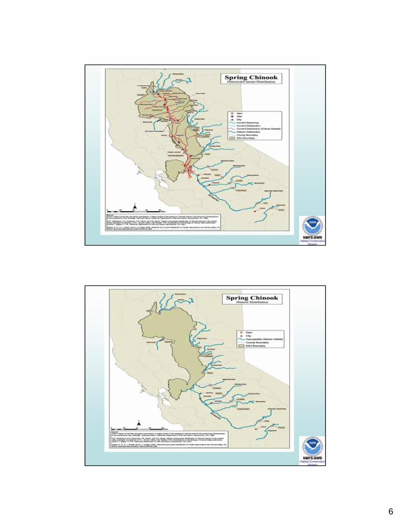
6
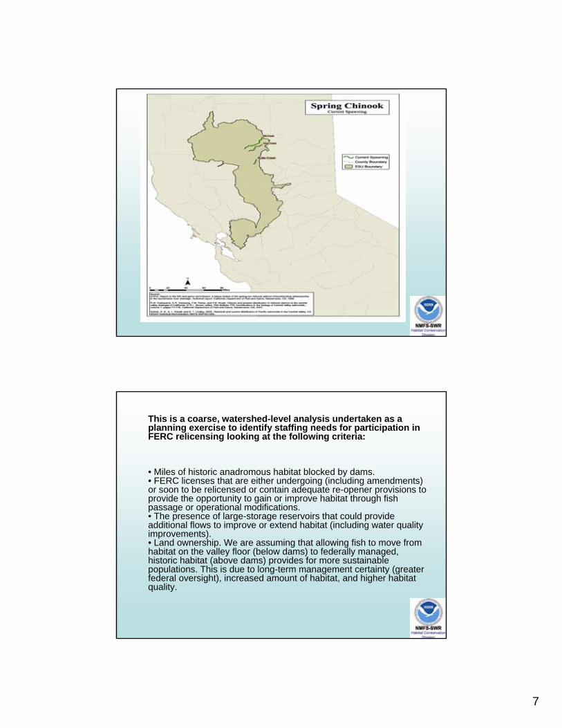
7
This is a coarse, watershed-level analysis undertaken as a planning exercise to identify staffing needs for participation in FERC relicensing looking at the following criteria:
• Miles of historic anadromous habitat blocked by dams. • FERC licenses that are either undergoing (including amendments) or soon to be relicensed or contain adequate re-opener provisions to provide the opportunity to gain or improve habitat through fish passage or operational modifications. • The presence of large-storage reservoirs that could provide additional flows to improve or extend habitat (including water quality improvements). • Land ownership. We are assuming that allowing fish to move from habitat on the valley floor (below dams) to federally managed, historic habitat (above dams) provides for more sustainable populations. This is due to long-term management certainty (greater federal oversight), increased amount of habitat, and higher habitat quality.

8
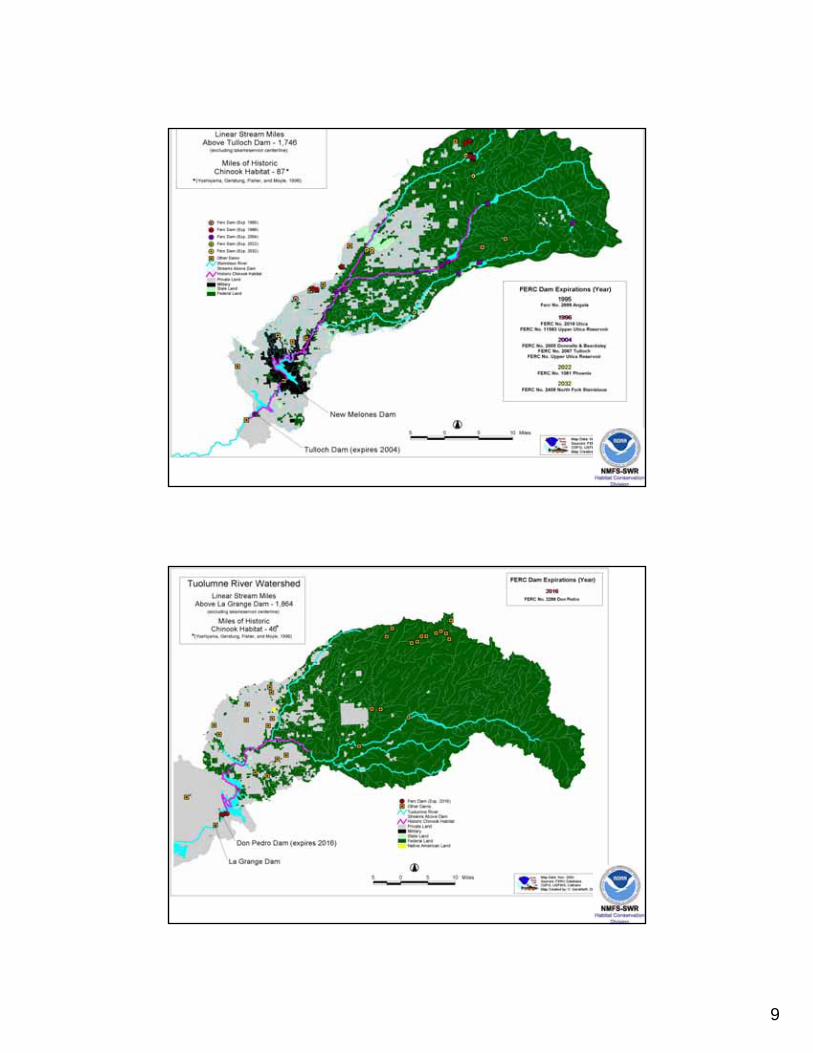
9
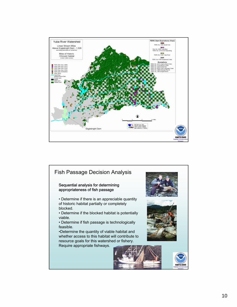
10
Fish Passage Decision Analysis
Sequential analysis for determining appropriateness of fish passage
• Determine if there is an appreciable quantity of historic habitat partially or completely blocked. • Determine if the blocked habitat is potentially viable. • Determine if fish passage is technologically feasible. •Determine the quantity of viable habitat and whether access to this habitat will contribute to resource goals for this watershed or fishery. Require appropriate fishways.
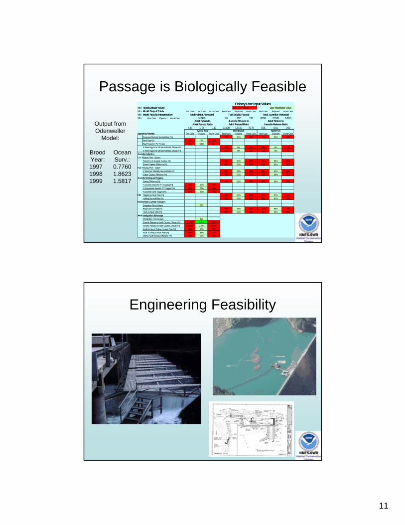
11
Passage is Biologically FeasibleInfo Reset Default Values Boundary Value User Modifiable Value Info Model Output Totals Best Case Expected Worst Case Best Case Expected Worst Case Best Case Expected Worst CaseInfo Model Results Interpretation Total Habitat Accessed Total Adults Passed Total Juveniles ReleasedInfo Best Case Expected Worst Case 647476 192 192 192 60341 23520 14550
4.15 1.72 0.12 314.28 122.50 75.78 0.01 0.01 0.00
Spawning Potential Best Case Expected Worst Case Best Case Expected Worst Case Best Case Expected Worst CasePrespawn Mortality Survival Rate (%) 97% 95% 90% 97% 95% 90%Redd Size (sf) 27 55 223Egg Production Per Female 5520 5365 5209In River Egg to Smolt Survival Rate, Stream (%) 13% 6% 5% 13% 6% 5%In River Egg to Smolt Survival Rate, Ocean (%) 15% 9% 3% 15% 9% 3%
Juvenile CollectionLow Tributary Flow - Screen
Proportion of Juvenile Capture (%) 95% 95% 95% 95% 95% 95%Screen Capture Efficiency (%) 95% 95% 95% 95% 95% 95%
High Tributary Flow - GulperIn Reservoir Mortality Survival Rate (%) 96% 91% 88% 96% 91% 88%Gulper Capture Efficiency (%) 79% 50% 21% 79% 50% 21%
Juvenile Sorting and TaggingSorting Efficiency (%) 99% 95% 90% 99% 95% 90%% Juvenile Sized for PIT Tagging (%) 25% 50% 75%% Appropriate Juvenile PIT Tagged (%) 10% 20% 30%% Juvenile CWT Tagged (%) 50% 60% 70%
Info Tagging Survival Rate (%) 99% 97% 95% 99% 97% 95%Holding Survival Rate (%) 99% 97% 86% 99% 97% 86%
Downstream Juvenile TransportEmigration Period (days) 200Barge Survival Rate (%) 99% 95% 70% 99% 95% 70%Truck Survival Rate (%) 99% 98% 88% 99% 98% 88%
Adult Immigration & PassageImmigration Period (days) 120Juvenile Release to Adult Capture, Stream (%) 1.32% 1.41% 0.16%Juvenile Release to Adult Capture, Ocean (%) 0.66% 0.23% 0.08%Adult Holding & Sorting Survival Rate (%) 99% 97% 95%Adult Trucking Survival Rate (%) 99% 96% 92%Marina Adult Release Efficiency (%) 75% 50% 25%
Fishery User Input Values
System Total West Branch North Fork
Adult Return to Adult Passed Ratio
Juvenile Release toAdult Passed Ratio
Adult Return to Juvenile Release RatioOutput from
OdenwellerModel:
Brood OceanYear: Surv.:1997 0.77601998 1.86231999 1.5817
Engineering Feasibility
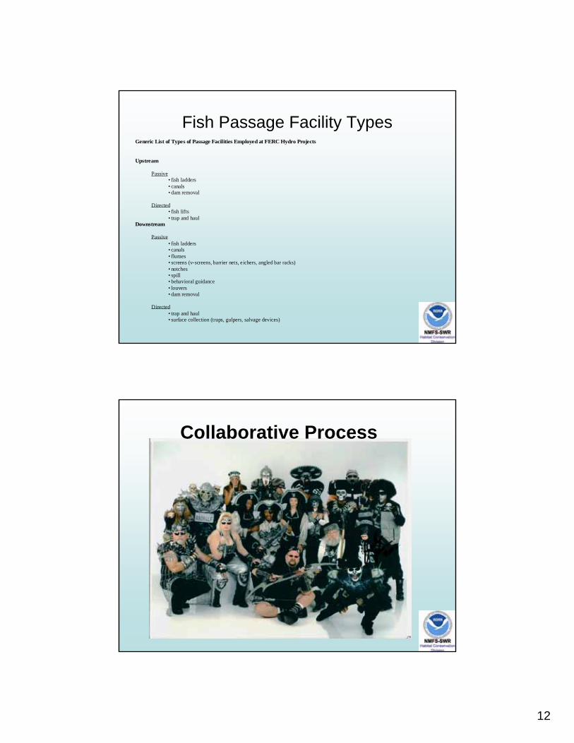
12
Fish Passage Facility TypesGeneric List of Types of Passage Facilities Employed at FERC Hydro Projects
Upstream
Passive• fish ladders• canals• dam removal
Directed• fish lifts• trap and haul
Downstream
Passive• fish ladders• canals• flumes• screens (v-screens, barrier nets, eichers, angled bar racks)• notches• spill• behavioral guidance• louvers• dam removal
Directed• trap and haul• surface collection (traps, gulpers, salvage devices)
Collaborative Process

13

1
FERC Case StudiesKennebec River
Gail Wippelhauser, Ph.D.Maine Department of Marine Resources
KENNEBEC RIVERHistorical ranges Dams
Wyman (121.1 rm) American eelAtlantic salmonalewife
Williams (112.5 rm) American shadCarrabassett River blueback herring
striped bassGilman Stream shortnose sturgeon
Anson UC,DC Atlantic sturgeonSEBASTICOOK RIVER Atlantic tomcod Passage
Abenaki (96.8 rm) DC rainbow smelt U=upstreamWaverly sea lamprey D=downstream
Sandy River MEW sea-run brook trout A=anadromousPioneer C=catadromous
Weston (83 rm) iDA, UC, iDC American eel D=diadromousAtlantic salmon i=interim
UD, DD Burnham (85 rm) alewifeAmerican shad
Shawmut (70 rm) iDA, UC, iDC blueback herringsea lamprey?
Hydro-Kennebec (64 rm) iDA, UC, iDC UD, DD Benton Falls (68rm) striped bass?
Lockwood (63 rm) iUA, iDA,UC, iDC iUA, UC, DA Fort Halifax (63 rm) American eelAtlantic salmon
Messalonskee Stream American eelEdwards (46 rm)
American eelCobboseecontee Stream alewife
DDAmerican Tissue
GULF of MAINE
2
Highlights of 24 years• License expirations: Edwards (1993), Lockwood (2004),
Hydro-Kennebec (1993), Shawmut (2021), Weston (1993), Anson (1993), Wyman (1993), Fort Halifax (1993), Benton Falls (built 1986), Burnham (jurisdictional issue)
• 1984 State petitions FERC for passage, KHDG forms? • 1985 Kennebec River Restoration Plan• 1987 DMR, DIFW, ASC, KHDG sign Settlement Agreement
– 5/1/99 to 5/1/01upstream passage at 7 KHDG dams– Funding for DMR for restoration
• 1987-1998 DMR stocks shad and alewives• 1987ish consultation for Edwards Project begins• 1994 FERC notice of intent to prepare an EIS and conduct
public scoping meetings– Edwards, Fort Halifax, MEW, Weston, Wyman, Messalonskee projects
• 1995 FERC issues draft EIS• 1997 FERC issues EIS
• 1998 Multiple parties sign Settlement Accord– Removal of Edwards Dam and funding for continued restoration – Interim fishlift at Lockwood by 5/1/2006– US passage at Lockwood and Hydro-Kennebec 2 years after 8000 shad passed
at Lockwood, but no sooner than 5/1/2010– US passage at Shawmut 2 years after 15,000 shad at H-K, after 5/1/2012– US passage at Weston 2 years after 35,000 shad at Shawmut, after 5/1/2014– Fishlift at Fort Halifax by May 1, 2003 or partial breach or removal of dam– US passage at Benton Falls and Burnham 1 year after passage at four upriver
nonhydro dams, after 5/1/2002– Eel passage studies by DMR for three years, then recommendations
• 1999 Edwards removed• 1999-2006-2008 DMR stocking shad and alewife• 1999-2008 DMR and/or licensee eel studies• 1999-2003 DMR provides passage at 4 nonhydropower dams • 2002 Multiple parties submit Settlement for Anson and
Abenaki projects (APEA process)• 2003-2008 FERC process and appeals for decommissioning
and breach of Fort Halifax• 2006 fishlifts operational at Benton Falls, Burnham, Lockwood• 2006 MEW dam removed
3
Lessons learned by GSWmay not represent the opinions of the management
• Remove a dam whenever you can
• Multi-party settlements (hydropower owners, state and federal agencies, tribes, conservation groups) allow comprehensive and logical fish passage
– Get the most important thing done first
– Look for a hook
– Luck is important (right time, place, people, energy prices)
– The settlement will never be perfect
– Share your letters (recommendations), argue in private, agree in public
• Everything takes longer than it should
• “Date certain” or “triggered” passage is equally likely to be challenged
P. Mondrian
Broadway-Boogie-Woogie
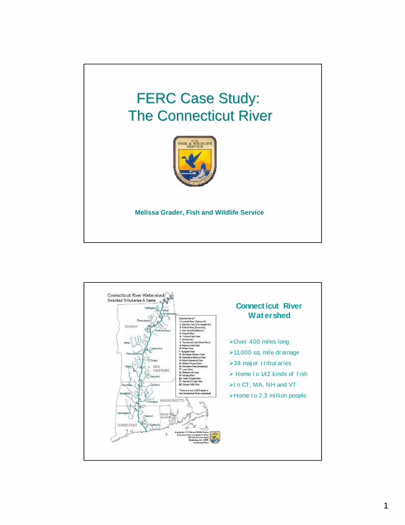
1
FERC Case Study: FERC Case Study: The Connecticut RiverThe Connecticut River
Melissa Grader, Fish and Wildlife Service
Connecticut River Watershed
Over 400 miles long
11,000 sq. mile drainage
38 major tributaries
Home to 142 kinds of fish
In CT, MA, NH and VT
Home to 2.3 million people
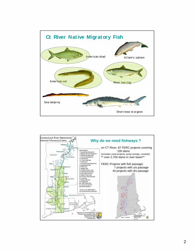
2
Ct River Native Migratory Fish
Atlantic salmon
River herring
Shortnose sturgeon
Sea lamprey
American eel
American shad
Why do we need fishways ?
on CT River: 87 FERC projects covering 100 dams
(excludes canal projects, pump storage, conduits)** over 2,700 dams in river basin**
FERC Projects with fish passage:7 projects with u/s passage
40 projects with d/s passage
3
Fisheries Management on the Connecticut River
Shad & River herring1. Hatchery program
Currently no hatchery program for Alosines2. Adult returns
Shad trapped and trucked from Holyoke to upstream reaches (Vernonand Ashuelot River) and outside basin (Maine, CT coastal)
River herring were T&Ted also until #s dropped too low3. Research
Genetics study/management ongoing to determine if different stocksof blueback herring inhabit different rivers
results to be used in making decisions on where donor stock wouldcome from now & in future
Some fish collected at Holyoke or in river below dam to study fishpassage design, swimming performance, etc. (Conte Lab)UConn study of predator-prey interactions for herring/shad & SB
4. Fish PassageOn rivers targeted for Alosine restoration, secure fish passage viaFERC process or in cooperation with dam owners at non-FERC dams
Fisheries Management on the Connecticut River (cont’d)
American eel
1. ResearchDownstream passage studies at Turners Falls
2. Fish PassageOn rivers targeted for eel restoration, secure fish passage viaFERC process or in cooperation with dam owners at non-FERC damsFor upstream passage, typically conduct assessment to determineareas of highest eel concentration for appropriate siting of fishway
Shortnose Sturgeon (federally-listed species)
1. Researchongoing to assess best method of safely passing sturgeon d/s
2. Fish PassageSturgeon trapped in lift are scanned for tags, weighed, measured thenreleased back into tailrace UNTIL d/s passage figured out

4
History of Mainstem Fish Passage
Tailrace and Spillway entrances
Holyoke eelway
Downstream Bypass
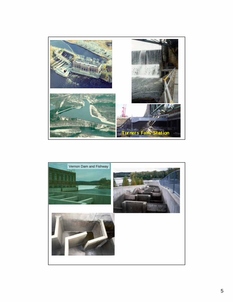
5
Turners Falls Station
Vernon Dam and Fishway
6
Shad Passage at Mainstem Dams
0
20
40
60
80
100
120
140
19671970
19731976
19791982
19851988
19911994
19972000
20032006
Year
% P
assa
ge
0
100000
200000
300000
400000
500000
600000
700000
800000
Holy
oke
Pass
age
Turners Falls Vernon Bellows Falls Holyoke
##
#
#
#
#
#
#
##
#
###
#
#
#
#
#
#
##
#
#
#
#
##
#
#
#
#
#
#
#
#
#
#
#
#
#
#
#
#
#
# #
##
#
#
#
#
#
#
#
#
#
#
#
#
#
#
#
#
#
# #
#
#
##
#
#
#
Lower Collinsville
Rainbow
Farmington River, CT
Upper Collinsville
Over 24 miles of habitat accessibleto shad and river herring
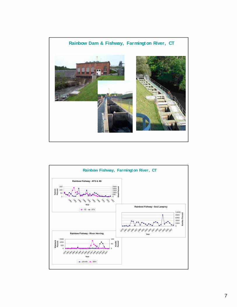
7
Rainbow Dam & Fishway, Farmington River, CT
Rainbow Fishway, Farmington River, CT
Rainbow Fishway - ATS & AS
05001000150020002500
20072004
20011998
19951992
19891986
19831980
Year
Shad
Pas
sed
0
50
100
150
Salm
on
Pass
ed
AS ATS
Rainbow Fishway - River Herring
0
50
100
2007
2005
2003
2001
1999
1997
1995
1993
1991
1989
1987
1985
1983
1981
1979
Year
Ale
wife
Pa
ssed
0
500
1000
1500
Blu
ebac
k Pa
ssed
alewife BBH
Rainbow Fishway - Sea Lamprey
0200040006000800010000
2007
2005
2003
2001
1999
1997
1995
1993
1991
1989
1987
1985
1983
1981
1979
Year
Num
ber P
asse
d
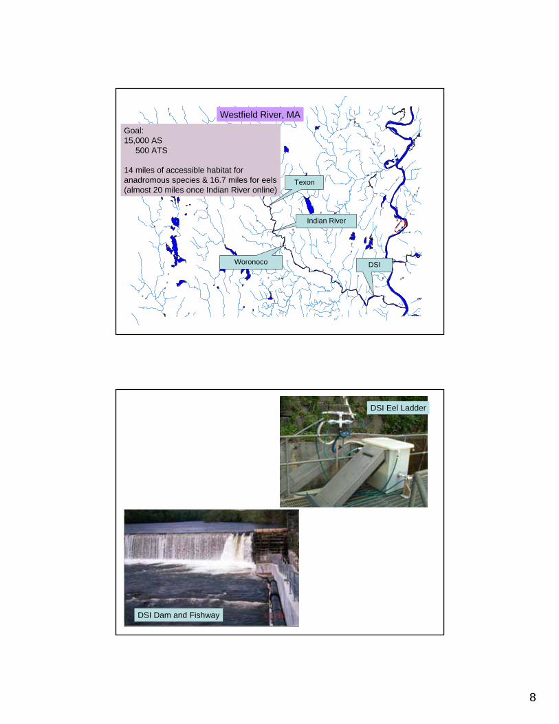
8
#
#
#
#
#
#
#
#
##
#
# #
#
# #
#
#
#
#
#
#
#
#
#
#
#
##
#
#
#
#
#
#
#
#
#
#
##
#
#
#
##
##
#
##
#
#
#
#
##
#
###
#
#
#
#
#
#
#
#
#
#
#
#
#
##
##
#
##
#
#
#
#
#
#
#
#
#
#
#
#
##
#
#
#
#
#
##
#
###
#
#
####
#
#
#
##
#
###
####
####
#
#
#
Westfield River, MA
DSIWoronoco
Texon
Indian River
Goal:15,000 AS
500 ATS
14 miles of accessible habitat for anadromous species & 16.7 miles for eels(almost 20 miles once Indian River online)
DSI Dam and Fishway
DSI Eel Ladder
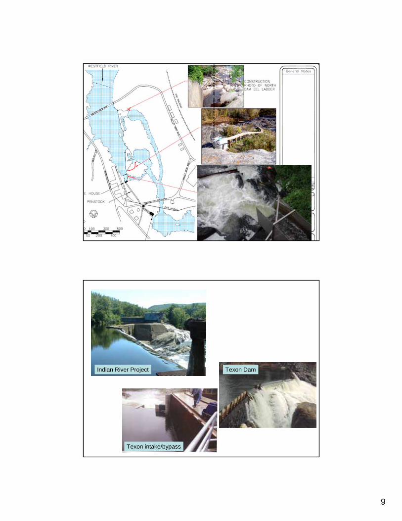
9
Indian River Project
Texon intake/bypass
Texon Dam
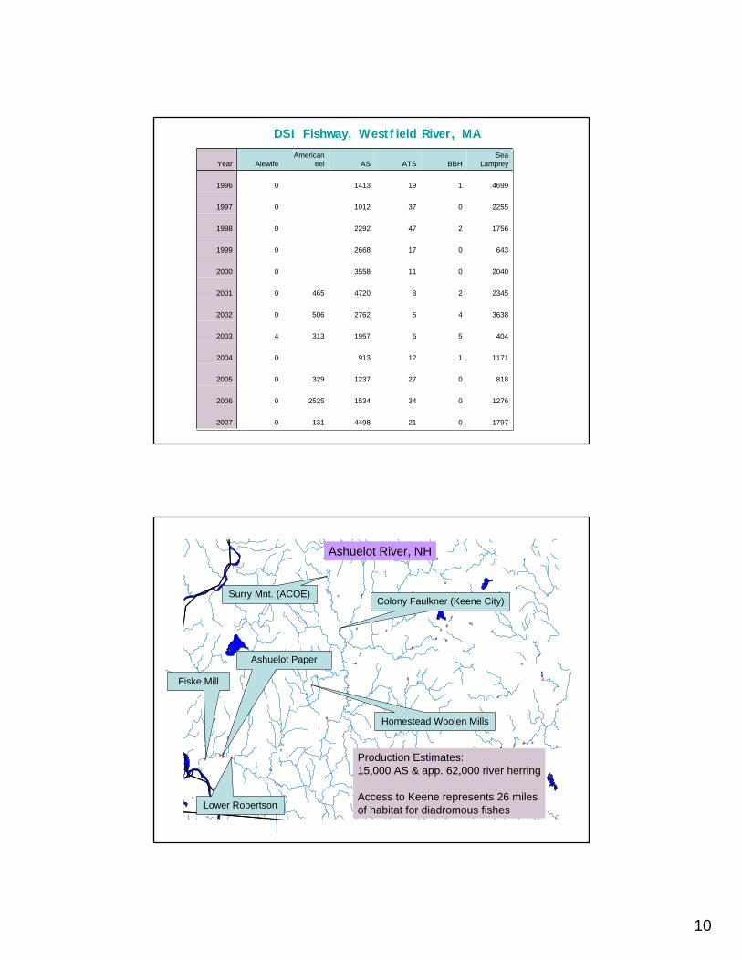
10
1797021449813102007
12760341534252502006
818027123732902005
117111291302004
40456195731342003
363845276250602002
234528472046502001
2040011355802000
643017266801999
1756247229201998
2255037101201997
4699119141301996
Sea LampreyBBHATSAS
American eelAlewifeYear
DSI Fishway, Westfield River, MA
#
#
#
#
#
#
#
#
#
#
#
#
#
#
#
#
#
##
#
#
#
#
#
#
#
# ##
#
#
#
#
#
#
#
#
#
#
#
#
#
#
#
#
#
#
#
#
#
#
#
#
#
#
#
#
#
#
# #
#
#
#
#
#
# #
#
# #
#
#
##
Fiske Mill
Ashuelot Paper
Lower Robertson
Ashuelot River, NH
Colony Faulkner (Keene City)Surry Mnt. (ACOE)
Homestead Woolen Mills
Production Estimates:15,000 AS & app. 62,000 river herring
Access to Keene represents 26 milesof habitat for diadromous fishes
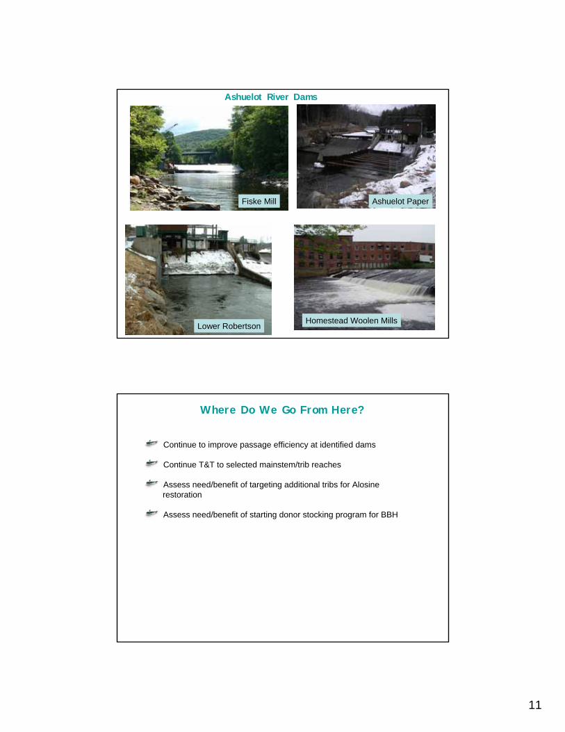
11
Homestead Woolen Mills
Fiske Mill Ashuelot Paper
Lower Robertson
Ashuelot River Dams
Where Do We Go From Here?
Continue to improve passage efficiency at identified dams
Continue T&T to selected mainstem/trib reaches
Assess need/benefit of targeting additional tribs for Alosinerestoration
Assess need/benefit of starting donor stocking program for BBH

12
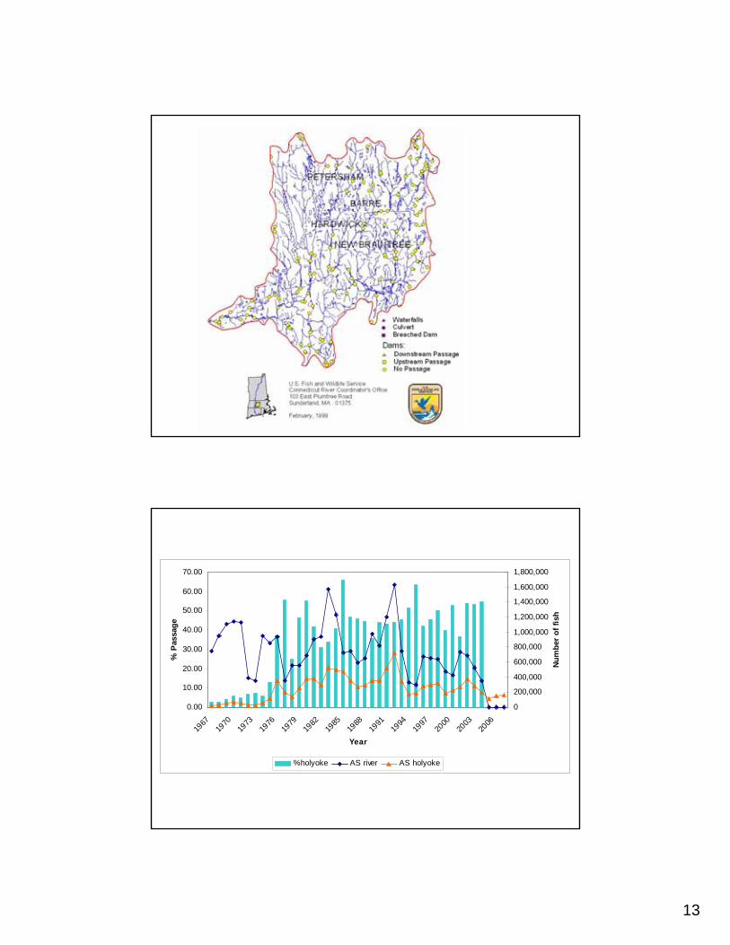
13
0.00
10.00
20.00
30.00
40.00
50.00
60.00
70.00
1967
1970
1973
1976
1979
1982
1985
1988
1991
1994
1997
2000
2003
2006
Year
% P
assa
ge
0
200,000
400,000
600,000
800,000
1,000,000
1,200,000
1,400,000
1,600,000
1,800,000
Num
ber
of fi
sh
%holyoke AS river AS holyoke
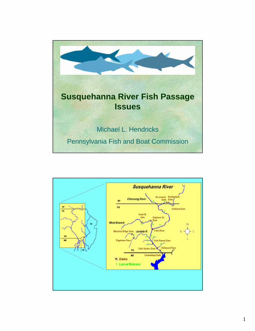
1
Susquehanna River Fish Passage Issues
Michael L. Hendricks
Pennsylvania Fish and Boat Commission
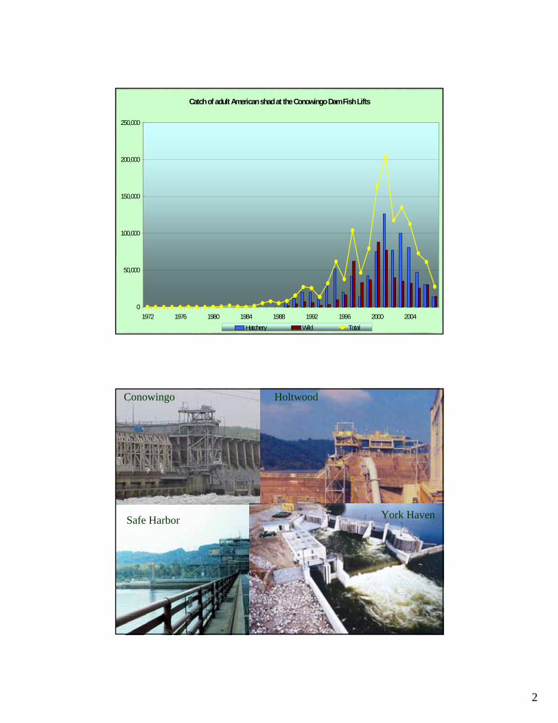
2
Catch of adult American shad at the Conowingo Dam Fish Lifts
0
50,000
100,000
150,000
200,000
250,000
1972 1976 1980 1984 1988 1992 1996 2000 2004Hatchery Wild Total
Conowingo Holtwood
Safe Harbor York Haven
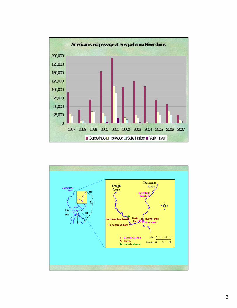
3
American shad passage at Susquehanna River dams.
0
25,000
50,000
75,000
100,000
125,000
150,000
175,000
200,000
1997 1998 1999 2000 2001 2002 2003 2004 2005 2006 2007
Conowingo Holtwood Safe Harbor York Haven
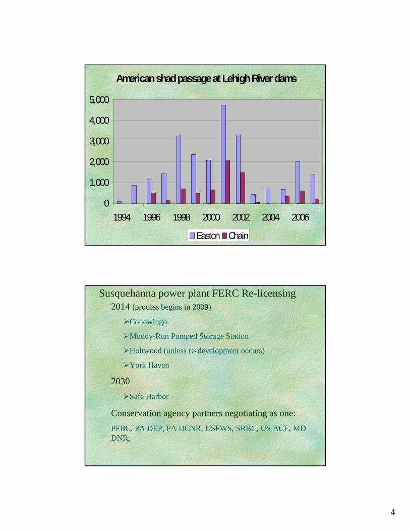
4
American shad passage at Lehigh River dams
0
1,000
2,000
3,000
4,000
5,000
1994 1996 1998 2000 2002 2004 2006
Easton Chain
Susquehanna power plant FERC Re-licensing2014 (process begins in 2009)
Conowingo
Muddy-Run Pumped Storage Station
Holtwood (unless re-development occurs)
York Haven
2030Safe Harbor
Conservation agency partners negotiating as one:PFBC, PA DEP, PA DCNR, USFWS, SRBC, US ACE, MD DNR,
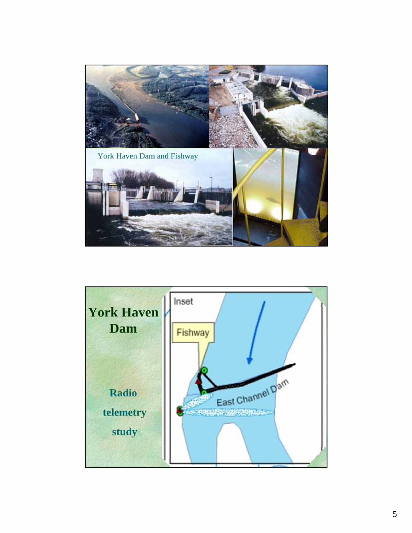
5
York Haven Dam and Fishway
York Haven Dam
Radio
telemetry
study
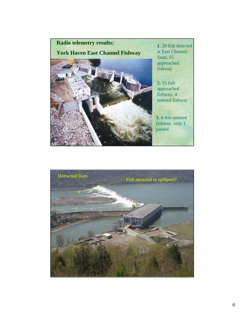
6
Radio telemetry results:
York Haven East Channel Fishway
3. 4 fish entered fishway, only 1 passed
•
1. 20 fish detected at East Channel Dam, 15 approached fishway
2. 15 fish approached fishway, 4 entered fishway
Holtwood DamFish attracted to spillpool?
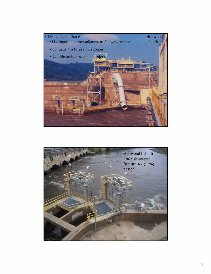
7
Holtwood fish lift•114 found in corner adjacent to fishway entrance
• 63 made > 5 forays into corner
• 44 ultimately passed the project
• 136 entered tailrace
Holtwood fish lift• 86 fish entered fish lift, 46 (53%) passed
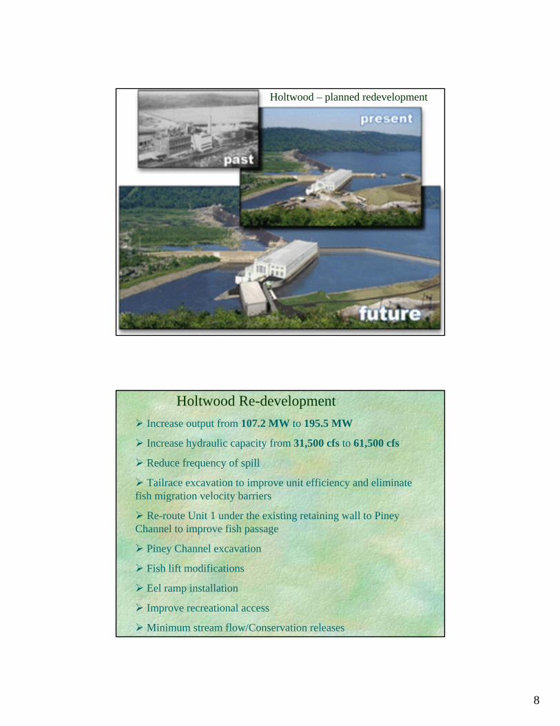
8
Holtwood – planned redevelopment
Holtwood Re-developmentIncrease output from 107.2 MW to 195.5 MW
Increase hydraulic capacity from 31,500 cfs to 61,500 cfs
Reduce frequency of spill
Tailrace excavation to improve unit efficiency and eliminate fish migration velocity barriers
Re-route Unit 1 under the existing retaining wall to Piney Channel to improve fish passage
Piney Channel excavation
Fish lift modifications
Eel ramp installation
Improve recreational access
Minimum stream flow/Conservation releases
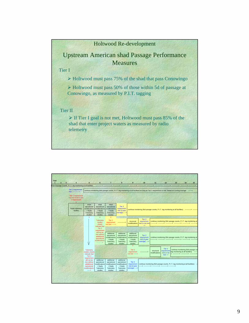
9
Holtwood Re-development
Upstream American shad Passage Performance Measures
Tier I
Holtwood must pass 75% of the shad that pass Conowingo
Holtwood must pass 50% of those within 5d of passage at Conowingo, as measured by P.I.T. tagging
Tier IIIf Tier I goal is not met, Holtwood must pass 85% of the
shad that enter project waters as measured by radio telemetry
Year1 2 3 4 5 6 7 8 9 10 11 12 13 14 15
Tier 1 requirement met ------------->
Tier 1 requirement not met move to tier
2 requirementV
V V V
Tier 2 requirement
not met ------>-------------> structural
modifications
Tier 2 requirement
met or not met--->
V
Tier 2 requirement
not met ------>-------------> structural
modifications
Tier 2 requirement met or not
met--->
Fish Passage Counts, P.I.T. taq monitoring at all facilities ------------> ------------> ------------> ------------> ------------> ------------> ------------> ------------> ------------> ------------> ------------> ------------> --
continue monitoring (fish pasage counts, P.I.T. tag monitoring at all facilities) as long as Tier 1 requirement is met, based on running average. ------>
continue monitoring (fish pasage counts, P.I.T. tag monitoring at all facilities) -----------> ----------
Tier 2 requirement met (3-year
average) --->
initial operational
modifications + Radio
Telemetry studies
Tier 2 requirement met (3-year
average) ---->
continue monitoring (fish pasage counts, P.I.T. tag monitoring at a-----------> ----------> ------------> ------------> ------------> ---------->
Radio telemetry studies
initial operational
modifications + Radio
Telemetry studies
initial operational
modifications + Radio
Telemetry studies
Telemetry studies clearly
indicate that Tier 2
requirement will not be
met without addditional operational
modifications ----------->
Telemetry studies clearly indicate that
Tier 2 requirement will not be
met without addditional operational
modifications ------>
additional operational
modifications + Radio
Telemetry studies
continue monitoring (fish pasage counts, P.I.T. tag monitoring at all facilities) ----------> ------------> ------------> ------------> ---------->
additional operational
modifications + Radio
Telemetry studies
additional operational
modifications + Radio
Telemetry studies
additional operational
modifications + Radio
Telemetry studies
additional operational
modifications + Radio
Telemetry studies
Tier 2 requirement met (3-year
average) --->
additional operational
modifications + Radio
Telemetry studies
continue monitoring (fish pasage counts, P.I.T. tag monitoring at a-----------> ----------> ------------> ------------> ------------> ---------->
continue monitoring (fish pasage coutag monitoring at all facilities) --------> ------------> ------------> ------------>
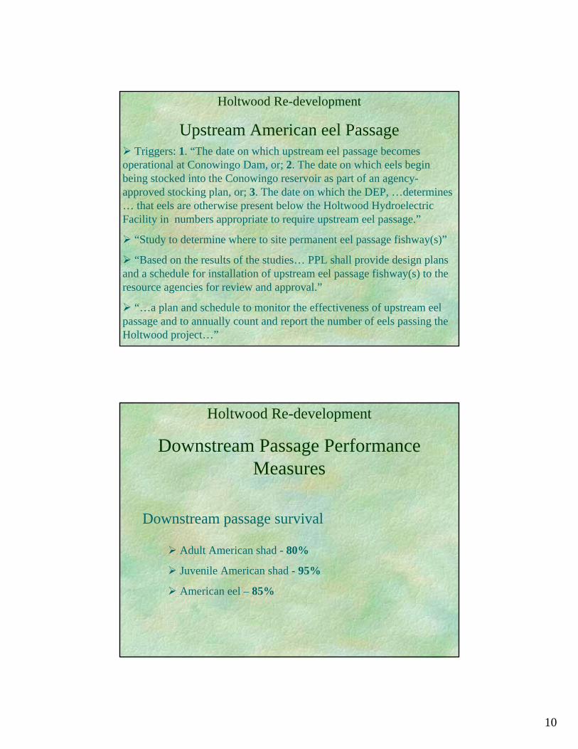
10
Holtwood Re-development
Upstream American eel PassageTriggers: 1. “The date on which upstream eel passage becomes
operational at Conowingo Dam, or; 2. The date on which eels begin being stocked into the Conowingo reservoir as part of an agency-approved stocking plan, or; 3. The date on which the DEP, …determines … that eels are otherwise present below the Holtwood Hydroelectric Facility in numbers appropriate to require upstream eel passage.”
“Study to determine where to site permanent eel passage fishway(s)”
“Based on the results of the studies… PPL shall provide design plans and a schedule for installation of upstream eel passage fishway(s) to the resource agencies for review and approval.”
“…a plan and schedule to monitor the effectiveness of upstream eelpassage and to annually count and report the number of eels passing the Holtwood project…”
Holtwood Re-development
Downstream Passage Performance Measures
Adult American shad - 80%
Juvenile American shad - 95%
American eel – 85%
Downstream passage survival

11
Holtwood Re-development: StatusAlmost 3 years of negotiation
PPL has submitted their draft application to FERC
FERC is processing the application
The resource agencies are continuing to negotiate with PPL on unresolved issues: minimum stream flow, boating access improvements, construction impacts on bald eagle nest sites, endangered plant issues
PA DEP has drafted a 401 certification (includes fish passage conditions) and a COA (Consent Order and Agreement- to avoid litigation )
PPL has not yet applied for a COE 404 permit or the required permits from SRBC
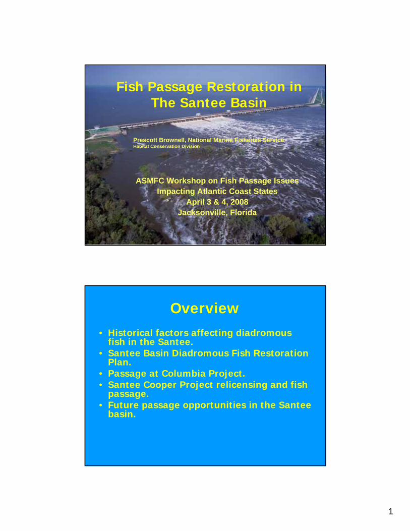
1
Fish Passage Restoration in The Santee Basin
ASMFC Workshop on Fish Passage Issues Impacting Atlantic Coast States
April 3 & 4, 2008Jacksonville, Florida
Prescott Brownell, National Marine Fisheries Service Habitat Conservation Division
Overview• Historical factors affecting diadromous
fish in the Santee.• Santee Basin Diadromous Fish Restoration
Plan.• Passage at Columbia Project.• Santee Cooper Project relicensing and fish
passage.• Future passage opportunities in the Santee
basin.
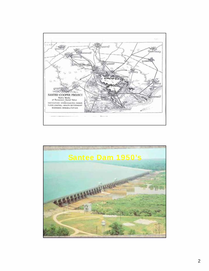
2
Santee Dam 1950’s

3
Fish Passage Begins
• (1950’s) Discovery of “landlocked” striped bass.
• Shad, herring runs relocate to Cooper.• Beginning of herring passage at Pinopolis,
as forage fish for stripers.• Lock passage continued, large numbers of
fish.• 1980’s Discovery of “landlocked”
shortnose sturgeon population.
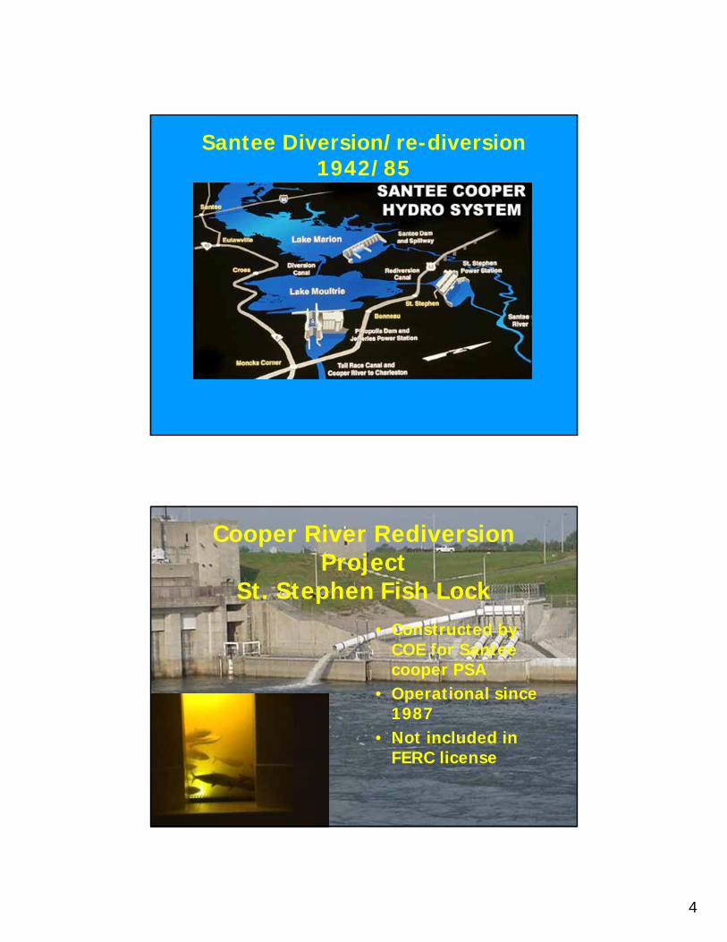
4
Santee Diversion/re-diversion 1942/85
Cooper River RediversionProject
St. Stephen Fish Lock• Constructed by
COE for Santee cooper PSA
• Operational since 1987
• Not included in FERC license
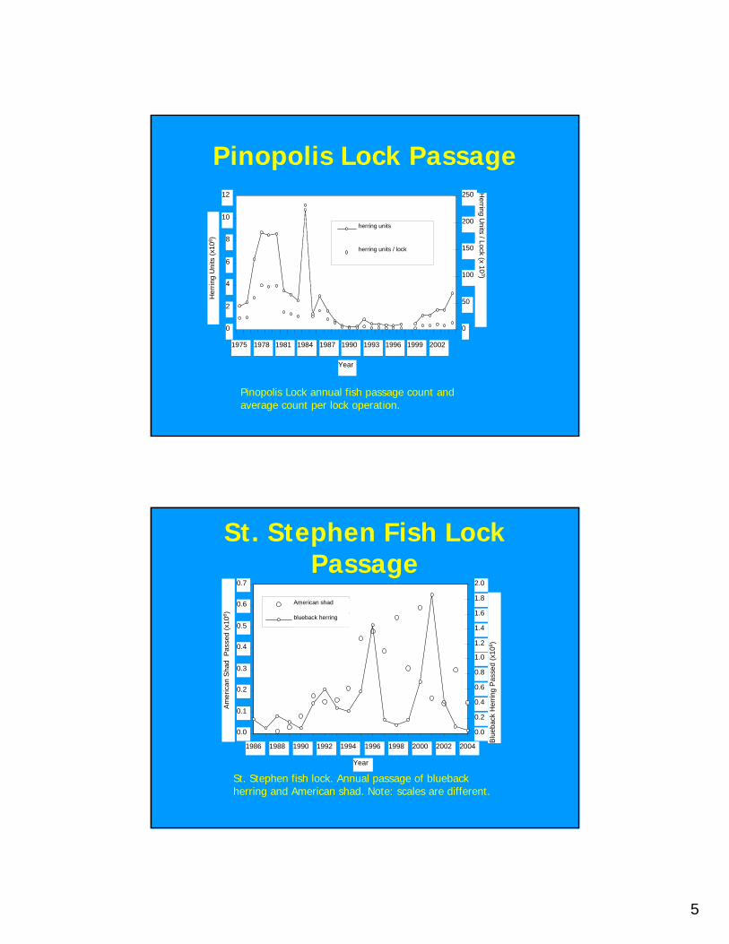
5
Pinopolis Lock Passage
Pinopolis Lock annual fish passage count and average count per lock operation.
0
2
4
6
8
10
12
1975 1978 1981 1984 1987 1990 1993 1996 1999 2002
Year
Her
ring
Uni
ts (x
106 )
0
50
100
150
200
250 Herring U
nits / Lock (x 103)
herring units
herring units / lock
St. Stephen fish lock. Annual passage of blueback herring and American shad. Note: scales are different.
0.0
0.1
0.2
0.3
0.4
0.5
0.6
0.7
1986 1988 1990 1992 1994 1996 1998 2000 2002 2004
Year
Am
eric
an S
had
Pas
sed
(x10
6 )
0.0
0.2
0.4
0.6
0.8
1.0
1.2
1.4
1.6
1.8
2.0
Blu
ebac
k H
errin
g P
asse
d (x
106 )
American shad
blueback herring
St. Stephen Fish Lock Passage
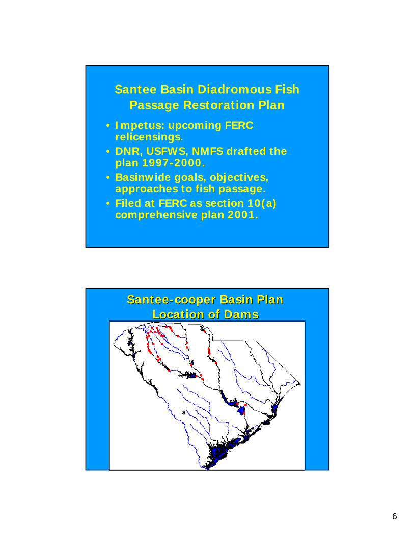
6
Santee Basin Diadromous Fish Passage Restoration Plan
• Impetus: upcoming FERCrelicensings.
• DNR, USFWS, NMFS drafted the plan 1997-2000.
• Basinwide goals, objectives, approaches to fish passage.
• Filed at FERC as section 10(a) comprehensive plan 2001.
SanteeSantee--cooper Basin Plancooper Basin PlanLocation of DamsLocation of Dams
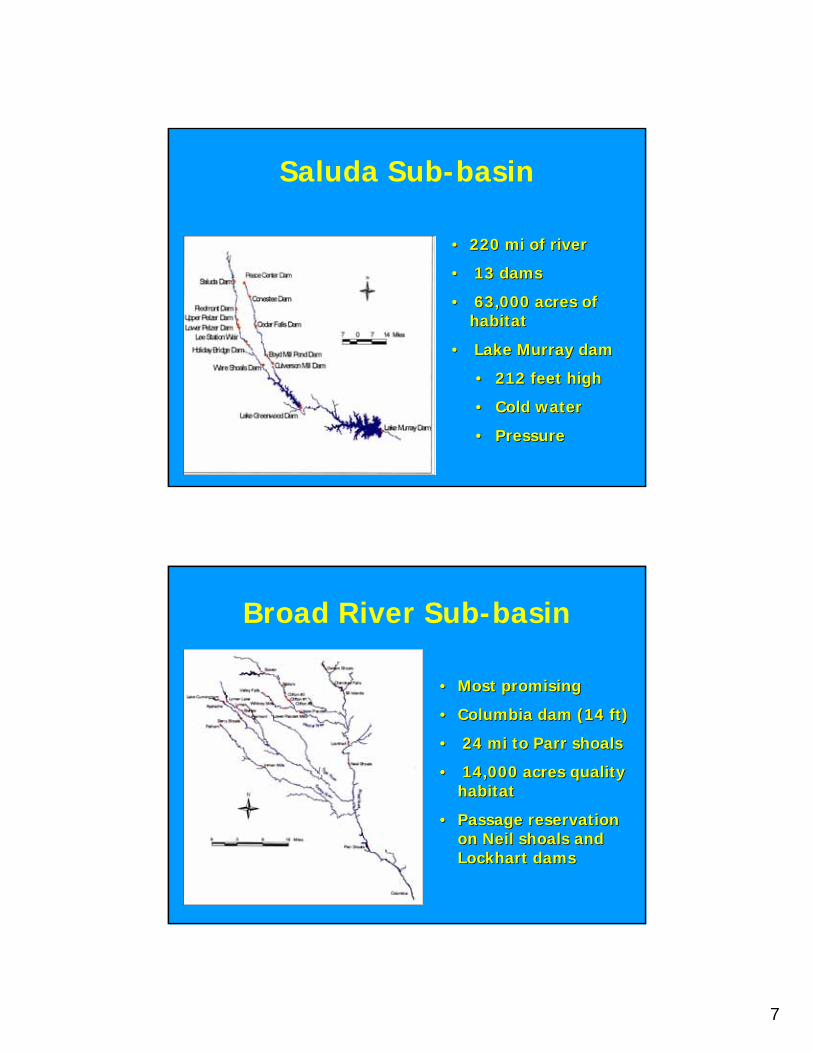
7
Saluda Sub-basin
•• 220 mi of river220 mi of river
•• 13 dams13 dams
•• 63,000 acres of 63,000 acres of habitathabitat
•• Lake Murray damLake Murray dam
•• 212 feet high212 feet high
•• Cold waterCold water
•• PressurePressure
Broad River Sub-basin
•• Most promisingMost promising
•• Columbia dam (14 ft)Columbia dam (14 ft)
•• 24 mi to Parr shoals24 mi to Parr shoals
•• 14,000 acres quality 14,000 acres quality habitathabitat
•• Passage reservation Passage reservation on Neil shoals and on Neil shoals and Lockhart damsLockhart dams
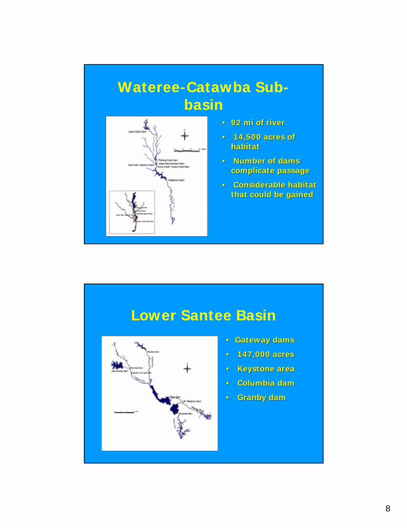
8
Wateree-Catawba Sub-basin
•• 92 mi of river92 mi of river
•• 14,500 acres of 14,500 acres of habitathabitat
•• Number of dams Number of dams complicate passagecomplicate passage
•• Considerable habitat Considerable habitat that could be gainedthat could be gained
Lower Santee Basin•• Gateway damsGateway dams
•• 147,000 acres147,000 acres
•• Keystone areaKeystone area
•• Columbia damColumbia dam
•• Granby damGranby dam
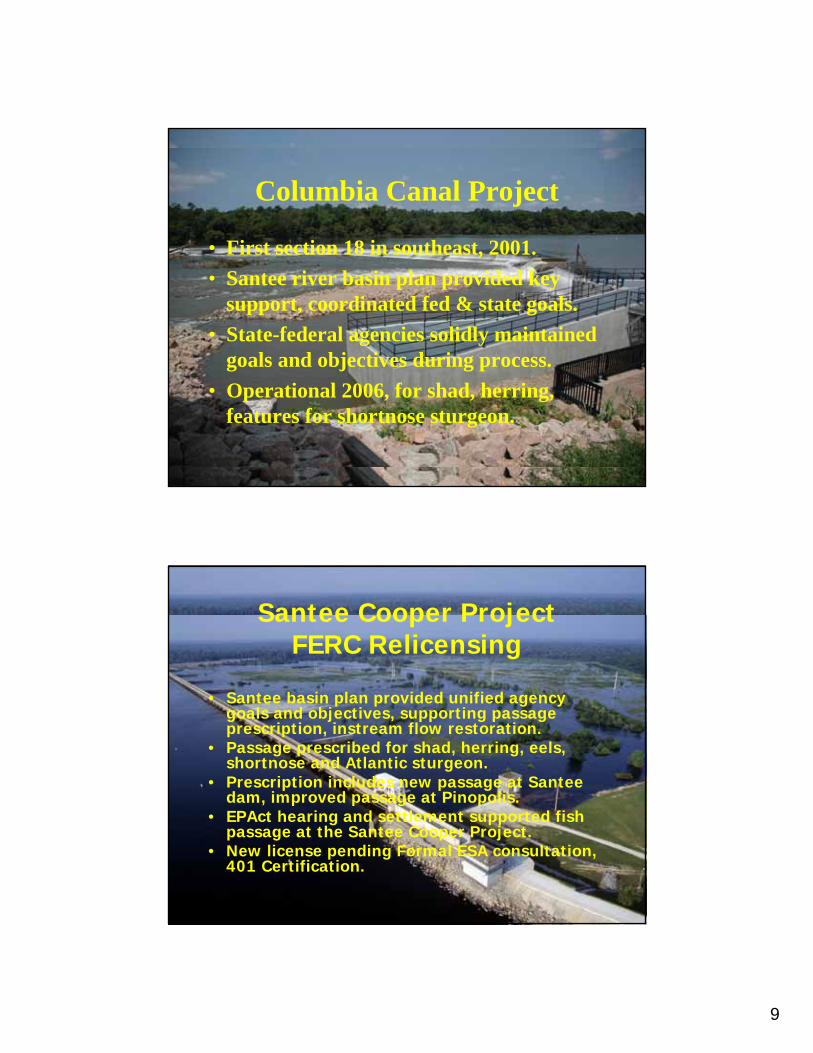
9
Columbia Canal Project
• First section 18 in southeast, 2001.• Santee river basin plan provided key
support, coordinated fed & state goals.• State-federal agencies solidly maintained
goals and objectives during process.• Operational 2006, for shad, herring,
features for shortnose sturgeon.
Santee Cooper ProjectFERC Relicensing
• Santee basin plan provided unified agency goals and objectives, supporting passage prescription, instream flow restoration.
• Passage prescribed for shad, herring, eels, shortnose and Atlantic sturgeon.
• Prescription includes new passage at Santee dam, improved passage at Pinopolis.
• EPAct hearing and settlement supported fish passage at the Santee Cooper Project.
• New license pending Formal ESA consultation, 401 Certification.
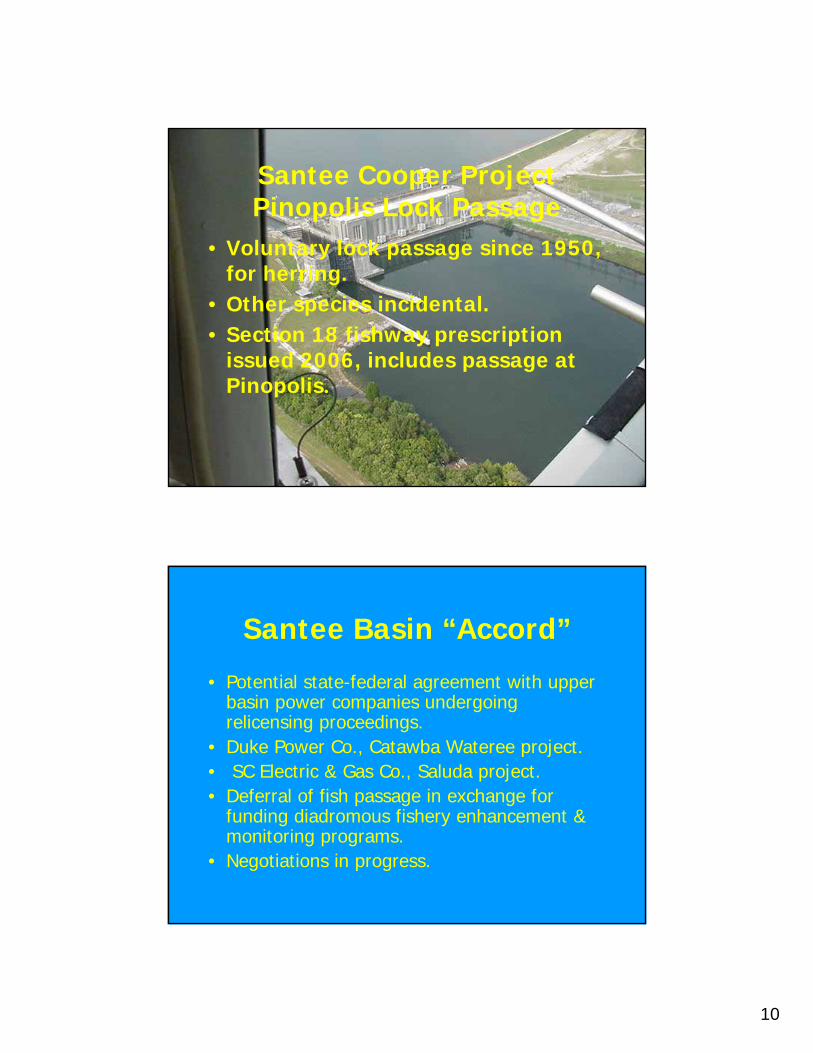
10
Santee Cooper ProjectPinopolis Lock Passage
• Voluntary lock passage since 1950, for herring.
• Other species incidental.• Section 18 fishway prescription
issued 2006, includes passage at Pinopolis.
Santee Basin “Accord”
• Potential state-federal agreement with upper basin power companies undergoingrelicensing proceedings.
• Duke Power Co., Catawba Wateree project.• SC Electric & Gas Co., Saluda project.• Deferral of fish passage in exchange for
funding diadromous fishery enhancement & monitoring programs.
• Negotiations in progress.
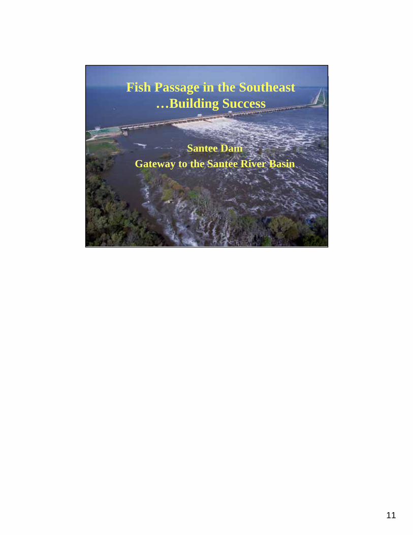
11
Fish Passage in the Southeast…Building Success
Santee DamGateway to the Santee River Basin
1
NOAA’s Fish Passage Activities In the Northeast
John G. Catena NOAA Restoration CenterGloucester, MA
NOAA’s Open Rivers Program
• On-the-ground barrier removal program• dam removals, culvert replacements
• Ecological and socio-economic benefits • National and regional competitive grants processes• Funding AND technical expertise• Leverage through collaboration stewardship and greater local awareness
2
NOAA’s Community-based Restoration Program
• Habitat Restoration technical assistance and grants program
• Focus on tidal wetlands, diadromousfish and shoreline restoration actions• Creates partnerships with local constituencies
• National and regional competitive grants processes• Fosters community support through hands-on citizen involvement in restoration projects• Leverages technical expertise and funds• Instills stewardship and conservation values
National and Regional Partnerships

3
Damage Assessment, Remediation, and Restoration Program
• Authority to claim damages for injuries to natural resources from oil spills and hazardous waste discharges
• OPA and CERCLA
• Use funds to restore injured resources
•“Trustees” – NOAA, USF&WS, and State agencies – joint decision-making
NOAA Restoration CenterNOAA Restoration CenterNortheast Fish Passage ExperienceNortheast Fish Passage Experience
Dam structure Dam structure –– average 8 ft height, most <18average 8 ft height, most <18--ft height, <200ft height, <200--ft lengthft length
RunRun--ofof--the river dams (nonthe river dams (non--hydroelectric facilities)hydroelectric facilities)
Impoundments Impoundments –– most less than 50 acmost less than 50 ac--ft, average depth <5 ftft, average depth <5 ft
Saw Mill Dam, Acushnet River, MASaw Mill Dam, Acushnet River, MASennebecSennebec Lake Dam, MELake Dam, ME
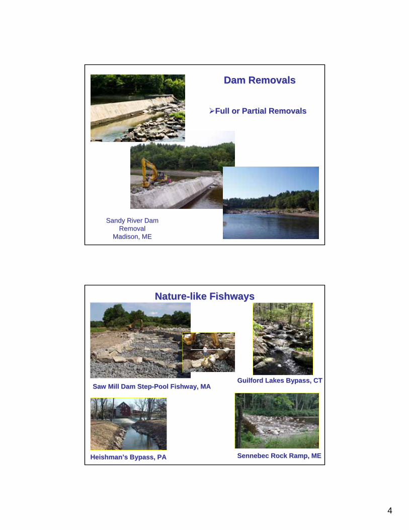
4
Dam RemovalsDam Removals
Sandy River Dam Sandy River Dam RemovalRemoval
Madison, MEMadison, ME
Full or Partial RemovalsFull or Partial Removals
NatureNature--like like FishwaysFishways
Saw Mill Dam StepSaw Mill Dam Step--Pool Pool FishwayFishway, MA, MAGuilford Lakes Bypass, CTGuilford Lakes Bypass, CT
Heishman’sHeishman’s Bypass, PABypass, PA SennebecSennebec Rock Ramp, MERock Ramp, ME
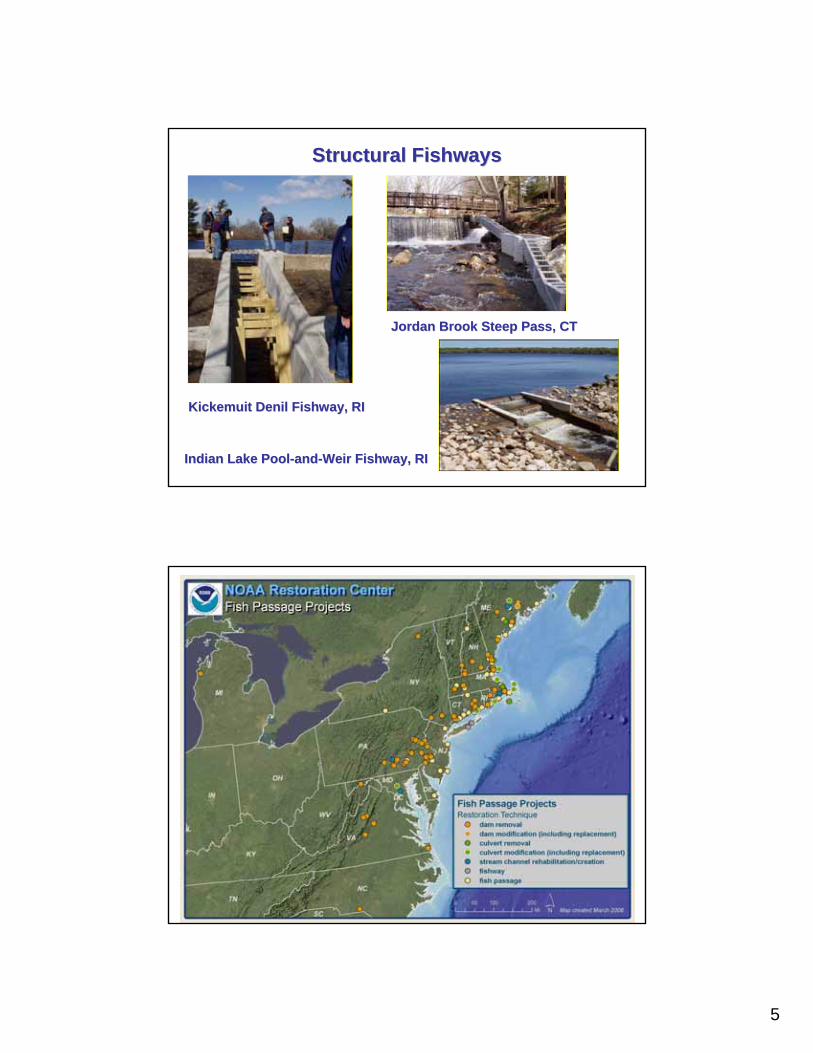
5
Structural Structural FishwaysFishways
KickemuitKickemuit DenilDenil FishwayFishway, RI, RI
Jordan Brook Steep Pass, CTJordan Brook Steep Pass, CT
Indian Lake PoolIndian Lake Pool--andand--Weir Weir FishwayFishway, RI, RI
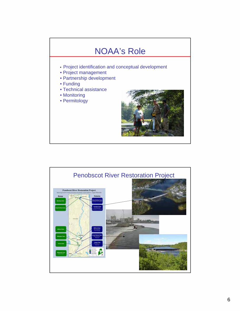
6
NOAA’s Role• Project identification and conceptual development• Project management• Partnership development• Funding• Technical assistance• Monitoring• Permitology
Penobscot River Restoration Project
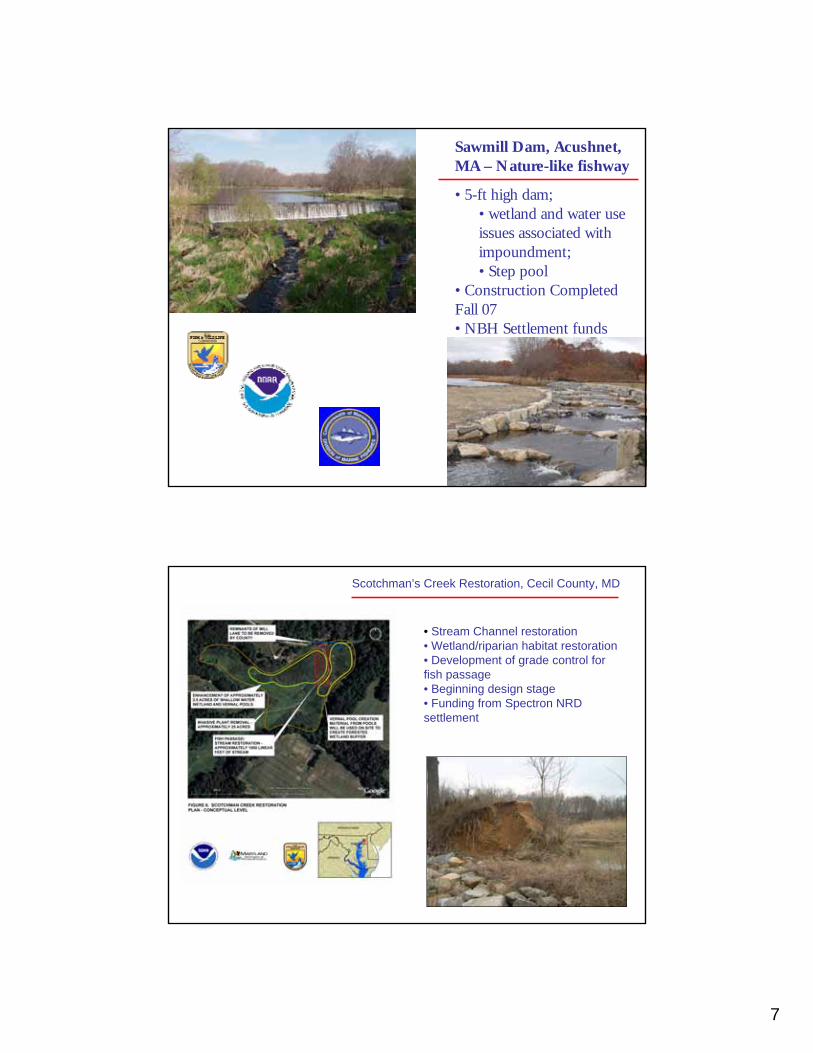
7
Sawmill Dam, Acushnet, MA – Nature-like fishway
• 5-ft high dam; • wetland and water use issues associated with impoundment; • Step pool
• Construction Completed Fall 07• NBH Settlement funds
Scotchman’s Creek Restoration, Cecil County, MD
• Stream Channel restoration• Wetland/riparian habitat restoration• Development of grade control for fish passage• Beginning design stage• Funding from Spectron NRD settlement
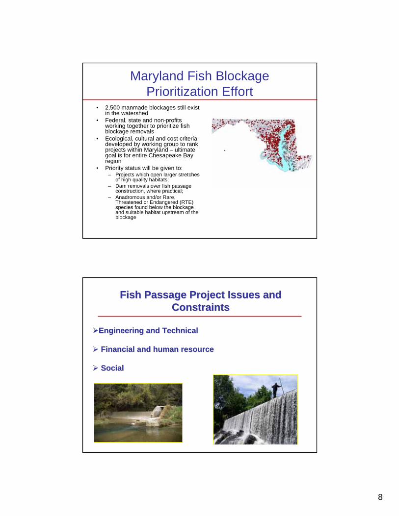
8
Maryland Fish Blockage Prioritization Effort
• 2,500 manmade blockages still exist in the watershed
• Federal, state and non-profits working together to prioritize fish blockage removals
• Ecological, cultural and cost criteria developed by working group to rank projects within Maryland – ultimate goal is for entire Chesapeake Bay region
• Priority status will be given to: – Projects which open larger stretches
of high quality habitats;– Dam removals over fish passage
construction, where practical;– Anadromous and/or Rare,
Threatened or Endangered (RTE) species found below the blockage and suitable habitat upstream of the blockage
Fish Passage Project Issues and Fish Passage Project Issues and ConstraintsConstraints
Engineering and TechnicalEngineering and Technical
Financial and human resourceFinancial and human resource
SocialSocial
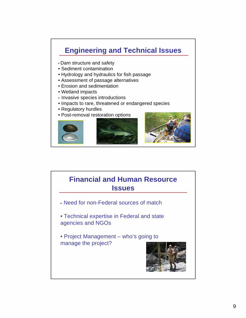
9
Engineering and Technical Issues• Dam structure and safety• Sediment contamination• Hydrology and hydraulics for fish passage• Assessment of passage alternatives • Erosion and sedimentation• Wetland impacts• Invasive species introductions • Impacts to rare, threatened or endangered species• Regulatory hurdles• Post-removal restoration options
Financial and Human Resource Issues
• Need for non-Federal sources of match
• Technical expertise in Federal and state agencies and NGOs
• Project Management – who’s going to manage the project?

10
Potential Project Social IssuesPotential Project Social IssuesCultural resources (historic, archaeological)Cultural resources (historic, archaeological)
Recreation Recreation –– boating, fishing, swimmingboating, fishing, swimmingReRe--introduction of introduction of anadromousanadromous fish to locally important fish to locally important
fishing areasfishing areasWater supply Water supply –– fire protection, agriculture, drinking waterfire protection, agriculture, drinking water
Existing infrastructure (sewer, water utilities, bridges)Existing infrastructure (sewer, water utilities, bridges)
Misperceived changes in river flow and flood protectionMisperceived changes in river flow and flood protection
Aesthetic and sentimental valuesAesthetic and sentimental values
Homestead Dam and Thompson Covered Bridge, NHHomestead Dam and Thompson Covered Bridge, NH Homestead Dam, NH, circa 1860Homestead Dam, NH, circa 1860
http://www.nmfs.noaa.gov/habitat/restoration/

1
A STATE PERSPECTIVE ON NON-HYDROPOWER
DAMS
Stephen Gephard CTDEP/Inland Fisheries Division
Old Lyme, CT
ASFMC Fish Passage Workshop, April 3-4, 2008 Gephard- “State Perspective on Non-Hydropower Dams”
There are an estimated 7,000 dams in Connecticut
Less than 30 generate electricity
Perhaps 20 are FERC-licensed
If we only addressed hydro dams, fish restoration wouldn’t progress far!
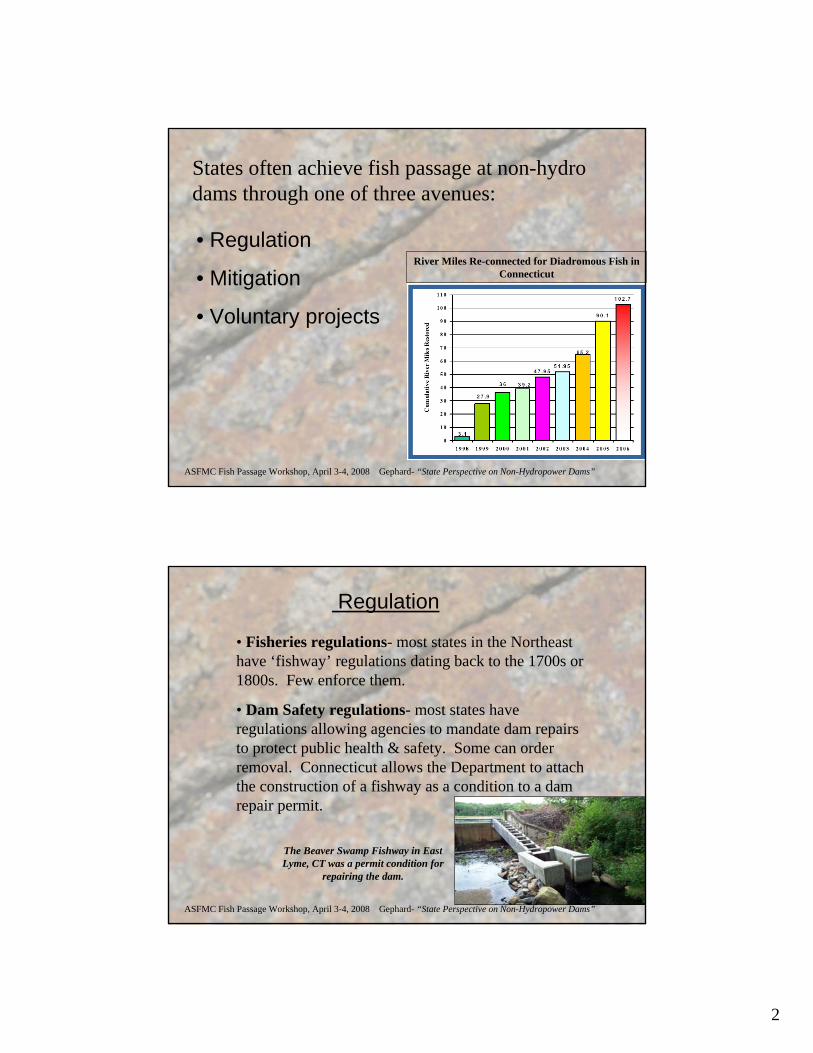
2
ASFMC Fish Passage Workshop, April 3-4, 2008 Gephard- “State Perspective on Non-Hydropower Dams”
States often achieve fish passage at non-hydro dams through one of three avenues:
• Regulation
• Mitigation
• Voluntary projects
River Miles Re-connected for Diadromous Fish in Connecticut
ASFMC Fish Passage Workshop, April 3-4, 2008 Gephard- “State Perspective on Non-Hydropower Dams”
Regulation
• Fisheries regulations- most states in the Northeast have ‘fishway’ regulations dating back to the 1700s or 1800s. Few enforce them.
• Dam Safety regulations- most states have regulations allowing agencies to mandate dam repairs to protect public health & safety. Some can order removal. Connecticut allows the Department to attach the construction of a fishway as a condition to a dam repair permit.
The Beaver Swamp Fishway in East Lyme, CT was a permit condition for
repairing the dam.
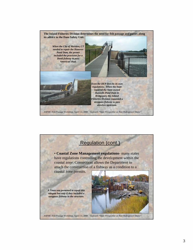
3
ASFMC Fish Passage Workshop, April 3-4, 2008 Gephard- “State Perspective on Non-Hydropower Dams”
When the City of Meriden, CT needed to repair the Hanover
Pond Dam, the permit included the provision for a
Denil fishway to pass American shad.
Even the DEP lives by its own regulations. When the State
repaired the State-owned Bunnells Pond Dam in Bridgeport, the Inland
Fisheries Division requested a steeppass fishway to pass
alewives upstream.
The Inland Fisheries Division determines the need for fish passage and passes along its advice to the Dam Safety Unit.
ASFMC Fish Passage Workshop, April 3-4, 2008 Gephard- “State Perspective on Non-Hydropower Dams”
Regulation (cont.)
• Coastal Zone Management regulations- many states have regulations controlling the development within the coastal zone. Connecticut allows the Department to attach the construction of a fishway as a condition to a coastal zone permits.
A Town was permitted to repair this tidegate but only if they included a steeppass fishway in the structure.
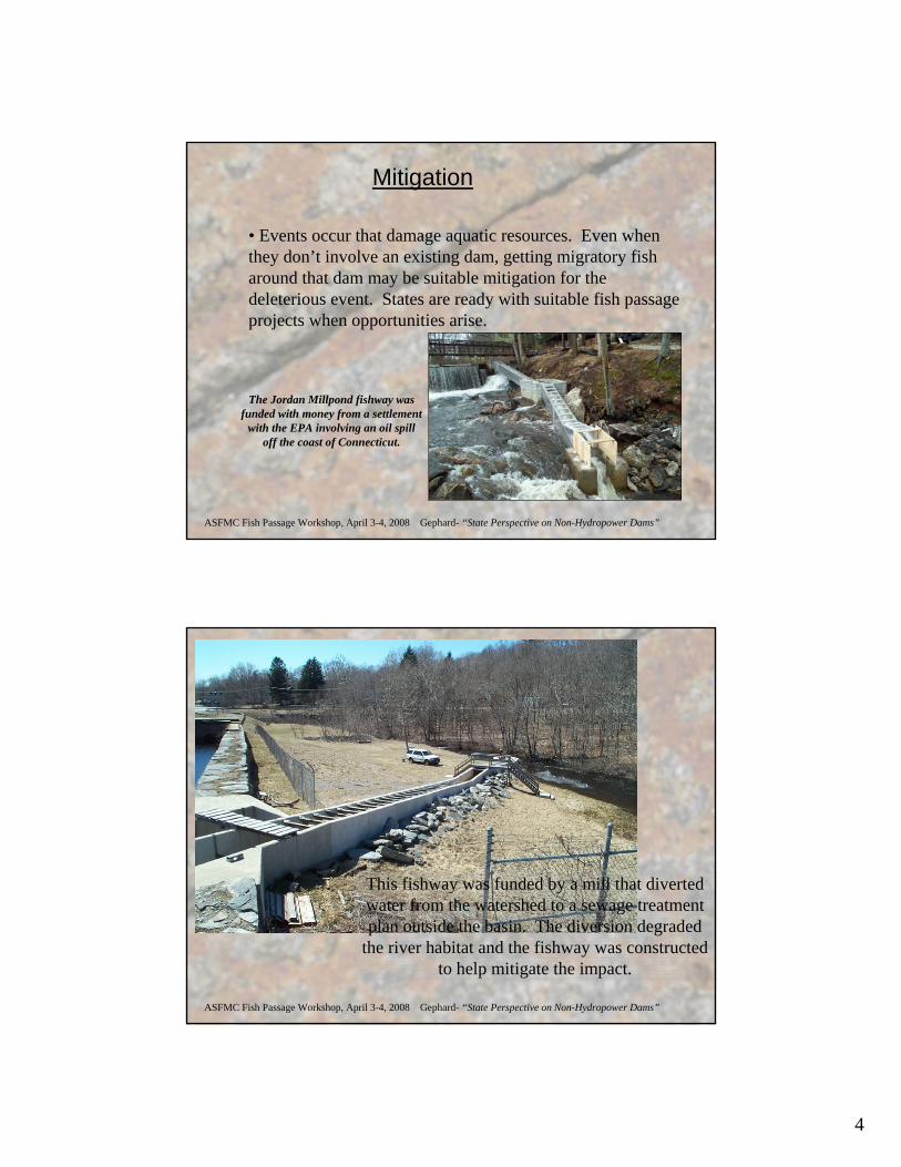
4
ASFMC Fish Passage Workshop, April 3-4, 2008 Gephard- “State Perspective on Non-Hydropower Dams”
Mitigation
• Events occur that damage aquatic resources. Even when they don’t involve an existing dam, getting migratory fish around that dam may be suitable mitigation for the deleterious event. States are ready with suitable fish passage projects when opportunities arise.
The Jordan Millpond fishway was funded with money from a settlement
with the EPA involving an oil spill off the coast of Connecticut.
ASFMC Fish Passage Workshop, April 3-4, 2008 Gephard- “State Perspective on Non-Hydropower Dams”
This fishway was funded by a mill that diverted water from the watershed to a sewage treatment plan outside the basin. The diversion degraded
the river habitat and the fishway was constructed to help mitigate the impact.
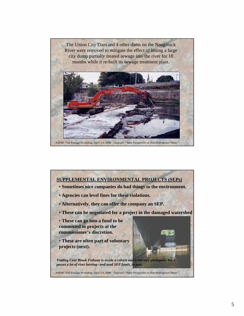
5
ASFMC Fish Passage Workshop, April 3-4, 2008 Gephard- “State Perspective on Non-Hydropower Dams”
The Union City Dam and 4 other dams on the Naugatuck River were removed to mitigate the effect of letting a large
city dump partially treated sewage into the river for 18 months while it re-built its sewage treatment plant.
ASFMC Fish Passage Workshop, April 3-4, 2008 Gephard- “State Perspective on Non-Hydropower Dams”
SUPPLEMENTAL ENVIRONMENTAL PROJECTS (SEPs)• Sometimes nice companies do bad things to the environment.
• Agencies can level fines for these violations.
• Alternatively, they can offer the company an SEP.
• These can be negotiated for a project in the damaged watershed
• These can go into a fund to be committed to projects at the commissioner’s discretion.
• These are often part of voluntary projects (next).
Trading Cove Brook Fishway is inside a culvert and is not very photogenic but it passes a lot of river herring– and used SEP funds, in part.
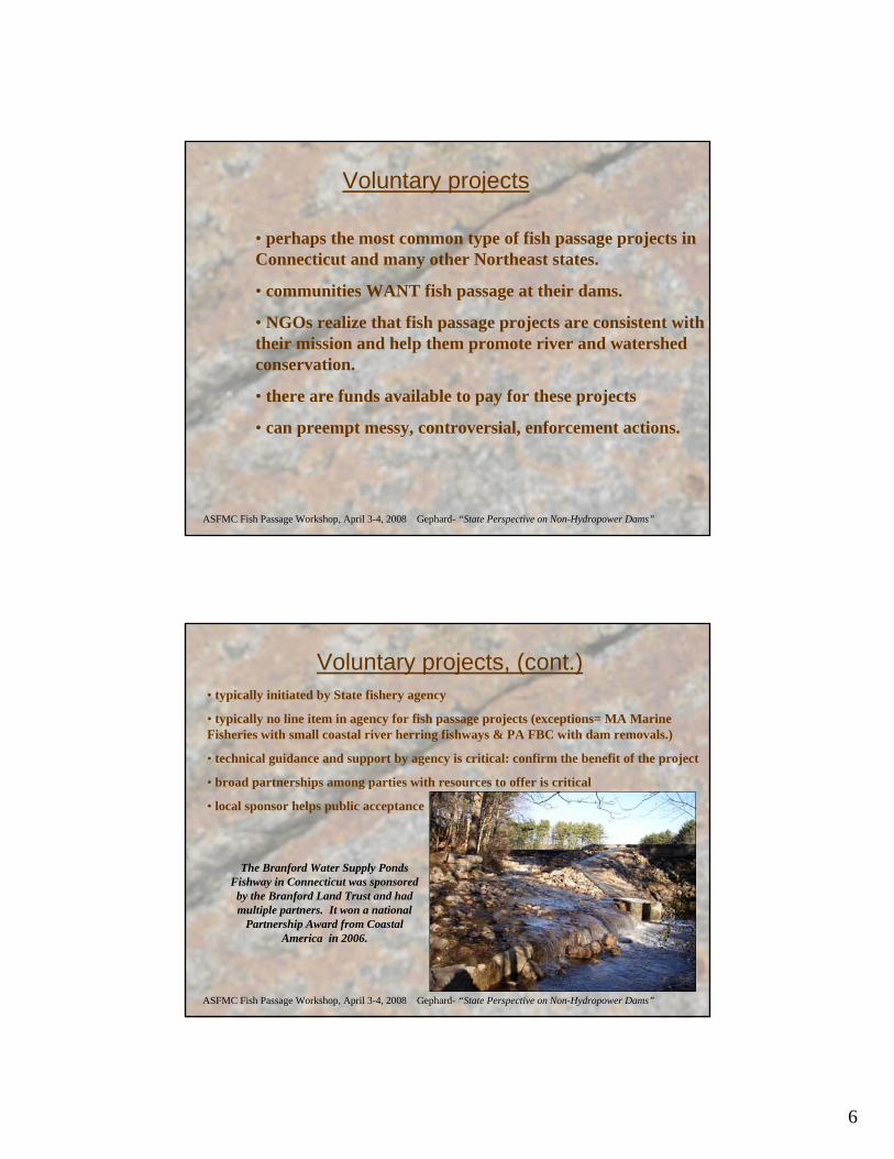
6
ASFMC Fish Passage Workshop, April 3-4, 2008 Gephard- “State Perspective on Non-Hydropower Dams”
Voluntary projects
• perhaps the most common type of fish passage projects in Connecticut and many other Northeast states.
• communities WANT fish passage at their dams.
• NGOs realize that fish passage projects are consistent with their mission and help them promote river and watershed conservation.
• there are funds available to pay for these projects
• can preempt messy, controversial, enforcement actions.
ASFMC Fish Passage Workshop, April 3-4, 2008 Gephard- “State Perspective on Non-Hydropower Dams”
Voluntary projects, (cont.)• typically initiated by State fishery agency
• typically no line item in agency for fish passage projects (exceptions= MA Marine Fisheries with small coastal river herring fishways & PA FBC with dam removals.)
• technical guidance and support by agency is critical: confirm the benefit of the project
• broad partnerships among parties with resources to offer is critical
• local sponsor helps public acceptance
The Branford Water Supply Ponds Fishway in Connecticut was sponsored
by the Branford Land Trust and had multiple partners. It won a national
Partnership Award from Coastal America in 2006.

7
ASFMC Fish Passage Workshop, April 3-4, 2008 Gephard- “State Perspective on Non-Hydropower Dams”
Voluntary projects, (cont.)
Who sponsors projects?
• municipalities• land trusts• watershed organizations• fishing groups (e.g. TU)• conservation groups• homeowner associations
NGOs with professional staff are good candidates to help local sponsor manage projects, e.g. American Rivers, TNC, Save the Sound.
ASFMC Fish Passage Workshop, April 3-4, 2008 Gephard- “State Perspective on Non-Hydropower Dams”
Voluntary projects, (cont.)
A typical project includes these steps:
1. Feasibility/exploration
2. Developing a team, assigning roles
3. Applying for grants
4. Designing the project
5. Applying for more grants
6. Bidding the construction
7. Building the project
8. Operation & Maintenance
eel pass
steeppass
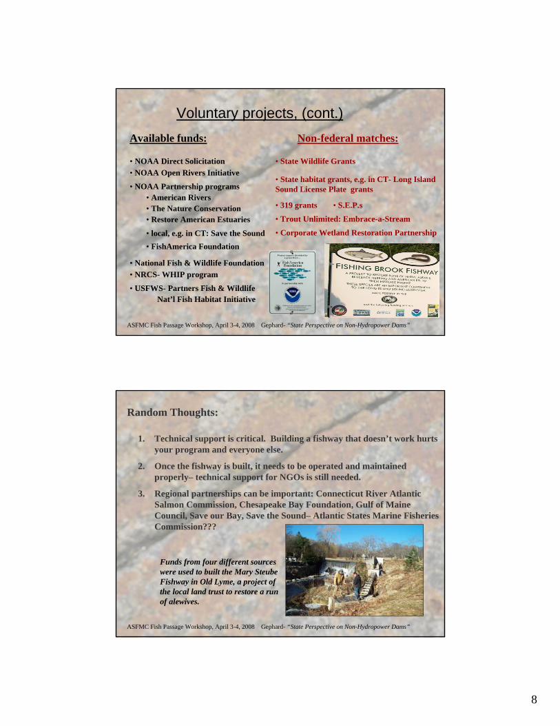
8
ASFMC Fish Passage Workshop, April 3-4, 2008 Gephard- “State Perspective on Non-Hydropower Dams”
Voluntary projects, (cont.)Available funds:
• NOAA Direct Solicitation• NOAA Open Rivers Initiative
• NOAA Partnership programs• American Rivers• The Nature Conservation• Restore American Estuaries
• local, e.g. in CT: Save the Sound
• National Fish & Wildlife Foundation
• FishAmerica Foundation
• NRCS- WHIP program
• USFWS- Partners Fish & Wildlife
Non-federal matches:
• State Wildlife Grants
• State habitat grants, e.g. in CT- Long Island Sound License Plate grants
• 319 grants
• Trout Unlimited: Embrace-a-Stream
• Corporate Wetland Restoration Partnership
• S.E.P.s
Nat’l Fish Habitat Initiative
ASFMC Fish Passage Workshop, April 3-4, 2008 Gephard- “State Perspective on Non-Hydropower Dams”
Random Thoughts:
1. Technical support is critical. Building a fishway that doesn’t work hurts your program and everyone else.
2. Once the fishway is built, it needs to be operated and maintained properly– technical support for NGOs is still needed.
3. Regional partnerships can be important: Connecticut River Atlantic Salmon Commission, Chesapeake Bay Foundation, Gulf of Maine Council, Save our Bay, Save the Sound– Atlantic States Marine Fisheries Commission???
Funds from four different sources were used to built the Mary Steube Fishway in Old Lyme, a project of the local land trust to restore a run of alewives.
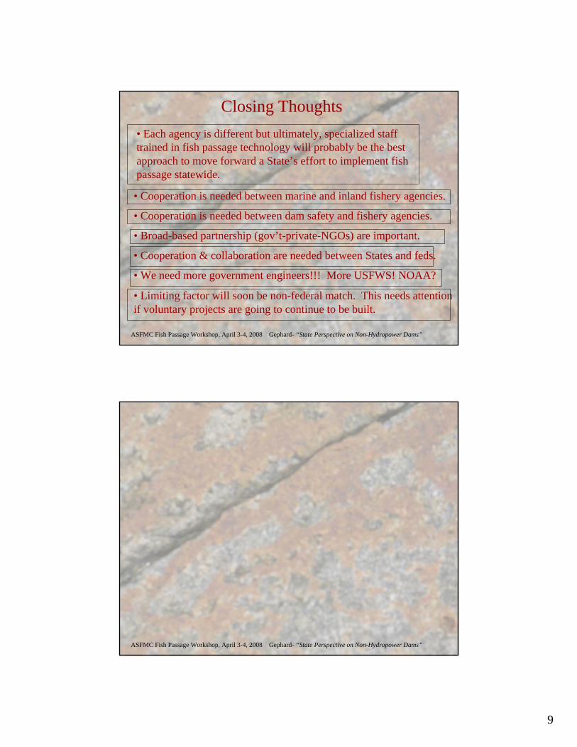
9
ASFMC Fish Passage Workshop, April 3-4, 2008 Gephard- “State Perspective on Non-Hydropower Dams”
Closing Thoughts• Each agency is different but ultimately, specialized staff trained in fish passage technology will probably be the best approach to move forward a State’s effort to implement fish passage statewide.
• Cooperation is needed between marine and inland fishery agencies.
• Cooperation is needed between dam safety and fishery agencies.
• Broad-based partnership (gov’t-private-NGOs) are important.
• Cooperation & collaboration are needed between States and feds.
• We need more government engineers!!! More USFWS! NOAA?
• Limiting factor will soon be non-federal match. This needs attention if voluntary projects are going to continue to be built.
ASFMC Fish Passage Workshop, April 3-4, 2008 Gephard- “State Perspective on Non-Hydropower Dams”
1
Fish Passage and River Restoration at Non-Hydropower Dams
Brian GraberAmerican Rivers
The Restoring Rivers Initiative of American Rivers The Restoring Rivers Initiative of American Rivers specializes in selective dam removal as a specializes in selective dam removal as a reasonable, beneficial and costreasonable, beneficial and cost--effective option effective option for restoring rivers and eliminating public safety for restoring rivers and eliminating public safety hazards.hazards.
On the east coast, we have offices in:On the east coast, we have offices in:Northampton, MANorthampton, MAAlbany, NYAlbany, NYGlastonbury, CTGlastonbury, CTHarrisburg, PAHarrisburg, PAWashington, DCWashington, DCColumbia, SCColumbia, SC
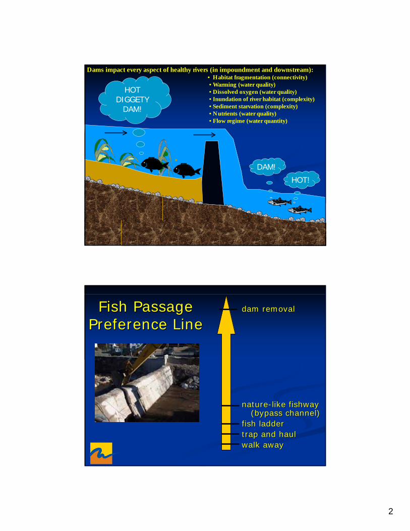
2
DAM!
HOT!
HOTDIGGETY
DAM!
Dams impact every aspect of healthy rivers (in impoundment and downstream):• Habitat fragmentation (connectivity)• Warming (water quality)• Dissolved oxygen (water quality)• Inundation of river habitat (complexity)• Sediment starvation (complexity)• Nutrients (water quality)• Flow regime (water quantity)
Fish Passage Fish Passage Preference LinePreference Line
dam removaldam removal
naturenature--like like fishwayfishway(bypass channel)(bypass channel)
fish ladderfish laddertrap and haultrap and haulwalk awaywalk away
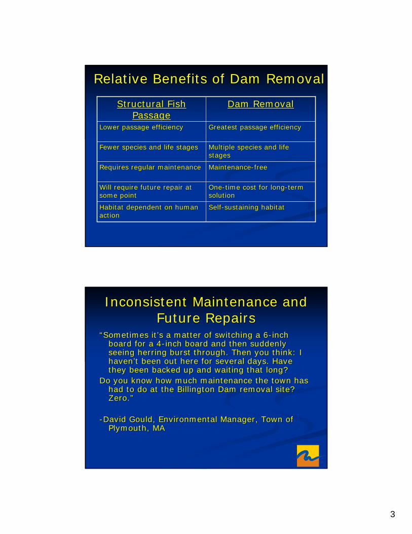
3
Relative Benefits of Dam RemovalRelative Benefits of Dam Removal
SelfSelf--sustaining habitatsustaining habitatHabitat dependent on human Habitat dependent on human actionaction
OneOne--time cost for longtime cost for long--term term solutionsolution
Will require future repair at Will require future repair at some pointsome point
MaintenanceMaintenance--freefreeRequires regular maintenanceRequires regular maintenance
Multiple species and life Multiple species and life stagesstages
Fewer species and life stagesFewer species and life stages
Greatest passage efficiencyGreatest passage efficiencyLower passage efficiencyLower passage efficiency
Dam RemovalDam RemovalStructural Fish Structural Fish PassagePassage
Inconsistent Maintenance and Inconsistent Maintenance and Future RepairsFuture Repairs
“Sometimes it’s a matter of switching a 6“Sometimes it’s a matter of switching a 6--inch inch board for a 4board for a 4--inch board and then suddenly inch board and then suddenly seeing herring burst through. Then you think: I seeing herring burst through. Then you think: I haven’t been out here for several days. Have haven’t been out here for several days. Have they been backed up and waiting that long? they been backed up and waiting that long?
Do you know how much maintenance the town has Do you know how much maintenance the town has had to do at the had to do at the BillingtonBillington Dam removal site? Dam removal site? Zero.”Zero.”
--David Gould, Environmental Manager, Town of David Gould, Environmental Manager, Town of Plymouth, MAPlymouth, MA
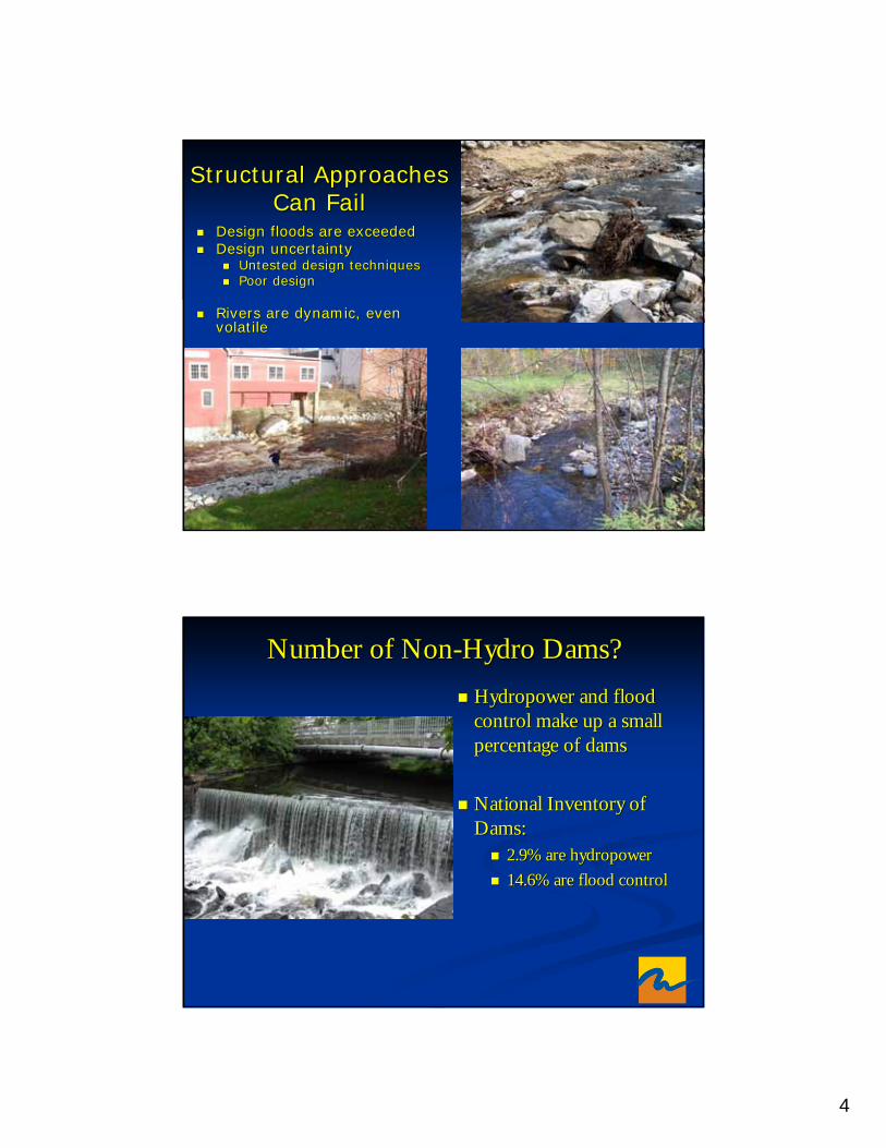
4
Structural Approaches Structural Approaches Can FailCan Fail
Design floods are exceededDesign floods are exceededDesign uncertaintyDesign uncertainty
Untested design techniquesUntested design techniquesPoor designPoor design
Rivers are dynamic, even Rivers are dynamic, even volatilevolatile
Number of NonNumber of Non--Hydro Dams?Hydro Dams?Hydropower and flood Hydropower and flood control make up a small control make up a small percentage of damspercentage of dams
National Inventory of National Inventory of Dams:Dams:
2.9% are hydropower 2.9% are hydropower 14.6% are flood control14.6% are flood control
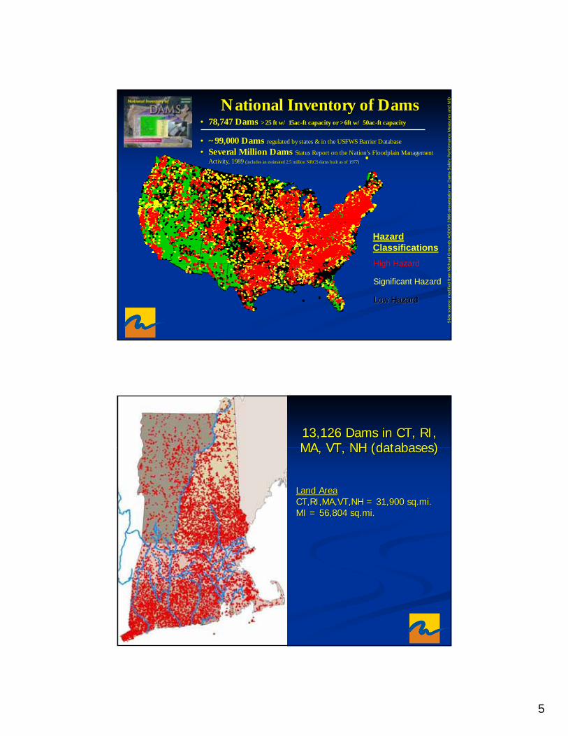
5
National Inventory of DamsNational Inventory of Dams•• 78,747 Dams 78,747 Dams >25 ft w/ 15ac>25 ft w/ 15ac--ft capacity or >6ft w/ 50acft capacity or >6ft w/ 50ac--ft capacityft capacity
•• ~99,000 Dams~99,000 Dams regulated by states & in the USFWS Barrier Databaseregulated by states & in the USFWS Barrier Database
•• Several Million DamsSeveral Million Dams Status Report on the Nation’s Floodplain Management Status Report on the Nation’s Floodplain Management Activity, 1989 Activity, 1989 (includes an estimated 2.5 million NRCS dams built as of 1977)(includes an estimated 2.5 million NRCS dams built as of 1977)
Low Hazard
High Hazard
Significant Hazard
Low HazardLow Hazard
Slid
e so
urce
: mod
ified
from
Mic
hael
Gro
unds
AS
DO
S 2
006
pres
enta
tion
on D
ams
Saf
ety
Per
form
ance
Mea
sure
s an
d N
ID
Hazard Classifications
13,126 Dams in CT, RI, 13,126 Dams in CT, RI, MA, VT, NH (databases)MA, VT, NH (databases)
Land AreaLand AreaCT,RI,MA,VT,NH = 31,900 sq.mi.CT,RI,MA,VT,NH = 31,900 sq.mi.MI = 56,804 sq.mi.MI = 56,804 sq.mi.
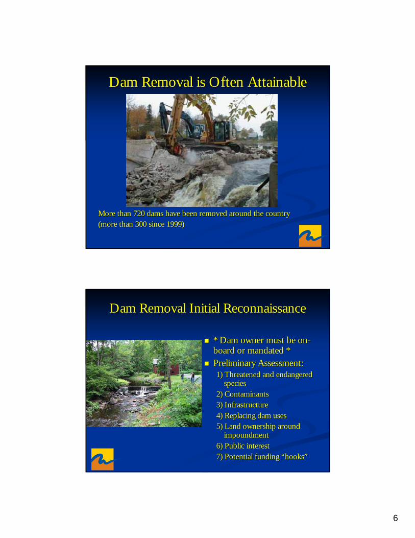
6
Dam Removal is Often AttainableDam Removal is Often Attainable
More than 720 dams have been removed around the country More than 720 dams have been removed around the country (more than 300 since 1999)(more than 300 since 1999)
Dam Removal Initial ReconnaissanceDam Removal Initial Reconnaissance
* Dam owner must be on* Dam owner must be on--board or mandated * board or mandated * Preliminary Assessment:Preliminary Assessment:1) Threatened and endangered 1) Threatened and endangered
speciesspecies2) Contaminants2) Contaminants3) Infrastructure3) Infrastructure4) Replacing dam uses 4) Replacing dam uses 5) Land ownership around 5) Land ownership around
impoundmentimpoundment6) Public interest6) Public interest7) Potential funding “hooks”7) Potential funding “hooks”
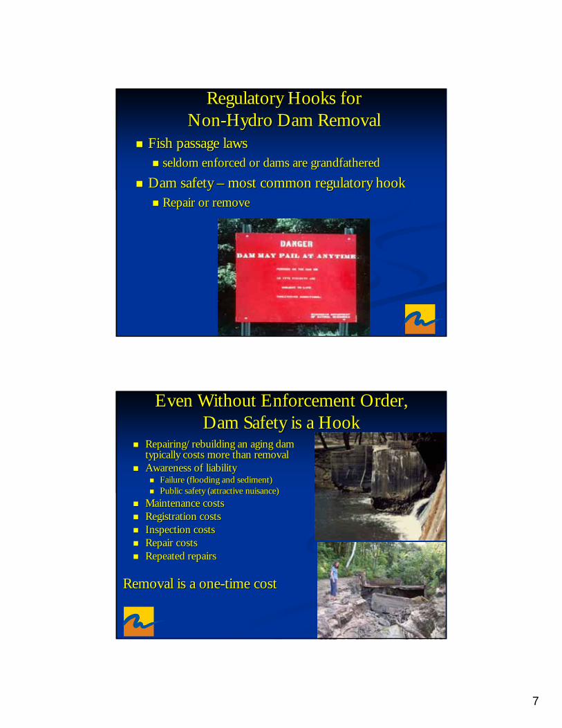
7
Regulatory Hooks for Regulatory Hooks for NonNon--Hydro Dam RemovalHydro Dam Removal
Fish passage lawsFish passage lawsseldom enforced or dams are grandfatheredseldom enforced or dams are grandfathered
Dam safety Dam safety –– most common regulatory hookmost common regulatory hookRepair or removeRepair or remove
Even Without Enforcement Order, Even Without Enforcement Order, Dam Safety is a HookDam Safety is a Hook
Repairing/rebuilding an aging dam Repairing/rebuilding an aging dam typically costs more than removaltypically costs more than removalAwareness of liabilityAwareness of liability
Failure (flooding and sediment)Failure (flooding and sediment)Public safety (attractive nuisance)Public safety (attractive nuisance)
Maintenance costsMaintenance costsRegistration costsRegistration costsInspection costsInspection costsRepair costsRepair costsRepeated repairsRepeated repairs
Removal is a oneRemoval is a one--time costtime cost
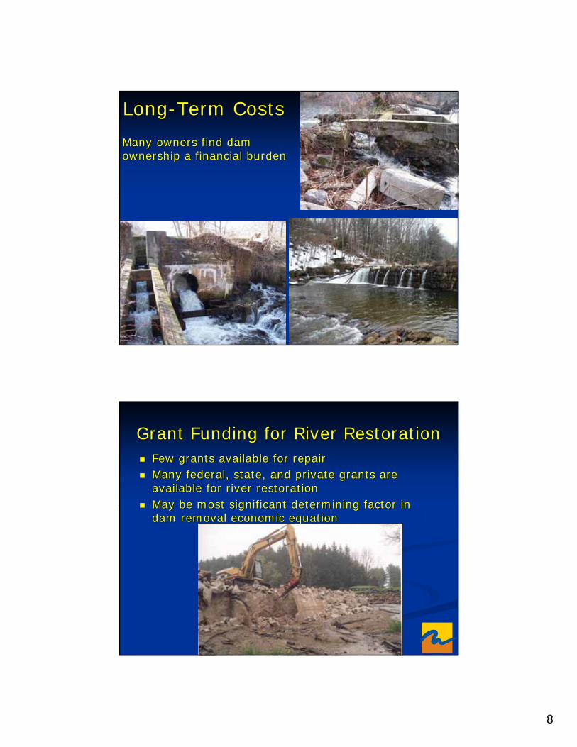
8
LongLong--Term CostsTerm Costs
Many owners find dam Many owners find dam ownership a financial burdenownership a financial burden
Grant Funding for River RestorationGrant Funding for River RestorationFew grants available for repairFew grants available for repairMany federal, state, and private grants are Many federal, state, and private grants are available for river restorationavailable for river restorationMay be most significant determining factor in May be most significant determining factor in dam removal economic equationdam removal economic equation
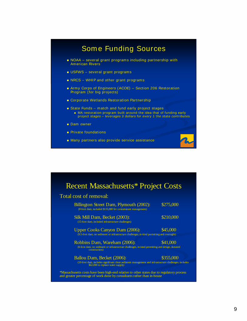
9
Some Funding SourcesSome Funding SourcesNOAA NOAA –– several grant programs including partnership with several grant programs including partnership with American RiversAmerican Rivers
USFWS USFWS –– several grant programsseveral grant programs
NRCS NRCS –– WHIP and other grant programsWHIP and other grant programs
Army Corps of Engineers (ACOE) Army Corps of Engineers (ACOE) –– Section 206 Restoration Section 206 Restoration Program (for big projects)Program (for big projects)
Corporate Wetlands Restoration PartnershipCorporate Wetlands Restoration Partnership
State Funds State Funds –– match and fund early project stagesmatch and fund early project stagesMA restoration program built around the idea that of funding earMA restoration program built around the idea that of funding early ly project stages project stages –– leverages 3 dollars for every 1 the state contributesleverages 3 dollars for every 1 the state contributes
Dam ownerDam owner
Private foundationsPrivate foundations
Many partners also provide service assistanceMany partners also provide service assistance
Recent Massachusetts* Project CostsRecent Massachusetts* Project CostsTotal cost of removal:Total cost of removal:
Billington Street Dam, Plymouth (2002):Billington Street Dam, Plymouth (2002): $275,000$275,000(8(8--foot dam, included $135,000 for contaminant management)foot dam, included $135,000 for contaminant management)
Silk Mill Dam, Becket (2003): Silk Mill Dam, Becket (2003): $210,000$210,000(15(15--foot dam, included infrastructure challenges)foot dam, included infrastructure challenges)
Upper Cooks Canyon Dam (2006): Upper Cooks Canyon Dam (2006): $45,000$45,000(9.5(9.5--foot dam, no sediment or infrastructure challenges, infoot dam, no sediment or infrastructure challenges, in--kind permitting and oversight)kind permitting and oversight)
Robbins Dam, Wareham (2006): Robbins Dam, Wareham (2006): $41,000$41,000(6(6--foot dam, no sediment or infrastructure challenges, infoot dam, no sediment or infrastructure challenges, in--kind permitting and design, donated kind permitting and design, donated
construction)construction)
BallouBallou Dam, Becket (2006): Dam, Becket (2006): $355,000$355,000(10(10--foot dam, includes significant clean sediment management and inffoot dam, includes significant clean sediment management and infrastructure challenges, includes rastructure challenges, includes
$62,000 to replace water supply)$62,000 to replace water supply)
*Massachusetts costs have been high*Massachusetts costs have been high--end relative to other states due to regulatory process end relative to other states due to regulatory process and greater percentage of work done by consultants rather than iand greater percentage of work done by consultants rather than inn--househouse
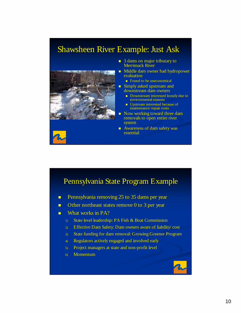
10
ShawsheenShawsheen River Example: Just AskRiver Example: Just Ask3 dams on major tributary to 3 dams on major tributary to Merrimack RiverMerrimack RiverMiddle dam owner had hydropower Middle dam owner had hydropower evaluationevaluation
Found to be uneconomicalFound to be uneconomicalSimply asked upstream and Simply asked upstream and downstream dam ownersdownstream dam owners
Downstream interested loosely due to Downstream interested loosely due to environmental reasonsenvironmental reasonsUpstream interested because of Upstream interested because of maintenance/repair costsmaintenance/repair costs
Now working toward three dam Now working toward three dam removals to open entire river removals to open entire river systemsystemAwareness of dam safety was Awareness of dam safety was essentialessential
Pennsylvania State Program ExamplePennsylvania State Program Example
Pennsylvania removing 25 to 35 dams per yearPennsylvania removing 25 to 35 dams per yearOther northeast states remove 0 to 3 per yearOther northeast states remove 0 to 3 per yearWhat works in PA?What works in PA?
1)1) State level leadership: PA Fish & Boat CommissionState level leadership: PA Fish & Boat Commission2)2) Effective Dam Safety: Dam owners aware of liability/costEffective Dam Safety: Dam owners aware of liability/cost3)3) State funding for dam removal: Growing Greener ProgramState funding for dam removal: Growing Greener Program4)4) Regulators actively engaged and involved earlyRegulators actively engaged and involved early5)5) Project managers at state and nonProject managers at state and non--profit levelprofit level6)6) MomentumMomentum
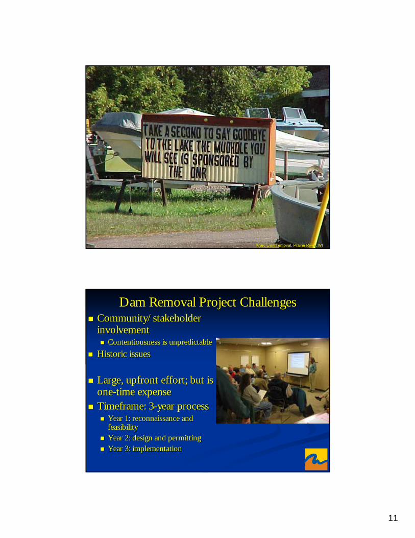
11
Ward Dam removal, Prairie River, WIWard Dam removal, Prairie River, WI
Dam Removal Project ChallengesDam Removal Project ChallengesCommunity/stakeholder Community/stakeholder involvement involvement
Contentiousness is unpredictableContentiousness is unpredictableHistoric issuesHistoric issues
Large, upfront effort; but is Large, upfront effort; but is oneone--time expensetime expenseTimeframe: 3Timeframe: 3--year processyear process
Year 1: reconnaissance and Year 1: reconnaissance and feasibilityfeasibilityYear 2: design and permittingYear 2: design and permittingYear 3: implementationYear 3: implementation
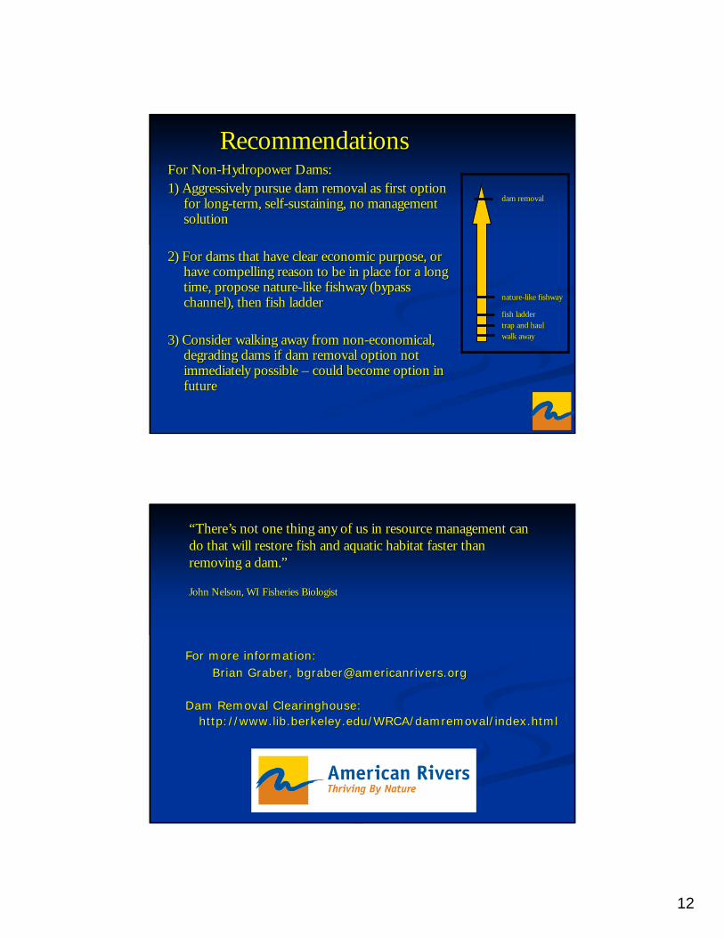
12
RecommendationsRecommendationsFor NonFor Non--Hydropower Dams:Hydropower Dams:1) Aggressively pursue dam removal as first option 1) Aggressively pursue dam removal as first option
for longfor long--term, selfterm, self--sustaining, no management sustaining, no management solutionsolution
2) For dams that have clear economic purpose, or 2) For dams that have clear economic purpose, or have compelling reason to be in place for a long have compelling reason to be in place for a long time, propose naturetime, propose nature--like like fishwayfishway (bypass (bypass channel), then fish ladderchannel), then fish ladder
3) Consider walking away from non3) Consider walking away from non--economical, economical, degrading dams if dam removal option not degrading dams if dam removal option not immediately possible immediately possible –– could become option in could become option in future future
dam removaldam removal
naturenature--like like fishway fishway
fish ladderfish laddertrap and haultrap and haulwalk awaywalk away
“There’s not one thing any of us in resource management can “There’s not one thing any of us in resource management can do that will restore fish and aquatic habitat faster than do that will restore fish and aquatic habitat faster than removing a dam.”removing a dam.”
John Nelson, WI Fisheries BiologistJohn Nelson, WI Fisheries Biologist
For more information:For more information:Brian Graber, Brian Graber, bgraberbgraber@@americanriversamericanrivers.org.org
Dam Removal Clearinghouse:Dam Removal Clearinghouse:http://www.lib.http://www.lib.berkeleyberkeley..eduedu/WRCA//WRCA/damremovaldamremoval/index.html/index.html
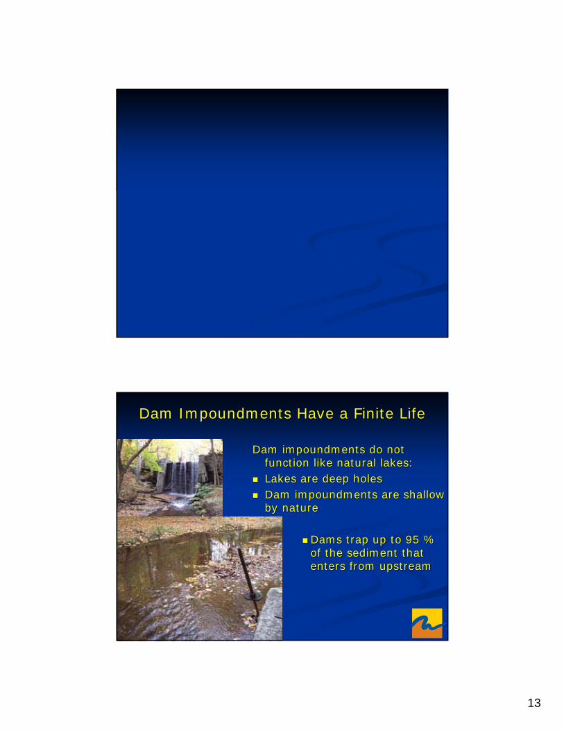
13
Dam Impoundments Have a Finite LifeDam Impoundments Have a Finite Life
Dam impoundments do not Dam impoundments do not function like natural lakes:function like natural lakes:Lakes are deep holesLakes are deep holesDam impoundments are shallow Dam impoundments are shallow by natureby nature
Dams trap up to 95 % Dams trap up to 95 % of the sediment that of the sediment that enters from upstreamenters from upstream
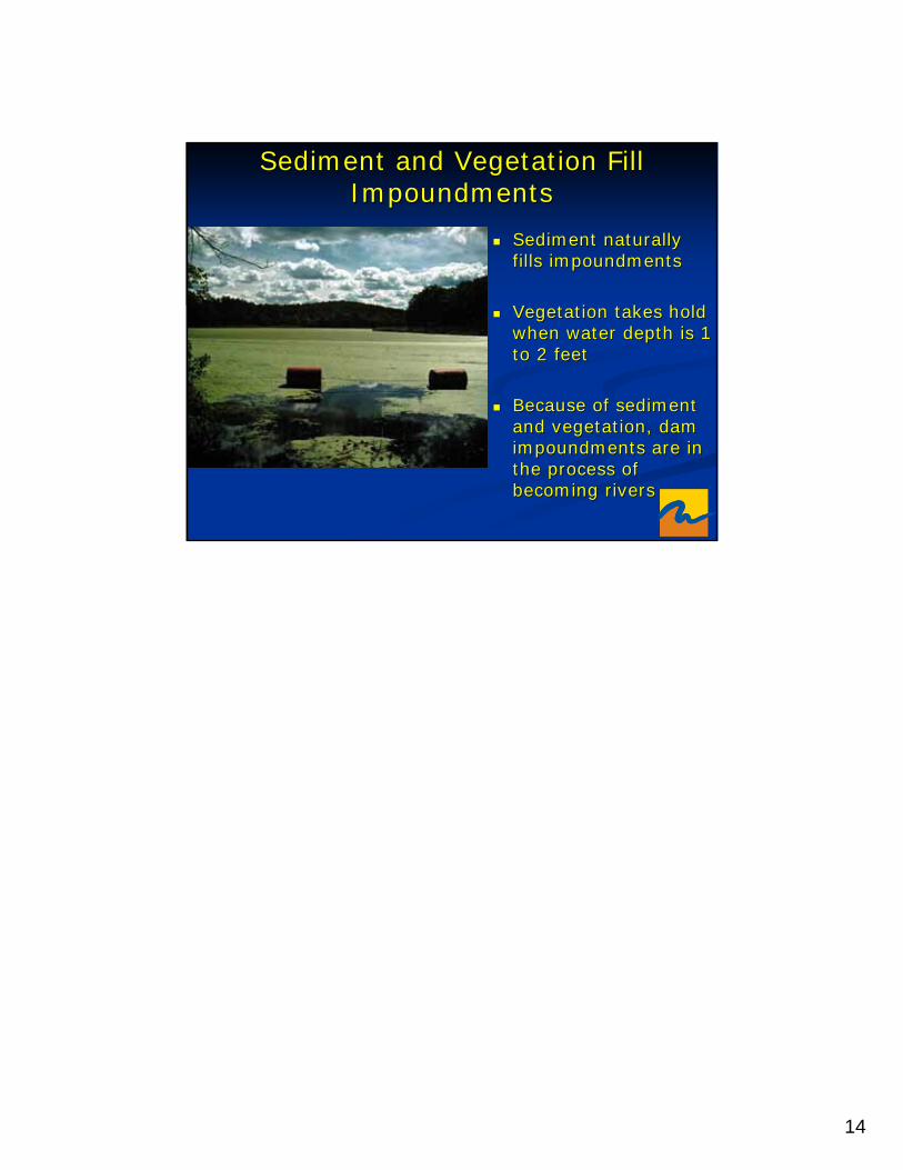
14
Sediment naturally Sediment naturally fills impoundmentsfills impoundments
Vegetation takes hold Vegetation takes hold when water depth is 1 when water depth is 1 to 2 feetto 2 feet
Because of sediment Because of sediment and vegetation, dam and vegetation, dam impoundments are in impoundments are in the process of the process of becoming riversbecoming rivers
Sediment and Vegetation Fill Sediment and Vegetation Fill ImpoundmentsImpoundments
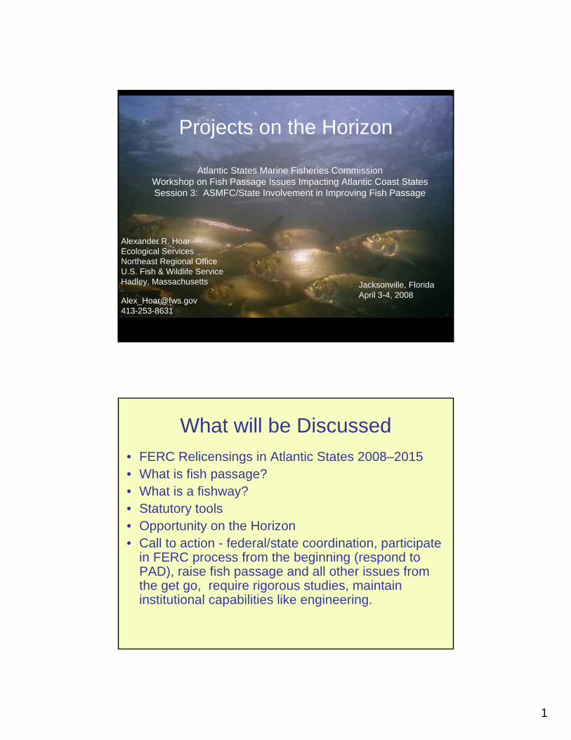
1
Projects on the Horizon
Alexander R. HoarEcological ServicesNortheast Regional OfficeU.S. Fish & Wildlife ServiceHadley, Massachusetts
Atlantic States Marine Fisheries Commission Workshop on Fish Passage Issues Impacting Atlantic Coast StatesSession 3: ASMFC/State Involvement in Improving Fish Passage
Jacksonville, FloridaApril 3-4, 2008
What will be Discussed• FERC Relicensings in Atlantic States 2008–2015• What is fish passage? • What is a fishway? • Statutory tools• Opportunity on the Horizon• Call to action - federal/state coordination, participate
in FERC process from the beginning (respond to PAD), raise fish passage and all other issues from the get go, require rigorous studies, maintain institutional capabilities like engineering.

2
CT 1
GA 5
MA 2
MD 1
ME 1
NC 3
NJ 1
NY 6
PA 5
SC 4
VA 3
VT 3 NH 1
Relicensingin Atlantic States
Anticipated by FERC2008-2015
FL 0
AL 2
AZ 1
CA 17 CO 4
CT 1
GA 5
ID 2
IN 1
MA 2
MD 1
ME 1
MI 4
MO 1
MT 2
NC 3
NE 1 NJ 1
NY 6
PA 5
SC 4
VA 3
WA 5
WI 3
WV 1
VT 3NH 1
LA 1
Relicensing Anticipated by FERC 2008-2015
IA 1
MN 3
OK 1
OR 2
TX 1
UT 1
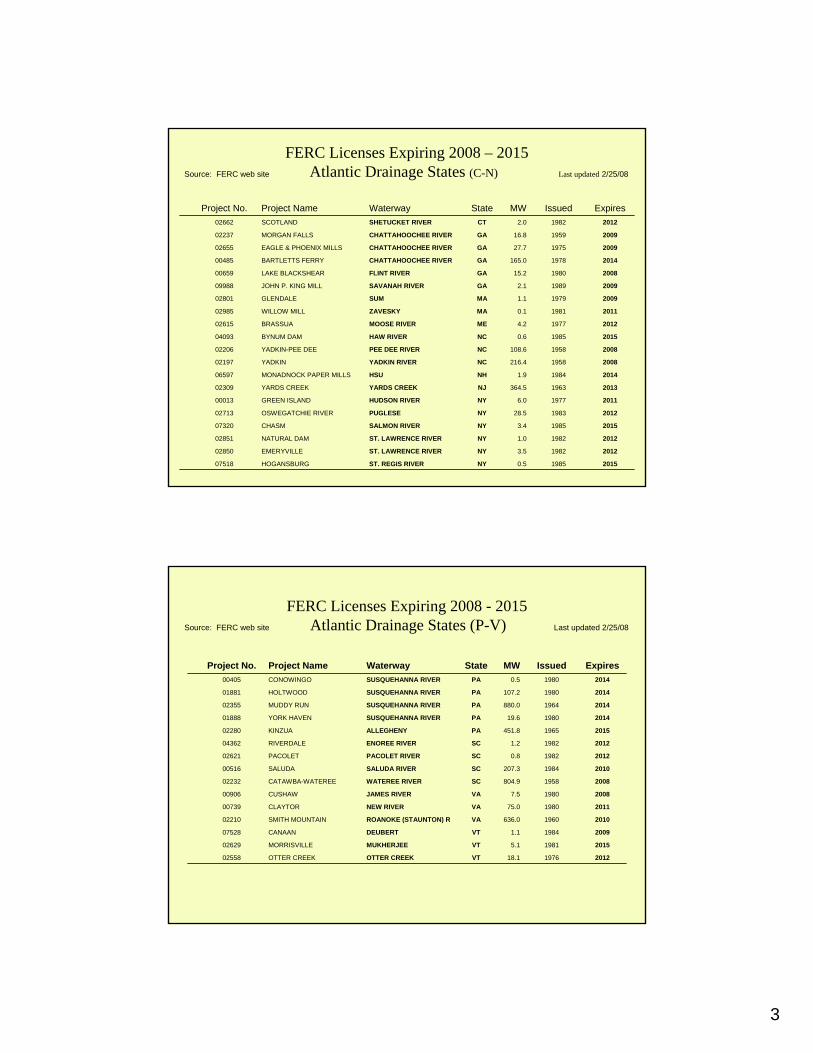
3
201519850.5NYST. REGIS RIVERHOGANSBURG07518
201219823.5NYST. LAWRENCE RIVEREMERYVILLE02850
201219821.0NYST. LAWRENCE RIVERNATURAL DAM02851
201519853.4NYSALMON RIVERCHASM07320
2012198328.5NYPUGLESEOSWEGATCHIE RIVER02713
201119776.0NYHUDSON RIVERGREEN ISLAND00013
20131963364.5NJYARDS CREEKYARDS CREEK02309
201419841.9NHHSUMONADNOCK PAPER MILLS06597
20081958216.4NCYADKIN RIVERYADKIN02197
20081958108.6NCPEE DEE RIVERYADKIN-PEE DEE02206
201519850.6NCHAW RIVERBYNUM DAM04093
201219774.2MEMOOSE RIVERBRASSUA02615
201119810.1MAZAVESKYWILLOW MILL02985
200919791.1MASUMGLENDALE02801
200919892.1GASAVANAH RIVERJOHN P. KING MILL09988
2008198015.2GAFLINT RIVERLAKE BLACKSHEAR00659
20141978165.0GACHATTAHOOCHEE RIVERBARTLETTS FERRY00485
2009197527.7GACHATTAHOOCHEE RIVEREAGLE & PHOENIX MILLS02655
2009195916.8GACHATTAHOOCHEE RIVERMORGAN FALLS02237
201219822.0CTSHETUCKET RIVERSCOTLAND02662
ExpiresIssued MWStateWaterwayProject NameProject No.
FERC Licenses Expiring 2008 – 2015Source: FERC web site Atlantic Drainage States (C-N) Last updated 2/25/08
2012197618.1VTOTTER CREEKOTTER CREEK02558
201519815.1VTMUKHERJEEMORRISVILLE02629
200919841.1VTDEUBERTCANAAN07528
20101960636.0VAROANOKE (STAUNTON) RSMITH MOUNTAIN02210
2011198075.0VANEW RIVERCLAYTOR00739
200819807.5VAJAMES RIVERCUSHAW00906
20081958804.9SCWATEREE RIVERCATAWBA-WATEREE02232
20101984207.3SCSALUDA RIVERSALUDA00516
201219820.8SCPACOLET RIVERPACOLET02621
201219821.2SCENOREE RIVERRIVERDALE04362
20151965451.8PAALLEGHENYKINZUA02280
2014198019.6PASUSQUEHANNA RIVERYORK HAVEN01888
20141964880.0PASUSQUEHANNA RIVER MUDDY RUN02355
20141980107.2PASUSQUEHANNA RIVERHOLTWOOD01881
201419800.5PASUSQUEHANNA RIVERCONOWINGO00405
ExpiresIssued MWStateWaterwayProject NameProject No.
FERC Licenses Expiring 2008 - 2015Source: FERC web site Atlantic Drainage States (P-V) Last updated 2/25/08
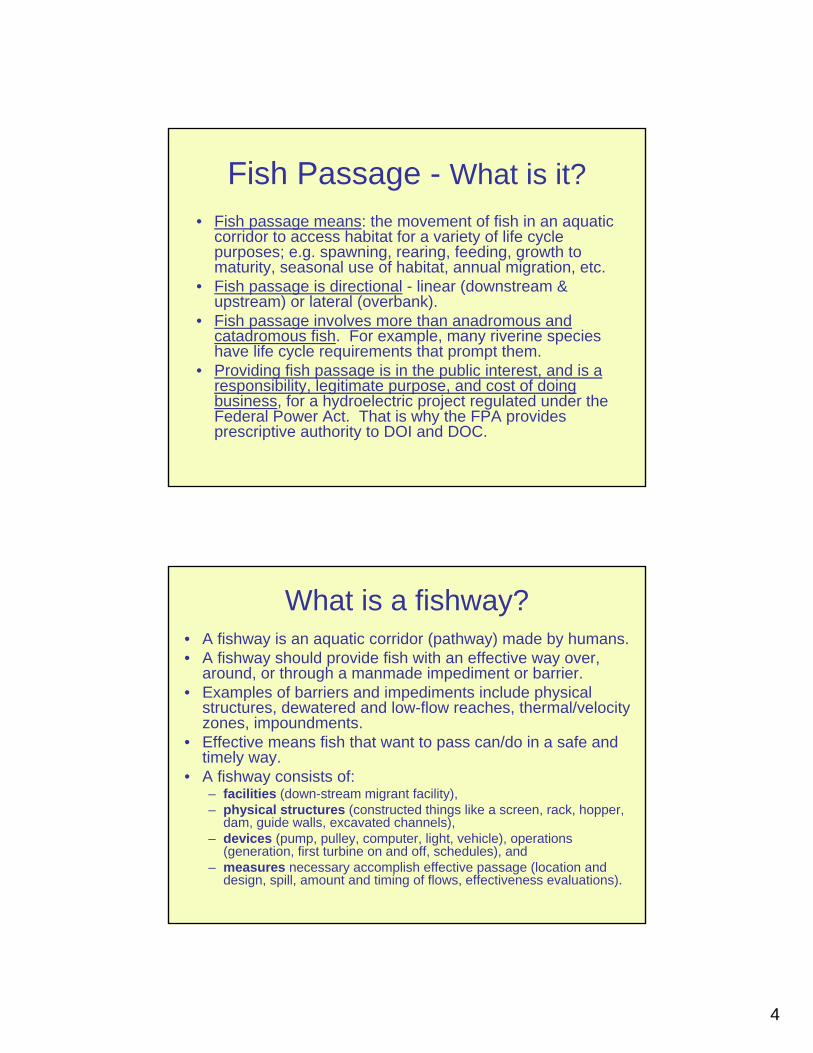
4
Fish Passage - What is it?• Fish passage means: the movement of fish in an aquatic
corridor to access habitat for a variety of life cycle purposes; e.g. spawning, rearing, feeding, growth to maturity, seasonal use of habitat, annual migration, etc.
• Fish passage is directional - linear (downstream & upstream) or lateral (overbank).
• Fish passage involves more than anadromous and catadromous fish. For example, many riverine species have life cycle requirements that prompt them.
• Providing fish passage is in the public interest, and is a responsibility, legitimate purpose, and cost of doing business, for a hydroelectric project regulated under the Federal Power Act. That is why the FPA provides prescriptive authority to DOI and DOC.
What is a fishway?• A fishway is an aquatic corridor (pathway) made by humans.• A fishway should provide fish with an effective way over,
around, or through a manmade impediment or barrier.• Examples of barriers and impediments include physical
structures, dewatered and low-flow reaches, thermal/velocity zones, impoundments.
• Effective means fish that want to pass can/do in a safe and timely way.
• A fishway consists of:– facilities (down-stream migrant facility), – physical structures (constructed things like a screen, rack, hopper,
dam, guide walls, excavated channels), – devices (pump, pulley, computer, light, vehicle), operations
(generation, first turbine on and off, schedules), and – measures necessary accomplish effective passage (location and
design, spill, amount and timing of flows, effectiveness evaluations).

5
Public Trust• In ancient times, the sovereign had the responsibility under
common law to protect the fishery and ensure that fish can pass as necessary in navigable waters. (fish = food.)
• The miller could not block the migratory run that people depended on for sustenance and it has always been the miller’s responsibility to provide passage for fish.
• There was tension between the miller (dam owner) and the fisherman over fish passage.
• This followed to the new land in the 1600s, became the responsibility of the colonial sovereign, transferred to the states at independence, and was codified in many states.
• Congress gave fish passage responsibility for non-federal hydro to DOI and DOC in the FPA, which preempts states law. Congress gave the states authority in the CWA to require fishway at FERC regulated hydro through issuance of Section 401 certification.
Statutory tools• Fish and Wildlife Coordination Act
– Action agency must consult with state fish and wildlife agencies, USFWS and NMFS.
– Resource agency purpose is to recommend means and measures to protect, conserve, and increase the fish and wildlife resources impacted by the project.
– Coordination should occur as a matter of practice between state and federal agencies.
• FPA sections 18, 4(e), 30(c) - DOI & DOC have broad mandatory conditioning authority for fishways (18), reservations (4(e)), exemptions (30(c)) – Reservations of authority – should be in every license and
exemption and can be acted on when there is just cause• CWA section 401 – states have broad mandatory
conditioning authority regarding quality and quantity of water for designated uses.
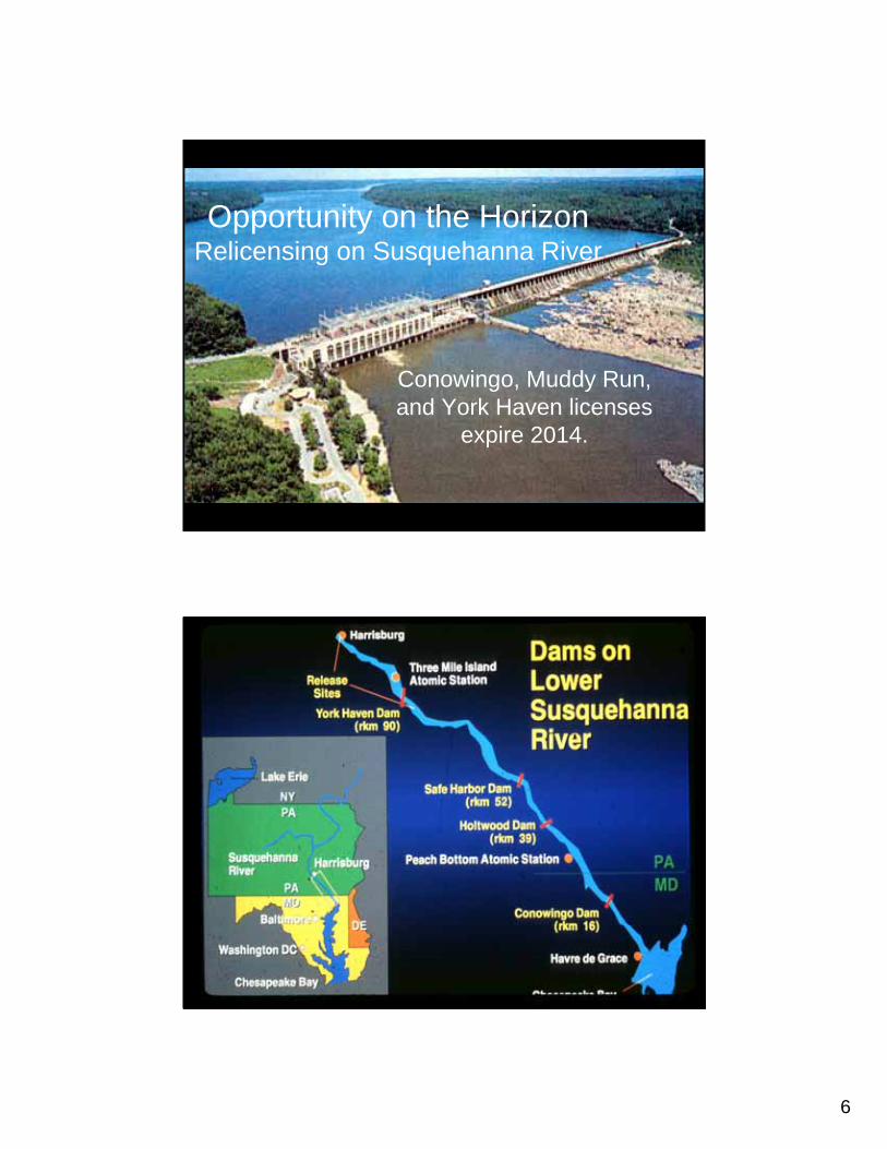
6
Opportunity on the Horizon Relicensing on Susquehanna River
Conowingo, Muddy Run, and York Haven licenses
expire 2014.
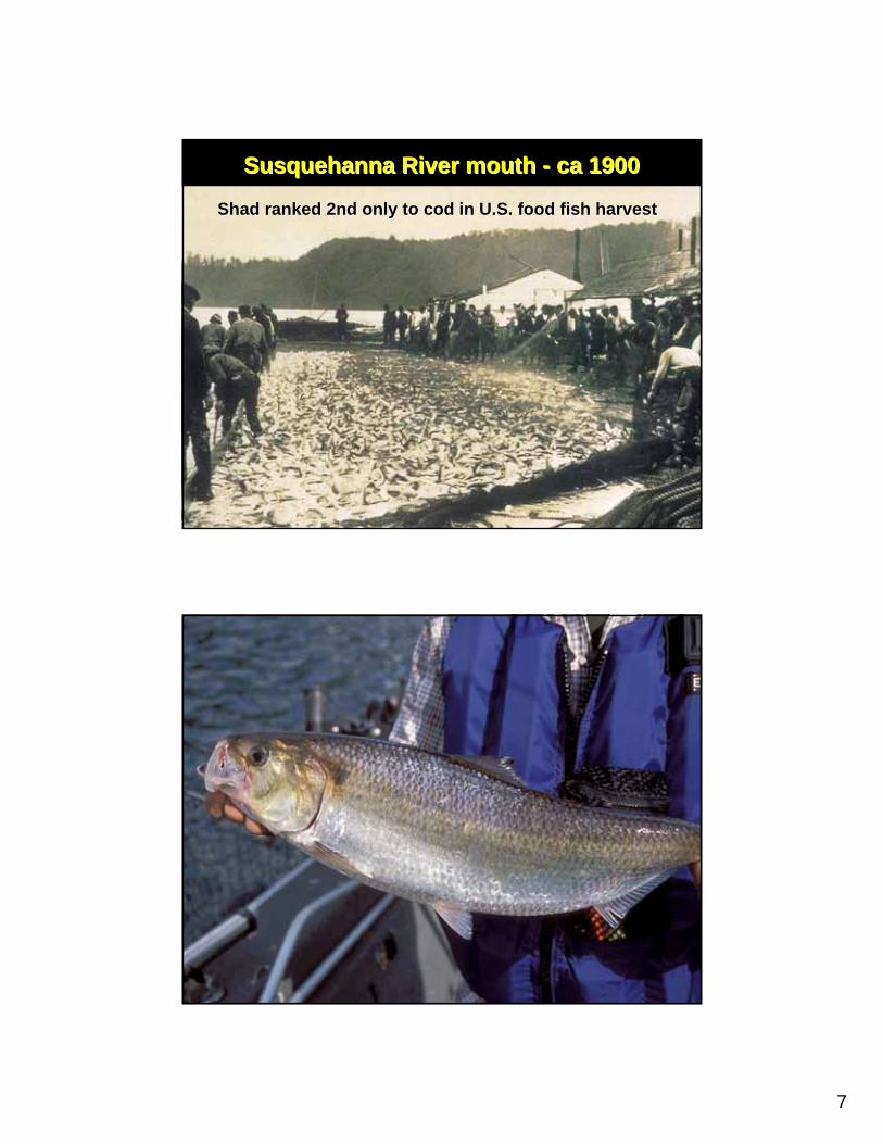
7
Susquehanna River mouth Susquehanna River mouth -- ca 1900ca 1900
Shad ranked 2nd only to cod in U.S. food fish harvestShad ranked 2nd only to cod in U.S. food fish harvest
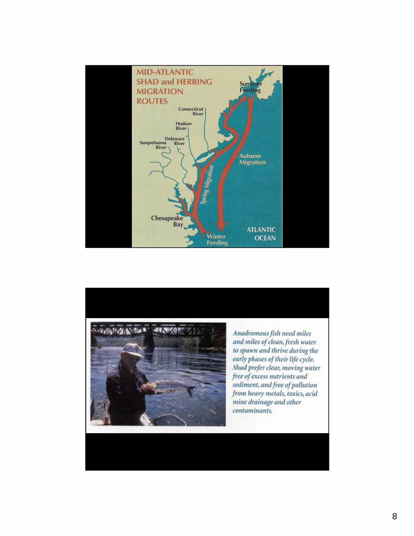
8
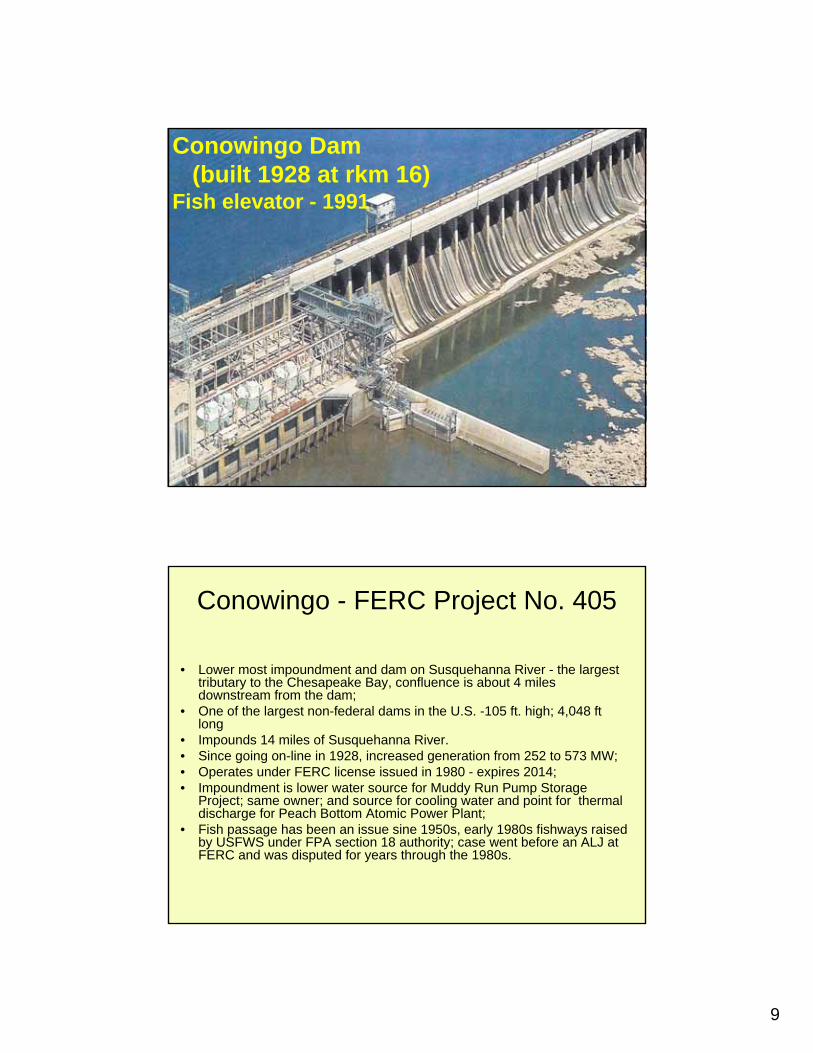
9
Conowingo Dam (built 1928 at rkm 16)
Fish elevator - 1991
Conowingo - FERC Project No. 405
• Lower most impoundment and dam on Susquehanna River - the largest tributary to the Chesapeake Bay, confluence is about 4 miles downstream from the dam;
• One of the largest non-federal dams in the U.S. -105 ft. high; 4,048 ft long
• Impounds 14 miles of Susquehanna River.• Since going on-line in 1928, increased generation from 252 to 573 MW; • Operates under FERC license issued in 1980 - expires 2014; • Impoundment is lower water source for Muddy Run Pump Storage
Project; same owner; and source for cooling water and point for thermal discharge for Peach Bottom Atomic Power Plant;
• Fish passage has been an issue sine 1950s, early 1980s fishways raised by USFWS under FPA section 18 authority; case went before an ALJ at FERC and was disputed for years through the 1980s.
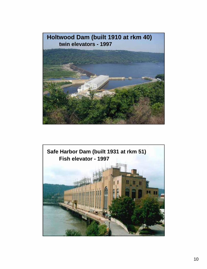
10
Holtwood Dam (built 1910 at rkm 40)twin elevators - 1997
Safe Harbor Dam (built 1931 at rkm 51)Fish elevator - 1997
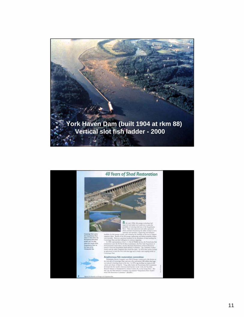
11
York Haven Dam (built 1904 at rkm 88)Vertical slot fish ladder - 2000
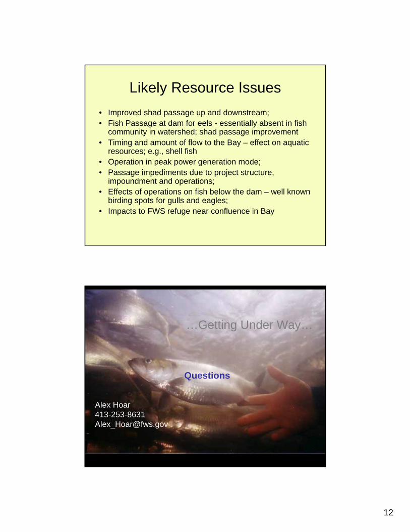
12
Likely Resource Issues• Improved shad passage up and downstream;• Fish Passage at dam for eels - essentially absent in fish
community in watershed; shad passage improvement• Timing and amount of flow to the Bay – effect on aquatic
resources; e.g., shell fish• Operation in peak power generation mode;• Passage impediments due to project structure,
impoundment and operations;• Effects of operations on fish below the dam – well known
birding spots for gulls and eagles;• Impacts to FWS refuge near confluence in Bay
…Getting Under Way…
Questions
Alex [email protected]

11
Small Barriers, Large Impacts: Small Barriers, Large Impacts: Impacts on American Eel Impacts on American Eel
Distribution in New York StateDistribution in New York StateLeonard S. MachutLeonard S. Machut
Tunison Laboratory of Aquatic SciencesTunison Laboratory of Aquatic SciencesCortland, NYCortland, NY
Collaborators and FundingCollaborators and FundingKarin E. Limburg Karin E. Limburg –– SUNY ESFSUNY ESFRobert E. Schmidt Robert E. Schmidt –– Bard College at Bard College at Simon’s Rock Simon’s Rock Dawn Dittman, James H. Johnson, JamesDawn Dittman, James H. Johnson, JamesMcKenna, Michelle Henry McKenna, Michelle Henry –– TunisonTunisonLaboratory of Aquatic ScienceLaboratory of Aquatic Science

22
Talk OutlineTalk Outline
What makes eels so unique & importantWhat makes eels so unique & importantMasters ResearchMasters ResearchNYS DEC Eel Management Plan NYS DEC Eel Management Plan ––
American Eels, Data Assimilation and American Eels, Data Assimilation and Management Options for Inland WatersManagement Options for Inland Waters
Why Are Eels So Cool?Why Are Eels So Cool?
a.k.a. a.k.a. –– Why spend three years Why spend three years being a poor graduate student being a poor graduate student trying to grab hold of an ugly, trying to grab hold of an ugly, slimy fish?slimy fish?
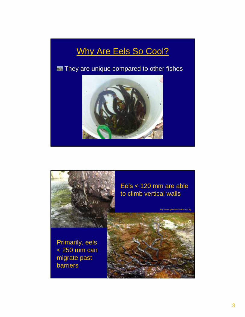
33
Why Are Eels So Cool?Why Are Eels So Cool?
They are unique compared to other fishesThey are unique compared to other fishes
Eels < 120 mm are able Eels < 120 mm are able to climb vertical wallsto climb vertical walls
Primarily, eels Primarily, eels < 250 mm can < 250 mm can migrate past migrate past barriersbarriers
http://www.glooskapandthefrog.org
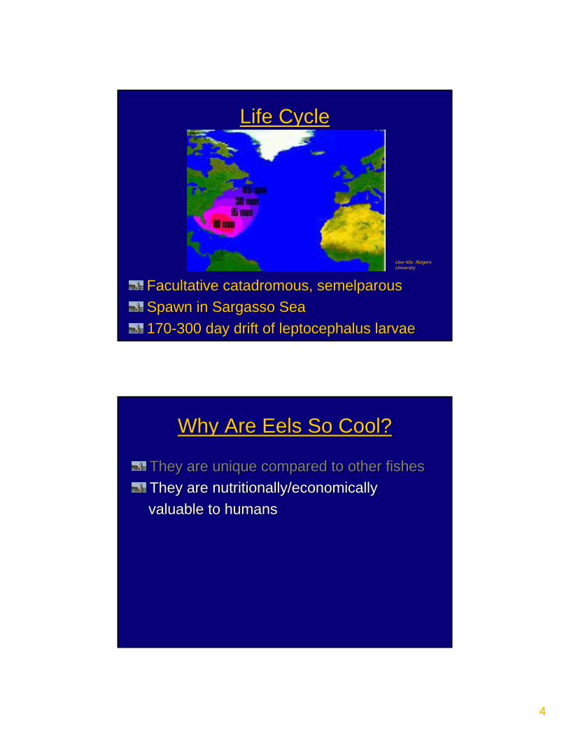
44
Life CycleLife Cycle
Facultative catadromous, semelparousFacultative catadromous, semelparousSpawn in Sargasso SeaSpawn in Sargasso Sea170170--300 day drift of leptocephalus larvae300 day drift of leptocephalus larvae
Uwe Kils, Rutgers University
Why Are Eels So Cool?Why Are Eels So Cool?
They are unique compared to other fishesThey are unique compared to other fishesThey are nutritionally/economicallyThey are nutritionally/economicallyvaluable to humans valuable to humans
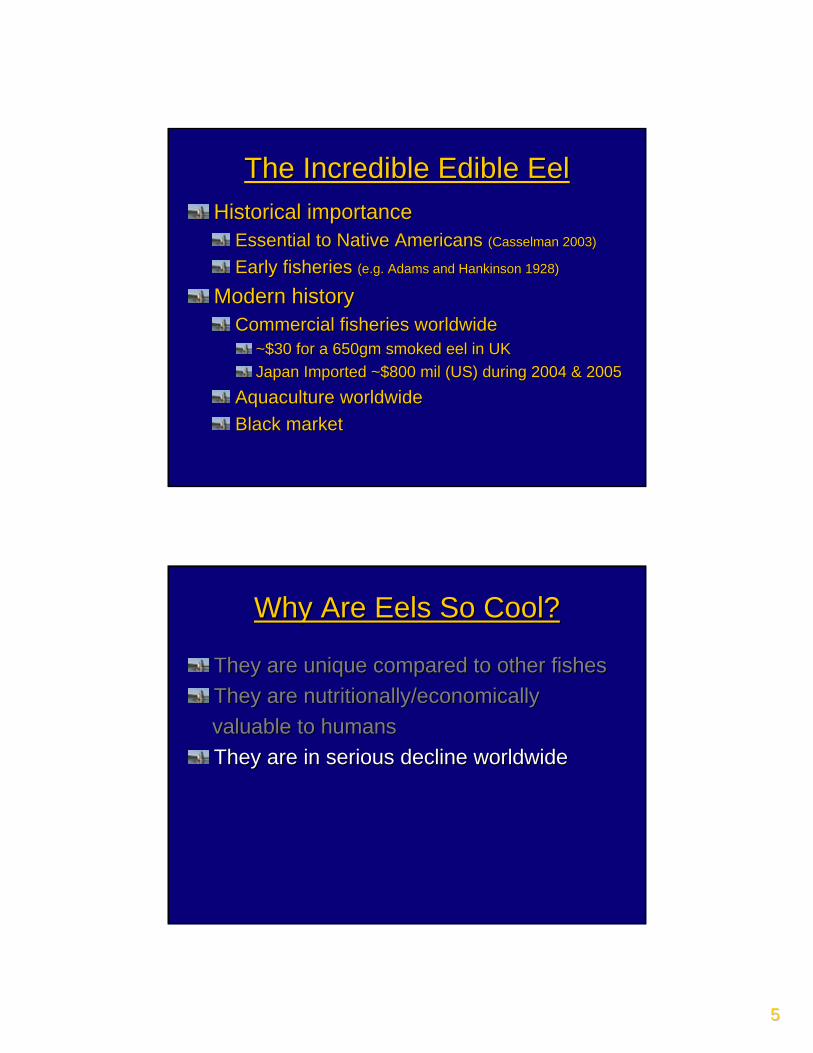
55
The Incredible Edible EelThe Incredible Edible EelHistorical importanceHistorical importance
Essential to Native Americans Essential to Native Americans (Casselman 2003)(Casselman 2003)
Early fisheries Early fisheries (e.g. Adams and Hankinson(e.g. Adams and Hankinson 1928)1928)
Modern historyModern historyCommercial fisheries worldwideCommercial fisheries worldwide
~$30 for a 650gm smoked eel in UK~$30 for a 650gm smoked eel in UKJapan Imported ~$800 mil (US) during 2004 & 2005Japan Imported ~$800 mil (US) during 2004 & 2005
Aquaculture worldwideAquaculture worldwideBlack marketBlack market
Why Are Eels So Cool?Why Are Eels So Cool?
They are unique compared to other fishesThey are unique compared to other fishesThey are nutritionally/economicallyThey are nutritionally/economicallyvaluable to humansvaluable to humansThey are in serious decline worldwideThey are in serious decline worldwide
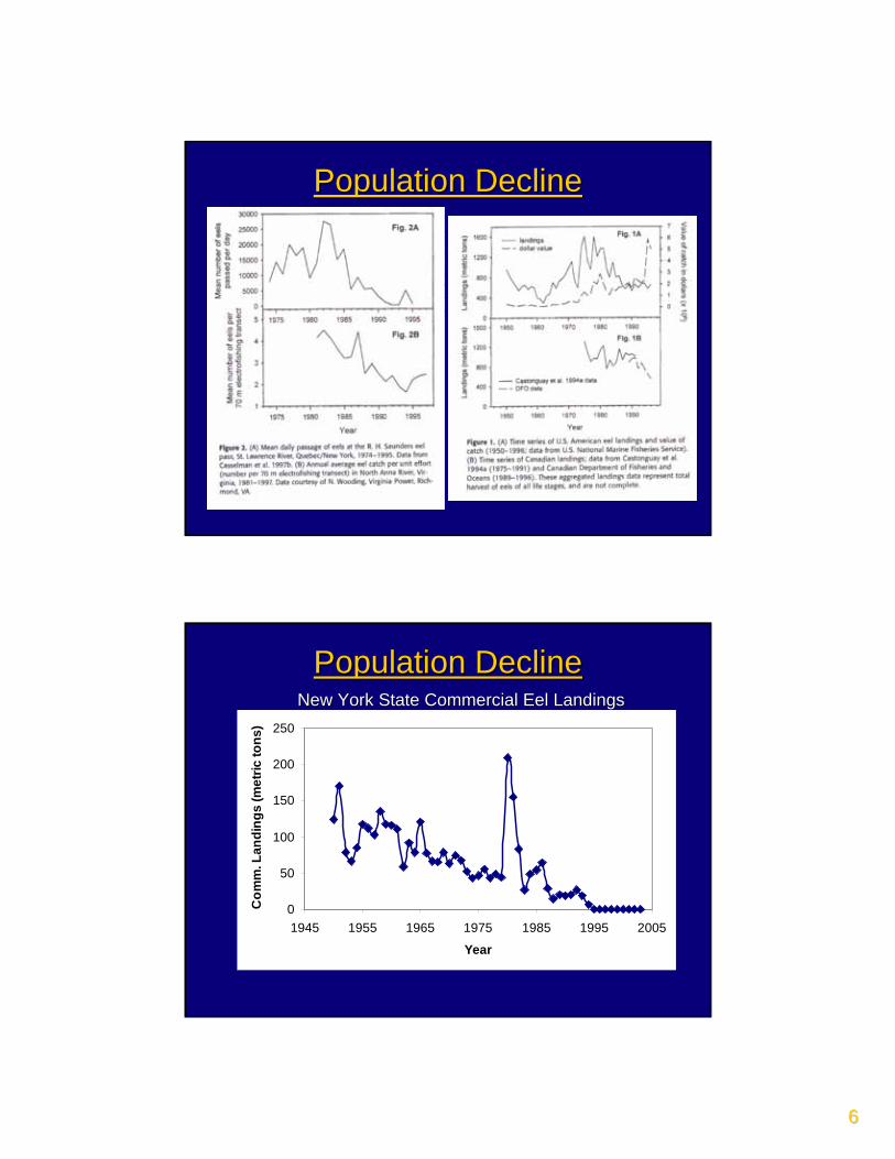
66
Population DeclinePopulation Decline
Population DeclinePopulation DeclineNew York State Commercial Eel LandingsNew York State Commercial Eel Landings
0
50
100
150
200
250
1945 1955 1965 1975 1985 1995 2005
Year
Com
m. L
andi
ngs
(met
ric to
ns)
77
Why Are Eels So Cool?Why Are Eels So Cool?
They are unique compared to other fishesThey are unique compared to other fishesThey are nutritionally/economicallyThey are nutritionally/economicallyvaluable to humansvaluable to humansThey are in serious decline worldwideThey are in serious decline worldwide
Significant local regional declinesSignificant local regional declinesPetition to list American eel under the Petition to list American eel under the Endangered Species ActEndangered Species Act
Why Are Eels So Cool?Why Are Eels So Cool?
They are unique compared to other fishesThey are unique compared to other fishesThey are nutritionally/economicallyThey are nutritionally/economicallyvaluable to humansvaluable to humansThey are in serious decline worldwideThey are in serious decline worldwideThey are very photogenicThey are very photogenic
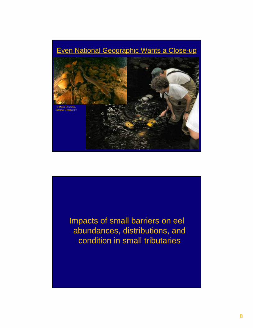
88
Even National Geographic Wants a CloseEven National Geographic Wants a Close--up up
© David Doubillet, National Geographic
Impacts of small barriers on eel abundances, distributions, and
condition in small tributaries

99
Does size really matter?Does size really matter?
Any barrier more than 15m (more than 50ft)in height is classed as a large barrierAny barrier less than 5m (15 ft or less) inheight is classed as a small barrierLarge dams (e.g. Moses-Saunders,Cannonsville) = only 2.7% of NY damsSmall dams = 72.8% of NY damsHydrodams = 3.5% of NY dams
Goals/Research QuestionsGoals/Research Questions
Expand upon research performed in the
main stem of the Hudson River (e.g. Morrison and
Secor 2003, 2004)
Document eel use of smaller streams
Identify impacts of small barriers on eel
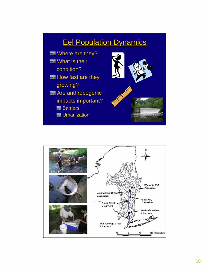
1010
Eel Population DynamicsEel Population DynamicsWhere are they? What is their condition?How fast are theygrowing?Are anthropogenicimpacts important?
BarriersUrbanization
Wynants Kill, 7 Barriers
Saw Kill,7 Barriers
Hannacroix Creek5 Barriers
Black Creek9 Barriers
Minisceongo Creek7 Barriers
Peekskill Hollow4 Barriers
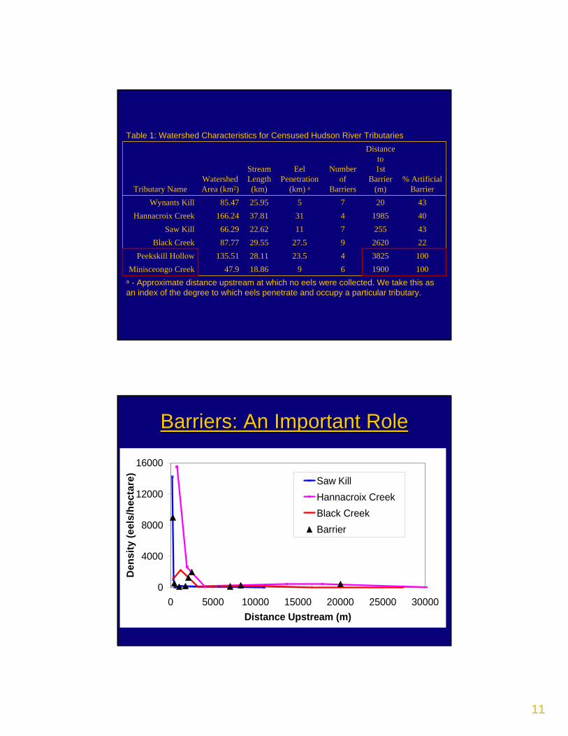
1111
a - Approximate distance upstream at which no eels were collected. We take this as an index of the degree to which eels penetrate and occupy a particular tributary.
10019006918.8647.9Minisceongo Creek1003825423.528.11135.51Peekskill Hollow222620927.529.5587.77Black Creek4325571122.6266.29Saw Kill40198543137.81166.24Hannacroix Creek43207525.9585.47Wynants Kill
% ArtificialBarrier
Distance to 1st
Barrier (m)
Number of
Barriers
EelPenetration
(km) a
Stream Length (km)
WatershedArea (km2)Tributary Name
Table 1: Watershed Characteristics for Censused Hudson River Tributaries
Barriers: An Important RoleBarriers: An Important Role
0
4000
8000
12000
16000
0 5000 10000 15000 20000 25000 30000Distance Upstream (m)
Den
sity
(eel
s/he
ctar
e) Saw KillHannacroix CreekBlack CreekBarrier
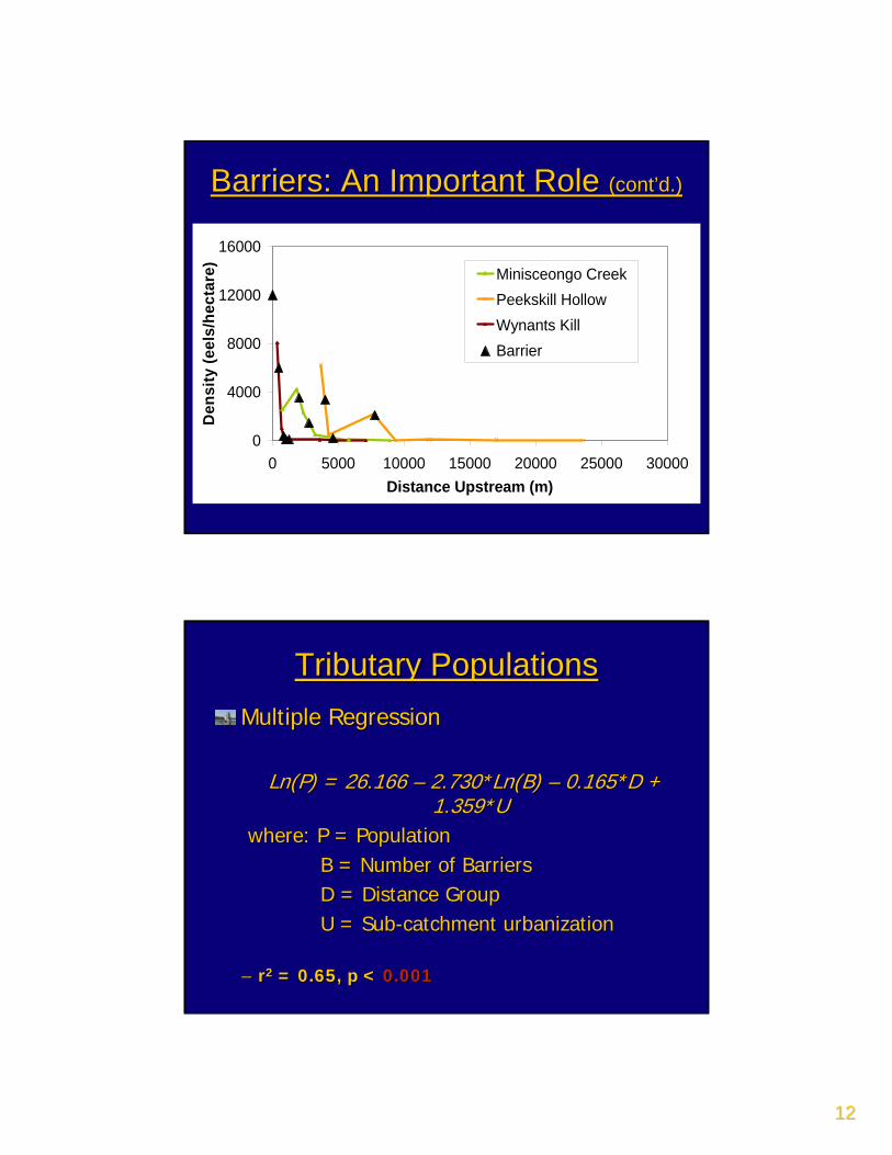
1212
Barriers: An Important Role Barriers: An Important Role (cont’d.)(cont’d.)
0
4000
8000
12000
16000
0 5000 10000 15000 20000 25000 30000Distance Upstream (m)
Den
sity
(eel
s/he
ctar
e) Minisceongo CreekPeekskill HollowWynants KillBarrier
Tributary PopulationsTributary PopulationsMultiple RegressionMultiple Regression
Ln(P) = 26.166 Ln(P) = 26.166 –– 2.730*Ln(B) 2.730*Ln(B) –– 0.165*D + 0.165*D + 1.359*U1.359*U
where: P = Populationwhere: P = PopulationB = Number of BarriersB = Number of BarriersD = Distance GroupD = Distance GroupU = SubU = Sub--catchment urbanizationcatchment urbanization
–– rr22 = 0.65, p <= 0.65, p < 0.0010.001
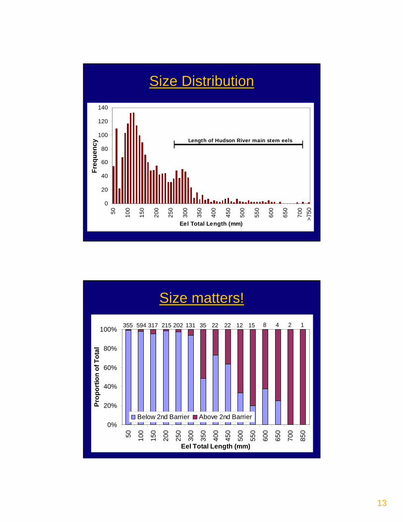
1313
0
20
40
60
80
100
120
14050 10
0
150
200
250
300
350
400
450
500
550
600
650
700
Eel Total Length (mm)
Freq
uenc
y
>750
Size DistributionSize Distribution
Length of Hudson River main stem eelsLength of Hudson River main stem eels
0%
20%
40%
60%
80%
100%
50 100
150
200
250
300
350
400
450
500
550
600
650
700
850
Eel Total Length (mm)
Prop
ortio
n of
Tot
al
Below 2nd Barrier Above 2nd Barrier
Size matters!Size matters!
355 594 317 215 202 35 22355 594 317 215 202 35 22 8 4 2 18 4 2 1131 22 12 15
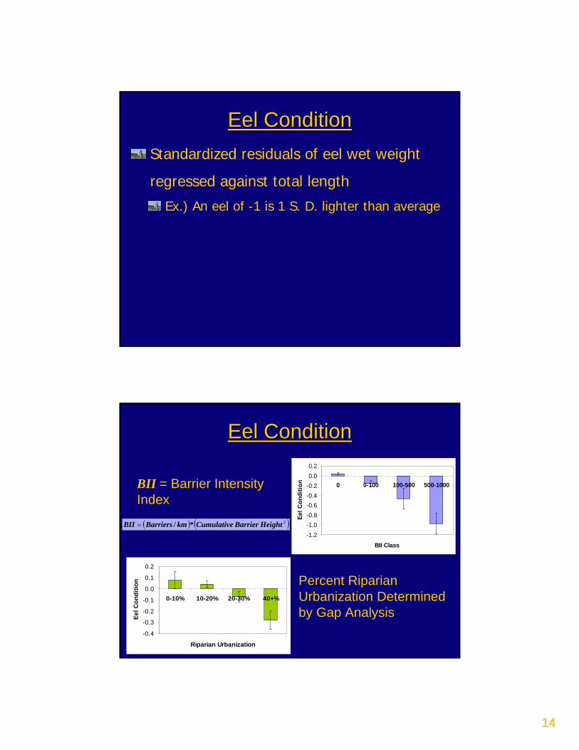
1414
Standardized residuals of eel wet weight
regressed against total length
Ex.) An eel of -1 is 1 S. D. lighter than average
Eel ConditionEel Condition
-1.2-1.0-0.8-0.6-0.4-0.20.00.2
0 0-100 100-500 500-1000
BII Class
Eel C
ondi
tionBII = Barrier Intensity
Index
( ) ( )2HeightBarrierCumulativekmBarriersBII */=
Eel ConditionEel Condition
-0.4
-0.3
-0.2
-0.1
0.0
0.1
0.2
0-10% 10-20% 20-30% 40+%
Riparian Urbanization
Eel C
ondi
tion Percent Riparian
Urbanization Determined by Gap Analysis
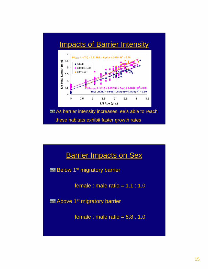
1515
Impacts of Barrier IntensityImpacts of Barrier Intensity
BII0: Ln(TL) = 0.5667(Ln Age) + 4.3435; R2 = 0.90BII0.1-100: Ln(TL) = 0.6128(Ln Age) + 4.4842; R2 = 0.85
BII>100: Ln(TL) = 0.8156(Ln Age) + 4.1468; R2 = 0.76
4
4.5
5
5.5
6
6.5
7
0 0.5 1 1.5 2 2.5 3 3.5
LN Age (yrs.)
LN T
otal
Len
gth
(mm
)BII = 0BII = 0.1-100BII = 100+
As barrier intensity increases, eels able to reach
these habitats exhibit faster growth rates
Barrier Impacts on SexBarrier Impacts on Sex
Below 1Below 1stst migratory barrier migratory barrier
female : male ratio = 1.1 : 1.0female : male ratio = 1.1 : 1.0
Above 1Above 1stst migratory barriermigratory barrier
female : male ratio = 8.8 : 1.0 female : male ratio = 8.8 : 1.0
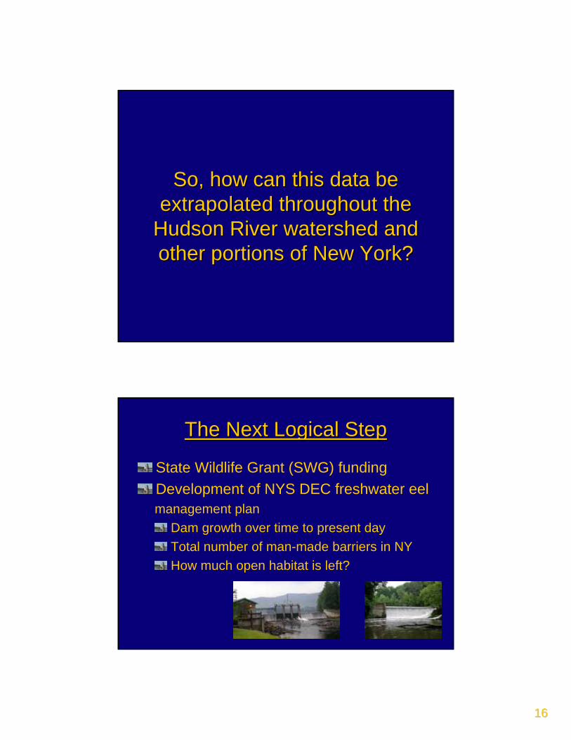
1616
So, how can this data be So, how can this data be extrapolated throughout the extrapolated throughout the
Hudson River watershed and Hudson River watershed and other portions of New York?other portions of New York?
The Next Logical StepThe Next Logical Step
State Wildlife Grant (SWG) fundingDevelopment of NYS DEC freshwater eelmanagement plan
Dam growth over time to present dayTotal number of man-made barriers in NYHow much open habitat is left?
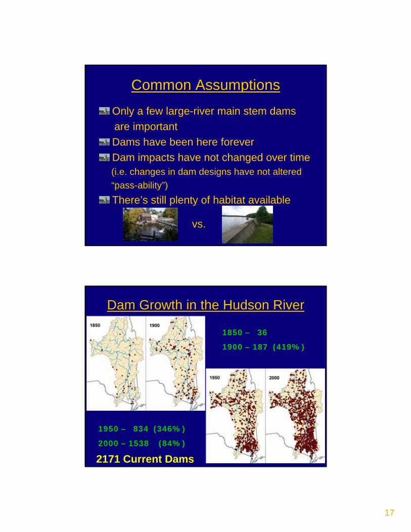
1717
Common AssumptionsCommon Assumptions
Only a few large-river main stem dams are importantDams have been here foreverDam impacts have not changed over time(i.e. changes in dam designs have not altered “pass-ability”)There’s still plenty of habitat available
vs.vs.
Dam Growth in the Hudson RiverDam Growth in the Hudson River
1850 – 36
1900 – 187 (419%)
1950 – 834 (346%)
2000 – 1538 (84%)
2171 Current Dams2171 Current Dams
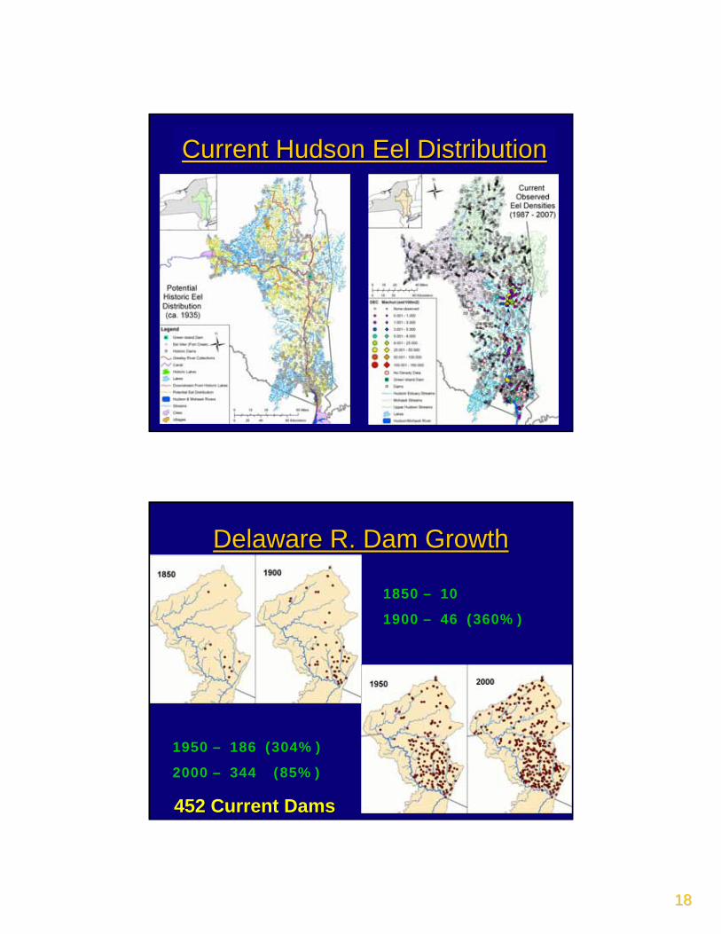
1818
Historic Hudson Eel DistributionHistoric Hudson Eel DistributionCurrent Hudson Eel DistributionCurrent Hudson Eel Distribution
Delaware R. Dam GrowthDelaware R. Dam Growth
1850 – 10
1900 – 46 (360%)
1950 – 186 (304%)
2000 – 344 (85%)
452 Current Dams452 Current Dams
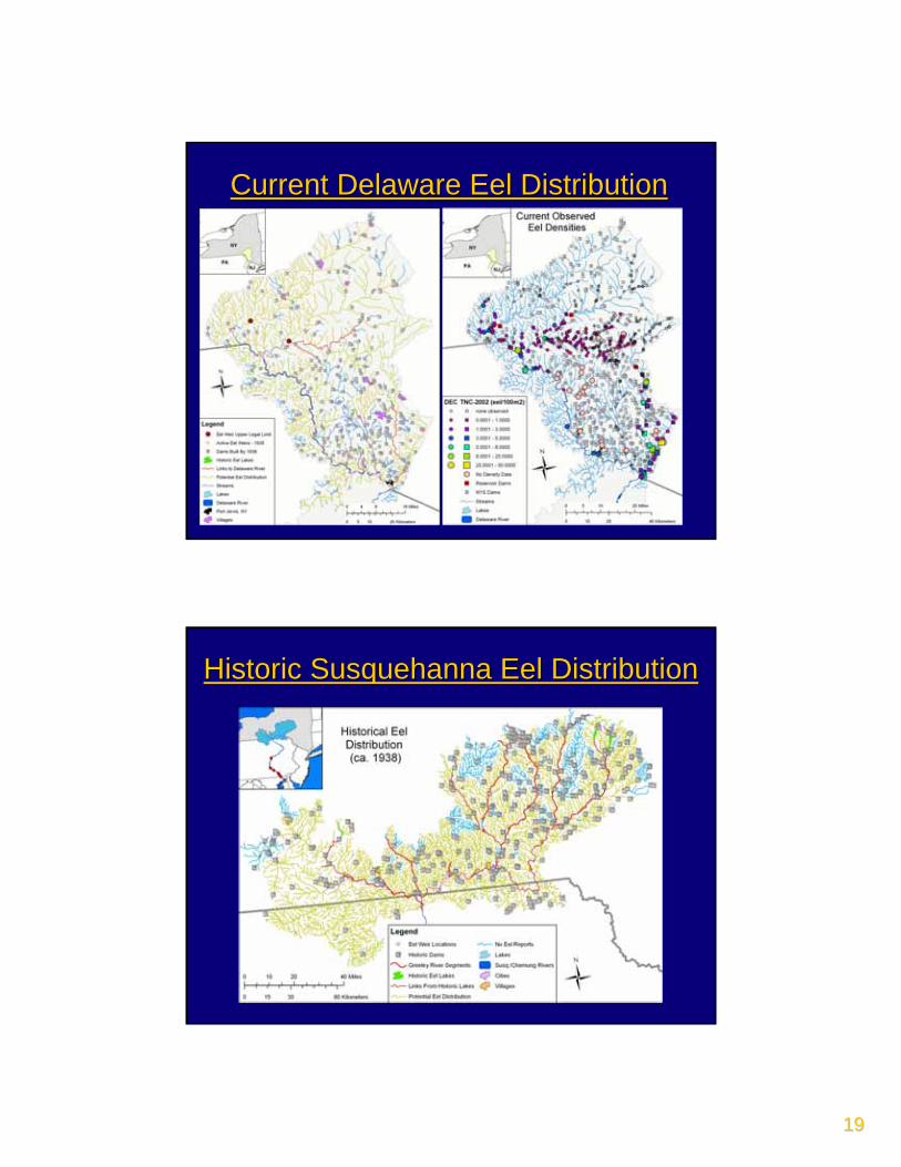
1919
Delaware Historical Eel DistributionDelaware Historical Eel DistributionCurrent Delaware Eel DistributionCurrent Delaware Eel Distribution
Historic Susquehanna Eel DistributionHistoric Susquehanna Eel Distribution
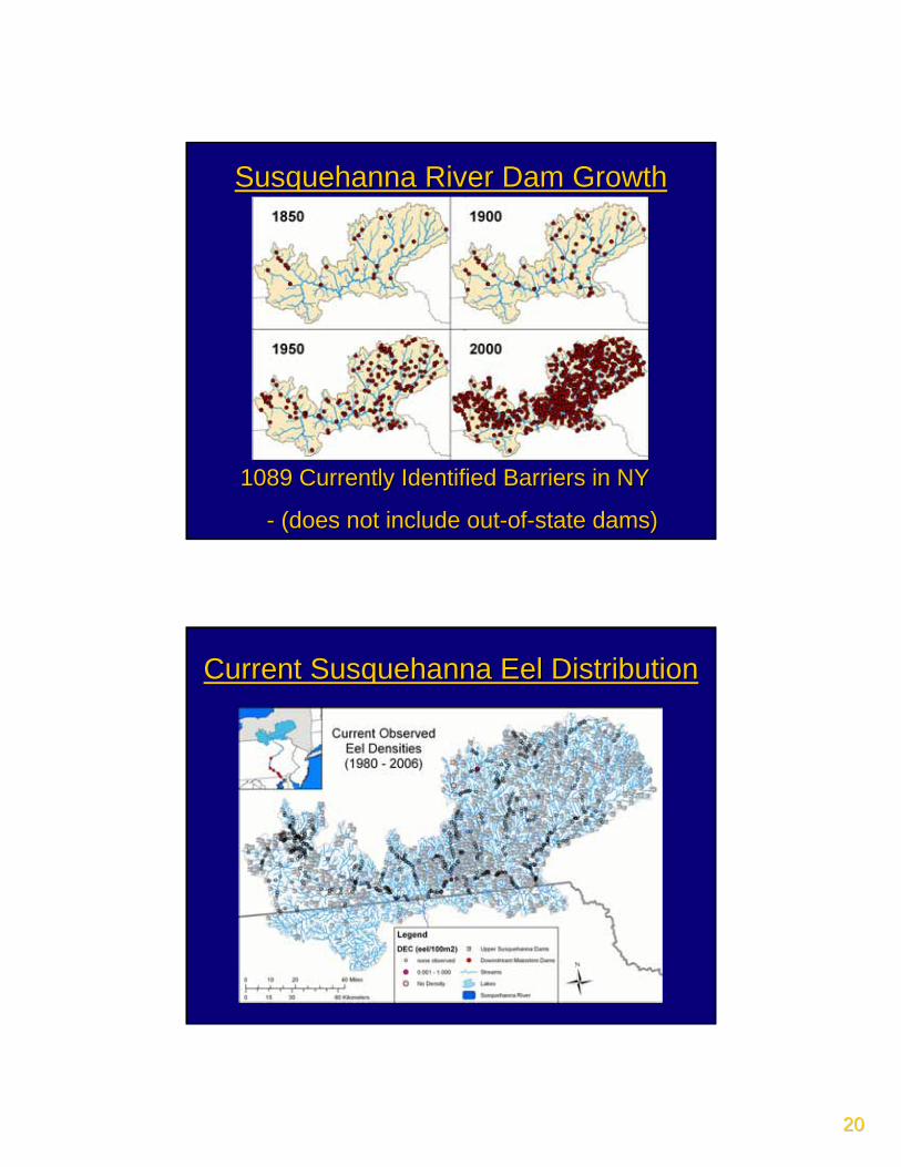
2020
Susquehanna River Dam GrowthSusquehanna River Dam Growth
1850 – 28
1900 – 60 (114%)
1950 – 185 (208%)
2000 – 938 (407%)
1089 Currently Identified Barriers in NY1089 Currently Identified Barriers in NY
-- (does not include out(does not include out--ofof--state dams)state dams)
Current Susquehanna Eel DistributionCurrent Susquehanna Eel Distribution
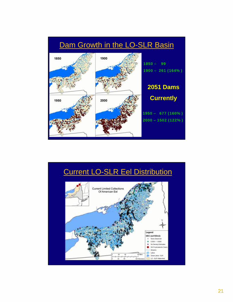
2121
1850 – 99
1900 – 261 (164%)
1950 – 677 (160%)
2000 – 1502 (122%)
2051 Dams2051 Dams
CurrentlyCurrently
Dam Growth in the LO-SLR Basin
LO-SLR Historical Eel DistributionCurrent LO-SLR Eel Distribution
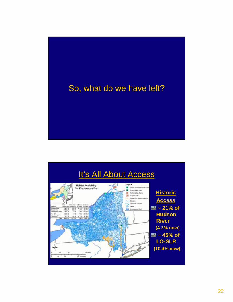
2222
So, what do we have left? So, what do we have left?
It’s All About AccessIt’s All About Access
HistoricAccess~ 21% of
Hudson River (4.2% now)~ 45% of
LO-SLR(10.4% now)
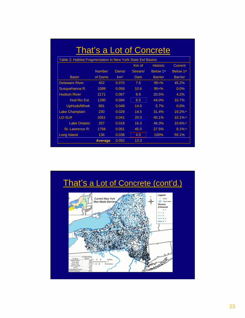
2323
That’s a Lot of ConcreteThat’s a Lot of Concrete
13.30.052Average55.1%100%4.00.038136Long Island8.1% a27.5%45.00.0511794St. Lawrence R.
10.6% a46.3%16.30.018257Lake Ontario10.1% a40.1%20.00.0412051LO-SLR19.2% a31.4%14.50.029230Lake Champlain0.0%5.7%14.90.048891UpHuds/Mhwk
10.7%44.0%6.50.0941280Hud Riv Est.4.2%20.5%9.90.0672171Hudson River 0.0%95+%10.60.0581089Susquehanna R.
45.2%95+%7.60.070452Delaware River BarrierBarrierDamkm2of DamsBasin
Below 1stBelow 1stStream/ Dams/NumberCurrentHistoricKm of
Table 2: Habitat Fragmentation in New York State Eel Basins
That’sThat’s a Lot of Concrete (cont’d.)a Lot of Concrete (cont’d.)
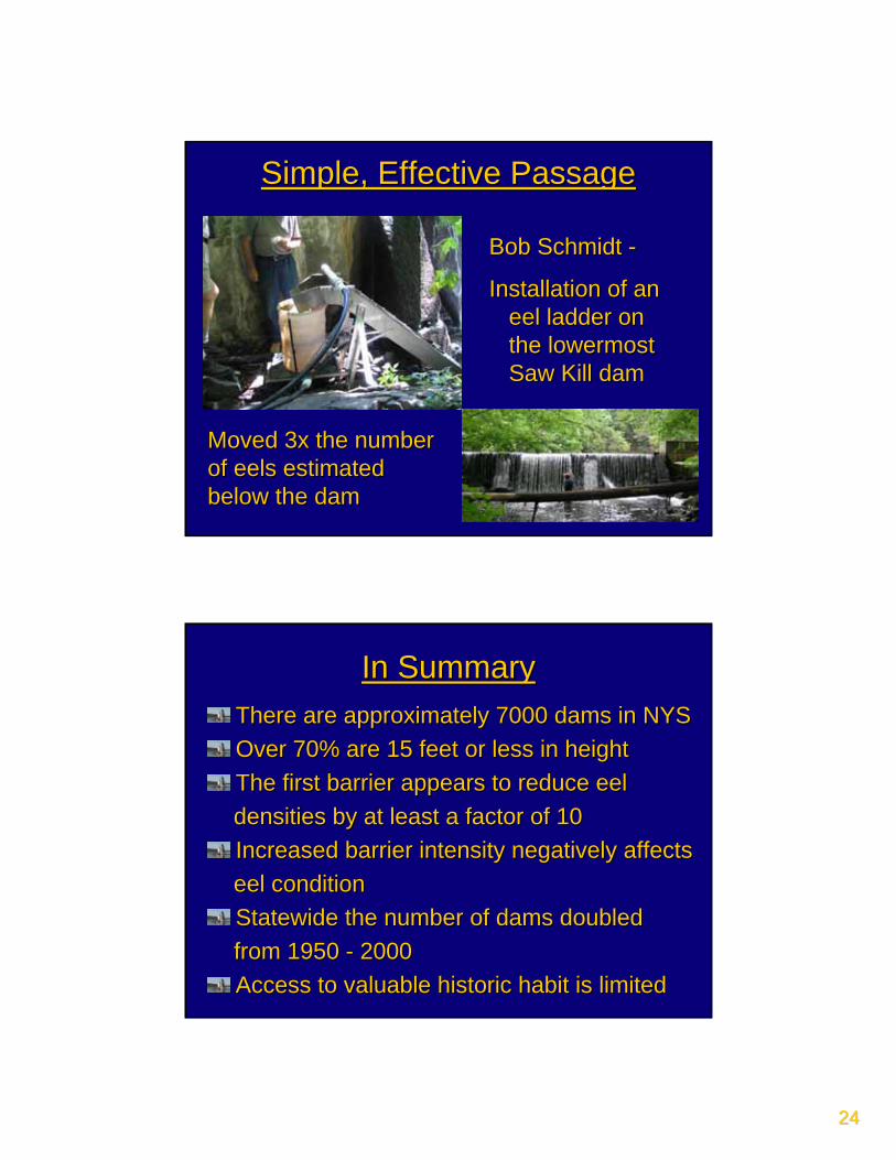
2424
Bob Schmidt Bob Schmidt --
Installation of an Installation of an eel ladder on eel ladder on the lowermost the lowermost Saw Kill damSaw Kill dam
Moved 3x the number Moved 3x the number of eels estimated of eels estimated below the dambelow the dam
Simple, Effective PassageSimple, Effective Passage
In SummaryIn SummaryThere are approximately 7000 dams in NYSThere are approximately 7000 dams in NYSOver 70% are 15 feet or less in heightOver 70% are 15 feet or less in heightThe first barrier appears to reduce eelThe first barrier appears to reduce eeldensities by at least a factor of 10densities by at least a factor of 10Increased barrier intensity negatively affectsIncreased barrier intensity negatively affectseel conditioneel conditionStatewide the number of dams doubledStatewide the number of dams doubledfrom 1950 from 1950 -- 20002000Access to valuable historic habit is limitedAccess to valuable historic habit is limited
2525
http://www.glooskapandthefrog.org
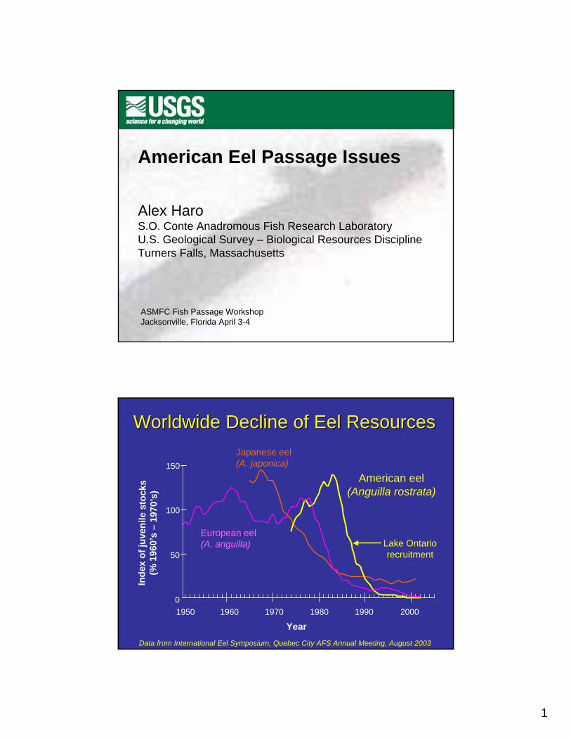
1
American Eel Passage Issues
Alex HaroS.O. Conte Anadromous Fish Research LaboratoryU.S. Geological Survey – Biological Resources DisciplineTurners Falls, Massachusetts
ASMFC Fish Passage WorkshopJacksonville, Florida April 3-4
Year
Inde
x of
juve
nil e
sto
cks
( % 1
960’
s –
1970
’ s)
American eel(Anguilla rostrata)
European eel(A. anguilla)
Japanese eel(A. japonica)
0
50
100
150
1950 1960 1970 1980 1990 2000
Worldwide Decline of Eel ResourcesWorldwide Decline of Eel Resources
Data from International Eel Symposium, Quebec City AFS Annual Meeting, August 2003
Lake Ontariorecruitment
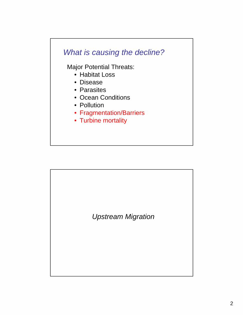
2
Major Potential Threats:• Habitat Loss• Disease• Parasites• Ocean Conditions• Pollution• Fragmentation/Barriers• Turbine mortality
What is causing the decline?
Upstream Migration
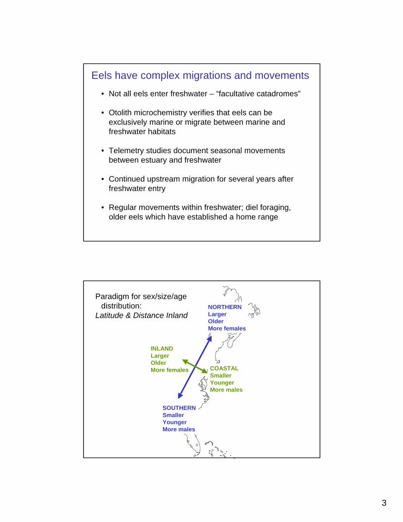
3
• Not all eels enter freshwater – “facultative catadromes”
• Otolith microchemistry verifies that eels can be exclusively marine or migrate between marine and freshwater habitats
• Telemetry studies document seasonal movements between estuary and freshwater
• Continued upstream migration for several years after freshwater entry
• Regular movements within freshwater; diel foraging, older eels which have established a home range
Eels have complex migrations and movements
NORTHERNLargerOlderMore females
SOUTHERNSmallerYoungerMore males
INLANDLargerOlderMore females COASTAL
SmallerYoungerMore males
Paradigm for sex/size/age distribution:
Latitude & Distance Inland

4
Variability in size and reproductive value of males and females
90 cm female90 cm female
47 cm female47 cm female
35 cm male35 cm male
Productive EstuaryMore females?
High Population Density Coastal FreshwaterFewer females
Coastal LakeMore females
Headwater StreamMore females
Headwater LakeMore females
Recent data puts the old paradigm for sex/size/age distribution into question
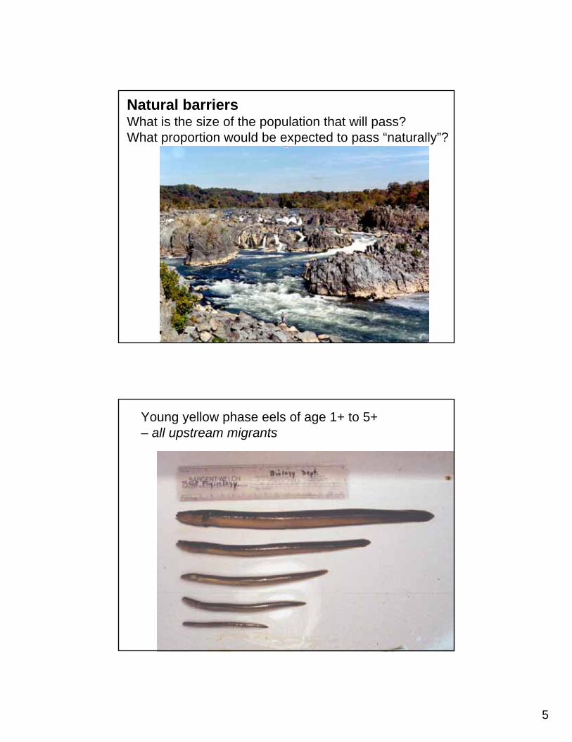
5
Natural barriersWhat is the size of the population that will pass?What proportion would be expected to pass “naturally”?
Young yellow phase eels of age 1+ to 5+– all upstream migrants
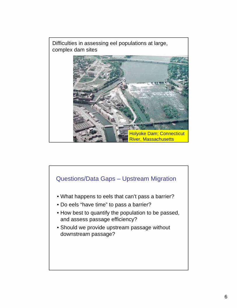
6
Difficulties in assessing eel populations at large, complex dam sites
Holyoke Dam; Connecticut River, Massachusetts
• What happens to eels that can’t pass a barrier?• Do eels “have time” to pass a barrier?• How best to quantify the population to be passed,
and assess passage efficiency?• Should we provide upstream passage without
downstream passage?
Questions/Data Gaps – Upstream Migration
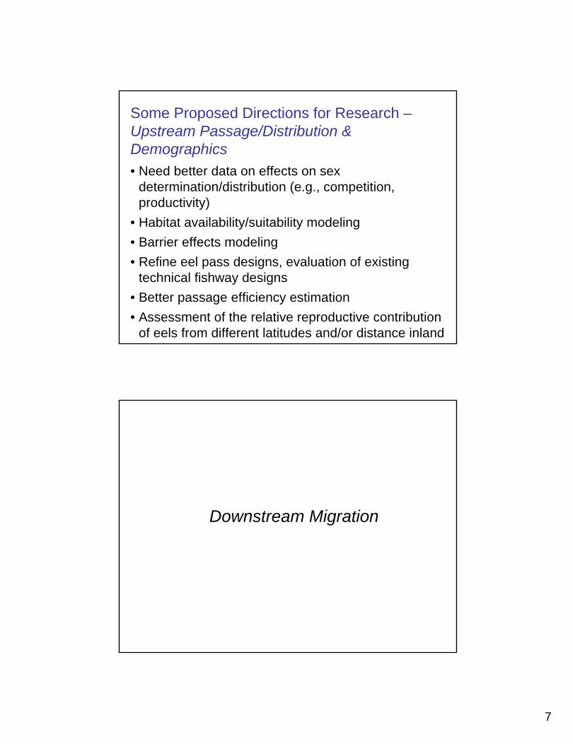
7
• Need better data on effects on sex determination/distribution (e.g., competition, productivity)
• Habitat availability/suitability modeling• Barrier effects modeling• Refine eel pass designs, evaluation of existing
technical fishway designs• Better passage efficiency estimation• Assessment of the relative reproductive contribution
of eels from different latitudes and/or distance inland
Some Proposed Directions for Research –Upstream Passage/Distribution & Demographics
Downstream Migration
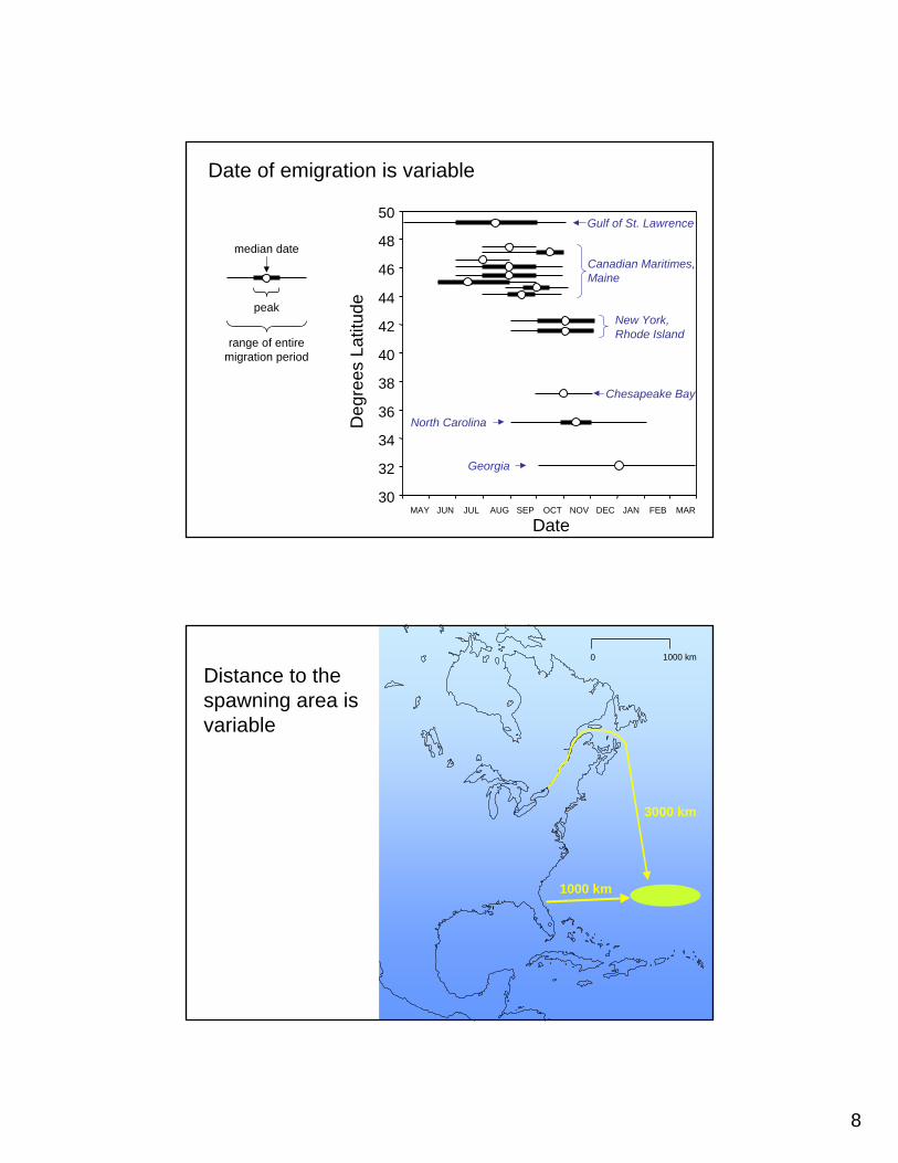
8
median date
peak
range of entire migration period
Date of emigration is variable
30
32
34
36
38
40
42
44
46
48
50
MAY JUN JUL AUG SEP OCT NOV DEC JAN FEB MAR
Deg
rees
Lat
itude
Date
Gulf of St. Lawrence
New York, Rhode Island
Chesapeake Bay
Georgia
North Carolina
Canadian Maritimes, Maine
0 1000 km
1000 km
3000 km
Distance to the spawning area is variable
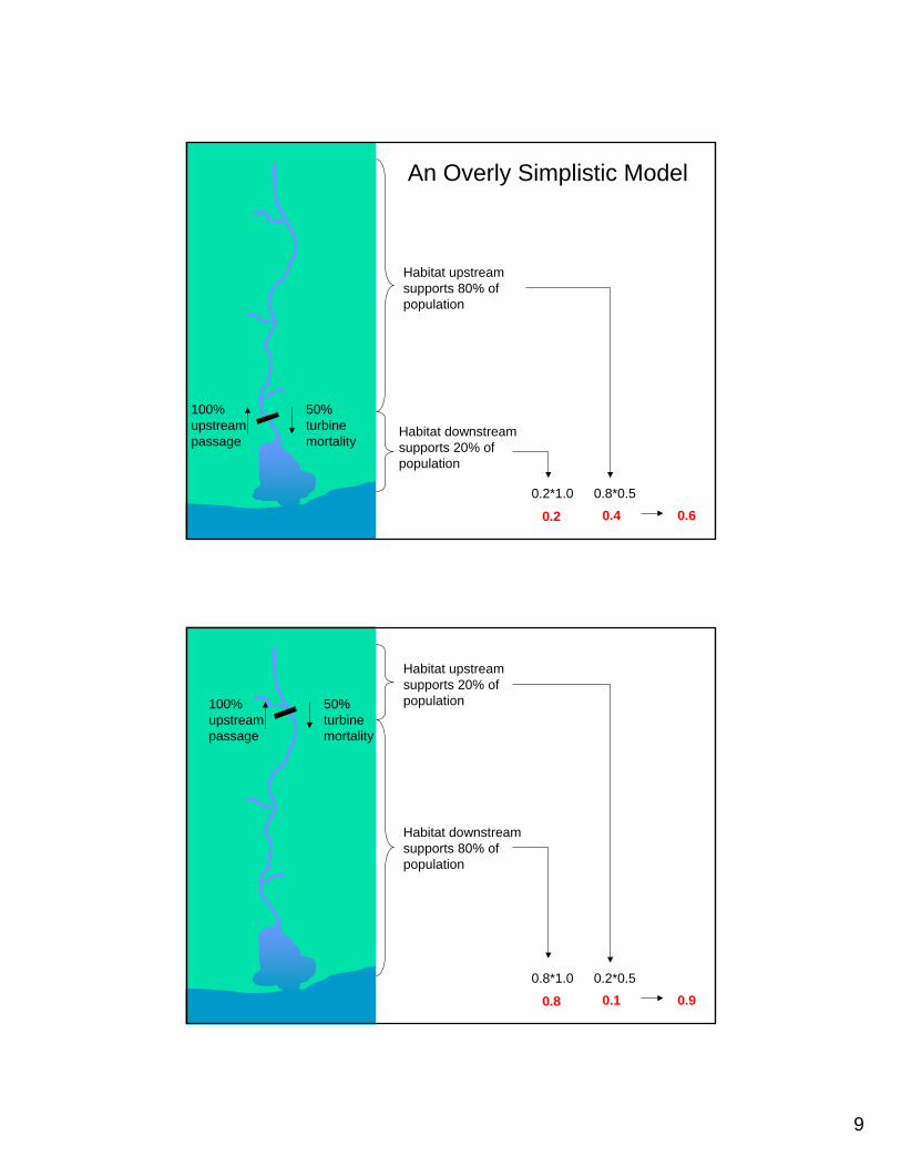
9
50% turbine mortality
100% upstream passage
Habitat upstream supports 80% of population
Habitat downstream supports 20% of population
0.2*1.0
0.2
0.8*0.5
0.4 0.6
An Overly Simplistic Model
50% turbine mortality
100% upstream passage
Habitat upstream supports 20% of population
Habitat downstream supports 80% of population
0.2*0.50.8*1.0
0.8 0.1 0.9
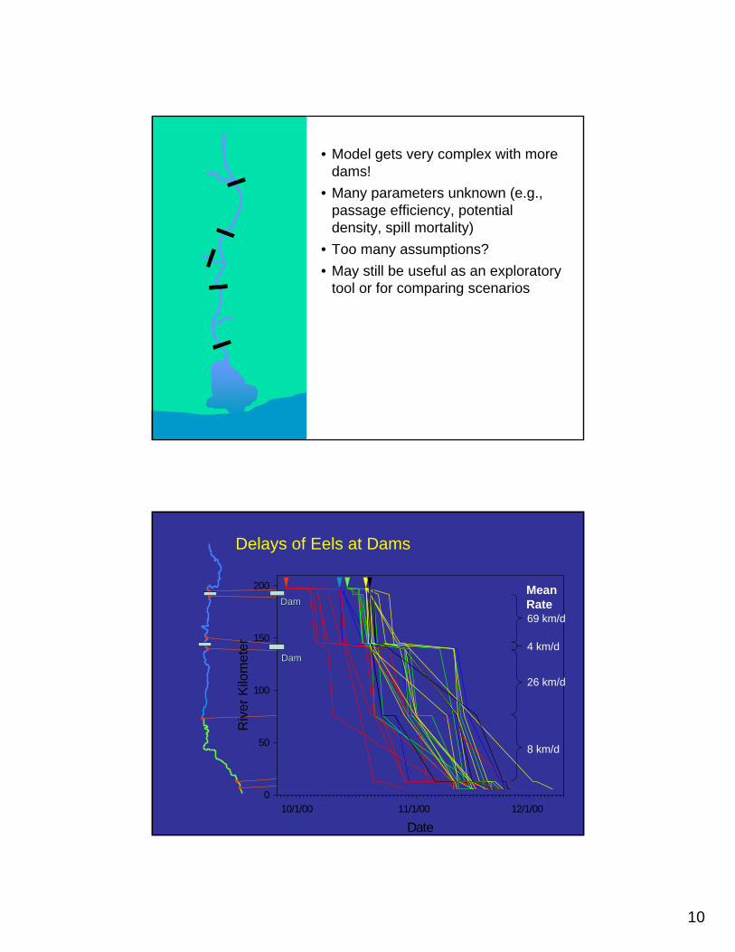
10
• Model gets very complex with more dams!
• Many parameters unknown (e.g., passage efficiency, potential density, spill mortality)
• Too many assumptions?• May still be useful as an exploratory
tool or for comparing scenarios
Date10/1/00 11/1/00 12/1/00
Riv
er K
ilom
eter
0
50
100
150
200
69 km/d
4 km/d
26 km/d
8 km/d
Delays of Eels at Dams
MeanRateDamDam
DamDam

11
• Are migratory timing cues universal?• What are current levels of “escapement”?• What is the specific level of threat of barriers at
different points in a watershed?• What are the effects of migratory delay? • What are the effects of spill mortality*?
Questions/Data Gaps – Downstream Migration
Assuming:1. Downstream passage at a hydro dam cannot be implemented within a reasonable timeframe, and
2. Spill mortality at non-hydro dams is significant,
Mitigate by passage/removal of other dams in the watershed, if there is a net reproductive benefit
Alex’s Crazy Idea #276
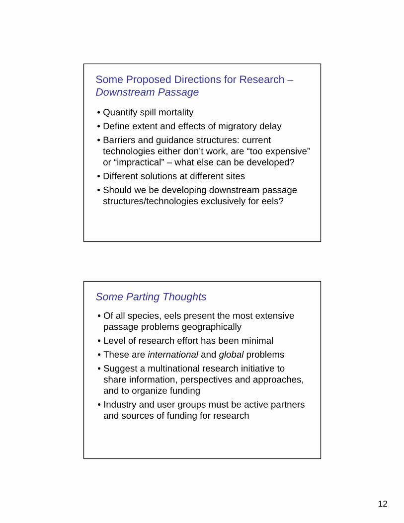
12
• Quantify spill mortality• Define extent and effects of migratory delay• Barriers and guidance structures: current
technologies either don’t work, are “too expensive” or “impractical” – what else can be developed?
• Different solutions at different sites• Should we be developing downstream passage
structures/technologies exclusively for eels?
Some Proposed Directions for Research –Downstream Passage
• Of all species, eels present the most extensive passage problems geographically
• Level of research effort has been minimal• These are international and global problems• Suggest a multinational research initiative to
share information, perspectives and approaches, and to organize funding
• Industry and user groups must be active partners and sources of funding for research
Some Parting Thoughts
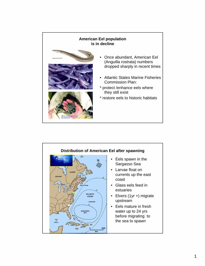
1
American Eel population is in decline
• Once abundant, American Eel (Anguilla rostrata) numbers dropped sharply in recent times
• Atlantic States Marine Fisheries Commission Plan:
* protect /enhance eels where they still exist
* restore eels to historic habitats
Distribution of American Eel after spawning
• Eels spawn in the Sargasso Sea
• Larvae float on currents up the east coast
• Glass eels feed in estuaries
• Elvers (1yr +) migrate upstream
• Eels mature in fresh water up to 24 yrs before migrating to the sea to spawn
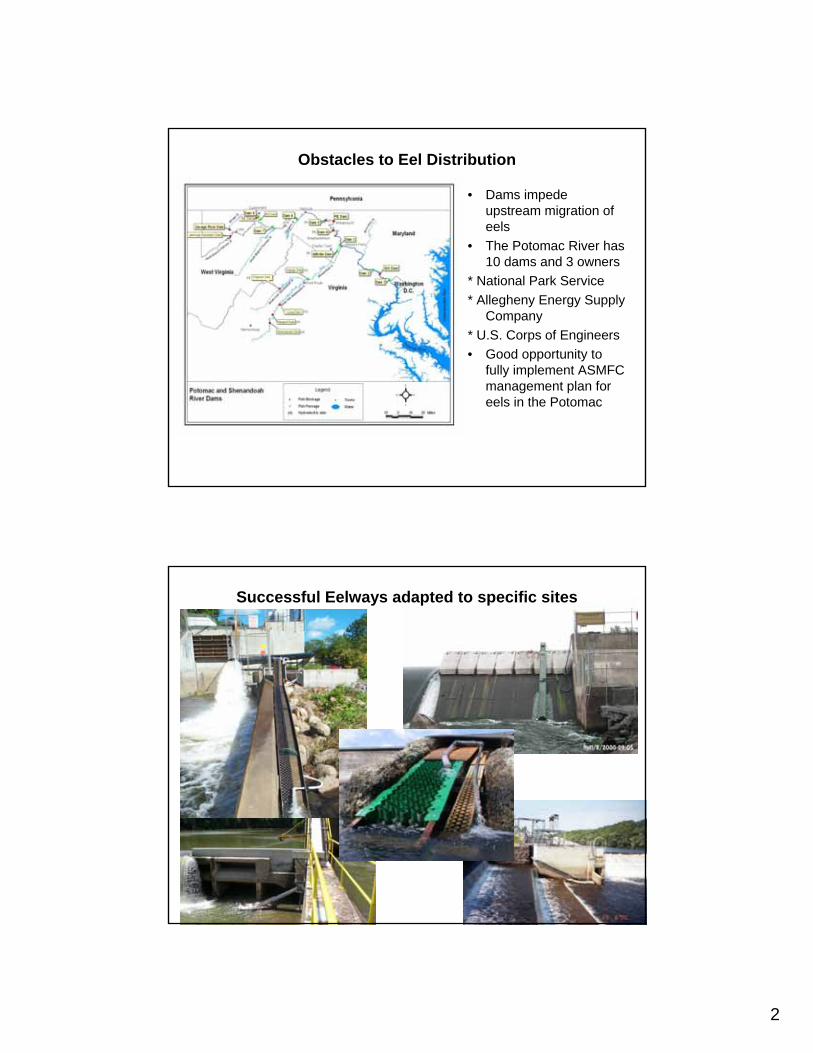
2
Obstacles to Eel Distribution
• Dams impede upstream migration of eels
• The Potomac River has 10 dams and 3 owners
* National Park Service* Allegheny Energy Supply
Company* U.S. Corps of Engineers• Good opportunity to
fully implement ASMFC management plan for eels in the Potomac
Successful Eelways adapted to specific sites

3
Eel Passageway Components
Eel passage is effective
• Eelway at nearby Millville Dam on the Shenandoah has passed 6,000 eels to-date
• Many eelways are in operation across the eel’s range
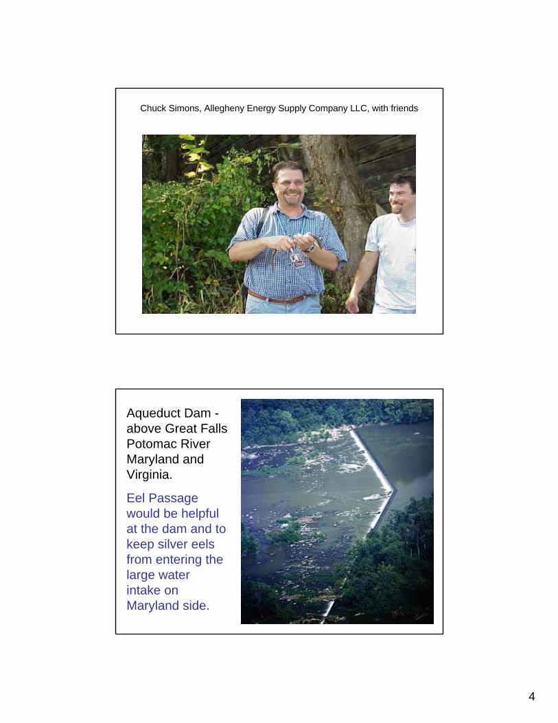
4
Chuck Simons, Allegheny Energy Supply Company LLC, with friends
Aqueduct Dam -above Great FallsPotomac RiverMaryland andVirginia.
Eel Passage would be helpful at the dam and to keep silver eels from entering the large water intake on Maryland side.
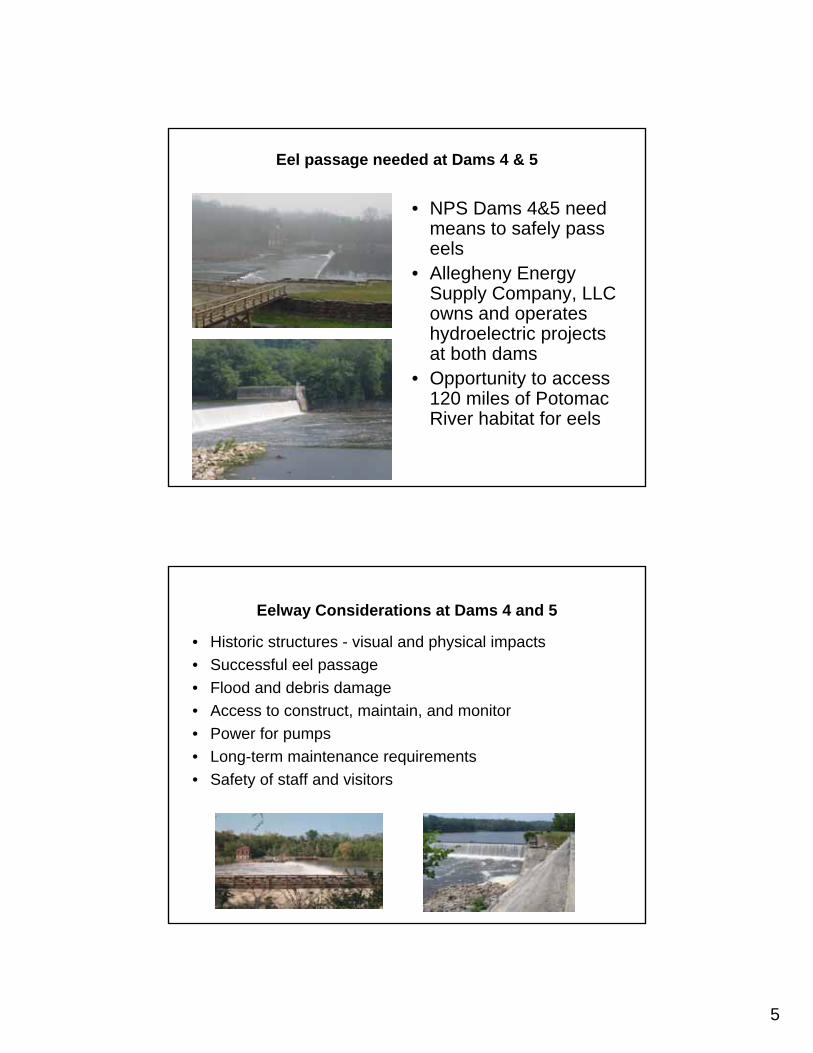
5
Eel passage needed at Dams 4 & 5
• NPS Dams 4&5 need means to safely pass eels
• Allegheny Energy Supply Company, LLC owns and operates hydroelectric projects at both dams
• Opportunity to access 120 miles of Potomac River habitat for eels
Eelway Considerations at Dams 4 and 5
• Historic structures - visual and physical impacts• Successful eel passage• Flood and debris damage • Access to construct, maintain, and monitor• Power for pumps• Long-term maintenance requirements• Safety of staff and visitors

6
Potomac River Dam 4
All Eelway Options
MD
W VA
Dam 4 – Maryland Options
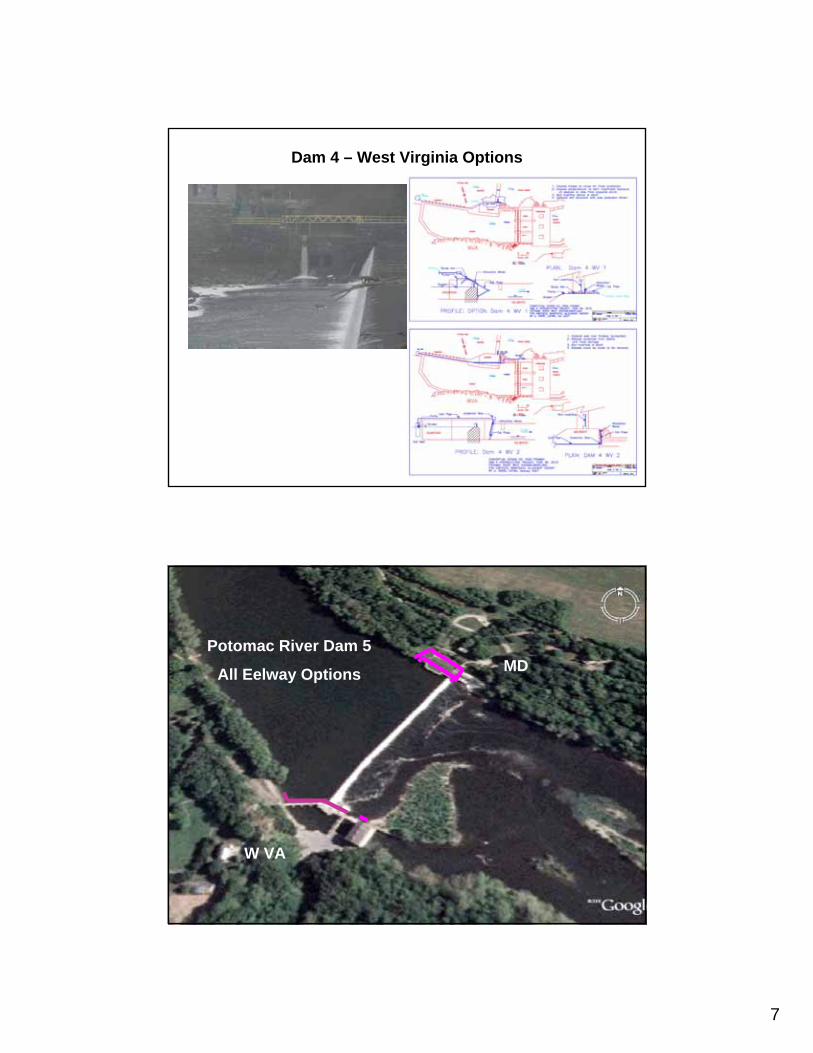
7
Dam 4 – West Virginia Options
Potomac River Dam 5
All Eelway Options MD
W VA

8
Dam 5 – Maryland Options
Dam 5 – West Virginia Options
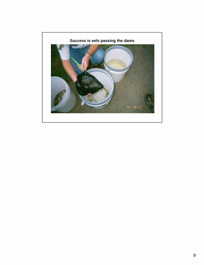
9
Success is eels passing the dams