attachment f commercial remote sensing space policy (crssp) 1 jenn willems usgs eros data center...
TRANSCRIPT

Commercial Remote Sensing Space Policy (CRSSP)
1
Attachment F
Commercial Remote Sensing Space Policy (CRSSP)
Jenn Willems USGS EROS Data Center
Archive Advisory Committee October 20, 2004

Commercial Remote Sensing Space Policy (CRSSP)
2
Attachment F
Presentation Outline
Policy and implementation background Implementation organization Progress in each area Next Steps

Commercial Remote Sensing Space Policy (CRSSP)
3
Attachment F
US Commercial Remote Sensing Space Policy
Policy signed by President Bush on April 25, 2003 Policy Goal:
Advance and protect US national security and foreign policy interests by: Maintaining the Nation’s leadership in remote sensing space
activities Sustaining and enhancing the US remote sensing industry
Synopsis of Policy directive to US Government: Rely to the maximum practical extent on US commercial remote sensing
space capabilities Focus Government systems on needs that are practically met
commercially Develop long-term sustainable relationship with industry Provide timely/responsive environment for licensing operations of
commercial remote sensing space systems Enable US industry to compete with foreign providers

Commercial Remote Sensing Space Policy (CRSSP)
4
Attachment F
Civil Implementation Background
Civil agencies were tasked to write an implementation plan
The implementation plan: Established a lead civil agency (USGS) Established interagency committees:
Senior Steering Committee (SSC) at policy level Implementation working group (IWG) at operational level
Designated agencies to share plan execution responsibilities and/or leverage capabilities where possible (USGS, NOAA, USDA, NGA, etc.)

Commercial Remote Sensing Space Policy (CRSSP)
5
Attachment F
Participating AgenciesDepartment of Commerce
• Census Bureau• National Oceanic and Atmospheric
Administration
Department of Defense• National Geospatial Intelligence Agency• US Army Corps of Engineers
Department of Energy
Department of Interior• Bureau of Land Management• US Fish and Wildlife Service• National Park Service• US Geological Survey
Department of Homeland Security• Federal Emergency Management Service• Transportation Safety Administration• US Coast Guard• Department of State
Department of Transportation
Federal Geographic Data Committee
National Aeronautics and Space Administration
National Capital Planning Commission
US Department of Agriculture
US Forest ServiceNatural Resources
Conservation Service
Foreign Agricultural Service
Farm Service Agency
US Environmental Protection Agency

Commercial Remote Sensing Space Policy (CRSSP)
6
Attachment F
CRSSP Implementation Organization
Senior Steering Committee (SSC)
Interagency Working Group (IWG)
Near TermRequirements
Long TermRequirements Infrastructure Procurement Budget Strategy
IWG Sub-teamsIWG Sub-teamsIWG Sub-teamsIWG Sub-teams

Commercial Remote Sensing Space Policy (CRSSP)
7
Attachment F
Near Term Requirements
The policy specifically requires civil agencies to: “Determine which civil needs can be met by
commercial remote sensing space capabilities; and Communicate current and projected needs to the
commercial remote sensing space industry”

Commercial Remote Sensing Space Policy (CRSSP)
8
Attachment F
Requirements Process
Near-term requirements objective - characterize and quantify agency remote sensing data requirements from current systems for: Industry planning Civil budget planning Identification of procurement opportunities Leveraging resources to facilitate new orders
Long-term requirements objective – Characterize needs for future systems (NOAA)

Commercial Remote Sensing Space Policy (CRSSP)
9
Attachment F
Requirements Collection
Survey given to all civil agencies Asked to describe projects for FY 04-06
Area of interest, sensor, spectral characteristics, resolution, cloud cover, application (i.e. mapping, monitoring, science research, regulatory, crop survey, etc.)
257 requirements were submitted 60% of civil agencies reported

Commercial Remote Sensing Space Policy (CRSSP)
10
Attachment F
Geographic Focus Areas
The requirements process identified areas appearing to be exceptional in the number of times they were requested and/or their correspondence with a concentration of civil mission needs.
Further analysis identified key regions where commercial remote sensing data would be of immediate use… Alaska Great Lakes Coastal and Border Areas Emergency Response

Commercial Remote Sensing Space Policy (CRSSP)
11
Attachment F
Infrastructure
Requirements
Status/
Feedback
Search and Order Tool
Customer Service
Library Imagery Available?
NO
YES
CRSSP/CDP*Archive
Order
New CDP*Task
Order
Data Product
Civil User
NOTE: The CRSSP and *commercial data provider libraries encompass the following archives:
CRSSP Library
NGA Archive USGS Archive USDA Archive Other
Commercial Data Provider Library
Space Imaging Archive Digital Globe Archive OrbImage Archive

Commercial Remote Sensing Space Policy (CRSSP)
12
Attachment F
Commercial Data Access
Add commercial satellite data to menu of USGS data/imagery holdings Landsats 1-5 & 7; Terra/ MODIS, ASTER; Aqua/MOVIS; NOAA/AVHRR;
SPOT historical scenes; declassified U.S. imagery; multitude of other DEM and other geospatial data sets
Draw on decades of all-source civil imagery procurement, management and distribution
Use experienced customer service to search, order, and redistribute data
Complete initial infrastructure enhancements by March 2005 USGS has coordinated large requirements/procurements:
USGS contracted for National 1-meter DOQ coverage (~$220M 1993-02)
Approximately 50% USGS funded, 50% reimbursable (Fed/State) USGS contracting for 1-ft imagery over US urban areas (~10M 2003-
2005)

Commercial Remote Sensing Space Policy (CRSSP)
13
Attachment F
Procurement
Contracts signed late in FY04 with: Space Imaging, Digital Globe, ORBIMAGE. The contracts: Complement family of USGS geospatial services/imagery
contracts Expand distribution rights including unrestricted and public
domain Provide optimum terms and conditions for civil needs Customer services staff steeped in civil applications
Over $1M purchased by agencies since August 2004 National Park Service, US Fish and Wildlife Service, Foreign
Agriculture Service, Bureau of Land Management NPS largest collect; covering national parks in SE Alaska

Commercial Remote Sensing Space Policy (CRSSP)
14
Attachment F
Budget
• FY06 budget planning cycle was already well along
• SSC considered initiative ideas that pooled requirements around several key needs (Alaska, etc.)
• Internal agency review and approval processes were out of phase with the FY06 budget cycle
• Ideas will be reconsidered for potential addition to FY07 budget submissions

Commercial Remote Sensing Space Policy (CRSSP)
15
Attachment F
Civil/NGA Coordination
• Investigating options for replicating applicable ClearView data to populate CRSSP archive
• Define method of receiving new data updates
• Explore methods to compare unfunded requirements to NGA planned acquisitions
• Evaluating possible leverage of NGA infrastructure

Commercial Remote Sensing Space Policy (CRSSP)
16
Attachment F
Next Steps Continue to make use of requirements data:
Examine/consolidate requirements for procurement opportunities Examine requirements for potential initiatives Field test new requirements collection system Implement system in Jan FY05
Validate our FY04 data with industry actuals Update FY05-06 Addition of FY07 requirements
Synchronize requirements and budget processes Develop case studies that demonstrate satellite utility for major
national needs such as emergency response Expose more users to satellite data by populating highly visible,
user friendly civil archive Continue productive civil/NGA cooperation for commercial
remote sensing

Commercial Remote Sensing Space Policy (CRSSP)
17
Attachment F
Back-up Slides

Commercial Remote Sensing Space Policy (CRSSP)
18
Attachment F
Improving Short-term Requirements Process
Improvements slated: Implement web-based interface tool for data capture
and reporting Automate data input into controlled fields Automate analysis and GIS display tools Dynamic update of requirements
Clarify requirements scope Involve any additional agencies Send out new GIS specialist to help agencies submit
and validate requirements

Commercial Remote Sensing Space Policy (CRSSP)
19
Attachment F
Alaska
Alaska lags behind other states in completeness and currency of its base mapping
Most available data does not meet National Map Accuracy Standards
Its size, remoteness and capricious weather hampers conventional mapping
Alaska’s infrastructure is isolated and widely distributed

Commercial Remote Sensing Space Policy (CRSSP)
20
Attachment F
Floods, Avalanche,Earthquakes

Commercial Remote Sensing Space Policy (CRSSP)
21
Attachment F
Industrial Disasters, Oil Spills
Commercial Remote Sensing Space Policy (CRSSP)
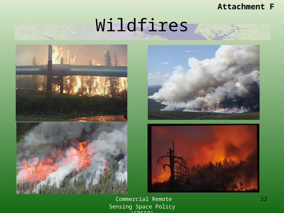
22
Attachment F
Wildfires

Commercial Remote Sensing Space Policy (CRSSP)
23
Attachment F
Key Alaska Needs
Critical targets .5 – 2.5 meter high resolution orthoimagery - core infrastructure 2.5 – 5.0 meter lower resolution orthoimagery – federal interest areas
Core infrastructure includes cities, towns, villages, roads, pipeline, ports and energy producing and development areas
Shared interest among multiple agencies and organizations for Alaska Data
Key areas of use include: Aviation Safety, Disaster Response, Homeland Security, Land Transfer, Public Safety, Environmental Research, Resource Assessment, Community & Economic Development

Commercial Remote Sensing Space Policy (CRSSP)
24
Attachment F
Great Lakes
Regional Needs:
Better Emergency Preparedness Imagery to enhance existing oil/toxic spill response mapping Minimize disaster losses / increase response timing / efficiencies
Improve Public Health Protect water intakes from threats Fewer beach closures
Enhance Ecological Protection / Restoration Monitor wetland changes caused by encroachment and invasives
Protect Endangered Species Sensitive near shore habitats

Commercial Remote Sensing Space Policy (CRSSP)
25
Attachment F
Great Lakes Partners Interest high for sharing high resolution satellite imagery between federal, state, tribal and local
agencies and Non governmental organizations (NGOs):
Dept. of Homeland Security (DHS) - Coast Guard, Immigration and Naturalization Service (INS), Border Patrol, Federal Emergency Management Agency (FEMA)
US Dept. of Agriculture (USDA) – Farm Service Agency (FSA), National Agriculture Statistics Service (NASS), Natural Resource Conservation Service (NRCS), Forest Service (FS), Crop Insurance
Dept. of Interior (DOI) – National Park Service (NPS), US Fish and Wildlife Service (FWS), Bureau of Land Management (BLM), Bureau of Indian Affairs (BIA), US Geological Survey (USGS)
Dept. of Transportation (DOT) – Federal Highway Administration (FHA)
Dept. of Defense (DOD) – US Army Corps of Engineers (USACE)
Environmental Protection Agency (EPA)- International Joint Commission (IJC)
States, counties and cities
Tribes
Ducks Unlimited, The Nature Conservancy
Integrated Ocean Observing System (IOOS)
Great Lakes Observing System (GLOS) is coordinating remote sensing requirements

Commercial Remote Sensing Space Policy (CRSSP)
26
Attachment F
Great Lakes Partners
Universities Minnesota
University of Minnesota - Duluth Wisconsin
U of WI – Madison and Milwaukee Michigan
Michigan State University Central Michigan University
Ohio Ohio State University of Toledo
New York State University of New York – Buffalo Cornell
Research and development for production of value-added products

Commercial Remote Sensing Space Policy (CRSSP)
27
Attachment F
Great Lakes Priority Needs
Option 1 – “Comprehensive Coverage”
Option 2 – “Special Monitoring”

Commercial Remote Sensing Space Policy (CRSSP)
28
Attachment F
Coastal & Border Areas
US Coast Guard National Defense Missions General Defense Operations Maritime Interception Operations Military Environmental Response Operations Port Operations, Security, and Defense Coastal Sea Control Operations Peacetime Military Engagement Polar Icebreaking

Commercial Remote Sensing Space Policy (CRSSP)
29
Attachment F
55 Military & Economically Important PortsMobile, AL
Anchorage, AK
* Valdez, AK
* Los Angeles/Long Beach, CA
* SFO/Oakland/Richmond, CA
Port Hueneme, CA
San Diego, CA (JHOC developing)
New Haven, CT
New London, CT
Wilmington, DE
Panama City & Port St. Joe, FL
Pensacola, FL
Tampa/Port Manatee, FL
West Palm Beach, FL
Miami & Port Everglades, FL
Port Canaveral, FL
Jacksonville, FL
Kings Bay, GA
Savannah, GA
Guam
Honolulu, HI
Pearl Harbor, HI
Chicago, IL
Louisville, KY
Baton Rouge, LA
Lake Charles, LA
New Orleans/Port of South, LA
Morgan City, LA
Boston, MA
Baltimore, MD
Portland, ME
Detroit, MI
Duluth/Superior, MI
St Louis, MO
Pascagoula, MS
Morehead City, NC
Wilmington & MOT Sunny Pt, NC
Portsmouth, NH
Buffalo, NY
New York/New Jersey
Cincinnati, OH
Cleveland, OH
Toledo, OH
Portland, OR
Pittsburgh, PA
Philadelphia, PA
San Juan, PR
Providence, RI
Charleston, SC
Memphis, TN
Corpus Christi, TX
Port Arthur/Beaumont, TX
* Galveston/TX City/Freeport, TX
* Houston, TX
* Norfolk/Newport News, VA (JHOC)
* Seattle/Tacoma, WA
Vancouver, WA
Huntington, WV* Only active inport surveillance capability tracking commercial vessels over 300 GT

Commercial Remote Sensing Space Policy (CRSSP)
30
Attachment F
Familiarization/Visualization

Commercial Remote Sensing Space Policy (CRSSP)
31
Attachment F
Infrastructure Assessments• Utilities
– Power Plants– Water/Sewage Treatment
• Road Networks• Power Networks
Water Treatment PlantWater Treatment Plant
Road Pipeline
Imagery backdrop for GIS databases Imagery backdrop
for GIS databases
Imagery supports creation of detailed site diagrams of facilities.
Imagery supports creation of detailed site diagrams of facilities.
Images courtesy of
DigitalGlobe Images courtesy of
DigitalGlobe

Commercial Remote Sensing Space Policy (CRSSP)
32
Attachment F
Safety Applications• Event Modeling
– Determine Potential Areas Affected– Help Plan for Different Types/Levels of
Response– Crisis Support
Prevailing Winds
Prevailing Winds Agent Release PointAgent Release Point
Event + 9 HoursEvent + 9 Hours
Event + 7 HoursEvent + 7 Hours
Event + 5 HoursEvent + 5 Hours
Event + 3 HoursEvent + 3 Hours
Event + 1 HourEvent + 1 Hour
Image courtesy of
DigitalGlobe Image courtesy of
DigitalGlobe

Commercial Remote Sensing Space Policy (CRSSP)
33
Attachment F
Border Control

Commercial Remote Sensing Space Policy (CRSSP)
34
Attachment F
Disaster Response

Commercial Remote Sensing Space Policy (CRSSP)
35
Attachment F
Requirements
Infrastructure Assessments Utilities
Power Plants Water/Sewage Facilities
Road Networks Power Networks
Safety Applications Event Modeling
Determine potential areas affected Help plan for varying levels of response Crisis support