bentley systems, incorporatedbentley systems, · pdf filewater watewater watergems sewergems...
TRANSCRIPT
Bentley Systems, IncorporatedBentley Systems,
Incorporated
7/4/2007
© 2002 Bentley Systems, Incorporated© 2002
Bentley Systems, Incorporated 1
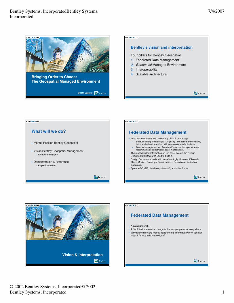
Bringing Order to Chaos:The Geospatial Managed Environment
Oscar Custers
What will we do?
• Market Position Bentley Geospatial
• Vision Bentley Geospatial Management
− What is the vision?
• Demonstration & Reference
− As per illustration
Vision & Interpretation
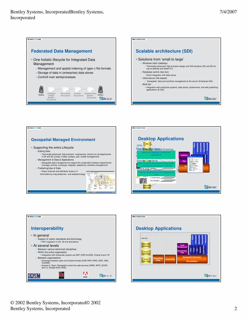
Bentley’s vision and interpretation
Four pillars for Bentley Geospatial
1. Federated Data Management
2. Geospatial Managed Environment
3. Interoperability
4. Scalable architecture
• Infrastructure assets are particularly difficult to manage
− Because of long lifecycles (50 - 75 years). The assets are constantly
being worked and re-worked with increasingly smaller budgets.
− Disaster Management and Terrorism Prevention have put increased requirements on infrastructure asset management.
• The most detailed information on the asset lives in the Design
Documentation that was used to build it.
• Design Documentation is still overwhelmingly “document” based -
Maps, Models, Drawings, Specifications, Schedules - and often
dispersed.
• Spans AEC, GIS, database, Microsoft, and other forms.
Federated Data Management
• A paradigm shift…
• A “tool” that spawned a change in the way people work everywhere
• Why spend time and money transforming information when you can
index it for use in its native form?
Federated Data Management
Bentley Systems, IncorporatedBentley Systems,
Incorporated
7/4/2007
© 2002 Bentley Systems, Incorporated© 2002
Bentley Systems, Incorporated 2
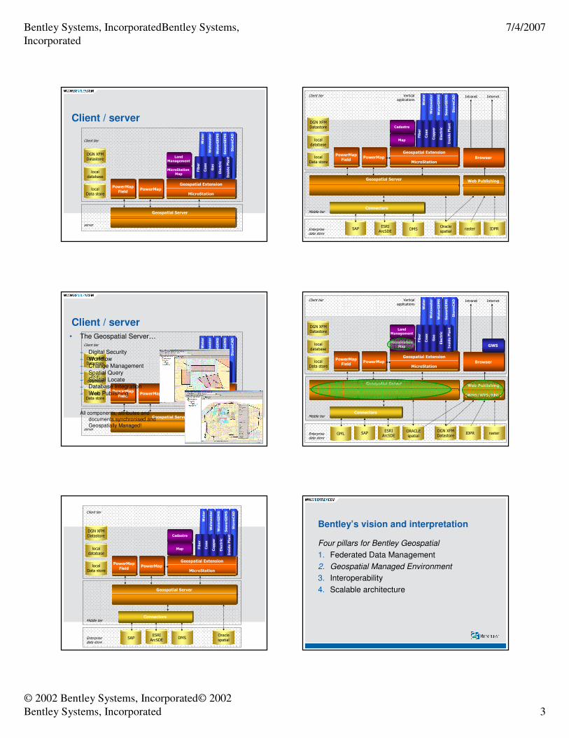
Federated Data Management
• One holistic lifecycle for Integrated Data Management
− Management and spatial indexing of (geo–) file formats
− Storage of data in (enterprise) data stores
− Controll over workprocesses
Bid & Build
Documents
As Built
Documents
Intelligent
Design
Models /
Documents
Detailed Asset
Models /
Documents
Database Database
Geospatial Managed Environment
• Supporting the entire Lifecycle− Editing Data
» Technically advanced, high precision ´engineering´ solution for all departmentsin 2D and 3D (create, modify, analyse, plot, mobile management)
− Management of Data & Applications
» Geospatial data management to support the cooperation between departments(manage, archive, exchange, integrate, datastores, workflow management)
− Publishing/Use of Data
» Share (internal) and distribute (extern) of
information by map plotserver– and webtechnology
Interoperability
• In general− Support of (open) standards and technology
»PDF integration in 2D, 3D and animations
• At several levels− Between various (technical) disciplines
− Within the entire organisation
» Integration with enterprise systems as SAP, ESRI ArcSDE, Oracle 9i and 10g
− Between organisations
» Exchange between open and closed formats (DGN XFM, DWG, MXD, GML, CityGML)
» Access to ‘Open’ Geospatial content by web-services (WMS, WFS, SOAP) and i.e. Google Earth (KML)
Scalable architecture (SDI)
• Solutions from ‘small to large’− Windows client (desktop)
» Technically advanced, high precision design and GIS solutions (2D and 3D) foruse at desktop and tablet Pc's
− Database centric (two tier)
» Direct integration with data stores
− Client/server (file based)
» ´Geospatial´ data and workflow management at the server (Enterprise GIS)
− Multi-tier
» Integration with enterprise systems, data stores, plotservices, and web publishingapplications (E-GIS)
Geospatial Extension
MicroStation
Geospatial Extension
MicroStation
GMLLandXML
localdatabase
raster
MID/MIF, MXD/SHPDWG
ORACLEspatial
DGN XFMDatastore
Water
Wastewater
WaterGEMS
SewerGEMS
StormCAD
Fiber
Coax
Copper
Electric
Inside Plant
Map
Cadastre
KML
Desktop Applications
The Map Manager…
Control Center for creating & querying the map
XFM….
Create Models, not just Drawings
− Smart placement tools build
intelligent engineering models for infrastructure management
Improve Standards
− Symbology and annotation based
on asset attributes
Build Smarter Software
− User defined placement routines ensure accuracy
Move from desktop to enterprise
applications
More accurate drawings promotes better understanding and safety in the field
Reduce development and maintenance costs
Desktop Applications
PowerMap
Geospatial Extension
MicroStation
MicroStation Map
PowerMapField
localData store
LandManagement
localdatabase
DGN XFMDatastore
Water
Watewater
WaterGEMS
SewerGEMS
StormCAD
Fiber
Coax
Gas
Electric
Inside Plant
PowerMap
Geospatial Extension
MicroStation
MicroStation Map
PowerMapField
localData store
LandManagement
Client tier
localdatabase
DGN XFMDatastore
Water
Watewater
WaterGEMS
SewerGEMS
StormCAD
Fiber
Coax
Gas
Electric
Inside Plant
Bentley Systems, IncorporatedBentley Systems,
Incorporated
7/4/2007
© 2002 Bentley Systems, Incorporated© 2002
Bentley Systems, Incorporated 3
PowerMap
Geospatial Extension
MicroStation
MicroStation Map
PowerMapField
localData store
LandManagement
Client tier
localdatabase
DGN XFMDatastore
Water
Watewater
WaterGEMS
SewerGEMS
StormCAD
Fiber
Coax
Gas
Electric
Inside Plant
server
Client / server
Geospatial Server
Client / server
PowerMap
Geospatial Extension
MicroStation
MicroStation Map
PowerMapField
localData store
LandManagement
Client tier
localdatabase
DGN XFMDatastore
Water
Watewater
WaterGEMS
SewerGEMS
StormCAD
Fiber
Coax
Gas
Electric
Inside Plant
server
Geospatial Server
• The Geospatial Server…
− Digital Security
− Workflow
− Change Management− Spatial Query
− Spatial Locate− Database Integration
− Web Publishing
All components, attributes and documents synchronised and
Geospatially Managed!
PowerMap
Geospatial Extension
MicroStation
Geospatial Server
Map
PowerMapField
localData store
Cadastre
Oraclespatial
Enterprise data store
Middle tier
Client tier
Connectors
DMSESRIArcSDE
localdatabase
DGN XFMDatastore
Water
Watewater
WaterGEMS
SewerGEMS
StormCAD
Fiber
Coax
Copper
Electric
Inside Plant
SAP
Water
Watewater
WaterGEMS
SewerGEMS
StormCAD
PowerMap
Web Publishing
Geospatial Extension
MicroStation
Fiber
Coax
DMSESRIArcSDE
SAPOraclespatial
Internet
Intranet
Map
PowerMapField
localData store
Cadastre
Copper
Electric
Inside Plant
Enterprise data store
Middle tier
Client tier Vertical applications
Internet
raster IDPR
localdatabase
DGN XFMDatastore
Geospatial Server
Connectors
Browser
Water
Watewater
WaterGEMS
SewerGEMS
StormCAD
PowerMap
Web Publishing
(WMS/WFS/KML)
Geospatial Extension
MicroStation
Fiber
Coax
ORACLEspatial
ESRIArcSDE
SAPDGN XFMDatastore
Internet
Intranet
MicroStation Map
PowerMapField
localData store
LandManagement
Gas
Electric
Inside Plant
Browser
Enterprise data store
Middle tier
Client tier Vertical applications
GWS
Internet
IDPR raster
localdatabase
DGN XFMDatastore
Geospatial Server
GML
Connectors
Bentley’s vision and interpretation
Four pillars for Bentley Geospatial
1. Federated Data Management
2. Geospatial Managed Environment
3. Interoperability
4. Scalable architecture
Bentley Systems, IncorporatedBentley Systems,
Incorporated
7/4/2007
© 2002 Bentley Systems, Incorporated© 2002
Bentley Systems, Incorporated 4
Any questions?
Contact: [email protected]
Thank You