best practices for financial management of gis operations
TRANSCRIPT
Best Practices for Financial Management of GIS
Operations
GIS-Pro 2013 Tuesday, September 17, 2013
Providence, Rhode Island
Greg Babinski, MA, GISP URISA Past-President URISA GMI Committee Chair COGO Secretary Finance & Marketing Manager King County GIS Center Seattle, WA USA

Why develop GIS best practices?
What is financial management?
What are key aspects of GIS financial management?
Recommended best practices
The role of the GIS Management Institute in the formal development of best practices
Best Practices for Financial Management of GIS Operations
Agenda

Best Practices for Financial Management of GIS Operations
Why develop GIS best practices?
We all have ‘practices’ for the work we have to accomplish as GIS Managers.
We wouldn’t be doing what we’re doing if it did not work, right?

Best Practices for Financial Management of GIS Operations
Why develop GIS best practices?
We all have ‘practices’ for the work we have to accomplish as GIS Managers.
We wouldn’t be doing what we’re doing if it did not work, right?
But ‘I’m a manager, and I can change, if I have to.’
We come to conferences to improve our practices, correct?

Best Practices for Financial Management of GIS Operations
Why develop GIS best practices?
Developing best practices is the mark of a maturing profession
Babinski’s Theory of GIS Management: As GIS Operational Maturity Improves, ROI Increases
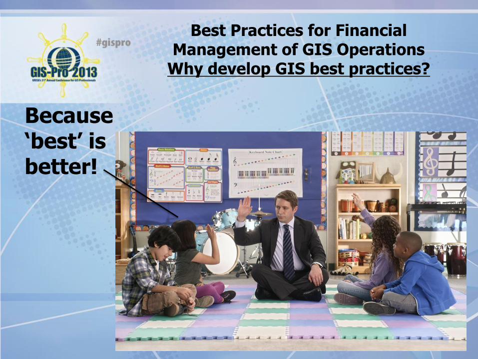
Best Practices for Financial Management of GIS Operations
Why develop GIS best practices?
Because ‘best’ is better!

Best Practices for Financial Management of GIS Operations What is financial management?
Financial management is the efficient and effective application of funds (money) and resources to accomplish the goals of an organization.
It includes finding funding sources, acquiring the funds, and allocating them to achieve the goals.
It includes controlling costs and maximizing revenue.
Professional management includes carefull fincial stewardship.

Best Practices for Financial Management of GIS Operations
What are key aspects of GIS financial management?
One of 18 competency clusters in the URISA GMI Geospatial
Management Competency Model adopted by USDOLETA

Best Practices for Financial Management of GIS Operations
What are key aspects of GIS financial management?
Seven individual competencies in the URISA GMI Geospatial Management Competency Model adopted by USDOLETA:
64. Prepare and document budgets
66. Manage expenditures and income
66. Identify Funding sources and obtain funding, including collaborative opportunities
67. Develop and maintain a long term financial plan
68. Conduct regular financial analysis
69. Implement standard financial accounting procedures and controls
70. Assure accountability by periodic independent audits
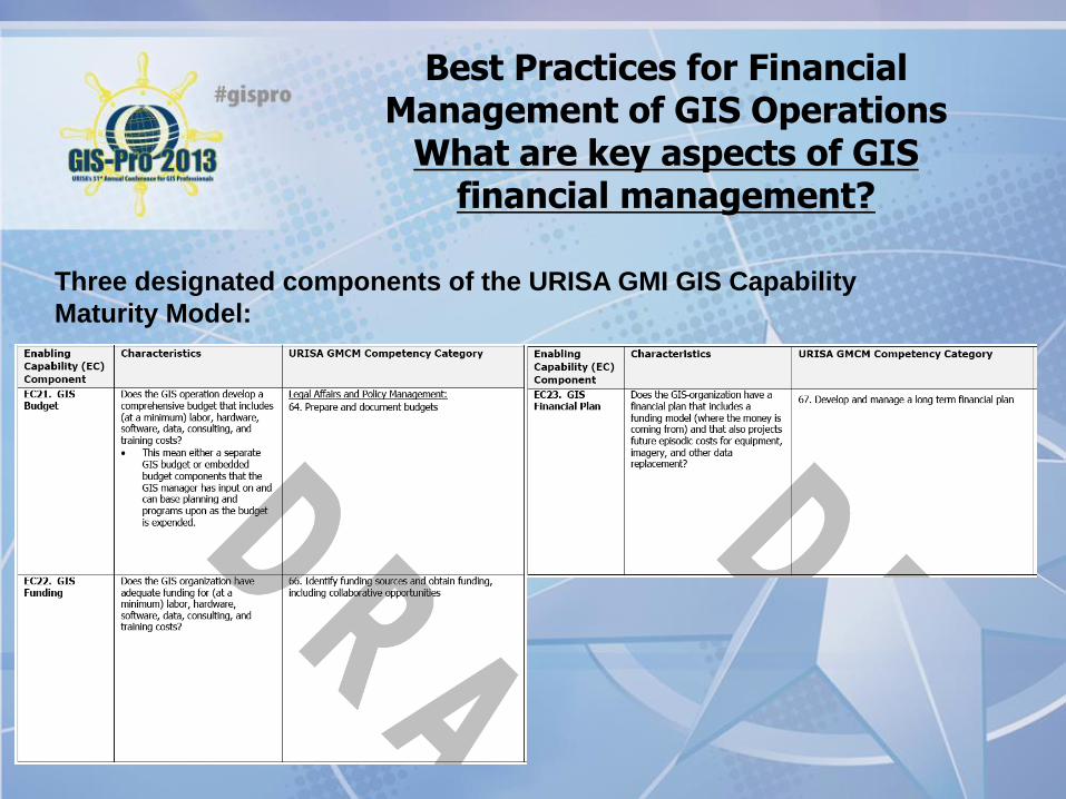
Best Practices for Financial Management of GIS Operations
What are key aspects of GIS financial management?
Three designated components of the URISA GMI GIS Capability
Maturity Model:
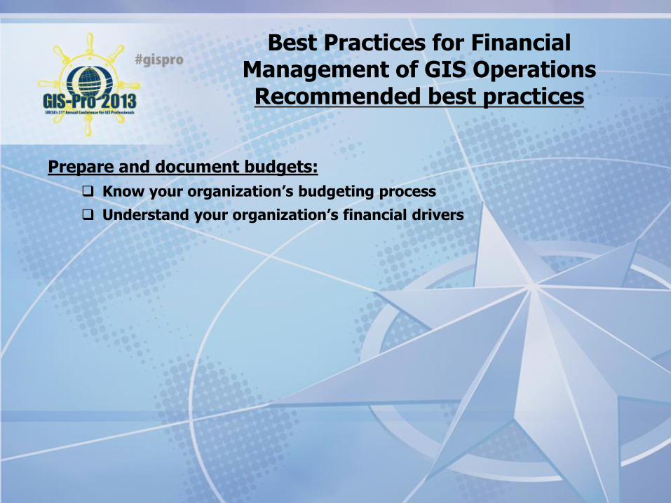
Best Practices for Financial Management of GIS Operations Recommended best practices
Prepare and document budgets:
Know your organization’s budgeting process
Understand your organization’s financial drivers

Best Practices for Financial Management of GIS Operations Recommended best practices
Manage expenditures and income:
Know and negotiate the fair market price for services and products required to develop, operate, and maintain your enterprise GIS
Ensure fair compensation for enterprise GIS services and products:
Ensure that your rates cover your costs
If required develop rates that generate profit and/or financial reserves
Best Practices for Financial Management of GIS Operations Recommended best practices
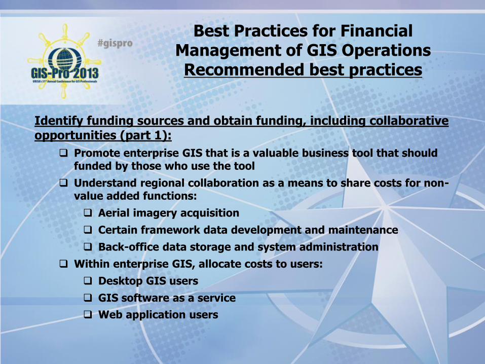
Identify funding sources and obtain funding, including collaborative opportunities (part 1):
Promote enterprise GIS that is a valuable business tool that should funded by those who use the tool
Understand regional collaboration as a means to share costs for non-value added functions:
Aerial imagery acquisition
Certain framework data development and maintenance
Back-office data storage and system administration
Within enterprise GIS, allocate costs to users:
Desktop GIS users
GIS software as a service
Web application users

Best Practices for Financial Management of GIS Operations Recommended best practices
Identify funding sources and obtain funding, including collaborative opportunities (part 2):
Understand and pursue commercial opportunities:
Commercialize applications or other products
Commercialize internal services of value to outside customers
Understand alternate funding sources:
Grants
Consortiums
Understand and be conversant in the ROI from GIS:
Internal ROI from implementing GIS to reduce costs
Internal ROI from implementing GIS to increase productivity or effectiveness
External ROI from regional economic benefits derived from GIS data, products, and services

Best Practices for Financial Management of GIS Operations Recommended best practices
Develop and maintain a long term financial plan:
Understand cyclical funding needs:
Equipment replacement
Imagery replacement
Other periodic data replacement
Labor payouts (retirement, long-term leave, other labor settlements)
Develop emergency financial reserves or contingencies

Best Practices for Financial Management of GIS Operations Recommended best practices
Conduct regular financial analysis:
Compare budgeted revenue against actual revenue received
Compare budgeted expenditures against actual expenses incurred
Compare your costs against peer agencies
Conduct activity based cost analysis
Conduct periodic supplier cost analysis
Best Practices for Financial Management of GIS Operations Recommended best practices
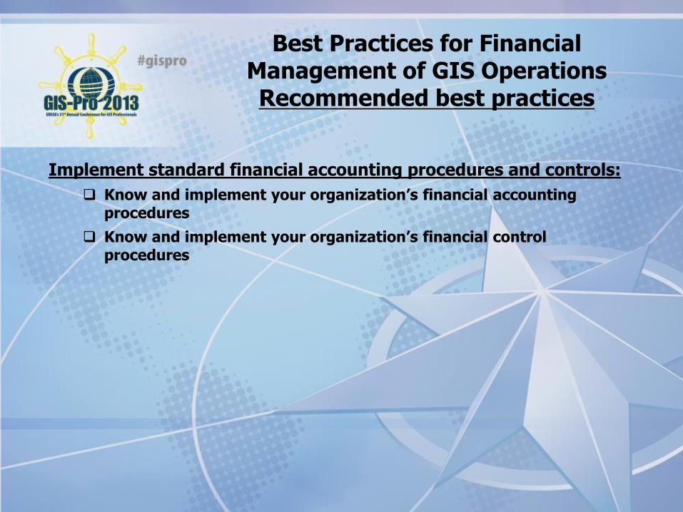
Implement standard financial accounting procedures and controls:
Know and implement your organization’s financial accounting procedures
Know and implement your organization’s financial control procedures

Best Practices for Financial Management of GIS Operations Recommended best practices
Assure accountability by periodic independent audits:
Understand your organization’s audit environment
Develop transparent financial systems
Discuss financial accountability and transparency with GIS staff:
Financial accountability as a part of GIS ethics
Transparent processes that are open to everyone promote clean audits

Best Practices for Financial Management of GIS Operations
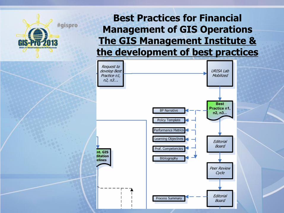
The GIS Management Institute & the development of best practices

Best Practices for Financial Management of GIS Operations
The GIS Management Institute & the development of best practices
GMI
GIS CMM
GMI Local
Agency
Accreditation
Program
GMI
GMBOK
PPD:URISA Labs
AcD: Gov Agency
Accreditation
AcD: Educational
Accreditation
GMI
Educational
Accreditation
Program
PPD: Educational
Requirements
UI ED: Educational
Content
URISA
Workshops
ULA
University
Diagram A: URISA GMI Conceptual Diagram3/25/2013
GMI
GMCM
CD: GISP-M
Requirements
GISCI
GISP-M
Certification
Program
GMI: GIS Management Institute
GIS CMM: GIS Capability Maturity Model
GMCM: Geospatial Management Competency Model
GMBOK: GIS Management Body of Knowledge
GISCI: GIS Certification Institute
AcD: GMI Accreditation Division
CD: GMI Certification Division
PPD: GMI Professional Practices Division
UI ED: URISA International Education Division
Best Practices for Financial Management of GIS Operations
The GIS Management Institute & the development of best practices
Best Practices for Financial Management of GIS Operations
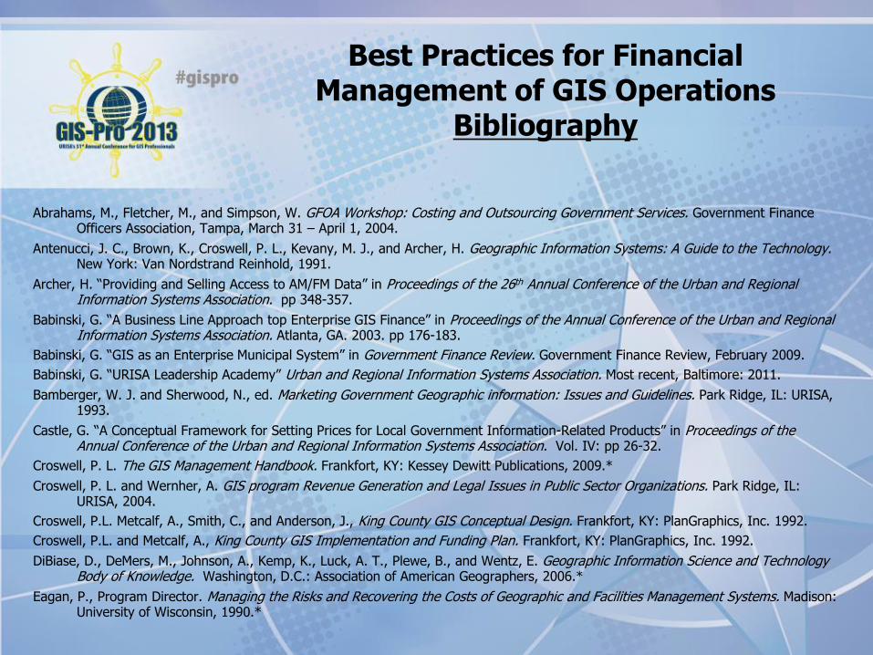
Bibliography
Abrahams, M., Fletcher, M., and Simpson, W. GFOA Workshop: Costing and Outsourcing Government Services. Government Finance Officers Association, Tampa, March 31 – April 1, 2004.
Antenucci, J. C., Brown, K., Croswell, P. L., Kevany, M. J., and Archer, H. Geographic Information Systems: A Guide to the Technology. New York: Van Nordstrand Reinhold, 1991.
Archer, H. “Providing and Selling Access to AM/FM Data” in Proceedings of the 26th Annual Conference of the Urban and Regional Information Systems Association. pp 348-357.
Babinski, G. “A Business Line Approach top Enterprise GIS Finance” in Proceedings of the Annual Conference of the Urban and Regional Information Systems Association. Atlanta, GA. 2003. pp 176-183.
Babinski, G. “GIS as an Enterprise Municipal System” in Government Finance Review. Government Finance Review, February 2009.
Babinski, G. “URISA Leadership Academy” Urban and Regional Information Systems Association. Most recent, Baltimore: 2011.
Bamberger, W. J. and Sherwood, N., ed. Marketing Government Geographic information: Issues and Guidelines. Park Ridge, IL: URISA, 1993.
Castle, G. “A Conceptual Framework for Setting Prices for Local Government Information-Related Products” in Proceedings of the Annual Conference of the Urban and Regional Information Systems Association. Vol. IV: pp 26-32.
Croswell, P. L. The GIS Management Handbook. Frankfort, KY: Kessey Dewitt Publications, 2009.*
Croswell, P. L. and Wernher, A. GIS program Revenue Generation and Legal Issues in Public Sector Organizations. Park Ridge, IL: URISA, 2004.
Croswell, P.L. Metcalf, A., Smith, C., and Anderson, J., King County GIS Conceptual Design. Frankfort, KY: PlanGraphics, Inc. 1992.
Croswell, P.L. and Metcalf, A., King County GIS Implementation and Funding Plan. Frankfort, KY: PlanGraphics, Inc. 1992.
DiBiase, D., DeMers, M., Johnson, A., Kemp, K., Luck, A. T., Plewe, B., and Wentz, E. Geographic Information Science and Technology Body of Knowledge. Washington, D.C.: Association of American Geographers, 2006.*
Eagan, P., Program Director. Managing the Risks and Recovering the Costs of Geographic and Facilities Management Systems. Madison: University of Wisconsin, 1990.*
Best Practices for Financial Management of GIS Operations
Bibliography
Furness, L. and Bowie, D. “Organizational Structuring and Charging for Geographic Information System Services” in Proceedings of the Annual Conference of the Australian Urban and Regional Information Systems Association. Queensland, Australia. 1992. Vol I, pp 173-182.
Horning, G. “How GIS Works in King County.” ArcNews. Spring 2007.
Huxhold, W. E. An Introduction to Urban Geographic Information Systems. New York: Oxford University Press, 1991.*
Huxhold, W. E. and Levinsohn, A. G. Managing Geographic Information System Projects. New York: Oxford University Press, 1995.*
Joffe, B. 10 Ways to Support Your GIS Without Selling Data. Oakland: Open Data Consortium, ND.
King County. King County Coordinated Geographic Information System Scoping Project. Municipality of Metropolitan Seattle, August 1993.
King County. Production Operations and Maintenance Plan. King County Geographic Information System, Seattle, April 14, 1997.
Korte, G. B. The GIS Book. Albany: OnWord Press, 2001.*
Lawrence, J. “Pricing GIS Participation and Products” in Proceedings of the 1995 Annual Conference of the Urban and Regional Information Systems Association. San Antonio, TX: pp. 165-172.
Lerner, N., Ancel, S., Stewart, M. A, and DiSera. D. Building a Business Case for Geospatial Technology: A Practitioner’s Guide to Financial and Strategic Analysis. Geospatial Information Technology Association and AWWA Research Foundation, 2007.*
Longley, P. A., Goodchild, M. F., Maguire, D. J., and Rhind, D. W., eds. Geographic Information Systems (2 vols). New York: John Wiley & sons, Inc. 1999.*
Maguire, D., Kouyoumjian, V., and Smith, R. The Business Benefits of GIS: An ROI Approach. Redlands: ESRI Press, 2008.*
Mayer, B., GIS Cost Allocation Model. Internal memo from KC GIS Coordinator dated July 6, 1992.
Obermeyer, N. J. and Pinto, J. K. Managing Geographic Information Systems. New York: The Guilford Press, 1994.*
Seeley, A. “Pierce County GIS Online Budget System.” 2010 URISA Exemplary Systems in Government – Distinguished Single System Award Winner.
Thum, P. “GIS Service Bureau Operations: Implementing a Service Bureau in a Local Government Setting.” in Proceedings of the 2002 Annual Conference of the Urban and Regional Information Systems Association. Chicago.
Tomlinson, R. Thinking About GIS: Geographic Information System Planning for Managers. ESRI Press, 2003.*
Best Practices for Financial Management of GIS Operations
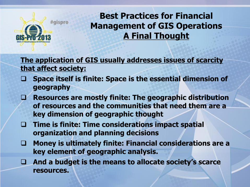
A Final Thought
The application of GIS usually addresses issues of scarcity that affect society:
Space itself is finite: Space is the essential dimension of geography
Resources are mostly finite: The geographic distribution of resources and the communities that need them are a key dimension of geographic thought
Time is finite: Time considerations impact spatial organization and planning decisions
Money is ultimately finite: Financial considerations are a key element of geographic analysis.
And a budget is the means to allocate society’s scarce resources.

Best Practices for Financial Management of GIS Operations
Call for volunteers
Are you interested in joining me to develop the formal URISA GMI Best Practice for Financial
Management of GIS Operations?

Greg Babinski, MA, GISP URISA Past-President URISA GMI Committee Chair COGO Secretary Finance & Marketing Manager
King County GIS Center 201 South Jackson Street MS: KSC-IT-0706 Seattle, WA 98104 USA P: 206-263-3753 F: 206-263-3145 E: [email protected] T: @gbabinski W: www.kingcounty.gov/gis