bexhill to hastings link road – evidence reviewbtckstorage.blob.core.windows.net/site10613/annex 3...
TRANSCRIPT

Bexhill to Hastings Link Road –Evidence Review
19th March 2012
Updated for revised estimates of benefits and costs18
Observations on the dependency of jobs on the scheme now
presented over two pages (instead of one) - further
comments added based on review of material submitted
15/16
New page showing the levels of uncertainty with the analysis26
Included reference to waterborne species (Green Bridge)25
New map showing levels of tranquillity within Combe Valley24
Reference to congestion impacts of new development trips20
ChangePage
The document has been revised
since it was originally circulated in
draft (14th March 2012). This table summarises the changes (page
numbers refer to this version of the
document)

In December 2011 the Secretary of State for Transport announced that DfT were unable to make a decision on the Bexhill to Hastings Link Road given the concerns about the scheme particularly in relation to the environment. Further work was commissioned to make sure that the scheme offers the best approach to regenerating the area and to consider whether further environmental measures could be deployed.
The aim of this document is to summarise the evidence collected as part of this further work setting out:
- how well the scheme meets its strategic objectives;
- the scale of regeneration/development potential offered by the scheme; and
- the impact of the scheme on the local environment.
The information and analysis presented in this document is principally based on material submitted by the scheme promoter (East Sussex County Council) and opponents (Hastings Alliance) since the December 2011 announcement, information published as part of the Planning Inquiry in 2010 and the various submissions made during the Development Pool process in 2011.
The document is not intended to be an exhaustive survey of the full range of material available to the Department and instead focuses on a few key questions of particular interest. Further information on the evidence presented in this document (or relating to other impacts) can be provided on request.
In line with the Department’s policy on investment decisions the full five cases of the Transport Business Case should be considered.
Background

The documents considers three high level
questions
� The local labour market is weak and
vulnerable to reductions in the size of the
public sector
� There are significant pockets of deprivation
within Hastings
� Residents of Bexhill and Hastings are more
reliant on employment opportunities within
the local area
� Journeys between the towns are already
delayed in the peak and would increase
significantly as traffic levels grow
� There is pressure for new development but
environmental designations constrain this
particularly in Hastings
What problems do Bexhill and Hastings face?
What is the economic strategy for Bexhill and Hastings and how well does the scheme support this strategy?
What are the full range of impacts of the scheme?

PROBLEM
Residents of Rother and Hastings are more likely to be unemployed and earn less than people elsewhereUnemployment (%) and Gross Weekly
Pay (£)1 (July 2010 - June 2011)
£5037.7%Great Britain
£5545.9%South East
£4707.7%Rother
£41910.2%Hastings
Gross
Weekly Wage
Unemployed
Job opportunities are in short supply locallyJSA claimants per unfilled jobcentre
vacancy (January 2012)2
0 5 10 15 20
Great
Britain
South
East
Rother
Hastings
The jobs residents do have are more likely to be in the public sectorPercentage of employee jobs in public administration, education and health
(2008)4
0% 10% 20% 30% 40% 50%
Great
Britain
South
East
Rother
Hastings
Sources: (1) Annual Population Survey and ASHE (both ONS); (2) Jobcentre Plus vacancies – summary analysis; (3) Cities Outlook 2012 – Centre for Cities;
(4) ONS analysis of Annual Business Inquiry
A 2012 report3 found that Hastings was the fourth most dependent city (out of 64)
on the public sector. There are 1.5 jobs
in private sector for every job in the public
sector (compared to 1.7 in Liverpool and 1.9 in Middlesbrough)
Job density (ratio of jobs to
working age population) is 0.62
in Hastings and 0.75 in Rother –
lower than in the South East
(0.80) and nationally (0.78)
The local labour market is weak and
vulnerable to reductions in the size of the
public sector

There are significant pockets of deprivation
within Hastings PROBLEM
Sources: (1) Extracted from Bexhill to Hasting Link Road – Regeneration Report (October 2009); (2) The English Indices of Deprivation 2010, CLG
The indices were updated in 2010
and Hastings was found to be the 19th (out of 326) most deprived
Local Authority in England with
28% of Lower Super Output Areas
amongst most deprived 10%2
Hollington and Wishing Tree
Castle, Central St Leonards, Gensing
Baird, Tresselland Ore
Deprivation in Hastings is concentrated in three areasIndex of Multiple Deprivation (2007) reported by Lower Super Output Area for Hastings
(Wards containing LSOAs in the bottom 10% are highlighted)
The levels of deprivation are not as prevalent in Rother (155th
most deprived Local Authority)

PROBLEM
2858 min47 min (2tph)Tunbridge Wells
516 min9 min (3tph)Bexhill
63104 min90 min (3tph)Gatwick
71142 min105 min (3tph)London
3780 min66 min (3tph)Brighton
3367 min107 min (2tph)Maidstone
3259 min92 min (2tph)Ashford
2962 min175 min (1tph)Uckfield
1845 min25 min (3tph)Eastbourne
MilesRoad
(AM peak)2
Rail (AM
peak)1
Sources: (1) LE analysis of National rail Enquiries Data – quickest journey shown along with trains departing Hastings between 0800 and 0900; (2) LE analysis
of Transport Direct for journeys starting at 0730; (3) DfT Accessibility Statistics
There are few large towns within commuting distanceJourney times from Hastings in AM peak
Residents of Bexhill and Hastings are
more reliant on employment opportunities
within the local area
Road journey times may not fully reflect peak
time congestion – the transport model
forecasts journey times between Bexhill and Hastings town centres of around 25 min
19.825.45.28.4England "urban -
less sparse" areas
27.630.86.59.7England
26.829.85.38.9SE "urban - less sparse" areas
32.633.86.410.0South East England
120+86.85.49.8Bexhill
120+72.85.48.4Hastings
CyclingWalking / PT
CyclingWalking / PTGeography
5,000 jobs500 jobs
Accessibility to employment sites is typical of similar urban areas for medium sized sites (more than 500 jobs) but poor for large scale sites (more than 5,000 jobs)Journey times (mins) to nearest employment site – walking/PT & cycling3
These statistics only show the journey times to the nearest available
employment site – they don’t show whether there are employment
vacancies at these sites so may give a misleading picture of how far someone might need to travel to access a job

PROBLEM
Journeys between the towns are already
delayed in the peak and would increase
significantly as traffic levels grow
3:51 (AM Peak)
11:37 (PM Peak)
2:46 (AM Peak)
2:50 (PM Peak)
1:51 (AM Peak)
9:57 (PM Peak)
The A259 Glyne Gap is the only significant road between Bexhill and Hastings and suffers from congestion during peakAdditional journey time in AM peak (0800 to 0900) and PM peak (16:00-18:00)
compared to minimum interpeak journey time (2011)1
Sources: (1) Glyne Gap Capacity Assessment; Mott MacDonald analysis for ESCC (December 2011); Map – downloaded from bing!; (2) Traffic Survey Report ;
Mott MacDonald (June 2011)
Modelling of junctions and link capacity
indicates that increasing traffic by 100
vehicles per hour (7% of AM traffic levels) would increase delays by a further 78 to
165 seconds per vehicle
In free-flow conditions
the blue route would
take 2 minutes and 54 seconds
Traffic levels are high throughout the dayGlyne Gap Automatic Traffic Counter Profile
September 20042
We haven’t seen the detailed
observations which inform this analysis
but it appears that the average delay
reported here masks significant variation in journey times from day-to-day

PROBLEM
There is pressure for new development but
environmental designations constrain this
particularly in HastingsHastings is flanked by an Area of Outstanding Natural Beauty to the North and East1
Rother and Hastings estimate that they require
163,000m2 of additional
floor space between 2008
and 2028 to meet increases
in the size of the workforce, reduce out-commuting and
to replace old stock2
Sources: (1) Rother District Council – Local Development Framework: Core Strategy Consultation on Strategic Directions (Nov 2008); (2) Hastings Borough
Council and Rother District Council, Hastings and Rother Employment Strategy and Land Review (May 2008) and Update (Aug 2011)

What problems do Bexhill and Hastings face?
What is the economic strategy for Bexhill and Hastings and how well does the scheme support this strategy?
What are the full range of impacts of the scheme?
� The Link Road forms part of a Five Point
Strategy for regenerating the economies of
Bexhill and Hastings
� A strategic development site – served by the
Link Road – is included in North East Bexhill
� The scope for a large scale development
elsewhere in the area appears limited
� The Link Road is intended to support the
Strategy by linking Development sites and
improving connectivity
� The scheme improves connectivity between
Bexhill and Hastings but also increases
congestion within some areas of the towns
� Enhanced connectivity should support the
NE Bexhill site but there are doubts about
whether all the development can be
attributed to the scheme

ECONOMIC STRATEGY
Stimulation of Business and Enterprise
Excellence in Higher and Further Education
Broadband and ICT
Transport
Urban Renaissance �New developments within Hastings Town Centre
�Renovation of housing stock in St Leonards
�Housing based regeneration in Ore – 650 new sustainable homes being delivered
�Hastings University Centre established in 2004 (now accommodates over 1,000 students)
�£100m Sussex Coast College Hastings at two sites in the Town
�Establishment of a Schools Investment Programme and two new academies
�Opening of Creative Media Centre in Hastings with accommodation for up to 46 businesses
� Innovation Centre opened in 2006 with 71 units catering for slightly more established firms
�Supported Brighton University to develop a Product Development Centre to help encourage
local businesses to take-up the latest technology and practices�First two phases of Priory Quarter development – including 800 new jobs created at SAGA
�Enviro 21 Business Corridor (including a site in NE Bexhill) to provide additional capacity and
specifically deigned premises for the environmental technology and service sectors
�Further development of Priory Quarter (6,000m2)
�Hastings became one of the first areas in the country to get full broadband coverage through
a partnership deal with BT�Advice provided to local businesses on the capabilities of broadband
�New £9m rail station opened in Hastings in 2004 and plans to upgrade Ore station
�New rolling stock and faster journey times on Ashford-Hastings line
�Bexhill to Hastings Link Road� Improvements to the A21
Source: ESCC evidence to Planning Inquiry (ESCC 3/1 and 4/1) and Economic Case for the BHLR (ESCC Paper 13/2/2012)
The Link Road forms part of a Five Point
Strategy for regenerating the economies of
Bexhill and Hastings £250-300 million has already been invested from a range of partners since the strategy was first formulated in 2002Elements of the strategy that have yet to be implemented are shown in the blue italic typeface

ECONOMIC STRATEGY
Eastern side of the development: would contain at least 980 dwelling and some 23,900 sq metres
of business floorspace. Business space would be restricted to light manufacturing and office
space given proximity to residential areas.
Western side of the
development: would contain
at least 130 dwelling and some 28,000 sq metres of
business floorspace. The
three distinct employment
areas allows for each to
have it’s own distinctive character and use. The mix
of uses is not currently
prescribed but is expected
mainly to be light
manufacturing. Other industrial and distribution
activities may be
acceptable subject to
consideration of impact on residential areas.
Source: Rother DC, North East
Bexhill Supplementary Planning
Document (June 2009)
A strategic development site – served by
the Link Road – is included in North East
Bexhill The NE Bexhill site would deliver a mix of additional housing and business space primarily for office and light manufacturing purposes

ECONOMIC STRATEGY
Business Land Supply1
1&2: 51,900m2
3: 21,700m2
4: c9,700m2
5: c10,000m2
6: 8,085m2
7: c5,600m2
8: 10,500m2
9: 1,200m2
10: 2,170m2
11: 3,000m2
The scope for a large scale development
elsewhere in the area appears limited
The NE Bexhill site accounts for 42% of the proposed new floorspace – other developments are planned in Hastings but these are generally smaller in scale and constrained by the urban area
The bidder reports2 that it is not only the size of the
development which
matters. The site is
flexible enough to
accommodate a number of businesses of different
size and type and this will
make the site highly
marketable
Sources: (1) E-mail from Rother District Council of 28th February 2012; (2) ESCC, Paper for External Reference Group
ERG02

ECONOMIC STRATEGY
The Link Road is intended to support the
Strategy by linking Development sites and
improving connectivity
The land in North East Bexhill can
only be released if the Link Road is
built given constraints on the local road network
The scheme reduces traffic on the A259 reducing journey times and
improving reliability that will in turn encourage increased public transport
services, enhanced regional accessibility and reduced severance
“Interviews with businesses…showed
that the BHLR is seen as emblematic of the future of Hastings and Bexhill
both in terms of what it will achieve
and as a sign of public sector
commitment to the area”
The Link Road connects the major development sites in Bexhill and
Hastings and facilitates a cluster of
businesses in the environmental
technology and service sector
Source: ESCC evidence to Planning Inquiry (ESCC 3/1
and 4/1)
The Link Road is viewed by East Sussex as integral to the delivery of the regeneration strategy – in particular it reduces congestion and unlocks the strategic development site in North East Bexhill and provides the connectivity to allow the establishment of a environmental technology cluster

ECONOMIC STRATEGY
…enhances connections between deprived areas and employment sites % reduction in AM peak car journey times in 2013 (forecast)1
..significantly reduces journey times within the Enviro21 corridorChange in AM peak journey times by car in 2013 from North
East Bexhill (forecast) – minutes1
…reduces traffic levels on the Glyne GapChange in Average Annual Daily Traffic flows (2015)2
Forecasts provided by East Sussex County Council indicates that the Link Road…
The results reported above are based on traffic forecasts produced in 2009 and for the 2011 BAFB submission and do not
incorporate the latest updates to the model. However, we would expect updated forecasts to provide a similar pattern of results
-4.9 min17.5 min22.4 minAshdown
-5.5 min15.3 min20.8 minHollington
ChangeWith scheme
Without scheme
The traffic forecasts indicate an increase in congestion in
Bexhill and the North East of Hastings before additional trips from the NE Bexhill development are taken into account – the
increased costs of these trips are equivalent to two-thirds of the
journey time savings of the scheme4
-19%
+81%
-37%
-39%
+26%
15-32%16-21%Baird, Ore & Tressell
37-40%27-29%Hollington & Wishing Tree
16-20%18-20%Castle, C St Leonards & Gensing
Central
Bexhill
NE
Bexhill…but some may
not benefit as
nationally 49% of the poorest 20%
of households
don’t have
access to a car3
Sources: (1) ESCC Regeneration Report (2009); (2) Mott MacDonald Forecasting Report (2011); (3) DfT, 2010 National Travel Survey; (4) LE analysis of
material submitted in BAFB
The scheme improves connectivity between
Bexhill and Hastings but it does increase
congestion within some areas of the towns

ECONOMIC STRATEGY
2. Alternative transport solutions can be implemented which unlock the North East Bexhill development
1. The Link Road isn’t sufficient to unlock the developments
�The BAFB indicates increased congestion from the development in NE Bexhill1
�Junctions near the NE Bexhill site are forecast to exceed capacity although the bidder reports that this can be addressed through signal optimisation2
�The Link Road enhances connectivity to other development sites in North West Hastings which would from part of the environmental technology and services cluster�The alternative options tested by ESCC only reduced traffic on the Glyne Gap by up to 5%3 - not enough to significantly reduce journey times on the main link between the two towns�However, we can’t rule out the possibility of a further option (or package) thatwould facilitate the site and ESCC hasn’t provided analysis to show that the site (or parts of it) can’t be developed without the BHLR – there is historical evidence which suggests 600 homes could be delivered without any new road link4
Sources: (1) ESCC Economic Assessment Report (Sept 2011); (2) Additional Modelling and Economic Assessment, Mott MacDonald (Feb 2012); (3) Traffic
Forecasting Report, ESCC (Jan 2010); (4) Urban & Regional Policy for the Hastings Alliance (Oct 2011)
The extent to which any new jobs created at the new development sites are themselves additional (or transfer from other locations in the study area or rest of the country) is considered in the final section of this document
Four main arguments have been put forward which question the importance of the Link Road to unlocking development in Bexhill and Hastings – the evidence on these is mixed
Enhanced connectivity should support the NE Bexhill site but there are doubts about whether all the development can be attributed to the scheme
The 3rd and 4th arguments are
summarised overleaf

ECONOMIC STRATEGY
3. Alternative sites can be developed which are not reliant on the Link Road
4. There will be no demand for the new developments unlocked by the scheme
�It is not apparent that there are alternative sites could meet the strategic objectives of the five point plan and/or deliver the floor space required by local plans
�There are no firm commitments from employers to occupy the site & the scheme does nothing to address the remoteness of Hastings/Bexhill from the rest of the South East�11% of chargeable premises in Hastings and 16% in Bexhill are currently vacant1
�The NE Bexhill site is much larger than other local developments but the planned increase in floorspace over 20 years is consistent with recent trends3
and ESCC report that experience locally is that new space has consistently achieved 80% occupancy within two years2
�Forecasts show significant reductions in journey time (20-40%) for trips between North East Bexhill and parts of Hastings – this will increase the attractiveness of the site to business
Sources: (1) ESCC (e-mail of 2nd March & ; (2) The Economic Case for the BHLR, ESCC (Feb 2012); (3) LE analysis of HBC and RDC; ESLR Update (Aug
2011)
The extent to which any new jobs created at the new development sites are themselves additional (or transfer from other locations in the study area or rest of the country) is considered in the final section of this document
Four main arguments have been put forward which question the importance of the Link Road to unlocking development in Bexhill and Hastings – the evidence on these is mixed
Enhanced connectivity should support the NE Bexhill site but there are doubts about whether all the development can be attributed to the scheme
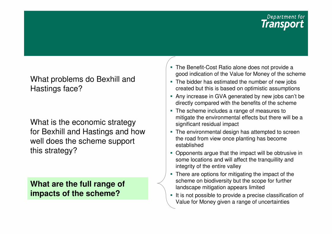
� The Benefit-Cost Ratio alone does not provide a good indication of the Value for Money of the scheme
� The bidder has estimated the number of new jobs created but this is based on optimistic assumptions
� Any increase in GVA generated by new jobs can’t be directly compared with the benefits of the scheme
� The scheme includes a range of measures to mitigate the environmental effects but there will be a significant residual impact
� The environmental design has attempted to screen the road from view once planting has become established
� Opponents argue that the impact will be obtrusive in some locations and will affect the tranquillity and integrity of the entire valley
� There are options for mitigating the impact of the scheme on biodiversity but the scope for further landscape mitigation appears limited
� It is not possible to provide a precise classification of Value for Money given a range of uncertainties
What problems do Bexhill and Hastings face?
What is the economic strategy for Bexhill and Hastings and how well does the scheme support this strategy?
What are the full range of impacts of the scheme?

The Benefit-Cost Ratio alone does not
provide a good indication of the Value for
Money of the scheme OVERALL CASE
The full range of impacts
are reported in the Appraisal Summary Table
Core BCR Other Significant Impacts Valuation Evidence
Scheme cost: £60.2m
Scheme benefits: £155.4m
Core BCR: 2.6
The Value for Money conclusion will be sensitive to how much weight is placed on the environmental impacts and the potential of the scheme to promote economic development
Improvements in reliability
Large Adverse impact on Landscape
New housing facilitated by scheme
New business units facilitated by
scheme
Regeneration
Moderate Adverse impact on
Biodiversity
Moderate Adverse impact on
Heritage of Historic Resources
Large Beneficial impact on Journey
Quality
Moderate Beneficial impact on
Severance
�Valued by bidder at £5.4m
�Value of housing land released is £98.5m (only
some of this can be attributed to the scheme)
� Increased congestion and landscape disbenefits of £91.9m
� Indicatively valued by DfT as disbenefits of
£77.3m�Bidders argue for a higher mitigation factor
based on coverage of mitigation works and
estimate disbenefits at £35.7m�Scheme opponents argue that no mitigation
factors should be applied which implies
disbenefits of £121.3m
The scheme delivers
improvements in journey time
from reduced congestion & a
more direct route for some journeys, a reduction in accidents
and increases in fuel duty.
However, increases in fuel
consumption (from increases in vehicle use) leads to an increase
in CO2 emissions and running
costs. Scheme benefits also
reflect increases in noise from
the new road
This column shows the benefits/
disbenefits which can be valued using
DfT guidance but are less robust

The bidder has estimated the number of
new jobs created but this is based on
optimistic assumptionsOVERALL CASE
Gross number of jobs
Deadweight – extent to which
development would occur
anyway
Displacement – reduced
output elsewhere in the area
Leakage – extent to which
jobs are taken by people
outside the area
Multipliers – additional jobs
from increased spending
locally
Net number of jobs within
Bexhill & Hastings
2,670
0%
Promoter1
20%
5%
1.45-1.65
3,074
2,670
10%
BIS
benchmarks2
43%
17%
1.46
1,645
DfT observations
As noted in slide 15 the bidder hasn’t been able to
show how much development could potentially be
delivered without the scheme
Promoter claims to use BIS benchmarks but rate
used is lower than reported for capital infrastructure
schemes
2009 Regeneration Report produced by the bidder
forecasted that 39% of jobs would be taken by
those living outside the area
This is the net number of jobs in the local area –
regional/national impact may differ
Assumes 100% occupancy
Sources: (1) genecon for ESCC, Valuing Potential Economic Impact (March 2012) – figures reported above include correction for calculation error identified by
DfT; (2) BIS, Research to Improve the Assessment of Additionality: figures reported for sub-regional impacts of capital infrastructure schemes
The bidder claims over 3,000 jobs will be created in Bexhill & Hastings. BIS benchmarks suggest that the number of additional jobs might be half this amount and we think there are other downside risks

Any increase in GVA generated by new
jobs can’t be directly compared with the
benefits of the schemeOVERALL CASE
Increased GVA can’t be directly compared with, or added to the estimates of benefits generated for the scheme for a number of reasons:
Our view is that the net number of jobs generated locally is overestimated
The £1 billion estimate assumes that the additional jobs will last 10 years but will be delivered over a 25
year period. It is a strong assumption that market failures would persist over this timescale without the scheme – only considering impacts to 2022 would
reduce the GVA impact by 75%
Double counting: Some of the increase in GVA will reflect improvements in productivity that are already
captured in the transport appraisal
Different units of account: GVA measures economic output whilst the Value for Money case is based on economic welfare (which considers wider environmental and social impacts). There are other
costs associated with generating this increased economic output that would need to be considered
e.g. child care, commuting costs, loss in leisure time
The bidder assumes relatively high levels of GVA per job particularly given existing local wage rates
The bidder has estimated that the scheme will generate an additional £1 billion in GVA over 25 years, we think this is likely to be an overestimate of national impacts because:
Additional investment may be required to support the site and jobs e.g. utilities, training etc
No account is taken of any displacement of jobs from elsewhere in England
Whilst increases in GVA can’t be compared directly with the benefits of the scheme – increases in local employment shouldn’t be ignored. The cost per job of other government programmes is typically around £20-30k (£20-30m for 1,000 jobs)1
(1) Valuing the Benefits of Regeneration (CLG, December
2010)
No account taken of increased congestion from trips to/from development

OVERALL CASE
Minimal landscape impacts in this section
as road is contained
within a built up area
In generating a monetary value to represent the disbenefits on the landscape we assume that the mitigation works reduces the
impact of the scheme by 30%. This gave a monetary figure of £77m – equivalent to 140% of the costs of the scheme. Given the
inherent uncertainties associated with valuing landscape disbenefits this should be viewed as a guide rather than a definitive value
Managed as wet
grassland and water bodies
Managed as neutral
grassland and shrubs
and new shaws and
hedgerows planted. Creation of 6.6Ha of new
woodland to compensate
for impact of scheme on
Marine Wood
Managed as open
grassland (badger
foraging) and neutral grassland with scrub
– new shaws and
hegrerows planted
The scheme includes a range of measures
to mitigate the environmental effects but
there will be a significant residual impactThe route was chosen to minimise the environmental impact and the scheme includes significant earthworks and planting to screen the road from view (particularly from the AONB to the North)
Computer generated
images of the future landscape produced by the
bidder are shown overleaf
(sites marked A and B).
Images from scheme
opponents are also shown for a 3rd site (C)
A B
The bidder estimates
that the total cost of
environmental mitigation measures
is over £21m
C

OVERALL CASE
More photomontages are available
Current landscape
Landscape 15 years after scheme opening
The environmental design has attempted to
screen the road from view once planting
has become established
A B
Source: photomontages supplied by bidder

OVERALL CASE
Current landscape1
Opponents argue that the impact will be
obtrusive in some locations and will affect the
tranquillity and integrity of the entire valley (1)
C Future landscape1
Sources: (1) objector images reported in 2009 assessment; (2) Environmental impact of the BHLR – Dr Judy Clark (submitted by Hastings Alliance)
The following points have been raised by opponents of the scheme2:
“The BHLR would effectively cut a coherent and historic landscape in half, destroying its integrity in the process, an irreversible
intrusion that no amount of mitigation could change…[t]he constant background drone of traffic where once there was none will
inevitably destroy the tranquillity and wild ambience of the area.”
“…so it [the road] would fragment wildlife habitats, leading to smaller areas of continuous habitat…and the creation of new habitat
does not address the issue.”

OVERALL CASE
Opponents argue that the impact will be
obtrusive in some locations and will affect the
tranquillity and integrity of the entire valley (2)
Source: Environmental Statement for BHLR
The areas shaded in Blue are assessed
as offering “areas of
exceptional
tranquillity”. The red
doted line is the proposed route of
the Link Road
There are many other
areas of exceptional
tranquillity in East Sussex
but the scheme opponents claim that the Combe
Valley is special given its
proximity to, and easy
access from, a large built
up urban area

OVERALL CASE
Establish a Green BridgeTo aid movement of bats, dormice and other species and to address issues of
habitat severance
There are options for mitigating the impact of
the scheme on biodiversity but the scope for
further landscape mitigation appears limited Place the road in a tunnelThis would leave the surrounding landscape unaffected
Additional cost: more than £100m
Deliverability: would require new
public inquiry
Level of mitigation provided: high – visual impact and fragmentation of
habitats would be avoided
Additional cost: circa £2-4m
Deliverability: may require planning
approval but should be possible to proceed separately from BHLR
Level of mitigation provided: low/medium – reduces some habitat
severance but not for waterborne
species. Doesn’t address issues of tranquillity/integrity of valley
“Off-setting” improvementsDeliver a long-term environmental legacy by enhancing habitats elsewhere e.g.
hedge management, woodland planting etc
Additional cost: circa £1m
Deliverability: project already being
developed for the Brede-Hastings
area through Heritage Lottery Fund
Level of mitigation provided: low –doesn’t mitigate against the visual
impacts within the Combe Haven
Valley
Placing the road in a tunnel and deep cutting would be expensive and would delay the scheme by a number of years

OVERALL CASE
It is not possible to provide a precise
classification of Value for Money given a
range of uncertainties The low-medium VfM range reported for the scheme reflects the level of uncertainty about the conventional transport benefits, the value of the landscape impacts and the regeneration benefits of the scheme
Landscape impacts
Conventional transport benefits
�The bidder reports that off-peak (night time and weekend) benefits are much higher than we would usually expect. We can’t demonstrate that these are wrong but the benefits could be overstated by up to 10% �The model parameters don’t fall within expectation and/or forecasts of responses to travel cost changes are outside normal ranges. Sensitivity tests show this could lead to an overestimate of benefits by as much as 15%�Reliability benefits are only 5% (can be 10-20% in heavily congested areas). Although we believe the benefits claimed have been appropriately calculated, the potential for benefits in unclaimed time periods (e.g. interpeak) means this may understate the case.
�Evidence used to value landscape disbenefits is limited and not as robust as for other parameters used in the appraisal�The method used to assess landscape impacts requires some level of subjective judgement – estimates should be considered as indicative
Regeneration �The case for development in NE Bexhill is based on the release of pent up demand amongst local businesses which want to expand. It is difficult to test whether this organic growth will occur although some evidence has been presented to show that there are constraints�It is unclear how much development can be accommodated without the road – the promoter hasn’t provided compelling evidence on dependency (although if the developments aren’t dependent then conventional transport benefits might be higher than reported here)�Regeneration impacts are difficult to value