cadastre survey (sghu 2313) - people.utm.my · cadastre 2034 cadastre 2034 outlines a vision for a...
TRANSCRIPT
CADASTRE SURVEY (SGHU 2313)
WEEK 1-INTRODUCTION TO CADASTRE SURVEY
SR DR. TAN LIAT CHOON07-5530844
016-4975551
1
OUTLINE• Definition of Cadastral Survey
• Cadastre and Cadastral
• Department of Survey and Mapping Malaysia (JUPEM)
2
DEFINITION OF CADASTRAL SURVEY
3
Definition
Cadastral surveying is the term generally used todescribe the gathering and recording of data about landparcels even though the records do not form part of anofficial cadastre.
When properties are initially registered, governmentofficials have traditionally undertaken the processes ofcadastral surveying and land title adjudication.
4
Definition
Cadastral surveying is the definition, identification,demarcation, measuring and mapping of new or changedlegal parcel boundaries. It usually includes the process ofre-establishing lost boundaries and sometimes resolvingdisputes over boundaries or other interests in real property.
5
Definition
Cadastres and cadastral surveys are aspects of land administration.
• The primary object of a cadastral is to determine for each landparcel, its location, the extent of its boundaries and surface area,and to indicate its separate identity, both graphically on a map or ina record as well as physically on the ground.
• Its secondary objective is to provide information for a multipurposecadastre to fulfil the overall information requirements of landadministration.
• Cadastral plans can fulfil many of the functions of large-scaletopographic maps, not only serving such purposes as boundarycontrol, registration of title and valuation but also forming a basis ofplanning and development.
6
Definition
The basic features that are recorded in a cadastre are the landparcels and their boundaries. Good practice will result in lawsrelating to parcels and their boundaries that:
• Provide a legal definition of a land parcel;• Recognize that boundaries may be vertical or horizontal;• Differentiate between the legal position of a boundary and
the physical position of objects;• Define the priority of evidence; and• Avoid getting into detail over the precision with which
boundaries should be surveyed for the purposes of landtitling.
7
Definition
In order to guarantee the accuracy of boundary surveysand to apply quality controls to the work of the cadastralsurvey, it is common for survey regulations and proceduresto be introduced.
These often prescribe the manner in which surveys areto be carried out as well as the standards that must beachieved.
Survey regulations and procedures may also prescribethe necessary qualification for the granting of licence toundertake cadastral surveys.
8
Definition
The objectives of cadastral surveys are to acquireinformation, process it, coordinate and finally to presentthe vital information.
Cadastral surveying is an expensive process not only inits execution but also in the loss of capital from delays indevelopment and investment which may arise owing toinefficiency.
9
Section 83 National Land Code 1965-Survey for purposes of alienation
under final title.
Where any land is surveyed in accordance with theprovisions of section 396 National Land Code 1965 for thepurpose of its alienation under final title, the boundariesdetermined on the survey shall accord as nearly as may bewith those indicated by the plan and description byreference to which the approval of the State Authority wasgiven.
10
CADASTRE AND CADASTRAL
11
Objective
To understand the role of the cadastre in the administrationof Federal or State or jurisdiction, its operation andcomponents.
12
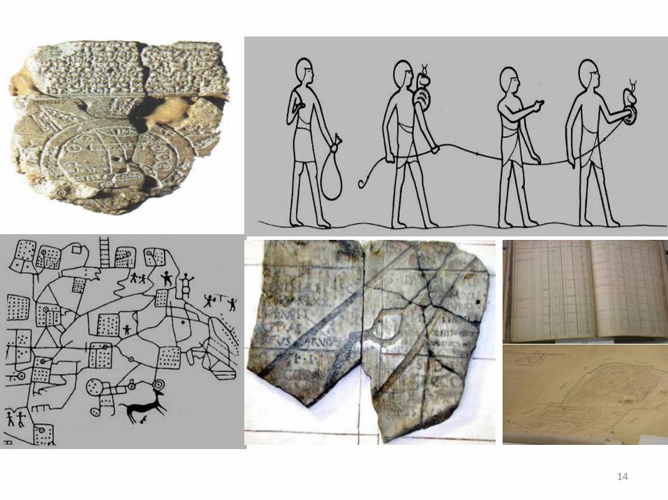
History of Cadastres
• Babylonian 4000 BC• Egyptians 3000 BC• Italy 1600 BC• Roman Empire 300 AD• Doomsday Book 1076 AD• Maria Theresia Cadastre 1792 AD• Napoleonic Cadastre 1807 AD• Computerized Cadastre 1980 AD• Cadastre 2014
13
14
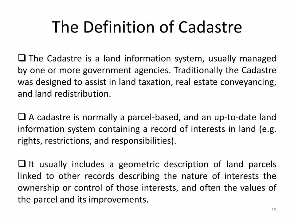
The Definition of Cadastre
The Cadastre is a land information system, usually managedby one or more government agencies. Traditionally the Cadastrewas designed to assist in land taxation, real estate conveyancing,and land redistribution.
A cadastre is normally a parcel-based, and an up-to-date landinformation system containing a record of interests in land (e.g.rights, restrictions, and responsibilities).
It usually includes a geometric description of land parcelslinked to other records describing the nature of interests theownership or control of those interests, and often the values ofthe parcel and its improvements.
15
The Definition of Cadastre
The International Federation of Surveyors Statement on theCadastre highlights the importance of the cadastre as a landinformation system for social and economic developmentfrom an international perspective and recognises thecentral role that surveyors play in the establishment andmaintenance of cadastre.
16
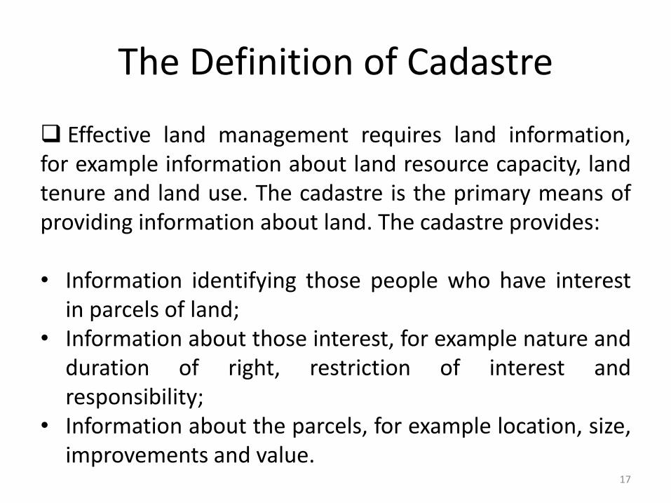
The Definition of Cadastre
Effective land management requires land information,for example information about land resource capacity, landtenure and land use. The cadastre is the primary means ofproviding information about land. The cadastre provides:
• Information identifying those people who have interestin parcels of land;
• Information about those interest, for example nature andduration of right, restriction of interest andresponsibility;
• Information about the parcels, for example location, size,improvements and value.
17
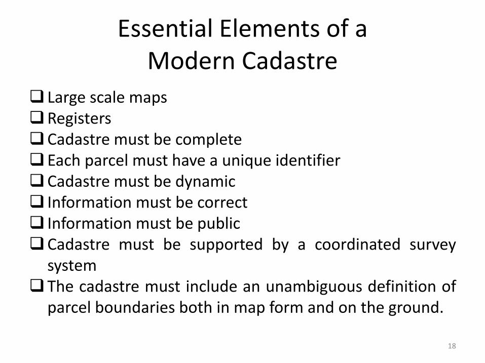
Essential Elements of a Modern Cadastre
Large scale mapsRegistersCadastre must be completeEach parcel must have a unique identifierCadastre must be dynamic Information must be correct Information must be publicCadastre must be supported by a coordinated survey
systemThe cadastre must include an unambiguous definition of
parcel boundaries both in map form and on the ground.
18
Cadastre
A successful CADASTRE should provide security of tenure, be simple and clear, be accessible, and provide current and
reliable information at minimum cost
19
Types of Cadastre
Juridical/Legal Cadastre
Fiscal Cadastre
Multipurpose Cadastre
20
Juridical/Legal Cadastre Supports land rights.
Is concerned with documenting rights and relating them tothe land with which they are associated. It is concerned with allforms of property rights.
As the information system which underpins land registration.
A written record or register containing information about eachparcel, such as the spatial information and the rights whichappertain to the land.
Contains a detailed description of the parcel, in the form ofeither survey maps or measurements.
21
Fiscal Cadastre
An instrument for administering land tax and valuepolicy.
The information required to develop and maintain afiscal cadastre may be collected directly or indirectlythrough surveys or from other sources, for instance detailsof land ownership and their property boundaries.
22
Multipurpose Cadastre
Should be maps showing the location and different typesof physical features.
Concerned with physical attributes such as man-madeobjects and natural features associated with each landparcel, abstractions, surveying and mapping data can alsobe referenced to the parcel.
23
Multipurpose Cadastre Advantages directly beneficial from multipurposecadastre are:
(i) an improved conveyancing system;(ii) an improved cadastral survey system;(iii) improved land use planning, land management and
environment management;(iv) improved management of publicly owned lands,(v) reduction of duplication; and(vi) better control of land transactions.
24
Multipurpose Cadastre
An extension of the basic cadastre, is an essential tool that can include other information from various databases or
registers, and can be adapted for local needs. It is a basis for planning for utilities, land information and development
management.
25
Benefits of Multipurpose Cadastre
A modern multipurpose cadastre can lead to improve:
• Conveyancing system.• Cadastral survey system.• Land use planning and land management.• Sustainable development.• Management of publicly owned lands.• Reduction of duplication.• Control of land transactions.
26
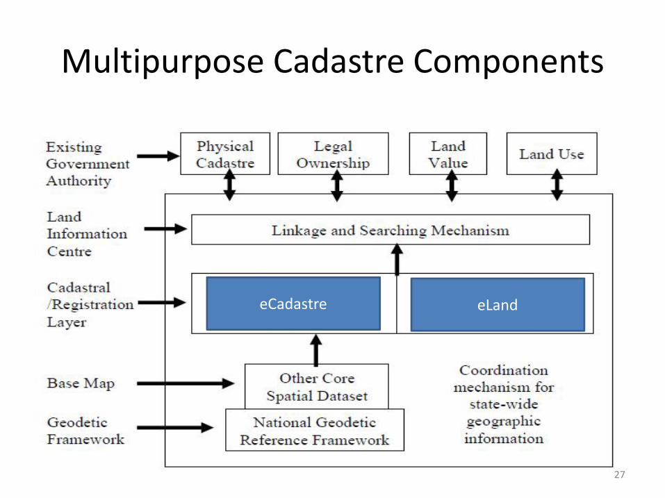
Multipurpose Cadastre Components
eCadastre eLand
27
Cadastral
The basic building block in any land administration system is the cadastral parcel. The cadastre consists of two parts:
• Registers• Maps
28
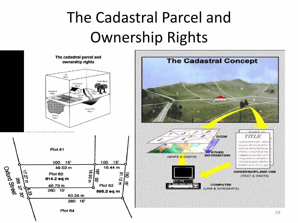
The Cadastral Parcel and Ownership Rights
29
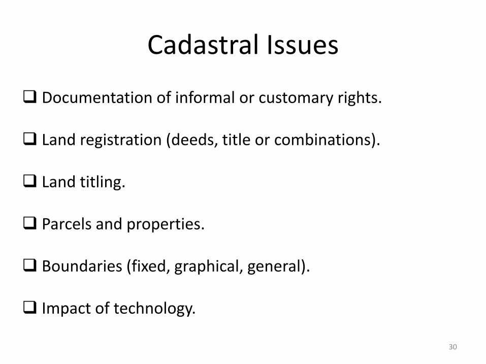
Cadastral Issues
Documentation of informal or customary rights.
Land registration (deeds, title or combinations).
Land titling.
Parcels and properties.
Boundaries (fixed, graphical, general).
Impact of technology.
30
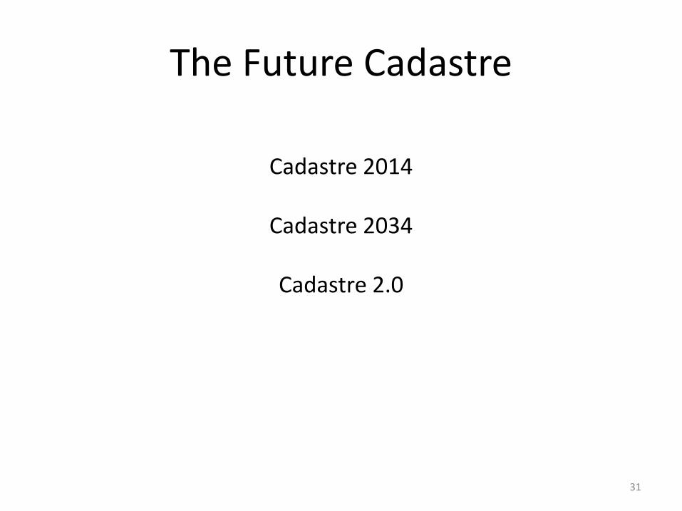
The Future Cadastre
Cadastre 2014
Cadastre 2034
Cadastre 2.0
31
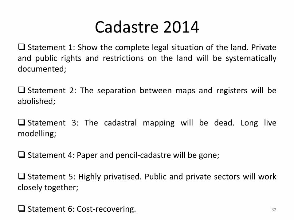
Cadastre 2014 Statement 1: Show the complete legal situation of the land. Privateand public rights and restrictions on the land will be systematicallydocumented;
Statement 2: The separation between maps and registers will beabolished;
Statement 3: The cadastral mapping will be dead. Long livemodelling;
Statement 4: Paper and pencil-cadastre will be gone;
Statement 5: Highly privatised. Public and private sectors will workclosely together;
Statement 6: Cost-recovering. 32
Cadastre 2034
Cadastre 2034 outlines a vision for a broader cadastrewhere information is readily accessible and people haveconfidence in the spatial extent of the various rights,restrictions, and responsibilities related to their land andreal property.
Cadastre 2034 will guide the evolution of jurisdictionalsystems and ensure a coordinated and consistent approachto future policies, legislation, standards, models andresearch; and provide clear direction for the sector as awhole.
33
Cadastre 2034
Fundamental to land and property ownership and issustainably managed;
Multipurpose, truly accessible, easily visualised, and readilyunderstood and used;
Fully integrated with broader legal and social interests onland;
A representation of the real world, which is survey accurate,3-dimensional and dynamic; and
A national cadastre based on common nationwide standards.34
Cadastre 2.0
Be multipurpose in nature, meeting a wide range ofneeds beyond simply recording land ownership of definingparcels for taxation;
Enable the full spectrum of rights and parcel definitionsto be modelled and managed within the system;
Be truly three-dimensional, to reflect better the realthree-dimensional overlapping rights, and the registrationof multi-level properties.
35
National Land Code 1965
The National Land Code 1965 (Act 56) was formulatedbased on existing practices in the 1950s until the pre-1965era before it came into effect on 1st January 1966.
Before this, all land dealings were governed by theFederated Malay States (Cap 138) Land Code 1926 thatcame into effect on 1st January 1928.
Also being enforced at the time were five separate Statelegislations in each of the five Unfederated Malay States aswell as the English Deeds System in the former StraitsSettlements of Malacca and Penang.
36

JABATAN UKUR DAN PEMETAAN MALAYSIA (JUPEM)
37
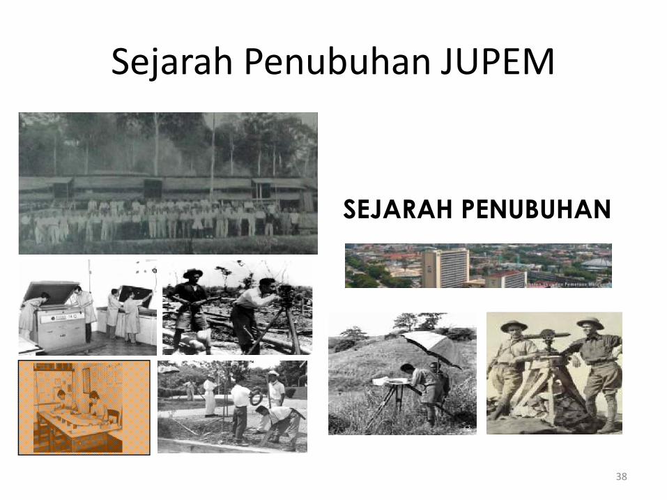
SEJARAH PENUBUHAN
Sejarah Penubuhan JUPEM
38
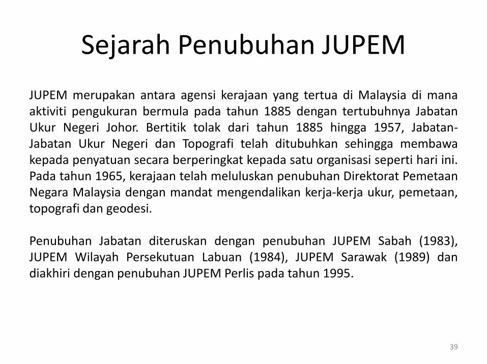
Sejarah Penubuhan JUPEM
JUPEM merupakan antara agensi kerajaan yang tertua di Malaysia di manaaktiviti pengukuran bermula pada tahun 1885 dengan tertubuhnya JabatanUkur Negeri Johor. Bertitik tolak dari tahun 1885 hingga 1957, Jabatan-Jabatan Ukur Negeri dan Topografi telah ditubuhkan sehingga membawakepada penyatuan secara berperingkat kepada satu organisasi seperti hari ini.Pada tahun 1965, kerajaan telah meluluskan penubuhan Direktorat PemetaanNegara Malaysia dengan mandat mengendalikan kerja-kerja ukur, pemetaan,topografi dan geodesi.
Penubuhan Jabatan diteruskan dengan penubuhan JUPEM Sabah (1983),JUPEM Wilayah Persekutuan Labuan (1984), JUPEM Sarawak (1989) dandiakhiri dengan penubuhan JUPEM Perlis pada tahun 1995.
39
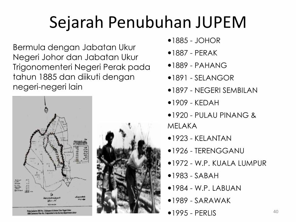
Bermula dengan Jabatan Ukur Negeri Johor dan Jabatan Ukur Trigonomenteri Negeri Perak pada tahun 1885 dan diikuti dengan negeri-negeri lain
1885 - JOHOR
1887 - PERAK
1889 - PAHANG
1891 - SELANGOR
1897 - NEGERI SEMBILAN
1909 - KEDAH
1920 - PULAU PINANG &
MELAKA
1923 - KELANTAN
1926 - TERENGGANU
1972 - W.P. KUALA LUMPUR
1983 - SABAH
1984 - W.P. LABUAN
1989 - SARAWAK
1995 - PERLIS
Sejarah Penubuhan JUPEM
40
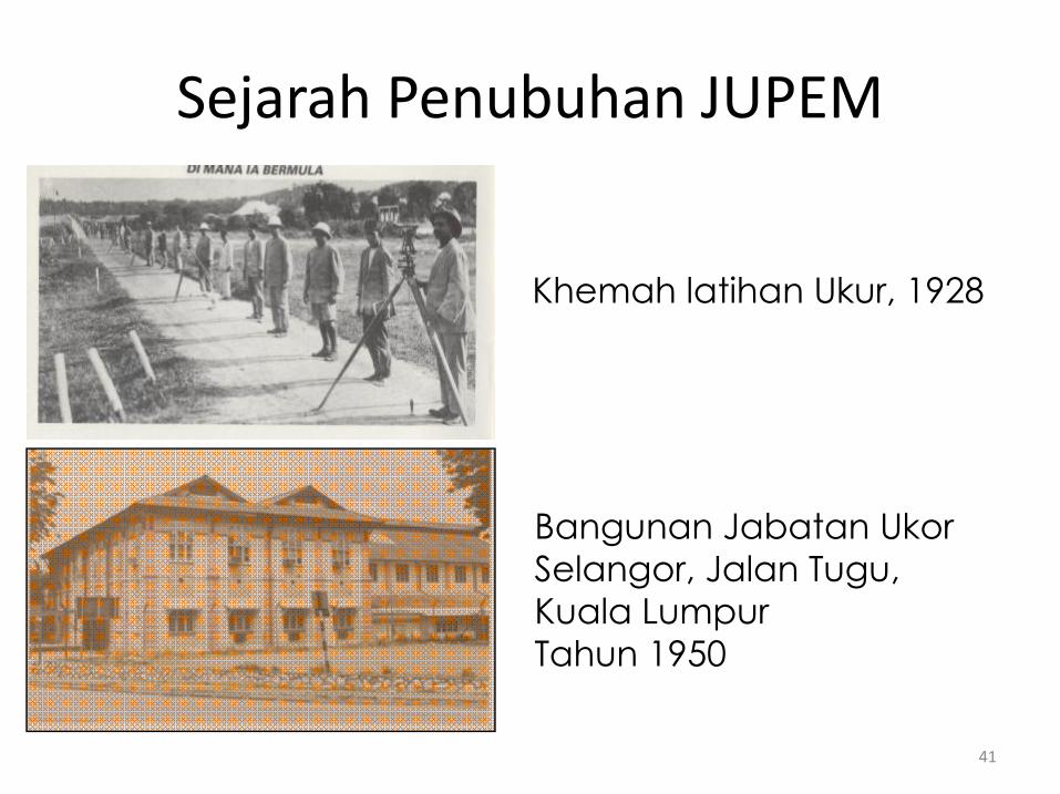
Khemah latihan Ukur, 1928
Bangunan Jabatan Ukor Selangor, Jalan Tugu, Kuala LumpurTahun 1950
Sejarah Penubuhan JUPEM
41
Carta Organisasi JUPEM
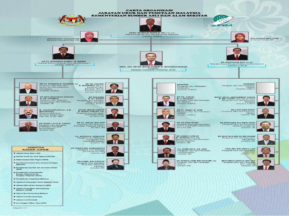
Jabatan Ukur dan Pemetaan Malaysia (JUPEM) terletak di bawahKementerian Sumber Asli dan Alam Sekitar (NRE). la diterajui olehKetua Pengarah Ukur dan Pemetaan (KPUP) yang juga selaku PengarahPemetaan Negara dan Pengarah Pemetaan Tentera.
Struktur organisasinya telah dibentuk dalam penyusunan semulastruktur organisasi JUPEM pada Oktober 2013, pada dasarnyaterbahagi kepada dua bahagian iaitu kadaster dan pemetaan.Bahagian-bahagian pemetaan di ketuai oleh Timbalan Ketua PengarahUkur dan Pemetaan I. Manakala Bahagian Kadaster termasuk 13JUPEM Negeri yang diletakkan terus di bawah Timbalan KetuaPengarah Ukur dan Pemetaan II.
Di bawah Pejabat KPUP di hubungkan terus dengan BahagianGeospatial Pertahanan dan Unit Integriti. 42

43
44
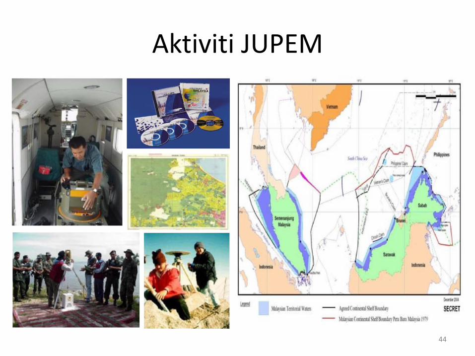
Aktiviti JUPEM
Aktiviti JUPEM
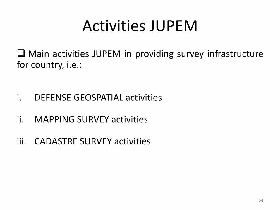
Aktiviti utama Jabatan Ukur Dan Pemetaan Malaysiadalam menyediakan infrastruktur ukur di seluruh negara,adalah:
i. Aktiviti GEOSPATIAL PERTAHANAN
ii. Aktiviti UKUR PEMETAAN
iii. Aktiviti UKUR KADASTER
45

DEPARTMENT OF SURVEY AND MAPPING MALAYSIA (JUPEM)
46
Establishment history
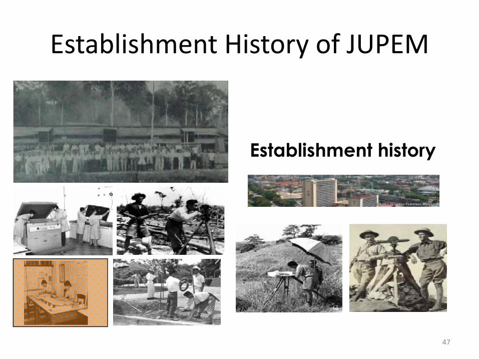
Establishment History of JUPEM
47
Establishment History of JUPEM
JUPEM is one of the earliest agencies in Malaysia that performsthe survey and mapping activities which started in 1885 whenthe Department of Survey Johor was established. Duringthe 1885 and 1957 period, the States Survey & TopographicDepartment were gradually, established one by one and latermerged as one entity as it is now known. In 1965, thegovernment approved the setting up of Directorate of NationalMapping, Malaysia that was responsible in survey, mapping,topographic and geodetic activities.
Later, Sabah’s JUPEM was found in 1983. Another branch was setup in the Federal Territory of Labuan in 1984. In 1989, Sarawak’sJUPEM was created while Perlis’s JUPEM was opened in 1995.
48
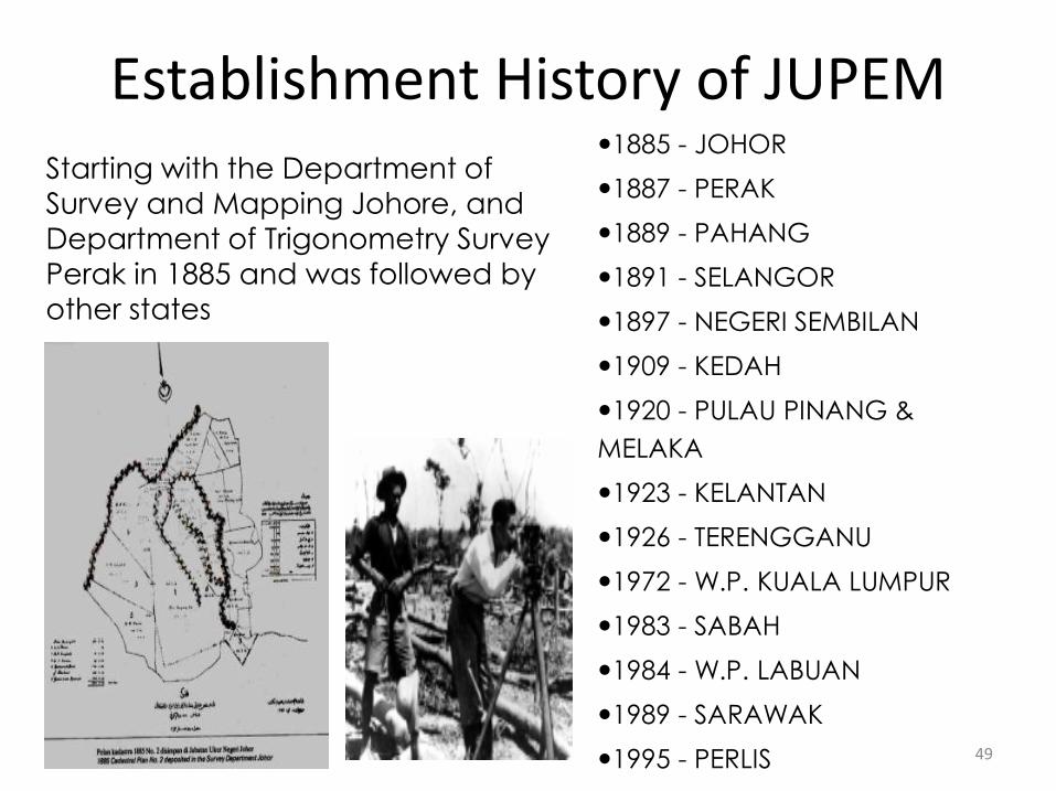
Starting with the Department of Survey and Mapping Johore, and Department of Trigonometry Survey Perak in 1885 and was followed by other states
1885 - JOHOR
1887 - PERAK
1889 - PAHANG
1891 - SELANGOR
1897 - NEGERI SEMBILAN
1909 - KEDAH
1920 - PULAU PINANG &
MELAKA
1923 - KELANTAN
1926 - TERENGGANU
1972 - W.P. KUALA LUMPUR
1983 - SABAH
1984 - W.P. LABUAN
1989 - SARAWAK
1995 - PERLIS
Establishment History of JUPEM
49
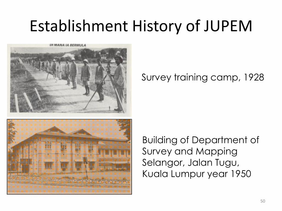
Survey training camp, 1928
Building of Department of Survey and Mapping Selangor, Jalan Tugu, Kuala Lumpur year 1950
Establishment History of JUPEM
50
Organisation Chart of JUPEM
Department of Survey and Mapping Malaysia (JUPEM) is under theMinistry of Natural Resources and Environment (NRE). It was led by theDirector General of Survey and Mapping (DG) who is also the Director ofNational Mapping and Director of Military Mapping.
This organizational structure has been set up in the organizationalrestructuring in October 2013, it is basically divided into two division, i.e.cadastre and mapping. Mapping division headed by Deputy DirectorGeneral of Survey and Mapping I. While cadastre division and 13 JUPEMStates are placed directly under the Deputy Director General of Surveyand Mapping II.
Di bawah Pejabat KPUP di hubungkan terus dengan BahagianGeospatial Pertahanan dan Unit Integriti. Director General of Survey andMapping office is connected directly with the Defense Geospatial andIntegrity Unit. 51
52

53
Activities JUPEM
Activities JUPEM
Main activities JUPEM in providing survey infrastructurefor country, i.e.:
i. DEFENSE GEOSPATIAL activities
ii. MAPPING SURVEY activities
iii. CADASTRE SURVEY activities
54

T H A N K YO U
55