catchment scale processes and river restoration - the river
TRANSCRIPT
Catchment Scale Processes and River Restoration
Dr Jenny Mant [email protected]
The River Restoration Centre
therrc.co.uk
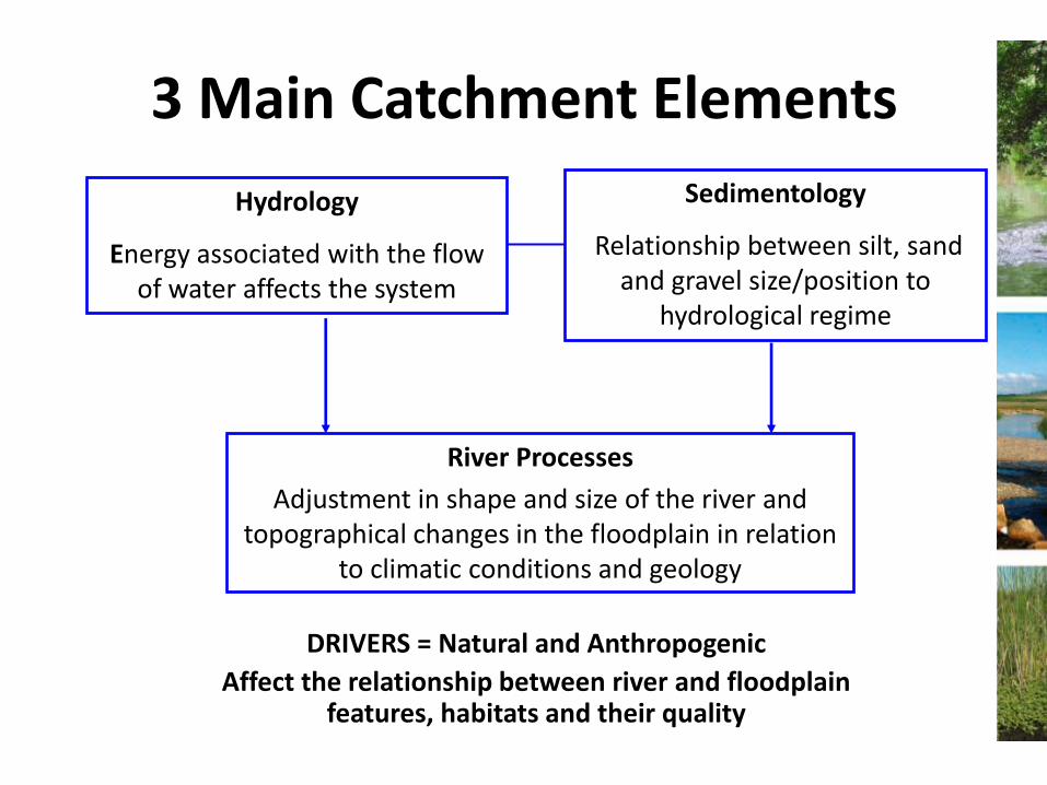
3 Main Catchment Elements
Hydrology
Energy associated with the flow of water affects the system
Sedimentology
Relationship between silt, sand and gravel size/position to
hydrological regime
River Processes
Adjustment in shape and size of the river and topographical changes in the floodplain in relation
to climatic conditions and geology
DRIVERS = Natural and Anthropogenic
Affect the relationship between river and floodplain features, habitats and their quality

Definition: River and Floodplain Processes...
The study of sediment sources, fluxes and
storages within the river channel over short,
medium and longer timescales and; of the resultant
floodplain morphology (Sear and Newson, 1993).
The pattern is determined by the hydrological
regime in a natural system.
Helps to identify appropriate mitigation measure.

• Streams receive water from their drainage basin
• Discharge: related to catchment area plus other influences
Catchments
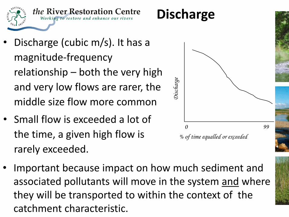
• Discharge (cubic m/s). It has a
magnitude-frequency
relationship – both the very high
and very low flows are rarer, the
middle size flow more common
• Small flow is exceeded a lot of
the time, a given high flow is
rarely exceeded. % of time equalled or exceeded
Dis
char
ge
0 99
• Important because impact on how much sediment and associated pollutants will move in the system and where they will be transported to within the context of the catchment characteristic.
Discharge
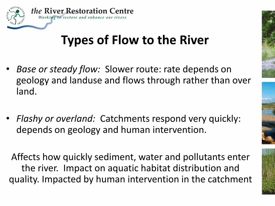
Types of Flow to the River
• Base or steady flow: Slower route: rate depends on geology and landuse and flows through rather than over land.
• Flashy or overland: Catchments respond very quickly: depends on geology and human intervention.
Affects how quickly sediment, water and pollutants enter the river. Impact on aquatic habitat distribution and
quality. Impacted by human intervention in the catchment

• Catchments receive inputs (precipitation)
• Transformed to outputs (streamflow and evaporation)
• Input = output (allow for storage)
• Output is continuous.
• Inputs (precipitation) are discrete (i.e. separated by time/space). Note:
– Visible and invisible inputs (e.g. seepage)
– Some river flow in summer maybe sustained by the flow of groundwater
Effects of Hydrology
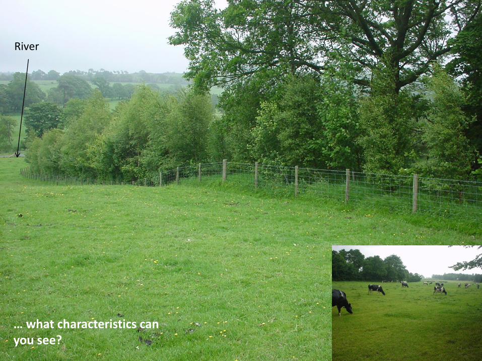
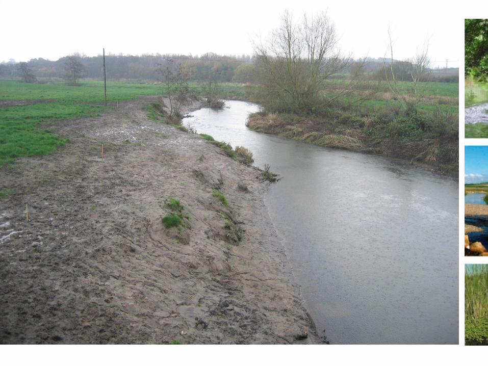
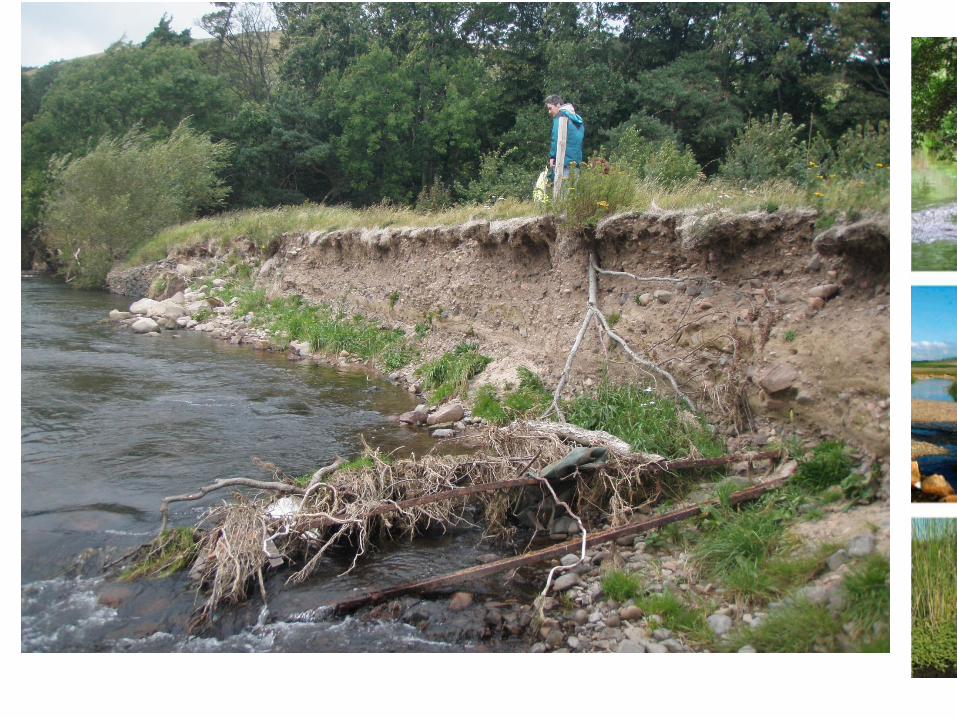
… what characteristics can you see?
River

Mechanisms of Sediment Movement
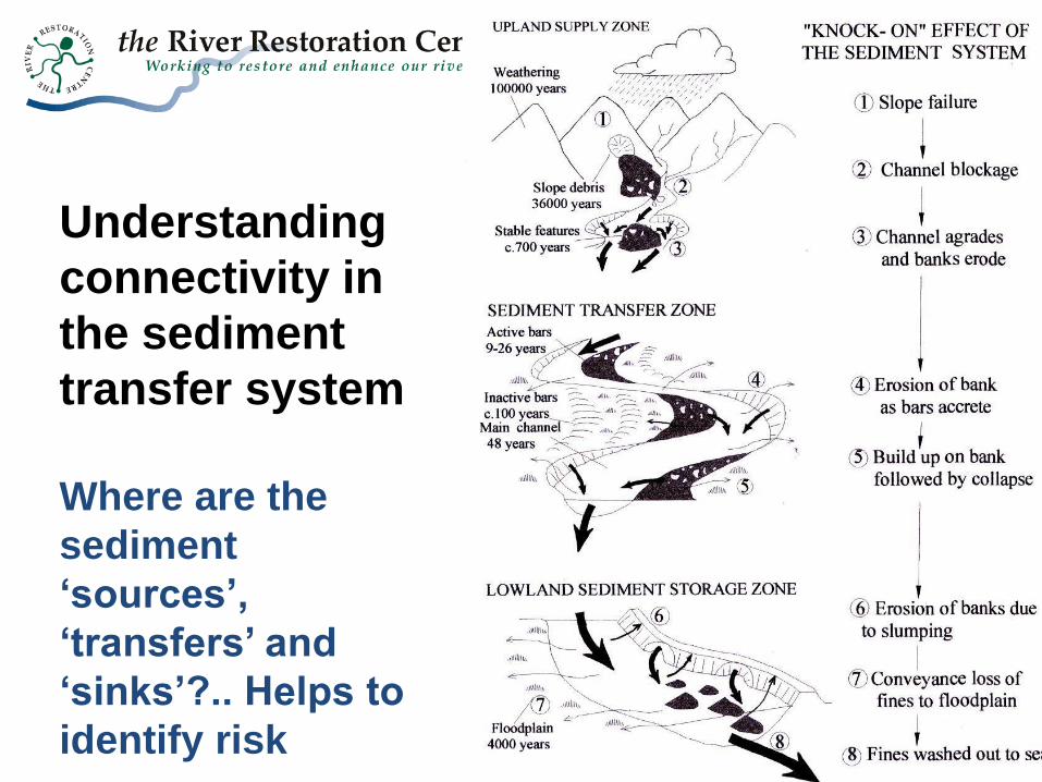
Understanding
connectivity in
the sediment
transfer system
Where are the
sediment
‘sources’,
‘transfers’ and
‘sinks’?.. Helps to
identify risk
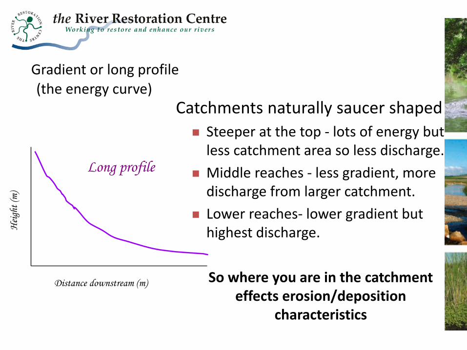
Gradient or long profile (the energy curve)
Distance downstream (m)
Hei
ght
(m)
Long profile
Catchments naturally saucer shaped
Steeper at the top - lots of energy but less catchment area so less discharge.
Middle reaches - less gradient, more discharge from larger catchment.
Lower reaches- lower gradient but highest discharge.
So where you are in the catchment effects erosion/deposition
characteristics


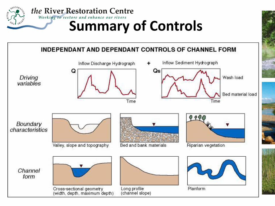
Summary of Controls
Human Intervention and Disruption to Natural Sediment
Sources

The Case of Realignment
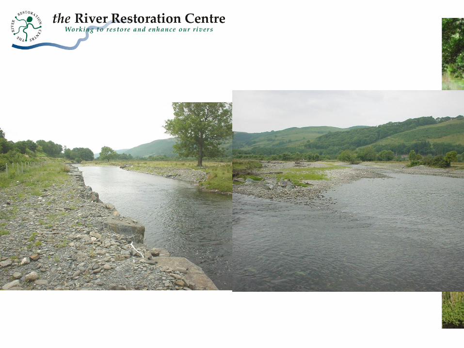
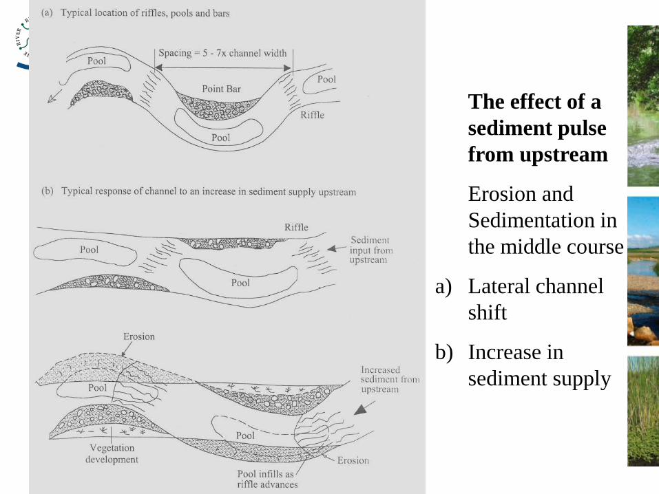
The effect of a
sediment pulse
from upstream
Erosion and
Sedimentation in
the middle course
a) Lateral channel
shift
b) Increase in
sediment supply
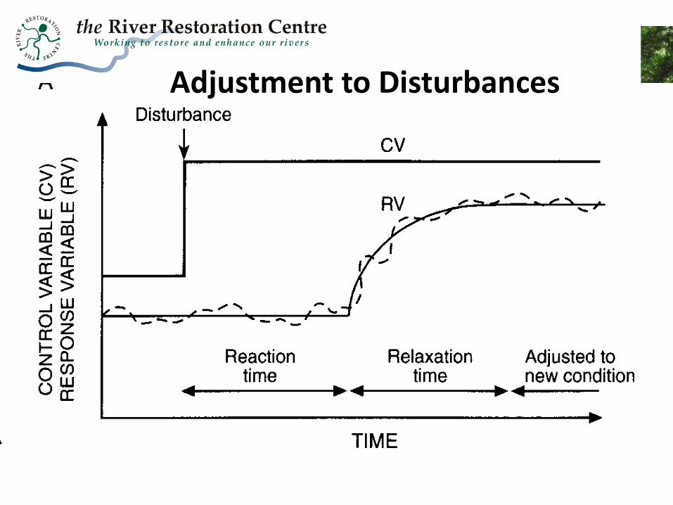
Adjustment to Disturbances
Minimising Risk and Uncertainty: Understanding the
Catchment Context


Hydrology/Hydraulics
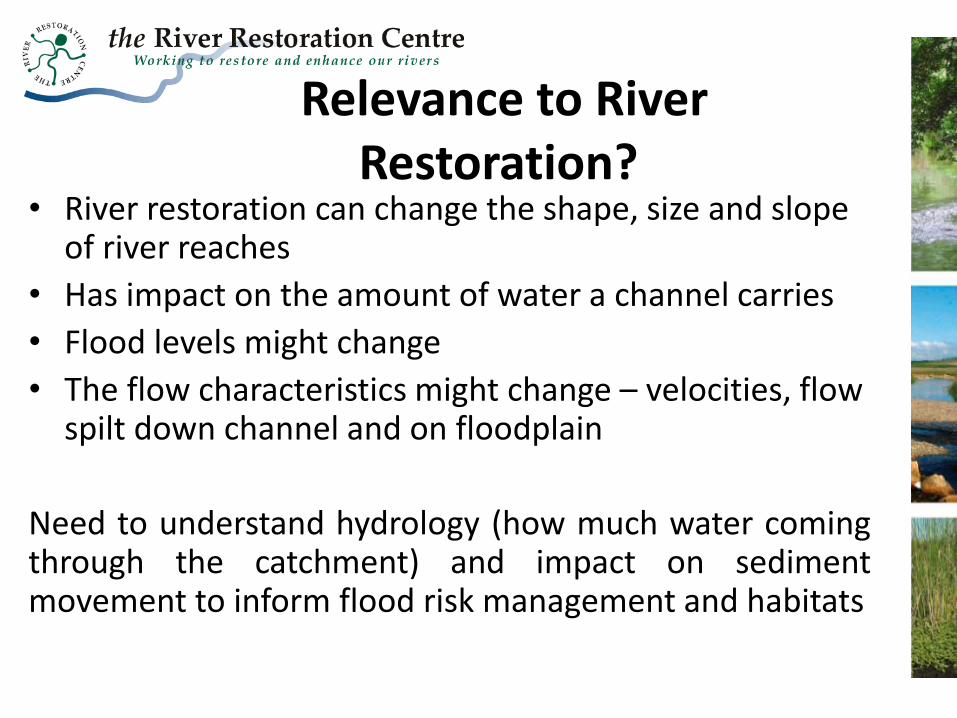
Relevance to River Restoration?
• River restoration can change the shape, size and slope of river reaches
• Has impact on the amount of water a channel carries
• Flood levels might change
• The flow characteristics might change – velocities, flow spilt down channel and on floodplain
Need to understand hydrology (how much water coming through the catchment) and impact on sediment movement to inform flood risk management and habitats

Hydrological components affecting streamflow • Catchment characteristics • Rainfall
(Be
ve
n 2
00
1:
8)
Between
storms
During
storms
Streamflow
Streamflow

The Purpose of Hydraulics Studies?
• Determine the level/depth and extent of the water, and the velocities in the channel and floodplain under normal and flood conditions:
– Experience/anecdotal evidence of what has happened previously
– Or.. Models… complexity used depends on what you need to know! (Risk of increase water levels)
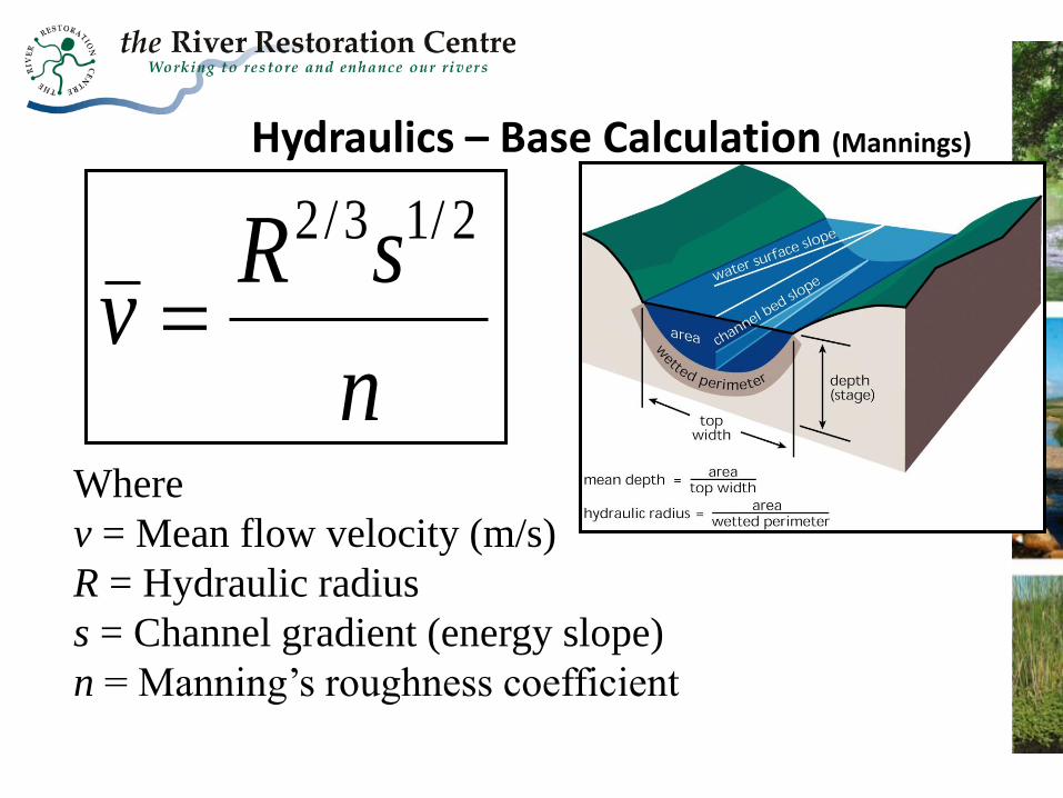
Hydraulics – Base Calculation (Mannings)
n
sRv
2/13/2
Where
v = Mean flow velocity (m/s)
R = Hydraulic radius
s = Channel gradient (energy slope)
n = Manning’s roughness coefficient
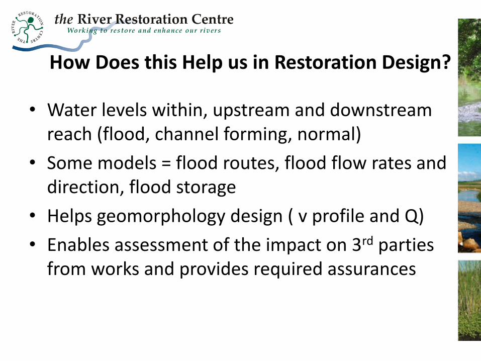
How Does this Help us in Restoration Design?
• Water levels within, upstream and downstream reach (flood, channel forming, normal)
• Some models = flood routes, flood flow rates and direction, flood storage
• Helps geomorphology design ( v profile and Q)
• Enables assessment of the impact on 3rd parties from works and provides required assurances
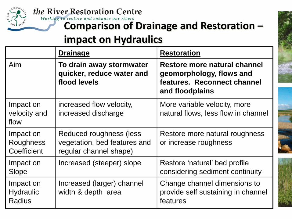
Comparison of Drainage and Restoration – impact on Hydraulics
Drainage Restoration
Aim To drain away stormwater
quicker, reduce water and
flood levels
Restore more natural channel
geomorphology, flows and
features. Reconnect channel
and floodplains
Impact on
velocity and
flow
increased flow velocity,
increased discharge
More variable velocity, more
natural flows, less flow in channel
Impact on
Roughness
Coefficient
Reduced roughness (less
vegetation, bed features and
regular channel shape)
Restore more natural roughness
or increase roughness
Impact on
Slope
Increased (steeper) slope Restore ‘natural’ bed profile
considering sediment continuity
Impact on
Hydraulic
Radius
Increased (larger) channel
width & depth area
Change channel dimensions to
provide self sustaining in channel
features

Bed shear
stress
Bedload
transport
Channel
geometry or
habitats
velocity profile
competence
& capacity
Velocity
distribution in
channel
erosion &
deposition
selective transport
bed roughness
availability
of sediment
Bed material
characteristics
Sediment
supply
Discharge
after Ashworth and Ferguson (1986)
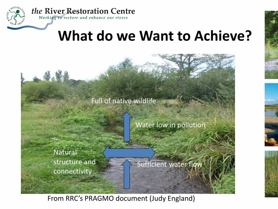
Water low in pollution
Full of native wildlife
Natural structure and connectivity
Sufficient water flow
What do we Want to Achieve?
From RRC’s PRAGMO document (Judy England)

River Habitats