chapter 6 the yebilla urr trail: linking hikers to the … 6 the yebilla urr trail: linking hikers...
TRANSCRIPT

CHAPTER 6
The Yurrebilla Trail:Linking hikers to the heritage
of the Adelaide HillsRebecca Brown and Anna M. Rebus
ith rolling countryside, steep gorges and native bushland, the Adelaide Hills provide anWimpressive backdrop to urban Adelaide. Linking national parks of the Adelaide Hills, the
Yurrebilla Trail celebrates a landscape with areas of great natural beauty and heritage as well as
spectacular views and special places of interest.
Starting at Belair Railway Station and ending at Athelstone on the River Torrens, the Yurrebilla
trail is 54 kilometres long and traverses Adelaide’s central hills face. With stories of settlement
history and conservation, scenic vistas, heritage sites and peaceful natural environments along the
way, it provides hikers with an opportunity to experience a range of short walks or a more intense
three-day bushwalking experience.

94 Valleys of Stone
THE POINT OF DIFFERENCE
There are many trails in the Adelaide Hills, and there are numerous long distance trails around
Australia. So what makes the Yurrebilla Trail different? From the visitors’ perspective, the feature
that sets the Yurrebilla Trail apart from other long distance trails is its accessibility to a
metropolitan centre and the thoughtful interpretation provided in a detailed guidebook and suite of
signs. From a planning and recreation perspective it represents the extensive collaboration of many
organisations and agencies.
The Yurrebilla Trail traverses Department for Environment and Heritage (DEH) managed lands
and other publicly managed and private lands. The shared land tenure in a way mirrors the shared
vision and work by many different groups of people. While it is a project owned by DEH, the
Yurrebilla Trail is the result of a large-scale collaborative effort including Flinders University, the
South Australian Tourism Commission, the Office for Recreation and Sport, Department for
Correctional Services and Walking SA.
THE ORIGINS OF THE PROJECT
In 1998, DEH decided to develop Morialta Conservation Park as Adelaide’s premier walking
location. This involved the rationalisation of trails that had evolved over the years and
redevelopment of lookouts, fencing and signs to reflect the spectacular bushland setting of the park.
This was not done without regard for the wider context. The Mount Lofty Ranges ‘Super Park’
concept was part of a 1997 government initiative and as part of this mooted regional integration of
open space, a trail connecting all of the central Mount Lofty Ranges parks was proposed.
It was suggested that the trail traverse some of South Australia’s most interesting and
spectacular landscapes and interpret the natural and cultural heritage of the area. The vision also
described a high-class bushwalking experience that connected into a range of tourism opportunities
along the way.
THE NAMING OF THE TRAIL
Originally the long distance trail across the Mount Lofty Ranges was to be called the Federation
Trail. However in 1999 this name was adopted for a long trail between Murray Bridge and
Springton in the Barossa Valley and was no longer a possible name for the DEH trail. In a search for
another meaningful name, the Kaurna word Yurrebilla was considered in recognition of the original
people of the Adelaide area, and as an effort towards reconciliation. Yurrebilla refers to the Mount
Lofty landscape and its story of creation.
At the time, the name Yurrebilla was a word being considered for the colloquially named ‘super
park’ – the integrated regional parklands of the Mount Lofty Ranges that would oversee broad scale
management across land tenure. Discussions in 2000 with the then representative Kaurna group,
Kaurna Meyunna, led to endorsement for the use of the name Yurrebilla for the Parklands and the
The Yurrebilla Trail 95
long distance trail that would traverse the spine of the Mount Lofty Ranges. The Yurrebilla Trail was
earmarked to become the tangible trademark of the parklands concept.
TOWARDS RECONCILIATION
The Hills Face Zone and the Adelaide Plains are recognised as the traditional country of the Kaurna
people, and the Peramangk are the traditional people of the Adelaide Hills (Tindale 1928). The
Yurrebilla Trail falls within the Hills Face Zone and the interpretive content was to concentrate on
Kaurna heritage.
Indigenous interpretation is considered an essential and important component of the heritage
along the Yurrebilla Trail. The interpretation featured along the trail was to integrate indigenous,
settlement and contemporary stories, giving equal emphasis to each.
DEH is respectful of the sensitivity of communicating cultural stories and the importance of
indigenous groups having control over their intellectual and cultural property. In 2003, broader
issues emerged about communicating the meaning and story of Yurrebilla. Consequently, the signs
and publications produced as part of this project acknowledge Kaurna as the traditional people of
the area and quote with permission from Kaurna people, however specific cultural details have not
been included. A commitment was made to collaboratively develop a future publication on Kaurna
culture and history for the Yurrebilla Trail.
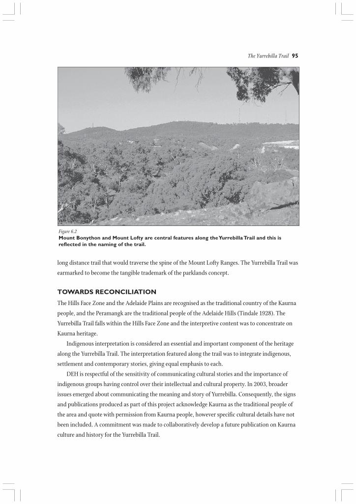
Figure 6.2Mount Bonython and Mount Lofty are central features along the Yurrebilla Trail and this isreflected in the naming of the trail.
96 Valleys of Stone
BENEFITTING PEOPLEAND PLACES
The Yurrebilla Trail is more than just a
bushwalking experience. It is envisaged that it
will have multiple benefits not only to those
that walk the trail, but also to those who
provide services in the area, and it is hoped that
it will contribute to a range of intangible social
and health benefits.
Environmental benefits• interpretive opportunities to share natural and
cultural heritage
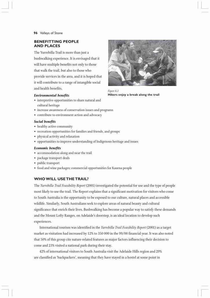
Figure 6.3Hikers enjoy a break along the trail
• increase awareness of conservation issues and programs• contribute to environment action and advocacy
Social benefits• healthy active community• recreation opportunities for families and friends, and groups• physical activity and relaxation• opportunities to improve understanding of Indigenous heritage and issues
Economic benefits• accommodation along and near the trail• package transport deals• public transport• food and wine packages; commercial opportunities for Kaurna people
WHO WILL USE THE TRAIL?
The Yurrebilla Trail Feasibility Report (2001) investigated the potential for use and the type of people
most likely to use the trail. The Report explains that a significant motivation for visitors who come
to South Australia is the opportunity to be exposed to our culture, natural places and accessible
wildlife. Similarly, South Australians seek to explore areas of natural beauty and cultural
significance that enrich their lives. Bushwalking has become a popular way to satisfy these demands
and the Mount Lofty Ranges, on Adelaide’s doorstep, is an ideal location to develop such
experiences.
International tourism was identified in the Yurrebilla Trail Feasibility Report (2001) as a target
market as visitation had increased by 12% to 350 000 in the 99/00 financial year. It was also noted
that 50% of this group cite nature-related features as major factors influencing their decision to
come and 23% visited a national park during their stay.
42% of international visitors to South Australia visit the Adelaide Hills region and 29%
are classified as ‘backpackers’, meaning that they have stayed in a hostel at some point in
The Yurrebilla Trail 97
their Australian stay.
Domestic tourism
comparatively is a much larger
group. The Yurrebilla Trail
Feasibility Report (2001) cites
850,000 holiday visitors to
Adelaide and Hills areas and
around 16% of these participate in
bushwalking or visiting national
parks. It was noted that is below
the national average (22%) and
there is considerable room for
development.
In 2000, South Australia had a
relatively strong market position
in relation to wine/food, heritage
and events, but was looking to
develop its position in the nature-
based sector
(SATC Marketing Plan 1999-2000).
Other States, particularly
Western Australia, Victoria,
Northern Territory and Tasmania
have developed and marketed high
profile walking opportunities over the past decade as part of their nature-based profile. The
Yurrebilla Trail, located close to Adelaide and the Hills facilities with its preferable outdoor climate,
will provide a highly competitive product and add significantly to the development of South
Australia’s nature-based profile (Yurrebilla Trail Feasibility Report, 2001).
The local recreation sector mostly uses the trail for interest, learning, exercise and socialising.
They can be segmented as such:• Small social group; 18-30s, over 55s;• Small family groups with primary school-aged children;• Interest groups; bushwalking, wine, photography, bird watching;• Education, soft adventure groups; schools, scouts.
According to the Feasibility Report, some 59% of Adelaide and Hills residents walk regularly,
with 42% of these walking at least once a week and another 42% walking at least once a month.
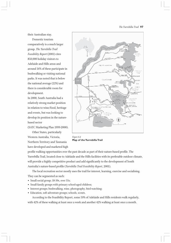
Figure 6.4Map of the Yurrebilla Trail

98 Valleys of Stone
PLANNING THE TRAIL
With the vision and objectives in place, the
detailed planning of the trail began with the
priority of finalising the trail route. The route
was selected for natural beauty and interest,
views, diverse environments, places of cultural
significance, trail gradient, connection to
tourism opportunities and places of interest. It
was a priority that the trail could be walked in
three days in its entirety, or in half-day
sections. Five sectors were planned with
trailheads placed at points close to
transportation links and services.
Several public risk considerations
influenced the location of the trail including
the need to avoid locating the trail along
Figure 6.5The Yurrebilla Trail marker with its distinctivegum leaf graphic.
roadsides. The trail traverses public and private land and this involved much negotiation and
agreement between the various public and private landholders including the managers of Waite
Conservation Reserve and Carrick Hill. Representatives of Walking SA provided specialist advice on
the route design. With the establishment of the final route, the planning team addressed
infrastructure, services and the physical trail construction of the trail.
Infrastructure along the trail was guided by a concept plan that identified locations for major
and minor trailheads. The trailhead signs feature orientation information including trail
descriptions, maps and bushwalking safety notes. Trail markers were planned to occur every 500
metres along the trail and at locations of interpretive interest. The trail markers would be labelled
with the distance to and from the trail terminus. This enabled specific locations to be pinpointed
along the trail where interpretive content could be provided in the guidebook.
Camping is not permitted in metropolitan parks and if hikers chose to walk the trail in its
entirety then it was important to ensure a range of accommodation from backpacker hostels to bed
and breakfast and hotel accommodation was available. Heritage and regional attractions would also
be featured as linkages from the trail, including places such as the Mount Lofty Botanic Gardens,
Carrick Hill and Mount Lofty Summit.
The trailheads are located on or within a short distance of bus routes so hikers can plan return
loops along the linear trail. Provisions for car parking are made at many of the trailheads.
Major funding and support was achieved through the presentation of the Feasibility Report. While
DEH provided substantial base funding, the majority of the resources to construct the trail and its
infrastructure came from the Office for Recreation and Sport over a period of three years.
The Yurrebilla Trail 99
BUILDING THE TRAIL
Construction of new sections of trail and repair
of the existing network occurred in sectors.
While a work crew was undertaking the
physical work in one area, final details for
another area were being resolved. A major
hurdle in addressing such details was the
pedestrian crossing at the new South Eastern
Freeway. The original concept was to traverse
the newly acquired Eagle Mountain Bike Park
and cross over the Heysen Tunnels. Resolving
issues that blended downhill mountain bike
racing and bushwalking eventually eliminated
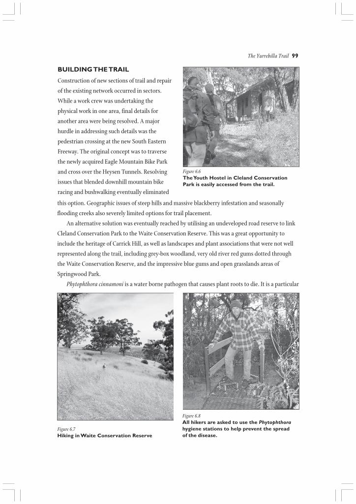
Figure 6.6The Youth Hostel in Cleland ConservationPark is easily accessed from the trail.
this option. Geographic issues of steep hills and massive blackberry infestation and seasonally
flooding creeks also severely limited options for trail placement.
An alternative solution was eventually reached by utilising an undeveloped road reserve to link
Cleland Conservation Park to the Waite Conservation Reserve. This was a great opportunity to
include the heritage of Carrick Hill, as well as landscapes and plant associations that were not well
represented along the trail, including grey-box woodland, very old river red gums dotted through
the Waite Conservation Reserve, and the impressive blue gums and open grasslands areas of
Springwood Park.
Phytophthora cinnamoni is a water borne pathogen that causes plant roots to die. It is a particular
Figure 6.7Hiking in Waite Conservation Reserve
Figure 6.8All hikers are asked to use the Phytophthorahygiene stations to help prevent the spreadof the disease.

100 Valleys of Stone
problem in stringybark associations in high rainfall areas. It can be carried from one area to
another by foot and is considered a serious threat to native vegetation. The trail planners entirely
avoided areas affected with Phytophthora and undertook soil testing in susceptible areas. Hygiene
stations are located at the beginning and end of each trail sector for hikers to use to brush soil
from their footwear.
The original trail concept involved approximately 20 km of new trail construction through
conservation reserves and the Hills Face Zone. The planning team considered that constructing
new trails would significantly scar undeveloped areas of the Hills Face Zone. The best possible
option was to use existing trails that offered opportunities and features of relative significance and
invest resources into upgrading trail surfaces.
The Yurrebilla Trail Feasibility Report (2001) states that an Australian Standards Trail
Classification 3 should be assigned to the Yurrebilla Trail in order to market and manage it to a
high standard. A Classification 3 trail has a highly modified surface with less than a 1 in 10 grade.
While ideal in theory, the terrain of the Adelaide Hills combined with the financial and
environmental restrictions associated with constructing extensive new trail sections meant that the
Yurrebilla Trail would include a mix of Moderate Hikes and Hard Hikes.
Criteria for Trail Classification
Class Class 3 Moderate Hike Class 4 Hard Hike
Trail Generally a modified surface, sections Generally distinct trail withoutconditions may be hardened. Kept mostly clear of major modification to the ground.
intrusions and obstacles. Encounters with fallen debris andother obstacles are likely.
Gradient Gradient may exceed 1:10 for short Gradient limited to environmentalsections but generally no steeper than and maintenance considerations.1:10. Steps may be common.
Adapted from Australian Standards 2156.1. Walking Tracks – Part 1: Classification & Signage
THE TRAIL WORKFORCE
A partnership agreement between the Department of Correctional Services and DEH provided the
construction workforce for the trail. Over a period of two years a team of six participants from the
Adelaide Pre-release Centre along with a custodial officer were responsible for much of the physical
construction of new trail and the upgrade of existing trails. Participants volunteered for the project
and stayed for varying periods from weeks to months. Participants learned skills and trained in
areas such as safe operation and maintenance of chainsaws and brush cutters as well as other small
plant and equipment, weed control methods including safe use of herbicides, stone walling and
basic landscape principles. The program’s focus was also to prepare inmates for their integration
into the community and workforce after release.
The Yurrebilla Trail 101
SPREADING THE WORD
Once the physical trail was completed, marked and opened for use, DEH needed to let the public
know about this new bushwalking opportunity. Led by the Office for Recreation and Sport, Trails
SA is an initiative that involves representatives from state government, local government and
recreation organisations to promote a network of quality trails. The Yurrebilla Trail was identified
as one of the ‘top five trails’, together with the Heysen Trail and Riesling Trail. The Heysen Trail was
established in 1976. The Yurrebilla Trail joins the Heysen Trail between Mount Lofty and Third
Falls in Morialta Conservation Park. A connection to the Heysen Trail was considered important
from a marketing perspective, given the recognition of the Heysen Trail within the recreation
industry.
The Yurrebilla Trail is promoted on the Trails SA website www.southaustraliantrails.com and
in the publication South Australian Trails which features the best bushwalks around the state. It also
has its own website www.environment.sa.gov.au/parks/yurrebilla which is an important pre-visit
tool for hikers. It contains updated trail information, hiking tips and links to sites that will help
hikers plan their trip. The website also connects hikers to the main DEH website; people can
explore the site and learn about conservation efforts being undertaken in the state.
THE FLINDERS UNIVERSITY HILLS FACE ZONE PROJECT
DEH became an industry partner to the Flinders University Hills Face Zone Project in 2001. DEH
financially contributed to the project in return for use of archaeological research undertaken as part
of the project, and also received extensive assistance from cultural tourism academics and students
to develop interpretive materials for the Yurrebilla Trail.
Of particular note is a report produced by two Cultural Tourism students who identified ways to
incorporate places along the Yurrebilla Trail into the fabric of the bushwalking experience. The
students developed the ‘cultural corridors’ concept. The Cultural Corridors of the Yurrebilla Trail
would be trail spurs that linked hikers to cultural experiences on or near the trail including places
such as Carrick Hill, Waite Arboretum, local wineries, Norton Summit and Crafers. Some of the
ideas around cultural corridors would later find their way into the guidebook although the phrase
itself was not used.
THE INTERPRETIVE APPROACH
There are countless stories that can be told along the Yurrebilla Trail. From the notorious
reputation of the tiersmen to the determination of the early pioneer women hauling produce from
hills gardens to city markets, the triumphs and tribulations of early settlers are revealed in the place
names, ruins, roads and built heritage of the Adelaide Hills. The Indigenous connection to this area
is reflected in historic seasonal pathways, Creation stories and place names.
The Department for Environment and Heritage uses interpretation to tell the stories of the

102 Valleys of Stone
Adelaide Hills. Interpretation, as defined by the Interpretation
Australia Association, is a ‘means of communicating ideas and
feelings which help people understand more about themselves and
their environment’.
Interpretation developed by DEH presents information that
(ideally) fosters in people a deeper and more meaningful connection
to what is being experienced. Interpretation is not simply about
presenting information on
the Adelaide Hills as a series of facts; it is about presenting the
stories of the people and places that have helped to shape the
modern landscape. In the case of the Yurrebilla Trail, interpretation
has included the development of Yurrebilla Trail – A Hiker’s
Guide and the installation of nine interpretive signs along the
trail.
The guidebook and signs use anecdotes, historic images and
writings, along with modern observations to create a sense of the
past, present and future in the Adelaide Hills. Through
Figure 6.9Cover of Yurrebilla Trail –A Hiker’s Guide
interpretation, the natural and cultural environments of the past are revealed and a sense of
continuity between past actions and future directions is cultivated. This is especially significant as
increasing development puts pressure on remaining stands of remnant forest and heathland habitats.
Messages of conservation and protection are therefore key throughout the guidebook and signs.
Interpretation is an essential part of DEH’s strategy for communicating with visitors. DEH’s
interpretive approach is based in part on the six principles of interpretation developed by Freeman
Tilden (1957). Tilden states that ‘the chief aim of interpretation is not instruction, but provocation’.
He also states that ‘information, as such, is not interpretation. Interpretation is revelation based
upon information’. Revelation does not usually come in the form of a person having an ah-ha!
moment while in the midst of a new experience. Revelation may take place weeks or years later as a
person connects the ideas, feelings and memories of a past experience to the new experience they
are having. DEH recognises that the experiences a hiker has while walking the Yurrebilla Trail may
affect their attitudes, feelings and beliefs about the cultural and natural environment now and in
the future.
As Ham and Weiler (2001) describe:
… interpretation influences not only what people know and do on-site, but potentially what visitors come to believeabout the area, about the importance of the resources being protected and the strategies being used to protect them,and even about conservation globally.
By telling of the history, heritage, conservation and environmental issues facing the Adelaide Hills,
it is hoped that hikers will feel a connection to this land and a desire to protect it.

The Yurrebilla Trail 103
THE INTERPRETIVE FRAMEWORK
The objective for the Yurrebilla Trail interpretation is based on the relationship between past,
present and future in relation to natural and cultural heritage and conservation.• Cultural Heritage – Past/Present• Natural Heritage – Past/Present• Conservation – Present/Future
The objective for Yurrebilla Trail interpretation is:
To improve visitors’ appreciation of the natural and cultural heritage of the Mount Lofty Ranges and the conservationissues it’s facing, and to inspire positive action and hope for its future protection.
Ham and Weiler (2003) have developed an approach to communication that suggests
interpretation must be enjoyable, relevant, organized and thematic. They emphasise the use of
themes in interpretation. The Department for Environment and Heritage has used this approach to
support the development of the guidebook and the interpretive signs along the Yurrebilla Trail. The
primary theme for the Yurrebilla Trail stems from the objective. The primary theme governs the
interpretation development for the trail:
The natural and cultural heritage of the Mount Lofty Ranges helps us understand our environment to act to conserve itfor the future.
Within the primary theme are sub-themes. Each sector of the trail offers hikers a different
experience through changing environments, habitats and cultural landscapes. Sub-themes were
written for each sector of the trail that reflected these diverse landscapes and experiences. Each sub-
theme relates to the primary visitor and secondary market group. Both the tourist and the
recreation markets are considered. The following sub-themes in the Thematic Matrix flavour each
sector of the trail and provided a foundation for interpretive research.
Sector Belair to Eagle on the Hill Eagle on the Hill to Summertown
Flavour Cultural heritage Uniquely South Australian
Primary Local eco-recreation International and interstate eco-tourismvisitor market
Secondary International and interstate eco-tourism Local eco-recreationvisitor market
Sub-theme Built heritage and special places tell storiesstatement of early settlement and reflect the lifestyle
and values of the time. Whilst the culturalformation of Adelaide is an infusion ofmany influences, the early English andEuropean colonial experience dominatesthis sector and challenges our perceptionsof determination, opportunity, environmentand home.
The Mount Lofty Ranges showcase some of thethings that are uniquely South Australian. Withthe rapid growth of global communications andinternational travel, the people of the world arebecoming less culturally and ideologicallydiverse. A re-emerging Aboriginal culture, theculture of Adelaide and the endemic wildlifeand natural environment are part of the uniqueidentity and character of South Australia.
104 Valleys of Stone
Sector Summertown to Norton Summit Norton Summit to Morialta
Flavour Intensive land use Natural heritage
Primary Local eco-recreation Local eco-recreationvisitor market
Secondary International and interstate eco-tourism International and interstate eco-tourismvisitor market
Sub-theme The fertile soils, cool climate and reliablestatement rainfall of the Mount Lofty Ranges provided
the perfect nursery for a thriving timberindustry for the formative city below.The Ranges also support market gardensand orchards established in the midnineteenth century. The range of producehas diversified with new ethnic groups andoverseas markets opening up to our clean,fresh produce.
Sector Morialta to River Torrens
Flavour People and the landscape
Primary Local eco-recreationvisitor market
Secondary International and interstate eco-tourismvisitor market
Sub-theme Here you can see suburban Adelaide encroaching on the Adelaide Hills. The people ofstatement Adelaide have an important role to manage human impacts on the biological diversity of the
Mount Lofty Ranges.
The Thematic Matrix – Yurrebilla Trail Interpretation Framework 2001
Steep slopes, inaccessible gorges, waterways,waterfalls, peaks, ridgelines and exposedescarpments have discouraged land uses suchas agriculture, grazing, timber felling and theincessant creep of housing developments. Thishas resulted in areas of eucalyptus forestsremaining largely undisturbed, now protectedby National Parks and Wildlife SA.
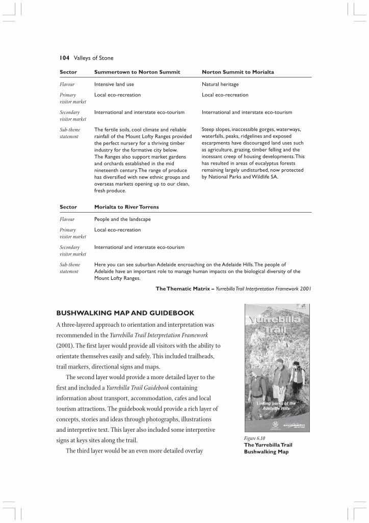
Figure 6.10The Yurrebilla TrailBushwalking Map
BUSHWALKING MAP AND GUIDEBOOK
A three-layered approach to orientation and interpretation was
recommended in the Yurrebilla Trail Interpretation Framework
(2001). The first layer would provide all visitors with the ability to
orientate themselves easily and safely. This included trailheads,
trail markers, directional signs and maps.
The second layer would provide a more detailed layer to the
first and included a Yurrebilla Trail Guidebook containing
information about transport, accommodation, cafes and local
tourism attractions. The guidebook would provide a rich layer of
concepts, stories and ideas through photographs, illustrations
and interpretive text. This layer also included some interpretive
signs at keys sites along the trail.
The third layer would be an even more detailed overlay

The Yurrebilla Trail 105
designed specifically for education groups, tourism operators and locals.
This layered approach was adopted and the first layer was implemented in 2003 with the
installation of trailhead signs and trail markers. The Yurrebilla Trail Bushwalking Map was
produced to coincide with the official launch of the Yurrebilla Trail in September 2003.
Implementation of the second layer began in 2004 as the research for Yurrebilla Trail – A Hiker’s
Guide began. The original intention was to keep the bushwalking map and the hiking guide as two
separate publications. However, as research progressed, it was decided that a single guidebook,
incorporating a map and interpretive information, would be an easier product for hikers to use.
Incorporating the map into the new guidebook allowed it to be updated and produced in the
style of the Heysen Trail maps. Released in late 2005, Yurrebilla Trail – A Hiker’s Guide supersedes the
bushwalking map and provides hikers with an easy to use, inclusive, pocket-sized product. With the
installation of nine interpretive signs along the trail, the second layer of the orientation and
interpretation approach was complete.
RESEARCHING Yurrebilla Trail – A Hiker’s Guide
Numerous agencies and organisations were contacted for their input on the contents of the
guidebook including the Urban Forest Biodiversity Project, Bush for Birds, Heritage SA, members of
Figure 6.11Historic photographs reveal early life in the Adelaide Hills. This is a photograph of the Simpsonfamily on a picnic in Belair National Park, c. 1899.
Reproduced courtesy of the State Library of South Australia SLSA:B 189384

106 Valleys of Stone
the local Kaurna community and the South Australian Museum. Individuals from the South
Australian Tourism Commission, Flinders University and the Office for Recreation and Sport
(among others) also commented on draft editions of the guidebook.
The concepts and ideas generated in the Thematic Matrix (discussed earlier) were refined and
edited into messages that introduced hikers to each sector of the trail. The development of a
specific message for each sector provided a focus for writing and allowed an overarching
storyline to emerge.
The research and writing of Yurrebilla Trail – A Hiker’s Guide was completed by DEH staff and
supported by extensive research undertaken by Flinders University staff and students of cultural
tourism and archaeology. Student research included detailed ‘inventories’ of places and sites of
heritage significance. Potentials for interpretation and development of cultural tourism were
considered and recommendations made. Students also made use of historic images and modern
photos to reveal the changing landscapes through time. As mentioned earlier, the concept of
‘cultural corridors’ surrounding the Yurrebilla Trail emerged. Research by DEH and Flinders
University revealed the history of known sites and also uncovered little known or long-forgotten
sites, stories and historic ‘personalities’. Of great importance to the overall look and feel of the
guidebook was the use of historic images procured through the State Library of South Australia.
These images offer a glimpse into the natural and cultural landscapes of the past.
The idea behind the development of Yurrebilla Trail – A Hiker’s Guide is that each sector of the
trail has a different flavour and that each corresponding section of the guidebook offers hikers a
taste of what makes the Adelaide Hills such a special place. The stories of the people and places of
the Adelaide Hills were too numerous to fit into the confines of a pocket-sized guidebook.
Therefore, the contents had to be carefully selected and edited. The content for each section of the
guidebook was derived from an understanding of who might walk each sector of the trail. For
example, it was noted that Sector 2, Eagle on the Hill to Summertown, might appeal to an
international audience. As a result, distinctly Australian or South Australian features along this
Discover Indigenousand early Europeanhistory and how ithas shaped localcommunities and
places.
Celebrate the naturaland cultural heritagethat is uniquely SouthAustralian and visitlandmarks such asMount Lofty and
Cleland Wildlife Park.
Learn about thechanges in land use
since the early ‘toilers’of the hills set up
orchards and marketgardens to thesustainable land
management practicesthat are being
encouraged today.
Discover new storiesof the formation of
this steep andinaccessible landscape
and how thisinfluenced land use
over time.
Witness thepressures on the
remaining areas ofnative vegetation
and parks and learnhow you can
protect this areafor future
generations.
Sector Belair to Eagle Eagle on the Hill Summertown to Norton Summit Morialta toon the Hill to Summertown Norton Summit to Morialta River Torrens
Title Cultures in Celebrating the spirit Living with Landscapes in Living onthe making of South Australia the land the making the fringe
Message

The Yurrebilla Trail 107
sector of the trail are highlighted. This includes Cleland Wildlife Park, which offers visitors close-up
encounters with Australian wildlife. The paragraph on Cleland Wildlife Park includes a picture of a
Yellow-footed Rock Wallaby. While this species is not found in the Adelaide Hills, it is found in
South Australia and is a symbol for a declining species that is making a comeback due to
conservation efforts. In the second sector, the Yurrebilla Trail joins with the Heysen Trail. The
opportunity is taken to discuss the trail and the artistic achievements of German-born, South
Australian-raised Hans Heysen, for whom the trail is named. Hikers also read about South
Australia’s state emblems, dry climate, water catchment areas and wildlife.
The structure of the guidebook includes introductory pages that briefly discuss issues of safety,
trail conditions, phytophthora and seasonal trail highlights. A reference chart outlining distance,
estimated hiking time, accommodation and attractions along the trail helps hikers prepare for their
excursion (see table below). A quick discussion on the history of Adelaide and Hills is followed by
lengthier chapters dedicated to each sector of the trail. A listing of organisations, references,
contact details and web links at the back of the guidebook allows hikers to delve more fully into the
stories that pique their interest. The ‘species identifier’ section encourages hikers to identify a
variety of bird, tree and wildflower species that they might come across as they walk the trail. A
detailed foldout map at the back of the guidebook helps to keep hikers on the right track.
As the trail passes through significant park areas and stands of important remnant vegetation
and habitat, it was essential that a message of conservation be conveyed. Hikers walk through tracts
of grey box woodlands, river red gums and blue gums that provide habitat for rare and endangered
Sector Belair to Eagle Eagle on the Hill Summertown to Norton Summit Morialta toon the Hill to Summertown Norton Summit to Morialta River Torrens
Time (one way) 6 hours 3 hours 3.5 hours 2.5 hours 5 hours
Distance 17.5 km 7 km 9 km 7.5 km 13 km(one way)
Classification Hard Hike Moderate Hike Hard Hike Moderate Hike Hard Hike
Accommodation Caravan Park Resort/Motel Bed and Self-contained Bed andoptions Bed and Bed and breakfast accommodation breakfast
breakfast breakfast Self-contained Bed andYouth Hostel accommodation breakfast
Youth Hostel
Other places Old Government Cleland Wildlife Summertown, Rostrevor College Athelstoneto visit from House, State Flora Park, Waterfall Uraidla, First Falls Wildflowerthe Trail Plant Nursery, Gully, Mount Lofty Norton Summit Valley Walk Garden,
Carrick Hill, Summit, Mount Museum, Norton River TorrensCity of Mitcham, Lofty Botanic Summit Cemetery, Linear ParkWaite Arboretum Gardens Adelaide Hills
Urrbrae House and Natural ResourceRose Garden, Waite Centre,
Walking Trail Norton Summit
Reference chart for planning a hike on the Yurrebilla Trail
108 Valleys of Stone
species including the yellow-tailed black cockatoo, Mount Lofty Ranges southern emu-wren and the
southern spiny-tailed gecko. Part of the interpretive process encourages people to recognize what is
familiar to them, such as specific flora and fauna species, and then begin to experience the
unfamiliar within a new frame of reference. Conveying a message of conservation through
interpretation is therefore about connecting people to the familiar urban backdrop of the Adelaide
Hills and introducing or reminding people of the natural and cultural heritage significance
contained within.
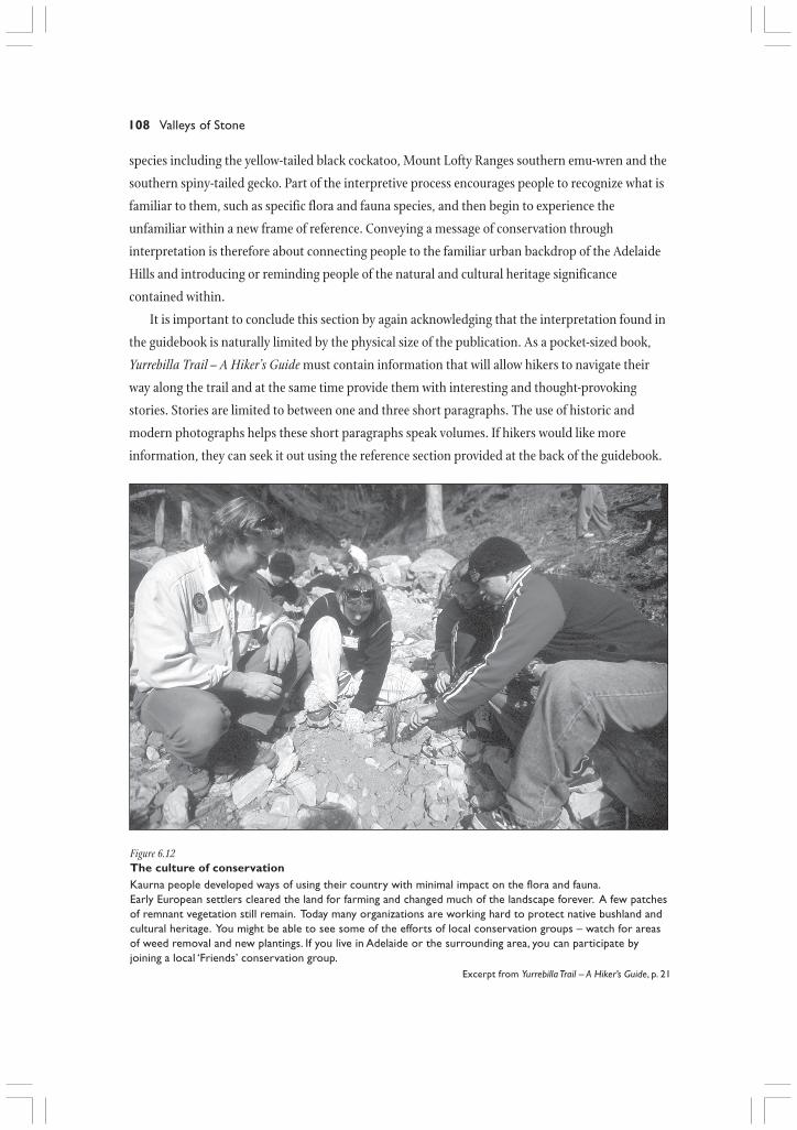
It is important to conclude this section by again acknowledging that the interpretation found in
the guidebook is naturally limited by the physical size of the publication. As a pocket-sized book,
Yurrebilla Trail – A Hiker’s Guide must contain information that will allow hikers to navigate their
way along the trail and at the same time provide them with interesting and thought-provoking
stories. Stories are limited to between one and three short paragraphs. The use of historic and
modern photographs helps these short paragraphs speak volumes. If hikers would like more
information, they can seek it out using the reference section provided at the back of the guidebook.
Figure 6.12The culture of conservationKaurna people developed ways of using their country with minimal impact on the flora and fauna.Early European settlers cleared the land for farming and changed much of the landscape forever. A few patchesof remnant vegetation still remain. Today many organizations are working hard to protect native bushland andcultural heritage. You might be able to see some of the efforts of local conservation groups – watch for areasof weed removal and new plantings. If you live in Adelaide or the surrounding area, you can participate byjoining a local ‘Friends’ conservation group.
Excerpt from Yurrebilla Trail – A Hiker’s Guide, p. 21
The Yurrebilla Trail 109
Sector Belair to Eagle Eagle on the Hill Summertown to Norton Summit Morialta toon the Hill to Summertown Norton Summit to Morialta River Torrens
Sign title
Sign location
Storyline
Sign title Birds of the The Tiers Fire – nature’s Black HillMount Lofty regenerator Conservation
Ranges Park
Sign location
Storyline
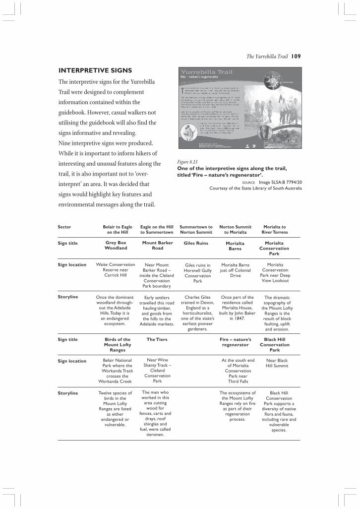
INTERPRETIVE SIGNS
The interpretive signs for the Yurrebilla
Trail were designed to complement
information contained within the
guidebook. However, casual walkers not
utilising the guidebook will also find the
signs informative and revealing.
Nine interpretive signs were produced.
While it is important to inform hikers of
interesting and unusual features along the
trail, it is also important not to ‘over-
interpret’ an area. It was decided that
signs would highlight key features and
environmental messages along the trail.
Grey BoxWoodland
Mount BarkerRoad
Giles Ruins MorialtaBarns
MorialtaConservation
Park
Waite ConservationReserve nearCarrick Hill
Near MountBarker Road –
inside the ClelandConservationPark boundary
Giles ruins inHorsnell GullyConservation
Park
Morialta Barnsjust off Colonial
Drive
MorialtaConservation
Park near DeepView Lookout
Once the dominantwoodland through-out the AdelaideHills. Today it isan endangered
ecosystem.
Early settlerstravelled this road
hauling timber,and goods fromthe hills to the
Adelaide markets.
Charles Gilestrained in Devon,
England as ahorticulturalist,
one of the state’searliest pioneer
gardeners.
Once part of theresidence calledMorialta House,
built by John Bakerin 1847.
The dramatictopography of
the Mount LoftyRanges is the
result of blockfaulting, upliftand erosion.
Belair NationalPark where theWorkanda Track
crosses theWorkanda Creek
Near WineShanty Track –
ClelandConservation
Park
At the south endof Morialta
ConservationPark nearThird Falls
Near BlackHill Summit
Twelve species ofbirds in theMount Lofty
Ranges are listedas either
endangered orvulnerable.
The men whoworked in thisarea cuttingwood for
fences, carts anddrays, roof
shingles andfuel, were called
tiersmen.
The ecosystems ofthe Mount Lofty
Ranges rely on fireas part of theirregeneration
process.
Black HillConservation
Park supports adiversity of native
flora and fauna,including rare and
vulnerablespecies.
Figure 6.13One of the interpretive signs along the trail,titled ‘Fire – nature’s regenerator’.
SOURCE Image SLSA:B 7794/20Courtesy of the State Library of South Australia

110 Valleys of Stone
PRODUCT AND SERVICES GUIDE
Further to the partnership process in the development and
promotion of the Yurrebilla Trail, the South Australian
Tourism Commission (SATC) has produced the Yurrebilla
Trail Product and Services Guide. This guide encourages
hikers to extend their bushwalking experience and explore
accommodation, dining and services located on or near the
trail. Part of the development process has been encouraging
local businesses to become ‘walker-friendly’ establishments.
Tourism is a vital means of income for many Adelaide Hills
communities and businesses are sure to benefit from
increased foot traffic in the area.
Designed to complement the Hiker’s Guide, the
development of SATC’s Product and Services Guide allows
hikers to experience the Yurrebilla Trail as a complete
tourism product. It also represents a significant and lengthy collaborative effort between the
Department for Environment and Heritage and the South Australian Tourism Commission.
ACHIEVING THE VISION
The Yurrebilla Trail project is still in early evaluative stages. It has only been established complete
with interpretation products for a short time and it is only possible to make arbitrary conclusions
without any qualitative or quantitative data to analyse. The vision for the project stated in the
Feasibility Report (2001) is a high reaching aspiration, as most visions are designed to be. After
more investment in the trail and several years, it will be possible to determine the significance of the
Yurrebilla Trail as a bushwalking experience and place of excellent natural and cultural
interpretation.
Reflecting on the original objectives outlined in the Feasibility Report (2001) we can confirm
several of the outcomes and achievements for the Yurrebilla Trail.• The Yurrebilla Trail links the major parks of the Mount Lofty Ranges, however the Greater Mount
Lofty Parklands concept is no longer as relevant as it was in 2001. The trail interpretation focuses onlandscape conservation rather than the ‘super park’.
• The interpretive signs and guidebook provide opportunities for awareness, understanding andappreciation of the Mount Lofty Ranges, but without formal evaluation it is not clear what impact theinterpretive content has on hikers.
• Through the South Australian Tourism Commission, relationships have been developed with serviceproviders along the trail route. It is hoped that these businesses will economically benefit fromsustainable tourism opportunities provided by trail users through the production of theYurrebilla Trail Product and Services Guide.
Figure 6.14The Yurrebilla Trail Product andServices Guide

The Yurrebilla Trail 111
• In terms of an ecotourism facility, the Yurrebilla Trail has a relatively low environmental impact, itaims to benefit the public socially as well as contribute to the sustainable economic regional base.It requires private operators to take it on as an ecotourism product in order for it to be trulypromoted as such.
• The Yurrebilla Trail, together with the regional trails network, provides the people of Adelaide and theHills many chances for recreation and relaxation. As mentioned previously, the majority of localpeople are day walkers who prefer loop walks rather than linear trails (such as the Yurrebilla Trail).The regional network is essential to complete circuit loops and enable hikers to take advantage ofsections of the Yurrebilla Trail, thus encouraging more physical activity and promoting physical, socialand mental health benefits.
AIMING TO THE FUTURE
With the development of the trail, guidebook and interpretive signs, the first and second layers of
the orientation and interpretation approach for the Yurrebilla Trail is complete. The third layer calls
for the specific development of products and materials appropriate for education groups, tourism
operators and local communities. This layer is to be developed in 2006 and beyond. Achieving the
objectives for this layer will be an evolving process as the Department for Environment and
Heritage (along with other Yurrebilla Trail partners) works to appeal to new audiences, understand
the changing demands of tourists and local communities, and promote a culture of conservation.
Meeting these objectives is certainly possible given a progressive approach to interpretation and
product development supported by new and existing partnerships.
From an educational perspective, it is envisaged that school groups use the Yurrebilla Trail as a
tangible way to explore the history and heritage of the Adelaide Hills. This would be facilitated with
a teacher resource package designed to enrich the student’s trail experience.
Tourism operators have the potential to grow their business by linking their products into the
Yurrebilla Trail with the support of the South Australian Tourism Commission. Local communities
will benefit as more people discover all that the Adelaide Hills have to offer. From a commercial
standpoint, the development of guided themed tours is a logical next step as operators seek to meet
the demands of niche markets. This might include creating Yurrebilla Trail hiking tours based
around photography, art, history, food/wine, interpretation of Kaurna heritage and so forth. Areas
around Sheoak Road, Brownhill Creek Road, Mount Lofty, Norton Summit and Summertown also
have great potential to develop bed and breakfast accommodation that would be ‘walker-friendly’.
In the future, quantitative and qualitative evaluation must be completed to identify the different
types of people who walk the Yurrebilla Trail. Are hikers locals or interstate and international
visitors? Do people walk the trail in short sections or as a three-day hike? Which facilities along the
trail did the hikers utilise? Do people use green transport options to access the trail? The answers to
these and other questions will help to guide future development of tourism products, educational
programs, interpretive strategies and conservation efforts associated with the trail.

112 Valleys of Stone
The Yurrebilla Trail is not an easy hike and it is only appropriate for individuals with at least a
moderate level of fitness. In some areas, the terrain is steep and rocky and may become more
difficult to access after a rainstorm. Currently, three out of five trail sectors are categorized as a
Class 4 Hard Hike. Changing these sectors into Class 3 Moderate Hike could not occur without major
unsustainable trail reconstruction. This level of trail modification would also cause considerable
disturbance to many environmentally sensitive areas. While intense trail modifications are not
realistic, some basic infrastructure upgrades, such as access to toilet facilities, will go towards
making the Yurrebilla Trail increasingly walker-friendly.
The development of the Yurrebilla Trail is a result of significant collaborative efforts between
the Department for Environment and Heritage, the South Australian Tourism Commission,
Flinders University, the Office for Recreation and Sport, the Department for Correctional Services,
Walking SA and many other individuals and agencies. The trail is meant to bring people closer to
the natural environment located so near to metropolitan Adelaide. Through interpretation, the
Department for Environment and Heritage has shared some of the stories of the people and places
of the Adelaide Hills that have helped to shape the modern landscape. The Yurrebilla Trail has
created a physical link between a number of Hills communities, protected areas and private land.
The Department for Environment and Heritage hopes that the Yurrebilla Trail creates in hikers an
emotional link to the natural and cultural heritage of the Adelaide Hills and fosters a desire to help
protect this area for generations to come.
REFERENCES
Australian Standards 2156.1. Walking Tracks – Part 1:Classification and Signage.
Department for Environment and Heritage. 2005 YurrebillaTrail – A Hiker’s Guide. Government of South Australia,Adelaide.
Department for Environment and Heritage. 2001 YurrebillaTrail Feasibility Report, unpublished document.Department for Environment and Heritage, Adelaide.
Department for Environment and Heritage. 2001 YurrebillaTrail (Belair to Black Hill) Draft InterpretationFramework. Government of South Australia, Adelaide.
Ham, S.H. and Weiler, B. 2003 Thematic Interpretation inSouth Australia. University of Idaho and MonashUniversity.
http://www.wildlifetourism.org.au/ppts/2003_ham_sam_thematic_interpretation.pdf
Ham, S.H. and Weiler, B. 2001 100,000 Beating Bird Hearts:Tourism, Wildlife and Interpretation. Keynote
Presentation – First National Conference on WildlifeTourism in Australia. Hobart, Tasmania, Australia.
http://www.wildlifetourism.org.au/ppts/swtc_ham_sam_weiler_betty.pdf
South Australian Tourism Commission 1999-2000Marketing Plan. South Australian TourismCommission, Adelaide.
Bureau of Tourism Research Australia 1998 OccasionalPaper 25.
Market Equity 2001 NPWSA/SATC Community BasedResearch.
2000 Survey of Recreational Participation McGregor Tan.
Tilden, F. 1957 Interpreting Our Heritage. The University ofNorth Carolina Press, Chapel Hill, North Carolina.
Tindale, N.B. 1928 Notes on the Coastal tribes of theWestern Part of South Australia. (Incomplete).Unpublished manuscript. South Australian Museum,Adelaide.