china’s smart traffic19343a27nxyv1ifure2nq0aw.wpengine.netdna-cdn.com/wp-content/... · 2008,06...
TRANSCRIPT

Jun ZhaoChina Siwei Surveying and Mapping Technology Co. Ltd. Beijing, China13th May, 2014
Construction and Applications
China’s Smart Traffic

1. Background1. Background
2. Architecture2. Architecture
3. Key Points3. Key Points
Contents
4. Applications4. Applications
5. Conclusions5. Conclusions

1. Background
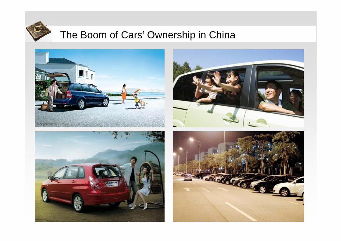
The Boom of Cars’ Ownership in China

Traffic Jams in Big Cities

Fog and Haze in Beijing

The Potentiality of Smart Traffic (ST) in ChinaCivilian car ownership in China continued rapid growthCivilian car ownership in China continued rapid growth
3.160 3.697 4.358 5.100
6.281
7.802
10.578
17,02% 17,88% 17,01%
23,16%24,22%
35,58%
0%5%10%15%20%25%30%35%40%
0
2.000
4.000
6.000
8.000
10.000
12.000
2005 2006 2007 2008 2009 2010 2011
民用汽车保有量(万辆) 保有量增长率Growth rate of civilian car ownership
Road construction speed is much lower than car ownership growthRoad construction speed is much lower than car ownership growth
335 346
358 373 386
401 408
3,34%3,67% 4,09%
3,50% 3,82%
1,78%
0%
1%
2%
3%
4%
5%
0
100
200
300
400
500
2005 2006 2007 2008 2009 2010 2011
中国公路里程(万公里) 公路里程增长率Growth rate of China highway mileage
The rate of passenger car equipped with navigation system is low in ChinaThe rate of passenger car equipped with navigation system is low in China
0%
1%
2%
3%
4%
5%
6%
7%
8%
0
200
400
600
800
1.000
1.200
1.400
1.600
2006 2007 2008 2009 2010 2011
加载交通信息车销量(万辆) 前装导航车销量(万辆)乘用车销量(万辆) 前装导航搭载率交通信息搭载率
Mobile Internet is growing rapidlyMobile Internet is growing rapidly
7.305 11.760
15.548
23.344 27.678 30.273 31.768
35.558
25.300 29.800
33.800 38.400
42.000 45.730
48.500 51.310 69,30%
-10%
0%
10%
20%
30%
40%
50%
60%
70%
0
10000
20000
30000
40000
50000
60000
2008,06 2008,12 2009,06 2009,12 2010,06 2010,12 2011,06 2011,12
移动互联网网民数 桌面互联网网民数 移动互联网网民比例
Civilian car ownership (ten thousand vehicles)
China highway mileage(ten thousand kilometers)
Mobile Internet users
Desktop Internet users
Ratio of mobile Internet users
Vehicles loaded with TIS (ten thousand)
Load rate of vehicles pre-equipped with navigation system
Load rate of TISPassenger car(ten thousand vehicles)
Vehicles pre-equipped with navigation system (ten thousand)

Supports for Energy Efficiency and Environment Improvement
Till 2015, the new investment in intelligent transportation is expected to reach
RMB 2.5 billion, according to Ministry of Transport of the People’s Republic of
China in 2011
In 2011, a set of critical targets for energy conservation and emission reduction
has been set in the 12th Five-Year-Plan
By the end of 2013, a lot of smart traffic related projects with huge investment
have been approved by the government, such as China Dynamic Navigation
and Traffic Information Service Platform (RMB 35 million) and Cloud Platform of
Intelligent Logistics (RMB 65 million) etc.
Support from the Government

2. Architecture

Data Source
Mobile Sensors
Sensors
Events
Data Processing
Data Service Platform
Data Service
Weather : internet
Operation Management System
RDS-TMCFM-RTICDigital Broadcasting
IP-TMCIP-RTICIP-TPEG
Terminal Equipment
Framework

11
Taxi
MyCar
Truck
Mobile
Parking
Gas Price
Incident
Flight
WeatherEtc. Smart Traffic Processing System
Raw Data Warehouse
Pre-Processing Module
Real-time Pre-Processing
Off-line Pre-Processing
Feature Data Warehouse
Analysis and Mining Module
User-Trigger Analysis and
Mining
Real-time Analysis and MiningResult Database
Distributed
Message
Queue
Applications
Cache DataGIS
Engine
V-OMS
Data Managem
ent
Data Managem
ent
System Monitoring
System Monitoring
Device Monitoring
Device Monitoring
Quality Evaluation
Quality Evaluation
Etc.Etc.
RESTful API SQL API JS API
Graphical Data Display
API
Data Platform
Data Analytics & Apps
Data Processing

Aggregation Processing&Fusion Convert
Data Caching System.TransmitTransmit Online data providerOnline data provider
Data Warehouse
FCD User logs GIS-T…….
Data MiningQB HTI D.Q.E User
Behavior……
Visualized operation management system
Socket
Directory
DaaSI/F
Traffic Data Center Data InterfaceFM Service• FM-RTIC• RDS-TMC
Online Traffic Service
• IP-RTIC• IP-TMC• IP-TPEG• SIGRA/Text/Voice• DPOI Search
Online Transportation Application Service
• GIS-T• Dynamic Routing• ECO/EV Service• Traffic Eyes• ……
D-POI
Pre-research• Mini FCD• Traffic Simulator• Traffic Location Reference• ……
Products & Services
Data Management Operation monitor system Device management ……
DataPush
Data source:Floating Car Data > 500,000 / minFrequency:60sService pattern:FM broadcast, internet, interactive service、personalized serviceStandard:RTIC/TMC/TPEG
Real time
Near Line
Off Line
Services

In vehicle navigation
Internet and LBS
ChinaSiwei
Map
SmartTrafficservice
New Busine-
ss
Big Data
ADAS
LBSInternet GIS
GPS phone navigation
The Business Structure
E-com Soc. Net.
Dyn. Traf.
Dyn. Met.
Dyn. PeopleFlows
Dyn. Googs
Dyn. Eve.

3. Key Points

The BeiDou Navigation System
Globe Navigation Techniques
Positioning Precision : 10m
Velocity Precision : 0.2m/s
Timing Precision : 20ns
Region Covered:
Asia-Pacific(currently)
All over the world(since 2020)
BeiDou Ground-based Augmentation
Correction information
BeiDou Short MessageBeiDou Navigation
Continuously Operated Reference
System

User Benefits Enables precise guidance of Airports, Railway
Stations and Shopping Centers.
Features Map content: shops, businesses, stairs, escalators,
elevators, restrooms, entrances and exits, terminals and airport gates
Routing Engine: features point to point navigation, multi-floor navigation using different routing options (stairs, escalator, elevator)
Coverage 2012Q4: Beijing (Sample)
Indoor Navigation Techniques

Establishment of Geo-database (Part 1)
Satellite Remote Sensing Image
All�over�the�China——Multi-scales,�Multi-themes�and�Multi-resolutions

Establishment of Geo-database (Part 2)
Aerial Remote Sensing Image

Establishment of Geo-database (Part 3)
PG�Raw�Data
PG�Raw�Image
Panorama
Hexahedral�Image
Data�Application
1
2
3 4 5
6
Original�Street�View�Data�
Laser�Point�cloud�Overlaid�Street�View
Detail�of�Street�View
Data�Processing
Street View Map

Establishment of Geo-database (Part 4)
High-precision Navigation Map
Refined�Traffic�Lane
Slope�&�Curvature
Subjects SpecificationCoverage 2843 counties
POI Number 11,300,000
Road Length 3.74 million km
Update
Highway 21 day per version
Top 50 cities 4 version per year
Other regions 2 version per year

Dynamic Information Service
Dyn. Met.Dyn. Pop. Dyn. GoodsDyn. Trf.
Utilities for data fusing, extraction, statistic etc.
Microwave Detection
Induction coilTravel time Detection
Radar
Camera Call center
WeatherStation
Cell phone Probe VehicleGate
BeiDou NavigationSystem

• Location�analysis�on�terminal�devices• Data�analysis on�user�behavior
Big Data Analysis
Transportation�Allocation
ServiceExpansion
Infrastructure�Planning
AbilityEnhancement
Emergency�Response
IntelligentizePrecision Abundant

4. Applications

Heilongjiang
Jilin
Liaoning
Beijing
Hebei
Shandong
Neimenggu
Fujian
Hainan
Guangxi
Shanxi
Anhui
Jiangxi
Henan
Hubei
Hunan
Chongqing
Sichuan
Guizhou
Yunnan
Tibet
Ningxia
Xinjiang
Shannxi
Qinghai
Gansu
Changchun
Chengdu
Changsha
Fuzhou
Shenyang
Wuhan
Nanjing
Taiwan
Ningbo
Suzhou
Wuxi Shan
ghai
Jiangsu
Wenzhou
Xiamen
Jinhua
Taizhou
Zhejiang
Hangzhou
Jiaxing
Zhuhai
Zhongshan
GuangdongGuang
zhouDongguanShenz
hen
Foshan
Shijiazhuang
Qingdao
Kunming
Xian
Taiyuan
Nanning
Tianjin
Domestic coverage: 34 big cities in China 2014
Intra-city Dynamic Traffic Information service
International coverage: Saudi ArabiaUAEThailand Indonesia Malaysia

25
Pearl River Delta region
Beijing-Tianjin area
Yangtze River Delta region
Inter-city Dynamic Traffic Information service

• Real-time traffic diagram
• Customize area traffic
• Traffic condition sharing
• Track sharing
• Track review
• Points, rank, badge rewarding
Traffic Eye APP
Coverage: More than 200k active users per day

Government
Enterprises Drivers
Vehicle Information Service Platform
ThematicNavigation
Vehicle Dynamic
Monitoring
Driver Assistance
DriverInteraction
Transport Capacity
Transport & Logistics
Dispatching
Decision Support
Policy Publish
Park Administration
Enterprise Portal
Goods Track
Driving Behavior Analysis
Vehicle Monitoring
Coverage: More than 150k commercial vehicles are managed in this platform

Highway & Meteorology Information Service
• National highway inquiry
• National weather warning
• Live road weather
• Real-time road closure
information
• Dynamic traffic information
Coverage: Around 1 million visits per day

Advaced Driver Assistance System
Calculating�the�camber�radius�and�the�maximum�safe�
speed
Identifying�segments�with�
frequent�accidents
Identifying�dangerous�segments
Speed- limitation
Providing�slope�information�for�
predictable�driving�actions
Judging�the��direction�of�headlights
Forecasting�security�condition�on
passing�zones
Identifying�abnormal�swing�glide�on�the�road
Lane level navigation map & dynamic traffic information
Coverage: 5 provinces in North China will be covered by the end of 2016

Telematics(Fun Drive)
Navigation Service
Safety Service
Life- Info
Interactive Service
Voice Service
Secretary Service
• Real-time traffic info• One-click navigation• Send to car
• Emergency service & roadside assistance
• Theft tracing• Remote control• Online diagnostics
• News & weather• Ticket service• Gas price info• Driving regular violation
query, payment online• Road book• Multi-conversation• Content sharing
with friends
• ASR• TTS
• Vehicle reports• Maintenance
suggestions• Designated driver info
Telematics
Coverage: Around 500k registered users
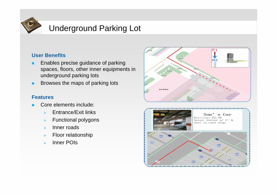
User Benefits Enables precise guidance of parking
spaces, floors, other inner equipments in underground parking lots
Browses the maps of parking lots
Features Core elements include:
Entrance/Exit links Functional polygons Inner roads Floor relationship Inner POIs
Underground Parking Lot

Indoor map
Indoor Positioning and Routing Application - Funwalk
Coverage: 180 locations in 4 cities, plan to cover 380 locations in 30 cities in 2014
Funwalk APP
Yansha Mall APP—Integrated into SAMSUNG

IntelligentLogistics
Vehicle�monitoring
Advertisement�Marketing
E-Business
IntelligentTravel
Traffic�Management
Urban�Security
Traffic�Monitoring
Administrative�Management
Urban�plan
Calling�Center
Emergency�Management
PUBLIC
IntelligentHealthcare
InteractiveCommunication
Navigation
IntelligentShopping
Dynamic�Trafficinformation
Industries
Government
Smart Traffic
Prospect

5. Conclusion

Conclusions
Abundant database, including the high-precision Geodata, the dynamic
data, makes traffic come to be smart and reliable.
Merged by GIS, mobile network, big data analysis and navigation
techniques, Smart Traffic has created a lot of applications which are
attractive and useful for users.
Smart Traffic is a creative industry with huge industrial prospects and
opportunities, we are looking forward the international cooperation to
promote the progress in Smart Traffic applications and improve the life
quality of humankind.