city council study session memorandum
TRANSCRIPT

To: Mayor and City Council From: Charles Ozaki, City and County Manager Prepared by: Kevin Standbridge, Deputy City and County Manager
Kristan Pritz, Director of Open Space and Trails David Allen, Director of Public Works
Meeting Date Agenda Item #
November 15, 2016 1
Agenda Title Presentation on Draft Rocky Mountain Greenway Feasibility Study: Broomfield to Boulder
Summary
• As part of the federal American Great Outdoors (AGO) initiative, the Department of the Interior (DOI) is working to connect urban refuges through an interconnected system of trails called the Rocky Mountain Greenway (RMG) in the Denver metro area.
• The vision for this regional trail is to connect the Rocky Mountain Arsenal National Wildlife Refuge (Rocky Mountain NWR), Two Ponds National Wildlife Refuge (Two Ponds NWR), Rocky Flats National Wildlife Refuge (Refuge), and Rocky Mountain National Park. The RMG is either a 10-foot concrete or crusher fines trail depending on terrain and existing trail connections.
• Broomfield supported the construction of the RMG on the southern edge of the Great Western Open Space, and this segment of the trail is now open. This location was addressed through the first RMG Feasibility Analysis that focused on a trail from Westminster to Broomfield.
• On May 10, 2016, City Council reviewed a proposed alignment for the construction of the trail as part of the Federal Land Access Program Grant (Grant) application. More recently, the Draft RMG Feasibility Study: Broomfield to Boulder (Draft Study) has been completed to review potential alignments for the same trail. Comments on the study are due by November 30.
• The Grant allows for a grade-separated overpass at Indiana Street spanning both that roadway and the future Jefferson Parkway, and an underpass at State Highway 128 that accesses the City of Boulder’s trail system. These grade-separated crossings would connect to trails on the Refuge that the USFWS is planning to construct in 2017 and 2018. This Grant does not include funding for the portion of the trail through the Refuge, which will be provided by the USFWS.
• Jefferson County (Jeffco) requested that the City and County of Broomfield, City of Westminster, City of Arvada, City of Boulder, and Boulder County become financial partners in the Grant by each providing a contribution to the Grant match.
• The estimated total grant request is $6,501,075, and the estimated local match of 17% is $1,118,835. • Each partner’s proposed estimated contribution to the Grant match is based generally on the cost of the improvements that are within and/or that specifically
benefit that entity’s jurisdiction. Jeffco, Arvada, and Westminster would each contribute $218,318. Boulder County and the City of Boulder would each contribute $184,170. Broomfield’s proposed match is $95,539 plus a 10% contingency added by Broomfield staff or $105,000.
• At the May 10 meeting, City Council approved Resolution No. 2016-73 that stated: 1) Broomfield will participate in the Grant as a partner to construct the RMG from the east side of Indiana Street to the north side of State Highway 128, excluding that portion of the RMG that crosses the Refuge; 2) Broomfield intends to provide a Grant match, subject to future City Council approval, which shall not exceed $105,000; 3) Any maintenance responsibilities for the RMG will be subject to City Council approval, excluding standard trail maintenance on Broomfield-owned property; 4) the RMG design must accommodate the future Jefferson Parkway; 5) the Broomfield Mayor or Mayor Pro-tem is authorized to sign the RMG Letter of Participation; and 6) Broomfield’s contribution is subject to conditions as outlined in the Letter of Participation that included soil sampling for the RMG along the trail route within the Refuge. If the Grant is approved, Broomfield’s contribution up to $105,000 is subject to future City Council review and approval. This approval would include Council action related to a budget amendment to appropriate the funds for Broomfield’s match. A copy of the letter is included as Attachment 1.
• The May 10 City Council memorandum also noted that the USFWS and FHWA indicated that a specific crossing location over Indiana Street and a specific trail alignment through the Refuge have not been finalized and will ultimately be determined by the USFWS, FHWA, and the Grant Partners with input from the Jefferson Parkway Public Highway Authority.
• Over the past year and a half, the Central Federal Lands, Federal Highway Authority (FHWA) initiated the Draft RMG Feasibility Study to determine how the RMG should extend from Broomfield, through the Refuge and north to Boulder.
• The project stakeholders included the City of Boulder, Boulder County, Colorado Department of Transportation, Colorado State Parks, FHWA, Jefferson County, Town of Lyons, Town of Superior, and United States Fish & Wildlife Service (USFWS). The City and County of Broomfield staff commented on the segment of the Draft Study related to the RMG trail from Broomfield to the Refuge.
• The Draft Study 1) summarizes research findings related to natural, cultural, and transportation resources, including trails; 2) describes potential trail alignments to access the Refuge; and 3) identifies cost estimates for each potential trail alignment. (Attachment 2)
• FHWA is requesting public comments on the Draft Study by November 30, 2016. • On October 27, 2016, the Open Space and Trails Advisory Committee (OSTAC) reviewed the Draft Study and commented. • Given the various access points into the Refuge identified in the Draft Study, OSTAC recommends that the preferable access point for the RMG from Broomfield
into the Refuge be located at the northwest corner of Broomfield’s Great Western Open Space. OSTAC’s reasons for this recommendation are explained in the memo.
• The Grant is one of the finalists for funding but has not been officially approved. Work has also begun on defining the protocol for the soil sampling plan. The communities are discussing the sampling locations and sharing costs.
• Staff is requesting that City Council comment on the Draft Study so that staff can pass these comments on to FHWA staff by the comment deadline of November 30. The project is planned to be completed once comments are received and incorporated into the Draft Study.
Prior Council Action
• On June 22, 2012, the City and County Manager's office sent an email discussing the general concept for RMG Phase 1 to City Council. • On April 23, 2013, the City Council received information about the RMG in a special report. No official action was requested. • On October 22, 2013, City Council approved Resolution No. 2013-175 to allow the construction of the RMG Trail on the southern edge of the Great Western Open
Space. • On May 10, 2016, City Council approved Resolution No. 2016-73 to authorize the City and County of Broomfield to be a partner in the Federal Lands Access
Program Grant for the Extension of the Rocky Mountain Greenway with conditions.
Financial Considerations N/A
Alternatives
N/A.
Proposed Actions/Recommendations Staff is requesting council comments on the Draft Study to pass on to FHWA so that the Draft Study can be finalized.
City and County of Broomfield, Colorado
CITY COUNCIL STUDY SESSION MEMORANDUM
Item 1 - Page 1

Rocky Mountain Greenway Trail Page 2
BACKGROUND
Central Federal Lands, Federal Highway Authority (FHWA) is requesting comments from stakeholders on the Draft Rocky Mountain Greenway Feasibility Study: Broomfield to Boulder (Draft Study) (Attachment 2). City Council comments will be passed on to the FHWA so that the project can be finalized. The following background provides information on the project and previous City Council actions.
Rocky Mountain Greenway
As part of the federal American Great Outdoors (AGO) initiative, the Department of the Interior (DOI) is working to connect urban refuges through an interconnected system of trails called the Rocky Mountain Greenway (RMG) in the Denver Metro Area. The RMG is also one of 16 trails included in Governor Hickenlooper’s “Colorado the Beautiful” 2016 initiative. The vision for this regional trail is to connect the Rocky Mountain Arsenal National Wildlife Refuge (Rocky Mountain NWR), Two Ponds National Wildlife Refuge in Arvada (Two Ponds NWR), Rocky Flats National Wildlife Refuge (Refuge) in Jefferson County, and Rocky Mountain National Park. The RMG is either a 10-foot concrete or crusher fines trail depending on terrain and existing trail connections. The map below shows the conceptual route for the RMG. Upon completion, the entire RMG is estimated to be about 80 miles long. Of this total mileage, 27 miles have been built or connected through existing trails.
The first segment of the RMG from the Sand Creek Trail to the Rocky Mountain Arsenal NWR on the east side of the Denver Metro Area is approximately three miles long and was
Item 1 - Page 2

Draft Rocky Mountain Greenway Feasibility Study: Broomfield to Boulder Page 3 constructed around 1998-2000. This trail connects to a series of existing trails in the Denver Metro Area. The second segment closed the trail gaps among the Rocky Mountain Arsenal NWR, the Refuge, and the Two Ponds NWR up to the east side of Indiana Street at the southwest corner of Broomfield’s Great Western Open Space. This segment is 9.7 miles long. The partnership for the second segment of the RMG included Westminster, Arvada, Broomfield and FHWA. A Feasibility Study was also completed to look at various routes. On October 22, 2013, the Broomfield City Council passed Resolution No. 2013-175 that approved the construction of the RMG on the southwest corner of Great Western Open Space by FHWA, subject to further design development and environmental research and Broomfield agreeing in concept to maintain the RMG. The maintenance of the RMG within Broomfield is estimated to be $200 annually. The segment of the RMG in Broomfield is open to the public, is approximately .3 miles long, and includes an overlook/turnaround at the end of the trail.
Federal Lands Access Program Grant
On May 10, 2016 City Council also reviewed a related request for Broomfield to participate in a proposed grant called the Federal Lands Access Program Grant (Grant) for the next phase of the RMG. The Grant allows for a grade-separated overpass at Indiana Street spanning both that roadway and the future Jefferson Parkway located at the southwest corner of Great Western Open Space and an underpass at State Highway 128 that accesses the City of Boulder’s trail system. These grade-separated crossings would connect to planned trails on the Refuge that the United States Fish & Wildlife Service (USFWS) is planning to construct in 2017 and 2018. This Grant does not include funding for the portion of the trail within the Refuge. The map below depicts this proposed trail and crossing plan. Funding for the trail on the Refuge will be provided by the USFWS.
The May 10 City Council memorandum noted that the USFWS and FHWA indicated that a specific crossing location over Indiana Street and a specific trail alignment through the Refuge
Item 1 - Page 3

Draft Rocky Mountain Greenway Feasibility Study: Broomfield to Boulder Page 4 have not been finalized and will ultimately be determined by the USFWS, FHWA, and the Grant Partners with input from the Jefferson Parkway Public Highway Authority. The above map shows a potential access point into the Refuge from the Broomfield overlook at the southwest corner of Great Western Open Space. This crossing location was used to provide a cost estimate for the Grant. The Draft Study that is discussed later in the memorandum goes into more detail about other potential access points from Broomfield into the Refuge. Jefferson County (Jeffco) requested that the City and County of Broomfield, City of Westminster, City of Arvada, City of Boulder, and Boulder County become financial partners in the Grant by each providing a contribution to the Grant match. The estimated total grant request is $6,501,075, and the estimated local match of 17% is $1,118,835. Each partner’s proposed estimated contribution to the Grant match is based generally on the cost of the improvements that are within and/or that specifically benefit that entity’s jurisdiction. Jeffco, Arvada, and Westminster would each contribute $218,318. Boulder County and the City of Boulder would each contribute $184,170. Broomfield’s proposed match is $95,539 plus a 10% contingency added by Broomfield staff for a total of $105,000. At the May 10 meeting, City Council approved Resolution No. 2016-73 that stated: 1) Broomfield will participate in the Grant as a partner to construct the RMG from the east side of Indiana Street to the north side of State Highway 128, excluding that portion of the RMG that crosses the Refuge; 2) Broomfield intends to provide a Grant match, subject to future City Council approval, which shall not exceed $105,000; 3) any maintenance responsibilities for the RMG will be subject to City Council approval, excluding standard trail maintenance on Broomfield-owned property; 4) the RMG design must accommodate the future Jefferson Parkway (Parkway); 5) the Broomfield Mayor or Mayor Pro-tem is authorized to sign the RMG Letter of Participation (Attachment 1); and 6) Broomfield’s contribution is subject to conditions as outlined in the Letter of Participation that included soil sampling for the RMG along the trail route within the Refuge. The communities are discussing the sampling locations and sharing costs. If the Grant is approved, Broomfield’s contribution up to $105,000 is subject to future City Council review and approval. This approval would include Council action related to a budget amendment to appropriate the funds for Broomfield’s match.
DRAFT ROCKY MOUNTAIN GREENWAY FEASIBILTY STUDY: BROOMFIELD TO BOULDER
Over the past year and a half, FHWA initiated a second RMG Feasibility Study to determine how the RMG should extend from Broomfield, through the Refuge and north to Boulder. The Draft RMG Feasibility Study: Broomfield to Boulder (Draft Study) identifies several options for RMG access from Broomfield to the Refuge. (Attachment 2) The project stakeholders included the City of Boulder, Boulder County, Colorado Department of Transportation, Colorado State Parks, FHWA, Jefferson County, Town of Lyons, Town of Superior, and USFWS. Broomfield staff focused its participation on reviewing the segment of the Draft Study related to the RMG trail from Broomfield to the Refuge. The Draft Study 1) summarizes research findings related to natural, cultural, and transportation resources, including trails; 2) describes potential trail alignments that connect to the existing trail network; and 3) identifies rough cost estimates for each potential trail alignment. Stakeholders also had the opportunity to make recommendations on changes to the narrative of the Draft Study.
Item 1 - Page 4

Draft Rocky Mountain Greenway Feasibility Study: Broomfield to Boulder Page 5 FHWA is requesting public comments on the Draft Study by November 30, 2016. The proposed options for access are shown on Figure 7, page 12 and Figure 8, page 13 of Attachment 2. The options for access from the RMG overlook in Broomfield into the Refuge include:
• Point E extends directly west from the RMG overlook on the southwest corner of Great Western Open Space across Indiana Street via an overpass into the Refuge. (Figure 7)
• Point F extends from the RMG overlook through the Skyestone neighborhood and heads north and west through Great Western Open Space and accesses the Refuge by an underpass beneath Indiana Street. This option is shown in Figure 7 of the Draft Study and below in more detail.
• Point J allows for access from the RMG Overlook through the Skyestone neighborhood and heads north along the east boundary of Broomfield up to State Highway 128 and extends along the north side of State Highway 128 to the Refuge at Point D. (Figure 8)
In addition, the option below was identified that completely bypasses the Refuge. • Point H runs from the RMG Overlook east and north up to the future trail associated with
the Parkway north to the US 36 Bikeway and then heads west into Boulder. This option does not provide a direct connection into the Refuge and is dependent on the future construction of the Parkway. (Attachment 2). (Figure 8)
The Draft Study considered other alignment options in the vicinity of McCaslin Boulevard; however, these potential alignments were eliminated due to the steep terrain between Rock Creek and the Coalton Trailhead.
Item 1 - Page 5

Draft Rocky Mountain Greenway Feasibility Study: Broomfield to Boulder Page 6 The map below shows the access point from Broomfield into the Refuge in the original Comprehensive Conservation Plan (CCP) that is located on the northwest corner of Great Western Open Space. The CCP was completed in 2005. This access point (blue arrow in the upper right-hand corner of the CCP Map) was selected after an extensive regional planning process that was conducted by the USFWS. Point F in the Draft Study matches the access point identified in the CCP.
• On October 27, 2016, the Open Space and Trails Advisory Committee (OSTAC) reviewed the
Draft Study and commented. After review of the various access points into the Refuge identified in the Draft Study, OSTAC recommends that the preferable access point for the RMG from Broomfield into the Refuge be located at the northwest corner of Broomfield’s Great Western Open Space. This location is Point F identified in Figure 7 on page 12 of the Draft Study. Access at Point F is recommended because this location: 1) is identified in the original Comprehensive Conservation Plan for the Refuge that included a robust public participation process and looked closely at environmental information within the Refuge; 2) has previously documented lower residual contamination testing results within the agreed upon allowable limit when compared to the southeast corner of the Refuge; 3) does not necessitate a trail system within the Refuge that requires the crossing of Walnut Creek, a sensitive environmental area, to reach the proposed Multi-Purpose Building located on the northeast corner of the Refuge; 4) is identified in Broomfield’s Open Space, Parks, Recreation and Trails Master Plan; and 5) accommodates the future Parkway without requiring potential adjustments to the crossing structure when the Parkway is built. OSTAC underscored that it is important that the USFWS continue to keep in its internal Refuge trail plan the connection from Point F to the future multi-purpose building and underpass beneath State Highway 128 at Point D.
OSTAC also noted that the Draft Study states that F has an estimated cost of $2.8 million in contrast to Point E at the southwest corner of the Great Western Open Space that has a cost of $2.2 million. While the cost of Point F is $600,000 more than Point E, it was suggested that the cost estimates should be reviewed more closely before the Draft Study is finalized to perhaps identify potential cost savings.
Item 1 - Page 6

Draft Rocky Mountain Greenway Feasibility Study: Broomfield to Boulder Page 7 Additional environmental study, public input and review, cost estimate updates, and local decision-making processes will refine the final trail characteristics and alignment. City Council’s comments will be incorporated into the FHWA’s work plan to refine the Draft Study into a final document. The final document will be completed once comments are collected and the Draft Study is updated.
Item 1 - Page 7
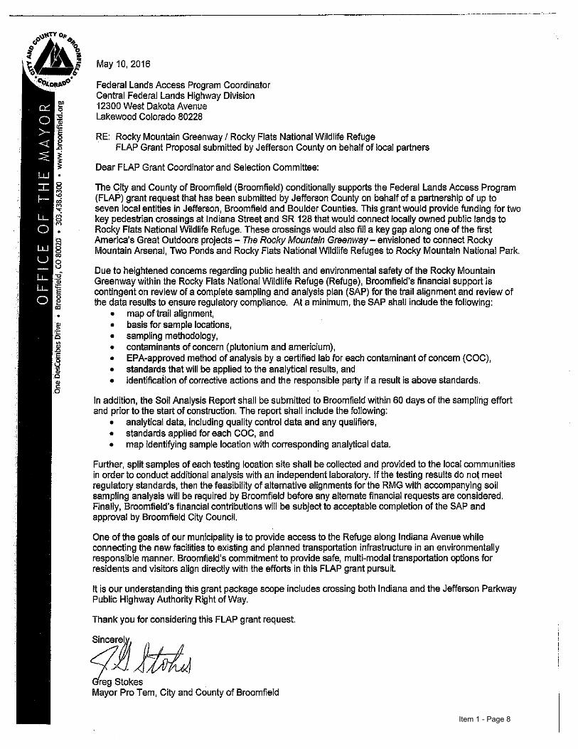
Item 1 - Page 8

1
Rocky Mountain Greenway Phase 1: the City of Broomfield to the City of Boulder
America’s Great Outdoors Rocky Mountain Greenway Feasibility Study Phase 1: Broomfield to Boulder
July 2016
Prepared by
Item 1 - Page 9

Feasibility Study | July 2016
i
Table of Contents Introduction .......................................................................................................... 1
Background and Previous Studies ........................................................ 1
Study Area ............................................................................................ 1
Core Team Collabora on ..................................................................... 1
Data Collec on ..................................................................................... 2
Site Visits ............................................................................................... 2
Cost Es mates ...................................................................................... 2
Relevant Plans ...................................................................................... 3
Project Phasing ..................................................................................... 5
Environmental Considera ons ............................................................. 6
Segment 1: Through Rocky Flats National Wildlife Refuge ............................................................................................. 9
Poten al Alignments .......................................................................... 11
Transit Connec ons ............................................................................ 13
Environmental Considera ons ........................................................... 14
Segment 2: North of Rocky Flats National Wildlife Refuge to Urban Boulder ......................................................................... 15
Poten al Alignments .......................................................................... 17
Transit Connec ons ............................................................................ 19
Environmental Considera ons ........................................................... 20
Segment 3: Through the City of Boulder ..................................... 21 Poten al Alignments .......................................................................... 23
Transit Connec ons ............................................................................ 23
Environmental Considera ons ........................................................... 24
Item 1 - Page 10

ii
Rocky Mountain Greenway Phase 1: the City of Broomfield to the City of Boulder
Acknowledgements Jefferson County Parks and Open Space
Town of Superior
Town of Lyons
City and County of Broomfield
Boulder County Commission
Boulder County Transporta on
Boulder County Open Space
City of Boulder, Open Space and Mountain Parks
City of Boulder, GO Boulder
City of Boulder, Parks and Recrea on
Colorado Department of Transporta on
Colorado Department of Natural Resources
Colorado Parks and Wildlife
Project Team Federal Highway Administra on, Central Federal Lands Highway Division
U.S. Fish and Wildlife Service, Region 6
Atkins North America, Inc.
PKM Design Group, Inc.
13th Street bike lane in
downtown Boulder. View looking south.
Item 1 - Page 11

Feasibility Study | July 2016
1
The Rocky Mountain Greenway (RMG) supports the America’s Great Outdoors (AGO) initiative with ongoing efforts to better connect urban units of the U.S. Fish and Wildlife Service (FWS) refuge system to the metropolitan areas in which they are located. As a part of this initiative, this project involves evaluating feasible trail connections and alignments between Rocky Flats National Wildlife Refuge (NWR), through Boulder County and the City of Boulder, to the Town of Lyons.
This feasibility study summarizes the findings of the site visits, considers stakeholder input, and evaluates exis ng facili es. It describes the general start and end points of the exis ng trails; considers natural, cultural, and mul ple transporta on resources; and describes poten al trail alignments, ameni es, and connec ons to the exis ng trail network. Future stages of this project will further refine the final trail characteris cs and alignment through greater environmental study, public input and review, and local decision making processes.
Background and Previous Studies The AGO ini a ve is an effort undertaken by the federal government to partner with states, tribes, and local communi es to protect and encourage recrea on and conserva on ac vi es across the country. AGO seeks to empower local agencies to improve access to natural resources, such as open space and wildlife refuges.
In March 2012, U.S. Secretary of the Interior Ken Salazar and Colorado Governor John Hickenlooper formalized the RMG Project, a federal, state, and local partnership to create a con nuous trail/transporta on connec on between Rocky Mountain Na onal Park and the Rocky Mountain Arsenal. A steering commi ee, appointed by the Governor’s office, guides planning processes for the trail based on an overarching vision to:
“Create uninterrupted trails and transporta on linkages connec ng the Denver metro area’s trail systems, the three na onal wildlife refuges in the metro region, Rocky Mountain Na onal Park, and the community trail systems in between.”
This vision is backed by the Colorado the Beau ful ini a ve and its “16 in 2016” plan. The Colorado the Beau ful ini a ve aims to build and enhance partnerships to grow and connect outdoor recrea onal resources statewide. As part of this, Governor Hickenlooper and the Colorado Department of Natural Resources (DNR) iden fied the RMG as one of the 16 in 2016 trails. The 16 in
2016 is a list of the 16 highest priority statewide trails that are targeted for construc on in 2016.
A previously completed feasibility study for a 7.5‐mile sec on of the RMG in the ci es of Arvada, Westminster, and Broomfield iden fied feasible trail connec ons between Two Ponds NWR and Rocky Flats NWR using both exis ng and newly constructed mul ‐use trails. This previous feasibility study was completed in 2013; construc on will be complete in the summer of 2016.
More informa on about the RMG may be found at www.rockymtngreen way.org.
Study Area The study area includes Rocky Flats NWR, the counties of Boulder, Jefferson, and Broomfield, and the cities and towns of Superior, Louisville, Boulder, Longmont, and Lyons. The study area is roughly bounded by U.S. Highway 36 (US 36) to the west, U.S. Highway 287 (US 287) to the east, State Highway 66 (SH 66) to the north, and Rocky Flats NWR to the south. An overview of the entire study area is shown in Figure 1.
Core Team Collaboration Local agency representatives played a major role in the development of this feasibility study. They collaborated throughout the study to share information, interests, and values related to the Rocky Flats NWR to the Town of Lyons section of the trail. The Core Team is made up of federal, state, and local representatives from the following agencies:
City of Boulder
Boulder County
Colorado Department of Transportation (CDOT)
Colorado State Parks
Federal Highway Administration, Central Federal Lands Highway Division
Jefferson County
Town of Lyons
Town of Superior
U.S. Fish and Wildlife Service
Introduction Figure 1. Study Area
Item 1 - Page 12

2
Rocky Mountain Greenway Phase 1: the City of Broomfield to the City of Boulder
The Core Team met throughout the development of this study to define the purpose of the project, review project deliverables for consistency and correctness, and collaborate to eliminate unfeasible design options and alignments. Additionally, the Core Team worked together to share information and discuss impacts of the project specific to each jurisdiction. The City and County of Broomfield commented on the segment of the report related to the RMG trail from Broomfield to Rocky Flats.
Data Collection Geographic information was collected from local jurisdictional databases, including the City of Boulder, Boulder County, the Denver Regional Council of Governments (DRCOG), and the U.S. Department of Agriculture. The information provided included:
Municipal boundaries
Existing trails
Planned trails
Existing road network
Existing transit network
Environmentally sensitive areas
Site Visits Three site visits were conducted with staff from the Core Team (FWS, Boulder County, the City of Boulder, the Town of Superior, and the Town of Lyons). The purpose of each site visit was to work with agency staff to iden fy exis ng and planned trail characteris cs, poten al trail alignments, and constraints within each jurisdic on. The dates and loca ons of site visits are shown in Figure 2.
The following principles were evaluated while scoping the conceptual trail alignments, trail connec ons, and poten al trailheads:
The trail should be a con nuous path for non‐motorized users that conforms to American Associa on of State and Highway Transporta on Officials (AASHTO) trail design standards.
The trail should support, where feasible, a mix of wheeled and pedestrian uses and a mix of recrea onal and u litarian travelers including families and children.
The trail system should serve as a regional trail corridor connec ng Rocky Mountain Arsenal NWR, Two Ponds NWR, Rocky Flats NWR, Colorado Front Range Trail, and local trails.
Trails and trail facili es should be designed to minimize adverse impacts to wildlife, natural areas, exis ng trails, and other environmental features.
Alignments should use the exis ng trail network as much as possible.
Trail improvements should not alter the character of exis ng trails.
All trails and trail improvements should balance reasonable financial constraints with design excellence.
Date Jurisdic on
May 4, 2015 Rocky Flats NWR, FWS
June 4, 2015 Boulder County, City of Boulder, Town of Superior
August 4, 2015 Boulder County, Town of Lyons, City of Boulder, and City of Longmont
Figure 2. Site Visits Trail improvements and addi ons should minimize visual intrusion and impact on surrounding environments.
Where feasible, at‐grade crossings should be avoided in preference of grade‐separated crossings, such as underpasses and overpasses.
Trail alignments should strive to serve mul ple purposes, such as recrea on, transporta on, drainageway maintenance, emergency access, etc.
Youth volunteers and local communi es should be involved in the subsequent planning, design, construc on, management, and maintenance ac vi es of the trail (where feasible) to foster community stewardship of the trail.
Cost Estimates Based on trail alignment scoping assump ons, preliminary cost es mates were calculated for the trail segments where new trail, or trail improvements, are being proposed. These cost es mates are based on 2016 dollars and use standard engineering assump ons to account for design, construc on, and oversight. These assump ons include:
Material costs
20 percent con ngency
10 ‐ 12 percent design costs
10 percent construc on engineering costs
5 percent Federal Highway Administra on, Central Federal Lands Division oversight costs
These cost es mates are intended to provide a planning‐level analysis to assist in the future decision‐making process at the local level. More detailed cost es mates will be necessary for future phases of project development.
Item 1 - Page 13

Feasibility Study | July 2016
3
Boulder County Comprehensive Plan (1999)
Northwest Quadrant Feasibility Study (2001)
St. Vrain Creek Corridor Open Space Management Plan (2004)
St. Vrain Creek Trail Master Plan (2004)
Rocky Flats NWR Comprehensive Conserva on Plan (2005)
Town of Superior Parks, Recrea on, Open Space, and Trails Master Plan (2005)
City of Boulder Open Space and Mountain Parks (OSMP) Visitor Master Plan (2005)
City of Boulder OSMP Marshall Mesa Southern Grasslands Trail Study Area Plan (2005)
City and County of Broomfield Open Space, Parks, Recrea on and Trails Master Plan (2005)
Town of Lyons Parks, Open Space, and Trails Master Plan Update (2008)
Colorado Front Range Trail Plan (2007)
Boulder County Comprehensive Plan Transporta on Element Update (2009)
Relevant Plans In general, exis ng plans for the region show a con nued commitment to open space connec vity, non‐motorized transporta on op ons, expanded recrea onal and educa onal opportuni es, and long‐term public health. Many of the jurisdic ons directly adjacent to the proposed trail have plans that specifically men on a focus on local connec ons to the exis ng and proposed regional trail network as a key element to mee ng their long‐term visions. A full list of relevant planning documents is shown in Figure 3.
Rocky Flats NWR In 1996 the Rocky Flats Cleanup Agreement was signed which began the process of cleaning up the hazardous materials located at the Rocky Flats Plant. Since then, there has been extensive environmental clean‐up to prepare the site for public use. This involved coordinated efforts between the U.S. Department of Energy (DOE), The U.S. Environmental Protec on Agency (EPA), and the Colorado Department of Health and Environment (CDPHE). During this me, the site was designated as a na onal superfund site by the EPA. In late 2006, the EPA and CDPHE granted regulatory approval of the cleanup at Rocky Flats. This cleared the way for the site to be removed from the superfund list in 2007. The land encompassed by the Refuge has been declared safe for public use.
In 2001, the Rocky Flats NWR Act was signed which began the process of transi oning the Rocky Flats site to the department of the interior for use as a future wildlife refuge. In 2004, the FWS released the Final Environmental Impact Study (EIS) for the Rocky Flats NWR. This document iden fied the poten al regional trail connec ons to the City of Boulder and Boulder County open
Figure 3. Relevant Plans
spaces to the north. It also notes the Refuge’s goal of providing “visitors and students high quality recrea onal, educa onal, and interpre ve opportuni es.”
The Rocky Flats NWR Final EIS was concurrently developed with the Rocky Flats NWR Comprehensive Conserva on Plan (CCP). The CCP includes a vision to build four miles of hiking trails and an addi onal 13 miles of mul ‐use trails within the Refuge. The lack of regional connec ons to exis ng Boulder County trails is men oned as a primary limita on to the Refuge’s outreach and growth plan. Addi onally, the CCP plans for the construc on of a mul ‐purpose building to be located on the northern por on of the Refuge. This is intended to serve as a welcome and educa onal center for visitors to the Refuge.
US 36 Bikeway In conjunc on with the reconstruc on of US 36 from Boulder to Denver, the US 36 Bikeway is a “commuter highway for cyclists” with construc on of 18 miles of new, 12‐foot‐wide paved, mul ‐use trail from Table Mesa Drive in Boulder to 80th Avenue in Westminster. This bikeway adds and enhances regional trail connec on opportuni es along the route, including enhanced crossings in Superior, Louisville, and Boulder. The completed US 36 Bikeway opened in March 2016.
Town of Superior The Town of Superior’s Parks, Recrea on, Open Space, and Trails Master Plan men ons the need to improve connec ons between the exis ng local trail network and the new US 36 Bikeway. A regional trail through Superior would
provide a key linkage between the local and regional networks. The Town of Superior’s trail network will connect with the US 36 Bikeway at the Coal Creek Trail and at the US 36 and McCaslin Boulevard Park‐n‐Ride.
City of Louisville In the City of Louisville’s 2012 Parks and Open Space Master Plan survey to residents, 94 percent of the respondents indicated that City trails were “very important” to them. In the same survey, regional trail connec ons ranked as the top priority for outdoor facility improvements. The City of Louisville will construct connec ons with the US 36 Bikeway at the Coal Creek Trail, at the US 36 and McCaslin Boulevard Park‐n‐Ride, and at the Davidson Mesa Open Space Park.
City of Boulder The City of Boulder’s Transporta on Master Plan iden fied a need to provide improved regional trail access to meet both its conges on management and climate ac on goals. It notes a current lack of bicycle and pedestrian op ons for regional commuters as a key reason why single‐occupancy vehicle usage is s ll the main choice for regional commuters into the city. Addi onally, the City of Boulder is currently in the process of developing a “2.0 bicycle network” to improve the intra‐city trail network.
The City of Boulder Open Space and Mountain Parks (OSMP) Visitor Master Plan explains the vision for how the City should grow and manage its trail system. As part of this plan, four sub‐regional areas were targeted for improvements. Two
Longmont Area Comprehensive
Plan (2003)
Item 1 - Page 14

4
Rocky Mountain Greenway Phase 1: the City of Broomfield to the City of Boulder
Town of Lyons Comprehensive Plan (2010)
City of Boulder Greenways Master
Plan (2011)
City of Louisville Parks, Recrea on, Open Space, and Trails
Comprehensive Master Plan (2012)
Boulder Reservoir Master Plan (2012)
City of Louisville Comprehensive
Plan (2013)
Town of Superior Transporta on Plan (2014)
City of Boulder Transporta on Master Plan (2014)
City of Longmont Parks, Recrea on, and Trails Master Plan (2014)
Town of Lyons Sustainable River Corridor Ac on Plan (2014)
Town of Lyons Environmental Sustainability Plan (2014)
of these areas directly impact the study area as defined in the feasibility study. The first, the Marshall Mesa‐Southern Grasslands Trail Study Area (TSA) Plan, encompasses the land between Rocky Flats NWR and the urban sec on of Boulder. Completed in December 2005, this plan created new trails and trailheads within the area. The second sub‐region within this project’s study area is the North TSA. This plan is currently being prepared with extensive community input and involvement. The primary goal of the plan is to improve visitor experiences and increase the sustainability of trails and trailheads while conserving the area’s natural, cultural, and agricultural resources. The dra of the North Trail Study Area Plan is an cipated in the summer of 2016. The results of this plan will guide the feasible alignments for the por on of the RMG between the City of Boulder and the Town of Lyons.
The Boulder Reservoir Master Plan iden fies new trails to complete a loop around the Boulder Reservoir, as well as connec ons across State Highway 119 (SH 119) to connect into the exis ng Longmont to Boulder (LOBO) Trail. It also iden fies a specific connec on into a poten al Lyons to Boulder (LYBO) trail along the Boulder Feeder Canal.
Boulder County The Twin Lakes Trail Connec ons project plans to connect the Twin Lakes Regional Trail with the LOBO Trail. The plan calls for improved crossings and sidewalks along mul ple streets to provide a con nuous facility. It is an cipated that final design will occur in 2016 with construc on planned for 2017.
Along the St. Vrain Creek in the northern‐most por on of the study area, Boulder County created the St. Vrain Trail Master Plan. This plan iden fies a proposed trail along the St. Vrain Creek connec ng the Town of Lyons to the City of Longmont. This is part of a larger St. Vrain Legacy Project, which includes the City of Longmont’s St. Vrain Greenway Master Plan, East Corridor Update, and other open spaces within the St. Vrain Creek corridor.
Jefferson County Jefferson Parkway is a poten al highway connec on between the exis ng Northwest Parkway and C‐470. The Parkway is planned to include a 10‐foot‐wide, mul ‐use trail that extends along the parkway and eventually connects to the US 36 Bikeway, as iden fied in the Jefferson Parkway EIS. The approximate alignment of Jefferson Parkway runs parallel to Indiana Street on the eastern side of Rocky Flats NWR and northeast of the Great Western Reservoir connec ng with the Northwest Parkway.
City and County of Broomfield The City and County of Broomfield Open Space, Parks, Recrea on, and Trails Master Plan provides a vision for open space and park land acquisi on, trails, and management guidelines based on an intensive public engagement process and environmental research.
Regional Transportation District The Regional Transporta on District’s (RTD) FasTracks plan includes a new commuter rail connec on to the ci es of Boulder and Longmont. This new rail line will run from Denver Union Sta on to the Boulder Transit Village and then on to downtown Longmont. The first sec on of this project ends in the City of Westminster. The extension to Boulder and Longmont does not currently have a construc on date.
State of Colorado The Colorado Front Range Trail Comprehensive Implementa on Plan lays out a vision to create a con nuous trail from Wyoming to New Mexico. This plan iden fies the connec ons between Lyons, Longmont, Boulder, Superior, and Rocky Flats NWR as priority segments. These segments were iden fied as cri cal missing links connec ng major ci es and popula on centers along the Front Range.
Item 1 - Page 15

Feasibility Study | July 2016
5
Figure 4
Project Phasing Due to planning efforts being completed by the City of Boulder as part of the North TSA plan, the RMG project has been split into two phases. Phase 1 will connect the exis ng RMG Trail from the City and County of Broomfield to the City of Boulder. Phase 2 will con nue the trail north from the City of Boulder to the Town of Lyons.
To ensure consistency and create a seamless trail experience north of Boulder, poten al RMG trail alignments for Phase 2 are not included in this report. Poten al alignments for the area between the City of Boulder and Town of Lyons will be examined at a later date when the North TSA study has created a vision for the area. Trail alignments in this area will be included in a separate report en tled America’s Great Outdoors Rocky Mountain Greenway Feasibility Study—the City of Boulder to the Town of Lyons.
Potential Alignments To be er understand the defining characteris cs within the project, the phase 1 study area has been divided into the following three segments (shown in Figure 4):
Segment 1: Through Rocky Flats NWR (Page 9) includes the proposed trail alignments within the Refuge, as well as the connec ons from the Refuge into the City and County of Broomfield and Boulder County.
Segment 2: North of Rocky Flats NWR to Urban Boulder (Page 15) encompasses the area between the Rocky Flats NWR and urban Boulder. This area is primarily open space and agricultural land that contains a number of exis ng unpaved trails.
Segment 3: Through the City of Boulder (Page 21) includes facili es through the urban areas of Boulder. This sec on consists of an extensive exis ng network of both on‐street and off‐street facili es.
Figure 4. Poten al Alignments
The simple, close-to-home activities, it discovered, are by and far away the most important to Americans…. The structure of our metropolitan areas has long since been set by nature and man, by the rivers and hills, and the railroads and highways. Many options remain, and the great task of planning is not to come up with another structure but to work within the strengths we have, and to discern this structure as people experience it in their everyday life.
–WILLIAM WHYTE
Item 1 - Page 16

6
Rocky Mountain Greenway Phase 1: the City of Broomfield to the City of Boulder
Figure 5. Environmental Considera ons
Environmental Considerations Any potential trail alignment will most likely cross through environmentally sensitive areas. Identified by the City of Boulder and Boulder County, these areas include floodplains, natural communities, rare plant areas, significant agricultural land, archaeologically sensitive areas, riparian corridors, and critical wildlife habitat. Walnut Creek flows through the Refuge and extends east into the City and County of Broomfield. It is important that any future trail alignment balances the best possible visitor experience with environmental sustainability and resource protection. Maps and discussions of each of these areas are shown in Figure 5.
Where a proposed alignment is located within an area identified as sensitive, best construction and management processes should be followed. Considerations should be given to the protection of water resources, native plant species, natural topography, and threatened and endangered animal species. Potential measures that could be used to minimize the impact to natural resources include:
Employing the use of retaining walls to minimize cut and fill
Ensuring fill materials are free of weed seeds to prevent the spread of noxious weeds
Replanting disturbed areas with native plant species to prevent soil erosion
Using seasonal closures, where appropriate, to protect nesting and breeding grounds
Using vegetation and topography to screen natural areas from trail users
Avoiding native grasslands or shrublands where possible to minimize impacts to native environments
This feasibility study relies on data collected during site visits, input from local agencies, and available spatial data to identify the range of feasible trail alignments for the RMG. While this study provides some insight on sensitive environmental areas, subsequent environmental analysis will be needed in future project phases to identify more specific environmental impacts. If federal
Floodplain (100-year) Rare Plant Areas
Rare Plant Areas
Rare plant areas are known to have, or are likely to have, the presence of plant species iden fied by the FWS, U.S. Forest Service, Bureau of Land Management, or the State of Colorado as being endangered, threatened, or sensi ve (showing a significant downward trend in popula on or density likely leading to threatened or endangered status in the future). Development within these areas must be guided by federal or state management plans specific to the type of rare plant present.
Floodplains (100‐Year)
These areas are considered at a higher risk for flooding based on their proximity and relative elevation to at least one of the 15 major drainageways that run through Boulder County. Development within these areas requires a floodplain development permit and is regulated by the Federal Emergency Management Agency (FEMA).
Item 1 - Page 17

Feasibility Study | July 2016
7
Natural Communities Significant Agricultural Land Critical Wildlife Habitat
Critical Wildlife Habitat
Cri cal wildlife habitats are lands that support a high degree of biodiversity or contain significant concentra ons of na ve wildlife species. These areas are considered vital to the maintenance, recovery, or reintroduc on of na ve plants and animals. Development near or within these areas should be constructed and managed in a way that does not introduce invasive species or limit the ability of na ve species to inhabit the area.
Natural Communities
Natural communi es are areas of land that contain a combina on of plant species that are extremely rare or vulnerable to ex rpa on. Development within these areas must be compliant with the specific area’s management plan and consider the impacts on the natural communi es.
Significant Agricultural Land
Areas are designated significant agricultural land based on a combina on of factors, including irriga on, length of growing season, depth of the water table, specific drainage characteris cs, soil profiles, and slope. Within Boulder County, land use within these districts is limited to those that support agricultural ac vi es. Conversions of land to other uses requires approval through the Boulder Planning Commission and may require a management plan to mi gate the impacts on agricultural ac vi es.
Figure 5. Environmental Considera ons (Con nued)
Item 1 - Page 18

8
Rocky Mountain Greenway Phase 1: the City of Broomfield to the City of Boulder
Archaeologically Sensitive Areas Riparian Corridors
Riparian Corridors
Riparian corridors represent areas that func on as transi onal lands between terrestrial and aqua c ecosystems. They serve as links allowing for the movement of wildlife between natural areas and provide benefits to water quality and flood management. Per the Boulder County Comprehensive Plan Environmental Resources Element, development and ac vi es within these corridors should not impede the corridor’s ability to perform its natural func ons.
Archaeologically Sensitive Areas
Areas considered archaeologically sensi ve are those that may contain ar facts or cultural remnants of previous inhabitants da ng back to 12,000 years ago. Iden fied by Boulder County’s Historic Preserva on Program, these sites are considered culturally significant to either the residents of Boulder County, the ci zens of Colorado, or the government of the United States. Construc on in an archaeologically sensi ve area may first require an inventory of all cultural resources and poten ally the crea on of a preserva on plan.
Item 1 - Page 19

Feasibility Study | July 2016
9
Rocky Flats NWR marks the southern‐most end of the study area. Formerly the Rocky Flats Environmental Technology site, the Refuge now encompasses 5,000 acres of protected wildlife habitat. The Department of Energy (DOE) has retained approximately 2,000 acres in the center of the property that will remain closed to the public for the foreseeable future. The area surrounding the DOE land has been remediated and determined to be safe as part of the Rocky Flats NWR Final EIS and CCP.
Throughout the Refuge, there are numerous existing, unpaved, double‐track maintenance roads, streams, and abandoned holding ponds. The geography is primarily rolling hills that provide unimpeded views of the Front Range and the Denver metropolitan area. The primary development within this area is located on the southern and western boundaries of the Refuge and includes residential developments, industrial mining operations, and the National Wind Technology Center. Maps of Segment 1, which encompass trails through the Refuge area, can be seen in Figure 7 and Figure 8.
The Rocky Flats NWR CCP creates the vision for a build‐out of the Refuge trail network, identifying potential public access points, internal trails, and overlook opportunities. A final design for these facilities and a final user management plan are still being considered. The Rocky Flats NWR CCP identified potential alignments through the Refuge, generally traversing from east to west. Several of these trails are planned to be multi‐use, open to pedestrians and cyclists, with multiple opportunities for overlooks and interpretive sites. The northern‐most of these planned trails would connect a multi‐purpose FWS facility and Lindsay Ranch with Refuge access points at the east, north, and west Refuge boundaries.
Several maintenance roads are in the vicinity of planned trails with culverts at crossing locations along the Walnut Creek and Rock Creek drainages. An abandoned railroad grade continues from the Great Western Open Space into the Refuge in a northeasterly direction. Because the Refuge has been closed to public access, there are no existing internal trails, nor is there evidence of social trail use within the Refuge.
The Rocky Mountain Greenway
Trails near the Rocky Flats NWR would offer panoramic views of the Fla rons and Front Range. View along
SH 128 looking north.
Item 1 - Page 20

10
Rocky Mountain Greenway Phase 1: the City of Broomfield to the City of Boulder
Item 1 - Page 21

Feasibility Study | July 2016
11
Potential Alignments The alignment of the previously completed section of the RMG ends in the Great Western Open Space in the City and County of Broomfield. To connect through the Refuge area, there are four potential trail alignments. Two of these alignments would connect into the Refuge via a grade‐separated crossing at Indiana Street. One alignment would circumvent the Refuge on its north side paralleling SH 128, and the fourth options would avoid the Refuge by traveling further to the north. It is important to note that the Jefferson Parkway future alignment includes Indiana Street as planned in the Jefferson Parkway EIS. The future parkway has the potential to connect to all four potential trail alignments. Any alignments that cross the Jefferson Parkway will need to accommodate the Jefferson Parkway.
The first potential alignment (Running through Point E on the next page) would connect into the Refuge with an overpass across Indiana Street near an existing, abandoned railroad grade. A grade‐separated crossing is preferred at this location due to the existing grades and speed of vehicle traffic. The bridge span would be approximately 500 feet and would be designed to accommodate a 10‐foot‐wide, paved, multi‐use pathway. An overpass at this location is estimated to cost approximately $2.2 Million.
The second potential alignment (Running through Point F) would work it’s way back southeast and turn north well east of the Great Western Reservoir. It would then veer back west well north of Walnut Creek until it would run into Indiana. Similar to the first alignment, a connection onto the refuge would be built. However it would be an underpass instead of an overpass. The underpass and additional trail segments are estimated to cost approximately $2.8M. If the underpass alternative is chosen, the alignment should be located outside of the high water limit of the Great Western Reservoir and consider the possibility of future reservoir expansion. Additionally, there is no schedule identified for the design and construction of Jefferson Parkway. It is likely that any connection to the future Parkway would occur after the construction of this portion of the RMG trail. Point F is noted as an access point in the approved CCP. Some of the trail for this route will be constructed by the developer of the Skyestone neighborhood in Broomfield which will decrease slightly the trail cost es mate. Broomfield strongly prefers the Point F alignment because crossing Walnut Creek within the Refuge is no longer necessary thereby avoiding environmental impacts and this access point is currently noted in the approved CCP.
Within the Refuge, these two alignments would follow an abandoned railroad bed and connect to existing maintenance roads as laid out in the Rocky Flats
Poten al alignments should cross exis ng culverts at
Walnut Creek to minimize impacts to wildlife habitat and drainage. View looking
southeast.
Protect exis ng foliage and wildlife. U lize natural overlook opportuni es. View looking northwest.
Connect internal trail system to historic homestead features within Rocky Flats NWR. Opportunity for interpreta on at historic
site of Lindsay Ranch.
Figure 6. Poten al underpass at SH 128
CCP. If access point E is used, a crossing will need to be constructed over Walnut Creek to allow the trail to continue westward following an existing double track maintenance access road. Potential trail alignments should cross over culverts that exist along the Walnut Creek drainage. The existing maintenance roads have steep slopes in some areas. Any feasible alignment through the Refuge will need to be routed along less severe slopes. Refuge visitors will be allowed to walk, bike, and ride horses in designated areas of the Refuge. Dogs and other pets are not permitted on the Refuge. Any internal trail used as part of the RMG trail should be a consistent 10‐foot‐wide crusher fines trail to match the surrounding RMG trail segments. Within the Refuge, approximately 12,600 feet of new trail will be constructed costing approximately $500,000.
On the north side of the Rocky Flats NWR, a potential crossing option has been identified near the Coalton Trailhead (Point D). At this point the trail would connect under SH 128. Figure 6 shows what a crossing at this location might look like. An underpass is the most feasible crossing at this location and would require grading and possibly retaining walls. It is estimated that a grade‐separated crossing would cost approximately $2,700,000. A grade separated crossing is preferred due to the high speeds of vehicle traffic on SH 128.
Other crossing options further west of the Coalton Trail Access Point were preliminarily identified, but eliminated as potential alignments due to the steep terrain between Rock Creek and the Coalton Trailhead.
The third potential alignment (Running through Point J—Map on page 13) would give users an option to avoid going onto the refuge while still being able to connect with the RMG. The trail would run east and west on the northern side of SH 128 and pick up the second alignment at the intersection of SH 128 and Eldorado Blvd. This potential alignment would offer a new alternative to on
(Con nued on Page 13)
Item 1 - Page 22

12
Rocky Mountain Greenway Phase 1: the City of Broomfield to the City of Boulder
Figure 7. Segment 1—Through Rocky Flats NWR
Previously Planned Trail
Poten al Trail
Rocky Flats NWR Trail (Per Rocky Flats CCP)
Exis ng Trail
Transit Stop
Trailhead/Trail Access
Overpass at Indiana Street
Construct new 510‐foot span over Indiana Street
Construct approximately 3,100‐feet of new 10‐foot mul ‐use path
Es mated Cost: $2.2M
Underpass at Indiana Street
Construct approximately 11,100 feet of new trail. 4,700 . built by developer.
Construct new underpass on Indiana Street north of Walnut Creek
Es mated Cost: $2.8M.
Rocky Flats NWR Internal Trails
Construct approximately 12,600 feet of new trails within Rocky Flats NWR
Es mated Cost: $500,000
Existing Gaps
Underpass at SH 128
Construct 8,400 feet of new trail Construct new underpass under
SH 128 near Coalton Trailhead Es mated Cost: $2.7 M
E F G D
Proposed Jefferson Parkway Alignment
Exis ng Social Trail
Item 1 - Page 23

Feasibility Study | July 2016
13
‐street biking and hiking along the border of the refuge. Crossing to the south side of SH 128 at the intersection with El Dorado Blvd., a new 10‐foot wide multi‐use path would need to be constructed parallel to SH 128. Continuing west on the north side of SH 128 past McCaslin Boulevard, this potential alignment would connect into the existing Coalton Trail Head. This new trail, including the two at‐grade crossings at SH 128 and El Dorado Blvd. and SH 128 and McCaslin Boulevard, is estimated to cost approximately $3,700,000.
The fourth potential alignment (Running through Points H and I) would travel north from the existing Refuge‐to‐Refuge trail on the east side of the Great Western Reservoir. The potential alignment would connect to the planned Jefferson Parkway multi‐use path and travel north to US 36. Here, the potential alignment would connect to the US 36 bikeway and continue northwest into the City of Boulder. Completion of this potential route would be dependent upon the timing of construction of the Jefferson Parkway. The only trail improvements that would be included as part of the RMG project would be the connection from the Refuge‐to‐Refuge trail to the future Jefferson Parkway multi‐use path. This section of trail is estimated to cost approximately $350,000.
Along this route, a new 10‐foot wide multi‐use path would need to be constructed on the east side of the Great Western Reservoir as well as along the east side of McCaslin Boulevard from South Indiana Street to Coalton Road. This would require the widening of the existing culvert at Rock Creek. Additionally, the St. Francis Trail would need to be formalized and potentially resurfaced to a 10‐foot wide crusher fines surface to match the surrounding trail segments. These improvements, including the approximately three and a half miles of new crusher fines trail, are estimated to cost approximately $1,000,000.
The third and fourth potential trail alignments would give trail users the option of traveling around the Refuge rather than directly across it. Crossing onto the Refuge is a concern for some local communities due to worries about trail user interactions with contaminated soils. Further discussion about contamination concerns is included in the Environmental Considerations section of this chapter.
Figure 8. Segment 1—Around Rocky Flats NWR
Previously Planned Trail
Poten al Trail
Rocky Flats NWR Trail (Per Rocky Flats CCP)
Exis ng Trail
Trailhead/Trail Access
Proposed Jefferson Parkway Alignment
New Trail to Coalton Trailhead
Construct and formalize approximately 3.5 miles of trail
Construct an at‐grade crossing Widen the culvert at Rock Creek Es mated Cost: $1,000,000
New Trail along SH 128
Construct 11,000 feet of new trail Construct at‐grade crossings Es mated Cost: $3,700,000
Existing Gaps (Continued)
New Trail East of Great Western Reservoir
Construct 9,400 feet of new trail Es mated Cost: $350,000
I J H
School
Exis ng Social Trail
Item 1 - Page 24

14
Rocky Mountain Greenway Phase 1: the City of Broomfield to the City of Boulder
Avoid large cut and fill to preserve the character of hillsides and vistas. View from Rocky Flats NWR looking northwest.
U lize exis ng road cut on Indiana Street as poten al loca on for grade‐separated crossing from Rocky Flats NWR to Great Western Open Space. View
looking east.
Preserve rare shrublands and other unique habitats. View from Rocky Flats NWR looking northwest.
Transit Connections There are no transit connections within the Rocky Flats NWR. On the western edge of the Refuge, where the proposed gravel public entrance road intersects State Highway 93 (SH 93), trail users will be able to connect with the SH 93 and Milepost 9 bus stop. This stop has service to the Downtown Boulder Station to the north and the Federal Center Station to the south. Both the Downtown Boulder Station and Federal Center Station provide regional connections to downtown Denver. This stop will only be accessible via the future internal trail network within the Refuge.
Depending on which trail alignment is chosen, a potential transit connection could be made at the Flatiron Park‐n‐Ride Station. This station would only be accessible if the Jefferson Parkway alignment is chosen as part of the RMG. This station has service to the Downtown Boulder Station, Boulder Junction at Depot Square Station, and Denver Union Station.
Environmental Considerations Until 1992, the Rocky Flats Environmental Technology Site was operated by the DOE for the development of nuclear defense materials. The DOE completed the cleanup in accordance with the Rocky Flats Cleanup Agreement under oversight by the United States Environmental Protection Agency and the Colorado Department of Public Health and Environment.
Although some surrounding communities continue to express concern over the potential plutonium exposure risks to Refuge visitors, the Rocky Flats NWR Final EIS found that the area around the DOE retained land is safe for public access. The FWS is cognizant of the public’s concerns over the historic uses and contamination of the land and is continuing to work with the EPA, DOE, and CDPHE to ensure all cleanup and monitoring agreements are met. In addition to this, the FWS Final CCP recommendations include the use of fencing, interpretive signage, and other public information dissemination programs to ensure the safe use of the Refuge.
In the spring of 2016, Jefferson County, in partnership with the FWS, prepared a Federal Lands Access Program (FLAP) grant application for the potential crossings into the Refuge at Indiana Street and SH 128. During this process, FWS
received public concern of the historical activities that occurred on the Rocky Flats NWR land. In response, the FWS agreed to continued soil testing on the Refuge to ensure the safety of all Refuge visitors.
The Refuge is of high environmental value because a majority of the site has remained undisturbed since its acquisition by the FWS, and provides habitat for many wildlife species, including two species that are federally listed as threatened (Preble’s meadow jumping mouse and Bald Eagle). Two vegetation communities within the Refuge, xeric tallgrass grassland and the tall upland shrubland, are considered to be rare for the region.
Other features in and around the area include the Rock Creek drainageway along the north side and Walnut Creek along the north‐west side of the Rocky Flats NWR. Any trail construction near these waterways or any other riparian zone should utilize soil protection measures to minimize soil erosion, and protect water quality and riparian habitats.
In addition to drainage, there also is significant agricultural land located to the northeast of Rocky Flats NWR on the northern side of SH 128. This land, owned by Boulder County, is designated as managed agricultural land. Due to this, no off‐trail recreational activities are allowed. This limits the potential for additional external trail connections in the vicinity of the northeast corner of Rocky Flats NWR.
Item 1 - Page 25

Feasibility Study | July 2016
15
North of Rocky Flats NWR, the area is primarily dedicated open space and agricultural land owned and managed by the City of Boulder OSMP Department and Boulder County. This area encompasses Marshall Lake, a manmade reservoir fed by the Community Ditch on its north side, as well as Coal Creek, which runs through the southern por on of this area. Also included are many exis ng trails, including the Coalton Trail, High Plains Trail, Greenbelt Plateau Trail, Community Ditch Trail, Marshall Mesa Trail, Coal Seam Trail, Marshall Valley Trail, Cowdrey Draw Trail, Mayhoffer Singletree Trail, and Meadowlark Trail. The trails along the western edge, including the Greenbelt Connector and Community Ditch trails, provide access to the City of Boulder’s mountain trail system, while the eastern trails, including the Coalton Trail and Singletree Trail, provide connec ons through Boulder County and to the Town of Superior’s trail network. An overview map showing these trails, trailheads, poten al connec ons, and poten al alignments is shown in Figure 9.
The Rocky Mountain Greenway
The RMG will connect into exis ng trails such as the Coalton Trail (shown). View along the Coalton Trail looking east.
Item 1 - Page 26

16
Rocky Mountain Greenway Phase 1: the City of Broomfield to the City of Boulder
Item 1 - Page 27

Feasibility Study | July 2016
17
Potential Alignments Based on input from stakeholders during site visits, two alignments were identified as options to connect Rocky Flats NWR to the existing urban Boulder trail network. Both options start from the trail access point about two miles east of SH 93 on SH 128. This access point has a turnoff from the highway, but lacks official parking or trailhead designation; however, trail users currently park on the side of the road within the CDOT right‐of‐way. Improvements are recommended to the Coalton Trail access point. This includes formalizing parking, adding wayfinding and interpretive signage, and improving access from SH 128. This access point will likely see an increase in use due to the potential to access the Boulder foothills, the Town of Superior’s regional trails, and Rocky Flats NWR. These improvements are estimated to cost $700,000.
The first potential alignment to connect north to Boulder would follow Coalton Trail, Meadowlark Trail, Mayhoffer Singletree Trail, and the US 36 Bikeway. The double‐track, natural‐surface Coalton Trail travels northeast from this access point to the Coalton Trailhead on McCaslin Boulevard. Currently, this trail is a double‐track natural‐surface trail. To provide a consistent 10‐foot trail cross section, it is recommended that the trail be regraded. This would require approximately 14,500 feet of regrading, which is estimated to cost approximately $550,000. At the Coalton Trailhead, there are existing parking facilities able to accommodate horse trailers, restrooms, and a picnic area. Proceeding north from the trailhead, a potential alignment would follow the Meadowlark Trail with an eight‐foot‐wide crusher fines surface. Both the
Figure 9. Segment 2—North of Rocky Flats NWR to Urban Boulder
Previously Planned Trail
Poten al Trail
Rocky Flats NWR Trail (Per Rocky Flat's CCP)
Exis ng Trail
Transit Stop
Trailhead/Trail Access
School
Park
Figure 10. Poten al trail along McCaslin Boulevard, view looking north.
Exis ng Social Trail
Item 1 - Page 28

18
Rocky Mountain Greenway Phase 1: the City of Broomfield to the City of Boulder
Coalton Trail and the Meadowlark Trail pass through active agricultural land, which mandates users remain on the trail at all times.
As part of the City of Boulder’s Marshall Mesa/Southern Grasslands TSA, many of the trails and trail facilities within this area already have been, or are planned to be, upgraded. Separate from this project, these changes will likely alter existing trail use patterns. To avoid redundant and unnecessary facilities, final decisions on upgrades to the Coalton Trail Access Point and the Coalton Trail should be deferred until new visitor use patterns emerge.
North of the Community Ditch, the Meadowlark Trail connects to the similarly surfaced Mayhoffer Singletree Trail. From this point, there are two options to connect to the US 36 Bikeway. One alignment would continue along this trail north to the Coal Creek Trail. At this location, there are several opportunities to make connections to other trails within the Town of Superior’s network, including connections along McCaslin Boulevard to Coal Creek and the US 36 Bikeway. Using the existing Coal Creek Trail, new landscaping and other amenities are suggested to separate trail users from vehicle traffic on McCaslin Boulevard (Figure 10). Curb‐cuts and other bicycle accommodations will be needed on the McCaslin Boulevard Bridge over Coal Creek to facilitate cyclists joining the RMG from on‐street bike lanes. Currently, the narrow bridge reduces the width of the sidewalk, used as part of the Coal Creek trail, to a four‐foot cross section. These changes are estimated to cost $100,000.
The other potential alignment from the Mayhoffer Singletree Trail to the US 36 Bikeway includes on‐street connections along West Thomas Street to South 2nd Avenue and then reconnecting with the Coal Creek Trail at an existing
underpass at McCaslin Boulevard. These streets currently lack pedestrian facilities and would require improvements. Existing right‐of‐way constraints on the eastern and southern sides of 2nd Avenue and Williams Street limit a new non‐motorized facility to a four‐foot cross section. Due to the constrained cross section of the roadway, bicyclists would ride within the vehicle lanes for this portion of the trail. Additionally, the existing, narrow 2nd Avenue bridge over Coal Creek would need to be restriped to a single vehicle lane to accommodate a six‐foot bicycle/pedestrian lane. Opposing vehicle traffic across the bridge would be required to yield, and take turns. Although not preferred, the low vehicle speeds and volumes of this roadway would accommodate a shared facility. The total cost for these improvements is estimated at $500,000.
From the Coal Creek Trail at McCaslin Boulevard, both of the alignments would connect to the US 36 Bikeway and provide regional connections to the City of Louisville and the Table Mesa Park‐n‐Ride, where the RMG would continue through the City of Boulder. The trails that make up this option currently accommodate hikers, bicyclists, dogs, and equestrian users.
A second op on to connect Rocky Flats NWR to urban Boulder uses the High Plains, Greenbelt Plateau, and Coal Seam Trails. From the access point on SH 128, the High Plains Trail travels west. Following this existing single‐track, natural‐surface trail, the potential alignment would use the existing bridge to cross Coal Creek and continue to the Greenbelt Plateau Trailhead. This existing trailhead contains parking for both vehicles and horse trailers, but lacks restrooms and picnic areas. This trailhead also provides connections via the Greenbelt Connector to the Flatirons Vista North and Prairie Vista trails west of SH 93.
This alignment would use the existing natural‐surface, double‐track Greenbelt Plateau Trail to connect to the 10‐foot, natural‐surface Community Ditch Trail and head west to the Coal Seam Trail. The alignment would follow the single‐track, natural‐surface Coal Seam Trail north to the Marshall Mesa Trailhead. This location has parking for both vehicles and horse trailers, picnic facilities, and well‐developed interpretive signage. From the Marshall Mesa Trailhead, a potential alignment would follow north on Marshall Road and continue north into Boulder.
Per the Marshall Mesa/Southern Grasslands TSA Plan, the High Plains, Greenbelt Plateau, Community Ditch, and Coal Seam Trails should remain single‐track, natural‐surface trails to maintain the natural character of the land. Major improvements to this route would be located to the north of the Marshall Mesa Trailhead. This includes adding a 10‐foot multi‐use trail to the southeast side of State Highway 170 (SH 170) and improving the intersection of SH 170 and Eldorado Springs Drive. This new multi‐use path would continue onto Eldorado Springs Drive and along Marshall Road, where the trail may switch between the east and west sides of the roadway. Where it crosses, crosswalks and signage will be needed. Additionally, expanded or new bridges and culverts would be needed at Marshallville Ditch, South Boulder Creek, Dry Creek Ditch Number 2, and Bear Creek Ditch. The portion of the trail through the neighborhood is outside the jurisdiction of the City of Boulder’s OSMP division; therefore, additional coordination with private land owners will be required. The cost of these improvements is estimated to be $450,000.
Upgrade Coalton Trail
Regrade approximately 14,500 feet of trail to a single‐track, 10‐foot wide crusher fines cross sec on
Es mated Cost: $550,000
Coal Creek Trail along McCaslin Boulevard
Add streetscaping Add curb‐cuts to sidewalks for bicyclists Es mated Cost: $100,000
Existing Gaps
2nd Avenue near Coal Creek
Add sidewalks and wayfinding Restripe 2nd Avenue bridge over Coal
Creek to a single, shared vehicle lane Es mated Cost: $500,000
Marshall Mesa Trailhead to Urban Boulder
Add new trail along SH 170, Eldorado Springs Drive, and Marshall Road
Construct/expand culverts Enhance street crossings Es mated Cost: $450,000
A B C D
Item 1 - Page 29

Feasibility Study | July 2016
19
Transit Connections Both options north of the Rocky Flats NWR have opportunities to connect to existing RTD regional transit routes. An alignment along US 36 would have access to both the US 36 and McCaslin Boulevard Park‐n‐Ride and the Table Mesa Park‐n‐Ride. These regional bus stations serve numerous local routes running to the Downtown Boulder Station and Denver International Airport (DIA). Users also could access the Flatiron Flyer bus rapid transit (BRT) line that provides express service between the City of Boulder and downtown Denver.
Additionally, at both the Greenbelt Plateau Trailhead and the Marshall Mesa Trailhead, bus stops serve the Golden‐Boulder regional bus route. Connections to these transit stops provide access to the Downtown Boulder Station and the Federal Center Station and West light rail line in the City of Golden. However, service at these stops is limited to regional fare service during weekday morning (5:00 a.m. to 9:00 a.m.) and evening (2:00 p.m. to 8:00 p.m.) commuting times. This schedule does not align with the typical trail use pattern observed on City of Boulder and Boulder County trails; therefore, the current transit service may have a limited ability to effectively service trail users.
Typical Cross Sections
The vision of the RMG is to create a continuous pathway to connect people to natural places. To facilitate this, efforts should be made to provide a consistent cross section and character throughout the trail where possible. The typical cross section for existing portions of the RMG is a 10‐foot‐wide trail with a crusher fines or paved concrete surface. In addition to the finished trail surface, additional two‐foot clear zones on either side of the trail enhance safety and ensure shrubs and other debris are clear of the pathway.
As a multi‐use trail, providing a 10‐foot‐wide cross section for the RMG allows for different users and user types, including walkers, runners, and bicyclists, to comfortably pass each other. In locations where space is limited, an eight‐foot cross section is recommended as a minimum width. Examples of these cross sections are shown below.
Although these cross sections are preferred, the final trail width and character should be balanced with the local environment and existing trails. Changes to existing trails should only occur if local jurisdictions concur that the alterations are appropriate.
Item 1 - Page 30

20
Rocky Mountain Greenway Phase 1: the City of Broomfield to the City of Boulder
Interpre ve signs along the trail can help educate the public and discourage off‐trail use through sensi ve areas.
Minimize impacts to the natural character of rural trails such as the High Plains Trail (shown). View looking northwest.
Environmental Considerations Between Rocky Flats NWR and urban Boulder, there are a number of environmentally sensitive and protected areas. This includes the riparian area around Coal Creek, which is designated as a protected area where public access is banned. Additionally, the area along the Greenbelt Plateau Trail is designated as a Habitat Conservation Area (HCA). This HCA protects a 3,000‐acre area of intact grassland and the plant and animal species that depend upon it. Visitors to the area may view wildlife such as badgers or burrowing owls. A restored sec on of Coal Creek cuts across the HCA. Bald Eagles return each year to nest in the co onwood trees along its banks and many ground‐nes ng birds breed here each spring, such as meadowlarks and grasshopper sparrows. As part of the City of Boulder’s management plan to protect and maintain this land, the area has seasonal closures. These restrictions only affect the land surrounding the trails and do not close the existing trails; although, as part of the Marshall Mesa/Southern Grasslands TSA Plan, continuous monitoring of the effects of trail use could change the management plan to include closures of the trails as well. Due to the sensitive ecology along the High Plains and Greenbelt Plateau trails, if these areas receive regional trail designation, they may require additional interpretive areas and educational plaques.
There also is existing agricultural land around Marshall Lake and the eastern side of this study area that limits off‐trail activities. Along the Coalton and Mayhoffer Singletree Trails, permits from Boulder County are required for off‐trail access.
Upgrades to trailheads and access points should be
deferred un l new trail use pa erns emerge.
Item 1 - Page 31

Feasibility Study | July 2016
21
The City of Boulder has an extensive mul modal network that provides mul ple route choices for regional travel. Pedestrian and bicycle facili es through the City primarily range from designated on‐street bike routes and separated sidewalks to 12‐foot, off‐street, mul ‐use, paved facili es.
The City of Boulder staff iden fied two general alignments suitable for a regional trail. These alignments primarily include paved facili es, travel along regional routes, and connect to regional transit centers. For the purpose of this study, these alignment op ons will be referred to as the “Western Op on” and the “Eastern Op on.” While these op ons are discussed discretely, it should be noted that using a combina on of these op ons through the City also may be feasible. A map of this por on of the study area and the poten al alignments is displayed in Figure 11.
Both of these poten al alignments provide differing connec ons and user experiences. The Western Op on primarily parallels Broadway Street and has an urban experience with direct access to the University of Colorado and Pearl Street. Compara vely, the Eastern Op on provides a more suburban experience. Traveling mostly on greenways and off‐street paths, this alignment has fewer commercial connec ons but avoids major vehicle interac ons.
In the northern por on of the city, both op ons intersect the City’s North TSA. Although poten al trail alignments in the north TSA are being released in Phase 2 of this study, poten al alignments within the urban por on of Boulder have been included regardless of their inclusion in the North TSA. All proposed trail alignments within the urban por on of the City are along exis ng trails that will not be impacted by the final results of the North TSA.
The Rocky Mountain Greenway
Traveling through urban Boulder, the
RMG could connect to major a rac ons, such as the Pearl Street
Mall.
Item 1 - Page 32

22
Rocky Mountain Greenway Phase 1: the City of Broomfield to the City of Boulder
Item 1 - Page 33

Feasibility Study | July 2016
23
The Bear Creek Greenway is a 10‐foot mul ‐use trail with grade‐separated crossings at major street intersec ons. This is a typical cross‐sec on for greenways in Boulder.
Potential Alignments
Western Op on
Primarily following Broadway Street north through the City, the Western Op on uses mostly shared sidewalks and paved mul ‐use paths. Star ng from Marshall Road in the south, the alignment parallels Broadway Street using an a ached mul ‐use trail to the University of Colorado. At the University, the trail has the op on to either con nue along Broadway Street or connect into the Skunk Creek Path. The la er op on would take trail users along the east side of the University campus and connect into the Boulder Creek Greenway. Both op ons would converge back at 13th Street before heading north through downtown Boulder. Using the Skunk Creek Path op on would provide a more natural se ng and highlight the City’s greenways, while remaining along Broadway Street would provide be er connec ons to restaurants and services around the University. Both op ons provide high‐quality bicycle and pedestrian facili es and connec ons to other pedestrian and bicycle facili es.
The Western Op on provides direct access to the Pearl Street Mall and other downtown ameni es. These include a variety of cafes, restaurants, bike shops, cultural ac vi es, and civic buildings. This alignment also connects to the Boulder Creek Greenway, providing regional trail connec ons to the City’s mountain trails.
North of downtown, the Western Op on travels north, one block east of Broadway Street, on 13th Street as a designated bike lane, shared facility, or a ached, wide sidewalk. It would parallel Broadway Street and pass smaller shopping centers, as well as a variety of recrea onal op ons such as the North Boulder Recrea onal Center. At Iris Avenue, the poten al alignment returns to
Broadway Street and goes north to the intersec on of Broadway Street and Norwood Avenue. At this loca on, the alignment turns west onto a shared mul ‐use trail and connects to the Wonderland Lake park facili es. This provides a connec on to the Foothills Trail, a crushed‐gravel and natural‐surface trail to the northwest. The alignment would con nue north un l the Four Mile Creek Trailhead, where poten al alignments for Phase 2 would begin.
Eastern Op on
The Eastern Op on mainly u lizes greenbelt, paved, mul ‐use trails. The Eastern Op on begins at the Table Mesa Park‐n‐Ride and heads north along a shared, mul ‐use path parallel to Thunderbird Drive and Foothills Parkway. At Pearl Street, the alignment could connect to the LOBO Trail to Longmont (in Phase 2), the Goose Creek Path to Boulder Junc on Depot Square, or the Wonderland Creek Greenbelt Trail to the Four Mile Creek Trailhead. Similar to the Western Op on, poten al alignments iden fied in Phase 2 would con nue north from the Four Mile Creek Trailhead.
Based on which trail op on is used to connect Rocky Flats NWR to urban Boulder, the Bear Creek Greenway could be used to connect trail users to the Eastern Op on. This would take trail users from Broadway Street and Table Mesa Drive into the Eastern Op on at Foothills Parkway, just south of Colorado Avenue.
In general, the Eastern Op on travels primarily along greenbelts and avoids many of the commercial areas more prevalent in central and western Boulder.
Transit Connections There are numerous local and regional transit connec ons throughout the City. As discussed previously, poten al trail alignments were selected, in part, based on their proximity to regional transit connec ons. Three transit loca ons with regional connec vity were iden fied within the City:
Table Mesa Park‐n‐Ride
Downtown Boulder Sta on
Boulder Junc on at Depot Square Sta on
The Table Mesa Park‐n‐Ride facility is in the southern por on of the city. Trail op ons along the US 36 Bikeway have direct access to this facility where transit connec ons can be made to downtown Denver, DIA, and various Boulder des na ons, including the Downtown Boulder Sta on and Boulder Junc on Depot Square.
The Downtown Boulder Sta on provides connec ons to DIA, Denver Union Sta on, the Town of Lyons, the City of Longmont, the City of Golden, and the West light rail line. Only the Western Op on has direct access to this loca on.
The third transit connec on is the new Boulder Junc on Depot Square Sta on. This provides BRT service along the US 36 corridor to downtown Denver. Addi onally, RTD’s FasTracks plan iden fies this as a future sta on on the commuter rail line between Longmont and Denver Union Sta on. The Eastern Op on would be able to access this loca on via a shared sidewalk along Pearl Street.
Adjacent to busy bicycle and pedestrian areas, such as near
the University of Colorado campus, non‐motorized
facili es are clearly delineated between modes and u lize grade‐separated crossings.
Item 1 - Page 34

24
Rocky Mountain Greenway Phase 1: the City of Broomfield to the City of Boulder
Calmed streets and separa on of users makes traveling through the urban por ons of Boulder accessible to a wide range of users.
Figure 11. Segment 3. City of Boulder
None
Due to the extensive bicycle and pedestrian network within the City of Boulder, no gaps have been identified. However, it is possible that, with increasing trail use, there may be interest in facility improvements in the future. At this time, only wayfinding is expected to be needed within this area, and it is estimated to cost approximately $40,000.
Existing Gaps
Environmental Considerations Because both alignments follow exis ng trails through the City of Boulder, environmental issues have not been iden fied as a considera on for trail feasibility in this area.
Phase 2 Con nuing north of urban Boulder, a majority of the land is encompassed by the City of Boulder’s North TSA study which is currently developing plans for trails in the area. To ensure the RMG is consistent with local planning processes, RMG alignments for this por on of the study area will not be published un l the North TSA study is completed. The comple on of the North TSA is expected in the summer of 2016.
Exis ng Trail
Transit Stop
Trailhead/ Trail Access
North TSA Boundary
Park
School
Item 1 - Page 35