city of elkton
TRANSCRIPT

City of ElktonCommunity Transportation Mobility PlanCreating a Vision to Connect the Community
January, 2019
Prepared By:
Partially funded with State Planning and Research dollars made available by:

iElkton Community Transportation Mobility Plan | February , 2019
Fig. 1 - Plan Approach ..................................... 2
Fig. 2 - Elkton City Limits ................................. 4
Fig. 3 - Peer Cities ............................................ 6
Fig. 4 - Population Growth ............................... 7
Fig. 5 - Median Household Income ................. 8
Fig. 6 - Median Home Values ........................... 9
Fig. 7 - Property Tax Rates ............................. 10
Fig. 8 - Elkton Vision Plan .............................. 14
Fig. 9 - Elkton Mobility Plan ........................... 16
Fig. 10 - Mobility Plan Projects ...................... 19
Table 1 - Project List ...................................... 18
Table 2 - Project Costs by Phase .................. 18
Table 3 - Costs by Facility Type ..................... 18
Table 4 - Bicycle and Pedestrian Eligible Grant
Programs ........................................ 20
FIGURES & TABLESTABLE OF CONTENTS
INTRODUCTION
Purpose .............................................................1
Plan Approach ..................................................2
Anticipated Results ...........................................2
Stakeholders .....................................................3
BACKGROUND
Location.............................................................4
Regional Changes ............................................5
Peer Cities .........................................................6
Peer Demographics ..........................................7
VISION PLAN
Vision Plan Description .....................................11
Character Areas ................................................13
CONNECTIVITY
Community Mobility Plan ..................................15
Facility Types .....................................................17
Projects .............................................................18
Project Costs .....................................................18
FIRST STEPS
Implementation .................................................20
Stages of a Project ............................................21
Typical Cross-Sections .....................................22
Summary ...........................................................22
APPENDIX
Public Input ...................................................A1
CH
AP
TE
R 1
: IN
TR
OD
UC
TIO
N
1Elkton Community Transportation Mobility Plan | February, 2019
Th e Nashville (TN) and Huntsville (AL) regions have been growing at an unprecedented rate over the last 20 years. As population and employment continue to expand outward from the urban cores, rural communities are feeling the eff ects and pressures of accommodating new residents, employees and traffi c - and the City of Elkton is no exception. Built along U.S. Highway 31 in southern Middle Tennessee, Elkton residents and business owners alike have had to endure many years of heavy truck traffi c and poor infrastructure that severely limits connectivity and hinders the ability to establish a true identity.
With help from the Tennessee Department of Transportation (TDOT), Elkton offi cials have taken a proactive approach to addressing future demands on the City’s infrastructure and quality of life. Th rough TDOT’s Community Transportation Planning Grant (CTPG) program, the City has started to take the necessary steps toward establishing land use policies and development guidelines that will enable Elkton to grow in a way that keeps the integrity of the City intact, establishes a sustainable pattern of future development and maintains the City’s identity.
INTRODUCTION
Th e TDOT Offi ce of Community Transportation Long-Range Planning provides rural cities with funding opportunities to plan for all modes of transportation needs through Community Transportation Planning Grants (CTPG). Cities that are located outside of Metropolitan Planning Organization (MPO) boundaries, like Elkton, are eligible for fi nancial assistance to plan for future growth.
Elkton was awarded CTPG funds to develop the City’s fi rst Transportation Mobility Plan. For years, City offi cials have voiced their concern about how and when growth in nearby metropolitan areas would impact the Elkton community. Elkton offi cials have also expressed the need to provide better infrastructure connections between existing and desired residential, commercial, and recreational areas. Th is Plan, therefore, utilizes a multi-modal approach that identifi es existing infrastructure and recommends complementary transportation improvements to improve mobility within the City’s limits. Th e Plan also strengthens the connections between the City’s transportation system, land use, and community vision.
One of the critical elements of a sustainable infrastructure plan is accommodating non-
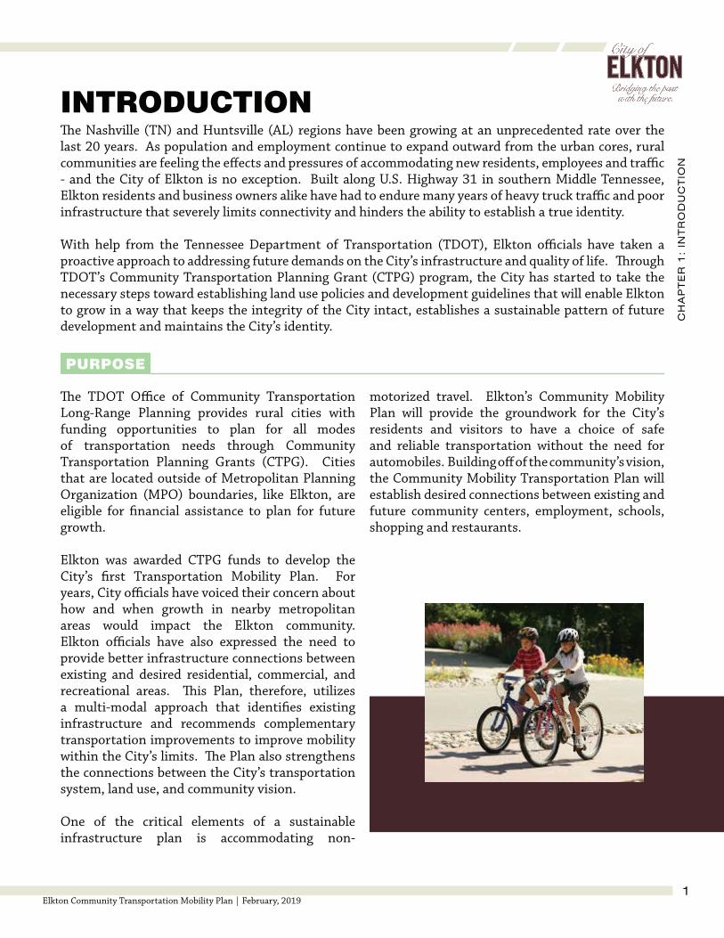
motorized travel. Elkton’s Community Mobility Plan will provide the groundwork for the City’s residents and visitors to have a choice of safe and reliable transportation without the need for automobiles. Building off of the community’s vision, the Community Mobility Transportation Plan will establish desired connections between existing and future community centers, employment, schools, shopping and restaurants.
PURPOSE

CH
AP
TE
R 1
: IN
TR
OD
UC
TIO
N
2Elkton Community Transportation Mobility Plan | February, 2019
PLAN APPROACH
Th ere are several benefi ts to having a mobility plan in place. A plan engages the community, provides inventory of current infrastructure conditions, provides a data-driven approach to reaching long-term goals, and outlines implementation phases and resources. A city with an integrated mobility plan ensures a better standard of living for its residents and a safer transportation network for all users of the system.
For a plan to be successful, it must compliment the City’s vision. As growth continues along Interstate 65 on the City’s east side, preserving Elkton’s identity is important. A Vision Plan is needed prior to the mobility plan to serve as a guiding document for future development. Land use components like character types and densities are included in the Vision Plan and set the groundwork for identifying local attractors or destinations.
Once the vision and land use framework is established, the Community Mobility Plan connects the community through a variety of facility types. Th ese connections are categorized into short-term and long-term projects and prioritized based on immediate need and complexity.
Th e Elkton Community Mobility Plan provides the City with a list of recommended improvements that will help boost the community’s growth and strengthen relationships with potential funding partners. Th e Mobility Plan will also establish a foundation for land use policy development and developer guidelines that support the community’s vision.
ANTICIPATED RESULTS
Identify Projects
Th is report includes a listing of potential transportation projects categorized by type and priority. Estimated project costs are also provided to help the City gauge the amount of resources that may be required.
Identify Funding
While the Plan identifi es the transportation desires of Elkton, it also lists potential funding sources and grant opportunities the City could pursue as a way to augment their fi nancial investment of the Plan. Local match percentages range between 5-50%, but provide an opportunity to leverage the City’s limited resources to fund higher-priced projects.
Establish Policies
Th is plan will also be used as a basis for creating or revising policies and guidelines that promote the City’s vision and serve as a platform for decision making because the plan represents the values of the community.
Figure 1: Plan Approach

CH
AP
TE
R 1
: IN
TR
OD
UC
TIO
N
3Elkton Community Transportation Mobility Plan | February, 2019
During the development of the Vision Plan and Community Mobility Plan, City offi cials solicited input from local agencies and residents on the planning process. Th e following list identifi es key stakeholders and their respective roles in the development of Elkton’s Transportation Mobility Plan. Although not every entity listed actively participated in the Mobility Plan’s process, each play an important role in advancing the Plan’s vision and recommendations.
Th e FHWA provides oversight, guidance and funding for
transportation improvements and ensures federal regulations and
ADA standards are met.
Federal Highway Administration (FHWA)
TDOT also provides oversight, guidance and funding for
transportation improvements.
Tennessee Department of Transportation (TDOT)
STATE & FEDERAL
REGIONAL & LOCAL GOVERNMENTS
Th e SCTDD assists local municipalities and county
governments with identifying community needs, community
development strategies, funding research and plan implementation.
South Central Tennessee Development District (SCTDD)
EMPLOYEES & PATRONS
Ultimately, the City’s residents, employees and patrons will be the
end-users and will benefi t the most from this plan. Input from this group of stakeholders is critical to the plan’s
success.
Residents & Visitors
STAKEHOLDERS
Th e City of Elkton government has jurisdiction over transportation projects within the city limits.
The City of Elkton
Giles County has jurisdiction and represents the unincorporated areas outside of Elkton’s city
limits. Additionally, Giles County operates and maintains the public
school system.
Giles County
PUBLIC / STAKEHOLDER MEETINGS
Two meetings were held at key progress points during the Mobility Plan’s development. Th e fi rst meeting, held on July 17, 2018, focused on the development of the City’s vision. Attendees were asked to defi ne the City’s legacy and provide their ideas of what Elkton should look like in the future. Th is meeting would establilsh Elkton’s Vision Plan.
Th e second meeting, held on August 16, 2018, allowed Elkton residents and other interested parties a chance to view and comment on the proposed recommendations that grew from the Vision Plan, and ultimately resulted in the contents of this document.
Copies of the sign-in sheets are shown in the Appendix for reference.

CH
AP
TE
R 2
: B
AC
KG
RO
UN
D
4Elkton Community Transportation Mobility Plan | February, 2019
BACKGROUND
LOCATION
As shown in Figure 2, Elkton is located in southeastern Giles County along the north bank of the Elks River in Middle Tennessee. Interstate 65 runs along the eastern city limits and connects Elkton to both Nashville (~80 miles) and Huntsville, Alabama (~30 miles). Both areas are experiencing considerable economic growth. Elkton’s location between these two growing metropolitan areas gives residents an opportunity to take advantage of the cultural opportunities of a large city, while living in a city with a small-town feel.
US Highway 31 runs through the City and connects Elkton to Pulaski - the Giles County seat - to the north, and Ardmore, Alabama to the south.
Figure 2: Elkton City Limits
Source: Elkton Historical SocietySource: Elkton Historical Society

CH
AP
TE
R 2
: B
AC
KG
RO
UN
D
5Elkton Community Transportation Mobility Plan | February, 2019
REGIONAL CHANGES
Nashville has experienced substantial growth over the past 30 years. According to Forbes magazine, in 2017, Nashville was the third fastest growing economy in the United States. Suburban sprawl has expanded the footprint of what is now considered the Nashville region. As a result, new employment centers have emerged in areas around Nashville including Cool Springs, Spring Hill and La Vergne/Smyrna. Music recording and production, tourism, health care and automotive industries are large contributors to the economy. Increasing numbers of residents in the Nashville area have also fed into smaller communities like Elkton, underlying the importance of a plan that will need to accommodate residents choosing to move outside the urbanized area.
NASHVILLE, TN
According to the Huntsville Area MPO’s 2040 Long Range Transportation Plan, households in the Huntsville urban area will increase by nearly 68,000 by the year 2040. Total households for the year 2040 are projected at 220,756. Th is growth will also impact employment. Nearly 133,000 new jobs will be added to the urban area bringing total employment to 355,311 jobs in the year 2040. Approximately 70 percent of this growth is expected to consist of non-retail employment - particularly in the Downtown center and around Cummings Research Park. Cummings Research Park is a center of business activity in the Huntsville area and will likely continue to attract jobs. Redstone Gateway, located just south of Cummings Research Park, has almost 500 acres of develop-able land available.
Furthermore, a ground breaking ceremony was held in November 2018 on a new $1.6 billion Mazda-Toyota manufacturing plant near the I-65/565 interchange anticipated to employ up to 4,000 workers by 20211. Th e location of this new plant is approximately 37 miles from Elkton.
1 https://whnt.com/2018/11/16/mazda-toyota-manufacturing-breaks-ground-on-1-6-billion-auto-plant-in-huntsville/
HUNTSVILLE, AL
Downtown Nashville Downtown Huntsville

CH
AP
TE
R 2
: B
AC
KG
RO
UN
D
6Elkton Community Transportation Mobility Plan | February, 2019
PEER CITIES
While understanding the economic growth happening in Nashville and Huntsville is important, it is also important to look at similar sized communities in order to understand how Elkton compares to other cities in the area, not just the large metropolitan areas nearby. Demographic data was developed for comparison for similar cities in the region called peer cities. Tennessee peer cities for Elkton include Eagleville, Ardmore, Adams, Cross Plains, Mitchellville, St. Joseph, Cornersville, Kingston Springs, and Lobelville. Also included are Gurley and Addison in Alabama.
Figure 3: Peer Cities

CH
AP
TE
R 2
: B
AC
KG
RO
UN
D
7Elkton Community Transportation Mobility Plan | February, 2019
PEER DEMOGRAPHICS
POPULATION
In 2010, Elkton had a population of 578 persons. However, the US Census Bureau estimates that Elkton’s population was 542 persons, representing a 6.2 percent decline in population over the seven year period. Elkton is one of four peer cities with a declining population. Lobelville, TN, Gurley, AL and Addison, AL all had populations that declined from 2010 to 2017.
Utilizing census information and other data sources, population growth, median household income, median home values, and property tax rates were compiled among the peer cities to help show how Elkton compares in terms of demographics.
Figure 4: Population Growth (2010-17); Source: ACS 2016 5-Yr, Am. Fact Finder (2017 Est)

CH
AP
TE
R 2
: B
AC
KG
RO
UN
D
8Elkton Community Transportation Mobility Plan | February, 2019
MEDIAN HOUSEHOLD INCOME
From 2010 to 2016, median household income in Elkton increased by $2,500 from $46,250 to $48,750, according to the American Community Survey 5-Year Estimates. Among the peer cities, the change in household income from 2010 to 2016 ranged from a $16,323 increase in Cornersville to a decrease of $9,333 in Mitchellville.
Figure 5: Median Household Income; Source: ACS Data Profi le (DP03), 5YR

CH
AP
TE
R 2
: B
AC
KG
RO
UN
D
9Elkton Community Transportation Mobility Plan | February, 2019
MEDIAN HOME VALUES
Th e median home value in Elkton increased 4.79 percent from 2010 to 2016. In 2010 the median home value in Elkton was $96,300 and in 2016, the value increased to $127,500. Th e average median home value among the peer cities was $112,053 in 2016.
Figure 6: Median Home Value; Source: ACS Data Profi le (DP03), 5YR

CH
AP
TE
R 2
: B
AC
KG
RO
UN
D
10Elkton Community Transportation Mobility Plan | February, 2019
PROPERTY TAX RATES
Property taxes can deter investment if the tax rates off set other advantages of building when compared to regional peers. High property taxes result from the need to provide public services to areas with low property values. As property values increase, tax rates are reduced to ensure a zero-sum increase in taxes collected. If tax rates reduce to negligible amounts, a tax rate increase can then be imposed to generate new revenue for the city at rates below what was initially set.
Elkton’s property tax rates are fairly consistent with the other peer cities in Tennessee and Alabama. Excluding the City of Cross Plains, each share a combination of varying city and county tax rates. In Alabama, additional state and school taxes are levied on properties that, consequently, cause two of the three Alabama peer cities to have the highest rates among the peer cities.
Figure 7: Peer Property Tax Rates; Source: TN Comptroller, 2017 Property Tax Rates, AL DOR, 2017 Millage Rates (10 mills = $0.01)
CH
AP
TE
R 3
: V
ISIO
N P
LA
N
11Elkton Community Transportation Mobility Plan | February, 2019
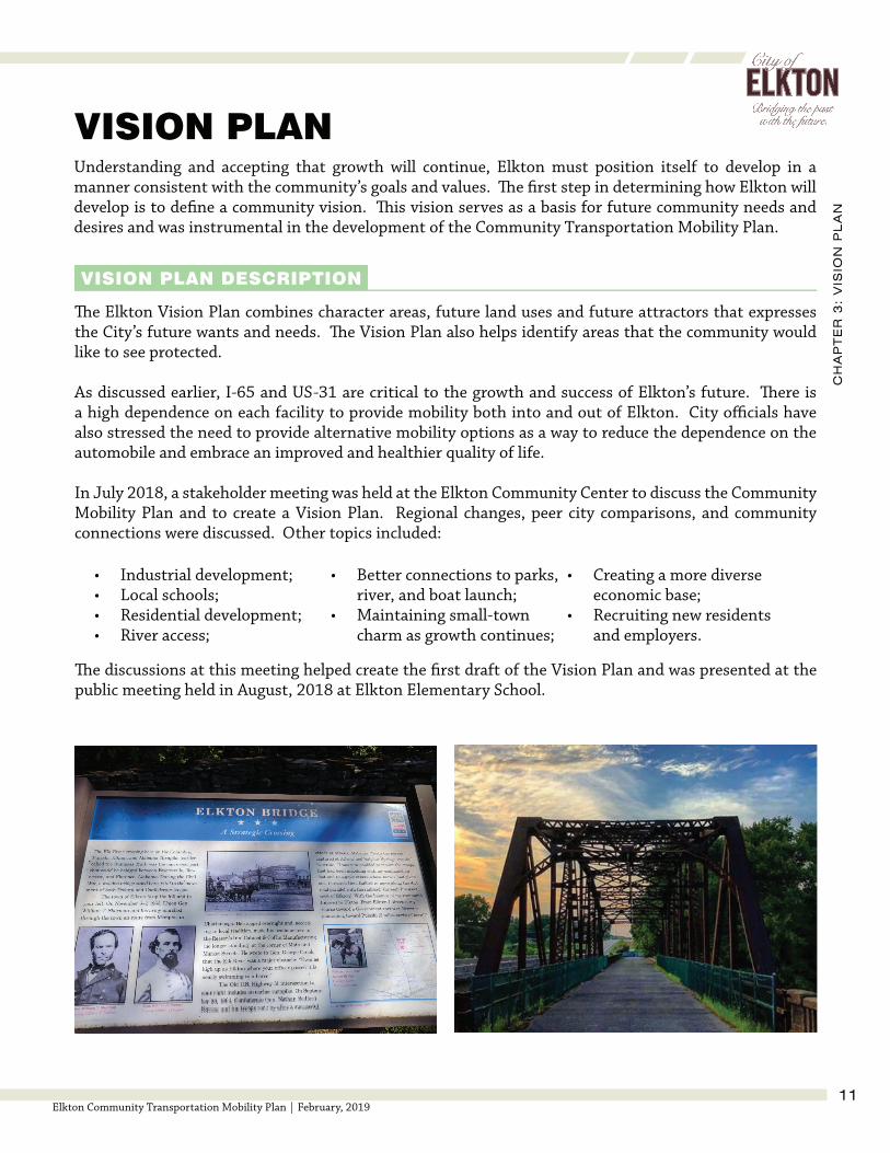
Understanding and accepting that growth will continue, Elkton must position itself to develop in a manner consistent with the community’s goals and values. Th e fi rst step in determining how Elkton will develop is to defi ne a community vision. Th is vision serves as a basis for future community needs and desires and was instrumental in the development of the Community Transportation Mobility Plan.
VISION PLAN
VISION PLAN DESCRIPTION
Th e Elkton Vision Plan combines character areas, future land uses and future attractors that expresses the City’s future wants and needs. Th e Vision Plan also helps identify areas that the community would like to see protected.
As discussed earlier, I-65 and US-31 are critical to the growth and success of Elkton’s future. Th ere is a high dependence on each facility to provide mobility both into and out of Elkton. City offi cials have also stressed the need to provide alternative mobility options as a way to reduce the dependence on the automobile and embrace an improved and healthier quality of life.
In July 2018, a stakeholder meeting was held at the Elkton Community Center to discuss the Community Mobility Plan and to create a Vision Plan. Regional changes, peer city comparisons, and community connections were discussed. Other topics included:
Th e discussions at this meeting helped create the fi rst draft of the Vision Plan and was presented at the public meeting held in August, 2018 at Elkton Elementary School.
• Industrial development;• Local schools;• Residential development;• River access;
• Better connections to parks, river, and boat launch;
• Maintaining small-town charm as growth continues;
• Creating a more diverse economic base;
• Recruiting new residents and employers.

CH
AP
TE
R 3
: V
ISIO
N P
LA
N
12Elkton Community Transportation Mobility Plan | February, 2019
Elkton Vision
”
“By 2040, the City of Elkton has grown to a population of over 1,500. Regional and local employment growth has provided more job opportunities in southern Middle Tennessee. A mixture of single- and multi-family residential - combined with new, mixed-use commercial and industrial development has provided the City with a safe, secure, economically sound, and sustainable community while preserving strong family and spiritual values. Robust parks and access to the Elk River off er the City’s residents and visitors viable recreational opportunities and a better quality of life. With the emergence of small-town shops, restaurants, and other amenities around the Interstate 65 interchange and downtown, visitors from all over the country experience the small-town charm Elkton residents have experienced for years.
CH
AP
TE
R 3
: V
ISIO
N P
LA
N
13Elkton Community Transportation Mobility Plan | February, 2019
CHARACTER AREAS
Within the City’s limits, the Vision Plan divides sections of Elkton into fi ve distinct character areas to best accommodate the anticipated growth pattern (see Figure 8). Th e areas are identifi ed as Residential, Regional Travel District, Jobs Center, Downtown Center, and Small Business District. To accommodate the surrounding growth while maintaining community traditions and values, land development must be properly planned to best utilize available resources. Building from existing development patterns and identifi ed conservation areas, the City’s Vision Plan helps identify where diff erent land uses and densities would be suitable.
DOWNTOWN CENTER
Th e downtown center area has a higher density development pattern and is comprised of mainly commercial and institutional land uses. Structures in the downtown area are set adjacent to the roadway and should be oriented to face the major thoroughfare. Parking should be provided behind the structures. Th is area should provide a sense of place, off ering a variety of activities while helping to create an identity for the community.
Th e Residential Area consists of existing and future single-family homes. Th e average density would be expected to be limited to up to two units per acre. A concerted eff ort should be made to protect these neighborhoods and all new development in these areas should integrate with the traditional development patterns.
RESIDENTIAL AREA
Th e Regional Travel District is comprised of commercial and retail establishments designed to attract regional travelers. Typical developments would include chain restaurants, markets, gas and electric vehicle charging stations, campgrounds, hotels, and motels.
Th e Small Business District consists of small offi ce and retail establishments as well as new multi- and single-family homes. Th e average density should be up to fi ve units per acre plus any non-residential. Residential and non-residential can be located within the same structure. Under these conditions, it is recommended that the non-residential units are at ground level.
SMALL BUSINESS DISTRICTREGIONAL TRAVEL DISTRICT
JOBS CENTER
Th e Emerging Jobs Center District consists of new offi ce and other commercial establishments. Th e average density can vary depending on the type of development in order to accommodate an occupant’s particular requirements.

14Elkton Community Transportation Mobility Plan | February, 2019
Figure 8: Elkton Vision Plan

CH
AP
TE
R 4
: C
ON
NE
CT
IVIT
Y
15Elkton Community Transportation Mobility Plan | February, 2019
CONNECTIVITY
COMMUNITY MOBILITY PLAN
Th e Community Mobility Plan builds from the vision to establish a connected community. By identifying these connections best suited for the expected user, the Mobility Plan provides an expanded transportation network that provides Elkton residents and visitors with mobility options that complement current travel behavior and promote healthier transportation choices (see Figure 9).
As mentioned earlier, US-31 is critical to the growth and success of Elkton. As the central roadway through the City, the community depends on this for mobility. Building adequate infrastructure along this highway and connecting it the City’s secondary facilities is essential to the health and safety of the community. Th e proposed projects include a multi-use path along US-31 between Ardmore Ridge and Bryson Road. Sidewalks are proposed along Baugh Road, Market Street and Main Street. A new industrial access road is proposed along Persimmon Island and George Whitfi eld Industrial Park Road as a way to improve truck movements to existing industrial areas within Elkton. Finally, a proposed greenway along the Elk River would connect to the multi-use trail on US-31 and provide a scenic trail for recreation.
Elkton’s Community Mobility Plan will achieve the following objectives:
• Provide safe and eff ective multi-modal alternatives both on and off the streets
• Connect current and future activity centers
• Develop sidewalks that get children to and from Elkton Elementary School and provide access to city parks and downtown activities
• Provide multi-use paths that enhance connections to city amenities and serve as an alternative travel route for residents and visitors
• Establish eco-friendly pathways along the Elk River that focuses more on recreational trips and less of effi cient mobility

16Elkton Community Transportation Mobility Plan | February, 2019
Figure 9: Elkton Mobility Plan

CH
AP
TE
R 4
: C
ON
NE
CT
IVIT
Y
17Elkton Community Transportation Mobility Plan | February, 2019
FACILITY TYPES
Th e following facility types off er multi-modal connections throughout the community using the development patterns that emerge from the Vision Plan.
PEDESTRIAN FACILITIES
SidewalksSidewalks provide dedicated space within the public right-of-way for use by pedestrians. A sidewalk is located adjacent to the roadway and can be used in either direction by persons traveling on foot or by wheelchair. Standard sidewalk widths are fi ve feet in width to allow for the movement of two passing pedestrians, as well as meeting the Americans with Disabilities Act (ADA) guidelines for wheelchair accessibility.
For safety and comfort reasons, sidewalks should be physically separated from the roadway by either a buff er space or curb. In rural settings, sidewalks without curb and gutter are typical.
Although sidewalks can be placed directly adjacent to a curb, a two- to four-foot buff er between the roadway and inner edge of sidewalk is recommended. As vehicular speeds increase, larger buff er spaces should be used. In most case, where sidewalks are missing from the original roadway design, underground drainage structures may need to be constructed. Th is can lead to signifi cant increases in project cost.
SHARED-USE FACILITIES
Shared-Use facilities provide non-motorized travel options to area residents and visitors. Th ese facilities can be utilized for diff erent travel purposes (e.g., transport, recreation) and can be traversed in either direction of travel.
Multi-Use PathsMulti-Use trails are dedicated paths for non-motorized transportation to provide a user mobility options to arrive at their desired destination. Th ese trails can be within roadway right-of-way, but are typically separate. If within the right-of-way, multi-use trails should be spaced more than fi ve feet from the roadway. Th e Tennessee Department of Transportation prefers a minimum width of 12 feet for multi-use paths.
GreenwaysGreenways are also dedicated paths for non-motorized transportation, but are primarily used for recreation. Th ese journey trails can facilitate eco-tourism and should focus on the experience of the trip and less on effi cient mobility to reach a destination. Th e preferred TDOT greenway width is also 12 feet. Th e surface of the greenway path can vary. Th e decision is usually based on factors such as context, constructibility and cost.

CH
AP
TE
R 4
: C
ON
NE
CT
IVIT
Y
18Elkton Community Transportation Mobility Plan | February, 2019
PROJECTS
Infrastructure improvement plans are typically grouped into phases. Each phase contains groups of projects arranged by geographical location, improvement type, expected date of completion or priority. Th e projects listed in the Elkton Community Mobility Plan are grouped by priority, but can be reorganized by project type or geography, depending on funding source eligibility.
PROJECT COSTS
Project costs were estimated in this plan using typical items needed in the construction of each diff erent type of facility. An estimated value was derived for each item, based on the 2017 TDOT average unit pay items on a per linear foot basis. Th e costs below represent the estimated cost of the entire length of the project. It is important to note that estimated costs do not include the purchase of right-of-way, easements and/or any additional costs associated with utility relocation.
Estimated costs by phase are shown in Table 1. Tables 2 and 3 display the projects grouped by phase and facility type respectively. Th e projects identifi ed in this plan and their locations are shown on the following maps in Figure 10.
Table 1: List of Projects
Table 2: Estimated Project Costs By Phase Table 3: Estimated Project Costs By Facility Type

19Elkton Community Transportation Mobility Plan | February, 2019
Figure 10: Mobility Plan Project Map

CH
AP
TE
R 5
: F
IRS
T S
TE
PS
20Elkton Community Transportation Mobility Plan | February, 2019
IMPLEMENTATION
Implementation of Elkton’s Mobility Plan will require the cooperation and coordination of state and federal governments as well as the Elkton community. It is important to select project partners early to help identify any potential issues or opportunities.
PARTNERS
Each project will require diff erent partners to adequately address the many aspects of implementation; however, it is crucial that TDOT, FHWA and local residents are involved in all stages of development. Depending on the project type and location, additional insight may be required by environmental agencies such as the Tennessee Department of Environment and Conservation (TDEC) and the Environmental Protection Agency (EPA).
FUNDING PROGRAMS
Th e project type, cost and amount of local match determine the eligible funding programs that can be pursued on a project. Diff erent funding programs are administered through varying state departments. For example, Table 4 below lists funding programs available for bicycle and pedestrian improvements in Tennessee.
FIRST STEPS
Table 4: Bicycle and Pedestrian Eligible Grant Programs

CH
AP
TE
R 5
: F
IRS
T S
TE
PS
21Elkton Community Transportation Mobility Plan | February, 2019
STAGES OF A PROJECT
Large infrastructure projects are typically developed in stages. With each stage, more detail is added to allow for better cost and scheduling estimates. Th e three major stages of a project are as follows:
Th is is the fi rst step of project development and is the current status of each project listed in this document. Projects in this development stage have a defi ned improvement type and general location. Specifi c alignments, cost estimates, materials used, phasing and funding sources are often conceptual and are subject to change. Furthermore, projects at this level are typically considered long-range in nature, and have not been offi cially pursued for design or construction; but may have been recommended for a planning-level study.
Th is stage further refi nes the details established in the Conceptual/Programming Level stage and defi nes the specifi c design plans including alignment, termini, right-of-way acquisition, easements, utility relocations, materials used, phasing and funding. Th e project should also contain a detailed and accurate cost estimate. Projects in this stage usually have a committed funding source and are typically listed in a near-term Improvement Plan.
Th is stage continues the momentum gathered from the Vision/Planning Level stage and begins to refi ne the project details, such as right-of-way needs and estimated cost. Actual alignments, materials, phasing and funding sources will be narrowed down, but not necessarily defi ned. Projects in this stage are typically near-term in nature and have had some level of study performed that contained a list of preferred recommendations.
Design/Construction Level3
Vision/Planning Level1
Conceptual/Programming Level2

CH
AP
TE
R 5
: F
IRS
T S
TE
PS
22Elkton Community Transportation Mobility Plan | February, 2019
TYPICAL CROSS-SECTIONS
Typical cross sections were developed in conjunction with the Elkton Mobility Plan and are intended to help City offi cials and the general public visualize how the proposed projects will be constructed within the existing right-of-way limits; and also show how a multi-modal facility can accommodate a variety of transportation options while maintaining desired traffi c operations and safety.
SUMMARY
Th e Community Transportation Mobility Plan provides the tools and guidance necessary to advance the City of Elkton to the next level of economic vitality and livability. By establishing a unifi ed vision and creating policies that nurture the City’s principles and values, Elkton offi cials have the power to pursue new opportunities and partnerships that foster growth and promote a better quality of life for the City’s residents, employees, and visitors.

APPENDIX

AP
PE
ND
IX
A1Elkton Community Transportation Mobility Plan | February, 2019

AP
PE
ND
IX
A2Elkton Community Transportation Mobility Plan | February, 2019
Written Comments Received from Stakeholder Meeting:

AP
PE
ND
IX
A3Elkton Community Transportation Mobility Plan | February, 2019
