click the “find/identify” tab - gis.pottcounty.comgis.pottcounty.com/html5/help/slides.pdf ·...
TRANSCRIPT
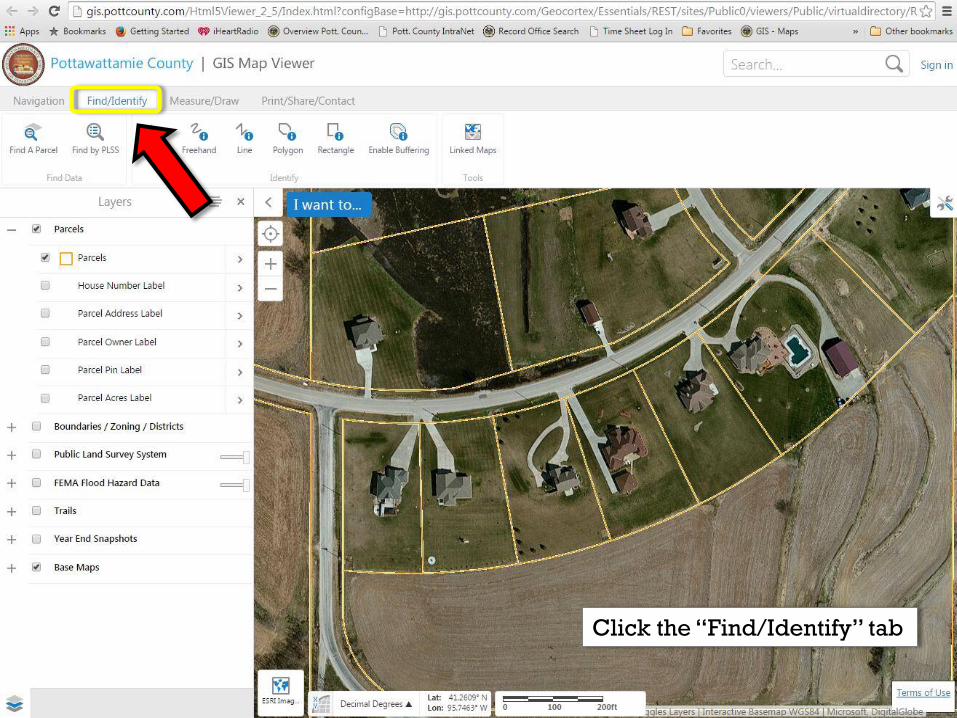
Click the “Find/Identify” tab
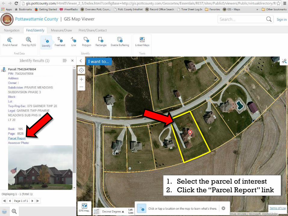
1. Select the parcel of interest
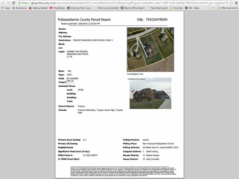
2. Click the “Parcel Report” link
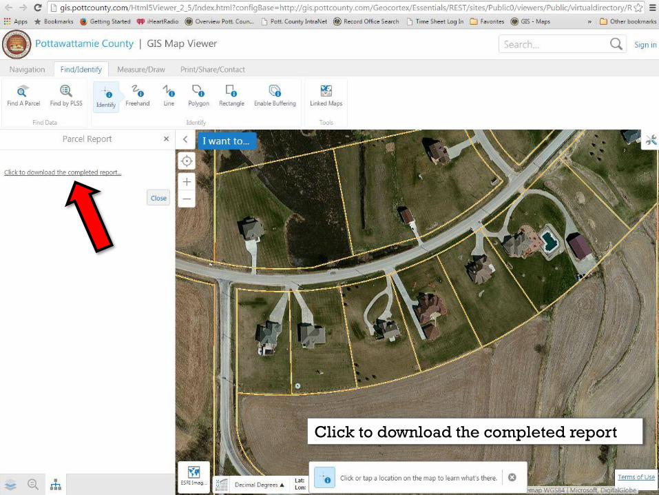
Click to download the completed report
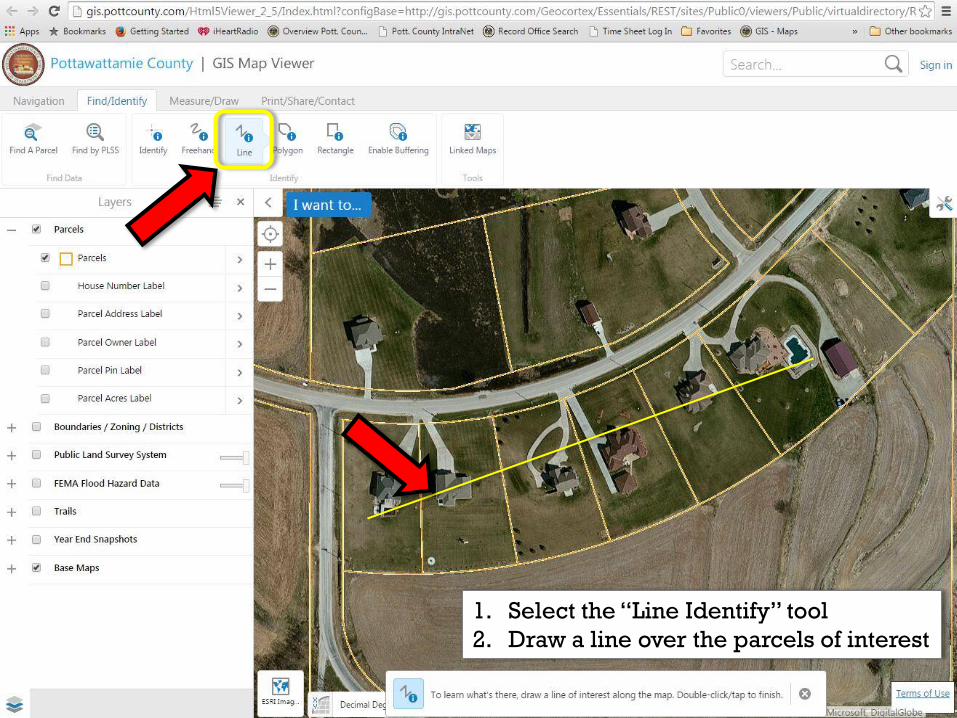
1. Select the “Line Identify” tool
2. Draw a line over the parcels of interest
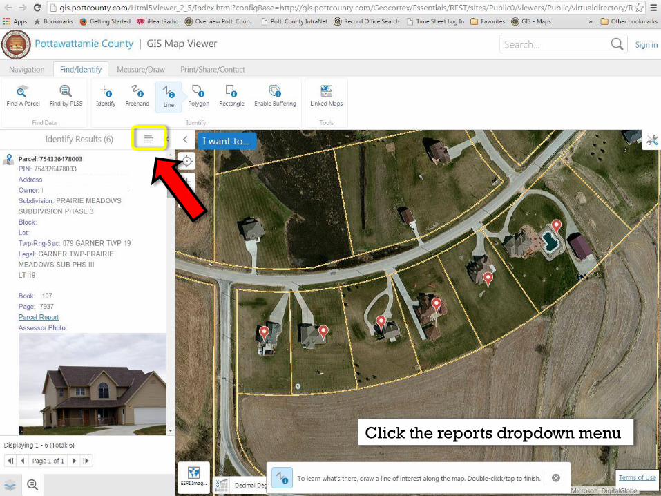
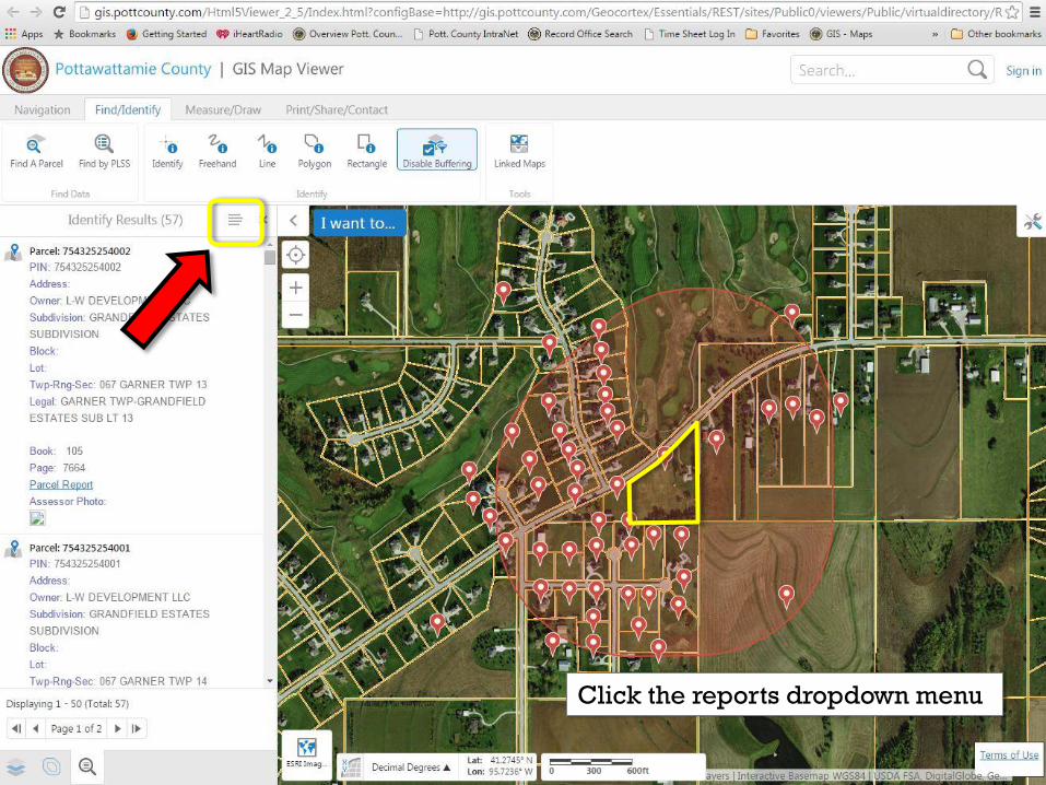
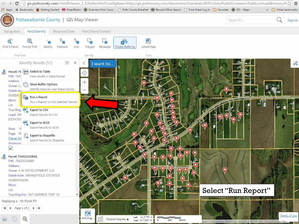
Click the reports dropdown menu
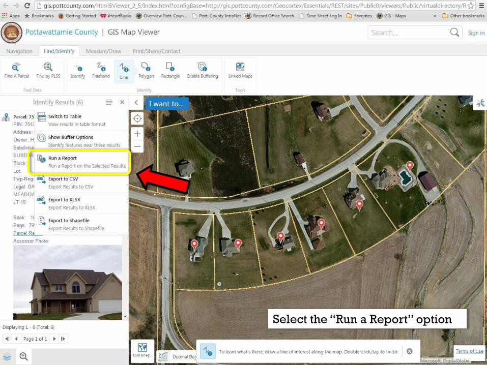
Select the “Run a Report” option

Select “Parcel Report”
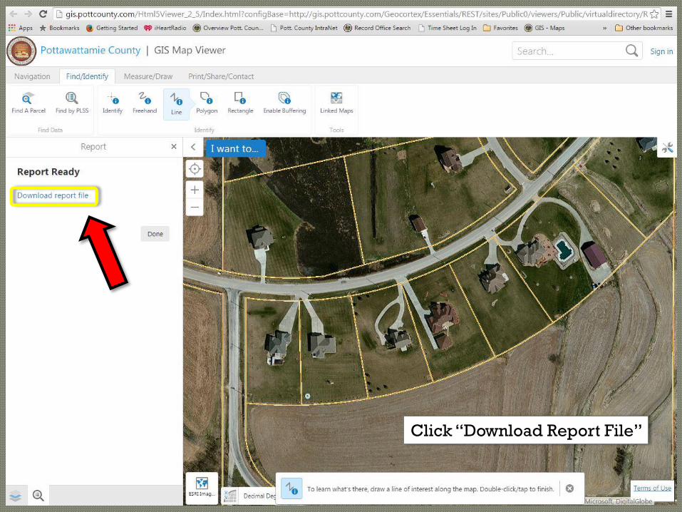
Click “Download Report File”
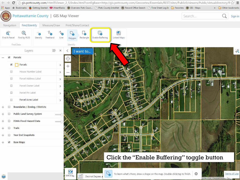
Click the “Enable Buffering” toggle button

Enter Distance and the Units
wanted for the buffer area
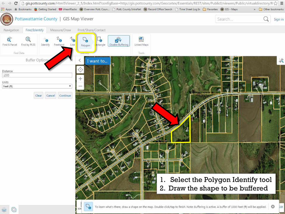
1. Select the Polygon Identify tool
2. Draw the shape to be buffered
Click the reports dropdown menu
Select “Run Report”
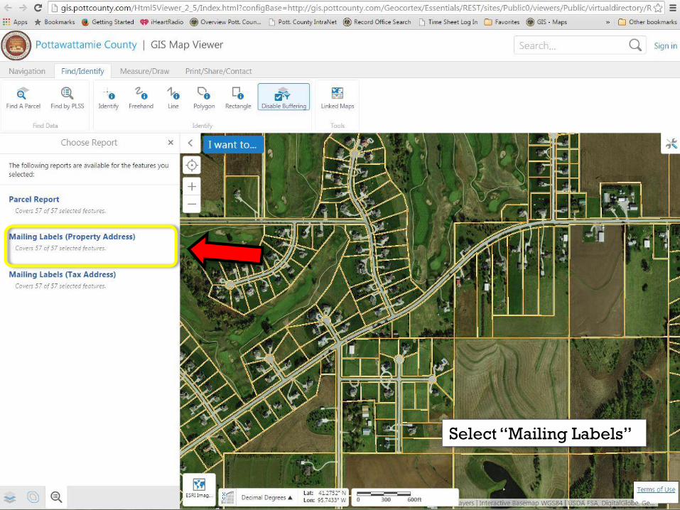
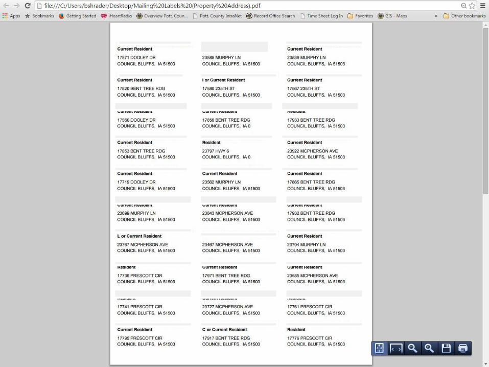
Select “Mailing Labels”
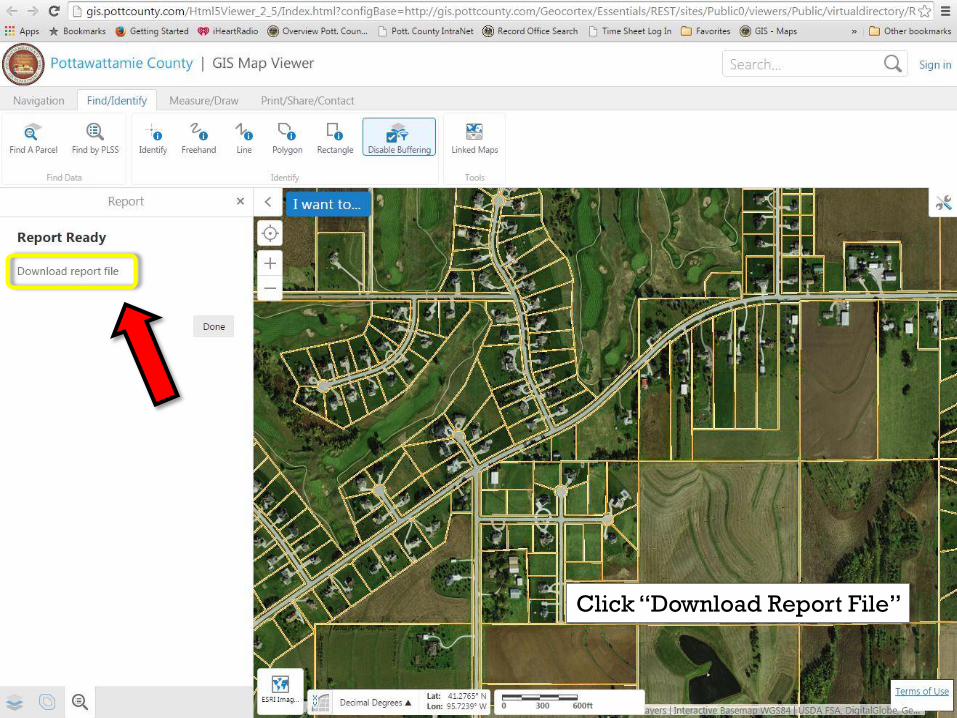
Click “Download Report File”