contractor using landxml - buildingsmart using landxml (machinecontrol, masscomputation, ......
TRANSCRIPT
1
Anders Avlesen – Skanska Survey
07.06.2012
Contractor using LandXML
(Machinecontrol, masscomputation, efficency) “How we use LandXML”
2
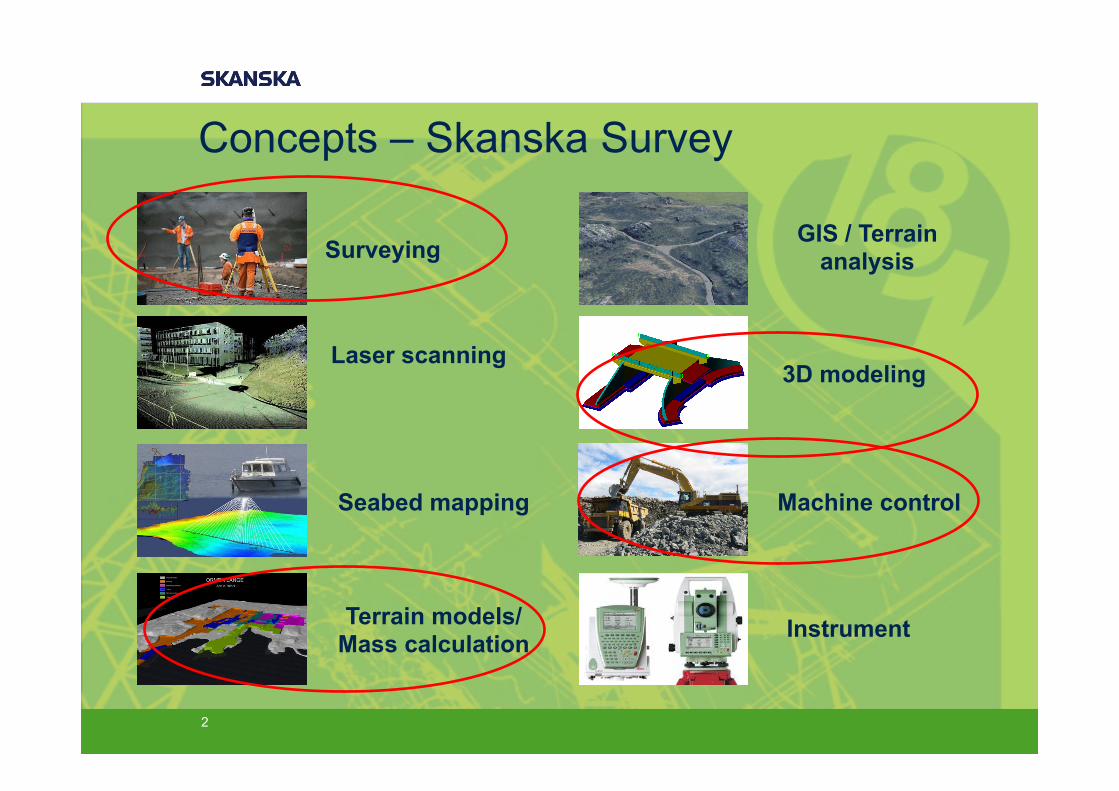
Surveying
Laser scanning
Seabed mapping
Terrain models/ Mass calculation
GIS / Terrain analysis
3D modeling
Machine control
Instrument
Concepts – Skanska Survey

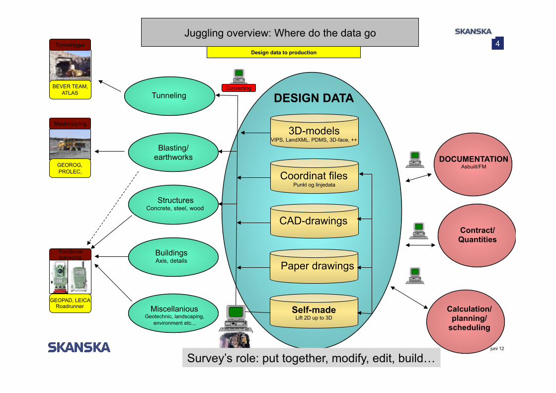
Juggling with data and programs
− We have knowledge to work efficiently − How does the surveyor work? − How is the data made/Where does it come from? − Content of design model
− 2D/3D? − type of objects?
− Choice of software to do a task
3
Mission: Make life easier for those outside
4
juni 12
Tunneling
Calculation/ planning/
scheduling
DESIGN DATA
Coordinat files Punkt og linjedata
Blasting/ earthworks
Structures Concrete, steel, wood
Buildings Axis, details
Miscellanious Geotechnic, landscaping,
environment etc..,
3D-models VIPS, LandXML. PDMS, 3D-face, ++
CAD-drawings
Paper drawings
Self-made Lift 2D up to 3D
Tunnelrigger
Maskinstyring
Traditional surveying
GEOROG, PROLEC,
BEVER TEAM,
ATLAS
GEOPAD, LEICA Roadrunner
Contract/ Quantities
DOCUMENTATION Asbuilt/FM
Converting
Juggling overview: Where do the data go
Design data to production
Survey’s role: put together, modify, edit, build…

Software juggle
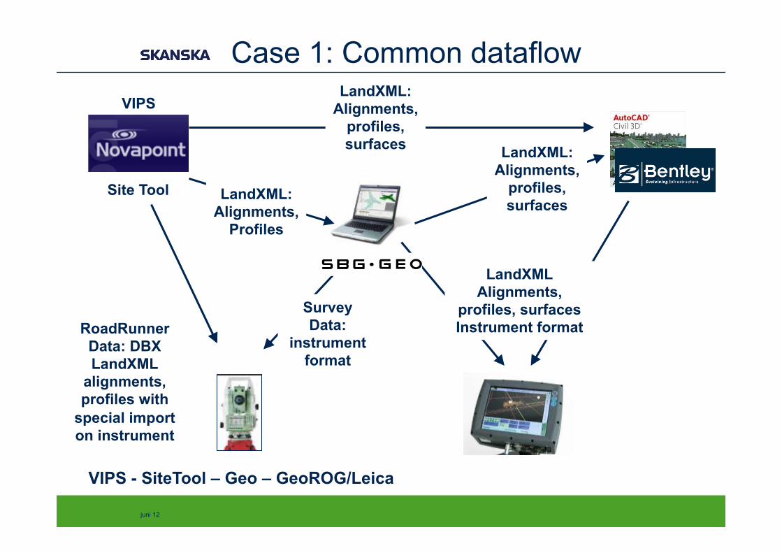
5
§ SBG GEO, main software for the surveyor § ”Simple” mass calculations” § Design roads/building pits/trenches § Drawings and documentation.
§ Bentley InRoads § Complex mass calculations, terrain modelling § Design roads/building pits/trenches
§ NovaPoint SiteTool § Convert VIPS-data to other formats
§ Some mass calculation § Geometrical control
§ AutoCad Civil 3D § Quality control of surfaces § Terrain-modelling § Volume computations
§ Gemini § Mass calculations for roads § Documentation “as built”
juni 12
VIPS - SiteTool – Geo – GeoROG/Leica
Site Tool
Survey Data:
instrument format
Export from Site Tool • Roadlines/Stringlines • Horizontal-geometry • Vertikal-geometry • Terrain-model (DTM) • Koordinates (XYZ)
RoadRunner Data: DBX LandXML
alignments, profiles with
special import on instrument
LandXML: Alignments,
profiles, surfaces
LandXML Alignments,
profiles, surfaces Instrument format
VIPS
LandXML: Alignments,
Profiles
LandXML: Alignments,
profiles, surfaces
Case 1: Common dataflow

Case 1 example: E18 bridges
− Stake-out data for bridges needs to be modelled − Avaialble: Very discrete data (every 5m) − Road alignment and profil => concrete bottom of bridge
− Stake-out as a road
− LandXML − From consultant via VIPS, − Exchange data between programs (three in total) − Export final data to surveyors equipment (with nice
information) − Use line-names and codes
7

Case 1 example: E18 Bridges
8
- Data from consultant/VIPS edited for the surveyor LandXML: - Export VIPS from NovaPoint - Export final product from Geo
(possible LXML)
Case 1 important point: Data flow
− Only open format for direct import/export of alignments/profiles − Don’t need to re-create alignment.
9
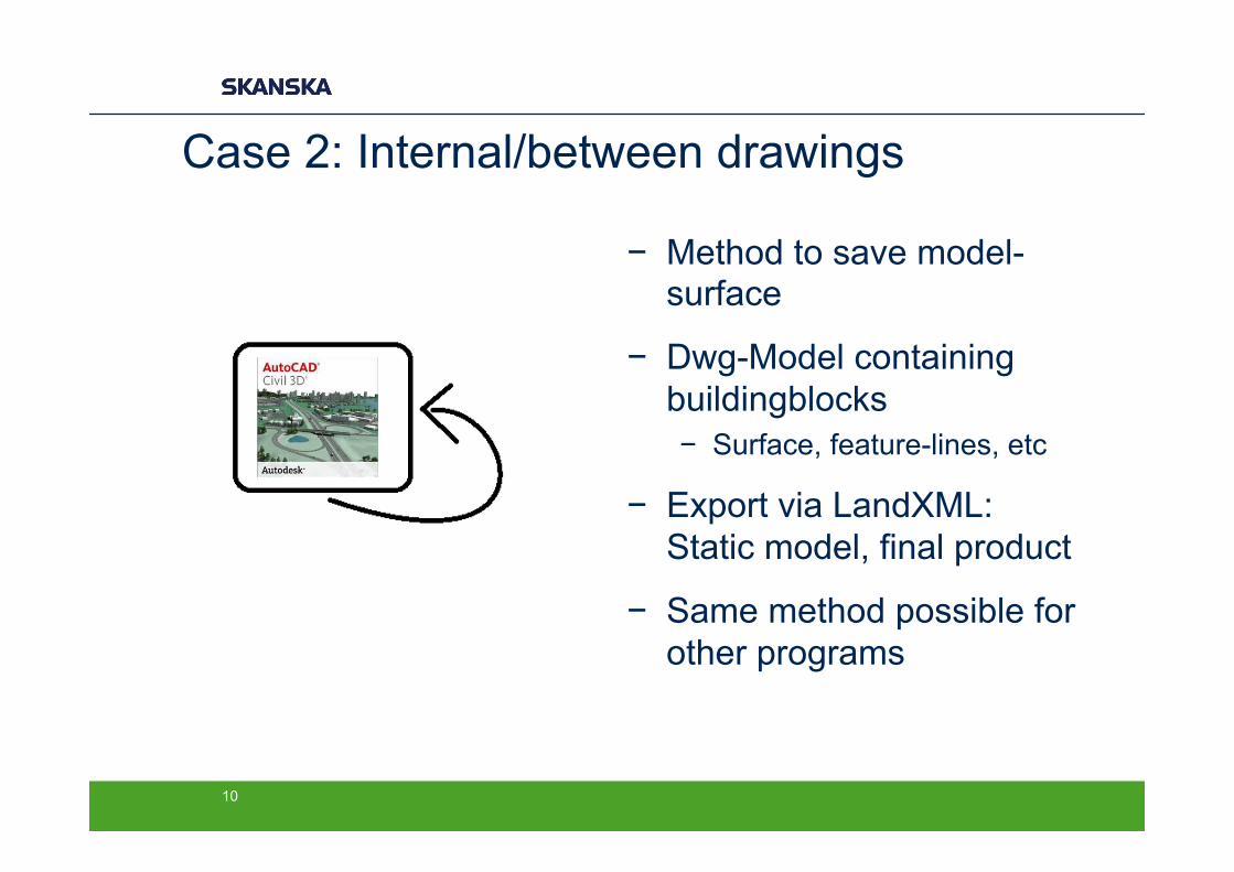
Case 2: Internal/between drawings
− Method to save model-surface
− Dwg-Model containing buildingblocks − Surface, feature-lines, etc
− Export via LandXML: Static model, final product
− Same method possible for other programs
10
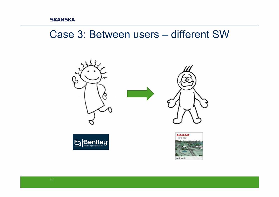
Case 3: Between users – different SW
11
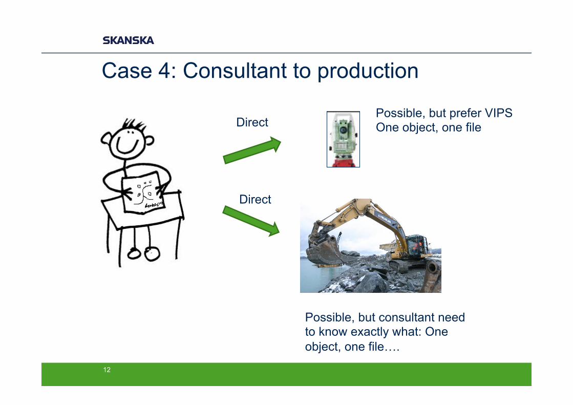
Case 4: Consultant to production
12
Direct
Direct
Possible, but prefer VIPS One object, one file
Possible, but consultant need to know exactly what: One object, one file….
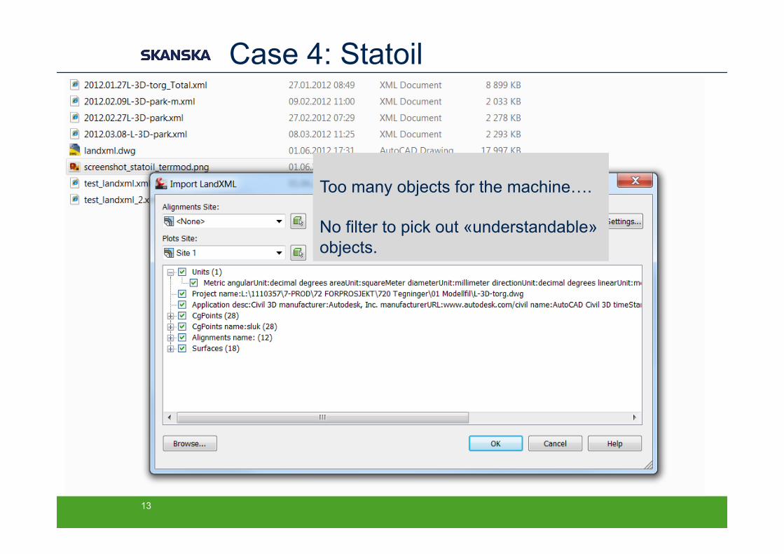
Case 4: Statoil
13
Too many objects for the machine…. No filter to pick out «understandable» objects.
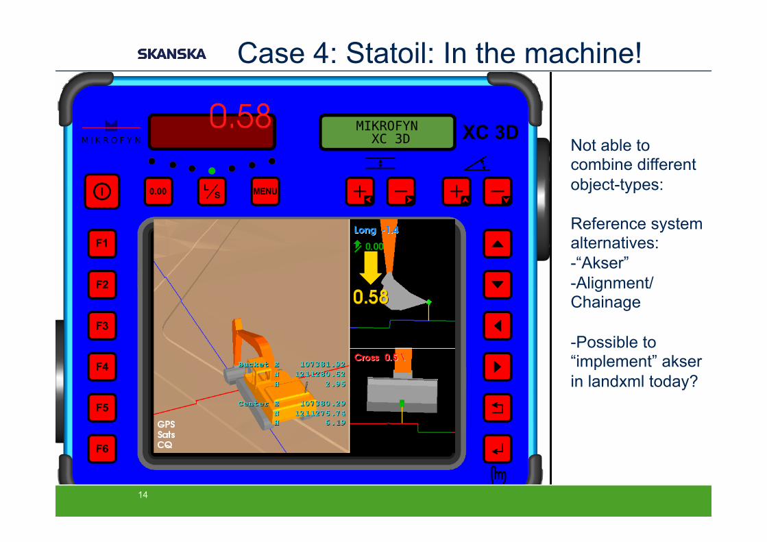
Case 4: Statoil: In the machine!
14
Not able to combine different object-types: Reference system alternatives: - “Akser” - Alignment/ Chainage
- Possible to “implement” akser in landxml today?
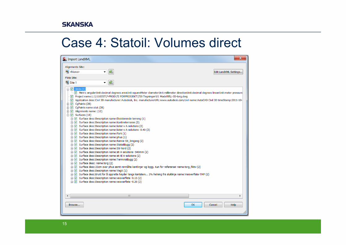
Case 4: Statoil: Volumes direct
15
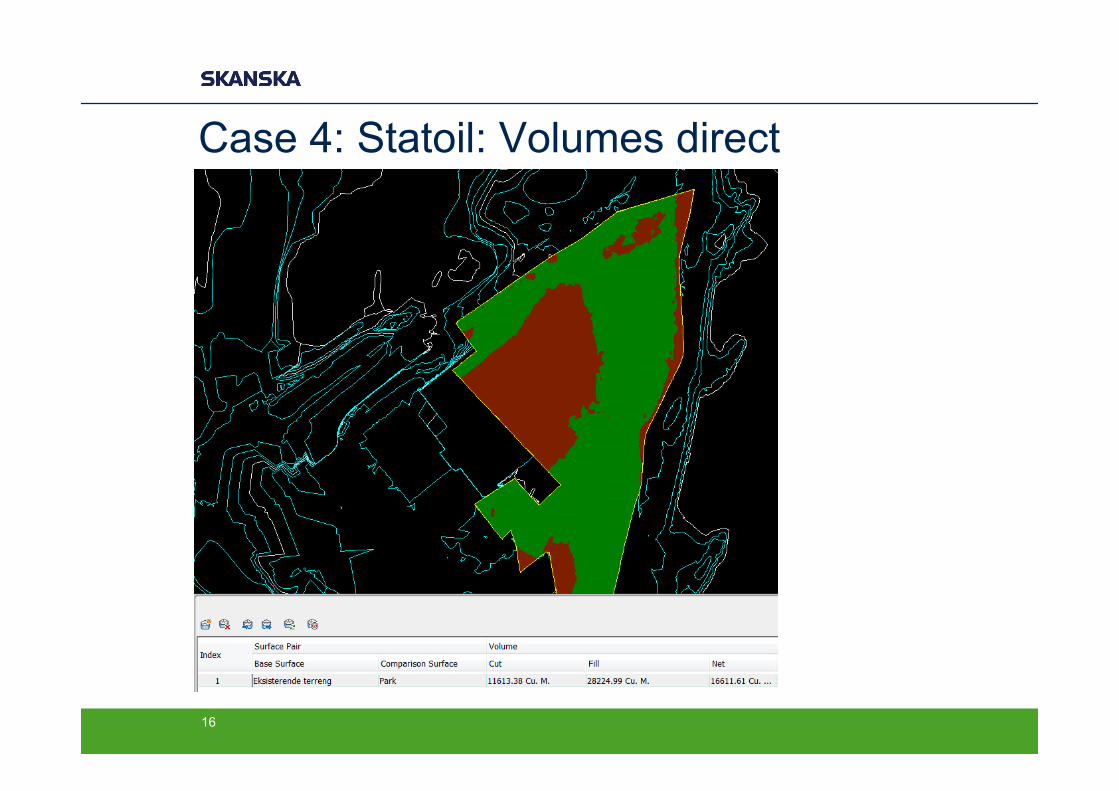
Case 4: Statoil: Volumes direct
16
Case 4: Machine control Statoil Fornebu − Data flow: Consultant -> Site (in landxml)
− Problems: Amount of models*
− LandXML: Terrainmodel for design surface − All points, alignments, profiles and surfaces in one xml-file
− Machine-control systems limits: − not able to choose what to import − Method: Import via Civil 3D, re-export single surface
− Also possible in geo, in-roads
− LandXML in general: − Nice:
− Possible to add desciptions direct on objects − Cons:
− SW up to date? SW could display more information?
17

LandXML is not allways used….
− Survey and Survey-DB
− Roadmodel?
− Pipe-network
18
LandXML: From the surveyor…? − LandXML from the surveyor to consultant….?
− Possibilities − Survey DB, not used? − Surface: triangulated together with breaklines, points, features − Put more information into the data
− Codes, descriptions on objects − Possible to save coordinate-system in the file, not used − Problem with large surfaces and size of xml-file.
− Formats used: − Kof, dwg/dxf, sosi, geo (intern exchange) − + document describing the actual work and surveyor
19
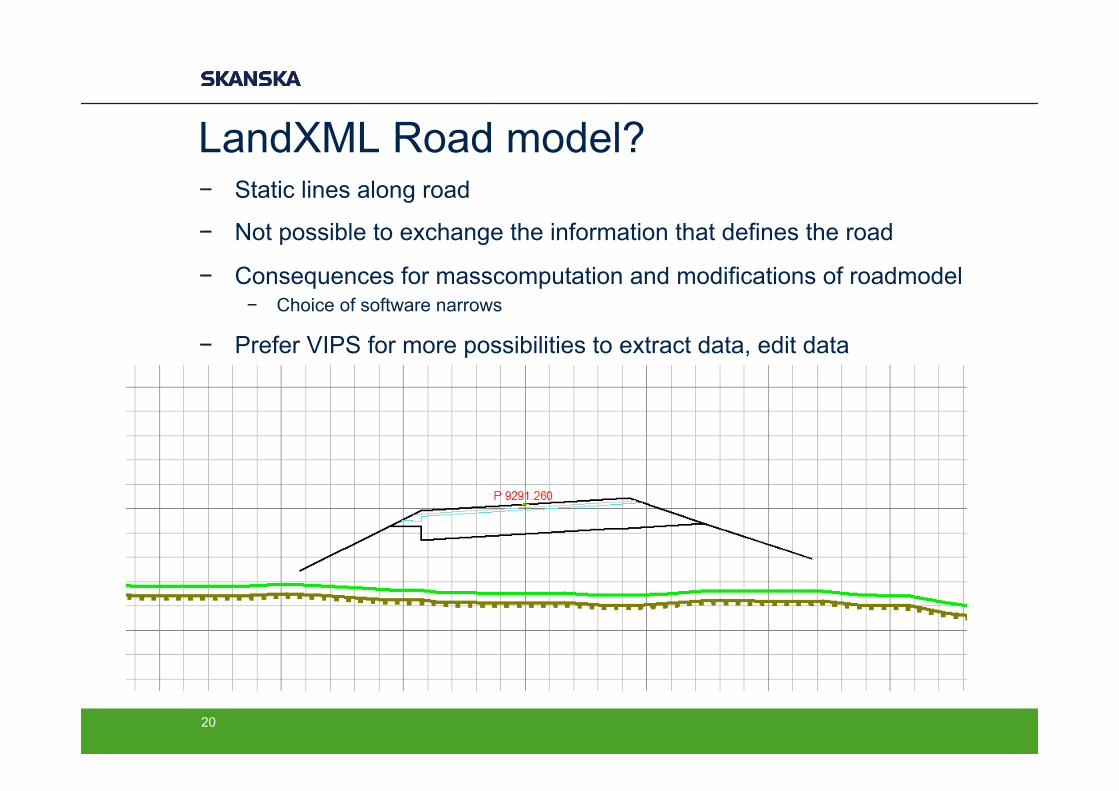
LandXML Road model? − Static lines along road
− Not possible to exchange the information that defines the road
− Consequences for masscomputation and modifications of roadmodel − Choice of software narrows
− Prefer VIPS for more possibilities to extract data, edit data
20
LandXML Pipemodel? − Pipe network in use?
− Should be possible to use the lines for stake-out − Should be possible to use data about manholes − Field-software not prepared for this model, but potential for
stakeing-out like a road-model?
− Where is the ditch? − Edges − Width of bottom − Layers
− In Norway: DWG-model with built-in stake-out lines
21

Conclusions by theme − General: Good for juggling!
− Machinecontrol − LandXML in use (ref. statoil) − Obvious problems with the dialect − *Software limits “the kind of information” and “amount of
information” possible to show
− Masscomputation − LandXML in use − **Surfaces, collecting different kinds of objects with information in
one place − **Static road-data (?) − Reports (not common)
− Efficiency − ***Depends on knowledge (ref. e18, statoil) − ****Not really consistent implementation between programs
22

The end…
− Questions?
− Other experiences?
− Weekend!
23
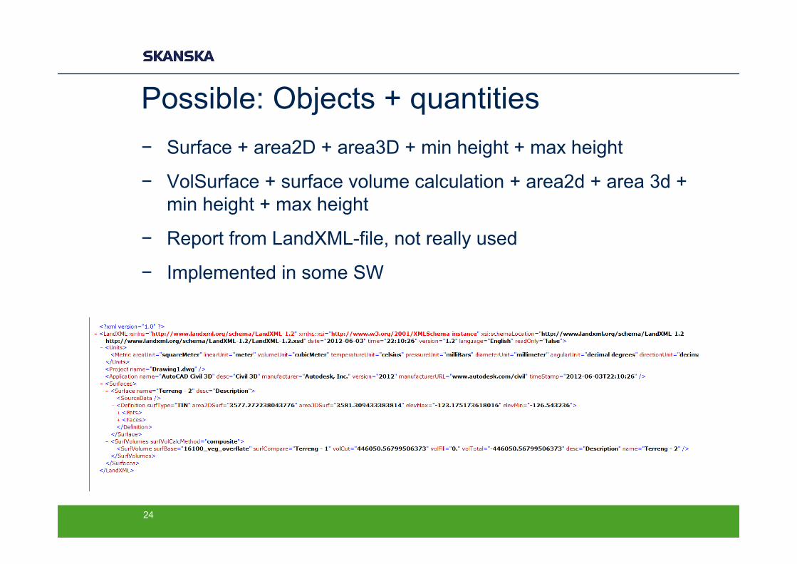
Possible: Objects + quantities − Surface + area2D + area3D + min height + max height
− VolSurface + surface volume calculation + area2d + area 3d + min height + max height
− Report from LandXML-file, not really used
− Implemented in some SW
24
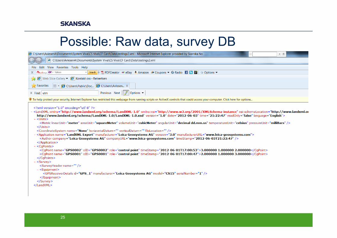
Possible: Raw data, survey DB
25
LandXML – What is used?
- Used content for stake-out/machine-control: - Roads:
- Alignments/Profiles + Surface - Terrain/Landscapeing:
- Surface (+ points)
- Now: Possibilities limited by “field software” - Why not possible to show alignment and surface at same
time? - Why convert nice smooth data to straight line-elements?
26

LandXML – Contractor status − For surveyor:
− Direct from consultant to site − Quasi-Roadmodel (instead of vips, “stringlines”, fake layers) − Terrain-model (not many alternatives)
− From site, landxml not used…? − Maybe to LARK
− For mass computations − Road-modell static
− not possible to recalculate to updated terrain − Not possible to change layers in roadmodel obviously….
− For machines: − Still dialect problems… − SW has more potential (re aksesystem)
27