critical issues and new sections - diy pest...
TRANSCRIPT
Global Observation of Forest and Land Cover Dynamics
Critical issues and new sections
Martin HeroldGOFC-GOLD Land Cover Office Jena, Germany
GLOBAL TERRESTRIAL OBSERVING SYSTEM

Global Observation of Forest and Land Cover Dynamics
Observing forest fires
Martin HeroldGOFC-GOLD Land Cover Office Jena, Germany
Contributors : E.Chuvieco, I. Csizsar , D. Davies
GLOBAL TERRESTRIAL OBSERVING SYSTEM
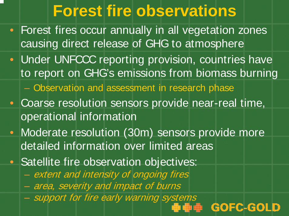
Forest fire observations• Forest fires occur annually in all vegetation zones
causing direct release of GHG to atmosphere• Under UNFCCC reporting provision, countries have
to report on GHG’s emissions from biomass burning– Observation and assessment in research phase
• Coarse resolution sensors provide near-real time, operational information
• Moderate resolution (30m) sensors provide more detailed information over limited areas
• Satellite fire observation objectives: – extent and intensity of ongoing fires – area, severity and impact of burns– support for fire early warning systems

Examples of fire observationsSatellite-based fire monitoring Information and data access
Global burnt areas 2000-2007: L3JRC (EC Joint Research Center)
http://www-tem.jrc.it/Disturbance_by_fire/products/burnt_areas/ GlobalBurntAreas2000-2007.htm
MODIS active fires and burned areas (UMD/NASA)
http://modis-fire.umd.edu/products.asp
FIRMS: Fire Information for Resource Management System (UMD/NASA/UN FAO)
http://maps.geog.umd.edu/firms
Globcarbon products (ESA)
http://dup.esrin.esa.int/ionia/globcarbon/products.asp
World Fire Atlas (ESA)
http://dup.esrin.esa.int/ionia/wfa/index.asp
Global Fire Emissions Database (GFED2) - multi-year burned area and emissions (NASA)
http://ess1.ess.uci.edu/%7Ejranders/data/GFED2/
TRMM VIRS fire product (NASA)
http://daac.gsfc.nasa.gov/precipitation/trmmVirsFire.shtml
Meteosat Second Generation (MSG) SEVIRI fire monitoring (EUMETSAT)
http://www.eumetsat.int/Home/Main/Access_to_Data/Meteosat_Meteorological_Products/Product_List/index.htm#FIR
Experimental Wildfire Automated Biomass Burning Algorithm: GOES WF-ABBA (University of Wisconsin- Madison / NOAA)
http://cimss.ssec.wisc.edu/goes/burn/wfabba.html

Examples of active fire observations
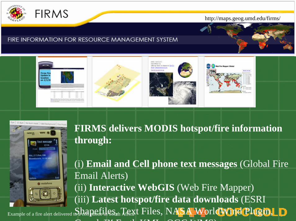
FIRMS delivers MODIS hotspot/fire information through:
(i) Email and Cell phone text messages (Global Fire Email Alerts) (ii) Interactive WebGIS (Web Fire Mapper) (iii) Latest hotspot/fire data downloads (ESRI Shapefiles, Text Files, NASA WorldWind Plugin, Google™ Earth KML OGC WMS)
Example of a fire alert delivered to a cell phone in South Africa
http://maps.geog.umd.edu/firms/

http://modis-fire.umd.edu/MCD45A1.aspContact: Luigi Boschetti <[email protected]>
EXAMPLE APPLICATIONS
• 1 year of composite of MODIS burned areas, superimposed on surface reflectance to provide geographic context.
• Burned area statistics for the same period, for vegetation type
Africa
0.00E+00
1.00E+05
2.00E+05
3.00E+05
4.00E+05
5.00E+05
6.00E+05
Jul-0
1 BA
Aug-01
BA
Sep-01
BA
Oct-01
BA
Nov-01
BA
Dec-01
BA
Jan-0
2 BA
Feb-02
BA
Mar-02
BA
Apr-02
BA
May-02 B
A
Jun-0
2 BA
fire
affe
cted
are
a [k
m^2
]
0%
5%
10%
15%
20%
25%
30%
unm
appe
d [%
]
croplandsbarren_or_sparsely_vegetatedgrasslandssavannaswoody_savannasopen_shrublandsclosed_shrublandsmixed_forestsdeciduous_broadleaf_forestdeciduous_needleleaf_forestevergreen_broadleaf_forestevergreen_needleleaf_forestotherunmapped BA

http://modis-fire.umd.edu/MCD45A1.aspEXAMPLE OF APPLICATIONS
(2)Assessment of Burning in Greece in

Fire observations and their usefulness for national REDD implementation
Approach Information REDD objective SuitabilityPre-fire Early warning
systemProtect forest areas at risk and address leakage and permanence
Most suitable for countries with significant amount of wildland fires and known fire regimes
Active fire Hot spot satellite data
Fire relief and active emissions reductionSupport of in-situ actions
Most suitable for countries with large number of small-scale deforestation fires
Post-fire Burned area estimates
Support estimation of areas of deforestation and degradation
All countries with forest loss due to fire

Fire observations and national estimation of area change data
• Additional + independent level of information to build capability and confidence in national forest monitoring
• Observing forest fires causing forest disturbance: – Coarse-resolution fire related observations are currently not
suitable to estimate area loss on a 0,5-1 ha scale – provide high-temporal intra-annual detail for longer
observation periods (i.e. 5-10 years)– provide a suitable indicator for areas potentially affected by
deforestation and forest degradation– national stratification based on fire affected areas could
trigger detailed investigations using fine-scale satellite or in situ data to fully quantify deforestation or degradation area
• National examples for monitoring emissions from fire (i.e. Canada)
Direct GHG emission estimation from fire observations
Two approaches from satellite data - direct and indirect:1.direct measurements of active fire characteristics:
– requires simultaneous observations to the fires– analyzing the radiative power generated from active fires– high temporal resolution sensors required for realistic
estimation of total emission• e.g. MSG-SEVIRI at low latitudes; MODIS at high latitudes
2. indirect estimations based on the main components associated to biomass consumption:– amount of gas released depends on biomass load (dry
matter), burning efficiency, burned surface area and the amount of trace gas released
• Technology is evolving

Global Observation of Forest and Land Cover Dynamics
Accuracy assessment and area estimation from satellite derived activity data
Martin HeroldGOFC-GOLD Land Cover Office Jena, Germany
Contributors: F. Achard, G. Grassi, C. Woodcock
GLOBAL TERRESTRIAL OBSERVING SYSTEM

Need for accuracy assessment• Simple area estimation for land category:
– use as indicated in map – common but (often) biased
• Accuracy assessment using a sample of higher quality data as integral part of national monitoring/accounting
• IPCC GPG: uncertainties should be quantified and reduced as far as practicable
• 2 different objectives:– Assess accuracy of land/use (change) map– Adjust area estimates (if validation shows bias)
• For REDD - accuracy assessment as process – using best efforts and continuous improvement while working
towards a robust assessment in the future– for future commitment periods: robust accuracy assessment in place
Sources of errorDifferent components of the satellite-based monitoring system affect the quality of the outcomes:•the quality and suitability of the satellite data (i.e. in terms of spatial, spectral, and temporal resolution)•the interoperability of different sensors or sensor generations•the radiometric and geometric preprocessing (i.e. correct geolocation)•the cartographic and thematic standards (i.e. land category definitions and MMU)•the interpretation procedure (i.e. classification algorithm or visual interpretation), •the post-processing of the map products (i.e. dealing with no data values, conversions, integration with different data formats e.g. vector versus raster)•the availability of reference data (e.g. in situ data) for evaluation and calibration of the system
Reducing sources of errorMany error sources can be properly addressed during the monitoring process using widely accepted data and approaches:•Suitable data characteristics: spatial and temporal•Data quality: Suitable preprocessing•Consistent and transparent mapping:
– same cartographic and thematic standards and accepted interpretation methods should be applied in a transparent manner using expert interpreters to derive the best national estimates,
– account for no data– make all data and products available
Accuracy assessment proceduresConsensus methods exist for assessing the accuracy of remote sensing-derived (singe-date) land cover maps:http://nofc.cfs.nrcan.gc.ca/gofc-gold/Report%20Series/GOLD_25.pdf
• Implementation steps for robust approach:–Sample design: a probability sampling design is the preferred approach for selecting reference locations–Response design: protocols to determine the reference or ground condition label and comparison to map labels–Analysis design: includes estimation formulas and analysis procedures for accuracy reporting, i.e. error matrix, accuracies and errors of omission and commission
• Often errors of omission and commission are not equal• Use accuracy information on bias in the map to adjust area
estimates and also to provide the confidence intervals

Practical considerations• Robust approach may not be achievable or practicable i.e.
monitoring historical land changes in developing countries• Verification should build confidence, improve knowledge of
potential errors and is used for continuous improvements• If no thorough accuracy assessment is possible or
practicable, recommendation to:− apply the best suitable mapping method in a transparent manner− consistency assessment allow some estimation of the quality− work backwards from most recent time (more reference data)
• Information without a proper statistical sample can be useful in understanding the basic error structure:
– Confidence values provided by interpretation or classification– Qualitative examinations/comparison with other maps– Systematic review and judgments by local and regional experts– Comparisons with non-spatial and statistical data

Global Observation of Forest and Land Cover Dynamics
Evolving data sources and technologies Martin HeroldGOFC-GOLD Land Cover Office Jena, Germany
Contributors: S. Brown, J. Kellndorfer, D. Mollicone, M. Wulder
GLOBAL TERRESTRIAL OBSERVING SYSTEM
Consideration of evolving technologies• Chapters 1 to 6 describe readily available following IPCC
guidance• New technologies and approaches for monitoring changes
in forest area, forest degradation and carbon stocks that:are potentially useful for REDD implementation have not been operationally for national level assessmentsmay provide additional data and certaintymay not be available for all developing countriesimplementation usually requires an additional amount of resourcesfurther pilot cases and international coordination neededtheir utility may be enhanced in coming years depending on data acquisition, access and scientific developments
The role of LIDAR observations• LIDAR (LIght Detection And Ranging) sensors:
– directly measure three-dimensional distribution of vegetation canopy components and sub-canopy topography
• Tool for a range of forest inventory information – primarily for estimation of tree/stand heights, also
volume, crown closure and biomass• Most operational examples using airborne
systems (footprint size of 0.1 – 2 m)• Global space-borne ICESAT/GLAS with
limitations caused by 70 m footprint diameter

Forest monitoring using Synthetic Aperture Radar (SAR) observations
• Active system independent of atmosphere• Data of several space-borne systems archived• ALOS L-band global observations strategy since
2007 • Requirements and
status of preprocessing• Baseline forest mapping• Cloudy areas• Project case studies
Source: J.Kellndorfer

Remote sensing support for carbon estimation
Direct biomass mapping remains a challenge
Existing capabilities:Satellite observation may help to map some specific forest types (i.e. mangroves, plantations etc.)
Deforestation/degradation mapping to guide field surveys –focus on area of most change
Targeted remote surveys to support carbon accounting:
• Very high resolution satellite data of air-photo quality to assist field surveys
• Some sensitivity of data LIDAR and RADAR systems• Integration of in-situ and satellite data for large scale
biomass mapping• Direct estimation of emissions from fire radiative power

Evaluating evolving technologiesUsefulness of evolving technologies should be judged by a number factors including:•Data characteristics & spatial/temporal resolution of current observations/sensors•Operational calibration and interpretation/analysis methods •Area of contribution to existing IPCC land sector reporting and sourcebook approach (chapters 1-6)•Estimated monitoring cost (i.e. per km2)•Experiences for monitoring purposes, i.e. examples for large scale or national demonstration projects•Data availability, coverage and access procedures•Known limitations and challenges, and approaches to deal with them•National capacities required for operational implementation•Status, expected near-term developments and long-term sustainability

Concluding remarks• New sections will be added to the GOFC-GOLD
sourcebook:– Soil carbon – Tiered estimation approach– Fire observations – operational satellite data products– Accuracy assessment – techniques for robust area
estimates– Evolving technologies and data sources – potential of
methods not considered operational today
• Further methods and technical details specified and added with evolving negotiations and decisions