data product user guide for suomi-national polar-orbiting
TRANSCRIPT

SounderSIPSATMSLevel1BProductsUserGuide
Goddard Earth Sciences Data and Information Services Center (GES DISC) http://disc.gsfc.nasa.gov NASA Goddard Space Flight Center Code 610.2 Greenbelt, MD 20771 USA © 2017. All rights reserved.
DataProductUserGuideforSuomi-NationalPolar-OrbitingPartnership(S-NPP)SounderScienceInvestigator-led
ProcessingSystem(SIPS)AdvancedTechnologyMicrowaveSounder(ATMS)Level
1BProducts
April2017
Version1.0
SoftwareVersion1.0
NationalAeronauticsandSpaceAdministrationGoddardEarthScienceDataInformationandServicesCenter(GESDISC)

SounderSIPSATMSLevel1BProductUserGuide
ii
Preparedby:
_______________________________________
RuthMonarrez,ProjectElementManagerS-NPPSounderSIPSJetPropulsionLaboratoryCaliforniaInstituteofTechnologyPasadena,CA
Reviewedby:
_______________________________________
ThomasHearty,GES DISC Science Data Support GSFCCode610.2

SounderSIPSATMSLevel1BProductUserGuide
iii
RevisionHistory
RevisionDate Changes Author2015-08-19 InitialRelease RuthMonarrez2016-04-06 BetaRelease RuthMonarrez2017-04 Version1Release RuthMonarrez

SounderSIPSATMSLevel1BProductUserGuide
iv
TableofContents................................................................................................................................................................................i
1.0Introduction....................................................................................................................................11.1 SounderSIPS......................................................................................................................................11.2MissionInstrumentDescription.........................................................................................................21.3DataDisclaimer........................................................................................................................................21.4ContactInformation................................................................................................................................21.5References..................................................................................................................................................2
2.0ATMSLevel1BProductOverview............................................................................................32.1ProductGranulationandIdentification...........................................................................................32.2AlgorithmBackground..........................................................................................................................32.3DataOrganization....................................................................................................................................42.4FileFormatandStructure.....................................................................................................................42.5Metadata.....................................................................................................................................................52.6FileNamingConvention.........................................................................................................................5
3.0DataContents..................................................................................................................................73.1Dimensions................................................................................................................................................73.2GlobalAttributes......................................................................................................................................83.3VariableAttributes................................................................................................................................153.4Geolocation..............................................................................................................................................163.5KeyScienceDataFields.......................................................................................................................163.6MissingData/FillValues....................................................................................................................17
4.0OptionsforReadingtheData.................................................................................................185.0DataServices................................................................................................................................18AppendixA:calib_degradedFlag.................................................................................................19AppendixB:CDLFileDefinition...................................................................................................20

SounderSIPSATMSLevel1BProductUserGuide
1
1.0IntroductionThisdocumentprovidesbasicinformationforusingVersion1oftheAdvancedTechnologyMicrowaveSounder(ATMS)Level1BproductsproducedbytheSuomi-NationalPolar-OrbitingPartnership(S-NPP)SounderScienceInvestigator-ledProcessingSystem(SIPS)attheNASAGoddardSpaceFlightCenter(GSFC).TheATMSLevel1Bproductisgeolocatedandcalibratedtoantennatemperature.TheATMSLevel1Aproductisnotdescribedindetailinthisdocument.1.1 SounderSIPSTheSuomi-NationalPolar-OrbitingPartnership(S-NPP)SounderSIPS,isoneofsixSIPSsformedbyNASAtoprovidetheprocessingoflevel0datathroughlevel1,level2andlevel3fromtheSoumiNPP(previouslyknownasNPP)satellite.TheSuomi-NPPsatelliteismanagedbytheNationalPolar-orbitingPartnership(NPP)whichincludeselementsfromNASA,NOAAandDoD.SpecificdetailsabouttheS-NPPMissioncanbefoundat:http://npp.gsfc.nasa.gov/index.html.TheS-NPPSounderSIPSisateammadeupoftheJetPropulsionLaboratory(JPL)andtheGoddardEarthSciencesDataandInformationServicesCenter(GESDISC).JPLprovidestheoverallprojectmanagement,sciencealgorithmsoftwareintegration,testandvalidationsupport.TheGESDISCperformslevel0dataacquisition,routinedataprocessingoperations.TheGESDISC/DistributedActiveArchiveCenteranddistributionofthedataproductsandassociateddocumentation.
Table1.1S-NPPSIPSs.ScienceTeam SIPS Instrument(s)Analyzed
Sounder Sounder ATMSandCrISOzone Ozone OMPSCeres CERESCARS CERESLand Land VIIRSAtmospheres Atmospheres VIIRSOcean Ocean VIIRS
TheSIPSsmayalsodevelopadditionalproductsthatmayhelptheirscienceteamsanalyzehowwellS-NPPproductswillbeusefulforcontinuingongoingclimatestudies.Consequently,mostSIPSsproduceavarietyofdataproductsfortheirscienceteams.SinceitispossiblethatmanyofthesedataproductsmayhavegeneralutilitytothesciencecommunitybeyondtheS-NPPscienceteams,NASArequeststhatSIPSproductsbemadeavailabletothepublic.ThisisconsistentwithNASA’sEarthScienceDataPolicyhttps://science.nasa.gov/earth-science/earth-science-data/data-information-policy

SounderSIPSATMSLevel1BProductUserGuide
2
1.2MissionInstrumentDescriptionTheS-NPPsatellitewaslaunchedonOctober28,2011fromVandenburgAirForceBaseinCalifornia.TheATMSisoneof5instrumentsonboardtheS-NPPsatellite.Theotherinstrumentsare:CloudsandtheEarth'sRadiantEnergySystem(CERES),Cross-trackInfraredSounder(CrIS),OzoneMappingandProfilerSuite(OMPS)andVisibleInfraredImagingRadiometerSuite(VIIRS).Table1.2.1andTable1.2.2containasummaryoftheATMSinstrumentandplatformparameters.NOTE:TheATMSinstrument’sScanDriveMechanismonS-NPPhasbeenexperiencingadditionalwearonthebearings.Toextendthelifeoftheinstrument,adecisionwasmadetoperformscanreversalsforthepurposeof‘re-wetting’thebearings.Thescanreversalsarenowoccurringtwiceperorbit,startingAug9,2016.Theendresultofthismaneuverisaslightlossofdata.YouwillnoticethislossbyFillValues.
Table1.2.1Instrumentparameters.
Platform Instrument InstrumentType
ScanRate(s)
ScanRange(°)
ScanPattern
FORDia(km,nadir)
SpectralChannels
S-NPP ATMS MW 8/3 ±53 96 16-75 22
Table1.2.2Approximateorbitalparameters.
Platform Alt OrbitIncl.(°)
EquatorXTime
Period RepeatOrbits
RepeatDays
Launch
S-NPP 824 98.7 13:30* 101 228 16 28 Oct 2011 1.3DataDisclaimerVersion 1.0 ATMS Level 1B data are released to the public as is. Every effort has been made to properly represent the data for which this document describes. 1.4ContactInformationForinformation,questionsorconcernswiththisATMSL1Bdataset,pleasecontact:[email protected]:[email protected],SuomiNationalPolarPartnershipMission;AlgorithmTheoreticalBasisDocumentNASAL1b:AdvancedTechnologyMicrowaveSounder,Version1July2004

SounderSIPSATMSLevel1BProductUserGuide
3
2.0ATMSLevel1BProductOverviewTheATMSLevel1Bproductconsistsofcalibratedradiancesandgeolocationalongwithanymetadatanecessarytouseandinterpretthisproduct. 2.1ProductGranulationandIdentificationTheATMSproductisdividedintoaseriesof6-minutesegmentsorgranuleswitheachgranulemakinguponefileand240granulesperday.Eachfilecontainsallobservationsforagiventypemadeduringaperiodofexactly6minutes.Foreachday,each240filesareidentifiedbygranulenumberinthefilename.Forexample,g156forgranule156outof240.Thenominalstarttimeofgranule1isdefinedtobe00:00:00.BecausebothCrISandATMSinstrumentsaresyncedtoTAI,thestarttimeofthefirst8-secondscansetofadaycanbeanywhereupto8secondslater.Itmoves1secondwitheachleapsecond.Ifthefirstscansetstarts8secondsafterthenominalstarttime,thenthedatacanextendupto8secondspastthenominalendtime.TheabilitytouniquelyidentifyagranuleisbuiltintotheATMSL1Bproduct.Thisisextremelyusefulwhenpublishinganalysisresults.Thenominaltimecoverage,representedasastring:yyyymmddThhmm,isusedtoconstructauniquegranuleidentifiercalled“gran_id”.gran_idisstoredasaglobalattributethatisalsousedinthefilename,seesection2.6FileNamingConvention.Inaddition,thereisanobservationidentifiervariablecalled“obs_id”thatcanfurtheruniquelyidentifyanobservationwithinthegranule.Theobs_idisformattedasthegran_idwithobservationinformationappendedtoit.Theformatofobs_idis:yyyymmddThhmm.aaaExxwhere‘aaa’isthe3-digitalong-trackindex(001–135)andxxisthecross-trackindex(01–96).The“E”indicatesearthview.Exampleofobs_id:20170401T2354.001E01 2.2AlgorithmBackgroundTheSounderSIPSATMSL1BdataproductsareaproductofprocessingNASALevel0datathroughLevel1A/GeolocationandLevel1B.SeeFigure1.TheATMSLevel1AprocessingextractsradiancecountsfromATMSsciencetelemetry,convertsengineeringcountsfromthehealthandstatustelemetriesintophysicalmeasurementssuchastemperatures.

SounderSIPSATMSLevel1BProductUserGuide
4
TheL1Ageolocationprocessingderivesspacecraftpositionsandattitudeaccordingtospacecraftdiarytelemetry.ItalsoprojectsATMSsoundingfield-of-views(FOV)ontothetopographicsurfacewithgeolocation,line-of-site(LOS)viewangles,solarangles,andsurfaceparameterssuchaselevationsandlandfractions.TheL1Bprocessingthenappliescalibrationcoefficients(gainandoffset)andnon-linearitycorrectiontotheradiancescountstoconvertthemtoantennatemperatures.L1BalsopropagatesallthegeolocationparametersfromL1AprocessingtotheL1Bproduct.FulldetailsoftheL1BprocessingstepsandcalibrationscanbefoundintheNASAL1b:AdvancedTechnologyMicrowaveSounderAlgorithmTheoreticalBasisDocument(ATBD)(Reference1).
Figure 1 2.3DataOrganizationTheATMSproductsaredividedintoaseriesof6minutesegmentswithonesegmentperfile.Eachfilecontainsallobservationsofagiventypemadeduringaperiodofexactly6minutes.Foreachdaythereare240files(alsoknownasgranules),identifiedbygranulenumberinthefilename.2.4FileFormatandStructureTheATMSL1Bfiles,similartotheCrISL1Bfiles,areinNetworkCommonDataForm,version4(NetCDF4)/HDF5format.
L1A and GeolocationProcesssing
EDOS L0 data
PGS Toolkit DEM
L1A product (netCDF)
Level 1BProcesssing L1B product
(netCDF)
ATMS L1A & L1B Software Flow
SounderSIPSATMSLevel1BProductUserGuide
5
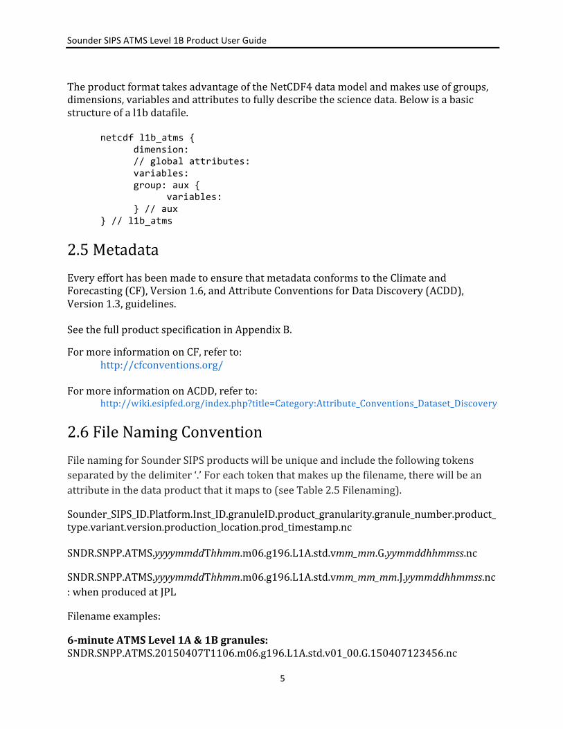
TheproductformattakesadvantageoftheNetCDF4datamodelandmakesuseofgroups,dimensions,variablesandattributestofullydescribethesciencedata.Belowisabasicstructureofal1bdatafile. netcdf l1b_atms { dimension: // global attributes: variables: group: aux { variables: } // aux } // l1b_atms 2.5MetadataEveryefforthasbeenmadetoensurethatmetadataconformstotheClimateandForecasting(CF),Version1.6,andAttributeConventionsforDataDiscovery(ACDD),Version1.3,guidelines.SeethefullproductspecificationinAppendixB. FormoreinformationonCF,referto: http://cfconventions.org/FormoreinformationonACDD,referto: http://wiki.esipfed.org/index.php?title=Category:Attribute_Conventions_Dataset_Discovery2.6FileNamingConventionFilenamingforSounderSIPSproductswillbeuniqueandincludethefollowingtokensseparatedbythedelimiter‘.’Foreachtokenthatmakesupthefilename,therewillbeanattributeinthedataproductthatitmapsto(seeTable2.5Filenaming).
Sounder_SIPS_ID.Platform.Inst_ID.granuleID.product_granularity.granule_number.product_type.variant.version.production_location.prod_timestamp.ncSNDR.SNPP.ATMS.yyyymmddThhmm.m06.g196.L1A.std.vmm_mm.G.yymmddhhmmss.nc
SNDR.SNPP.ATMS.yyyymmddThhmm.m06.g196.L1A.std.vmm_mm_mm.J.yymmddhhmmss.nc:whenproducedatJPL
Filenameexamples:
6-minuteATMSLevel1A&1Bgranules:SNDR.SNPP.ATMS.20150407T1106.m06.g196.L1A.std.v01_00.G.150407123456.nc

SounderSIPSATMSLevel1BProductUserGuide
6
SNDR.SNPP.ATMS.20150407T1106.m06.g196.L1B.std.v01_00.G.150407123459.nc
Where:
o Sounder_SIPS_IDasaprojectidentifier<product_name_project>=SNDRo Platform<product_name_platform>=SNPPo Inst_ID<product_name_instr>=ATMSo granuleID(yyyymmddThhmm)<gran_id>nominalstarttimewhere:
§ yyyy=year§ mm=monthofyear(01-12)§ dd=dayofmonth(01-31)§ hh=hour(00-24)§ mm=minute(00-59)
o product_granularity<product_name_duration>=m06(6minute)o granule_number<granule_number>=g###o product_typewithanoptionalidentifierfortesting<product_type_name_id>
§ L1BforATMSLevel1B
o variant<product_name_variant>=stdo versionvmm_mm<product_name_version>-eg.v01_08
§ VersioningwillbesynchronizedacrossSounderSIPSproductso production_location<product_name_producer>-J=SIPSatJPL,
G=Operations,T=Test,W=CrISTeamatUWisco prod_timestampsoeachproducthasauniquename(yymmddhhmmss)
<product_name_timestamp>-150407123456o Extension(.nc)
Table2.6FileanamingFilenametoken AttributenameinCDF
(mapping)Format Value(s) Notes
Sounder_SIPS_ID product_name_project SNDR Platform product_name_platform SNPP Inst_ID product_name_instr ATMS,CrIS granuleID gran_id yyyymmddThhmm Nominalstarttime product_granularity product_name_duration m06 6minutesgranule_number granule_number g### g001–g240 Onlyfor6-
minutegranuleproducts
product_type product_name_type_id+optionalidentifierforuniqueness
L1A,L1B,L1BNSR NSR=NormalSpectralResolution
Version product_name_version v01_##;v01_##_## e.g.v01_08;v01_08_00(whenproducedatJPL)

SounderSIPSATMSLevel1BProductUserGuide
7
variant product_name_variant Freeformtext.Nowhitespaceorpunctuationexceptunderscore.
std Usedtoidentifyspecialruns.Thedefaultis:std=standard.
production_location product_name_producer J:JetPropulsionLaboratoryG:GoddardSpaceFlightCenterT:TestW:UniversityofWisconsin
prod_timestamp product_name_timestamp yymmddhhmmss
3.0DataContentsTheATMSL1BdataproductsarewritteninNetCDF4formatandthereforemakesuseofgroups,dimensions,variablesandattributes(global&variable).EveryNetCDF4/HDF5filecontains,ataminimum,onerootgroupwhichisunnamed.AttentionshouldbegiventoqualityflagsandcheckedforfillvaluesbeforebeingusedforanyanalysisorhigherprocessingoftheL1Bproduct.AfullprofileofthecontentsofthefilesisincludedinAppendixB.
Selectedfieldsarehighlightedinthissection.
3.1Dimensions KeydimensionsusedthroughouttheATMSL1Bproduct.
Table3.1Dimensions
Dimensionname Size Meaning
atrack 135 Along-trackspatialdimension
xtrack 96 Cross-trackspatialdimension
channel 22 ATMSchannels
band 5 Microwavebands:K,Ka,V,W,G
utc_tuple 7 year,month,day,hour,minute,second,msec

SounderSIPSATMSLevel1BProductUserGuide
8
3.2GlobalAttributesTherearetwotypesofattributes:global&variable.Inthissecionwewilltalkaboutglobalattributes.Globalattributes,sometimesreferredtoas‘file-levelattributes’,provideinformationabouttheentirefileor6-minutegranule.Thisincludesobservationtimes,publisherandcreatorinformation,dataprovenance,geolocationinformation.ManyattributesarerequiredtoconformtotheCF&ACDDstandardswhileotherattributesarewrittenforconsistencywithlegacyproducts,hence,youmayfindsomeinformationtobealittleredundantordifferinginthenamingconvention.
TherearesomeQAglobalattributesthatshouldbeconsideredbeforeusingthedatainanalysisorprocessing.SeeTable3.2.2GlobalAttributesorAppendixB:CDLFileDefinitionforfulldefinition.
Table3.2.1QAAttributeName Type Dimension DescriptionAutomaticQualityFlag string Passed:thegranulecontainsanon-degraded
calibratedbrightnesstemperatureorradianceforatleastonechannelinageolocatedFOVSuspect:thegranuledoesnotqualifyas"Passed"butcontainsa(possiblydegraded)calibratedbrightnesstemperatureorradianceforatleastonechannel(possiblywithoutassociatedgeolocation)Failed:thegranulecontainsnocalibratedbrightnesstemperatures/radiances.
geo_qual ushort atrack,xtrack Overallvalueof0indicatesnocriticalissues.Bit2(surface_loc)-FailedgeolocationonEarthtopographicsurfaceBit3(DEM)-CouldnotsetFOVsurfaceelevationsandlandwaterfractionBit4(geoid_loc)-FailedgeolocationonEarthgeoidBit5(solar_ang)-FailedtosetsolarzenithorazimuthanglesBit6(spacecraft_ang)-FailedtosetspacecraftzenithorazimuthanglesBit7-Unused(0)Bit8(band_specific)-Failedgeolocationofsomebands
qa_no_data string Asimpleindicatorofwhetherthisisan"empty"granulewithnodatafromtheinstrument."TRUE"or"FALSE".
AfulldefinitionoftheglobalattributescanbefoundinAppendixB:CDLFileDefinition.
Table3.2.2GlobalAttributes

SounderSIPSATMSLevel1BProductUserGuide
9
Attribute Name Type Description Heritage naming_authority string The organization that provides the initial id (see above) for
the dataset. The naming authority should be uniquely specified by this attribute. We recommend using reverse-DNS naming for the naming authority; URIs are also acceptable. Example: 'edu.ucar.unidata'.
ACDD Recommended
history string Provides an audit trail for modifications to the original data. This attribute is also in the NetCDF Users Guide: 'This is a character array with a line for each invocation of a program that has modified the dataset. Well-behaved generic netCDF applications should append a line containing: date, time of day, user name, program name and command arguments.' To include a more complete description you can append a reference to an ISO Lineage entity; see NOAA EDM ISO Lineage guidance.
CF, ACDD Recommended
source string The method of production of the original data. If it was model-generated, source should name the model and its version. If it is observational, source should characterize it. This attribute is defined in the CF Conventions. Examples: 'temperature from CTD #1234'; 'world model v.0.1'.
CF, ACDD Recommended
processing_level string A textual description of the processing (or quality control) level of the data.
ACDD Recommended
product_name_type_id string Product name as it appears in product_name (L1A, L1B, L2, SNO_AIRS_CrIS)
comment string Miscellaneous information about the data or methods used to produce it. Can be empty.
CF, ACDD Recommended
acknowledgment string A place to acknowledge various types of support for the project that produced this data.
ACDD Recommended
license string Provide the URL to a standard or specific license, enter "Freely Distributed" or "None", or describe any restrictions to data access and distribution in free text.
ACDD Recommended
standard_name_vocabulary
string The name and version of the controlled vocabulary from which variable standard names are taken. (Values for any standard_name attribute must come from the CF Standard Names vocabulary for the data file or product to comply with CF.) Example: 'CF Standard Name Table v27'.
ACDD Recommended
date_created string The date on which this version of the data was created. (Modification of values implies a new version, hence this would be assigned the date of the most recent values modification.) Metadata changes are not considered when assigning the date_created. The ISO 8601:2004 extended date format is recommended, as described in the Attribute Content Guidance section.
ACDD Recommended, ECS/AIRS ProductionDateTime
creator_name string The name of the person (or other creator type specified by the creator_type attribute) principally responsible for creating this data.
ACDD Recommended
creator_email string The email address of the person (or other creator type specified by the creator_type attribute) principally responsible for creating this data.
ACDD Recommended

SounderSIPSATMSLevel1BProductUserGuide
10
creator_url string The URL of the person (or other creator type specified by the creator_type attribute) principally responsible for creating this data.
ACDD Recommended
institution string Processing facility that produced this file CF, ACDD Recommended
project string The name of the project(s) principally responsible for originating this data. Multiple projects can be separated by commas, as described under Attribute Content Guidelines. Examples: 'PATMOS-X', 'Extended Continental Shelf Project'.
ACDD Recommended
publisher_name string The name of the person (or other entity specified by the publisher_type attribute) responsible for publishing the data file or product to users, with its current metadata and format.
ACDD Recommended
publisher_email string The email address of the person (or other entity specified by the publisher_type attribute) responsible for publishing the data file or product to users, with its current metadata and format.
ACDD Recommended
publisher_url string The URL of the person (or other entity specified by the publisher_type attribute) responsible for publishing the data file or product to users, with its current metadata and format.
ACDD Recommended
geospatial_bounds string Describes the data's 2D or 3D geospatial extent in OGC's Well-Known Text (WKT) Geometry format (reference the OGC Simple Feature Access (SFA) specification). The meaning and order of values for each point's coordinates depends on the coordinate reference system (CRS). The ACDD default is 2D geometry in the EPSG:4326 coordinate reference system. The default may be overridden with geospatial_bounds_crs and geospatial_bounds_vertical_crs (see those attributes). EPSG:4326 coordinate values are latitude (decimal degrees_north) and longitude (decimal degrees_east), in that order. Longitude values in the default case are limited to the -180, 180) range. Example: 'POLYGON ((40.26 -111.29, 41.26 -111.29, 41.26 -110.29, 40.26 -110.29, 40.26 -111.29))'.
ACDD Recommended
geospatial_bounds_crs string The coordinate reference system (CRS) of the point coordinates in the geospatial_bounds attribute. This CRS may be 2-dimensional or 3-dimensional, but together with geospatial_bounds_vertical_crs, if that attribute is supplied, must match the dimensionality, order, and meaning of point coordinate values in the geospatial_bounds attribute. If geospatial_bounds_vertical_crs is also present then this attribute must only specify a 2D CRS. EPSG CRSs are strongly recommended. If this attribute is not specified, the CRS is assumed to be EPSG:4326. Examples: 'EPSG:4979' (the 3D WGS84 CRS), 'EPSG:4047'.
ACDD Recommended
geospatial_lat_min float Describes a simple lower latitude limit; may be part of a 2- or 3-dimensional bounding region. Geospatial_lat_min specifies the southernmost latitude covered by the dataset.
ACDD Recommended

SounderSIPSATMSLevel1BProductUserGuide
11
geospatial_lat_max float Describes a simple upper latitude limit; may be part of a 2- or 3-dimensional bounding region. Geospatial_lat_max specifies the northernmost latitude covered by the dataset.
ACDD Recommended
geospatial_lon_min float Describes a simple longitude limit; may be part of a 2- or 3-dimensional bounding region. geospatial_lon_min specifies the westernmost longitude covered by the dataset. See also geospatial_lon_max.
ACDD Recommended
geospatial_lon_max float Describes a simple longitude limit; may be part of a 2- or 3-dimensional bounding region. geospatial_lon_max specifies the easternmost longitude covered by the dataset. Cases where geospatial_lon_min is greater than geospatial_lon_max indicate the bounding box extends from geospatial_lon_max, through the longitude range discontinuity meridian (either the antimeridian for -180:180 values, or Prime Meridian for 0:360 values), to geospatial_lon_min; for example, geospatial_lon_min=170 and geospatial_lon_max=-175 incorporates 15 degrees of longitude (ranges 170 to 180 and -180 to -175).
ACDD Recommended
time_coverage_start string Nominal start time. Describes the time of the first data point in the data set. Use the ISO 8601:2004 date format, preferably the extended format as recommended in the Attribute Content Guidance section.
ACDD Recommended
time_of_first_valid_obs
string Describes the time of the first valid data point in the data set. Use the ISO 8601:2004 date extended format.
time_coverage_mid string Describes the midpoint between the nominal start and end times. Use the ISO 8601:2004 date format, preferably the extended format as recommended in the Attribute Content Guidance section.
Sounder SIPS extension by analogy with ACDD time_coverage_start and time_coverage_end
time_coverage_end string Nominal end time. Describes the time of the last data point in the data set. Use ISO 8601:2004 date format, preferably the extended format as recommended in the Attribute Content Guidance section.
ACDD Recommended
time_of_last_valid_obs
string
time_coverage_duration
string Describes the duration of the data set. Use ISO 8601:2004 duration format, preferably the extended format as recommended in the Attribute Content Guidance section.
ACDD Recommended
product_name_duration
string Product duration as it appears in product_name (m06 means six minutes)
creator_type string Specifies type of creator with one of the following: 'person', 'group', 'institution', or 'position'. If this attribute is not specified, the creator is assumed to be a person.
ACDD Suggested

SounderSIPSATMSLevel1BProductUserGuide
12
creator_institution string The institution of the creator; should uniquely identify the creator's institution. This attribute's value should be specified even if it matches the value of publisher_institution, or if creator_type is institution.
ACDD Suggested
product_version string Version identifier of the data file or product as assigned by the data creator. For example, a new algorithm or methodology could result in a new product_version.
ACDD Suggested, (ECS versionid)
keywords_vocabulary string If you are using a controlled vocabulary for the words/phrases in your "keywords" attribute, this is the unique name or identifier of the vocabulary from which keywords are taken. If more than one keyword vocabulary is used, each may be presented with a prefix and a following comma, so that keywords may optionally be prefixed with the controlled vocabulary key. Example: 'GCMD:GCMD Keywords, CF:NetCDF COARDS Climate and Forecast Standard Names'.
ACDD Suggested
platform string Name of the platform(s) that supported the sensor data used to create this data set or product. Platforms can be of any type, including satellite, ship, station, aircraft or other. Indicate controlled vocabulary used in platform_vocabulary.
ACDD Suggested
platform_vocabulary string Controlled vocabulary for the names used in the "platform" attribute.
ACDD Suggested
product_name_platform
string Platform name as it appears in product_name
instrument string Name of the contributing instrument(s) or sensor(s) used to create this data set or product. Indicate controlled vocabulary used in instrument_vocabulary.
ACDD Suggested
instrument_vocabulary string Controlled vocabulary for the names used in the "instrument" attribute.
ACDD Suggested
product_name_instr string Instrument name as it appears in product_name
product_name string Canonical fully qualified product name (official file name) ECS LocalGranuleID
product_name_variant string Processing variant identifier as it appears in product_name. 'std' (shorthand for 'standard') is to be the default and should be what is seen in all public products.
product_name_version string Version number as it appears in product_name (v01_00_00)
product_name_producer
string Production facility as it appears in product_name (single character) 'T' is the default, for unofficial local test products
product_name_timestamp
string Processing timestamp as it appears in product_name (yymmddhhmmss)
product_name_extension
string File extension as it appears in product_name (typically nc)
granule_number ushort granule number of day (1-240) AIRS

SounderSIPSATMSLevel1BProductUserGuide
13
product_name_granule_number
string zero-padded string for granule number of day (g001-g240) AIRS
gran_id string Unique granule identifier yyyymmddThhmm of granule start, including year, month, day, hour, and minute of granule start time
geospatial_lat_mid float granule center latitude AIRS LatgranuleCen
geospatial_lon_mid float granule center longitude AIRS LongranuleCen
featureType string structure of data in file CF
data_structure string a character string indicating the internal organization of the data with currently allowed values of 'grid', 'station', 'trajectory', or 'swath'. The 'structure' here generally describes the horizontal structure and in all cases data may also be functions, for example, of a vertical coordinate and/or time. (If using CMOR pass this in a call to cmor_set_cur_dataset_attribute.)
CMIP5/CMOR
cdm_data_type string The data type, as derived from Unidata's Common Data Model Scientific Data types and understood by THREDDS. (This is a THREDDS "dataType", and is different from the CF NetCDF attribute 'featureType', which indicates a Discrete Sampling Geometry file in CF.)
ACDD Suggested
identifier_product_doi_authority
string digital signature source AIRS
algorithm_version string The version of the algorithm in whatever format is selected by the developers. Versions from multiple sub-algorithms may be concatenated with semicolon separators. (ex: 'CCAST 4.2; BB emis from MIT 2016-04-01')
production_host string Identifying information about the host computer for this run. (Output of linux "uname -a" command.)
format_version string Format version.
input_file_names string Semicolon-separated list of names or unique identifiers of files that were used to make this product. There will always be one space after each semicolon. There is no final semicolon.
ECS InputPointer; ISO Source Citation
input_file_types string Semicolon-separated list of tags giving the role of each input file in input_file_names. There will always be one space after each semicolon. There is no final semicolon.
ISO Source Description
input_file_dates string Semicolon-separated list of creation dates for each input file in input_file_names. There will always be one space after each semicolon. There is no final semicolon.
ISO Source Creation Date

SounderSIPSATMSLevel1BProductUserGuide
14
orbitDirection string Orbit is ascending and/or descending. Values are "Ascending" or "Descending" if the entire granule fits that description. "NorthPole" and "SouthPole" are used for polar-crossing granules. "NA" is used when a determination cannot be made.
SMAP uses this attribute name but only asc/desc because files are half orbits. The values used here are similar to AIRS node_type.
day_night_flag string Data is day or night. "Day" means subsatellite point for all valid scans has solar zenith angle less than 90 degrees. "Night" means subsatellite point for all valid scans has solar zenith angle greater than 90 degrees. "Both" means the dataset contains valid observations with solar zenith angle above and below 90 degrees. "NA" means a value could not be determined.
AIRS DayNightFlag
AutomaticQualityFlag string "Passed": the granule contains a non-degraded calibrated brightness temperature or radiance for at least one channel in a geolocated FOV "Suspect": the granule does not qualify as "Passed" but contains a (possibly degraded) calibrated brightness temperature or radiance for at least one channel (possibly without associated geolocation) "Failed": the granule contains no calibrated brightness temperatures/radiances.
ECS. AIRS called it AutomaticQAFlag in HDF attributes but AutomaticQualityFlag in metadata.
qa_pct_data_missing float Percentage of expected observations that are missing. ECS, maps to (part of) ISO 19115 CompletenessComission
qa_pct_data_geo float Percentage of expected observations that are successfully geolocated.
maps to (part of) ISO 19115 CompletenessComission
qa_pct_data_sci_mode float Percentage of expected observations that were taken while the instrument was in science mode and are successfully geolocated.
maps to (part of) ISO 19115 CompletenessComission
qa_no_data string A simple indicator of whether this is an "empty" granule with no data from the instrument. "TRUE" or "FALSE".

SounderSIPSATMSLevel1BProductUserGuide
15
3.3VariableAttributesEachvariablehasitsownassociatedattributes.VariablesattributesareaCFstandardandareusedtodescribethevariableinfulldetailtoproperlyinterpretitsvalue.
Table3.3:VariableAttributesAttribute Relevant
standard(s)Description
units CF,UDUNITS units,forvariablesthatrepresentphysicalquantities
_FillValue CF,NetCDF asinglesentinelvalueindicatingthedatapointcontainsfillinsteadofvaliddata
standard_name CF standardnamefromtheCFstandardnametable,ifoneexistsforthequantitybeingrepresented
long_name CF alongernamedescribingthequantitybeingrepresented,suitableforaplottitle
valid_range CF apairofvaluesindicatingtheminimumandmaximumvaluestobeconsideredvalid
coordinates CF aspace-separatedlistofthenamesofothervariablesthatarecoordinatesforthisvariable
description alongerdescriptionofthequantitybeingrepresented
coverage_content_type ACDD,ISO19115-1 indicatesthesourceofthedataancillary_variables CF aspace-separatedlistofthenamesofother
variablesthatcontaininformationaboutthisvariable
bounds CF definestheextent,forcellvariablescell_methods CF describesstatisticalmethodsusedtoderive
data,forcellvariablesflag_values CF acomma-separatedlistofflagvalues,for
variablesthatrepresentflagsflag_meanings CF aspaceseparatedlistofthemeaningsofeach
flagvalue,forvariablesthatrepresentflagsflag_masks CF acomma-separatedlistofflagmasks,for
variablesthatrepresentflags.Ifthisattributeispresent,thebasicruleis“applytheflagmaskandifyougettheflagvalue,itmeanstheflagmeaning”

SounderSIPSATMSLevel1BProductUserGuide
16
3.4GeolocationKeygeophysicaldimensionsarespacecraftpositionandaltitude.
Table3.4.1GeolocationDimensions
Dimensionname Size Meaning
atrack 135 Along-trackspatialdimension
xtrack 96 Cross-trackspatialdimension
Andthekeygeolocationvariablesare:
Table3.4.2GeolocationVariablesGeolocationVariable
Dimensions Type Meaning
lat atrack,xtrack 32-bitfloating-point latitudeoffovcenter
lon atrack,xtrack 32-bitfloating-point longitudeoffovcenter
obs_time_tai atrack,xtrack 64-bitfloating-point earthviewobservationmidtimeforeachfovinunitsofsecondssince1993-01-01T00:00:00
obs_time_utc atrack,xtrack,utc_tuple
16-bitinteger UTCearthviewobservationtimeasanarrayofintegers:year,month,day,hour,minute,second,msec
3.5KeyScienceDataFieldsKeysciencedatafieldsandtheauxgroupandtheirdimensionsaredefinedbelow.
Table3.5.1ScienceDataFields
Variable Dimensions Type Meaning
antenna_temp atrack,xtrack,channel
32-bitfloating-point
CalibratedscenebrightnesstemperatureforeachATMSchannelandbeamposition.ThisoutputistheRayleighequivalenttemperatureandnotthePlanckblackbodyequivalenttemperature
cold_nedt channel 32-bitfloating- Noiseequivalentdeltatemperature

SounderSIPSATMSLevel1BProductUserGuide
17
point derivedfromobservationsofcoldspace
warm_nedt channel 32-bitfloating-point
Noiseequivalentdeltatemperaturederivedfromobservationsofthewarmcalibrationtarget
Theauxgroupisnotreadilyusedbythewiderusercommunitybutisprovidedhereforcompleteness.
Table3.5.2AuxGroupVariableName
Type Dimension Units Description
offset float atrack,channel Kelvin Offsetusedincalibratingearthscenebrightnesstemps
gain float atrack,channel Count/Kelvin Gainfactorusedincalibratingearthscenebrightnesstemps.
nonlin float atrack,xtrack,channel
Kelvin Nonlinearitycorrectionusedincalibratingearthscenebrightnesstemps
cold_temp float atrack,channel Kelvin Effectivetemperatureofcoldcalibrationview(space)(Tcc)";
warm_temp float atrack,channel Kelvin Effectivetemperatureofwarmcalibrationview(blackbody)(Twc)";
3.6MissingData/FillValuesOnoccasion,therewillbedatathatismissingforwhateverreason.Inthesituationwherethereareincompletegranuleswithinthe6-minuteproductgranule,themissingdatawillbefilledwitha‘FillValues’.Thefillvalueisindicatedbytheattribute‘_FillValue’.Thefillvaluewillexistinthesamelocationthemissingdatawouldexist.Thiswillpreservetheshapeofthe6-minutegranule.Shouldthedataforanentire6-minutegranulebemissing,agranulewillstillbeproducedandwillcontainallfillvalues.Inotherwords,afullfill-valuegranulewillbeproduced.Withthisinmind,itisadvisedtocheckthedataforfillvaluesbeforeitisused.Thefillvaluesarelistedinthetablebelow.

SounderSIPSATMSLevel1BProductUserGuide
18
Table:3.6.1FillValuesVariableType FillValueubyte 255UB ushort 65535US
uint 4294967295U float 9.96921e+36f double 9.96920996838687e+36
4.0OptionsforReadingtheDataTheATMSL1BfilesarewritteninNetCDF4/HDF5.BecauseNetCDF4buildsupontheclassicNetCDFdatamodelusingHDF5asthestoragelayer,auserofthedataproductcantakefulladvantageoftoolsandlibrariesreadilyavailabletoaccessthedata.
EveryNetCDF4fileisconsideredanHDF5file,however,noteveryHDF5fileisnecessarilyaNetCDF4file.AlimitedsubsetoftheHDF5datamodelandfileformatfeaturesareusedinNetCDF4files.ConformancetotheearliermentionedCF&ACDDstandardsallowsforuserstotakeadvantageofmostNetCDFinterfaces.
ToolsandlibrariesforreadingNetCDF4aswellasaNetCDFUsers’GuidearewrittenandmaintainedbyUnidataandcanbefoundonlineat:
http://www.unidata.ucar.edu/software/netcdf/
ThereareanumberofinterfacesavailableforreadingNetCDFfordifferentprogramminglanguagesincluding:C/C++,Fortran,Matlab,IDL,PythonandPerl.
Additionally,butcanalsobeaccessedwithHDF5toolsandlibrariesavailableat:https://www.hdfgroup.org/products/hdf5_tools/
5.0DataServices
TheATMSLevel1BproductsareavailabletotheusercommunityviatheGoddardDistributedActiveArchiveCenter(GDAAC).
https://disc.gsfc.nasa.gov/datasets/SNPPATMSL1B_V1/summary
The ATMS Level 1A products are not made publicly available. No other Data Services are provided for these products.

SounderSIPSATMSLevel1BProductUserGuide
19
AppendixA:calib_degradedFlagFlag Binindex Numbits meaning
reserved 28-32 1 0sv4_moon_unknown 27 1 Missingmoonangleforthisscan'sspaceview#4.
Lunarintrusionstatusisunknown.sv3_moon_unknown 26 1 Missingmoonangleforthisscan'sspaceview#3.
Lunarintrusionstatusisunknown.sv2_moon_unknown 25 1 Missingmoonangleforthisscan'sspaceview#2.
Lunarintrusionstatusisunknown.sv1_moon_unknown 24 1 Missingmoonangleforthisscan'sspaceview#1.
Lunarintrusionstatusisunknown.sv4_bad 23 1 Thisscan'sspaceview#4notusedbecauseof
lunarintrusionorotherproblem.Ascan-specificcalibrationmaystillbecalculatedusingspaceviewsfromneighboringviewsandscans.
sv3_bad 22 1 Thisscan'sspaceview#3notusedbecauseoflunarintrusionorotherproblem.Ascan-specificcalibrationmaystillbecalculatedusingspaceviewsfromneighboringviewsandscans.
sv2_bad 21 1 Thisscan'sspaceview#2notusedbecauseoflunarintrusionorotherproblem.Ascan-specificcalibrationmaystillbecalculatedusingspaceviewsfromneighboringviewsandscans.
sv1_bad 20 1 Thisscan'sspaceview#1notusedbecauseoflunarintrusionorotherproblem.Ascan-specificcalibrationmaystillbecalculatedusingspaceviewsfromneighboringviewsandscans.
reserved 18–19 1 0bb_bad 17 1 Thisscan'sblackbodyviewnotused.Ascan-
specificcalibrationmaystillbecalculatedusingblackbodyviewsfromneighboringscans.
reserved 14-16 1 0shelf_temp_bad 13 1 Insufficientvalidshelftemperaturevaluestouse
inascancalibration.Fall-backconstantshelftemperaturesareused.
space_temp_bad 12 1 Insufficienteffectivespacetemperaturevaluestoproduceascan-specificcalibration.Scanmaystillbecalibratedusingcoefficientsfromanotherscan.
bb_temp_bad 11 1 Insufficientvalidblackbodytemperaturereadingstoproduceascan-specificcalibration.Scanmaystillbecalibratedusingcoefficientsfromanotherscan.
cold_cal_bad 10 1 Insufficientvalidspace(coldcalibration)observationcountstoproduceascan-specificcalibration.Scanmaystillbecalibratedusing

SounderSIPSATMSLevel1BProductUserGuide
20
coefficientsfromanotherscan.warm_cal_bad 9 1 Insufficientvalidblackbody(warmcalibration)
observationcountstoproduceascan-specificcalibration.Scanmaystillbecalibratedusingcoefficientsfromanotherscan.
reserved 4-8 1 0cal_from_diff_scan 3 1 Calibrationvaluesusedfromdifferentscancal_failed 2 1 Nousablecalibration.Scanisnotcalibrated.reserved 1 1 0
AppendixB:CDLFileDefinitionAfulldataproductspecificationisgeneratedbyusingtheNetCDF4libraryandusingthencdumputility.ThisproducesaCDLtextfileshowingthefullstructureoftheATMSL1bdatafile.
ThecommandusedtogeneratetheCDLfileis:ncdump–h<filename>.nc
netcdf l1b_atms { dimensions: spatial = 3; // directions: x, y, z fov_poly = 8; // lat/lon points defining the ploygon bounding an fov (anticlockwise as viewed from above) utc_tuple = 8; // parts of UTC time attitude = 3; // roll, pitch, yaw atrack = 135; // along-track spatial dimension xtrack = 96; // cross-track spatial dimension channel = 22; // channel number band = 5; // Microwave bands spacextrack = 4; // space view // global attributes: string :keywords="EARTH SCIENCE > SPECTRAL/ENGINEERING > MICROWAVE > ANTENNA TEMPERATURE"; // A comma-separated list of key words and/or phrases. Keywords may be common words or phrases, terms from a controlled vocabulary (GCMD is often used), or URIs for terms from a controlled vocabulary (see also "keywords_vocabulary" attribute). string :Conventions="CF-1.6, ACDD-1.3"; string :naming_authority="Unassigned"; // In final published products this is expected to be http://dx.doi.org/; The organization that provides the initial id (see above) for the dataset. The naming authority should be uniquely specified by this attribute. We recommend using reverse-DNS naming for the naming authority; URIs are also acceptable. Example: 'edu.ucar.unidata'. string :history=""; // Requirement against executable that writes the NetCDF. Value will be appended to and not overwritten.; Provides an audit trail for modifications to the original data. This attribute is also in the NetCDF Users Guide: 'This is a character array with a line for each invocation of a program that has modified the dataset. Well-behaved generic netCDF applications should append a line containing: date, time of day, user name, program name and command arguments.' To include a more complete description you can append a reference to an ISO Lineage entity; see NOAA EDM ISO Lineage guidance. string :source="ATMS instrument telemetry"; // The method of production of the original data. If it was model-generated, source should name the model and its version. If it is observational, source should characterize it. This attribute is

SounderSIPSATMSLevel1BProductUserGuide
21
defined in the CF Conventions. Examples: 'temperature from CTD #1234'; 'world model v.0.1'. string :processing_level="1B"; // A textual description of the processing (or quality control) level of the data. string :product_name_type_id="L1B"; // Product name as it appears in product_name (L1A, L1B, L2, SNO_AIRS_CrIS) string :comment=""; // Currently not intended to be used.; Miscellaneous information about the data or methods used to produce it. Can be empty. string :acknowledgment="Support for this research was provided by NASA."; // A place to acknowledge various types of support for the project that produced this data. string :license="Limited to Sounder SIPS affiliates"; // Provide the URL to a standard or specific license, enter "Freely Distributed" or "None", or describe any restrictions to data access and distribution in free text. string :standard_name_vocabulary="CF Standard Name Table v28"; // The name and version of the controlled vocabulary from which variable standard names are taken. (Values for any standard_name attribute must come from the CF Standard Names vocabulary for the data file or product to comply with CF.) Example: 'CF Standard Name Table v27'. string :date_created="Unassigned"; // PGE responsibility; The date on which this version of the data was created. (Modification of values implies a new version, hence this would be assigned the date of the most recent values modification.) Metadata changes are not considered when assigning the date_created. The ISO 8601:2004 extended date format is recommended, as described in the Attribute Content Guidance section. string :creator_name="Unassigned"; // The name of the person (or other creator type specified by the creator_type attribute) principally responsible for creating this data. string :creator_email="Unassigned"; // The email address of the person (or other creator type specified by the creator_type attribute) principally responsible for creating this data. string :creator_url="Unassigned"; // The URL of the person (or other creator type specified by the creator_type attribute) principally responsible for creating this data. string :institution="Unassigned"; // Processing facility that produced this file string :project="Sounder SIPS"; // The name of the project(s) principally responsible for originating this data. Multiple projects can be separated by commas, as described under Attribute Content Guidelines. Examples: 'PATMOS-X', 'Extended Continental Shelf Project'. string :product_name_project="SNDR"; // The name of the project as it appears in the file name. 'SNDR' for all Sounder SIPS products, even AIRS products. string :publisher_name="Unassigned"; // The name of the person (or other entity specified by the publisher_type attribute) responsible for publishing the data file or product to users, with its current metadata and format. string :publisher_email="Unassigned"; // The email address of the person (or other entity specified by the publisher_type attribute) responsible for publishing the data file or product to users, with its current metadata and format. string :publisher_url="Unassigned"; // The URL of the person (or other entity specified by the publisher_type attribute) responsible for publishing the data file or product to users, with its current metadata and format. string :geospatial_bounds=""; // Will use the POLYGON as shown in the description. The example is clockwise as viewed from above, but WKT spec at https://en.wikipedia.org/wiki/Well-known_text says it should be counter-clockwise. We'll go counterclockwise. The last point must repeat the first point to provide closure. L1A PGE geolocation fills in and later PGEs copy.; Describes the data's 2D or 3D geospatial extent in OGC's Well-Known Text (WKT) Geometry format (reference the OGC Simple Feature Access (SFA) specification). The meaning and order of values for each point's coordinates depends on the coordinate reference system (CRS). The ACDD default is 2D geometry in the EPSG:4326 coordinate reference system. The default may be overridden with geospatial_bounds_crs and geospatial_bounds_vertical_crs (see those attributes). EPSG:4326 coordinate values are latitude (decimal degrees_north) and longitude (decimal degrees_east), in that order. Longitude values in the default case

SounderSIPSATMSLevel1BProductUserGuide
22
are limited to the -180, 180) range. Example: 'POLYGON ((40.26 -111.29, 41.26 -111.29, 41.26 -110.29, 40.26 -110.29, 40.26 -111.29))'. string :geospatial_bounds_crs="EPSG:4326"; // The coordinate reference system (CRS) of the point coordinates in the geospatial_bounds attribute. This CRS may be 2-dimensional or 3-dimensional, but together with geospatial_bounds_vertical_crs, if that attribute is supplied, must match the dimensionality, order, and meaning of point coordinate values in the geospatial_bounds attribute. If geospatial_bounds_vertical_crs is also present then this attribute must only specify a 2D CRS. EPSG CRSs are strongly recommended. If this attribute is not specified, the CRS is assumed to be EPSG:4326. Examples: 'EPSG:4979' (the 3D WGS84 CRS), 'EPSG:4047'. float :geospatial_lat_min=9.9692099683868690e+36f; // PGE responsibility; Describes a simple lower latitude limit; may be part of a 2- or 3-dimensional bounding region. Geospatial_lat_min specifies the southernmost latitude covered by the dataset. float :geospatial_lat_max=9.9692099683868690e+36f; // PGE responsibility; Describes a simple upper latitude limit; may be part of a 2- or 3-dimensional bounding region. Geospatial_lat_max specifies the northernmost latitude covered by the dataset. float :geospatial_lon_min=9.9692099683868690e+36f; // PGE responsibility; Describes a simple longitude limit; may be part of a 2- or 3-dimensional bounding region. geospatial_lon_min specifies the westernmost longitude covered by the dataset. See also geospatial_lon_max. float :geospatial_lon_max=9.9692099683868690e+36f; // PGE responsibility; Describes a simple longitude limit; may be part of a 2- or 3-dimensional bounding region. geospatial_lon_max specifies the easternmost longitude covered by the dataset. Cases where geospatial_lon_min is greater than geospatial_lon_max indicate the bounding box extends from geospatial_lon_max, through the longitude range discontinuity meridian (either the antimeridian for -180:180 values, or Prime Meridian for 0:360 values), to geospatial_lon_min; for example, geospatial_lon_min=170 and geospatial_lon_max=-175 incorporates 15 degrees of longitude (ranges 170 to 180 and -180 to -175). string :time_coverage_start=""; // We use nominal limits, not the actual timestamp of the first data point. (seconds always = 00.00"); Nominal start time. Describes the time of the first data point in the data set. Use the ISO 8601:2004 date format, preferably the extended format as recommended in the Attribute Content Guidance section. string :time_of_first_valid_obs=""; // This is a companion to time_coverage_start. But where time_coverage_start gives the nominal limit, this gives the actual timestamp of the first valid observation included in the product.; Describes the time of the first valid data point in the data set. Use the ISO 8601:2004 date extended format. string :time_coverage_mid=""; // We use nominal limits, not the actual timestamps of the first and last data points. (seconds always = 00.00"); Describes the midpoint between the nominal start and end times. Use the ISO 8601:2004 date format, preferably the extended format as recommended in the Attribute Content Guidance section. string :time_coverage_end=""; // We use nominal limits, not the actual timestamp of the first data point. (seconds always = 00.00") This value may be 1 second wrong in case of a leapsecond.; Nominal end time. Describes the time of the last data point in the data set. Use ISO 8601:2004 date format, preferably the extended format as recommended in the Attribute Content Guidance section. string :time_of_last_valid_obs=""; // This is a companion to time_coverage_end. But where time_coverage_end gives the nominal limit, this gives the actual timestamp of the last valid observation included in the product. Note that this can be a few seconds after the nominal end time given in time_coverage_end.; string :time_coverage_duration="P0000-00-00T00:06:00"; // This value may technically be 1 second wrong in cases with leapseconds but the value will not change.; Describes the duration of the data set. Use ISO 8601:2004 duration format, preferably the extended format as recommended in the Attribute Content Guidance section. string :product_name_duration="m06"; // Product duration as it appears in product_name (m06 means six minutes) string :creator_type="institution"; // Specifies type of creator with one of the following: 'person', 'group', 'institution', or 'position'. If this attribute is not specified, the creator is assumed to be a person.

SounderSIPSATMSLevel1BProductUserGuide
23
string :creator_institution="Jet Propulsion Laboratory -- California Institute of Technology"; // The institution of the creator; should uniquely identify the creator's institution. This attribute's value should be specified even if it matches the value of publisher_institution, or if creator_type is institution. string :product_version="v01.00.00"; // product_version is the version assigned to the build of the overall Sounder SIPS system. It will increment for all PGEs each build, even if not all PGEs have any changes. Always of the form 'vxx.yy.zz', with 2-digit major, minor, and revision subfields. (ex 'v01.00.12.'). Major version will correspond to DISC collection number.; Version identifier of the data file or product as assigned by the data creator. For example, a new algorithm or methodology could result in a new product_version. string :keywords_vocabulary="GCMD:GCMD Keywords"; // If you are using a controlled vocabulary for the words/phrases in your "keywords" attribute, this is the unique name or identifier of the vocabulary from which keywords are taken. If more than one keyword vocabulary is used, each may be presented with a prefix and a following comma, so that keywords may optionally be prefixed with the controlled vocabulary key. Example: 'GCMD:GCMD Keywords, CF:NetCDF COARDS Climate and Forecast Standard Names'. string :platform="SUOMI-NPP > Suomi National Polar-orbiting Partnership"; // Name of the platform(s) that supported the sensor data used to create this data set or product. Platforms can be of any type, including satellite, ship, station, aircraft or other. Indicate controlled vocabulary used in platform_vocabulary. string :platform_vocabulary="GCMD:GCMD Keywords"; // Controlled vocabulary for the names used in the "platform" attribute. string :product_name_platform="SNPP"; // Platform name as it appears in product_name string :instrument="ATMS > Advanced Technology Microwave Sounder"; // Name of the contributing instrument(s) or sensor(s) used to create this data set or product. Indicate controlled vocabulary used in instrument_vocabulary. string :instrument_vocabulary="GCMD:GCMD Keywords"; // Controlled vocabulary for the names used in the "instrument" attribute. string :product_name_instr="ATMS"; // Instrument name as it appears in product_name string :product_name=""; // PGE responsibility; Canonical fully qualified product name (official file name) string :product_name_variant="std"; // PGE Responsibility ('std' should be the default); Processing variant identifier as it appears in product_name. 'std' (shorthand for 'standard') is to be the default and should be what is seen in all public products. string :product_name_version="vxx_xx_xx"; // product_name_version is a simplified form of product_version that goes into the file name. It substitutes underscores for dots and excludes the revision subfield. (ex 'v01_00' for distribution; 'v01_00_12' for local). Note this string will be flowed into the PGEs through the config files in order to provide control of how the filenames appear across the entire ensemble of data products.; Version number as it appears in product_name (v01_00_00) string :product_name_producer="T"; // PGE Responsibility; Production facility as it appears in product_name (single character) 'T' is the default, for unofficial local test products string :product_name_timestamp="yymmddhhmmss"; // PGE responsibility; Processing timestamp as it appears in product_name (yymmddhhmmss) string :product_name_extension="nc"; // File extension as it appears in product_name (typically nc) ushort :granule_number=0.0; // PGE responsibility. L1A fills in and later PGEs copy.; granule number of day (1-240) string :product_name_granule_number="g000"; // PGE responsibility. L1A fills in and later PGEs copy.; zero-padded string for granule number of day (g001-g240) string :gran_id="yymmddThhmm"; // PGE responsibility. L1A fills in and later PGEs copy.; Unique granule identifier yyyymmddThhmm of granule start, including year, month, day, hour, and minute of granule start time float :geospatial_lat_mid=9.9692099683868690e+36f; // PGE responsibility. L1A fills in and later PGEs copy.; granule center latitude

SounderSIPSATMSLevel1BProductUserGuide
24
float :geospatial_lon_mid=9.9692099683868690e+36f; // PGE responsibility. L1A fills in and later PGEs copy.; granule center longitude string :featureType="point"; // should be swath but that is not permitted by the current version of CF; structure of data in file string :data_structure="swath"; // a character string indicating the internal organization of the data with currently allowed values of 'grid', 'station', 'trajectory', or 'swath'. The 'structure' here generally describes the horizontal structure and in all cases data may also be functions, for example, of a vertical coordinate and/or time. (If using CMOR pass this in a call to cmor_set_cur_dataset_attribute.) string :cdm_data_type="Swath"; // The data type, as derived from Unidata's Common Data Model Scientific Data types and understood by THREDDS. (This is a THREDDS "dataType", and is different from the CF NetCDF attribute 'featureType', which indicates a Discrete Sampling Geometry file in CF.) string :identifier_product_doi_authority="Unassigned"; // probably redundant with naming_authority but retained for EOSDIS compatibility. Expected to be http://dx.doi.org/ in final publisted products.; digital signature source string :algorithm_version=""; // It is set by the PGE developers in a config file or source code they control, so that it can be set by the PGE at run time. If the PGE can switch different algorithms at runtime, the selected algorithm should be reflected here.; The version of the algorithm in whatever format is selected by the developers. Versions from multiple sub-algorithms may be concatenated with semicolon separators. (ex: 'CCAST 4.2; BB emis from MIT 2016-04-01') string :production_host=""; // PGE responsibility (for science code this string will be passed in); Identifying information about the host computer for this run. (Output of linux "uname -a" command.) string :format_version="v01.04.04"; // format_version relates to the spreadsheet. For public products it is of the form 'vxx.yy.zz'. For local runs from a local version of the spreadsheet it will add the suffix '_Untrusted': 'vxx.yy.zz_Untrusted'. Developers update it to reflect the level of changes, but always retain the '_Untrusted' suffix.; Format version. string :input_file_names=""; // File names only: not path+filename; Semicolon-separated list of names or unique identifiers of files that were used to make this product. There will always be one space after each semicolon. There is no final semicolon. string :input_file_types=""; // These are human-readable tokens agreed by the team. A downstream process will populate metadata by keying off a list of expected values. Values include: ATMS_L1A, ATMS_L1B_AlgParam, ATMS_L1B_Template; Semicolon-separated list of tags giving the role of each input file in input_file_names. There will always be one space after each semicolon. There is no final semicolon. string :input_file_dates=""; // Dates shall be formatted according to ISO 8601: YYYY-MM-DD; Semicolon-separated list of creation dates for each input file in input_file_names. There will always be one space after each semicolon. There is no final semicolon. string :orbitDirection="NA"; // Orbit is ascending and/or descending. Values are "Ascending" or "Descending" if the entire granule fits that description. "NorthPole" and "SouthPole" are used for polar-crossing granules. "NA" is used when a determination cannot be made. string :day_night_flag="NA"; // Data is day or night. "Day" means subsatellite point for all valid scans has solar zenith angle less than 90 degrees. "Night" means subsatellite point for all valid scans has solar zenith angle greater than 90 degrees. "Both" means the dataset contains valid observations with solar zenith angle above and below 90 degrees. "NA" means a value could not be determined. string :AutomaticQualityFlag="Missing"; // Similar to ECS field but ECS field is per observed parameter and here we give a single value. "Missing" is a special case when there is no downlinked data. These files are internal placeholders, never visible to the public.; "Passed": the granule contains a non-degraded calibrated brightness temperature or radiance for at least one channel in a geolocated FOV; "Suspect": the granule does not qualify as "Passed" but contains a (possibly degraded) calibrated brightness temperature or radiance for at least one channel (possibly without associated geolocation); "Failed": the granule contains no calibrated brightness temperatures/radiances.

SounderSIPSATMSLevel1BProductUserGuide
25
float :qa_pct_data_missing=100.0; // Similar to ECS field QAPercentMissingData but ECS field is per observed parameter and here we give a single value.; Percentage of expected observations that are missing. float :qa_pct_data_geo=0.0; // Percentage of expected observations that are successfully geolocated. float :qa_pct_data_sci_mode=0.0; // Percentage of expected observations that were taken while the instrument was in science mode and are successfully geolocated. string :qa_no_data="0"; // Processing systems may delete empty files or may propagate them as placeholders. Empty files should not be seen by the public.; A simple indicator of whether this is an "empty" granule with no data from the instrument. "TRUE" or "FALSE". string :title="SNPP ATMS Level-1B"; // a succinct description of what is in the dataset. (= ECS long name) string :summary="The Level-1B ATMS product includes data from the ATMS instrument for one six-minute interval. Data is geolocated and calibrated to antenna temperature."; // A paragraph describing the dataset, analogous to an abstract for a paper. string :shortname="SNPPATMSL1B"; // ECS Short Name string :product_group="l1b_atms"; string :id="Unassigned"; // DOI; An identifier for the data set, provided by and unique within its naming authority. The combination of the "naming authority" and the "id" should be globally unique, but the id can be globally unique by itself also. IDs can be URLs, URNs, DOIs, meaningful text strings, a local key, or any other unique string of characters. The id should not include white space characters. string :identifier_product_doi="Unassigned"; // probably redundant with id but retained for EOSDIS compatibility; digital signature string :metadata_link="http://disc.sci.gsfc.nasa.gov/"; // A URL that gives the location of more complete metadata. A persistent URL is recommended for this attribute. string :references="ATMS ATBD is in review. It will be published at http://eospso.gsfc.nasa.gov/content/algorithm-theoretical-basis-documents"; // ATDB and design documents describing processing algorithms. Can be empty. string :contributor_name="Jet Propulsion Laboratory: Bjorn Lambrigtsen"; // Can be a semicolon-separated list. contributor_role must then be a parallel semicolon-separated list.; The names of any individuals or institutions that contributed to the creation of this data. string :contributor_role="SNPP ATMS Scientist"; // See contributor_name; The roles of any individuals or institutions that contributed to the creation of this data. variables: string obs_id(atrack, xtrack); string obs_id:units="1"; string obs_id:long_name="earth view observation id"; string obs_id:description="unique earth view observation identifier: yyyymmddThhmm.aaaExx. Includes gran_id plus 3-digit along-track index (1-135) and 2-digit cross-track index (1-96)."; string obs_id:coverage_content_type="referenceInformation"; ubyte instrument_state(atrack, xtrack); string instrument_state:units="1"; string instrument_state:long_name="instrument state"; string instrument_state:coordinates="lon lat"; string instrument_state:description="instrument/data state: 0/'Process' - Data is usable for science; 1/'Special' - Observations are valid but instrument is not configured for science data (ex: stare mode); 2/'Erroneous' - Data is not usable (ex: checksum error); 3/'Missing' - No data was received."; ubyte instrument_state:_FillValue=255ub; string instrument_state:coverage_content_type="qualityInformation"; string instrument_state:flag_meanings="Process Special Erroneous Missing"; ubyte instrument_state:flag_values=0, 1, 2, 3;

SounderSIPSATMSLevel1BProductUserGuide
26
double obs_time_tai(atrack, xtrack); string obs_time_tai:units="seconds since 1993-01-01 00:00"; double obs_time_tai:valid_range=-2934835217.0, 3376598409.0; string obs_time_tai:long_name="earth view FOV midtime"; string obs_time_tai:standard_name="time"; string obs_time_tai:description="earth view observation midtime for each FOV"; double obs_time_tai:_FillValue=9.9692099683868690e+36; string obs_time_tai:coverage_content_type="referenceInformation"; ushort obs_time_utc(atrack, xtrack, utc_tuple); string obs_time_utc:units="1"; string obs_time_utc:long_name="earth view UTC FOV time"; string obs_time_utc:coordinates="utc_tuple_lbl"; string obs_time_utc:description="UTC earth view observation time as an array of integers: year, month, day, hour, minute, second, millisec, microsec"; ushort obs_time_utc:_FillValue= 65535us; string obs_time_utc:coverage_content_type="referenceInformation"; float lat(atrack, xtrack); string lat:units="degrees_north"; float lat:valid_range=-90.0, 90.0; string lat:long_name="latitude"; string lat:standard_name="latitude"; string lat:description="latitude of FOV center"; float lat:_FillValue=9.9692099683868690e+36f; string lat:coverage_content_type="referenceInformation"; string lat:bounds="lat_bnds"; float lat_geoid(atrack, xtrack); string lat_geoid:units="degrees_north"; float lat_geoid:valid_range=-90.0, 90.0; string lat_geoid:long_name="latitude"; string lat_geoid:standard_name="latitude"; string lat_geoid:description="latitude of FOV center on the geoid (without terrain correction)"; float lat_geoid:_FillValue=9.9692099683868690e+36f; string lat_geoid:coverage_content_type="referenceInformation"; float lon(atrack, xtrack); string lon:units="degrees_east"; float lon:valid_range=-180.0, 180.0; string lon:long_name="longitude"; string lon:standard_name="longitude"; string lon:description="longitude of FOV center"; float lon:_FillValue=9.9692099683868690e+36f; string lon:coverage_content_type="referenceInformation"; string lon:bounds="lon_bnds"; float lon_geoid(atrack, xtrack); string lon_geoid:units="degrees_east"; float lon_geoid:valid_range=-180.0, 180.0; string lon_geoid:long_name="longitude"; string lon_geoid:standard_name="longitude"; string lon_geoid:description="longitude of FOV center on the geoid (without terrain correction)"; float lon_geoid:_FillValue=9.9692099683868690e+36f; string lon_geoid:coverage_content_type="referenceInformation"; float lat_bnds(atrack, xtrack, fov_poly); string lat_bnds:units="degrees_north"; float lat_bnds:valid_range=-90.0, 90.0;

SounderSIPSATMSLevel1BProductUserGuide
27
string lat_bnds:long_name="FOV boundary latitudes"; string lat_bnds:description="latitudes of points forming a polygon around the perimeter of the FOV"; float lat_bnds:_FillValue=9.9692099683868690e+36f; string lat_bnds:coverage_content_type="referenceInformation"; float lon_bnds(atrack, xtrack, fov_poly); string lon_bnds:units="degrees_east"; float lon_bnds:valid_range=-180.0, 180.0; string lon_bnds:long_name="FOV boundary longitudes"; string lon_bnds:description="longitudes of points forming a polygon around the perimeter of the FOV"; float lon_bnds:_FillValue=9.9692099683868690e+36f; string lon_bnds:coverage_content_type="referenceInformation"; float land_frac(atrack, xtrack); string land_frac:units="1"; float land_frac:valid_range=0.0, 1.0; string land_frac:long_name="land fraction"; string land_frac:standard_name="land_area_fraction"; string land_frac:coordinates="lon lat"; string land_frac:description="land fraction over the FOV"; float land_frac:_FillValue=9.9692099683868690e+36f; string land_frac:coverage_content_type="referenceInformation"; string land_frac:cell_methods="area: mean (beam-weighted)"; float surf_alt(atrack, xtrack); string surf_alt:units="m"; string surf_alt:ancillary_variables="surf_alt_sdev"; float surf_alt:valid_range=-500.0, 10000.0; string surf_alt:long_name="surface altitude"; string surf_alt:standard_name="surface_altitude"; string surf_alt:coordinates="lon lat"; string surf_alt:description="mean surface altitude wrt earth model over the FOV"; float surf_alt:_FillValue=9.9692099683868690e+36f; string surf_alt:coverage_content_type="referenceInformation"; string surf_alt:cell_methods="area: mean (beam-weighted)"; float surf_alt_sdev(atrack, xtrack); string surf_alt_sdev:units="m"; float surf_alt_sdev:valid_range=0.0, 10000.0; string surf_alt_sdev:long_name="surface altitude standard deviation"; string surf_alt_sdev:coordinates="lon lat"; string surf_alt_sdev:description="standard deviation of surface altitude within the FOV"; float surf_alt_sdev:_FillValue=9.9692099683868690e+36f; string surf_alt_sdev:coverage_content_type="qualityInformation"; string surf_alt_sdev:cell_methods="area: standard_deviation (beam-weighted)"; float sun_glint_lat(atrack); string sun_glint_lat:units="degrees_north"; float sun_glint_lat:valid_range=-90.0, 90.0; string sun_glint_lat:long_name="sun glint latitude"; string sun_glint_lat:standard_name="latitude"; string sun_glint_lat:coordinates="subsat_lon subsat_lat"; string sun_glint_lat:description="sun glint spot latitude at scan_mid_time. Fill for night observations."; float sun_glint_lat:_FillValue=9.9692099683868690e+36f; string sun_glint_lat:coverage_content_type="referenceInformation"; float sun_glint_lon(atrack);

SounderSIPSATMSLevel1BProductUserGuide
28
string sun_glint_lon:units="degrees_east"; float sun_glint_lon:valid_range=-180.0, 180.0; string sun_glint_lon:long_name="sun glint longitude"; string sun_glint_lon:standard_name="longitude"; string sun_glint_lon:coordinates="subsat_lon subsat_lat"; string sun_glint_lon:description="sun glint spot longitude at scan_mid_time. Fill for night observations."; float sun_glint_lon:_FillValue=9.9692099683868690e+36f; string sun_glint_lon:coverage_content_type="referenceInformation"; float sol_zen(atrack, xtrack); string sol_zen:units="degree"; float sol_zen:valid_range=0.0, 180.0; string sol_zen:long_name="solar zenith angle"; string sol_zen:standard_name="solar_zenith_angle"; string sol_zen:coordinates="lon lat"; string sol_zen:description="solar zenith angle at the center of the spot"; float sol_zen:_FillValue=9.9692099683868690e+36f; string sol_zen:coverage_content_type="referenceInformation"; float sol_azi(atrack, xtrack); string sol_azi:units="degree"; float sol_azi:valid_range=0.0, 360.0; string sol_azi:long_name="solar azimuth angle"; string sol_azi:standard_name="solar_azimuth_angle"; string sol_azi:coordinates="lon lat"; string sol_azi:description="solar azimuth angle at the center of the spot (clockwise from North)"; float sol_azi:_FillValue=9.9692099683868690e+36f; string sol_azi:coverage_content_type="referenceInformation"; float sun_glint_dist(atrack, xtrack); string sun_glint_dist:units="m"; float sun_glint_dist:valid_range=0.0, 30000.0; string sun_glint_dist:long_name="sun glint distance"; string sun_glint_dist:coordinates="lon lat"; string sun_glint_dist:description="distance of sun glint spot to the center of the spot. Fill for night observations."; float sun_glint_dist:_FillValue=9.9692099683868690e+36f; string sun_glint_dist:coverage_content_type="referenceInformation"; float view_ang(atrack, xtrack); string view_ang:units="degree"; float view_ang:valid_range=0.0, 180.0; string view_ang:long_name="view angle"; string view_ang:standard_name="sensor_view_angle"; string view_ang:coordinates="lon lat"; string view_ang:description="off nadir pointing angle"; float view_ang:_FillValue=9.9692099683868690e+36f; string view_ang:coverage_content_type="referenceInformation"; float sat_zen(atrack, xtrack); string sat_zen:units="degree"; float sat_zen:valid_range=0.0, 180.0; string sat_zen:long_name="satellite zenith angle"; string sat_zen:standard_name="sensor_zenith_angle"; string sat_zen:coordinates="lon lat"; string sat_zen:description="satellite zenith angle at the center of the spot"; float sat_zen:_FillValue=9.9692099683868690e+36f; string sat_zen:coverage_content_type="referenceInformation";

SounderSIPSATMSLevel1BProductUserGuide
29
float sat_azi(atrack, xtrack); string sat_azi:units="degree"; float sat_azi:valid_range=0.0, 360.0; string sat_azi:long_name="satellite azimuth angle"; string sat_azi:standard_name="sensor_azimuth_angle"; string sat_azi:coordinates="lon lat"; string sat_azi:description="satellite azimuth angle at the center of the spot (clockwise from North)"; float sat_azi:_FillValue=9.9692099683868690e+36f; string sat_azi:coverage_content_type="referenceInformation"; float sat_range(atrack, xtrack); string sat_range:units="m"; float sat_range:valid_range=1.0e5, 1.0e7; string sat_range:long_name="satellite range"; string sat_range:coordinates="lon lat"; string sat_range:description="line of sight distance between satellite and spot center"; float sat_range:_FillValue=9.9692099683868690e+36f; string sat_range:coverage_content_type="referenceInformation"; ubyte asc_flag(atrack); string asc_flag:units="1"; ubyte asc_flag:valid_range=0, 1; string asc_flag:long_name="ascending orbit flag"; string asc_flag:coordinates="subsat_lon subsat_lat"; string asc_flag:description="ascending orbit flag: 1 if ascending, 0 descending"; ubyte asc_flag:_FillValue=255ub; string asc_flag:coverage_content_type="referenceInformation"; string asc_flag:flag_meanings="descending ascending"; ubyte asc_flag:flag_values=0, 1; float subsat_lat(atrack); // standard_name platform_latitude is under review for a future CF version string subsat_lat:units="degrees_north"; float subsat_lat:valid_range=-90.0, 90.0; string subsat_lat:long_name="sub-satellite latitude"; string subsat_lat:standard_name="latitude"; string subsat_lat:description="sub-satellite latitude at scan_mid_time"; float subsat_lat:_FillValue=9.9692099683868690e+36f; string subsat_lat:coverage_content_type="referenceInformation"; float subsat_lon(atrack); // standard_name platform_longitude is under review for a future CF version string subsat_lon:units="degrees_east"; float subsat_lon:valid_range=-180.0, 180.0; string subsat_lon:long_name="sub-satellite longitude"; string subsat_lon:standard_name="longitude"; string subsat_lon:description="sub-satellite longitude at scan_mid_time"; float subsat_lon:_FillValue=9.9692099683868690e+36f; string subsat_lon:coverage_content_type="referenceInformation"; double scan_mid_time(atrack); string scan_mid_time:units="seconds since 1993-01-01 00:00"; double scan_mid_time:valid_range=-2934835217.0, 3376598409.0; string scan_mid_time:long_name="midscan TAI93"; string scan_mid_time:standard_name="time"; string scan_mid_time:coordinates="subsat_lon subsat_lat"; string scan_mid_time:description="TAI93 at middle of earth scene scans"; double scan_mid_time:_FillValue=9.9692099683868690e+36;

SounderSIPSATMSLevel1BProductUserGuide
30
string scan_mid_time:coverage_content_type="referenceInformation"; float sat_alt(atrack); // standard_name platform_altitude is under review for a future CF version string sat_alt:units="m"; float sat_alt:valid_range=1.0e5, 1.0e6; string sat_alt:long_name="satellite altitude"; string sat_alt:standard_name="altitude"; string sat_alt:coordinates="subsat_lon subsat_lat"; string sat_alt:description="satellite altitude with respect to earth model at scan_mid_time"; float sat_alt:_FillValue=9.9692099683868690e+36f; string sat_alt:coverage_content_type="referenceInformation"; float sat_pos(atrack, spatial); string sat_pos:units="m"; string sat_pos:long_name="satellite position"; string sat_pos:coordinates="subsat_lon subsat_lat spatial_lbl"; string sat_pos:description="satellite ECR position at scan_mid_time"; float sat_pos:_FillValue=9.9692099683868690e+36f; string sat_pos:coverage_content_type="referenceInformation"; float sat_vel(atrack, spatial); string sat_vel:units="m s-1"; string sat_vel:long_name="satellite velocity"; string sat_vel:coordinates="subsat_lon subsat_lat spatial_lbl"; string sat_vel:description="satellite ECR velocity at scan_mid_time"; float sat_vel:_FillValue=9.9692099683868690e+36f; string sat_vel:coverage_content_type="referenceInformation"; float sat_att(atrack, attitude); string sat_att:units="degree"; float sat_att:valid_range=-180.0, 180.0; string sat_att:long_name="satellite attitude"; string sat_att:coordinates="subsat_lon subsat_lat angular_lbl"; string sat_att:description="satellite attitude at scan_mid_time. An orthogonal triad. First element is angle about the +x (roll) ORB axis. +x axis is positively oriented in the direction of orbital flight. Second element is angle about +y (pitch) ORB axis. +y axis is oriented normal to the orbit plane with the positive sense opposite to that of the orbit's angular momentum vector H. Third element is angle about +z (yaw) axis. +z axis is positively oriented Earthward parallel to the satellite radius vector R from the spacecraft center of mass to the center of the Earth."; float sat_att:_FillValue=9.9692099683868690e+36f; string sat_att:coverage_content_type="referenceInformation"; float moon_ang(atrack, spacextrack); string moon_ang:units="degree"; float moon_ang:valid_range=0.0, 180.0; string moon_ang:long_name="moon angle"; string moon_ang:coordinates="subsat_lon subsat_lat"; string moon_ang:description="angle between moon and FOV center for space view"; float moon_ang:_FillValue=9.9692099683868690e+36f; string moon_ang:coverage_content_type="referenceInformation"; string attitude_lbl(attitude); string attitude_lbl:long_name="rotational direction"; string attitude_lbl:description="list of rotational directions (roll, pitch, yaw)"; string attitude_lbl:coverage_content_type="auxiliaryInformation"; string spatial_lbl(spatial);

SounderSIPSATMSLevel1BProductUserGuide
31
string spatial_lbl:long_name="spatial direction"; string spatial_lbl:description="list of spatial directions (X, Y, Z)"; string spatial_lbl:coverage_content_type="auxiliaryInformation"; string utc_tuple_lbl(utc_tuple); string utc_tuple_lbl:long_name="UTC date/time parts"; string utc_tuple_lbl:description="names of the elements of UTC when it is expressed as an array of integers year,month,day,hour,minute,second,millisecond,microsecond"; string utc_tuple_lbl:coverage_content_type="auxiliaryInformation"; ushort geo_qual(atrack, xtrack); string geo_qual:units="1"; string geo_qual:long_name="geolocation quality"; string geo_qual:description="Bit 2 - Failed geolocation on Earth topographic surface Bit 3 - Could not set FOV surface elevations and land water fraction Bit 4 - Failed geolocation on Earth geoid Bit 5 - Failed to set solar zenith or azimuth angles Bit 6 - Failed to set spacecraft zenith or azimuth angles Bit 7 - Unused (0) Bit 8 - Failed geolocation of some bands"; ushort geo_qual:_FillValue= 65535us; string geo_qual:coverage_content_type="qualityInformation"; string geo_qual:flag_meanings="unused surface_loc DEM geoid_loc solar_ang spacecraft_ang unused band_specific"; ushort geo_qual:flag_values=1, 2, 4, 8, 16, 32, 64, 128; float band_lat(atrack, xtrack, band); string band_lat:units="degrees_north"; float band_lat:valid_range=-90.0, 90.0; string band_lat:long_name="band latitude"; string band_lat:standard_name="latitude"; string band_lat:description="band-specific fov center latitude"; float band_lat:_FillValue=9.9692099683868690e+36f; string band_lat:coverage_content_type="referenceInformation"; string band_lat:bounds="band_lat_bnds"; float band_lon(atrack, xtrack, band); string band_lon:units="degrees_east"; float band_lon:valid_range=-180.0, 180.0; string band_lon:long_name="band longitude"; string band_lon:standard_name="longitude"; string band_lon:description="band-specific fov center longitude"; float band_lon:_FillValue=9.9692099683868690e+36f; string band_lon:coverage_content_type="referenceInformation"; string band_lon:bounds="band_lon_bnds"; float band_lat_bnds(atrack, xtrack, band, fov_poly); string band_lat_bnds:units="degrees_north"; float band_lat_bnds:valid_range=-90.0, 90.0; string band_lat_bnds:long_name="band fov boundary latitudes"; string band_lat_bnds:description="latitudes of points forming a polygon around the perimeter of the band-specific fov"; float band_lat_bnds:_FillValue=9.9692099683868690e+36f; string band_lat_bnds:coverage_content_type="referenceInformation"; float band_lon_bnds(atrack, xtrack, band, fov_poly); string band_lon_bnds:units="degrees_east"; float band_lon_bnds:valid_range=-180.0, 180.0; string band_lon_bnds:long_name="band fov boundary longitudes"; string band_lon_bnds:description="longitudes of points forming a polygon around the perimeter of the band-specific fov";

SounderSIPSATMSLevel1BProductUserGuide
32
float band_lon_bnds:_FillValue=9.9692099683868690e+36f; string band_lon_bnds:coverage_content_type="referenceInformation"; float band_land_frac(atrack, xtrack, band); string band_land_frac:units="1"; float band_land_frac:valid_range=0.0, 1.0; string band_land_frac:long_name="band land fraction"; string band_land_frac:standard_name="land_area_fraction"; string band_land_frac:coordinates="band_lbl band_lat band_lon"; string band_land_frac:description="band-specific land fraction over the fov"; float band_land_frac:_FillValue=9.9692099683868690e+36f; string band_land_frac:cell_methods="area: mean (beam-weighted)"; string band_land_frac:coverage_content_type="referenceInformation"; float band_surf_alt(atrack, xtrack, band); string band_surf_alt:units="m"; float band_surf_alt:valid_range=-500.0, 10000.0; string band_surf_alt:long_name="band surface altitude"; string band_surf_alt:standard_name="surface_altitude"; string band_surf_alt:coordinates="band_lbl band_lat band_lon"; string band_surf_alt:description="band-specific mean surface altitude over the fov"; float band_surf_alt:_FillValue=9.9692099683868690e+36f; string band_surf_alt:cell_methods="area: mean (beam-weighted)"; string band_surf_alt:coverage_content_type="referenceInformation"; ushort band_geoloc_chan(band); string band_geoloc_chan:units="1"; ushort band_geoloc_chan:valid_range=1, 22; string band_geoloc_chan:long_name="band geolocation channel"; string band_geoloc_chan:coordinates="bad_lbl"; string band_geoloc_chan:description="Channel used in determining the geolocation information for each band"; ushort band_geoloc_chan:_FillValue= 65535us; string band_geoloc_chan:coverage_content_type="referenceInformation"; float antenna_temp(atrack, xtrack, channel); string antenna_temp:units="Kelvin"; float antenna_temp:valid_range=0.0, 400.0; string antenna_temp:long_name="antenna temperature"; string antenna_temp:standard_name="brightness_temperature"; string antenna_temp:coordinates="lon lat"; string antenna_temp:description="Calibrated scene brightness temperature for each ATMS channel and beam position. This output is the Rayleigh equivalent temperature and not the Planck blackbody equivalent temperature"; float antenna_temp:_FillValue=9.9692099683868690e+36f; string antenna_temp:coverage_content_type="physicalMeasurement"; uint calib_degraded(atrack, channel); string calib_degraded:units="1"; string calib_degraded:long_name="calibration degradation flags"; string calib_degraded:coordinates="subsat_lon subsat_lat"; string calib_degraded:description="(Bit 1 is most significant. It is not used because it can cause confusion when this flag is used as a signed or unsigned integer.) Bit 1: reserved (0) Bit 2 : No usable calibration. Scan is not calibrated. Bit 3 : Calibration values used from different scan. Bits 4-8: reserved (0) Bit 9 : Insufficient valid black body (warm calibration) observation counts to produce a scan-specific calibration. Scan may still be calibrated using coefficients from another scan.

SounderSIPSATMSLevel1BProductUserGuide
33
Bit 10 : Insufficient valid space (cold calibration) observation counts to produce a scan-specific calibration. Scan may still be calibrated using coefficients from another scan. Bit 11: Insufficient valid black body temperature readings to produce a scan-specific calibration. Scan may still be calibrated using coefficients from another scan. Bit 12: Insufficient effective space temperature values to produce a scan-specific calibration. Scan may still be calibrated using coefficients from another scan. Bit 13: Insufficient valid shelf temperature values to use in a scan calibration. Fall-back constant shelf temperatures are used. Bits 14-16: reserved (0) Bit 17 : This scan's black body view not used. A scan-specific calibration may still be calculated using black body views from neighboring scans. Bits 18-19 : reserved (0) Bit 20: This scan's space view #1 not used because of lunar intrusion or other problem. A scan-specific calibration may still be calculated using space views from neighboring views and scans. Bit 21: This scan's space view #2 not used because of lunar intrusion or other problem. A scan-specific calibration may still be calculated using space views from neighboring views and scans. Bit 22 : This scan's space view #3 not used because of lunar intrusion or other problem. A scan-specific calibration may still be calculated using space views from neighboring views and scans. Bit 23 : This scan's space view #4 not used because of lunar intrusion or other problem. A scan-specific calibration may still be calculated using space views from neighboring views and scans. Bit 24: Missing moon angle for this scan's space view #1. Lunar intrusion status is unknown. Bit 25: Missing moon angle for this scan's space view #2. Lunar intrusion status is unknown. Bit 26: Missing moon angle for this scan's space view #3. Lunar intrusion status is unknown. Bit 27: Missing moon angle for this scan's space view #4. Lunar intrusion status is unknown. Bits 28-32: reserved (0)"; uint calib_degraded:_FillValue= 4294967295u; string calib_degraded:coverage_content_type="qualityInformation"; string calib_degraded:flag_meanings="reserved reserved reserved reserved reserved sv4_moon_unknown sv3_moon_unknown sv2_moon_unknown sv1_moon_unknown sv4_bad sv3_bad sv2_bad sv1_bad reserved reserved bb_bad reserved reserved reserved shelf_temp_bad space_temp_bad bb_temp_bad cold_cal_bad warm_cal_bad reserved reserved reserved reserved reserved cal_from_diff_scan cal_failed reserved"; uint calib_degraded:flag_masks=1, 2, 4, 8, 16, 32, 64, 128, 256, 512, 1024, 2048, 4096, 8192, 16384, 32768, 65536, 131072, 262144, 524288, 1048576, 2097152, 4194304, 8388608, 16777216, 33554432, 67108864, 134217728, 268435456, 536870912, 1073741824, 2147483648u; float cold_nedt(channel); string cold_nedt:units="Kelvin"; float cold_nedt:valid_range=0.001, 100.0; string cold_nedt:long_name="cold NEdT"; string cold_nedt:description="Noise equivalent delta temperature derived from observations of cold space"; float cold_nedt:_FillValue=9.9692099683868690e+36f; string cold_nedt:coverage_content_type="qualityInformation"; float warm_nedt(channel); string warm_nedt:units="Kelvin";

SounderSIPSATMSLevel1BProductUserGuide
34
float warm_nedt:valid_range=0.001, 100.0; string warm_nedt:long_name="warm NEdT"; string warm_nedt:description="Noise equivalent delta temperature derived from observations of the warm calibration target"; float warm_nedt:_FillValue=9.9692099683868690e+36f; string warm_nedt:coverage_content_type="qualityInformation"; string band_lbl(band); string band_lbl:long_name="Band name"; string band_lbl:standard_name="sensor_band_identifier"; string band_lbl:description="List of Microwave bands (K, Ka, V, W, G)"; string band_lbl:coverage_content_type="auxillaryInformation"; ushort channel(channel); string channel:units="1"; string channel:long_name="channel number"; string channel:description="Number for each channel (1-22)"; ushort channel:_FillValue= 65535us; string channel:coverage_content_type="auxillaryInformation"; string chan_band(channel); string chan_band:long_name="channel band"; string chan_band:description="Name of band for each channel"; string chan_band:coverage_content_type="auxillaryInformation"; char antenna(channel); string antenna:long_name="antenna name"; string antenna:description="Name of antenna for each channel"; char antenna:_FillValue=","; string antenna:coverage_content_type="auxillaryInformation"; float center_freq(channel); string center_freq:units="MHz"; string center_freq:long_name="channel center frequency"; string center_freq:standard_name="sensor_band_central_radiation_frequency"; string center_freq:description="Channel center frequency"; float center_freq:_FillValue=9.9692099683868690e+36f; string center_freq:coverage_content_type="auxillaryInformation"; float if_offset_1(channel); string if_offset_1:units="MHz"; string if_offset_1:long_name="first intermediate frequency offset"; string if_offset_1:description="Offset of first intermediate frequency stage (zero for no mixing)"; float if_offset_1:_FillValue=9.9692099683868690e+36f; string if_offset_1:coverage_content_type="auxillaryInformation"; float if_offset_2(channel); string if_offset_2:units="MHz"; string if_offset_2:long_name="second intermediate frequency offset"; string if_offset_2:description="Offset of second intermediate frequency stage (zero for no mixing)"; float if_offset_2:_FillValue=9.9692099683868690e+36f; string if_offset_2:coverage_content_type="auxillaryInformation"; float bandwidth(channel); string bandwidth:units="MHz"; string bandwidth:long_name="total bandwidth"; string bandwidth:description="bandwidth of sum of 1, 2, or 4 channels"; float bandwidth:_FillValue=9.9692099683868690e+36f; string bandwidth:coverage_content_type="auxillaryInformation";

SounderSIPSATMSLevel1BProductUserGuide
35
char polarization(channel); string polarization:long_name="Polarization"; string polarization:description="Nominal polarization: Vertical or Horizontal"; char polarization:_FillValue=","; string polarization:coverage_content_type="auxillaryInformation"; float beam_width(channel); string beam_width:units="degrees"; string beam_width:long_name="Beam width"; string beam_width:description="Nominal beam width"; float beam_width:_FillValue=9.9692099683868690e+36f; string beam_width:coverage_content_type="auxillaryInformation"; data: attitude_lbl="Roll", "Pitch", "Yaw"; spatial_lbl="X", "Y", "Z"; utc_tuple_lbl="year", "month", "day", "hour", "minute", "second", "millisecond", "microsecond"; band_geoloc_chan=1.0, 2.0, 3.0, 16.0, 17.0; band_lbl="K", "Ka", "V", "W", "G"; channel=1.0, 2.0, 3.0, 4.0, 5.0, 6.0, 7.0, 8.0, 9.0, 10.0, 11.0, 12.0, 13.0, 14.0, 15.0, 16.0, 17.0, 18.0, 19.0, 20.0, 21.0, 22.0; chan_band="K", "Ka", "V", "V", "V", "V", "V", "V", "V", "V", "V", "V", "V", "V", "V", "W", "G", "G", "G", "G", "G", "G"; antenna="A", "A", "A", "A", "A", "A", "A", "A", "A", "A", "A", "A", "A", "A", "A", "B", "B", "B", "B", "B", "B", "B"; center_freq=23800.0, 31400.0, 50300.0, 51760.0, 52800.0, 53596.0, 54400.0, 54940.0, 55500.0, 57290.344, 57290.344, 57290.344, 57290.344, 57290.344, 57290.344, 88200.0, 165500.0, 183310.0, 183310.0, 183310.0, 183310.0, 183310.0; if_offset_1=0.0, 0.0, 0.0, 0.0, 0.0, 115.0, 0.0, 0.0, 0.0, 0.0, 217.0, 322.0, 322.0, 322.0, 322.0, 0.0, 0.0, 7000.0, 4500.0, 3000.0, 1800.0, 1000.0; if_offset_2=0.0, 0.0, 0.0, 0.0, 0.0, 0.0, 0.0, 0.0, 0.0, 0.0, 0.0, 48.0, 22.0, 10.0, 4.5, 0.0, 0.0, 0.0, 0.0, 0.0, 0.0, 0.0; bandwidth=270.0, 180.0, 180.0, 400.0, 400.0, 340.0, 400.0, 400.0, 330.0, 310.0, 156.0, 144.0, 64.0, 32.0, 12.0, 2000.0, 2300.0, 4000.0, 4000.0, 2000.0, 2000.0, 1000.0; polarization="V", "V", "H", "H", "H", "H", "H", "H", "H", "H", "H", "H", "H", "H", "H", "V", "H", "H", "H", "H", "H", "H"; beam_width=5.2, 5.2, 2.2, 2.2, 2.2, 2.2, 2.2, 2.2, 2.2, 2.2, 2.2, 2.2, 2.2, 2.2, 2.2, 2.2, 1.1, 1.1, 1.1, 1.1, 1.1, 1.1; group: aux { variables: float offset(atrack, channel); string offset:units="Kelvin"; string offset:long_name="calibration offset"; string offset:coordinates="subsat_lon subsat_lat"; string offset:description="Offset used in calibrating earth scene brightness temps."; float offset:_FillValue=9.9692099683868690e+36f; string offset:coverage_content_type="auxillaryInformation"; float gain(atrack, channel); string gain:units="Count/Kelvin"; string gain:long_name="calibration gain"; string gain:coordinates="subsat_lon subsat_lat"; string gain:description="Gain factor used in calibrating earth scene brightness temps."; float gain:_FillValue=9.9692099683868690e+36f;

SounderSIPSATMSLevel1BProductUserGuide
36
string gain:coverage_content_type="auxillaryInformation"; float nonlin(atrack, xtrack, channel); string nonlin:units="Kelvin"; float nonlin:valid_range=0.0, 400.0; string nonlin:long_name="nonlinearity correction"; string nonlin:coordinates="lon lat"; string nonlin:description="Nonlinearity correction used in calibrating earth scene brightness temps."; float nonlin:_FillValue=9.9692099683868690e+36f; string nonlin:coverage_content_type="auxillaryInformation"; float cold_temp(atrack, channel); string cold_temp:units="Kelvin"; string cold_temp:long_name="cold space temperature"; string cold_temp:coordinates="subsat_lon subsat_lat"; string cold_temp:description="Effective temperature of cold calibration view (space) (Tcc)"; float cold_temp:_FillValue=9.9692099683868690e+36f; string cold_temp:coverage_content_type="auxillaryInformation"; float warm_temp(atrack, channel); string warm_temp:units="Kelvin"; string warm_temp:long_name="warm calibration temperature"; string warm_temp:coordinates="subsat_lon subsat_lat"; string warm_temp:description="Effective temperature of warm calibration view (black body) (Twc)"; float warm_temp:_FillValue=9.9692099683868690e+36f; string warm_temp:coverage_content_type="auxillaryInformation"; } // aux } // l1b_atms