detection of the oyashio and kuroshio fronts under the
TRANSCRIPT

RESEARCH ARTICLE Open Access
Detection of the Oyashio and Kuroshiofronts under the projected climate changein the 21st centuryHaruka Nishikawa1* , Shiro Nishikawa1, Hiroshi Ishizaki1, Tsuyoshi Wakamatsu2,3 and Yoichi Ishikawa1
Abstract
We evaluate the Oyashio and Kuroshio fronts latitudinal transition under the projected climate change scenariosusing eddy resolving regional ocean climate projection products from 1981 to 2100. The regional ocean climateprojections are produced based on dynamical downscaling of four CMIP5 models and two RCP experiments RCP2.6and RCP8.5. Two approaches of the fronts detection methods are compared. One is conventional approach basedon subsurface specific isotherm and another is newly proposed approach based on the Oyashio and Kuroshiowater temperature and salinity (TS) profiles that may change as the global warming progresses. It is found that theOyashio TS profile rapidly shift to be high both in temperature and salinity in RCP8.5 cases while the Kuroshio TSprofile shows small change toward the end of the twenty-first century in all cases. Northward shift of the Oyashioand Kuroshio fronts reaches 2° northward by the late twenty-first century in extreme case of RCP8.5 cases from thetemperature-based definition. On the other hand, the northward shifts of fronts are less than 1° when we use theTS-based definition. The comparison of both fronts positions with the surface velocity distributions suggest that theTS-based definition captures transitions of the fronts better than the temperature-based definition.
Keywords: Global warming, Climate projection, Kuroshio, Oyashio
IntroductionOyashio is the western boundary current and its extensionof the western subarctic gyre in the North Pacific Ocean(Fig. 1). A part of East Kamchatka Current (EKC) flowsinto the Okhotsk Sea in the northern Kuril Straits and isthen mixed with Okhotsk Sea Mode Waters (OSMW).This is the origin of the Oyashio water. Oyashio flowssouthward along Japanese coast and its south westernedge reaches off Tohoku region. Turning eastward off theTohoku region, Oyashio current follows the Sub-ArcticFront (SAF) characterized by the temperature front andforms the Oyashio extension or the Subarctic Current(Zhang and Hanawa 1993). South of the Oyashio front liesthe Kuroshio front associated with Kuroshio and its
extension, Kuroshio Extension (KE), a strong westwardboundary current of the North Pacific Ocean subtropicalcirculation. Area between the Oyashio front and the Kuro-shio front, the Kuroshio-Oyashio Transition Zone(KOTZ), is known to be highly productive fishinggrounds. Nutrient-rich Oyashio waters sustain large stocksof small pelagic fish (e.g., Pacific saury, Japanese sardine)while the warm Kuroshio waters provide them winterspawning grounds. The small pelagic fish migrate season-ally between the Kuroshio waters for spawning and theOyashio waters for growing in KOTZ. In autumn, fishingvessels in Tohoku region can catch fat fish that is migrat-ing from the Oyashio waters to the Kuroshio waters intheir neighborhood ocean. KOTZ is also important forfish stock itself. Recruitment of the Pacific saury varieswith the spring productivity in this region through the lar-vae survival rate (Ichii et al. 2018).
© The Author(s). 2020 Open Access This article is licensed under a Creative Commons Attribution 4.0 International License,which permits use, sharing, adaptation, distribution and reproduction in any medium or format, as long as you giveappropriate credit to the original author(s) and the source, provide a link to the Creative Commons licence, and indicate ifchanges were made. The images or other third party material in this article are included in the article's Creative Commonslicence, unless indicated otherwise in a credit line to the material. If material is not included in the article's Creative Commonslicence and your intended use is not permitted by statutory regulation or exceeds the permitted use, you will need to obtainpermission directly from the copyright holder. To view a copy of this licence, visit http://creativecommons.org/licenses/by/4.0/.
* Correspondence: [email protected] Agency for Marine-Earth Science and Technology, 3173-25Showa-machi, Kanazawa-ku, Yokohama, Kanagawa 236-0001, JapanFull list of author information is available at the end of the article
Progress in Earth and Planetary Science
Nishikawa et al. Progress in Earth and Planetary Science (2020) 7:29 https://doi.org/10.1186/s40645-020-00342-2

Since KOTZ is defined as an area that lies between theOyashio and Kuroshio fronts, evaluation of its transitionunder the climate change requires concurrent analysis ofboth fronts. If the both Oyashio and Kuroshio frontsshift northward, the transition zone will shift northward,and if the only Kuroshio front shifts north, the area oftransition zone will reduce. These changes should haveserious impacts on migration ecology and stock level offish and fishing industry. Inter-annual to decadal timescale variation of the Oyashio and Kuroshio fronts canbe explained mainly by linear dynamics of wind-drivenocean circulation theory (Seager et al. 2001). There aresome studies on the future projection of Kuroshio frontunder the climate change. Most of studies suggested thatthe Kuroshio front will shift north along with the Kuro-shio intensification (Sato et al. 2006; Yang et al. 2016; Liet al. 2017) and one study suggested that the Kuroshiofront location will not change (Sakamoto et al. 2005). Incontrast, there are no studies conducted on the Oyashiofront transition under the climate change to authors’knowledge.In general, realistic representation of the Oyashio and
Kuroshio fronts and associated complex water massproperties in KOTZ in numerical simulation requireseddy-resolving horizontal resolution (e.g., Hurlburt et al.1996). However, the resolution of most of ocean compo-nents in CMIP5 models are in the range of 1–2° andtheir horizontal resolutions are too coarse to reproduceKOTZ and its associated fronts. In this study, we investi-gated how the Oyashio and Kuroshio fronts will shift
under the climate change by using high-resolution futureocean regional projections based on the fifth phase ofthe Climate Model Intercomparison Project (CMIP5)products. The new regional ocean projections have 10km horizontal resolution which is high enough to repre-sent the Oyashio and Kuroshio fronts in realistic man-ner. Combinations of four models and two experimentsare chosen from CMIP5 multi model ensemble datasetsand this is the first model intercomparison study of theOyashio and Kuroshio fronts transition under the cli-mate change.Since the Oyashio front and the Kuroshio front are both
characterized by strong surface current as extensions of sub-polar and subtropical western boundary currents, the bestway to identify the location of both fronts are to follow theassociated strong surface current axis. The most reliableKuroshio front location, which is reported by the Japan CoastGuard (JCG), is estimated by various observation data. Theysee the velocity, temperature, and sea surface height (SSH)distribution collected by national patrol boats, merchant ves-sels, buoys, radars, and satellites and finally they decide thelocation by hand. However, such works take a lot of time.For that reason, the locations of the Oyashio and Kuroshiofronts are conventionally defined based on respective specificisotherm at reference depth because both fronts are charac-terized by temperature fronts.Under the current climate condition, the Oyashio front
roughly follows 5 °C isotherm at 100 m depth and theKuroshio front roughly follows 14–15 °C isotherm at200 m depth (Kawai 1972). These definitions are the
Fig. 1 Schematic diagram of the Kuroshio and Oyashio. Oyashio is a mixture of the East Kamchatka Current (EKC) and Okhotsk Sea Mode Water(OSMW) that outflows to the Pacific through the Kuril Straits. The black triangle represents the area where we picked up waters as the pureOyashio water and the shaded area below the Kuroshio (gray arrow) represent the area where we picked up waters as the pure Kuroshio water
Nishikawa et al. Progress in Earth and Planetary Science (2020) 7:29 Page 2 of 12
most popular because they are more practical and robustthan other definitions (e.g., using sea surface height gra-dient or sea surface temperature) and the defined frontscorrespond well to the core of the surface velocity (Kidaet al. 2015). Many studies (e.g., Masujima et al. 2003;Kouketsu et al. 2005; Kakehi et al. 2017), and govern-ment offices (e.g., Japan Meteorological Agency, Fisher-ies Research, and Education Agency Japan) used thesedefinitions. Also, previous studies for the climate changeadopt these definitions (e.g., Yokouchi et al. 2006). How-ever, we expect that this conventional approach wouldnot be effective for front detection in the future projec-tion products, since the specific index temperature asso-ciated with each front gradually changes as the climatechange progresses.We propose new front detection method that uses both
temperature and salinity profiles. Then we compare tran-sition of KOTZ and associated fronts distribution evalu-ated by the two front detection methods, conventionalmethod (henceforth temperature-based) and newly pro-posed method (henceforth TS-based). We focused onspring season (April–May) when the Oyashio front showsseasonal southward shift and the period is an importantseason for growing and migration of small pelagic fish.This paper is organized as follows. Production of the re-gional projection of ocean state by dynamical downscalingof CMIP5 products and the front detection methods aredescried in “Methods/Experimental” section. Evaluation ofthe TS properties and detected front locations using theregional ocean projection data set are made in “Results”section. General remarks on our front detection methodsand their impact of to the evaluation of the KOTZ pro-duction are briefly discussed.
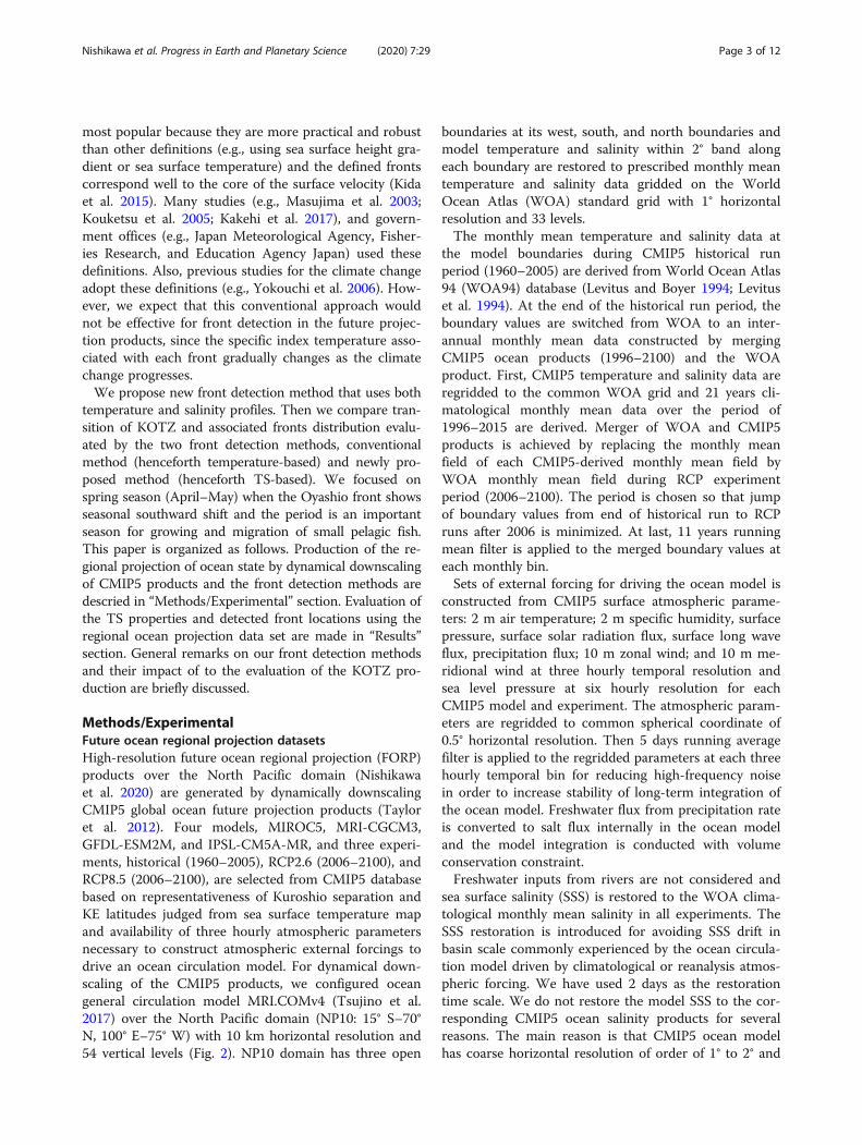
Methods/ExperimentalFuture ocean regional projection datasetsHigh-resolution future ocean regional projection (FORP)products over the North Pacific domain (Nishikawaet al. 2020) are generated by dynamically downscalingCMIP5 global ocean future projection products (Tayloret al. 2012). Four models, MIROC5, MRI-CGCM3,GFDL-ESM2M, and IPSL-CM5A-MR, and three experi-ments, historical (1960–2005), RCP2.6 (2006–2100), andRCP8.5 (2006–2100), are selected from CMIP5 databasebased on representativeness of Kuroshio separation andKE latitudes judged from sea surface temperature mapand availability of three hourly atmospheric parametersnecessary to construct atmospheric external forcings todrive an ocean circulation model. For dynamical down-scaling of the CMIP5 products, we configured oceangeneral circulation model MRI.COMv4 (Tsujino et al.2017) over the North Pacific domain (NP10: 15° S–70°N, 100° E–75° W) with 10 km horizontal resolution and54 vertical levels (Fig. 2). NP10 domain has three open
boundaries at its west, south, and north boundaries andmodel temperature and salinity within 2° band alongeach boundary are restored to prescribed monthly meantemperature and salinity data gridded on the WorldOcean Atlas (WOA) standard grid with 1° horizontalresolution and 33 levels.The monthly mean temperature and salinity data at
the model boundaries during CMIP5 historical runperiod (1960–2005) are derived from World Ocean Atlas94 (WOA94) database (Levitus and Boyer 1994; Levituset al. 1994). At the end of the historical run period, theboundary values are switched from WOA to an inter-annual monthly mean data constructed by mergingCMIP5 ocean products (1996–2100) and the WOAproduct. First, CMIP5 temperature and salinity data areregridded to the common WOA grid and 21 years cli-matological monthly mean data over the period of1996–2015 are derived. Merger of WOA and CMIP5products is achieved by replacing the monthly meanfield of each CMIP5-derived monthly mean field byWOA monthly mean field during RCP experimentperiod (2006–2100). The period is chosen so that jumpof boundary values from end of historical run to RCPruns after 2006 is minimized. At last, 11 years runningmean filter is applied to the merged boundary values ateach monthly bin.Sets of external forcing for driving the ocean model is
constructed from CMIP5 surface atmospheric parame-ters: 2 m air temperature; 2 m specific humidity, surfacepressure, surface solar radiation flux, surface long waveflux, precipitation flux; 10 m zonal wind; and 10 m me-ridional wind at three hourly temporal resolution andsea level pressure at six hourly resolution for eachCMIP5 model and experiment. The atmospheric param-eters are regridded to common spherical coordinate of0.5° horizontal resolution. Then 5 days running averagefilter is applied to the regridded parameters at each threehourly temporal bin for reducing high-frequency noisein order to increase stability of long-term integration ofthe ocean model. Freshwater flux from precipitation rateis converted to salt flux internally in the ocean modeland the model integration is conducted with volumeconservation constraint.Freshwater inputs from rivers are not considered and
sea surface salinity (SSS) is restored to the WOA clima-tological monthly mean salinity in all experiments. TheSSS restoration is introduced for avoiding SSS drift inbasin scale commonly experienced by the ocean circula-tion model driven by climatological or reanalysis atmos-pheric forcing. We have used 2 days as the restorationtime scale. We do not restore the model SSS to the cor-responding CMIP5 ocean salinity products for severalreasons. The main reason is that CMIP5 ocean modelhas coarse horizontal resolution of order of 1° to 2° and
Nishikawa et al. Progress in Earth and Planetary Science (2020) 7:29 Page 3 of 12

western boundary currents such as Kuroshio and Oya-shio are not well represented compared to FORP-NP10with resolution of order 1/10°. Because of this large dis-crepancy between the original CMIP5 ocean model andFORP-NP10, CMIP5 SSS has spatial distribution un-matched to the circulation pattern represented in FORP-NP10 and level of the discrepancy differs among theCMIP5 models and scenarios. In order to make thedownscaling experimental settings as common as pos-sible, we chose the WOA SSS as a common SSS productfor the restoration.Ocean model starts from the rest initialized with the
WOA January mean temperature and salinity and integratedwith the CMIP5-derived atmospheric forcing from 1960 to2100. After 20 years spinning-up run period, we savedmonthly mean oceanic parameters, temperature, salinity,SSH, velocity fields, and surface forcing fields from 1981 to2100. We call this regional future ocean projection product,FORP-NP10, hereafter. In this study, we use monthly meantemperature, salinity, and horizontal velocity fields fromFORP-NP10 over the period from 1981 to 2100. In order totest the newly proposed front detection method under thecurrent climate condition, we also use temperature, salinity,and velocity from four-dimensional variational ocean re-analysis for the Western North Pacific Ocean, FORA-WNP(Usui et al. 2017). FORA-WNP shares the same horizontalgrid and vertical grid coordinates with FORP-NP10 over theanalysis domain depicted in Fig. 2.
Front detection methodsThe conventional approach, which regards the Oyashiofront roughly follows 5 °C isotherm at 100 m depth andthe Kuroshio front roughly follows 14–15 °C isotherm at200 m depth, was applied to temperature data of FORA-WNP on April 2002. As can be confirmed in Fig. 3, thedetected Oyashio and Kuroshio fronts match well withthe KE and the SAF accompanying eastward strong sur-face currents. However, in evaluating future transition ofthe Oyashio and Kuroshio fronts, the conventionalmethod to detect front distribution based on target iso-therm line would become infeasible due to basin-wideupper ocean temperature rise expected under the pro-jected climate change. Thus, detection of both frontswould require alternative approach. Here, we propose anew method for detecting the Oyashio and Kuroshiofronts based on TS profiles of the Oyashio and Kuroshiowaters. We picked up waters in a triangle area (143.5–146° E and 42–43° N) in Fig. 1 as the area where stand-ard Oyashio water can be found due to its closeness tothe region where the EKC is mixed with OSMW to formthe Oyashio water. We define standard TS profile of thepure Oyashio water by water properties within the tri-angle. Detecting the KE axis from the surface velocityfield, we define wasters found within 0–50 km south ofthe Kuroshio axis and within 140–160 E longitudinalband as standard TS profile of the pure Kuroshio waters(shaded area in Fig. 1). TS profiles of the pure Oyashio
Fig. 2 Model domain of FORP-NP10 configuration. Color shades are bottom topography and overlaid white box is area of analysis in this study
Nishikawa et al. Progress in Earth and Planetary Science (2020) 7:29 Page 4 of 12

and pure Kuroshio waters (solid lines in Fig. 4) definedthis manner from FORA-WNP during the period 1981–2015 correspond well to TS profiles of observed Oyashioand Kuroshio waters (cross marks in Fig. 4).We calculated each TS profiles of FORP-NP10 in April
and May from 2006 to 2100 and averaged them every 20
years period. But only first period is from 2006 to 2020.Then we interpolated the TS profile sets (2006–2020, …,2081–2100) to estimate the yearly TS profiles. The reasonwhy we use averaging and interpolation is that we focuson describing decadal time scale transitions of the Oyashioand Kuroshio fronts. Next, we calculated the ratio ofOyashio-Kuroshio mixing ratio of the water at 300 mdepth over the rectangular domain (143–160° E, 30–50°N) depicted in Fig. 2. Waters in the target area are theOyashio water, Kuroshio water, or mixture of these waters(see Fig. 4), and the Oyashio-Kuroshio mixing ratio is cal-culated by using TS profiles (Shimizu et al. 2001).Since low-density Kuroshio water sometimes runs over
high density Oyashio water (Nishikawa et al. 2016), thefronts position varies with depth. Also the TS profiles ofpure Oyashio and Kuroshio waters change slightly duringthe transportation. For that reason, we tested theOyashio-Kuroshio mixing ratio in some depths to find themost suitable criteria for fronts detection. Consequently,we defined the waters with larger than 90% of theOyashio-Kuroshio mixing ratio at 300 m depth as theOyashio waters and the waters with smaller than 5% ofthe Oyashio-Kuroshio mixing ratio at 300 m depth as theKuroshio waters. This definition mostly corresponds tothe Oyashio and Kuroshio fronts distribution that are sug-gested by velocity, temperature, and salinity distribution.Then we detect the Oyashio and Kuroshio fronts as southand north limits of each waters in each longitude. Thisdefinition of fronts is named as “TS-based.” We also usethe conventional way to detect the fronts. We regardedthe isotherm of 5 °C at 100 m as the Oyashio front andregarded the isotherm of 14.5 °C at 200 m as the Kuroshiofront. This definition is named as “temperature-based.”Then we analyze mean latitudes of the Oyashio andKuroshio fronts from 143° E to 160° E in this study.
Fig. 3 Distribution of a the TS based Oyashio water (red shade) and TS based Kuroshio water (blue shade) and b surface absolute velocity in April 15,2002. Isotherm of 5 °C represents the value at 100 m and is a traditional definition of the Oyashio front, and isotherm of 14.5 °C represents the value at200 m and is a traditional definition of the Kuroshio front. Data are from FORA-WNP
Fig. 4 Profiles of the current pure Oyashio waters (blue) and Kuroshiowaters (red) that were estimated by using FORA-WNP temperature andsalinity data. Color shade represents the Oyashio mixing ratio. Blue (red)crosses denote the pure Oyashio (Kuroshio) waters profiles estimated byobservation data (Yasuda et al. 2001). We defined the mixing ratio below26.0 σθ as 0% or undefined by salinity
Nishikawa et al. Progress in Earth and Planetary Science (2020) 7:29 Page 5 of 12

We compared the “TS-based” and “temperature-based” front detection methods in the current climatestate. Figure 3a is an example of the comparison madein April 2002 using FORA-WNP data. In the TS-baseddefinition, the Oyashio front in 145° E is at 38.7° N andthe Kuroshio front in 155° E is located at 38.0° N sincewe picked up the minimum and maximum latitude ofthe Oyashio and Kuroshio waters. The Oyashio andKuroshio fronts locations detected from the twomethods distribution are mostly the same in the currentclimate state. It can be also confirmed that both Oyashioand Kuroshio fronts locations are also consistent withthe KE and the SAF, respectively based on the surfacecurrent structure (Fig. 3b).
ResultsSverdrup transport stream function of CMIP5 forcingIn order to characterize differences among the selectedCMIP5 forcing regarding their expected impact to theKuroshio and Oyashio fronts, the Sverdrup transportstream function (STSF) is calculated from 10 years an-nual mean and winter (December, January, and Febru-ary) mean wind stress for each CMIP5 forcing. Timeseries of the latitude of zero STSF measured at 160° Eare plotted in Fig. 5. The latitude of zero STSF repre-sents the border of sub-tropical and sub-polar gyres ex-pected from the linear wind-driven ocean circulationtheory. More specifically, the zero STSF latitudes basedon winter mean wind stress and annual mean windstress correspond to the Kuroshio front and the subarc-tic (Oyashio) front (Hurlburt et al. 1996), respectively.
The winter mean wind-stress derived zero STSF lati-tudes under RCP8.5 scenario during the future projec-tion period (2005–2100) shows two distinct patterns: (i)no significant trend in MRI-CGCM3 and IPSL-CM5A-MR and (ii) poleward shift of about 2 to 3° in MIROC5and GFDL-ESM2M. The same patterns can be found inthe annual mean wind-stress derived STSF latitudes withlarger poleward shifts of about 4° in MIROC5. There isno clear trend in STSF latitudes in all cases underRCP2.6 scenario. Thus from CMIP5 wind stress, signifi-cant poleward shift of both Kuroshio and Oyashio frontsin the FORP-NP10 products is expected to be seen inMIROC5 and GFDL-ESM2M under RCP8.5 scenario.
Transition of Oyashio and Kuroshio water propertiesunder the climate changeWe show the future Oyashio and Kuroshio TS profilesfrom the FORP-NP10 products. The average TS profilesof April and May during 2006–2020, 2041–2060, and2081–2100 are plotted in Fig. 6. In the four RCP2.6 runs,the scenario the emission decreased from mid-twenty-first century; only slight changes can be seen both in theOyashio and the Kuroshio TS profiles. Among the fourmodels, clear shift of Oyashio temperature and salinityshift to high in the mid-twenty-first century can befound in MRI-CGCM3 and MIROC5 in April andMIROC5 in May. On the contrary in the RCP8.5 runs,the scenario the emission keeps increasing toward theend of the twenty-first century; all products show thatOyashio temperature and salinity drastically increaseand get closer to the Kuroshio TS profiles by the end of
Fig. 5 Time series of zero latitude of Sverdrup transport at 160° E calculated from MIROC5 (black lines), MRI-CGCM3 (red lines), IPSL-CM5A-MR(blue lines), and GFDL-ESM2M (green lines) a winter (December, January, and February) mean and b annual mean wind stress forcing from CMIP5RCP2.6 (solid lines) and RCP8.5 (dashed lines) experiments.
Nishikawa et al. Progress in Earth and Planetary Science (2020) 7:29 Page 6 of 12

the century. On the other hand, Kuroshio TS profilesshow very little change in all simulations throughtwenty-first century. We concluded that the Kuroshiocharacteristics of temperature and salinity are robust tothe projected climate change, but the Oyashio waterproperties are very sensitive to the emission scenarios.Although the change of Oyashio TS profiles in RCP8.5varies with models, all models predict that Oyashiotemperature will be over 10 °C in the end of the twenty-first century.
Comparison of two front detection methodsApril–May mean latitudes of the Oyashio and Kuroshiofronts detected in two methods for all FORP-NP10products are shown in Fig. 7. The mean latitudes of thefronts in historical and RCP runs, difference betweenTS-based and temp-based front latitudes, and differenceof latitudes between historical and RCP runs are sum-marized in Table 1. Both the Oyashio and Kuroshiofronts under RCP8.5 scenario tend to shift northward inthe temperature-based estimation and the TS-based
Fig. 6 TS profiles of the pure Oyashio waters (blue) and Kuroshio waters (red) in April and May with four models and two scenarios. Each curve iscorresponding to a mean value during 2006–2020, 2041–2060, and 2081–2100
Nishikawa et al. Progress in Earth and Planetary Science (2020) 7:29 Page 7 of 12

estimation. Notable point is that the shifts by thetemperature-based estimation are remarkably larger thanthe shifts estimated by the TS-based detection method(Fig. 7).
The mean latitudes of the fronts in historical and RCPruns, difference between TS-based and temp-based frontlatitudes, and difference of latitudes between historicaland RCP runs are summarized in Table 1. Both Oyashio
Fig. 7 Time series of the April–May mean Oyashio and Kuroshio fronts latitude from RCP2.6 and RCP8.5 scenarios of four models. Black (gray)curves are TS-based (temperature-based) latitude of historical simulation from 1982 to 2005. Blue (light blue) curves are TS-based (temperature-based) latitude of RCP2.6 simulation from 2006 to 2100. Red (orange) curves are TS-based (temperature-based) latitude of RCP8.5 simulation from2006 to 2100
Nishikawa et al. Progress in Earth and Planetary Science (2020) 7:29 Page 8 of 12

and Kuroshio fronts shift northward in most of thecases. On average of four models, the Oyashio front lati-tude in the late twenty-first century (2051–2100 mean)is 0.67° (temperature-based)/0.44° (TS-based) larger thanhistorical mean in RCP2.6 and 1.57° (temperature-based)/0.58° (TS-based) in RCP8.5. For the Kuroshiofront, 0.50° (temperature-based)/0.19° (TS-based) largerthan historical mean in RCP2.6 and 1.77° (temperature-based)/0.46° (TS-based) in RCP8.5. The northward shiftsare larger in RCP8.5 than that in RCP2.6. At the samedefinition of fronts, there is no significant difference be-tween northing of the Oyashio fronts and the Kuroshiofronts. The degree of northward shift is larger intemperature-based estimation than in TS-based estima-tion (see the difference between historical and RCP runsin Table 1). Mean latitudes of the Oyashio and Kuroshiofronts tend to be higher in temperature-based estimationthan in TS-based estimation (see the difference betweentemperature-based and TS-based in Table 1).Since the temperature-based and the TS-based fronts
latitudes are significantly different in MIROC5 RCP8.5case, we plotted surface ocean state from MIROC5RCP8.5 case in May 2080 in Fig. 8. According to thetemperature-based front detection method, the Oyashiofront (5 °C at 100 m) is located in the coastal area ofHokkaido and Kuril Islands and the offshore Kuroshio
front (14.5 °C at 200 m) is located above 40° N (Fig. 8a).However, according to the surface velocity field (Fig. 8d,e), the current continues from the EKC turns to eastnear 155° E and 44° N, which seems to be correspondingto the Oyashio current. The 100 m depth temperature inthat region is about 9 °C (Fig. 8b). From Fig. 8e, theKuroshio main stream is obviously located around 32–37° N and the corresponding 200 m temperature isabout 17 °C (Fig. 8c). On the other hand, thetemperature-based Kuroshio front is located around 40–41° N, along which 200 m depth salinity is about 34.2PSU (Fig. 8f). The salinity is obviously too low for theKuroshio waters.
DiscussionWe estimated transitions of the Oyashio and Kuroshiowaters TS profiles and respective front positions underthe influence of the projected climate change using thehigh-resolution regional ocean future projection FORP-NP10. The fronts transitions evaluated by two front defin-ition methods, conventional temperature-based methodand newly proposed TS-based method, are compared.While the Kuroshio water TS profile is relatively stable inall cases, the Oyashio water TS profile experiences largeshift toward high temperature and salinity rapidly in allRCP8.5 cases. Both the Oyashio and Kuroshio fronts tend
Table 1 Table caption
Difference between future and historical
OY temp OY TS Diff TS-temp KR temp KR TS Diff TS-temp OY temp OY TS KR temp KR TS
MRI-CGCM3 RCP2.6 early 21st 39.66 39.92 0.26 34.86 34.37 -0.49 0.26 -0.03 0.27 0.08
late 21st 39.90 40.16 0.26 35.01 34.45 -0.56 0.50 0.21 0.42 0.16
RCP8.5 early 21st 39.66 39.89 0.23 34.82 34.41 -0.41 0.26 -0.06 0.23 0.12
late 21st 40.96 39.98 -0.98 35.93 34.55 -1.38 1.56 0.03 1.34 0.26
HISTORIAL 39.40 39.95 0.55 34.59 34.29 -0.30 - - - -
MIROC5 RCP2.6 early 21st 42.19 42.07 -0.12 36.11 35.14 -0.97 0.94 0.79 0.33 0.29
late 21st 42.87 41.72 -1.15 36.63 35.13 -1.50 1.62 0.44 0.85 0.28
RCP8.5 early 21st 42.43 41.94 -0.49 36.04 35.16 -0.88 1.18 0.66 0.26 0.31
late 21st 42.96 41.94 -1.02 38.28 35.74 -2.54 1.71 0.66 2.50 0.89
HISTORIAL 41.25 41.28 0.03 35.78 34.85 -0.93 - - - -
IPSL-CM5A-MR RCP2.6 early 21st 40.84 41.22 0.38 35.76 34.84 -0.92 0.44 0.80 0.26 -0.15
late 21st 40.95 41.04 0.09 35.99 34.81 -1.18 0.55 0.62 0.49 -0.18
RCP8.5 early 21st 40.63 40.93 0.30 35.68 34.88 -0.80 0.23 0.51 0.18 -0.11
late 21st 42.40 41.14 -1.26 37.45 35.33 -2.12 2.00 0.72 1.95 0.34
HISTORIAL 40.40 40.42 0.02 35.50 34.99 -0.51 - - - -
GFDL-ESM2M RCP2.6 early 21st 41.85 41.71 -0.14 36.27 35.25 -1.02 0.41 0.83 0.41 0.33
late 21st 41.44 41.36 -0.08 36.10 35.43 -0.67 0.00 0.48 0.24 0.51
RCP8.5 early 21st 42.07 41.48 -0.59 36.60 35.36 -1.24 0.63 0.60 0.74 0.44
late 21st 42.44 41.80 -0.64 37.13 35.29 -1.84 1.00 0.92 1.27 0.37
HISTORIAL 41.44 40.88 -0.56 35.86 34.92 -0.94 - - - -
Nishikawa et al. Progress in Earth and Planetary Science (2020) 7:29 Page 9 of 12

to shift northward in the temperature-based estimationand the TS-based estimation. But the notable point is thatthe shifts by the temperature-based estimation are re-markably larger than the shifts by the TS-based estima-tion. In the Oyashio front detection case, temperaturechange in Oyashio water causes the difference estimatesdepending on a choice of the detection methods inRCP8.5 cases, too. Due to the Oyashio warming, the Oya-shio front looks moving southward from tracking the iso-therm of 5°°C at 100 m, which is the conventionaldefinition of the Oyashio front position.Since the high-temperature Oyashio waters penetrate
into the Kuroshio-Oyashio transition zone, isotherm of14.5 °C at 200 m, which is the conventional definition ofthe Kuroshio front position, appears in the far northfrom the actual Kuroshio front position as shown in Fig.8. Thus, the temperature-based front detection methodmisses the actual front positions under the projected cli-mate change due to global warming impacts. The TS-based estimation also suggests that the Oyashio and
Kuroshio fronts shift northward in all cases, but the lati-tudinal changes are lower than 1°. For that reason, werecommend the TS-based definition for discussing theOyashio and Kuroshio front transitions under the pro-jected climate change using FORP-NP10 products. Beingaware of temperature and salinity change of the Oyashioand Kuroshio water properties is a key to follow thetransitions of the Oyashio and Kuroshio fronts and even-tually transitions of water properties of KOTZ under theprojected climate change.As summarized in the previous section, this northward
shift tendency is anticipated prior to the ocean down-scaling experiments from analysis of the STSF zero lati-tude based on the CMIP5 wind stress forcing. However,this tendency is noticeable only in the specific set of theforcing, MIROC5 and IPSL-CM5A-MR under RCP8.5scenario (Fig. 5). Among the FORP-NP10 products, thelargest northward shift of about 6° in the Kuroshio frontcan be found in the MIROC5 and IPSL-CM5A-MRunder RCP8.5 scenario based on the temperature-based
Fig. 8 a Distribution of the TS based Oyashio water (red shade) and TS-based Kuroshio water (blue shade) in May 2080 from RCP8.5 scenario ofMIROC5. The isotherm of 5 °C represents the temperature-based Oyashio front and the isotherm of 14.5 °C represents the temperature-basedKuroshio front. b 100 m and c 200 m temperature distribution. d Surface current vector. Color represents current direction. e Surface absolutevelocity. f 200 m salinity distribution
Nishikawa et al. Progress in Earth and Planetary Science (2020) 7:29 Page 10 of 12

estimation. However, the corresponding Kuroshio frontsestimated by the TS-based detection method do notshow significant northward shift compared to the othermodels, MRI-CGCM3 and GFDL-ESM2M. In the caseof the Oyashio front, its significant northward shift ofabout 4° can be seen in MIROC5, IPSL-CM5A-MR, andMRI-CGCM3 under RCP8.5 scenario and minor north-ward shift of about 2° in MIROC5 under RCP8.5 sce-nario based on temperature-based estimation. Thispattern is not consistent with the poleward shift of theOyashio front anticipated from the analysis of the STSMzero latitude in Fig. 5b on which MRI-CGCM does notshow significant poleward shift. Further, such clear con-nection between wind stress and the latitudinal shift ofthe fronts is missing in the TS-based estimation. Theseobservations tell us that the latitudinal shift of the Kuro-shio and Oyashio fronts can be explained partly by thewind stress shift, but transitions in water mass propertieshave large impact in determining the Kuroshio and theOyashio fronts under the projected climate change.According to the TS-based transitions in fronts positions,
the latitudinal change of the Oyashio and Kuroshio frontswill not be so drastic as is estimated from the conventionalapproach. It is possible to say that the impacts of the climatechange on the fish migration and fishing grounds locationare small from these results. However, we alert that the glo-bal warming may have serious impacts on the distributionand stock of fish in the Oyashio and Kuroshio region. At thepresent time, many fish do the seasonal migration betweenthe Kuroshio and Oyashio region. If their migration ecologydepends on temperature, the Oyashio warming will influenceon it. Our results are from April to May. Since the Oyashiowater has a seasonal cycle in intensity and its distribution(Sekine 1988), the degree of temperature and salinity changein other season may be different from spring. However, weexpect that the same change occurs in other seasons. This isa subject for future analysis. We are also concerned aboutthe Oyashio productivity. The nutrient amount in the Oya-shio water will decrease. The rich nutrients in the Oyashiowater are supplied by the vertical mixing in the upstreamOyashio region. The drastic warming of the Oyashio waterwill possibly change the nutrient cycle. It is necessary to in-vestigate why the Oyashio water changes, for example,whether the OSMW or the EKC contributes to the Oyashiowarming, and how the Oyashio warming will have an impacton the ecology in the Northwestern Pacific in future.
ConclusionsWe show three important results in this study. First, thefront latitude of the Oyashio and Kuroshio will shiftnorthward. Second, Oyashio TS profile will drasticallychange. Third, the fronts positions vary depending onthe detecting method, temperature-based or TS-based.The northward shift of the Kuroshio front has already
been reported by previous studies. We confirm their re-sults by using the first eddy-resolving CMIP5 model.And this is the first study that suggests the possibility ofthe Oyashio front northward shift. Also, the Kuroshioand Oyashio TS profiles in the future are firstly esti-mated in this study. The third results are related to thesecond one. Our study suggested that since the drasticTS profile change, the conventional front definitionbased on isotherm distribution will probably be uselessin the future. There are no negligible information forstudies about impact assessment of global warming.
Authors’ contributionsSN, HI, TW, and YI developed the ocean climate projection products. HNanalyzed the model output and wrote the first draft manuscript. SN, HI, andTW provided ideas for the study and helped in interpretation of the modeloutput. SN and TW collaborated with the corresponding author in theconstruction of the manuscript through several drafts. All co-authors partici-pated in discussions about the results and commented on the manuscript.All authors read and approved the final manuscript.
FundingHN, SN, HI, TW, and YI are supported by the Social Implementation Programon Climate Change Adaptation Technology (SI-CAT) Grant NumberJPMXD0715667163 from the Ministry of Education, Culture, Sports, Scienceand Technology (MEXT). HN is supported by JSPS KAKENHI Grant number18K14516. TW is supported by the Nansen Center (NERSC) basic funding.
Availability of data and materialsThe FORA-WNP and FORP data set used in this study is available from theauthors upon request. The request URL of FORA-WNP is http://synthesis.jam-stec.go.jp/FORA/e/.
Competing interestsThe authors declare that they have no competing interests.
Author details1Japan Agency for Marine-Earth Science and Technology, 3173-25Showa-machi, Kanazawa-ku, Yokohama, Kanagawa 236-0001, Japan. 2TheNansen Center, Thormøhlens gate 47, 5006 Bergen, Norway. 3Bjerknes Centrefor Climate Research, Jahnebakken 5, 5007 Bergen, Norway.
Received: 27 December 2019 Accepted: 27 May 2020
ReferencesHurlburt H, Wallcraft A, Schmitz W, Hogan P, Metzger E (1996) Dynamics of the
Kuroshio/Oyashio current system using eddy-resolving models of the NorthPacific Ocean. J Geophys Res 101:941–976. https://doi.org/10.1029/95JC01674
Ichii T, Nishikawa H, Mahapatra K, Okamura H, Igarashi H, Sakai M, Suyama S,Namagmai M, Naya M, Usui N, Okara Y (2018) Oceanographic factorsaffecting interannual recruitment variability of Pacific saury (Cololabis saira) inthe central and western North Pacific. Fish Oceanogr 27:445–457
Kakehi S, Ito S, Wagawa T (2017) Estimating surface water mixing ratios usingsalinity and potential alkalinity in the Kuroshio-Oyashio mixed water regions.Estimating surface water mixing ratios using salinity and potential alkalinityin the Kuroshio-Oyashio mixed water regions. J Geophys Res Oceans 122:1927–1942
Kawai H (1972) Hydrography of the Kuroshio Extension. In: Stommel H, Yoshida K(eds) . its physical aspects, Kuroshio, pp 235–352
Kida S, Mitsudera F, Aoki S et al (2015) Oceanic fronts and jets around Japan: areview. J Oceanogr 71(5):469–497. https://doi.org/10.1007/s10872-015-0283-7
Kouketsu S, Yasuda I, Hiroe Y (2005) Observation of frontal waves and associatedsalinity minimum formation along the Kuroshio Extension. J Geophys ResOceans:110
Levitus S, Boyer TP (1994) World Ocean Atlas 1994. Vol. 4. Temperature. NOAAAtlas NESDIS 4. U.S. Government Printing Office, Washington, D.C., p 117
Nishikawa et al. Progress in Earth and Planetary Science (2020) 7:29 Page 11 of 12

Levitus S, Burgett R, Boyer TP (1994) World Ocean Atlas 1994. Vol. 3. Salinity. NOAAAtlas NESDIS 2. U.S. Government Printing Office, Washington, D.C., p 99
Li R, Jing Z, Chen Z, Wu L (2017) Response of the Kuroshio Extension path stateto near-term global warming in CMIP5 experiments with MIROC4h. JGeophys Res 122(4):2871–2883
Masujima M, Yasuda I, Hiroe Y, Watanabe T (2003) Transport of Oyashio wateracross the subarctic front into the mixed water region and formation ofNPIW. J Oceanogr 59:855–869
Nishikawa H, Usui N, Kamachi M, Tanaka Y, Ishikawa Y (2016) Link between theinteranual variability in the Kuroshio-Oyashio layered structure and thechlorophyll-a concentrations in the Kuroshio Extension during spring.Oceanography Japan 25(5):133–144
Nishikawa S, Wakamatsu T, Ishizaki H, Tanaka Y, Ishikawa Y (2020) Developmentof high-resolution ocean future projection data set around Japan for coastalapplications. PEPS submitted
Sakamoto TT, Hasumi H, Ishii M, Emori S, Suzuki T, Nishimura T, Sumi A (2005)Responses of the Kuroshio and the Kuroshio extension to global warming ina high-resolution climate model. Geophys Res Lett 32:14
Sato Y, Yukimoto S, Tsujino H, Ishizaki H, Noda A (2006) Response of North PacificOcean circulation in a Kuroshio-Resolving ocean model to an arcticoscillation (AO)-like change in Northern hemisphere atmospheric circulationdue to greenhouse-gas forcing. J Meteorol Soc Jpn 84(2):295–309
Seager R, Kushnir Y, Henderson N, Cane M, Miller J (2001) Wind-driven shifts inthe latitude of the Kuroshio-Oyashio extension and generation of SSTanomalies on decadal timescales. J Clim 14:4249–4265. https://doi.org/10.1175/1520-0442(2001)014<4249:WDSITL>2.0.CO;2
Sekine Y (1988) Anomalous southward intrusion of the Oyashio east of Japan: 1.Influence of the seasonal and interannual variations in the wind stress overthe North Pacific. J Geophys Res Oceans 93:2247–2255
Shimizu, Y., Yasuda, I., and Ito, S. (2001) Distribution and circulation of the coastalOyashio intrusion. Journal of Physical Oceanography, 31, 1561–1578.
Taylor KE, Stouffer RJ, Meehl GA (2012) An overview of CMIP5 and experimentdesign. Amer Meteor Soc 93:485–498. https://doi.org/10.1175/BAMS-D-11-00094.1
Tsujino H, Nakano H, Sakamoto K, Urakawa S, Hirabara M, Ishizaki H, Yamanaka G(2017) Reference manual for the Meteorological Research InstituteCommunity Ocean Model version 4 (MRI.COMv4). Technical Reports of theMRI 80.
Usui N, Wakamatsu T, Tanaka Y, Hirose N, Toyoda T, Nishikawa S, Fujii Y, TakatsukiY, Igarashi H, Nishikawa H, Ishikawa Y, Kuragano T, Kamachi M (2017) Four-dimensional variational ocean reanalysis: a 30-year high-resolution dataset inthe western North Pacific (FORA-WNP30). J Oceanogr 73:205–233
Yang H, Liu J, Lohmann G, Shi X, Hu Y, Chen X (2016) Ocean-atmospheredynamics changes associated with prominent ocean surface turbulent heatfluxes trends during 1958–2013. Ocean Dyn 66(3):353–365
Yasuda I, Hiroe Y, Komatsu K, Kawasaki K, Joyce TM, Bahr F, Kawasaki Y (2001)Hydrographic structure and transport of the Oyashio south of Hokkaido andthe formation of North Pacific Intermediate Water. J Geophys Res Oceans106:6931–6942
Yokouchi, K., Tsuda, A., Kuwata, A., Kasai, H., Ichikawa, T., Hirota, Y., Adachi, K.,Asanuma, I. and Ishida, H. (2006) Simulated in situ measurements of primaryproduction in Japanese waters. pp. 65–88 in global climate change andresponse of carbon cycle in the equatorial pacific and Indian oceans andadjacent landmasses edited by K. Kawahata and Y. Awaya, Elsevier,Amsterdam
Zhang RC, Hanawa K (1993) Features of the watermass front in the NorthwesternNorth Pacific. J GeophysRes 98C:967–975
Publisher’s NoteSpringer Nature remains neutral with regard to jurisdictional claims inpublished maps and institutional affiliations.
Nishikawa et al. Progress in Earth and Planetary Science (2020) 7:29 Page 12 of 12