development guidelines - florin-vineyard community plan ... · for the florin-vineyard area, also...
TRANSCRIPT

Development Guidelines - Florin-Vineyard Community Plan Administrative Draft
December 18, 2002
Table of Contents i
TABLE OF CONTENTS
1.0 INTRODUCTION .............................................................................................. 1-1 1.1 Purpose and Intent ..................................................................................... 1-1 1.2 Setting ........................................................................................................ 1-1 1.3 Land Use Summary ................................................................................... 1-3
2.0 RESIDENTIAL LAND USES ........................................................................... 2-1 2.1 Residential Densities ................................................................................. 2-1 2.2 Existing Neighborhood Boundaries .......................................................... 2-1 2.3 Neighborhood Connectivity ...................................................................... 2-2
3.0 COMMERCIAL LAND USE ............................................................................ 3-1 3.1 Mixed Use Developments ......................................................................... 3-1 3.2 Commercial Design ................................................................................... 3-2
4.0 INDUSTRIAL LAND USE ................................................................................ 4-1 4.1 Residential Boundaries .............................................................................. 4-1 4.2 Public Infrastructure .................................................................................. 4-1
5.0 OPEN SPACE ..................................................................................................... 5-1 5.1 Drainage Parkways .................................................................................... 5-1 5.2 Parkways – Electrical Transmission Corridors .......................................... 5-2 5.3 Wetlands .................................................................................................... 5-3
6.0 STREETSCAPE ................................................................................................. 6-1

Development Guidelines - Florin-Vineyard Community Plan Administrative Draft
December 18, 2002
List of Exhibits ii
LIST OF EXHIBITS
1.2 Study Area and Proposed Land Use
1.3 Table of Land Uses and Potential Dwelling Yield
3.1 Multi-Story, Mixed Use Illustration
5.1 Drainage Parkway and Preferred Local Street/Residential Interface
5.2 Pedestrian/Bicycle Path Section
6.0 Typical Street Sections
Development Guidelines - Florin-Vineyard Community Plan Administrative Draft
December 18, 2002
LIST OF POLICIES
RESIDENTIAL
Policy FV-1. Encourage a variety of lot sizes and housing types to promote social andeconomic diversity, and to promote greater variation visibly for neighborhoods.
Policy FV-2. Ensure an adequate mix of housing affordability dispersed throughout thecommunity.
Policy FV-3. Promote policies to cite duplexes for all corner lots in single-family subdivisionsto promote a better integration of housing types throughout the community.
Policy FV-4. Encourage larger lots for residential uses along the boundary common to anyneighborhood of a lower density.
Policy FV-5. For any new residential subdivision, provide assurance (e.g., larger/deeper lots,recorded setback line, or CC&Rs) that any two-story (or greater height) structurecan be set back at least 100 feet from the boundary common to an existingneighborhood of a lower density.
Policy FV-6. Promote residential development that will result in a diverse streetscape in termsof housing types, building setbacks, and building height.
Policy FV-7. The street pattern for new residential areas should be simple in design, andshould provide multiple points of access (vehicles, pedestrians and bicyclists) tonearby commercial areas, parks, schools and public transit.
Policy FV-8. For any new residential subdivision, provide the Planning Department with ananalysis of circulation in the larger neighborhood, and demonstrate how theproposed subdivision will contribute to and enhance circulation for area residents(vehicles, pedestrians and bicyclists).
Policy FV-9. Pedestrian and bicycle trails/pathways should be located within open space areasto the extent feasible.
List of Policies iii
Development Guidelines - Florin-Vineyard Community Plan Administrative Draft
December 18, 2002
COMMERCIAL
Policy FV-10. Promote mixed use concepts that capitalize on synergies between and amongdifferent types of land uses (e.g., residential and office).
Policy FV-11. Encourage the elimination of barriers to pedestrian access between differenttypes of complementary land uses.
Policy FV-12. Promote commercial centers in new neighborhoods that are integrated into andphysically connect with those adjacent neighborhoods.
Policy FV-13. Promote the incorporation of plazas and open spaces into commercialdevelopment that will provide for public gatherings and outdoor uses such asfarmers’ markets.
Policy FV-14. Encourage commercial architecture and building design that promotes pedestrianand various forms of multi-modal access.
Policy FV-15. Promote commercial uses that cater to nearby residents, in locations where theyare easily accessible for pedestrians, and those that will help create a more activeand vibrant pedestrian environment (e.g., theaters, restaurants, outdoor cafes, andfarmers’ markets).
Policy FV-16. Promote pedestrian-friendly, human-scale commercial development that providessafe and pleasant places for people.
Policy FV-17. Encourage screening of visibly large or tall structures such as water tanks orcellular facilities, by either locating them in areas seen by few people, or“hidden” by placement on the roof of a commercial building, or integrated intothe building’s design and architecture.
INDUSTRIAL
Policy FV-18. Encourage larger lots for industrial uses along the boundary common to anyresidential or agricultural-residential neighborhood.
List of Policies iv

Development Guidelines - Florin-Vineyard Community Plan Administrative Draft
December 18, 2002
Policy FV-19. For any new industrial subdivision, provide assurance (e.g., larger/deeper lots,recorded setback line, or CC&Rs) that any structure can be set back at least 100feet from the boundary common to an existing residential or agricultural-residential neighborhood.
Policy FV-20. Outdoor industrial storage areas should be located at least 50 feet from theboundary common to an existing residential or agricultural-residentialneighborhood, and this setback area should be landscaped.
Policy FV-21. Any new industrial development should either connect (extend as necessary) topublic water and sewer, or provide assurance (e.g., bond, installation of dry lines,or record an agreement to connect) to connect at some future date.
Policy FV-22. Any new industrial development should comply with appropriate fire preventionmeasures, including an adequate water supply for necessary fire flows.
OPEN SPACE
Policy FV-23. Residential development adjacent to drainage parkways should avoid providingan excessive number of back-up lots, and should provide front-on street and openended cul-de-sacs whenever possible.
Policy FV-24. Improvements to drainage parkways should be consistent with the most recentlyapproved plans and/or improvements (downstream or upstream) in terms ofwidth, landscaping, and pedestrian access.
Policy FV-25. Promote the construction of a network of pedestrian/bicycle trails within thestudy area, particularly within the electrical transmission corridor that runs north-south through the study area, near the alignment of Waterman Road.
Policy FV-26. Residential development adjacent to the electrical transmission corridor (runningnorth-south through the study area, near the alignment of Waterman Road)should avoid providing an excessive number of back-up lots, and should providefront-on streets and open ended cul-de-sacs whenever possible. In addition,residential fencing separating yard areas from this electrical transmissioncorridor should be an open design to allow viewing of the corridor.
List of Policies v

Development Guidelines - Florin-Vineyard Community Plan Administrative Draft
December 18, 2002
Policy FV-27. Identify a funding source that would allow for the Southgate Recreation and ParkDistrict to take ownership and assume maintenance responsibility for theelectrical transmission corridor running north-south through the study area, nearthe alignment of Waterman Road.
Policy FV-28. Ensure no net loss of vernal pool acreage, and/or values and functions, andmitigate any loss in relation to the values of quality of habitat.
Policy FV-29. Evaluate feasible on-site alternatives in the environmental review process thatreduce impacts on vernal pools and provide effective on-site preservation interms of minimum management requirements, effective size, and evaluationcriteria.
STREETSCAPE
Policy FV-30. Prominent entry subdivision signage and landscape treatment is encouraged atproject entry points to provide a greater sense of neighborhood identity.
Policy FV-31. Median landscaping is encouraged for all thoroughfares, arterials, and collectorstreets.
Policy FV-32. All wood fences and masonry walls should be screened with trees and shrubs.Chain-link fencing is discouraged. Open-type fencing (e.g., wrought-ironfencing) should be used adjacent to all open space areas.
Policy FV-33. Masonry walls should correspond to a theme common to an overall communitydesign concept (e.g., materials, color and texture), and subdivisions should beconditioned to adhere to a wall design standard.
Policy FV-34. Landscaped corridors should be included adjacent to the right-of-way on bothsides of all thoroughfares, arterials, and collector streets. The width of thiscorridor should be a minimum of 25 feet on both sides of thoroughfare andarterial streets, and 15 feet on both sides of collector streets.
Policy FV-35. Pedestrian facilities along thoroughfare and arterial streets should include a 6-foot wide sidewalk, separated by the curb by a variable width planter thatincludes trees. The sidewalk should meander within the corridor to the extentpossible.
List of Policies vi

Development Guidelines - Florin-Vineyard Community Plan Administrative Draft
December 18, 2002
1.0 INTRODUCTION
1.1 PURPOSE AND INTENT
In 1999, the Sacramento County Board of Supervisors initiated a community planning programfor the Florin-Vineyard area, also known as the “Gap” area. The term “Gap” has been used torefer to this area because it is located between the existing urban area to the west of Elk Grove-Florin Road and a comprehensively planned urban area to the east (i.e., North Vineyard Stationand Vineyard Springs). The goal of this planning process is to provide a vision for the orderlyand systematic urbanization of the study area through the establishment of a preferred land useplan and a facilities finance element based upon this plan. Preservation and protection of therural character of existing agricultural-residential neighborhoods is one of the primary objectivesin the planning process. Other objectives include clustering of commercial uses at majorintersections, providing appropriate locations for multifamily uses, preserving wetlands, andconsidering public use/transportation options for the California Central Traction Railroad tracks.The preferred land use plan shows the existing agricultural-residential neighborhoods protectedby a variety of agricultural-residential and transitional land use designations. Several new urbangrowth areas are shown along thoroughfares and at major intersections throughout the study area.
The following architectural and site design guidelines are intended to help guide development ofthis area and lessen the potential for land use conflicts. Graphic descriptions or illustrations havebeen included for use in site design and the development of properties subject to this study.Design review is not recommended, but use of these guidelines is encouraged in subsequententitlement applications submitted to the Planning Department. These guidelines shall beincorporated into the South Sacramento and Vineyard Community Plans for the respective studyarea, and are intended to supplement the policies of these planning documents.
1.2 SETTING
The proposed Florin-Vineyard Community Plan area covers approximately 3,760+ acres and islocated within the community planning areas of both Vineyard and South Sacramento. Theboundaries of the Florin-Vineyard Community Plan (see Exhibit 1.2) are generally Elder CreekRoad on the north, Bradshaw Road on the east, the Churchill Downs neighborhood to the south,and the Union Pacific Railroad tracks on the west.
Introduction 1-1

Development Guidelines - Florin-Vineyard Community Plan Administrative Draft
December 18, 2002
At the time of this study, 2002, the Florin-Vineyard study area comprises 3,760+ acres and 670parcels. There are many established “ranchette” neighborhoods in this area. A total of 556dwelling units exist today, and based on the 2000 Census, this represents a population ofapproximately 1,690 residents. The area is also bisected by Elder and Gerber Creeks, the CentralCalifornia Traction Railroad track, and several overhead transmission lines and associatedeasements. Its lack of continuity is perhaps one of the biggest obstacles to a comprehensiveplanning effort. The large number of property owners, existing development patterns, anddiverse opinions on appropriate urban development is also problematic.
Introduction 1-2
NOT TO SCALE
GERBER ROAD
BR
AD
SH
AW
RO
AD
SO
UT
HW
AT
TA
VE
.
ELDER CREEK ROAD
FLORIN ROAD
UN
ION
PA
CIF
IC R
AIL
RO
AD
EL
K
G
RO
VE
- F
LO
RIN
R
OA
D
FR
EN
CH
RO
AD
FL
OR
IN
PE
RK
INS
RO
AD
CE
NT
RA
L C
ALIF
OR
NIA
TR
AC
TIO
N C
OM
PA
NY
RA
ILR
OA
D
HE
DG
E
A
VE
NU
E
SC
M-1(SM)
M-1(SM)
M-1(SM)(F)
M-1
M-1(F)
M-1
M-1
RD 1-2
AR 1-2GC
RD 2-3
RD 3-5
RD 3-5
RD 3-5
RD 3-5OS
AR 1-2
AR 1-2
AR 2-5
AR 1-2RD 2-3
AR 2-5
AR 2-5
M-1
GC
SC
RECREATION
OS
OSLC
GC
AR 1-2
RD-15
RD 2-3
RD 2-3
RD 2-3
RD 3-5
RD-20
AR 2-5
AR 1-2
RD-15
RD 3-5
LC
BP
RD-10(MHP)
RD-10(MHP)M-1
AR
1-2
OS RD 3-5
Exhibit 1.2: Study Area and Proposed Land Use
Development Guidelines - Florin-Vineyard Community Plan Administrative Draft
December 18, 2002
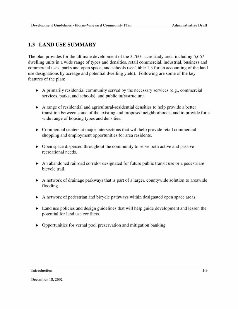
1.3 LAND USE SUMMARY
The plan provides for the ultimate development of the 3,760+ acre study area, including 5,667dwelling units in a wide range of types and densities, retail commercial, industrial, business andcommercial uses, parks and open space, and schools (see Table 1.3 for an accounting of the landuse designations by acreage and potential dwelling yield). Following are some of the keyfeatures of the plan:
♦ A primarily residential community served by the necessary services (e.g., commercialservices, parks, and schools), and public infrastructure.
♦ A range of residential and agricultural-residential densities to help provide a bettertransition between some of the existing and proposed neighborhoods, and to provide for awide range of housing types and densities.
♦ Commercial centers at major intersections that will help provide retail commercialshopping and employment opportunities for area residents.
♦ Open space dispersed throughout the community to serve both active and passiverecreational needs.
♦ An abandoned railroad corridor designated for future public transit use or a pedestrian/bicycle trail.
♦ A network of drainage parkways that is part of a larger, countywide solution to areawideflooding.
♦ A network of pedestrian and bicycle pathways within designated open space areas.
♦ Land use policies and design guidelines that will help guide development and lessen thepotential for land use conflicts.
♦ Opportunities for vernal pool preservation and mitigation banking.
Introduction 1-3

Development Guidelines - Florin-Vineyard Community Plan Administrative Draft
December 18, 2002
Introduction 1-4
Table 1.3 Proposed Land Use Designations and Potential Dwelling Yield
M-1/M-1(F)/M-1(SM) – 150 parcels; 1242 acres totalGC – 12 parcels; 26 acres totalSC – 4 parcels; 73 acres totalLC – 7 parcels; 46 acres totalBP – 1 parcel; 5 acres totalAR 2-5 – 68 parcels; 373.5 acres total/125 dwellings possible, assuming 1 unit per 3 acresAR 1-2 – 205 parcels; 654.5 acres total/436 dwellings possible, assuming 1 unit per 1.5 acresRD 1-2 – 17 parcels; 117 acres total/176 dwellings possible, assuming 1.5 units per acreRD 2-3 – 41 parcels; 252.5 acres total/631 dwellings possible, assuming 2.5 units per acreRD 3-5 – 127 parcels; 770.5 acres total/3,467 dwellings possible, assuming 4.5 units per acreRD-20 – 2 parcels; 22 acres total/396 dwellings possible, assuming 18 units per acreRD-15 – 6 parcels; 23 acres total/299 dwellings possible, assuming 13 units per acreRD-10(MHP) – 3 parcels; 13.7 acres total/137 dwellings possibleOS – 23 parcels; 89.3 acres totalGolf Course/Recreation – 4 parcels; 58 acres total
Potential dwelling yield – 5,667
Study Area – 3,766 acresExisting Parcels – 670Existing Dwellings – 556
Note: The source of this information is from the Sacramento County GIS data base. There are several factorsthat influence dwelling yield (e.g., location and design of streets, utilities and drainage improvements). Athorough master planning effort such as that conducted for North Vineyard Station would produce a moreaccurate potential dwelling yield.

Development Guidelines - Florin-Vineyard Community Plan Administrative Draft
December 18, 2002
2.0 RESIDENTIAL LAND USE
2.1 RESIDENTIAL DENSITIES
The plan will provide for a broad range of densities and dwelling unit type by the land usedesignations (e.g., AR 1-2 and RD 3-5) where lot sizes and density can be varied, based on thedesire of property owners and developers, or to help mitigate impacts to existing neighborhoods.In the case of the above table, the fixed unit count simply refers to the density average used tocalculate dwelling yields. This range in the land use designations is much easier to provide for inlargely undeveloped areas rather than existing neighborhoods. The following policies are offeredto help guide development and promote diversification in housing.
Policy FV-1. Encourage a variety of lot sizes and housing types to promote social andeconomic diversity, and to promote greater variation visibly forneighborhoods.
Policy FV-2. Ensure an adequate mix of housing affordability dispersed throughout thecommunity.
Policy FV-3. Promote policies to cite duplexes for all corner lots in single-familysubdivisions to promote a better integration of housing types throughout thecommunity.
2.2 EXISTING NEIGHBORHOOD BOUNDARIES
As indicated above, there are many agricultural-residential neighborhoods that make up the studyarea, and preservation and protection of rural lifestyles is one of the primary objectives in thisplanning process. A potential conflict occurs along the boundary of these different land usedesignations. For example, incompatible development could present a potential for nuisances,complaints, noise, invasion of privacy, and increased traffic to one or both forms of land use.Policies relating to setbacks, lot sizes, and building height will help to lessen the potential forthese conflicts. The following policies are offered to help guide development and lessen thesepotential conflicts.
Residential Land Use 2-1

Development Guidelines - Florin-Vineyard Community Plan Administrative Draft
December 18, 2002
Policy FV-4. Encourage larger lots for residential uses along the boundary common to anyneighborhood of a lower density.
Policy FV-5. For any new residential subdivision, provide assurance (e.g., larger/deeperlots, recorded setback line, or CC&Rs) that any two-story (or greater height)structure can be set back at least 100 feet from the boundary common to anexisting neighborhood of a lower density .
Policy FV-6. Promote residential development that will result in a diverse streetscape interms of housing types, building setbacks, and building height.
2.3 NEIGHBORHOOD CONNECTIVITY
The plan reflects several neighborhoods or pockets of new urban development. It will bedesirable to ensure that these new developments are interconnected. Piecemeal developmentwhere each subdivision is served by its own cul-de-sac does not benefit pedestrians, bicyclists, orfoster a sense of community. Although this may be particularly difficult to implement in thatthere are so many different property owners within the study area, the following policies will behelpful to promote this desired connectivity.
Policy FV-7. The street pattern for new residential areas should be simple in design, andshould provide multiple points of access (vehicles, pedestrians and bicyclists)to nearby commercial areas, parks, schools and public transit.
Policy FV-8. For any new residential subdivision, provide the Planning Department withan analysis of circulation in the larger neighborhood, and demonstrate howthe proposed subdivision will contribute to and enhance circulation for arearesidents (vehicles, pedestrians and bicyclists).
Policy FV-9. Pedestrian and bicycle trails/pathways should be located within open spacesareas to the extent feasible.
Residential Land Use 2-2

Development Guidelines - Florin-Vineyard Community Plan Administrative Draft
December 18, 2002
3.0 COMMERCIAL LAND USE
3.1 MIXED USE DEVELOPMENTS
The plan contains several commercial land use designations, primarily located at majorintersections within the study area. At three of these commercial locations, multifamily has alsobeen designated. It would be desirable to integrate these uses to help create a more vibrant“town center” environment, reduced vehicle trips, and greater convenience for area residents.Mixed use developments can take various forms. For example, a simple commercial-residentialdevelopment on the same parcel with no barriers between the uses such as fencing orlandscaping; or a multi-story structure with retail on the ground floor and residential above,shared parking, and reduced front yard setbacks (see Exhibit 3.1). Standards that permit mixed-use development are beyond the scope of this project; however, policies are recommended thatwould encourage this type of development, provided that the necessary entitlements can besecured.
Commercial Land Use 3-1
Exhibit 3.1: Multi-Story, Mixed Use Illustration
ground floor retail
upper level officeand/or residential
active, pedestrian-friendlystreet environment
Development Guidelines - Florin-Vineyard Community Plan Administrative Draft
December 18, 2002
Policy FV-10. Promote mixed use concepts that capitalize on synergies between andamong different type of land uses (e.g., residential and office).
Policy FV-11. Encourage the elimination of barriers to pedestrian access between differenttypes of complementary land uses.
3.2 COMMERCIAL DESIGN
A “town center” concept is very important to create a greater sense of identity or community forresidents. Many commercial centers today use one or more architectural themes to help set themapart from others in the commercial district. A town center is a unique combination ofelements—diversity, activity, architectural character, a street scene, color, texture and scale. Thefollowing policies are offered to help create better places for people to work, live, gather, shop,and enjoy community life.
Policy FV-12. Promote commercial centers in new neighborhoods that are integrated intoand physically connect with those adjacent neighborhoods.
Policy FV-13. Promote the incorporation of plazas and open spaces into commercialdevelopment that will provide for public gatherings and outdoor uses suchas farmers’ markets.
Policy FV-14. Encourage commercial architecture and building design that promotespedestrian and various forms of multi-modal access.
Policy FV-15. Promote commercial uses that cater to nearby residents, in locations wherethey are easily accessible for pedestrians, and those that will help create amore active and vibrant pedestrian environment (e.g., theaters, restaurants,outdoor cafes, and farmers’ markets).
Policy FV-16. Promote pedestrian-friendly, human-scale commercial development thatprovides safe and pleasant places for people.
Policy FV-17. Encourage screening of visibly large or tall structures such as water tanksor cellular facilities, by locating them in areas “hidden” by placement onthe roof of a building or integrated into the building’s design.
Commercial Land Use 3-2
Development Guidelines - Florin-Vineyard Community Plan Administrative Draft
December 18, 2002
4.0 INDUSTRIAL LAND USE
4.1 RESIDENTIAL BOUNDARIES
There are several existing neighborhoods that abut industrial land use within the study area.Today, much of this industrial land is either vacant or is used for some low intensity purposesuch as general yard storage. With the intensification in land use possible through this planningprocess, and the new residential designations, potential conflicts may occur along the boundaryof the different land use designations. For example, industrial development adjacent toresidential development presents a potential for nuisances, complaints, noise, invasion ofprivacy, and increased traffic to one or both of these forms of land use. The following policiesrelating to setbacks and building height will help to lessen the potential for these conflicts.
Policy FV-18. Encourage larger lots for industrial uses along the boundary common to anyresidential or agricultural-residential neighborhood.
Policy FV-19. For any new industrial subdivision, provide assurance (e.g., larger/deeperlots, recorded setback line, or CC&Rs) that any structure can be set back atleast 100 feet from the boundary common to an existing residential oragricultural-residential neighborhood.
Policy FV-20. Outdoor industrial storage areas should be located at least 50 feet from theboundary common to an existing residential or agricultural-residentialneighborhood, and this setback area should be landscaped.
4.2 PUBLIC INFRASTRUCTURE
Much of the industrial land within the study area is unique in that it is constrained by floodplain,transmission easements, and high noise (60-65 CNEL) from Mather operations. Some of theseindustrial lands also are designated as “Aggregate Resources” on the General Plan. On onehand, it would be preferable to ensure that new industrial development is adequately served byinfrastructure, and is attractive for high-quality industrial development in terms of both designand improvements. However, the floodplain coverage in the industrial area is significant, and
Industrial Land Use 4-1

Development Guidelines - Florin-Vineyard Community Plan Administrative Draft
December 18, 2002
there are many vernal pools located in and adjacent to the floodplain. Thus, the cost ofchannelization of Elder Creek might be quite high. Also, it might be desirable to locate amitigation bank for vernal pools in this area.
Policy FV-21. Any new industrial development should either connect (extend as necessary)to public water and sewer, or provide assurance (e.g., bond, installation ofdry lines, or record an agreement to connect) to connect at some future date.
Policy FV-22. Any new industrial development should comply with appropriate fireprevention measures, including an adequate water supply for necessary fireflows.
Industrial Land Use 4-2

Development Guidelines - Florin-Vineyard Community Plan Administrative Draft
December 18, 2002
5.0 OPEN SPACE
5.1 DRAINAGE PARKWAYS
The study area is bisected by Elder Creek, Gerber Creek, and Union House Creek.Improvements to many of these creeks (channelization) will be made as part of the County floodcontrol project, and the conditions imposed on the North Vineyard Station Specific Plandevelopment. In most cases, these improvements will consist of linear open space areas thatcontain manmade storm drainage channels, wetland areas, and maintenance road/pedestrianpathways (Exhibit 5.1). These drainage parkways will serve a dual purpose—conveying stormwater drainage and providing linear open space for recreation use. In some cases, the SouthgateRecreation and Park District may choose to provide some type of joint-use facility adjacent tothese parkways, although improvements to the parkways do not necessarily count towardQuimby Act requirements. To the extent that improvements to these drainage parkways are notmade by the County as part of a flood control project, the following policies are offered to ensurea consistent approach to the design and development of these areas.
Open Space 5-1
Exhibit 5.1: Drainage Parkway and Street/Residential Interface
meandering low-flow channelemergent marsh
drought tolerant trees, shrubs and annual grassland
sidewalk combined with bike/ped trail
front-on streets and open endedcul-de-sacs encouraged
Development Guidelines - Florin-Vineyard Community Plan Administrative Draft
December 18, 2002
Policy FV-23. Residential development adjacent to drainage parkways should avoidproviding an excessive number of back-up lots, and should provide front-onstreet and open ended cul-de-sacs whenever possible.
Policy FV-24. Improvements to drainage parkways should be consistent with the mostrecently approved plans and/or improvements (downstream or upstream) interms of width, landscaping, and pedestrian access.
5.2 PARKWAYS – ELECTRICAL TRANSMISSION CORRIDORS
The study area is bisected by numerous overhead electrical transmission lines, and associatedtowers and utility easements. Within these electrical transmission corridors, no structures arepermitted; however, parking areas (e.g., parking areas associated with commercial and multi-family uses) are acceptable. These corridors provide an ideal opportunity for linear open spaceconnections between parks, neighborhoods, and other uses. They could also include apedestrian/bicycle network (see Exhibit 5.2). The North Vineyard Station Specific Plandevelopment designates a 300-400 foot wide parkway along the alignment of this corridor forthat purpose. Further south of the study area, a park (Churchill Downs Community Park) hasbeen located to correspond with this corridor. According to the Southgate Recreation and ParkDistrict, these areas do not count toward Quimby Act requirements, but might be suitable forsome form of passive recreational use. If a funding source were to be identified (assessmentdistrict), the District has indicated a willingness to accept these areas for development andmaintenance. The following policies are offered to help guide the development of and adjacentto these areas.
Policy FV-25. Promote the construction of a network of pedestrian/bicycle trails within thestudy area, particularly within the electrical transmission corridor that runsnorth-south through the study area, near the alignment of Waterman Road.
Policy FV-26. Residential development adjacent to the electrical transmission corridor(running north-south through the study area, near the alignment ofWaterman Road) should avoid providing an excessive number of back-uplots, and should provide front-on streets and open ended cul-de-sacswhenever possible. In addition, residential fencing separating yard areasfrom this electrical transmission corridor should be an open design to allowviewing of the corridor.
Open Space 5-2

Development Guidelines - Florin-Vineyard Community Plan Administrative Draft
December 18, 2002
Policy FV-27. Identify a funding source that would allow for the Southgate Recreation andPark District to take ownership and assume maintenance responsibility forthe electrical transmission corridor running north-south through the studyarea, near the alignment of Waterman Road.
5.3 WETLANDS
There are several acres of jurisdictional wetlands, including numerous vernal pools locatedwithin the study area. The two primary areas are located within the floodplain of Elder Creeknorth of Florin Road, and adjacent to the Central California Traction Railroad tracks south ofGerber Road. Neither of these two areas have been designated for intense urban development,and it is recommended that these areas be considered for a possible vernal pool mitigation bank.It may be more advantageous to look beyond the designated urban areas to preserve wetlands inpermanent open space. It should be noted that the floodplain of Elder Creek north of FlorinRoad is currently located outside of the Urban Policy Area (UPA) on the General Plan, and thatdirectly to the south, the North Vineyard Station Specific Plan development is located inside ofthe UPA. Regardless of the value to preservation within the study area, property owners will
Open Space 5-3
2' 10' 2'shoulder shoulder
2" asphalt concreteover aggregate base
Exhibit 5.2: Pedestrian/Bicycle Path Section

Development Guidelines - Florin-Vineyard Community Plan Administrative Draft
December 18, 2002
have to mitigate impacts to these wetlands from their own development. The following policy isrecommended to help guide development of these wetland areas.
Policy FV-28. Ensure no net loss of vernal pool acreage, and/or values and functions, andmitigate any loss in relation to the values of quality of habitat.
Policy FV-29. Evaluate feasible on-site alternatives in the environmental review processthat reduce impacts on vernal pools and provide effective on-sitepreservation in terms of minimum management requirements, effective size,and evaluation criteria.
Open Space 5-4

Development Guidelines - Florin-Vineyard Community Plan Administrative Draft
December 18, 2002
6.0 STREETSCAPE
A consistent approach to the treatment (design) for thoroughfares, arterials and collector streetswill help promote a positive community identity, enhanced pedestrian activity, and create a moredesirable quality of life for residents. Median landscaping, soundwall design, meanderingsidewalks, and landscape corridor width are some of the features that contribute to a desirablestreetscape. Guidelines for streetscapes will be particularly important in the development of thestudy area because of the large number of property owners, and the development patterns thathave already been approved and/or established in this area. The following policies are offered tohelp create a more desirable streetscape.
Policy FV-30. Prominent entry subdivision signage and landscape treatment is encouragedat project entry points to provide a greater sense of neighborhood identity.
Policy FV-31. Median landscaping is encouraged for all thoroughfares, arterials, andcollector streets.
Policy FV-32. All wood fences and masonry walls should be screened with trees andshrubs. Chain-link fencing is discouraged. Open-type fencing (e.g.,wrought-iron fencing) should be used adjacent to all open space areas.
Policy FV-33. Masonry walls should correspond to a theme common to an overallcommunity design concept (e.g., materials, color and texture), andsubdivisions should be conditioned to adhere to a wall design standard.
Policy FV-34. Landscaped corridors should be included adjacent to the right-of-way onboth sides of all thoroughfares, arterials, and collector streets. The width ofthis corridor should be a minimum or 25 feet on both sides of thoroughfareand arterial streets, and 15 feet on both sides of collector streets.
Policy FV-35. Pedestrian facilities along thoroughfare and arterial streets should include a6-foot wide sidewalk, separated by the curb by a variable width planter thatincludes trees. The sidewalk should meander within the corridor to theextent possible.
Streetscape 6-1

Development Guidelines - Florin-Vineyard Community Plan Administrative Draft
December 18, 2002
Streetscape 6-2
48' R/W
15' 3' 6' 30' 6' 3' 15' landscape corridor
w/separated sidewalklandscape corridor
w/separated sidewalktravel way w/bike lane
parking parking
Collector Street Section
4' sidewalkstreet trees (typ.)
6' sidewalk
street trees (typ.)
72' R/W
landscape corridorw/meandering sidewalk
landscape corridorw/meandering sidewalk
Arterial Street Section
25' 3' 4' 23' 12' 23' 4' 3' 25'
bikelane
bikelane
travel way landscapemedian
travel way
Exhibit 6.0: Typical Street Sections

Development Guidelines - Florin-Vineyard Community Plan Administrative Draft
December 18, 2002