GPSRO Data Processing and Science Applications at UCAR
Bill KuoUCAR COSMIC
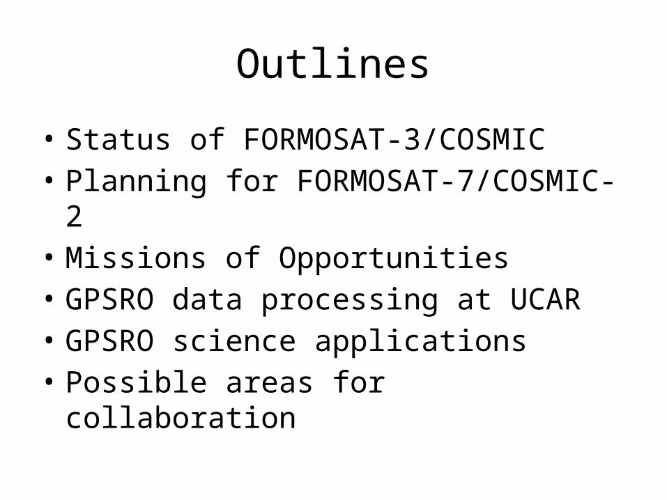
Outlines
• Status of FORMOSAT-3/COSMIC• Planning for FORMOSAT-7/COSMIC-2• Missions of Opportunities• GPSRO data processing at UCAR• GPSRO science applications• Possible areas for collaboration
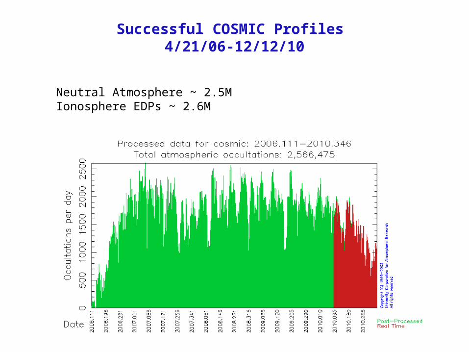
Successful COSMIC Profiles 4/21/06-12/12/10
Neutral Atmosphere ~ 2.5MIonosphere EDPs ~ 2.6M
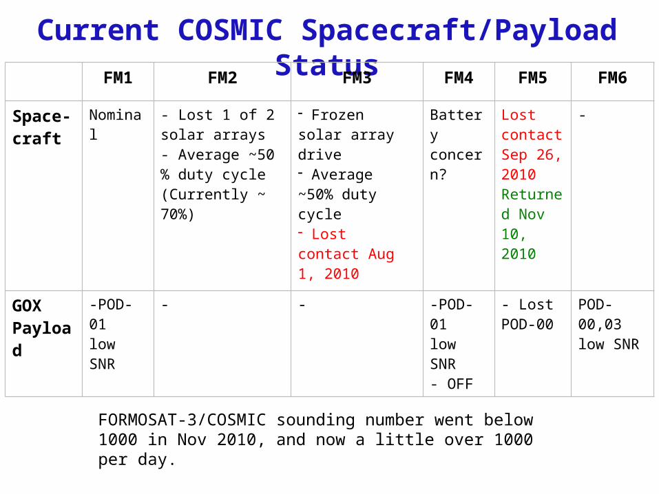
Current COSMIC Spacecraft/Payload StatusFM1 FM2 FM3 FM4 FM5 FM6
Space-craft
Nominal - Lost 1 of 2 solar arrays- Average ~50 % duty cycle(Currently ~ 70%)
- Frozen solar array drive- Average ~50% duty cycle- Lost contact Aug 1, 2010
Battery concern?
LostcontactSep 26,2010Returned Nov 10, 2010
-
GOXPayload
-POD-01 low SNR
- - -POD-01 low SNR- OFF
- Lost POD-00
POD-00,03 low SNR
FORMOSAT-3/COSMIC sounding number went below 1000 in Nov 2010, and now a little over 1000 per day.
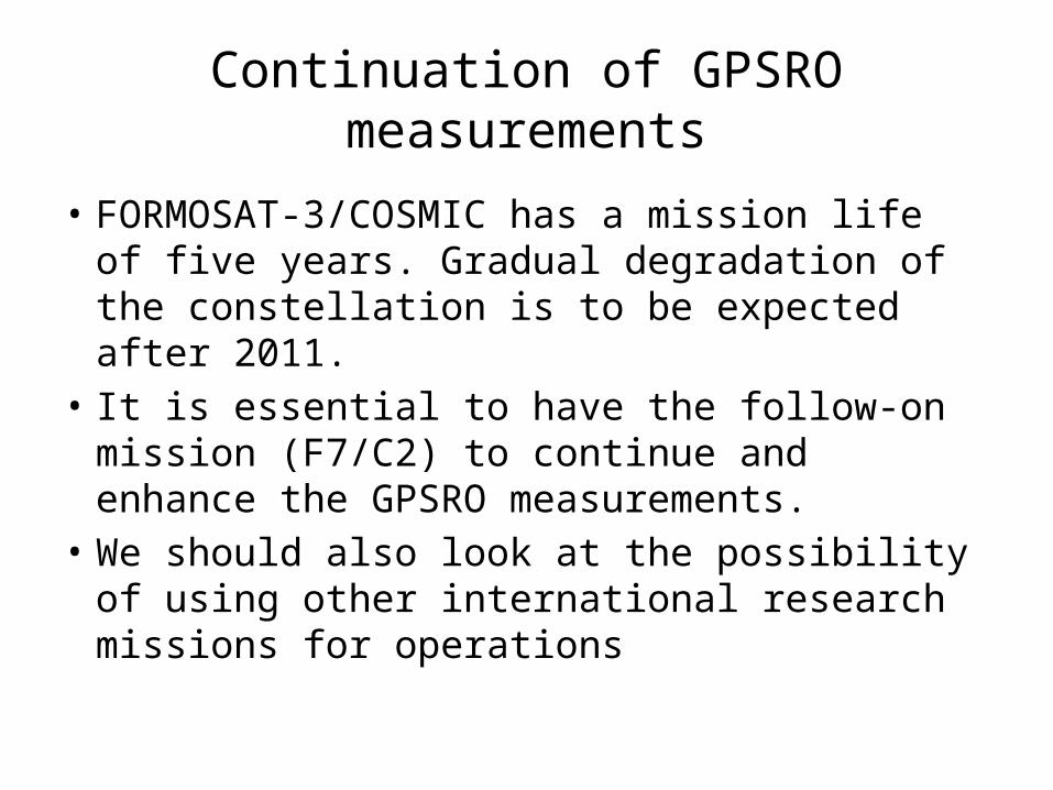
Continuation of GPSRO measurements
• FORMOSAT-3/COSMIC has a mission life of five years. Gradual degradation of the constellation is to be expected after 2011.
• It is essential to have the follow-on mission (F7/C2) to continue and enhance the GPSRO measurements.
• We should also look at the possibility of using other international research missions for operations
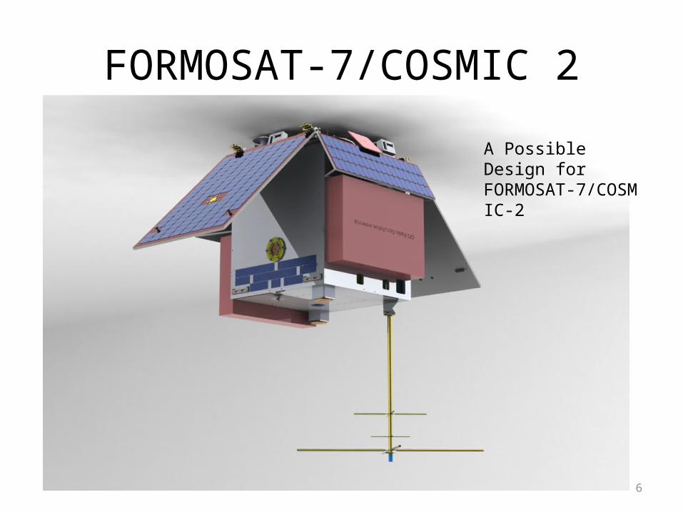
FORMOSAT-7/COSMIC 2
6
A Possible Design for FORMOSAT-7/COSMIC-2
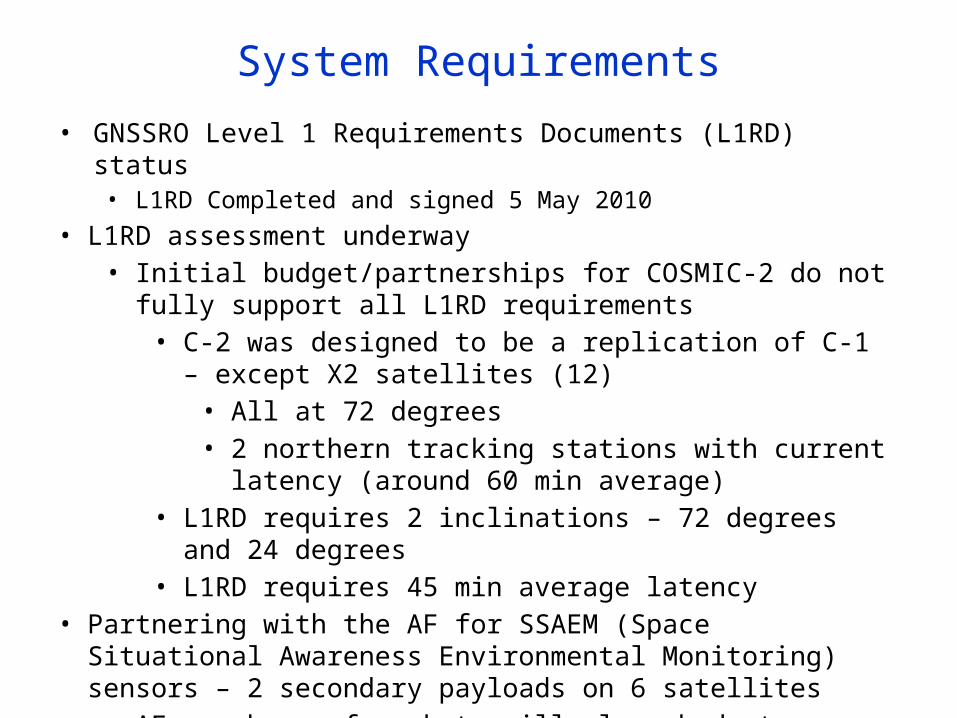
System Requirements• GNSSRO Level 1 Requirements Documents (L1RD) status
• L1RD Completed and signed 5 May 2010• L1RD assessment underway
• Initial budget/partnerships for COSMIC-2 do not fully support all L1RD requirements• C-2 was designed to be a replication of C-1 – except X2 satellites
(12)• All at 72 degrees• 2 northern tracking stations with current latency (around 60
min average)• L1RD requires 2 inclinations – 72 degrees and 24 degrees• L1RD requires 45 min average latency
• Partnering with the AF for SSAEM (Space Situational Awareness Environmental Monitoring) sensors – 2 secondary payloads on 6 satellites• AF purchase of rockets will close budget shortfall – allow us to meet all
L1RD threshold requirements
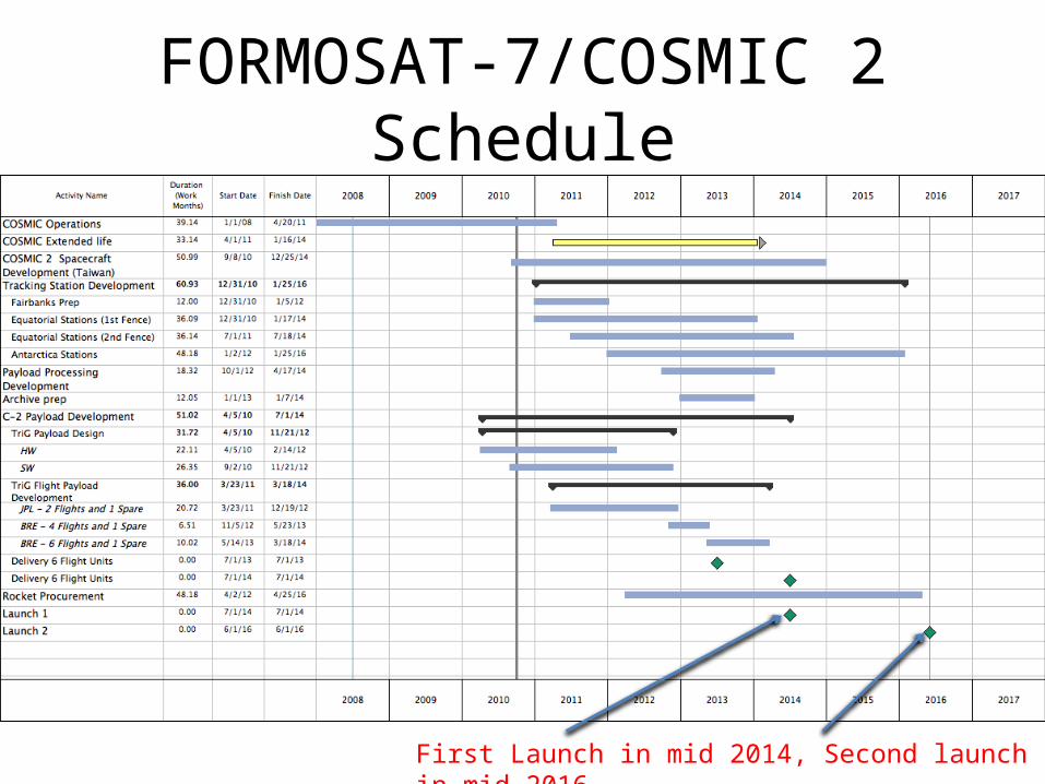
FORMOSAT-7/COSMIC 2 Schedule
First Launch in mid 2014, Second launch in mid 2016
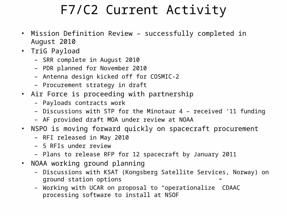
F7/C2 Current Activity
• Mission Definition Review – successfully completed in August 2010• TriG Payload
– SRR complete in August 2010– PDR planned for November 2010– Antenna design kicked off for COSMIC-2– Procurement strategy in draft
• Air Force is proceeding with partnership– Payloads contracts work– Discussions with STP for the Minotaur 4 – received ‘11 funding– AF provided draft MOA under review at NOAA
• NSPO is moving forward quickly on spacecraft procurement– RFI released in May 2010– 5 RFIs under review– Plans to release RFP for 12 spacecraft by January 2011
• NOAA working ground planning– Discussions with KSAT (Kongsberg Satellite Services, Norway) on ground station options– Working with UCAR on proposal to “operationalize” CDAAC processing software to install
at NSOF
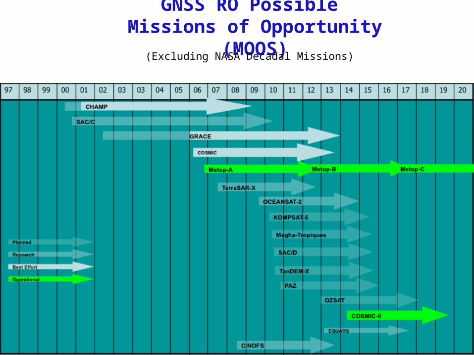
GNSS RO Possible Missions of Opportunity (MOOS)
(Excluding NASA Decadal Missions)
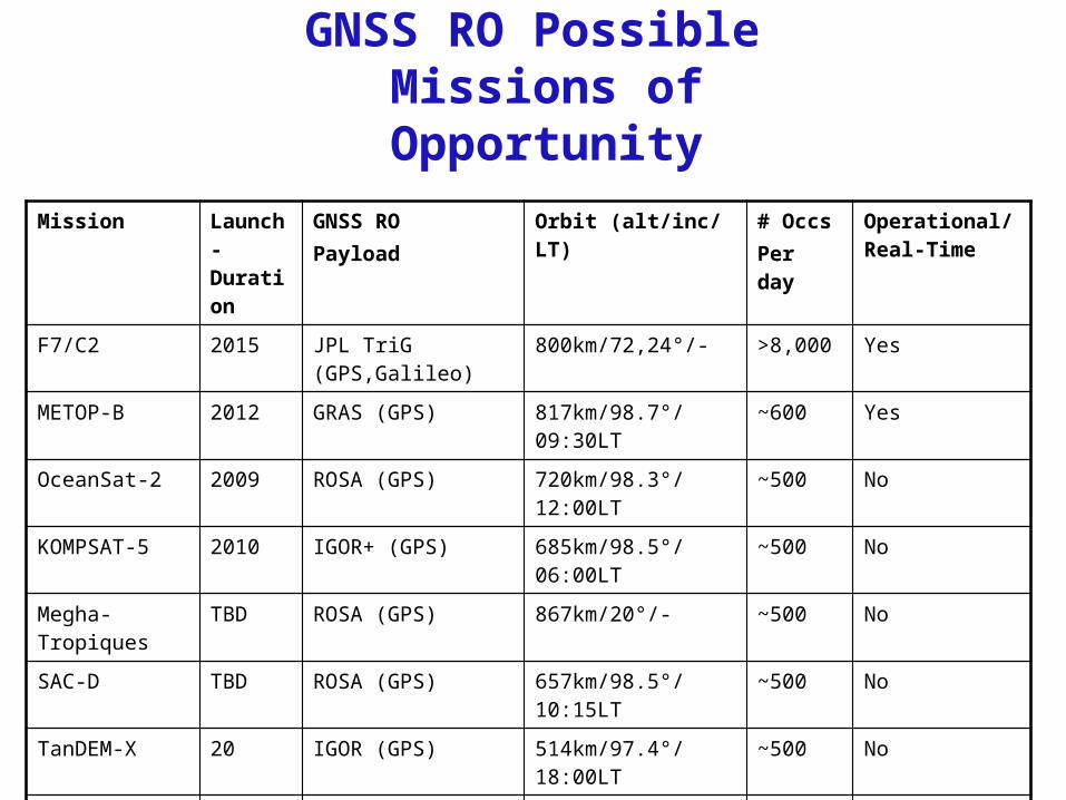
GNSS RO Possible Missions of Opportunity
Mission Launch-Duration
GNSS ROPayload
Orbit (alt/inc/ LT) # OccsPer day
Operational/Real-Time
F7/C2 2015 JPL TriG (GPS,Galileo) 800km/72,24°/- >8,000 Yes
METOP-B 2012 GRAS (GPS) 817km/98.7°/09:30LT ~600 Yes
OceanSat-2 2009 ROSA (GPS) 720km/98.3°/12:00LT ~500 No
KOMPSAT-5 2010 IGOR+ (GPS) 685km/98.5°/06:00LT ~500 No
Megha-Tropiques TBD ROSA (GPS) 867km/20°/- ~500 No
SAC-D TBD ROSA (GPS) 657km/98.5°/10:15LT ~500 No
TanDEM-X 20 IGOR (GPS) 514km/97.4°/18:00LT ~500 No
PAZ 2012 IGOR+ (GPS) 510km/97.4°/- ~500 No
EQUARS 2012 IGOR (GPS) 750km/20°/- ~500 No
CNOFS 2008 BlackJack (GPS) 853/405km/13°/- ~250 Best effort
SAC-C 2000 BlackJack 715km/98.5°/10:15LT ~200 Best effort
Missions of OpportunitySAC-C (Satélite de Aplicaciones Cientificas – C)
• Argentinian CONAE mission launched Nov 2000• 715km altitude, 98° inclination, 10:15 LT• JPL BlackJack, Open Loop, four single patch antenna• Near real-time data provided by Germany’s GFZ and CONAE• CDAAC providing 140-180 occultations per day to NOAA• ~ 50-60% success from tracked profiles• UCAR working with Tom Meehan and CONAE
• configure GPS receiver to track rising occultations all day (now only 10-18 UTC)
• reduce negative impact of aging oscillator
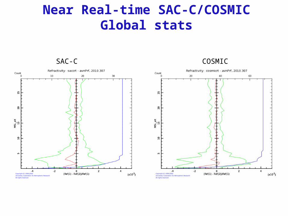
Near Real-time SAC-C/COSMICGlobal stats
SAC-C COSMIC
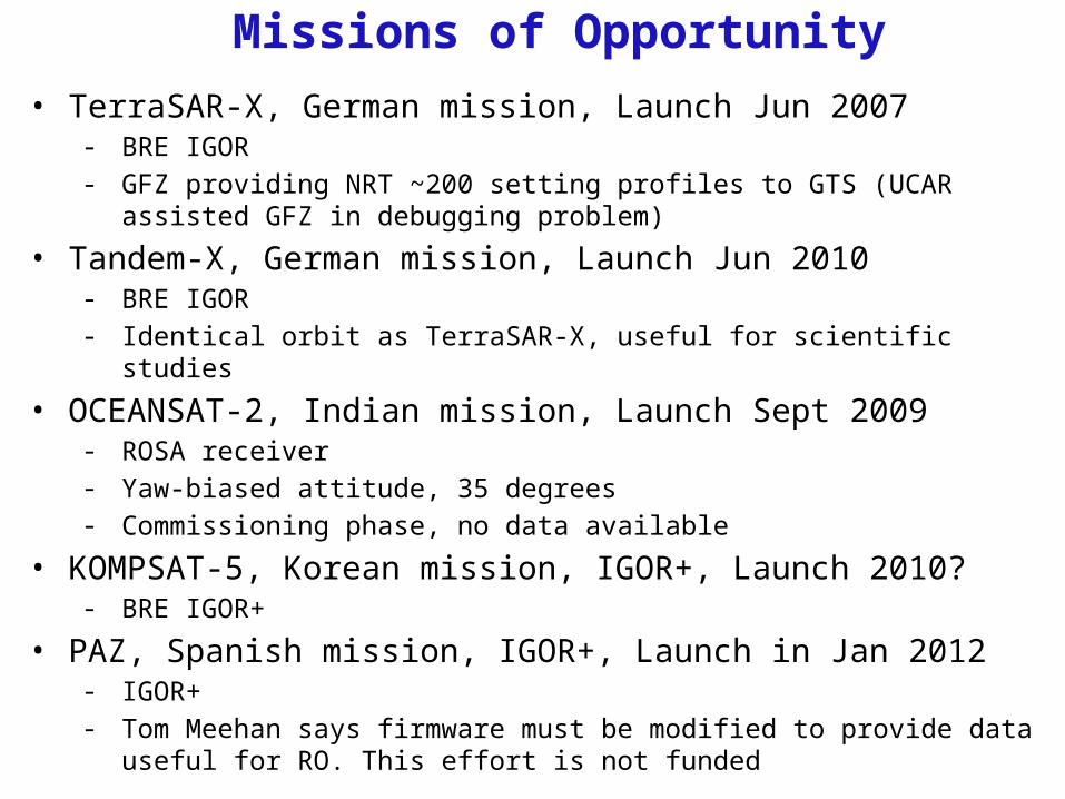
Missions of Opportunity• TerraSAR-X, German mission, Launch Jun 2007
- BRE IGOR- GFZ providing NRT ~200 setting profiles to GTS (UCAR assisted GFZ in debugging
problem)
• Tandem-X, German mission, Launch Jun 2010- BRE IGOR- Identical orbit as TerraSAR-X, useful for scientific studies
• OCEANSAT-2, Indian mission, Launch Sept 2009- ROSA receiver- Yaw-biased attitude, 35 degrees- Commissioning phase, no data available
• KOMPSAT-5, Korean mission, IGOR+, Launch 2010?- BRE IGOR+
• PAZ, Spanish mission, IGOR+, Launch in Jan 2012- IGOR+- Tom Meehan says firmware must be modified to provide data useful for RO. This
effort is not funded
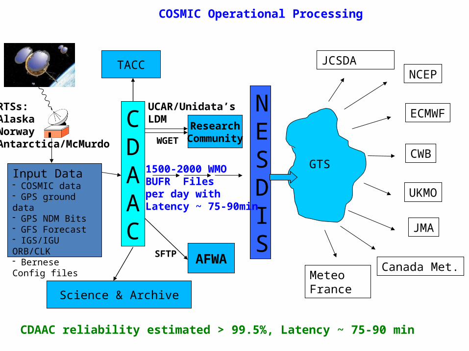
CDAAC
NESDIS
GTS
NCEP
ECMWF
CWB
UKMO
Canada Met.
JMA
1500-2000 WMOBUFR Files per day withLatency ~ 75-90min
Getting COSMIC Results to Weather Centers
JCSDA
MeteoFrance
COSMIC Operational Processing
Science & Archive
TACC
AFWA
Input Data- COSMIC data- GPS ground data- GPS NDM Bits- GFS Forecast- IGS/IGU ORB/CLK- Bernese Config files
ResearchCommunity
SFTP
UCAR/Unidata’sLDM
WGET
RTSs:AlaskaNorwayAntarctica/McMurdo
CDAAC reliability estimated > 99.5%, Latency ~ 75-90 min
Main CDAAC Functions
• RO Payload Operation– Configuration control (firmware and tracking configuration)– Scientific/technical guidance for commanding, operation– Near real-time monitoring, trouble-shooting, and Q/C data analysis
• Data Processing and Analysis– Level0 unformatting and QC– GPS ground processing (ZTD, site estimation, clock estimation)– LEO POD, and atmospheric excess phase– Absolute TEC generation– Inversions (neutral atmosphere and ionosphere)– Retrievals (1DVAR)– NWP and correlative data handling– Product QC and analysis

CDAAC Functions (cont)
• System Operation and Monitoring- H/W, O/S and NFS filesystem- System fail-overs- CDAAC operations
• Input data stream monitoring– RTS downlink– GPS Bit-grabber operation and monitoring– GPS ground data (IGS, NRCan, EUMETSAT, COSMIC sites)– IGS and IGU orbits, clocks and EOP (Earth Orientation Parameter)– Bernese configuration– NCEP GFS, ECMWF, radiosonde, ionosonde
• Data Management, Dissemination, and Archival• Support Data Users
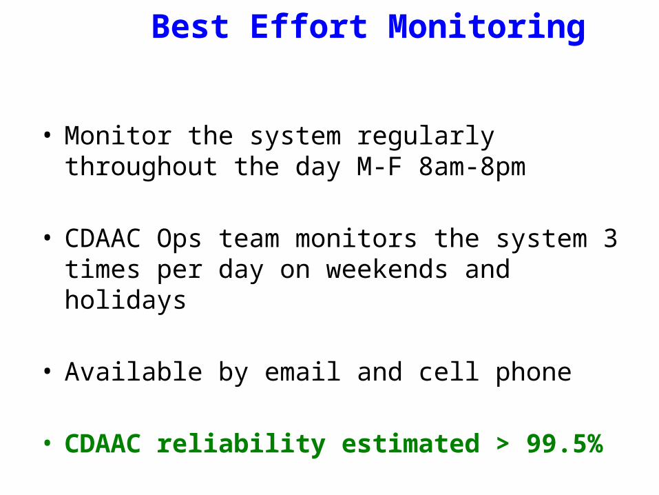
Best Effort Monitoring
• Monitor the system regularly throughout the day M-F 8am-8pm
• CDAAC Ops team monitors the system 3 times per day on weekends and holidays
• Available by email and cell phone
• CDAAC reliability estimated > 99.5%
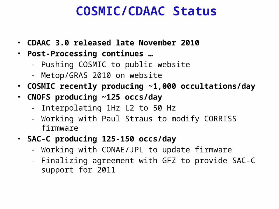
COSMIC/CDAAC Status
• CDAAC 3.0 released late November 2010• Post-Processing continues …
- Pushing COSMIC to public website- Metop/GRAS 2010 on website
• COSMIC recently producing ~1,000 occultations/day • CNOFS producing ~125 occs/day
- Interpolating 1Hz L2 to 50 Hz- Working with Paul Straus to modify CORRISS firmware
• SAC-C producing 125-150 occs/day- Working with CONAE/JPL to update firmware- Finalizing agreement with GFZ to provide SAC-C support for 2011
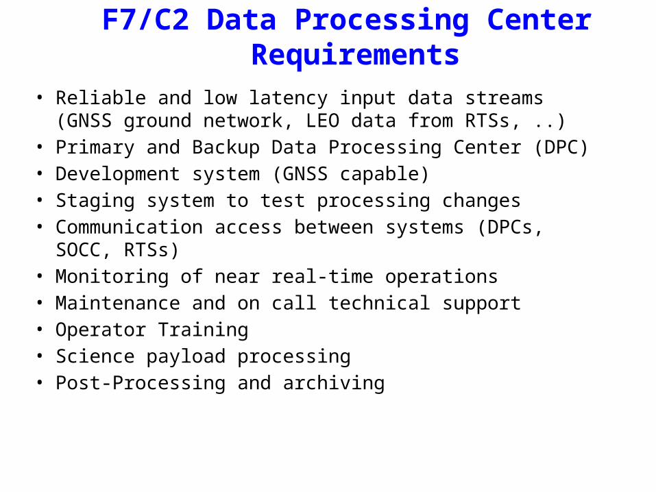
F7/C2 Data Processing Center Requirements
• Reliable and low latency input data streams (GNSS ground network, LEO data from RTSs, ..)
• Primary and Backup Data Processing Center (DPC)• Development system (GNSS capable)• Staging system to test processing changes• Communication access between systems (DPCs, SOCC, RTSs)• Monitoring of near real-time operations• Maintenance and on call technical support• Operator Training• Science payload processing• Post-Processing and archiving
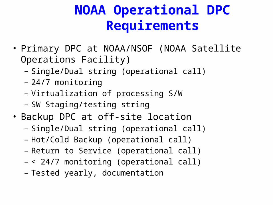
NOAA Operational DPCRequirements
• Primary DPC at NOAA/NSOF (NOAA Satellite Operations Facility)– Single/Dual string (operational call)– 24/7 monitoring– Virtualization of processing S/W– SW Staging/testing string
• Backup DPC at off-site location– Single/Dual string (operational call)– Hot/Cold Backup (operational call)– Return to Service (operational call)– < 24/7 monitoring (operational call)– Tested yearly, documentation
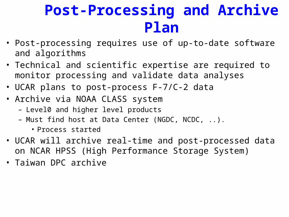
Post-Processing and Archive Plan
• Post-processing requires use of up-to-date software and algorithms• Technical and scientific expertise are required to monitor processing
and validate data analyses• UCAR plans to post-process F-7/C-2 data• Archive via NOAA CLASS system
– Level0 and higher level products– Must find host at Data Center (NGDC, NCDC, ..).
• Process started
• UCAR will archive real-time and post-processed data on NCAR HPSS (High Performance Storage System)
• Taiwan DPC archive
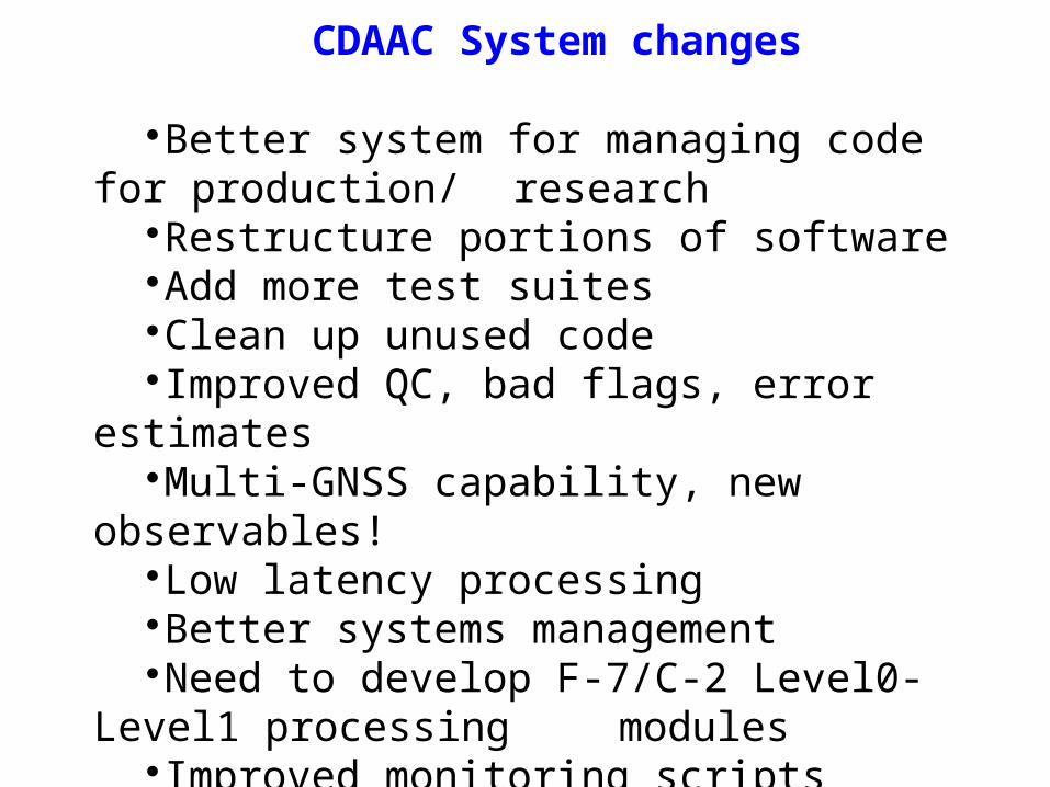
CDAAC System changes
Better system for managing code for production/research
Restructure portions of softwareAdd more test suitesClean up unused codeImproved QC, bad flags, error estimatesMulti-GNSS capability, new observables!Low latency processingBetter systems managementNeed to develop F-7/C-2 Level0-Level1 processing
modulesImproved monitoring scriptsImproved documentation
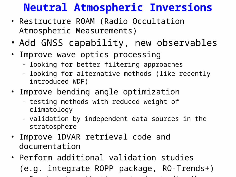
Neutral Atmospheric Inversions• Restructure ROAM (Radio Occultation Atmospheric
Measurements)
• Add GNSS capability, new observables• Improve wave optics processing
– looking for better filtering approaches– looking for alternative methods (like recently introduced WDF)
• Improve bending angle optimization- testing methods with reduced weight of climatology- validation by independent data sources in the stratosphere
• Improve 1DVAR retrieval code and documentation• Perform additional validation studies (e.g. integrate ROPP
package, RO-Trends+)- Requires investigation and understanding the sources of the
differences

1) Phase Connection
2) Bending AngleGeneration (WO,GO)
3) Bending AngleCorrection, Connection
4) Bending AngleOptimization, Inversion
atmPhs
conPhs
benPrf
bcnPrf
atmPrf
1) Mission-dependent; 2-4) Mission-independent.
1) Input positions, velocities, raw phase and amplitude,clim. model.Processing removal of NDM, connection of the phase,down-sampling to one rate. Output positions, velocities, connected phase,amplitude, HSL, lat, lon, height of TP.
2) Input output from 1Processing retrieval of WO (Phase Matching and FSIor CT2) and GO bending angles for L1, L2, (L5)Output GO and WO bending angles for L1,L2,(L5)
3) Input output from 2Processing ionospheric correction (incl. additionalsmoothing of L4), connection of GO and WO bendingangles.Output ionosphere free connected bending angles
4) Input output from 3, clim. model, atm. model.Processing optimization of bending angles,inversion of N,T,P.Output N,T,P.
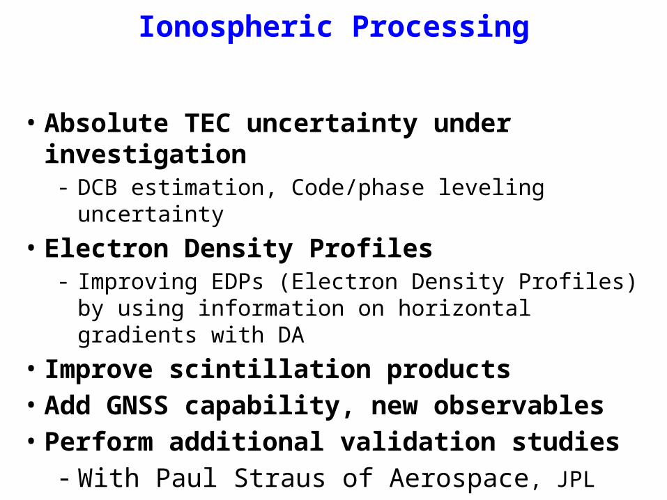
• Absolute TEC uncertainty under investigation- DCB estimation, Code/phase leveling uncertainty
• Electron Density Profiles- Improving EDPs (Electron Density Profiles) by using information
on horizontal gradients with DA
• Improve scintillation products• Add GNSS capability, new observables• Perform additional validation studies
- With Paul Straus of Aerospace, JPL
Ionospheric Processing
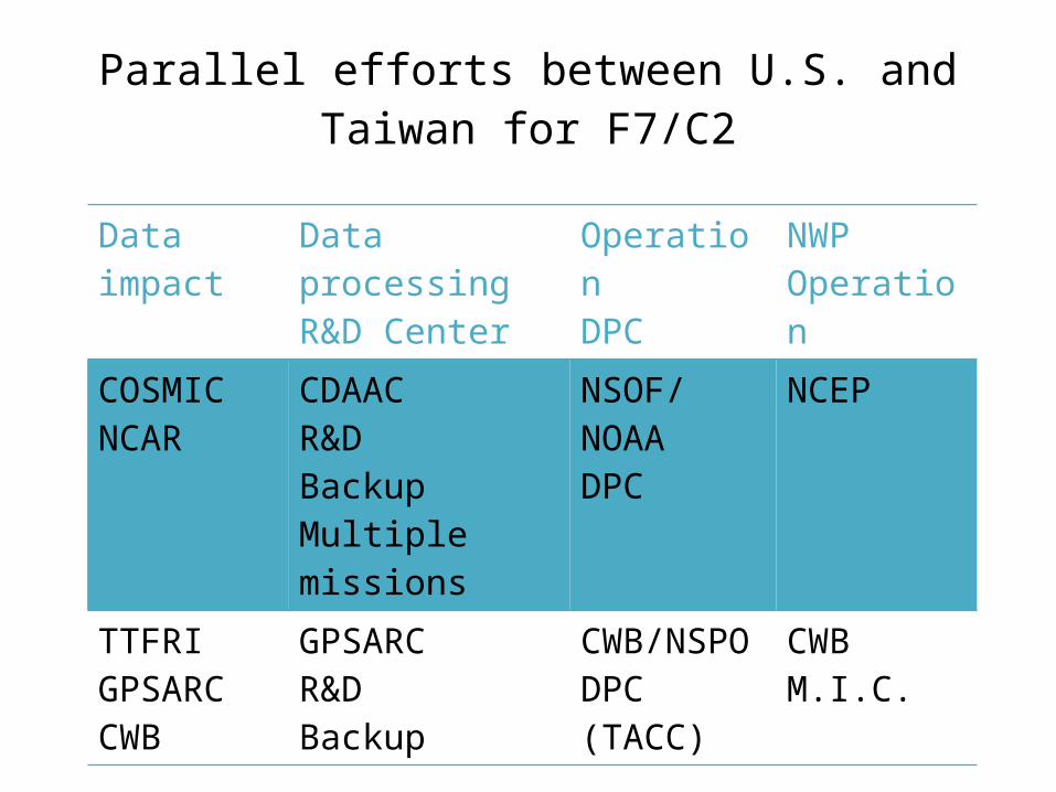
Data impact Data processingR&D Center
OperationDPC
NWP Operation
COSMIC NCAR
CDAACR&D BackupMultiple missions
NSOF/NOAADPC
NCEP
TTFRIGPSARCCWB
GPSARCR&DBackup
CWB/NSPODPC (TACC)
CWBM.I.C.
Parallel efforts between U.S. and Taiwan for F7/C2
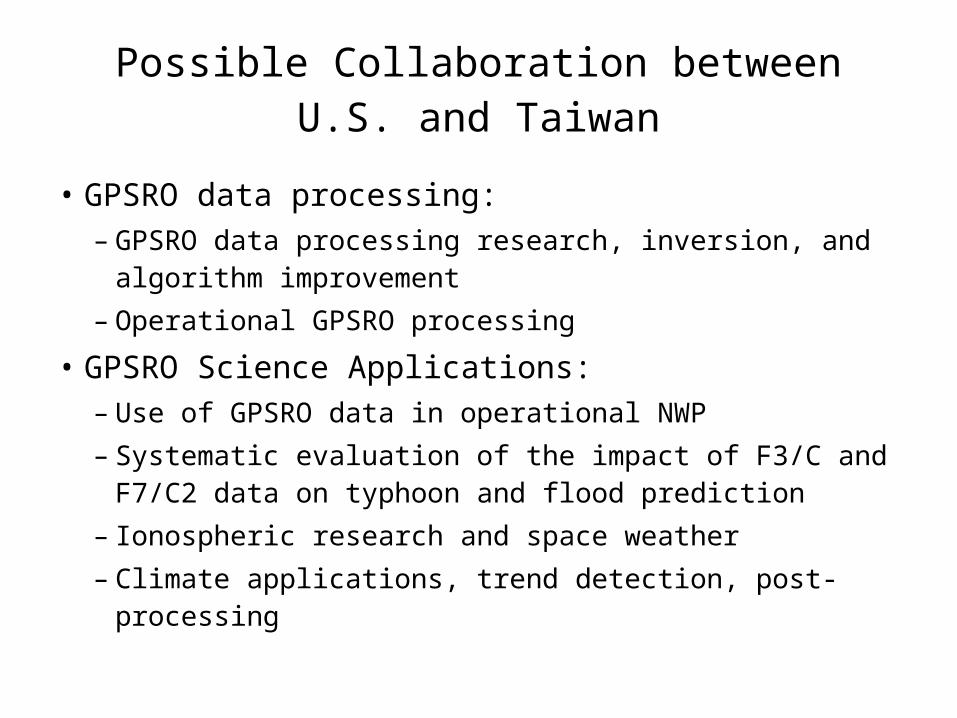
Possible Collaboration between U.S. and Taiwan
• GPSRO data processing:– GPSRO data processing research, inversion, and
algorithm improvement– Operational GPSRO processing
• GPSRO Science Applications:– Use of GPSRO data in operational NWP– Systematic evaluation of the impact of F3/C and F7/C2
data on typhoon and flood prediction– Ionospheric research and space weather– Climate applications, trend detection, post-processing
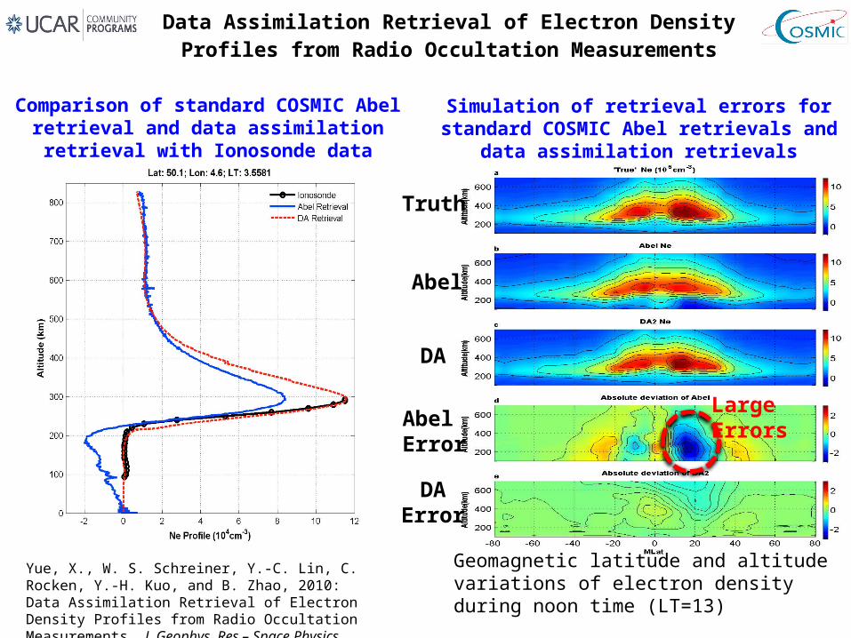
Data Assimilation Retrieval of Electron Density Profiles from Radio Occultation Measurements
Yue, X., W. S. Schreiner, Y.-C. Lin, C. Rocken, Y.-H. Kuo, and B. Zhao, 2010: Data Assimilation Retrieval of Electron Density Profiles from Radio Occultation Measurements. J. Geophys. Res – Space Physics, 2010JA015980, (under review).
Geomagnetic latitude and altitude variations of electron density during noon time (LT=13)
Comparison of standard COSMIC Abel retrieval and data assimilation retrieval with Ionosonde data
Simulation of retrieval errors for standard COSMIC Abel retrievals and data assimilation retrievals
Truth
Abel
DA
AbelError
DAError
LargeErrors
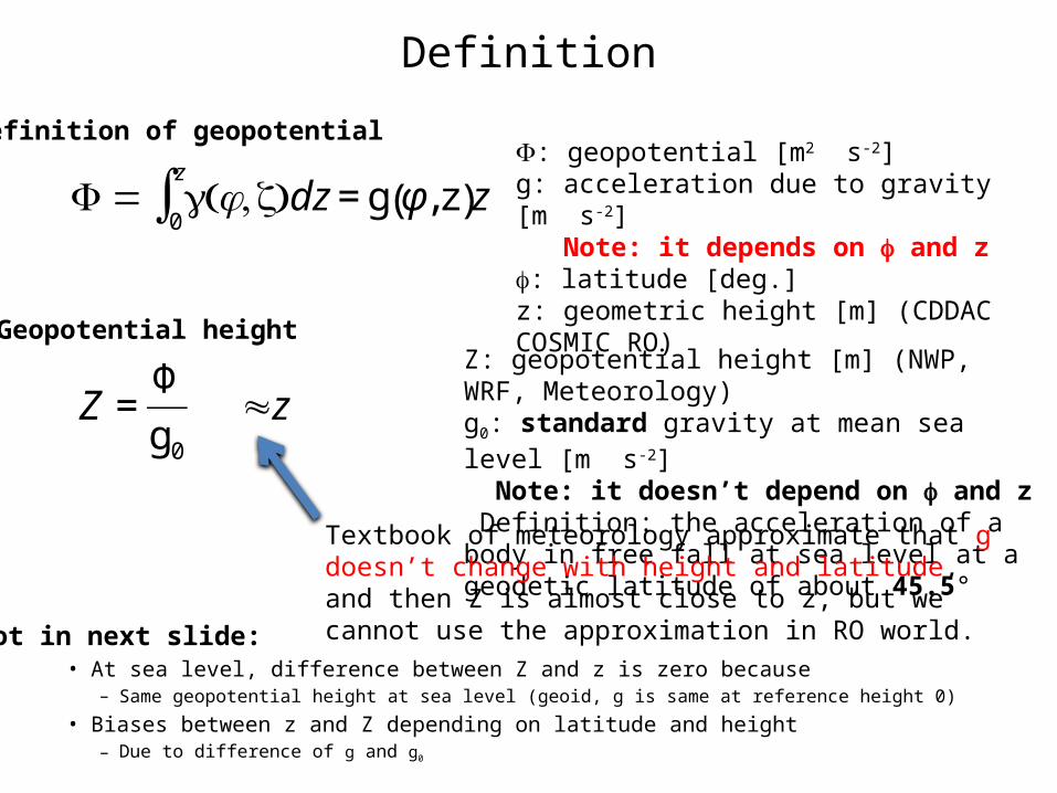
Definition
• At sea level, difference between Z and z is zero because– Same geopotential height at sea level (geoid, g is same at reference height 0)
• Biases between z and Z depending on latitude and height– Due to difference of g and g0
€
Φ = g φ,z( )dz = g φ, z( )z0
z
∫F: geopotential [m2 s-2]g: acceleration due to gravity [m s-2] Note: it depends on f and zf: latitude [deg.]z: geometric height [m] (CDDAC COSMIC RO)
Definition of geopotential
Geopotential height
€
Z =Φ
g0
Z: geopotential height [m] (NWP, WRF, Meteorology)g0: standard gravity at mean sea level [m s-2] Note: it doesn’t depend on f and z Definition: the acceleration of a body in free fall at sea level at a geodetic latitude of about 45.5°
€
≈z
Textbook of meteorology approximate that g doesn’t change with height and latitude, and then Z is almost close to z, but we cannot use the approximation in RO world.Plot in next slide:
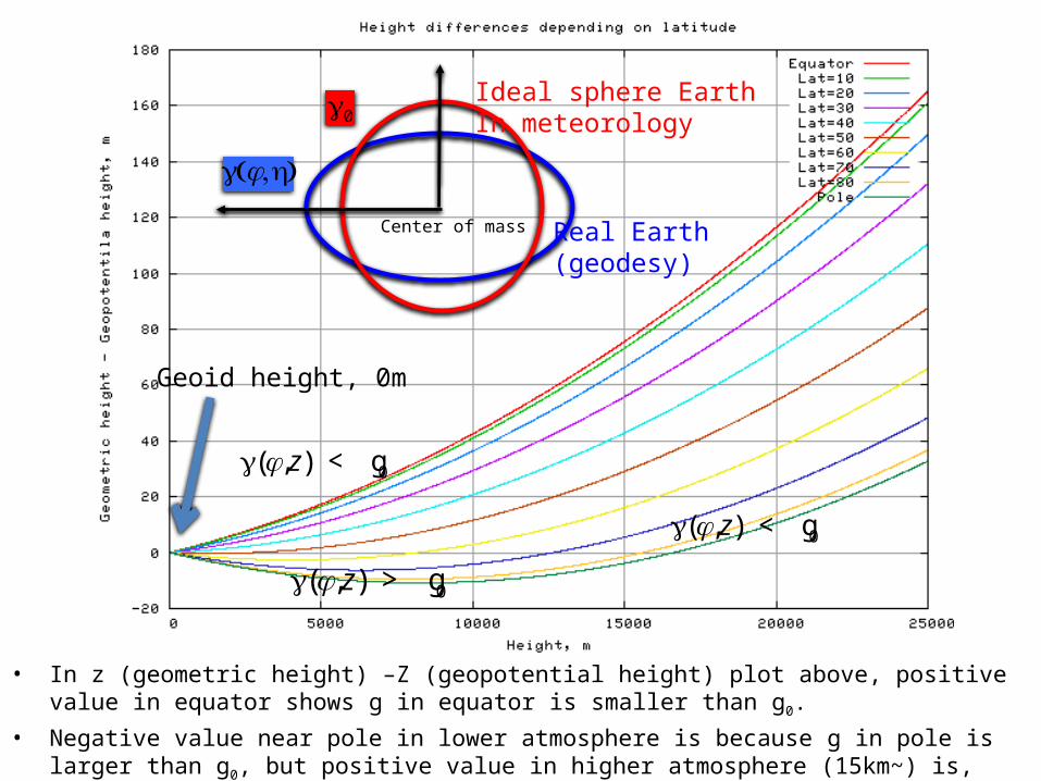
• In z (geometric height) –Z (geopotential height) plot above, positive value in equator shows g in equator is smaller than g0.
• Negative value near pole in lower atmosphere is because g in pole is larger than g0, but positive value in higher atmosphere (15km~) is, again, because g in higher altitude is smaller than g0
Geoid height, 0m
€
g φ,z( ) < g 0
€
g φ,z( ) > g 0
€
g φ,z( ) < g 0
€
g0
€
g φ,h( )
Real Earth(geodesy)
Ideal sphere EarthIn meteorology
Center of mass
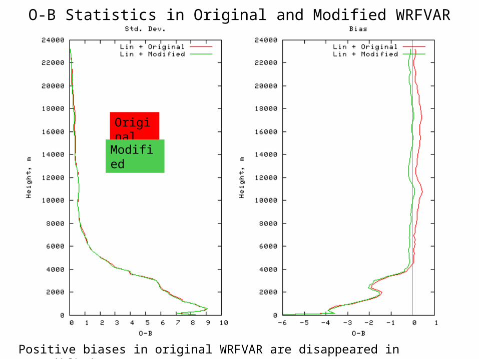
O-B Statistics in Original and Modified WRFVAR
Positive biases in original WRFVAR are disappeared in modified WRFVAR
Original
Modified
33
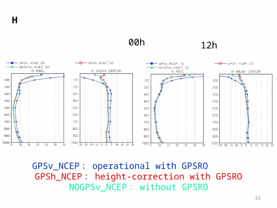
GPSv_NCEP: operational with GPSRO GPSh_NCEP: height-correction with GPSRO
NOGPSv_NCEP: without GPSRO
H
00h 12h
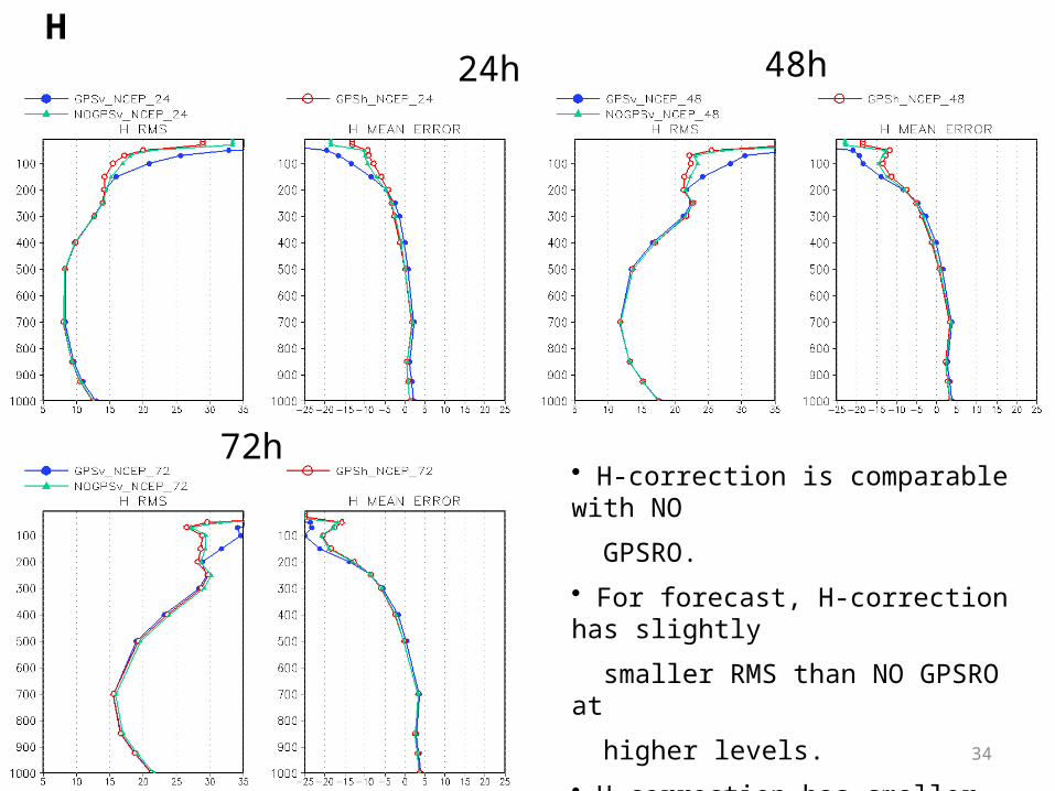
34
H 24h 48h
72h• H-correction is comparable with NO
GPSRO.
• For forecast, H-correction has slightly
smaller RMS than NO GPSRO at
higher levels.
• H-correction has smaller bias at model
top.


