Nunavut Map Selection Supporting Nunavut competitiveness for mineral exploration and
development
April 17, 2012Anna North, Mineral Resources Directorate, AANDC

Background
2009 - 2010
• Nunavut Regional Office and Mineral Resources Directorate in Ottawa began a joint initiative to make Map Selection an official IT project.
• Secure foundations for project: plan, money and people.
2011 - 2012
• Long term contracts in place to manage and provide IT component
2
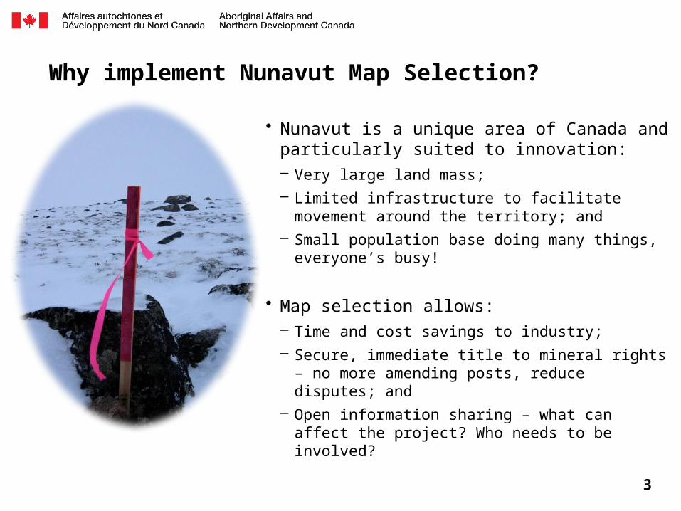
Why implement Nunavut Map Selection?
• Nunavut is a unique area of Canada and particularly suited to innovation: – Very large land mass;– Limited infrastructure to facilitate movement around the
territory; and– Small population base doing many things, everyone’s
busy!
• Map selection allows:– Time and cost savings to industry;– Secure, immediate title to mineral rights – no more
amending posts, reduce disputes; and– Open information sharing – what can affect the project?
Who needs to be involved?
3
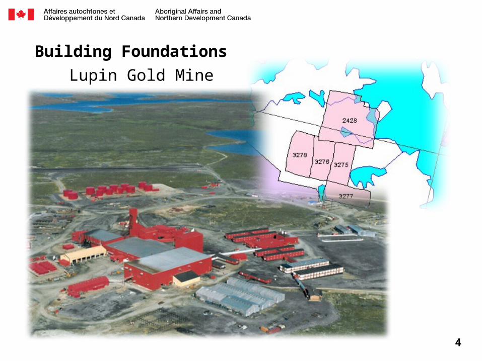
Building Foundations
4
Lupin Gold Mine
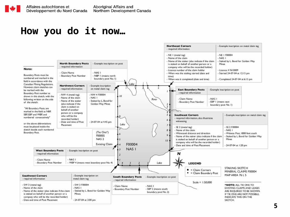
How you do it now…
5

… your application to record mineral claim F76234 has been entered as “PENDING” in our database, we cannot further process your application to record these claims as you have not…
6
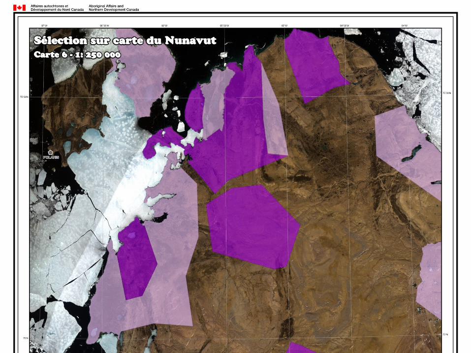
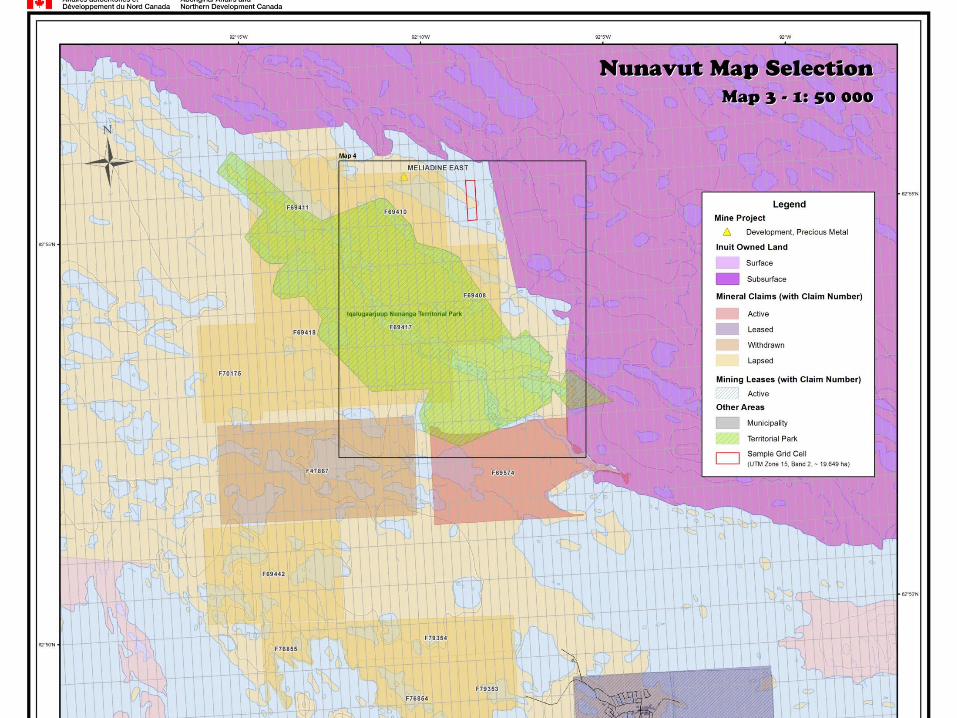
Nunavut Map Selection
Opportunity for innovation• Dedicated project manager to co-ordinate two streams: IT solution and
Regulatory changes
• Ongoing involvement with Nunavut Mining Recorder to meet business needs and ensure seamless transition
7

8
9

10
11
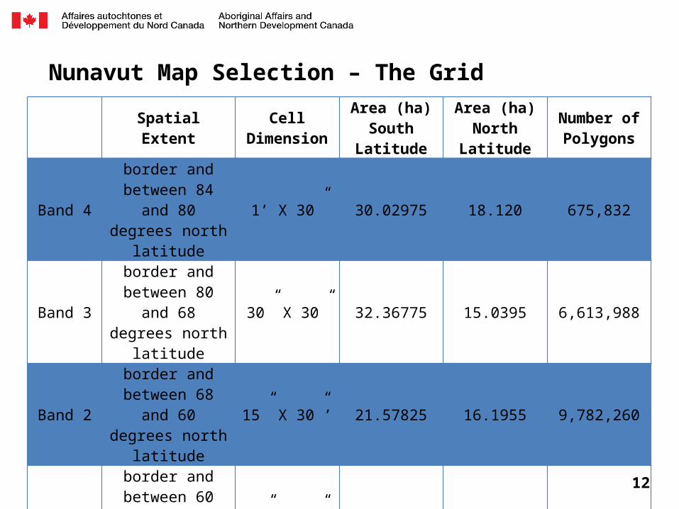
Nunavut Map Selection – The Grid
Spatial Extent Cell Dimension
Area (ha)South
Latitude
Area (ha)North
Latitude
Number of Polygons
Band 4
border and between 84 and 80 degrees north
latitude
1’ X 30” 30.02975 18.120 675,832
Band 3
border and between 80 and 68 degrees north
latitude
30” X 30” 32.36775 15.0395 6,613,988
Band 2
border and between 68 and 60 degrees north
latitude
15” X 30”’ 21.57825 16.1955 9,782,260
Band 1
border and between 60 and 50 degrees north
latitude
15” X 30”’ 27.69425 21.589 63,440
TOTAL # of Cells 17,135,520
12

What we have heard to date
13
Comment Solution
Lowers competitive edgeAreas staked up quickly
→Up-front work deposits
→Re-staking rules
No work doneSpeculative staking
→Up-front work deposits
→Scaled work requirements
GIS representations of data layersWhere are existing claims?
→Complete data conversion
→Ask for voluntary submission of claim corner coordinates
Slow internet in Nunavut →Solution will be light
Credit card paymentsNo credit card?
→Purchase pre-paid VISA cards from Post Offices
TransitionHow do I convert? What if I don’t want to convert?
→ Prepare now
→Period of time (90 days) where no staking will be allowed
→Prefer mandatory conversion

The Plan
2012• Award long term contract to solution provider• Data conversion and audit/clean up• Regulatory drafting process
2013• Replace MINERS • Provide online services that do not require
regulatory change• Gazette part I
2014• Canada Gazette II• Transition • Implement online map selection
14
Expectations
• Mining Recorder’s Office will transition into new internal database– Opportunity to offer online payment for certain applications such as Prospector’s
Licence
• Work on transition measures for locating existing claims– Requires some industry input
• Work on regulatory changes– Expect to engage in dialogue through Canada Gazette process – Potential to have a small working group
• Update at NMS 2013
15