nunavut map selection supporting nunavut competitiveness for mineral exploration and development...
TRANSCRIPT
Nunavut Map Selection Supporting Nunavut competitiveness for mineral exploration and
development
April 17, 2012Anna North, Mineral Resources Directorate, AANDC

Background
2009 - 2010
• Nunavut Regional Office and Mineral Resources Directorate in Ottawa began a joint initiative to make Map Selection an official IT project.
• Secure foundations for project: plan, money and people.
2011 - 2012
• Long term contracts in place to manage and provide IT component
2
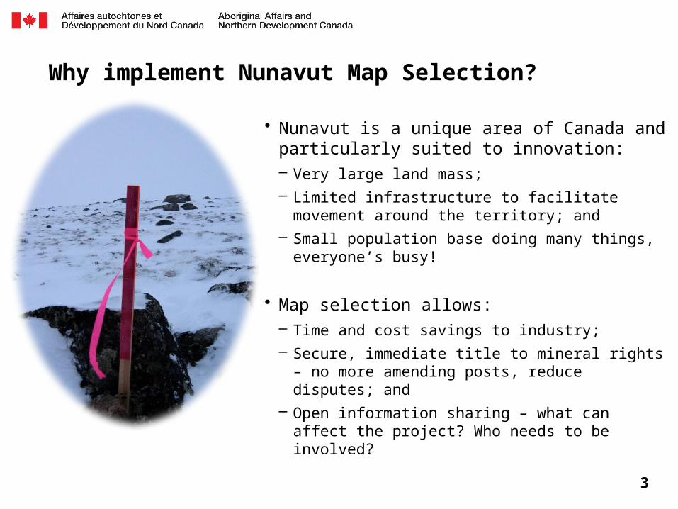
Why implement Nunavut Map Selection?
• Nunavut is a unique area of Canada and particularly suited to innovation: – Very large land mass;– Limited infrastructure to facilitate movement around the
territory; and– Small population base doing many things, everyone’s
busy!
• Map selection allows:– Time and cost savings to industry;– Secure, immediate title to mineral rights – no more
amending posts, reduce disputes; and– Open information sharing – what can affect the project?
Who needs to be involved?
3
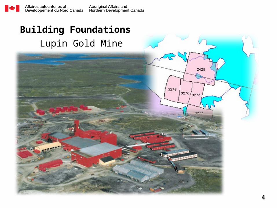
Building Foundations
4
Lupin Gold Mine
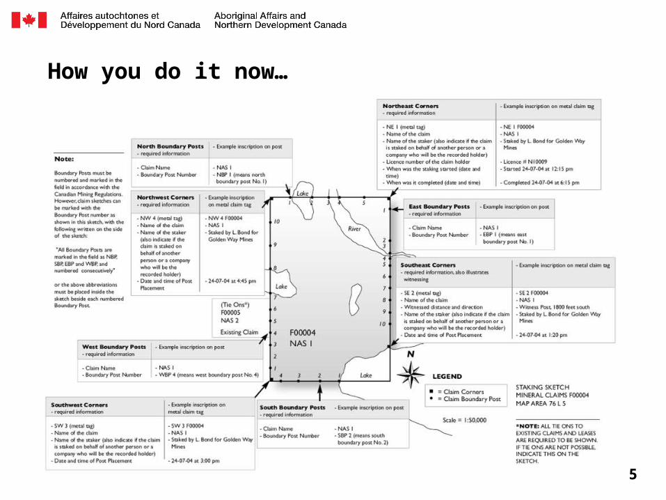
How you do it now…
5

… your application to record mineral claim F76234 has been entered as “PENDING” in our database, we cannot further process your application to record these claims as you have not…
6
Nunavut Map Selection
Opportunity for innovation• Dedicated project manager to co-ordinate two streams: IT solution and
Regulatory changes
• Ongoing involvement with Nunavut Mining Recorder to meet business needs and ensure seamless transition
7

8
9

10
11
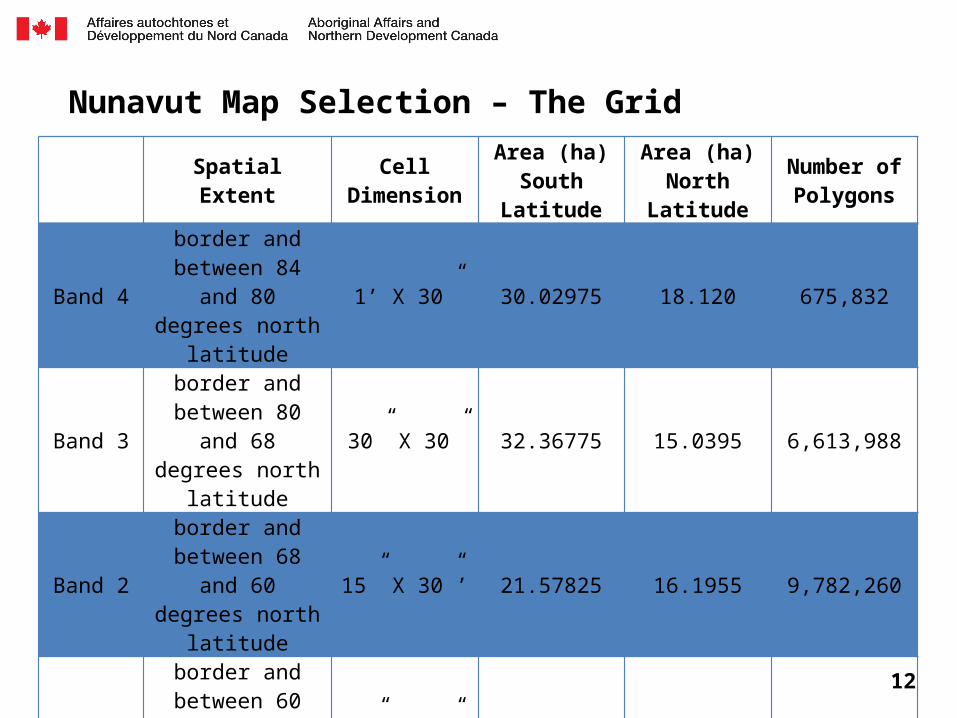
Nunavut Map Selection – The Grid
Spatial Extent Cell Dimension
Area (ha)South
Latitude
Area (ha)North
Latitude
Number of Polygons
Band 4
border and between 84 and 80 degrees north
latitude
1’ X 30” 30.02975 18.120 675,832
Band 3
border and between 80 and 68 degrees north
latitude
30” X 30” 32.36775 15.0395 6,613,988
Band 2
border and between 68 and 60 degrees north
latitude
15” X 30”’ 21.57825 16.1955 9,782,260
Band 1
border and between 60 and 50 degrees north
latitude
15” X 30”’ 27.69425 21.589 63,440
TOTAL # of Cells 17,135,520
12

What we have heard to date
13
Comment Solution
Lowers competitive edgeAreas staked up quickly
→Up-front work deposits
→Re-staking rules
No work doneSpeculative staking
→Up-front work deposits
→Scaled work requirements
GIS representations of data layersWhere are existing claims?
→Complete data conversion
→Ask for voluntary submission of claim corner coordinates
Slow internet in Nunavut →Solution will be light
Credit card paymentsNo credit card?
→Purchase pre-paid VISA cards from Post Offices
TransitionHow do I convert? What if I don’t want to convert?
→ Prepare now
→Period of time (90 days) where no staking will be allowed
→Prefer mandatory conversion

The Plan
2012• Award long term contract to solution provider• Data conversion and audit/clean up• Regulatory drafting process
2013• Replace MINERS • Provide online services that do not require
regulatory change• Gazette part I
2014• Canada Gazette II• Transition • Implement online map selection
14
Expectations
• Mining Recorder’s Office will transition into new internal database– Opportunity to offer online payment for certain applications such as Prospector’s
Licence
• Work on transition measures for locating existing claims– Requires some industry input
• Work on regulatory changes– Expect to engage in dialogue through Canada Gazette process – Potential to have a small working group
• Update at NMS 2013
15