
The Collective and The Cloth Goes to Cowtown
Tour by - Planners’ RevolutionUrban Navigator - Kelly Porter, AICP
August 25, 2010QuickTime™ and a
TIFF (Uncompressed) decompressorare needed to see this picture.
QuickTime™ and aTIFF (Uncompressed) decompressor
are needed to see this picture.
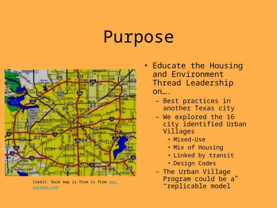
Purpose
• Educate the Housing and Environment Thread Leadership on….– Best practices in another
Texas city– We explored the 16 city
identified Urban Villages• Mixed-Use• Mix of Housing• Linked by transit• Design Codes
– The Urban Village Program could be a “replicable model”Credit: Base map is from is from www.aaroads.com
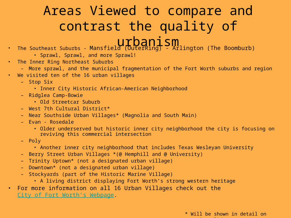
Areas Viewed to compare and contrast the quality of
urbanism• The Southeast Suburbs - Mansfield (OuterRing) - Arlington (The Boomburb)
• Sprawl, Sprawl, and more Sprawl!• The Inner Ring Northeast Suburbs
– More sprawl, and the municipal fragmentation of the Fort Worth suburbs and region• We visited ten of the 16 urban villages
– Stop Six• Inner City Historic African-American Neighborhood
– Ridglea Camp-Bowie• Old Streetcar Suburb
– West 7th Cultural District*– Near Southside Urban Villages* (Magnolia and South Main)– Evan - Rosedale
• Older underserved but historic inner city neighborhood the city is focusing on reviving this commercial intersection– Poly
• Another inner city neighborhood that includes Texas Wesleyan University– Berry Street Urban Villages *(@ Hemphill and @ University)– Trinity Uptown* (not a designated urban village)– Downtown* (not a designated urban village)– Stockyards (part of the Historic Marine Village)
• A living district displaying Fort Worth’s strong western heritage• For more information on all 16 Urban Villages check out the City of Fort Worth’s Webpage.
* Will be shown in detail on upcoming slides

Viewin’ Gruen• In addition to a tour of Fort Worth’s Central City and
Urban Villages, Planners’ Revolution and The Cloth attended the AIA-Fort Worth Chapter’s exhibition about Victor Gruen’s vision for Downtown Fort Worth by the 1970s. In the 1950s, Fort Worth as well as every other city in the nation began to see its downtowns decline with the advent of freeways and suburbanization. During this period, the City of Fort Worth hired architect Victor Gruen to develop a plan for the city that would modernize (and destroyed many treasures) its CBD by building several new modern structures, parking garages, and ringed the area with a freeway loop. The point was to make downtown more auto friendly, so suburbanites could easily drive downtown, park in a garage and be no more than a 2.5 minute walk from any destination in the CBD. Thankfully, it was never fully actualized. It actually called for the destruction of the iconic Tarrant County Courthouse and several other beloved structures. He did similar plans for Kalamazoo and Detroit.

West 7th Street• This emerging urban corridor links
Downtown and Cultural District• Dense, pedestrian friendly, mixed
used, with housing, office, and retail• 7th Street is about to be narrowed
from six to four lanes, plus bike-lanes• Design Guidelines have been
implemented to ensure that development lends itself to creating “place”
• Notable new developments along the corridor include West 7th, Museum Place, So7, Montgomery Plaza.
The next four slides show display pictures from the two best developments along this corridor, Museum Place, and West 7th.
View looking west at the southern streetscape along 7th Street
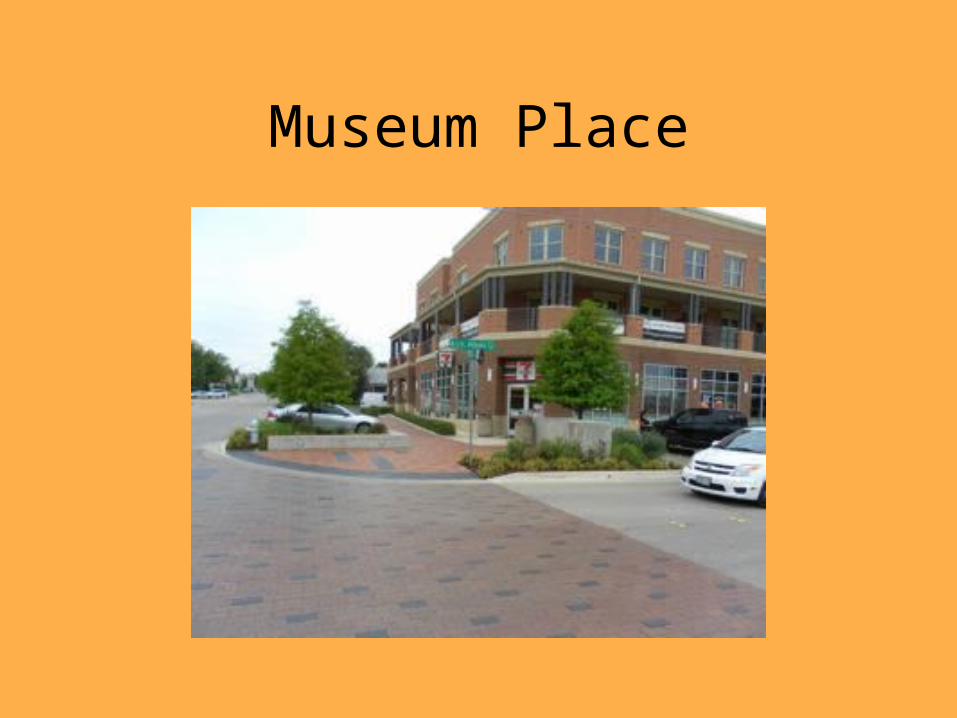
Museum Place
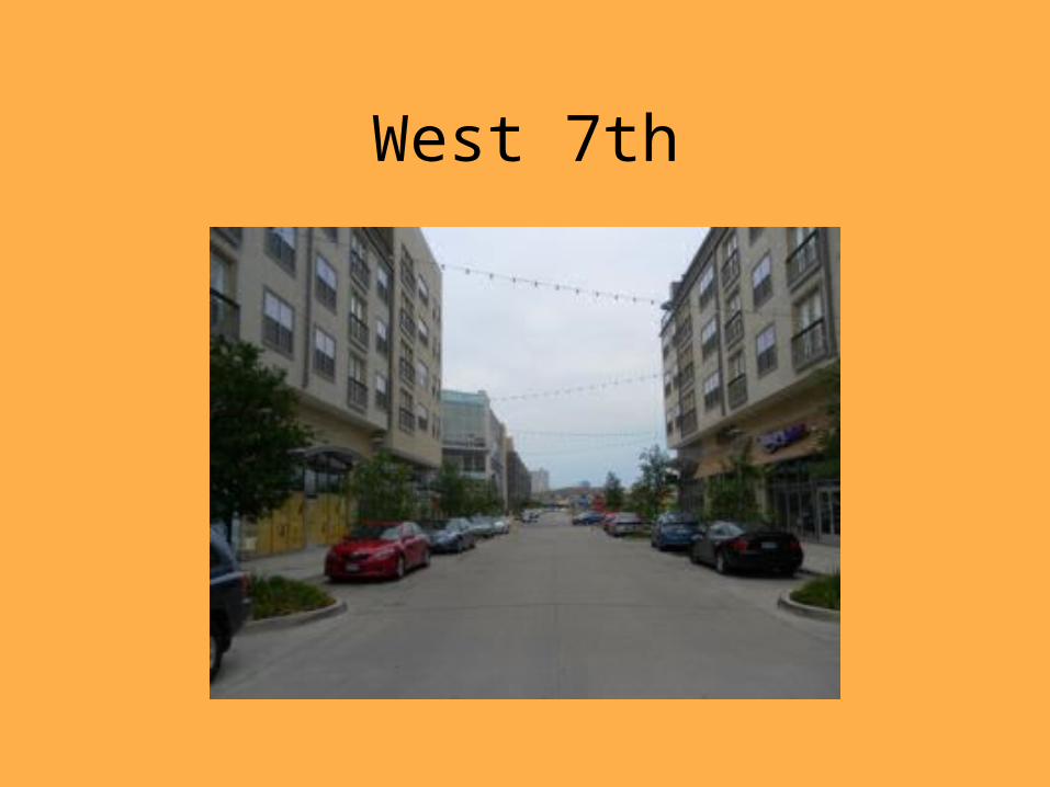
West 7th

West 7th at the Movies

West 7th Housing Plaza
For more detailed commentary and photos of The West 7th corridor and other areas in this presentation, please take a look at Kevin Buchanan's Fortworthology
blog. He does an excellent job on explaining the good (W. 7th and Museum Place), the bad, and the ugly (Montgomery Plaza). SO7 is far from the worse but
includes several flaws.
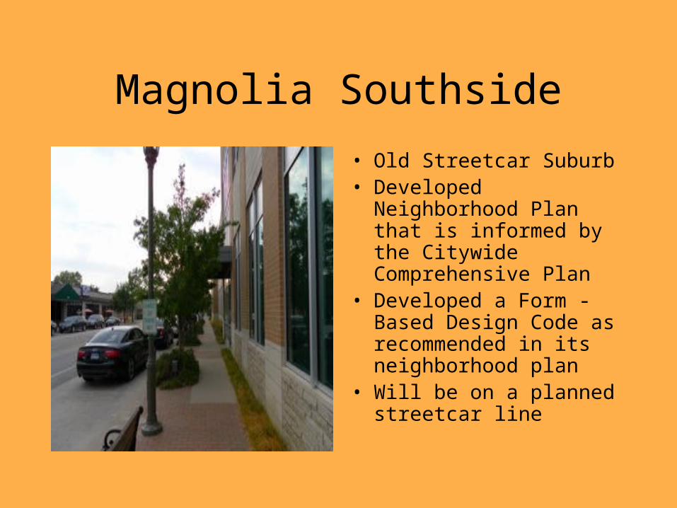
Magnolia Southside
• Old Streetcar Suburb• Developed Neighborhood
Plan that is informed by the Citywide Comprehensive Plan
• Developed a Form -Based Design Code as recommended in its neighborhood plan
• Will be on a planned streetcar line

Magnolia - Southside
This a view of Oleander Walk. It’s amazing how even a small street such as this, that would typically be looked at as an alley can be transformed into an inviting corridor for all.

Magnolia Southside

Magnolia Green
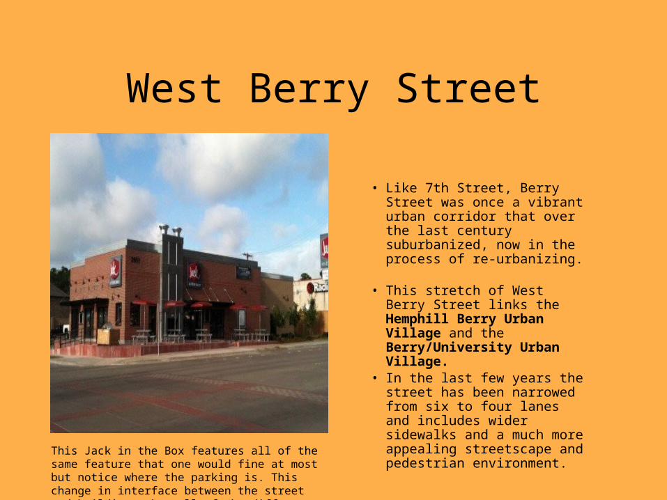
West Berry Street
• Like 7th Street, Berry Street was once a vibrant urban corridor that over the last century suburbanized, now in the process of re-urbanizing.
• This stretch of West Berry Street links the Hemphill Berry Urban Village and the Berry/University Urban Village.
• In the last few years the street has been narrowed from six to four lanes and includes wider sidewalks and a much more appealing streetscape and pedestrian environment.
This Jack in the Box features all of the same feature that one would fine at most but notice where the parking is. This change in interface between the street and building makes all of the difference in the world.
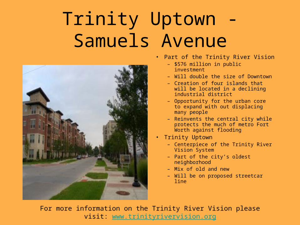
Trinity Uptown - Samuels Avenue
• Part of the Trinity River Vision– $576 million in public investment– Will double the size of Downtown– Creation of four islands that will be
located in a declining industrial district– Opportunity for the urban core to
expand with out displacing many people– Reinvents the central city while protects
the much of metro Fort Worth against flooding
• Trinity Uptown – Centerpiece of the Trinity River Vision
System– Part of the city’s oldest neighborhood– Mix of old and new– Will be on proposed streetcar line
For more information on the Trinity River Vision please visit: www.trinityrivervision.org
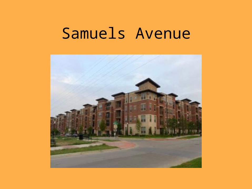
Samuels Avenue

Samuels Avenue - Uptown
For more information on Trinity Uptown please visit:www.uptownfortworth.com
Old residential
New - Villa de Leon

Downtown
Just for Kicks, The wonderful Water Gardens Downtown!
The Urban Navigator

Downtown
Core of the CBD as viewed from Commerce Street

More Coming Soon!• Planners’ Revolution will be taking another group to Funkytown on the
weekend of December 18, 2010• We should have many more pictures and more detailed descriptions following
this trip!
21st Century - Development
Regulation
The very happy Urban
Navigator


