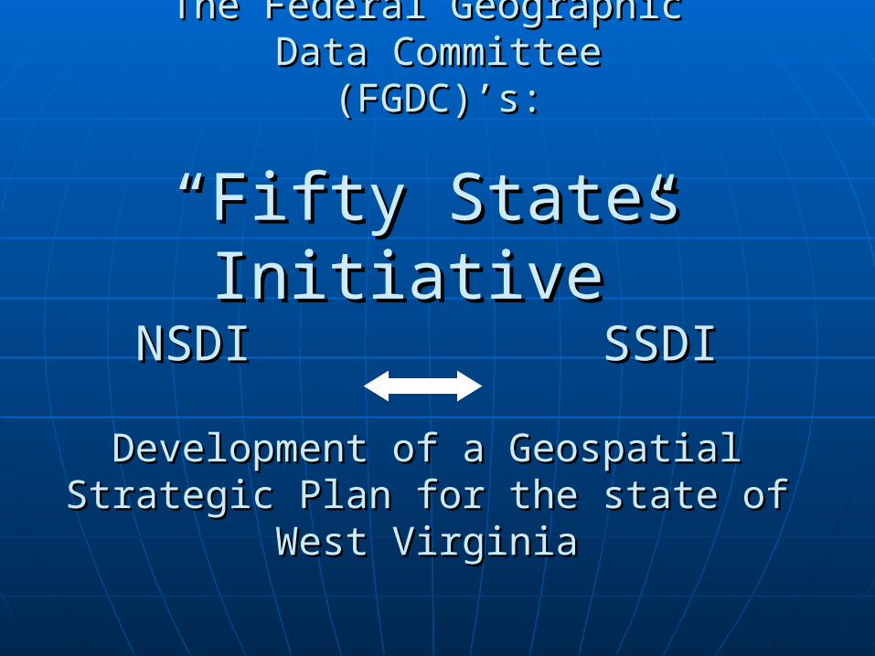
The Federal GeographicThe Federal Geographic Data Committee Data Committee
(FGDC)’s: (FGDC)’s:
“Fifty States Initiative”“Fifty States Initiative”NSDI SSDINSDI SSDI
Development of a Geospatial Strategic Development of a Geospatial Strategic Plan for the state of West VirginiaPlan for the state of West Virginia
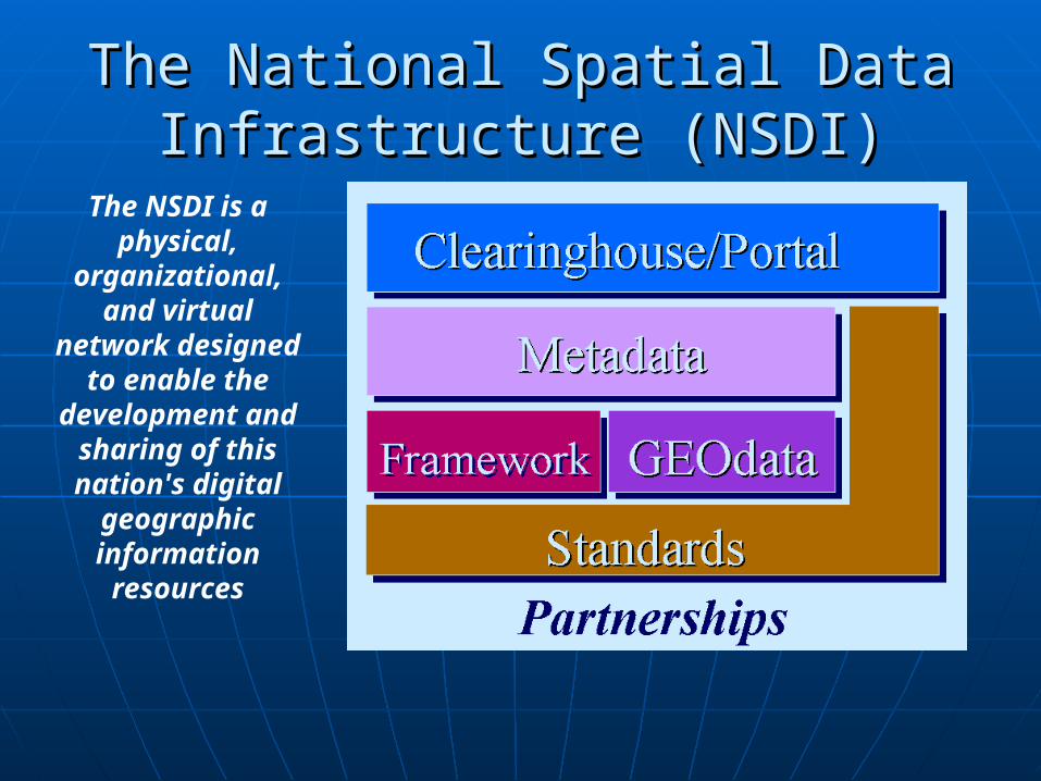
The National Spatial Data The National Spatial Data Infrastructure (NSDI)Infrastructure (NSDI)
The NSDI is a physical,
organizational, and virtual
network designed to enable the
development and sharing of this nation's digital
geographic information resources
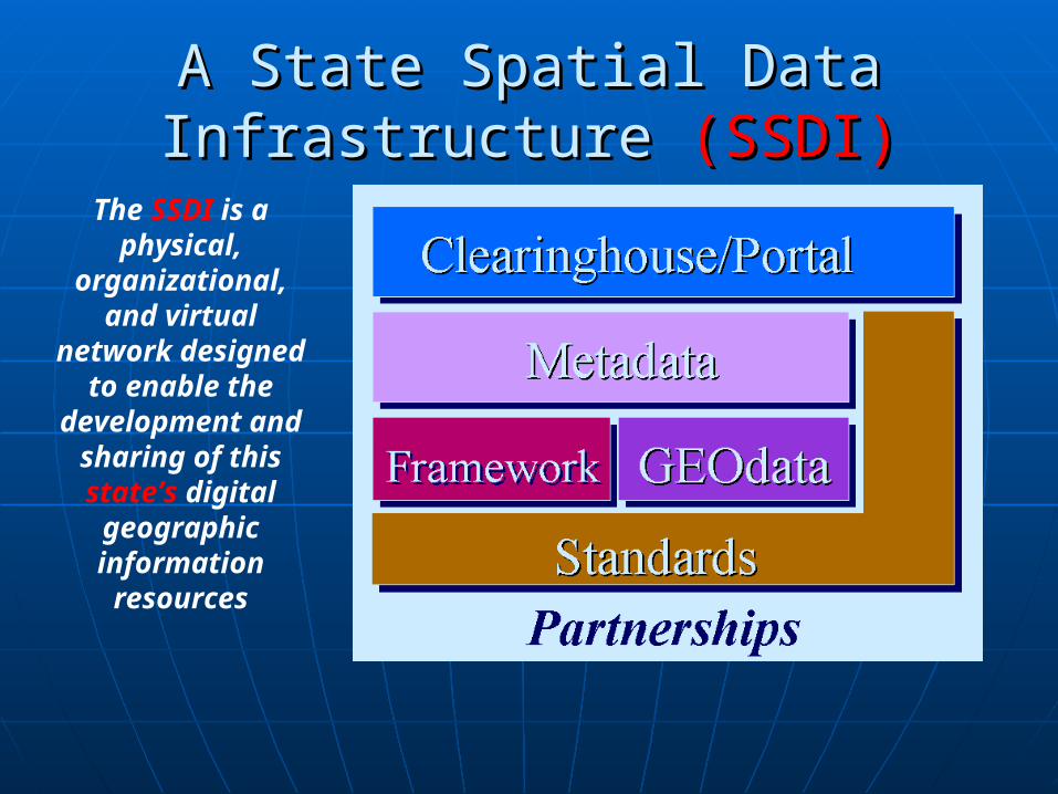
A State Spatial Data Infrastructure A State Spatial Data Infrastructure (SSDI)(SSDI)
The SSDI is a physical,
organizational, and virtual
network designed to enable the
development and sharing of this state’s digital geographic information resources
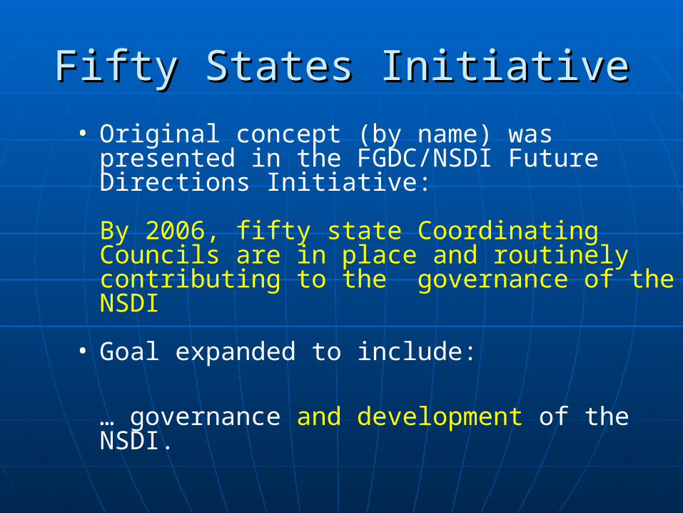
Fifty States InitiativeFifty States Initiative
• Original concept (by name) was presented in the FGDC/NSDI Future Directions Initiative:
By 2006, fifty state Coordinating Councils are in place and routinely contributing to the governance of the NSDI
• Goal expanded to include:
… governance and development of the NSDI.

Relationship of the NSDI andthe SSDIs
NSDI
50 StatesInitiative
SSDIState 1
SSDIState 2
SSDIWV
©2006, Applied Geographics, Inc
Fifty States InitiativeFifty States Initiative
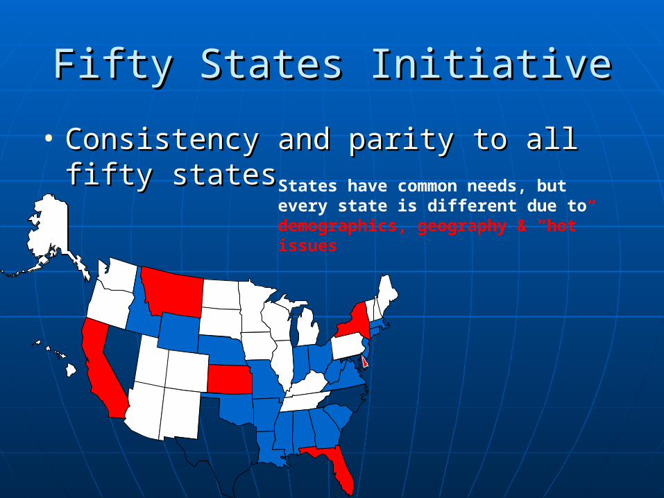
• Consistency and parity to all fifty Consistency and parity to all fifty statesstates States have common needs, but
every state is different due to demographics, geography & “hot” issues
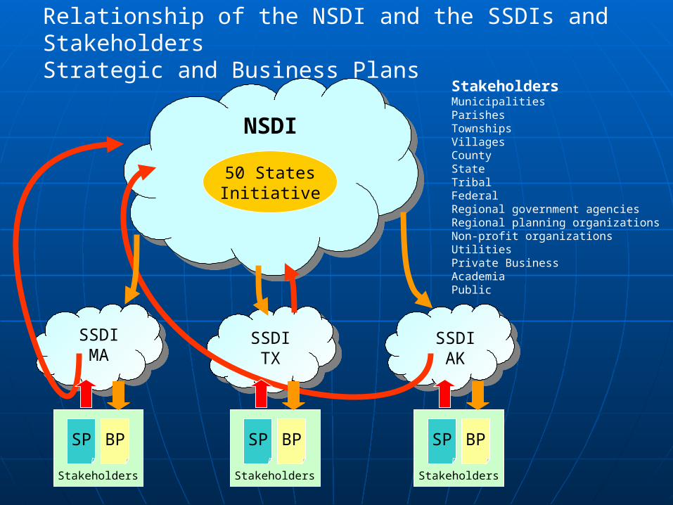
Relationship of the NSDI and the SSDIs and StakeholdersStrategic and Business Plans
StakeholdersMunicipalitiesParishesTownshipsVillages CountyStateTribalFederalRegional government agencies Regional planning organizations Non-profit organizationsUtilitiesPrivate BusinessAcademiaPublic
NSDI
50 StatesInitiative
SSDIMA
SSDITX
SSDIAK
SP BP
Stakeholders
SP BP
Stakeholders
SP BP
Stakeholders
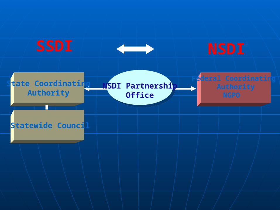
Federal Coordinating Authority
NGPO
State CoordinatingAuthority
Statewide Council
NSDI PartnershipOffice
SSDI NSDI
State CoordinatingAuthority
Statewide Council
NSDI PartnershipOffice
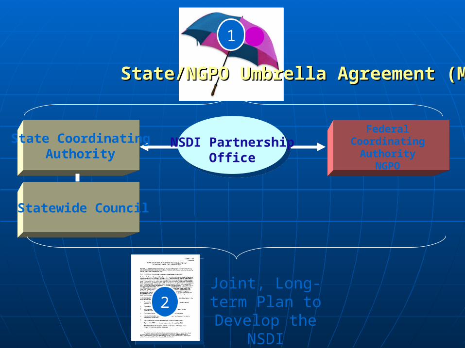
State/NGPO Umbrella Agreement (MOU)State/NGPO Umbrella Agreement (MOU)
1
Joint, Long-term Plan to Develop the
NSDI2
Federal CoordinatingAuthority
NGPO
The FGDC CAP Grant ProgramThe FGDC CAP Grant Program
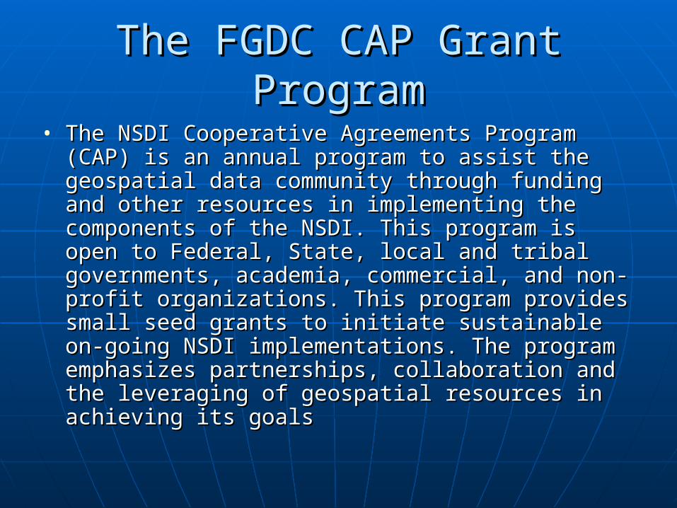
• The NSDI Cooperative Agreements Program (CAP) The NSDI Cooperative Agreements Program (CAP) is an annual program to assist the geospatial data is an annual program to assist the geospatial data community through funding and other resources community through funding and other resources in implementing the components of the NSDI. in implementing the components of the NSDI. This program is open to Federal, State, local and This program is open to Federal, State, local and tribal governments, academia, commercial, and tribal governments, academia, commercial, and non-profit organizations. This program provides non-profit organizations. This program provides small seed grants to initiate sustainable on-going small seed grants to initiate sustainable on-going NSDI implementations. The program emphasizes NSDI implementations. The program emphasizes partnerships, collaboration and the leveraging of partnerships, collaboration and the leveraging of geospatial resources in achieving its goals geospatial resources in achieving its goals
The FGDC CAP Grant ProgramThe FGDC CAP Grant Program
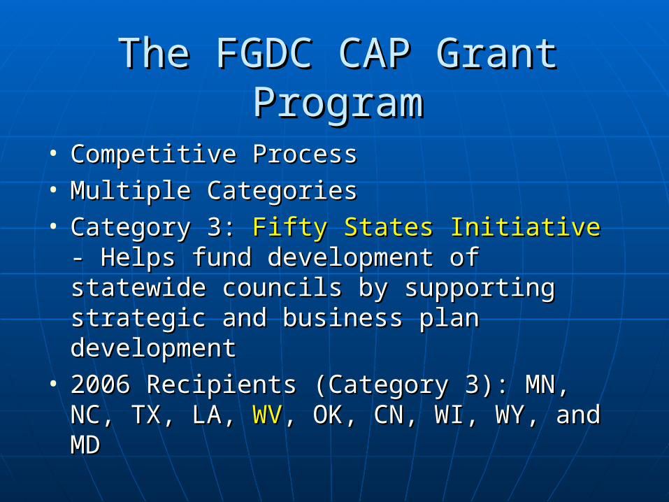
• Competitive ProcessCompetitive Process• Multiple CategoriesMultiple Categories• Category 3: Category 3: Fifty States InitiativeFifty States Initiative - Helps - Helps
fund development of statewide councils fund development of statewide councils by supporting strategic and business by supporting strategic and business plan development plan development
• 2006 Recipients (Category 3): MN, NC, 2006 Recipients (Category 3): MN, NC, TX, LA, TX, LA, WVWV, OK, CN, WI, WY, and MD, OK, CN, WI, WY, and MD
Project Overview and GoalsProject Overview and Goals
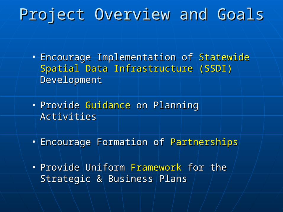
• Encourage Implementation of Encourage Implementation of Statewide Statewide Spatial Data InfrastructureSpatial Data Infrastructure (SSDI)(SSDI) DevelopmentDevelopment
• Provide Provide GuidanceGuidance on Planning Activities on Planning Activities
• Encourage Formation of Encourage Formation of PartnershipsPartnerships
• Provide Uniform Provide Uniform FrameworkFramework for the Strategic for the Strategic & Business Plans& Business Plans
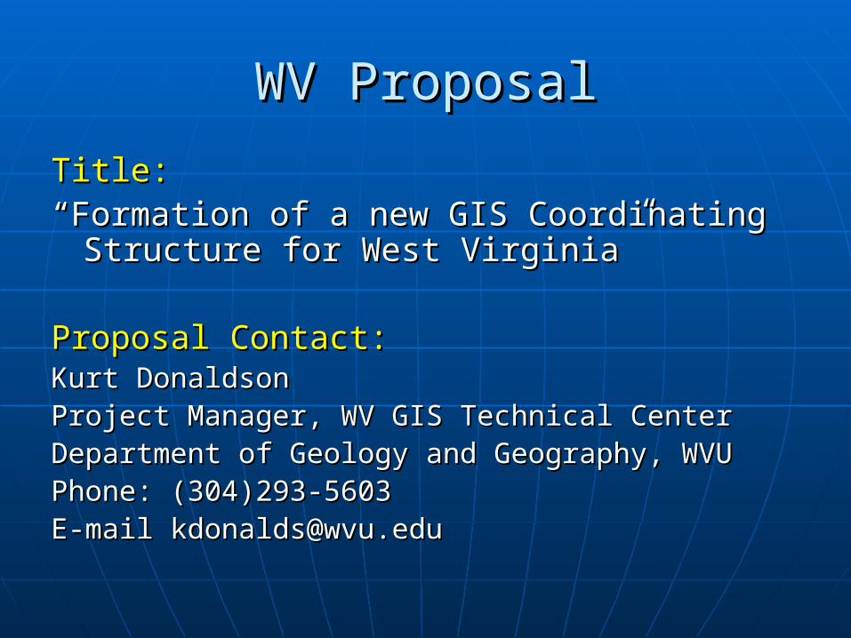
WV ProposalWV Proposal
Title:Title:““Formation of a new GIS Coordinating Formation of a new GIS Coordinating
Structure for West Virginia”Structure for West Virginia”
Proposal Contact:Proposal Contact:Kurt DonaldsonKurt DonaldsonProject Manager, WV GIS Technical CenterProject Manager, WV GIS Technical CenterDepartment of Geology and Geography, WVUDepartment of Geology and Geography, WVUPhone: (304)293-5603Phone: (304)293-5603E-mail [email protected] [email protected]
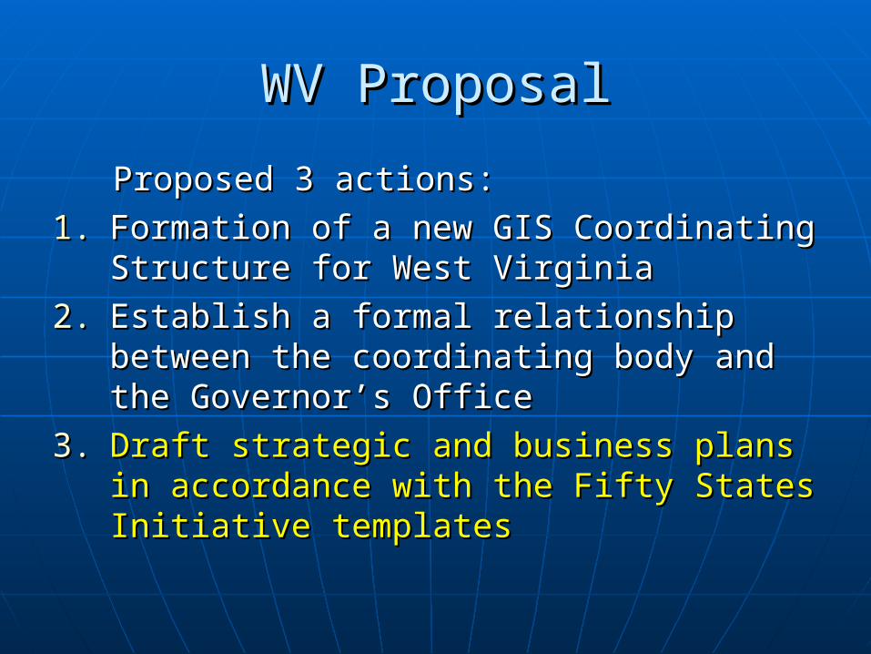
WV ProposalWV Proposal
Proposed 3 actions:Proposed 3 actions:
1.1. Formation of a new GIS Coordinating Formation of a new GIS Coordinating Structure for West VirginiaStructure for West Virginia
2.2. Establish a formal relationship between Establish a formal relationship between the coordinating body and the the coordinating body and the Governor’s OfficeGovernor’s Office
3.3. Draft strategic and business plans in Draft strategic and business plans in accordance with the Fifty States Initiative accordance with the Fifty States Initiative templatestemplates
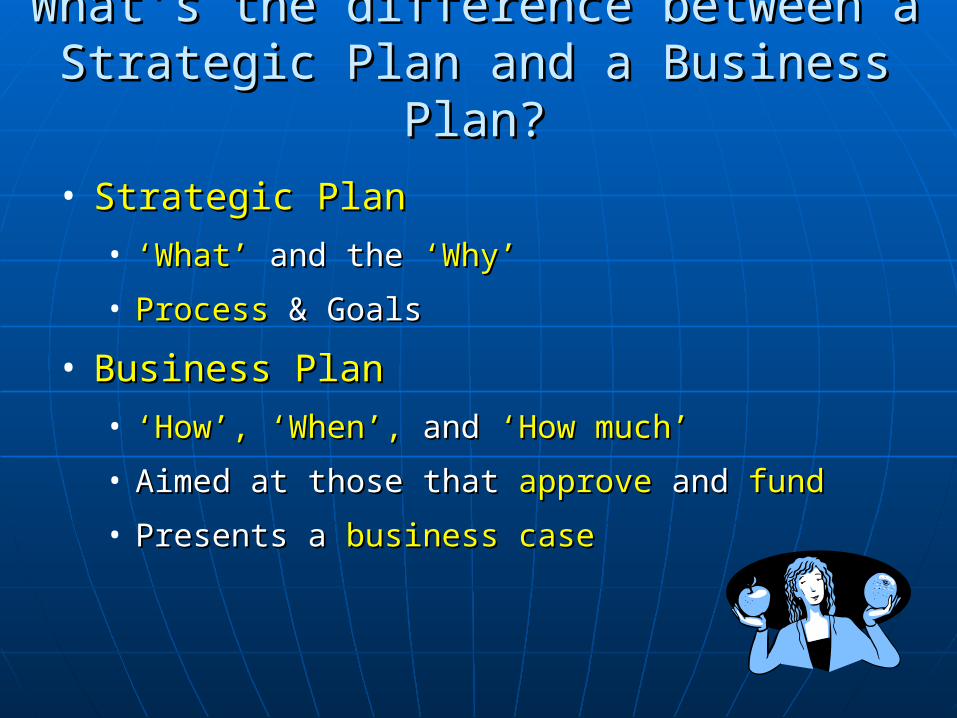
• Strategic PlanStrategic Plan
• ‘‘What’What’ and the and the ‘Why’‘Why’
• ProcessProcess & Goals & Goals
• Business PlanBusiness Plan
• ‘‘How’,How’, ‘When’,‘When’, andand ‘How much’‘How much’
• Aimed at those that Aimed at those that approveapprove and and fundfund
• Presents a Presents a business casebusiness case
What’s the difference between a Strategic What’s the difference between a Strategic Plan and a Business Plan?Plan and a Business Plan?
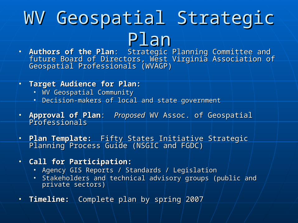
WV Geospatial Strategic PlanWV Geospatial Strategic Plan• Authors of the PlanAuthors of the Plan: Strategic Planning Committee and future : Strategic Planning Committee and future
Board of Directors, West Virginia Association of Geospatial Board of Directors, West Virginia Association of Geospatial Professionals (WVAGP)Professionals (WVAGP)
• Target Audience for Plan:Target Audience for Plan:• WV Geospatial CommunityWV Geospatial Community• Decision-makers of local and state governmentDecision-makers of local and state government
• Approval of PlanApproval of Plan: : ProposedProposed WV Assoc. of Geospatial Professionals WV Assoc. of Geospatial Professionals
• Plan Template:Plan Template: Fifty States Initiative Strategic Planning Process Fifty States Initiative Strategic Planning Process Guide (NSGIC and FGDC)Guide (NSGIC and FGDC)
• Call for Participation:Call for Participation:• Agency GIS Reports / Standards / LegislationAgency GIS Reports / Standards / Legislation• Stakeholders and technical advisory groups (public and private sectors)Stakeholders and technical advisory groups (public and private sectors)
• Timeline:Timeline: Complete plan by spring 2007 Complete plan by spring 2007
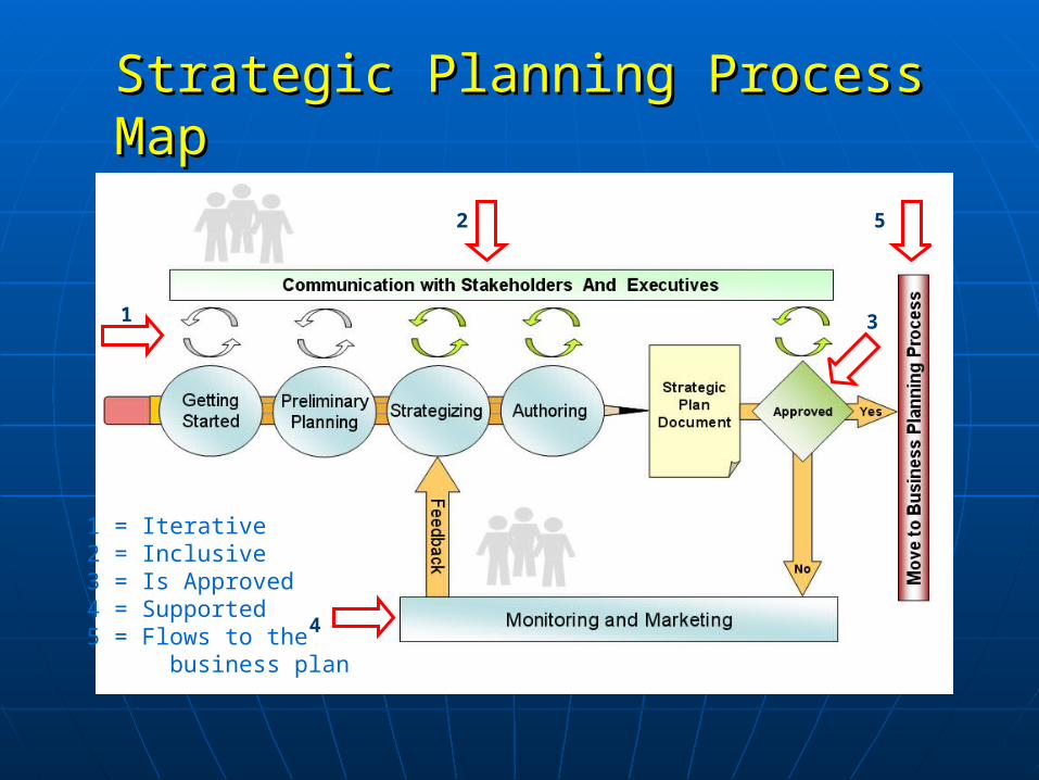
2
3
5
4
1 = Iterative2 = Inclusive3 = Is Approved4 = Supported5 = Flows to the business plan
1
Strategic Planning Process MapStrategic Planning Process Map
WV Geospatial Strategic PlanWV Geospatial Strategic Plan
Kurt DonaldsonKurt Donaldson
Project Manager, WV GIS Technical CenterProject Manager, WV GIS Technical Center
Department of Geology and Geography, WVUDepartment of Geology and Geography, WVU
Phone: (304)293-5603Phone: (304)293-5603

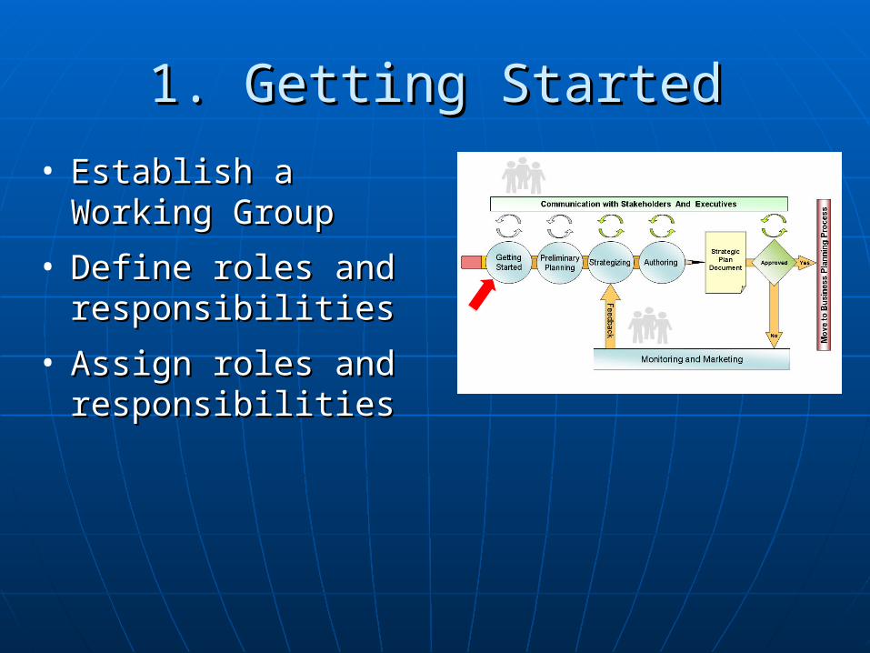
1. Getting Started1. Getting Started
• Establish a Working Establish a Working GroupGroup
• Define roles and Define roles and responsibilitiesresponsibilities
• Assign roles and Assign roles and responsibilitiesresponsibilities
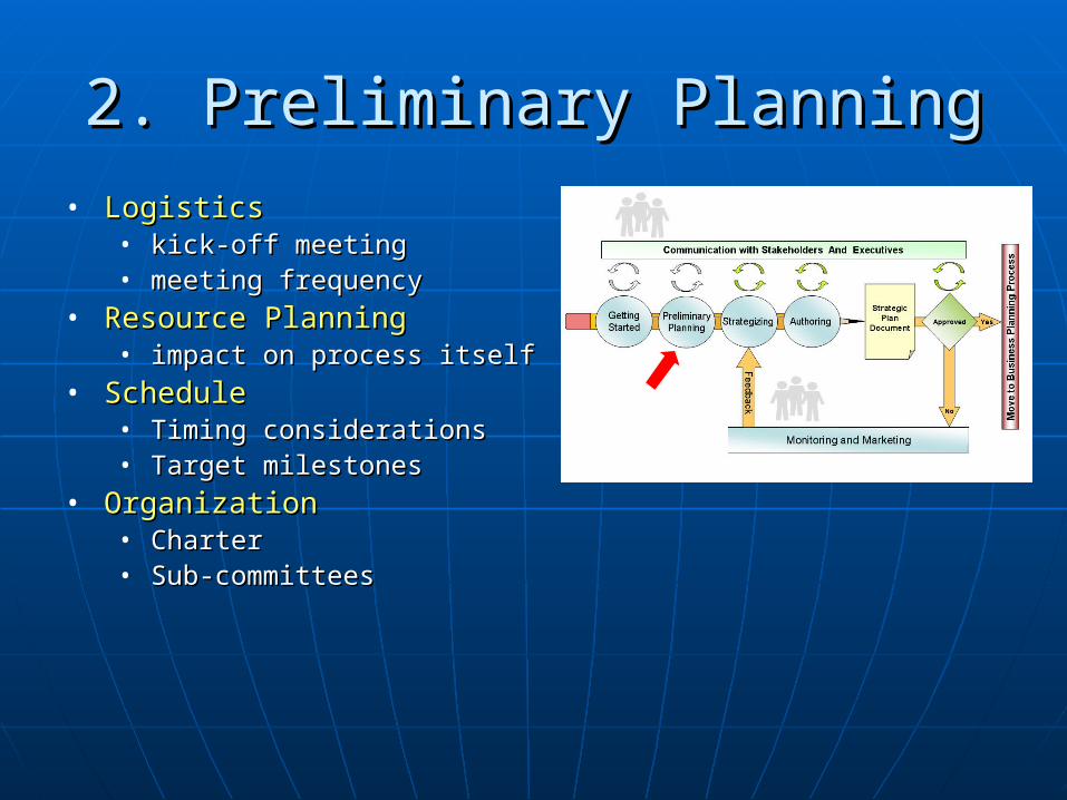
2. Preliminary Planning2. Preliminary Planning
• LogisticsLogistics• kick-off meetingkick-off meeting• meeting frequencymeeting frequency
• Resource PlanningResource Planning• impact on process itselfimpact on process itself
• ScheduleSchedule• Timing considerationsTiming considerations• Target milestonesTarget milestones
• OrganizationOrganization• CharterCharter• Sub-committeesSub-committees
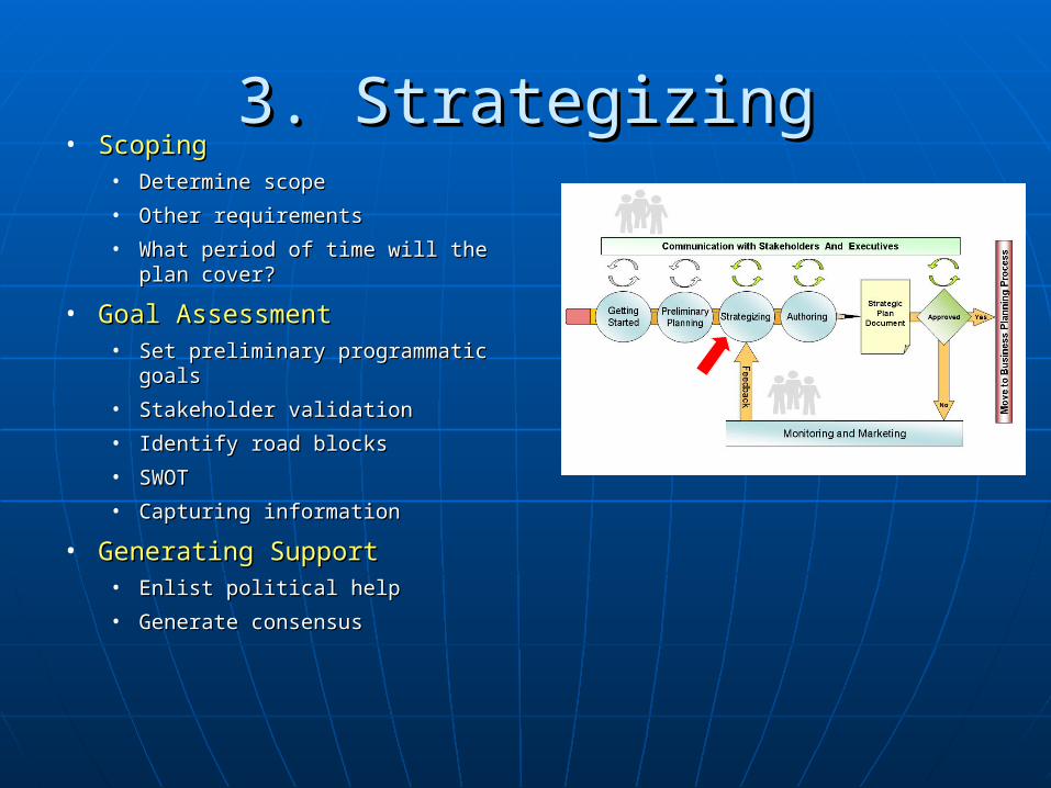
3. Strategizing3. Strategizing• ScopingScoping
• Determine scopeDetermine scope
• Other requirementsOther requirements
• What period of time will the plan What period of time will the plan cover?cover?
• Goal AssessmentGoal Assessment• Set preliminary programmatic goalsSet preliminary programmatic goals
• Stakeholder validationStakeholder validation
• Identify road blocksIdentify road blocks
• SWOTSWOT
• Capturing informationCapturing information
• Generating SupportGenerating Support• Enlist political help Enlist political help
• Generate consensusGenerate consensus
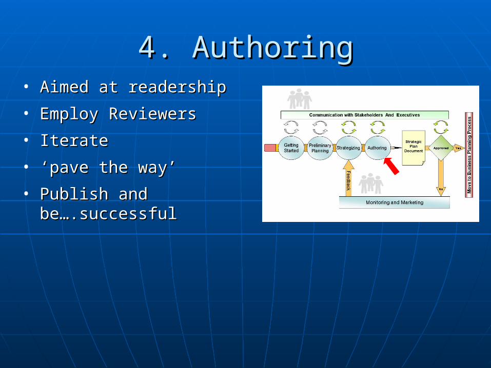
4. Authoring4. Authoring• Aimed at readershipAimed at readership
• Employ ReviewersEmploy Reviewers
• IterateIterate
• ‘‘pave the way’pave the way’
• Publish and Publish and be….successfulbe….successful

5. Monitoring and Marketing5. Monitoring and Marketing
• Assessing progressAssessing progress
• Who/whereWho/where
• How oftenHow often
• Develop metrics Develop metrics
• Progress MonitoringProgress Monitoring
• Marketing Marketing
• Collecting feedbackCollecting feedback

Questions and AnswersQuestions and Answers


